Embed Size (px)
Citation preview

Created by XMLmind XSL-FO Converter.
Paleontology
Dr. Árpád, Dávid

Created by XMLmind XSL-FO Converter.
Paleontology Dr. Árpád, Dávid
Publication date 2011 Szerzői jog © 2011 EKF
Copyright 2011, EKF
iii Created by XMLmind XSL-FO Converter.
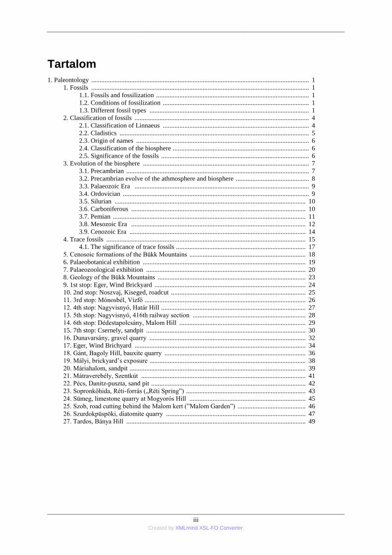
Tartalom
1. Paleontology ................................................................................................................................... 1 1. Fossils ................................................................................................................................... 1
1.1. Fossils and fossilization ............................................................................................ 1 1.2. Conditions of fossilization ........................................................................................ 1 1.3. Different fossil types ................................................................................................ 1
2. Classification of fossils ......................................................................................................... 4 2.1. Classification of Linnaeus ........................................................................................ 4 2.2. Cladistics .................................................................................................................. 5 2.3. Origin of names ........................................................................................................ 6 2.4. Classification of the biosphere .................................................................................. 6 2.5. Significance of the fossils ......................................................................................... 6
3. Evolution of the biosphere .................................................................................................... 7 3.1. Precambrian .............................................................................................................. 7 3.2. Precambrian evolve of the athmosphere and biosphere ............................................ 8 3.3. Palaeozoic Era ......................................................................................................... 9 3.4. Ordovician ................................................................................................................ 9 3.5. Silurian ................................................................................................................... 10 3.6. Carboniferous ......................................................................................................... 10 3.7. Pemian .................................................................................................................... 11 3.8. Mesozoic Era ......................................................................................................... 12 3.9. Cenozoic Era .......................................................................................................... 14
4. Trace fossils ........................................................................................................................ 15 4.1. The significance of trace fossils .............................................................................. 17
5. Cenosoic formations of the Bükk Mountains ...................................................................... 18 6. Palaeobotanical exhibition .................................................................................................. 19 7. Palaeozoological exhibition ................................................................................................ 20 8. Geology of the Bükk Mountains ......................................................................................... 23 9. 1st stop: Eger, Wind Brickyard ........................................................................................... 24 10. 2nd stop: Noszvaj, Kiseged, roadcut ................................................................................. 25 11. 3rd stop: Mónosbél, Vízfő ................................................................................................. 26 12. 4th stop: Nagyvisnyó, Határ Hill ....................................................................................... 27 13. 5th stop: Nagyvisnyó, 416th railway section .................................................................... 28 14. 6th stop: Dédestapolcsány, Malom Hill ............................................................................ 29 15. 7th stop: Csernely, sandpit ................................................................................................ 30 16. Dunavarsány, gravel quarry .............................................................................................. 32 17. Eger, Wind Brichyard ....................................................................................................... 34 18. Gánt, Bagoly Hill, bauxite quarry ..................................................................................... 36 19. Mályi, brickyard’s exposure .............................................................................................. 38 20. Máriahalom, sandpit .......................................................................................................... 39 21. Mátraverebély, Szentkút ................................................................................................... 41 22. Pécs, Danitz-puszta, sand pit ............................................................................................. 42 23. Sopronkőhida, Réti-forrás („Réti Spring‖) ........................................................................ 43 24. Sümeg, limestone quarry at Mogyorós Hill ...................................................................... 45 25. Szob, road cutting behind the Malom kert (‖Malom Garden‖) ......................................... 46 26. Szurdokpüspöki, diatomite quarry .................................................................................... 47 27. Tardos, Bánya Hill ............................................................................................................ 49

1 Created by XMLmind XSL-FO Converter.
1. fejezet - Paleontology
BASICS OF PALEONTOLOGY
1. Fossils
1.1. Fossils and fossilization
Fossils (from Latin fossus, literally "having been dug up") are the preserved remains or traces of animals, plants,
and other organisms from the remote past. Fossilization is an exceptionally rare occurrence, because most
components of formerly-living things tend to decompose relatively quickly following death. In order for an
organism to be fossilized, the remains normally need to be covered by sediment as soon as possible. However
there are exceptions to this, such as if an organism becomes frozen, desiccated, or comes to rest in an anoxic
(oxygen-free) environment. There are several different types of fossils and fossilization processes.
1.2. Conditions of fossilization
A very small amount of prehistoric life got fossilized. In order for this phenomenon to take place, conditions had
to be exactly right. It was just like winning the prehistoric lottery.
Usually only the hard parts of an organism can become fossilized, such as teeth, claws, shells, and bones. The
soft body parts are usually lost, except for in very special conditions.
There are many ways for an organism to get preserved, but I will explain the general way in which most fossils
form. First of all, fossils only occur in sedimentary rock, no others. The best scenario would be in which an
organism is buried at the bottom of a lake where it is then covered by a lot of sediment. In this type of
environment, the organism is protected from other animals and natural elements that would cause the body's
breakdown. It is crucial that the body be in an environment that allows for rapid burial. Areas in which there is a
high rate of sediment deposition is ideal because of the presence of minerals and the increase of pressure.
There are other ways of preservation, too. One of them being petrification. Most people have seen petrified
wood. This is how it happened: Long ago, dead logs were washed into a river and buried in the sand. Water with
alkaline and dissolved silica went down through the sediments, and contacted the logs. The logs decayed,
releasing carbon dioxide, which dissolved in the water and formed carbonic acid. The alkaline water was then
neutralized, and the silica precipitated out of the solution. Very slowly, the cellulose of the wood is replaced,
molecule by molecule, by the silica. Eventually, the wood is replaced in perfect detail by minerals. If other
minerals are there, also, the wood could be stained pretty colours.
Organisms can also be preserved by carbonization. If a leaf falls into a stagnant, oxygen-poor swamp, it may not
decay. If it gets covered in silt and subjected to heat and pressure, most of the leaf's organic material is released
as methane, water, and carbon dioxide. The remainder is a thin film of carbon, showing the imprint of the leaf.
Insects and fish can be preserved in this way too.
1.3. Different fossil types
The term ―fossil‖ is used for any trace of past life. Fossils are not only the actual remains of organisms, such as
teeth, bones, shell, and leaves (body fossils), but also the results of their activity, such as burrows and foot prints
(trace fossils), and organic compounds they produce by biochemical processes (chemical fossils). Occasionally,
inorganically produced structures may be confused with traces of life, such as dendrites. These are called
pseudofossils. The definitions below explain the types of fossils found in the context of fossilization processes.
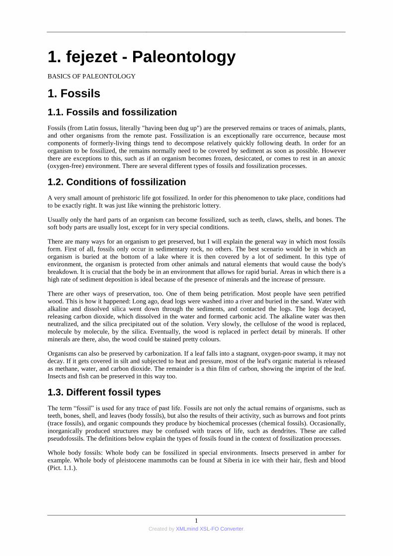
Whole body fossils: Whole body can be fossilized in special environments. Insects preserved in amber for
example. Whole body of pleistocene mammoths can be found at Siberia in ice with their hair, flesh and blood
(Pict. 1.1.).
Paleontology
2 Created by XMLmind XSL-FO Converter.
Pict. 1.1. The whole body of a mammoth from Berezovka (www.mathisencordlary.blogspot.com)
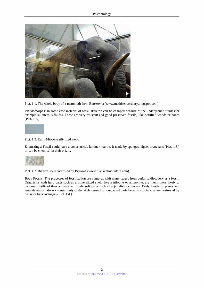
Pseudomorphs: In some case material of fossil skeleton can be changed because of the underground fluids (for
example siliciferous fluids). These are very resistant and good preserved fossils, like petrified woods or bones
(Pict. 1.2.)
Pict. 1.2. Early Miocene silicified wood
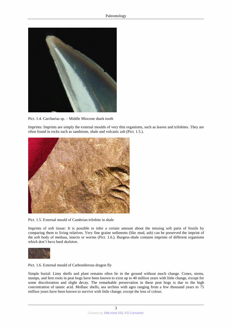
Encrustings: Fossil could have a concentrical, laminar mantle. It made by sponges, algae, bryozoans (Pict. 1.3.)
or can be chemical in their origin.
Pict. 1.3. Bivalve shell encrusted by Bryozoa (www.blackcatmountain.com)
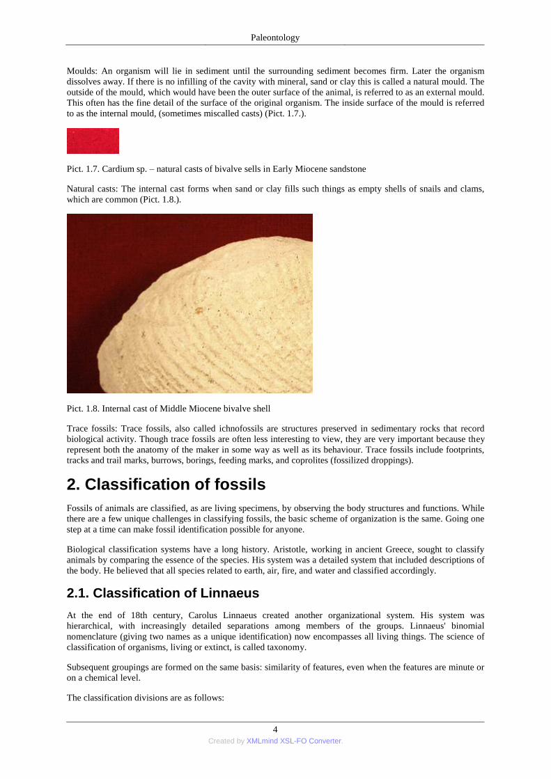
Body Fossils: The processes of fossilization are complex with many stages from burial to discovery as a fossil.
Organisms with hard parts such as a mineralized shell, like a trilobite or ammonite, are much more likely to
become fossilized than animals with only soft parts such as a jellyfish or worms. Body fossils of plants and
animals almost always consist only of the skeletonized or toughened parts because soft tissues are destroyed by
decay or by scavengers (Pict. 1.4.).
Paleontology
3 Created by XMLmind XSL-FO Converter.
Pict. 1.4. Carcharias sp. – Middle Miocene shark tooth
Imprints: Imprints are simply the external moulds of very thin organisms, such as leaves and trilobites. They are
often found in rocks such as sandstone, shale and volcanic ash (Pict. 1.5.).
Pict. 1.5. External mould of Cambrian trilobite in shale
Imprints of soft tissue: It is possible to infer a certain amount about the missing soft parts of fossils by
comparing them to living relatives. Very fine graine sediments (like mud, ash) can be preserved the imprint of
the soft body of medusa, insects or worms (Pict. 1.6.). Burgess-shale contains imprints of different organisms
which don’t have hard skeleton.
Pict. 1.6. External mould of Carboniferous dragon fly
Simple burial: Limy shells and plant remains often lie in the ground without much change. Cones, stems,
stumps, and fern roots in peat bogs have been known to exist up to 40 million years with little change, except for
some discoloration and slight decay. The remarkable preservation in these peat bogs is due to the high
concentration of tannic acid. Mollusc shells, sea urchins with ages ranging from a few thousand years to 75
million years have been known to survive with little change, except the loss of colour.
Paleontology
4 Created by XMLmind XSL-FO Converter.
Moulds: An organism will lie in sediment until the surrounding sediment becomes firm. Later the organism
dissolves away. If there is no infilling of the cavity with mineral, sand or clay this is called a natural mould. The
outside of the mould, which would have been the outer surface of the animal, is referred to as an external mould.
This often has the fine detail of the surface of the original organism. The inside surface of the mould is referred
to as the internal mould, (sometimes miscalled casts) (Pict. 1.7.).
Pict. 1.7. Cardium sp. – natural casts of bivalve sells in Early Miocene sandstone
Natural casts: The internal cast forms when sand or clay fills such things as empty shells of snails and clams,
which are common (Pict. 1.8.).
Pict. 1.8. Internal cast of Middle Miocene bivalve shell
Trace fossils: Trace fossils, also called ichnofossils are structures preserved in sedimentary rocks that record
biological activity. Though trace fossils are often less interesting to view, they are very important because they
represent both the anatomy of the maker in some way as well as its behaviour. Trace fossils include footprints,
tracks and trail marks, burrows, borings, feeding marks, and coprolites (fossilized droppings).
2. Classification of fossils
Fossils of animals are classified, as are living specimens, by observing the body structures and functions. While
there are a few unique challenges in classifying fossils, the basic scheme of organization is the same. Going one
step at a time can make fossil identification possible for anyone.
Biological classification systems have a long history. Aristotle, working in ancient Greece, sought to classify
animals by comparing the essence of the species. His system was a detailed system that included descriptions of
the body. He believed that all species related to earth, air, fire, and water and classified accordingly.
2.1. Classification of Linnaeus
At the end of 18th century, Carolus Linnaeus created another organizational system. His system was
hierarchical, with increasingly detailed separations among members of the groups. Linnaeus' binomial
nomenclature (giving two names as a unique identification) now encompasses all living things. The science of
classification of organisms, living or extinct, is called taxonomy.
Subsequent groupings are formed on the same basis: similarity of features, even when the features are minute or
on a chemical level.
The classification divisions are as follows:
Paleontology
5 Created by XMLmind XSL-FO Converter.
Kingdom
Phylum
Class
Order
Family
Genus
Species
Kingdom Animalia
Phylum Vertebrata
Class Mammalia
Order Primates
Family Hominidae
Genus Homo
Species Homo sapiens (Linné, 1758)
The species group comprises similar individual organisms that interbreed and produce offspring; however with
fossils, inconclusive evidence of reproductive isolation is not certain. The definition of a species is based on
morphological (form and structure of an organism) criteria, and the chemical analysis of the organisms' shells
(hard parts).
Genus refers to closely related species, such as hominides. Homo is one of the genus names for the Primates.
Individual species include Homo sapiens, H. erectus, H. habilis and several others. Genus and species names are
usually printed in italics, while names of groups, such as classes or orders, are not. In scientific works, the
"authority" for a binomial name is usually given, at least when it is first mentioned.
Genera forms together into major groups of similar organisms called families. Family names always end in "ae".
Families group together into orders. Order names begin with a capital and usually (but not always) end in an "a".
Groups of orders form classes--the basis for most fossil research. The phylum Mollusca contains four classes:
gastropoda, cephalopods, pelecypoda and scaphopoda.
Groups of classes form into plyla (plural of phylum). Some of the most common phyla include arthropoda
(insects), platyhelminthes (tapeworms), chordata (fishes, retile, birds, mammals), mollusca (snails), and porifera
(sponges).
Phyla group together to form kingdoms - the topmost group. Depending on what source you use, this group
consists of seven kingdoms including bacteria, crenarchaeota, euryarchaeota, protoctista, plantae, fungi and
animalia.
2.2. Cladistics
A different method of classification organisms, living or extinct, has gradually taken root over the Linnaean
version, especially among professional biologists, palaeontologists and life scientists. The cladistic method of
phylogenetic systematics, devised by the German biologist Willi Henning, uses the features of an organism as
identification.
In the Linnaean system, the traits used to classify an organism are often a matter of discussion or opinion. In
cladistics, these features are specifically identified as synapomorphies or unique derived characters. Since these
unique characters appear only once, the organisms' descendants all share the same distinctive trait. Organisms
Paleontology
6 Created by XMLmind XSL-FO Converter.
containing the same unique features form a group called a clade. Subsequently, all members of a clade
descended from the same common ancestor.
Cladograms objectively establish an organisms' common origin. As individual characteristics form, clades split
up into subclades. This creates a family tree structure called cladograms. This branching system shows where
additional characteristics (groups) appear, and the evolutionary relationship between groups and organisms.
Cladograms are less prone to opinion and errors than the Linnaean version; however, for everyday purposes, the
Linnaean system is still in use.
2.3. Origin of names
Usually, scientific names of fossils derive from the Latin or another ancient language. The terms are
international and recognized throughout the scientific world, no matter the native language spoken. The
meaning of scientific names comes from an organisms' physical characteristics, geographic location when found
or the name of the discoverer. Scientific names are occasionally cumbersome, so nicknames are given; for
example, the 'Dudley bug', a species of trilobite called Calymene blumenbachi, derived its nickname from the
region in England where the fossil species is particularly common.
2.4. Classification of the biosphere
At the top of the taxonomic classification of organisms, one can find either Domain or Kingdom. For two
centuries, from the mid-eighteenth century until the mid-twentieth century, organisms were generally considered
to belong to one of two kingdoms, Plantae (plants, including bacteria) or Animalia (animals, including
protozoa). This system, proposed by Carolus Linnaeus in the mid-eighteenth century, had obvious difficulties,
including the problem of placing fungi, protists, and prokaryotes. There are single-celled organisms that fall
between the two categories, such as Euglena, that can photosynthesize food from sunlight and, yet, feed by
consuming organic matter.
American ecologist Robert H. Whittaker proposed a system with five kingdoms: Monera (prokaryotes—bacteria
and blue-green algae), Protista (unicellular, multicellular, and colonial protists), Fungi, Plantae, and Animalia.
This system was widely used for three decades, and remains popular today.
More recently, the "domain," a classification level higher than kingdom, has been devised. Also called a
"Superregnum" or "Superkingdom," domain is the top-level grouping of organisms in scientific classification.
One of the reasons such a classification has been developed is because research has revealed the unique nature
of anaerobic bacteria (called Archaeobacteria, or simply Archaea). These "living fossils" are genetically and
metabolically very different from oxygen-breathing organisms. Various numbers of Kingdoms are recognized
under the domain category.
2.5. Significance of the fossils
Rock-forming fossils: There are biogén sedimentary rocks (bioliths) which contain mostly fossil fragments.
Fossil plant remains build up the coal and diatomite, while fossil animal skeletons build up several limestones
(reef-limestones, crinoid limeston).
Geochronological significance: There are so called index fossils which sign a period of the Earth history. These
organisms has to be very common in the sediment, it has a big range, fast evolution and characteristic
morphological pattern. Trilobites, conodonts, ammonites and foraminiferas are good index fossils of several
periods.
Evolutional significance: Dollo’s law tell that evolution is not reversible. This hypothesis was first stated by
Dollo in this way: "An organism is unable to return, even partially, to a previous stage already realized in the
ranks of its ancestors.‖ According to this hypothesis a structure or organ that has been lost or discarded through
the process of evolution will not reappear in exactly the same form in that line of organisms. Fossil groups has a
progressive, a persistent and a regressive periiod in their evolution. But there are a lot of random phenomena in
evolution which take harder the biostratigraphy. Persistentce is a phenomenon when species doesn’t change
during millions of years. These are the living fossils like Ginkgo biloba, Lingula or Latimera. Convergence is
another phenomenon. several organisms (for example dolphin and Ichthyosaurus) has similar morphology
because of the similar environments and life habitats. Homeomorphy is a similar phenomenon to this but the
organisms are in close relationship.
Paleontology
7 Created by XMLmind XSL-FO Converter.
Environmental significance: There were organisms which didn’t tolerant the change of the environmental
factors (for example corals, sea urchins). They have a big environmental significance.
3. Evolution of the biosphere
3.1. Precambrian
Any consideration of the geological history of earth as it pertains to the genesis and evolution of life, that is, to
paleobiology, must hold the sea as centric. Life began in the sea, and most extant life yet exists in the sea. The
sea contains an incomprehensible diversity of life, mostly still undiscovered or described, ranging across all the
domains of life. The sea is absolutely brimming with microscopic life, including bacteria that make their living
by a constellation of different metabolic processes, and the Archaeans, among which are the extremophiles
living in vents at temperatures well above the boiling point of water.
The sea was the mother of all life beginning some 3.8 billion years ago, and remains so today. The land-based
animals each carry with them a miniature ocean, pulsing in their cells and circulatory systems. All life, including
human, could be viewed as bags sea water containing the same mineral constituency as the ocean together with
a dynamic dispersion of molecules that perform the biological processes that constitute life.
In all living cells - proteins answer for both form and function. Proteins are the active elements of cells that aid
and control the chemical reactions that make the cell work. They receive signals from outside of the cell. They
control the processes by which proteins are made from the instructions in the genes. They also form the
scaffolding that gives cells their shape and as well as parts of the linkages that stick cells together into tissues
and organs. A protein's shape determines its function, which, in turn, depends on its water-hating (hydrophobic)
properties - to work proteins must be immersed in a miniature sea within the cell that does not greatly differ
from the sea from whence it came. Life came from the sea, and the sea sustains life on earth, especially the
many microbes that recycle the fundamental elements from which proteins are constructed (for example in the
nitrogen cycle).
Archaean Time (3800 to 2500 mya): The atmosphere that existed during Archean time would be toxic to most
extant life on our planet. Also, rocks were just beginning to form at the crust of the earth. It is believed that life
on earth made its appearance in the seas during Archaean time. The first life is believed to be the Eubacteria
(i.e., bacteria), single-celled prokaryotic organisms with no DNA-containing Nucleus. The earliest bacteria
obtained energy through chemosynthesis (ingestion of organic molecules). They produced the oldest fossils that
date to about 3500 mya, and are known as bacterial microfossils. Discovered in the 1970s in western Australia,
these earliest fossils express what appear to be chemical signs of delicate chains of microbes that appear exactly
like living blue-green algae (otherwise known as cyanobacteria). For billions of years, these bacteria formed
extensive slimy carpets in shallow coastal waters, and before the end of Achaean-time 2.5 bya had also formed a
thin crust on land. Known as stromatolites, these accretionary growth structures produced by the prokaryotes,
and also possibly Arachaea and primitive Eukaryotes, became increasingly abundant during the Archaean, a fact
of critical importance to the later evolution of life. However, an alternate hypothesis postulates that eukaryotes
may have appeared in late Archaean time. Ancient shales of northwest Australia dated with uranium and lead to
2700 mya contain microscopic traces of oil containing sterols. Since eukaryotes are the only organisms on Earth
that can make these molecules, these shale's support the theory that amoeba-like eukaryotes may have appeared
early in life's history. Stromatolitic structures span the Precambrian and extend to modern time, though they are
currently limited to several isolated environments. While science generally cannot determine the producing
organism or organisms, stromatolite can indeed be beautiful expressions of the most ancient life on earth.
Proterozoic Era (2500 to 544 mya): During the Proterozoic realized events paramount to the further evolution
of life, most notably the steady buildup of oxygen in the atmosphere. Stable continents formed. Bacteria and
archaean microbes, some able to tolerate extremely hostile environments, became increasingly abundant. By
about 1.8 bya, eukaryotic celled animals appear as fossils, These are the organisms that most people are most
familiar with - all animals, plants, fungi, and protists which share fundamental characteristics such as cellular
organization, biochemistry, and molecular biology. Cyanobacteria, photosynthetic Eubacteria that produce
oxygen as a metabolism byproduct may have appeared of early as 3.5 billion years ago, but became common
and widespread in the Proterozoic. The rapid build-up of oxygen in the atmosphere was primarily owing to their
photosynthetic activity. Hence, cyanobacteria have been paramount in evolution and ecological change
throughout earth's history. They have been attributed at least in part, because of the intense energy density of
oxygen-burning aerobic metabolism of Eukaryotes, with the explosion of diversity in the late Precambrian into
Paleontology
8 Created by XMLmind XSL-FO Converter.
the Cambrian (the Cambrian Explosion). The other great contribution of the cyanobacteria is in the origin of
plants. The chloroplast where plants make food is actually a cyanobacterium living within the plant's cells.
The cellular organelle mitochondria (and associated mitachondrial DNA) of animals, the center of aerobic
energy production is believed evolved from aerobic bacteria. Similarly, and in a separate evolutionary event,
chloroplasts of eukaryotic plants is belived evolved from the autotrophic, photosynthetic cyanobacteria.
The other great evolutionary innovation of the Eukaryotes that occured in the Proterozoic was the ability to
reproduce sexually, making genetic diversity possible, and as a consequence, greatly enhanced the ability to
adapt to and survive environmental changes. Unlike prokaryotic bacteria that are identical clones, sex enabled
favorable mutations to persist and amplify in a population's genome. Multi-celled, soft-bodied marine organisms
(metazoans) evolve.
The oldest fossils within Kingdon Animalia are Vendian age 650 to 544 mya, are found at nearly 30 locations
around the world, and are most distinctive. The Ediacara Hills of Southern Australia, and the Vendian White
Sea Region of Northern Russia are two of the more famous. Typically, the Vendian or Ediacaran fossils are
preserved as thin impressions on bedding surfaces of fine to medium-grained sedimentary rocks. Ostensibly,
these organisms were very thin, lacked any minerallized hard parts or well developed organs or organ systems,
and had a quilt-like outer surface.
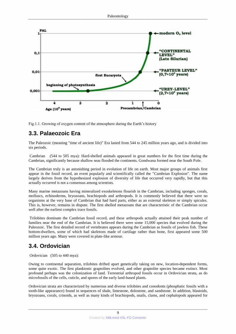
3.2. Precambrian evolve of the athmosphere and biosphere
Evolution of athmosphere and biosphere are in connection because these processes have an effect on each other.
The primer athmosphere of the Earth loosed at 4,6-3,6 Ma years before. These athmosphere contained rare gases
mostly. While the dominant gases of the secondary atmosphere are O2, N2 and CO2. N2 and CO2 came from
volcanic activities, while the origin of O2 is the process of photodissociation and photosynthesis.
The initial formation of oxygen from photochemical dissociation of water vapor is found to provide the
primitive oxygen in the atmosphere. Because of the Urey self-regulation of this process by shielding H2O vapor
with O2, O3, and CO2, primitive oxygen levels cannot exceed O2 0.001 present atmospheric level (P.A.L.).
The analysis of photochemistry of the atmospheric constituents is made possible by measurements of solar
radiation with space vehicles and the now excellent data on uv absorption. The rates of oxidation of lithospheric
materials are examined in this primitive atmosphere and, because of active species of oxygen present, found
adequate to make unnecessary the usual assumption of high oxygenic levels in the pre-Cambrian eras to account
for such lithospheric oxides. The appearance of an oxygenic atmosphere awaits a rate of production that exceeds
O2 photodissociation and loss.
The rise of oxygen from the primitive levels can only be associated with photosynthetic activity, which in turn
depends upon the range of ecologic conditions at any period. Throughout the pre-Cambrian, lethal quantities of
UV will penetrate to 5 or 10 meters depth in water. This limits the origin and early evolution of life to benthic
organisms in shallow pools, small lakes or protected shallow seas where excessive convection does not bring
life too close to the surface, and yet where it can receive a maximum of non-lethal but attenuated sunlight. Life
cannot exist in the oceans generally and pelagic organisms are forbidden. Atmospheric oxygen cannot rise
significantly until continental extensions and climatic circumstances combine to achieve the necessary extent of
this protected photosynthesis, over an area estimated at 1 to 10 per cent of present continental areas.
When oxygen passes 0.01 P.A.L., the ocean surfaces are sufficiently shadowed to permit widespread extension
of life to the entire hydrosphere. Likewise, a variety of other biological opportunities arising from the metabolic
potentials of respiration are opened to major evolutionary modification when oxygenic concentration rises to
this level. Therefore, this oxygenic level is specified as the ―first critical level‖ which is identified by immediate
inference with the explosive evolutionary advances of the Cambrian period (−600 m.y.). The consequent rate of
oxygen production is expedited.
When oxygen passes 0.1 P.A.L., the land surfaces are sufficiently shadowed from lethal uv to permit spread of
life to dry land. This oxygenic level is specified as the ―second critical level‖ and by immediate inference is
identified with the appearance and explosive spread of evolutionary organisms on the land at the end of the
Silurian (−420 m.y.).
Subsequently, oxygen must have risen rapidly to the Carboniferous. Because of the phase lag in the process of
decay, the change of atmospheric oxygen may have fluctuated as a damped saw-toothed oscillation through late
Paleozoic, Mesozoic, and even Cenozoic times in arriving at the present quasi-permanent level (Fig. 1.1.).
Paleontology
9 Created by XMLmind XSL-FO Converter.
Fig.1.1. Growing of oxygen content of the atmosphere during the Earth’s history
3.3. Palaeozoic Era
The Paleozoic (meaning "time of ancient life)" Era lasted from 544 to 245 million years ago, and is divided into
six periods.
Cambrian (544 to 505 mya): Hard-shelled animals appeared in great numbers for the first time during the
Cambrian, significantly because shallow seas flooded the continents. Gondwana formed near the South Pole.
The Cambrian truly is an astonishing period in evolution of life on earth. Most major groups of animals first
appear in the fossil record, an event popularly and scientifically called the "Cambrian Explosion". The name
largely derives from the hypothesized explosion of diversity of life that occurred very rapidly, but that this
actually occurred is not a consensus among scientists.
Many marine metazoans having mineralized exoskeletons flourish in the Cambrian, including sponges, corals,
molluscs, echinoderms, bryozoans, brachiopods and arthropods. It is commonly believed that there were no
organisms at the very base of Cambrian that had hard parts, either as an external skeleton or simply spicules.
This is, however, remains in dispute. The first shelled metazoans that are characteristic of the Cambrian occur
well after the earliest complex trace fossils.
Trilobites dominate the Cambrian fossil record, and these arthropods actually attained their peak number of
families near the end of the Cambrian. It is believed there were some 15,000 species that evolved during the
Paleozoic. The first detailed record of vertebrates appears during the Cambrian as fossils of jawless fish. These
bottom-dwellers, some of which had skeletons made of cartilage rather than bone, first appeared some 500
million years ago. Many were covered in plate-like armour.
3.4. Ordovician
Ordovician (505 to 440 mya):
Owing to continental separation, trilobites drifted apart genetically taking on new, location-dependent forms,
some quite exotic. The first planktonic graptolites evolved, and other graptolite species became extinct. Most
profound perhaps was the colonization of land. Terrestrial arthropod fossils occur in Ordovician strata, as do
microfossils of the cells, cuticle, and spores of the early land-based plants.
Ordovician strata are characterized by numerous and diverse trilobites and conodonts (phosphatic fossils with a
tooth-like appearance) found in sequences of shale, limestone, dolostone, and sandstone. In addition, blastoids,
bryozoans, corals, crinoids, as well as many kinds of brachiopods, snails, clams, and cephalopods appeared for
Paleontology
10 Created by XMLmind XSL-FO Converter.
the first time in the geologic record in tropical Ordovician environments. Remains of Ostracoderms (jawless,
armored fish) from Ordovician rocks comprise some of the oldest vertebrate fossils.
Despite the appearance of coral fossils during this time, reef ecosystems continued to be dominated by algae and
sponges, and in some cases by bryozoans.
The Ordovician fossils are the oldest complete vertebrates. They were jawless, armored fish with large bony
shields on the head, and small plate-like scales covering the tail.
The Ordovician ended with a major extinction event that caused the demise of some 60% of marine genera. A
Late Ordovician glaciation contributed to profound ecological disruption and mass extinctions. Reef-building
fauna were broadly decimated. Nearly all conodonts disappeared in the North Atlantic Realm. Many groups of
echinoderms, brachiopods, bryozoans, graptolites, and chitinozoans also disappeared.
3.5. Silurian
Silurian (440 to 410 mya):
The Silurian realized additional marked changes for Earth that affected life significantly. Sea levels rose as the
climate stabilized, at least compared to the prior millions of years. Coral reefs made their first appearance and
expanded. Land plants evolved in the moist regions near the Equator. The Silurian was also a remarkable time in
the evolution of fishes. Not only does this time period mark the wide and rapid spread of jawless fish, but also
the highly significant appearances of both the first known freshwater fish as well as the first fish with jaws,
which resulted from an adaptation of an anterior gill arch. The Silurian strata has fossils that are substantive
evidence of life on land, particularly the arthropod groups. The fossils of the earliest of vascular plants are also
prevalent. In the oceans, there was a widespread radiation of crinoids and a continuation of the expansion of the
brachiopods.
Devonian (410 to 360 mya): The Devonian was a time of great change across the Tree of Life. Reef
ecosystems saw new and more varied forms, including the ammonoids and fish. It was also a time when life
achieved the critical event of adapting to land. Both the first tetrapods, or four legged land-living vertebrates,
and the first arthropods colonized the land, including wingless insects and the earliest arachnids. In the sea,
ammonoids and fish evolve and quickly diversify. Arthropods and ultimately tetrapods were plodding the lands.
The first insects, spiders, and tetrapods evolve.
In the Lower Devonian, plants were very tiny and primitive, generally lacking the leaf, root and vascular
systems that would soon appear. But plant radiation was already progressing rapidly and led to the ferns,
horsetails and seed plants. By the late Devonian earth had forests of tall rooted trees covered with leaves. The
lycopodes (Phylum Lycopodiophyta) are the oldest extant lineage of vascular plants. Sigillaria is an example of
a lycopod tree. The seed-bearing Gymnosperms appeared near the end of the Devonian, an adaptation ultimately
leading to propagation to dryer habitats.
The Devonian is often appropriately called the "Age of Fishes", since the fish took their place in complex reef
systems containing nautiloids, corals, graptolites, blastods, echinoderms, trilobites, sponges, brachiopods and
conodonts. With the many new forms of predators, trilobites continue to evolve their defensive strategies.
During the Devonian, Placodermi (armored fish), Sarcopterygii (lobe-finned fish and lungfish) and
Actinopterygii (conventional bony fish or ray-finned fish) evolved rapidly, many of which became huge and
fierce predators. Until later in the Devonian the fishes were the only vertebrates, and gave rise to all other
vertebrate lineages.
Arthropods radiated to become well-established on land in the Devonian, and in some cases attained impressive
size. The increasing biomass of land plants and higher oxygen levels by the end of the Devonian faciliated the
adaption to terrestrial life of herbivorous animals. The arthropods colonized the land, including wingless insects
and the earliest arachnids. This adaptation was influenced by the Caledonian orogeny. This process began
during the Cambrian – Silurian and resulted collision of the Iapetus Ocean. The final collision happened
between Laurencia, Baltica and micro terrains at the end of Silurian period.
3.6. Carboniferous
Carboniferous (360 to 286 mya):
Paleontology
11 Created by XMLmind XSL-FO Converter.
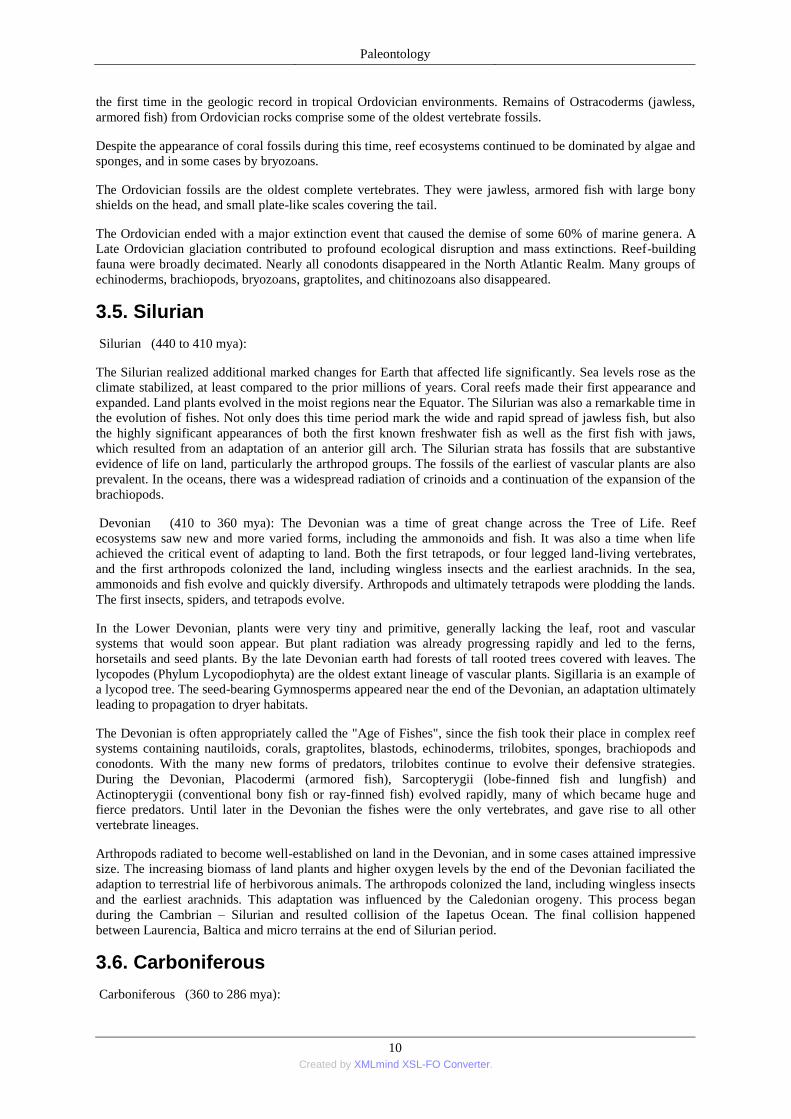
During the Carboniferous, the continents below the equator still formed the supercontinent Gondwana. Life
flourished in the seas in the wake of the late Devonian Extinction. Ammonoids rediversified very quickly. It
looks at the loba line which became very complicated during the evolution of this group (Fig. 1.2.).
Fig. 1.2. Lobe alternations during the evolution of Ammonoidea
Crinoids, blastoids, brachiopods and bryozoans and single-celled Eukaryotes fusulinids known as fusulinids
became abundant. The ray finned fishes radiate enormously. However, the age of the trilobite was drawing to a
close.
Life on land really took root in the Carboniferous, setting the stage for huge coal deposits to be formed in low-
laying swamps. Common in the coal producing swamps spore bearing lycopod trees that grew to more than 100
feet tall, Sigillaria and both spore-bearing and seed ferns. The early wingless insect forms that appeared in the
Devonian acquire wings, and continue their radiation filling ever-expanding environmental niches. The burial of
organically produced carbon is believed to have caused atmosphereic oxygen to increase to concentrations 80%
higher than today, and may have, in turn, led to gigantism in some insects and amphibians whose limited
respiratory systems would have otherwise constrained their size.
Despite the appearance of seeds, most Carboniferous plants continued to use spores from reproduction. The
moist and swampy environments of the Carboniferous enabled the Lycophytes (i.e., scale trees and club mosses)
that evolved during the late Silurian to early Devonian to continue to diversify and flourish throughout the
Carboniferous. Similary, Calamites and ferns were other spore-bearing plants that appeared during the Devonian
and thrived during the following Carboniferous period.
Reptiles first appear in the Carboniferous, following the appearance of amphibians in the Devonian. The
amniote egg appears, an important evolutionary invent that set the stage for further colonization of the land by
tetrapods. The ancestors of birds, mammals, and reptiles could then reproduce on land since the embryo no
longer required an aqueous environment.
3.7. Pemian
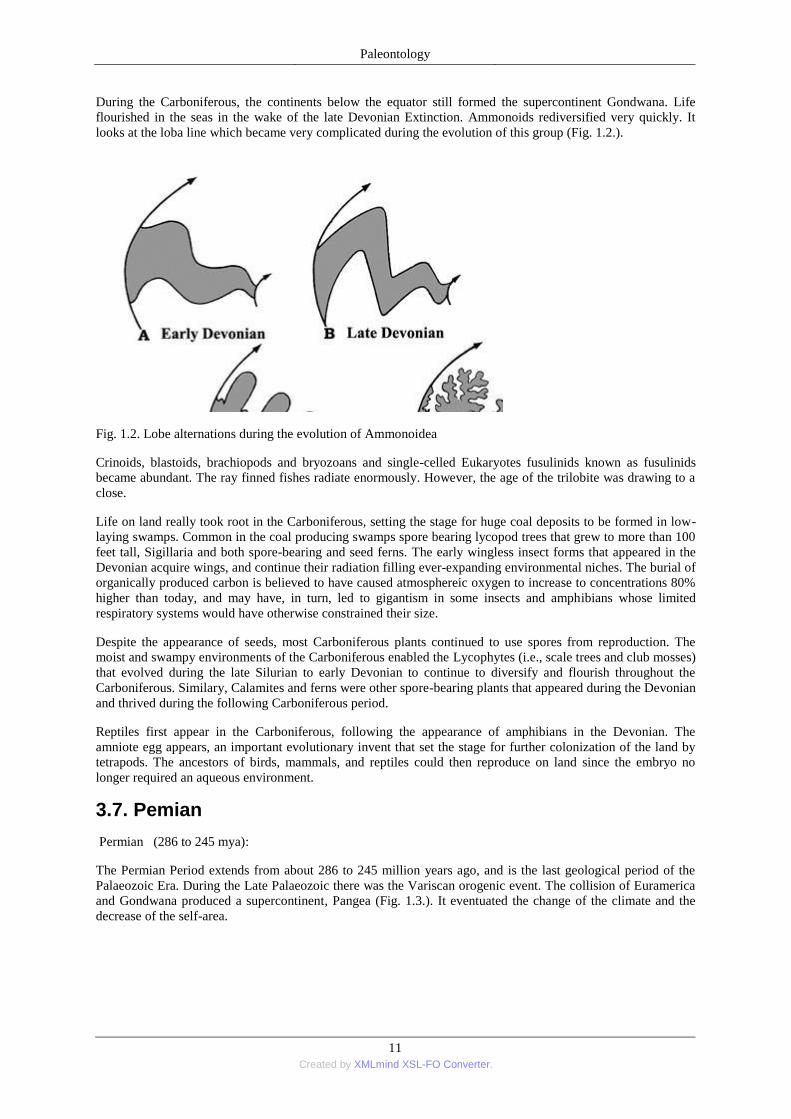
Permian (286 to 245 mya):
The Permian Period extends from about 286 to 245 million years ago, and is the last geological period of the
Palaeozoic Era. During the Late Palaeozoic there was the Variscan orogenic event. The collision of Euramerica
and Gondwana produced a supercontinent, Pangea (Fig. 1.3.). It eventuated the change of the climate and the
decrease of the self-area.
Paleontology
12 Created by XMLmind XSL-FO Converter.
Fig. 1.3. Evolving of the Pangea during the Late Permian
Life on land included a diversity of plants, arthropods, amphibians and reptiles. The reptiles were mainly
synapsids (Pelycosaurs and Therapsids) that appeared in the Upper Carboniferous, and were bulky, cold-
blooded animals with small brains Towards the very end of the Permian the first archosaurs appear, the
ancestors of the soon to follow Triassic dinosaurs. Permian marine environments were abundant in molluscs,
echinoderms, and brachiopods.
The Permian ended with the most extensive extinction event recorded in palaeontology: the Permian-Triassic
extinction event, where some 90% to 95% of marine organisms and 70% of all terrestrial organisms became
extinct.
3.8. Mesozoic Era
One of the most striking events in the Mesozoic Era was the rise to dominance of dinosaurs in terrestrial
ecosystems. The Mesozoic lasted from 245 to 65 million years ago, and is divided into three periods. The
Mesozoic, which derives its name from the Greek with a rough meaning of middle animals, began after the
Permian extinction and ended with the Cretaceous extinction. It comprises the Triassic, Jurassic and Cretaceous
Periods. The Mesozoic is most famed for the Dinosaurs, and popular lexicon considers it the Age of the
Dinosaurs (or Reptiles). The dinosaurs together with reptiles of all sizes ranging from the gigantic to the merely
intimidating by human size standards, dominated the terrestrial environments. The flowering plants, or
angiosperms, appeared in the Mesozoic.
Triassic (245 to 208 mya): The Permian-Triassic (P/T) Extinction Event marked the end of the Permian Period
of the Paleozoic Era, and the start of the Triassic Period of the Mesozoic Era. The P/T extinction decimated the
brachiopods, corals, echinoderms, mollusks, and other invertebrates. The last surviving trilobite order, the
Proetids, also did not survive. The P/T event set the stage for adaptative radiation in both land and marine
environments. Corals belonging to Hexacorallia appeared.
Among the Enchinodermata, the inadunate crinoids, which had barely survived the end-Permian extinction with
one family, finally disappeared. While crinoids were the most abundant group of echinoderms from the early
Ordovician to the late Paleozoic, they nearly went extinct during the Permian-Triassic extinction. All the post-
Paleozoic crinoids, namely the Articulata, are presumed to be a monophyletic clade that originated from the
inadunate Order Cladida. However there seems to be a great gap between the morphologies of articulates and
Paleozoic crinoids. Thus, a single genus of crinoid is known from the early Triassic, and is ancestral to all "deep
water" extant articulate crinoids.
Other invertebrates, notably the bivalves, ammonoids and brachiopods recovered to dominate the marine
environment, and the squid-like Belemites appeared and became abundant. New groups of echinoderms
appeared as well. Marine reptiles were highly diverse, including the Sauropterygia, nothosaurs,
Paleontology
13 Created by XMLmind XSL-FO Converter.
pachypleurosaurs, placodonts, and the first plesiosaurs. The ichthyosaurs appeared in the early Triassic, and
radiated into huge, marine-dominating species. Seed plants dominated the land, especially conifers to the north
and the Glossopteris, or seed ferns, to the south. The first flowering plants (the Angiosperms) probably evolved
during the Triassic
The Triassic period closed with an extinction event that particularly affected marine life, including decimation
of marine reptiles, except the surviving ichthyosaurs and plesiosaurs. A quarter of invertebrate families met
extinction, as well as the conodonts. Actually, many extinction events punctuated the Triassic, which are
believed to have provided additional selective pressures fostering the dinosaur radiation into emptied niches.
Triassic land was predominately the supercontinent Pangea (meaning all the land) located near the equator.
Sediments from the Dinosaurs would thus go on to be increasingly diverse and dominating in the subsequent
Jurassic and Cretaceous Periods. Among other tetrapods, several reptilian orders also became extinct, including
the protosaurs, nothosaurs, and placodonts.
Jurassic (208 to 146 mya): While the dinosaurs appeared in the Triassic, it was during the Jurassic that they
prodigiously radiated and ascended to be the rulers of the land. Dinosaurs are a clade of reptiles defined by
somewhat ambiguous criteria. Compared with other reptiles, the dinosaur hind limbs are beneath the body. The
pelvis extends vertically so that the hip socket vertically carries the load, rather than on lateral loading other
reptiles. In recent years dinosaurs have been viewed as transitional between ordinary reptiles (especially
crocodiles) and the birds.
The immense plant-eating dinosaurs (the sauropods) were ubiquitous and were the prey of the large theropods,
including ceratosaurs, megalosaurs, and allosaurs. Among plantae, Gymnosperms (especially conifers,
Bennettitales and cycads) and ferns are common providing abundant food for the sauropods. Birds evolved
during the late Jurassic. The pterosaurs, the flying reptiles, were common in the Jurassic. Fish and reptiles
dominated marine environs. The ichthyosaurs, plesiosaurs, and marine crocodiles flourished, as did bivalves,
belemnites, brachiopods, echinoids, starfish, sponges and ammonites among the invertebrates. Ammonites were
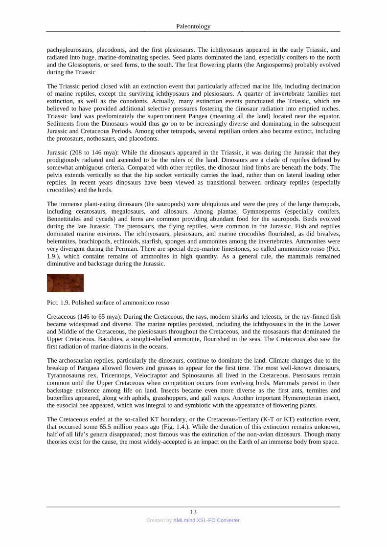
very divergent during the Permian. There are special deep-marine limestones, so called ammonitico rosso (Pict.
1.9.), which contains remains of ammonites in high quantity. As a general rule, the mammals remained
diminutive and backstage during the Jurassic.
Pict. 1.9. Polished surface of ammonitico rosso
Cretaceous (146 to 65 mya): During the Cretaceous, the rays, modern sharks and teleosts, or the ray-finned fish
became widespread and diverse. The marine reptiles persisted, including the ichthyosaurs in the in the Lower
and Middle of the Cretaceous, the plesiosaurs throughout the Cretaceous, and the mosasaurs that dominated the
Upper Cretaceous. Baculites, a straight-shelled ammonite, flourished in the seas. The Cretaceous also saw the
first radiation of marine diatoms in the oceans.
The archosaurian reptiles, particularly the dinosaurs, continue to dominate the land. Climate changes due to the
breakup of Pangaea allowed flowers and grasses to appear for the first time. The most well-known dinosaurs,
Tyrannosaurus rex, Triceratops, Velociraptor and Spinosaurus all lived in the Cretaceous. Pterosaurs remain
common until the Upper Cretaceous when competition occurs from evolving birds. Mammals persist in their
backstage existence among life on land. Insects became even more diverse as the first ants, termites and
butterflies appeared, along with aphids, grasshoppers, and gall wasps. Another important Hymenopteran insect,
the eusocial bee appeared, which was integral to and symbiotic with the appearance of flowering plants.
The Cretaceous ended at the so-called KT boundary, or the Cretaceous-Tertiary (K-T or KT) extinction event,
that occurred some 65.5 million years ago (Fig. 1.4.). While the duration of this extinction remains unknown,
half of all life’s genera disappeared; most famous was the extinction of the non-avian dinosaurs. Though many
theories exist for the cause, the most widely-accepted is an impact on the Earth of an immense body from space.
Paleontology
14 Created by XMLmind XSL-FO Converter.
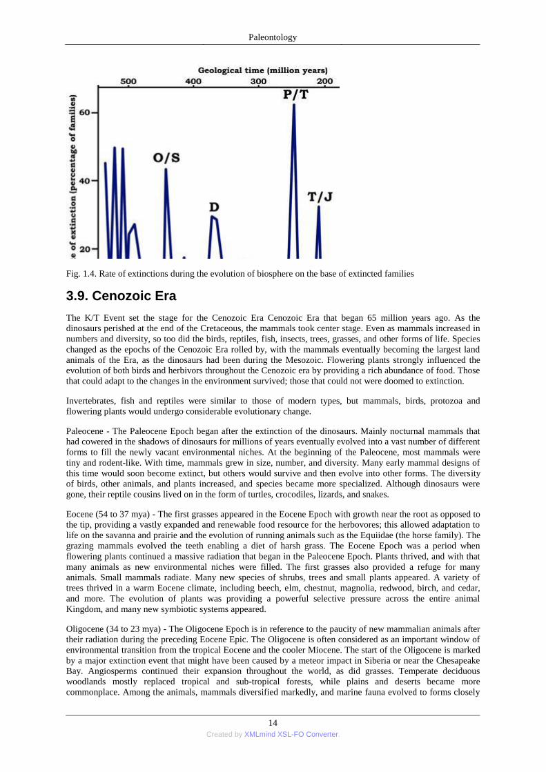
Fig. 1.4. Rate of extinctions during the evolution of biosphere on the base of extincted families
3.9. Cenozoic Era
The K/T Event set the stage for the Cenozoic Era Cenozoic Era that began 65 million years ago. As the
dinosaurs perished at the end of the Cretaceous, the mammals took center stage. Even as mammals increased in
numbers and diversity, so too did the birds, reptiles, fish, insects, trees, grasses, and other forms of life. Species
changed as the epochs of the Cenozoic Era rolled by, with the mammals eventually becoming the largest land
animals of the Era, as the dinosaurs had been during the Mesozoic. Flowering plants strongly influenced the
evolution of both birds and herbivors throughout the Cenozoic era by providing a rich abundance of food. Those
that could adapt to the changes in the environment survived; those that could not were doomed to extinction.
Invertebrates, fish and reptiles were similar to those of modern types, but mammals, birds, protozoa and
flowering plants would undergo considerable evolutionary change.
Paleocene - The Paleocene Epoch began after the extinction of the dinosaurs. Mainly nocturnal mammals that
had cowered in the shadows of dinosaurs for millions of years eventually evolved into a vast number of different
forms to fill the newly vacant environmental niches. At the beginning of the Paleocene, most mammals were
tiny and rodent-like. With time, mammals grew in size, number, and diversity. Many early mammal designs of
this time would soon become extinct, but others would survive and then evolve into other forms. The diversity
of birds, other animals, and plants increased, and species became more specialized. Although dinosaurs were
gone, their reptile cousins lived on in the form of turtles, crocodiles, lizards, and snakes.
Eocene (54 to 37 mya) - The first grasses appeared in the Eocene Epoch with growth near the root as opposed to
the tip, providing a vastly expanded and renewable food resource for the herbovores; this allowed adaptation to
life on the savanna and prairie and the evolution of running animals such as the Equiidae (the horse family). The
grazing mammals evolved the teeth enabling a diet of harsh grass. The Eocene Epoch was a period when
flowering plants continued a massive radiation that began in the Paleocene Epoch. Plants thrived, and with that
many animals as new environmental niches were filled. The first grasses also provided a refuge for many
animals. Small mammals radiate. Many new species of shrubs, trees and small plants appeared. A variety of
trees thrived in a warm Eocene climate, including beech, elm, chestnut, magnolia, redwood, birch, and cedar,
and more. The evolution of plants was providing a powerful selective pressure across the entire animal
Kingdom, and many new symbiotic systems appeared.
Oligocene (34 to 23 mya) - The Oligocene Epoch is in reference to the paucity of new mammalian animals after
their radiation during the preceding Eocene Epic. The Oligocene is often considered as an important window of
environmental transition from the tropical Eocene and the cooler Miocene. The start of the Oligocene is marked
by a major extinction event that might have been caused by a meteor impact in Siberia or near the Chesapeake
Bay. Angiosperms continued their expansion throughout the world, as did grasses. Temperate deciduous
woodlands mostly replaced tropical and sub-tropical forests, while plains and deserts became more
commonplace. Among the animals, mammals diversified markedly, and marine fauna evolved to forms closely
Paleontology
15 Created by XMLmind XSL-FO Converter.
resembling those extant today. Ancestors of modern elephants and rhinoceros grew to large size in Africa,
where the first apes primate belonging to suborder Anthropoidea that includes monkeys, apes, and humans, also
appeared.
Miocene (23 to 5 mya) - The Miocene is thus a very long 18 million years, and generally marks the transition
from the far prehistoric world to a pseudo-modern world. A major expansion of grasslands occurred as forests
declined in the cooler and dryer climate, driving selection and radiation of large herbivores, including the
ruminants which are ancestors of modern cattle and deer. Mammals such as wolves, horses and deer as well as
birds also generally evolved to closely resemble forms extant today.
Pliocene (5.3 to 1.8 mya) - The Pliocene climate was relative cool and dry as in modern times. These modern
climates reduced tropical vegetation and shrank tropical forest to a band near the equator. Concurrently,
deciduous and coniferous forests, tundra, grasslands, dry savannahs and deserts filled the space.
Continental drift would play a major role is how animals, and particularly terrestrial mammals were to
distribute.
Both marine and terrestrial life was for the most part modern, though discernibly more primitive. Herbivores
grew in size, as did their predators. The first recognizable human ancestors, the australopithecines, appeared in
the Pliocene. Mammalian life evolved in continent-dependent ways, and some migration occurred between
continents. In North America, rodents, mastodonts, elephant-like gomphotheres, and opossums were notably
prolific, while hoofed animals generally declined. Africa’s hoofed animals and primates were notably
successful, and the australopithecines (some of the first hominids) appeared late in the Pliocene The Pliocene
seas were thrived with mammals such as seals and sea lions. Rudabánya is a fossil-rich famous Pliocene locality
in Hungary. There were swamps at this area where fossilization rata was high. Mastodons, monkeys, small
rodents and hominids are the most important fossils of this outcrop.
The Quaternary Period includes two geologic epochs: the Pleistocene and the Holocene. It began less than 2
million years ago. Pleistocene climate was marked by repeated glacial cycles where continental glaciers pushed
to the 40th parallel in some places. It is estimated that, at maximum glacial extent, 30% of the Earth's surface
was covered by ice. In addition, a zone of permafrost stretched southward from the edge of the glacial sheet, a
few hundred kilometres in North America, and several hundred in Eurasia. The severe climatic changes during
the ice age had major impacts on the fauna and flora. With each advance of the ice, large areas of the continents
became totally depopulated, and plants and animals retreating southward in front of the advancing glacier faced
tremendous stress. The most severe stress resulted from drastic climatic changes, reduced living space, and
curtailed food supply. A major extinction event of large mammals (megafauna), which included mammoths,
mastodons, saber-toothed cats, Irish elk, cave bears, and short-faced bears, began late in the Pleistocene and
continued into the Holocene. Neanderthals also became extinct during this period. At the end of the last ice age,
cold-blooded animals, smaller mammals like wood mice, migratory birds, and swifter animals like whitetail deer
had replaced the megafauna and migrated north.
The most important event of Holocene is the evolution of the human and the human civilizations.
4. Trace fossils
Trace fossils are geological records of biological activity. Trace fossils may be impressions made on the
substrate by an organism: for example, burrows, borings (bioerosion), urolites (erosion caused by evacuation of
liquid wastes), footprints and feeding marks, and root cavities. The term in its broadest sense also includes the
remains of other organic material produced by an organism — for example coprolites (fossilized droppings) or
chemical markers — or sedimentological structures produced by biological means - for example, stromatolites.
Trace fossils contrast with body fossils, which are the fossilized remains of parts of organisms' bodies, usually
altered by later chemical activity or mineralization.
Sedimentary structures, for example those produced by empty shells rolling along the sea floor, are not
produced through the behaviour of an organism and not considered trace fossils.
The study of traces is called ichnology, which is divided into paleoichnology, or the study of trace fossils, and
neoichnology, the study of modern traces. This science is challenging, as most traces reflect the behaviour —
not the biological affinity — of their makers. As such, trace fossils are categorised into form genera, based upon
their appearance and the implied behaviour of their makers.
Paleontology
16 Created by XMLmind XSL-FO Converter.
Trace fossils are generally difficult or impossible to assign to a specific maker. Only in very rare occasions are
the makers found in association with their tracks. Further, entirely different organisms may produce identical
tracks. Therefore conventional taxonomy is not applicable, and a comprehensive form taxonomy has been
erected. At the highest level of the classification, five behavioral modes are recognized:
resting taces resting
traces
dwelling traces
locomotion traces crawling
traces
walking traces
runing traces
jumping traces
flying traces
feeding traces feeding
traces
grazing traces
predation traces
other traces
Owing to their nature, trace fossils can be considered as both paleontological and sedimentological entires,
therby bridging the gap between two of the main subdivisions in sedimentary geology. Four major categories are
recognized: (1) Bioerosion structure – a biogenic structure excavated mechanically or biochemically by an
organism into a ridged substrate: includes borings, gnawings, scrapings, bitings and related traces (Pict. 1.10.).
Pict. 1.10. Bioerosion of boring bivalves and boring sponges in Early Miocene abrasion pebble
(2) Biostratification structures – a biogenic sedimentary structure consisting of stratification imparted by the
activity of an organism: biogenic graded bedding, byssal mats, certain stromatolites and similar structures (Pict.
1.11.)
Pict. 1.11. Cross section of Cambrian stromatolite
(3) Bioturbation structures – a biogenic structure that reflects the disruption of biogenic and physical
stratification features or sediment fabrics by the activity of an organism: includes tracks, trails, burrows and
similar structure (Pict. 1.12.)
Paleontology
17 Created by XMLmind XSL-FO Converter.
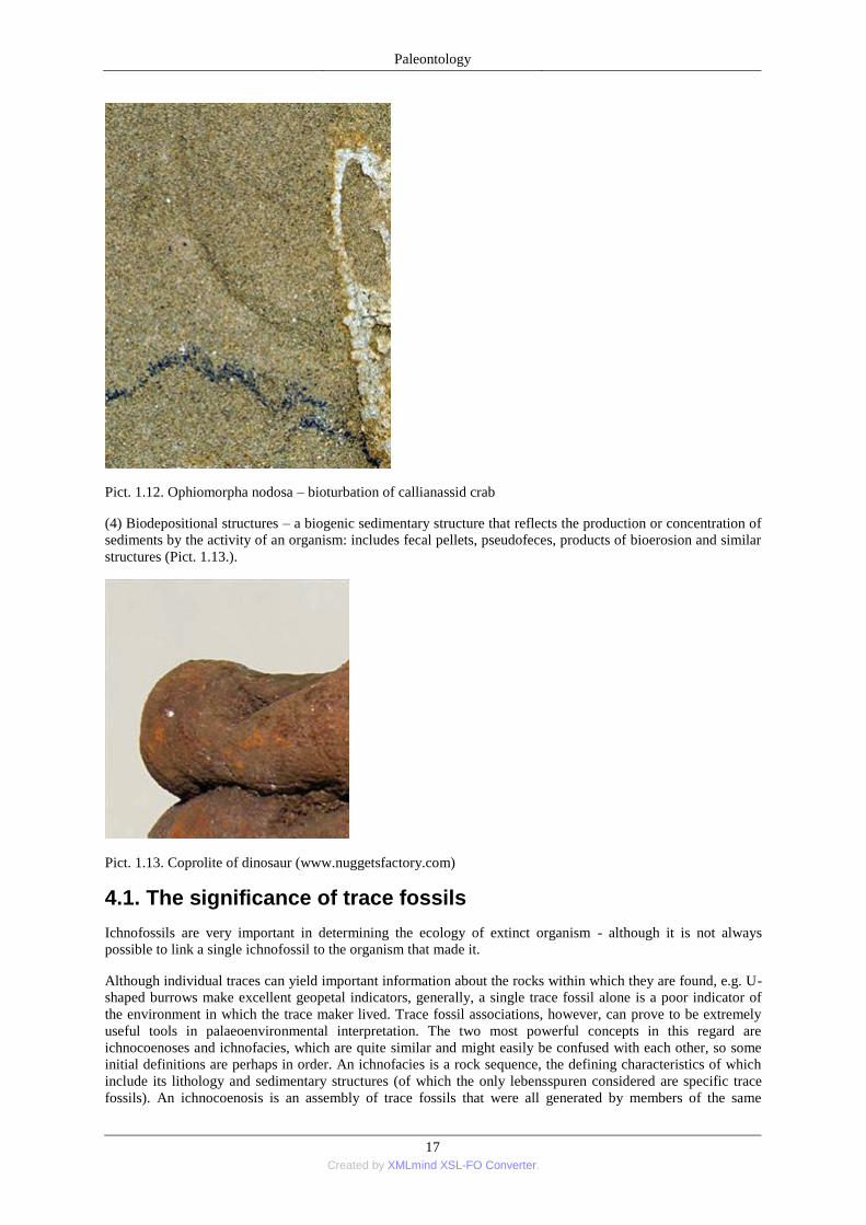
Pict. 1.12. Ophiomorpha nodosa – bioturbation of callianassid crab
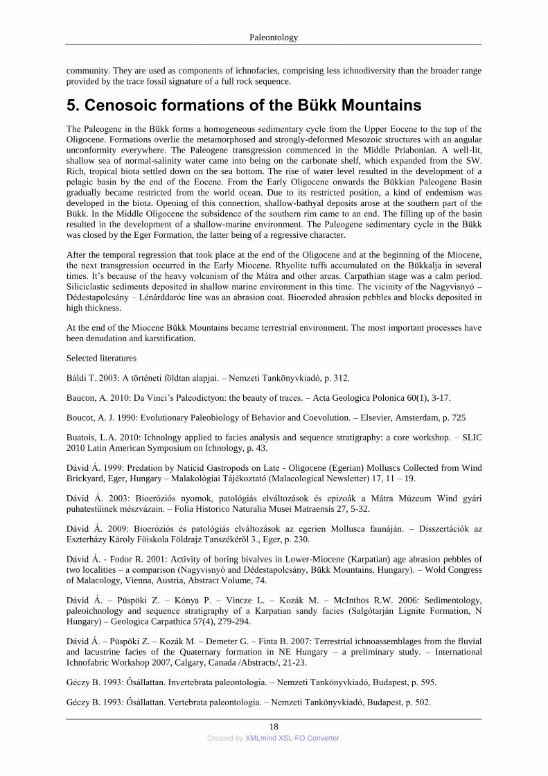
(4) Biodepositional structures – a biogenic sedimentary structure that reflects the production or concentration of
sediments by the activity of an organism: includes fecal pellets, pseudofeces, products of bioerosion and similar
structures (Pict. 1.13.).
Pict. 1.13. Coprolite of dinosaur (www.nuggetsfactory.com)
4.1. The significance of trace fossils
Ichnofossils are very important in determining the ecology of extinct organism - although it is not always
possible to link a single ichnofossil to the organism that made it.
Although individual traces can yield important information about the rocks within which they are found, e.g. U-
shaped burrows make excellent geopetal indicators, generally, a single trace fossil alone is a poor indicator of
the environment in which the trace maker lived. Trace fossil associations, however, can prove to be extremely
useful tools in palaeoenvironmental interpretation. The two most powerful concepts in this regard are
ichnocoenoses and ichnofacies, which are quite similar and might easily be confused with each other, so some
initial definitions are perhaps in order. An ichnofacies is a rock sequence, the defining characteristics of which
include its lithology and sedimentary structures (of which the only lebensspuren considered are specific trace
fossils). An ichnocoenosis is an assembly of trace fossils that were all generated by members of the same
Paleontology
18 Created by XMLmind XSL-FO Converter.
community. They are used as components of ichnofacies, comprising less ichnodiversity than the broader range
provided by the trace fossil signature of a full rock sequence.
5. Cenosoic formations of the Bükk Mountains
The Paleogene in the Bükk forms a homogeneous sedimentary cycle from the Upper Eocene to the top of the
Oligocene. Formations overlie the metamorphosed and strongly-deformed Mesozoic structures with an angular
unconformity everywhere. The Paleogene transgression commenced in the Middle Priabonian. A well-lit,
shallow sea of normal-salinity water came into being on the carbonate shelf, which expanded from the SW.
Rich, tropical biota settled down on the sea bottom. The rise of water level resulted in the development of a
pelagic basin by the end of the Eocene. From the Early Oligocene onwards the Bükkian Paleogene Basin
gradually became restricted from the world ocean. Due to its restricted position, a kind of endemism was
developed in the biota. Opening of this connection, shallow-bathyal deposits arose at the southern part of the
Bükk. In the Middle Oligocene the subsidence of the southern rim came to an end. The filling up of the basin
resulted in the development of a shallow-marine environment. The Paleogene sedimentary cycle in the Bükk
was closed by the Eger Formation, the latter being of a regressive character.
After the temporal regression that took place at the end of the Oligocene and at the beginning of the Miocene,
the next transgression occurred in the Early Miocene. Rhyolite tuffs accumulated on the Bükkalja in several
times. It’s because of the heavy volcanism of the Mátra and other areas. Carpathian stage was a calm period.
Siliciclastic sediments deposited in shallow marine environment in this time. The vicinity of the Nagyvisnyó –
Dédestapolcsány – Lénárddaróc line was an abrasion coat. Bioeroded abrasion pebbles and blocks deposited in
high thickness.
At the end of the Miocene Bükk Mountains became terrestrial environment. The most important processes have
been denudation and karstification.
Selected literatures
Báldi T. 2003: A történeti földtan alapjai. – Nemzeti Tankönyvkiadó, p. 312.
Baucon, A. 2010: Da Vinci’s Paleodictyon: the beauty of traces. – Acta Geologica Polonica 60(1), 3-17.
Boucot, A. J. 1990: Evolutionary Paleobiology of Behavior and Coevolution. – Elsevier, Amsterdam, p. 725
Buatois, L.A. 2010: Ichnology applied to facies analysis and sequence stratigraphy: a core workshop. – SLIC
2010 Latin American Symposium on Ichnology, p. 43.
Dávid Á. 1999: Predation by Naticid Gastropods on Late - Oligocene (Egerian) Molluscs Collected from Wind
Brickyard, Eger, Hungary – Malakológiai Tájékoztató (Malacological Newsletter) 17, 11 – 19.
Dávid Á. 2003: Bioeróziós nyomok, patológiás elváltozások és epizoák a Mátra Múzeum Wind gyári
puhatestűinek mészvázain. – Folia Historico Naturalia Musei Matraensis 27, 5-32.
Dávid Á. 2009: Bioeróziós és patológiás elváltozások az egerien Mollusca faunáján. – Disszertációk az
Eszterházy Károly Főiskola Földrajz Tanszékéről 3., Eger, p. 230.
Dávid Á. - Fodor R. 2001: Activity of boring bivalves in Lower-Miocene (Karpatian) age abrasion pebbles of
two localities – a comparison (Nagyvisnyó and Dédestapolcsány, Bükk Mountains, Hungary). – Wold Congress
of Malacology, Vienna, Austria, Abstract Volume, 74.
Dávid Á. – Püspöki Z. – Kónya P. – Vincze L. – Kozák M. – McInthos R.W. 2006: Sedimentology,
paleoichnology and sequence stratigraphy of a Karpatian sandy facies (Salgótarján Lignite Formation, N
Hungary) – Geologica Carpathica 57(4), 279-294.
Dávid Á. – Püspöki Z. – Kozák M. – Demeter G. – Finta B. 2007: Terrestrial ichnoassemblages from the fluvial
and lacustrine facies of the Quaternary formation in NE Hungary – a preliminary study. – International
Ichnofabric Workshop 2007, Calgary, Canada /Abstracts/, 21-23.
Géczy B. 1993: Ősállattan. Invertebrata paleontologia. – Nemzeti Tankönyvkiadó, Budapest, p. 595.
Géczy B. 1993: Ősállattan. Vertebrata paleontologia. – Nemzeti Tankönyvkiadó, Budapest, p. 502.
Paleontology
19 Created by XMLmind XSL-FO Converter.
Juhász Á. 1987: Évmilliók emlékei. – Gondolat Kiadó, Budapest, p. 562.
Pemberton, S. G. – Spila, M. – Pulham, A. J. – Saunders, T. – MacEachern, J. A. – Robbins, D. – Sinclair, I. K.
2001: Ichnology & Sedimentology of Shallow to Marginal Marine Systems: Ben Nevis & Avalon Reservoirs,
Jeanne D’Arc Basin. – Geological Association of Canada Short Course, 15, p. 343.
Seilacher, A. 1964: Sedimentological classification and nomenclature of trace fossils. – Sedimentology, 3, 253-
256.
Szónoky M. 1995: A Föld és az élet fejlődése. – JATEPress, Szeged, p. 212.
www.paleodb.org
http://www.fossilmuseum.net
http://research.eas.ualberta.ca/ichnology
http://www.ichnology.ca
Palaeonological exhibition of the Mátra Museum
6. Palaeobotanical exhibition
Fossil plants recorded from the rocks of the Carboniferous-Pleistocene in Northeaster Hungary are on view at
the exhibitions. This part of our country is also notewortly from the point of view of paleobotany. Most of the
fossils were yielded by Paleogene and Neogene deposits. Among Paleogene localities Eger-Kiseged is
overriding importance, it dates back to the end of the Early Oligocene, thus its fossil plants are about 35 million
years old. The remains of terrestrial plants, leaves, fruits and seeds had drifted into the former sea, then were
burried by sediments and fossilized. Nowadays unknown, ancient plants were recorded here the most of which
became extinct as early as the Late Oligocene. These plants were tropical-subtropical requiring warm climates,
and their remote modern relatives are to be found in South-East Asia. This extremely exotic flora flourished
during the Early Oligocene at much lower latitudes than the recent latitudinal position of Eger. The great variety
of plants is manifested both in the high diversity and the morphological variability of species. The flora and
vegetation were dominated by ancient species of beech, oak, walnut, laurel, leguminous plants, elm, buckthorn,
however, numerous exotic, tropical plants appeared, such as Sloanea of the Elaeocarpaceae family. Among
plants that have become extinct during Earth history Ráskya recorded also in Kiseged, is a quite peculiar one
with its winged fruits.
From the younger Late Oligocene epoch the locality in the Eger-Wind brickyard is noted for plant remains.
Fossils were collected from three levels which are referred to as „lower‖, „middle‖ and „upper level floras‖
representing different time slices. The „lower level flora‖ is the oldest one, some elements of which recall the
thermophilous ancient flora of the Early Oligocene. The most diverse among the three levels is the youngest
„upper level flora‖ which includes in the mass the remains of a riparian vegetation. This flora is much more
modern with several new plant taxa resembling extant specie and requiring in part temperate climatic
conditions. However, temperate elements appeared along the rivers and withdrew to catchment areas, whereas
most of the plant forming the zonal vegetation were thermophilous. Due to the presence of swamps and
inundated areas the number of riparian and paludal taxa is high. Plants, like a species of Acer (Acer trilobatum),
alder, elm, laurel species, Myrica, „Rhamnus‖ warthae –a species known only from the Late Oligocene of the
Carpathian Basin – swamp cypress, ferns and other plants dominated this flora.
After the uplift of the Carpathians significant volcanic events took place in more cycles during the Miocene.
Owing to this, the formation of silicified woods was favoured by upwelling hydrothermal solutions, a quite nice
example of which is exhibited from Mikófalva. Great number of localities are known from the Miocene of
Northeastern Hungary (Felsőtárkány, Sály, Dédestapolcsány, Uppony, Mikófalva, Bánhorváti, Balaton-Dellő).
Fossil plants indicate well warming and cooling cycles during the Miocene. Remains of woingnut (Pterocarya),
maple (Acer), mediterranean species of oak (Quercus), laurel (Lauraceae), sweet gum (Liquidambar),
leguminous plants (Leguminosae) and Zelkova were frequent in the floras. The occurrence of thermophilous
plants, e.g. palms, serves as a proof of the fact that even as late as the younger Miocene subtropical climate
periods that were much warmer than today, took place. In addition to changes of the zonal climate, the flora
indicates well the coeval environment (swamps, wetlands, lowlands, uplands, etc.).
Paleontology
20 Created by XMLmind XSL-FO Converter.
Leaf fossils of the Pleistocene epoch have been preserved first of all in freshwater limestones formed in the
vicinity of thermal waters. Mainly species of ferns, alder, elm and hazel-nut were recorded. Since these plants
represent the plant cover formed in the special environment of thermal waters they provide useful pieces of
information on the microclimate of the hydrotermal area. Information of the remote palaeoenvironment can be
obtained by the study of pollens (palynological studies).
Professor baron Gábor Andreánszky was an outstanding personality of palaeobotanical studies in Hungary. He
studied among others the fossil floras of Northeastern Hungary and described numerous new fossil species
based on the collections of the Mátra Museum.
7. Palaeozoological exhibition
Fossils are the remains of ancient life. These remnants or traces of organisms of past geologic ages help us learn
about evolution and the development of ancient environments of the Earth. Fossils date back to thousands of
years to many millions of years in age, and come in a variety of sizes, from minute traces to large skeletons.
Trace fossils are clues to former life, they are resulted by the activities or presence of animals and plants.
The oldest rocks of Bükk Mountains were formed at the end of Palaeozoic Era during the Carboniferous and
Permian periods reflecting marine environments. These rocks can be fined in the vicinity of Nagyvisnyó. The
most famous Carboniferous locality is at cuts of Eger-Putnok Railway. Brachiopods, bryozoans, crinoids can be
found here. While the most beautiful locality of Permian marine sediments is the Mihálovits quarry.
The Bükk Mountains are mainly built up of Triassic limestone which is relatively poor in fossils. Some green
algae (Diplopora) and bivalves (Daonella) can be collected only. The Cretaceous ager fossils refer to the
diversity of the ancient fauna of small biohermas. The most characteristic fossils are colonial corals and Rudist
bivalves.
Cainozoic rocks of the Bükk Mountains are also marine deposits. During the Eocene, shallow marine
environment were dominant at this area. The biggest locality of Eocene sediments is the Nagy-Eged Hill, near to
Eger. Nummulites, sponge and coral colonies, molluscs are very common here.
During the Oligocene, Paratethys took place in the Carpathian Basin. Several world-famous Oligocene localities
can be found at the vicinity of Eger. Kiseged is a well-known locality of Early Oligocene plant remains and
fishes. While the outcrop of Wind Brickyard is the stratotype of Egerian. Leaves, solitary corals, molluscs, fish
remains can be collected here. Rocky shoreface were characteristic near to Nagyvisnyó and Dédestapolcsány at
the beginning of Miocene. Bioerosional traces are very common in the abrasion pebbles. These trace fossils are
from several boring sponges, boring bivalves and worms mostly. At the end of Miocene, during the Pleistocene,
characteristic climate change were determinate. Special megafauna leaved in the Carpathian Basin at this time:
wholly mammoth, wholly rhino, cave bear, cave lion. This megafauna extincted 10.000 years ago, because of
the climate change.
Selected literatures
Andreánszky G. 1966: On the Upper Oligocene Flora of Hungary. Analysis of the Site at the Wind Brickyard,
Eger. – Studia Biologica Hungarica 5, p. 151.
Báldi T. 1973: Mollusc fauna of the Hungarian Upper Oligocene /Egerian/. - Akadémiai Kiadó, Budapest, p.
511.
Dávid Á. 2009: Bioeróziós és patológiás elváltozások az egerien Mollusca faunáján. – Disszertációk az
Eszterházy Károly Főiskola Földrajz Tanszékéről 3., Eger, p. 230.
Főzy I. – Szente I. 2007: A Kárpát-medence ősmaradványai. – Gondolat Kiadó, Budapest, p. 456.
Fűköh L. 2010: Gerinctelen-ősmaradványok a Mátra térségében. – In: Baráz Cs. (szerk.) 2010. A Mátrai
Tájvédelmi Körzet. Heves és Nógrád határán. – Eger, 81. - 83.
Géczy B. 1993: Ősállattan. Invertebrata paleontologia. – Nemzeti Tankönyvkiadó, Budapest, p. 595.
Géczy B. 1993: Ősállattan. Vertebrata paleontologia. – Nemzeti Tankönyvkiadó, Budapest, p. 502.
Paleontology
21 Created by XMLmind XSL-FO Converter.
Hably L. 2010: Ősnövénymaradványok a Mátra térségében. – In: Baráz Cs. (szerk.) 2010. A Mátrai Tájvédelmi
Körzet. Heves és Nógrád határán. – Eger, 79-80.
Hably L. – Erdei B. – Kvaček, Z. 2001: 19th century’s palaeobotanical types and originals of the Hungarian
Natural History Museum, p. 235.
Hír J. 2010: Miocén korú szárazföldi gerincesek maradványai a Mátra hegységben. – In: Baráz Cs. (szerk.)
2010. A Mátrai Tájvédelmi Körzet. Heves és Nógrád határán. – Eger, 85-90.
Vörös I. 2010: Fossilis Elephantidák a Mátra környékén. – In: Baráz Cs. (szerk.) 2010. A Mátrai Tájvédelmi
Körzet. Heves és Nógrád határán. – Eger, 91-98.
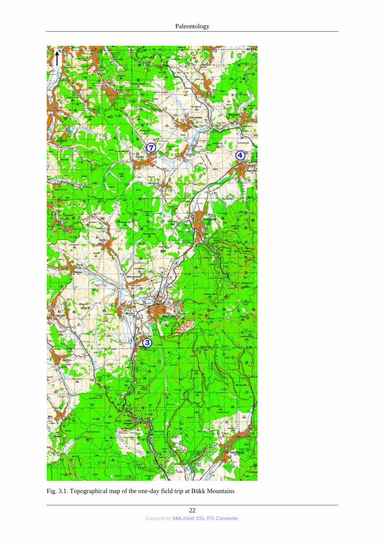
PALAEONTOLOGICAL FIELD TRIP TO THE BÜKK MOUNTAINS
Route: Eger – Szarvaskő – Mónosbél – Bélapátfalva – Szilvásvárad – Nagyvisnyó – Dédestapolcsány –
Nekézseny – Csernely – Bükkmogyorósd – Szilvásvárad – Bélapátfalva – Mónosbél – Szarvaskő – Eger (100
km) (Fig. 3.1.)
Paleontology
22 Created by XMLmind XSL-FO Converter.
Fig. 3.1. Topographical map of the one-day field trip at Bükk Mountains
Paleontology
23 Created by XMLmind XSL-FO Converter.
Aims: To get acquinted with the development of the Bükk Mountains on the basis of paleontological data. To
know the most important fossil finding sites of the Bükk Mountains, and to collect fossils at the above
mentioned localities.
It is important to take care of your and of the others’ physical soundness during the field trip!
8. Geology of the Bükk Mountains
Bükk Mountains was built mostly such marine sediments which arose during the Late Paleozoic and the Early
Mesozoic. These rocks are limestone, shale, radiolarite, dolomite and sandstone. These formations can be
analogue with the South Apline and Dinarid formations.
The oldest section recorded in the Bükkian sedimentary cycle was deposited in a pelagic basin during the
Carboniferous. The filling up of this flysch basin resulted in the development of a shallow marine environment.
Sedimentation vas controlled mainly by a continuous siliciclastic influx. Shales and bioherma-limestones arose
in this time.
Permian is featured by shallow-marine limestones. This formation evolved in anoxic sea. It’s rich in benthic
flora and fauna (alga, foraminifers, brachiopods). The mass extinction at the Permian-Triassic boundary was not
followed by significant changes in the sedimentary patterns; the accumulation of sediments continued on a
gently sloping shallow shelf.
During the Early Triassic the sedimentary basin became less restricted and a well-oxigenated, wave-agitated
ramp came into being. In the high-energy environment of the inner ramp characteristic coatal or nearshore
oolithic sand banks were formed. As in other parts of the Tethyan shelf, from the beginning of the Middle
Triassic, a carbonate plateau also came into being in the Bükk Unit. A rich biota developed in the shallow water
of the slowly but steadily sinking area, and the latter was separated from the distant continental terrain by
sedimentary traps. Stromatolites, rip-up and redeposited algal mat laminae, and strata consisting of oncoids with
a diameter of some centimetres, alternate with subtidal sediments. These latter are indicative of the well-
oxygenated, well-circulated shallow water of the euphotic zone in the lagoonal environment of the platform.
These facieses are dominant in the Bükk Mountains.
During the Early Jurassic special magmatic succession, so called ophiolitic series was formed at the area. The
area of the Bükk may have been close to the rift zone of the Tethys in this time. Basalt lava flows, pillow-lava
masses and radiolatites show these processes.
Cretaceous rocks are very rare in the Bükk Mountains. Near to Nekézseny and Dédestapolcsány can be found
Late Cretaceous conglomerates which were deposited in shallow-marine environment. The age of this is
Senonian on the base of fossils.
The Paleogene in the Bükk forms a homogeneous sedimentary cycle from the Upper Eocene to the top of the
Oligocene. Formations overlie the metamorphosed and strongly-deformed Mesozoic structures with an angular
unconformity everywhere. The Paleogene transgression commenced in the Middle Priabonian. A well-lit,
shallow sea of normal-salinity water came into being on the carbonate shelf, which expanded from the SW.
Rich, tropical biota settled down on the sea bottom. The rise of water level resulted in the development of a
pelagic basin by the end of the Eocene. From the Early Oligocene onwards the Bükkian Paleogene Basin
gradually became restricted from the world ocean. Due to its restricted position, a kind of endemism was
developed in the biota. Opening of this connection, shallow-bathyal deposits arose at the southern part of the
Bükk. In the Middle Oligocene the subsidence of the southern rim came to an end. The filling up of the basin
resulted in the development of a shallow-marine environment. The Paleogene sedimentary cycle in the Bükk
was closed by the Eger Formation, the latter being of a regressive character.
After the temporal regression that took place at the end of the Oligocene and at the beginning of the Miocene,
the next transgression occurred in the Early Miocene. Rhyolite tuffs accumulated on the Bükkalja in several
times. It’s because of the heavy volcanism of the Mátra and other areas. Karpatian stage was a calm period.
Siliciclastic sediments deposited in shallow marine environment in this time. The vicinity of the Nagyvisnyó –
Dédestapolcsány – Lénárddaróc line was an abrasion coat. Bioeroded abrasion pebbles and blocks deposited in
high thickness.
At the end of the Miocene Bükk Mountains became terrestrial environment. The most important processes have
been denudation and karstification.
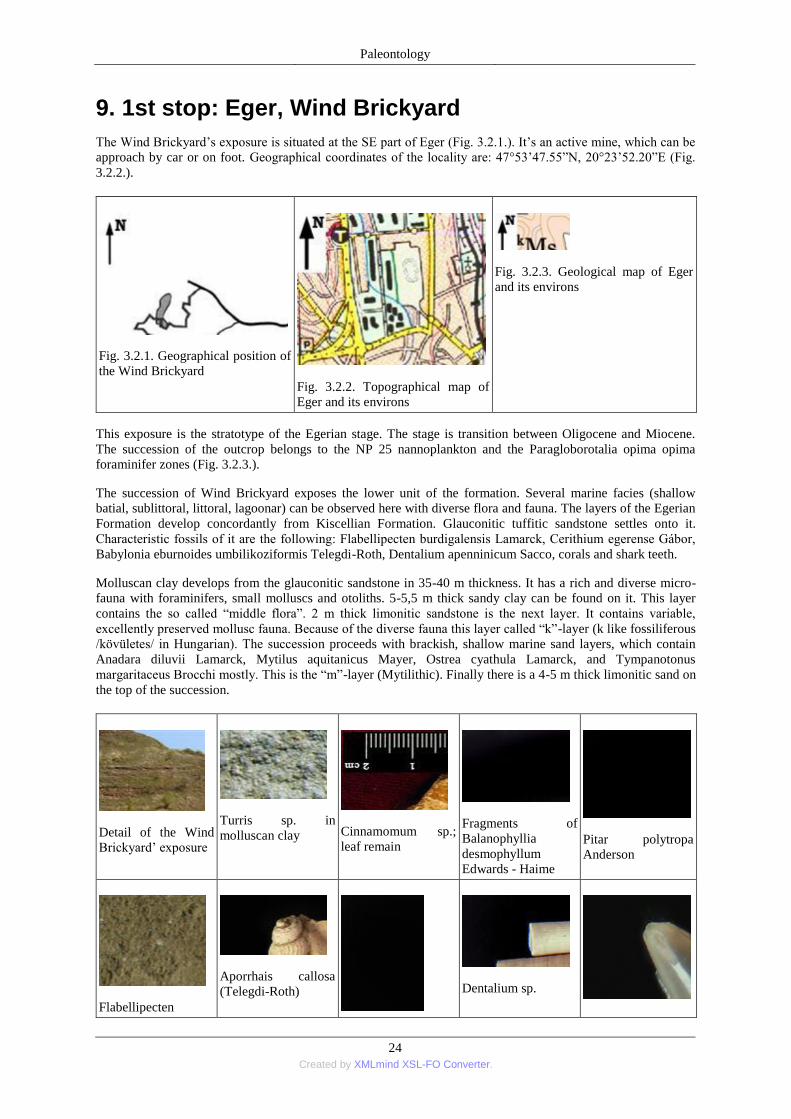
Paleontology
24 Created by XMLmind XSL-FO Converter.
9. 1st stop: Eger, Wind Brickyard
The Wind Brickyard’s exposure is situated at the SE part of Eger (Fig. 3.2.1.). It’s an active mine, which can be
approach by car or on foot. Geographical coordinates of the locality are: 47°53’47.55‖N, 20°23’52.20‖E (Fig.
3.2.2.).
Fig. 3.2.1. Geographical position of
the Wind Brickyard
Fig. 3.2.2. Topographical map of
Eger and its environs
Fig. 3.2.3. Geological map of Eger
and its environs
This exposure is the stratotype of the Egerian stage. The stage is transition between Oligocene and Miocene.
The succession of the outcrop belongs to the NP 25 nannoplankton and the Paragloborotalia opima opima
foraminifer zones (Fig. 3.2.3.).
The succession of Wind Brickyard exposes the lower unit of the formation. Several marine facies (shallow
batial, sublittoral, littoral, lagoonar) can be observed here with diverse flora and fauna. The layers of the Egerian
Formation develop concordantly from Kiscellian Formation. Glauconitic tuffitic sandstone settles onto it.
Characteristic fossils of it are the following: Flabellipecten burdigalensis Lamarck, Cerithium egerense Gábor,
Babylonia eburnoides umbilikoziformis Telegdi-Roth, Dentalium apenninicum Sacco, corals and shark teeth.
Molluscan clay develops from the glauconitic sandstone in 35-40 m thickness. It has a rich and diverse micro-
fauna with foraminifers, small molluscs and otoliths. 5-5,5 m thick sandy clay can be found on it. This layer
contains the so called ―middle flora‖. 2 m thick limonitic sandstone is the next layer. It contains variable,
excellently preserved mollusc fauna. Because of the diverse fauna this layer called ―k‖-layer (k like fossiliferous
/kövületes/ in Hungarian). The succession proceeds with brackish, shallow marine sand layers, which contain
Anadara diluvii Lamarck, Mytilus aquitanicus Mayer, Ostrea cyathula Lamarck, and Tympanotonus
margaritaceus Brocchi mostly. This is the ―m‖-layer (Mytilithic). Finally there is a 4-5 m thick limonitic sand on
the top of the succession.
Detail of the Wind
Brickyard’ exposure
Turris sp. in
molluscan clay
Cinnamomum sp.;
leaf remain
Fragments of
Balanophyllia
desmophyllum
Edwards - Haime
Pitar polytropa
Anderson
Flabellipecten
Aporrhais callosa
(Telegdi-Roth)
Dentalium sp.
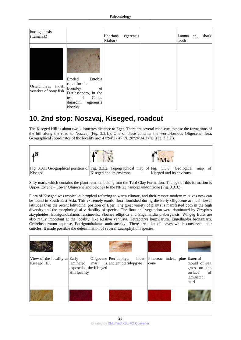
Paleontology
25 Created by XMLmind XSL-FO Converter.
burdigalensis
(Lamarck) Hadriana egerensis
(Gábor) Lamna sp., shark
tooth
Osteichthyes indet.,
vertebra of bony fish
Eroded Entobia
cateniformis
Bromley et
D'Alessandro, in the
test of Conus
dujardini egerensis
Noszky
10. 2nd stop: Noszvaj, Kiseged, roadcut
The Kiseged Hill is about two kilometres distance to Eger. There are several road-cuts expose the formations of
the hill along the road to Noszvaj (Fig. 3.3.1.). One of these contains the world-famous Oligocene flora.
Geographical coordinates of the locality are: 47°54’57.49‖N, 20°24’34.37‖E (Fig. 3.3.2.).
Fig. 3.3.1. Geographical position of
Kiseged
Fig. 3.3.2. Topographical map of
Kiseged and its environs
Fig. 3.3.3. Geological map of
Kiseged and its environs
Silty marls which contains the plant remains belong into the Tard Clay Formation. The age of this formation is
Upper Eocene – Lower Oligocene and belongs to the NP 23 nannoplankton zone (Fig. 3.3.3.).
Flora of Kiseged was tropical-subtropical referring to warm climate, and their remote modern relatives now can
be found in South-East Asia. This extremely exotic flora flourished during the Early Oligocene at much lower
latitudes than the recent latitudinal position of Eger. The great variety of plants is manifested both in the high
diversity and the morphological variability of species. The flora and vegetation were dominated by Zizyphus
zizyphoides, Eotrigonobalanus furcinervis, Sloanea elliptica and Engelhardia orsbergensis. Wingeg fruits are
also really important at the locality, like Raskya ventusta, Tetrapterys harpyiarum, Engelhardia brongniarti,
Cedrelospermum aquense, Eotrigonobalanus andreanszkyi. There are a lot of leaves which conserved their
cuticles. It made possible the determination of several Laurophyllum species.
View of the locality at
Kiseged Hill
Early Oligocene
laminated marl is
exposed at the Kiseged
Hill locality
Pteridophyta indet.;
ancient pteridopgyte
Pinaceae indet., pine
cone
External
mould of sea
grass on the
surface of
laminated
marl
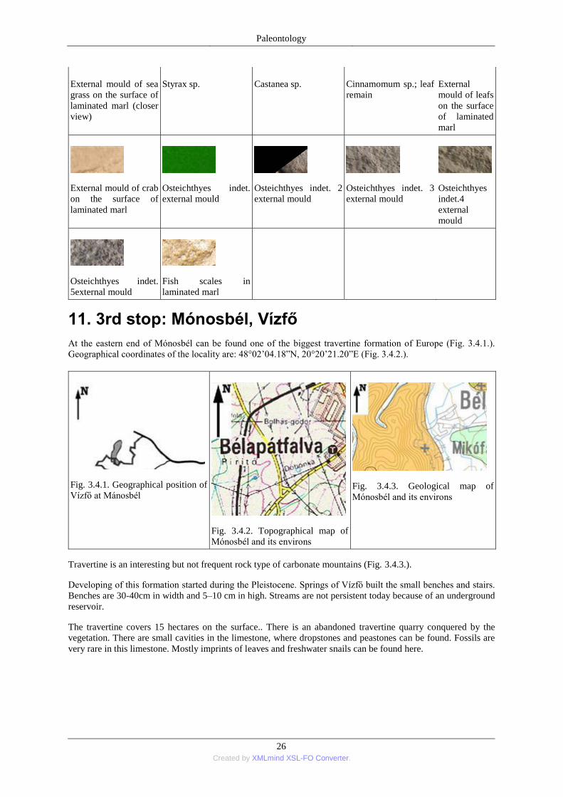
Paleontology
26 Created by XMLmind XSL-FO Converter.
External mould of sea
grass on the surface of
laminated marl (closer
view)
Styrax sp. Castanea sp. Cinnamomum sp.; leaf
remain External
mould of leafs
on the surface
of laminated
marl
External mould of crab
on the surface of
laminated marl
Osteichthyes indet.
external mould
Osteichthyes indet. 2
external mould
Osteichthyes indet. 3
external mould
Osteichthyes
indet.4
external
mould
Osteichthyes indet.
5external mould
Fish scales in
laminated marl
11. 3rd stop: Mónosbél, Vízfő
At the eastern end of Mónosbél can be found one of the biggest travertine formation of Europe (Fig. 3.4.1.).
Geographical coordinates of the locality are: 48°02’04.18‖N, 20°20’21.20‖E (Fig. 3.4.2.).
Fig. 3.4.1. Geographical position of
Vízfő at Mánosbél
Fig. 3.4.2. Topographical map of
Mónosbél and its environs
Fig. 3.4.3. Geological map of
Mónosbél and its environs
Travertine is an interesting but not frequent rock type of carbonate mountains (Fig. 3.4.3.).
Developing of this formation started during the Pleistocene. Springs of Vízfő built the small benches and stairs.
Benches are 30-40cm in width and 5–10 cm in high. Streams are not persistent today because of an underground
reservoir.
The travertine covers 15 hectares on the surface.. There is an abandoned travertine quarry conquered by the
vegetation. There are small cavities in the limestone, where dropstones and peastones can be found. Fossils are
very rare in this limestone. Mostly imprints of leaves and freshwater snails can be found here.
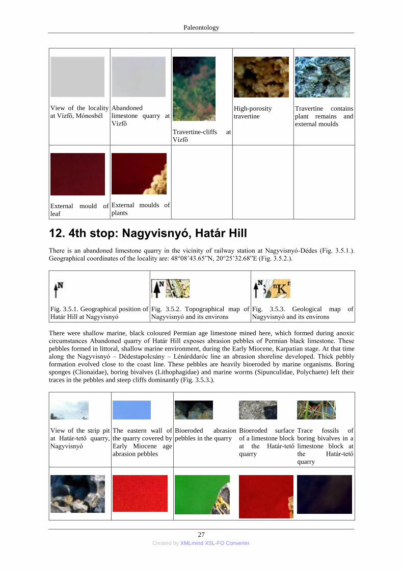
Paleontology
27 Created by XMLmind XSL-FO Converter.
View of the locality
at Vízfő, Mónosbél
Abandoned
limestone quarry at
Vízfő
Travertine-cliffs at
Vízfő
High-porosity
travertine
Travertine contains
plant remains and
external moulds
External mould of
leaf
External moulds of
plants
12. 4th stop: Nagyvisnyó, Határ Hill
There is an abandoned limestone quarry in the vicinity of railway station at Nagyvisnyó-Dédes (Fig. 3.5.1.).
Geographical coordinates of the locality are: 48°08’43.65‖N, 20°25’32.68‖E (Fig. 3.5.2.).
Fig. 3.5.1. Geographical position of
Határ Hill at Nagyvisnyó
Fig. 3.5.2. Topographical map of
Nagyvisnyó and its environs
Fig. 3.5.3. Geological map of
Nagyvisnyó and its environs
There were shallow marine, black coloured Permian age limestone mined here, which formed during anoxic
circumstances Abandoned quarry of Határ Hill exposes abrasion pebbles of Permian black limestone. These
pebbles formed in littoral, shallow marine environment, during the Early Miocene, Karpatian stage. At that time
along the Nagyvisnyó – Dédestapolcsány – Lénárddaróc line an abrasion shoreline developed. Thick pebbly
formation evolved close to the coast line. These pebbles are heavily bioeroded by marine organisms. Boring
sponges (Clionaidae), boring bivalves (Lithophagidae) and marine worms (Sipunculidae, Polychaete) left their
traces in the pebbles and steep cliffs dominantly (Fig. 3.5.3.).
View of the strip pit
at Határ-tető quarry,
Nagyvisnyó
The eastern wall of
the quarry covered by
Early Miocene age
abrasion pebbles
Bioeroded abrasion
pebbles in the quarry
Bioeroded surface
of a limestone block
at the Határ-tető
quarry
Trace fossils of
boring bivalves in a
limestone block at
the Határ-tető
quarry
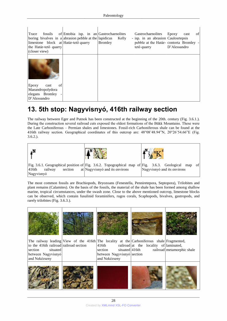
Paleontology
28 Created by XMLmind XSL-FO Converter.
Trace fossils of
boring bivalves in a
limestone block at
the Határ-tető quarry
(closer view)
Entobia isp. in an
abrasion pebble at the
Határ-tető quarry
Gastrochaenolites
lapidicus Kelly -
Bromley
Gastrochaenolites
isp. in an abrasion
pebble at the Határ-
tető quarry
Epoxy cast of
Caulosrtepsis
contorta Bromley -
D’Alessandro
Epoxy cast of
Maeandropolydora
elegans Bromley -
D’Alessandro
13. 5th stop: Nagyvisnyó, 416th railway section
The railway between Eger and Putnok has been constructed at the beginning of the 20th. century (Fig. 3.6.1.).
During the construction several railroad cuts exposed the oldest formations of the Bükk Mountains. These were
the Late Carboniferous – Permian shales and limestones. Fossil-rich Carboniferous shale can be found at the
416th railway section. Geographical coordinates of this outcrop are: 48°08’48.94‖N, 20°26’54.66‖E (Fig.
3.6.2.).
Fig. 3.6.1. Geographical position of
416th railway section at
Nagyvisnyó
Fig. 3.6.2. Topographical map of
Nagyvisnyó and its environs
Fig. 3.6.3. Geological map of
Nagyvisnyó and its environs
The most common fossils are Brachiopods, Bryozoans (Fenestella, Penniretepora, Septopora), Trilobites and
plant remains (Calamites). On the basis of the fossils, the material of the shale has been formed among shallow
marine, tropical circumstances, under the swash zone. Close to the above mentioned outcrop, limestone blocks
can be observed, which contain fusulinid foraminifers, rugos corals, Scaphopods, bivalves, gastropods, and
rarely trilobites (Fig. 3.6.3.).
The railway leading
to the 416th railroad
section situated
between Nagyvisnyó
and Nekézseny
View of the 416th
railroad section
The locality at the
416th railroad
section situated
between Nagyvisnyó
and Nekézseny
Carboniferous shale
at the locality of
416th railroad
section
Fragmented,
laminated,
metamorphic shale
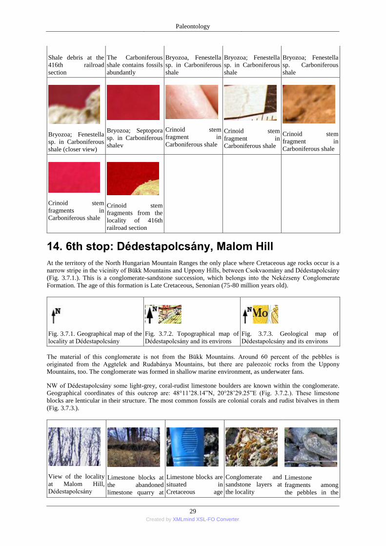
Paleontology
29 Created by XMLmind XSL-FO Converter.
Shale debris at the
416th railroad
section
The Carboniferous
shale contains fossils
abundantly
Bryozoa, Fenestella
sp. in Carboniferous
shale
Bryozoa; Fenestella
sp. in Carboniferous
shale
Bryozoa; Fenestella
sp. Carboniferous
shale
Bryozoa; Fenestella
sp. in Carboniferous
shale (closer view)
Bryozoa; Septopora
sp. in Carboniferous
shalev
Crinoid stem
fragment in
Carboniferous shale
Crinoid stem
fragment in
Carboniferous shale
Crinoid stem
fragment in
Carboniferous shale
Crinoid stem
fragments in
Carboniferous shale
Crinoid stem
fragments from the
locality of 416th
railroad section
14. 6th stop: Dédestapolcsány, Malom Hill
At the territory of the North Hungarian Mountain Ranges the only place where Cretaceous age rocks occur is a
narrow stripe in the vicinity of Bükk Mountains and Uppony Hills, between Csokvaomány and Dédestapolcsány
(Fig. 3.7.1.). This is a conglomerate-sandstone succession, which belongs into the Nekézseny Conglomerate
Formation. The age of this formation is Late Cretaceous, Senonian (75-80 million years old).
Fig. 3.7.1. Geographical map of the
locality at Dédestapolcsány
Fig. 3.7.2. Topographical map of
Dédestapolcsány and its environs
Fig. 3.7.3. Geological map of
Dédestapolcsány and its environs
The material of this conglomerate is not from the Bükk Mountains. Around 60 percent of the pebbles is
originated from the Aggtelek and Rudabánya Mountains, but there are paleozoic rocks from the Uppony
Mountains, too. The conglomerate was formed in shallow marine environment, as underwater fans.
NW of Dédestapolcsány some light-grey, coral-rudist limestone boulders are known within the conglomerate.
Geographical coordinates of this outcrop are: 48°11’28.14‖N, 20°28’29.25‖E (Fig. 3.7.2.). These limestone
blocks are lenticular in their structure. The most common fossils are colonial corals and rudist bivalves in them
(Fig. 3.7.3.).
View of the locality
at Malom Hill,
Dédestapolcsány
Limestone blocks at
the abandoned
limestone quarry at
Limestone blocks are
situated in
Cretaceous age
Conglomerate and
sandstone layers at
the locality
Limestone
fragments among
the pebbles in the
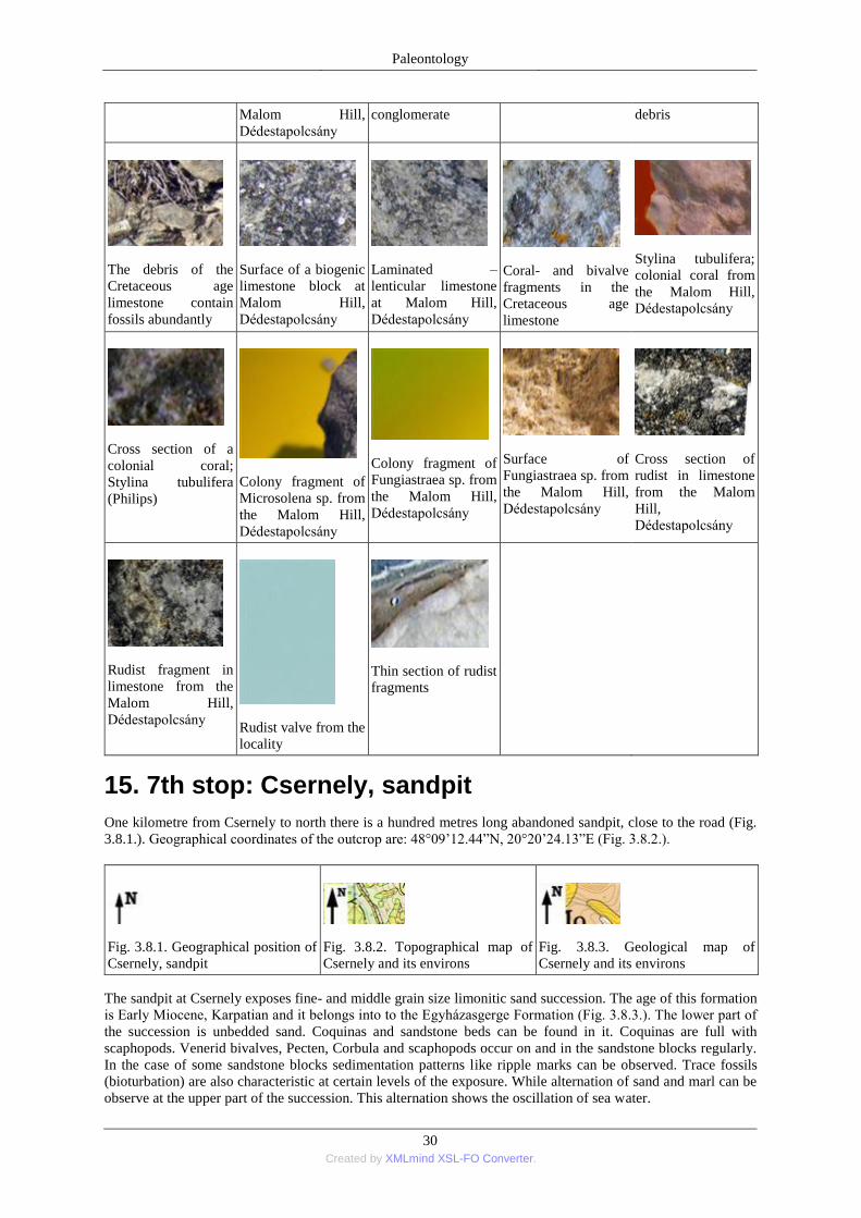
Paleontology
30 Created by XMLmind XSL-FO Converter.
Malom Hill,
Dédestapolcsány conglomerate debris
The debris of the
Cretaceous age
limestone contain
fossils abundantly
Surface of a biogenic
limestone block at
Malom Hill,
Dédestapolcsány
Laminated –
lenticular limestone
at Malom Hill,
Dédestapolcsány
Coral- and bivalve
fragments in the
Cretaceous age
limestone
Stylina tubulifera;
colonial coral from
the Malom Hill,
Dédestapolcsány
Cross section of a
colonial coral;
Stylina tubulifera
(Philips)
Colony fragment of
Microsolena sp. from
the Malom Hill,
Dédestapolcsány
Colony fragment of
Fungiastraea sp. from
the Malom Hill,
Dédestapolcsány
Surface of
Fungiastraea sp. from
the Malom Hill,
Dédestapolcsány
Cross section of
rudist in limestone
from the Malom
Hill,
Dédestapolcsány
Rudist fragment in
limestone from the
Malom Hill,
Dédestapolcsány
Rudist valve from the
locality
Thin section of rudist
fragments
15. 7th stop: Csernely, sandpit
One kilometre from Csernely to north there is a hundred metres long abandoned sandpit, close to the road (Fig.
3.8.1.). Geographical coordinates of the outcrop are: 48°09’12.44‖N, 20°20’24.13‖E (Fig. 3.8.2.).
Fig. 3.8.1. Geographical position of
Csernely, sandpit
Fig. 3.8.2. Topographical map of
Csernely and its environs
Fig. 3.8.3. Geological map of
Csernely and its environs
The sandpit at Csernely exposes fine- and middle grain size limonitic sand succession. The age of this formation
is Early Miocene, Karpatian and it belongs into to the Egyházasgerge Formation (Fig. 3.8.3.). The lower part of
the succession is unbedded sand. Coquinas and sandstone beds can be found in it. Coquinas are full with
scaphopods. Venerid bivalves, Pecten, Corbula and scaphopods occur on and in the sandstone blocks regularly.
In the case of some sandstone blocks sedimentation patterns like ripple marks can be observed. Trace fossils
(bioturbation) are also characteristic at certain levels of the exposure. While alternation of sand and marl can be
observe at the upper part of the succession. This alternation shows the oscillation of sea water.
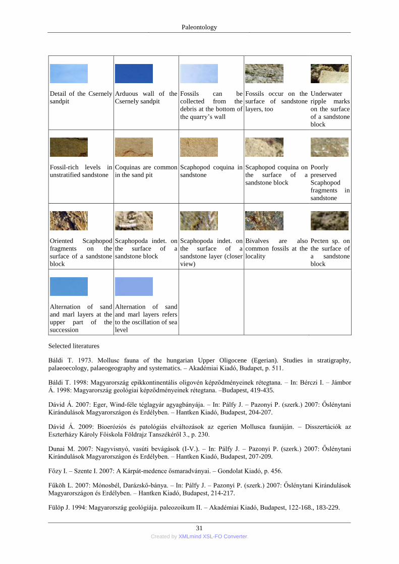
Paleontology
31 Created by XMLmind XSL-FO Converter.
Detail of the Csernely
sandpit
Arduous wall of the
Csernely sandpit
Fossils can be
collected from the
debris at the bottom of
the quarry’s wall
Fossils occur on the
surface of sandstone
layers, too
Underwater
ripple marks
on the surface
of a sandstone
block
Fossil-rich levels in
unstratified sandstone
Coquinas are common
in the sand pit
Scaphopod coquina in
sandstone
Scaphopod coquina on
the surface of a
sandstone block
Poorly
preserved
Scaphopod
fragments in
sandstone
Oriented Scaphopod
fragments on the
surface of a sandstone
block
Scaphopoda indet. on
the surface of a
sandstone block
Scaphopoda indet. on
the surface of a
sandstone layer (closer
view)
Bivalves are also
common fossils at the
locality
Pecten sp. on
the surface of
a sandstone
block
Alternation of sand
and marl layers at the
upper part of the
succession
Alternation of sand
and marl layers refers
to the oscillation of sea
level
Selected literatures
Báldi T. 1973. Mollusc fauna of the hungarian Upper Oligocene (Egerian). Studies in stratigraphy,
palaeoecology, palaeogeography and systematics. – Akadémiai Kiadó, Budapet, p. 511.
Báldi T. 1998: Magyarország epikkontinentális oligovén képződményeinek rétegtana. – In: Bérczi I. – Jámbor
Á. 1998: Magyarország geológiai képződményeinek rétegtana. –Budapest, 419-435.
Dávid Á. 2007: Eger, Wind-féle téglagyár agyagbányája. – In: Pálfy J. – Pazonyi P. (szerk.) 2007: Őslénytani
Kirándulások Magyarországon és Erdélyben. – Hantken Kiadó, Budapest, 204-207.
Dávid Á. 2009: Bioeróziós és patológiás elváltozások az egerien Mollusca faunáján. – Disszertációk az
Eszterházy Károly Főiskola Földrajz Tanszékéről 3., p. 230.
Dunai M. 2007: Nagyvisnyó, vasúti bevágások (I-V.). – In: Pálfy J. – Pazonyi P. (szerk.) 2007: Őslénytani
Kirándulások Magyarországon és Erdélyben. – Hantken Kiadó, Budapest, 207-209.
Főzy I. – Szente I. 2007: A Kárpát-medence ősmaradványai. – Gondolat Kiadó, p. 456.
Fűköh L. 2007: Mónosbél, Darázskő-bánya. – In: Pálfy J. – Pazonyi P. (szerk.) 2007: Őslénytani Kirándulások
Magyarországon és Erdélyben. – Hantken Kiadó, Budapest, 214-217.
Fülöp J. 1994: Magyarország geológiája. paleozoikum II. – Akadémiai Kiadó, Budapest, 122-168., 183-229.
Paleontology
32 Created by XMLmind XSL-FO Converter.
Hably L. – Báldi T. – Nagymarosy A. 2007: Noszvaj, Kiseged. – In: Pálfy J. – Pazonyi P. (szerk.) 2007:
Őslénytani Kirándulások Magyarországon és Erdélyben. – Hantken Kiadó, Budapest, 199-203.
Kovács S. – Hips K. 1998: A Bükk- és az Aggtelek–Rudabányai-hegység újpaleozóos képződményeinek
rétegtana. – In: Bérczi I. – Jámbor Á. (szerk.) 1998: Magyarország geológiai képződményeinek rétegtana. –
Budapest, 149-153.
Pelikán P. (szerk.) 2005: A Bükk hegység földtana. – Magyarázó a Bükk-hegység földtani térképéhez (1:50
000). – Budapest, 23-132.
Fossil collecting field trips in Hungary
16. Dunavarsány, gravel quarry
South to Budapest until the northern boundary of Nemesnádudvar, in the vicinity of river Danube there are large
areas covered with Pleistocene age gravels. Several quarries expose this gravel succession (Fig. 4.1.1.). The
examined locality is situated one kilometre to Dunavarsány to the east. The geographical coordinates of that are:
47°16’22.39‖N, 19°02’42.32‖E (Fig. 4.1.2.).
Fig. 4.1.1. Geographical position of
the Dunavarsány, gravel quarry
Fig. 4.1.2. Topographical map of
Dunavarsány and its environs
Fig. 4.1.3. Geological map of
Dunavarsány and its environs
The basal formation of it is Late Miocene age clay, aleurolite and sand. Thickness of gravel beds is 6-7 m at
Taksony – Dunavarsány – Délegyháza but 10-40 m at other parts of the Danube Valley (Fig. 4.1.3.).
The material of gravels is mostly quartzite, but other rock can be occur from the nearest mountains (e.g. andesite
from the Visegrád Mountains, or sandstone, limestone and dolomite from the Buda Mountains). There are rocks
among the pebbles, which cannot fin din Hungary. These are eclogite, granulite, and other metamorphic rocks.
Fossils can be occur among the pebbles also. The most common are the rounded oyster valves and the petrified
wood fragments. Sometimes it can be found Pleistocene age mammal remains, like teeth of horses, molars of
mammoths, bones of herbivorous terrestrial mammals.
The grain size of the gravels is variable. Small (2-5 mm) and fine grained (5-20 mm) pebbels are dominant at
the surface, while bigger grans are common near to the base.
The gravel quarrys at
Dunavarsány are the
property of AQUA
Kft.
Area of the gravel
quarry is closed by
gates. You need
permission to enter.
One of the lakes at
Dunavarsány, gravel
quarry
The gravel beds at
Dunavarsány are
from the terraces of
river Danube
The pebbles are
moderately – well
rounded, poorly
sorted
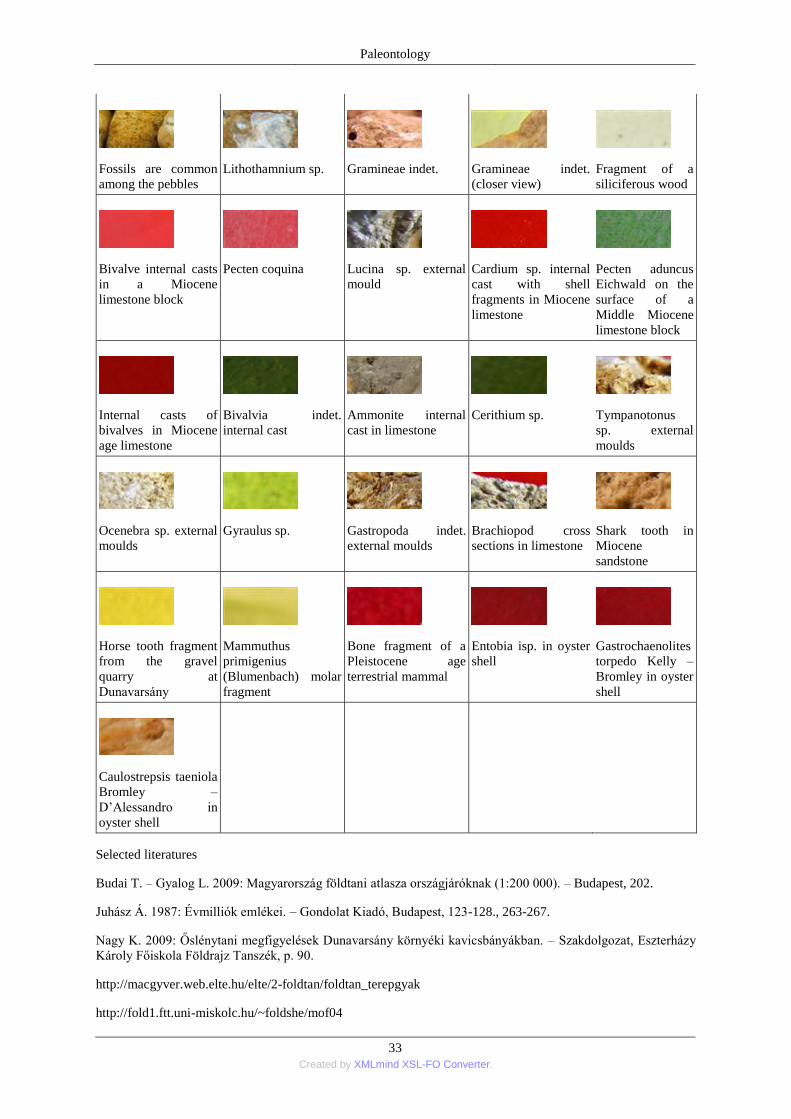
Paleontology
33 Created by XMLmind XSL-FO Converter.
Fossils are common
among the pebbles
Lithothamnium sp.
Gramineae indet.
Gramineae indet.
(closer view)
Fragment of a
siliciferous wood
Bivalve internal casts
in a Miocene
limestone block
Pecten coquina
Lucina sp. external
mould
Cardium sp. internal
cast with shell
fragments in Miocene
limestone
Pecten aduncus
Eichwald on the
surface of a
Middle Miocene
limestone block
Internal casts of
bivalves in Miocene
age limestone
Bivalvia indet.
internal cast
Ammonite internal
cast in limestone
Cerithium sp.
Tympanotonus
sp. external
moulds
Ocenebra sp. external
moulds
Gyraulus sp.
Gastropoda indet.
external moulds
Brachiopod cross
sections in limestone
Shark tooth in
Miocene
sandstone
Horse tooth fragment
from the gravel
quarry at
Dunavarsány
Mammuthus
primigenius
(Blumenbach) molar
fragment
Bone fragment of a
Pleistocene age
terrestrial mammal
Entobia isp. in oyster
shell
Gastrochaenolites
torpedo Kelly –
Bromley in oyster
shell
Caulostrepsis taeniola
Bromley –
D’Alessandro in
oyster shell
Selected literatures
Budai T. – Gyalog L. 2009: Magyarország földtani atlasza országjáróknak (1:200 000). – Budapest, 202.
Juhász Á. 1987: Évmilliók emlékei. – Gondolat Kiadó, Budapest, 123-128., 263-267.
Nagy K. 2009: Őslénytani megfigyelések Dunavarsány környéki kavicsbányákban. – Szakdolgozat, Eszterházy
Károly Főiskola Földrajz Tanszék, p. 90.
http://macgyver.web.elte.hu/elte/2-foldtan/foldtan_terepgyak
http://fold1.ftt.uni-miskolc.hu/~foldshe/mof04
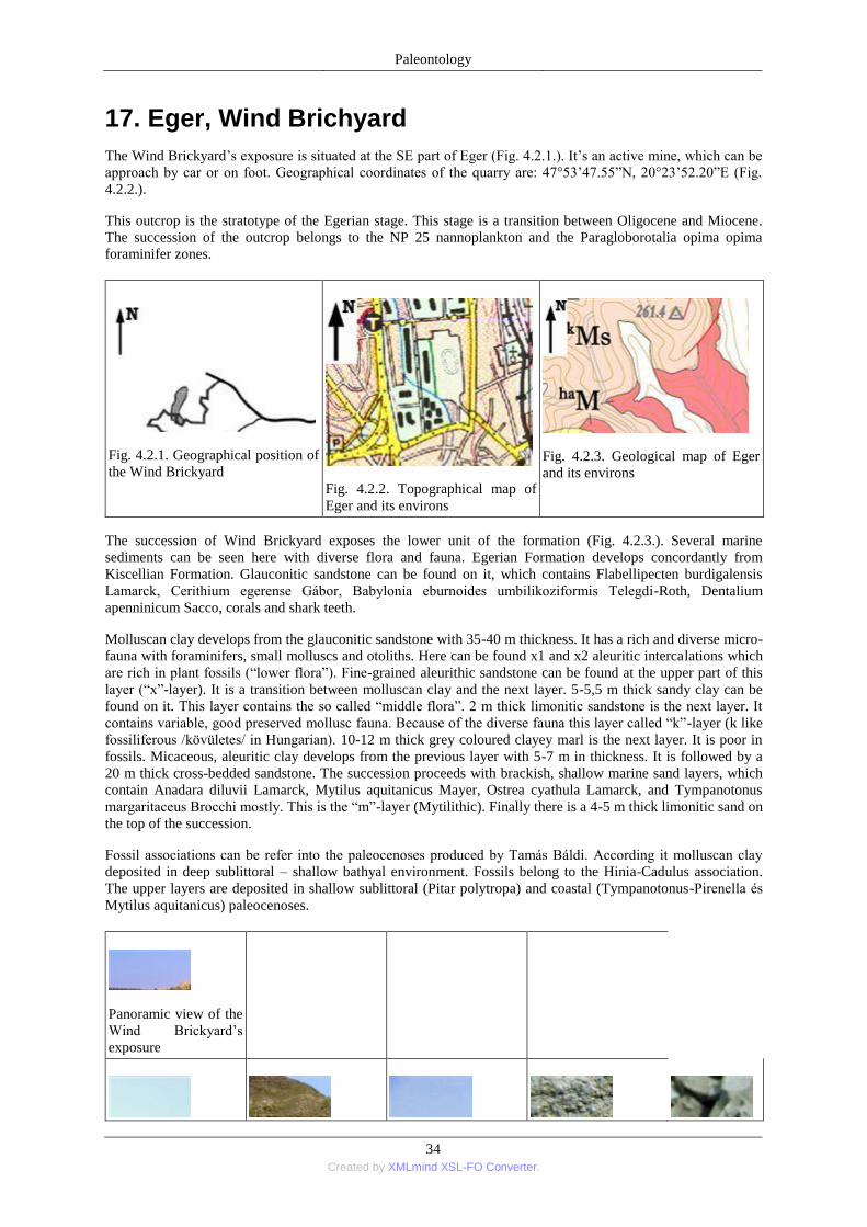
Paleontology
34 Created by XMLmind XSL-FO Converter.
17. Eger, Wind Brichyard
The Wind Brickyard’s exposure is situated at the SE part of Eger (Fig. 4.2.1.). It’s an active mine, which can be
approach by car or on foot. Geographical coordinates of the quarry are: 47°53’47.55‖N, 20°23’52.20‖E (Fig.
4.2.2.).
This outcrop is the stratotype of the Egerian stage. This stage is a transition between Oligocene and Miocene.
The succession of the outcrop belongs to the NP 25 nannoplankton and the Paragloborotalia opima opima
foraminifer zones.
Fig. 4.2.1. Geographical position of
the Wind Brickyard
Fig. 4.2.2. Topographical map of
Eger and its environs
Fig. 4.2.3. Geological map of Eger
and its environs
The succession of Wind Brickyard exposes the lower unit of the formation (Fig. 4.2.3.). Several marine
sediments can be seen here with diverse flora and fauna. Egerian Formation develops concordantly from
Kiscellian Formation. Glauconitic sandstone can be found on it, which contains Flabellipecten burdigalensis
Lamarck, Cerithium egerense Gábor, Babylonia eburnoides umbilikoziformis Telegdi-Roth, Dentalium
apenninicum Sacco, corals and shark teeth.
Molluscan clay develops from the glauconitic sandstone with 35-40 m thickness. It has a rich and diverse micro-
fauna with foraminifers, small molluscs and otoliths. Here can be found x1 and x2 aleuritic intercalations which
are rich in plant fossils (―lower flora‖). Fine-grained aleurithic sandstone can be found at the upper part of this
layer (―x‖-layer). It is a transition between molluscan clay and the next layer. 5-5,5 m thick sandy clay can be
found on it. This layer contains the so called ―middle flora‖. 2 m thick limonitic sandstone is the next layer. It
contains variable, good preserved mollusc fauna. Because of the diverse fauna this layer called ―k‖-layer (k like
fossiliferous /kövületes/ in Hungarian). 10-12 m thick grey coloured clayey marl is the next layer. It is poor in
fossils. Micaceous, aleuritic clay develops from the previous layer with 5-7 m in thickness. It is followed by a
20 m thick cross-bedded sandstone. The succession proceeds with brackish, shallow marine sand layers, which
contain Anadara diluvii Lamarck, Mytilus aquitanicus Mayer, Ostrea cyathula Lamarck, and Tympanotonus
margaritaceus Brocchi mostly. This is the ―m‖-layer (Mytilithic). Finally there is a 4-5 m thick limonitic sand on
the top of the succession.
Fossil associations can be refer into the paleocenoses produced by Tamás Báldi. According it molluscan clay
deposited in deep sublittoral – shallow bathyal environment. Fossils belong to the Hinia-Cadulus association.
The upper layers are deposited in shallow sublittoral (Pitar polytropa) and coastal (Tympanotonus-Pirenella és
Mytilus aquitanicus) paleocenoses.
Panoramic view of the
Wind Brickyard’s
exposure
Paleontology
35 Created by XMLmind XSL-FO Converter.
The northern entrance
of the Wind
Brickyard’s exposure
Concordant marine
succession at the Wind
Brickyard’s exposure
Slump at the middle
part of the exposure Turris sp. in molluscan
clay Flabellipecten
burdigalensis
(Lamarck) in
molluscan clay
Myrica sp. 1, a fossil
leaf
Myrica sp. 2, a fossil
leaf
Daphnogene sp.; a
fossil leaf
Cinnamomum sp.; a
fossil leaf
Nodosaria sp.
Balanophyllia
desmophyllum
Edwards - Haime
Anadara diluvii
Lamarck
Flabellipecten
burdigalensis
(Lamarck)
Arctica islandica
(Braun in Agassiz)
. Laevicardium
sp.
Pitar polytropa
Anderson
Architectonica sp.
Aporrhais pespelicani
(Linnaeus)
Strombus coronatus
Defrance
Galeodea
nodosa
(Solander in
Brander)
Hadriana egerensis
(Gábor)
Typhis pungens
(Solander in Brander)
Galeodes basilica
(Bellardi)
Athleta rarispina
(Lamarck)
Turris coronata
(Münster in
Goldfuss)
Turricula legányii
Báldi
Dentalium sp.
Fragment of Decapod
crab claw
Schizaster sp.
Synodontaspis
sp.
Carcharias sp.
Lamna sp.
Osteichthyes indet.;
vertebra of bony fish
Osteichthyes indet.,
skull fragment
Eroded
Entobia
cateniformis
Bromley -
D'Alessandro
in shell of
Conus
dujardini
egerensis
Noszky
Paleontology
36 Created by XMLmind XSL-FO Converter.
Maeandropolydora
elegans Bromley -
D'Alessandro in shell
of Ampullina
crassatina (Lamarck)
Teredolites
longissimus Kelly –
Bromley in molluscan
clay
Teredolites
longissimus Kelly –
Bromley in molluscan
clay
Conservated Teredo
valves on natural casts
of Teredolites
longissimus Kelly –
Bromley
Arenicolites
isp. in
limonitic
sandstone
Lockeia isp. in
limonitic sandstone
Planolites montanus
(Pemberton - Frey) in
limonitic sandstone
Ptichoplasma isp. in
limonitic sandstone
Teichichnus rectus
Seilacher in
glauconitic sandstone
Thalassinoides
paradoxicus
Woodward in
limonitic
sandstone
Trichichnus linearis
Frey in molluscan clay
Trichichnus isp. in
glauconitic sandstone
Selected literatures
Báldi T. 1973. Mollusc fauna of the hungarian Upper Oligocene (Egerian). Studies in stratigraphy,
palaeoecology, palaeogeography and systematics. – Akadémiai Kiadó, Budapet, p. 511.
Báldi T. 1998: Magyarország epikkontinentális oligovén képződményeinek rétegtana. – In: Bérczi I. – Jámbor
Á. 1998: Magyarország geológiai képződményeinek rétegtana. –Budapest, 419-435.
Dávid Á. 1990: Újabb paleoökológiai megfigyelések felső-oligocén korú puhatestűeken (Eger, volt Wind-féle
téglagyár). - Malakológiai Tájékoztató 9., 12-14.
Dávid Á. 2007: Eger, Wind-féle téglagyár agyagbányája. – In: Pálfy J. – Pazonyi P. (szerk.) 2007: Őslénytani
Kirándulások Magyarországon és Erdélyben. – Hantken Kiadó, Budapest, 204-207.
Dávid Á. 2009: Bioeróziós és patológiás elváltozások az egerien Mollusca faunáján. – Disszertációk az
Eszterházy Károly Főiskola Földrajz Tanszékéről 3., p. 230.
Fodor R. 2001a: Bioeróziós nyomok felső-oligocén korallokon (Wind-féle téglagyár, Eger). – Földtani Közlöny
130/1-2, 179-196.
Főzy I. – Szente I. 2007: A Kárpát-medence ősmaradványai. – Gondolat Kiadó, 258-259.
Hegedűs Gy. 1962: Magyarországi oligocén korallok. – A MÁFI Évi Jelentése az 1959. évről, Budapest, 231-
261.
Pelikán P. (szerk.) 2005: A Bükk hegység földtana. – Magyarázó a Bükk-hegység földtani térképéhez (1:50
000). – Budapest, 107-108.
18. Gánt, Bagoly Hill, bauxite quarry
The centre of bauxite mining had been in the vicinity of Gánt during the 1980’ years. There were five quarries
close to the village. The Bagoly Hill was the biggest one among them (Fig. 4.3.1.). The geographical coordintes
of this quarry are: 47°22’01.06‖N, 18°23’02.43‖E (Fig. 4.3.2.).
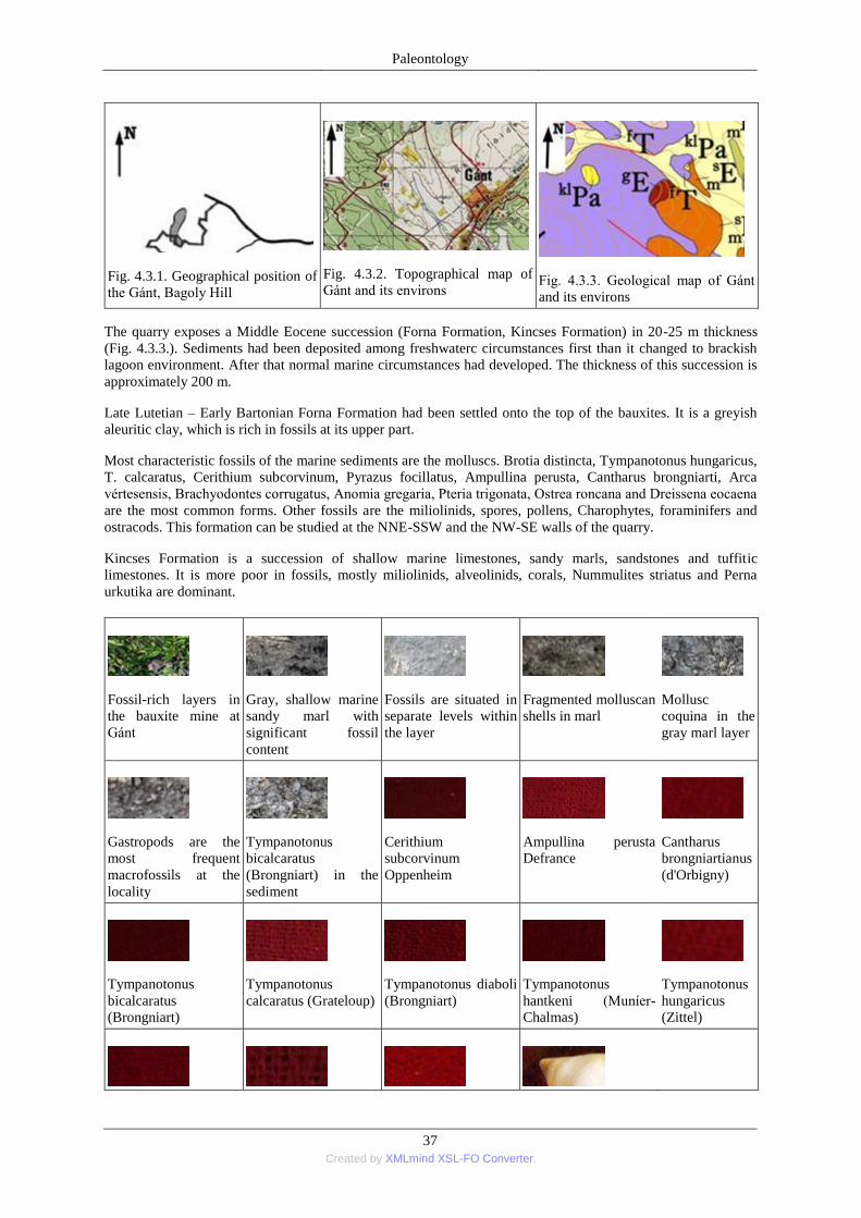
Paleontology
37 Created by XMLmind XSL-FO Converter.
Fig. 4.3.1. Geographical position of
the Gánt, Bagoly Hill
Fig. 4.3.2. Topographical map of
Gánt and its environs
Fig. 4.3.3. Geological map of Gánt
and its environs
The quarry exposes a Middle Eocene succession (Forna Formation, Kincses Formation) in 20-25 m thickness
(Fig. 4.3.3.). Sediments had been deposited among freshwaterc circumstances first than it changed to brackish
lagoon environment. After that normal marine circumstances had developed. The thickness of this succession is
approximately 200 m.
Late Lutetian – Early Bartonian Forna Formation had been settled onto the top of the bauxites. It is a greyish
aleuritic clay, which is rich in fossils at its upper part.
Most characteristic fossils of the marine sediments are the molluscs. Brotia distincta, Tympanotonus hungaricus,
T. calcaratus, Cerithium subcorvinum, Pyrazus focillatus, Ampullina perusta, Cantharus brongniarti, Arca
vértesensis, Brachyodontes corrugatus, Anomia gregaria, Pteria trigonata, Ostrea roncana and Dreissena eocaena
are the most common forms. Other fossils are the miliolinids, spores, pollens, Charophytes, foraminifers and
ostracods. This formation can be studied at the NNE-SSW and the NW-SE walls of the quarry.
Kincses Formation is a succession of shallow marine limestones, sandy marls, sandstones and tuffitic
limestones. It is more poor in fossils, mostly miliolinids, alveolinids, corals, Nummulites striatus and Perna
urkutika are dominant.
Fossil-rich layers in
the bauxite mine at
Gánt
Gray, shallow marine
sandy marl with
significant fossil
content
Fossils are situated in
separate levels within
the layer
Fragmented molluscan
shells in marl
Mollusc
coquina in the
gray marl layer
Gastropods are the
most frequent
macrofossils at the
locality
Tympanotonus
bicalcaratus
(Brongniart) in the
sediment
Cerithium
subcorvinum
Oppenheim
Ampullina perusta
Defrance
Cantharus
brongniartianus
(d'Orbigny)
Tympanotonus
bicalcaratus
(Brongniart)
Tympanotonus
calcaratus (Grateloup)
Tympanotonus diaboli
(Brongniart)
Tympanotonus
hantkeni (Muníer-
Chalmas)
Tympanotonus
hungaricus
(Zittel)
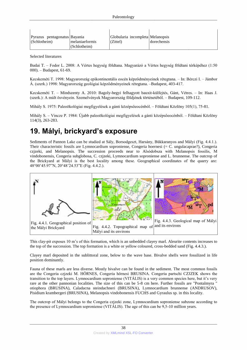
Paleontology
38 Created by XMLmind XSL-FO Converter.
Pyrazus pentagonatus
(Schlotheim) Bayania
melaniaeformis
(Schlotheim)
Globularia incompleta
(Zittel) Melanopsis
dorechensis
Selected literatures
Budai T. – Fodor L. 2008: A Vértes hegység földtana. Magyarázó a Vértes hegység földtani térképéhez (1:50
000). – Budapest, 61-69.
Kecskeméti T. 1998: Magyarország epikontinentális eocén képződményeinek rétegtana. – In: Bérczi I. – Jámbor
Á. (szerk.) 1998: Magyarország geológiai képződményeinek rétegtana. –Budapest, 403-417.
Kecskeméti T. – Mindszenty A. 2010: Bagoly-hegyi felhagyott bauxit-külfejtés, Gánt, Vétres. – In: Haas J.
(szerk.): A múlt ösvényein. Szemelvények Magyarország földjének történetéből. – Budapest, 109-112.
Mihály S. 1975: Paleoökológiai megfigyelések a gánti középsőeocénból. – Földtani Közlöny 105(1), 75-81.
Mihály S. – Vincze P. 1984: Újabb paleoökológiai megfigyelések a gánti középsőeocénból. – Földtani Közlöny
114(3), 263-283.
19. Mályi, brickyard’s exposure
Sediments of Pannon Lake can be studied at Sály, Borsodgeszt, Harsány, Bükkaranyos and Mályi (Fig. 4.4.1.).
Their characteristic fossils are Lymnocardium soproniense, Congeria hoernesi (= C. ungulacaprae?), Congeria
czjzeki, and Melanopsis. The succession proceeds near to Alsódobsza with Melanopsis fossilis, M
vindobonensis, Congeria subglobosa, C. czjzeki, Lymnocardium soproniense and L. brunnense. The outcrop of
the Brickyard at Mályi is the best locality among these. Geographical coordinates of the quarry are:
48°00’45.97‖N, 20°48’24.53‖E (Fig. 4.4.2.).
Fig. 4.4.1. Geographical position of
the Mályi Brickyard
Fig. 4.4.2. Topographical map of
Mályi and its environs
Fig. 4.4.3. Geological map of Mályi
and its environs
This clay-pit exposes 10 m’s of this formation, which is an unbedded clayey marl. Aleurite contents increases to
the top of the succession. The top formation is a white or yellow coloured, cross-bedded sand (Fig. 4.4.3.).
Clayey marl deposited in the sublittoral zone, below to the wave base. Bivalve shells were fossilized in life
position dominantly.
Fauna of these marls are less diverse. Mostly bivalve can be found in the sediment. The most common fossils
are the Congeria czjzeki M. HÖRNES, Congeria hörnesi BRUSINA. Congeria partschi CZJZEK shows the
transition to the top layers. Lymnocardium soproniense (VITÁLIS) is a very common species here, but it’s very
rare at the other pannonian localities. The size of this can be 5-8 cm here. Further fossils are "Pontalmyra "
otiophora (BRUSINA), Caladacna steindachneri (BRUSINA), Lymnocardium brunnense (ANDRUSOV),
Pisidium krambergeri (BRUSINA), Melanopsis vindobonensis FUCHS and Gyraulus sp. in this locality.
The outcrop of Mályi belongs to the Congeria czjzeki zone, Lymnocardium soproniense subzone according to
the presence of Lymnocardium soproniense (VITÁLIS). The age of this can be 9,5-10 million years.
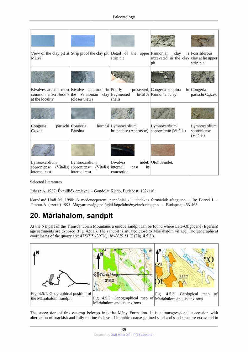
Paleontology
39 Created by XMLmind XSL-FO Converter.
View of the clay pit at
Mályi
Strip pit of the clay pit
Detail of the upper
strip pit
Pannonian clay is
excavated in the clay
pit
Fossiliferous
clay at he upper
strip pit
Bivalves are the most
common macrofossils
at the locality
Bivalve coquinas in
the Pannonian clay
(closer view)
Poorly preserved,
fragmented bivalve
shells
Congeria-coquina in
Pannonian clay
Congeria
partschi Czjzek
Congeria partschi
Czjzek
Congeria hörnesi
Brusina
Lymnocardium
brunnense (Andrusov)
Lymnocardium
soproniense (Vitális)
Lymnocardium
soproniense
(Vitális)
Lymnocardium
soproniense (Vitális)
internal cast
Lymnocardium
soproniense (Vitális)
internal cast
Bivalvia indet.
internal cast in
concretion
Otolith indet.
Selected literatures
Juhász Á. 1987: Évmilliók emlékei. – Gondolat Kiadó, Budapest, 102-110.
Korpásné Hódi M. 1998: A medenceperemi pannóniai s.l. üledékes formációk rétegtana. – In: Bérczi I. –
Jámbor Á. (szerk.) 1998: Magyarország geológiai képződményeinek rétegtana. – Budapest, 453-468.
20. Máriahalom, sandpit
At the NE part of the Transdanubian Mountains a unique sandpit can be found where Late-Oligocene (Egerian)
age sediments are exposed (Fig. 4.5.1.). The sandpit is situated close to Máriahalom village. The geographical
coordinates of the quarry are: 47°37’56.39‖N, 18°43’29.51‖E (Fig. 4.5.2.).
Fig. 4.5.1. Geographical position of
the Máriahalom, sandpit
Fig. 4.5.2. Topographical map of
Máriahalom and its environs
Fig. 4.5.3. Geological map of
Máriahalom and its environs
The succession of this outcrop belongs into the Mány Formation. It is a transgressional succession with
alternation of brackish and fully marine facieses. Limonitic coarse-grained sand and sandstone are excavated in
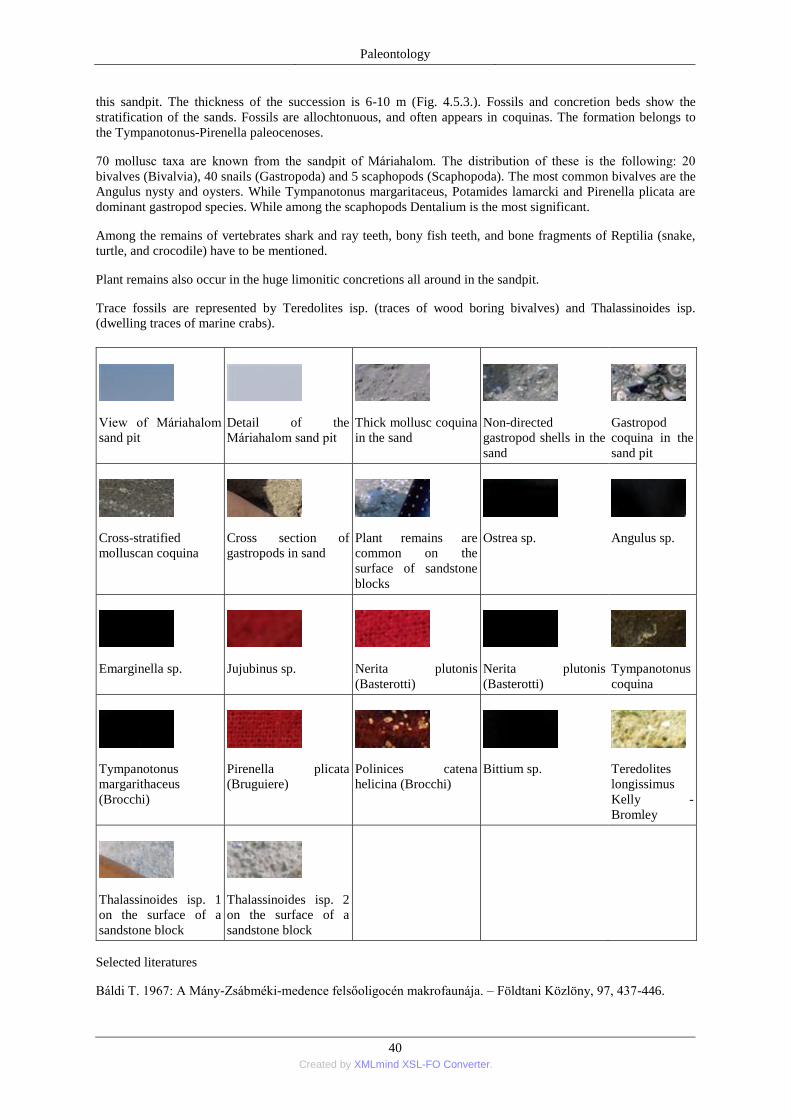
Paleontology
40 Created by XMLmind XSL-FO Converter.
this sandpit. The thickness of the succession is 6-10 m (Fig. 4.5.3.). Fossils and concretion beds show the
stratification of the sands. Fossils are allochtonuous, and often appears in coquinas. The formation belongs to
the Tympanotonus-Pirenella paleocenoses.
70 mollusc taxa are known from the sandpit of Máriahalom. The distribution of these is the following: 20
bivalves (Bivalvia), 40 snails (Gastropoda) and 5 scaphopods (Scaphopoda). The most common bivalves are the
Angulus nysty and oysters. While Tympanotonus margaritaceus, Potamides lamarcki and Pirenella plicata are
dominant gastropod species. While among the scaphopods Dentalium is the most significant.
Among the remains of vertebrates shark and ray teeth, bony fish teeth, and bone fragments of Reptilia (snake,
turtle, and crocodile) have to be mentioned.
Plant remains also occur in the huge limonitic concretions all around in the sandpit.
Trace fossils are represented by Teredolites isp. (traces of wood boring bivalves) and Thalassinoides isp.
(dwelling traces of marine crabs).
View of Máriahalom
sand pit
Detail of the
Máriahalom sand pit
Thick mollusc coquina
in the sand
Non-directed
gastropod shells in the
sand
Gastropod
coquina in the
sand pit
Cross-stratified
molluscan coquina
Cross section of
gastropods in sand
Plant remains are
common on the
surface of sandstone
blocks
Ostrea sp.
Angulus sp.
Emarginella sp.
Jujubinus sp.
Nerita plutonis
(Basterotti)
Nerita plutonis
(Basterotti)
Tympanotonus
coquina
Tympanotonus
margarithaceus
(Brocchi)
Pirenella plicata
(Bruguiere)
Polinices catena
helicina (Brocchi)
Bittium sp.
Teredolites
longissimus
Kelly -
Bromley
Thalassinoides isp. 1
on the surface of a
sandstone block
Thalassinoides isp. 2
on the surface of a
sandstone block
Selected literatures
Báldi T. 1967: A Mány-Zsábméki-medence felsőoligocén makrofaunája. – Földtani Közlöny, 97, 437-446.
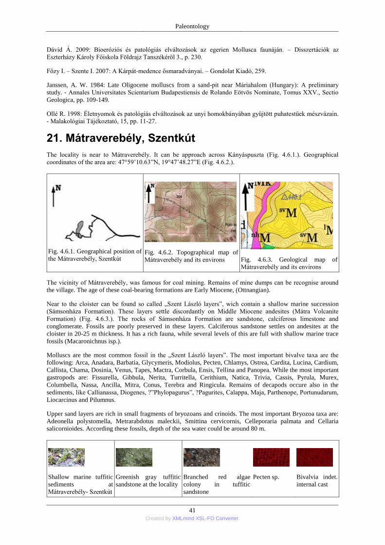
Paleontology
41 Created by XMLmind XSL-FO Converter.
Dávid Á. 2009: Bioeróziós és patológiás elváltozások az egerien Mollusca faunáján. – Disszertációk az
Eszterházy Károly Főiskola Földrajz Tanszékéről 3., p. 230.
Főzy I. – Szente I. 2007: A Kárpát-medence ősmaradványai. – Gondolat Kiadó, 259.
Janssen, A. W. 1984: Late Oligocene molluscs from a sand-pit near Máriahalom (Hungary): A preliminary
study. - Annales Universitates Scientarium Budapestiensis de Rolando Eötvös Nominate, Tomus XXV., Sectio
Geologica, pp. 109-149.
Ollé R. 1998: Életnyomok és patológiás elváltozások az unyi homokbányában gyűjtött puhatestűek mészvázain.
- Malakológiai Tájékoztató, 15, pp. 11-27.
21. Mátraverebély, Szentkút
The locality is near to Mátraverebély. It can be approach across Kányáspuszta (Fig. 4.6.1.). Geographical
coordinates of the area are: 47°59’10.63‖N, 19°47’48.27‖E (Fig. 4.6.2.).
Fig. 4.6.1. Geographical position of
the Mátraverebély, Szentkút
Fig. 4.6.2. Topographical map of
Mátraverebély and its environs
Fig. 4.6.3. Geological map of
Mátraverebély and its environs
The vicinity of Mátraverebély, was famous for coal mining. Remains of mine dumps can be recognise around
the village. The age of these coal-bearing formations are Early Miocene, (Ottnangian).
Near to the cloister can be found so called „Szent László layers‖, wich contain a shallow marine succession
(Sámsonháza Formation). These layers settle discordantly on Middle Miocene andesites (Mátra Volcanite
Formation) (Fig. 4.6.3.). The rocks of Sámsonháza Formation are sandstone, calciferous limestone and
conglomerate. Fossils are poorly preserved in these layers. Calciferous sandstone settles on andesites at the
cloister in 20-25 m thickness. It has a rich fauna, while several levels of this are full with shallow marine trace
fossils (Macaronichnus isp.).
Molluscs are the most common fossil in the „Szent László layers‖. The most important bivalve taxa are the
following: Arca, Anadara, Barbatia, Glycymeris, Modiolus, Pecten, Chlamys, Ostrea, Cardita, Lucina, Cardium,
Callista, Chama, Dosinia, Venus, Tapes, Mactra, Corbula, Ensis, Tellina and Panopea. While the most important
gastropods are: Fissurella, Gibbula, Nerita, Turritella, Cerithium, Natica, Trivia, Cassis, Pyrula, Murex,
Columbella, Nassa, Ancilla, Mitra, Conus, Terebra and Ringicula. Remains of decapods occure also in the
sediments, like Callianassa, Diogenes, ?‖Phylopagurus‖, ?Pagurites, Calappa, Maja, Parthenope, Portunudarum,
Liocarcinus and Pilumnus.
Upper sand layers are rich in small fragments of bryozoans and crinoids. The most important Bryozoa taxa are:
Adeonella polystomella, Metrarabdotus maleckii, Smittina cervicornis, Celleporaria palmata and Cellaria
salicornioides. According these fossils, depth of the sea water could be around 80 m.
Shallow marine tuffitic
sediments at
Mátraverebély- Szentkút
Greenish gray tuffitic
sandstone at the locality
Branched red algae
colony in tuffitic
sandstone
Pecten sp.
Bivalvia indet.
internal cast
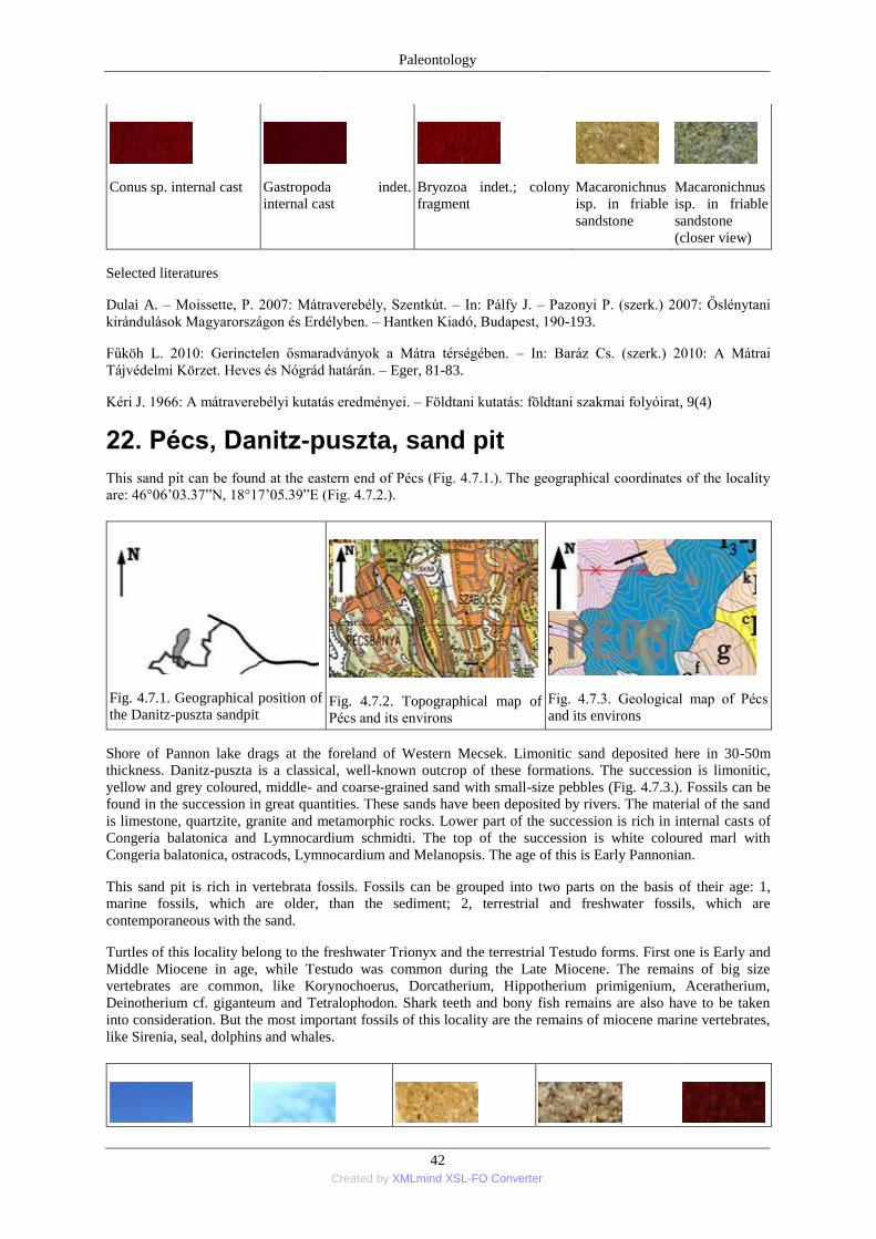
Paleontology
42 Created by XMLmind XSL-FO Converter.
Conus sp. internal cast
Gastropoda indet.
internal cast
Bryozoa indet.; colony
fragment
Macaronichnus
isp. in friable
sandstone
Macaronichnus
isp. in friable
sandstone
(closer view)
Selected literatures
Dulai A. – Moissette, P. 2007: Mátraverebély, Szentkút. – In: Pálfy J. – Pazonyi P. (szerk.) 2007: Őslénytani
kirándulások Magyarországon és Erdélyben. – Hantken Kiadó, Budapest, 190-193.
Fűköh L. 2010: Gerinctelen ősmaradványok a Mátra térségében. – In: Baráz Cs. (szerk.) 2010: A Mátrai
Tájvédelmi Körzet. Heves és Nógrád határán. – Eger, 81-83.
Kéri J. 1966: A mátraverebélyi kutatás eredményei. – Földtani kutatás: földtani szakmai folyóirat, 9(4)
22. Pécs, Danitz-puszta, sand pit
This sand pit can be found at the eastern end of Pécs (Fig. 4.7.1.). The geographical coordinates of the locality
are: 46°06’03.37‖N, 18°17’05.39‖E (Fig. 4.7.2.).
Fig. 4.7.1. Geographical position of
the Danitz-puszta sandpit
Fig. 4.7.2. Topographical map of
Pécs and its environs
Fig. 4.7.3. Geological map of Pécs
and its environs
Shore of Pannon lake drags at the foreland of Western Mecsek. Limonitic sand deposited here in 30-50m
thickness. Danitz-puszta is a classical, well-known outcrop of these formations. The succession is limonitic,
yellow and grey coloured, middle- and coarse-grained sand with small-size pebbles (Fig. 4.7.3.). Fossils can be
found in the succession in great quantities. These sands have been deposited by rivers. The material of the sand
is limestone, quartzite, granite and metamorphic rocks. Lower part of the succession is rich in internal casts of
Congeria balatonica and Lymnocardium schmidti. The top of the succession is white coloured marl with
Congeria balatonica, ostracods, Lymnocardium and Melanopsis. The age of this is Early Pannonian.
This sand pit is rich in vertebrata fossils. Fossils can be grouped into two parts on the basis of their age: 1,
marine fossils, which are older, than the sediment; 2, terrestrial and freshwater fossils, which are
contemporaneous with the sand.
Turtles of this locality belong to the freshwater Trionyx and the terrestrial Testudo forms. First one is Early and
Middle Miocene in age, while Testudo was common during the Late Miocene. The remains of big size
vertebrates are common, like Korynochoerus, Dorcatherium, Hippotherium primigenium, Aceratherium,
Deinotherium cf. giganteum and Tetralophodon. Shark teeth and bony fish remains are also have to be taken
into consideration. But the most important fossils of this locality are the remains of miocene marine vertebrates,
like Sirenia, seal, dolphins and whales.
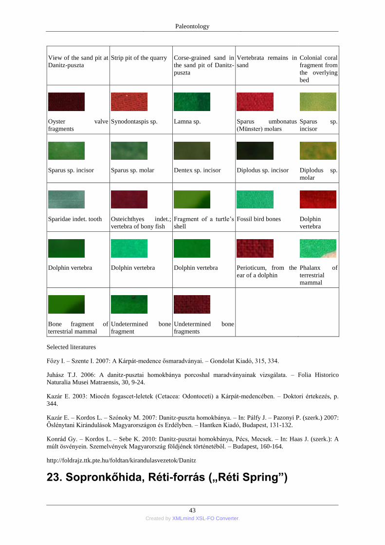
Paleontology
43 Created by XMLmind XSL-FO Converter.
View of the sand pit at
Danitz-puszta Strip pit of the quarry Corse-grained sand in
the sand pit of Danitz-
puszta
Vertebrata remains in
sand Colonial coral
fragment from
the overlying
bed
Oyster valve
fragments
Synodontaspis sp.
Lamna sp.
Sparus umbonatus
(Münster) molars
Sparus sp.
incisor
Sparus sp. incisor
Sparus sp. molar
Dentex sp. incisor
Diplodus sp. incisor
Diplodus sp.
molar
Sparidae indet. tooth
Osteichthyes indet.;
vertebra of bony fish
Fragment of a turtle’s
shell
Fossil bird bones
Dolphin
vertebra
Dolphin vertebra
Dolphin vertebra
Dolphin vertebra
Perioticum, from the
ear of a dolphin
Phalanx of
terrestrial
mammal
Bone fragment of
terrestrial mammal
Undetermined bone
fragment
Undetermined bone
fragments
Selected literatures
Főzy I. – Szente I. 2007: A Kárpát-medence ősmaradványai. – Gondolat Kiadó, 315, 334.
Juhász T.J. 2006: A danitz-pusztai homokbánya porcoshal maradványainak vizsgálata. – Folia Historico
Naturalia Musei Matraensis, 30, 9-24.
Kazár E. 2003: Miocén fogascet-leletek (Cetacea: Odontoceti) a Kárpát-medencében. – Doktori értekezés, p.
344.
Kazár E. – Kordos L. – Szónoky M. 2007: Danitz-puszta homokbánya. – In: Pálfy J. – Pazonyi P. (szerk.) 2007:
Őslénytani Kirándulások Magyarországon és Erdélyben. – Hantken Kiadó, Budapest, 131-132.
Konrád Gy. – Kordos L. – Sebe K. 2010: Danitz-pusztai homokbánya, Pécs, Mecsek. – In: Haas J. (szerk.): A
múlt ösvényein. Szemelvények Magyarország földjének történetéből. – Budapest, 160-164.
http://foldrajz.ttk.pte.hu/foldtan/kirandulasvezetok/Danitz
23. Sopronkőhida, Réti-forrás („Réti Spring”)
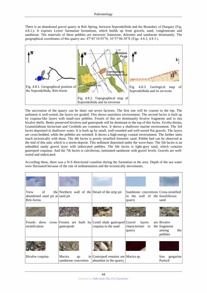
Paleontology
44 Created by XMLmind XSL-FO Converter.
There is an abandoned gravel quarry at Réti Spring, between Sopronkőhida and the Boundary of Hungary (Fig.
4.8.1.). It exposes Lower Sarmatian formations, which builds up from gravels, sand, conglomerate and
sandstone. The materials of these pebbles are mesozoic limestone, dolomite and sandstone dominantly. The
geographical coordinates of this quarry are: 47°45’10.93‖N, 16°37’06.38‖E (Figs. 4.8.2, 4.8.3.).
Fig. 4.8.1. Geographical position of
the Sopronkőhida, Réti-forrás
Fig. 4.8.2. Topographical map of
Sopronkőhida and its environs
Fig. 4.8.3. Geological map of
Sopronkőhida and its environs
The succession of the quarry can be share out seven facieses. The first one will be coarser to the top. The
sediment is well-sorted, the layers are graded. This shows nearshore environment. The second facies is built up
by coquina-like layers with small-size pebbles. Fossils of this are dominantly bivalve fragments and in situ
bivalve shells. Better preserved bivalves and gastropods will be dominant to the top of this facies. Ervilia dissita,
Granulolabium bicinctum and Cerithids are common here. It shows a shallower marine environment. The 3rd
facies deposited in shallower water. It is built up by small, well-rounded and well-sorted flat gravels. The layers
are cross-bedded, while the pebbles are oriented. It shows a high-energy coastal environment. The further units
touch tectonically with these. The 4th facies is poorly stratified limonitic sand. Pebble bed can be observed at
the mid of this unit, which is a storm-deposit. This sediment deposited under the wave-base. The 5th facies is an
unbedded sandy gravel layer with imbricated pebbles. The 6th facies is light-grey sand, which contains
gastropod coquinas. And the 7th facies is calciferous, laminated sandstone with gravel levels. Gravels are well-
sorted and imbricated.
According these, there was a N-S directional coastline during the Sarmatian at the area. Depth of the sea water
were fluctuated because of the rate of sedimentation and the tectonically movements.
View of the
abandoned sand pit at
Réti-forrás
Northern wall of the
sand pit
Detail of the strip pit
Sandstone concretions
in the wall of the
quarry
Cross-stratified
fossiliferous
sand
Fossils show cross-
stratification
Forsets are built by
gastropods
Lentil shale gastropod
coquina in the sand
Gravel layers are
characteristic to the
quarry
Bivalve
fragments
among the
pebbles
Bivalve coquina
Mactra sp. in
sandstone concretion
Gastropod remains are
abundant in the quarry
Mactra sp.
Irus gregarius
Partsch
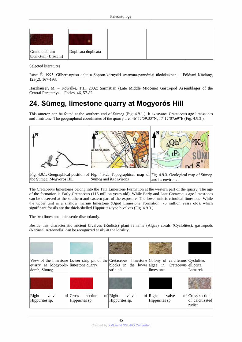
Paleontology
45 Created by XMLmind XSL-FO Converter.
Granulolabium
bicinctum (Brocchi)
Duplicata duplicata
Selected literatures
Rosta É. 1993: Gilbert-típusú delta a Sopron-környéki szarmata-pannóniai üledékekben. – Földtani Közlöny,
123(2), 167-193.
Harzhauser, M. – Kowalke, T.H. 2002: Sarmatian (Late Middle Miocene) Gastropod Assemblages of the
Central Paratethys. – Facies, 46, 57-82.
24. Sümeg, limestone quarry at Mogyorós Hill
This outcrop can be found at the southern end of Sümeg (Fig. 4.9.1.). It excavates Cretaceous age limestones
and flintstone. The geographical coordinates of the quarry are: 46°57’59.33‖N, 17°17’07.69‖E (Fig. 4.9.2.).
Fig. 4.9.1. Geographical position of
the Sümeg, Mogyorós Hill
Fig. 4.9.2. Topographical map of
Sümeg and its environs
Fig. 4.9.3. Geological map of Sümeg
and its environs
The Cretaceous limestones belong into the Tata Limestone Formation at the western part of the quarry. The age
of the formation is Early Cretaceous (115 million years old). While Early and Late Cretaceous age limestones
can be observed at the southern and eastern part of the exposure. The lower unit is crinoidal limestone. While
the upper unit is a shallow marine limestone (Ugod Limestone Formation, 75 million years old), which
significant fossils are the thick-shelled Hippurites-type bivalves (Fig. 4.9.3.).
The two limestone units settle discordantly.
Beside this characteristic ancient bivalves (Rudists) plant remains (Algae) corals (Cyclolites), gastropods
(Nerinea, Acteonella) can be recognized easily at the locality.
View of the limestone
quarry at Mogyorós-
domb, Sümeg
Lower strip pit of the
limestone quarry
Cretaceous limestone
blocks in the lower
strip pit
Colony of calciferous
algae in Cretaceous
limestone
Cyclolites
elliptica
Lamarck
Right valve of
Hippurites sp.
Cross section of
Hippurites sp.
Right valve of
Hippurites sp.
Right valve of
Hippurites sp.
Cross-section
of calcitizated
rudist
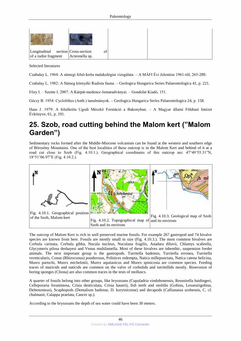
Paleontology
46 Created by XMLmind XSL-FO Converter.
Longitudinal section
of a rudist fragment
Cross-section of
Acteonella sp.
Selected literatures
Czabalay L. 1964: A sümegi felső-kréta malakológiai vizsgálata. – A MÁFI Évi Jelentése 1961-ről, 265-289.
Czabalay L. 1982: A Sümeg környéki Rudista fauna. – Geologica Hungarica Series Palaeontologica 41, p. 221.
Főzy I. – Szente I. 2007: A Kárpát-medence ősmaradványai. – Gondolat Kiadó, 151.
Géczy B. 1954: Cyclolithes (Anth.) tanulmányok. – Geologica Hungarica Series Palaeontologica 24, p. 158.
Haas J. 1979: A felsőkréta Ugodi Mészkő Formáció a Bakonyban. – A Magyar állami Földtani Intézet
Évkönyve, 61, p. 191.
25. Szob, road cutting behind the Malom kert (”Malom Garden”)
Sedimentary rocks formed after the Middle-Miocene volcanism can be found at the western and southern edge
of Börzsöny Mountains. One of the best localities of these outcrop is in the Malom Kert and behind of it at a
road cut close to Szob (Fig. 4.10.1.). Geographical coordinates of this outcrop are: 47°49’55.31‖N,
18°51’06.97‖E (Fig. 4.10.2.).
Fig. 4.10.1. Geographical position
of the Szob, Malom-kert
Fig. 4.10.2. Topographical map of
Szob and its environs
Fig. 4.10.3. Geological map of Szob
and its environs
The outcrop of Malom Kert is rich in well preserved marine fossils. For example 267 gastropod and 74 bivalve
species are known from here. Fossils are mostly small in size (Fig. 4.10.3.). The most common bivalves are
Corbula carinata, Corbula gibba, Nucula nucleus, Nuculana fragilis, Anadara diluvii, Chlamys scabrella,
Glycymeris pilosa deshayesi and Venus multilamella. Most of these bivalves are inbenthic, suspension feeder
animals. The next important group is the gastropods. Turritella badensis, Turritella erronea, Turritella
vermicularis, Conus (Rhizoconus) ponderosus, Polinices redempta, Natica millepunctata, Natica catena helicina,
Murex partschi, Murex michelottii, Murex aquitanicus and Murex spinicosta are common species. Feeding
traces of muricids and naticids are common on the valve of corbulids and turritellids mostly. Bioerosion of
boring sponges (Cliona) are also common traces in the tests of molluscs.
A quarter of fossils belong into other groups, like bryozoans (Cupuladria vindobonensis, Reussirella haidingeri,
Celleporaria foraminosa, Crisia denticulata, Crisia haueri), fish teeth and otoliths (Gobius, Lesueurigobius,
Deltenosteus), Scaphopods (Dentalium badense, D. korytnicense) and decapods (Callianassa szobensis, C. cf.
chalmasii, Calappa praelata, Cancer sp.).
According to the bryozoans the depth of sea water could have been 30 meters.
Paleontology
47 Created by XMLmind XSL-FO Converter.
View of the road cut at
Szob
Fossil-bearing layer in
the succession of the
locality
Dark colored, sand
layer with coal marks
Cardium sp.
Aequipecten
seniensis
(Lamarck)
Pitar sp.
Solarium (Nipteraxis)
marthae (Boettger)
Theodoxus sp.
Tritia rosthorni Partsch
Ancilla
glandiformis
(Lamarck)
Bittium spina Partsch
Natica catena helicina
(Brocchi)
Murex (Tubicauda)
spinicosta Bronn
Clavatula
granulatocincta
Münster
Ringicula
auriculata
(Ménard de la
Groye)
Turritella turris
badensis Basterot
Oliva inflata Lamarck
Cymatium sp.
Erato laevis auctorum
Erato laevis
auctorum
Tudicla sp.
Fragment of Decapod
crab claw
Selachoidei indet.;
shark tooth
Selachoidei indet.;
shark tooth
Otolith indet.
Osteichthyes indet.;
vertebra of bony fosh
Oichnus paraboloides
Bromley, complete
naticid feeding trace
Selected literatures
Bosnakoff M. 2001: Két középső-miocén feltárás otolithjainak összehasonlító vizsgálata (Ipolydamásd,
Börzsöny hegység, Bükkmogyorósd, Bükk hegység). – Földtani Közlöny 131(1-2), 197-220.
Bosnakoff M. 2006: a szobi középső-miocén lelőhely otolith-faunája és őskörnyezeti viszonyai. – Szakdolgozat,
ELTE TTK Őslénytani Tanszék, Budapest, p. 63.
Dudás G. 1999: Naticidae fúrásnyomok középső-miocén puhatestűek mészvázain (Ipolydamásd, Börzsöny-
hegység) – Malakológiai tájékoztató, 17, 21-36.
Dulai A. 2007: Szob, Malom-kert. – In: Pálfy J. – Pazonyi P. (szerk.) 2007: Őslénytani kirándulások
Magyarországon és Erdélyben. – Hantken Kiadó, Budapest, 34-37.
26. Szurdokpüspöki, diatomite quarry
Paleontology
48 Created by XMLmind XSL-FO Converter.
The locality is situated at the border of Nógrád County, between Szurdokpüspöki and Gyöngyöspata villages.
There is a special white coloured rock, which has very low specific weight. This rock is the laminated diatomite
(Fig. 4.11.1.). Geographical coordinates of the abandoned quarry are: 47°50’34.38‖N, 19°43’49.91‖E (Fig.
4.11.2.).
Fig. 4.11.1. Geographical position
of the Szurdokpüspöki, diatomite
quarry
Fig. 4.11.2. Topographical map of
Szurdokpüspöki and its environs
Fig. 4.11.3. Geological map of
Szurdokpüspöki and its environs
Diatomic mud settled during the Middle Miocene (Sarmatian). There had been shallow marine lagunal
environment at that time. Marine water had a special composition because of the hydrothermal processes took
place at the Mátra Mountains. The water had significant silica content which favoured for siliceous algae.
Millions of microscopic shells of Diatomaceae alga compose the diatomite. The maximal thickness of diatomite
succession is 100 m in the vicinity of Szurdokpüspöki and Gyöngyöspata. The lower 40 m thick unit deposited
in freshwater, while the upper unit settled down among marine circumstances. Abandoned quarry at
Szurdokpüspöki excavates the both units.
The lower, freshwater unit is rich in small fossils. Hydrobia is very common gastropod genus in marly layers.
While diatomite laminae are rich in imprints of leaves, insects (larvae of dragonflies, flys) and fishes (Fig.
4.11.3.).
Small road leads to the
diatomite quarry
The entrance of the
quarry
View of the diatomite
quarry at
Szurdokpüspöki
Fossils are most
common at the
eastern wall
Diantomaceous
layers are at the
eastern wall
Fossils are common on
the surfaces of shale
fragments
Cinnamomum sp., leaf
of laurum
External mould of
scribble
Hydrobia-bearing
marl
Hydrobia sp. in
marl
Gastropoda indet. on
surface of marl
Osteichthyes indet.;
external mould of bony
fish
Osteichthyes indet.;
external mould of bony
fish
Planolites isp. 1.
in siliciferous
diatomite shale
Planolites isp.
2. in
siliciferous
diatomite shale
Selected literatures
Fűköh L. 2010: Gerinctelen ősmaradványok a Mátra térségében. – In: Baráz Cs. (szerk.) 2010: A Mátrai
Tájvédelmi Körzet. Heves és Nógrád határán. – Eger, 81-83.
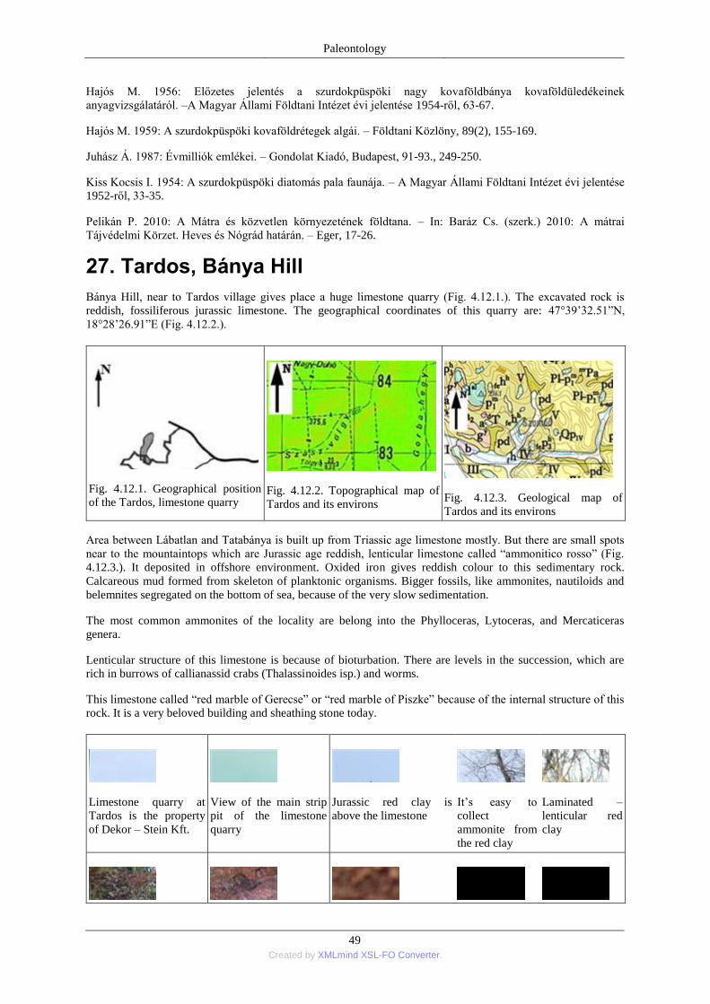
Paleontology
49 Created by XMLmind XSL-FO Converter.
Hajós M. 1956: Előzetes jelentés a szurdokpüspöki nagy kovaföldbánya kovaföldüledékeinek
anyagvizsgálatáról. –A Magyar Állami Földtani Intézet évi jelentése 1954-ről, 63-67.
Hajós M. 1959: A szurdokpüspöki kovaföldrétegek algái. – Földtani Közlöny, 89(2), 155-169.
Juhász Á. 1987: Évmilliók emlékei. – Gondolat Kiadó, Budapest, 91-93., 249-250.
Kiss Kocsis I. 1954: A szurdokpüspöki diatomás pala faunája. – A Magyar Állami Földtani Intézet évi jelentése
1952-ről, 33-35.
Pelikán P. 2010: A Mátra és közvetlen környezetének földtana. – In: Baráz Cs. (szerk.) 2010: A mátrai
Tájvédelmi Körzet. Heves és Nógrád határán. – Eger, 17-26.
27. Tardos, Bánya Hill
Bánya Hill, near to Tardos village gives place a huge limestone quarry (Fig. 4.12.1.). The excavated rock is
reddish, fossiliferous jurassic limestone. The geographical coordinates of this quarry are: 47°39’32.51‖N,
18°28’26.91‖E (Fig. 4.12.2.).
Fig. 4.12.1. Geographical position
of the Tardos, limestone quarry
Fig. 4.12.2. Topographical map of
Tardos and its environs
Fig. 4.12.3. Geological map of
Tardos and its environs
Area between Lábatlan and Tatabánya is built up from Triassic age limestone mostly. But there are small spots
near to the mountaintops which are Jurassic age reddish, lenticular limestone called ―ammonitico rosso‖ (Fig.
4.12.3.). It deposited in offshore environment. Oxided iron gives reddish colour to this sedimentary rock.
Calcareous mud formed from skeleton of planktonic organisms. Bigger fossils, like ammonites, nautiloids and
belemnites segregated on the bottom of sea, because of the very slow sedimentation.
The most common ammonites of the locality are belong into the Phylloceras, Lytoceras, and Mercaticeras
genera.
Lenticular structure of this limestone is because of bioturbation. There are levels in the succession, which are
rich in burrows of callianassid crabs (Thalassinoides isp.) and worms.
This limestone called ―red marble of Gerecse‖ or ―red marble of Piszke‖ because of the internal structure of this
rock. It is a very beloved building and sheathing stone today.
Limestone quarry at
Tardos is the property
of Dekor – Stein Kft.
View of the main strip
pit of the limestone
quarry
Jurassic red clay is
above the limestone
It’s easy to
collect
ammonite from
the red clay
Laminated –
lenticular red
clay
Paleontology
50 Created by XMLmind XSL-FO Converter.
Fossils in the debris Stylolite is aspecial
structure of jurassic
limestone
Harpoceras radians
(Reinecke) Phylloceras sp. Hildoceras sp.
Parkinsonia sp.
Parkinsonia sp.
Juraphyllites sp.
Calliphylloceras
sp.
Fargment of
Calliphylloceras
sp.
Fragment of
Calliphylloceras sp.
Gregoryceras sp.
Ammonites indet.
Thalassinoides
isp. 1.
Thalassinoides
isp. 1.
Selceted literatures
Főzy I. – Szente I. 2007: A Kárpát-medence ősmaradványai. – Gondolat Kiadó, 96-97.
Hála J. 1995: Kőbányászat és kőfaragás a Gerecse hegységben, különös tekintettel a tardosbányai kőfejtők
barlanglakásaira. In: Hála J. (szerk.) 1995: Ásványok, kőzetek hagyományok. Életmód és tradició 7. Budapest,
MTA Néprajzi Kutatóintézet, 308-334.
Juhász Á. 1987: Évmilliók emlékei. – Gondolat Kiadó, Budapest, 61-65, 271-272, 376-382.
Vörös A. 1998: A Dunántúli-középhegység jura képződményeinek rétegtana. – In: Bérczi I. – Jámbor Á.
(szerk.) 1998: Magyarország geológiai képződményeinek rétegtana. –Budapest, 299-308.
Fájlok
1_1_fossil_plants.ppt
2_1_4_miocene_fossil_plants.ppt
2_2_1_paleozoic_fossil_animals.ppt
2_1_2_wind_brickyard_lower_llora.ppt
1_2_fossil_animals.ppt
2_2_2_mesozoic_fossil_animals.ppt
2_1_1_kiseged_hill.ppt
1_3_trace_fossil.ppt
2_1_3_wind_brickyard_upper_flora.ppt
2_2_3_cenozoic_fossil_animals.ppt