Embed Size (px)
Citation preview
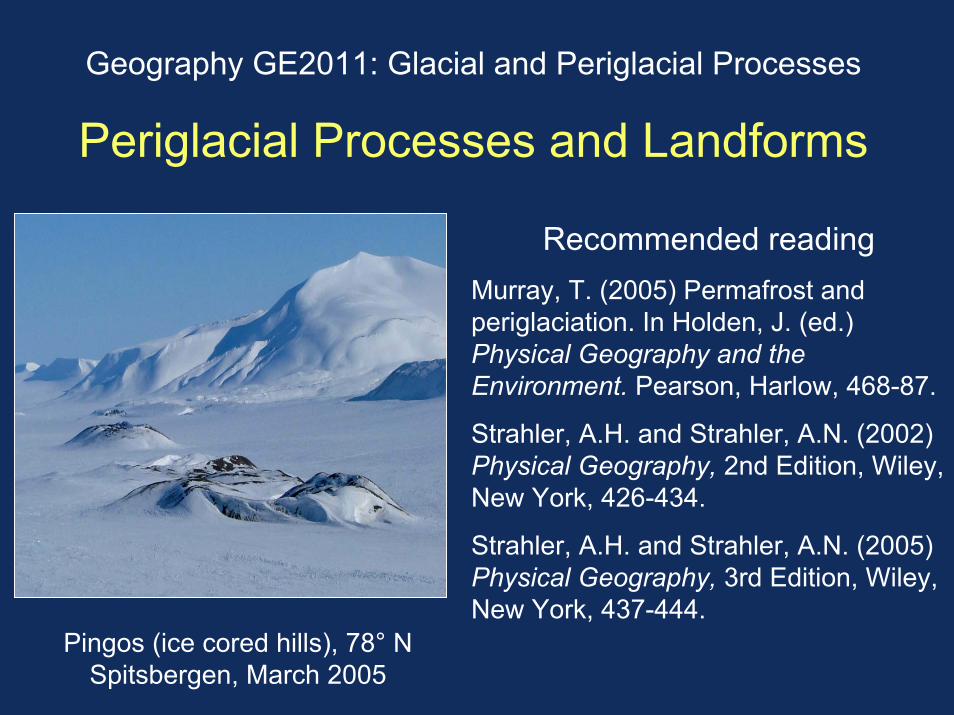
Geography GE2011: Glacial and Periglacial Processes
Periglacial Processes and Landforms
Recommended readingMurray, T. (2005) Permafrost and periglaciation. In Holden, J. (ed.) Physical Geography and the Environment. Pearson, Harlow, 468-87.
Strahler, A.H. and Strahler, A.N. (2002) Physical Geography, 2nd Edition, Wiley, New York, 426-434.
Strahler, A.H. and Strahler, A.N. (2005) Physical Geography, 3rd Edition, Wiley, New York, 437-444.
Pingos (ice cored hills), 78° N Spitsbergen, March 2005
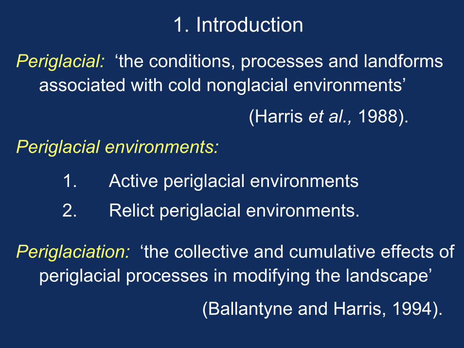
1. Introduction
Periglacial: ‘the conditions, processes and landforms associated with cold nonglacial environments’
(Harris et al., 1988).
Periglacial environments:
1. Active periglacial environments2. Relict periglacial environments.
Periglaciation: ‘the collective and cumulative effects of periglacial processes in modifying the landscape’
(Ballantyne and Harris, 1994).
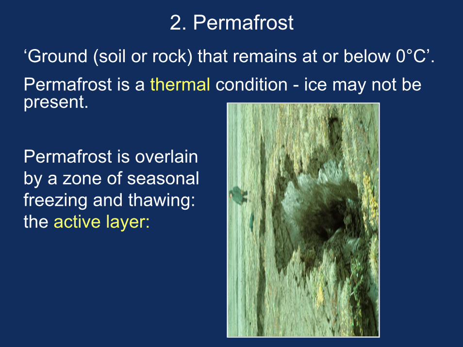
2. Permafrost‘Ground (soil or rock) that remains at or below 0°C’.Permafrost is a thermal condition - ice may not be present.
Permafrost is overlain by a zone of seasonal freezing and thawing: the active layer:
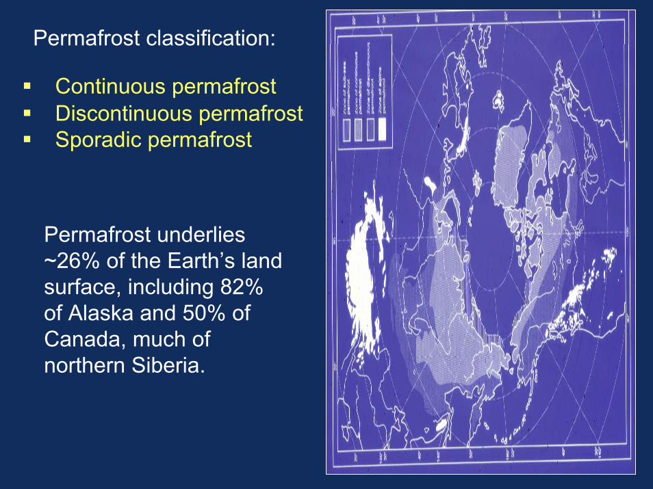
Permafrost classification:
Continuous permafrostDiscontinuous permafrostSporadic permafrost
Permafrost underlies ~26% of the Earth’s land surface, including 82% of Alaska and 50% of Canada, much of northern Siberia.
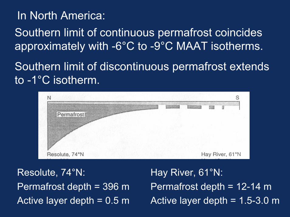
In North America:Southern limit of continuous permafrost coincides approximately with -6°C to -9°C MAAT isotherms.
Southern limit of discontinuous permafrost extends to -1°C isotherm.
Resolute, 74°N:Permafrost depth = 396 mActive layer depth = 0.5 m
Hay River, 61°N:Permafrost depth = 12-14 mActive layer depth = 1.5-3.0 m
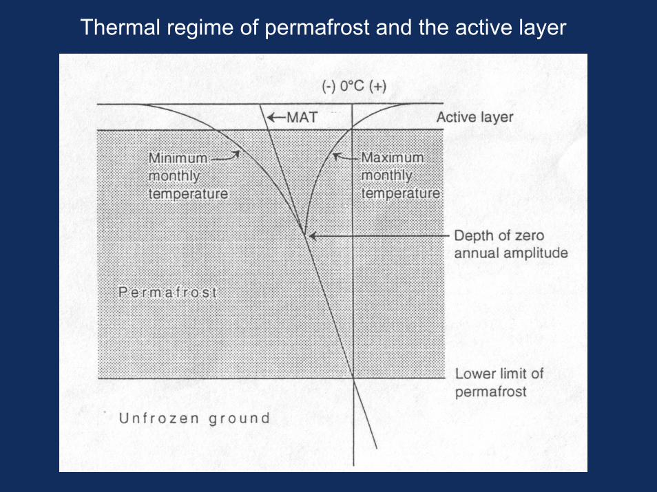
Thermal regime of permafrost and the active layer
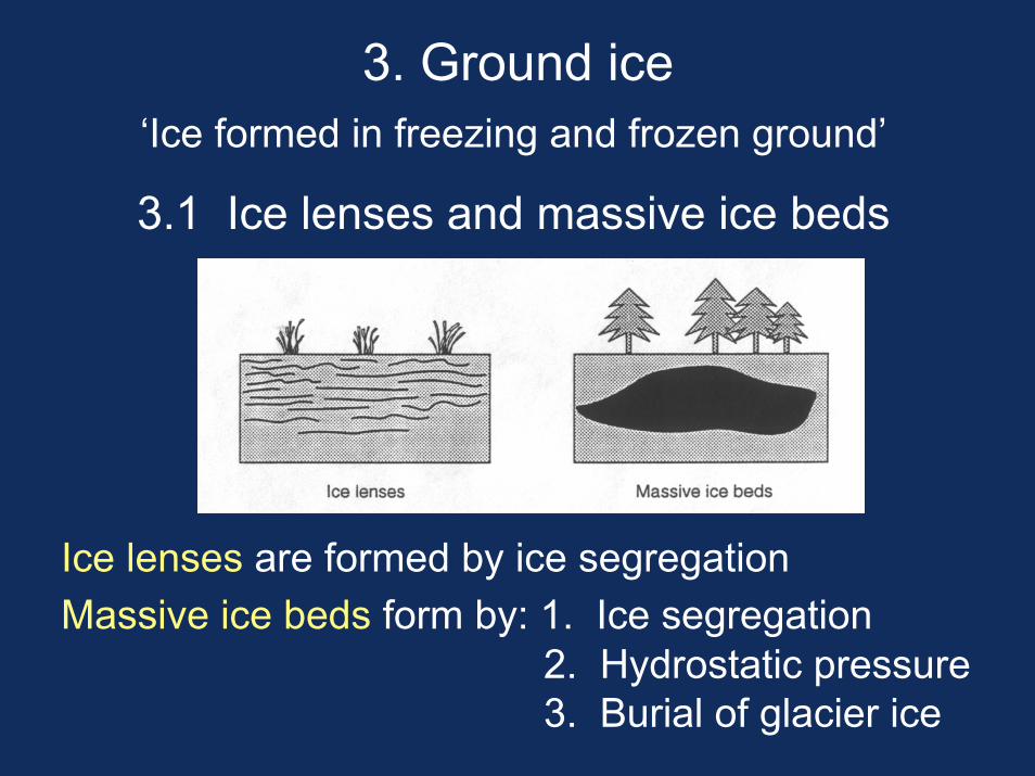
3. Ground ice‘Ice formed in freezing and frozen ground’
3.1 Ice lenses and massive ice beds
Ice lenses are formed by ice segregation Massive ice beds form by: 1. Ice segregation
2. Hydrostatic pressure3. Burial of glacier ice
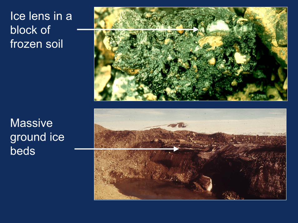
Ice lens in a block of frozen soil
Massive ground ice beds
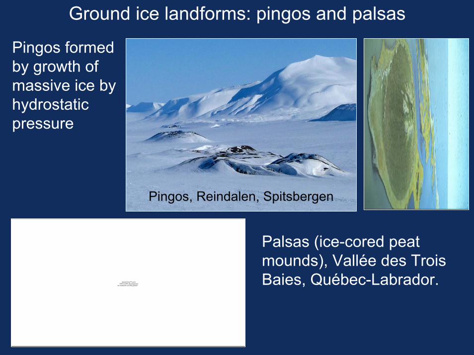
Ground ice landforms: pingos and palsas
QuickTime™ and aTIFF (LZW) decompressor
are needed to see this picture.
Palsas (ice-cored peat mounds), Vallée des Trois Baies, Québec-Labrador.
Pingos, Reindalen, Spitsbergen
Pingos formed by growth of massive ice by hydrostatic pressure
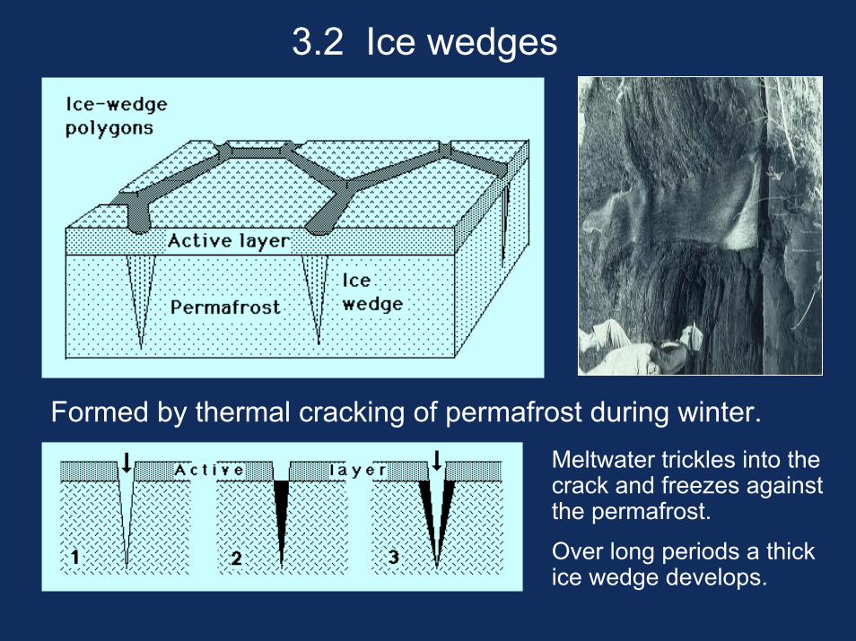
3.2 Ice wedges
Formed by thermal cracking of permafrost during winter.Meltwater trickles into the crack and freezes against the permafrost.
Over long periods a thick ice wedge develops.
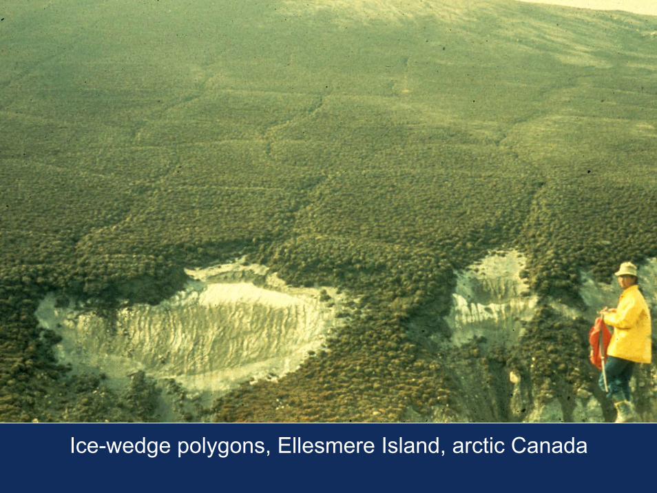
Ice-wedge polygons, Ellesmere Island, arctic Canada
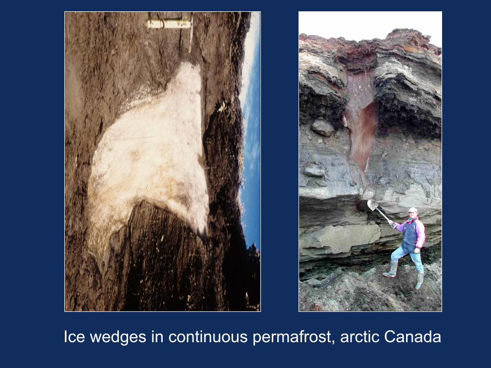
Ice wedges in continuous permafrost, arctic Canada
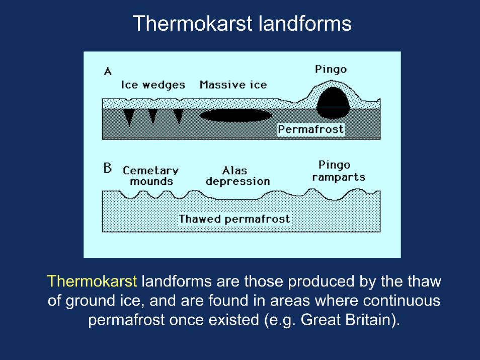
Thermokarst landforms
Thermokarst landforms are those produced by the thaw of ground ice, and are found in areas where continuous
permafrost once existed (e.g. Great Britain).
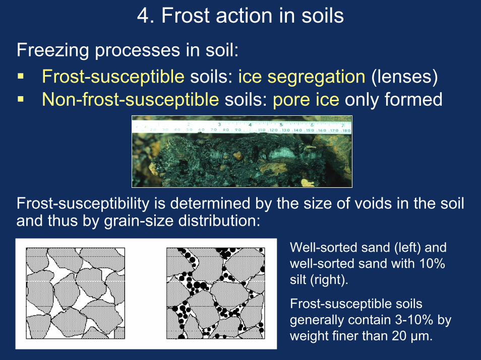
4. Frost action in soilsFreezing processes in soil:
Frost-susceptible soils: ice segregation (lenses) Non-frost-susceptible soils: pore ice only formed
Frost-susceptibility is determined by the size of voids in the soil and thus by grain-size distribution:
Well-sorted sand (left) and well-sorted sand with 10% silt (right).
Frost-susceptible soils generally contain 3-10% by weight finer than 20 µm.
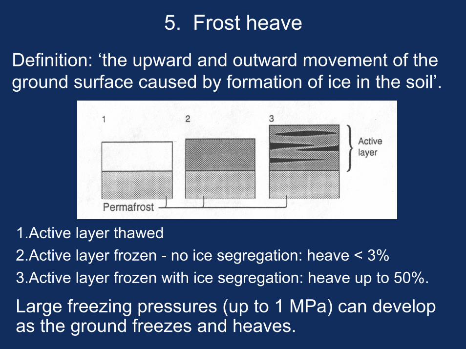
5. Frost heave
Definition: ‘the upward and outward movement of the ground surface caused by formation of ice in the soil’.
1.Active layer thawed2.Active layer frozen - no ice segregation: heave < 3%3.Active layer frozen with ice segregation: heave up to 50%.
Large freezing pressures (up to 1 MPa) can develop as the ground freezes and heaves.
6. Frost weathering of rock
= Breakdown of rock through repeated freezing and thawing
• Water in rocks expands by 9% on freezing
• Two effects:
• Macrogelivation: breakdown of rock into angular clasts by water freezing in joints
• Microgelivation: small-scale breakdown of rock into particles (silt, sand) by freezing of water in pores and by formation of ice lenses - often causes rounding of rock surfaces by granular disaggregation
• Landforms: frost-shattered bedrock, blockfields and other forms of frost-weathered detritus.
QuickTime™ and aPhoto - JPEG decompressor
are needed to see this picture.
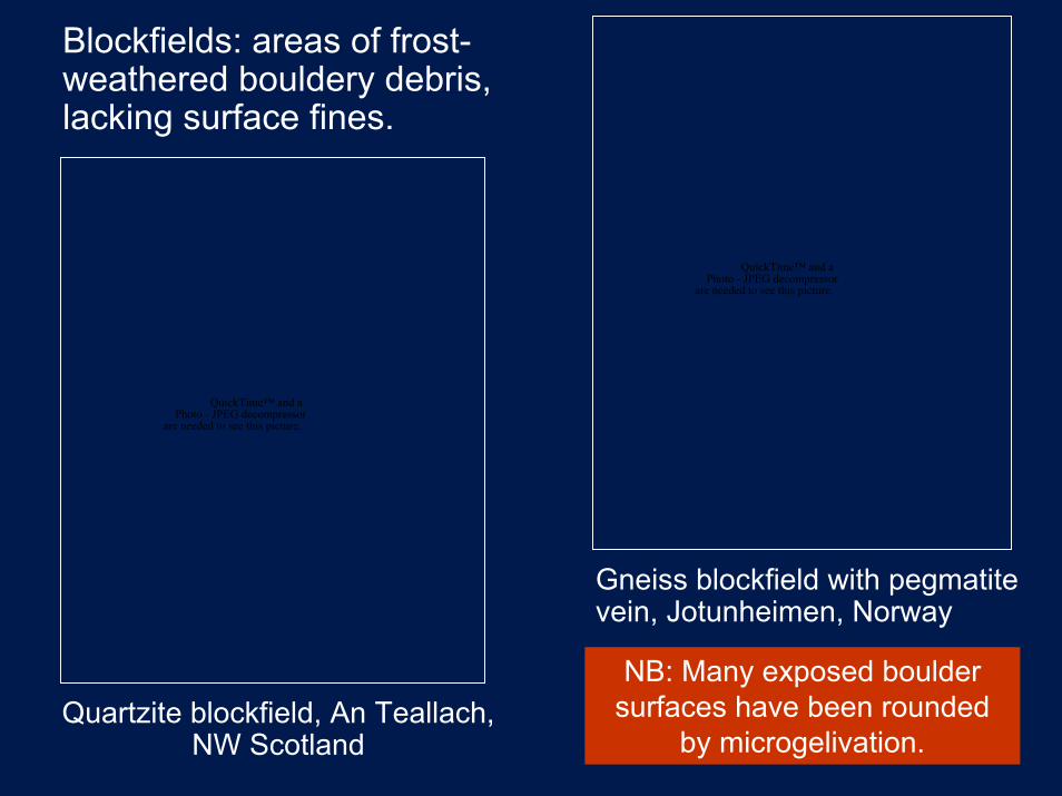
Blockfields: areas of frost-weathered bouldery debris, lacking surface fines.
QuickTime™ and aPhoto - JPEG decompressor
are needed to see this picture.
Gneiss blockfield with pegmatite vein, Jotunheimen, Norway
NB: Many exposed boulder surfaces have been rounded
by microgelivation.Quartzite blockfield, An Teallach,
NW Scotland
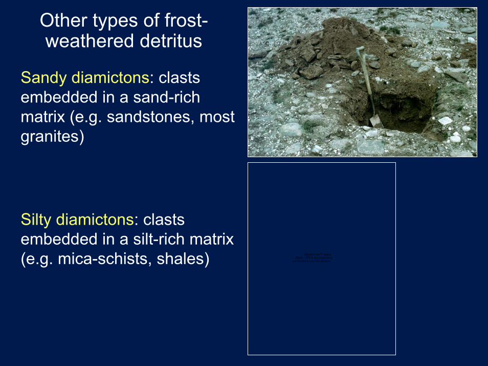
Other types of frost-weathered detritus
Sandy diamictons: clastsembedded in a sand-rich matrix (e.g. sandstones, most granites)
Silty diamictons: clastsembedded in a silt-rich matrix (e.g. mica-schists, shales) QuickTime™ and a
Photo - JPEG decompressorare needed to see this picture.
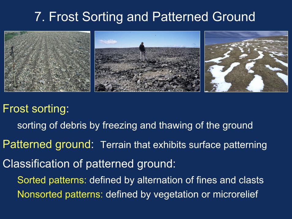
7. Frost Sorting and Patterned Ground
Frost sorting:sorting of debris by freezing and thawing of the ground
Patterned ground: Terrain that exhibits surface patterning
Classification of patterned ground: Sorted patterns: defined by alternation of fines and clastsNonsorted patterns: defined by vegetation or microrelief
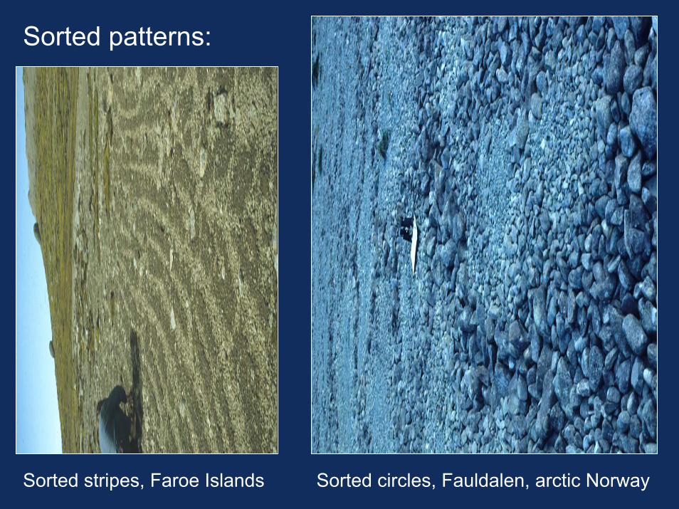
Sorted patterns:
Sorted stripes, Faroe Islands Sorted circles, Fauldalen, arctic Norway
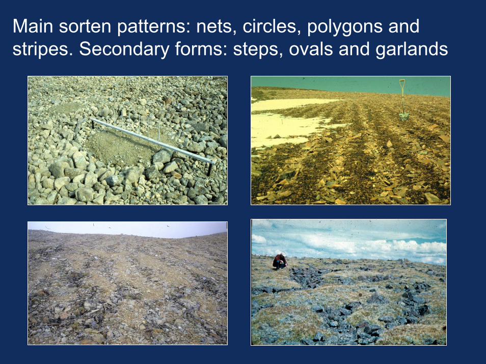
Main sorten patterns: nets, circles, polygons and stripes. Secondary forms: steps, ovals and garlands
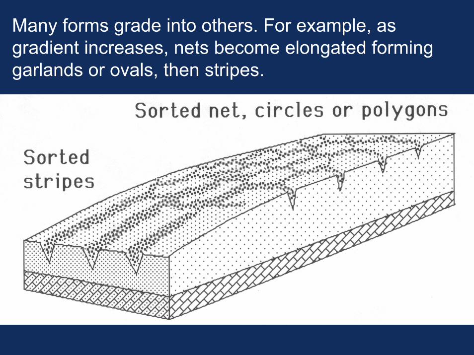
Many forms grade into others. For example, as gradient increases, nets become elongated forming garlands or ovals, then stripes.
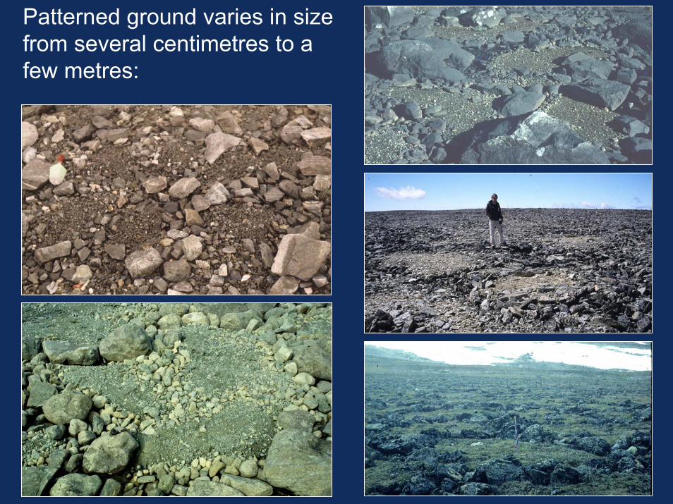
Patterned ground varies in size from several centimetres to a few metres:
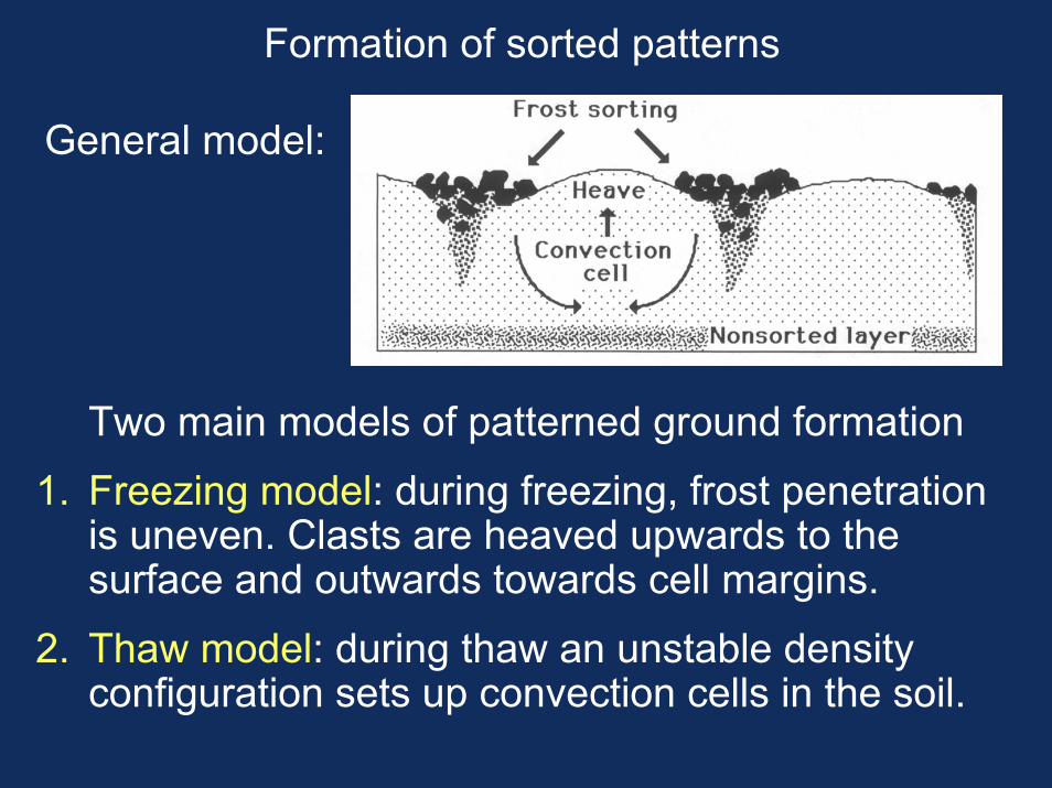
Formation of sorted patterns
General model:
Two main models of patterned ground formation
1. Freezing model: during freezing, frost penetration is uneven. Clasts are heaved upwards to the surface and outwards towards cell margins.
2. Thaw model: during thaw an unstable density configuration sets up convection cells in the soil.
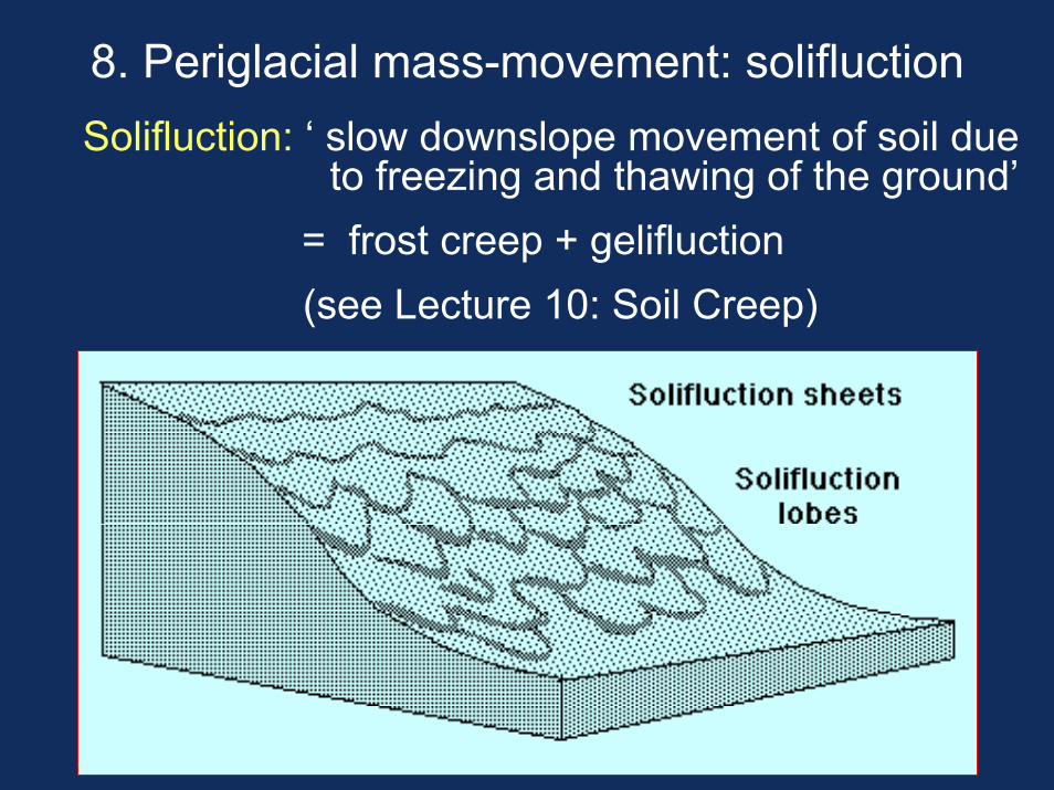
8. Periglacial mass-movement: solifluctionSolifluction: ‘ slow downslope movement of soil due
to freezing and thawing of the ground’= frost creep + gelifluction(see Lecture 10: Soil Creep)
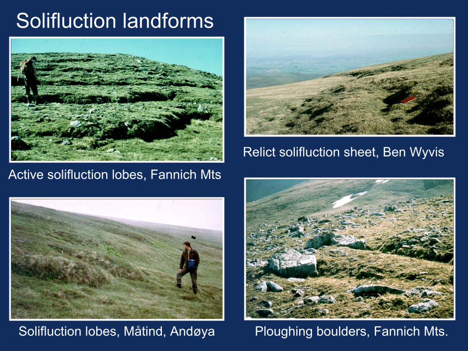
Solifluction landforms
Relict solifluction sheet, Ben Wyvis
Active solifluction lobes, Fannich Mts
Solifluction lobes, Måtind, Andøya Ploughing boulders, Fannich Mts.
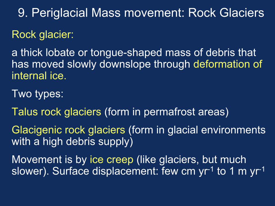
9. Periglacial Mass movement: Rock Glaciers
Rock glacier:
a thick lobate or tongue-shaped mass of debris that has moved slowly downslope through deformation of internal ice.
Two types:
Talus rock glaciers (form in permafrost areas)
Glacigenic rock glaciers (form in glacial environments with a high debris supply)
Movement is by ice creep (like glaciers, but much slower). Surface displacement: few cm yr-1 to 1 m yr-1
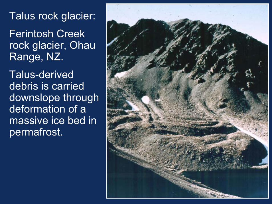
Talus rock glacier:
Ferintosh Creek rock glacier, Ohau Range, NZ.
Talus-derived debris is carrieddownslope through deformation of a massive ice bed in permafrost.
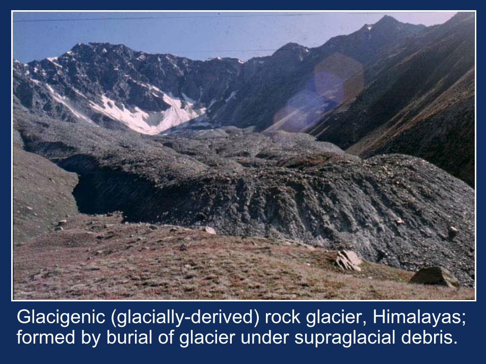
Glacigenic (glacially-derived) rock glacier, Himalayas; formed by burial of glacier under supraglacial debris.
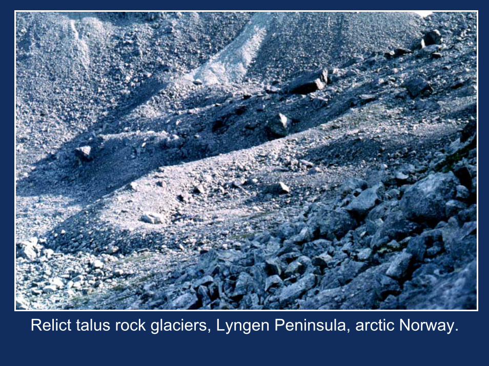
Relict talus rock glaciers, Lyngen Peninsula, arctic Norway.
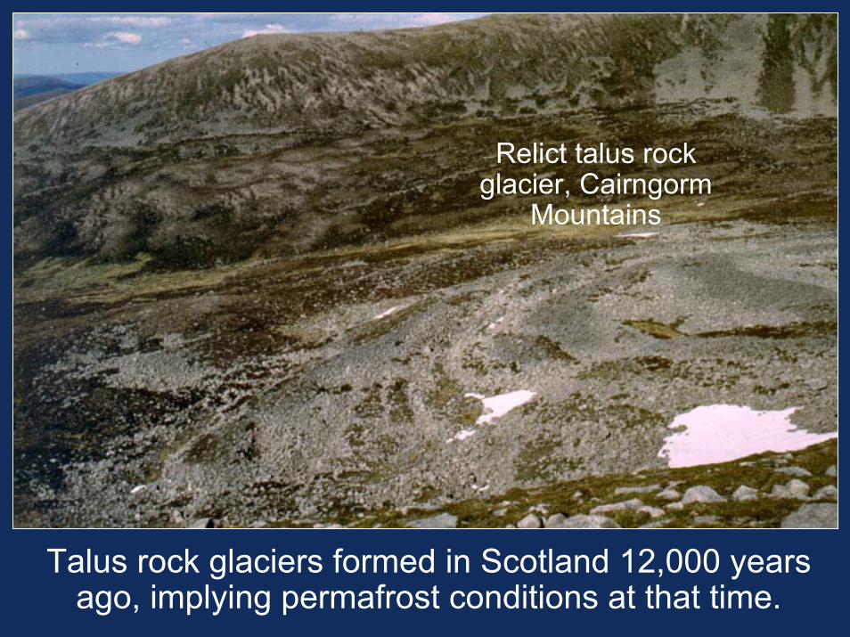
Relict talus rock glacier, Cairngorm
Mountains
Talus rock glaciers formed in Scotland 12,000 years ago, implying permafrost conditions at that time.