Embed Size (px)
Citation preview

Plotting a Bearing onto your map
• Why we plot bearings
• Where am I?
• Location by resectioning
• Where is the ____ I can see in the distance?
• Location by intersection
• Using straight line course legs

A single bearing, sighted to a peak,resulting in two possible locations along
a trail.
Location by Resectioning
a.k.a Triangulation
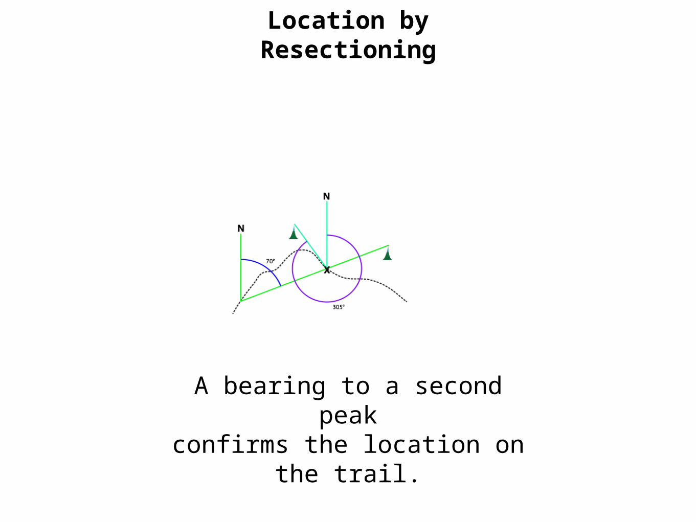
A bearing to a second peakconfirms the location on the
trail.
Location by Resectioning

Location by intersection
Using bearings sighted from two or more
known locations, to find an unknown location.
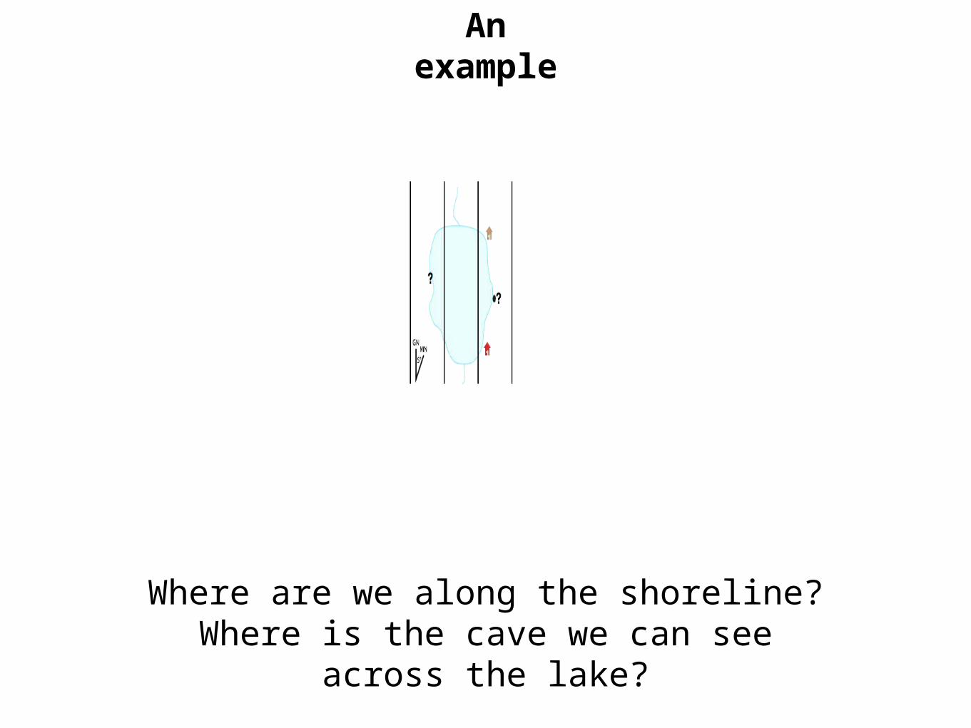
An example
Where are we along the shoreline?Where is the cave we can see across the
lake?
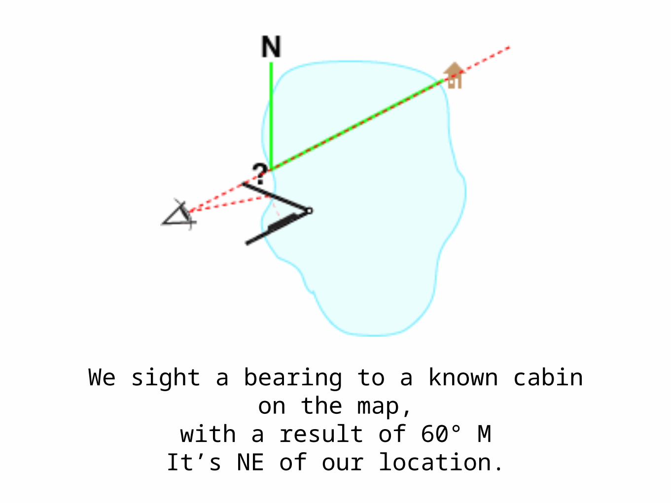
We sight a bearing to a known cabin on the map,
with a result of 60° MIt’s NE of our location.
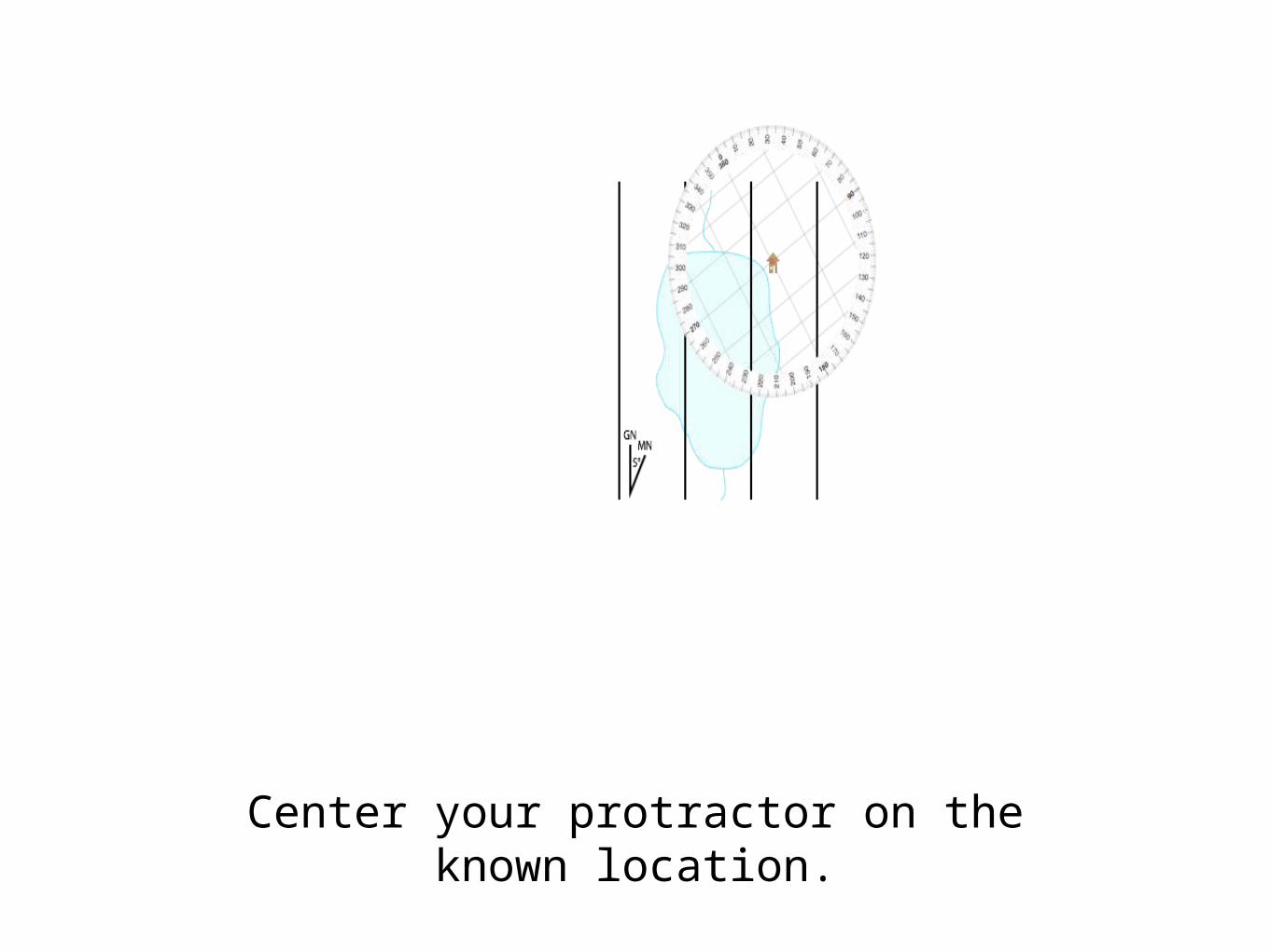
Center your protractor on the known location.

Align the protractor with Grid North.
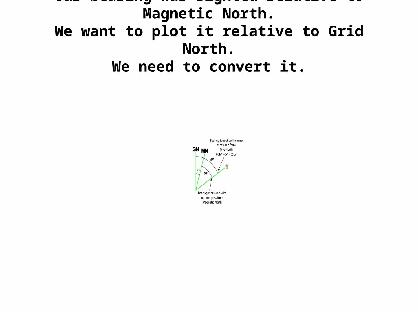
Our bearing was sighted relative to Magnetic North.
We want to plot it relative to Grid North.We need to convert it.
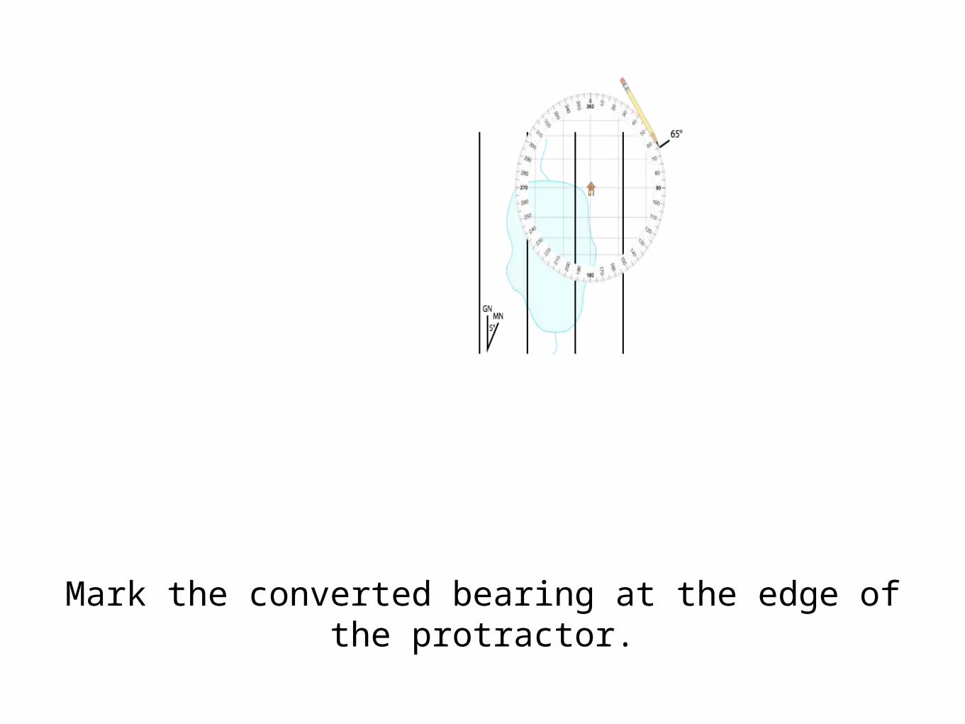
Mark the converted bearing at the edge of the protractor.
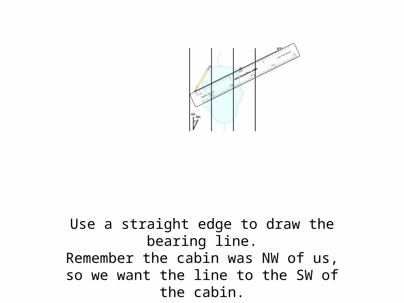
Use a straight edge to draw the bearing line.
Remember the cabin was NW of us,so we want the line to the SW of the
cabin.

The bearing plotted back towards our location
defines our location where it crosses the lakeshore.
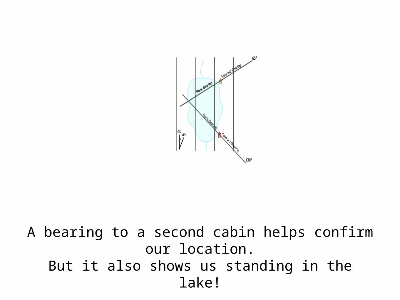
A bearing to a second cabin helps confirm our location.
But it also shows us standing in the lake!
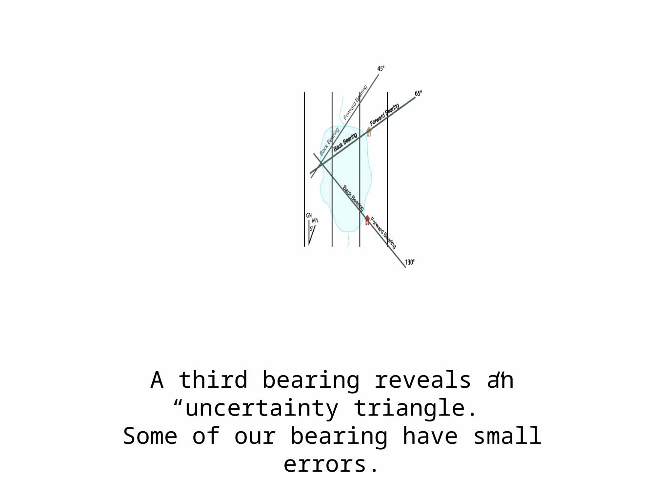
A third bearing reveals an “uncertainty triangle.”
Some of our bearing have small errors.

You can use your compass
as a protractor

Plotting a bearing with a baseplate compass
Set the dial to the desired bearing (using the map’s north reference)
Align the compass with the north reference lines.
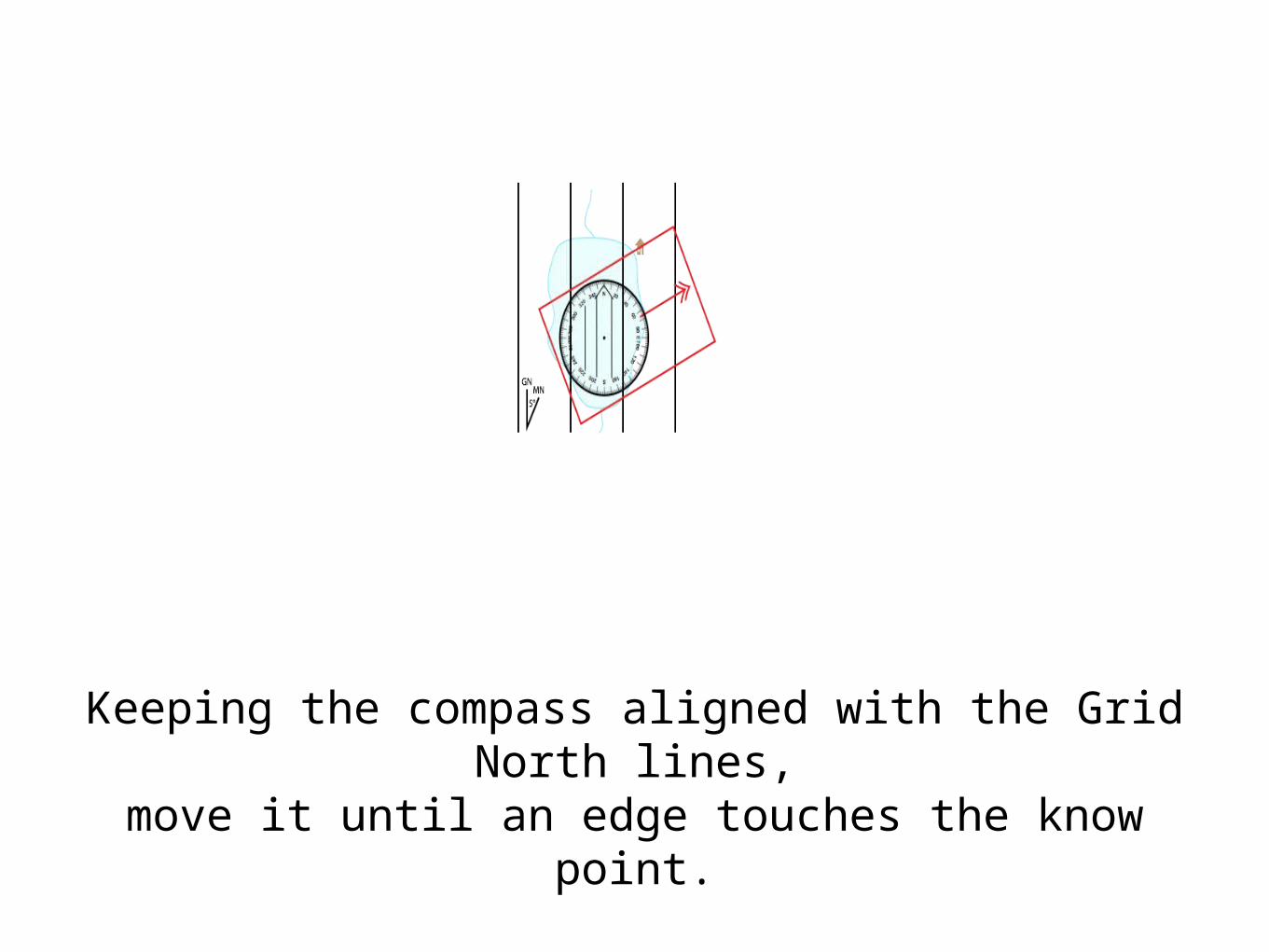
Keeping the compass aligned with the Grid North lines,
move it until an edge touches the know point.

Draw the bearing line along the edge of the compass.
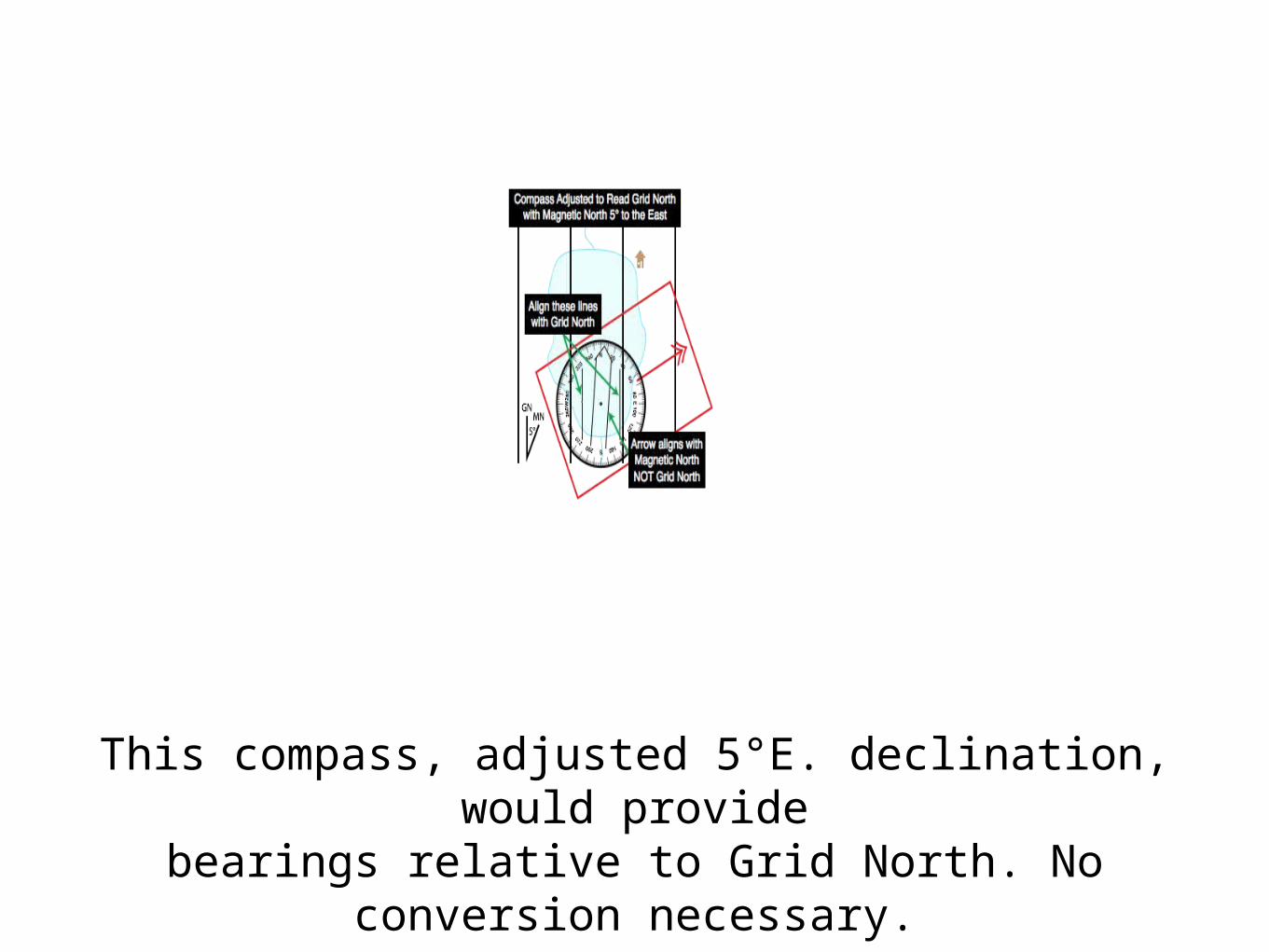
This compass, adjusted 5°E. declination, would provide
bearings relative to Grid North. No conversion necessary.
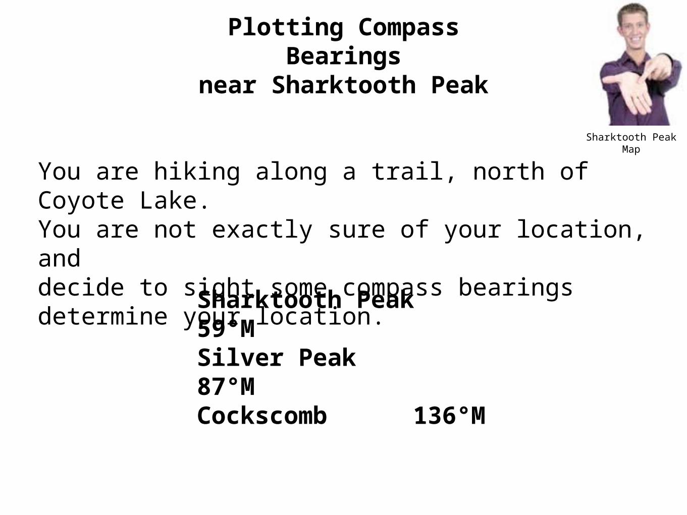
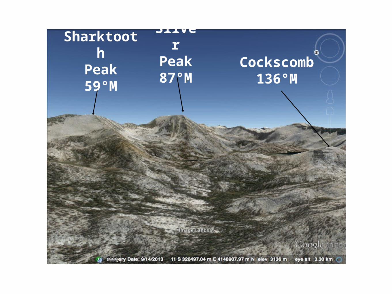
Sharktooth Peak Map
You are hiking along a trail, north of Coyote Lake.You are not exactly sure of your location, anddecide to sight some compass bearings determine your location.
Plotting Compass Bearings
near Sharktooth Peak
Sharktooth Peak 59°MSilver Peak 87°MCockscomb136°M
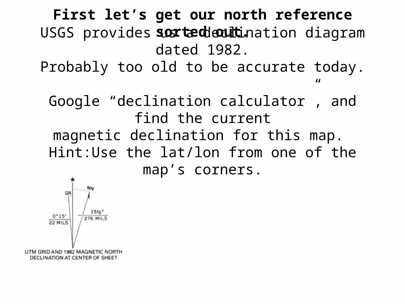
First let’s get our north reference sorted out.USGS provides us a declination diagram dated
1982.Probably too old to be accurate today.
Google “declination calculator”, and find the current
magnetic declination for this map. Hint:Use the lat/lon from one of the map’s
corners.

http://www.ngdc.noaa.gov/geomag-web/#declination
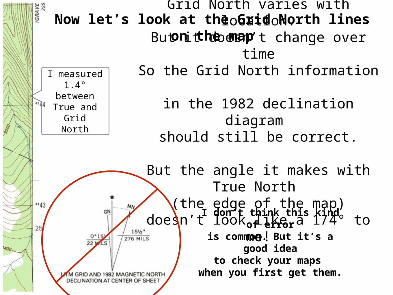
Now let’s look at the Grid North lines on the mapGrid North varies with location.
But it doesn’t change over timeSo the Grid North information
in the 1982 declination diagram should still be correct.
But the angle it makes with True North
(the edge of the map)doesn’t look like a 1/4° to me!
I measured1.4°
betweenTrue and
GridNorth
I don’t think this kind of error
is common. But it’s a good idea
to check your maps when you first get them.
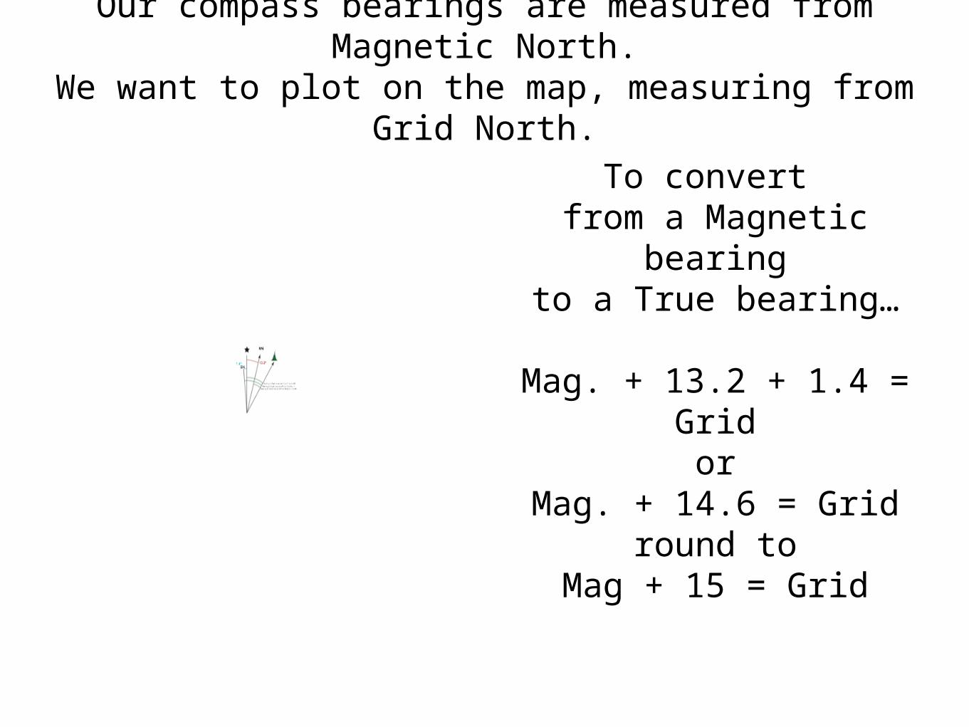
Our compass bearings are measured from Magnetic North.
We want to plot on the map, measuring from Grid North.
To convert from a Magnetic
bearingto a True bearing…
Mag. + 13.2 + 1.4 = Gridor
Mag. + 14.6 = Gridround to
Mag + 15 = Grid

You are hiking along a trail, north of Coyote Lake.You are not exactly sure of your location, anddecide to sight some compass bearings determine your location.Sharktooth Peak
59°MSilver Peak 87°MCockscomb136°M
Convert your bearings to work from Grid North.
Plot them on the map.
Sharktooth
Peak59°M
Silver
Peak87°M
Cockscomb
136°M


View West
View South
View North
You are somewhere east of Big Margaret Lake.
Plot some bearings to find your exact location341°M 0°M
264°M
138°M
186°M
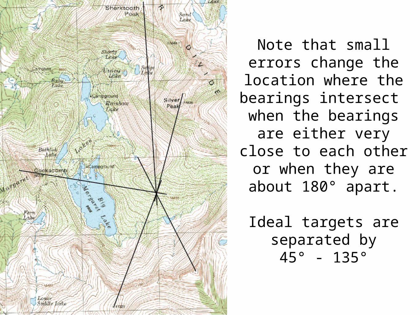
Note that small errors change the location
where thebearings intersect
when the bearings are either very close to each other or when they are about 180°
apart.
Ideal targets are separated by
45° - 135°
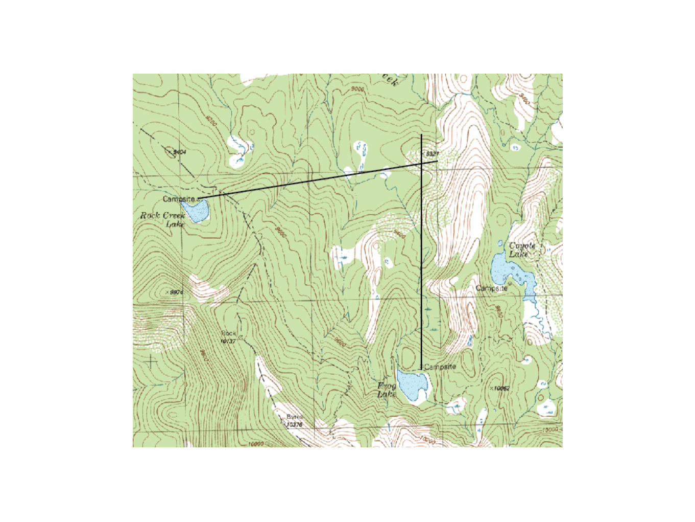
From your campsite at Frog Lake you can seewhat looks like an old mining cabin in the distance.
Curious about its location, you take a bearing with your compass.
345°M
The next day you camp at Rock Creek Lake.Again you can see the cabin and take a compass bearing.
66°M
Where is the cabin?Should you take another bearing before you hike to
the cabin?

Location by resectioning is often taught,
but is seldom used in the field
It’s rare to find 3 identifiable featuresall of which are on your map sheet.
It’s more common to use just one bearing
and combine it with other information,
like being located on a trail or other identifiable feature.
Often you do not have enough information
to detect errors in plotting.