Embed Size (px)
Citation preview
PNT Advisory Board 18
Arve DimmenDirector Maritime SafetyPNT Advisory Board Dec 8, 2016
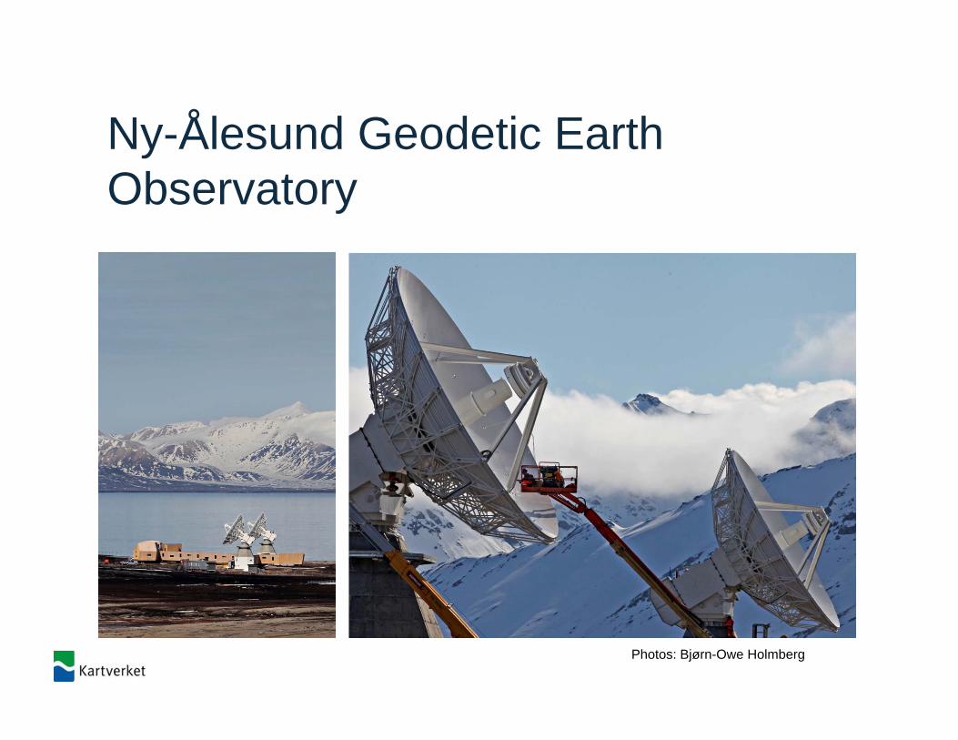
Ny-Ålesund Geodetic Earth Observatory
Photos: Bjørn-Owe Holmberg
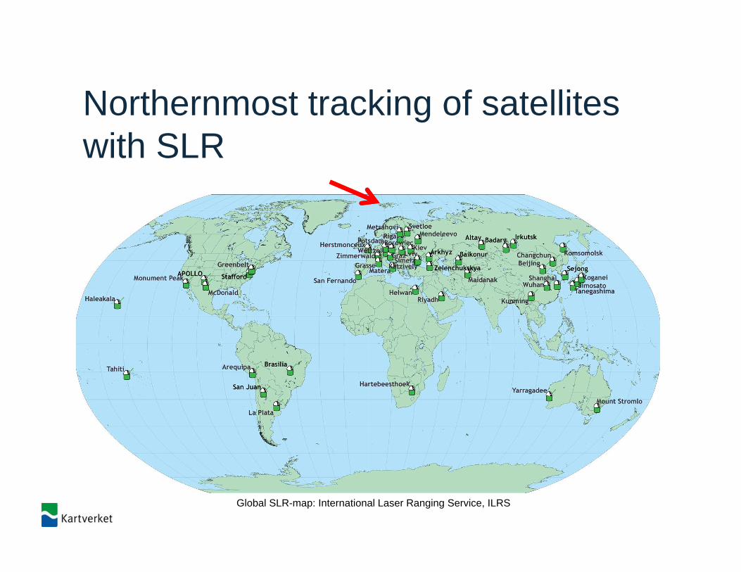
Northernmost tracking of satelliteswith SLR
Global SLR-map: International Laser Ranging Service, ILRS
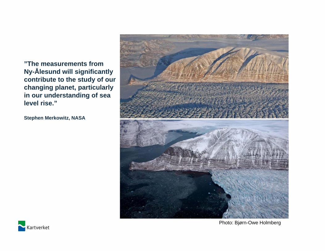
”The measurements from Ny-Ålesund will significantlycontribute to the study of ourchanging planet, particularlyin our understanding of sealevel rise.”
Stephen Merkowitz, NASA
Photo: Bjørn-Owe Holmberg
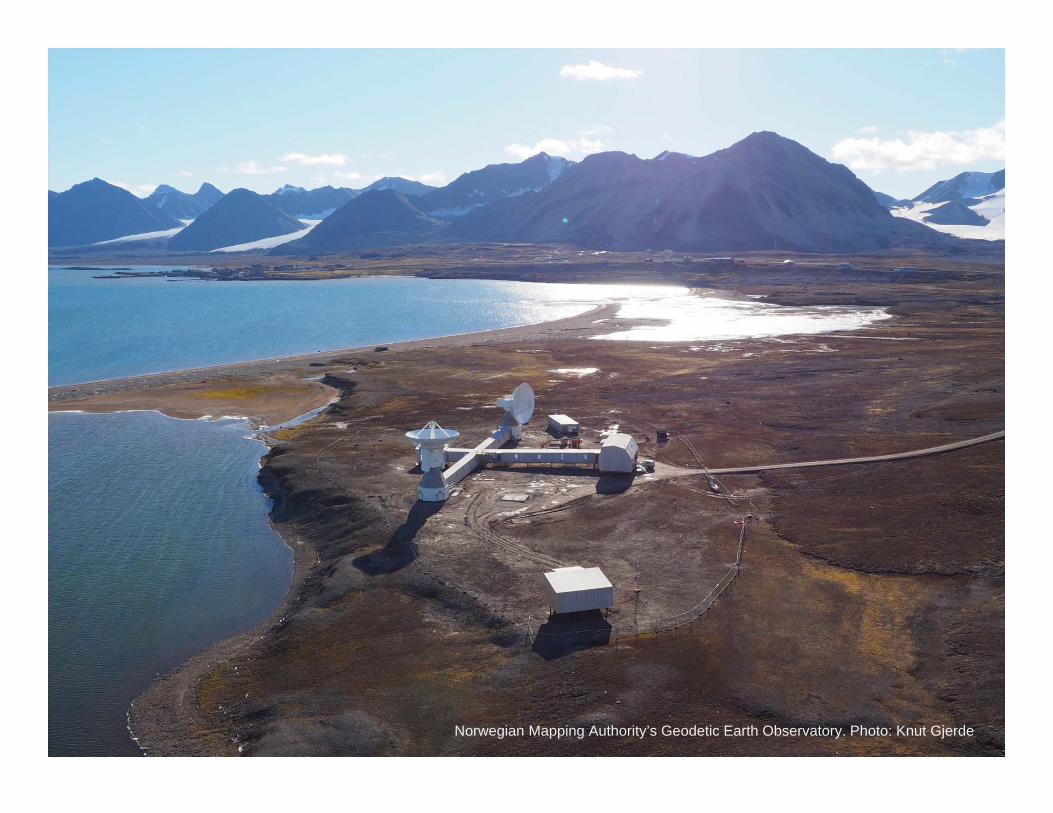
Norwegian Mapping Authority’s Geodetic Earth Observatory. Photo: Knut Gjerde
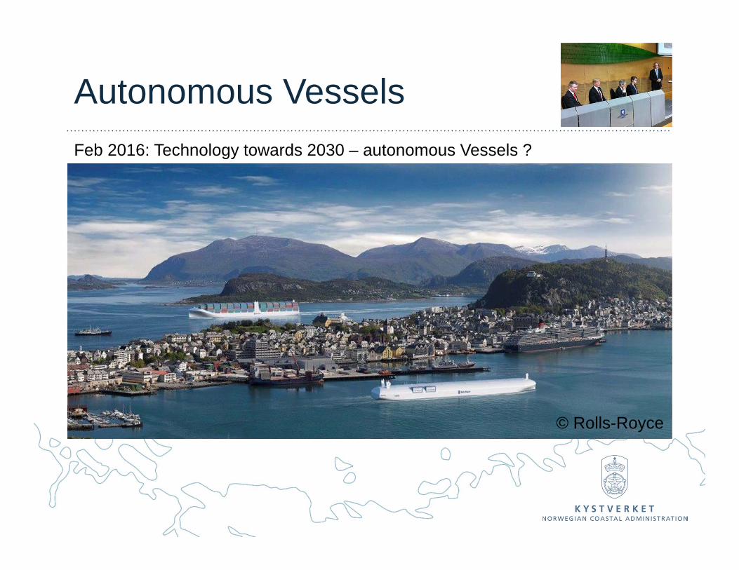
Autonomous VesselsFeb 2016: Technology towards 2030 – autonomous Vessels ?
© Rolls-Royce
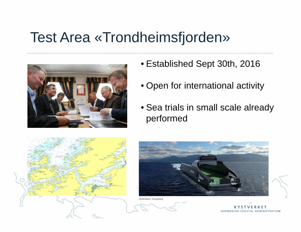
Test Area «Trondheimsfjorden»
• Established Sept 30th, 2016
• Open for international activity
• Sea trials in small scale alreadyperformed
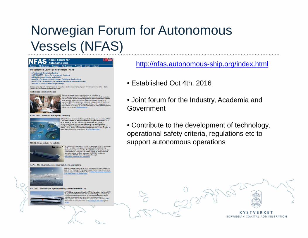
Norwegian Forum for AutonomousVessels (NFAS)
http://nfas.autonomous-ship.org/index.html
• Established Oct 4th, 2016
• Joint forum for the Industry, Academia and Government
• Contribute to the development of technology, operational safety criteria, regulations etc to support autonomous operations
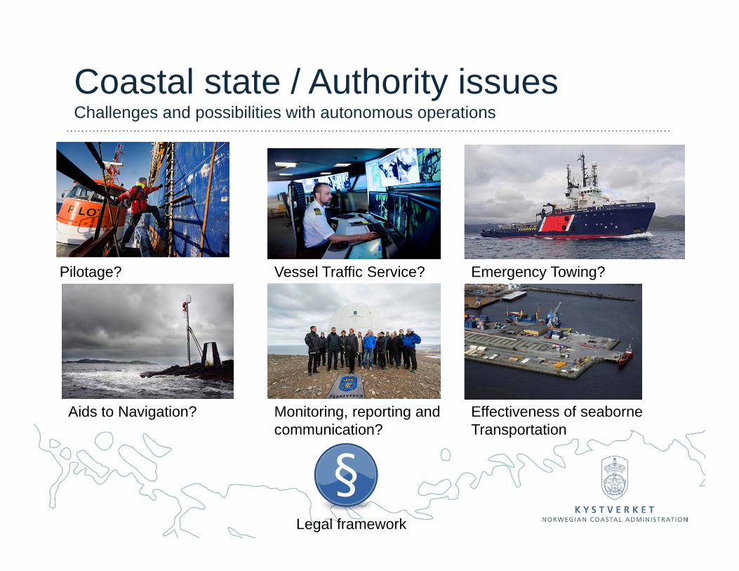
Coastal state / Authority issuesChallenges and possibilities with autonomous operations
Pilotage?
Aids to Navigation?
Vessel Traffic Service? Emergency Towing?
Monitoring, reporting and communication?
Effectiveness of seaborneTransportation
Legal framework
CLEAN, SAFE AND EFFICIENT SEAWAYS
www.kystverket.no