Embed Size (px)
Citation preview
I
Gwinnett County Planning Division Rezoning Application
Last Updated 12/2015
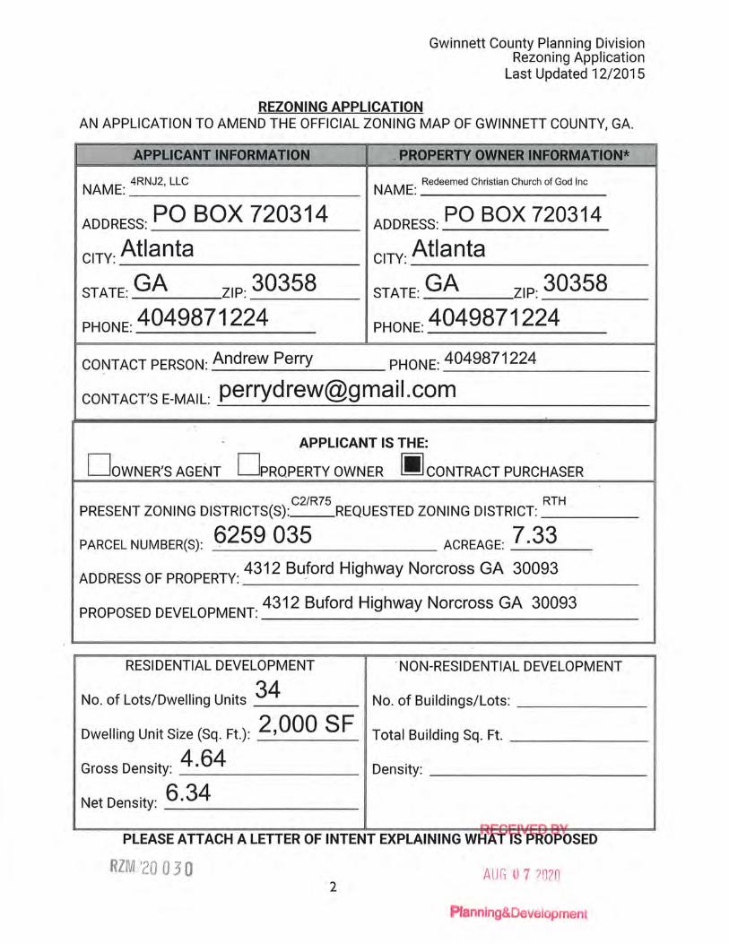
REZONING APPLICATION AN APPLICATION TO AMEND THE OFFICIAL ZONING MAP OF GWINNETT COUNTY, GA.
APPLICANT INFORMATION I . PROPERTY OWNER INFORMATIO;~---
NAME: 4RNJ2, LLC NAME: Redeemed Christian Church of God Inc
ADDRESS: PO BOX 720314 ADDRESS: PO BOX 720314
ciTY: Atlanta ciTY: Atlanta
STATE: GA ZIP: 30358 STATE: GA ZIP: 30358.
PHONE: 4049871224 PHONE: 4049871224
CONTACT PERSON: Andrew Perry PHONE:4049871224
CONTACT'S E-MAIL: [email protected]
. APPLICANT IS THE:
DowNER'S AGENT DPRQPERTY OWNER 1111 CONTRACT PURCHASER
. C2/R75 PRESENT ZONING DISTRICTS(S) : REQUESTED ZONING DISTRICT:
RTH
PARCEL NUMBER(S): 6259 035 ACREAGE: 7 .33 ADDRESS OF PROPERTY: 4312 Buford Highway Norcross GA 30093
PROPOSED DEVELOPMENT: 4312 Buford Highway Norcross GA 30093
RESIDENTIAL DEVELOPMENT . NON-RESIDENTIAL DEVELOPMENT
No. of Lots/Dwelling Units 34 No. of Buildings/Lots: _____ _
Dwelling Unit Size (Sq. Ft.): 2,000 SF Total Building Sq. Ft. _____ _
Gross Density: _4_.6_4 _____ _ Density.: _________ _
Net Density: _6_.3_4 ______ _
PLEASE ATTACH A LETTER OF INTENT EXPLAINING WR
RZM '20 0 3 0 AUG 0 7 ?020 2
lanning&Development
I FRONTLI~ SLR~VJ:NG " MAPPOO. l:NC.
3595 Canton Road Suite 116, PMB 272 Marietta, GA 30066 Ph. (678) 355-9905 Fax (678) 355-9805
I~\ www.frontlinesurveying.com
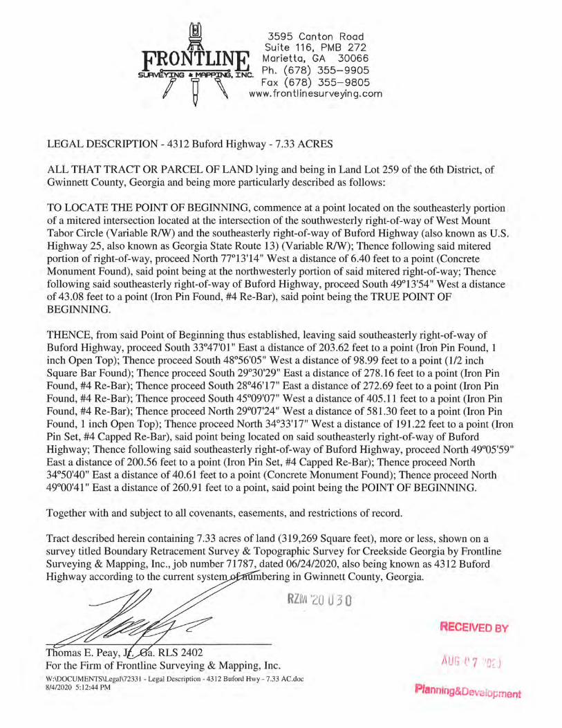
LEGAL DESCRIPTION - 4312 Buford Highway - 7.33 ACRES
ALL THAT TRACT OR PARCEL OF LAND lying and being in Land Lot 259 of the 6th District, of Gwinnett County, Georgia and being more particularly described as follows:
TO LOCATE THE POINT OF BEGINNING, commence at a point located on the southeasterly portion of a mitered intersection located at the intersection of the southwesterly right-of-way of West Mount Tabor Circle (Variable R/W) and the southeasterly right-of-way of Buford Highway (also known as U.S. Highway 25, also known as Georgia State Route 13) (Variable R/W); Thence following said mitered portion of right-of-way, proceed North 77°13'14" West a distance of 6.40 feet to a point (Concrete Monument Found), said point being at the northwesterly portion of said mitered right-of-way; Thence following said southeasterly right-of-way of Buford Highway, proceed South 49°13'54" West a distance of 43.08 feet to a point (Iron Pin Found, #4 Re-Bar), said point being the TRUE POINT OF BEGINNING.
THENCE, from said Poin~ of Beginning thus established, leaving said southeasterly right-of-way of Buford Highway, proceed South 33°47'01" East a distance of 203.62 feet to a point (Iron Pin Found, 1 inch Open Top); Thence proceed South 48°56'05" West a distance of 98.99 feet to a point (1/2 inch Square Bar Found); Thence proceed South 29°30'29" East a distance of 278.16 feet to a point (Iron Pin Found, #4 Re-Bar); Thence proceed South 28°46'17" East a distance of 272.69 feet to a point (Iron Pin Found, #4 Re-Bar); Thence proceed South 45°09'07" West a distance of 405.11 feet to a point (Iron Pin Found, #4 Re-Bar); Thence proceed North 29°07'24" West a distance of 581.30 feet to a point (Iron Pin Found, 1 inch Open Top); Thence proceed North 34°33'17" West a distance of 191.22 feet to a point (Iron Pin Set, #4 Capped Re-Bar), said point being located on said southeasterly right-of-way of Buford Highway; Thence following said southeasterly right-of-way of Buford Highway, proceed North 49°05'59" East a distance of 200.56 feet to a point (Iron Pin Set, #4 Capped Re-Bar); Thence proceed North 34°50'40" East a distance of 40.61 feet to a point (Concrete Monument Found); Thence proceed North 49°00'41" East a distance of 260.91 feet to a point, said point being the POINT OF BEGINNING.
Together with and subject to all covenants, easements, and restrictions of record.
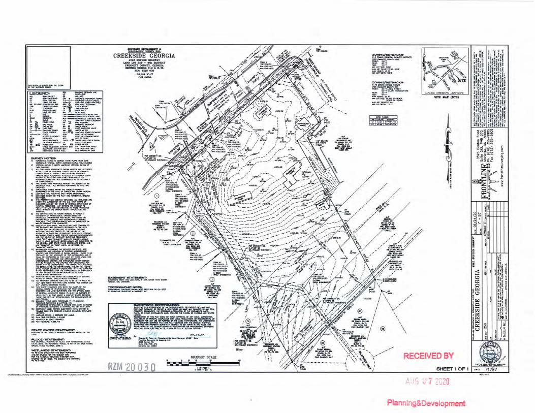
Tract described herein containing 7.33 acres of land (319,269 Square feet), more or less, shown on a survey titled Boundary Retracement Survey & Topographic Survey for Creekside Georgia by Frontline Surveying & Mapping, Inc., job number 71787, dated 06/24/2020, also being known as 4312 Buford Highway according to the current system mbering in Gwinnett County, Georgia.
RZM 120 U 3 0
Thomas E. Peay, J . For the Firm of Frontline Surveying & Mapping, Inc. W:\DOCUMENTS\Legal\72331 - Legal Description - 4312 Buford Hwy- 7.33 AC.doc 8/4/2020 5:12:44 PM
RECEIVED BY
Plannfng&Oevaio;.;ment
)>
::0
m
0 m
<
m
0 ~
©
-·- _,.·<..
" /
' ' ' ' ' '
CR
EE
KSI
DE
G
EOR
GIA
431
2 B
UFO
RD
H
IGH
WA
Y
DA
it
OS
24
20
SCA
«
1" =
50'
CND~
Received by Planning and Developm
ent8/28/2020
RZM2020-00030
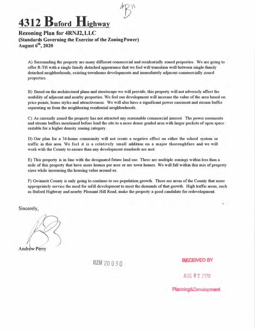
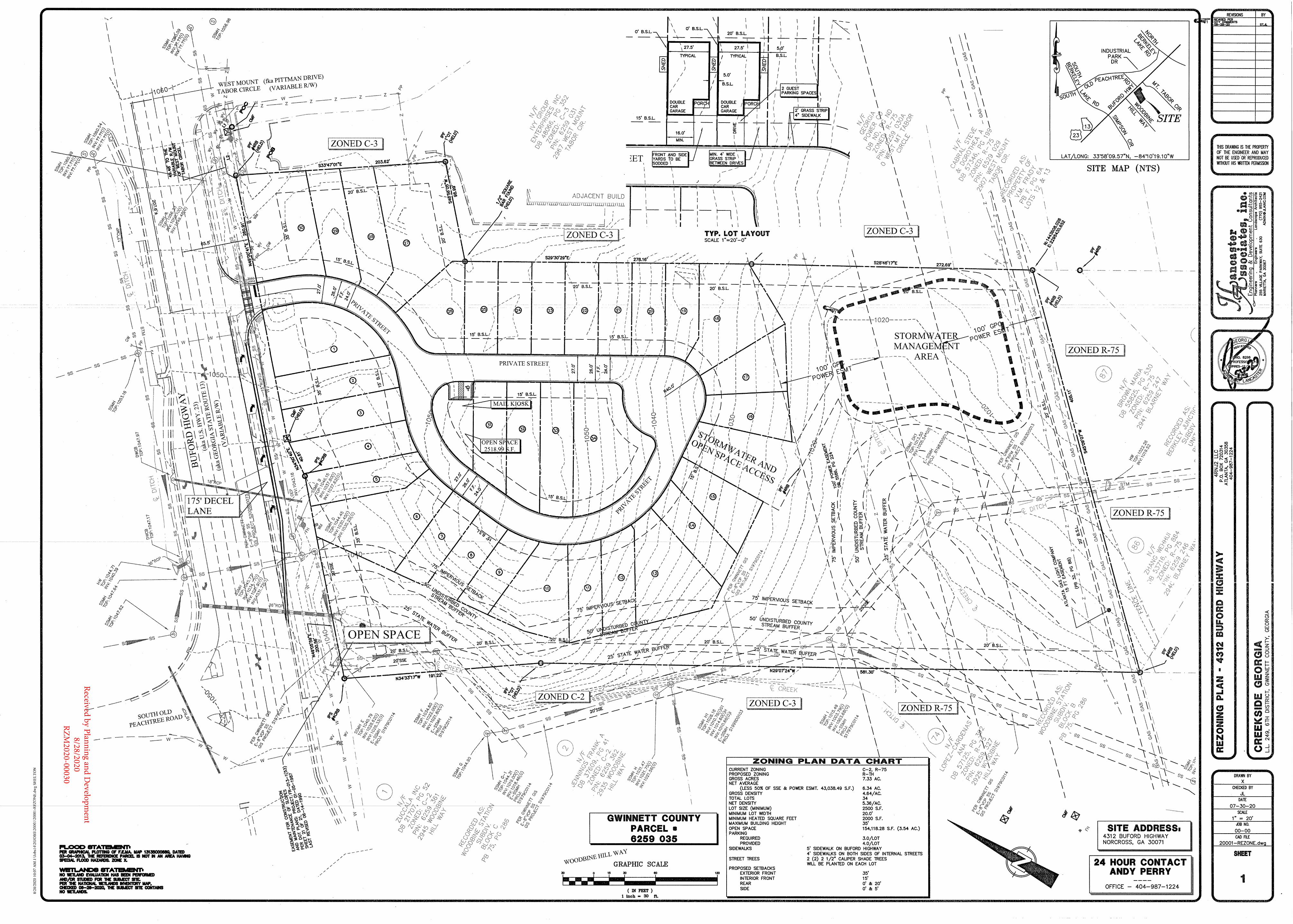
4312 Buford Highway Rezoning Plan for 4RNJ2,LLC (Standards Governing the Exercise of the Zoning Power) August 6t\ 2020
A) Surrounding the property are many different commercial and residentially zoned properties. We are going to offer R-TH with a single family detached appearance that we feel will transition well between single-family detached neighborhoods, existing townhome developments and immediately adjacent commercially zoned properties.
B) Based on the architectural plans and streetscape we will provide, this property will not adversely affect the usability of adjacent and nearby properties. We feel our development will increase the value of the area based on price points, home styles and attractiveness. We will also have a significant power easement and stream buffer separating us from the neighboring residential neighborhoods.
C) As currently zoned the property has not attracted any reasonable commercial interest. The power easements and stream buffers mentioned before lend the site to a more dense graded area with larger pockets of open space suitable for a higher density zoning category .
D) Our plan for a 34-home community will not create a negative effect on either the school syst'em or traffic in this area. We feel it is a relatively small addition on a major thoroughfare and we will work with the County to ensure than any development standards are met.
E) This property is in line with the designated future land use. There are multiple zonings within less than a mile of this property that have more homes per acre or are town homes. We will fall within this mix of property sizes while increasing the housing value around us .
F) Gwinnett County is only going to continue to see population growth. There are areas of the County that more appropriately service the need for infill development to meet the demands of that growth. High traffic areas, such as Buford Highway and nearby Pleasant Hill Road, make the property a good candidate for redevelopment.
Sincerely,
RZM '20 0 3 O CEIVEDBV
AUG 0 7 2n20
Planning&Development
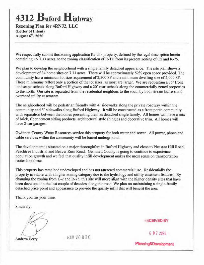
4312 Buford Highway Rezoning Plan for 4RNJ2, LLC (Letter of Intent) August 6t\ 2020
We respectfully submit this zoning application for this property, defined by the legal description herein containing+/- 7.33 acres, to the zoning classification ofR-TH from its present zoning of C2 and R-75.
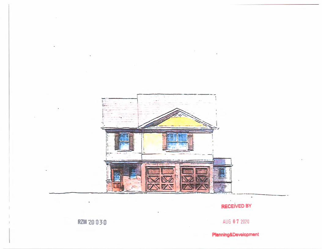
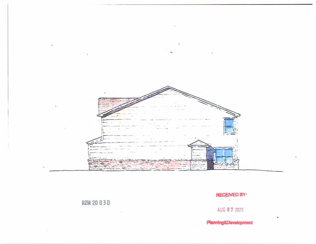
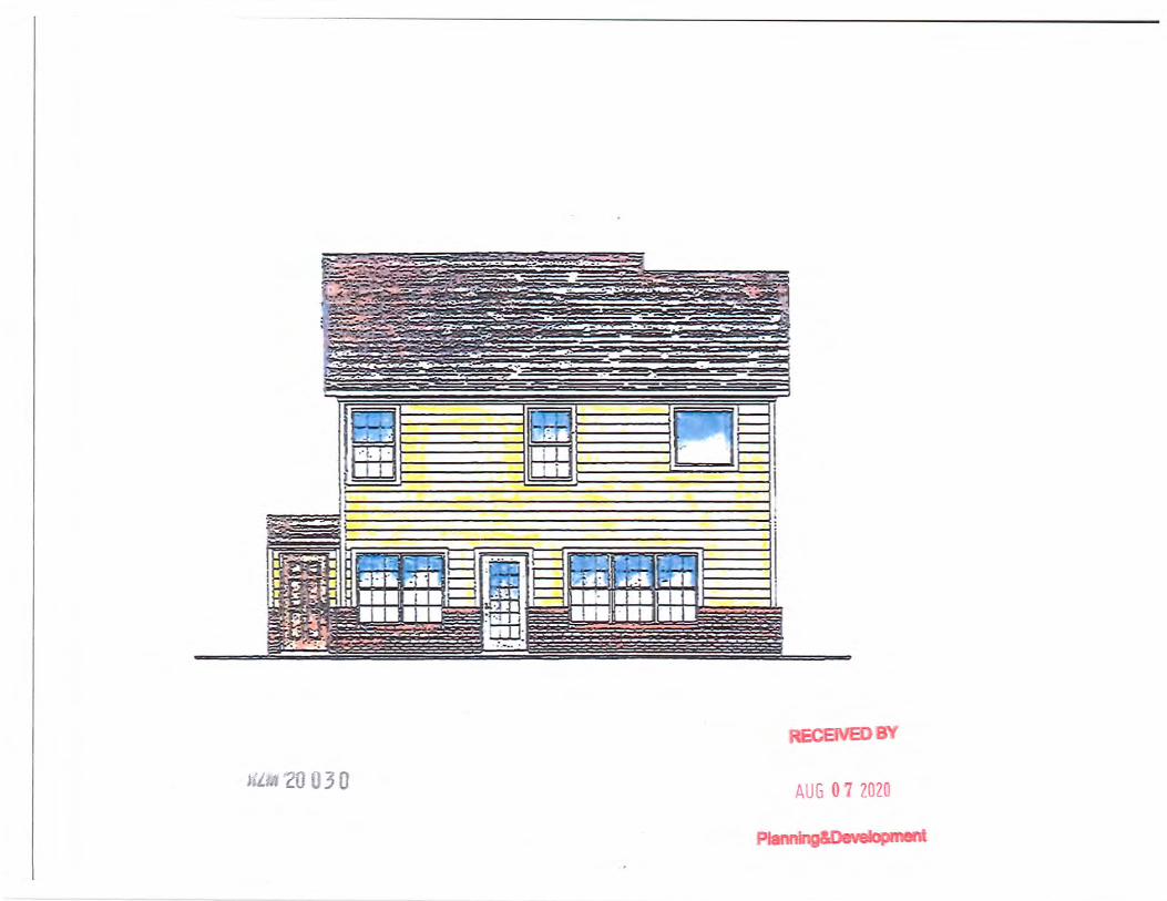
We plan to develop the neighborhood with a single family detached appearance. The site plan shows a development of 34 home sites on 7.33 acres. There will be approximately 52% open space provided. The community has a minimum lot size requirement of 2,500 SF and a minimum dwelling size of 2,000 SF. Those minimums reflect only a portion of the lot sizes, as most are larger. We are requesting a 35' front landscape setback along Buford Highway and a 20' rear setback along the commercially zoned properties to the north. Our site is separated from the residential neighbors to the south by both stream buffers and overhead utility easements.
The neighborhood will be pedestrian friendly with 4' sidewalks along the private roadway within the community and 5' sidewalks along Buford Highway. It will be constructed as a front porch community with separation between the homes presenting them as detached single family. All homes will have a mix of brick, fiber cement siding products, architectural style shingles and decorative trim. All homes will have 2-car garages.
Gwinnett County Water Resources service this property for both water and sewer. All power, phone and ·cable services within the community will be buried underground.
The development is situated on a major thoroughfare in Buford Highway and close to Pleasant Hill Road, Peachtree Industrial and Beaver Ruin Road. Gwinnett County is going to continue to experience population growth and we feel that quality infill development makes the most sense on transportation routes like these.
This property has remained undeveloped and has not attracted commercial use. Residentially the property is viable with a higher zoning category due to the hydrology and utility easement features. By changing the zoning from C-2 and R-75, this site will more align with the higher density sites that have been developed in the last couple of decades along this road. We plan on maintaining a single-family detached price point and appearance to provide the quality infill that will benefit the area.
Thank you for your time.
Sincerely,
'?{ECEIVED BY
G 0 7 2020 Andrew Perry HlM '20 03 0
Plannfng&Development

Gwinnett County Planning Division Rezoning Application
Last Updated 12/2015
REZONING APPLICANT'S CERTIFICATION
THE UNDERSIGNED BELOW IS AUTHORIZED TO MAKE THIS APPLICATION. THE UNDERSIGNED IS AWARE THAT NO APPLICATION OR REAPPLICATION AFFECTING THE SAME LAND SHALL BE ACTED UPON WITHIN 12 MONTHS FROM THE DATE OF LAST ACTION BY THE BOARD OF COMMISSIONERS UNLESS WAIVED BY THE BOARD OF COMMISSIONERS. IN NO CASE SHALL AN APPLICATION OR REAPPLICATION BE ACTED UPON IN LESS THAN SIX (6) MONTHS FROM THE DATE -OF LAST ACTION BY THE BOARD OF COMMISSIONERS.
Signatur Date
Date Notary Seal
ECEIVED BV
~(liVI '20 03 0 AUG 0 7 2020 4
Plannlng&Developmen
Gwinnett County Planning Division Rezoning Application
Last Updated 12/ 201 5
REZONING PROPERTY OWNER'S CERTIFICATION
THE UNDERSIGNED BELOW, OR AS ATTACHED, IS THE OWNER OF THE PROPERTY CONSIDERED IN THIS APPLICATION. THE UNDERSIGNED IS AWARE THAT NO APPLICATION OR REAPPLICATION AFFECTING THE SAME LAND SHALL BE ACTED UPON WITHIN 12 MONTHS FROM THE DATE OF LAST ACTION BY THE BOARD OF COMMISSIONERS UNLESS WAIVED BY THE BOARD OF COMMISSIONERS. IN NO CASE SHALL AN APPLICATION OR REAPPLICATION BE ACTED UPON IN LESS THAN SIX (6) MONTHS FROM THE DATE OF LAST ACTION BY THE BOARD OF COMMISSIONERS.
b(<_ .. Type or Print Name and Title
Signature of Notary Public Date
RZM '20 0 3 0 5
Date
YAXIN XIONG NOT ARY PUBLIC Gwinnett County State of Georgia
My Comm. Expires Jan. 7, 2024
Notary Seal
ECEIVEDBV
A 11 r, 0 7 2020
Plannlng&Development
Received 10-27-20RZM2020-00030
Gwinnett County Planning Division Rezoning Application
Last Updated 12/2015
VERIFICATION OF CURRENT PAID PROPERTY TAXES FOR REZONING
THE UNDERSIGNED BELOW IS AUTHORIZED TO MAKE THIS APPLICATION. THE UNDERSIGNED CERTIFIES THAT ALL GWINNETT COUNTY PROPERTY TAXES BILLED TO DATE FOR THE PARCEL LISTED BELOW HAVE BEEN PAID IN FULL TO THE TAX COMMISSIONER OF GWINNETT COUNTY, GEORGIA. IN NO CASE SHALL AN APPLICATION OR REAPPLICATION FOR REZONING BE PROCESSED WITHOUT SUCH PROPERTY VERIFICATION.
*Note: A SEPARATE .VERIFICATION FORM MUST BE COMPLETED FOR EACH TAX PARCEL INCLUDED IN THE REZONING REQUEST.
PARCEL l.D. NUMBER: (Map Reference Number)
Signature of Applicant
Andrew Perry
6 District
259 035 Land Lot Parcel
8-6-20 Date
***PLEASE TAKE THIS FORM TO THE TAX COMMISSIONERS OFFICE AT THE GWINNETT JUSTICE AND ADMINISTRATION CENTER, 75 LANGLEY DRIVE, FOR THEIR APPROVAL BELOW.***
TAX COMMISSIONERS USE ONLY
(PAYMENT OF ALL PROPERTY TAXES BILLED TO DATE FOR THE ABOVE REFERENCED PARCEL HAVE BEEN VERIFIED AS PAID CURRENT AND CONFIRMED BY THE SIGNATURE BELOW)
-- i y:o d l )N\czv\ft'C TS/l-=J& · . NAME TITLE
?;/ O 6/ cb?d:D DATE
ECEIVEDB
HZM '20 0 3 0 7 AUG 0 7 2020
Pfannfno&OAvAlnnm•nt
I I
/. ~
c CD
c:>
E
I 0
C'J
j
c::>
w
"1
I .~
r-~
l .
w
Q
0 I! (_
':J ' ~
<(
~ ,--
. -
I I
m
c=
"1
c:::::> c:--..J
t-0 <
-9
:::::> <
(
I l
I 1.
' \
I I'
' I
I
' .
1 1,
! ,.
! I
I
• ,
·. •, 'I
. , i I "
·l 'I
1rmr
I ... ··•· -
·-•.
-
t l ~.
i ·,
t~\' -
1 I
-
D
L~ _ _J ~, .. r ,_,,. • • "
LS• I I SHEET NO:
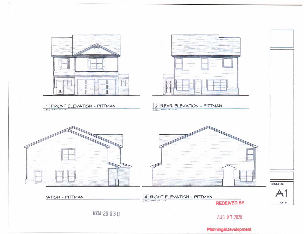
'ATION - PITTMAN - Pf.l RIGHT ELEVATION - PITIMAN A1 RECEIVED BY t OF 9
RlrA w20 0 3 •1 1
AUG 0 7 ZOZO

![Carrier Text File...May 30, 2020 · 0288 po box 6392 grand rapids mi 2832 po box 42033 hazelwood mo 5110 po box 624 milwaukee wi 7536 po box 1849 stow oh assurant health [fortis]](https://img.pdfslide.net/doc/110x75/6045b6cae307f02e1f7fcbd2/carrier-text-file-may-30-2020-0288-po-box-6392-grand-rapids-mi-2832-po-box.jpg)

![thomas & deborai thomas & debora] thomas & deborai contractor iverson, po box 2212, po box 2212, po box 2212, applicant owner p1506-023 $183,148.65 applicant owner pi 506-032 $21,328.08](https://img.pdfslide.net/doc/110x75/5eca3f7cce74ca60fc41cd93/-thomas-deborai-thomas-debora-thomas-deborai-contractor-iverson.jpg)