Embed Size (px)
Citation preview
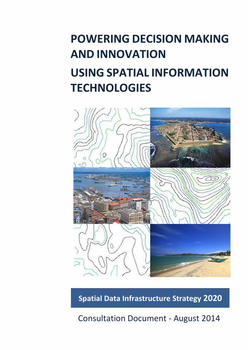
Spatial Data Infrastructure Strategy 2020
POWERING DECISION MAKING AND INNOVATION USING SPATIAL INFORMATION TECHNOLOGIES
Consultation Document - August 2014
2
CONTENTS Executive Summary ..................................................................................3
Introduction .............................................................................................5
What is Spatial Information? .......................................................6
Why is Spatial Information Important? ........................................6
What is a Spatial Data Infrastructure? .........................................6
Current Situation .....................................................................................7
Our Vision ................................................................................................8
Our Mission .............................................................................................8
Our Goals .................................................................................................8
Strategic Alignment..................................................................................9
Case for Change .......................................................................................10
Need for Good Governance .........................................................10
Sustainable Development ............................................................13
Moving Forward ......................................................................................15
Governance Structure ..............................................................................16
Strategic Framework ................................................................................17
Goal 1: .........................................................................................18
Goal 2: .........................................................................................19
Goal 3: .........................................................................................20
Goal 4: .........................................................................................21
Integrated Strategies ...............................................................................22
Stakeholder Engagement .............................................................22
Legal and Policy Framework ........................................................23
National Map Portal ....................................................................24
Spatial Data Framework ..............................................................25
National Spatial Data Catalogue ..................................................26
Spatial Data Warehouse ..............................................................27
Spatial Data Management ...........................................................28
Spatial Data Acquisition Program .................................................29
Disaster Management Pilot .........................................................30
Education and Awareness Programs ............................................31
Summary .................................................................................................32
References and Bibliography ....................................................................33
Sri Lanka Spatial Data Infrastructure Strategy 2020: Powering Decision Making and Innovation Using Spatial Information Technologies
3
EXECUTIVE SUMMARY An international study has found that users of geographic information report that they spend 80% of their time collating and managing information and 20% analysing and generating benefits from it. The reverse should be true (GIP, 2008).
Investigations within government in Sri Lanka show we are not immune from this problem. Although our spatial technology skills are highly developed and the systems used to collect the information are advanced; it is in sharing the information where we fall down. It is not possible to access accurate and integrated spatial information across the whole of Sri Lanka with reliability. This is the situation for government entities and access for the broader community is also a problem.
What this means is that the benefits of the information are not being fully realised.
Organisations across the government sector recognise that processes could be improved. Current manual data sharing procedures introduce delays in business practises, and the effort required to manually integrate updates is labour intensive and time consuming and therefore costly. A further expense is incurred because of parallel duplicated systems that have arisen because of policy restrictions which in turn arise because of a lack of trust. In this atmosphere decisions may be made using outdated versions of data.
A further issue is society’s growing need for more timely information. Fast and easy is the new norm. Landowners, investors, planners and emergency services want better information so they can take the data and create products and services that meet the needs of government and the wider community in today’s world.
There is a critical need to make sound decisions in response to environmental and social imperatives and to stimulate economic growth and increase the market value of goods and services.
What is needed is in depth knowledge about the location of people, places and infrastructure – facilitated by accurate, user friendly, easily accessible spatial information. Also needed are safeguards within this open environment to protect sensitive information such as an individual’s private details, and the location of rare fauna, some natural resources and defence installations.
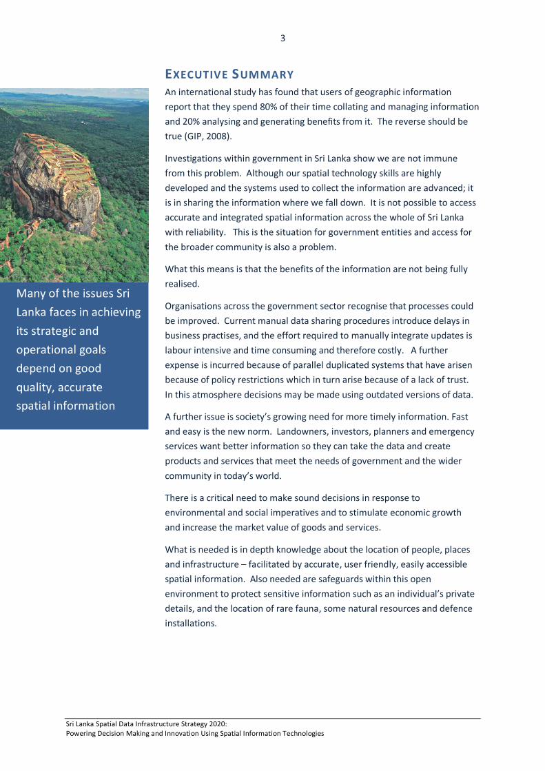
Many of the issues Sri Lanka faces in achieving its strategic and operational goals depend on good quality, accurate spatial information
Sri Lanka Spatial Data Infrastructure Strategy 2020: Powering Decision Making and Innovation Using Spatial Information Technologies
4
What this strategy proposes is the creation of an environment where government organisations can cooperate, and thus improve, the management and exchange of spatial information. It also allows people to discover, view and obtain information for a particular part of the country without needing to know the details of how the data is stored and maintained by different organisations.
The proposed Sri Lanka Spatial Data Infrastructure will include a National Map Portal that provides access to spatially referenced data for all levels of government, the private sector, non-profit organisations, academia and the community. Having accessible spatial information will facilitate natural resource monitoring, flood mitigation, management of public infrastructures, coordinated national projects and disaster preparedness. This is an important way to support and serve the national interest.
This document uses recognised standards for strategic planning. First four goals were established that are supported by ten integrated strategies.
The goals and strategies are directed at getting the legal and policy framework right, reducing costs associated with spatial data duplication, storage and access, getting increased return on investment and efficiency based on the ‘create once, use many times’ principle.
The benefits that flow from the strategy are many and varied. Open and transparent access to the Government’s spatial information is an important step to improving the nation’s spatial data service delivery and is a significant step towards transitioning to joined-up government.
There is also significant economic benefit to both government and the user community in having a single mechanism for accessing spatial information. It reduces the complexity for customers in dealing with multiple departments, and creates an environment for greater innovation and competition.
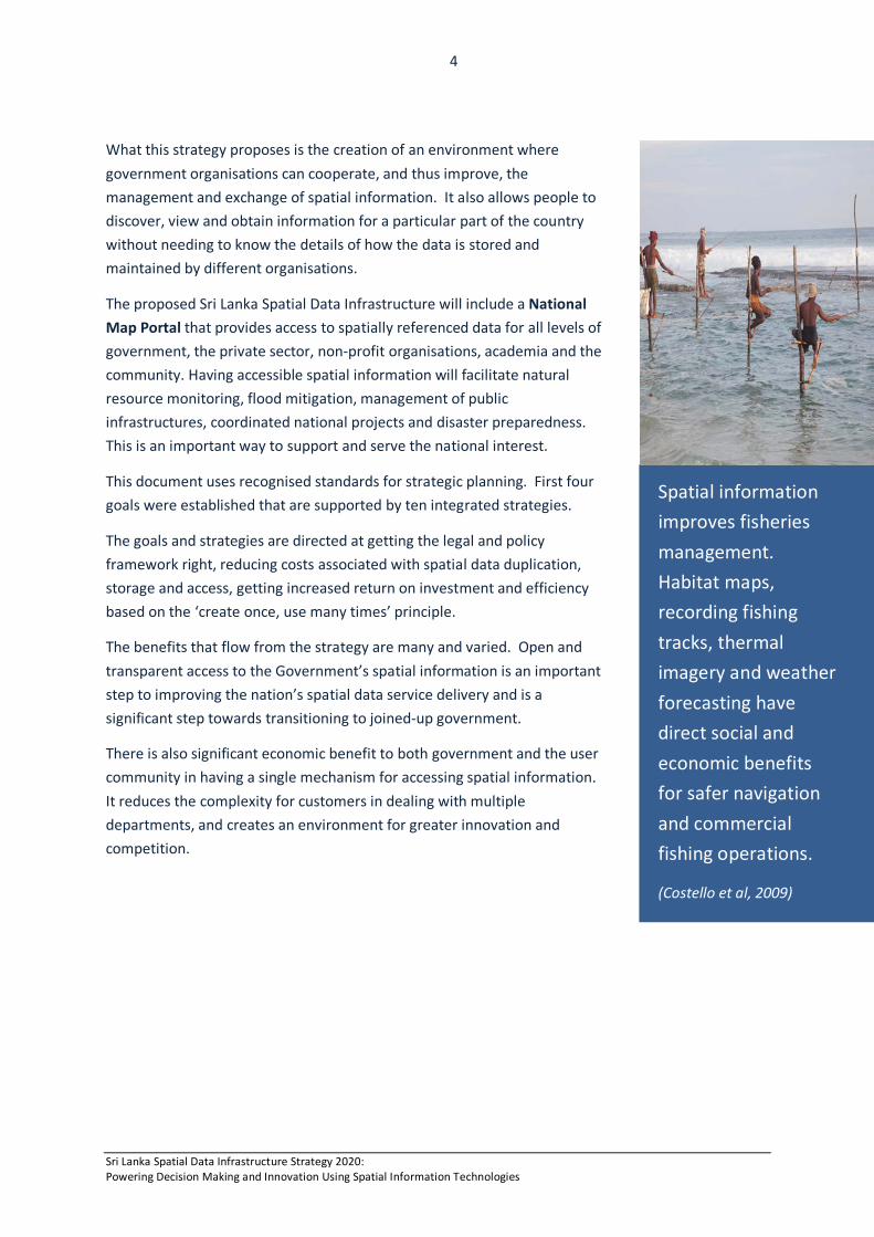
Spatial information improves fisheries management. Habitat maps, recording fishing tracks, thermal imagery and weather forecasting have direct social and economic benefits for safer navigation and commercial fishing operations.
(Costello et al, 2009)
Sri Lanka Spatial Data Infrastructure Strategy 2020: Powering Decision Making and Innovation Using Spatial Information Technologies
5
INTRODUCTION The Sri Lankan Government is experiencing financial and social pressures to deliver services more efficiently. Information technology is recognised as being central to redesigning the way in which organisations work together to deliver better services to the community. When combined with the commitment of government organisations to collaborate and consider alternative ways of business, the potential for improvements to services can be significant.
The Sri Lankan people, via a range of services, depend upon access to spatial information (maps) as a foundation for national planning, land use planning, infrastructure development, environmental sustainability and disaster management. These are critical priorities of government and the provision of maps, which underpin these services, requires a whole-of-government approach to be truly effective.
Studies show that spatial information contributes to growth in gross domestic product, creates new business opportunities, boosts revenue generating capacity, and contributes to productivity related savings. There is also evidence indicating significant intangible benefits including an increase in employee satisfaction from improved work practises and increased community wellbeing through access to knowledge about location (ACIL Tasman, 2008).
In order to facilitate access, delivery and sharing of spatial information; nations around the world are developing National Spatial Data Infrastructures (NSDI). A NSDI is an initiative that creates an environment where government organisations can cooperate, and thus improve, the management and exchange of spatial information. It allows people to discover, view and obtain spatial information online for a particular part of the country without needing to know the details of how the data is stored and maintained by independent organisations.
The government is working towards building a Sri Lanka National Spatial Infrastructure (SLSDI), which includes a single authoritative National Map Portal for the people of Sri Lanka. This map portal will provide access to spatially referenced data to all levels of government, the private sector, non-profit organisations, academia and the community for effective evidence-based decision making. This information will facilitate natural resource monitoring, flood mitigation, management of public infrastructures, national projects and disaster preparedness for the betterment of the community.
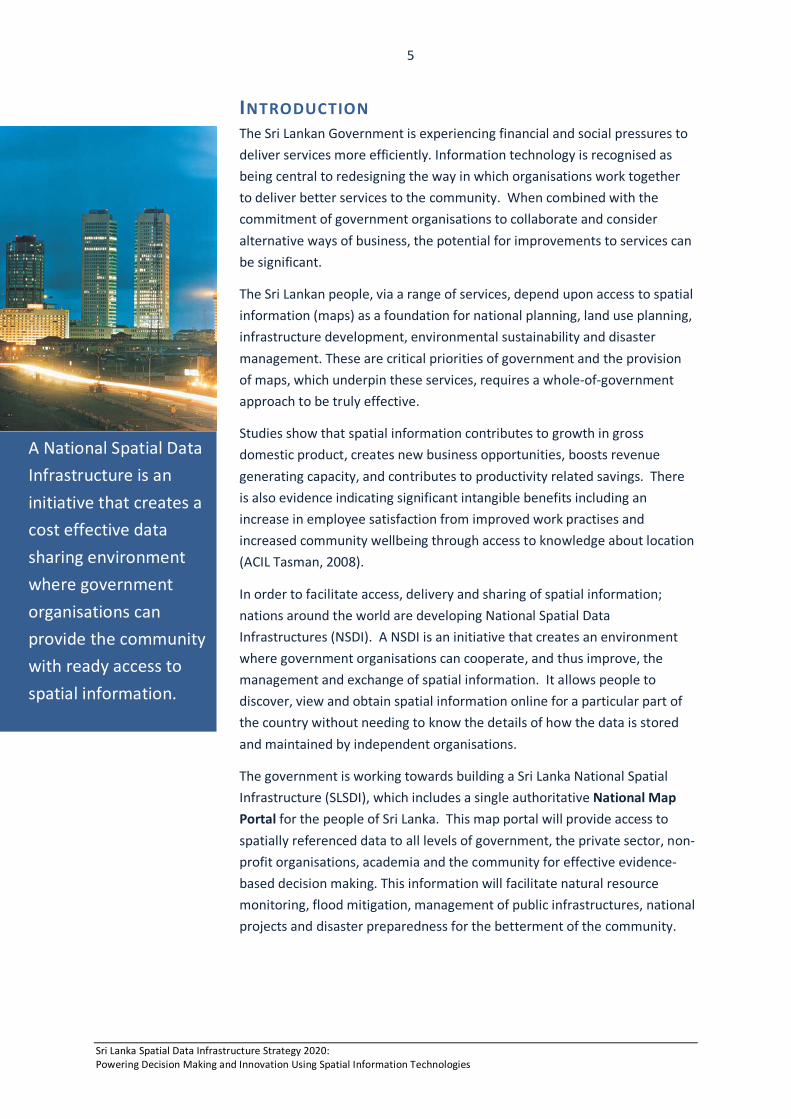
A National Spatial Data Infrastructure is an initiative that creates a cost effective data sharing environment where government organisations can provide the community with ready access to spatial information.
Sri Lanka Spatial Data Infrastructure Strategy 2020: Powering Decision Making and Innovation Using Spatial Information Technologies
6
WHAT IS SPATIAL INFORMATION? Spatial Information (or spatial data) describes the physical location of geographic features and their relationship with other features. Spatial information is presented in many forms including maps, digital data sets, satellite imagery and aerial photography.
WHY IS SPATIAL INFORMATION IMPORTANT? Spatial information and the knowledge is provides is essential to the livelihood of the Sri Lankan people. This is because it:
• provides a real world context for business information; • provides a holistic and integrated approach to problem solving,
decision making, planning and service delivery; • enables the development of new products and services; • provides a big picture, enabling the analysis of complex data and
the ability to identify relationships, trends and patterns such as, population changes; and
• enables the best course of action to be taken by exploring various scenarios, such as the impact on infrastructure from flood water.
WHAT IS A SPATIAL DATA INFRASTRUCTURE? A Spatial Data Infrastructure (SDI) is the physical and organisational aspects of managing and exchanging spatial information. A SDI comprises the people, policies and technologies necessary to enable the use of spatially referenced data. The infrastructure has many components. These include:
• An online National Map Portal that allows people to view maps, query information and download spatial data.
• A catalogue of data sets so that people know what data is available and who to contact for more information.
• Government policies that support information sharing in real-time. • Interoperable data standards that enable data to be integrated
with other data and systems. • Data upload facilities for content providers including location
information provided by the public voluntarily.
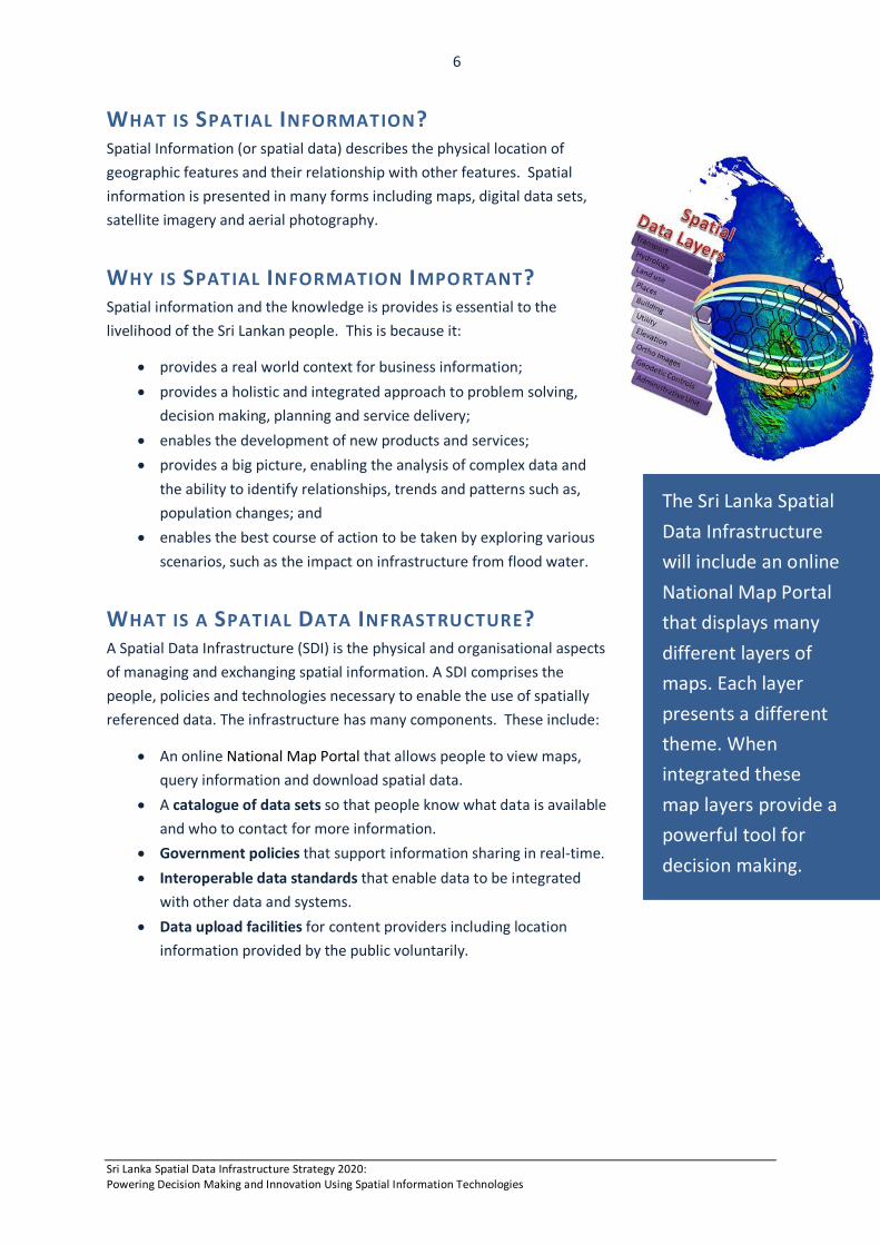
The Sri Lanka Spatial Data Infrastructure will include an online National Map Portal that displays many different layers of maps. Each layer presents a different theme. When integrated these map layers provide a powerful tool for decision making.
Sri Lanka Spatial Data Infrastructure Strategy 2020: Powering Decision Making and Innovation Using Spatial Information Technologies
7
CURRENT SITUATION The Government of Sri Lanka has vast holdings of spatial information collected by various government departments, with the majority located at the Survey Department. Spatial information technology skills are highly developed and the systems used to collect this information are advanced.
In spite of this, spatial information is not able to be easily shared between organisations at the present time; nor is it accessible to the broader community. This means that the benefits of this information are not being fully realised.
Spatial data sets are collected by a number of government organisations to facilitate conduct of an organisation’s business and not with other agencies needs in mind. These data are managed in closed systems and this has created a multitude of information silos.
Currently, data collected by organisations is not accessible. It is difficult to know what information is available and where it is held. This has led to several organisations collecting the same information because they are unaware that the information already exists.
Organisations across the government sector recognise that current processes are inefficient and that more cooperation across the sector is required. However, existing data sharing policies are restricting collaboration. There is a significant paper trail of agreements that need to be processed before data sets can be transferred from one organisation to another. Manual data sharing procedures contribute to delay in sharing, and the effort required to manually integrate updates from one agency to another is labour intensive and time consuming.
In addition to creating a costly overhead for government, current practise has seen organisations develop their own data standards and product specifications. This has meant that a substantial amount of spatial information is not cohesive. As a result, gathering data sets to produce higher value products is time consuming as a significant amount of reprocessing is required to make it usable.
Evidence-based decision making is currently not possible because spatial data is not easily integrated. There are currently too few linkages across key government data sets making the relationships between geographic features difficult to analyse. As a consequence, data are not meaningful in the user’s context. For example, it is not possible for a land developer to query information to understand what can be done on land (land use rights); what cannot be done (restrictions due to landslide risk), and what must be done (reforestation of cleared areas).
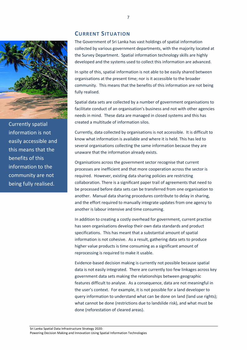
Currently spatial information is not easily accessible and this means that the benefits of this information to the community are not being fully realised.
Sri Lanka Spatial Data Infrastructure Strategy 2020: Powering Decision Making and Innovation Using Spatial Information Technologies
8
This problem requires urgent attention. While data have significant value as a single information product; it is the integration of spatial data with other information that increases its value exponentially to government and business.
VISION Within this context, the Government of Sri Lanka’s vision is:
“Sustainable development through effective use of spatial information for evidence-based decision making.”
MISSION With a new future envisioned, the Government’s mission is:
“To lead effective sharing and use of spatial information by the government, private sector and general public for business, research and innovation, to benefit the wider community.”
GOALS The Sri Lanka Spatial Data Infrastructure Strategy has the following goals:
1. An accurate nationwide representation of the landscape that is readily accessible and easily integrated with economic, social and environmental geographies.
2. Greater efficiency and productivity in the management and sharing of spatial data.
3. Evidence-based decision making in government, business and the wider community through access to integrated spatial information.
4. Spatial solutions readily available and widely used across Sri Lanka in response to emerging opportunities.
Sri Lanka Spatial Data Infrastructure Strategy 2020: Powering Decision Making and Innovation Using Spatial Information Technologies
9
STRATEGIC ALIGNMENT Many of the issues that Sri Lanka faces in achieving its operational and strategic goals have a dependency on spatial information. Land and geographic information underpins many of the objectives and goals outlined in the Sri Lankan Country Partnership Strategy 2013-2016 (ADB, 2012). These strategies seek to:
• Sustain private and public investment • Shift towards a more knowledge-based economy that is globally integrated and
competitive, environmentally friendly and internally integrated. • Ensure improvement in living standards and social inclusion.
In addition, the development of a Sri Lanka Spatial Data Infrastructure supports the challenges identified in many key government initiatives (Table 1).
Strategies of Government of Sri Lanka Spatial Information – A Strategic enabler
Transforming a Nation through Information technology (ICTA).
Ready access to spatial information technology provides society with equitable distribution of opportunity and knowledge.
National Climate Change Adaptation Strategy for Sri Lanka 2011-2016.
Provides an integrated approach to national planning and development through visualisation and dissemination of climate change information for the government and broader community.
Unstoppable Sri Lanka 2020: Public Investment Strategy 2014-2016 (Ministry for National Planning and Ministry for Finance and Planning).
Increased availability and useability of spatial data will create a more diverse and efficient service base and realise an increase in economic and social benefits as a result of new products and services.
National Sustainable Development Strategy (Ministry of Environment).
Integrated spatial information from across the government sector to monitor and manage land degradation, pollution, water resources, biological diversity and waste disposal.
National Tourism Development Strategy 2011-2016 (Ministry for Economic Development).
Accessible and accurate map coverage of Sri Lanka promotes tourism through ease of discovering places to see and things to do.
National Action Plan for Harita Lanka Programme (Ministry for Environment).
Supports evidenced-based decision making for the protection of natural resources and safeguarding the environment.
Mahinda Chinthanaya: Vision for the Future, Development Policy Framework, (Ministry for National Planning and Ministry for Finance and Planning).
Provides a foundation for the ‘Knowledge Hub’ to be the centre of excellence for spatial information and technology.
Strategy of Science and Technology Ministry
Provides a whole-of-government approach offering citizens a single window to all government spatial information.
Sri Lanka Comprehensive Disaster Management Programme 2014-18
Supports the spatial information sharing, research and effective planning that is required for enhanced disaster risk reduction capabilities and climate change adaptation.
Table 1: SLSDI alignment to strategic priorities of Government
Sri Lanka Spatial Data Infrastructure Strategy 2020: Powering Decision Making and Innovation Using Spatial Information Technologies
10
CASE FOR CHANGE The Sri Lankan government has a significant amount of spatial information covering the nation and this information is used for evidence-based decision making and good governance. So why change anything?
• Firstly, there is a growing need for more timely information and therefore it is important that processes are efficient and information more accessible to the broader community. This will ensure that the principles underpinning transparent and open government are upheld and processes sustainable.
• Secondly, there are environmental and social imperatives that require a united response, and a critical need to stimulate economic growth by increasing the market value of goods and services. It is time for all government organisations to accelerate their collective efforts in the national interest in order to meet local, national and global economic, social and environmental challenges.
GOOD GOVERNANCE We exist in a world where information is increasing exponentially. Government organisations are faced with the dilemma of transforming captive data held in individual applications and data repositories into openly available information. The better information that landowners, investors, planners and emergency services have; the better use they can make of this information and the more products and services they can create.
At the same time, the government needs to safeguard sensitive information such as an individual’s private details, and the location of rare fauna, gem deposits and defence installations. This approach will give the public confidence that government is being both open and balancing privacy concerns.
Good governance comes with establishing a sustainable organisational structure for the management of spatial information. The governing processes include the ability to position, guide, oversee and monitor the development of spatial information resources for the good of the nation. This requires effective policy and legislation, compliance with standards and the implementation of common operating procedures.
The National Spatial Data Infrastructure compliments Sri Lanka’s e-government initiative. It is an enabler that transforms the operations of government through the delivery of integrated spatial information to users; providing them with a choice of spatial information to meet their individual needs and circumstances. By facilitating online transactions between government agencies, citizens and businesses; the tenets of transparency, accountability and ethically responsible governance are upheld.
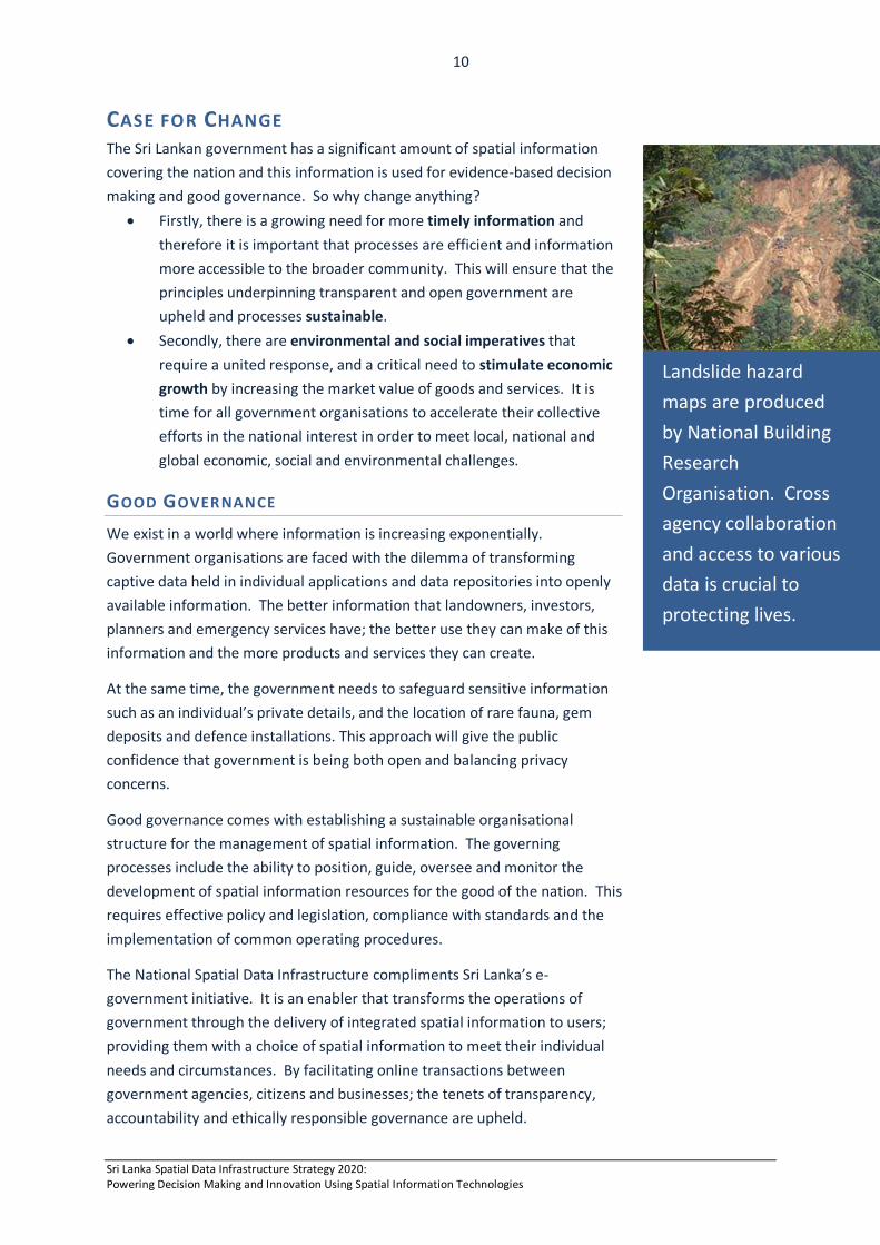
Landslide hazard maps are produced by National Building Research Organisation. Cross agency collaboration and access to various data is crucial to protecting lives.
Sri Lanka Spatial Data Infrastructure Strategy 2020: Powering Decision Making and Innovation Using Spatial Information Technologies
11
The National Spatial Data Infrastructure provides a framework in which true end-to-end business processes can be conducted across agencies. The intent is to provide a whole-of-government perspective on data and processes, rather than an agency-oriented viewpoint, to make it easier for Sri Lankans to interact with government. This will result in -
• Optimised service delivery, leading to investment certainty and economic sustainability.
• Better sharing and integration of spatial information across government, private sector and the community.
• Streamlined government services and reduced transaction times. • Improved quality of decision-making and response times. • Reduced paperwork and run around between agencies. • Reduced errors, duplication and rework. • Provide citizens with greater choice of how they access spatial
services, and empower them by making information more readily accessible.
• Potential value-adding to agency data and more opportunities to innovate.
• Facilitate community engagement and involvement in government decision-making processes
To be successful, the National Spatial Data Infrastructure requires a governance model that balances horizontal collaboration with vertical accountability. Agencies will need to work in a more collaborative manner, prioritising the need for integration of government services and collection of spatial data.
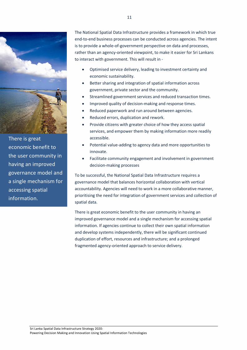
There is great economic benefit to the user community in having an improved governance model and a single mechanism for accessing spatial information. If agencies continue to collect their own spatial information and develop systems independently, there will be significant continued duplication of effort, resources and infrastructure; and a prolonged fragmented agency-oriented approach to service delivery.
There is great economic benefit to the user community in having an improved governance model and a single mechanism for accessing spatial information.
Sri Lanka Spatial Data Infrastructure Strategy 2020: Powering Decision Making and Innovation Using Spatial Information Technologies
12
Significant issues arise from having a profusion of spatial information portals, including:
• users having to visit multiple web locations to access government spatial information;
• a lack of consistency and ‘look and feel’, leading to lower levels of useability by the community;
• a diversity in technology used, leading to diluted knowledge and capabilities and limited opportunities to fully utilise and leverage information;
• lack of a common Government ‘brand’ across portals; and • limited inter-agency interactions and less ability to integrate
information.
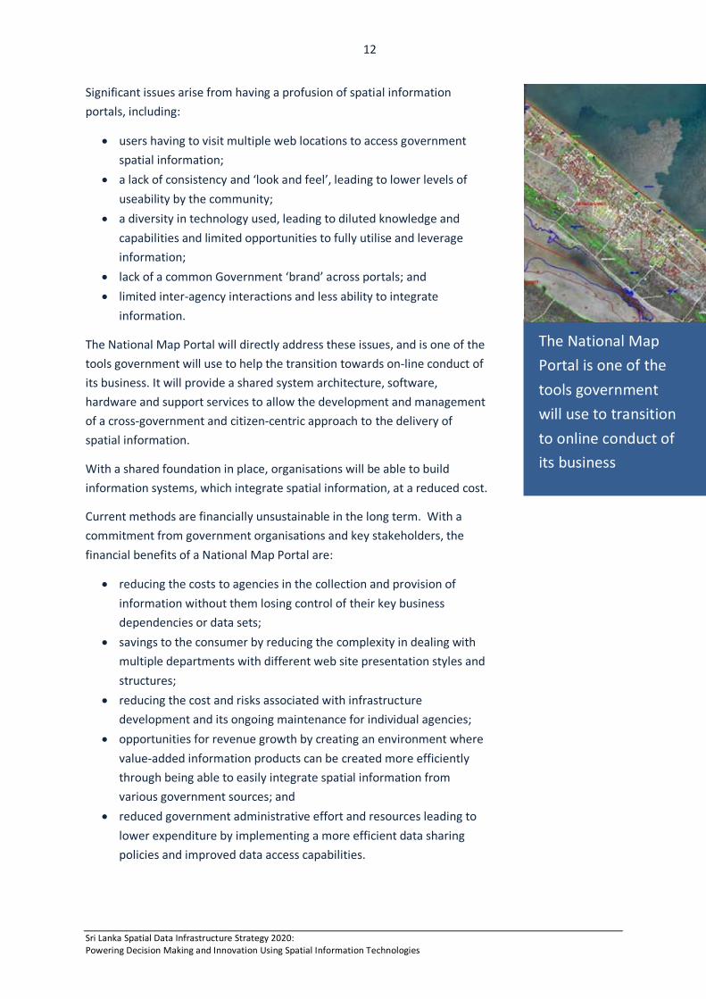
The National Map Portal will directly address these issues, and is one of the tools government will use to help the transition towards on-line conduct of its business. It will provide a shared system architecture, software, hardware and support services to allow the development and management of a cross-government and citizen-centric approach to the delivery of spatial information.
With a shared foundation in place, organisations will be able to build information systems, which integrate spatial information, at a reduced cost.
Current methods are financially unsustainable in the long term. With a commitment from government organisations and key stakeholders, the financial benefits of a National Map Portal are:
• reducing the costs to agencies in the collection and provision of information without them losing control of their key business dependencies or data sets;
• savings to the consumer by reducing the complexity in dealing with multiple departments with different web site presentation styles and structures;
• reducing the cost and risks associated with infrastructure development and its ongoing maintenance for individual agencies;
• opportunities for revenue growth by creating an environment where value-added information products can be created more efficiently through being able to easily integrate spatial information from various government sources; and
• reduced government administrative effort and resources leading to lower expenditure by implementing a more efficient data sharing policies and improved data access capabilities.
The National Map Portal is one of the tools government will use to transition to online conduct of its business
Sri Lanka Spatial Data Infrastructure Strategy 2020: Powering Decision Making and Innovation Using Spatial Information Technologies
13
SUSTAINABLE DEVELOPMENT Managing the orderly development of land and the subsequent provision of a multitude of government and private sector services such as transport, utilities and health, requires integrated planning. This planning is underpinned by an understanding of where things are and how they relate to each other. Optimised planning capabilities are fundamental to a vibrant economy and community.
Government’s ability to understand and recognise the geographic distribution of people throughout the country, and respond effectively to their needs, is dependent on having sound information for decision-making. This information comes from a wide variety of sources and can become meaningless without a geographic context.
To understand nationwide issues, the Government needs an information framework with which to collect, collate, and analyse nationwide needs. The National Map Portal will provide a much needed method to integrate and explore information from a national perspective. This equates to better provision of services at the Provincial and District levels and cohesiveness across administration boundaries, particularly relating to environmental management and infrastructure development.
Planning, preparing, responding to, and recovering from natural disasters, is critical to providing a safer Sri Lanka. Community safety and resiliency can be optimised through knowing the location of people, places and infrastructure. Spatial information is critical in these processes and having the right information at the right time is paramount.
To address environmental and social imperatives, the National Map Portal will provide up-to-date access to the spatial information collected across government. Organisations dealing with environmental and emergency situations will have a common operating picture. This includes local information for risk assessment, evacuation route planning and priority management. There is a significant requirement to be able to source community information quickly and be able to display the local situation geographically.
Community expectations are evolving with advancements in technology and the increase in computer literacy among the community. Government recognises that to maintain relevance with prevailing societal needs there is a need to deliver spatial information in a way that can be visualised and used anywhere, anytime and on any electronic device. Staying abreast of community expectations and having a sense of where the best public value is now and in the future, is a key responsibility of Government. This strategy responds to community aspirations.
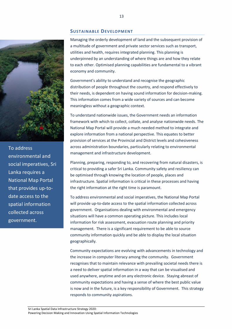
To address environmental and social imperatives, Sri Lanka requires a National Map Portal that provides up-to-date access to the spatial information collected across government.
Sri Lanka Spatial Data Infrastructure Strategy 2020: Powering Decision Making and Innovation Using Spatial Information Technologies
14
Economies worldwide are battling to grow and create jobs following a damaging recession whose effects continue to be felt. Economic growth is a critical focus for government, which is concentrating on three pillars (MFP, 2010):
• Promoting inclusive and sustainable economic growth; • Catalysing private investment and enhancing the effectiveness of
public investment; and • Supporting human resources and knowledge development.
Sri Lanka requires innovative solutions to address emerging needs. Open access to spatial information has the potential to create a more diverse market place – one that meets a wide range of community needs beyond hard copy maps. However, with spatial information currently inaccessible, the ability to innovate is limited.
There is a need to develop a capability to build new products and services, such as mobile phone applications that show the location of restaurants, businesses and real estate for sale. This requires ready access to spatial data combined with system interoperability and standards.
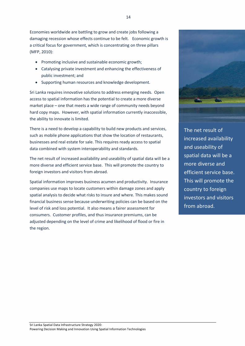
The net result of increased availability and useability of spatial data will be a more diverse and efficient service base. This will promote the country to foreign investors and visitors from abroad.
Spatial information improves business acumen and productivity. Insurance companies use maps to locate customers within damage zones and apply spatial analysis to decide what risks to insure and where. This makes sound financial business sense because underwriting policies can be based on the level of risk and loss potential. It also means a fairer assessment for consumers. Customer profiles, and thus insurance premiums, can be adjusted depending on the level of crime and likelihood of flood or fire in the region.
The net result of increased availability and useability of spatial data will be a more diverse and efficient service base. This will promote the country to foreign investors and visitors from abroad.
Sri Lanka Spatial Data Infrastructure Strategy 2020: Powering Decision Making and Innovation Using Spatial Information Technologies
15
MOVING FORWARD The development of the Sri Lankan Spatial Data Infrastructure will address many challenges of government through a coordinated and strategic approach to spatial information management and access.
This strategy provides the impetus for action. It includes four goals and ten integrated strategies that set out what needs to be done over the coming years. The approach will ensure that Sri Lanka keeps pace with worlds best practise spatial data infrastructures.
There are five major strategic challenges ahead:
• Firstly, to provide simplified access to the Government’s spatial information by providing online access using a common infrastructure; and to do this in a way that respects confidentiality and commercially sensitive data. This is the basis for improving the efficiency of the Government’s business processes involving spatial information, particularly those which span several agencies.
• Secondly, to effectively manage the complexity of spatial data supply chains (information flows) to create sustainable solutions. This requires automating the entire supply chain from upstream to downstream data sharing activities and horizontally across the government sector.
• Thirdly, to develop solutions that are consumer-centric, where the broader community has access to information that affords a knowledge proposition; not just a standard information offering. This means not only providing access to spatial information, but also providing the means to query and search information.
• Fourthly, to optimise investment by developing partnerships across the spatial information community (public, private and academic sectors), and by embracing the online community as an integral part of the spatial data collection process – locally, nationally and globally.
• Finally, to raise the awareness of the value of spatial information for evidence-based decision making and innovation, and create a culture of data sharing across the government sector through effective governance and policy.
The Sri Lankan Spatial Data Infrastructure will address many challenges of government through a coordinated and strategic approach to spatial data management and access. This strategy provides the impetus for action.
Sri Lanka Spatial Data Infrastructure Strategy 2020: Powering Decision Making and Innovation Using Spatial Information Technologies
16
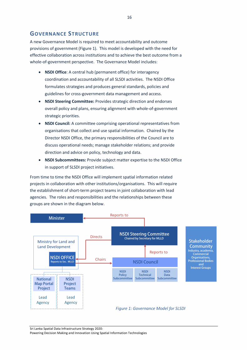
NSDI OFFICEReports to Sec. MLLD
NationalMap Portal
Project
NSDI Council
NSDI Steering CommitteeChaired by Secretary for MLLD
Ministry for Land and Land Development
Directs
Chairs
NSDIProjectTeams
Lead Agency
NSDIPolicy
Subcommittee
NSDITechnical
Subcommittee
NSDIData
Subcommittee
Reports to
MinisterReports to
ICTA
Stakeholder Community
Industry, academia, Commercial
Organisations, Professional Bodies
andInterest Groups
Lead Agency
Lead Agency
GOVERNANCE STRUCTURE A new Governance Model is required to meet accountability and outcome provisions of government (Figure 1). This model is developed with the need for effective collaboration across institutions and to achieve the best outcome from a whole-of-government perspective. The Governance Model includes:
• NSDI Office: A central hub (permanent office) for interagency coordination and accountability of all SLSDI activities. The NSDI Office
formulates strategies and produces general standards, policies and guidelines for cross-government data management and access.
• NSDI Steering Committee: Provides strategic direction and endorses overall policy and plans, ensuring alignment with whole-of-government
strategic priorities.
• NSDI Council: A committee comprising operational representatives from organisations that collect and use spatial information. Chaired by the
Director NSDI Office, the primary responsibilities of the Council are to discuss operational needs; manage stakeholder relations; and provide
direction and advice on policy, technology and data.
• NSDI Subcommittees: Provide subject matter expertise to the NSDI Office in support of SLSDI project initiatives.
From time to time the NSDI Office will implement spatial information related projects in collaboration with other institutions/organisations. This will require the establishment of short-term project teams in joint collaboration with lead agencies. The roles and responsibilities and the relationships between these groups are shown in the diagram below.
Figure 1: Governance Model for SLSDI
Sri Lanka Spatial Data Infrastructure Strategy 2020: Powering Decision Making and Innovation Using Spatial Information Technologies
17
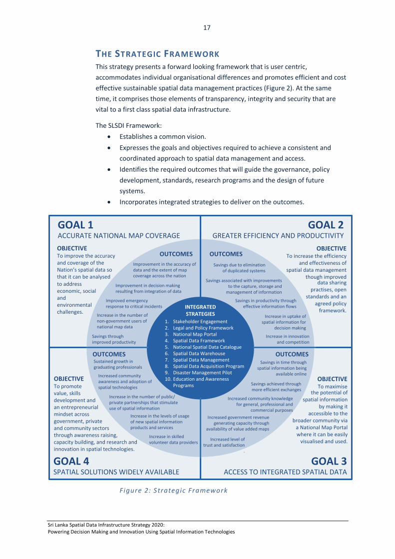
THE STRATEGIC FRAMEWORK This strategy presents a forward looking framework that is user centric, accommodates individual organisational differences and promotes efficient and cost effective sustainable spatial data management practices (Figure 2). At the same time, it comprises those elements of transparency, integrity and security that are vital to a first class spatial data infrastructure.
The SLSDI Framework: • Establishes a common vision. • Expresses the goals and objectives required to achieve a consistent and
coordinated approach to spatial data management and access. • Identifies the required outcomes that will guide the governance, policy
development, standards, research programs and the design of future systems.
• Incorporates integrated strategies to deliver on the outcomes.
Figure 2: S trategic Framework
Savings in time through spatial information being
available online
OBJECTIVETo improve the accuracy and coverage of the Nation’s spatial data so that it can be analysedto address economic, social and environmental challenges.
OBJECTIVETo increase the efficiency
and effectiveness of spatial data management
though improved data sharing
practises, open standards and an
agreed policy framework.
Improved emergency response to critical incidents
GOAL 1ACCURATE NATIONAL MAP COVERAGE
GOAL 2GREATER EFFICIENCY AND PRODUCTIVITY
1. Stakeholder Engagement2. Legal and Policy Framework3. National Map Portal4. Spatial Data Framework5. National Spatial Data Catalogue6. Spatial Data Warehouse7. Spatial Data Management8. Spatial Data Acquisition Program9. Disaster Management Pilot 10. Education and Awareness
Programs
INTEGRATED STRATEGIES
Increased government revenue generating capacity through
availability of value added maps
OUTCOMES
Increased community knowledge for general, professional and
commercial purposes
Savings achieved through more efficient exchanges
Increased level of trust and satisfaction
.
OUTCOMES OUTCOMESImprovement in the accuracy of data and the extent of map coverage across the nation
Improvement in decision making resulting from integration of data
Sustained growth in graduating professionals
Increase in the number of public/private partnerships that stimulate use of spatial information
Increased community awareness and adoption of spatial technologies
Increase in the levels of usage of new spatial information products and services
Increase in skilled volunteer data providers
OBJECTIVETo maximise
the potential of spatial information
by making it accessible to the
broader community via a National Map Portal where it can be easily
visualised and used.
OBJECTIVETo promote value, skillsdevelopment and an entrepreneurial mindset across government, private and community sectors through awareness raising, capacity building, and research and innovation in spatial technologies.
Savings due to elimination of duplicated systems
Increase in innovation and competition
Savings associated with improvements to the capture, storage and
management of information
Increase in uptake of spatial information for
decision making
Savings in productivity through effective information flows
OUTCOMES
GOAL 4SPATIAL SOLUTIONS WIDELY AVAILABLE
GOAL 3ACCESS TO INTEGRATED SPATIAL DATA
Increase in the number of non-government users of national map data
Savings through improved productivity
Sri Lanka Spatial Data Infrastructure Strategy 2020: Powering Decision Making and Innovation Using Spatial Information Technologies
18
GOAL 1: AN ACCURATE NATIONWIDE REPRESENTATION OF THE LANDSCAPE INTEGRATED WITH ECONOMIC, SOCIAL AND ENVIRONMENTAL GEOGRAPHIES
Objective: To improve the accuracy and coverage of the Nation’s spatial data so that it can be analysed to address economic, social and environmental challenges.
With no National Spatial Data Infrastructure in place and with many agencies actively using and collecting spatial information, it is not possible for the user to determine what information is available, which areas are covered and what level of accuracy exists.
Currently it is not possible to access accurate and integrated spatial information across the whole of Sri Lanka with reliability. Data collection is time consuming and expensive, and even with the best efforts of many organisations, there are still significant gaps in coverage. This is an issue.
Incomplete and inaccurate data hampers business processes, creates administrative boundary disputes and may cause time delays in emergency response and evacuation. There is a need to progressively update the accuracy of map coverage across the nation focussing on significant areas and priority data themes. There are also data themes, such as address data and points of interest, needed for future intelligent location-based services.
Data integration is also problematic with current methods. It is difficult to align various data themes (forestry, land use, land slide etc.) to achieve a unified national representation. In addition, there are currently too few linkages across key data sets making the relationships between geographic features difficult to analyse. As a consequence, data are not meaningful in the user’s context. For example, it is not possible for a land developer to query information to understand what can be done on land (land use rights); what cannot be done (restrictions due to landslide risk), and what must be done (reforestation of cleared areas).
OUTCOMES The aim is to achieve the following outcomes for government, private sector, academia and the community.
• Enhanced ability to use spatial data in analysing complex relationships, trends and patterns across a broad spectrum of applications.
• The government of Sri Lanka recognised internationally as a trusted source of information about the countries natural resources, business opportunities and landscape.
• Increased range and scope of spatial data available to address economic, social and environmental challenges.
Sri Lanka Spatial Data Infrastructure Strategy 2020: Powering Decision Making and Innovation Using Spatial Information Technologies
19
GOAL 2: GREATER EFFICIENCY AND PRODUCTIVITY IN THE MANAGEMENT AND SHARING OF SPATIAL DATA
Objective: To increase the efficiency and effectiveness of spatial data management though improved data sharing practises, open standards and an agreed policy framework.
The government actively collects and manages spatial information across the entire nation. It is important that this information is preserved as an information resource for future generations.
This requires an all-encompassing view of how efficiently information is collected and organised, and how the mapping systems of the future are operated. It is vital that the government considers the people, policies, programs, processing and storage of information when committing to improving, automating, sharing and preserving spatial data resources.
Currently, spatial data is managed within closed systems. Spatial information is collected independently by different organisations and data sharing between organisations is restrictive under current policies. In some cases, this had led to duplicated data collection. At times it is unclear which spatial information is the most up-to-date. The risk is that organisations may base decisions on outdated versions of the data.
Currently, data formats are not always compatible across data sets and their structure does not suit multiple government business needs. This makes reuse problematic as data needs to be manually reworked causing time delays and increased overheads.
Costs associated with spatial information are high and therefore productivity improvement is essential to ongoing financial viability. Process improvement means that resources can be redirected to other priorities, including the much needed updating of topographic data which is out-of-date in some areas.
OUTCOMES The aim is to achieve the following outcomes for government, private sector, academia and the community.
• Policy driven productivity improvement across the government sector due to eliminating duplication and improving the capture, storage and management of data.
• Cultural change that delivers the benefits of shared resources and working in cooperation with specific stakeholders and the wider community.
• Increase in innovation and competition resulting from strategic and policy leadership at national and local levels.
Sri Lanka Spatial Data Infrastructure Strategy 2020: Powering Decision Making and Innovation Using Spatial Information Technologies
20
GOAL 3: EVIDENCE-BASED DECISION MAKING IN GOVERNMENT, BUSINESS AND THE WIDER COMMUNITY THROUGH ACCESS TO INTEGRATED SPATIAL INFORMATION
Objective: To maximise the potential of spatial information by making it accessible across government and to the broader community via a National Map Portal.
This objective recognises that improved visualisation techniques are necessary to building community knowledge (general and professional) about the physical landscape, the location of people and changes in the environment.
Because business processes using spatial information often span several government agencies; this objective also recognises the importance of treating spatial information as a service and making it available online through a single portal. A unified view to spatial information will allow users to complete an interaction with government without having to visit individual organisations. Organisations will be able to deliver information, consistently and appropriately, when and where it’s needed most.
There are various bilateral data sharing agreements in place, different pricing models and various ways of managing intellectual property and copyright. This strategy promotes flexible access arrangements that provide ready access to fundamental data and value-added products.
OUTCOMES The aim is to achieve the following outcomes for government, private sector, academia and the community.
• Growth in government revenue generating capacity through the increase in number of value-added map based products available to the wider community.
• Increased community knowledge and enhanced decision making for general, professional and commercial purposes.
• Enhanced level of community satisfaction though better access to spatial information and public confidence in the security of private information.
Sri Lanka Spatial Data Infrastructure Strategy 2020: Powering Decision Making and Innovation Using Spatial Information Technologies
21
GOAL 4: SPATIAL SOLUTIONS READILY AVAILABLE AND WIDELY USED ACROSS SRI LANKA IN RESPONSE TO EMERGING OPPORTUNITIES
Objective: To promote value, skills development and an entrepreneurial mindset across the government, private and community sectors through awareness raising, capacity building, and research and innovation in spatial technologies.
Having the technology to share spatial information is only one aspect of this strategy. It is just as important to have a high level of computer literacy skills within the community to ensure its use; and the professional skills in the workforce, to use it innovatively.
There is a need to actively promote spatial information and advertise the National Map Portal to the broader community. Whilst internet and web-based products are becoming increasingly popular, the majority of the community are not aware of how spatial information can be used. Yet it is the community that can provide valuable local spatial information.
Building the capacity to improve the management and use of spatial information is an important element of this strategy as it increases the range of people, organisations and communities who are able to access, use and collect spatial information and develop new products and services.
Making innovation work requires a workforce with a range of sophisticated skills. Building this capacity is crucial for economic development and growth. This calls for the active promotion of the spatial sciences and increased government partnerships with universities and training providers to ensure the profession has the necessary skills.
In order to develop a range of professional skills, this strategy includes a pilot project for Disaster Management that utilises a range of spatial data sets from across government organisations. The project will test the infrastructure technologies, data formats and standards; and build human resource capacity to develop much larger projects in the future.
OUTCOMES The aim is to achieve the following outcomes for government, private sector, academia and the community.
• Increased community awareness and adoption of spatial technologies through education programs and sustained growth in graduating professionals.
• Increase in the number of public/private partnerships that stimulate use of spatial information through development of an innovative and competitive value adding industry.
• Enhanced level of economic development attributed to increased levels in usage of spatial information products and services.
Sri Lanka Spatial Data Infrastructure Strategy 2020: Powering Decision Making and Innovation Using Spatial Information Technologies
22
HOW WE WILL ACHIEVE OUR GOALS INTEGRATED STRAT EGIES There are ten integrated strategies that collectively represent the major steps towards achieving a Spatial Data Infrastructure for Sri Lanka. These relate to:
1. Stakeholder Engagement 2. Legal and Policy Framework 3. National Map Portal 4. Spatial Data Framework 5. National Spatial Data Catalogue 6. Spatial Data Warehouse 7. Spatial Data Management 8. Spatial Data Acquisition Program 9. Disaster Management Pilot 10. Education and Awareness Programs
1. STAKEHOLDER ENGAGEMENT To ensure that the spatial data infrastructure is a success, it is necessary to fully explore, analyse and document stakeholder requirements. Four important stakeholder groups are recognised:
• Organisations responsible for generating data, such as the Survey Department, Forestry Department and Disaster Management Centre.
• Government departments and commercial enterprises that add value to the data by extracting information from the proposed spatial data warehouse.
• Information users such as administrators, managers, farmers co-operatives, individuals and the general public who acquire benefits from the availability of information.
• Community groups with a special interest in spatial information and its use such as professional bodies, and volunteered geographic information providers and hobbyists.
A participative approach to cooperation and coordination will be adopted to build on common interests and requirements. A stakeholder requirements matrix will be used to determine common, essential and aspirational requirements.
T H E O U T P U T O F T H I S S T R A T E G Y I S A C L E A R U N D E R S T A N D I N G
O F S T A K E H O L D E R R E Q U I R E M E N T S A N D A S H A R E D V I S I O N .
Sri Lanka Spatial Data Infrastructure Strategy 2020: Powering Decision Making and Innovation Using Spatial Information Technologies
23
2. LEGAL AND POLICY FRAMEWORK Agreements on specific policies are required between stakeholders at national, provincial, district and local levels of government. These agreements will provide a clear direction and unified approach to sharing spatial information. They will also empower those responsible for the collection and maintenance of spatial data to adopt best practise methods in the national interest.
The Legal and Policy Framework will be developed using the following ten guiding principles:
• Spatial Data Management: Spatial data management is conducted in a way that maximises its value and optimises resources.
• Data Access: Easy, efficient and equitable access to spatial data where technology, data formats, organisational arrangements, location, costs and conditions do not inhibit its use.
• Maximise Benefits: Data access and pricing regimes maximise net benefits to the community.
• Custodianship: Data custodians manage spatial data as trustees for the community and enable its integration with other information.
• Data Acquisition: The planning, recording and acquisition of spatial data achieves the most strategic use of resources and avoids duplication of effort.
• Respected Rights: Confidentiality, privacy, security and intellectual property rights of data custodians and all sectors of the community, are preserved.
• Industry Engagement: Public/private partnerships are promoted to foster the development of an innovative and competitive value-adding industry.
• Common Practises: Spatial data are compatible and consistent with, internationally recognised standards and guidelines.
• Data Security: Data are maintained in a secure environment and transmitted through secure methods.
• Storage and disposal: Data are held with adequate provision for long-term care including disaster recovery and backup procedures, and are disposed or archived in accordance with ICT regulations.
The Legal and Policy Framework will be continually refined as the spatial industry establishes itself in an online environment.
T H E O U T P U T O F T H I S S T R A T E G Y I S A N A T I O N A L L Y E N D O R S E D
L E G A L A N D P O L I C Y F R A M E W O R K T H A T P R O M O T E S T H E
R E S P O N S I B L E M A N A G E M E N T O F S P A T I A L D A T A A S A C R I T I C A L
R E S O U R C E F O R T H E B E N E F I T O F G O V E R N M E N T A N D T H E
W I D E R C O M M U N I T Y . Sri Lanka Spatial Data Infrastructure Strategy 2020: Powering Decision Making and Innovation Using Spatial Information Technologies
24
3. NATIONAL MAP PORTAL A major deliverable of the Sri Lanka Spatial Data Infrastructure is the design and implementation of the National Map Portal, which will provide all users with timely and secure access to information from various authoritative sources.
The following tasks will be performed:
• Design and develop the National Map Portal • Provide shared map viewing capabilities • Build the Data Catalogue and Data Warehouse according to an
agreed Data Framework • Develop the spatial data services (Web Map Services and Web
Feature Services) • Develop the data download and upload facilities • Implement security services to protect government data • Implement storage for data dissemination • Develop e-commerce capabilities for commercial users
T H E O U T P U T T H I S S T R A T E G Y I S A N O P E R A T I O N A L N A T I O N A L
M A P P O R T A L T H A T P R O V I D E S O N L I N E A C C E S S T O L A Y E R S O F
I N T E G R A T E D S P A T I A L I N F O R M A T I O N .
Sri Lanka Spatial Data Infrastructure Strategy 2020: Powering Decision Making and Innovation Using Spatial Information Technologies
25
4. SPATIAL DATA FRAMEWORK The Data Framework consists of three primary tiers of information:
• Fundamental data themes that support multiple purposes • Specific business application data layers, such as flora and fauna • Socio- economic layers, such as census data
Spatial information users have a recurring need for 14 fundamental data themes. These themes are a priority for the National Map Portal. They are:
• Administrative Boundaries • Reserves • Geodetic Network • Place Names • Cadastre (Future data set) • Imagery • Transportation • Buildings • Utility • Topography • Hydrography • Elevation • Land Use • Street Address (future data set)
In establishing the framework the following actions are required: 1. Identify agency custodial responsibilities for each theme 2. Specify the data sets for each theme 3. Complete gaps in national coverage 4. Collect new data themes i.e. street addresses, cadastre 5. Specify data standards and models 6. Set data restrictions – government and public views 7. Set quality standards and compliance measures 8. Specify update frequency and version control 9. Set the pricing structure (free and fee for value-added services)
T H E O U T P U T O F T H I S S T R A T E G Y I S A N A T I O N A L L Y
R E C O G N I S E D A U T H O R I T A T I V E S O U R C E O F F U N D A M E N T A L
S P A T I A L D A T A T H E M E S D E V E L O P E D O N A C O M M O N
R E F E R E N C E S Y S T E M .
Sri Lanka Spatial Data Infrastructure Strategy 2020: Powering Decision Making and Innovation Using Spatial Information Technologies
26
5. NATIONAL SPATIAL DATA CATALOGUE A major deliverable of the spatial data infrastructure is the catalogue (or data library), which allows users to search for specific information. Building the catalogue requires descriptive metadata; that is, information about the spatial data. It includes the following:
• Data collection methods • Accuracy of source datasets • Projection specifications, scale, exchange format, compression and
file type • Content, quality and geographic extent • Data custodian’s contact information
Descriptive metadata is important from the perspective of an organisation, user and system administrator/developer. Without descriptive metadata it is difficult for a user to access data and impossible to determine its suitability for mapping and analysis.
The management of descriptive metadata remains with the agency that collects and maintains the data itself. The actual metadata catalogue is managed by a central coordinating team to ensure a consistent means of data access via the National Map Portal.
In establishing the National Catalogue all agency metadata will be converted to digital form, and metadata structures and definitions will be referenced to a standard.
T H E O U T P U T O F T H I S S T R A T E G Y I S A N A T I O N A L C A T A L O G U E
‘ L I B R A R Y ’ O F S P A T I A L D A T A A N D D E S C R I P T I V E M E T A D A T A
T H A T E N A B L E S U S E R S T O A C C E S S I N F O R M A T I O N T H R O U G H
T H E N A T I O N A L M A P P O R T A L .
Sri Lanka Spatial Data Infrastructure Strategy 2020: Powering Decision Making and Innovation Using Spatial Information Technologies
27
6. SPATIAL DATA WAREHOUS E In order to disseminate spatial data through the National Map Portal, the data will be stored with each organisation in a decentralised data warehouse environment or alternatively use a centralised storage solution where organisations will be able to upload their spatial data via the Lanka Government Network (LGN). The latter facility will provide much needed additional storage capacity for government and data backup capabilities to reduce the risk of information loss.
This is a significant step. Many organisations rely on computer hard disk storage and portable drives for backup. This means spatial information has limited accessibility and is subject to data loss through corrupted storage devices.
This strategy proposes standard principles for data storage and these will form part of the data custodian responsibilities. They are:
• Data Security: Data are maintained in a secure environment and transmitted through secure methods.
• Storage: Data are held with adequate provision for long-term care including disaster recovery and backup procedures.
• Disposal: Data that are not required are disposed or archived in accordance with the Government’s record keeping legislation.
T H E O U T P U T O F T H I S S T R A T E G Y I S A D A T A W A R E H O U S E T H A T
P R O V I D E S D A T A C U S T O D I A N S W I T H T H E A B I L I T Y T O U P L O A D
( A N D B A C K U P ) T H E I R S P A T I A L D A T A H O L D I N G S T O A S E C U R E
C E N T R A L S T O R A G E A R E A F O R D I S S E M I N A T I O N V I A T H E
N A T I O N A L M A P P O R T A L .
Sri Lanka Spatial Data Infrastructure Strategy 2020: Powering Decision Making and Innovation Using Spatial Information Technologies
28
7. SPATIAL DATA MANAGEMENT There is a significant opportunity to derive benefits from the removal of legislative, administrative, policy and functional impediments which give rise to duplication in data collection, access limitations, information gaps and costly inefficiencies.
It is proposed to seek a commitment to greater information sharing and access by means of an intergovernmental charter which articulates the principles and some specific undertakings of data custodians. These include:
• Access: All data is consolidated and accessed in the most cost-effective way through the National Map Portal
• Avoid Duplication: All projects and activities that give rise to substantial datasets will establish at the outset whether suitable data already exist.
• Standards Compliance: Best practice guidelines and standards are used to manage the currency, completeness, accuracy and consistency of data to enhance the integration of individual and disparate data sets.
• Metadata: Appropriate metadata and common vocabulary is used to accurately define and describe spatial data including content, geographic extent, purpose, characteristics, currency and accessibility, together with contact details for further information.
• Maintenance and Revision: Data are revised and maintained according to a program of work that meets agency business priorities and broader government commitments.
• Quality Assurance: Appropriate audit processes are applied to each dataset to produce data that are fit for purpose before release.
• Value Adding: Data is in a form suitable for further value-adding by internal and external customers.
• Legal Compliance: Data is compliant with laws and regulations governing data attribution and usage, and is managed in accordance within approved privacy and data sensitivity guidelines.
T H E O U T P U T O F T H I S S T R A T E G Y I S A N A G R E E D S E T O F
C O M M O N O P E R A T I N G P R I N C I P L E S R E L A T I N G T O T H E
C A P T U R E , M A I N T E N A N C E , S U P P L Y , U S E A N D M A N A G E M E N T
O F S P A T I A L I N F O R M A T I O N .
Sri Lanka Spatial Data Infrastructure Strategy 2020: Powering Decision Making and Innovation Using Spatial Information Technologies
29
8. SPATIAL DATA ACQUISITION PROGRAM Each year government agencies purchase a wide range of spatial information including aerial photography and satellite imagery. The cost of this information can run into millions of rupee per year. Given the potential for overlap, this strategy proposes a coordinated Spatial Data Acquisition Program to ensure strategic investment and use of resources.
The objective is to reduce costs associated with the capture, storage and management of information by:
• Planning, recording and acquiring spatial information through one channel.
• Clear oversight of nationally/internationally funded Projects that acquire spatial information.
• Acquiring multi-user licenses for imagery to enable reuse by many organisations.
• Maintaining a single version of key government spatial information. • Leveraging greater value through economies of scale and
consolidated spend. • Establishing an annual program of work where organisations can
register their requirements annually.
T H E O U T P U T O F T H I S S T R A T E G Y I S A D A T A A C Q U I S I T I O N
P R O G R A M T H A T P R O V I D E S A C O O R D I N A T E D A N D C O S T
E F F E C T I V E A P P R O A C H T O S P A T I A L D A T A C O L L E C T I O N ,
P R O C U R E M E N T A N D M A N A G E M E N T .
Sri Lanka Spatial Data Infrastructure Strategy 2020: Powering Decision Making and Innovation Using Spatial Information Technologies
30
9. DISASTER MANAGEMENT PILOT
The Disaster Management Application will pilot the spatial data sharing methods that will be implemented in the Sri Lanka Spatial Data Infrastructure. The pilot project aims to deliver early results so that the capabilities of the Spatial Data Infrastructure are made visible, benefits accrued early, and momentum is maintained towards the longer-term vision. It will also build technical and policy skills required for the implementation and ongoing management of the SLSDI.
This staged approach is an appropriate course of action. By nature NSDI development is a long-term project. With a staged approach it is possible to encompass the dynamic nature of the country’s strategic outlook with timely actions for data integration and system development.
The Disaster Management Application will use spatial information obtained from several organisations across the government sector. The pilot will test the following:
• Data availability and accessibility
• Spatial Data Sharing Policies
• Multilayer approach to visualising data
• Ability to consume Web Map Services
• User access methods and restrictions
• Gap analysis on National capabilities
• Data storage and retrieval • Metadata creation • Implementation Road Map • Resource capacity and
capabilities
The Disaster Management Application is the first of many thematic applications that will be built using the Spatial Data Infrastructure. Lessons learned will be adopted for other thematic areas.
T H E O U T P U T O F T H I S S T R A T E G Y I S A D I S A S T E R M A N A G E M E N T
A P P L I C A T I O N B U I L T U S I N G T H E S P A T I A L D A T A
I N F R A S T R U C T U R E D A T A M A N A G E M E N T A N D D A T A E X C H A N G E
M E T H O D S .
Sri Lanka Spatial Data Infrastructure Strategy 2020: Powering Decision Making and Innovation Using Spatial Information Technologies
31
10. EDUCATION AWARENESS PROGRAMS To ensure the best use of spatial information within the professional and general community this strategy proposes the following activities:
• Actively raise awareness of spatial information and promote the use of the National Map Portal to the community through various media.
• Capacity planning to identify the spatial core competencies and common skills sets required and incorporate these into existing training programs to increase the uptake of spatial technologies in the government sector.
• Support research, innovation and skills development through open access to spatial information.
T H E O U T P U T O F T H I S S T R A T E G Y I S A N E D U C A T I O N P R O G R A M
T H A T R A I S E S A W A R E N E S S , A N D B U I L D S C A P A C I T Y A N D
C A P A B I L I T Y I N S P A T I A L T E C H N O L O G I E S .
MILESTONES Sri Lanka Spatial Data Infrastructure Strategy 2020: Powering Decision Making and Innovation Using Spatial Information Technologies
32
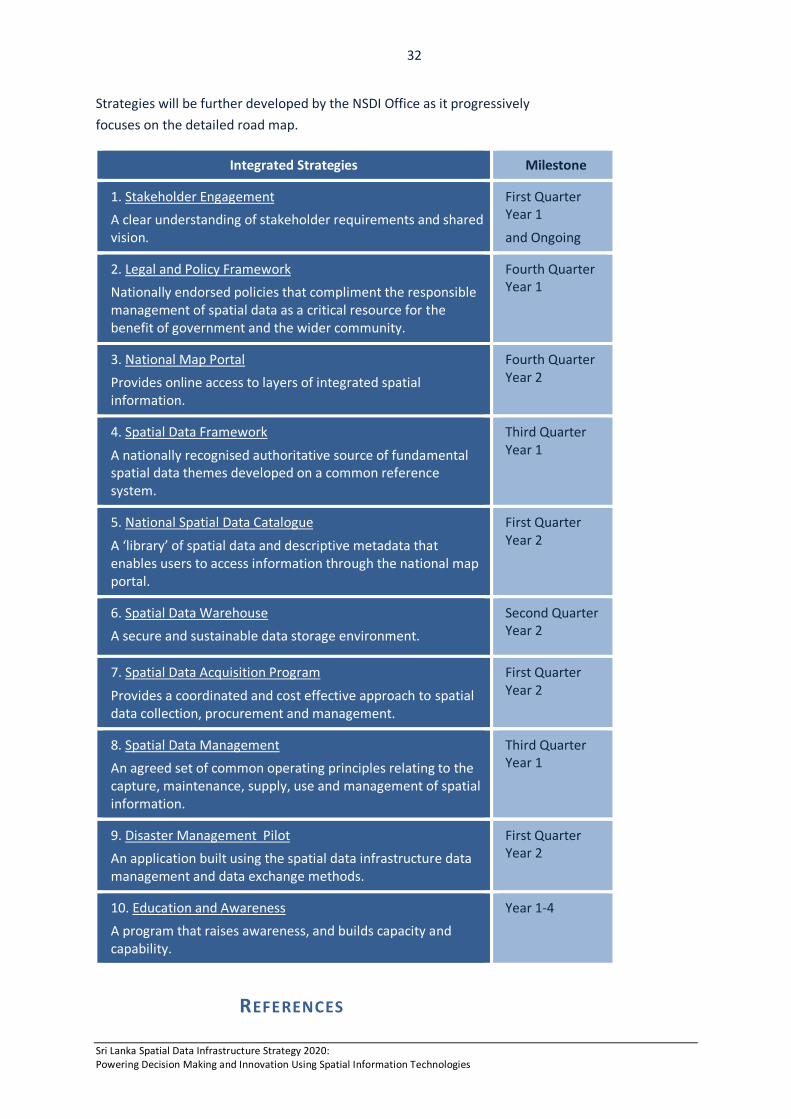
Strategies will be further developed by the NSDI Office as it progressively focuses on the detailed road map.
Integrated Strategies Milestone
1. Stakeholder Engagement A clear understanding of stakeholder requirements and shared vision.. .
First Quarter Year 1
and Ongoing
2. Legal and Policy Framework Nationally endorsed policies that compliment the responsible management of spatial data as a critical resource for the benefit of government and the wider community.
Fourth Quarter Year 1
3. National Map Portal Provides online access to layers of integrated spatial information.
Fourth Quarter Year 2
4. Spatial Data Framework
A nationally recognised authoritative source of fundamental spatial data themes developed on a common reference system.
Third Quarter Year 1
5. National Spatial Data Catalogue
A ‘library’ of spatial data and descriptive metadata that enables users to access information through the national map portal.
First Quarter Year 2
6. Spatial Data Warehouse A secure and sustainable data storage environment.
Second Quarter Year 2
7. Spatial Data Acquisition Program
Provides a coordinated and cost effective approach to spatial data collection, procurement and management.
First Quarter Year 2
8. Spatial Data Management An agreed set of common operating principles relating to the capture, maintenance, supply, use and management of spatial information.
Third Quarter Year 1
9. Disaster Management Pilot An application built using the spatial data infrastructure data management and data exchange methods.
First Quarter Year 2
10. Education and Awareness A program that raises awareness, and builds capacity and capability.
Year 1-4
REFERENCES Sri Lanka Spatial Data Infrastructure Strategy 2020: Powering Decision Making and Innovation Using Spatial Information Technologies
33
ACIL Tasman (2008) The Value of Spatial Information: The impact of modern spatial information technologies on the Australian economy, available at http://www.crcsi.com.au/Resources/general-interest, accessed Oct 2013.
Costello, C., Rassweilerb, A., Siegelc, D., De Leod, G., Michelie, F. and Rosenbergf, A. (2009) The value of spatial information in MPA network design, Proceedings of the National Academy of Science USA, December 2009.
Geographic Information Panel (GIP) (2008) Place Matters: the Location Strategy for the United Kingdom (pp.8-39). London.
Government of Sri Lanka Ministry of Finance and Planning (MFP) (2010), Sri Lanka: The Emerging Wonder of Asia, Mahinda Chintana (Vision for the Future), The Development Policy Framework, Colombo.
BIBLIOGRAPHY
ICTA (Transforming a Nation through Information Technology, available at http://www.icta.lk/en/e-sri-lanka.html, accessed June 2014.
Department of National Planning and Ministry for Finance and Planning
(2010) Mahinda Chinthanaya: Vision for the Future, The Development Policy Framework, (http://www.treasury.gov.lk/publications/npd/mahindaChintanaVisi
on-2010full-eng.pdf, Government of Sri Lanka, available at accessed July 2014.
Ministry for Disaster Management (2014) Sri Lanka Comprehensive Disaster Management Program 2014 – 2018, p.15, published March 2104.
Ministry for Economic Development (2010) National Tourism Development
Strategy 2011-2016, available at http://srilanka.travel/catalog/view/theme/default/image/pdf/English.pdf, accessed June 2014.
Ministry for Environment (2009) National Action Plan for Harita Lanka
Programme available at http://www.environmentmin.gov.lk/web/pdf/Harita_Lanka_Book_small.pdf, accessed June 2014.
Ministry of Environment and Natural Resources (2014) National Sustainable
Development Strategy, under development, available at http://www.un.org/esa/agenda21/natlinfo/countr/slanka/nsds.pdf, draft accessed June 2014.
Sri Lanka Spatial Data Infrastructure Strategy 2020: Powering Decision Making and Innovation Using Spatial Information Technologies
34
Ministry for National Planning and Ministry for Finance and Planning (2013) Unstoppable Sri Lanka 2020: Public Investment Strategy 2014-2016, available at http://www.treasury.gov.lk/news-and-events/541-budget-2014-1.html, accessed June 2014.
Presidential Secretariat of Sri Lanka (2013), SMART Government, available at http://www.presidentsoffice.gov.lk/index.php?option=com_k2&view=item&id=194:our-vision-is-a-smart-sri-lanka-president, accessed July 2014.
UN-SPIDER (2011) Technical Advisory Mission, unpublished works, 17-21 October.
UN.HABITAT (2000) National Climate Change Adaptation Strategy for Sri Lanka 2011-2016 (NCCAS), available at http://www.climatechange.lk/adaptation/Files/Strategy_Booklet-Final_for_Print_Low_res(1).pdf, accessed May 2014.
ACKNOWLEDGEMENTS The Sri Lanka Spatial Data Infrastructure Strategy represents the position and deliberations of the National Spatial Data Infrastructure (NSDI) Working Group and was prepared by Dr Lesley Arnold, World Bank Consultant. It includes contributions from government agency representatives through workshop discussions.
The NSDI Working Group members are:
Mr. Wasantha Deshapriya, Director, Re-Engineering Government Program
Mr. S.M.P.P. Sangakkara, Additional Surveyor General, Survey Department
Mrs. A. L. S. C. Perera, Deputy Survey General, Survey Department
Mr. K Prasanna Chandith, Director, National Disaster Relief Service Centre
Mr. Ajith Wijemanne, Deputy Director, Department of Meteorology
Mrs. Kumari Weerasinghe, Senior Scientist, National Building Research Organization
Mr. Srimal Samansiri, Assistant Director, Disaster Management Centre
Mr. E. A. P. N. Edirisinghe, Deputy Conservator of Forests, Forest Department
Mr. Ajith Silva, Director, Ministry of Environmental and Renewable Energy
Ms A.D.P.N. Attygalle, Assistant Secretary, Ministry of Land and Land Development
MORE DETAILS For further information regarding this strategy contact:
Wasantha Deshapriya Chair, NSDI Working Group Director, Re-engineering Government Programme, ICTA Tel: +94-777584312; Fax: +94-1-2369091; Email: [email protected]
PHOTOGRAPHY Courtesy Sri Lanka Tourism Development Authority
Sri Lanka Spatial Data Infrastructure Strategy 2020: Powering Decision Making and Innovation Using Spatial Information Technologies

35
Sri Lanka Spatial Data Infrastructure Strategy 2020: Powering Decision Making and Innovation Using Spatial Information Technologies