Embed Size (px)
Citation preview
Rother District Council
Committee - Planning RotherDistrict Council
Date and Time - Thursday 18 July 20139:30am — 1:00pm and 2:00pm until close of business
(At the discretion of the Chairman, the timing of lunch may be varied)
Venue - Town Hall, Bexhill-on-Sea
Councillors appointed to the Committee:B. Kentfield (Chairman), C.N. Ramus (Vice-Chairman), Mrs M.L. Barnes, J.J. Carroll,P.R. Douart, R.V. Elliston, Mrs J.P. Gadd, A.E. Ganly, I.G.F. Jenkins (ex-officio), J.A.Lee, Mrs S.M. Prochak, S.H. Souster, D.W.L.M. Vereker, M.R. Watson and Mrs D.C.Williams.
AGENDA
1. MINUTES — To authorise the Chairman to sign the minutes of the meeting ofthe Committee held on 20 June 2013 as a correct record of the proceedings.
2. APOLOGIES FOR ABSENCE
3. ADDITIONAL AGENDA ITEMS — To consider such other items as theChairman decides are urgent and due notice of which has been given to theChief Executive by 12 noon on the day preceding the meeting.
4 WITHDRAWN APPLICATIONS — The Head of Planning to advise Members ofthose planning applications on the agenda which have been withdrawn.
5. DISCLOSURE OF INTEREST — To receive any disclosure by Members ofpersonal and disclosable pecuniary interests in matters on the agenda, thenature of any interest and whether the Member regards the interest asprejudicial under the terms of the Code of Conduct. Members are reminded ofthe need to repeat their declaration immediately prior to the commencement ofthe item in question.
PageNo.
6. PLANNING APPLICATIONS — Report of the Director of Services. -
NOTE: Representations on any items on the Agenda must be received inwriting by 9:00am on the day preceding the meeting.
This agenda can be made available in large print, Braille,audiotape/CD or in another language upon request. For all enquiries
please contact [email protected]: 01424 787812Rother District Council
Putting Customers First, Delivering Value for Money,Building Stronger, Safer Communities and Working in Partnership

PageNo.
7. REPORT OF THE DIRECTOR OF SERVICES1) Appeals.
8. TO NOTE THE DATE AND TIME FOR FUTURE SITE INSPECTIONS -
Tuesday 20 August 2013 at 8:30am departing from the Town Hall, Bexhill.
Derek Stevens Despatch date: 10 July 2013Chief Executive
NOTE: Representations on any items on the Agenda must be received in writing by9:00am on the day preceding the meeting.
Enquiries — please ask for Louise Cook (Tel: 01424 787812)For details of the Council, its elected representatives and meetings, visit the Rother District
Council website www.rother.gov.uk
Rother District Council Agenda Item: 7.1
Report to - Planning Committee
Date - 18July2013
Report of the - Director of Services
Subject - Appeals
Recommendation: It be RESOLVED: That the report be noted.
Head of Service: Tim Hickling
APPEALS LODGED
RR/2012/1 791/P Dens Wood — Land at, Kent Lane, BrightlingMr K HatcherThe construction of timber stables and barn building forthe welfare of 3 horses and the storage of associatedfeed and equipment. Formation of new vehicular accesspoint.
RR/2012/2527/P Rosemary, Bellhurst Road, RoberlsbridgeRother Developments LimitedDemolition of existing bungalow and garage andconstruction of 2 detached dwellings with integralgarages and new accesses. (Alternative to schemeapproved under RR/201 1/18461P)
RR/2012/2004/P 60 Barrack Road, BexhillMr Shaun PollingtonDemolition of existing bungalow and construction of 4 x 3bedroom self-contained flats with parking spaces for 7cars. (Resubmission of RR/201 2/1 074/P)
RR/201 1/2309/P Phoebes Wood, Fontridge Lane, BurwashMr Sven EmbergThe erection of a Country House.
RR/2012/1 964/P St John The Baptist Church — Land Adj, BattleDr Tim ReedTo change the use of part of an area of scrub/woodlandon which to construct a car parking area to accommodate3 cars ancillary to the private residential use of the oldschool.
RR/2012/1 884/P The Stables, Morlais Ridge, Winchelsea, IckleshamMr Andrew HodgsonChange of use from existing wooden oak barn to a onebedroom domestic property.
p1130718 - Appeals 1
APPEALS ALLOWED
RR1201 2/794/P Bramble Farm, Staplecross Road, EwhurstMr & Mrs L and J StanleyRemove Condition 1 and amend Condition 3 ofENF/EWH/2006/393 to enable permanent mixedagricultural and residential use, by the stationing of amobile home and 2 touring caravans used for residentialpurposes.
APPEALS DISMISSED
RR/2013/301/P Adanac, Whatlington Road, BattleMrA Green and Ms S GibbRemoval of existing car port structure. Erection of 2storey rear extension and rebuilding of side entranceporch.
RR!2012/794/P Bramble Farm, Staplecross Road, EwhurstMr& Mrs LandJ StanleyRemove Condition 1 and amend Condition 3 ofENF/EWH/2006/393 to enable permanent mixedagricultural and residential use, by the stationing of amobile home and 2 touring caravans used for residentialpurposes — Costs claim rejected
HIGH COURT CHALLENGES
RR/201 2/1 278/P Ticehurst Recreation Ground (MUGA), Lower HighStreet, Ticehurst.Application for Judicial Review lodged 21 January 2013by Mrs S May seeking the quashing of the planningpermission which removed the hours of use condition.
FORTHCOMING HEARINGS/INQUIRIES
RR/2012/1 385/P Edlins Farm, Mountfield Lane, MountfieldErection of single storey farmhouse.10:00am on 22 August 2013 in the Committee Room atthe Town Hall, Bexh ill.
RR/2012/1 141/P Bantham Farm, London Road, TicehurstConversion of a disused/redundant building to residentialuse.Postponed — new date awaited — Reconvened hearing— 10:00am on 28 August 2013 in the Council Chamber atthe Town Hall, Bexhill.
Anthony LeonardDirector of Services
p1130718 - Appeals 2
Rother District Council Agenda Item: 6
Report to - Planning Committee
Date - 18 July 2013
Report of - Director of Services
Subject - Planning Applications
Head of Service: Tim Hickling
Planning Committee Procedures
Background PapersThese are planning applications, forms and plans as presented in the Agenda.Correspondence between the applicant, agents, consultees and otherrepresentatives in respect of the application. Previous planning applications andcorrespondence where relevant, reports to Committee, decision notices and appealdecisions which are specifically referred to in the reports. Planning applications canbe viewed on the planning website www.planning.rother.gov.uk.
Planning Committee ReportsIf you are viewing the electronic copy of the Planning Applications report to PlanningCommittee then you can access individual reported applications by clicking on thelink (View application/correspondence) at the end of each report.
ConsultationsRelevant consultation replies which have been received after the report has beenprinted and before the Committee meeting will normally be reported orally in asummary form.
Late Representations and Requests for DefermentAny representations and requests for deferment in respect of planning applicationson the Planning Committee agenda must be received by the Head of Planning inwriting by 9am on the Wednesday before the meeting at the latest. The Council willnot entertain a request for deferment unless it is supported by a full statementcontaining valid reasons for the request.
Delegated ApplicationsIn certain circumstances the Planning Committee will indicate that it is only preparedto grant or refuse planning permission if, or unless certain amendments to a proposalare undertaken or subject to completion of outstanding consultations. In thesecircumstances the Head of Planning can be delegated authority to issue the decisionof the Planning Committee once the requirements of the Committee have beensatisfactorily complied with. A delegated decision does not mean that planningpermission or refusal will automatically be issued, If there are consultationobjections, difficulties, or negotiations are not satisfactorily concluded, then theapplication will have to be reported back to the Planning Committee or reported viathe internal only electronic Notified D system as a means of providing furtherinformation for elected Members. This delegation also allows the Head of Planningto negotiate and amend applications, conditions, reasons for refusal and notescommensurate with the instructions of the Committee. Any applications which are
1
considered prior to the expiry of the consultation reply period are automaticallydelegated for a decision.
The Council does not allow the recording or photographing of its proceedings.
Order of PresentationThe report on planning applications is presented in the following order as shownbelow:
Rye (Rye Ward)Beckley, Northiam, Peasmarsh, Rye Foreign (Rother Levels Ward)Brede, Udimore, Westfield (Brede Valley Ward)Camber, East Guideford, lcklesham, Iden, P/ayden (Eastern Rother Ward)Ewhurs1, Sedlescombe (Ewhurst and Sed/escombe Ward)Fairlight, Guestling, Pett (Marsham Ward)Bexhill (All Wards)Battle (Battle Town/Crowhurst/Da,well Wards)Ashburnham, Catsfield, Crowhurst Penhurst (Cr0 whurst Ward)Brightling, Burwash, Dal/ington, Mountfie/d, Whatlington (Darwell Ward)Bodiam, Hurst Green, Salehurst & Robertsbridge (Salehurst Ward)Ticehurst, Etchingham (Ticehurst and Etchingham Ward)Neighbouring Authorities
REFERENCE PAGE PARISH SITE ADDRESS
RR/2013/356/P 2 RYE 14 Tower Street —
Building next to
RR/2013/835/P 10 BECKLEY Land at Kings Bank Lane
RR12013/955/P 19 BECKLEY Land known as Oak TreeHouse(formerly Royal Oak PublicHouse), Main Street
RR/201 3/861/P 28 GUESTLING Spring Bank — land adjacentto, Butchers Lane, Three Oaks
RR12013/865/P 37 BEXHILL 21 South Cliff
RR/2013/1 051/P 45 BEXHILL Cooden Beach HotelCooden Sea Road
RR/2013/1206/P 52 BEXHILL 14 Willow Drive
RR/201 1/1027/P 58 CATSFIELD Wylands Angling CentrePowdermill Lane
RR/2012/151/P 69 CATSFIELD Wylands FarmPowdermill Lane
RR/2013/101 1/P 79 WHATLINGTON Units 32-37 Vinehall BusinessPark, Vinehall Road
2

RR/2013/1 158/P 91 HURST GREEN Old Orchard adjacent WincotLondon Road
RR/201 3/879/P 96 SALEHURST/ Beech House FarmROBERTSBRIDGE Beech House Lane
3
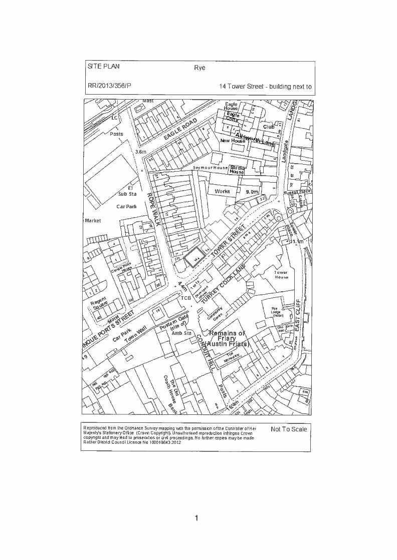
TE PLAN Rye
RR/2013!356/P 14 Tower Street - building next to
Not To ScaleReprthic from the Ornence Sur.ey mappng v.th the pennssron ofthe Controller otHer1.1 ajest’Js Stationery (Cro C opynght LI nauthorised reproJctIon infringes Crowicopight and may lead to pmoetinn or dI proceedings. No hjher pies maybe madeRotherDsthd Coundl Licen No 1000 10n 2012
1
Planning Committee 18 July 2013
RR120131356/P RYE 14 Tower Street — building next to
Partial demolition of existing warehouse andconstruction of new enlarged roof and new front andside elevations and formation of 2 no ground floorshops and 2 no flats above.
Applicant: Mrs Susan MurdochAgent: GSL Design PartnershipCase Officer: Mr J McSweeney (Tel: 01424 787617)
(Email: [email protected])Parish: RYEWard Member: Councillor Lord Ampthill and Councillor S H SousterReason for Commiftee consideration: Head of Planning referral - History of siteStatutory 8 week date: 17 April 2013
This application has been added to the Committee site inspection list.
1.0 POLICIES
1.1 Policies GD1 (ii)(iii)(iv)(viii) and RY6 of the Rother District Local Plan (2006).
1.2 Policies OSS5, EN2 and RY1 of the Rother District Local Plan - CoreStrategy.
2.0 SITE
2.1 The application site comprises a former warehouse building fronting TowerStreet on its northern side. The building recently gained planning permissionfor 75% light industrial and 25% retail and is trading as such, It is bordered bya shop with a flat above to the northeast, by the former public conveniences tothe southeast and to the rear a terrace of houses (at a lower ground level) inRope Walk. The site is set within the Rye Conservation area and shoppingarea as defined within the Rother District Local Plan.
2.2 The building is brick built with a tile roof. To the main street is a large accessdoor.
3.0 HISTORY (relevant)
3.1 R157/7 Furniture repository — Approved conditional.
RR/2009/929/P Change of use from warehouse to commercial andprivate housing use — Withdrawn.
2
RR/2009/1 595/P Demolition of existing warehouse and construction of new2 storey building to provide shop and 2 first floor flats —
Refused.
RR/2012/1 072/P Partial demolition of existing warehouse and constructionof new enlarged roof and new front and side elevationsand formation of 2 no. ground floor shops and 2 no. flatsabove — Refused.
RR/2012/1589/P Change of use from warehouse to 75% light industrial +
25% retail. New front entrance to sit behind the existingroller shutter — Approved conditional.
4.0 PROPOSAL
4.1 This application seeks permission for the partial demolition of existingwarehouse and construction of new enlarged roof and new front and sideelevation and formation of 2 no. ground floor shops and 2 no. flats above.
4.2 Revisions have been made to the previous refused scheme(RR/2012/1072/P) seeking to address the Council’s concerns. In this respectthe agent states:“In recognition of the concerns of the neighbours in Rope WaIk regarding lossof daylight and potential overlooking, the previously submitted additionalpitched roof to the rear has now been amended to a flat roof with a pitchedroof frontage down to the existing rear flat roof level. Also, the existing rearwall has been reduced in height by approximately 1.5m and tile-hangingintroduced between this level and the eaves above, to reduce the mass ofbrickwork on this elevation, thereby improving the outlook for the adjoiningneighbours. The result of these changes is that there is now a minimalprojection of the new rear roof above the line of the existing corrugated roofthus considerably minimising loss of sunlight/daylight to the properties at therear. In order to address the issue of overlooking, the rear-facing Velux roofwindows have been divided into pairs of a smaller size and upstandsintroduced to each side of those which would be subject to overlooking fromthe upper level of no. 3 Rope Walk.. .Also the potential for overlooking fromthe Velux windows Thto the rear gardens and windows of properties in RopeWalk has been addressed by setting the sill level high and providing a verticalstainless steel mesh screen across the bottom of the Velux windows, securedto the side upstands, and with the top level with the sills. This means thatthere will be no view downwards, and no overlooking.”
5.0 CONSULTATIONS
5.1 Town Council:
5.1.1 Support refusal. Overbearing. Adverse impact on the amenity of theoccupants of neighbouring residential properties. Inconsistent plans.
3
5.2 Highway Authority:
5.2.1 No representations received.
5.3 Planning Notice:
5.3.1 Rye Conservation Society has no objection subject to neighbours.
5.3.2 Two letters of objection have been received, their concerns have beensummarised below;• Take light from my property.• Flat roof will provide ideal nesting sites for seagulls.• Overlooking from windows in rear.• No provision for waste bins or cycles.• Premises already provides employment and business activity to this street
and Rye.• Shows no further consideration towards the privacy and light sources to
our property than the previous refused scheme.
5.3.3 One letter in support of the proposal, their points are summarised below;• Improvement to the building.• Advantageous — providing more jobs and low cost housing both of which
are needed in Rye.
6.0 APPRAISAL
6.1 Issues for consideration
6.1.2 Like the previous refused scheme (RR!2012/1072/P), the main issues forconsideration are;• Design in relation to the Conservation Area.• Impact upon adjoining residents.• Acceptability of use in this locality.• Highway implications.• Provision of facilities within the scheme
6.2 Design and Conservation Area
6.2.1 Policy GD1 (vii) of the Rother District Local Plan (2006) states thatdevelopment should not prejudice the character, appearance or setting ofconservation areas.
6.2.2 Policy EN2 of the Rother District Local Plan - Core Strategy states thatdevelopment affecting the historic built environment will be required toreinforce the special character of the district’s historic settlements and makereference to the character analysis in Conservation Area Appraisals.
6.2.3 The existing warehouse building, constructed in the fifties or sixties, is plain,modest in detail, constructed with a brick frontage and may be consideredneutral in terms of preserving the special character of the Conservation Area.The scale of the existing warehouse building fits acceptably within the street
4
frontage providing a transition from the low level former public convenienceson the one side to the higher buildings on the rest of Tower Street.
6.2.4 This application seeks the conversion of the existing warehouse building. Thedesign approach is constrained by the existing parameters of the building,albeit that a new roof design is now proposed. From a purely design aspectthe simple fenestration details and alterations in roof design are simplesolutions to an existing warehouse building, which would not be at odds to theappearance and character of this locality.
6.2.5 While velux rooflights are still provided in the rear elevation they would not bereadily viewed from any public viewpoint. Furthermore, a pitched roofelement is proposed on the southern aspect of the rear roof to conceal the flatroof behind.
6.3 Impact upon adioining residents
6.3.1 Policy GD1 (ii) of the Rother District Local Plan (2006) states thatdevelopment should be in keeping with and not unreasonably harm theamenities of adjoining properties. This is echoed in Policy OSS5 (ii) of theRother District Local Plan - Core Strategy.
6.3.2 The site has a very close relationship with properties in Rope Walk, especiallyno. 3, in places being within a metre from this property. Therefore carefulconsideration of potential impact upon this and neighbouring properties isessential and has always been a major issue with any changes to thisbuilding.
6.3.3 It is intended to alter the roof profile from the existing single pitch to a flat roofon the rear section with a pitch roof to the street frontage. It is also proposedto reduce the existing height of the rear wall by at least a metre. The changedprofile of the building is such, that the physical relationship with no. 3 RopeWalk is no worse than that existing.
6.3.4 In respect to overlooking; 9 velux windows are proposed facing Rope Walk,however, 3 are at a high level positioned towards the centre of the buildingand will not allow any views over neighbouring properties.
6.4.4 The close relationship with properties in Rope Walk has been considered inthe design of the velux windows. Firstly the cill height of the windows is at1 .7m (above floor level), and vertical stainless steel mesh screen are to befitted across the bottom of the windows. Furthermore, upstands are to beintroduced to the sides of the windows to mitigate against oblique viewsacross to Rope Walk properties. These mitigation measures are sufficient toprevent demonstrable harm to the amenities of neighbouring properties byvirtue of overlooking.
6.4 Highway implications
6.4.1 Policy GD1 (iii) of the Rother District Local Plan (2006) states that alldevelopment should provide for adequate and safe access by all relevantmodes of transport and provide adequate parking provision.
5
6.4.2 Policy 006 (ii) of the Rother District Local Plan - Core Strategy states that asafe physical environment will be facilitated by ensuring that all developmentavoids prejudice to road and/or pedestrian safety.
6.4.3 Whilst the Highway Authority has been consulted no representations havebeen received. No adverse comments were received in respect of theprevious application RR/201 2/1072/P.
6.4.4 It is fair to assume that the proposed shops and flats may generate a slightincrease in vehicular movements compared with the existing use. It is evidentthat no parking (cycle or vehicular) can be provided on site as part of thisproposal. Whilst concerns could be expressed regarding the lack of parkingprovided, it has to be accepted that there is no parking at present. Taking intoaccount the town centre location and due to the negligible increase in use,refusal on highway grounds would not be justified.
6.5 Provision of facilities within the scheme
6.5.1 The proposed scheme shows no provision for waste bins for either the shopsor flats. If development proceeds in this form it would have to be on the basisof waste and refuse being placed on the kerbside on collection days as occurselsewhere in Rye town centre. This lack of provision is not an ideal solution,but it is a constraint of the site and it would be necessary to impose acondition on any permission to ensure adequate arrangements.
6.6 Acceptability of use in this locality
6.6.1 Policy RY6 of the Rother District Local Plan (2006) states, the ‘main shoppingarea’ of Rye, will be the primaly focus for retail development for the town.
6.6.2 Policy RY1 (iv) of the Rother District Local Plan - Core Strategy statesproposals for development and change in Rye will retain the centre of Rye asthe main focus for retail and services for the town.
6.6.3 While a light industrial/retail use is to be lost as a result of this proposal, tworetail uses at ground floor level will be beneficial to the town centre economyand the provision of residential usage above retail is a characteristic of thispart of Rye.
7.0 SUMMARY
7.1 The simple fenestration details and alterations in roof design are simplesolutions to an existing warehouse building, which would not be at odds withthe appearance and character of the locality. The close relationship withresidential properties in Rope Walk has been considered in the designprocess, with the mitigation measures sufficient to prevent the proposal fromcausing demonstrable harm to their residential amenities. Furthermore, thesite occupies a central location with the provision of two retail uses likely tobring economic benefits to the town, while residential usage above is part ofthe characteristic of this part of Rye.
6
RECOMMENDATION: GRANT (FULL PLANNING)
CONDITIONS
The development hereby permitted shall be begun before the expiration of 3years from the date of this permission.Reason: In accordance with section 91 of the Town and Country Planning Act1990 (as amended by section 51 of the Planning and Compulsory PurchaseAct 2004).
2. The development hereby permitted shall be carried out in accordance with thefollowing approved plans:drawing no. 08.34.6A, dated 2.4.13.drawing no. 08.34.7B, dated 28.2.13.drawing entitled ‘view from rear velux window at no. 3 Rope Walk’, datestamped 19 February 2013.Reason: For the avoidance of doubt and in the interests of proper planning, asadvised in the CLG guidance ‘Greater Flexibility for Planning Permissions’.
3. No development shall take place until samples of the materials to be used inthe construction of the external surtaces of the building hereby permitted havebeen submitted to and approved in writing by the local planning authority.Development shall be carried out in accordance with the approved details.Reason: To ensure that the development reflects the character and/orappearance of the existing building and to preserve the visual amenities of thearea in accordance with Policies GD1 (iv)(viii) of the Rother District Local Plan(2006).
4. Before commencement of the works hereby approved, details of all newjoinery, including windows and doors, at a scale of 1:10 elevations with fullsize sections through cills, frames and opening lights, including glazing barsand mullion, shall be submitted to and approved in writing by the localplanning authority and only those approved details shall be employed withinthe development and thereafter retained.Reason: To ensure that the development reflects the character and/orappearance of the existing building and to preserve the visual amenities of thearea in accordance with Policies GD1 (iv)(viii) of the Rother District Local Plan(2006).
5. Before the use hereby permitted commences, details of the siting and form ofbins for the storage and recycling of refuse within the site (internally orexternally), and a collection point, shall be submitted to and approved inwriting by the local planning authority and the approved details shall beimplemented and thereafter continued, with all bins and containers availablefor use, maintained and replaced as need be.Reason: To safeguard the visual amenities of the locality in accordance withPolicies GD1 (iv)(viii) of the Rother District Local Plan (2006).
6. At the time of construction and prior to the first occupation or use of theresidential flats hereby approved, the velux windows on the rear (north-west)elevation serving bedroom’s 2 and 1 as shown on plan drawing no. 08.34.6A,
7
dated 2.4.13 shall be fitted with ‘wings’ and ‘mesh screen’ as shown on plan‘rear velux window’, date stamped 19.2.13 and thereafter remain in anunaltered condition.Reason: To preclude overlooking and thereby protect the residentialamenities of the neighbouring occupiers in accordance with Policy GD1 (ii) ofthe Rother District Local Plan (2006).
7. At the time of construction and prior to the first occupation or use of theresidential flats hereby approved, the bathroom and kitchen windows at firstfloor level within the north-east elevation, as indicated on the approveddrawing no. 08.346A, dated 2.4.13, shall be glazed with obscure glass ofobscurity level equivalent to scale 5 on the Pilkington Glass Scale and shallthereafter be retained in that condition.Reason: To preserve the residential amenities of the locality in accordancewith Policy GD1 (ii) of the Rother District Local Plan (2006).
8. Notwithstanding the provisions of the Town and Country Planning (GeneralPermitted Development) Order 1995 (as amended) (or any order revoking andre-enacting that Order with or without modification), no windows or otheropenings (other than those expressly authorised by this permission) shall beinserted into the building.Reason: To preclude overlooking and thereby protect the residentialamenities of the neighbouring occupiers in accordance with Policy GD1 (ii) ofthe Rother District Local Plan (2006).
Note: The granting of planning permission does not grant or imply the right toconstruct foundations on adjoining property or to enter onto adjoining propertywithout the consent of the owners of that property in order to carry out constructionwork or subsequent maintenance work.
NPPF: In accordance with Article 31 Town and Country Planning (DevelopmentManagement Procedure) Order 2010 (as amended), the local planning authority hasacted positively and proactively in determining this application by assessing theproposal against all material considerations, including planning policies and anyrepresentations that may have been received and subsequently determining to grantplanning permission in accordance with the presumption in favour of sustainabledevelopment, as set out within the National Planning Policy Framework (NPPF).
View application/correspondence
8
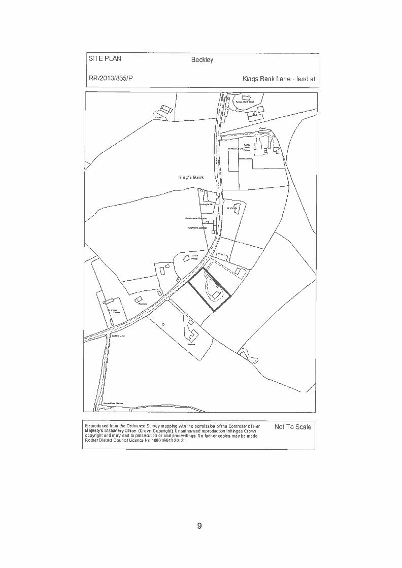
SITE PLAN Becklev
RRe2O1 3/835/P Kings Bank Lane - land at
Not To ScaleReproduced from the Ordnance Surey mapping tfl the permission ofthe Controer of HerIi ajests Stationery Qffce I Cro?ii Copyrighti. LI nauthorrsed reproduction infringes Cro’,copyrrght and may lead to proseoition or dh proceedings No flirther pies may be madeRother Distrid Caunol Licenee No 10C01043 2012
9
Planning Committee 18 July 2013
RR1201318351P BECKLEY Land at Kings Bank Lane
Use of site for production of fencing and other timberproducts, from locally sourced timber
Applicant: Mr HardyAgent: Mr HardyCase Officer: Mr S Carey (Tel: 01424 787611)
(Email:[email protected])Parish: BECKLEYWard Member: Councillor I G F Jenkins and Councillor M MooneyReason for Committee consideration: History of site.Statutory 8 week date: 19 June 2013
1.0 POLICIES
1.1 Policy GD1 (General Development Considerations) of the Rother DistrictLocal Plan (hereafter referred to as Local Plan (2006) applies, in particular(iii), (iv) and (v). Policy EM3 (Employment Use of Buildings in theCountryside), in particular (v), and Policy DS4 (Development Boundaries) arealso relevant.
1 .2 Policies OSS1 (Overall Spatial Development Strategy), OSS4 (Location ofDevelopment), OSS5 (General Development Considerations), RA2 (GeneralStrategy for the Countryside), RA3 (Development in the Countryside), EC3(Existing Employment Sites), and EN1 (Landscape Stewardship), containedwithin the Rother District Local Plan - Core Strategy (hereafter referred to asCore Strategy), also apply.
1.3 Paragraph 28 of the National Planning Policy Framework (NPPF) relates tothe need to support a prosperous rural economy, paragraph 109 requires theplanning system to contribute to and enhance the natural and localenvironment, paragraph 115 is concerned with conserving the landscape andscenic beauty in Areas of Outstanding Natural Beauty (AONB), whileparagraph 123 requires planning decisions to ensure new developments donot create noise and areas of tranquillity which are relatively undisturbed bynoise remain the same.
2.0 SITE
2.1 The application relates to a field on the south-eastern side of Kings BankLane. It is outside of any recognised Development Boundary as defined in theLocal Plan (2006).
2.2 The field has a wooden building currently in situ. Formerly accessed viashared access belonging to the adjacent field to the north-west, a new accessfrom Kings Bank Lane, has recently been created. The precise use of the land
10
is unclear but it currently includes some storage and a business making fenceposts.
2.3 The nearest neighbouring properties are Taihoa, to the south-east of the site,and South Fields, directly opposite the site.
3.0 HISTORY (Most recent and relevant only)
3.1 RR/88/1658 Change of use to fencing contractors yard, erection ofworkshop for storing manufacturing of fencing, newaccess — approved (temporary) — September 1988.
3.2 RR189/3002/P Change of use from fencing workshop to manufacture ofpine and oak furniture — approved (temporary) —
December 1989.
3.3 RR/90/2293 Change of use of land and existing building to fencingmanufacturers — Approved Conditional (Temporarypermission) -
3.4 RR!2012/719!P Formation of access — Approved September 2012.
3.5 RR/2012/2216/P Use of site for production of fencing and other items, egpicnic tables, from locally sourced timber — RefusedJanuary 2013.
4.0 PROPOSAL
4.1 This application relates to a change of use of a piece of land to a fencingwood yard. The applicant’s intention is to produce timber products, fromlocally sourced materials.
4.2 The statement accompanying the application states that the throughput oftimber would be governed by harvesting elsewhere, and there would notalways be on-site activity.
4.3 Transport of the gathered materials would be by a pick-up truck and trailer,and not big lorries. Timber would then be processed on site utilisingmachinery such as a PTO tractor, saw bench and splitter for post and railproduction, peeling machine, with sawing and peeling taking place at the rearof the site away from the roadside, and the fabrication of fence panels,morticing and stapling taking place within the existing workshop.
5.0 CONSULTATIONS
5.1 Parish Council:
5.1.1 Recommend refusal (summarised):
• The site has not been in continual use for 20 years or more.
11
• While site has been there for over 20 years, applicant has rarely workedthere.
• There have been numerous complaints over the years about the site.• Planning statement submitted indicates continual use — not occasional on-
site activity.• More machinery would be introduced on site.• Would more buildings be needed for the storage?• Applicant has not why previous attempts at fencing manufacture have
been abandoned or failed.• Opportunistic attempt to obtain planning consent for a business which has
no serious business plan and no hope of being financially viable.• Will, after a short period of time, result in an application for a domestic
dwelling after a short period of time on the then redundant ‘brown fieldsite’.
5.2 Highway Authority:
5.2.1 “Do not wish to restrict grant of consent. The proposal is for a relatively smallscale development and the level of traffic generated by its use is likely to below. With this in mind, while the road leading to the site is narrow in places, Ihave no major concerns that the impact of the development will be to thedetriment of highway safety.”
5.3 Director of Services — Environmental Health:
5.3.1 Any comments received will be reported.
5.4 Planning Notice:
5.4.1 5 letters of objection (summarised):• Disruption to the locality with unacceptable noise levels and increased
vehicular activity.• Already experience noisy machinery at weekends and holidays from this
location.• Would only increase if permission is granted.• Use of vehicles will have serious impact on what is already a narrow
country lane, further damaging verges and possibly causing damage toroad surfaces.
• Quiet residential lane, light industry operating could open the gates forfurther development.
• Development not materially different to refused application from last year• Letters submitted stating site has been used in recent years for the
manufacture of fencing are factually incorrect.• Use has been at best intermittent.• Applicant has no respect for planning control or for the environment of
Kings Bank Lane.• Use of site for a manufacturing use contrary to national and local planning
policies.• Site in countryside, and applicant has not demonstrated that the proposal
requires a countryside location.• LPAS should encourage other countryside uses in the area, such as
holiday accommodation.
12

• Proposed development will damage the tranquillity of area and detractfrom the holiday accommodation on offer.
• Site is used mainly as a dumping ground for builders rubbish.• There are others who would be willing to restore the land to its proper use
of agriculture, if applicant cannot afford to maintain the site.• Proposed use would threaten the amenities of local residents in the Lane.
5.4.2 One letter of support (summarised):• Area has been used for fence manufacturing for many years.• Proposal is a rural craft which should be maintained, and needs to be
protected for future generations.• Villages are fast losing their past identities due to influx of second home
ownership and loss of local businesses and employment.
6.0 APPRAISAL
6.1 The main issues to consider are the impact of a commercial business in thiscountryside location, having regard to the strict controls on new developmentin the countryside and the land’s siting within the High Weald AONB, theimpact upon nearby properties and any highway / traffic issues arising.
6.2 Impact on the countryside location
6.2.1 This application involves balancing the need to protect the landscape andcharacter of the High Weald AONB, with the need to provide and retainemployment opportunities within the countryside. In this respect, it is helpful toset out the scope of all relevant policies.
6.2.2 Policies GD1 (iv) and (v) of the Local Plan (2006) and Policy OSS5 (iii) of theCore Strategy relate to all development respecting and not detracting from thecharacter and appearance of the locality, and being compatible with theconservation of the natural beauty of the High Weald AONB. Policy EN1 of theCore Strategy relating to Landscape Stewardship seeks to protect thedistinctive identified landscape character, ecological features and settlementpattern of the High Weald AONB.
6.2.3 Policy EM3 (v) of the Local Plan (2006) states that the re-use and adaptationof buildings in the countryside for employment purposes will be permitted,provided that the proposed use either has an acceptable impact on itssurroundings, including its traffic impact and on local amenity, or that anypotential harmful impacts can be dealt with by imposing reasonableconditions. Policy EC3 of the Core Strategy also refers to employment sitesand securing the effective use of employment land and premises, with subparagraph (i) stating that land and premises currently (or last) in employment,including tourism, use will be retained in such use unless it is demonstratedthat there is no reasonable prospect of its continued use for employmentpurposes or it would cause serious harm to local amenities.
6.2.4 Policy DS4 of the Local Plan (2006) states that ‘Outside of the developmentboundaries of the towns and villages... Proposals for new developmenttherein will be required to accord with relevant Local Plan policies and unlessthere is specific provision in these policies for the proposed form of
13
development to be located in the countryside, the proposals will also berequired to demonstrate that a countryside location is necessary for thedevelopment.’
6.2.5 Policy OSS1 of the Core Strategy refers to the need to give particularattention to the ecological, agricultural, public enjoyment and intrinsic value ofthe countryside, and continue to generally restrict new development to that forwhich a countryside location is necessary or appropriate to promotingsustainable land-based industries and sensitive diversification, primarily foremployment uses. Policy RA2 (iii) is concerned with, generally conserving theintrinsic value, locally distinctive rural character, landscape features, builtheritage, and the natural and ecological resources of the countryside.
6.2.6 Policy OSS4 of the Core Strategy refers to location of development, with theassessment of a particular location’s suitability when determining planningapplications being considered in the context of several different issues,including, the character and qualities of the landscape. Policy RA2 (iii) strictlylimits new development to that which supports local agricultural, economic ortourism needs and maintains or improves the rural character.
6.2.7 Policy RA3 of the Core Strategy relates to Development in the Countryside,with proposals for development in the countryside being determined on thebasis of as number of issues, including, (ii) - supporting suitable employmentand tourism opportunities in the countryside, including by the conversion, foremployment use, of farm buildings generally in keeping with the ruralcharacter, and by the sensitive, normally small-scale growth of existingbusiness sites and premises, and (v) - ensuring that all development in thecountryside is of an appropriate scale, will not adversely impact on thelandscape character or natural resources of the countryside and, whereverpracticable, support sensitive land management.
6.2.8 As well as local policies, the national guidance set out in the NPPF alsocarries great weight. Paragraph 28, which relates to the need to support aprosperous rural economy by supporting the sustainable growth andexpansion of all types of business and enterprise in rural areas, both throughconversion of existing buildings and well-designed new buildings, and topromote the development and diversification of agricultural and other land-based rural businesses.
6.2.9 At the same time Paragraphs 109 and 115 of the NPPF are concerned withthe conservation of the natural environment, requiring the planning system tocontribute to and enhance the natural and local environment, and conservethe landscape and scenic beauty in AONB.
6.2.10 Paragraph 123 requires planning decisions to avoid noise from giving rise tosignificant adverse impacts on health and quality of life as a result of newdevelopment; mitigate and reduce to a minimum other adverse impacts onhealth and quality of life arising from noise from new development, includingthrough the use of conditions; and identify and protect areas of tranquillitywhich have remained relatively undisturbed by noise and are prized for theirrecreational and amenity value for this reason.
14
6.2.11 The documents submitted with the applicant include several letters frombusinesses and individuals, stating that to their knowledge the site has beenused for several years for fencing and as a log yard.
6.2.12 The Council records do show, as these letters claim, that the site has somehistory of fencing operations taking place. A temporary use of the land andworkshop appears to have begun in 1988 with the most recent use as afencing manufacturers approved in 1990 (Ref: RR/90/2293/P); however thislast permission was again granted only on a temporary basis, and expired inAugust 1996. The use has never been renewed since.
6.2.13 More recently, an application was submitted last year for a similar proposal(Ref: RR!2012/2216/P), and was refused due to insufficient information tojustify the commercial activity proposed.
6.2.14 Currently there is a collection of agricultural machinery at the rear part of thesite, along with various piles of rubble and assorted waste, as well as piles oflogs and fence posts used in the existing business on site. All this has led tosome objectors describing the site as an ‘eyesore’ and a ‘tip’. Objectors alsoclaim that the site has not been used for manufacturing purposes.
6.2.15 Past site visits within the last year show some evidence that the site has beenused for timber production, however it is not clear on what scale.
6.2.16 While the local plan policies and the NPPF are keen to encourage aprosperous rural economy by supporting the sustainable growth andexpansion of all types of business and enterprise in rural areas, there isalways a balance to be struck within AONB areas. The submitted site layoutplan shows large areas of storage of raw materials, which appears to contrastwith the ‘low volume’ of material input to the site, as claimed in the applicant’sletter dated 30 May 2013.
6.2.17 Having regard to the need to safeguard the appearance and character of theAONB, the local planning authority has, as a rule, limited similar ruralenterprise applications where conversion or re-use of buildings have beenaccepted, to ensure only limited open storage on sites. While it may beaccepted that this site could have limited outside storage (due to the capacityof the workshop and with the screening from the road in place) the areacurrently proposed is considered excessive.
6.2.18 While the site has been used for employment and commercial purposes in thepast, including for fencing manufacture, this use is not the established use ofthe site and as such the supporting letters carry limited weight whendetermining the acceptability of the commercial enterprise in this location.Although it has not been demonstrated that a countryside location isnecessary (Local Plan Policy DS4), the NPPF in relation to a prosperous ruraleconomy refers to ‘all types of business’. It is acknowledged that if thisparticular business does draw its source material from local woodland, then allother things being equal a suitable rural site is not out of the question.
6.2.l9Although further information has been submitted relating to the proposedactivities on the site, the information is still considered imprecise. Thepotential scale of this operation is not clear and the view is taken that the
15
acceptability of the site for a commercial wood yard has not been sufficientlyjustified with regard to the impact on the visual appearance of the locality andthe High Weald AONB.
6.3 Impact on nearby properties
6.3.1 As with the issue of the AONB, there is a need to balance the introduction of acommercial business into the countryside, with the requirement to protect theamenities of nearby properties.
6.3.2 Policy GD1 (ii) of the Local Plan (2006) and Policy OSS5 (ii) of the CoreStrategy refer to the need for all development to be in keeping with and notunreasonably harm the amenities of adjoining properties.
6.3.3 Paragraph 123 of the NPPF is also relevant when considering the impact onresidential properties, with planning decisions being required to avoid noisefrom giving rise to significant adverse impacts on health and quality of life as aresult of new development; to mitigate and reduce to a minimum otheradverse impacts on health and quality of life arising from noise from newdevelopment, including through the use of conditions; and to identify andprotect areas of tranquillity which have remained relatively undisturbed bynoise and are prized for their recreational and amenity value for this reason.
6.3.4 The main issue concerning local objectors relates to noise levels from powerdriven machinery as well as traffic implications.
6.3.5 One objection refers to articulated vehicles delivering to the site early morningand later in the evening, while others refer to noise from the site andadditional traffic on the road itself, in the tranquil location.
6.3.6 The application states that movements of materials to and from the site wouldbe via a pick-up truck and trailer, and this is accepted by the HighwayAuthority, in so much as the use is relatively low key from a highwayperspective. This view is accepted.
6.3.7 The site was visited by the Council’s Senior Environmental Health Officerduring the course of the 2012 application. It was noted then that woodworkingmachinery is traditionally very noisy and generally, depending on the location,days of the week, time of the day and duration of periods of use of suchmachinery, there is potential for a detrimental effect on nearby residentialamenity.
6.3.9 While further information has been provided regarding machinery to be used,and specific areas for where work with noise implications could be carried out,there is still limited information regarding the noise implications of theprocesses which would be undertaken.
6.3.lOln particular, while the main activities concerning noise are limited to theworkshop, there is no information regarding the soundproof ing of this building.Although this information could in theory be subject to a condition, the view istaken that as there are other concerns over the use, as explained above, anapproval with such reliance on details required by condition could not bejustified in this instance.
16
7.0 SUMMARY
7.1 While it is acknowledged that the site does have a previous use for fencingand wood manufacturing purposes, and some commercial woodmanufacturing, and these are the type of businesses that may be justified in acountryside location, the information provided with this application is stilllimited. The scale and intensity of use being proposed here is likely to have anadverse impact on the visual amenity of the High Weald AONB.
7.2 Although the need to encourage secure suitable employment sites isacknowledged, including in countryside areas, the information provided doesnot guarantee that the proposed use would not cause serious harm to localamenities, especially to the High Weald AONB and nearby properties, withinthis tranquil location. This uncertainty is a concern.
7.3 Circular 11/95 relates to the use of planning conditions in planningpermissions. While conditions can be used to enable a development toproceed, in this instance it is considered that the lack of clear informationwould lead to an element of ‘second guessing’ on the local planningauthority’s part and imprecise conditions being imposed. This would fail tomeet the six tests as set out in paragraph 14 of the Circular; in particular, theneed for conditions to be ‘precise’.
RECOMMENDATION: REFUSE (FULL PLANNING)
REASONS FOR REFUSAL
1. Notwithstanding some previous commercial use of the site, the applicationcontains insufficient information or explanation such as to justify thecommercial activity within the High Weald Area of Outstanding Natural Beauty(AONB), having regard to the situation of the site in a particularly quiet rurallocation where any new development should be critically assessed. The scaleand intensity of the woodworking use being proposed here is likely to have anadverse impact on the local character of the High Weald AONB, and on theamenities of nearby residents. As such, the proposal is contrary to PoliciesGD1 (ii), (iii), (iv) and (v) of the Rother District Local Plan (2006), PoliciesOSS5 (ii) and (iii), EN1 (i) and RA2 (viii) of the Rother District Local Plan -
Core Strategy, and guidance contained within paragraphs 109, 115 and 123of the National Planning Policy Framework.
NPPF: In accordance with Article 31 Town and Country Planning (DevelopmentManagement Procedure) Order 2010 (as amended),the local planning authority hasacted positively and proactively in determining this application by identifying mattersof concern with the proposal and discussing those with the Applicant. However, ithas not been possible to resolve them. The local planning authority is willing toprovide pre-application advice in respect of any future application for a reviseddevelopment.
View application/correspondence
17
SITE PLAN Beckley
RR,20131955/P Land known as Oak Tree House Main Street
Not To ScaleRepruduce from t,e Drdnonc Suey rnang ‘Ath the permissmn ofthe ControIler ofHer.ojestys Stationery Ofh ‘Croin Ccpyiinnt. LI nauthortsed mproiction nfrmnes Croccpyhght and may lead to proseition or oil pm:eedins No uher pies mayhe madeRotherDistri Coundl Licen No 1 DC31E3 2Dt
18
Planning Committee 18 July 2013
RR/201 3/955/P BECKLEY Land known as Oak Tree House(formerly Royal Oak Public House), Main Street
Proposed amendments to dwelling design for plots 1-4 previously approved under planning ref.RR/2003/3300/P
Applicant: Steed Construction LtdAgent: Michael 0 HaIl Building DesignCase Officer: Miss H Bonds (Tel: 01424 787602)
(Email: [email protected])Parish: BECKLEYWard Member: Councillor I G F Jenkins and Councillor M MooneyReason for Committee consideration: Head of Planning referral - Planninghistory of site.Statutory 8 week date: 2 July 2013
This application has been added to the Committee site inspection list.
1.0 POLICIES
1.1 Policy GD1 of the Rother District Local Plan (2006) requires development to:(i) meet the needs of future occupiers, including providing appropriateamenities and the provision of appropriate means of access for disabledusers; (ii) be in keeping with and not unreasonably harm the amenities ofadjoining properties; (iv) respect and not detract from the character andappearance of the locality; and (v) be compatible with the conservation of thenatural beauty of the High Weald Area of Outstanding Natural Beauty(AONB).
1 .2 Emerging policies in the Rother District Local Plan — Core Strategy includePolicy OSS5, which requires development to: (i) meet the needs of futureoccupiers including providing appropriate amenities and the provision ofappropriate means of access for disabled users; (ii) not unreasonably harmthe amenities of adjoining properties; and (iii) respect and not detract from thecharacter and appearance of the locality. Policy EN1 seeks the protection andwherever possible, enhancement, of the district’s nationally designated andlocally distinctive landscapes and landscape features, including the HighWeald AONB. Policy EN3 requires development to be of a high design qualityby contributing positively to the character of the site and surroundings.
1 .3 The National Planning Policy Framework (NPPF) sets out Governmentguidance and national policy. Chapter 6 supports the delivery of a wide choiceof quality homes and Chapter 7 supports good design, noting that it is a keyaspect of sustainable development, is indivisible from good planning, andshould contribute positively to making places better for people.
19
2.0 SITE
2.1 This application relates to a site of a former public house and surroundingland in the northern part of Beckley, outside the Development Boundary andwithin the High Weald Area of Outstanding Natural Beauty. The public house,which remained on site unoccupied for several years, has now beendemolished.
2.2 The site is a triangular shape, bordered by Main Street to the north and KingsBank Lane to the east. There is a row of residential properties opposite thesite on the northern side of Main Street and 2 houses on the opposite side ofKings Bank Lane. There is a protected oak tree in the eastern part of the site.
2.3 The land is currently clear and development has recommenced on the basisof the existing planning permission.
3.0 HISTORY
3.1 RR/2001/1240/P Change of use of the Royal Oak Inn to a dwelling.Allowed on appeal in December 2001.
3.2 RR/2002/2677/P Demolition of Oak Tree House and the construction of 9cottages with associated parking and landscaping.Refused in December 2002.
3.3 RR/2003/1 201/P Demolition of Oak Tree House and erection of 7 cottageswith garages, parking and landscaping with alterations toexisting access. Refused in June 2003.
3.4 RR/2003/3300/P Demolition of existing dwelling and erection of 7 cottageswith garages, parking, landscaping and associated worksincluding alterations to an existing access. Allowed onappeal in September 2004.
3.5 RR/2009/2827/O Lawful development certificate for erection of 7cottageswith garages, parking, access, landscaping andassociated works in accordance with planning permissionRR/2003/3300/P. Approved in May 2010.
4.0 PROPOSAL
4.1 Planning permission is sought for amendments to the design of the approvedresidential development of 7 dwellings (permitted under reference no.RR/2003/3300/P).
4.2 The approved scheme includes two terraces, each of 3 cottages, alongsidethe Main Street and Kings Bank Lane boundaries and a detached housebetween them facing an open green triangle to the east (which contains theprotected oak tree). There would be one vehicular access point to the site
20
from Kings Bank Lane. A total of 14 car parking spaces, in a combination of 3garages and areas of hardstanding would be provided around a turning headin the central part of the site.
4.3 The proposed amendments to the original appeal scheme are as follows:
A revised layout for plots 1—3 so that the front elevations would be thesouth-facing elevations, and the rear elevations would face Main Street(compared to the approved layout where the front elevations face MainStreet). The changes also show the addition of landscaped garden areasto the boundary fronting Main Street and a low brickwork retaining wall, aswell as alterations to the internal layout of plots 1—3.
Revised elevations for plot 4 including the deletion of a second floor reargable and one rooflight, and the addition of 5 roof lights.
iii. Alterations to the size and style of external windows and doors: sash stylewindows would be replaced with casement style windows throughout andthe height of windows compared to internal floor levels would beincreased.
iv. Changes to the approved external materials (brickwork on all houses, andtile hanging on plot 4). All houses would be constructed in the same brick.
5.0 CONSULTATIONS
5.1 Parish Council:
5.1.1 Recommends refusal.‘Members spent some time considering the proposed amendments to thedesign and details of the terrace of three cottages fronting Main Street, andthe detached house (Plot 4) at the former Royal Oak site, being fully awarethat the original scheme was approved by an Inspector on 3 September 2004.Members had the benefit of examining and comparing the original approvedplans, provided to the PC nearly ten years ago, with the submitted amendedplans of this application.Councillors were sympathetic to the plight of the new owner, Mr John Steed,who found he was unable to build according to the approved plan, as thissentence from a covering letter from his agent makes clear: -
“Approval for revised details is sought as previous window heights did nottake into account furniture layouts to proposed dwellings in particular tokitchen and bathroom areas where goods/worktops would be in front ofwindows or in bedroom areas where space for beds would be restricted tobelow window areas.”Were it just a small matter of adjusting some “window heights” to theelevations the PC might have agreed! However, the proposed amendmentsgo considerably further and will radically change the street scene’, and assuch the proposed changes are so significant that the PC cannot recommendapproval.Firstly, all the ridge heights of the dwellings (plots 1-4) have increased suchthat the ridge height of cottage No. 1 is likely to be over two metres above that
21
shown on the original approved elevations; this will be a very significantchange in the ‘street scene’ in Main Street.Secondly, it is now proposed to totally change the front elevations of theterrace of three cottages on Main Street by having no front doors on theproperties, with the only access to the dwelling being provided to the rear.Gone also are the iron railings and front garden gates abutting the footway onMain Street to be replaced with brickwork. Again the PC considers these arevery significant changes to the appearance and ‘street scene’ of the threecottages fronting Main Street, Beckley. The Inspector’s approval noted thecharm of terraced cottages enhancing the street scene — but with only thebacks visible the charm of opening doors and smiling faces is gone.Thirdly, gone has the gable design roof of the detached dwelling (plot 4). The‘amended’ design now shows an extended pitched rool higher ridge heightand a complete change in window fenestration, a complete re-design of plot 4,again hardly recognisable as the approved detached building.Members were fully aware of the following statement made by the ownersagent in the application —
‘Should it be deemed that the proposed revisions are not acceptable then thedevelopment will proceed based on the current approved details.’‘Good design’ is always being stressed as an important consideration forcouncillors in their deliberations on planning matters. Councillors consideredthat these proposed amendments did not provide any improvementswhatsoever to the design and appearance of the properties; they are simply areaction to the fact that the original design simply did not fit on the site. Thedevelopment should be built according to the original approved plans sincehouse fronts are far more appealing visually than house backs. After all, theInspector in her decision letter made the following observation —
‘The appeal proposal is, in my opinion, an attractive and well-thought outscheme.’BPC asks that the above application be refused for all the reasons set outabove, and if the LPA are mindful to approve the application then the PC asksthat the application be ‘called in’ and considered by the LPA PlanningCommittee.”
5.2 The applicant’s agent has provided a detailed response to the ParishCouncil’s comments, together with an illustrative drawing showing theappearance of the front elevation of plots 1 -3, should these be constructed inaccordance with the previously approved design. This response and drawingis included in the separate APPENDIX DOCUMENT relating to thisCommittee 18 July2013.
5.3 Planning Notice
5.3.1 No comments received.
6.0 APPRAISAL
6.1 The development of the site with 7 cottages and garages, parking,landscaping and associated works has already been approved on appeal andwas commenced in August 2009, confirmed by a Certificate of Lawfulnessgranted in May 2010. The site has recently been purchased by a localdeveloper. The current application does not seek to alter the principle of the
22
approved development but proposes some alterations to its detailed design.Each aspect of the proposal will be considered in turn:
6.2 Revised layout and orientation for Plots 1-3:
6.2.1 The applicant notes that the approved layout for plots 1-3, in which theproperties front Main Street, would have necessitated the inclusion of steppedaccesses between the front entrances and the public footway, due to thedifference in ground levels between the public footway and the adjoining land.The revised layout, with the main front entrance doors on the southernelevation within the site, would now enable level access to the front entrancesin accordance with Part M of the Building Regulations and would also allowaccess to the front of the properties from the vehicular access! parking area.There are no changes proposed to the size or location of the plots.
6.2.2 While it is more common for the front of properties to face a main road, Plots5-7, which lie parallel to Kingsbank Lane, already face inwards in a similararrangement to that now proposed for Plots 1-3. The original Inspector’sviews do not preclude the intended change. In the case of Plots 1-3, thedifference in ground levels would cause difficulties in accessing the approvedfront entrances without steps, which would result in the houses beinginaccessible to some people with disabilities. The approved orientation couldalso encourage inappropriate vehicle parking! stopping on Main Street (forexample by delivery vehicles, or residents unloading shopping or simplywanting to leave their cars by the front door on a busy road). The proposedchanges would resolve these two issues, which represents an improvement tothe scheme as a whole.
6.2.3 The Parish Council’s concerns with the height of the houses are noted.However, the approved drawings did not take account of the changes inground level between Main Street and the development site, or between theeast and west of the site (which are both up to im). Consequently, theapproved drawings illustrated a uniform roof pitch height of 8.05m measuredat both the front (north) and rear (south) elevations, and also illustrate levelground beneath the houses. The proposed drawings take account of theincreases in ground level that would be necessary to construct the houses onthe sloping ground, and also the necessary difference in the height of the frontand rear elevations. Consequently, the height of the south-facing elevations isO.05m higher than approved (with the chimney O.15m higher). The height ofthe north-facing elevations is O.45m higher than approved (with the chimneyO.55m higher). It is considered that these increases are not in any waysignificant and would have no unacceptable effect on the street scene.
6.2.4 When measured from the ground level of the public footway on Main Street,the front elevation of Plot 1 would be up to 1O.lm higher than the publicfootway. It is acknowledged that this is 2 m higher than the approved height ofthe house at Plot 1. However, if the houses were to be constructed asapproved, the ground level would need to be raised to create a level surface,and consequently, the overall height of the ridge would be comparable to thatproposed in any event. Consequently, it is not the case that the height of thehouses has significantly increased, only that the plans now accuratelyillustrate the necessary changes to the existing ground levels.
23
6.2.5 The rear (north-facing) elevation of the terrace includes many windows andonly a centrally positioned door and small window have been omitted fromeach house, compared to the approved elevation. This, together with theproposed landscaped garden area and low brick wall on the rear boundarywould ensure the rear elevation fronting Main Street would not appear as aninactive frontage. The Parish Council’s concerns are noted, however, it is notconsidered the proposed changes would significantly alter the appearance ofthis elevation. The proposed changes to the internal layout would not haveany adverse effect on the appearance of the development.
6.2.6 Taking into account the practical difficulties that would result from theapproved layout, the proposed changes to the layout and orientation of plots1-3 are considered acceptable.
6.3 Revised elevations for plot 4:
6.3.1 The applicant notes that the changes are proposed in order to provide betterrainwater drainage detailing to the roof, rooflights more in keeping with thestyle of house and locality, and to make better use of the space within the 2rfloor of the property (the approved scheme includes 1 large “attic room” on the2’ floor and 4 bedrooms on the 1st floor. The proposed scheme includes 3bedrooms on the 1st floor and 2 additional bedrooms! study on the 2 floor).
6.3.2 The most noticeable change would be to the rear elevation of the property,facing into the site, where a second floor gable would be omitted. This wouldresult in the front and rear elevations appearing similar, and also similar to thehouses proposed for plots 1—3. There would be no increase in the height ofthe building (the proposed design is O.25m lower than the approved), noincrease in the roof height or steepness of its pitch, and no increase in thesize of the building’s footprint. The ridge of the roof visible at the rearelevation would be 2.5m wider compared to the approved scheme due to theomission of the second floor gable, but as this elevation would not appearprominent from either Main Street or Kings Bank Lane this change would nothave any significant effect on the wider landscape.
6.3.3 The design of the proposed windows would be altered in accordance with thechanges proposed for the other plots. For the front elevation in particular theproposed revisions are similar to the approved arrangement and would notsignificantly alter the appearance of the house. The changes to thefenestration on the rear elevation are more significant with the omission of acentral 1st floor window, 2 floor gable window and 1 rooflight, and theaddition of 4 smaller rooflights. However, these changes would result in thehouse being of a comparable design to the other houses within thedevelopment and are therefore not considered unacceptable.
6.3.4 The new roof lights would not result in any unacceptable overlooking becausethe affected elevations do not face other properties. The majority of therooflights are proposed on the rear elevation, and the rooflights would not beout of keeping with the overall design of the building. Therefore, the proposedchanges to the elevations of plot 4 are considered acceptable.
24
6.4 External windows and doors and materials:
6.4.1 The proposed changes to the windows are included in the scheme and arenecessary because the approved window heights did not take into accountinternal furniture layouts or Building Regulations requirements. Thesechanges relate to plots 1-4 only. A separate application for a non-materialamendment to the design of the windows for plots 5-7 has previously beenapproved. The changes to the windows on plots 1-4 would result in similarwindow designs for all the plots.
6.4.2 The materials of the windows and doors would not alter from the approved(white painted timber windows and stained hardwood doors), only the style,size and position compared to floor levels. There would not be any significantchange in the size of individual windows compared to the approved, It isconsidered that the proposed changes to the windows and doors arenecessary and would not significantly alter the overall appearance of thedevelopment. Consequently, the changes are considered acceptable.
6.4.3 Changes to the brickwork and tile hanging are also proposed to plots 1-4, tomatch those recently approved for plots 5-7 through a minor amendmentapplication. The proposed materials are red tiles and a mottled red brick, arenot significantly different to those previously approved and are consideredacceptable.
7.0 SUMMARY
7.1 The main issue is the proposed re-orientation of plots 1 — 3. This will, inparticular, improve accessibility within the site and help avoid potential trafficproblems. The design of the terrace is acceptable. The other changes of detailwould not result in a development that is significantly different to thedevelopment that has been approved.
7.3 After a protracted history and inaction the final development of the site is to bewelcomed. The proposed changes would have no adverse effect on thelandscape within the AONB or the character of the village locally, and noadverse effect on amenity. Consequently, the proposal is consideredacceptable and planning permission should be granted.
RECOMMENDATION: GRANT (FULL PLANNING)
CONDITIONS
1. The development hereby permitted shall be begun before the expiration of 3years from the date of this permission.Reason: In accordance with section 91 of the Town & Country Planning Act1990 (as amended by section 51 of the Planning and Compulsory PurchaseAct 2004).
2. The development hereby permitted shall be carried out in accordance with thefollowing approved drawings:
25
• 4197.02B — Site Setting Out Plan (February 2013)• 4197.1 O1A — Plots 1—3 - Floor Plans (February 2013)• 4197.104A — Plots 1—3 - Elevations (February 2013)• 4197.105A— Plots 1—3 - Elevations and Sections (February 2013)• 4197.106A — Plot 4- Floor Plans (February 2013)• 4197.107A— Plot 4-Elevations and Sections (February 2013)
Reason: For the avoidance of doubt and in the interests of proper planning, asadvised in the CLG Guidance ‘Greater Flexibility for Planning Permissions’.
3. All planting, seeding or turting comprised in the approved details oflandscaping shall be carried out in the first planting and seeding seasonsfollowing the occupation of the buildings or the completion of thedevelopment, whichever is the sooner; and any trees or plants which within aperiod of 5 years from the completion of the development die, are removed orbecome seriously damaged or diseased shall be replaced in the next plantingseason with others of a similar size and species, unless the local planningauthority gives written consent to any variation.Reason: To ensure that the development does not prejudice the appearanceof the locality, in accordance with Policies GD1 (iv & v) of the Rother DistrictLocal Plan (2006) and Policy OSS5 (iii) of the Rother District Local Plan —
Core Strategy.
Note: The applicant is reminded that planning permission RR/2003/3300/P remainsin full force and affect in respect of all other matters.
NPPF: In accordance with Article 31 of the Town and Country Planning(Development Management Procedure) Order 2010 (as amended), the localplanning authority has acted positively and proactively in determining this applicationby assessing the proposal against all material considerations, including planningpolicies and any representations that may have been received and subsequentlydetermining to grant planning permission in accordance with the presumption infavour of sustainable development, as set out within the National Planning PolicyFramework. (NPPF)
View application/correspondence
26
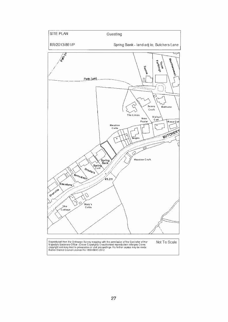
SITE PLAN Guestling
RR/201 3/861/P Spring Bank- land adj to, Butchers Lane
Not To ScaleRepmduced from the Ordnance Sur.’ey mapping vAth the permission ofthe Controller ofHerFAajeste Stationery Off ‘Croi Cnpvrighfl Unauthoriaed reprnction infringes Crov,cnpnrght and may lead to pmsetion or diI pmceedings. No hinter piea may he madeRotherOistnid Coundi Licen No lQCO1E43 2012
27
Planning Committee 18 July 2013
RR/2013/861/P GUESTLING Spring Bank — land adjacent to,Butchers Lane, Three Oaks
Erection of a three bedroom detached dwelling
Applicant: Mr S EldridgeAgent: Pump House DesignCase Officer: Mr J McSweeney (Tel: 01424 787617)
(Email: [email protected])Parish: GUESTLINGWard Member: Councillor R K Bird and Councillor R H PattenReason for Committee consideration: Head of Planning referral - History ofsite.Statutory 8 week date: 19 June 2013
1.0 POLICIES
1.1 Local Plan (2006) Policies apply and in particular DS3 (Developmentboundaries), HG4 (Layout and design) and GD1 which sets out the generaldevelopment considerations that all development should meet. This includes(i), it meets the needs of future occupiers, including providing appropriateamenities (ii), it is in keeping with and does not unreasonably harm theamenities of adjoining properties (iii), it provides for adequate and safe accessby all relevant modes of transport and appropriate parking provision (iv), itrespects and does not detract from the character and appearance of thelocality and (v), it is compatible with the conversation of the natural beauty ofthe High Weald Area of Outstanding Natural Beauty (AONB).
1.2 Policies OSS3 (Use of Development Boundaries) and OSS5 (GeneralDevelopment Considerations) of the Rother District Local Plan - Core Strategyalso apply.
1.3 The National Planning Policy Framework (NPPF) is also relevant especiallythe following paragraphs. Paragraph 9 states; Pursing sustainabledevelopment involves seeking positive improvements in the quality of thebuilt, natural and historic environment, as well as in people’s quality of life,including widening the choice of high quality homes. Paragraph 58 statesthat, planning policies and decisions should aim to ensure that developments:will function well and add to the overall quality of the area, establish a strongsense of place, using streetscapes and building to create attractive andcomfortable places to live, work and visit, and that developments shouldrespond to local character.
28
2.0 SITE
2.1 The land lies to the north-west of Butchers Lane, set within the developmentboundary for Three Oaks as defined within the Rother District Local Plan andset within the High Weald AONB.The site gently slopes from north to south and is currently set lm above thehighway level. The septic tank which serves 1 — 3 Meadow Cottages islocated within the site, and these properties including no. 4 Meadow Cottageshave right of access across the site. To the west the site is adjoined by a 2storey detached property and to the east a 2 storey end of terrace property.
3.0 HISTORY
3.1 RR/2005/566/P Outline: Erection of a 2 storey detached house —
withdrawn — 6 May 2005.
3.2 RR/2008/1 080/P Outline: Erection of chalet bungalow and alteration toexisting vehicular access — Refused — 13 October 2008.
3.3 RR/201 1/2656/P Outline: Proposed new dwelling — Refused — 12 February2012.
3.4 RR/2012/1 186/P Outline: Proposed new dwelling — Approved conditional —
18 October2012.
3.5 RR/2012/2344/P Approval of reserved matters 1 and 6 following outlineapproval RR/2012/1186/P for single dwelling house —
Refused — 17 January 2013.
4.0 PROPOSAL
4.1 This application seeks approval of reserved matters following the grant ofoutline permission RR/2012/1186/P. The reserved matters outstanding and tobe considered in this application are access, appearance, landscaping, layoutand scale.
4.2 The dwelling will be constructed in facing brickwork under a pitched tiles roof.Accommodation consists of kitchen/diner, living room and shower room atground floor and 3 bedrooms, one with en-suite and bathroom at first floorlevel. A single garage and on-site parking and turning area are proposed.
5.0 CONSULTATIONS
5.1 Parish Council:
5.1 .1 “The proposal by virtue of its size and mass does not sit comfortably with thegeneral pattern of development where smaller properties dominate. While thesite may be capable of accommodating the proposal the building design doesnot respect the adjoining properties. Its proximity to Spring Bank to the west
29
will have a detrimental impact on the natural light currently available to four ofits rooms, as the current occupant has been resident for more than twentyyears this amenity should remain.The waste water and surface water arrangement to the cottages to the eastwill be disrupted by the proposal and the existing septic tank and theproposed bio disc will be too close to the proposed property.The site would seem to require a flood risk assessment. The amount of waterthat runs off the site on to the road indicates that a water attenuation schemeshould be agreed before development is considered.Consequently the proposal by virtue of its height, bulk, mass and effect onwater that run off would unreasonably harm the amenities of thosesurrounding properties.The proposal is therefore contraty to policy GD 1 (ii) (iv) (xv) , HG4 of RDLP andOSS5 (ii) (iii) and EN3 of the proposed core strategy.”
5.2 Hicihway Authority:
5.2.1 Do not wish to comment, however, it should be noted that an appropriatelicense will need to be obtained from the County Council prior to thecommencement of any works within the highway.
5.3 Public Notice:
5.3.1 13 letters of objection have been received, their concerns have beensummarised below:• Too large to be satisfactorily accommodated within the constraints of the
site.• Unacceptable relationship with neighbouring properties.• Over bearing and over dominant.• Cramped and urban in appearance.• Out of keeping with the semi-rural character of the locality.• Septic tank (serving 1, 2 & 3 Meadow Cottages) has been incorrectly
portrayed.• North west corner of the new building will be over the existing foul water
pipe.• Damage to drainage pipes/septic tank during construction.• Bio-disc to be located in exact position of storm drain system that takes
majority of the surface water.• Constant noise and obnoxious odour from bio-disc.• Bio-disc sited uphill, foul water will need to be pumped to it.• Bio-disc sited on badger trial.• Most of the site will be covered by hard surfaces — will add to the abnormal
amount of water that already lies/passes through site.• To create soakaway the hedge and oak tree (within hedge would have to
be taken out.• The back boundary line is incorrectly represented.• Inadequate access, it is unclear whether the terms of the outline consent
have been met.• During times of heavy rain the plot becomes flooded.• Completely block out all natural light to four rooms in my home.• Property may create a dam effect with the water impacting on both
neighbouring properties.• Bio-disc less than the recommended 1 Om from neighbouring properties.
30
• Set in front of the building line of my house.• Discharge of water will make the lane even worse than it is now — road
had been repaired on several occasions.• Land is already saturated and cannot take any more water.• Traffic needs to be calmed on this stretch of road, which is becoming a
‘rat-run’.• Road damage is causing problems to ‘Meadow Croft’. Issues with road
need to be rectified prior to any more construction.
6.0 APPRAISAL
6.1 Issues for consideration
6.1.1 The principle of developing a single house of the site has already beenestablished. Members inspected the site on 18 September 2012. The mainissues to consider are whether the reserved matters pursuant to outlinepermission RR/2012/1186/P are acceptable. These include:
• Design and scale of the dwelling.• Impact upon the character of area.• Impact upon neighbouring residential amenities.• Highway implications.• Drainage.
6.2 Design and scale
6.2.1 Although at the outline stage there were some reservations regarding whetherthe site could adequately accommodate a detached dwelling, it was acceptedthat the plot size is similar to others within close proximity. The final dwellingrequires careful assessment but an appropriately designed and scaleddetached dwelling need not cause demonstrable harm to the character of thearea or to the residential amenities of immediate neighbours.
6.2.2 The proposed dwelling albeit two storey in height has been set away from‘Spring Bank’ at first floor level. This separation coupled with the spacebetween the site and no. 4 Meadow Cottages, helps to break up the built formalong this stretch of the village. The brick and tile two storey dwelling withsingle storey garage to the side is an acceptable design solution within thevillage locality, which has no one defining architectural characteristic.
6.3 Impact upon character of area
6.3.1 The site is set within the Development Boundary for Three Oaks. The existingtypical ribbon form of development has a strong semi-rural character. Inparticular, the historic undeveloped nature of the application site, together withthe side garden of 4 Meadow Cottages adjoining the east side has longprovided an open aspect. The development of this site will therefore alter theappearance of the street scene; however, this is not in itself a reason forrefusal.
6.3.2 The design of the proposed dwelling with the roof line running parallel to theroad, and the separation afforded at first floor level between the new dwelling
31
and ‘Spring Bank’ coupled with the side garden of 4 Meadow Cottagescontinues with the variations of dwellings and spacing that gives the area itsloosely developed semi-rural character.
6.4 Impact upon neighbouring amenities
6.4.1 In comparison to the open nature of the site the erection of a two storeydwelling will inevitably have a greater impact upon adjoining residents.However, this is not in itself a reason for refusal: very many redevelopmentshave the same effect. The issue is whether those impacts are unreasonablein terms of, for example, loss of light, over bearing nature or overlooking in theparticular circumstances.
6.4.2 The site adjoins the north-east side of ‘Spring Bank’ which has windows onthis facing elevation (two at ground floor and two at first floor level). Theimpact will be greatest to the two ground floor windows, which serve a livingroom and study/cloakroom. Notwithstanding that one window serves a livingroom this is not the only window to this room, with a French door on the rearelevation. Therefore while light may be obscured to this side window, areason for refusal could not be justified on this element alone given thepresence of the French doors on the rear elevation.
6.4.3 The relationship of the new house to 4 Meadow Cottages is in one sense lesspronounced given the distance this neighbouring property is set away fromthe common boundary. However, previous application RR/2012/2344/P wasrefused, amongst other things, by virtue of the potential impact on 4 MeadowCottages. While the proposed dwelling has been modified with less of a fullgable and has moved slightly away from the common boundary, it is not sosignificant. Therefore impact upon the amenities of this property needs to becarefully considered.
6.4.4 While oblique views may be afforded over the rear garden of ‘Spring Cottage’from first floor rear windows, these are not considered to be unduly intrusive,or unusual for linear development of this nature, given that the principle ofdeveloping the site has already been accepted.
6.5 Highway implications
6.5.1 The local concerns raised regarding highway safety have been noted.However, highway visibility from the application site was considered at lengthduring the determination of the outline permission (RR/2012/1186/P). Themain issue was whether adequate visibility sight lines could be achieved,especially to the west, which would involve the trimming back of the hedges tothe front of ‘Spring Bank’. This raised the question as to ownership of thehedge. The Highway Authority concluded that the hedges in question hadencroached over highway land and therefore they could be trimmed back toprovide adequate visibility to serve the application site.
6.5.2 The access arrangement proposed is similar to that indicatively shown atoutline stage; therefore subject to the applicant complying with conditions 5 —
7 attached to RR/201 2/11 86/P, then highway impact is acceptable.
32
6.6 Drainage issues
6.6.1 From a drainage perspective the site has a number of constraints, includingits size, need to accommodate drainage for 1 — 3 Meadow Cottages andexisting flooding issues.
6.6.2 This proposal has been informally discussed with the Council’s BuildingControl Officers, which led to the revised drainage system which is now beingproposed. The conclusions of these discussions were that a dwelling shownin this position would necessitate the removal of the existing septic tank(serving 1 -3 Meadow Cottages). The agent is aware of this and hasproposed a bio disc system in the north western corner of the plot for theseproperties.
6.6.3 Should this application be approved then drainage would be carefullyconsidered under Building Regulations.
6.7 Land ownership
6.7.1 As shown on the Land Registry Plan (submitted with the outlineRR/2012/1186/P) there is a parcel of land within the site, which is not ownedby the applicant. This area is owned by either or all of 1 — 4 MeadowCottages and is likely to have been the position of their previous outsidetoilets. These properties also have right of way across the site to this landand also to maintain and empty their septic tank which is also located withinthe application site.
6.7.2 Land ownership and rights of access are not material planning considerationsand are private matters between the parties involved.
6.8 Issues raised
6.8.1 A local resident has suggested that the area is located within a flood risk area;however, the area is not located within either Flood Zone 2 or 3 which aredefined as specific flood risk areas.
6.8.2 In respect to badgers, while it is noted that there is a run across the site theredoes not appear to be a badger set within the site boundaries.
7.0 SUMMARY
7.1 The brick and tile two storey dwelling with a single storey garage to the side isan acceptable design solution within the village locality, which has no strongdesign theme or character. The separation afforded at first floor levelbetween the new dwelling and ‘Spring Bank’ coupled with the side garden of 4Meadow Cottages helps to maintain the variation of dwellings and spacingthat gives the area its loosely development semi-rural character.
7.2 Notwithstanding that the proposal alters the outlook that the immediateneighbours currently enjoy the development of this plot set within the villagedevelopment boundary is acceptable and will not cause demonstrable harm to
33
their amenities. The drainage constraints of the site are acknowledged andwhilst the systems proposed are achievable, specific detail will be carefullyconsidered under Building Regulations. As such the proposed dwellingpursuant to outline permission RR/2012/1186!P is acceptable.
RECOMMENDATION: APPROVE (RESERVED MATTERS)
CONDITIONS
The development hereby permitted shall be carried out in accordance with thefollowing approved plans:drawing no. 3252/13/1/A, dated March 2013.drawing no. 3252/13/C/LBP, dated July 2013.Reason: For the avoidance of doubt and in the interests of proper planning, asadvised in the CLG guidance ‘Greater Flexibility for Planning Permissions’.
2. The dwelling hereby approved shall be constructed using ‘Redland Brecklandbrown plain tiles’ and ‘Hanson Atherstone red brickwork’ unless otherwiseagreed in writing by the local planning authority.Reason: To ensure the development reflects the character and/or appearanceof the locality in accordance with Policy GD1 (iv)(v) of the Rother District LocalPlan (2006).
3. Notwithstanding the provisions of the Town and Country Planning (GeneralPermitted Development) Order 1995 (as amended) (or any order revoking andre-enacting that Order with or without modification), no windows or otheropenings (other than those expressly authorised by this permission) shall beinserted into the dwelling.Reason: To preclude overlooking and thereby protect the residentialamenities of the neighbouring occupiers in accordance with Policy GD1 (ii) ofthe Rother District Local Plan.
4. Notwithstanding the provisions of the Town and Country Planning (GeneralPermitted Development) Order 1995 (as amended) (or any order revoking andre-enacting that order with or without modification), no extensions oralterations, as defined within classes A, B, and E of Part 1 of the Schedule 2of the order, shall be carried out on the site otherwise than in accordance witha planning permission granted by the local planning authority.Reason: To ensure appropriate development of the site and preservation ofthe amenities of the area in accordance with Policy GD1 (iv) of the RotherDistrict Local Plan (2006).
5. At the time of construction and prior to the first occupation or use of thedwelling hereby approved, the shower room and en-suite windows at groundfloor and first floor level within the north-east elevation, as indicated on theapproved drawing no. 3252/13/1/A, dated March 13, shall be glazed withobscure glass of obscurity level equivalent to scale 5 on the Pilkington GlassScale and shall thereafter be retained in that condition.Reason: To preserve the residential amenities of the locality in accordancewith Policy GD1 (ii) of the Rother District Local Plan (2006).
34
6. All hard and soft landscape works including a brindle permeable block paveddriveway shall be carried out in accordance with the approved details. Theworks shall be carried out prior to the occupation of the dwelling or inaccordance with a programmed agreed with the local planning authority.Reason: To safeguard the characteristics of the locality in accordance withPolicy GD1 (iv)(v) of the Rother District Local Plan (2006).
Notes:1. This planning permission does not authorise any interference with, or
disturbance of, any private right of way which crosses the site. If a diversionor stopping-up of a right of way is required this must be resolved between theparties concerned.
2. The granting of planning permission does not grant or imply the right to carryout works on adjoining property or land outside the applicants control or toenter onto adjoining property without the consent of the owners of thatproperty in order to carry out construction work or subsequent maintenancework.
NPPF: In accordance with Article 31 Town and Country Planning (DevelopmentManagement Procedure) Order 2010 (as amended), the local planning authority hasacted positively and proactively in determining this application by identifying mattersof concern within the application (as originally submitted) and negotiating, with theApplicant, acceptable amendments to the proposal to address those concerns. As aresult, the local planning authority has been able to grant planning permission for anacceptable proposal, in accordance with the presumption in favour of sustainabledevelopment, as set out within the National Planning Policy Framework (NPPF).
View application/correspondence
35
SITE PLAN Bexhill
RR/2O13/86iP 21 South Cliff
Not To ScaleReproduced from the Ordnance Sur.ev mappinq vATh the permission of the controller ofHertaeets Stahcnery OThce (Crocsr coprmght: Onauthonsed reprc&ctron infringes Crovrcopyright and may lead to prosecotco or DVm, pmoceedinpn No hirther copies may he madeRotherD:sznd Couool Liceoco No IOCO1LtE43 2012
36
Planning Committee 18 July 2013
RR1201318651P BEXHILL 21 South Cliff
Replacement of existing chalet bungalow with new 4bedroom detached house
Applicant: Mr P FriendAgent: Adams Johns Kennard LtdCase Officer: Mr P Cornfield (Tel: 01424 787614)
(Email: [email protected])Parish: -
Ward Member: Councillor J A Lee and Councillor T MansiReason for Committee consideration: Member referral - Councillor J A LeeStatutory 8 week date: 21 June 2013
This application was considered by the Planning Committee at its meeting on 20June 2013 following a visit to the site by Members. The application was deferred tonegotiate in respect of design. Amended details have been received in terms ofsiting, but the design remains unchanged. The original objectors to the scheme havebeen notified. The report following is updated on the basis of the revised details.
1.0 POLICIES
1 .1 Rother District Local Plan (2006) Policy GD1 (ii)(iii)(iv)(vi).
1.2 Rother District Local Plan (Core Strategy) Policies EN3(i) & OSS5(ii)(iii).
1.3 National Planning Policy Framework (NPPF), Section 7.
2.0 SITE
2.1 The existing detached chalet bungalow which has a steeply pitched roof, isset on the southern side of South Cliff and benefits from a single vehicularaccess point and a low brick built front boundary wall. The façade of thebuilding is set back from the highway some 9m and set parallel to the highwayboundary, unlike the neighbouring properties.
2.2 The relatively level rear garden extends some 26m from the rear façade andthen falls steeply away to a lower area adjacent to the promenade.
2.3 Neighbouring dwellings are a detached extended chalet style property at 23South Cliff lying to the west and a new two- storey dwelling lying to the east at19 South Cliff.
2.4 Rear garden boundaries are currently predominantly hedging with somewalling to the southern end of the eastern boundary.
37
2.5 In the wider setting there is no consistent local vernacular. The local area hasa wide mixture of age and style of property using mainly brick and render intheir construction. Many dwellings have been extended over timeincorporating various architectural features such as balconies. Most dwellingsare individual in their design.
2.6 Aside from detached dwellings, the main characteristic of the area is hippedridged roofs. This creates a certain visual rhythm to the streetscape createdby the separation at eaves level between the buildings affording viewsbetween the dwellings; though at street level almost all have single storeyelements and/or fencing which block light and views. This, in itself, forms acharacteristic of the area.
3.0 HISTORY
3.1 RR/85!0950 2 storey extension and alterations to form additionalgarage with bedroom over, dining room extensioncloakroom — Approved.
3.2 RR/86/0429 First floor extension to form dressing and en-suitebathroom — Approved.
3.3 RR/86/2684 Conservatory at rear of existing house — Approved.
4M PROPOSAL
4.1 This application seeks the complete demolition of the chalet bungalow and anew four bedroom dwelling built.
4.2 The individual building is a two-storey design with additional rooms in the roofspace and an integral garage. The building is orientated to sit at a slight angleto the highway boundary to reflect the positioning of the neighbouringdwellings. The main feature is the strong roof form which has three elementscreating two ridges running north! south and a pitch set between them frontingthe highway. Eaves and ridge heights to the eastern element reflects that of19 South Cliff while the eaves detail to the west is set approximately 11/2
storeys high rising to a second ridge slightly higher than the aforementionedelement to the east.
Amended Plan4.3 Following consideration of the application by the Planning Committee and the
resolution to defer a decision an amended plan has been submitted. Thedwelling is now shown repositioned in the plot some O.73m forward and someO.lm eastwards of the position initially proposed. The design of the buildingand its overall footprint size remain unaltered.
38
5.0 CONSULTATIONS
5.1 Planning Notice (initial advertisement):
5.1.1 Five separate letters and one petition representing 13 addresses (three lettersare also represented in the petition) were received objecting to the proposeddevelopment, which included the following concerns initially:• Proposed height.• Proposed third floor.• Increase in footprint.• Change to the rear building line.• Use of a soak away and overflow to the unstable cliff.• Not in keeping within similar properties in the area.• Shadowing effect.• Loss of a view.• Overlooking.• Risk of Iandslip.
5.2 Amended Plan:
5.2.1 Letters have been sent to the original objectors (and the head petitioner)which included a copy of the agents’ latest supporting letter and the planshowing the revised position. Any comments received will be reported atCommittee.
5.2.2 One letter has been received supporting the scheme: the rationale behind thearchitectural merits and the ridge height is similar to others and the lowereaves heights allows light between the properties.
6.0 APPRAISAL
6.1 The area has seen an evolution of development over the years, with bothadditions to existing properties (some very substantial) and replacementdwellings. The key issues arising from this proposal are:
- Visual impact upon street scene and locality;- Impact upon amenity of the immediate neighbouring properties (19 & 23
South Cliff.
6.2 Visual impact upon the street scene and locality
Design:6.2.1 The proposed building will be read within the context of the surrounding area
as described above in paragraphs 2.5 and 2.6. While many properties in theimmediate vicinity date from the early to mid2Oth Century the contemporarydesign does not follow that more ‘traditional’ approach. While the house is notdesigned to be in keeping [The amended details do not change this], itincludes architectural elements which are seen in the vicinity. The roof slopesreflect the hip design of so many properties when viewed from the highway.Acknowledging that the new building is higher than the existing to bereplaced, the design allows the visual rhythm of the street scene to bemaintained and keep the separation between neighbouring roof profiles. The
39
particular roof design is described in paragraph 4.2. The western ridge is to behigher than the eastern ridge due to the lower central element breaking up theroof mass. By introducing this visual break and the narrow central wall runningthe height of the building, the ridge height is not necessarily the focal point ofthe façade as there are four clear elements to it. The amended drawing, no.FR12641 -200, shows the height differences between adjoining properties.
6.2.2 Objections were initially received regarding the proposed design, including thefact that the scheme is not in keeping with the surrounding area. It is acceptedthat the design has not been proposed to reflect the older style of dwellings inthe area. Indeed, the recently completed dwelling at 19 South Cliff, whilehaving a more ‘traditional silhouette’, has facades which do not match anfound in the immediate vicinity. Similarly, across the locality many mid-20Century style dwellings do not have elements which are found in the early 20th
Century properties. It is this discontinuity which injects some design vibrancyand variety into the street scene and wider area.
6.2.3 Members saw the mixed character of the area on the site visit: the followinghouses nearby are notable for their design and particularly their scale:
18 South Cliff - substantially extended and remodelled to give a moremodern appearance
1 9 South Cliff - a good quality new building next to the application site29 South Cliff - an older building of a considerably greater scale than its
bungalow nature33 South Cliff - an older building extensively remodelled and extended
across the width of its site
6.2.4 Design is sometimes viewed as a subjective matter, though the planningauthority has to consider whether the design accords or conflicts with adoptedand emerging policy and government advice. Supporting paragraph 5.19 ofthe Rother District Local Plan (2006) in part states, ‘Good design shouldrespect the character of its setting, whether urban or rural and can make apositive contribution to reinforcing local distinctiveness. This should still allowroom for imaginative design solutions that respond sensitively to site andsetting.’ The chosen design approach does not reinforce ‘local distinctiveness’because there is not anything really distinctive in terms of one type ofarchitectural style or material for example. However, it is considered to be animaginative design which reflects elements common to the area as describedabove in paragraphs 4.2 and 6.2.1. With regard to the ‘...design solution thatrespond sensitively to site and setting’, the setting is a mixed one, though thiswill be clearly an alternative design to the established one. However, thedesign does respond to the setting by being bold in its approach.
Materials:6.2.5 The proposed render finish is considered sympathetic to the locality and
reflects both the recently completed dwelling at 33 South Cliff and 17 SouthCliff which is a much older property.
Positioning:6.2.6 Following consideration by the Planning Committee to defer a decision for
negotiations, an amended plan has been received.
40
6.2.7 The amended plan shows the footprint (to remain the same size) moved some0.73m closer to the highway boundary and moved some 0.lm away from thewestern boundary. The orientation of the building is to remain the same as theinitial plan which is shown to be set at a slight angle to the highway boundary,reflecting the neighbouring dwellings.
6.2.8 Objections were received originally raising concern that the ‘building line’ isnot being followed. Drawing number FR12641 -200 (the amended plan) bringsthe building marginally forward but compared to the existing bungalow whichsits nearer the road the new dwelling would still be positioned more to reflectthe neighbouring dwellings.
6.2.9 While the design is unchanged and remains more radical to that currently inthe area, it is considered that this bold approach does not adversely affect thevisual amenity of the street scene or the wider area. Indeed it iscomplemented by the bolder designs at numbers 19 and 33 South Cliff whichare modern style dwellings reflecting current styles, approaches andexpectations. While set slightly closer to the highway than the initial plan, thepotential impact upon the street scene and locality is essentially no different tothat initially considered by the Planning Committee.
6.3 Impact upon amenity of the immediate neighbouring properties (19 & 23South Cliff
6.3.1 The proposed dwelling is considerably different to the mid20th Century styleproperty it is to replace. Consideration has been given to how the schemecould adversely impact upon the neighbouring properties. Photographs wereinitially submitted by the occupier of 23 South Cliff who expressed concern thedevelopment will cause over-shadowing to their balcony, sun room and solarpanels as well as a loss of a view to the east.
6.3.2 The amended plan shows the proposed building repositioned some 0.73mcloser to the highway, resulting in the proposed balcony now being set in linewith the south face of the extension of 23 South Cliff. The change of housetype on the plot remains significant. The small movement forward reducesthat bit more the opportunity of overlooking of the rear elevation of 23 SouthCliff. Potential overshadowing will be reduced, as will the perception ofoverbearing.
6.3.3 The objective of Policy GD1 (ii) of the Rother District Local Plan (2006) is thatnew development should not unreasonably harm the amenities of adjoiningproperties. It is considered the proposed amended scheme, though muchlarger than the existing dwelling, will not unreasonably harm the amenities ofthe neighbouring properties.
6.3.4 Sufficient off road parking space remains available for the dwelling.
6.4 Other matters
6.4.1 Drainage issues and potential landslip were included as reasons for objectionto the initial scheme. The plans indicate the rainwater runoff will be directed toa pipe which leads to the shingle at the base of the cliff. It is good practice notto discharge runoff water into a combined sewer. The agent confirms the
41
applicant is in the process of commissioning an engineering report on cliffstabilisation. The drainage issue is principally an issue addressed under theBuilding Regulations but discharge beyond the cliff line would be positive.
7.0 SUMMARY
7.1 While design can sometimes be seen as a subjective matter there are clearprinciples that can be considered. The site is both in an urban setting to thenorth and a cliff top setting to the south and any design needs to respondaccordingly. In this case the principles are ones of scale, materials andcontext.
7.2 This is a bespoke design which is considered to reflect elements of theneighbouring dwellings, such as lower eaves heights and ‘hips’ to providespace between the dwellings, while bringing an architectural vibrancy to thestreet scene.
7.3 Following the earlier deferral by Committee the applicants wish to remain withthe original concept for the house design. The slight repositioning forwardhelps the relationship to 23 South Cliff and minimises further directoverlooking of the rear elevations of 19 and 23 South Cliff. It does not create alevel of overshadowing or be overbearing to warrant a recommendation ofrefusal. No further design changes to the elevations are proposed but it isconsidered that the scheme does not conflict with national or local policiesand once again can be supported.
RECOMMENDATION: GRANT (FULL PLANNING)
CONDITIONS:
The development hereby permitted shall be begun before the expiration of 3years from the date of this permission.Reason: In accordance with Section 91 of the Town and Country Planning Act1990 (as amended by Section 51 of the Planning and Compulsory PurchaseAct 2004).
2. The development hereby permitted shall be carried out in accordance with thefollowing approved plans: Dwg. no.FR12614-SD100 rev A title block dated: 8April 2013, Dwg. nos. FR12614-SD1O1 rev B & FR12614-SD1O3 rev A (sitelocation only) title block dated: 16 April 2013, Dwg. no. FR12641-200 titleblock dated: June 2013.Reason: For the avoidance of doubt and in the interests of proper planning asadvised in the CLG Guidance document ‘Greater Flexibility’ for PlanningPermissions, 2009.
3. External materials illustrated on dwg. no. FR12614-SD1O1 rev B title blockdated. 16 April 2013 are to be used and no other.Reason: To safeguard the visual amenity of the locality in accordance withPolicy GD1 (ii)(iv)(vi) of the Rother District Local Plan (2006) & Policies EN3(i)& OSS5(ii)(iii) of the Rother District Local Plan (Core Strategy).
42
4. The garage accommodation shall be used only for purposes incidental to theoccupation and enjoyment of the dwelling as such and not for any trade orbusiness.Reason: In the interests of protecting the character of the area and theresidential amenities of neighbouring properties in accordance with PolicyGD1(ii) of the Rother District Local Plan & Policy OSS5(ii)(iii) of the RotherDistrict Local Plan (Core Strategy).
5. No development shall commence until a scheme for the provision of surfacewater drainage works has been submitted to and approved in writing by thelocal planning authority and the dwelling shall not be occupied until thedrainage works to serve the development have been provided in accordancewith the approved details.Reason: To ensure the satisfactory drainage of the site and to prevent waterpollution in accordance with Policy GD1 (x) of the Rother District Local Plan(2006) & Policy OSS5(ii)(iii) of the Rother District Local Plan (Core Strategy).
NPPF: In accordance with Article 31 Town and Country Planning (DevelopmentManagement Procedure) Order 2010 (as amended), the local planning authority hasacted positively and proactively in determining this application by identifying mattersof concern within the application (as originally submitted) and negotiating, with theApplicant, acceptable amendments to the proposal to address those concerns. As aresult, the local planning authority has been able to grant planning permission for anacceptable proposal, in accordance with the presumption in favour of sustainabledevelopment, as set out within the National Planning Policy Framework (NPPF).
View application/correspondence
43
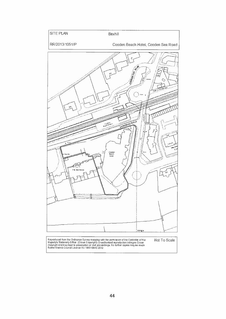
-
Planning Committee 18 July 2013
RR/2013/1 051/P BEXHILL Cooden Beach Hotel, Cooden Sea Road
Replace extant planning permission RR/201 0/961/Pfor proposed two storey extension
Applicant: Cooden Beach HotelAgent: Mr Watson, Challinor Hall AssociatesCase Officer: Mr P Cornfield (Tel: 01424 787614)
(Email: [email protected])Parish: -
Ward Member: Councillor S H Earl and Councillor Mrs J P GaddReason for Committee consideration: Head of Planning referralStatutory 8 week date: 15 July 2013
This application has been added to the Committee site inspection list.
1.0 POLICIES
1.1 Rother District Local Plan (2006) Policies EM7 and GD1(ii)(iv).
1 .2 Rother District Local Plan (Core Strategy) Policies EC6(i)(ii), OSS5(ii)(iii).
2.0 SITE
2.1 This substantial hotel lies in a prominent location in Cooden on the westernfringe of the Bexhill development boundary as defined within Policy DS3 ofthe Rother District Local Plan.
2.2 A car park is set to the rear of the site with unrestricted on road parkingavailable in the immediate vicinity. To the west of the hotel is a three storeyblock of flats which share the same vehicular access point as the hotel offHerbrand Walk.
2.3 To the south and west of the hotel building is a terrace and lawned garden.
2.4 While the hotel is set above Flood Zone 2 and Flood Zone 3 levels, themajority of the hotel is recorded as being set within an area affected bysurface runoff flood water (which includes the car park area, neighbouringbuildings and the junction of Herbrand Walk and Cooden Sea Road). The landfor the extension is in an area unaffected by any of the aforementioned areasidentified as at risk from flooding.
45
3.0 HISTORY
3.1 RR/2007/3245/P Construction of patio area (Retrospective application)Approved.
RR/2005/3127/P Outline: Demolition of an existing 8 room detached hotelbuilding. Erection of 15 new hotel apartments, 8 newhotel rooms and increase parking from 51 to 68 spaces.Approved.
RR12006/2495/P Demolition of existing 8 room building and pool houseand erection of 15 new apartments and 8 hotel lettingrooms. Increase parking from 51 to 68 spaces pursuantto outline permission RR/2005/31 27/P. Approved.
RR/2006/1233/P Variation of Condition 10 imposed upon outline planningpermission RR/2005/3127/P for demolition of existing 8room detached hotel building. Erection of 15 newapartments, 8 new hotel rooms and increase parking from51 to 68 spaces so as to allow apartments to be soldseparately. Approved.
RR/2010/961/P Proposed two storey extension. Approved.
4.0 PROPOSAL
4.1 This application seeks to renew the permission granted under RR/2010/961/Pfor a proposed two storey extension. The extension will increase the functionroom area at ground floor and provide five additional bedrooms above. Afurther bedroom extension is proposed at second floor level within the existingroof with a new dormer window. Balconies are provided to the bedrooms atfirst floor.
5.0 CONSULTATIONS
5.1 Highway Authority:
5.1.1 Do not wish to restrict the grant of consent.
5.2 Environment Agency:
5.2.1 Raise no objection.
5.3 Planning Notice:
5.3.1 Thirteen letters of objection, from 10 flats in The Sea House (contains 15 flats)to the west of the hotel have been received raising the following concerns(summarised):• Loss of views eastwards.• The flats are now all owned but when permission was originally given only
rented.
46
• Disturbance from construction traffic.• Overlooking.• Loss of light.• Noise/anti-social behaviour.• Increase in guest numbers! larger functions.
6.0 APPRAISAL
6.1 Clarification on the type of application made
6.1 .1 This application is to replace an extant permission in order to extend the timelimit for its implementation. The document introduced to give guidance onsuch applications entitled ‘Greater flexibility for planning permissions’ wasbrought into force on 1 October 2009 via the Town and Country Planning(General Development Procedure) (Amendment No. 3) (England) Order 2009and the second edition was issued in October 2010 by the Department forCommunities and Local Government.
6.1.2 Section 1 of the document states, ‘This measure has been introduced/n orderto make it easier for developers and local planning authorities to keepplanning permissions alive for longer during the economic downturn so thatthey can more quickly be implemented when economic conditions improve.’
6.1.3 The document includes guidance on the determining the applications and inpart states:
‘23: How should local planning authorities approach these applications?In current circumstances, local planning authorities should take a positive andconstructive approach towards applications which improve the prospect ofsustainable development being taken forward quickly. The developmentproposed in an application for extension will by definition have been judged tobe acceptable in principle at an earlier date. While these applications should,of course, be determined in accordance with s.38(6) of the Planning andCompulsory Purchase Act 2004, local planning authorities should, in makingtheir decisions, focus their attention on development plan policies and othermaterial considerations which may have changed significantly since theoriginal grant of permission.
24: Do local planning authorities have to grant an application to extend thetime limits for implementation?No. This process is not a rubber stamp. Local planning authorities may refuseapplications to extend the time limit for permissions where changes in thedevelopment plan or other relevant material considerations indicate theproposal should no longer be treated favourably.’
6.2 Development appraisal:
6.2.1 The following assessment is based on the above guidance.
6.2.2 The key issues arising from this application are:
i) Potential impact upon the visual amenity of the streetscene and beachfront
47
ii) Potential impact upon the neighbouring residential amenities.
Potential impact upon the visual amenity of the streetscene and beachfront6.2.3 The overall mass of the extension and the ridge height has been designed to
be subservient to the existing height and step down again to accommodatethe repositioned second floor dormer. When viewed from higher ground to theeast (000den Drive), the profile will fall sympathetically towards the beach.From that vantage point, the stepped roof design will be seen in context withthe long distance views to the peninsula of Beachy Head. No adverse visualimpact will occur to the streetscene.
6.2.4 When viewed from the beach, the extension will be read against the existingbuilding and the three storey block of flats immediately to the west. Whileincreased in mass, bulk and scale, the proposed development will notadversely affect the visual amenity of the beach.
Potential impact upon the neighbouring residential amenities.6.2.5 The area of the building to be extended is currently flat roofed. The new
proposal will extend some 9.8m at its furthest point beyond the existingwestern elevation. The proposed ground floor extension is to be essentiallytriangular in shape running parallel to the boundary with the new flats (TheSea House) to the west, and about 6m off this boundary.
6.2.6 A new first floor element will be set on the existing flat roof area and abovenew extended ground floor element. The first floor elevations are to be setback some 2m from the ground floor elevations to allow for generousbalconies. Three balconies are to be south facing and two west facing. Whenfirst considered in 2010 an amended plan was submitted showing a wallscreen enclosing half of one west facing balcony to reduce the opportunity ofmutual overlooking. This was considered acceptable by the PlanningCommittee in the previous application
6.2.7 The second floor will be extended to provide a suitably designed ridged roof.A proposed dormer will replace an existing dormer; no rooflights are proposedin the western elevation. The lower roof line will also minimise overshadowingof the properties to the west in the morning.
6.2.8 Concerns have been raised that the development will cause a loss of amenitythrough overlooking. Mutual overlooking from bedrooms & communal roomson the west elevation of the hotel and the south side of The Sea House iscurrently possible. The proposed development will not reduce that issue andtherefore some overlooking will occur. However, mitigation measuresdescribed at paragraph 6.2.6 through an amended plan were considered inthe previous application and approved.
6.2.9 Loss of light is a material consideration and this has been raised as anobjection. However, the proposed extension is to be set to the south-east ofthe rear elevation of the block of flats. The closest point between the two issome 14m. The roof described at paragraph 6.2.3 limits overshadowing andon the basis the flats are south facing, they do benefit from direct sunlight themajority of the day. Therefore an undue loss of light should not occur.
48
6.2.10 Noise and anti-social behaviour have been raised as concerns. The increasedcapacity of the function room measures some 71 .5m2, thus reducing externalspace accordingly. The modest increase in internal capacity for the hotel isnot considered to increase potential disturbance to a perceived level as towarrant a recommendation for refusal. Response to anti-social behaviour is aPolice matter and cannot be the subject of any condition.
6.3 Other matters
6.3.1 Other objections include the differing assertions that the flats wereunoccupied! tenanted at the time of the previous application, hence noobjections were made then. It is now indicated the majority are occupied bytheir owners, hence the objections.
6.3.2 On the basis the Planning Committee previously considered the developmentacceptable the matter at hand is whether there have been any materialchanges between the initial consent and the renewal application. Oneobjection states that this application should be considered afresh, not just arenewal. Determination of this application has been made in the light of thedocument referenced at paragraph 6.1 and due consideration given torepresentations made and current national and local policies and governmentguidance.
6.3.3 The change in tenure is not a material consideration and the issues ofoverlooking and impact upon amenity were taken into account by theCommittee Members who visited the site on 15 June 2010 and considered thescheme at their meeting of the 17 June 2010.
7.0 SUMMARY
7.1 Members will have an opportunity to view the site again. Having assessed thesubmission against both national and local policies and the guidance set outin the document ‘Greater Flexibility for Planning Permissions’, it is consideredthe scheme accords with all relevant economic and environmental policiesand the renewal of permission can be conditionally supported. There is noreason to come to a view contrary to the original decision.
RECOMMENDATION: GRANT (FULL PLANNING)
CONDITIONS
1. The development hereby permitted shall be begun before the expiration of 3years from the date of this permission.Reason: In accordance with section 91 of the Town and Country Planning Act1990 (as amended by section 51 of the Planning and Compulsory PurchaseAct 2004).
2. The development hereby permitted shall be carried out in accordance with thefollowing approved amended plans: Dwg. nos. 2009.67.2b, 2009.67.3b and2008.67.4, date stamped: 21 April 2010.
49
Reason: For the avoidance of doubt and in the interests of proper planning asadvised in the CLG Guidance document ‘Greater Flexibility’ for PlanningPermissions, 2009.
3. Before the extension hereby permitted is brought into use its external wallsshall be rendered and colour washed with a colour matching the paintedrender on the existing elevations of the building.Reason: To ensure that the development reflects the character andappearance of the locality in accordance with Rother District Local Plan(2006) Policies EM7 and GD1(ii)(iv) & Rother District Local Plan (CoreStrategy) Policies EC6(i)(ii), OSS5(ii)(iii).
NPPF: In accordance with Article 31 Town and Country Planning (DevelopmentManagement Procedure) Order 2010 (as amended), the local planning authority hasacted positively and proactively in determining this application by assessing theproposal against all material considerations, including planning policies and anyrepresentations that may have been received and subsequently determining to grantplanning permission in accordance with the presumption in favour of sustainabledevelopment, as set out within the National Planning Policy Framework (NPPF).
View application/correspondence
50
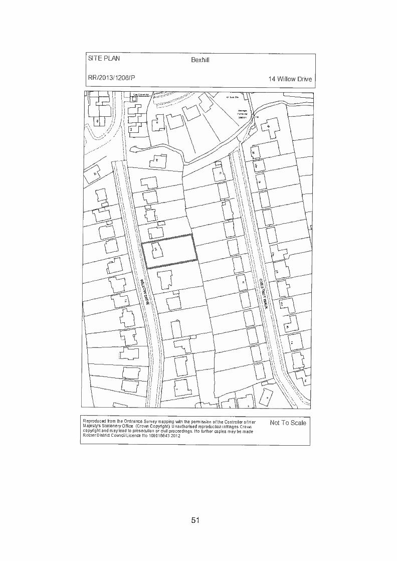
SITE PLA1i BexhI
RR/201311206/P 14 WIIow Drive
Not To Sca’eRepmduced from the Ordnance Sur.’eymaprEn the ennissmn ofthe ControElec ofHer1 ajeatVs Stationery iCro’r Copyright. LI nauthcnsed reprojction infringes Crowi
copyright and may lead to pmseoiticn or odl pmceedings. 110 ftirther copies may be madeRotherDistrid Coundl Licenco No 10C01E 2012
51
Planning Committee 18 July 2013
RR/201 3/1 206/P BEXHILL 14 Willow Drive
Two storey extension and remodelling of existinghouse
Applicant: Mr A Corsi and Miss K BoswellAgent: Michael WhitingCase Officer: Miss H Bonds (Tel: 01424 787602)
(Email: [email protected])Parish: -
Ward Member: Councillor S H Earl and Councillor Mrs J P GaddReason for Committee consideration: Head of Planning referral - Applicant isa member of staff.Statutory 8 week date: 2 August 2013
This application has been added to the Committee site inspection list.
1.0 POLICIES
1.1 Policy GD1 of the Rother District Local Plan (2006) requires development to:(ii) be in keeping with and not unreasonably harm the amenities of adjoiningproperties; and (iv) respect and not detract from the character andappearance of the locality. Policy HG8 supports proposals to extend or alteran existing dwelling where they are in keeping with the character of theexisting dwelling and its surroundings in terms of its size, style, design andmaterials, as well as protecting the amenities of adjoining properties and meetother criteria in Policy GD1.
1 .2 Emerging policies in the Rother District Local Plan — Core Strategy includePolicy OSS5, which requires development to (ii) not unreasonably harm theamenities of adjoining properties; and (iii) respect and not detract from thecharacter and appearance of the locality. Policy EN3 requires newdevelopment to be of a high design quality by (i) contributing positively to thecharacter of the site and surroundings.
2.0 SITE
2.1 This application relates to a detached, 2 storey house located on a residentialcul-de-sac in the western part of Bexhill. The property occupies a large plotaround 21 metres wide and 41 metres deep, with the house positionedconventionally on the road frontage in the western part of the site, and a longrear garden to the east. The house itself dates from the 1950s and isconstructed of red brick with a mansard type roof with brown concrete tiles.
2.2 Willow Drive slopes down from south to north, meaning the application site ison lower ground than the property directly to the south, number 12, and on
52
higher ground than number 16 to the north. Number 12 is a brown brick chaletbungalow and number 16 is a white render! brown brick bungalow. WillowDrive includes a mixture of detached 20th century houses of various sizes andstyles, most have large rear gardens and smaller front gardens!driveways andlow brick front walls.
3.0 HISTORY
3.1 B149/90 Dwelling house. Approved in May 1949.
3.2 B!50/102 Revised plan of dwelling house garage and store.Approved in April 1950.
3.3 B/52!28 Amended plan of dwelling house. Approved in February1952.
3.4 B!52!28!A Amended site plan for dwelling house. Approved in March1952.
4.0 PROPOSAL
4.1 Planning permission is sought for a 2 storey extension at the rear andsouthern side of the house, together with the remodelling of the houseincluding a replacement pitched roof to the house and attached garage, newporch at the front, and the rendering of external walls at first floor level and theaddition of timber to give a “Tudor” effect. Feature glazing is proposed in acentral gabled section and porch at the front of the house.
4.2 The side extension would extend 5.5 metres to the south and would beseparated from the boundary with 12 Willow Drive by 2 metres. The rearextension would extend 3.3 metres into the rear garden, and an area of raiseddecking, 0.5 metres above the level of the garden, would be constructedadjacent to the rear elevation. The height of the new roof would be 0.75metres above the existing ridge line.
4.3 One small beech tree would be removed from the front of the site.
5.0 CONSULTATIONS
5.1 Planninci Notice: 2 letters have been received.
5.1.1 One letter notes that it is believed there are bats lodging in the roof of 14Willow Drive.
5.1.2 One letter, from the occupier of the adjacent property (16 Willow Drive) notesthat the wastewater drainage connection between 14 and 16 Willow Drive isshared, and assurance is sought that the drainage infrastructure has sufficientcapacity to serve the proposed extension and remodelling works withoutadversely affecting the drainage of 16 Willow Drive.
53
6.0 APPRAISAL
6.1 The main considerations are the effect of the development on the streetscene, and the effect on residential amenity.
6.2 Effect on the street scene
6.2.1 14 Willow Drive is one of the largest houses on the cul-de-sac and is ratherimposing. While there is a mixture of house designs in the locality, the designof number 14 is unusual and not wholly in keeping with the locality. Theproposed extensions and remodelling would quite significantly increase thesize of the house but the plot is considered to be of a sufficient size toaccommodate the development without it appearing cramped. It is consideredthat the proposed remodelling would improve the appearance of the propertyand would contribute positively to the character of the site and surroundings.There are Tudor style properties in the locality and while this house would beon a larger scale, it would not be out of keeping with the local area. Alandscaping condition is proposed to require suitable planting on the site tomitigate the loss of the small beech tree at the front of the site.
6.3 Effect on residential amenity
6.3.1 The extension would bring the building in closer proximity to the boundary ofthe property to the south, 12 Willow Drive but a gap of 2 metres would beretained, which is considered sufficient for the development not to appearoverbearing, particularly considering the difference in ground levels betweenthe properties. The proposal would reduce the number of windows on the sideelevations and would have no unacceptable effect on overlooking. Thewindows on the side elevation of number 12 are obscure glazed bathroomwindows and the extension would lead to no unacceptable loss of light orovershadowing.
6.3.2 The extension would have some direct impact on the level of light thatreaches the kitchen window on the southern side of the property to the north,16 Willow Drive. This property lies on a lower ground level than theapplication site and on its northern side, and the level of light reaching thewindows on this facing elevation is already affected by the existing house atnumber 14 and the close boarded boundary fence. However, the kitchen hasanother source of natural light from an attached conservatory which adjoinsthe rear boundary. Furthermore, the 2 storey part of the extension is set backfrom the northern boundary by 4 metres, which would help to mitigate theeffect to some extent. Therefore, while there will be an impact, it is notconsidered that it would be unacceptable. There would be no unacceptableeffect on overlooking to number 16. The amenity of occupiers of properties onthe opposite side of the road and those properties in Chestnut Walk to theeast would not be affected, due to the degree of separation.
6.4 Other matters
6.4.1 The public comments received relating to bats and drainage are noted andhave been passed to the applicant.
6.4.2 The applicant has confirmed that the roof has been checked by an officer fromthe RSPCA and no evidence of bats has been found, although a full survey
54
has not been carried out. In the absence of evidence that bats are presentwithin the roof, it is not considered reasonable to withhold permission. Batsare a protected species and it is the applicant’s responsibility to ensure thatany bats present or their roosts are not disturbed or harmed during the works.Consequently, a note is attached to draw the applicant’s attention to NaturalEngland’s guidance on bats in houses.
6.4.3 The applicant has confirmed that drainage will not be adversely affected bythe development. A note is attached to advise the applicant to seekprofessional advice on the potential effect on any shared drainage with theadjacent property.
7.0 SUMMARY
7.1 While this is overall a significant extension, the proposed extensions andremodelling would have a positive effect on the appearance of the propertyand the character of the site and surroundings. The site is of sufficient size toaccommodate a large dwelling and there would be no unacceptable effect onresidential amenity.
RECOMMENDATION: GRANT (FULL PLANNING) DELEGATED (EXPIRY OFCONSULTATION PERIOD)
CONDITIONS
The development hereby permitted shall be begun before the expiration of 3years from the date of this permission.Reason: In accordance with section 91 of the Town & Country Planning Act1990 (as amended by section 51 of the Planning and Compulsory PurchaseAct 2004).
2. The development hereby permitted shall be carried out in accordance with thefollowing approved drawings:• Site Plan (Scale 1:1250)• Drawing no. 2013,026,6 - Block Plan (Scale 1:500)• Drawing no. 2013,026,4 — Elevations as Existing (June 2013)• Drawing no. 2013,026,5 — Elevations as Existing (June 2013)• Drawing no. 201 3,026,3 — Floor Plans as Existing (June 2013)• Drawing no. 2013,026,2 — 1st Floor Plan & Sections (June 2013)• Drawing no. 2013,026,1 — Ground Floor Plan & Elevations (June 2013)Reason: For the avoidance of doubt and in the interests of proper planning, asadvised in the CLG guidance ‘Greater Flexibility for Planning Permissions’.
3. No development shall take place until soft landscaping details have beensubmitted to and approved by the local planning authority, which shall include:a. Indications of all existing trees and hedgerows on the land including details
of those to be retained, together with measures for their protection in thecourse of development.
b. Planting plans;c. Written specifications (including cultivation and other operations
associated with plant and grass establishment);
55
d. Schedules of plants, noting species, plant sizes and proposednumbers/densities where appropriate;
e. Implementation programme.Reason: To enhance the appearance of the development and safeguard thecharacteristics of the locality, in accordance with Policy GD1 (iv) of the RotherDistrict Local Plan (2006).
4. No development shall take place until details of the colour of the concrete tilesto be used in the roof of the development hereby permitted have beensubmitted to and approved in writing by the local planning authority.Development shall be carried out in accordance with the approved details.Reason: To maintain the visual amenities of the surrounding area inaccordance with Policy GD1 (iv) of the Rother District Local Plan (2006).
5. All soft landscape works shall be carried out in accordance with the approveddetails. The works shall be carried out in accordance with the programmeagreed with the local planning authority.Reason: To enhance the appearance of the development and safeguard thecharacteristics of the locality, in accordance with Policy GD1 (iv) of the RotherDistrict Local Plan (2006).
6. The brickwork to be used in the construction of the external surfaces of thedevelopment hereby permitted shall match in colour and texture the brickworkused in the existing building.Reason: To maintain the visual amenities of the surrounding area inaccordance with Policy GD1 (iv) of the Rother District Local Plan (2006).
Notes:1. The applicant is reminded that it is an offence to damage or destroy species
protected under separate legislation. Planning permission for a developmentdoes not provide a defence against prosecution under European and UKwildlife protection legislation. Separate licenses and consents may berequired to undertake work on the site where protected species are found andif protected species are present, these should be sought before developmentcommences. Natural England has produced guidance on protected species,including bats in houses, which is available on their website:www.nralenorg.uk.
2. The applicant is advised to seek professional advice on the appropriatenessof the proposed drainage with regard to the potential effect on the existingdrainage system at the adjacent property, no. 16 Willow Drive.
NPPF: In accordance with Article 31 of the Town and Country Planning(Development Management Procedure) Order 2010 (as amended), the localplanning authority has acted positively and proactively in determining this applicationby assessing the proposal against all material considerations, including planningpolicies and any representations that may have been received and subsequentlydetermining to grant planning permission in accordance with the presumption infavour of sustainable development, as set out within the National Planning PolicyFramework (NPPF).
View application/correspondence
56
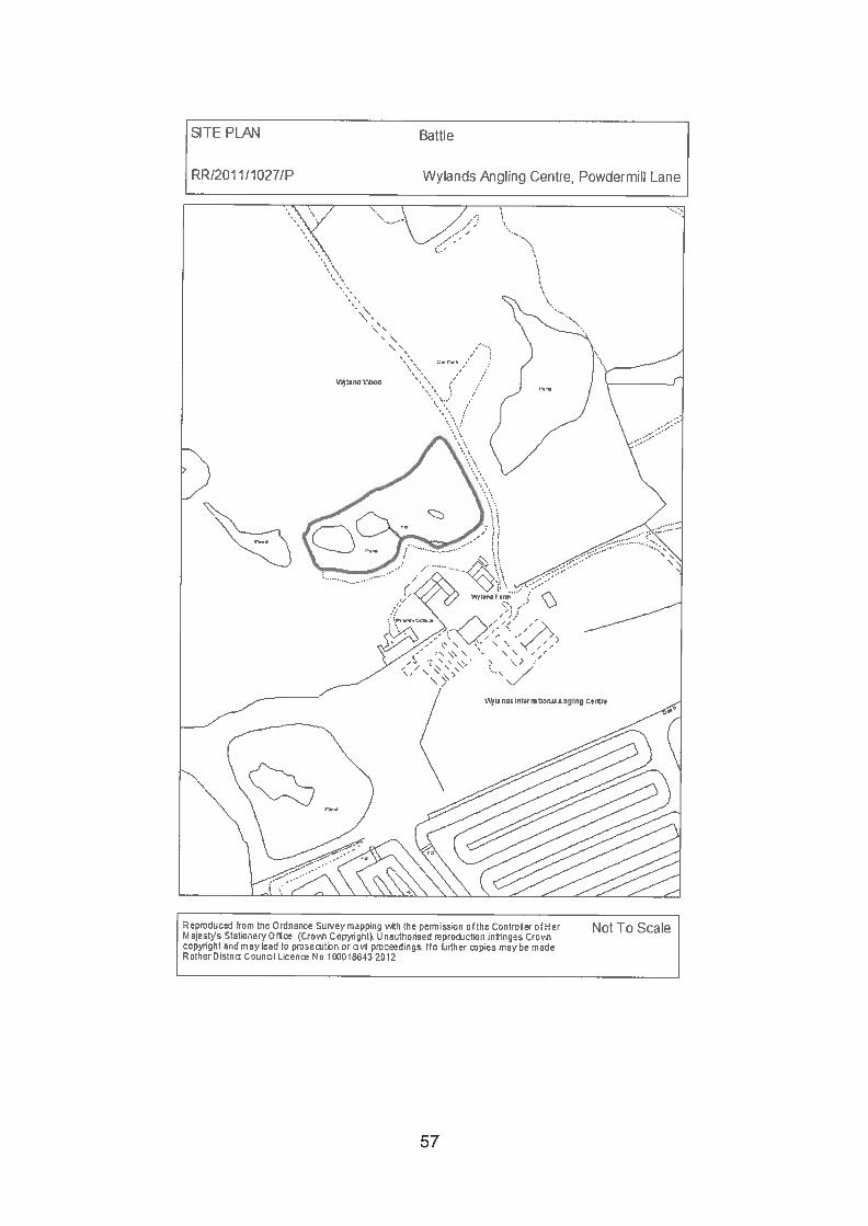
SITE PLAN Battle
RR/201 1/1027/P Wylands Angling Centre, Powdermill Lane
Not To ScaleRerruduced from the Ordnance Sur.’ey mamg v.4th the permission ofthe Controller ofH erMajestys Stationery Off Crova, Ccp’.iight Linauthorised reprcction infringes Crojiccpiight and may lead to pmseruiticn or an pmceedings No hirther pies may Lu madeRcther C stud Counol Licen No 10CC 1 Ert.2 2012
57
Planning Committee
RR/201 1/1 027/P CATSFIELD Wylands Angling Centre, PowdermillLane
Excavation works to and surrounding House Lake(Retrospective) and construction of 3 fishingplatforms and formation of 3 disabled parking bays.
Applicant: Mr 0 P BullAgent: Pump House DesignsCase Officer: Mr A S Rowland (Tel: 01424 787612)
(Email: [email protected])Parish: CATSFIELDWard Member: Councillor A E DaviesReason for Committee consideration: Head of Planning referral - Extensiveplanning history.Statutory 8 week date: 14 July 2011
This application was deferred at the August 2011 Committee for negotiations onamended plans to reduce the stark appearance of the alterations to the lake andimprove mitigation measures.
In view of the passage of time, more recent applications and an enforcement appealin the meantime, the application has been included on the Committee site inspectionlist.
1.0 POLICIES
1.1 The Rother District Local Plan 2006 is the Development Plan the policies ofwhich have been saved. Policy GD1 sets out general development criteriaapplicable to all development; GD1(iv),(v)&(vii) are particularly applicable.Policy EM7 supports proposals for the development of tourism or visitorfacilities. Policy DS1 sets out principles with which development shouldaccord, most specifically to this application:DS1(vi) — avoid prejudicing the High Weald Area of Outstanding NaturalBeauty (AONB).DS1 ((ix) — respects distinct landscape character etc.DS1 (x) — protect ancient woodland from development that would prejudice itsecological and landscape value.
1.2 The Rother District Local Plan — Core Strategy as an emerging policydocument having reached its examination stage may be afforded appropriateweight in determining planning applications (National Planning PolicyFramework (NPPF) para 216). The following policies can be applied to theconsideration of this proposal:
• OSS4(vi) — consideration in the context of landscape character/quality• OSS5 — General Development Considerations
58
• EN1 — Landscape Stewardship• RA2 — General Strategy for the Countryside• RA3 — Development in the Countryside (RA3((ii)• C03 - Improving Sports and Recreation Provision• EC6(i) — Enhancement of existing tourism attractions.• EN5(viii & ix) Biodiversity• TR4(iv) — Car parking.
1.3 The NPPF is a material consideration. Paragraph 28 of the NPPF supportseconomic growth in rural areas, promoting a strong rural economy and thesustainable growth of all types of business and enterprise in rural areasincluding support for sustainable rural tourism and leisure developments thatbenefit businesses in rural areas. Chapter 11 (Conserving and enhancing thenatural environment) is of particular relevance; para 115 provides that greatweight should be given to conserving landscape and scenic beauty in AONB,which have the highest status of protection in relation to landscape and scenicbeauty. Paragraph 118 requires planning authorities to aim to conserve andenhance biodiversity when determining planning applications and para 187advises decision takers to work proactively with applicants.
1.4 The National Parks and Access to the Countryside Act 1949 (Sections 5, 11and 88) and Section 85 of the Countryside and Rights of Way Act 2000 placea duty upon the Council to conserve and enhance AONB’s. Planning lawrequires that planning applications must be determined in accordance with thedevelopment plan unless material considerations indicate otherwise. NaturalEngland’s standing advice on ancient woodland is material to this application.
2.0 SITE
2.1 Wylands Angling Centre lies off the south side of Powdermill Lane, theapplication relates specifically to the lake to the west side of the drivewayknown as House Lake. The whole site is situated within the High WealdAONB and designated ancient woodland extends to the edge of the lake onits north and west sides.
3.0 HISTORY (Relevant)
3.1 RR/2010/731/P Excavation works to and surrounding House Lake(Retrospective) - Refused 20 May 2010
3.2 RR/2012/151/P Renovation works to Junior Lake (Retrospective) — Notyet determined.
3.3 An enforcement notice was served on 2l September 2011 relating to:1) The creation of a new lake (Junior Lake).2) The enlargement of House Lake by removing part of an island.3) The provision of a dam structure between House Lake and the new lake.4) The provision of paths and hard surfaced angling stations around House
Lake.
59
The subsequent appeal against the Enforcement Notice was dismissed andtherefore the notice is effective; it requires the land to be restored to its formercondition by:
i) Removing Junior Lakeii) Reinstating the islandiii) Removing the dam between House Lake and Junior Lake.iv) Removing the paths and angling stations around House Lake.
It should be noted that in considering the Enforcement Notice appeal theInspector was not required to consider the planning merits of the developmentunder ground (a) “that planning permission should be granted for what isalleged in the notice.” These merits now fall to the Council to consider indetermining both this planning application and application referenceRR/201 2/151/P.
4.0 PROPOSAL
4.1 Planning permission is sought retrospectively for works that have beenundertaken around the lake to form re-configured fishing stations with stepsdown to them, formation of a surfaced perimeter path, works to the bank sideand dredging of the lake edge. The fishing stations and the access path havebeen finished with gravel on a porous sub base but as part of the proposal it isintended to top these areas with bark chippings; some areas have alreadybeen so treated. Additionally a single island within the lake has been dividedinto two islands.
4.2 Since reporting this matter to the August 2011 Planning Committee, theapplication has been amended to include 3 disabled parking bays parallel tothe access drive on House Lake dam with bark covered paths leading to 3timber fishing platforms overhanging the lake edge with guard railing. Therevised plan also indicates amended landscaping proposals, (Drwg No2270/10/1/E) which includes marginal water planting as well.
4.3 The application is accompanied by a Planting Schedule which includesspecifications for establishment and maintenance. The schedule proposesplanting of individual trees and groups of planting and areas to be left toregenerate naturally.
5.0 CONSULTATIONS
5.1 Parish Council:
5.1.1 (Original comment 20011) ‘Objects to this retrospective planning proposal.There is insufficient in formation to support the application and it is not clearwhat the final outcome should be. There appears to be vety little change fromthe previous application RR/2010/731/P which was refused’
5.1.2 Comment has been invited upon the amended proposals (July 2013)
60
5.2 Southern Water:
5.2.1 No objections.
5.3 Environment Agency:
5.3.1 The proposed development will be acceptable if conditioned to require theprovision and implementation of a landscape/habitat management plan. (Seewebsite for full text)
5.4 Forestry Commission (2011):
5.4.1 Government advice places importance on preventing loss of ancientwoodland. Ancient woodland is widely regarded as irreplaceable. Part of thesite is subject to a felling licence which is conditional upon restocking eitherthrough regeneration or replanting. Aerial photographs appear to indicateother areas outside of any felling licence where trees have been removed.The felling licence condition mentioned above requires replanting, ifregeneration is not achieved, before 30 June 2012. The site manager hasassured the Commission that this will be done. (Website for full text)
5.5 Director of Services - Tree Officer (2011):
5.5.1 PPS 9 highlights the importance of Ancient Woodland; the development hasresulted in the loss of such woodland.Further to the losses of ancient woodland there has been no evidencesubmitted which comments on the presence of protected species and thepossible impact the clearance work would have had on them.In line with PPS9 mitigation and compensation measures should be used tooffset the losses of ancient woodland. This would also be necessary for anyharm that this development may have caused to any protected species. Thelandscape plan is satisfactory, but there could be included a managementplan to secure the ongoing protection and enhancement of new and existingenvironmental features and benefits across the area of Wylands. For instancethe plan could include the planting of new areas of woodland adjacent existingancient woodland or on cleared areas formerly identified as ancient woodlandas well as measures to enhance the diversity of habitats for protectedspecies.I do not consider that the application can be decided until these aspects havebeen resolved.
5.6 ESCC AONB Officer (2012):
5.6.1 House Lake is of a formalized character not in keeping with wider AONBlandscape the works proposed have the effect of extending that character.The features proposed effectively produce a parkland setting. The fishingplatforms, hard edges, steps and handrails (akin to street furniture) allcontribute to a formal, non-natural arrangement out of character with theAONB where a more natural, softened effect would be expected.Further specialist advice is required for a detailed management objectives andproposals to specify what the design intension is and how to achieve it.Proposal does not conserve and enhance the AONB. (For full text seewebsite)
61
5.7 Planninci Notice:
5.7.1 Three letters of objection —
• More natural surroundings should have been achieved.• The application contains many inaccuracies.• Previous application was refused as out of character with the AONB —
nothing has changed.• The application refers to works to ‘Junior Lake’ upstream from House
Lake. This area should be reinstated.• Loss of ancient woodland unacceptable to Forestry Commission.
5.7.2 An extensive letter of representation, which has not been summarized andwhich includes aerial photographs and photographs illustrating the situationbefore/during the works are attached as an APPENDIX DOCUMENT relatingto this Committee 18 July 2013.
6.0 APPRAISAL
6.1 Issues for consideration
6.1.1 Having regard to the statutory requirements, local policies, the NPPF and thefact that the site is an approved Angling Centre having been developed overmany years as a recreational facility the main issues for consideration are:
i) The effect of the enforcement notice.ii) The impact upon the character and appearance of the High Weald AONB.iii) The impact upon ancient woodland and biodiversity and its mitigationiv) The balance to be struck.
6.2 The effect of the enforcement notice
6.2.1 An enforcement notice may only be addressed by a successful appeal againstit or by the grant of planning permission. The appeal was dismissed but theplanning merits were not considered; they were left to this application togetherwith application RR/2012/151/P. In the event that this planning application isrefused the effect of the enforcement notice is to require:
i) The excavated fishing areas to be in filled and seeded to reinstate slopinggrass banks.
ii) The infilling of the gap between the two islands to reform a single island.iii) Remove the surfaced paths, steps, handrails etc. that have been creatediv) Remove that part of the dam to Junior Lake that falls within the ‘red’ site
area of this application.
6.3 The impact upon the character and appearance of the Hicih Weald AONB.
6.3.1 The Council has a statutory duty under the Countryside and Rights of WayAct 2000 (CROW Act 2000) to have regard to the purpose of designation ofAONBs the primary purpose of which is to conserve and enhance naturalbeauty.
62
• In pursuing the primary purpose of designation, account should be takenof the needs of agriculture, forestty, other rural industries and of theeconomic and social needs of local communities. Particular regard shouldbe paid to promoting sustainable forms of social and economicdevelopment that in themselves conserve and enhance the environment.
• Recreation is not an objective of designation, but the demand forrecreation should be met so far as this is consistent with the conservationof natural beauty and the needs of agriculture, forestry and other uses.
• The Countryside and Rights of Way Act 2000 reaffirms the primarypurpose of AONBs to conserve and enhance natural beauty and sets outresponsibilities for their management and for the production of AONBManagement Plans. (source HWAONB Management Plan)
6.3.2 Application RR!2010/731/P which was refused related to, essentially, thesame physical works as the current application minus the parking spaces andplatforms for the disabled now also included. That application was refused forthe reason:
‘The proposed development has resulted in a stark and unnatural landscapefeature wholly out of character and harmful to the appearance of the HighWeald Area of Outstanding Natural Beauty that could not be adequatelymitigated by the imposition of planning conditions. The Area of OutstandingNatural Beauty is required to be afforded the highest level of protection andtherefore the harm caused by the proposal is judged to be contrary to policyC3 of the South East Plan and policies GD1 (iv)&(v) of the Rother DistrictLocal Plan.’
6.3.3 The report leading to the issue of the enforcement notice (29 July 2011) gavethe reasons for taking enforcement action as:
‘The development has resulted in a stark and unnatural feature wholly out ofcharacter and harmful to the appearance of the High Weald Area ofOutstanding Natural Beauty which could not be adequately mitigated by theimposition of planning conditions. The Area of Outstanding Natural Beauty isrequired to be afforded the highest level of protection and therefore the harmcaused by the development is judged to be contrary to policies GD 1 (iv) and(v) of the Rother District Local Plan. The hard surfacing and the dam haveregular, unnatural features which contrast with the natural landscape. Theexecution of the works necessitated tel/hg of trees which, whilst notdevelopment in itself, prejudiced the Area of Outstanding Natural Beauty andfollowing the removal of the works the vegetation can be allowed toregenerate. The development involves the creation of further man madefeatures on the sita’
6.3.4 The question that now falls to be considered, is whether the additionallandscaping, marginal planting of water plants, surfacing of fishing areas andpaths with bark (previously gravel) and the natural regeneration andcolonisation of areas adequately mitigates the harm previously identified. Thisis of course largely a matter of individual opinion and judgement but Members’attention is drawn to the consultation response from the High Weald AONBunit. It should nevertheless be pointed out that the AONB response letter inthe first paragraph emphasises ‘This statement contains the professionalviews of the Policy Manager and not the views of the High Wea/d AONB Joint
63
Advisory Committee.’ The High Weald AONB Management Plan is a materialconsideration in the determination of the application.
6.3.5 Some Members will recall seeing the site in 2010 (for RR/2010/731/P) as areminder and for Members who did not visit an aerial photograph is attachedto the APPENDIX DOCUMENT. The site was inspected again by Members inAugust 2011 leading to the deferment of this application for amended plannegotiations; it being noted that there had been some regeneration and thescarring caused by the earthworks was less obvious than in 2010. Memberswill inspect the site again prior to considering this report and will observe thatthere has been further softening of the earthworks by regeneration andgreening of fishing stations by colonization.
6.3.6 In considering the effect of the works, and equally mitigation measures, it isimportant to understand that a public footpath traverses the dam at theeastern end of House Lake southwards to a ridge-top before descending intothe valley but of course the public do have access to the wider site as payingcustomers.
6.3.7 Your officers’ assessment is that the access drive-side disabled parkingspaces proposed have little material impact upon natural beauty appearing aswider sections of driveway. However, the associated timber watersideplatforms and safety rails, no doubt desirable for wheelchair users, seen atclose quarters by users of the public footpath would be alien to natural beauty;it is considered that they could not be adequately screened. These structureswould add to the ‘street furniture’ found to be unacceptable by the High WealdUnit. It is accepted that House Lake is the most convenient for access bypersons with restricted mobility that should not however mean that anunnatural appearance is acceptable or inevitable.
6.3.8 House Lake is not itself a natural feature having been created in the mid1980s, the access drive is on the dam that allowed the lake to be formed. Abridge spanning to the main island is believed to date from a similar time.However, it nestled surrounded on two sides by woodland and a grass banksloping up to the farm buildings on the south side and had a naturalisticsetting. Like the bridge the rustic handrails/barriers and steps detract fromthis. The altered land form surrounding the fishing stations that have beencreated are inescapably artificial, landscape planting would partially concealand soften the harshness of some of these areas. The ‘flat’ areas have clearlybeen created for a functional reason; they are unnatural, primarily because ofthe surface finish/colour and not specifically because they are flat. Theoriginally specified gravel was unacceptable; bark has now been specifiedand has been spread over some areas. Where bark has been used it hasallowed grass to start to establish which, along with marginal plants becomingestablished has mitigated to a degree the stark appearance previously citedas harmful to the AONB. The excavation to bisect the island is not consideredto be a matter that warrants a refusal of planning permission on AONBgrounds. In the final analysis the overall effect of the works upon the AONB isa matter of judgment.
64
6.4 The impact upon ancient woodland and biodiversity and its mitigation.
6.4.1 This application impacts upon ancient woodland and potentially biodiversityprimarily as a result of the formation of a path, steps and levelled fishingstations on the north side of the lake where the ancient woodland designationextends to the lake margin.
6.4.2 It is clear from aerial photographs that previously the woodland canopyoverhung the waterline on the north side and the western end. What is notclear is what exactly existed in the way of fishing stations and pathways toaccess them. There is however no doubt that there has been both earthworksand the formalization of an access path which will have disturbed thewoodland floor to a greater or lesser extent. Ancient woodland is a finiteresource the loss of which should be resisted. The value of ancient woodlandlays in the woodland floor not the trees themselves; it cannot be re-createdonce lost. Because the application is retrospective the loss has to a largedegree already occurred.
6.4.3 Similarly, there may have been disturbance to protected species and probablyloss of marginal habitat. However, since the application is retrospective thereis no reliable means of ascertaining the extent of any harm that may havebeen caused. The removal of trees was for the most part with the benefit of afelling licence from the Forestry Commission in 2009 who presumably did notperceive there to be a risk to protected species reliant upon them such asbats. The removal of trees did not require planning permission. It is alsospeculated that the fact that the lake is used as a commercial fishery is verylikely to diminish the likely presence of protected species as a result of regularhuman presence.
6.4.4 Just prior to the August 2011 Planning Committee meeting the applicantprovided a report relating to ancient woodland and protected species, togetherwith mitigation proposals, which was forwarded to Natural England. No formalresponse has been received presumably because the Council is expected toself-serve using their website. Using this facility it has been concluded that inthe event that Members resolve to grant planning permission it would beappropriate to require mitigation measures in respect of woodland plantingand provision for protected species in the form of bat and bird boxes andreptile provision in the form of artificial hibernacula.
6.5 The balance to be struck.
6.5.1 Wylands is a commercial fishery using countryside lakes which contributes tothe local economy. At the same time it is within the designated AONB whichshould be afforded the highest level of protection. The NPPF requires bothgreat weight to be given to conserving the AONB and support to maintain astrong rural economy and the sustainable growth of all types of business andenterprise in rural areas, including support for sustainable rural tourism andleisure developments that benefit businesses. The High Weald AONBManagement Plan recognises the demand for recreation should be met onlyso far as this is consistent with the conservation of natural beauty. This is thebalance to be struck.
65
6.5.1 It is your officers’ opinion that any harm that has occurred to the ancientwoodland edge and bio-diversity has already occurred and warrants mitigationin the event that planning permission were to be granted. Where soil has beenremoved the intrinsic value contained therein has been lost, simply importingsoil and replanting does not re-create ancient woodland.
6.5.2 However, the existing ‘street furniture’ elements, most particularly the existinghandrails/barriers and the proposed timber platforms are/would be harmful tothe AONB; they are obvious in the view from the public footpath and areurbanizing features. If Members are minded to approve the application it issuggested that these elements should be deleted from the application.
6.5.3 Turning to the earthworks, it is considered that works to the island have not inisolation caused unacceptable landscape harm, especially when water plantsare established as proposed. The earthworks to form the fishing stations aremore controversial. In 2010 they were clearly raw in the landscape and of anunnatural form. Today, 3 years later the impact is less obvious but to thecritical eye still unnatural. The proposed planting would go some way toalleviating the adverse impact but more could be done with some furtherground re-modelling and planting. It is probably not necessary to entirelyrestore original levels to achieve an acceptable appearance but a morerounded, contoured and gentle transition taken together with planting wouldbe more appropriate than the mechanical engineered form that currentlyexists. Members will be able to view the fishing stations to aid thereassessment of this matter.
7.0 SUMMARY
7.1 Overall it is considered that the works that have been undertaken to HouseLake, principally the handrails/barriers, the unnatural ‘banks’ to the fishingstations together with the proposed formation of timber platforms at the lakeedge are considered to be to the detriment of the character and appearanceof the High Weald AONB and should not be supported.
7.2 It is considered that whilst the proposal has resulted in some loss of ancientwoodland and harm may have been caused to protected species/habitat thiscannot be accurately or reliably be identified. Moreover, because much of thevalue of ancient woodland lies in the woodland floor any harm has alreadyoccurred by soil removal. Consequently it is considered that mitigationmeasures should be required by the imposition of reasonable conditions,reflecting the suggestions within the applicants’ habitat report (MayhewConsultancy) in the event that planning permission was to be granted.
7.3 It is concluded that without amendment the development as set out in theapplication would be harmful to the High Weald AONB.
RECOMMENDATION: REFUSE (FULL PLANNING)
66
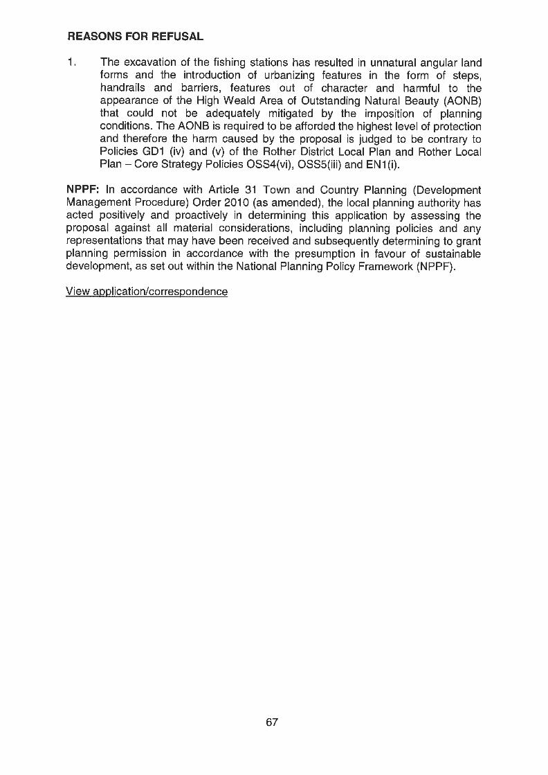
REASONS FOR REFUSAL
1. The excavation of the fishing stations has resulted in unnatural angular landforms and the introduction of urbanizing features in the form of steps,handrails and barriers, features out of character and harmful to theappearance of the High Weald Area of Outstanding Natural Beauty (AONB)that could not be adequately mitigated by the imposition of planningconditions. The AONB is required to be afforded the highest level of protectionand therefore the harm caused by the proposal is judged to be contrary toPolicies GD1 (iv) and (v) of the Rother District Local Plan and Rother LocalPlan — Core Strategy Policies OSS4(vi), OSS5(iii) and EN 1(i).
NPPF: In accordance with Article 31 Town and Country Planning (DevelopmentManagement Procedure) Order 2010 (as amended), the local planning authority hasacted positively and proactively in determining this application by assessing theproposal against all material considerations, including planning policies and anyrepresentations that may have been received and subsequently determining to grantplanning permission in accordance with the presumption in favour of sustainabledevelopment, as set out within the National Planning Policy Framework (NPPF).
View application/correspondence
67
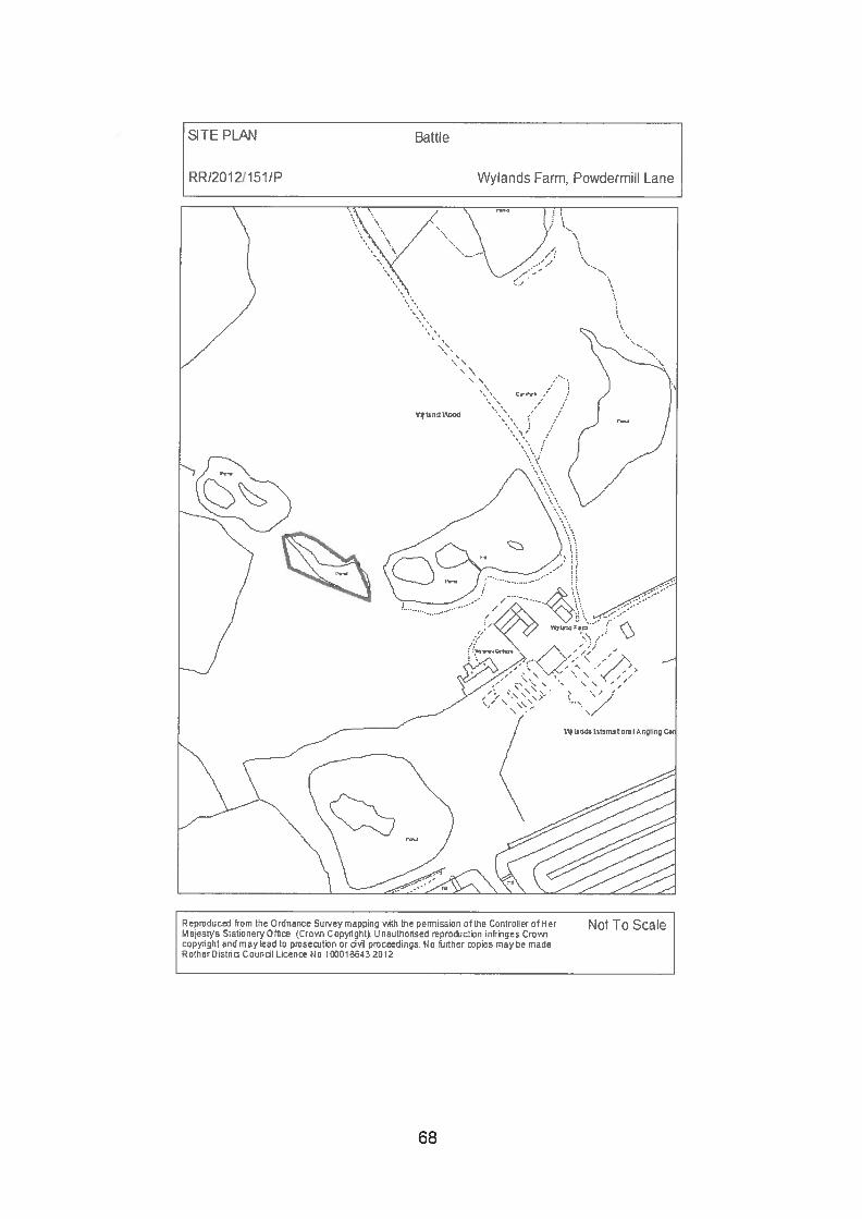
SITE PLAN Battle
RR/2012!151/P Wylands Farm, Powdermill Lane
Not To ScaleReprouce from the Ordnance Sur.’ey maprng with the permission cfthe ControUer of H orII ajest’n Stationery CIfh iCro,gi Ccpright LI nauthonsed reproduction infrmnes Crow,copr,ght and maylead to proseottan or iI proceedings tic further pies maybe madeRothurDistrid Counol LIcenm to 1OCO 103 2012
68
Planning Committee 18 July 2013
RR/201 2/1 51/P CATSFIELD Wylands Farm, Powdermill Lane
Renovation works to Junior Lake (Retrospective)
Applicant: Mr D P Bul IAgent: Pump House DesignsCase Officer: Mr A S Rowland (Tel: 01424 787612)
(Email: [email protected])Parish: CATSFIELDWard Member: Councillor A E DaviesReason for Committee consideration: Head of Planning referral - Extensiveplanning historyStatutory 8 week date: 29 February 2012.
This application has been added to the Committee site inspection list.
1.0 POLICIES
1.1 The Rother District Local Plan 2006 is the Development Plan the policies ofwhich have been saved. Policy GD1 sets out general development criteriaapplicable to all development; GD1(iv),(v)&(vii) are particularly applicable.Policy EM7 supports proposals for the development of tourism or visitorfacilities. Policy DS1 sets out principles with which development shouldaccord, most specifically to this application:
DS1(vi) — avoid prejudicing the High Weald Area of Outstanding NaturalBeauty (AONB).DS1 ((ix) — respects distinct landscape character etc.DS1 (x) — protect ancient woodland from development that would prejudice itsecological and landscape value.
1 .2 The Rother District Local Plan — Core Strategy (with focused amendments) asan emerging policy document having reached its examination stage may beafforded appropriate weight in determining planning applications (NationalPlanning Policy Framework (NPPF) para 216). The following policies can beapplied to the consideration of this proposal:
• OSS4(vi) — consideration in the context of landscape character/quality• OSS5 — General Development Considerations• EN1 — Landscape Stewardship• RA2 — General Strategy for the Countryside• RA3 — Development in the Countryside (RA3((ii)• C03 - Improving Sports and Recreation Provision• EC6(i) — Enhancement of existing tourism attractions.• EN5(viii & ix) Biodiversity
69
1 .3 The National Planning Policy Framework (NPPF) is a material consideration.Paragraph 28 of the NPPF supports economic growth in rural areas,promoting a strong rural economy and the sustainable growth of all types ofbusiness and enterprise in rural areas including support for sustainable ruraltourism and leisure developments that benefit businesses in rural areas.Chapter 11 (Conserving and enhancing the natural environment) is ofparticular relevance; para 115 provides that great weight should be given toconserving landscape and scenic beauty in Areas of Outstanding NaturalBeauty, which have the highest status of protection in relation to landscapeand scenic beauty. Paragraph 118 requires planning authorities to aim toconserve and enhance biodiversity when determining planning applicationsand para 1 87 advises decision takers to work proactively with applicants.
1 .4 The National Parks and Access to the Countryside Act 1949 (Sections 5, 11and 88) and Section 85 of the Countryside and Rights of Way Act 2000 placea duty upon the Council to conserve and enhance AONBs. Planning lawrequires that planning applications must be determined in accordance with thedevelopment plan unless material considerations indicate otherwise.
2.0 SITE
2.1 Wylands Angling Centre lies off the south side of Powdermill Lane, theapplication relates specifically to a newly created lake situated to the west ofHouse Lake which itself is on the west side of the access drive. The wholesite is situated within the High Weald AONB. The lake the subject of thisapplication lies within land designated as ancient woodland.
3.0 HISTORY (Relevant)
3.1 RR/2010/731/P Excavation works to and surrounding House Lake(Retrospective) - Refused 20 May 2010.
3.2 RR/2011/1027/P Excavation works to and surrounding House Lake(Retrospective) and construction of 3 fishing platformsand formation of 3 disabled parking bays — Not yetdetermined.
3.3 An enforcement notice was served on 21 September 2011 relating to:
5) The creation of a new lake (Junior Lake).6) The enlargement of House Lake by removing part of an island.7) The provision of a dam structure between House Lake and the new lake.8) The provision of paths and hard surfaced angling stations around House
Lake.
The subsequent appeal was dismissed and therefore the notice is effective; itrequires the land to be restored to its former condition by:
i) Removing Junior Lake.ii) Reinstating the island.iii) Removing the dam between House Lake and Junior Lake.
70
iv) Removing the paths and angling stations around House Lake.
It should be noted that in considering the Enforcement Notice appeal theInspector was not required to consider the planning merits of the developmentunderground (a) “that planning permission should not be granted for what isalleged in the notice.” These merits now fall to the Council to consider indetermining both this planning application and application referenceRR/201 1/1027/P.
4.0 PROPOSAL
4.1 The description of development provided by the applicants’ agent is‘Renovation of Junior Lake (Retrospective)’. The name Junior Lake hasrecently been adopted by the applicants following the works undertaken toform it.
4.2 The applicant has been invited to agree that the description of developmentshould be amended to accurately reflect the unauthorised works alreadyundertaken and proposed by the submitted plans. The proposal being theenlargement of former pond for wildlife purposes by the reinstatement andraising of the dam, formation of overflow and the creation of 3 timber ‘dippingplatforms’ at the edge of the lake
4.3 The application is certainly retrospective but whilst a small pond existed onhistoric mapping it is known from research and evidence submitted for theEnforcement Notice appeal that it was prone to drying out in the summer.Moreover any dam that may have existed was breached thereby draining thepond: a feeder stream remained running into House Lake.
5.0 CONSULTATIONS
5.1 Parish Council:
5.1.1 Comments awaited.
5.2 Environment Agency:
5.2.1 The proposed development will be acceptable if conditioned to require theprovision and implementation of a landscape/habitat management plan.No ecological information has been submitted to support the application.There is no information on the cross section of the pond that demonstrates itsvalue for wildlife nor input from an experienced ecologist.The LPA should prevent harm to biodiversity interests and seek to enhanceand expand them where possible. (See website for full text)
5.3 Forestry Commission:
5.3.1 Government strongly discourages development resulting in loss of ancientwoodland unless there are overriding public benefits. Ancient woodland iswidely regarded as irreplaceable.
71
5.3.2 The site is subject to a felling licence which is conditional upon restockingeither through regeneration or replanting. The felling licence conditionmentioned above requires replanting, if regeneration is not achieved, before30 June 2012. (See website for full text)
5.4 Director of Services - Tree Officer:
5.4.1 “The NPPF highlights the importance of ancient woodland stating thatplanning permission should be refused for development resulting in the loss ordeterioration of irreplaceable habitats, including ancient woodland.
In this instance the planning application is retrospective and resulted in theloss of areas of ancient woodland. It is considered that the ancient woodlandaround the pond has been disturbed to such an extent it would not bepossible to restore the habitat satisfactory. It is recognized that the creation ofponds and clearings in woodland can add to the diversity of the habitat ifmanaged appropriately. A management plan should be drawn up for the pondto ensure this.
Although it is considered that there would be no benefit to restoring the arealost to the pond, in line with Policy EN5 (viii) of the Rother District Local Plan —
Core Strategy mitigation and compensation measures should be uses tooffset the losses of ancient woodland. There could be included a managementplan to secure the on-going protection and enhancement of new and existingenvironmental features and benefits across the area of Wylands. For instancethe plan should include the planting of new areas of woodland adjacentexisting ancient woodland or on cleared areas formerly identified as ancientwoodland as well as measures to enhance the diversity of habitats forprotected species.”
5.5 ESCC AONB Officer:
5.5.1 Not satisfied with the profiling works to Junior Lake, the felling of ancientwoodland and the additional work suggested to the wetland area above JuniorLake. A full detailed pond renovation and management plan is required toallow full assessment of impact on AONB. The information provided isinadequate. It is expected that a plan be included outlining how a pond canlong term support and encourage an appropriate variety of pond life.
5.5.2 Proposals do not currently meet the requirement Gi of the AONBManagement Plan (restore natural functioning water systems). As existingJunior Lake does not conserve and enhance the AONB. (See website for fulltext)
5.6 Planning Notice:
5.6.1 One letter that does not comment upon the merits of the planning applicationbut sets out the author’s knowledge of how the unauthorised works werecarried out.
5.6.2 Members’ attention is drawn to the appendix document referring to applicationRR/201 1/1 027/P which pre-dates the submission of this application but doescontain comment upon the subject matter of this submission.
72
6.0 APPRAISAL
6.1 Issues for consideration
6.1.1 Having regard to the statutory requirements, local policies, the NPPF and thefact that the site is an approved Angling Centre having been developed overmany years as a recreational facility the main issues for consideration are:
i) The effect of the enforcement notice.ii) The impact upon the character and appearance of the High Weald AONB.iii) The impact upon ancient woodland and biodiversity and its mitigationiv) The balance to be struck.
6.2 i) The effect of the enforcement notice
6.2.1 An enforcement notice may only be addressed by a successful appeal againstit or by the grant of planning permission. The appeal was dismissed but theplanning merits were not considered; they were left to this application togetherwith application RR/201 1/1027/P. In the event that this planning application isrefused the effect of the enforcement notice is to require:i) The infilling of the lake with soil and reseed with grassii) Remove the dam to Junior Lake
6.3 ii) The impact upon the character and appearance of the High Weald AONB.
6.3.1 The Council has a statutory duty under the Countryside and Rights of WayAct 2000 (CROW Act 2000) to have regard to the purpose of designation ofAONBs the primary purpose of which is to conserve and enhance naturalbeauty.• In pursuing the primary purpose of designation, account should be taken
of the needs of agriculture, forestry, other rural industries and of theeconomic and social needs of local communities. Particular regard shouldbe paid to promoting sustainable forms of social and economicdevelopment that in themselves conserve and enhance the environment.
• Recreation is not an objective of designation, but the demand forrecreation should be met so far as this is consistent with the conservationof natural beauty and the needs of agriculture, forestry and other uses.
• The Countryside and Rights of Way Act 2000 reaffirms the primarypurpose of AONB5 to conserve and enhance natural beauty and sets outresponsibilities for their management and for the production of AONBManagement Plans. (source HWAONB Management plan)
6.3.2 Prior to the formation of Junior Lake as it is today the land was wooded with asmall pond that it is understood periodically dried up. The ‘red’ site area sitswithin a larger expanse of designated ancient woodland, a significant area ofwhich was felled under a Forestry Commission licence. It is assumed that theForestry Commission were satisfied that the tree felling and subsequentregrowth/replanting did not breach their responsibility to safeguard the AONB.The felling licence was conditional upon regeneration supplemented, ifnecessary, by replanting. The Forestry Commission are responsible forenforcement of their own conditions. They have confirmed that
73
notwithstanding that the area of the lake could not be replanted in the event ofplanning permission being granted this would not prevent enforcement overthe remaining area of the licence. Members will have noted the viewsexpressed by the AONB Unit’s Policy Manager.
6.3.3 Prior to the unauthorised works to form the present Junior Lake the areaappeared as woodland in the AONB landscape. Following the implementationof the felling licence there was a degradation of the landscape that wasexacerbated by the earthworks to form the new lake both as a result of theformation of the dam and the resultant appearance of ‘bare earth’. When theregeneration/replanting required by the felling licence grows much of thevisual harm to the landscape will disappear. The dam is an artificial landformbut as it has greened so it has become significantly less apparent in thelandscape. The only public view of the dam in the landscape is across thelength of House Lake from the public footpath; additional planting could beconditioned if considered necessary. Members will be inspecting the site andsome Members will also recall having done so in both 2010 and 2011 and willtherefore be in a position to appreciate the change that has naturallyoccurred.
6.3.4 Your officers’ view is that the re-establishment of tree cover will ensure thatthe appearance of the landscape will be conserved; the biodiversity potentialof the lake gives the opportunity to provide enhancement. The lake is not nowgenerally visible in the wider landscape and in time it would only be visible atclose quarters or from the air. The exact qualities of what existed prior to theunauthorised works are not precisely known. It has been suggested that theland form may have been a typical ghyll stream. Natural England defines aGhyll as, ‘valley woodlands where a stream has eroded the underlying rock’.This it is not thought to be the case here. Consideration has been given to thepotential effect upon the woodland of the lake. Natural England say thataltering the drainage into woods or the water table around woods and veterantrees may affect their long term viability and composition. It is opined that ifthere is any effect of the water table on trees in this case it is most likely that itwould result in different species establishing to suit the conditions, but inlandscape terms woodland cover would continue giving a neutral landscapeimpact. Indeed the lake banks could be planted with species well suited tosuch a location such as Alder.
6.4 iii) The impact upon ancient woodland and biodiversity and its mitiQation.
6.4.1 The site is within designated ancient woodland. For Members’ informationancient woodland is defined in Natural England Standing Advice as:
• ‘Ancient woodland in England is defined as an area that has been woodedcontinuously since at least 1600 AD 4. If woodland has been through along phase in the last 400 years when the land was open, for example asgrassland, heath, moor or arable, then the site is classed as recentwoodland. It may still have high value for nature conservation, but it is notancient woodland.
• Continuously wooded in the above definition does not require there tohave been a continuous physical cover of trees and shrubs across theentirety of a site. Open space, both temporary and permanent, is an
74
important component of woodlands. Habitats such as glades, deer lawns,rides, ponds and streams, as well as gaps created by natural disturbance,may all occur within woodland and add to its diversity.
• In most; if not all ancient woods, the trees and shrubs have been cut downperiodically. The time between the felling occurring and the tree canopybeing re-established will vary depending on the management regime, andregrowth may be delayed by deer grazing or other factors. Provided thatthe area has remained as woodland the stand is still considered ancient.Since it may have been cut over many times in the past; ancient woodlanddoes not necessarily contain old trees.’
6.4.2 This application has impacted upon ancient woodland and potentiallybiodiversity. The formalisation of graded lakeside banks etc. has destroyedthe most important element of ancient woodland, the woodland floor with all ofits historic resource as an ecological reservoir of species. Moreover, it iswidely acknowledged that this cannot be re-created. Indeed, new woodlandcreation does not provide a direct replacement for the conditions found inancient woodland and hence cannot be considered as mitigation for anirreplaceable environmental asset. Support for this view is given in the UKBiodiversity Action Plan which comments that: ‘ the full suite ofcommunities and features associated with ancient woodland can never bereplicated. Given time, perhaps centuries, new woods may be able to achievethe same level of biodiversity as ancient woodland.’ Because the applicationis retrospective the loss of ancient woodland quality has to a large degreealready occurred and cannot be replicated; the infilling of the lake will not reestablish ancient woodland as such. Similarly, there may have beendisturbance to protected species and probably loss of habitat. However, sincethe application is retrospective there is no reliable means of ascertaining theextent of any harm that may have been cause. The lake does howeverintroduce different new habitats.
6.4.3 The AONB Unit were not satisfied, following a site inspection with the profilingworks to Junior Lake, the felling of ancient woodland and the additionalwetland area above Junior Lake. It must firstly be said that planningpermission is not required to fell trees and the applicant did obtain therequisite felling licence from the Forestry Commission before doing so. Thereference to works to a wetland area above the lake is not understood as nosuch area can be found and it is not clear as to what works are beingreferenced. The application is retrospective in all respects other than thesuggested formation of three ‘dipping platforms’. Similarly the lake profile isnot shown upon any plan nor can it be accurately ascertained without drainingthe lake. What is clear from a site inspection is that there are shallow marginsto the lake well suited to amphibian access and egress. In latercorrespondence the AONB Unit state that, ‘if this is to be managed as awildlife pond then further design and consideration to the management andstructure of it needs to be given. It is partially true that natural regenerationwill assist the formation of natural wildlife pond, but we are concerned that thisappears to be dependent on water flows over time, providing no guaranteethat the aims of the planning application can be achieved.’ The EnvironmentAgency recommends a planning condition to secure a management plancovering both ancient woodland and wildlife pond management.
75
6.4.4 The dipping platforms would permit visitors to access the water toinvestigate/study water life and would not be visible to the wider public or inthe landscape because of being set low to the water. However, if Membersfind this unacceptable or inconsistent with the recommended approach uponRR/201 1/1027/P above the applicants would delete them from the application.
6.5 iv) The balance to be struck
6.5.1 It is a regrettable fact that the works have been undertaken and the ancientwoodland over the footprint of the lake and its immediate banks and dam hasbeen destroyed. It cannot be restored. If the lake were to be in-filled andplanted as specified by the Enforcement Notice the result would be an area ofnew woodland which in time may benefit ecologically from abutting theancient woodland. However alternatively, if new woodland is to be planted itcould equally be in another location adjacent to ancient woodland where itcould also reinforce screening as well as increasing woodland cover. The lakein situ would remain. This approach would have the dual benefit of notcausing any additional ancient woodland damage through further earthworkswhilst adding to habitat variety.
6.5.2 It is believed that by this latter approach the AONB would be conserved andcould be enhanced by imposition and enforcement of a management plancondition as suggested by the Environment Agency. It would also be pertinentto restrict the lake to a wildlife facility and to specifically exclude its use forangling purposes.
7.0 SUMMARY
7.1 The development has resulted in the loss of ancient woodland, a resourcethat cannot be recreated.
7.2 Surrounding felled woodland will regenerate and/or be replanted under thecontrol of the Forestry Commissions felling licence conditions, indeedregeneration is already occurring; this, together with additional planting and amanagement plan would ensure that the landscape of the AONB is conservedand enhanced.
7.3 The management of the lake in accord with good practice, such as publishedby the Pond Conservation Trust (www.pondconservation.org.uk) wouldpotentially enable a diversity of habitat to be achieved. A management planwould be an appropriate means of delivering this.
RECOMMENDATION: GRANT (FULL PLANNING)
CONDITIONS
1. Within six months of the date of this permission a management plan, includinglong term objectives, management responsibilities and maintenanceschedules for all ancient woodland, and the lake the subject of this planningpermission, shall be submitted to the local planning authority and shall be
76
subject to their approval. The management plan shall be carried out asapproved and any subsequent variations shall be agreed in writing by thelocal planning authority.The scheme shall include the following elements:• An Ancient Woodland management plan of the surrounding site; and• A wildlife pond management plan detailing how the pond benefits wildlife
particularly by having a range of profiles (such as shallow areas) andhabitats to benefit pond-life.
• Protected species mitigation measures based upon the suggestions setout within the report of the Mayhew Consultancy dated 8 August 2011.
Reason: To ensure the protection of areas for wildlife and supporting habitatand to secure opportunities for the enhancement of the nature conservationvalue of the site in line with national planning policy, Policy GD1 (vii) of theRother Local Plan 2006 and Policies EN5(viii) & (ix) of the Rother Local Plan— Core Strategy (with focused amendments)
2. The lake the subject of this planning permission shall be retained for wildlifeconservation purposes only and shall not be used for any angling purposeswhatsoever.Reason: To ensure the protection and retention of areas for wildlife andsupporting habitat of nature conservation value on the site in line with nationalplanning policy, Policy OD1 (vii) of the Rother Local Plan 2006 and PoliciesEN5(viii) & (ix) of the Rother Local Plan — Core Strategy (with focusedamendments)
3. Within 6 months of the date of this permission a scheme of landscape plantinghave been submitted to and approved by the local planning authority, whichshall include planting plan, written specification and schedule of plants (notingspecies and numbers). The planting shall be undertaken in accordance withthe approved details in the first planting season following the approval of suchdetails.Reason: To enhance the appearance of the development and to safeguardthe characteristics of the locality in accordance with Policies GD1 (iv) & (v) ofthe Rother District Local Plan.
NPPF: In accordance with Article 31 Town and Country Planning (DevelopmentManagement Procedure) Order 2010 (as amended), the local planning authority hasacted positively and proactively in determining this application by assessing theproposal against all material considerations, including planning policies and anyrepresentations that may have been received and subsequently determining to grantplanning permission in accordance with the presumption in favour of sustainabledevelopment, as set out within the National Planning Policy Framework (NPPF).
View application/correspondence
77
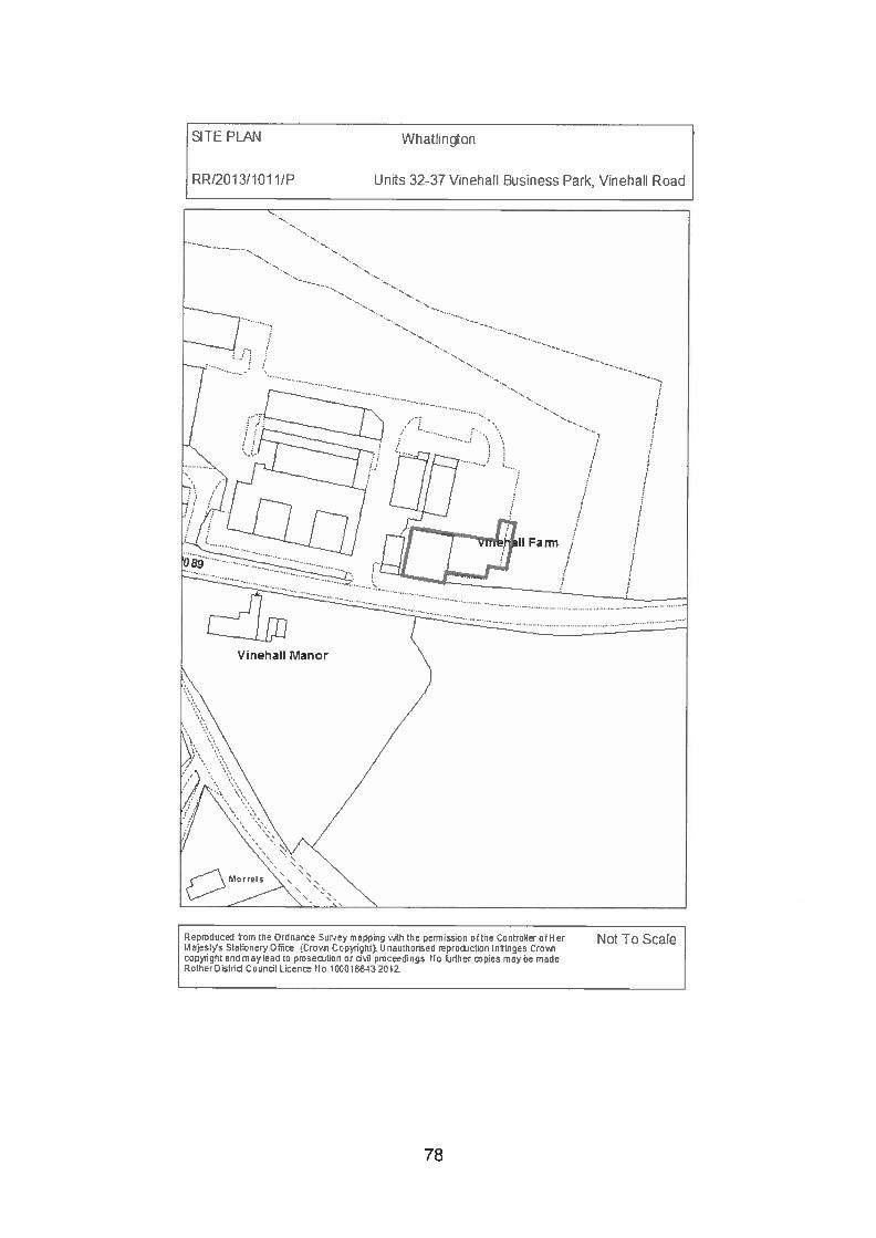
SITE PLAN Whatlington
RR120131101 1/P Uns 32-37 Vinehail Busness Park, Vinehaii Road
Rernduced from the Ordnance Sur.ey mapin v,th the ennsson ofthe Control’er ofHerlajest’/s StatoneryOft Croi Copight. Linauthonsed mprocton infringes Cro’A,
copght and may Cad to pmseton or iI pmceedngs. No fudh&r pies may be madeRotherDstri Coundi Licen No 10O010 2012
Not To Scale
78
Planning Committee 18 July 2013
RR/201 3/1 011/P WHATLINGTON Units 32-37 Vinehall Business Park,Vinehall Road
Change of use from Use Class B1 (business) to UseClass B2 (general industrial)
Applicant: Paneltech Systems LimitedAgent: CLM PlanningCase Officer: Miss H Bonds (Tel: 01424 787602)
(Email: [email protected])Parish: WHATLINGTONWard Member: Councillor D W L M Vereker and Councillor R WhiteReason for Committee consideration: Head of Planning referralStatutory 8 week date: 8 July 2013
This application has been added to the Committee site inspection list.
1.0 POLICIES
1.1 Policy GD1 of the Rother District Local Plan (2006) requires development to:(ii) be in keeping with and not unreasonably harm the amenities of adjoiningproperties; (iv) respect and not detract from the character and appearance ofthe locality; and (v) be compatible with the conservation of the natural beautyof the High Weald Area Outstanding Natural Beauty (AONB). Policy EM1seeks to accommodate smaller scale business activities by (iii) theconversion, redevelopment or extension of sites and premises outsidedevelopment boundaries where this does not detract from the character orappearance of the area as well as meeting general developmentconsiderations. Policy EM3 supports the re-use and adaption of buildings inthe countryside for employment purposes subject to certain criteria, including:(v) the proposed use either has an acceptable impact on its surroundings,including its traffic impact and on local amenity or any potentially harmfulimpacts can be dealt with by imposing reasonable conditions on a planningpermission.
1 .2 Emerging policies in the Rother District Local Plan — Core Strategy includePolicy OSS5, which requires development to: (ii) not unreasonably harm theamenities of adjoining properties; and (iii) respect and not detract from thecharacter and appearance of the locality. Policy EC3 supports effective use ofemployment land and premises by (ii) permitting intensification, conversion,redevelopment and/or extension having regard to other policies of the Plan.Policy EN1 seeks the protection and wherever possible, enhancement, of thedistrict’s nationally designated and locally distinctive landscapes andlandscape features, including the High Weald AONB.
1 .3 The National Planning Policy Framework (NPPF) sets out Governmentguidance and national policy. Chapter 1 notes that significant weight should
79
be placed on the need to support economic growth through the planningsystem. Chapter 3 supports the sustainable growth and expansion of all typesof business and enterprise in rural areas. Chapter 11 notes that planningpolicies and decisions should aim to avoid noise from giving rise to significantadverse impacts on health and quality of life as a result of new development;and mitigate and reduce to a minimum other adverse impacts on health andquality of life arising from noise from new development, including through theuse of conditions.
2.0 SITE
2.1 The application site comprises one building and an adjoining area of hard-standing, situated on the Vinehall Business Park. The Vinehall Business Parkis a complex of converted farm buildings which lies adjacent to the A21/B2089 junction, north of the main settlement of Whatlington. Buildings aregenerally of a small size, the current application relates to one of the largestbuildings in the complex. The building is of metal/timber construction andoccupies a rectangular footprint of 288m2, providing accommodation on asingle level. It has large doors on the front (northern) elevation. The buildingcontains 4 numbered “units”, numbers 32/34 in its eastern half, and numbers35/37 in its western half. It is partly divided into 2 halves by an internal wallbut the internal space is used as one large area.
2.2 The site is located within the High Weald AONB and outside the developmentboundary. The area is generally characterised by areas of agricultural land,woodland and scattered properties. The closest residential properties to theapplication site are Vinehall Farmhouse (which is under the control of theowner of the business park) and Vinehall Manor, which lies on the southernside of the B2089. The house at Vinehall Manor lies 55m south-west of theapplication site, while the garden is 15m away at the closest point, separatedby the road.
3.0 HISTORY
3.1 RR/89/0723/P Change of use in principle from agricultural to lightindustrial (Bi) use. Approved conditional in August 1989.This permission covers the majority of land and buildingswithin the Business Park, including the application site.
3.2 RR/90/1184/P Change of use and conversion of portion of existingagricultural building to form cold store and distributionbase. Approved conditional in July 1990. This permissionrelates to one unit, unit no. 3, which lies in the central partof the Business Park.
3.3 RR/90/1186/P Change of use and conversion of portion of existingagricultural building to form wood-turners workshop.Approved conditional in July 1990. This permissionrelates to one unit, unit no. 1, also in the central part ofthe Business Park.
80
3.4 RR/2005/3706/P Change of use of redundant agricultural shed tocommercial B1/B8 use. Approved conditional in February2005. This permission relates to the building immediatelywest of the application site.
3.5 On 19 March 2013, the Council served a Breach of Condition Notice on theapplicant for not complying with condition 7 of planning permissionRR/89!0723/P. Condition 7 limits the use of premises within the VinehallBusiness Park to those within Use Class Bi of the Town & Country Planning(Use Classes) Order 1987. In serving the Breach of Condition Notice, theCouncil considered that the current use of the building falls within Use ClassB2. The serving of the Breach of Condition Notice followed lengthyenforcement investigations which commenced with the receipt of a complaintregarding noise from the application site in January 2011.
4.0 PROPOSAL
4.1 The current application seeks permission retrospectively to change the use ofthe site from Use Class Bi (business) to Use Class B2 (general industrial).The applicant operates a metal fabrication and welding department from thebuilding. This involves noise generating activities in the handling and makingof metal products through the cutting, shaping and grinding of steel. It isconsidered that these activities fall outside the definition of a Bi use, andconsequently, the applicant seeks to regularise the current use of the sitethrough a change of use to use class B2.
4.2 Products manufactured by the applicant, Paneltech Systems Ltd, includemetal beams, stairs, ladders, fire escapes, railings and the fitting out ofshipping containers. All work is undertaken inside the building. The land to theeast of the building is used for the open storage of metal and finishedproducts, prior to dispatch to customers.
4.3 The applicant has suggested that a planning condition could be imposed tolimit the use of the units for the benefit of Paneltech Systems Ltd only toensure that the planning authority retains control over any subsequent B2 useof the units which may have different characteristics and which could impacton neighbouring amenity. Paneltech Systems Ltd has occupied units 32-34(the eastern part of the building) since 2007 and units 35-37 (the western part)since 2010. The company has 11 full time members of staff includingdirectors, and 1 part time member of staff.
5.0 CONSULTATIONS
5.1 WhatlinQton Parish Council:
5.1.1 Objects strongly. “The Parish Council cannot see any justification or need tochange the existing 81 usage, especially as there are many other sites inmore appropriate areas that already have 82 permission. It is essential thatthe residential amenities of the locality be preserved. The changes would alsobe out of keeping with the area and give a precedent for future changes. To
81
open up the current usage of the business centre would make it difficult toregulate and control the usage of the land.”
5.2 Head of Environmental Health:
5.2.1 Has submitted the following comments:
“I have read the correspondence relating to this application and a site visitwas made on Friday 28 June 2013.No significant additional insulation or other works have been carried out to thebuildings since my visits to Vinehall Manor in August and September lastyear. The occupant of Vinehall Manor has stated that noise emission from thesite is still an issue.The insulation/other work (changes to working practices) has been carried out— as per the noise reports to a cost of several thousand pounds — but not inmy view to a level that makes the use acceptable. This is borne out by myobservations in 2012 and those of the occupant of Vinehall Manor recently. Itis mainly the western half of the building (nearest to Vinehall Manor house)that has been insulated. This insulation is not complete (see below) and wouldappear from a product catalogue to be for domestic situations ano, whilst wehave been told what that the construction method is we cannot verify theacoustic integrity of the walls and roof as we do not know how well the workswere carried out. Possibly the insulation works already carried out need to beimproved.These matters are extremely important in sound insulation as a relativelysmall gap or area without insulation can have a big implication for noiseemission. In my view, works still required relate to: there are ventilationspaces in the ridge and not all of these have been filled (9 out of 16 remainopen), there is a relatively large hole in the north facing wall of thewesternmost unit which houses a large ventilation fan (this is necessary but itis an acoustic weakness), insulation panels have not been sealed againsteach other, 3 corrugated plastic skylight panels (approximately 4m by im) inthe easternmost unit are not insulated along with the roof in this unit. One ofthe main doors can remain open for up to an hour a day when work is beingundertaken inside the units. Obviously this has implications for noiseemission.It/s important to insulate the whole building as noise will radiate out of thebuilding in all directions — including the walls and roof — preferring acousticallyweak areas. If more insulation/other works (for example changes to workingpractices) were carried out I could not guarantee the absence of loss ofamenity or prevention of statutory nuisance. Metal working is inherently noisy.Will additional works be cost effective?There is also the matter of deliveries of steel and movement of metal fromoutside to inside and vice versa. There are 3 deliveries a week whichincreases to 1 a day when busy. Only so much can be done to mitigate noisein this respect as there are the practicalities of moving the steel to consider.There is a reported problem with the delivery Iorrys “turning warning”.A significant part of the garden of Vinehall Manor is in close proximity to theunits not only in distance (only 14.5 metres across the B2089) — as shown inthe submitted photographs —but height, as the garden slopes upwards to theeast. The garden at this point is higher than the units. The swimming pool andpatio area containing chairs and loungers is in this area and is obviously usedfor relaxation and enjoyment.
82
The disturbance caused is unpredictable, is sudden and can be impulsiverather than steady, can be audible over traffic either in terms of loudness orbecause of its “noticability” due to frequency (eg: sawing metal, grindingmetaI dropping metal). Traffic noise is psychologically more acceptable as weget used to it and we hear it coming.Noise emission has caused loss of amenity and nuisance in my view andfurther investigations may well substantiate a statutory nuisance in which caselegal action could be taken as currently best practicable means of minimisingthe noise are not being used. It is very important to control the situation atthis, the planning stage, as permission should not be given to a use thatwould in all probability cause a statutory nuisance. This is a planning matterand should be dealt with as such.The consultant refers to BS4 142 but this standard is not for assessingnuisance — it is a method of assessing whether complaints are likely which theconsultant rightly says. Complaints indeed have been received and arejustified. I have commented previously regarding my observations inAugust/September 2102 — please see my email to Mr Searle dated 24September 2012 which is included in my email of 8 February 2013, attached.The garden is an important part of Vinehall Manor. The occupier is entitled tobe in any part of it when not swimming./ appreciate the economic situation but / cannot support this application evenwith conditions. The building is not suitable for the current use as isdemonstrated by the current problem.”
5.3 Planning Notice:
5.3.1 One letter of objection has been received from the occupier of Vinehall Manor.This is included in full in the attached APPENDIX DOCUMENT relating to thisCommittee 18 July 2013 and summarised as follows:
• Noise from the application site has made life at Vinehall Manor a miseryfor the last 3 years. It has been difficult to hold conversations in the gardenof the property because of the noise, which tends to be at its most acute inthe area around the garden’s swimming pool. However, the noise hasbeen a year-round problem which is not only noticed when in the garden.
• The cutting, grinding, clanging, bashing and dropping of steel, togetherwith the delivery of steel to Paneltech’s premises, is precisely the sort ofnoisy activity which is not permitted at Vinehall Business Park. TheBusiness Park is in a residential area within the High Weald AONB, whichis an area that is not suitable for B2 use, whether with or withoutconditions. The wider character of the area has not changed since theoriginal Bi permission was granted in 1989.
• The particular premises that are occupied by Paneltech are entirelyinappropriate for the sorts of work carried out, which is why noise hasescaped from them and why the District Council served a breach ofcondition notice in March 2013, after completion of sound insulation works.
• The noise consultant’s report, submitted with the application, suggeststhat: (a) road noise already exists, so there is no reason for not putting upwith noise from Paneltech, and (b) Vinehall Manor has a large garden sothere must be quiet areas of it. These arguments are flawed, as the
83
occupier knew of the road noise when they bought Vinehall Manor androad noise is not a breach of planning control, the noise caused byPaneltech is very different from road noise, and the occupier is entitled toenjoy the whole of their house and garden, not just the parts which aresituated away from Paneltech’s premises.
• The noise consultant’s report is flawed. The measurement used is not ameasure of noise nuisance or loss of amenity, the noise in the garden ofVinehall Manor has not been measured and account has not been taken ofthe topography of the land. The area of garden near the swimming pool issignificantly higher than the land upon which Vinehall Manor is built.
• Nobody is better placed than the occupier of Vinehall Manor to confirmthat the noise endured from Paneltech has been unacceptable. Paneltechhave adopted a self-contradictory stance of submitting the currentapplication while still trying to assert that, despite the serving of a breachof condition notice, there is no noise problem.
• No amount of planning conditions could make this area one which issuitable for B2 use, or make Paneltech’s premises suitable for theactivities which they have been carrying on there. A condition to requirethe doors to the unit to be kept closed will not work because some of thepieces of metal they work on are too large to fit inside the building, andPaneltech have previously advised the Council’s Enforcement Officer thatthe doors have to be kept open for light and ventilation purposes. It isunclear how the flaps that have been installed on the doors to enable longpieces of metal to be cut without having to keep the doors open wouldwork. The planning application refers to a disciplinary policy in relation tothe doors, but many employees of Paneltech are members of the samefamily, and it is unlikely that a family company of this type would takeserious disciplinary steps against anyone who left the doors open.
• There is no way of soundproofing the noise caused by metal beingdelivered to and removed from the premises, nor the movement of steelproducts which are stored in the open air.
• There is no suggestion in the planning application that having to relocatewould represent any threat to Paneltech’s business. There is nosuggestion that granting permission for B2 use would create new jobs, andthere is no suggestion that refusing permission would lead to the loss ofjobs. The applicant has made no attempt to explain why they could noteasily move to a location appropriate to the work which they carry out.
• Light industry without detrimental noise is Bi use. Paneltech’s applicationis for B2 use. Allowing B2 use would give Paneltech the green light tomake noise in a residential area, and result in the loss of the protectiongiven by the existing Bi permission. The last three years, and the serviceof a Breach of Condition Notice, demonstrate beyond any doubt thatPaneltech cannot conduct their activities without an unacceptable level ofnoise nuisance, resulting in significant loss of residential amenity.
• Any permission to expand the activities which may be carried on atVinehall Business Park would represent a deeply regrettable precedent
84

and could be the first step in a gradual erosion of the vital planningrestrictions which apply to the area.
6.0 APPRAISAL
6.1 Issues for consideration
6.1.1 The main issues for consideration are considered to be:• The effect on residential amenity;• Economic considerations; and• The effect on the High Weald AONB.
6.2 The effect on residential amenity
6.2.1 The Town & Country Planning (Use Classes) Order 1987 defines a class Biuse as: “a use which can be carried out in any residential area withoutdetriment to the amenity of that area by reason of noise, vibration, smell,fumes, smoke, soot, ash, dust or grit”. The reference to “any residential area”is general, and not specific to the actual area surrounding the site, meaningthat it would be irrelevant if the actual site is located in a noisy area.Furthermore, the definition is focused not on the inherent qualities of theindustrial process, but on the impact of the use. Therefore, the design of aparticular building and any measures incorporated into the design to minimisenoise emissions are relevant in determining whether a particular process fallsinto the Bi category. A class B2 use, on the other hand, is defined as: “a usefor the carrying on of an industrial process other than one falling within classBi”.
6.2.2 The conversion of former agricultural buildings for business uses is supportedin principle by Local Plan policies in order to support the rural economy, butonly where the change of use is not intrusive and does not have anunacceptable effect on the surroundings. The Vinehall Business Park’slocation, in rural surroundings and close to residential properties, meant thatits conversion from agricultural use in 1989 was only permitted subject to acondition to limit the its use to Bi uses. This type of business park, which hasmainly small units, is generally suitable for small Bi businesses and start-upbusinesses. It should be noted that no part of the Business Park is currentlypermitted for class B2 uses, and the Business Park is not in any way a typicalindustrial estate.
6.2.3 It appears that noise from the site began to adversely affect residentialamenity when the applicant moved into the western part of the building (i.e.units 35-37). Since noise complaints began to be received, the applicantshave implemented changes in working practices to help reduce noise andhave also carried out works to the building itself to better insulate and soundproof it, following advice from a sound insulation consultant. It is understoodthat the initial sound-proofing works were completed in March 2012, butmonitoring undertaken by the Council’s Senior Environmental Health Officer inAugust and September 2012 found that that the level and nature of the noisewas still such that it would adversely affect the amenity of the occupiers of thenearby residential property, Vinehall Manor. The main noises that wereaudible in the garden of Vinehall Manor during that monitoring were: metal
85
cutting, grinding, clanging, metal hammering, banging, machinery noises andreversing alarms.
6.2.4 The applicants have identified a number of activities that take place on sitewhich have the potential to create unwanted noise, such as: hammering andgrinding steel, using saws which have not been correctly set up, and droppingor rough handling of steel, inside or outside the building. Since September2012, the applicants have confirmed they have implemented further changesincluding enforcing a ‘doors closed’ policy more rigidly which means that thedoors to the building are only open when steel is being taken into and out ofthe building, installing an extraction fan to ensure the work area is properlyventilated without needing to work with the doors open, and insulating theskylights within the roof of the building. The applicants consider that thesoundproofing works which have been carried out, together with the “doorsclosed” policy, address all of the potential noise sources within the building.Other changes that have been implemented include: the introduction of a limiton the amount of steel lifted in one lift and the way in which steel is movedaround outside, the use of a quiet electric fork lift truck, a reduction ingrinding, the use of soft-faced hammers wherever possible, the installation offlaps in the doors to the building to enable long lengths of steel to be cutwithout having to keep the doors open, and the holding of regular staffmeetings to discuss noise reduction, among other matters. The applicantshave also identified two further changes that could be implemented to furtherreduce noise, namely the installation of catchers on machines to reduce thenoise caused by dropping metal, and ensuring the smallest grinder possible isused for any particular job.
6.2.5 Notwithstanding the changes that have been made, noise from activitiesinside the building is still audible at times outside the building, and complaintshave continued to be received. Although parts of the building have beeninsulated, there are still areas which have not, as noted by the EnvironmentalHealth Officer, and due to its design and construction it is unlikely to bepossible to fully sound-proof it. Noise appears to escape through the fabric ofthe building itself, in addition to any openings. Therefore, while clearly, noiseis significantly more noticeable if the doors are open, keeping all openingsclosed does not fully mitigate the noise. Noise also arises from the movement,loading and unloading of metal in the yard outside the building, and it wouldnot be possible to significantly limit such movement outside withoutunreasonably restricting the operations of the business. Furthermore, theextent of business operations is such that they could not be confined to theeastern part of the building alone.
6.2.6 While it would not be reasonable to expect the business to operate silently,due to the nature of the operations carried out and the materials used, somenoise is particularly intrusive in the garden of Vinehall Manor and has anadverse effect on residential amenity. As the Environmental Health Officernotes this noise is unpredictable, is sudden and can be impulsive rather thansteady. It is acknowledged that traffic noise is also noticeable from the roadsoutside the site and audible in the residential garden, however, this istransient. Consequently, it is not considered that the presence of traffic noisemeans that adverse noise effects from industrial activities, which can at timesbe heard over the traffic noise, are acceptable.
86
6.2.7 Due to the close proximity of a residential property, the application site is notsuitable for use by a class B2 business operation. Indeed the whole basis forthe original conversion scheme was for a Bi operation more appropriate tothe countryside location. Conditions could be used to limit the noise to someextent, but measures that have already been put in place have not resolvedthe problems completely, and complaints are still received.
6.3 Economic considerations
6.3.1 Refusal of the current application would mean that either the applicant wouldneed to operate the site as a Bi business, which does not appear possibletaking into account the nature of the work and premises, or alternatively wouldneed to relocate from the site. Relocation would clearly cause some upheavalto operations and could adversely affect the operation of this established localbusiness in the short term and potentiaHy put employees’ jobs at risk.However, there are industrial premises elsewhere within the District that couldbe suitable for a B2 class business such as this. Consequently, relocation islikely to be possible, although it is appreciated that the identification andsecuring of new premises would take some time if it is to be done in a mannerto minimise disruption to business operations.
6.4 The effect on the High Weald AONB
6.4.1 The site is located within an established rural business park and is not readilyvisible from outside the boundary of the business park. There is no proposalto increase use of or expand the existing open area, and consequently theproposed change of use would have no unacceptable visual effect on thelandscape within the AONB. As detailed above, noise can be audible outsidethe site, and any significant increase in noise, such as that which could arisefrom an unrestricted B2 use, is likely to have an adverse effect on thecharacter of the area and the wider AONB.
7.0 SUMMARY
7.1 The site is not considered suitable in principle for a B2 use, due to itsproximity to residential properties. The current use of the site has led to noisecomplaints. While it is noted that the applicant has implemented variousmeasures in an attempt to reduce noise, it appears that these have had only alimited degree of success. It is considered that it would not be possible toreduce noise further to any significant degree without unreasonablyconstraining the operations of the business. Consequently, the site is notsuitable for the operations of the current occupier.
7.2 Reasons to refuse planning permission are clear: the development has anadverse effect on residential amenity; the site is not suitable for the use; andthe Council’s Environmental Health Department cannot support the proposal.However, the economic implications of refusing permission outright cannot beignored. Therefore, consideration could be given to granting the applicant aconditional permission for a temporary period of 12 months to allow businessactivities to continue in a controlled manner for a temporary period while theapplicant identifies and relocates to different premises.
87
7.3 If Members are minded to refuse planning permission, it is intended that theCouncil will take further formal enforcement action in the form of serving anenforcement notice, to require the applicant to cease the use within a setperiod of time. That period of time is likely to be 12 months which would givethe applicants time to identify and relocate to alternative premises.
7.4 A benefit of granting a temporary planning permission is that the permissioncan be conditioned to require the use to be carried out in a way that wouldreduce adverse impacts on amenity as far as possible. A risk in granting atemporary permission is that the applicant may not use the 12 month period inthe way that it is intended, i.e. to identify and relocate to another site, andinstead may remain at the application site and apply for a further planningpermission at the end of the 12 month period. Any such application would beassessed on its merits but it is anticipated at this time that it would not besupported.
7.5 The benefit of serving an enforcement notice is that the Council would be in aposition to prosecute the applicant should they fail to comply with it within theset period of time, thereby requiring the use to case.
7.6 The applicant would of course have the option of appealing against anyrefusal of planning permission or any particular condition that is applied to aplanning permission. The applicant could also appeal against the serving ofan enforcement notice.
7.7 It is considered that the granting of a planning permission for the use, even fora temporary period, might result in an unclear message being given to theapplicant and to members of the public in respect of the use which should berelocated. Consequently, it is recommended that planning permission isrefused. It should be noted, however, that if the applicant does not cease theuse and the Council has to take further formal enforcement action to requirethe use to cease, then the applicant should be given a reasonable period oftime in which to vacate the site.
RECOMMENDATION: REFUSE (FULL PLANNING)
REASONS FOR REFUSAL
The change of use to a B2 use has had an unacceptable effect on theresidential amenity of the occupiers of Vinehall Manor, due to the level andcharacteristics of the noise generated by the industrial activities. The site isnot appropriate for the use due to: its proximity to the residential property, thephysical properties of the building itself, and the nature of businessoperations, which include the storage and handling of metal outside thebuilding. The insulation works to the building that have been undertaken bythe applicant, together with the changes to working practices that have beenimplemented have not reduced noise effects to an acceptable level. Adverseeffects could not be reasonably mitigated through the use of planningconditions. The proposal therefore conflicts with Policy GD1 (ii) of the RotherDistrict Local Plan (2006) and Policy OSS5 (ii) of the Rather District LocalPlan — Core Strategy.
88

2. The proposed change of use to a B2 use by reason of its character and theoperations involved has had an adverse effect on the character of the HighWeald Area of Outstanding Natural Beauty due to noise. The proposaltherefore conflicts with Policy GD1 (v) of the Rother District Local Plan (2006)and Policy EN1 of the Rother District Local Plan — Core Strategy.
NPPF: In accordance with Article 31 of the Town & Country Planning (DevelopmentManagement Procedure) Order 2010 (as amended), the local planning authority hasacted positively and proactively in determining this application by identifying mattersof concern with the proposal and determining the application in a timely manner,clearly setting out the reasons for refusal, thereby allowing the applicant theopportunity to consider the harm caused and whether or not it can be remedied aspart of a revised scheme.
View application/correspondence
89
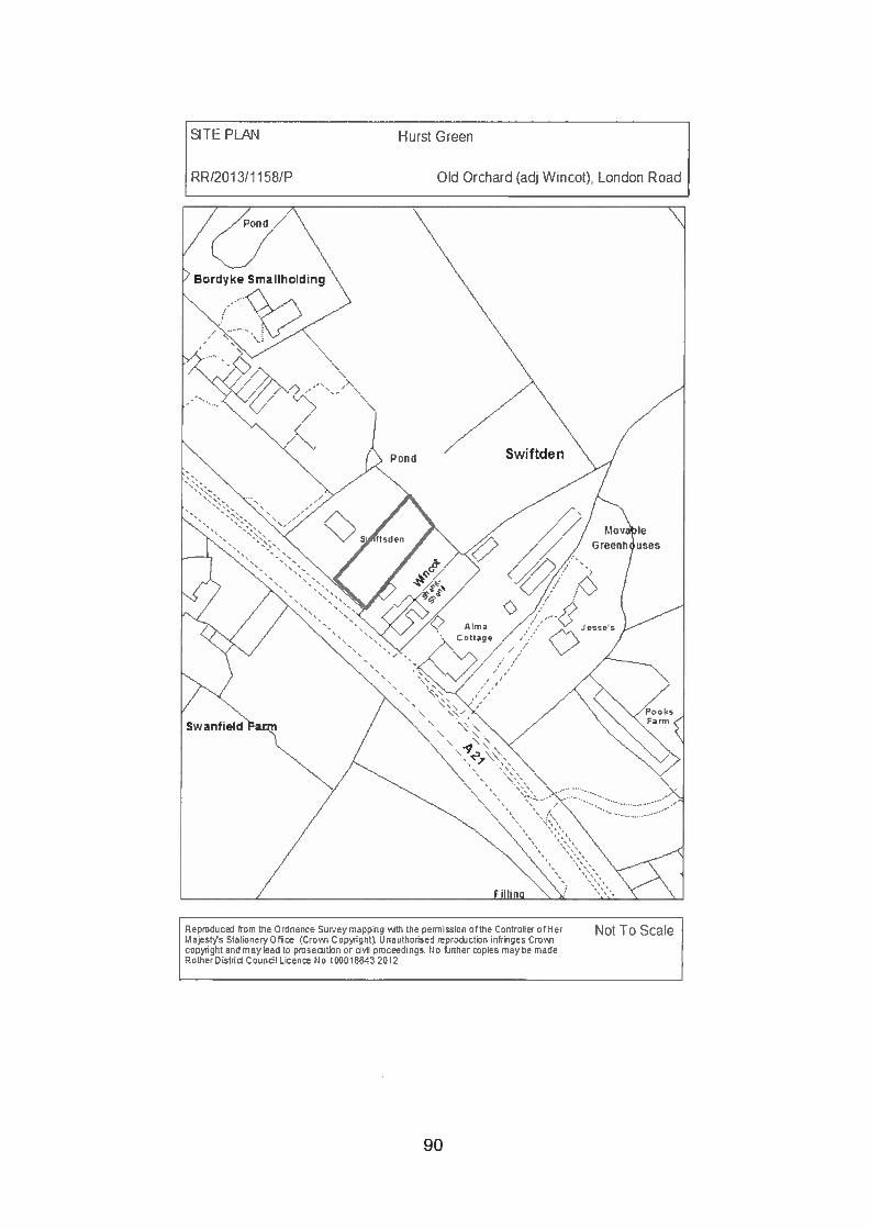
SITE PLAN Hurst Green
RR/2013!1158/P Old Orchard (adj Wncot), London Road
Not To ScaleRepmdsced from the Ordnance Survey mapping v.th the germieaion ofthe Oentrnller oft-IcrM ajest’,’s Stationery Offl Crovsi Onpyight). U naothorised reprnction infringes CrnJ1copyight and may lead to pmeetion or dhI pmceed’nge No fridher pies may he madeRotherO ietd Ooanbl Lceo No 10001 E-E3 2012
90
Planning Committee 18 July 2013
RR/2013/1158/P HURST GREEN Old Orchard adjacent Wincot,London Road
Outline: residential 3 bedroom detached chaletbungalow
Applicant: Mr G BrowneAgent: -
Case Officer: Mr M Worsley (Tel: 01424 787618)(Email: [email protected])
Parish: HURST GREENWard Member: Councillor G S Browne and Councillor Mrs S M
ProchakReason for Committee consideration: The applicant is an elected member.Statutory 8 week date: 26 July 2013
This application has been added to the Committee site inspection list.
1.0 POLICIES
1.1 Rother District Local Plan (2006)
. DS1 (Location of development);
. DS2 (New development and land use changes);
. DS4 (Development outside of development boundaries);
. GD1 (General development considerations); and
. HG1O (New dwellings in the countryside).
1.2 Rother District Council Local Plan — Core Strategy
. OSS5 (General development considerations);
. RA2 (General staregy for the countryside);
. RA3 (Development in the countryside); and
. EN1 (Landscape stewardship).
1.3 National Planning Policy Framework
1.3.1 The provisions relating to sustainable development, isolated homes in thecountryside and conserving and enhancing the natural environment includingparagraphs 55 and 1 15.
2.0 SITE
2.1 This site is located within the countryside but within an area of sporadicdevelopment to the north of Hurst Green. It is within the High Weald Area ofOutstanding Natural Beauty (AONB). It fronts the northeast side of the A21
91
trunk road and is found between two residential properties; Swiftsden to thenorthwest and Wincot to the southeast. The plot measures around 18m inwidth and 43m in depth. There are a number of fruit trees within the site andtall hedges to the front and rear boundaries.
3.0 HISTORY
3.1 RR/79/2219 Outline: erection of single storey domestic dwelling —
refused.
RR/80/1 231 Outline application for erection of single storeyagricultural dwelling.
4.0 PROPOSAL
4.1 Outline planning permission is sought for a 3 bedroom detached chaletbungalow. All matters are reserved although plans have been submittedshowing an approximate siting, layout, elevations, access and parking. Theseshould be treated as indicative only.
5.0 CONSULTATIONS
5.1 Parish Council:
5.1.1 The applicant is the Chair of Hurst Green Parish Council and therefore theyfeel it is inappropriate for them to comment.
5.2 Highways Agency:
5.2.1 Any comments will be reported.
5.3 Planning Notice:
5.3.1 Any comments will be reported.
6.0 APPRAISAL
6.1 The principal issue to consider is whether the countryside location of the siteoutside any defined Development Boundary is appropriate for a new dwellingbearing in mind that new residential development is not normally allowed inthe countryside in order to protect its inherent character and qualities.
6.2 Policy HG1O of the Rother District Local Plan (2006) states that:
Proposals for new dwellings in the countryside will be refused unless it:(i) is for the replacement of an existing dwelling on a one for one basis,
subject to meeting the criteria at Policy GD1, the replacement dwellingbeing within the same curtilage and of a comparable size; exceptionally, asomewhat larger dwelling may be acceptable where it would be more in
92
keeping with the character of the locality in terms of its siting, design andmaterials;
(ii is the conversion (without the need for substantial rebuilding) of a buildingin accordance with Policy HG 11;
(iii) can be demonstrated by the applicant to be essential for the running of anenterprise which must be in a countiyside location and is of an appropriatesize and directly related to the enterprise; or
(iv) is housing for local people unable to compete in the local housing market,subject to the criteria in Policy HG2 above;
(v) is the conversion or sub-division of an existing larger property where it isthe only effective means of reusing it and meets the criteria in Policy GD1.
6.3 Policy RA3 (iii) of the Rother District Council Local Plan — Core Strategy andparagraph 55 of the National Planning Policy Framework (NPPF) providesimilar exceptions for the provision of rural housing.
6.4 No evidence has been submitted to establish the need for the proposeddwelling against the exceptions provided for by Development Plan policiesand National Guidance in the Framework. The proposed development wouldtherefore, as a matter of principle, be contrary to the aims of restricting newdevelopment in the countryside thereby safeguarding the character andappearance of the countryside and the High Weald AONB. The proposalwould be in conflict with Policy HG1O of the Rother District Local Plan (2006),Policy RA3 (iii) of the Rother District Council Local Plan — Core Strategy andthe NPPF which advocates that great weight should be given to conservinglandscape and scenic beauty in AONBs which have the highest status ofprotection in relation to landscape and scenic beauty.
6.5 The information contained within a supporting statement has been noted. Thisexplains that the site is located within the hamlet of Swiftsden where there are40 dwellings, including two recent additions at Copper Field Lodge and FoxFarm. There are also businesses at Ashdene Service Station, Orchard FarmShop, Horse Shoe Service Area and K. Drury & Son. Facilities include twoSpar shops (one of which is open 24 hours), a well-stocked farm shop andrestaurant, a new school and playgroup and the centre of Hurst Green lessthan 1 mile away and Etchingham station around 1.5 miles away.
6.6 Whilst there may be other dwellings nearby and access to a limited number ofservices and employment opportunities, the fact still remains that the site islocated within the countryside outside any defined Development Boundarywhere proposals for new dwellings are only allowed in exceptionalcircumstances. The proposed dwelling does not meet any of the policyexceptions and is therefore unacceptable in principle.
7.0 SUMMARY
7.1 The countryside and AONB are highly valued assets. There are only limitedcircumstances where development is acceptable consistent with maintainingthe inherent qualities and character of the countryside. New residentialdevelopment is not normally acceptable outside of the defined DevelopmentBoundaries unless it meets one of the policy exceptions. No evidence hasbeen submitted to establish the need for the proposed dwelling against the
93

exceptions provided for by Development Plan policies and national guidance.The proposed development would therefore, as a matter of principle, beunacceptable and harmful to the character and appearance of the countrysideand the AONB.
RECOMMENDATION: REFUSE (FULL PLANNING)
REASONS FOR REFUSAL
1. The site is located in the countryside outside any defined DevelopmentBoundary where national and local planning policies seek to strictly controlresidential development and only permit new dwellings in specialcircumstances. The proposed chalet does not meet any of the planning policyexceptions for new dwellings in the countryside and would therefore beharmful to the rural character and appearance of the locality and thelandscape and scenic beauty of the High Weald Area of Outstanding NaturalBeauty. As such the development is contrary to Policies DS1 (i), (iv), (vi) &(ix), DS2 (vi), DS4, GD1 (iv) & (v) and HG1O of the Rother District Local Plan(2006), Policies OSS5 (iii), RA3 (iii) and EN1 (i) of the Rother District CouncilLocal Plan — Core Strategy and paragraphs 55 and 115 of the NationalPlanning Policy Framework.
Note: This decision notice relates to the following plan: 1:1500 site plan.
NPPF: In accordance with Article 31 Town and Country Planning (DevelopmentManagement Procedure) Order 2010 (as amended), the local planning authority hasacted positively and proactively in determining this application by identifying mattersof concern with the proposal and discussing those with the Applicant. However, theissues are so fundamental to the proposal that it has not been possible to negotiatea satisfactory way forward and due to the harm which has been clearly identifiedwithin the reason for the refusal, approval has not been possible.
View application/correspondence
94
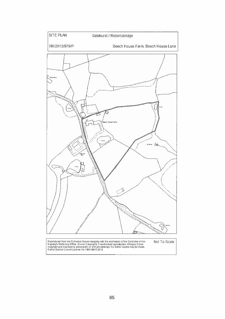
SITE PLAN Salehurst I Robertsbridge
RR120131879/P Beech House Earm, Beech House Lane
Not To ScaleReproduced from the Ordnance Sur.’ny mapping with the pennisaion ofthe Controller otHerMajeaWa Stationery Off Crow-i Copyright). Unauthoriaed reproduction infringes Crowncopyright and may lead to pmsecitEnn or dvii proceedings Fin heiher piea may he madeRntherDistrid Coundi Ucen rio i0001564320t2
95
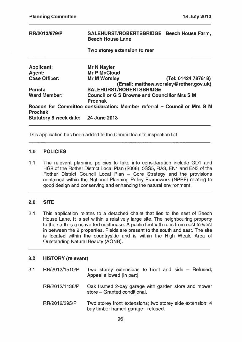
Planning Committee 18 July 2013
RR1201318791P SALEHURST/ROBERTSBRIDGE Beech House Farm,Beech House Lane
Two storey extension to rear
Applicant: Mr N NaylerAgent: Mr P McCloudCase Officer: Mr M Worsley (Tel: 01424 787618)
(Email: [email protected])Parish: SALEHURST/ROBERTSBRIDGEWard Member: Councillor G S Browne and Councillor Mrs S M
ProchakReason for Committee consideration: Member referral — Councillor Mrs S MProchakStatutory 8 week date: 24 June 2013
This application has been added to the Committee site inspection list.
1.0 POLICIES
1.1 The relevant planning policies to take into consideration include GD1 andHG8 of the Rother District Local Plan (2006); OSS5, RA3, EN1 and EN3 of theRother District Council Local Plan — Core Strategy and the provisionscontained within the National Planning Policy Framework (NPPF) relating togood design and conserving and enhancing the natural environment.
2.0 SITE
2.1 This application relates to a detached chalet that lies to the east of BeechHouse Lane. It is set within a relatively large site. The neighbouring propertyto the north is a converted oasthouse. A public footpath runs from east to westin between the 2 properties. Fields are present to the south and east. The siteis located within the countryside and is within the High Weald Area ofOutstanding Natural Beauty (AONB).
3.0 HISTORY (relevant)
3.1 RR/2012/1510/P Two storey extensions to front and side — Refused;Appeal allowed (in part).
RR/2012/1138/P Oak framed 2-bay garage with garden store and mowerstore — Granted conditional.
RR/2012/395/P Two storey front extensions; two storey side extension; 4bay timber framed garage - refused.
96
RR/2007/3066/P Installation of three first floor windows — Grantedconditional.
RR/1 999/261 0/P Proposed erection of garage/gardening shed — Grantedconditional.
RR/94/1 179/P Proposed agricultural vehicle and implement shed intraditional Sussex/Kent style — Granted conditional.
A165/443 Farmhouse to replace existing dilapidated farmhouse tobe demolished — Granted conditional.
4.0 PROPOSAL
4.1 Permission is sought to extend the dwelling on the north elevation. Theextension would measure 8.5m in length and 6.3m in width, which is 54c infootprint. First floor accommodation would be provided within a pitched roof. Aflat roof dormer with bi-folding doors would be provided at first floor level onthe east facing roof slope. Matching materials would be used.
4.2 The existing floor plans show 2 bedrooms and a small lounge at ground floorlevel which are shown on the proposed floor plans to be converted to a winestore, library and study. The extension would provide a snooker room atground floor level and a bedroom with en-suite at first floor level.
5.0 CONSULTATIONS
5.1 Parish Council:
5.1.2 ‘The PC considers that this additional application would be overdevelopmentof the site. In addition to the fairly recent approval for extensions to the front ofthe property (RR/2012/1510/P), this represents a substantial addition to thedwelling, resulting in a considerable increase in the built-up appearance of thesite to the detriment of the neighbouring property and to the character of thearea and landscape setting within the AONB.’
5.2 Planning Notice:
5.2.1 Two letters of objection, including one from the occupant of the oasthouse tothe north, containing the following comments (summarised):• Out of keeping with existing dwelling.• Visually unattractive.• The property was marketed as a 6 bedroom property before purchase by
the present owners.• Now described as a two bedroom property.• Previous ground floor bedrooms are now annotated as wine store, library,
music room, etc. which are more applicable to a Stately home than a “2bedroom house”.
• Will be visually detrimental to the neighbouring property, especially during6 months of the year when there are no leaves.
97
• Would harm the amenities of the adjoining property.• An application for three windows in the roof was submitted in 2007.
6.0 APPRAISAL
6.1 Background
6.1.1 Planning permission for a two storey extension 145m2 in footprint on the eastside of the property was dismissed at appeal (RR!2012/1510/P) towards theend of last year. As part of the same appeal additions to the front wereallowed. The Inspector was of the opinion that the east side extension wouldcomprise a substantial addition to the dwelling, would significantly increase itsoverall bulk and overall would result in a considerable increase in the built-upappearance of the site to the detriment of the open rural character of the areaand natural landscape setting of the AONB.
6.2 Issues for consideration
6.2.1 The main issues to consider include the impact of the proposal on the ruralcharacter and appearance of the surrounding area, including the landscapeand scenic beauty of the AONB, and the living conditions of occupants of theneighbouring property to the north.
6.3 Character and appearance
6.3.1 Compared to the extension dismissed at appeal (145 m2 in footprint), theproposed extension (54 m2 in footprint) has been significantly reduced in size.It has also been attached to the north elevation instead of the east.
6.3.2 The existing property is around 246m2 in footprint. The extensions to the frontof the property that were allowed at appeal measure 37m2 in footprint.Cumulatively the proposed extension and the front additions measure 91square metres in footprint. This scale of enlargement is consideredappropriate given the size of the existing dwelling and the site.
6.3.3 The scale and pitched roof form of the rear extension would be in keepingwith and appear subservient to the character and appearance of the existingdwelling and would not harm the landscape and scenic beauty of the AONB.
6.4 Living conditions of the occupants of Oak Farm Oast
6.4.1 Although the proposed extension would be within 3.5m of the boundary withthe neighbouring oasthouse to the north, there is a tall mature hedge presentwhich provides significant screening. In addition, no windows or otheropenings are proposed on the north elevation. Whilst the occupant of theneighbouring property is likely to see the proposed extension during the wintermonths when the hedge loses its leaves, it should not unacceptably affecttheir living conditions by way of direct overlooking, loss of light,overshadowing or it appearing overbearing.
98
7.0 SUMMARY
7.1 The proposed extension is considered to be of an appropriate scale anddesign. It would appear visuaHy subservient to the existing property and wouldnot harm the rural character and appearance of the locality or the landscapeand scenic beauty of the AONB. Whilst the neighbouring oasthouse to thenorth may be able to see the addition in the winter months, it should notadversely affect their living conditions.
RECOMMENDATION: GRANT (FULL PLANNING)
CONDITIONS
1. The development hereby permitted shall be begun before the expiration of 3years from the date of this permission.Reason: In accordance with section 91 of the Town and Country Planning Act1990 (as amended by section 51 of the Planning and Compulsory PurchaseAct 2004).
2. The development hereby permitted shall be carried out in accordance with thefollowing approved plans:Drawing no. 11/1150/02 dated February 2012;Drawing no. 11/1150/04;Drawing no. 12/1164/06 dated 4 February 2013;Drawing no. ELD/13/1 179/01 dated April2013; andDrawing no. ELD/13/1 179/02 dated April 2013.Reason: For the avoidance of doubt and in the interests of proper planning, asadvised in the CLG guidance ‘Greater Flexibility for Planning Permissions’.
3. The materials to be used in the construction of the external surfaces of theextension hereby permitted shall match in materials, colour and texture thoseused in the existing building.Reason: To maintain the characteristics of the existing building in accordancewith Policies GD1 (iv) & (v) and HG8 of the Rother District Local Plan (2006)and Policies OSS5 (iii), RA3 (iv), EN1 (i) and EN3 (I) of the Rother DistrictCouncil Local Plan — Core Strategy.
NPPF: In accordance with Article 31 Town and Country Planning (DevelopmentManagement Procedure) Order 2010 (as amended), the local planning authority hasacted positively and proactively in determining this application by assessing theproposal against all material considerations, including planning policies and anyrepresentations that may have been received and subsequently determining to grantplanning permission in accordance with the presumption in favour of sustainabledevelopment, as set out within the National Planning Policy Framework (NPPF).
View application/correspondence
--oo0oo--
99
Rother District Council Agenda Item: 6
Committee - Planning
Date - 18July2013
Report of the - Director of Services
Subject - Planning applications
APPENDICES
APPLICATION REPORT PAGE NO
A RR/2013/955/P BECKLEY 19Land known as Oak Tree House(formerly Royal Oak Public House)Main Street
B RR/201 1/1027/P CATSFIELD 58Wylands Angling CentrePowdermill Lane
C RR/2013/1011/P WHATLINGTON 79Units 32-37 Vinehall Business ParkVinehall Road
-000oo-
Those applications listed above include additional information as an appendix to theagenda. In order to access related documents, click on the following link and then
follow the instructions on the screen to view a planning application on line:http://www. rother.gov. uk!index.cfm?articleid=1 08
AAPPENDICES
RR/201 3/955/P
Site:
BECKLEYLand known as Oak Tree House(formerly Royal Oak Public House),Main Street
Proposed development:
Proposed amendments to dwellingdesign for plots 1-4 previouslyapproved under planning ref.R R/2003/33001P.
1/lichael B. Hall Building Design Services Ltd.V.A.T. Reg No. 824 4267 32
Studio A339 London Road
Bexhill on Sea. East Sussex
Planning Department TN39 4AJRotherDistnct Council ;‘- - Telephone (01424)214541
Town Hall E-mail: [email protected] uk
Bexhill on Sea -‘ 21 JUN 2f3 I Website:www.mjchaeldha]I.couk
East Sussex -.
TN393JX :.-
21st June 2013Dear Sir/Madam, ““ ‘‘ --..-----,--
Re: RR’2013/955/P.Proposed amendments (Plots 1-4) to Current approved design under Planning ApprovalRR12003/3300/P.Residential Development of 7no.dwellings. Land known as Oak Tree House, (FormerlyRoyal Oak Public House) Main Street, Beckley, East Sussex, TN31 6RJ.For Steed Construction Ltd.
Further to Beckley Parish Councils comments in respect of the above application we wish to, onbehalf of the applicants Steed Construction Ltd, respond to the comments made.
The development of the proposal site is currently allowable under planning approvalRR’2003/3300/P and is covered by a Certificate of Lawful Development RRJ2009/282710 issued on10th May 2010. As such Steed Construction could proceed on site in accordance with the approveddrawings and the details covered by the various discharge of conditions granted as a requirement ofthe 2003 approval. However having carefully reviewed these approved details it is clear that there areissues relating to various aspects of the design which would result in a built-scheme that would not,in our opinion, be in the best interests of the future occupants of the properties or to the wider villageas a whole.
In respect of the revised proposals for the re-orientation of the entrances to Plots 1-3. The original
Q planning scheme gave no indication of finished ground or floor levels for the development and thiswas covered by Condition 9 of the approval. Subsequently a drawing was submitted indicating fulldrainage proposals for the site including site levels and finished floor levels for the development. Asthis is the only approved level drawing it is to this that the development is currently approved to bebuilt. The approved details allow for the finished floor level of Plots 1-3 to be set at 9.650. Havingapproved the design of the development, discharged Condition 9 of the approval and granted aCertificate of Lawful Development, thus determining that all matters that were required to had beendealt with to allow the commencement of works on site, no-one had raised issue over the approvedlevels and their relationship with those of Main Street. The approved level drawing 579-04A clearlyshows a cover level onto the existing manhole, within the Main Street footpath adjacent to theHighways by-way across the site, of 8.750. The footpath then falls away from this level towards thewest, It is clear that these levels, as approved, would result in plots 1-3 being elevated above thefootpath and requiring stepped accesses to the front entrances and drawing no.579-04a does indeedshow steps to the front of plots 1-3. These are the approved details and in the absence of any otherlevel information either within the original application allowed at appeal or in the discharge of thevarious conditions required to enable works to commence on site, confirmed by the Certificate ofLawful Development, it is to these approved levels that Steed Construction Ltd are intending to
4197/EH
Registered Office: 19 New Roed. Brighon. BNI IUF
conStrLLet as they rightly can. They coild have just got on with the works based on the approved
e ala but being responsible developers ‘who care about what they build. They did not want tO
COnStrUCt the properties knowing that this would mean substantial stepped accesses up to the main
:ntrus,. hard onto the public footpath and rendering the remaining front garden areas as ‘dead’
behind wrought iron railings. ftassist in visualising what the development will look-like if
u t to the approved details we have enclosed a street elevation showing the Main Street elevation.
The following needs to be noted:
• Front garden areas behind the wrought iron railing would be inaccessible due to steps and
retaining structures required either side.
• Railings to stepped accesses would need to comply with Part K Building Regulation
requirements and could not be he same as current approved boundary fence design.
• Windows adjacent to the entrance steps will need to be fixed lights (ie. non-opening) as they
can’t impede on the stepped access or landing (top and bottom) areas.
• All other windows (except cloakroom) will need to be fitted with opening restrictors to
comply with Part K Building Jegulation requirements due to low ciii heights in relation to
finished floor levels.
• There would need to be epsed rodding eyes to the drain connections of the rainwater
downpipes to the centre of the terrace as they cannot be taken down to below ground level
without having a pumped connection to the main drainage system.
COnsideration was given to trying toarnend the finished floor levels of Plots 1-3 to bring them down
towards the existing footpath level ci Main Street however there are many reasons why this is not
techncaIiy achievable in particular resulting in the need for a pumped drainage system for both foul
and Surface water drainage serving plots 1-3, the extensive spoil which would need to be removed
froni site to allow the lower foi-aation level and the amount of’ retaining structure including
water-proof tanicing which would be required to both of the flank walls and to the rear garden areas.
Neither the option of continuing ‘th the development as approved nor revising the levels down
WOuld in our opinion be the most sensible way forward. It is for that reason the alternative design for
Plot5 1-3 has been put forward. Whilst the Parish Councils disappointment in no longer seeing front
entrflces onto Main Street may beunderstood their reasoning of losing the visible charm of ‘opening
door5 and smiling faces’ is sonwhat naive. Bearing in mind that the parking area serving the
devIopment is to the rear it is non unreasonable to expect that the occupiers of the properties are
more likely to be using the rear entrances to the properties on a day-to-day basis. Of course visitors
to the properties are likely to approach the properties from Main Street, if the entrances are as
cuirently approved, however this is likely to result in parking in front of’ the properties, even for a
Sllcrt time, on what is the busy E2O88 road. Indeed it is not just visitors who might resort to pulling
UP ifl front of the entrances and parking on the B2088. The occupants themselves, when in a rush or
loaded down with shopping etc are likely to see this as an easier solution than parking to the area to
th rear and consequently there is a strong likelihood of the designated parking for Plots 1-3 to the
re.r being underused. The subnritted revised design addresses the issues of the current approved
dergn The properties still retaiii their cottage like appeal. The re-locating of the main entrances off
of’ the parking mews, in line wiih that already designed to Plots 5 7, wiH negate the possibility of
°‘Street parking and will sens.ibly address the approved site levels relationship with Main Street.
Th proposed retaining wall to he front of the properties required to address the site levels, which
ar clear and apparent on site and have been from the start of the planning process, have been kept
lo (max 600mm high) and te ‘front garden’ areas are proposed to be fully landscaped with a
P1flting scheme that will require minimal maintenance but will provide variation and interest along
the Main Street frontage. All of these revisions would in the applicants opinion provide a far bettervisual solution to this important elevation than the suburban details currently approved and ready forimplementation on site. It is for these reasons that the current application has been submittedHowever if the proposed amendments are not deemed suitable the applicant vill proceed on the basisof the current approved details.
In respect of the comments made by the Parish Council regarding the ridge height of plots 1-3. thisremains as per previous approved drawing no.26/35/24A Section B-B relative to the finished floorlevel of the properties as denoted on this section.
Moving onto the comments of the Parish Council in respect of the proposed amendments to the roofdesign of Plot 4, The ridge height of this property remains as previously approved ondrawing.no.26/35/24A, it is not higher as suggested by the Parish Council. There is no extended pitchroof We are assuming that they are referring to what appears to be a hipped end indicated on the rearelevation of plot 4 on drawing no.26/35/24A. This is a drawing error on the part of the originalapplicants. Both the approved sides and front elevations for this plot, along with the approved floorplans, clearly show a frill gabled roof from flank wall to flank wall with a ‘planted’ gable of adifferent pitch to the rear elevation to the northern end. The only change proposed in the roofscape isthe removal of’ this ‘dummy’ gable to the rear elevation. The gable does not contribute to the usablefloor area of the proposed accommodation at this level and would need to be constructed as a‘planted’ gable which would mean that the window shown on the approved drawings would in factbe a ‘dummy’ window. The formation of such a gable right on the outer edge of a duo-pitched roofand with no return on, in this case, the rear elevation also results in very poor rainwater drainagedetailing and a clumsy bargeboardlfascia junction to the rear corner. Neither of which were shown onthe approved drawings. In respect of the rainwater drainage issue, taking valley rafters down to asingle point results in overshooting of gutters and consequently either larger gutter/downpipes and/orhopper heads needing to be incorporated. Neither of which, from a visual point of view, would in ouropinion be acceptable in this particular instance. The roofseape of the street view of the property,both from Kings Bank Lane and the public by-way, will remain as approved with the exception of asingle small rooflight added to the front elevation of the property. The removal of the rear gablewould not amount to a complete re-design of Plot 4 ‘hardly recognisable as the approved detachedbuilding’ as suggested by the Parish Council. The removal of the rear gable will not alter the visualappearance of the unit from the public areas and would not therefore have any detrimental effect onthe developments contribution to the wider village Context. If implemented however it would be clearto all users of the new ‘mews’ area that the gable is purely a ‘decorative’ add-on and included on thewhim of a designer andior planner to provide some notion of ‘visual’ interest to the dwelling. This isnot coherent design practice and goes against all principles of vernacular design which the ParishCouncil claim to be so keen on.
The applicants have as much interest as the Parish Council in building a good quality developmentand it is for that reason that the various amendments to the current approved scheme are beingsought. However it must also be noted that the scheme as currently approved, including all the issuesoutlined above, can be built and will be built should the proposed amendments be unacceptable to thelocal authority. The applicants have no wish to make amendments to the approved scheme just forthe sake of it. In fact they would prefer to just get on and build the development which currently hasthe benefit of all the necessary planning consents. They could have indeed done this but beingresponsible and conscientious developers of long local standing and with a reputation for goodquality developments they did not want to do the future occupiers of the properties or indeed the
\tllJ a dissr. ie h\ COT IIIICIiTTC an appro\C( heine hieh on Jor insption
lUll TUUUjUI lSUe \ liiCh Lid heen o\kLed h othi s ilk eheine could hc huilt. i,
b the R:ilt (ocneil. to thc olicliLil Ii O\ d pLn hut th II ihn ha L to accept this ‘ill
lllLkkIe tile Ltlloillaiius \ thin that dsii 1 h j ncnt ctirnl’. ouh Ic’. to Jdiss theNe aiti
ll 1LO fl cood laith thout IT\ uhurioi moi)\ C fly lie (lC\dOpLls I his is U IacJ’cC oitr’inia to
au rC\d chcflk hot ls i iiS otIi\ InC TO ILIL i ippiO\ d sLIlCi1i ICUCI auij it i To:
thi ea’.on that apuo’.al iTitl:c zbniuttl dctiR i ICcpCLIIUII\ tjUCstLJ
‘L)tis hIiIhijjjI\
I lii I i— J /‘jj:. i
in hLILIft \liclael I) I lal lhtildin I)>iC1 i
I ks \li)II duC o I’’7 I l (1 orillsii OliC jOscu1l\ I
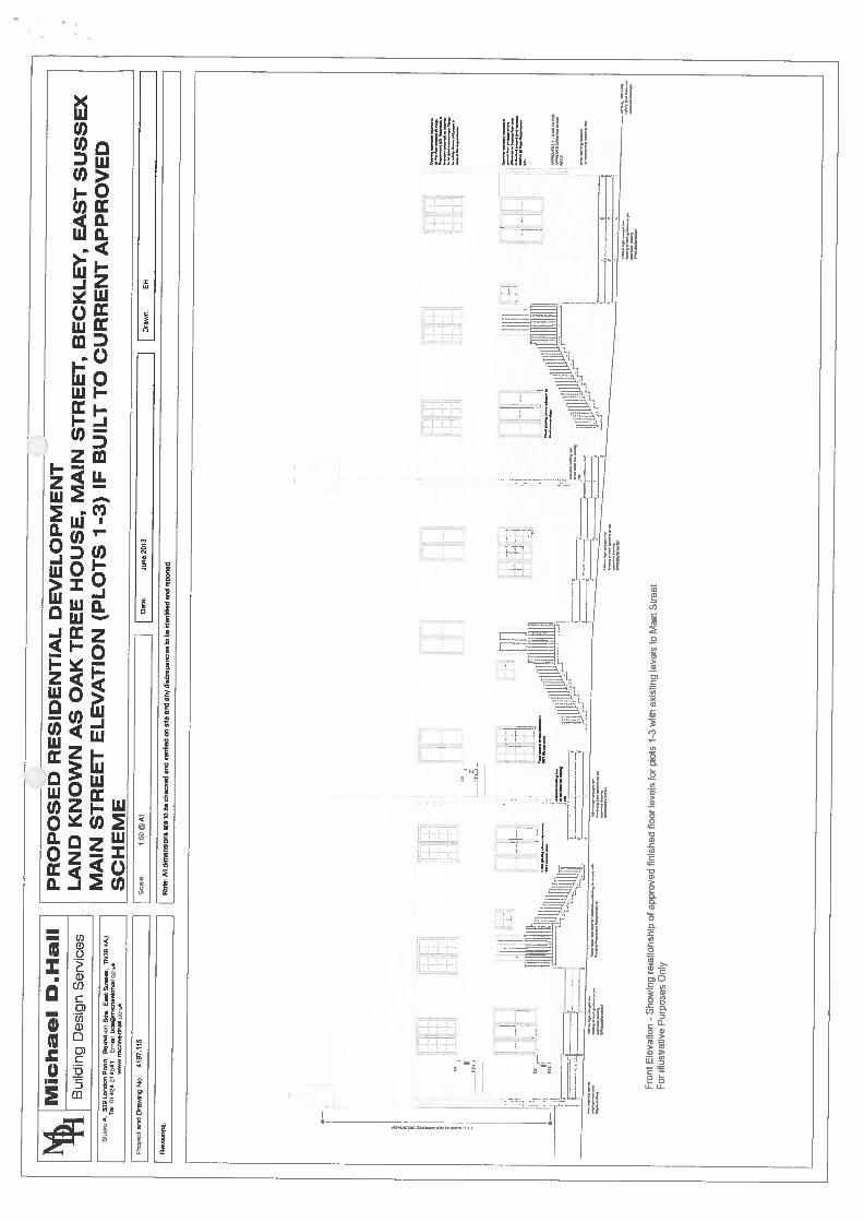
I
s4M
ichael
D.H
all
‘fl
Bui
ldin
gD
esig
nS
erv
ices
SNO
reA
.3
39
Lcr,
don
Rea
O.
0-o
n-S
ee.
Eao
tS
9oe
TN
39C
AJ
Tel
01424
214541
Ern
adbds@
n-w
cnae
ldIs
eIl.
ce.U
knnc5
90ld
IlaI
LcO
LA
Pro
:ect
end
Dle
wir
-Ig
No
4197
.115
Revis
ions
Sca
le.
1:50
@A
1
PR
OP
OS
ED
RE
SID
EN
TIA
LD
EV
EL
OP
ME
NT
LA
ND
KN
OW
NA
SO
AK
TR
EE
HO
US
E,
MA
INS
TR
EE
T,
BE
CK
LE
Y,
EA
ST
SU
SS
EX
MA
INS
TR
EE
TE
LE
VA
TIO
N(P
LO
TS
1.3
)IF
BU
ILT
TO
CU
RR
EN
TA
PP
RO
VE
DS
CH
EM
E
Not
e:A
lldi
men
sion
sar
eto
bech
ecke
dar
idve
nhie
don
ella
end
any
disc
repa
ncie
s9
beId
andfi
edand
rep
ort
ed
DoN
,Jo
ne
2013
JDro
wn.
OH
[ H .
-
-
[IF!..
]EiiIT1
nil
Fro
ntE
leva
tion
-S
how
ing
rela
tion
ship
ofap
prov
edfi
nis
hed
floo
rle
vels
for
plot
s1-
3w
ithex
isti
ngle
vels
toM
ain
Str
eet
For
Illu
stra
tive
Pu
rpo
ses
Onl
y
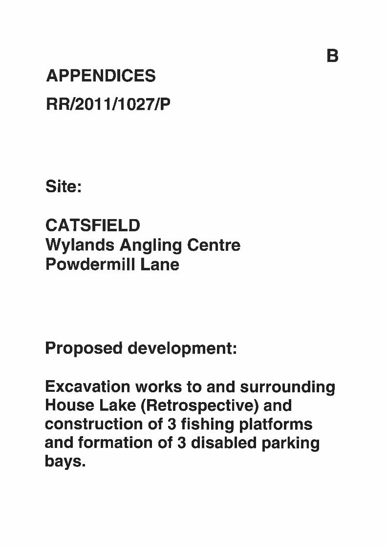
BAPPENDICES
RR/201 1/1027/P
Site:
CATSFIELDWylands Angling CentrePowdermill Lane
Proposed development:
Excavation works to and surroundingHouse Lake (Retrospective) andconstruction of 3 fishing platformsand formation of 3 disabled parkingbays.
Catsfield ManorChurch RoadCatsJieldBattle
East SussexTN33 9BG
Head of PlanningRother District CouncilTown HallBexhill on SeaEast Sussex
For the attention of the Case Officer: Mr A. Rowland
28 June20110
Dear Sirs,
Application Number: RRJ2O1 1/1027/P (Retrospective, Re-application)Wy land Angling Centre: Excavation Works To and Surrounding House Lake
In May 2010. the first retrospective application to retain this damaging unauthoriseddevelopment was refused. The Officer stated in his Report to Committee:
“The works undertaken have changed the appearance of the lake completely; its
Jörmc’r natural appearance has been lost, the lake noit’ has an appearance that might
more normally be seen in an urban park.”
The development is unnecessary and pointless but damaging and urbanising.
It is essential in the High Weald Area of Outstanding Natural Beauty, in an ancientwoodland setting, House Lake is restored to the appearance of a natural lake.
This objection also re-emphasises the importance of enforcing against the damagingunauthorised engineering developments outside the “red line boundary”, butincorporated into this application, to ensure the ancient woodland and ghyll arerestored.
Yours faithfully
MJ-ier
Application Number: RR/201 1/1027/P (Retrospective, Re-application)Wyland Angling Centre: Excavation Works to and Surrounding House Lake
I. Key Issues
The development consists of excavated fishing ‘bunkers”.
House Lake is now bunded by the walls of the fishing bunkers and the dam.
The impact is man-made, artificial, engineered and unnatural.
In an AONB, it is imperative all landscape features appear natural.
Fishing bunkers and fishing platforms are man-made and alien to a natural lake.
House Lake is an introduced water body and cannot be mistaken for a natural lakewith these alien features.
It is important to rural character that a lake is surrounded by grass and by lake banks.
Hard landscaping around a lake, especially surrounding the waters edge, is stronglyurbanising.
It is therefore essential the lake is restored by filling in the damaging bunkers andplatforms that have been cut out of the lake banks and restoring the land to grass.
No fishing lake at any fishery in the country has fishing bunkers.
No fishing lake at any fishery in the country has hardstanding around the lake’s edge.
This is an AONB.
In an AONB. it is the authority’s statutory duty to ensure the appearance and-‘ character of natural beauty is safeguarded, is not harmed and is conseed.
2. Proposed Mitigation of Damage
Putting down bark on the concrete platforms or planting a few clumps of trees on topof the fishing bunkers cannot make the bunkers or platforms look any more natural.The bunkers and platforms are unmistakably man-made and damaging.
It is essential the lake has normal lake banks and the margin of the lake to the watersedge is grassed.
Nor does the proposed mitigation screen the damage. There is no screening from thepublic footpath. Tree clumps on top of the bunkers do not screen the bunkers.
The only remedy is removal of the damage itself by reinstatement of the grassed lakebanks to the waters edge.
3. Public footpath
A public footpath crosses the valley at Wylands.
House Lake lies directly adjacent to the public footpath and the damage to the lake istherefore highly visible.
It is impossible to screen House Lake from the footpath as the existing open view tothe ancient woodland is important and any attempt to block off the lake would itselfbe damaging.
4. Other fisheries
If a fishing peg is marked at all, the standard practice is small individual fishing spots(“swims”) at the lake edge which do not involve any engineering works or earthworks
( and are small and minimally intrusive.
This is true for all fisheries: not just fisheries in nationally protected landscapes.
We know of no fishery which has dug out the banks of a lake to form fishing bunkersor concreted the lake edge.
5. Claimed justification at Wylands for hardstandings and bunkers
The arguments used are:
Health and Safety
To argue there are health and safety risks associated with fishing from grass is simplynot a sensible argument.
Erosion
The lake banks were sound: see evidence submitted by the applicant to the planninginspectorate in 2008 [Appendix 2].
Even zferoded, this development is unrelated to the maintenance of lake edges andlake banks.
Disabled access
The main platform is only accessible to the disabled via the road and the otherbunkers are inaccessible. This development is plainly not designed with the nonambulant disabled in mind. There are published guidelines for sensitively designedfishing spots for the disabled, to which this development does not relate.
C
6. Establishing a Precedent for Further Development at Wylands
Excavating fishing bunkers and platforms to surround a lake with bundedhardstanding is without precedent at any other fishery anywhere in the country.
If granted permission as acceptable development, artificial platforms and bunkerscould be repeated on any (or all) of the other lakes at Wylands.
The duty of the LPA is to conserve natural beauty and protect the AONB landscapefrom harm, incremental loss of rural character and urbanisation.
In the future, the LPA could not argue any similar development on any other lake isharmful unless this application is refused and reinstatement of the lake banksenforced.
7. Forestry law( ,
To permit this development would prevent the Forestry Commission enforcing the:
i) Coppicin licence replanting conditions;
ii) The replanting of the unlawfully felled or grubbed out trees.
The breaches of forestry law: where coppiced trees grubbed out, this wasoutside the scope of the coppicing licences; where standard trees felledwithin the licenced coppicing areas; where trees felled or grubbed outoutside the boundaries of the licences.
See penultimate sentence of the Forestry Comrnissions letter dated 10June 2011.
It is important enforcement of the replanting orders is not frustrated.
Please note the 2010 advice letter from the Forestry Commission appended to theapplication relates to these replanting orders, not to the planning application.
8. Biodiversitv
There are natural watercourses, lakes and extensive ancient woodland at Wylands.
The responses to Q 13 are incorrect. There j a reasonable likelihood of protectedspecies on the application land, on land adjacent or near the application site.
It is important to safeguard existing habitat, woodland continuity and continuitybetween the ancient woodland and watercourses.
The Forestry Commission response dated 10 June 2011 highlights this issue inparagraph 3 and also states: Ancient woodland is an important habitat jör EuropeanProtected Species such as bats, dorm ice and great crested newt, but i’e could not seesupporting evidence that has demonstrated absence”.
3
9. The New Lake (named by Wylands in the application “Junior Lake”)
The “red line” development site includes the dam for the New Lake but excludes theNew Lake. There is no information on the dam in the application.
The creation of the New Lake involved the construction of a dam and bulldozing theancient woodland and the ghyll stream feature of conservation importance.
There is irrefutable evidence that the New Lake did not exist before 2009.
A much smaller and shallower (dried out) pond existed with an area 15-20% of theNew Lake.
OS Maps evidence:
- A triangular pond to the west of House Lake (dried out)
- A ghyll stream - running down the centre of the footprint of the New Lake -
from Wood Lake (a lake again unlawfully built. c.1990) to the triangular pondto House Lake
- No darn as the watercourse is continuous
- Detailed ground contours giving accurate AOD measurements of the ancientwoodland floor and the banks of the ghyll stream within the ancient woodland
The surveys produced by Alan Hunting. Pump House Designs, Partridge Associatesand David Huskisson Associates for Wylands applications between 1998 and 2008 allevidence the existence of the ghyll stream feature, the AOD contours around thestream, the triangular pond and no darn [Appendix 3].
Aerial photographs provided to the Council evidence:
- The exposed ghyll between Wood Lake and House Lake (after deforestationand prior to excavation and levelling works commencing)
- The clearing of woodland on the footprint of the New Lake
- Felled mature tree standards on the footprint of the New Lake
- Excavations and levelling works destroying the contours of the ghyll feature
- The excavation and modelling of the New Lake
- The scraping, filling and levelling of the ancient woodland floor
Site photographs (enforcement department, acquired by a FOl request) also evidencethe bulldozers, excavation and modelling of the New Lake [Appendix 4].
This evidence is incontrovertible: the lake did not exist before 2009.
4
c.Wylands has produced an unswom statement about a pond that periodically dried out.This feature is not the New Lake.
The LPA did not serve a Stop Notice in 2009 stating the woodland floor can berestored and the development of the New Lake is reversible.
It is necessary to enforce reversal and reinstatement of the original land contours onthe footprint of the New Lake to enable enforcement by the Forestry Commission ofwoodland replanting orders.
10. Enforcement
The Ordnance Survey datum provides the LPA with the detailed evidence includingthe precise location, line and level of contours.
This Ordnance Survey datum appears on Ordnance Survey maps and on the surveysproduced by Alan Hunting and David Huskisson Associates in 1998 and 2008.
There is no doubt that important woodland features and habitats have been disturbedbut this is no excuse for inaction.
Restoration in accordance with OS data needs to be enforced to:
- Restore the original contours of the ancient woodland floor and ghyll streamfeature
- Restore the lake banks and a grassed waters edge (essential rural features)
- Allow reinstatement of trees on the ancient woodland footprint(>400 years since 1600 AD)
- Allow conservation of the historic ancient woodland curtilage
- Remove the dam
11. Other development elements within the red line:
Perimeter path
The ancient woodland was cleared to construct the perimeter footpath. The landrequires restoration to permit the implementation of the replanting orders andconservation of the ancient woodland margin.
Is land
The island has been partially excavated, cut in two and cleared of some trees. Thesmaller islands appear more artificial and the impact is adverse.
5
12. Policy
The CROW Act 2000 places a statutory duty on the LPA to conserve and enhance theappearance and character of the High Weald Area of Outstanding Natural Beauty.The conservation of natural beauty is the primary purpose of designation.
National and local policy stresses these areas have the highest status of landscapeprotection in relation to scenic and landscape beauty.
National and local policy requires the conservation of ancient woodlands against anyloss, damage or adverse impact. In the High Weald, ancient woodlands are a keycharacteristic of natural beauty. The High Weald Management Plan (2009) prioritisesthe protection and restoration of ancient woodlands as historic assets of biodiversityimportance and cultural significance. It is not the trees but the land occupiedcontinuously by trees since at least 1600 AD that is classified as ancient woodlandand of principal importance. Therefore it is the footprint of the ancient woodland thatbenefits from the greatest protection.
Conservation of Natural Beauty in AONBs
CROW Act 2000PPS7: Nationally designated areas, paragraph 21Rother Local Plan: DSI (vi) and GD1 (v)
Ancient Woodland
Forestry Commission: Government policy on Ancient Woodland Sites(ref: letter 10 June 2011)
Rother Local Plan: DS 1 (x)
Character of the locality
Rother Local Plan: DSI (ix), GDI (iv) and GDI (vi)
Biodiversity
Rother Local Plan: GD1 (vii)CROW Act 2000PPS9: implementation of UK BAP Priority SpeciesWildlife and Countryside Act 1981UK Biodiversity Action Plan Priority SpeciesHabitats Directive 1992Habitats Regulations 1994The Convention on the Conservation of European Wildlife and Natural Habitats 1979
6
Appendices
Appendix 1: Aerial Photographs of House Lake
1A: Before and After: 2004 and 2010
1B: Current State: Spring 2011
Appendix 2: I-louse Lake — lake banks
2A — 2D: 2008 Photographs by David Huskisson Associates
(1Appendix 3: Survey Maps 1998 —2008
- 3A: 1 998 Alan Hunting Associates
October 1998DwgNo: 339/97/101: 1250
- 3B: 2006 Pump House Designs
November 2006DwgNo: 2270—OS- S106
- 3C: 2007 Partridge Associates
January 2007DwgNo: 1067/61:2000
- 3D: 2008 David Huskisson Associates
September 2008Dwg No: DH21:500
Appendix 4: Site photographs of engineering works
4A and 4B: Photographs from the enforcement department [obtained by FOT request]
7
4 4___ -
I •‘ ‘ L;P.UI. 11h
A4DAF1
L04 A’1.f
— — i—,.—,
A
•
—4
6••
II
, / -ii
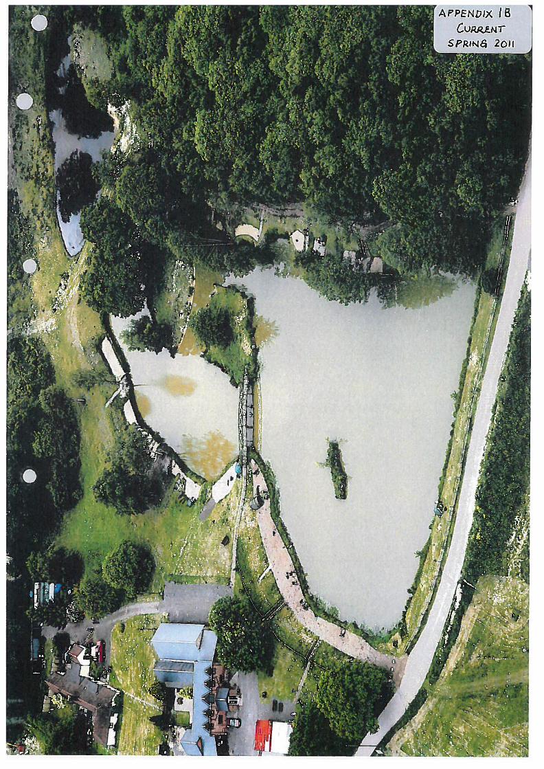
r APPENDIx 18
SPRIN6 2oii
I
I
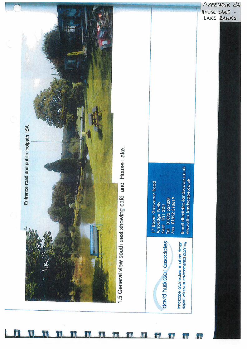
>c::,
7S
U’-t,
r-Z
Zrn)c
_...
Ent
ranc
ero
adan
dpu
blic
foot
path
15A
—U
—[
Er*
‘
I5
Gen
eral
view
south
east
show
ing
café
and
House
Lak
e.
dav
idhu
skis
son
asso
ciat
es
bndsc
ape
arch
itec
ture
.ur
ban
desi
gnex
pert
witn
ess
•en
viro
nmen
tdp!
anni
ng
17U
pper
Gro
sven
orR
oad
Tun
brid
geW
ells
Ken
tTN
12D
UTe
l01
892
5278
28Fa
x01
8925
1061
9
Em
ail
dha@
dha-
landsc
ape.
co.u
kw
ww
.dha-
landsc
ape.
co.u
k
‘L
t$fl
—p
--
-—
__
--
—
C-,
£2Dci
-Q
0
0C.)
I—
C0
E0
0C,)
0
CLC)
I.
(Dci
LWWJi Thu_u Ti r
aSCDC
Co
-Qci)CDci)L..
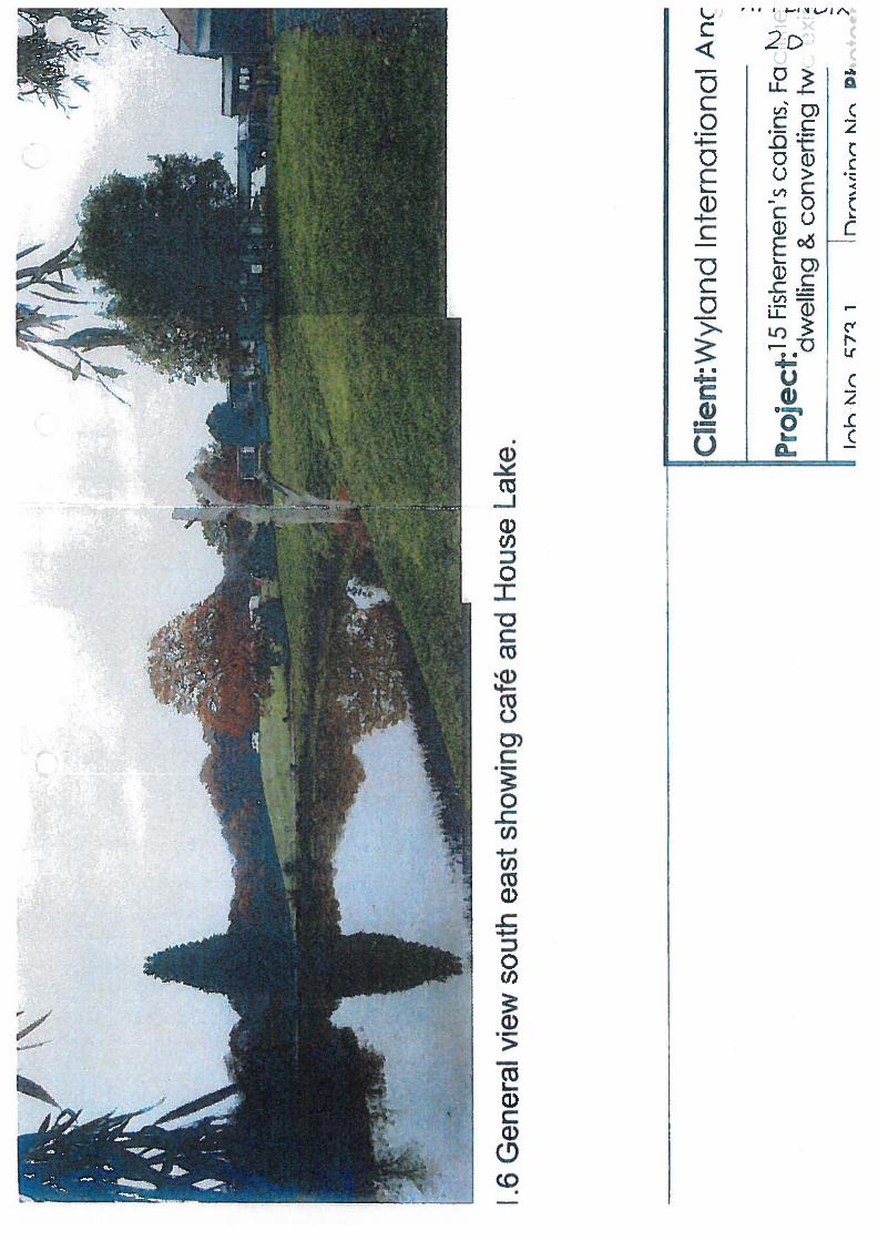
6.
I 6G
ener
alvi
ewso
uth
east
show
ing
café
and
Hou
seL
ake. C
lien
t:W
ylan
din
tern
atio
nal
Anc
Proje
ct:
15
Fis
herm
en’s
cabin
s,Fa
____
dw
elli
ng
&co
nver
ting
tw
Irk
M,m
17
1M
rD
I’
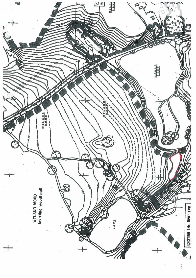
+
WY
LAN
DW
OO
D(e
xls
tjn
gw
oodta
ndi
4+
‘U
J
.2
+ I4N
o.. U
NITS
FOR1
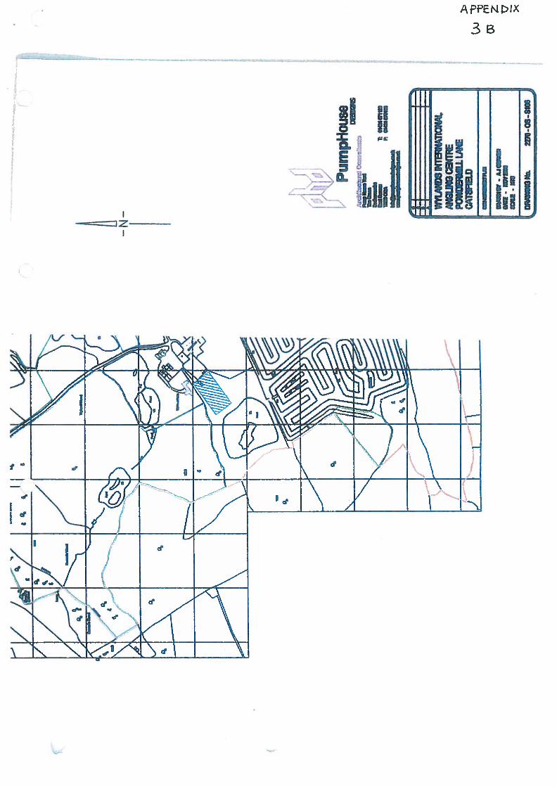
z—
1.
YI1Nid
rr
3cLEGEND
-A’ EXISTING WOODLAND
J EXISTING HEDGEROWS
RECENTLY PLANTED TREESr’ - AND SHRUBS
r ESTABLISHED NATWE TREEI •-‘l & ShRUB PLANTING
[ PROPOSED NATWE TREE &l\ SHRUB PLANTING
FUTURE NATWE TREE &- —1 SHRUB PLANTING
______
EXISTING GRASS AREAS
I I EXISTING LAKES
I PROPOSED CAR PARKING(with number of spaces)
TB TOILET BLOCK
[ I INTERPRETATION PANEL
I - I OWNERSHIP BOUND.RY
NOTES-Management of existing vegetation and new
planting to be maintained in accordance withmanagement plan.
-Measures to encourage wildlife to be agreedwith local authority.
-All new planting to be protected from rabbitsand pedestrian with rabbit proof fencing, spiralguards and mesh shrub guards.
-Any external lighting to be low level, directionaland energy efficient to be agreed with localauthority.
-Design and location of parking areas to beagreed and subject to visitor managementsuategy agreed with Local Authority.
-Interpretation panels to be provided (text &graphics to be approved by Local Authority)along public footpath for educational purposes
‘I l’ F’Tqk,.flAaMba
b t4b ——
‘-————a———
WYLAND INTERNATIONAL ANGLINGCENTRE
WYLAND INTERNATIONAL ANGLING CENTREBATTLE
DTh)
LANDSCAPE STRATEGY PLAN
i—I.
rnnee Al Ju07 3?
F
1067/6
riPARTRIDGE ASSOCIATES
Ld friiAta,4 Wt 0. 731 — 4l U
Td GIUO1Ufl PalliN fl
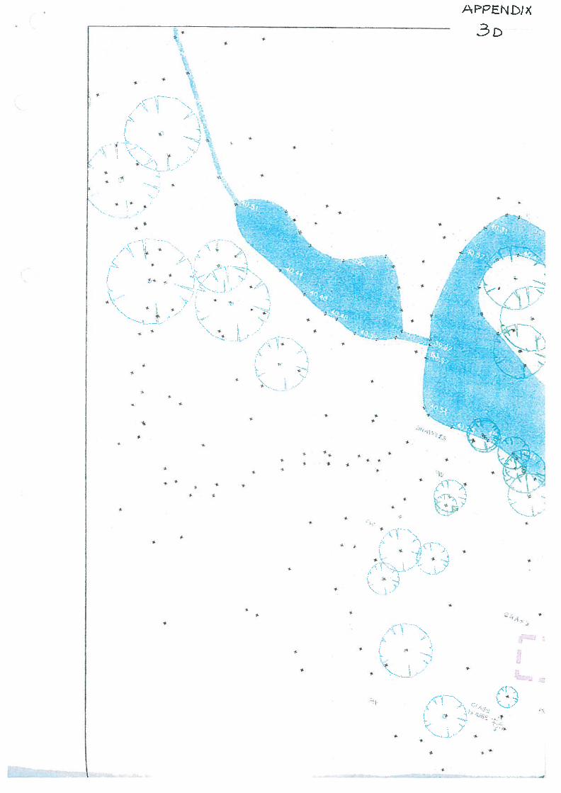
$,SSS
SS
>(QN3d1
$
I
5
$
S
S
,1
•ss
$
S
S
•
S
I
S
$
5-S
La:.
r 4’’I&—’Af\
4A
—I
4s
-
, _.)•:
3-
-—.-
‘-..
r
CAPPENDICES
RR/201 3/1011/P
Site:
WHATLINGTONUnits 32-37 Vinehall Business ParkVinehall Road
Proposed development:
Change of use from Use Class B1(business) to Use Class B2 (generalindustrial)
Planning Application Number RR12013/1 01 1/P
Applicant: Paneltech Systems Ltd
Note of Objections
Claudia Nagel-DaviesVinehall Manor
WhatlingtonEast Sussex TN32 5JW
1. For the reasons set out in this Note, I respectfully urge the Planning Committee torefuse the application referred to above.
Vinehall Manor
2. Vinehall Manor sits in the High Weald Area of Outstanding Natural Beauty. It isa listed building of historical and architectural significance, parts of which date back tothe th century.
3. I moved to Vinehall Manor in August 1995 and have lived here ever since. It ismy home and is the only property which I own. My two children live here when they arenot at school or university. I came to Vinehall Manor for the peace and tranquillity of lifein the country, having specifically established (through my solicitor) that only BI useswere permitted at Vinehall Business Centre.
Vinehall Business Centre
4. Vinehall Business Centre, where Paneltech carry on business, is directly oppositeVinehall Manor. The southern side of the premises which Paneltech occupy isapproximately 20 metres from the northern boundary of the garden of Vinehall Manor.’ Ibelieve the principal building occupied by Paneltech was originally a shed for farmvehicles.
5. Vinehall Business Centre is on part of the site of Vinehall Farm. Both are ownedby the Elliott family.
6. In August 1989 Rother permitted Vinehall Business Centre to be used for BIpurposes. That permission (RR189/0723/P) is subject to a condition which reads asfollows:
See the annotated satellite photograph which appears at page 1 of the Annex to this Note.
“Notwithstanding the provisions of the Town and Country Planning (Use Classes)Order 1987, the premises shall be used for the purposes stated in the applicationonly and not otherwise.
Reason: to ensure the appropriate use of the site.”
7. It was for Paneltech to familiarise themselves with these restrictions before goinginto occupation.
Problems
8. Since early 2010 I have been greatly troubled by the noise of steel-cutting andother related activities which Paneltech carry out. From May 2010, 1 repeatedly drewthese problems to the attention of Paneltech, their landlord (Margaret Elliott) and hermanaging agent (Cluttons).
9. After seven months of getting nowhere, I reported the matter to Rother DistrictCouncil in January 2011 •2 Rother engaged in extensive discussions with Paneltech.Those discussions - and assurances which Paneltech gave to Rother - did not resolve theproblems. Neither did sound insulation works which were undertaken by Paneltech in2012. So, in March 2013, Rother served upon Paneltech a breach of condition noticeunder the Town and Country Planning Act 1990. So far as I am aware, Paneltech did notmake any attempt to have that notice set aside.
10. The breach of condition notice allowed Paneltech 28 days to cease using thepremises for B2 purposes. Upon Paneltech then indicating that they intended to submit aplanning application for B2 use, Rother agreed not to prosecute for the time being.
What do Paneltech do?
11. This question is best answered in Paneltech’s own words. Prior to its recentrevision, Paneltech’s website stated that:
“In 2007 Paneltech was incorporated to become Paneltech Systems Ltd and alsosaw the introduction of a full fabrication and welding workshop at our premises inEast Sussex [that is, at Vinehall Business Centre]. This has enabled Paneltech toprovide a wide range of mechanical services including the manufacture ofpipework systems, pump skids, ISO container conversions, general structuralsteelwork and small/medium batch fabrication work...
2 I have contemplated taking legal action against Paneltech, hut have to date refrained from doing sobecause it seems to me that breaches of planning control can and should be dealt with through enforcementaction by the local planning authority.
2
Our in-house fabrication workshop offers the design and manufacture of steel andpipe work. From small assembly parts to medium sized structures, our engineerscan produce to very high standards. In support of this we have facilities availablefor surface preperation [sic] such a [sic] galvanising and various paint finishes...
We have the facility on site to house up to four containers at any time to beconverted. Some of the options for these conversions include:
WindowsPersonal doorsAdditional cargo doorsFull insulation and liningPower and lightingWater and drainageCable and pipe entry/access pointsTop mounted handrails and internal/external staircases...
We can also offer hot dip galvanising, spray painting and powder coating tocustomer requirements...
In house plant includes:
2x300A mig set2x I 80A manual arc setsI x plasma cutting setlxl8OA TIG setlxl6 inch band sawlx 9 inch band sawlx rotabroach magnetic drill1 x 3 tonne counterbalance forklift truck...
Our 2000 square foot dedicated workshop and fully surfaced yard provides morethan adequate room to handle most small to medium fabrication projects.”
12. The revised version of Paneltech’s website (www.paneltech-svsteins.co.uk) is toequivalent effect.
Why are Paneltech’s activities a problem?
13. Paneltech’s activities are a problem for two reasons. First, as is confirmed by thebreach of condition notice. they involve a glaring breach of the B I permission whichapplies to Vinehall Business Centre. Second, the noise which comes from Paneltech’spremises has made my life at Vinehall Manor a misery for the last three years. I havestruggled to hold conversations in my garden because of the noise emanating fromPaneltech. The noise tends to be at its most acute in the area around my swimming pooi,
3
which is a matter of yards away from Paneltech’s premises. However, the noise has beena year-round problem and not just a problem which is only noticed when in the garden.
14. The cutting, grinding, clanging, bashing and dropping of steel - not to mention thenoise of the delivery of that steel to Paneltech, on large lorries3 - is precisely the sort ofnoisy work which is not permitted at Vinehall Business Centre. It is for that reason thatRother served the breach of condition notice upon Paneltech in March 2013.
15. If Paneltech wished to see “the introduction of a full fabrication and weldingworkshop” or carry out the sorts of activities (welding/drilling/sawing/galvanising/spraypainting/fabrication/powder-coating/container conversions) to which their website refers,it was incumbent upon them to find premises which were suitable for (and had planningpermission allowing) work of that kind, in a location where neighbouring propertieswould not be adversely affected.
Paneltech’s position
16. Having been in breach of planning permission for at least three years, Paneltechnow seek to argue that there should be a change of use at Vinehall Business Centre, so asto allow the B2 activities which they carry out. The fact that Paneltech are making suchan application confirms that they are well aware that those activities constitute a breachof planning permission.
17. Despite this, Paneltech’s unsigned Supporting Statement seeks to dispute theindisputable by asserting that “It is my strong belief that our activity is within B 1 use”.Were that the case, Rother would not have served an enforcement notice on 19 March2013 and the Planning Committee would not now be dealing with this application for B2use.
18. The application itself is flawed in that it fails properly to identify the land towhich it relates. Section 4 of the application form refers only to units 32 to 37, which aresaid (in sections 9 and 1 8) to be made of blockwork and corrugated sheets and to amountto 271 square metres. By contrast, the Planning Statement dated 13 May 2013 states (onpage 2) that “the proposed planning unit also includes land to the east of the units whichis used for the storage of metal and finished products prior to dispatch to customers”.According to page 1 of the Planning Statement, this land amounts to about 290 squaremetres.
The reality
19. Contrary to the picture painted by Paneltech’s planning application, theinescapable facts are that:
At page 2 of the Annex is a photograph (taken on 10 June 2013) showing a delivery of whatappear to he long steel girders.
4
(i) Vinehall Business Centre is in an area which is not - and never has been -
suitable for B2 use, whether with or without conditions. This is why onlyBl use was permitted in the first place. The area around VinehallBusiness Centre has not changed: it remains a residential area, in an Areaof Outstanding Natural Beauty.
(ii) The particular premises which are occupied by Paneltech are entirelyinappropriate for the sorts of work which they carry out there. This is whynoise has escaped from them and why Rother served the breach ofcondition notice in March 2013 (that is, Jf: completion of the soundinsulation works which Paneltech agreed with Rother).
Noise reports
20. Paneltech’s application contains two reports prepared by an acoustic consultant,Mr Durrant.
21. Mr Durrant’s arguments seem to be that (a) road noise already exists, so there isno reason for not putting up with noise from Paneltech4and (b) I have a large garden, so Imust be able to find a quiet corner of it. The answers to those points are obvious: (i) Iknew of the road noise when I bought Vinehall Manor, (ii) the road noise is not a breachof planning control, (iii) having lived in central London for the first 30 years of my life, Iam well accustomed to road noise, (iv) the noise caused by Paneltech is very differentfrom road noise and is a breach of planning control and (v) I am entitled to enjoy thewhole of my house and garden, not just the parts which are situated away fromPaneltech’s premises.5
22. Six short points demonstrate that Mr Du rrant’s approach and conclusions areflawed:
(i) BS4 142, upon which Mr Durrant relies, is in essence a mathematicalformula, aimed at trying to establish the likelihood of complaints.
(ii) At best, BS4 142 is a general i sed guide. The Foreword to BS4 142 makesclear that “Response to noise is subjective and affected by many factors(acoustic and non—acoustic)... BS4 142 is necessarily general in character
In his report dated 24 April 2013, Mr Durrant says that the noise from Paneltech is “not new”. Ifhe means that this noise problem has existed for three years, with the result that Paneltech have been inbreach of planning control for those three years, he is correct. As noted above, I first noticed the problemin 2010 and have been complaining to Rother about it since January 2011.
Paneltech’s Supporting Statement asserts that their nearest neighbours do not regard theiractivities as a noise nuisance. Leaving aside the fact that there is no supporting evidence from theseunnamed neighbours, this ignores that fact that Paneltech’s neighbours at Vinehall Business Centre arebusinesses: they use their premises for commercial purposes and occupy them under short leases orlicences. They do not live there.
5

and may not cover all situations...Although, in general. there is arelationship between the incidence of complaints and the level of generalcommLtrntv annoyance, quantilive assessment of the latter is beyond thescope of this standard, as is the assessment of nuisance”.
(iii) The High Court has confirmed that BS4 142 is a measure of noise
nuisance or loss of amenity: see Lawrence i’ Feii Tigers Ltd [2011]EWHC 360 (QB), at paragraph 183.
iv) In this instance, Mr Durrant has riot measured the noise in the garden ofVinehall Manor.
(v) Neither has he taken any account of the topography of the land. The areaof garden near the swimming pool is significantly higher than the landupon which Vinehall Manor is built, but Mr Durrant makes no mention ofthis .
(vi) Mr Durrant has ignored the key fact that Rother have served a breach ofcondition notice. His report dated 26 February 2013 was prepared before(not after) the breach of condition notice was served. If the conclusionsexpressed in that report were correct, Rother would not have served abreach of condition notice 21 days later. Mr Durrant’s report dated 24April 2013 makes no mention at all of the breach of condition notice.
23. Mr Durrant has not had to live with the noise problems caused by Paneltech. Hehas never set foot in Vinehall Manor or its garden and, in the absence of any statement tothe contrary, it may he assumed that his noise assessments were carried out at times prearranged with Paneltech. Indeed, it is clear that some of the noise which Mr Durrant wasmeasuring was itself pre-arranged with Paneltech.7 For reasons which he has notproperly explained, Mr Durrant regards the noise in the garden as less important than thenoise in Vinehall Manor itself.8
A photograph illustrating the height difference is at page 3 of the Annex. The area of garden nearthe pool is roughly level with the first floor of Vinehall Manor.
“In addition to the typical activities, it was requested that frr a period of 15 minutes a 9” grinder, a4” grinder and hammering took place at the same time Mr Durrant’s report dated 26 February 2013,page 9. It is not clear how Mr Durrant can have first-hand knowledge of what is and is not “typical”.
I think most people would accept that the assessment priority should hc placed on the dwellingrather than the garden.” says Mr Durrant in his report dated 24 April 2013. This approach is misconceived.because (a) there is nothing to suggest that “most people” would regard the garden as of less importancethan the dwelling. (b) I am entitled to enjoy the whole of my property, not just certain parts of it, (c) thegarden is nearer Paneltech’s premises than Vinehall Manor is and (d) unlike Vinehall Manor, the garden isnot enclosed by thick brick walls. The only sensible explanation for Mr Durrant’s reluctance to focus onthe garden is that that is where the problem has been at its most acute.
6
24. Testing noise on a pre-arranged basis, at locations other than Vinehall Manor orits garden, ignores the realities of the situation. No one is better placed than me toconfirm that the noise which I have endured from Paneltech has been unacceptable. IfPaneltech had good reason to believe that there was no noise problem, (a) it was open tothem to challenge the breach of condition notice through a judicial review application and(b) there would be no need for them to make this application for B2 use. IHstead, theyhave adopted the self-contradictory stance of submitting this application while still tryingto assert that, despite the breach of condition notice, there is no noise problem.
25. Rother have a knowledge and understanding of local conditions and topographywhich Mr Durrant (who is based in Suffolk) cannot he expected to possess. They are notpaid by any party to produce reports. Rother’s Senior Environmental Health Officer, MrMills, has had access to Vinehall Manor and its garden on numerous occasions and hasmeasured the noise levels. The result of this objective testing, which reflected therealities of the noise with which I have had to contend, was the service of the breach ofcondition notice upon Paneltech On 19 March 2013. Mr Mills’ notes (recited by MrDurrant in his report dated 24 April 2013) expressly record Mr Mills’ view that the noisefrom Paneltech “definitely affects the amenity of the nearby residential property [that is,Vinehall Manor and its garden]”.
My submissions
26. From a personal perspective, my submissions begin and end with a heartfelt pleathat the integrity of this beautiful area be preserved and that an end be put to the miserywhich Paneltech have caused. For several years now, Paneltech have been breaching theapplicable planning laws without apology and with impunity. This cannot continue.
27. If I felt that the problems presented by Paneltech’s activities could be solvedthrough the imposition of conditions upon any permission granted to them, I would sayso. For the reasons explained above, however, attaching conditions is not an answer.9No amount of conditions is going to make this area one which is suitable for B2 use.And no amount of conditions is going to make Paneltech’s premises suitable for theactivities which they have been carrying out there.
28. The inherent unsuitability of the premises is beyond question:
The Planning Statement dated 13 May 2013 suggests (on page 6) that a condition could beimposed “limiting the use of the units for the benefit of Paneltech only to ensure the LPA controls anysubsequent B2 use of the units which may have different characteristics which could impact onneighbouring amenity”. This suggestion is misconceived, because (a) Paneltech seem to be applying forB2 in permission in respect of open land (not just “the units”), (h) it wrongly presupposes that Paneltechwill not expand its activities at the premises and (c) it would be tantamount to granting a permissionpersonal to Paneltech. “Planning permission runs with the land and it is seldom desirable to provideotherwise.. .A permission personal to a company is inappropriate because its shares can be transferred toother persons without affecting the legal personality of the company”: the Department of theEnvironment’s Circular 11/95 (Use of Conditions in Planning Permission), paragraph 93. The suggestionthat “catchers” could he installed on machinery is equally empty, because the problem goes much furtherthan noise caused by metal being dropped in the premises.
7
(i) Paneltech promised Rother that they would keep the doors closed whileworking. This proved to be an empty promise, because I wassubsequently told that some of the pieces of metal which they work on aretoo long to fit inside the premises and that they forget to close the doorswhen working on items which do fit inside the premises. This isconsistent with Paneltech’s website, which states that “The control paneldepartment have been working on 10 sets of heating elements which areeach 5m long, and four of these with their controls heat a 2Oft container ofcrude oil. As you can imagine these took some careful manoeuvringaround the workshop! And had to have specially designed crates forshipping.”
(ii) A different explanation was given to Mr Searle, Rother’s SeniorEnforcement Officer: Paneltech told him that the doors had to be keptopen for light and ventilation purposes. Whichever of these conflictingexplanations is true, all of this confirms that the premises are just notsuitable for the work which Paneltech do there and that a conditionrequiring the doors to be kept closed will simply not work. It has alreadybeen tried and has failed.
(iii) The Planning Statement says that “flaps have been installed in the doors toenable long lengths of metal to be cut without having to keep the doorsopen”. The fact that flaps have had to be cut into the doors illustrates thatthe unit is simply not appropriate for the work which is being done there.The size of the flaps is not stated and there is no explanation of how a longlength of metal can be held steady and worked upon safely while part of itis protruding through a flap in a door. If a door has an open flap in it, thedoor cannot sensibly be said to he closed.
(iv) Paneltech’s application refers to a “disciplinary policy” in relation to thedoors, but there is no evidence that this forms part of any staff handbookor that anyone has ever been disciplined for leaving the doors open.’° Interms of staff, Paneltech’s website refers to (among others) John Lee,Deborah Lee, Lucy Lee, Joshua Lee, Michael Lee, Darryl Lee and JamieLee. The suggestion that a family company of this type would take seriousdisciplinary steps against anyone who left the doors open is, with respect,fanciful.
(v) The disciplinary policy rings even more hollow when one readsPaneltech’s Supporting Statement, which concedes that (a) following the
Paneltech have produced no documentation to substantiate the points referred to at the foot of page2 of the Planning Statement. If there is a disciplinary policy, Paneltech could easily have produced a copyof the relevant part of their staff handbook. Similarly, if there is an agreement with the (unnamed) maincustomer that steel is pre-prepared, it is not clear why Paneltech could not have provided a copy of thatagreement.
8
filling in of the skylights, there is now no natural light in the premises and(b) the interior of the premises becomes hot during the summer. To theextent that any disciplinary policy might exist, it is obviously unworkable.A disciplinary policy which means that staff are not allowed to opendoors, despite having to work in a hot environment with no natural light,does no more than re-confirm that the premises are unsuitable for the workwhich Paneltech do there.
Economics
29. It is revealing that Paneltech make no reasoned attempt to pray economicconsiderations in aid of their application. If having to move represented any threat toPaneltech’s business, the application would have made much of that point. There is nosuggestion from Paneltech that granting permission for B2 use would create new jobs;and there is no suggestion that refusing permission would lead to the loss of jobs.
30. Paneltech’s website emphasises their project management and logisticalcapabilities (including the fact that they helped to move the Gray Nicolls factory), somoving their own equipment to another location is not likely to be a difficult or costlyexercise for them. Paneltech have made no attempt to explain why a family company ofthis kind cannot easily move to a location appropriate to the work which they carry out,rather than remaining in a location which is obviously unsuitable.
31. Despite the service of the breach of condition notice, there is nothing inPaneltech’s application to suggest that they have even considered researching alternativepremises. If there is a shortage of B2 property in this area, it is for a reason - this is aresidential location within an Area of Outstanding Natural Beauty, in which B2 use is notappropriate. It may be that Paneltech will have to find B2 premises in Hastings orBexhill, these being locations where industrial estates exist. According to CompaniesHouse, Mr and Mrs Lee, who are the director and company secretary of Paneltech, live inNorthiam. Commuting to appropriate premises in Hastings or Bexhill would be no moreonerous than commuting to inappropriate premises in Whatlington.
32. These points are illustrated by the following concrete examples, produced by briefsearches of the internet:
(i) On 29 April 2013, Cluttons’ website advertised four units at VinehallBusiness Centre, to be let on “annual self-renewing licences”, at pricesequating to £7.55, £7.98, £8.01 and £10 per square foot. In the absence ofany evidence from Paneltech of the licence fee which they pay at VinehallBusiness Centre, it may be assumed that they pay in the region of £7 to £9per square foot.
(ii) On 23 April 2013, four industrial properties in Bexhill were advertised onwww.movehut.co.uk, at prices of only £4.29 to £7.28 per square foot.
9
These were at Beeching Park Industrial Estate and Wainwright Road, adistance of just 17 miles from Mr and Mrs Lee’s home.
(iii) On the same date, a further B2 unit was advertised on the same website atSpelmonden Estate, Goudhurst, at £4.50 per square foot.
33. On the basis of those figures, it can be seen that, far from being uneconomic,moving to B2 premises would probably save Paneltech money. This may explain thefailure of their application to make any reference to appropriate premises to which theycould move.
Summary
34. The application to change the use at Vinehall Business Centre is an eleventh-hourattempt to avoid the risk of prosecution under the breach of condition notice. It ismisconceived and unsustainable:
(i) By applying for B2 use, Paneltech have accepted that they cannot carryout their work at Vinehall Business Centre in a manner consistent with theB I permission which governs the site.
(ii) Light industry without detrimental noise is Bl use. Paneltech’sapplication is for B2 use. Whatever spin they attempt to put on it in theirapplication, allowing B2 use would be giving Paneltech the green light tomake noise in a residential area. Permitting such use would immediatelywipe away the protection given by the existing B I permission. Theapplication comes nowhere close to making out a case for allowing B2 usein this residential area.
(iii) The application presupposes that the premises themselves will remainunchanged. It is implicit in Rother’s enforcement notice that the premiseswhich Paneltech are using are not suitable (or in a suitable location) forthe B2 activities which they are carrying out. Paneltech’s references to theheat, the absence of natural light and the cutting of flaps into doorsillustrate just how inappropriate these premises are for the activities whichthey carry out in them.
(iv) The character of the area has not changed since B 1 permission was givenin 1989. This remains a residential area within an Area of OutstandingNatural Beauty. B2 use was inappropriate in 1989 and is just asinappropriate now.
(v) The last three years - and the service by Rother of the breach of conditionnotice - demonstrate beyond any doubt that Panel tech cannot conduct theiractivities without an unacceptable level of noise nuisance, resulting insignificant loss of amenity to my family and me. Paneltech have
10
attempted to soundproof their premises and have promised Rother that thedoors to the premises will be shut at all times that work is in progress.Despite this, Rother served the breach of condition notice.
(vi) There is no way of soundproofing the noise caused by metal beingdelivered to and removed from the premises, those being things whichhappen in the open air, a matter of yards from Vinehall Manor. Neitherwould there be any way of soundproofing the movements of steel productswhich are being stored in the open air. It is notable that Paneltech appearto be seeking B2 permission not just in respect of units 32 to 37, but inrespect of the entirety of the land (including open land) which theyoccupy.
(vii) Attaching conditions to any permission would not solve the numerousproblems which are presented by the carrying on of a business in a placewhich is wholly unsuitable for that use.
(viii) There is no economic reason for allowing the application, because (a)there is no evidence to suggest that the outcome of the application wouldcreate or jeopardise jobs, (b) as Cluttons have conceded, there is alreadymore accommodation at Vinehall Business Centre than the market canbear and (c) renting appropriate B2 premises would appear to be cheaperfor Paneltech than occupying inappropriate premises at Vinehall BusinessCentre.
(ix) The application flies directly in the face of Policies EN2, EN3 and EN9 ofthe Rother District Local Plan (2006):
“Conserving and enhancing landscape quality and characterwill be the primary objective in the Sussex Downs and HighWeald Areas of Outstanding Natural Beauty...” (EN2)
“In order to protect and promote the quiet enjoyment of Areas ofOutstanding Natural Beauty, development within them will belimited to that derived from the character and qualities of thecountryside, having regard to the social and economic well-beingof the areas. Development involving change or damage to theircharacter or qualities, including significant increases in noiseandlor intrusion from traffic or other activity, or having asignificant adverse effect on established views, will not bepermitted.” (EN3)
“Activities that require extensive use of land, such as golfcourses, and noisy activities will not be acceptable in remoteand unspoiled landscapes. Where a case can be established forsuch uses and the development can be satisfactorily assimilated
11
into the landscape, locations in areas of damaged or disturbedlandscapes or in urban fringes will be preferred provided the noiseimpact on neighbouring areas is acceptable.” (EN9)
35. Finally, I would make the point that, whether or not it had conditions attached toit and however carefully phrased it might be, any permission to expand the activitieswhich may be carried on at Vinehall Business Centre would represent a deeplyregrettable precedent. It would be the first step in what I fear would be a gradual erosionof the vital planning restrictions which apply to the area.
36. To conclude, I can do no better than quote from paragraph 78 of the Departmentof the Environment’s Circular 11/95 (Use of Conditions in Planning Permission):
“Noise can have a significant effect on the environment and on the quality of lifeenjoyed by individuals and communities. The planning system should ensure that,wherever practicable, noise-sensitive developments are separated from majorsources of noise, and that new development involving noisy activities should, ifpossible, be sited away from noise-sensitive land uses.”
37. 1 submit this Note in the sincere hope that the Planning Committee will ensurethat the character of the locality is properly protected, that the misery and loss of amenitywhich I have suffered is finally brought to an end and that no steps are taken to turnVinehall Business Centre into a site where any form of B2 industry may be carried on.To permit such use would be a disastrous blow to the character and history of the localityand to Vinehall Manor.
Claudia Nagel-Davies 17 June 2013
12

Planning Application Number RR/2013/1O1 1/P
Applicant: Paneltech Systems Ltd
Annex to the Note of Objections
Claudia Nagel.DaviesVinehall Manor
WhatlingtonEast Sussex TN32 5JW
Page 1 Satellite photographPage 2 Photograph showing delivery of long girders on 10 June 2013Page 3 Photograph illustrating the height difference between Vinehall Manor and
the area of garden around the swimming pool
13
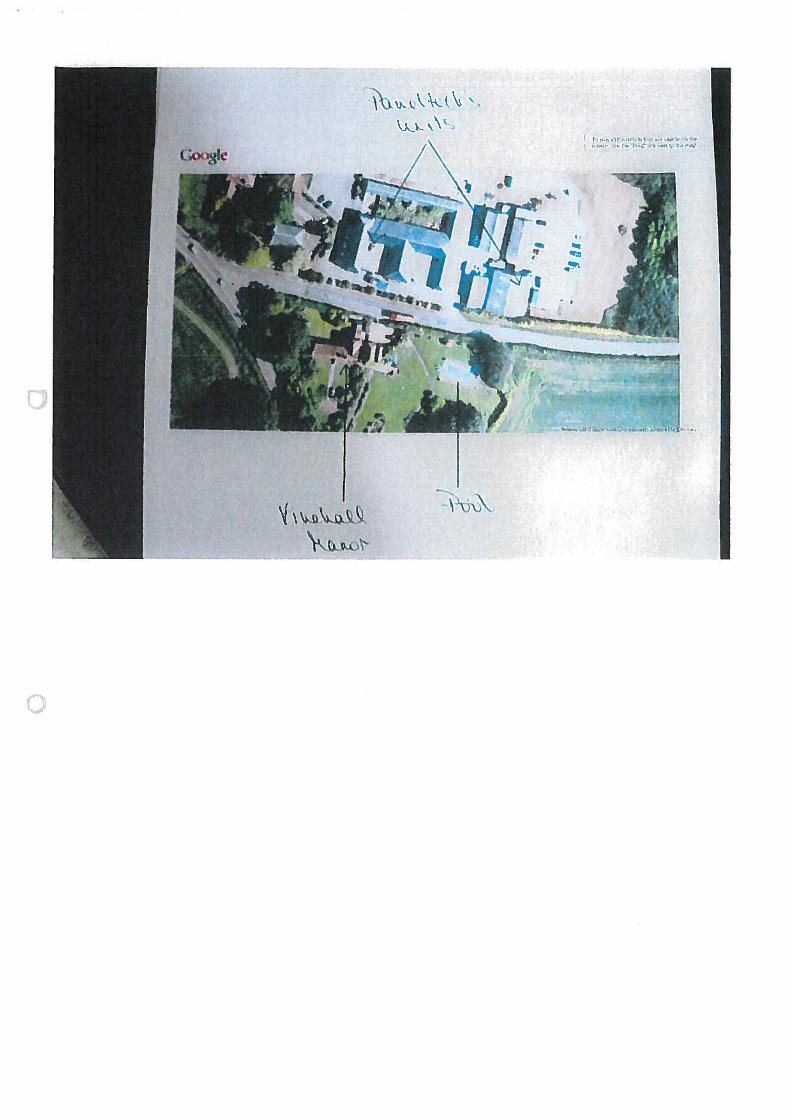
I
,-
‘I
F—
m
4
‘‘
::
WE
-‘.
1;’
;
—.----