Embed Size (px)
Citation preview
Pre-Columbian Archaeology Pre-Columbian Archaeology of North Americaof North America
Regional Chronologies:Regional Chronologies:
Week 9 – the Great Plains and Week 9 – the Great Plains and Great BasinGreat Basin

FloraFlora
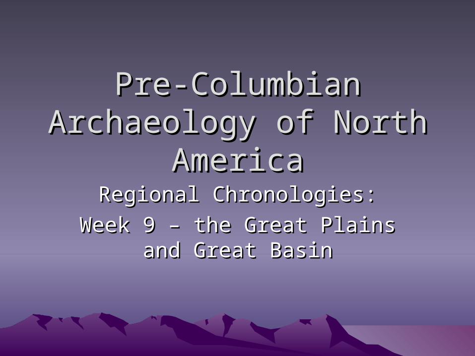
• Great Plains– Grasslands dominating region between Rocky
Mountains and Mississippi River• Prairie peninsula in Illinois
– Short-grass steppe in west (30 cm)– Tall-grass prairie in the east (200 cm)– Dominated by grasses and forbs (non-grass
herbs)– Trees only along rivers
• Cottonwood (Populos deltoides)
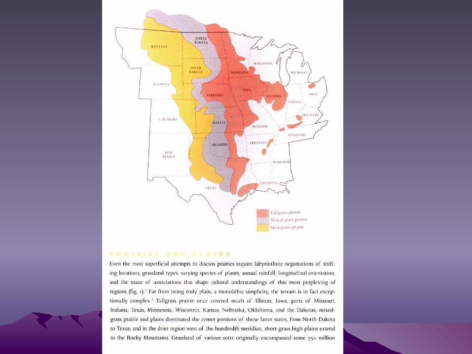
Tall-grass PrairieTall-grass Prairie
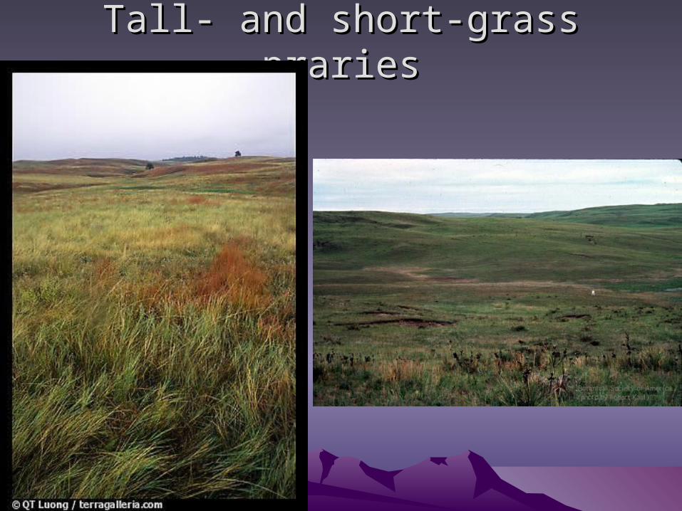
Tall- and short-grass prariesTall- and short-grass praries
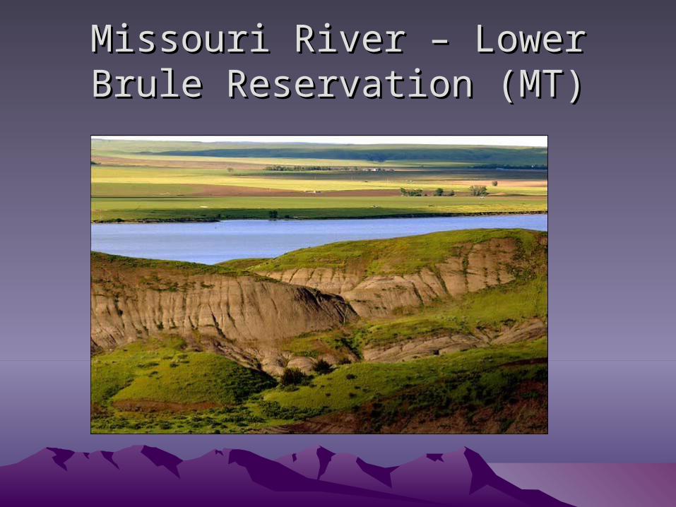
Missouri River – Lower Brule Missouri River – Lower Brule Reservation (MT)Reservation (MT)

Missouri River – Glasgow, MOMissouri River – Glasgow, MO
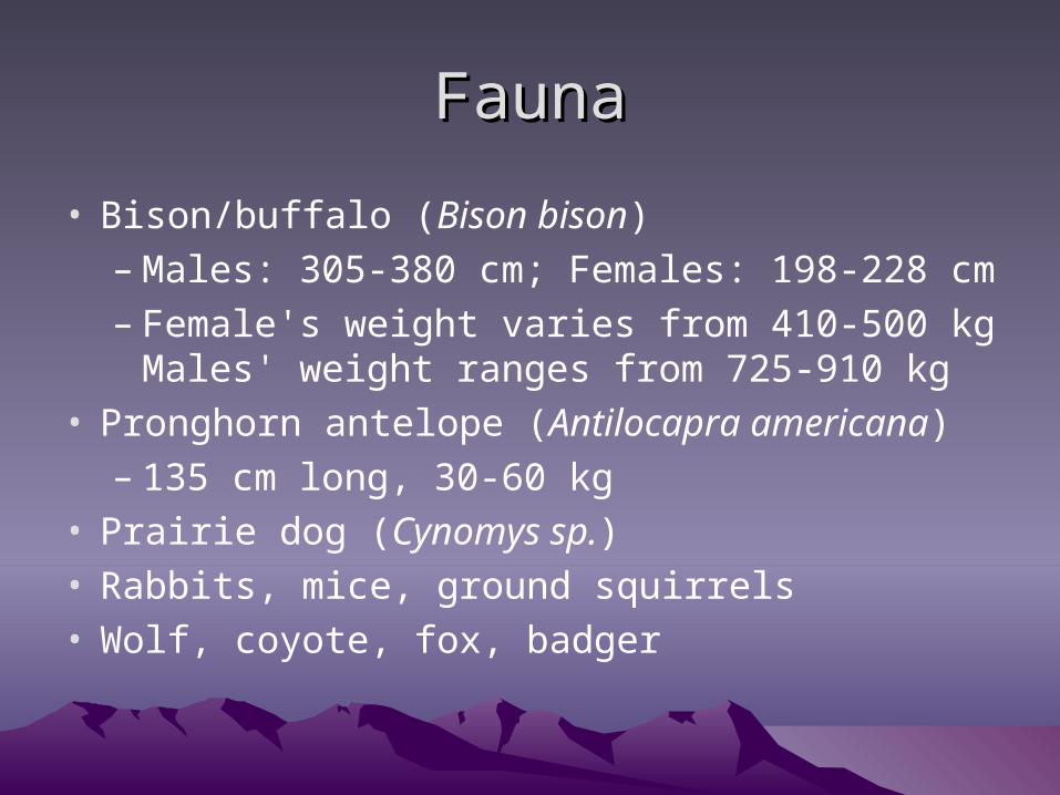
FaunaFauna
• Bison/buffalo (Bison bison)– Males: 305-380 cm; Females: 198-228 cm– Female's weight varies from 410-500 kg
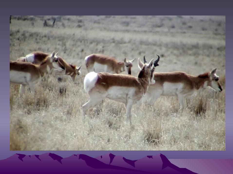
Males' weight ranges from 725-910 kg • Pronghorn antelope (Antilocapra americana)
– 135 cm long, 30-60 kg• Prairie dog (Cynomys sp.)• Rabbits, mice, ground squirrels• Wolf, coyote, fox, badger

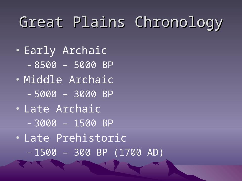
Great Plains ChronologyGreat Plains Chronology
• Early Archaic– 8500 – 5000 BP
• Middle Archaic– 5000 – 3000 BP
• Late Archaic– 3000 – 1500 BP
• Late Prehistoric– 1500 – 300 BP (1700 AD)
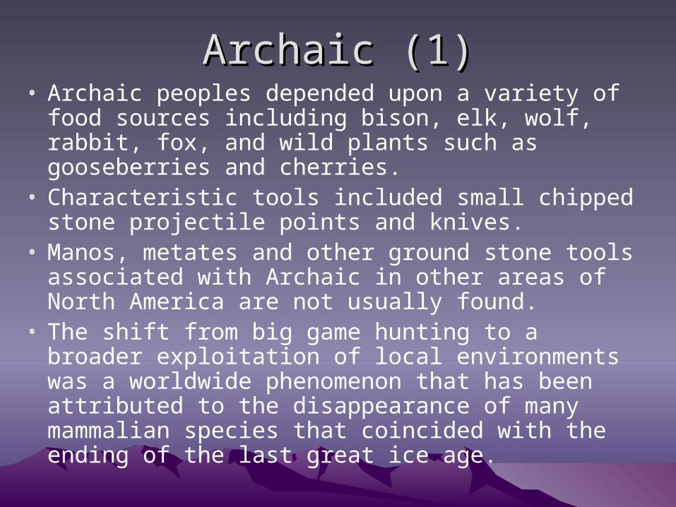
Archaic (1)Archaic (1)• Archaic peoples depended upon a variety of food
sources including bison, elk, wolf, rabbit, fox, and wild plants such as gooseberries and cherries.
• Characteristic tools included small chipped stone projectile points and knives.
• Manos, metates and other ground stone tools associated with Archaic in other areas of North America are not usually found.
• The shift from big game hunting to a broader exploitation of local environments was a worldwide phenomenon that has been attributed to the disappearance of many mammalian species that coincided with the ending of the last great ice age.
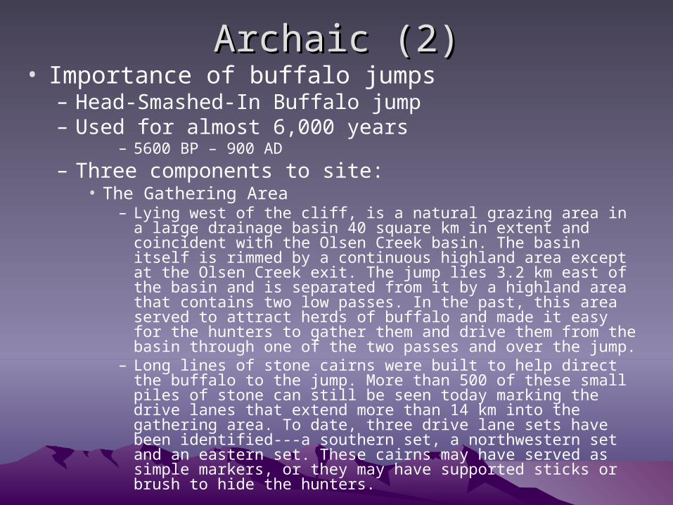
Archaic (2)Archaic (2)• Importance of buffalo jumps
– Head-Smashed-In Buffalo jump– Used for almost 6,000 years
– 5600 BP – 900 AD
– Three components to site:• The Gathering Area
– Lying west of the cliff, is a natural grazing area in a large drainage basin 40 square km in extent and coincident with the Olsen Creek basin. The basin itself is rimmed by a continuous highland area except at the Olsen Creek exit. The jump lies 3.2 km east of the basin and is separated from it by a highland area that contains two low passes. In the past, this area served to attract herds of buffalo and made it easy for the hunters to gather them and drive them from the basin through one of the two passes and over the jump.
– Long lines of stone cairns were built to help direct the buffalo to the jump. More than 500 of these small piles of stone can still be seen today marking the drive lanes that extend more than 14 km into the gathering area. To date, three drive lane sets have been identified---a southern set, a northwestern set and an eastern set. These cairns may have served as simple markers, or they may have supported sticks or brush to hide the hunters.
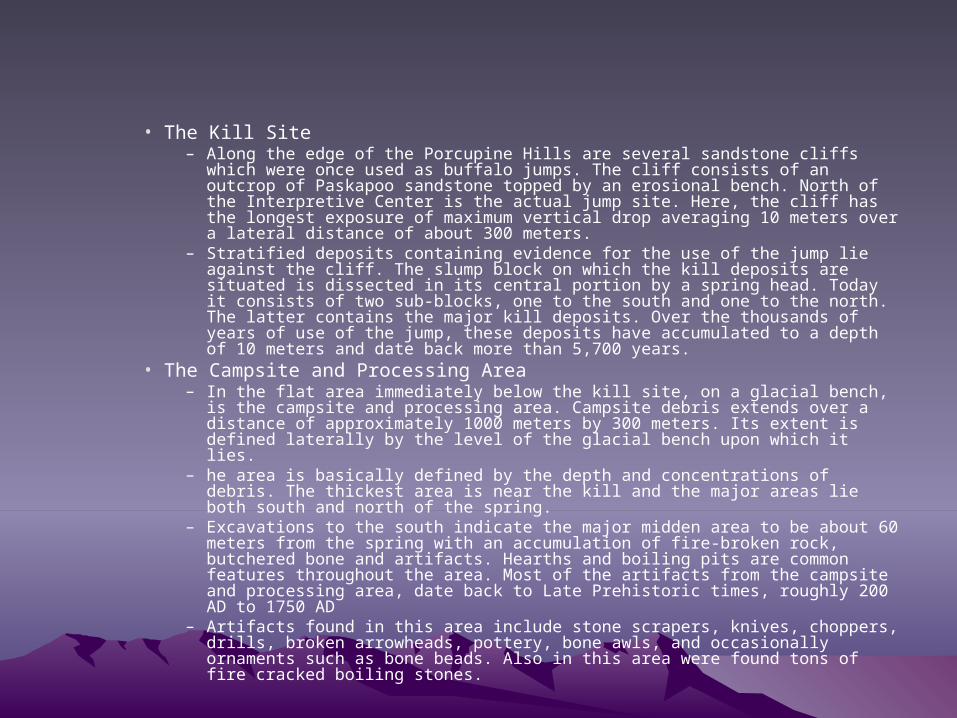
• The Kill Site– Along the edge of the Porcupine Hills are several sandstone cliffs which were
once used as buffalo jumps. The cliff consists of an outcrop of Paskapoo sandstone topped by an erosional bench. North of the Interpretive Center is the actual jump site. Here, the cliff has the longest exposure of maximum vertical drop averaging 10 meters over a lateral distance of about 300 meters.
– Stratified deposits containing evidence for the use of the jump lie against the cliff. The slump block on which the kill deposits are situated is dissected in its central portion by a spring head. Today it consists of two sub-blocks, one to the south and one to the north. The latter contains the major kill deposits. Over the thousands of years of use of the jump, these deposits have accumulated to a depth of 10 meters and date back more than 5,700 years.
• The Campsite and Processing Area– In the flat area immediately below the kill site, on a glacial bench, is the campsite
and processing area. Campsite debris extends over a distance of approximately 1000 meters by 300 meters. Its extent is defined laterally by the level of the glacial bench upon which it lies.
– he area is basically defined by the depth and concentrations of debris. The thickest area is near the kill and the major areas lie both south and north of the spring.
– Excavations to the south indicate the major midden area to be about 60 meters from the spring with an accumulation of fire-broken rock, butchered bone and artifacts. Hearths and boiling pits are common features throughout the area. Most of the artifacts from the campsite and processing area, date back to Late Prehistoric times, roughly 200 AD to 1750 AD
– Artifacts found in this area include stone scrapers, knives, choppers, drills, broken arrowheads, pottery, bone awls, and occasionally ornaments such as bone beads. Also in this area were found tons of fire cracked boiling stones.
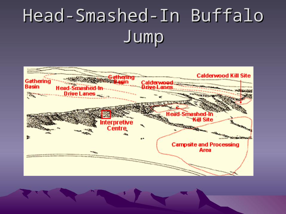
Head-Smashed-In Buffalo JumpHead-Smashed-In Buffalo Jump

Archaic Points (1)Archaic Points (1)• This medium to large point has a
rectangular stem with long parallel - sided blade. It's widest at the shoulders, which are narrow and angular, to rounded. T stem is long ; the side edges are ground. flaking may be random or parallel transverse. The Alberta point was named by Marie Wormington { 1957 :134 } for examples found in the province of Alberta, Canada. The Alberta point is related to and a variant of Eden /Scottsbluff points.
• AGE AND CULTURE : Early Archaic, contemporary with Scottsbluff points.
• DISTRIBUTION : The Canadian provinces of Alberta and Saskatchewan and parts of Idaho, Montana , North and South Dakota, Wyoming and Nebraska.

Archaic Points (2)Archaic Points (2)
• Bell base notched points
• Age and Culture: Middle Archaic 7000 - 5000 B.P.
• Distribution: Central Texas
• L: 4.61 cm• R: 5.83 cm
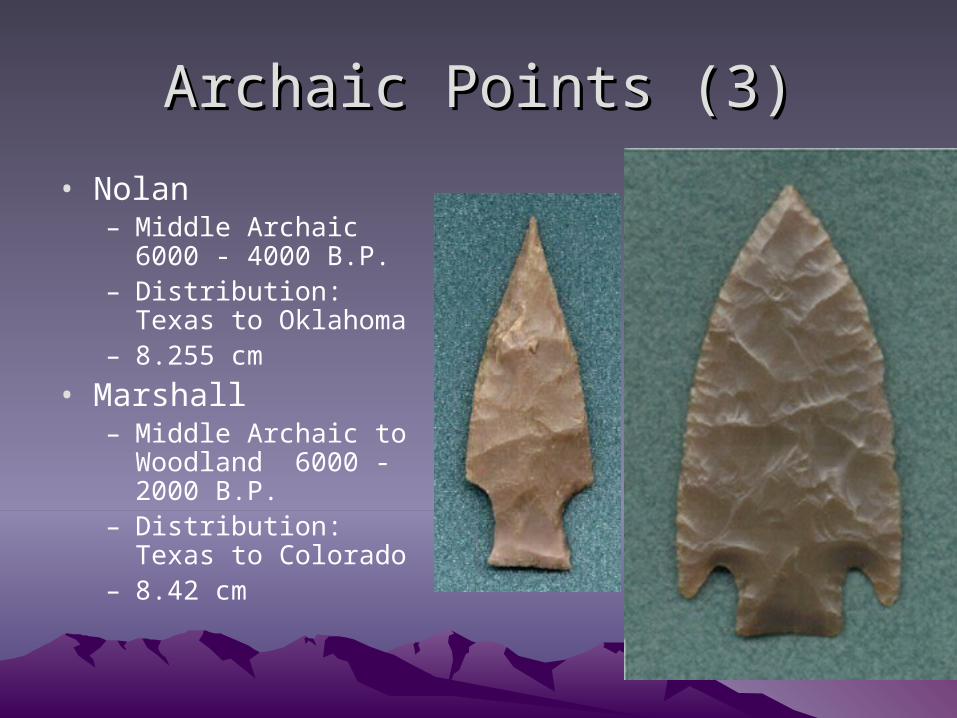
Archaic Points (3)Archaic Points (3)
• Nolan– Middle Archaic 6000 -
4000 B.P.– Distribution: Texas to
Oklahoma– 8.255 cm
• Marshall– Middle Archaic to
Woodland 6000 - 2000 B.P.
– Distribution: Texas to Colorado
– 8.42 cm
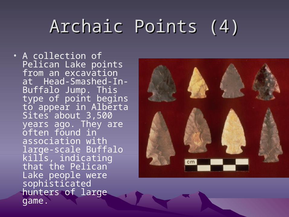
Archaic Points (4)Archaic Points (4)
• A collection of Pelican Lake points from an excavation at Head-Smashed-In-Buffalo Jump. This type of point begins to appear in Alberta Sites about 3,500 years ago. They are often found in association with large-scale Buffalo kills, indicating that the Pelican Lake people were sophisticated hunters of large game.

Archaic Points (5)Archaic Points (5)
• Late Archaic dart point with fiber binding still attached.
• Lower Pecos region of Texas
Post-archaicPost-archaic
• On the Great Plains the archaic is followed by the Woodland Period– We will talk about this next week

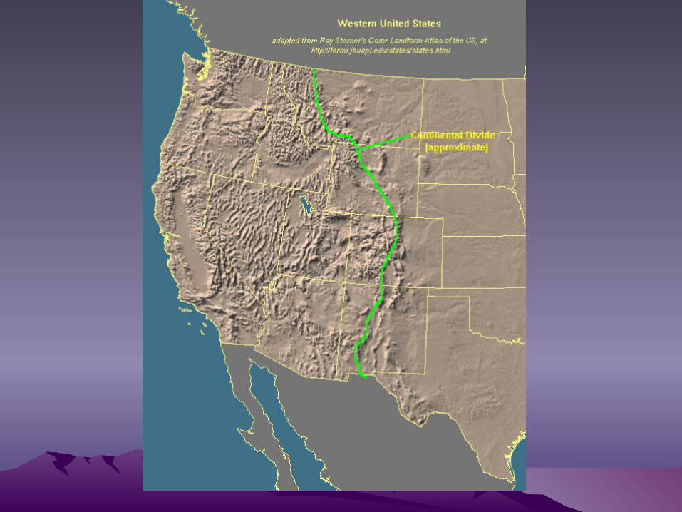
Great BasinGreat Basin
• Current ecological conditions in the Great Basin are characterized by:– 1. Little rain (usually 60 cm per year and often half of that)– 2. Soil cannot absorb the rain, so there is usually runoff in the form of
flash floods – 3. Altitudinal variety (i.e., zonation) ranges:
• a. Valley desert • b. Juniper and pinon • c. Alpine in higher elevations
– 4. Thus, while a generally dry area, there exists microenvironmental variation with vertical zonation.
– Ecological conditions in the Great Basin during the Pleistocene were quite different:
– 1. There were rivers and lakes • a. Now characterized by:
– (1) Dry riverbeds – (2) Dry lake playas
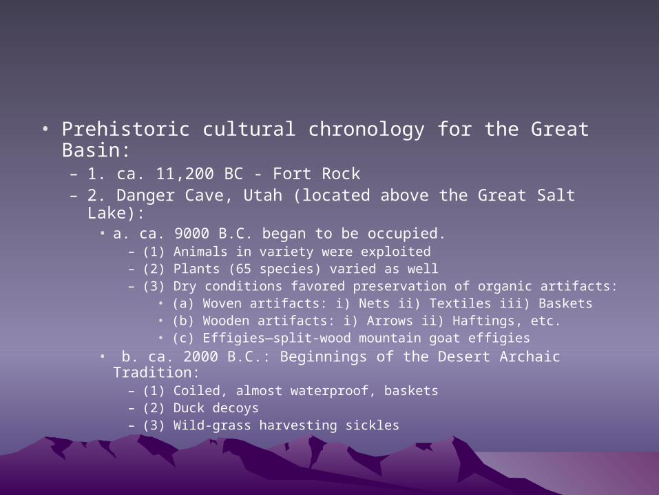
• Prehistoric cultural chronology for the Great Basin:– 1. ca. 11,200 BC - Fort Rock– 2. Danger Cave, Utah (located above the Great Salt Lake):
• a. ca. 9000 B.C. began to be occupied. – (1) Animals in variety were exploited – (2) Plants (65 species) varied as well – (3) Dry conditions favored preservation of organic artifacts:
• (a) Woven artifacts: i) Nets ii) Textiles iii) Baskets • (b) Wooden artifacts: i) Arrows ii) Haftings, etc. • (c) Effigies—split-wood mountain goat effigies
• b. ca. 2000 B.C.: Beginnings of the Desert Archaic Tradition: – (1) Coiled, almost waterproof, baskets – (2) Duck decoys – (3) Wild-grass harvesting sickles
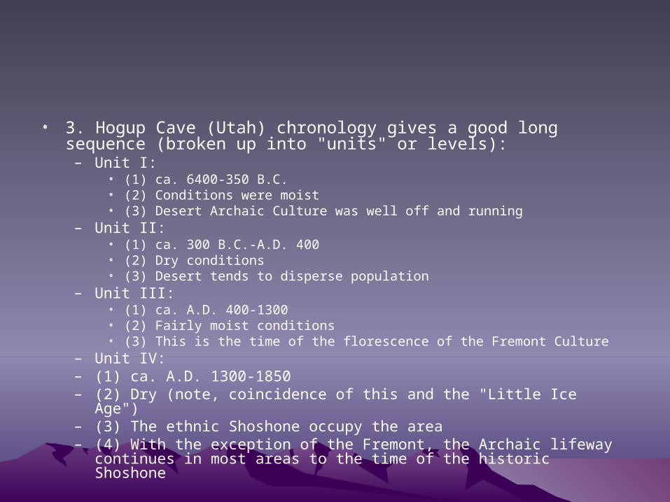
• 3. Hogup Cave (Utah) chronology gives a good long sequence (broken up into "units" or levels):
– Unit I: • (1) ca. 6400-350 B.C. • (2) Conditions were moist • (3) Desert Archaic Culture was well off and running
– Unit II: • (1) ca. 300 B.C.-A.D. 400 • (2) Dry conditions • (3) Desert tends to disperse population
– Unit III: • (1) ca. A.D. 400-1300 • (2) Fairly moist conditions • (3) This is the time of the florescence of the Fremont Culture
– Unit IV: – (1) ca. A.D. 1300-1850 – (2) Dry (note, coincidence of this and the "Little Ice Age") – (3) The ethnic Shoshone occupy the area – (4) With the exception of the Fremont, the Archaic lifeway continues in most
areas to the time of the historic Shoshone

Fremont CultureFremont Culture• The Fremont Culture is the main exception, and is quite interesting.• Fremont Culture:
– a. Dates: ca. A.D. 500-1400 – b. Situated in the eastern Great Basin
• (1) Eastern Utah • (2) North of the Anasazi of the Southwest
– c. Probably an outgrowth of the Desert Archaic Tradition, but had some cultural affinities with both:
• (1) Southwest cultures • (2) Plains cultures
– d. Most characteristic artifact: limbless clay figurines – e. Subsistence:
• (1) Horticultural lifestyle: – (a) Corn:
• i) Zea mays • ii) ca. ±A.D.400
– (b) Other seeds (Artemesia and others)• (2) Hunted and gathered during part of the year
– f. Had above-ground masonry architecture (similar to the Southwest) – g. Produced grayware pottery – h. Note that
• (1) Flourishing of the Fremont Culture correlates with the relatively moist Hogup III Unit, and, • (2) Decline correlates with the increasing desiccation that characterizes the Hogup III Unit onward.
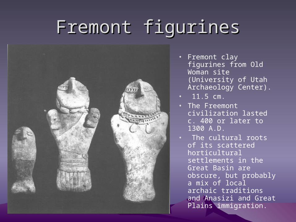
Fremont figurinesFremont figurines
• Fremont clay figurines from Old Woman site (University of Utah Archaeology Center).
• 11.5 cm.• The Freemont
civilization lasted c. 400 or later to 1300 A.D.
• The cultural roots of its scattered horticultural settlements in the Great Basin are obscure, but probably a mix of local archaic traditions and Anasizi and Great Plains immigration.
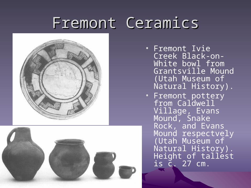
Fremont CeramicsFremont Ceramics
• Fremont Ivie Creek Black-on-White bowl from Grantsville Mound (Utah Museum of Natural History).
• Fremont pottery from Caldwell Village, Evans Mound, Snake Rock, and Evans Mound respectvely (Utah Museum of Natural History). Height of tallest is c. 27 cm.
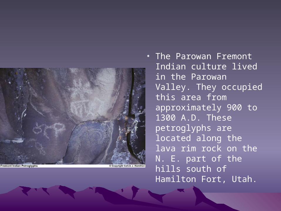
• The Parowan Fremont Indian culture lived in the Parowan Valley. They occupied this area from approximately 900 to 1300 A.D. These petroglyphs are located along the lava rim rock on the N. E. part of the hills south of Hamilton Fort, Utah.
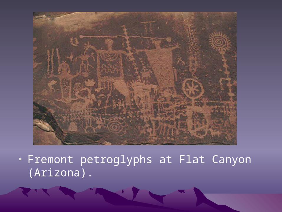
• Fremont petroglyphs at Flat Canyon (Arizona).