Embed Size (px)
Citation preview
Preliminary Flood Hazard Data Training Tutorial
May 2013 - Updated February 2015 for Revised Preliminary Guidance
2
What’s Inside?
Thanks for your interest in the
Preliminary Flood Hazard Data Tool! • Preliminary flood hazard data (preliminary data)
description• Benefits of centralized preliminary data• Guided tour of associated Mapping Information
Platform (MIP) new features• Guided tour of preliminary data search tool• Additional guidance and resources
3
Preliminary Flood Hazard Data Contents• Preliminary data provide the public an early look at their home
or community’s risk to flood hazards• Preliminary data accessible from the public search tool
include:1. Flood Insurance Rate Maps (FIRMs)
2. Flood Insurance Study (FIS) Report
3. FIRM Database
4
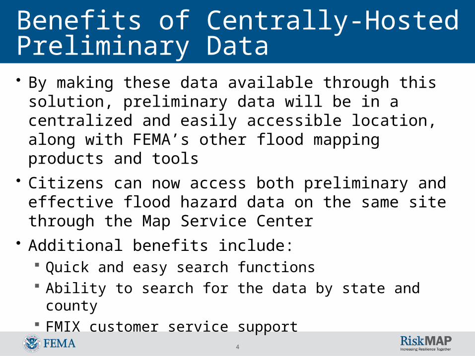
Benefits of Centrally-Hosted Preliminary Data• By making these data available through this solution,
preliminary data will be in a centralized and easily accessible location, along with FEMA’s other flood mapping products and tools
• Citizens can now access both preliminary and effective flood hazard data on the same site through the Map Service Center
• Additional benefits include: Quick and easy search functions Ability to search for the data by state and county FMIX customer service support
5
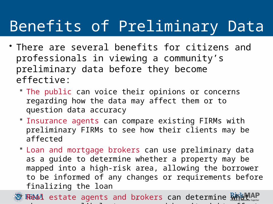
Benefits of Preliminary Data• There are several benefits for citizens and professionals in
viewing a community’s preliminary data before they become effective: The public can voice their opinions or concerns regarding how the data
may affect them or to question data accuracy Insurance agents can compare existing FIRMs with preliminary FIRMs
to see how their clients may be affected Loan and mortgage brokers can use preliminary data as a guide to
determine whether a property may be mapped into a high-risk area, allowing the borrower to be informed of any changes or requirements before finalizing the loan
Real estate agents and brokers can determine what changes are likely to occur and how it might affect any properties for sale
Engineers, developers, and builders can plan for safer construction
6
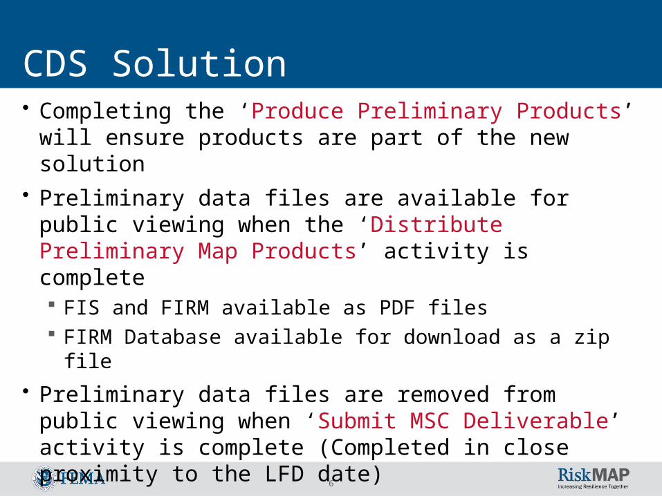
CDS Solution• Completing the ‘Produce Preliminary Products’ will ensure
products are part of the new solution• Preliminary data files are available for public viewing when
the ‘Distribute Preliminary Map Products’ activity is complete FIS and FIRM available as PDF files FIRM Database available for download as a zip file
• Preliminary data files are removed from public viewing when ‘Submit MSC Deliverable’ activity is complete (Completed in close proximity to the LFD date)
• No FIRMette tool capabilities: Preliminary mapping products will not be viewable in an
application that provides the FIRMette web tool
7
MIP Changes
The following screens depict Mapping Information Platform (MIP) changes associated
with this Release
8
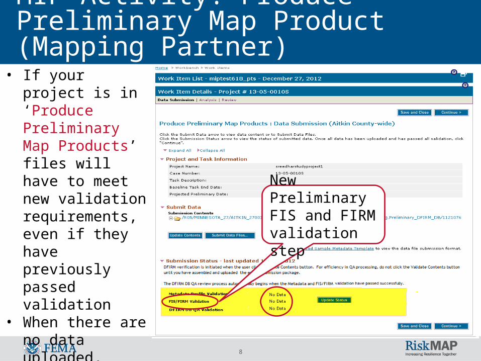
MIP Activity: Produce Preliminary Map Product (Mapping Partner)
New Preliminary FIS and FIRM validation step
• If your project is in ‘Produce Preliminary Map Products’ files will have to meet new validation requirements, even if they have previously passed validation
• When there are no data uploaded, status will show ‘No Data’
9
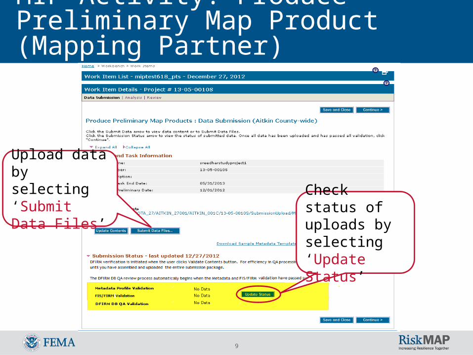
MIP Activity: Produce Preliminary Map Product (Mapping Partner)
Check status of uploads by selecting ‘Update Status’
Upload data by selecting ‘Submit Data Files’
10
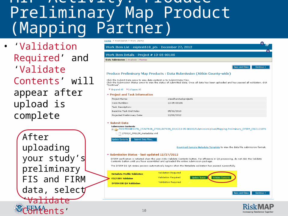
MIP Activity: Produce Preliminary Map Product (Mapping Partner)
• ‘Validation Required’ and ‘Validate Contents’ will appear after upload is complete
After uploading your study’s preliminary FIS and FIRM data, select ‘Validate Contents’
11
Preliminary FIRM and FIS Validation Requirements (Mapping Partner)
• Auto-Validation is performed within the ‘Produce Preliminary Map Products’ activity
• FIS and FIRM validations are automatically triggered when Metaman completes and passes validation
• FIS and FIRM validation must pass before DFIRM DB QA validation is automatically triggered
12
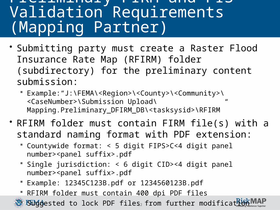
Preliminary FIRM and FIS Validation Requirements (Mapping Partner)• Submitting party must create a Raster Flood Insurance Rate
Map (RFIRM) folder (subdirectory) for the preliminary content submission: Example:“J:\FEMA\<Region>\<County>\<Community>\<CaseNumber>\
Submission Upload\Mapping.Preliminary_DFIRM_DB\<tasksysid>\RFIRM”
• RFIRM folder must contain FIRM file(s) with a standard naming format with PDF extension: Countywide format: < 5 digit FIPS>C<4 digit panel number><panel suffix>.pdf Single jurisdiction: < 6 digit CID><4 digit panel number><panel suffix>.pdf Example: 12345C123B.pdf or 1234560123B.pdf RFIRM folder must contain 400 dpi PDF files Suggested to lock PDF files from further modification
13
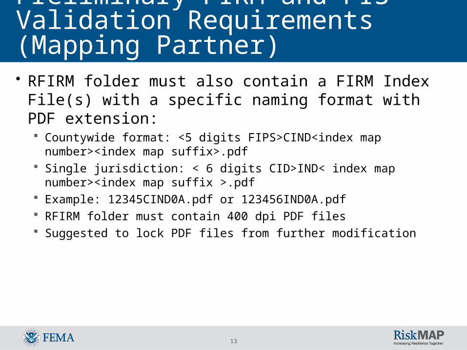
Preliminary FIRM and FIS Validation Requirements (Mapping Partner)• RFIRM folder must also contain a FIRM Index File(s) with a
specific naming format with PDF extension: Countywide format: <5 digits FIPS>CIND<index map number><index map
suffix>.pdf Single jurisdiction: < 6 digits CID>IND< index map number><index map suffix
>.pdf Example: 12345CIND0A.pdf or 123456IND0A.pdf RFIRM folder must contain 400 dpi PDF files Suggested to lock PDF files from further modification
14
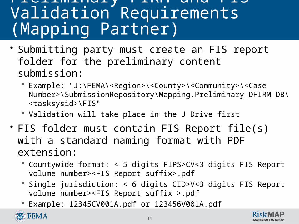
• Submitting party must create an FIS report folder for the preliminary content submission: Example: "J:\FEMA\<Region>\<County>\<Community>\<Case Number>\
SubmissionRepository\Mapping.Preliminary_DFIRM_DB\<tasksysid>\FIS" Validation will take place in the J Drive first
• FIS folder must contain FIS Report file(s) with a standard naming format with PDF extension: Countywide format: < 5 digits FIPS>CV<3 digits FIS Report volume
number><FIS Report suffix>.pdf Single jurisdiction: < 6 digits CID>V<3 digits FIS Report volume number><FIS
Report suffix >.pdf Example: 12345CV001A.pdf or 123456V001A.pdf
Preliminary FIRM and FIS Validation Requirements (Mapping Partner)
15
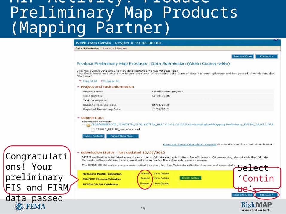
MIP Activity: Produce Preliminary Map Products (Mapping Partner)
Select ‘Continue’
Congratulations! Your preliminary FIS and FIRM data passed
16
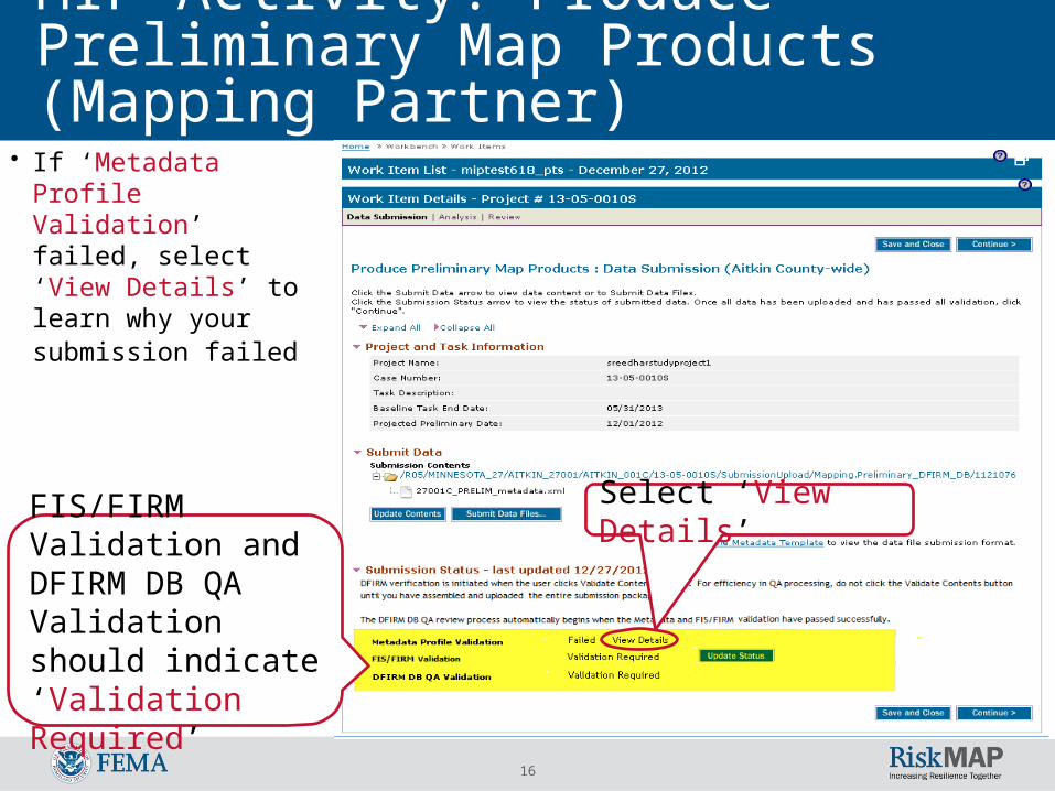
MIP Activity: Produce Preliminary Map Products (Mapping Partner)
Select ‘View Details’
• If ‘Metadata Profile Validation’ failed, select ‘View Details’ to learn why your submission failed
FIS/FIRM Validation and DFIRM DB QA Validation should indicate ‘Validation Required’
17
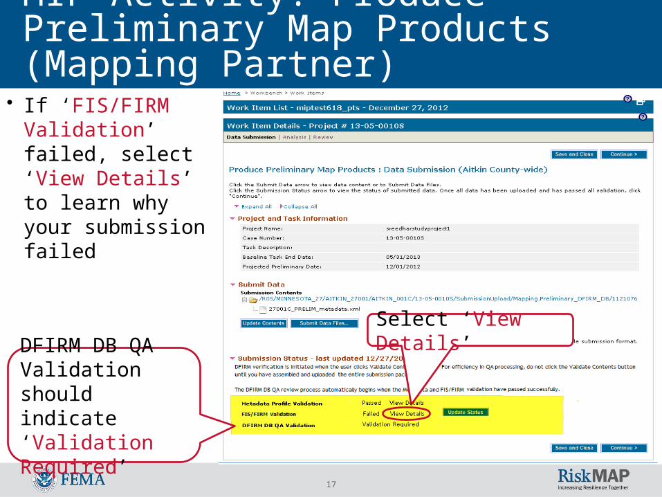
MIP Activity: Produce Preliminary Map Products (Mapping Partner)
• If ‘FIS/FIRM Validation’ failed, select ‘View Details’ to learn why your submission failed
DFIRM DB QA Validation should indicate ‘Validation Required’
Select ‘View Details’
18
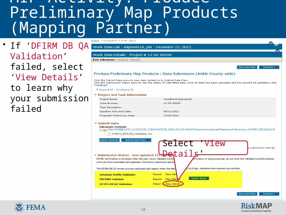
MIP Activity: Produce Preliminary Map Products (Mapping Partner)
• If ‘DFIRM DB QA Validation’ failed, select ‘View Details’ to learn why your submission failed
Select ‘View Details’
19
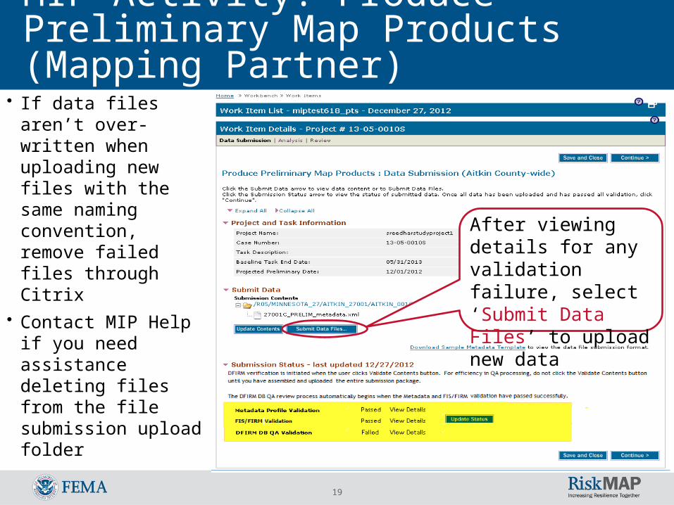
MIP Activity: Produce Preliminary Map Products (Mapping Partner)
• If data files aren’t over-written when uploading new files with the same naming convention, remove failed files through Citrix
• Contact MIP Help if you need assistance deleting files from the file submission upload folder
After viewing details for any validation failure, select ‘Submit Data Files’ to upload new data
20
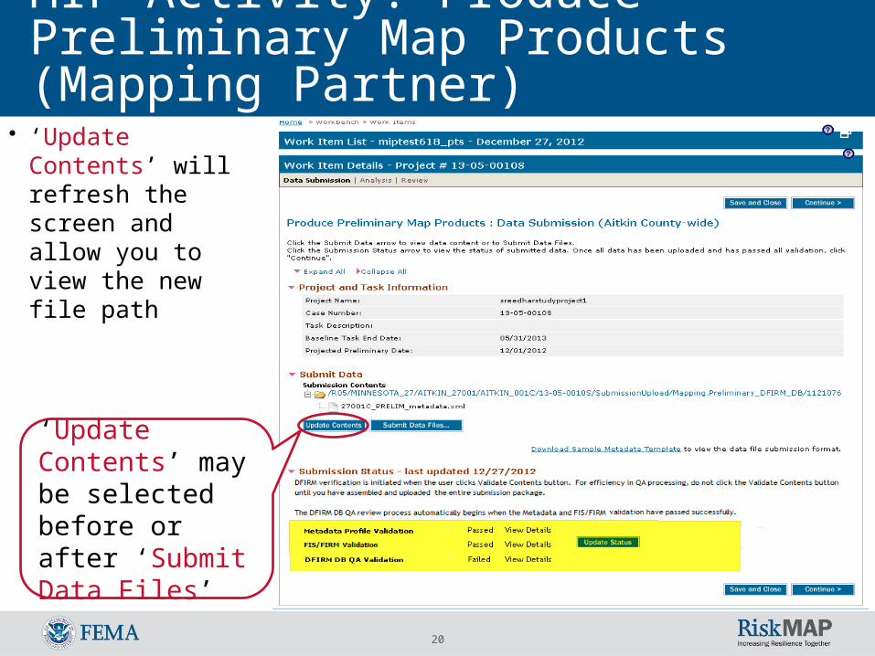
MIP Activity: Produce Preliminary Map Products (Mapping Partner)
‘Update Contents’ may be selected before or after ‘Submit Data Files’
• ‘Update Contents’ will refresh the screen and allow you to view the new file path
21
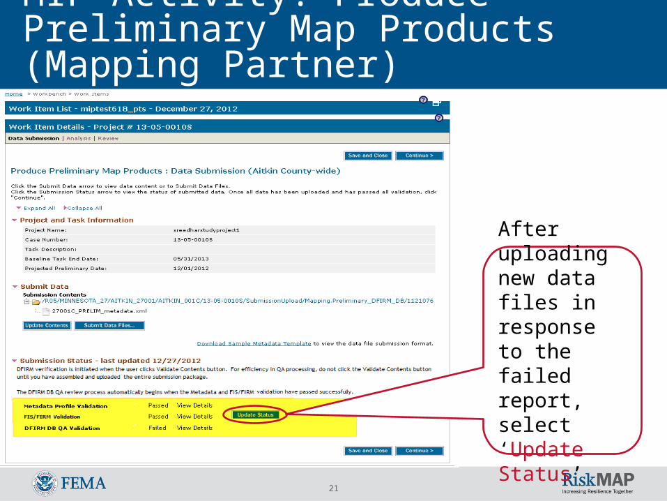
MIP Activity: Produce Preliminary Map Products (Mapping Partner)
After uploading new data files in response to the failed report, select ‘Update Status’
22
MIP Activity: Produce Preliminary Map Products (Mapping Partner)
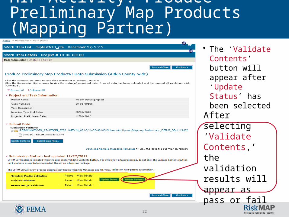
After selecting ‘Validate Contents,’ the validation results will appear as pass or fail
• The ‘Validate Contents’ button will appear after ‘Update Status’ has been selected
23
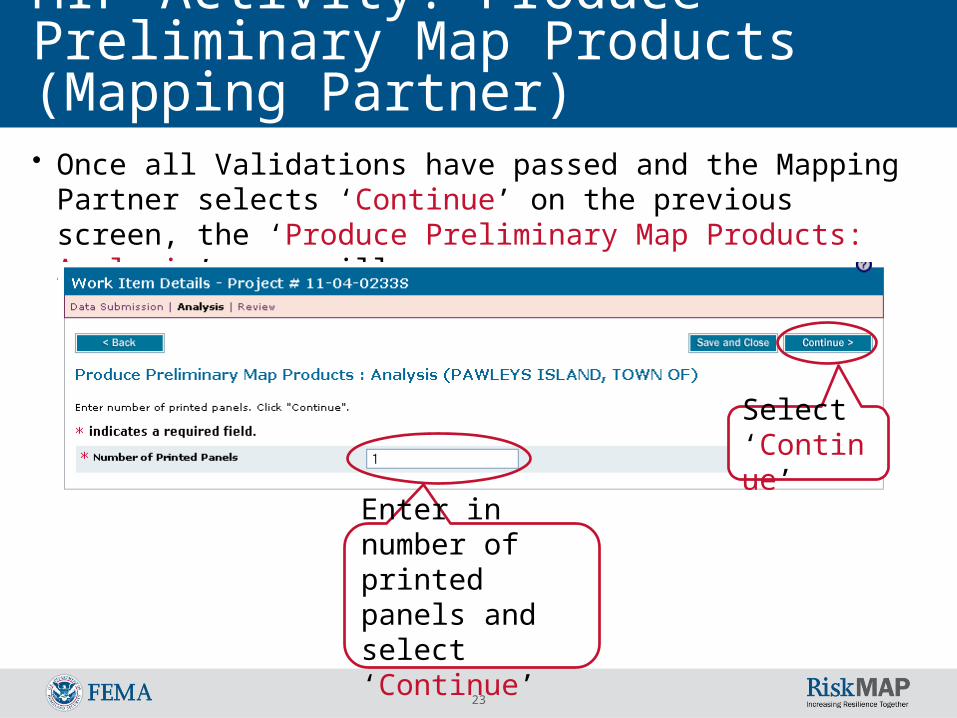
MIP Activity: Produce Preliminary Map Products (Mapping Partner)• Once all Validations have passed and the Mapping Partner selects
‘Continue’ on the previous screen, the ‘Produce Preliminary Map Products: Analysis’ page will appear:
Enter in number of printed panels and select ‘Continue’
Select ‘Continue’
24
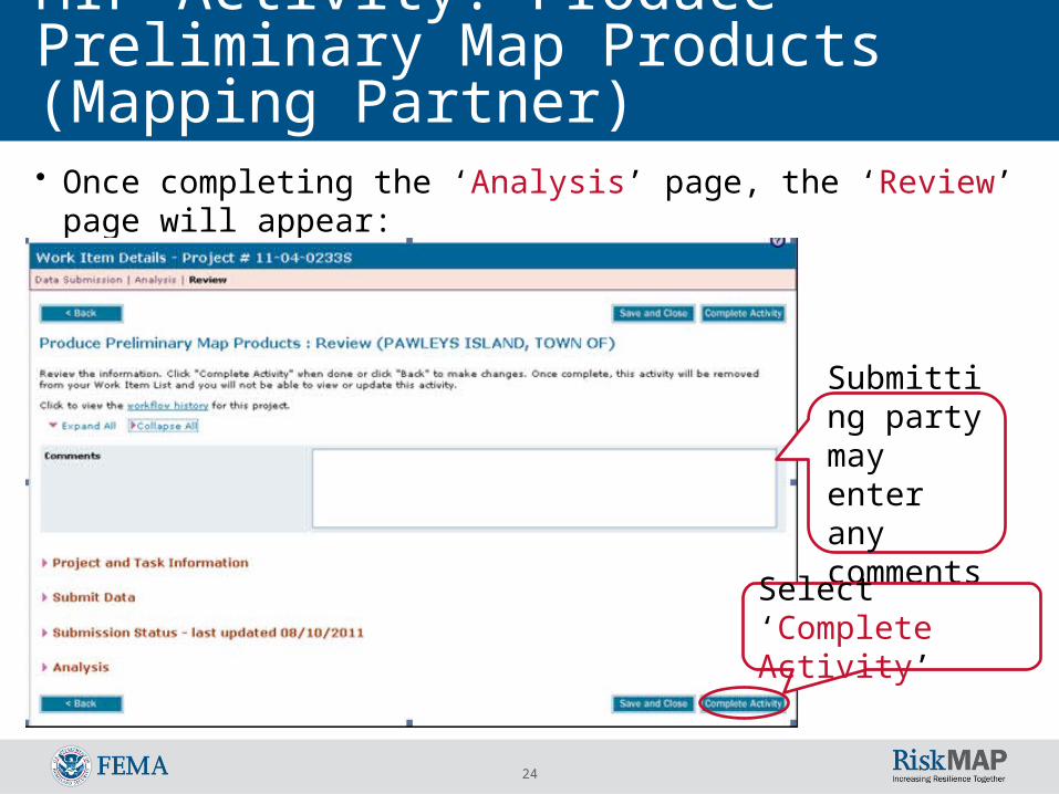
MIP Activity: Produce Preliminary Map Products (Mapping Partner)• Once completing the ‘Analysis’ page, the ‘Review’ page will appear:
Submitting party may enter any comments
Select ‘Complete Activity’
25
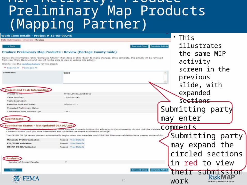
MIP Activity: Produce Preliminary Map Products (Mapping Partner)
• This illustrates the same MIP activity screen in the previous slide, with expanded sections
Submitting party may enter comments
Submitting party may expand the circled sections in red to view their submission work
26
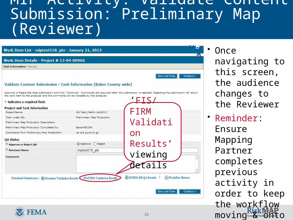
MIP Activity: Validate Content Submission: Preliminary Map (Reviewer)
‘FIS/FIRM Validation Results’ viewing details
• Once navigating to this screen, the audience changes to the Reviewer
• Reminder: Ensure Mapping Partner completes previous activity in order to keep the workflow moving & onto the QR3 review
27
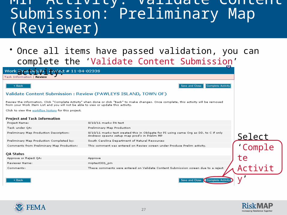
• Once all items have passed validation, you can complete the ‘Validate Content Submission’ activity:
Select ‘Complete Activity’
MIP Activity: Validate Content Submission: Preliminary Map (Reviewer)
28
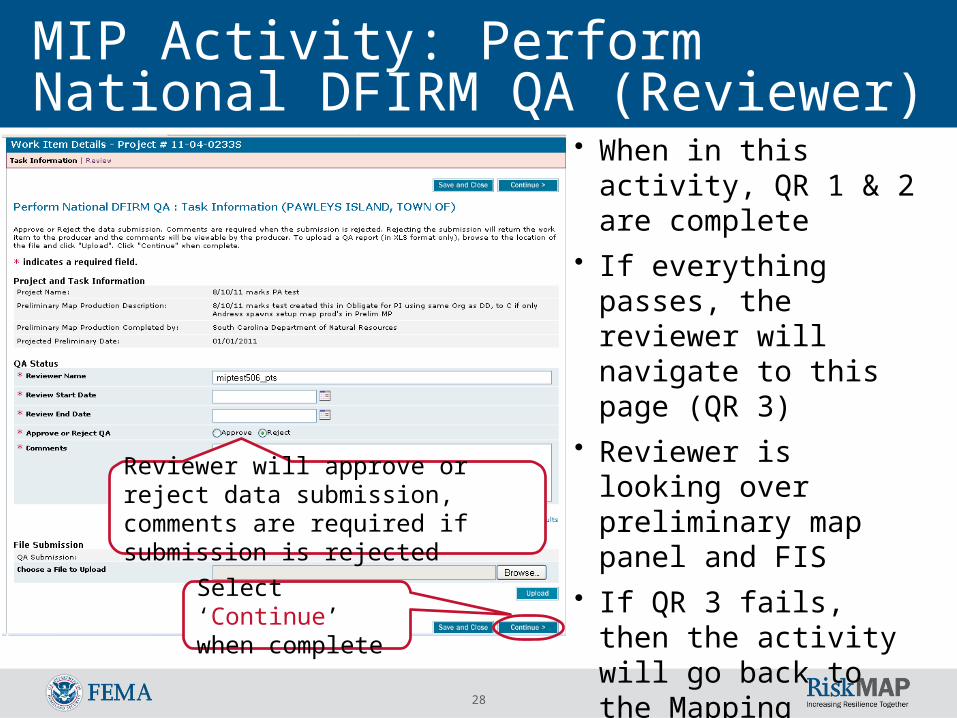
MIP Activity: Perform National DFIRM QA (Reviewer)
• When in this activity, QR 1 & 2 are complete
• If everything passes, the reviewer will navigate to this page (QR 3)
• Reviewer is looking over preliminary map panel and FIS
• If QR 3 fails, then the activity will go back to the Mapping Partner in QR 2 (‘Produce Preliminary Map Products’)Select ‘Continue’
when complete
Reviewer will approve or reject data submission, comments are required if submission is rejected
29
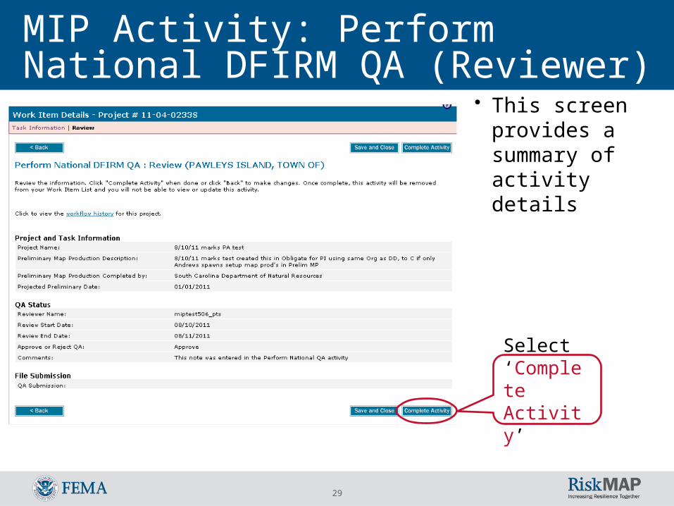
MIP Activity: Perform National DFIRM QA (Reviewer)
Select ‘Complete Activity’
• This screen provides a summary of activity details
30
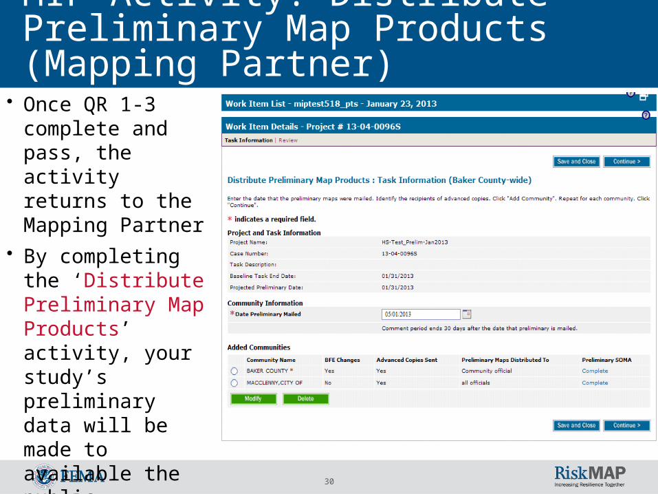
MIP Activity: Distribute Preliminary Map Products (Mapping Partner)
• Once QR 1-3 complete and pass, the activity returns to the Mapping Partner
• By completing the ‘Distribute Preliminary Map Products’ activity, your study’s preliminary data will be made to available the public
31
MIP Activity: Distribute Preliminary Map Products (Mapping Partner)
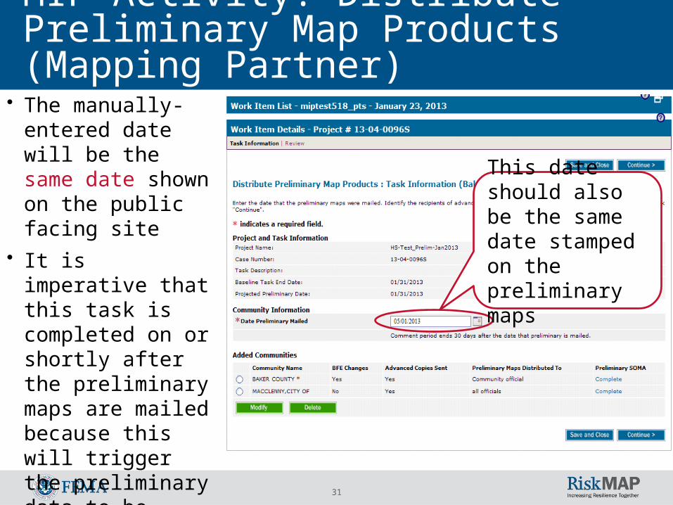
• The manually-entered date will be the same date shown on the public facing site
• It is imperative that this task is completed on or shortly after the preliminary maps are mailed because this will trigger the preliminary data to be uploaded to the centrally-hosted site
This date should also be the same date stamped on the preliminary maps
32
Revised Preliminary Data• If you must revise preliminary data, a new project must be
created Publish the entire data package again
• When the revised preliminary data move past the ‘Distribute Preliminary Map Products’ activity, two sets of preliminary data will appear publically, the original and the revised Contact MIP Help to manually “hide” the preliminary data files that
were revised o “Hidden” files will be removed from the primary Preliminary Data site when
MIP Help completes the request and will propagate to the MSC the next day Data from the same project should appear in one place – not split
between Regional and CDS-hosted sites
33
Exception Processing• If it is determined that one or more products should not
appear on the public-facing websites: If submission to the MIP and subsequent validation are still a project
requirements, MIP Help tickets must be submitted to “hide” the files after publishing
If the FIRM Database will not be displayed for public access, a MIP Help ticket must be submitted
The FIRM Database zip file created for the public site is compiled from the GIS shapefiles submitted to the MIP and QC’d through DVT. If the FIRM Database is not uploaded to the MIP in shapefile format because of Regional specifications the metadata xml file should not be uploaded to the MIP to prevent an incomplete FIRM DB zip file from being published to the public-facing site
34
Un-publishing Preliminary Data• In rare cases and after FEMA approval, data can be removed
from the MSC Please seek approval from FEMA if you need to un-publish data Contact MIP Help for support In the case of partial file removal (e.g. FIRM, FIS, and/or FIRM
Database), language will indicate “No record found” for the removed product type in the MSC search results
Because Revised Preliminary MIP Projects do not advance to the Submit MSC Deliverables MIP activity, the Revised Preliminary data must be manually removed from the public siteo After consolidation of data into the primary project, or after the primary
project moves past LFD, a request must be made to MIP Help to “hide” the files from the Revised Preliminary project
35
Tour of Preliminary Data Search Tool
The following screens show the step-by-step public-facing process of viewing a community’s
preliminary flood hazard data
36
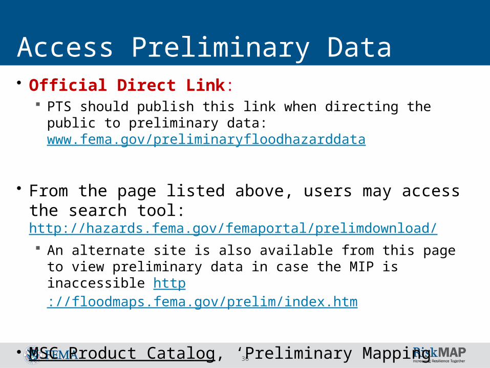
Access Preliminary Data• Official Direct Link:
PTS should publish this link when directing the public to preliminary data: www.fema.gov/preliminaryfloodhazarddata
• From the page listed above, users may access the search tool: http://hazards.fema.gov/femaportal/prelimdownload/ An alternate site is also available from this page to view preliminary
data in case the MIP is inaccessible http://floodmaps.fema.gov/prelim/index.htm
• MSC Product Catalog, ‘Preliminary Mapping Products’
37
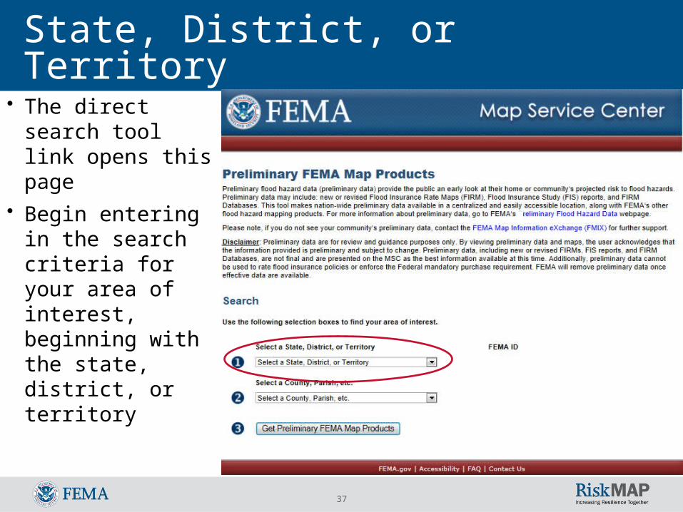
State, District, or Territory • The direct search
tool link opens this page
• Begin entering in the search criteria for your area of interest, beginning with the state, district, or territory
38
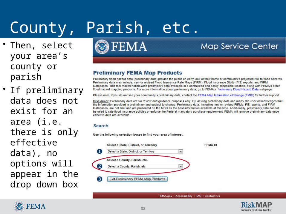
County, Parish, etc. • Then, select your
area’s county or parish
• If preliminary data does not exist for an area (i.e. there is only effective data), no options will appear in the drop down box

39
Get Preliminary FEMA Map Products
• Select ‘Get Preliminary FEMA Map Products’
Disclaimer language
40
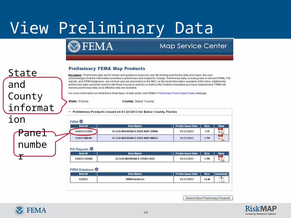
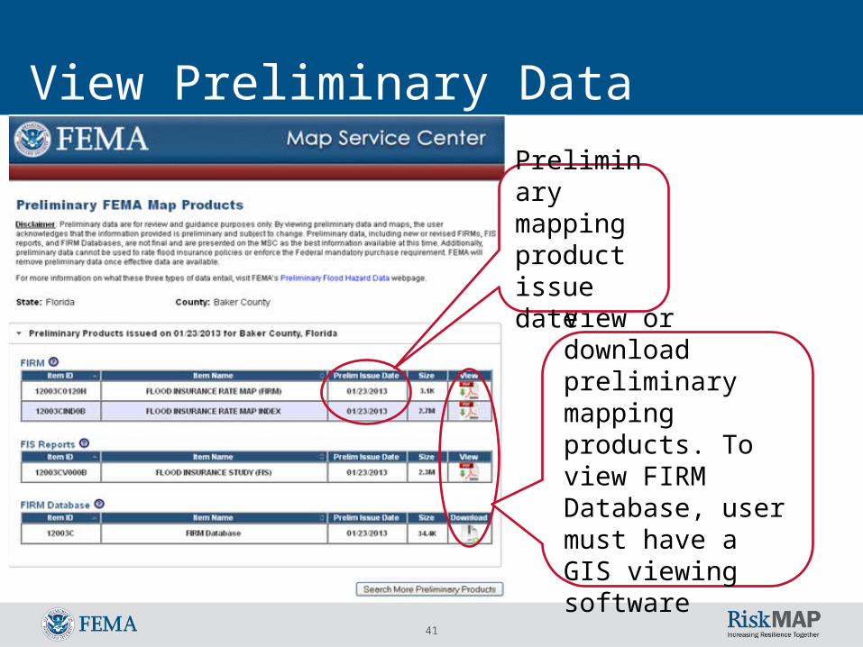
View Preliminary Data
Panel number
State and County information
41
View Preliminary Data
View or download preliminary mapping products. To view FIRM Database, user must have a GIS viewing software
Preliminary mapping product issue date
42
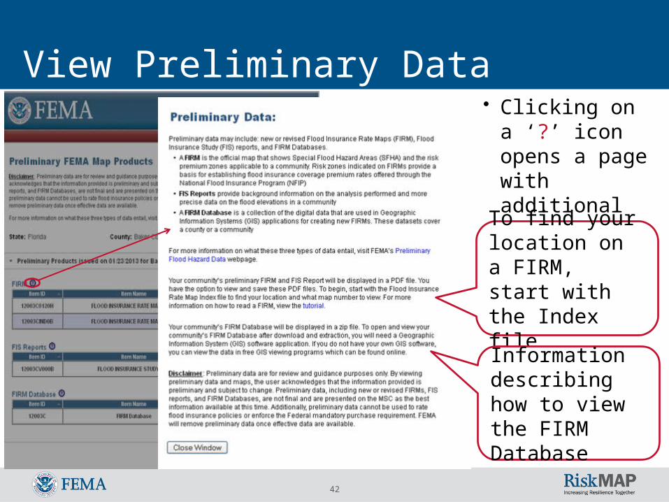
View Preliminary Data• Clicking on a ‘?’
icon opens a page with additional information
To find your location on a FIRM, start with the Index file
Information describing how to view the FIRM Database
43
Resources• For questions, please contact MIP Help at
• Public resources: Preliminary Flood Hazard Data FAQs Preliminary Flood Hazard Data Flyer Preliminary Flood Hazard Data Understanding Preliminary Flood Hazard Maps Understanding the Changes to Your Community’s Flood Insur
ance Rate Map