Embed Size (px)
Citation preview

BELLA VISTA STATION PRECINCT Aboriginal Heritage Impact Statement
Prepared for Landcom
The Hills Shire Local Government Area
December 2019
Ref. 1823
KELLEHER NIGHTINGALE CONSULTING PTY LTD Archaeological and Heritage Management
ACN 120 187 671
Level 10, 25 Bligh Street SYDNEY NSW 2000
Phone 02 9232 5373 Fax 02 9223 0680

Bella Vista Station Precinct: Aboriginal Heritage Impact Statement December 2019
i
Document Information
Project Name Bella Vista Station Precinct:
Aboriginal Heritage Impact Statement
Project Number 1823
Version 1.0
Client Name Landcom
Recipient Peter Alevizos, Project Manager
Issue Date 11 December 2019
Prepared by Dr Matthew Kelleher; Ben Anderson
Approved by Dr Matthew Kelleher; Alison Nightingale

Bella Vista Station Precinct: Aboriginal Heritage Impact Statement December 2019
ii
Executive Summary
Landcom proposes to deliver accelerated serviced development parcels for housing supply and facilitate interim precinct activation of the Bella Vista Station Precinct, one of eight station precincts along the corridor of the Sydney Metro Northwest. The Bella Vista Station Precinct comprises surplus government owned land surrounding the Bella Vista Station and is located approximately 30 kilometres north west of the Sydney Central Business District within The Hills Shire Local Government Area. Landcom is seeking concept State Significant Development (SSD) approval for the proposed redevelopment to set out the precinct concept proposal and establishes the framework for future development. Secretary’s Environmental Assessment Requirements were issued on 11 July 2019 for the Bella Vista Station Precinct (SSD 10344). Landcom is currently undertaking detailed planning and assessment for the project, including the preparation of an Environmental Impact Statement (EIS). An Aboriginal heritage assessment is required as part of the EIS. Landcom engaged Kelleher Nightingale Consulting Pty Ltd to prepare an Aboriginal Heritage Impact Statement to inform the EIS. Review of background information, Aboriginal community consultation, and archaeological assessment resulted in the identification of four Aboriginal archaeological sites (comprising six Aboriginal Heritage Information Management System registrations) within the Bella Vista Station Precinct; however, three of the identified Aboriginal archaeological sites and the portion of site NWRL PAD 7 within the Bella Vista Station Precinct had been destroyed prior to the construction of the Sydney Metro Northwest. An area of PAD (NWRL PAD5) was also excavated and found not to be an Aboriginal archaeological site. No Aboriginal archaeological sites will be impacted by the proposed development of the Bella Vista Station Precinct. There are no extant Aboriginal archaeological sites within the study area. Management measures should be implemented for Aboriginal objects situated within the non-impacted portion of the site NWRL PAD7 (outside study area) to ensure this area is avoided by proposed construction activities. Management measures to be implemented include protective fencing and identification as ‘no-go zones’ on all maps, including the Construction Environmental Management Plan. Documented toolbox talks will also be held to ensure all on-site staff and contractors are aware of obligations and requirements regarding the protection of Aboriginal heritage and the adjacent site area.

Bella Vista Station Precinct: Aboriginal Heritage Impact Statement December 2019
iii
Contents
EXECUTIVE SUMMARY .............................................................................................................................. II
FIGURES ................................................................................................................................................... IV
TABLES ..................................................................................................................................................... IV
1 INTRODUCTION................................................................................................................................. 1
1.1 PROJECT BACKGROUND ..........................................................................................................................1 1.2 PROPONENT AND CONSULTANTS ..............................................................................................................1 1.3 LOCATION AND SCOPE OF ACTIVITY ...........................................................................................................1 1.4 PROJECT REQUIREMENTS ........................................................................................................................4
2 LANDSCAPE CONTEXT ....................................................................................................................... 5
2.1 LANDFORM, HYDROLOGY, GEOLOGY AND SOILS ...........................................................................................5 2.2 VEGETATION AND LAND USE HISTORY ........................................................................................................8 2.3 ETHNOHISTORIC CONTEXT ......................................................................................................................9
3 ARCHAEOLOGICAL CONTEXT ........................................................................................................... 11
4 CONSULTATION PROCESS ............................................................................................................... 15
4.1 CONSULTATION FOR THE AHIS AND AHIP APPLICATION .............................................................................15 4.2 REGISTRATION OF INTEREST ..................................................................................................................15 4.3 STAKEHOLDER RESPONSES TO THE PROPOSED ASSESSMENT METHODOLOGY FOR THE ABORIGINAL HERITAGE IMPACT
STATEMENT .......................................................................................................................................16 4.4 REVIEW OF DRAFT ABORIGINAL HERITAGE IMPACT STATEMENT AND STAKEHOLDER RESPONSES .........................16 4.5 ABORIGINAL CULTURAL VALUES .............................................................................................................16
5 SUMMARY AND ANALYSIS OF BACKGROUND INFORMATION ......................................................... 17
5.1 SUMMARY OF KNOWN ABORIGINAL SITES WITHIN THE STUDY AREA...............................................................17
6 CULTURAL HERITAGE VALUES AND STATEMENT OF SIGNIFICANCE ................................................. 18
6.1 SIGNIFICANCE ASSESSMENT CRITERIA .....................................................................................................18 6.2 STATEMENTS OF SIGNIFICANCE ..............................................................................................................19
7 THE PROPOSED ACTIVITY AND IMPACT ASSESSMENT ..................................................................... 20
8 CONCLUSIONS AND RECOMMENDATIONS ...................................................................................... 20
REFERENCES ............................................................................................................................................ 21
APPENDIX A ADVERTISEMENT FOR REGISTRATION OF INTEREST ....................................................... 23
APPENDIX B ABORIGINAL COMMUNITY COMMENTS ......................................................................... 24

Bella Vista Station Precinct: Aboriginal Heritage Impact Statement December 2019
iv
Figures
Figure 1. Location of the study area ................................................................................................................ 2 Figure 2. Detail of study area........................................................................................................................... 3 Figure 3. Relief map of study area ................................................................................................................... 6 Figure 4. Geology and soil landscapes of study area ....................................................................................... 7 Figure 5. Identified Aboriginal archaeological sites within the Indigenous Heritage Assessment area ........ 13
Tables
Table 1. SEARs for Aboriginal heritage ............................................................................................................ 4 Table 2. Identified Aboriginal archaeological features within the Indigenous Heritage Assessment area ... 11 Table 3. Registered Aboriginal stakeholders ................................................................................................. 15 Table 4. Aboriginal archaeological features identified within the study area ............................................... 17

Bella Vista Station Precinct: Aboriginal Heritage Impact Statement December 2019
1
1 Introduction
1.1 Project background
The New South Wales (NSW) Government is implementing Sydney’s Rail Future, a plan to transform and modernise Sydney’s rail network so that it can grow with the city’s population and meet the needs of customers in the future. Sydney Metro is a new standalone rail network identified in Sydney’s Rail Future consisting of Sydney Metro Northwest (Stage 1) which opened to the public for train services on 26 May 2019 and Sydney Metro City & Southwest (Stage 2), which is due for completion in 2024. Under the Sydney Metro Northwest (SMNW) Places program, Landcom and Sydney Metro are working collaboratively with the Department of Planning, Industry and Environment (DPIE), local councils, other government organisations and key stakeholders to develop the long-term vision and delivery program to guide the transformation of approximately 65 hectares (ha) of surplus government owned or controlled land around new SMNW station precincts. The Bella Vista Station Precinct forms part of a network of eight station precincts along the corridor of the SMNW. The NSW Government previously announced the Bella Vista Station Precinct as a Priority Precinct to support and help drive the urban renewal of traditionally rural residential land to a new urban environment that leverages positively off Australia's first metro line.
1.2 Proponent and consultants
As part of the SMNW Places program, Landcom is proposing the redevelopment of surplus government owned land surrounding the Bella Vista Station to facilitate the renewal of the locality and deliver a greater supply and diversity housing and employment opportunities. Landcom is seeking concept State Significant Development (SSD) approval for the proposed redevelopment to set out the precinct concept proposal and establishes the framework for future development. Secretary’s Environmental Assessment Requirements (SEARs) were issued on 11 July 2019 for the Bella Vista Station Precinct (SSD 10344). Landcom is currently undertaking detailed planning and assessment for the project, including the preparation of an Environmental Impact Statement (EIS). An Aboriginal heritage assessment is required as part of the EIS. Landcom engaged Kelleher Nightingale Consulting Pty Ltd (KNC) to prepare an Aboriginal Heritage Impact Statement (AHIS) to inform the EIS.
1.3 Location and scope of activity
The Bella Vista Station Precinct (hereafter referred to as the study area) comprises surplus government owned land surrounding the Bella Vista Station. The study area is located within The Hills Shire Local Government Area approximately 30 kilometres north west of the Sydney CBD (Figure 1). The study area is generally bound by Old Windsor Road in the east, Elizabeth Macarthur Creek in the west, Memorial Avenue in the north and Celebration Drive in the south. The proposed works would include:
Residential dwellings comprising residential flat buildings and terraces
Non-residential land uses including retail and commercial
A new primary school
New streets and intersection connections to the existing road network
Public open space including public domain and parks and
Community facilities.

Bella Vista Station Precinct: Aboriginal Heritage Impact Statement December 2019
2
Figure 1. Location of the study area

Bella Vista Station Precinct: Aboriginal Heritage Impact Statement December 2019
3
Figure 2. Detail of study area

Bella Vista Station Precinct: Aboriginal Heritage Impact Statement December 2019
4
1.4 Project requirements
This AHIS addresses the Aboriginal heritage requirements identified in the project SEARs and DPIE [including the former Office of Environment and Heritage (OEH)]. The objectives of the AHIS combine Aboriginal community consultation with an archaeological investigation in accordance with
Secretary’s environmental assessment requirements;
Code of Practice for Archaeological Investigation of Aboriginal Objects in NSW (OEH 2010); and
Aboriginal cultural heritage consultation requirements for proponents 2010 (OEH 2010). Aboriginal cultural heritage assessment for the project was designed to meet the SEARs. This included:
Assessment of impacts to Aboriginal heritage (both cultural and archaeological significance);
Consultation with Aboriginal communities to assess impacts and develop mitigation measures; Specific requirements of the SEARs are outlined in the table below.
Table 1. SEARs for Aboriginal heritage
Secretary’s Environmental Assessment Requirements Where addressed in this
document
Aboriginal Heritage: provide a detailed Aboriginal heritage impact statement (AHIS) that identifies and addresses the extent of Aboriginal heritage impacts of the proposal on the site and the surrounding area, including objects, places or features (including biological diversity) of cultural value within the landscape. If Aboriginal Cultural Heritage is found at the site, a full Aboriginal Cultural Heritage Assessment Report together with document of required consultation must be provided.
Sections 2, 3, 4 and 5

Bella Vista Station Precinct: Aboriginal Heritage Impact Statement December 2019
5
2 Landscape Context
2.1 Landform, hydrology, geology and soils
The study area is located on the Cumberland Plain, a large low lying and gently undulating physiographic region of the Sydney Basin. The Sydney Basin is a large geological feature stretching from Batemans Bay in the south to Newcastle in the north and Lithgow in the west. The formation of the basin began between 250 to 300 million years ago when river deltas gradually replaced the ocean that had extended as far west as Lithgow (Pickett and Alder 1997). The study area is located within the catchment area of Elizabeth Macarthur Creek, a north flowing tributary of Caddies Creek. The topography of the study area is characterised by crest, elevated flat, open depression and slope landforms that form a north running low ridgeline and the creek flats and banks west of Elizabeth Macarthur Creek (Figure 3). Elizabeth Macarthur Creek and Caddies Creek are prominent hydrological features in the local landscape and are likely to have provided reliable sources of fresh water. Hydrology of the region has been highly altered since European settlement with the construction of various drainage works that have affected the natural flow and flood regime in these areas. The study area is located on Ashfield Shale (Rwa) geology (Figure 4). Ashfield Shale geology forms the lowest formation of the Wianamatta Group and is present within the majority of the study area. Ashfield Shale was formed from subaqueous sedimentary deposits and consists of dark-grey to black sideritic claystone and siltstone, grading upward into a fine sandstone-siltstone laminate (Clark and Jones 1991). Previous archaeological investigations in the study area have identified silcrete cobbles on the slopes above Elizabeth Macarthur Creek (see Section 3). Silcrete is the primary raw material for stone artefacts found in the Sydney region and is found within outcrops of St Marys Formation geology which occurs across the northern Cumberland Plain and in Rickaby Creek Gravel geology (Doelman et al 2015: 498-500). While neither of these geologies have been identified within the study area, the silcrete cobbles are likely to represent remnants of St Marys Formation geology which is believed to have formed in the channels of a river system that flowed across the Cumberland Plain (Doelman et al 2015: 498-500). The soil landscapes within the study area are linked to the topography and underlying geology (Figure 4). The residual Blacktown soil landscape is developed in situ on the gentle crests and slopes from underlying Ashfield Shale geology and consists of shallow to moderately deep hard-setting red, brown and yellow podzolic soils. It is subject to minor erosion where surface vegetation is not maintained. The soil landscape is often close to water sources and associated resources without being within areas prone to flooding. Previous archaeological investigations within the study area have shown that areas within close proximity to permanent water sources are more likely to contain high-density Aboriginal sites (see Section 3). These areas would have provided a relatively stable environment throughout the year for gathering a range of resources.

Bella Vista Station Precinct: Aboriginal Heritage Impact Statement December 2019
6
Figure 3. Relief map of study area

Bella Vista Station Precinct: Aboriginal Heritage Impact Statement December 2019
7
Figure 4. Geology and soil landscapes of study area
Bella Vista Station Precinct: Aboriginal Heritage Impact Statement December 2019
8
2.2 Vegetation and land use history
The distribution of native vegetation within the study area has been affected by historic and contemporary European land use practices in the region. Prior to 1788, a mixture of native vegetation communities would have extended across the entirety of the Cumberland Plain with distribution determined by a combination of factors including soils, topography and climate. Prior to European land clearance, vegetation within the study area would have derived from two chief communities. A study by the NSW National Parks and Wildlife Service (NPWS) in 2002 identified scatted remnant Cumberland Plain Woodland would have grown on the hills and ridges whilst the major drainage lines would have contained River-Flat Eucalypt Forest. Cumberland Plain Woodland is characterised by a canopy of predominantly Grey Box (Eucalyptus moluccana) and Forest Red Gum (E. tereticornis) with Narrow-leaved Ironbark (E. crebra), Spotted Gum (Corymbia maculata) and Thin-leaved Stringybark (E. eugenioides). The undergrowth contains Blackthorn (Bursaria spinosa) and grasses such as Kangaroo Grass (Themeda australis) and Weeping Meadow Grass (Microlaena stipoides var. stipoides). River-Flat Eucalypt Forest is characterised by an open tree layer of Forest Red Gum (Eucalyptus tereticornis), Cabbage Gum (E. amplifolia), Rough-Barked Apple (Angophora floribunda) and Broad-Leaved Apple (A. subvelutina). Smaller trees, such as White Feather Honeymyrtle (Melaleuca decora), Prickly-Leaved Teatree (M. styphelioides), Grey Myrtle (Backhousia myrtifolia), White Cedar (Melia azaderach), River Oak (Casuarina cunninghamiana) and Swamp Oak (C. glauca) may also be present. The undergrowth contains scattered shrubs including Sweet Bursaria (Bursaria spinose), Forest Nightshade (Solanum prinophyllum) and Native Raspberry (Rubus parvifolius) with a groundcover of forbs, scramblers and grasses such including Weeping Grass (Microlaena stipoides), Kidney Weed (Dichondra repens) and Basket Grass (Oplismenus aemulus). European settlement in the region began in the late 18
th Century with land grants to ex-convicts, emancipists, retired
soldiers and free settlers to the south of the study area (Brook 2008: 111). In 1794, a dirt road known as Hawkesbury Road was laid out from Parramatta, through the government farm at Toongabbie to the Hawksbury River. The road was the primary transport route in the region and would eventually become Old Windsor Road and parts of Windsor Road. By the 1830s, large portions of the region were being used for farming (Brook 2008: 112) The area has remained predominantly semi-rural with land-use practices including low intensity cropping, grazing and pasturage. A number of large dams were constructed throughout the area and several residential and agricultural structures were also present. In the last decade, land use within the region has become increasingly urban and construction of the Sydney Metro Northwest (formerly North West Rail Link) has impacted a large portion of the study area.

Bella Vista Station Precinct: Aboriginal Heritage Impact Statement December 2019
9
2.3 Ethnohistoric context
The study area lies within a landscape which was important to, and intensively used by, past Aboriginal peoples (Attenbrow 2002). Aboriginal people living throughout Australia at the time of European invasion belonged to a multitude of groups that spoke approximately 250 distinct languages and several hundred dialects (Walsh 1993: 1). The history of the Cumberland Plain during the late 18
th and early 19
th centuries is heavily reliant on a small number of
contemporary accounts generally written by British military officers or wealthy individuals. The information within these early British accounts regarding the Aboriginal people was reliant upon communication that was based on hand gestures and tone of voice (Troy 1993: 12). Watkin Tench, who published his account of the voyage of the First Fleet and the colony to December 1791, noted that his information on Aboriginal people was “made up of detached observations, taken at different times, and not from a regular series of knowledge of the customs and manners of a people with whom opportunities of communication are so scarce as to have been seldom obtained” (Tench 2012: 51). As such, historical accounts from this period provide vague and at times contradictory information about Aboriginal people and some of the material within these accounts contains views that are not appropriate today and do not reflect the views of the authors of this report. It should also be noted that the early European accounts are observations of Aboriginal people living in the Sydney region during the late 18
th and 19
th centuries and should not be
used to infer the cultural practices of Aboriginal people living in the preceding millennia which are highly unlikely to have been static. Aboriginal people transmitted information orally and the Darug Custodian Aboriginal Corporation, a Registered Aboriginal Stakeholder for the project advised that:
Knowledge of culture, lifestyle and lore have been part of Darug people’s lives for thousands of years, this was passed down to the next generations and this started with birth and continued for a lifetime. Darug people spent a lifetime learning and as people grew older they passed through stages of knowledge, elders became elders with the learning of stages of knowledge not by their age, being an elder is part of the kinship system this was a very complicated system based on respect. (letter dated 19/08/2019)
The diversity of the groups living in the Sydney region was apparent to Europeans from their earliest interactions despite having arrived with an almost total ignorance of the land and its people. Watkin Tench, a captain-lieutenant of the marines, was part of several expeditions to explore the wider Sydney area. Tench documented that on one expedition, two Aboriginal men who had been brought from the coast as guides were unfamiliar with the area west of Rose Hill (Parramatta) (Tench 1793:117-118) and that when the men conversed with an Aboriginal man further inland “they conversed on a par and understood each other perfectly, yet they spoke different dialects of the same language; many of the most common and necessary words used in life bearing no similitude, and others being slightly different” (Tench 1793:122). David Collins, deputy judge advocate and lieutenant-governor of the colony, noted that the Aboriginal people living inland, who he referred to as the ‘woods tribes’, and the Aboriginal people living along the coast had different dialects, songs, dances, subsistence and some implements (Collins 1798: 557-589). Collins noted that the inland groups had spears inlaid with stones instead of oyster shell and used a type of mesh unlike the nets of the people living along the coast (Collins 1798: 589). Tench (1793:230) noted that the inland groups ‘depend but little on fish, as the river yields only millets and that their principal support is derived from small animals which they kill and some roots (a species of wild yam chiefly) which they dig out of the earth’. Along the rivers and larger creeks, bandicoots and wallabies were caught in traps and snares, while birds were snared using decoys (Collins 1798: 555; Tench 1793). The open woodland of the Cumberland Plain would have played host to possums and gliders and these likely formed a major component of the diet. These were hunted in a number of ways, including smoking out the animal by lighting a fire in the base of a hollow tree, burning large tracts of land and gathering the stranded animals, as well as cutting toe-holds in trees and climbing up to reach them (Kohen 1993:10; Tench 1793:82). Berries, Banksia flowers and wild honey were also recorded as foods of the local inhabitants (Collins 1798 [Kohen 1985:9]). A particularly important plant food was the Burrawong (Macrozamia communis), which provided a nutritious nut that was pounded and soaked in running water to leach out toxins before the flour-like extract was made into small cakes and baked over a fire (Kohen 1993:8) The arrival of Europeans in 1788 began a cataclysmic series of events which radically changed the lifestyle of Aboriginal people on the Cumberland Plain. Contact with Europeans introduced diseases, such as smallpox, that drastically altered the size and structure of the Aboriginal population, the expansion of settlements and establishment of farmland subsumed the traditional areas used to meet subsistence needs and successive government policies were adopted to make Aboriginal people adopt European culture, religion and lifestyle (Attenbrow 2002; Brook and Kohen 1991). European observations from the late 18
th and early 19
th centuries did not make reference to the Aboriginal
name of the language that the ‘woods tribes’ they encountered spoke and it was only in the late 19th
Century that the name Darug (also referred to as Daruk, Dharuk, Dharook, and Dharug) was used to refer to the language of the traditional inhabitants of the Cumberland Plain (Attenbrow 2002:33). In the early 20
th Century, anthropologist/linguist
R H Matthews noted that “the Dharuk speaking people adjoined the Thurrawal on the north, extending along the coast to the Hawkesbury River, and inland to what are now Windsor, Penrith, Campbelltown, and intervening towns” (Matthews 1901:155 [in Attenbrow 2002: 32]).

Bella Vista Station Precinct: Aboriginal Heritage Impact Statement December 2019
10
European settlement in the region began in the late 18th
Century with land grants to ex-convicts, emancipists, retired soldiers and free settlers to the south of the study area (Brook 2008: 111). The seizure of resource gathering areas by Europeans for settlements, farmland and pastures across the Cumberland Plain in addition to droughts during the years 1803-1805 and 1814-1816 applied increasing pressure on the relationship between the Aboriginal population and European settlers. Throughout the last decade of the 18
th Century, Pemulwuy, a member of the 'woods tribes' led
a series of raids on farms in the Sydney region for food or as ‘payback’ for atrocities (Kohen 2005). In response military force was used. Collins recorded that “to check at once, if possible, these dangerous depredators, Captain Paterson directed a party of the corps to be sent from Parramatta, with instructions to destroy as many as they could meet with of the wood tribe (Bè-dia-gal); and, in the hope of striking terror, to erect gibbets in different places, whereon the bodies of all they might kill were to be hung” and that “several of these people were killed in consequence of this order; but none of their bodies being[sic] found” (Collins 1798: 416). In March 1797, Pemulwuy led a large group of at least a hundred Aboriginal warriors in a raid on the Government Farm at Toongabbie. After the raid, Pemulwuy’s group was followed to the outskirts of Parramatta by armed soldiers and settlers. During the ensuing ‘Battle of Parramatta’, Pemulwuy was shot at least seven times and taken to a government hospital. Although he was wearing leg irons and still had buckshot in his body and head, Pemulwuy escaped the hospital. On 1 May 1801, Governor King issued a government and general order that Aboriginal people near Parramatta, Georges River and Prospect could be shot on sight and in November of that year he outlawed Pemulwuy and offered a reward for his capture (Kohen 2005). Pemulwuy was killed by Henry Hacking in June 1802 and Governor King ordered that his head should be preserved in spirits and sent to Sir Joseph Banks for study in England (Kohen 2005). King wrote to Banks that although Pemulwuy had been “a terrible pest to the colony, he was a brave and independent character” (Kohen 2005). The expansion of European settlement along the Nepean and Hawkesbury Rivers in the early 19
th Century and a period
of drought during 1814-1816 saw another period of intensive conflict involving a series of raids and retaliatory killings between Aboriginal groups and settlers at Bringelly, Appin and along the Nepean and Hawkesbury Rivers. Many officials, including the then Governor Lachlan Macquarie, often recognised that these conflicts were initiated by the settlers; however, in 1816, Macquarie issued a proclamation that banned Aboriginal people from carrying weapons, banned traditional customs relating to punishment and limited the number of Aboriginal people allowed to gather within the colony (Campbell 1816: 1). The proclamation also stated Macquarie’s intention change how the Aboriginal people of the Cumberland Plains lived and encourage them to adopt the lifestyle of the British (Campbell 1816: 1). In addition punitive expeditions were dispatched to capture or kill those Aboriginal people involved in the conflict (Brook and Kohen 1991:23). By the mid-19
th century, the Aboriginal population of the Cumberland Plain were often forced to depend of large
estates for employment or were living within reserves and missions where their lives were often heavily controlled (Attenbrow 2002: 84, 159; Colley 2002: 63-65). New South Wales has the largest Aboriginal population in Australia and the Aboriginal people of New South Wales “continue to fight to protect cultural heritage and maintain cultural practices” (Hunt and Ellsmore 2016: 78). Aboriginal culture endures to this day across the Cumberland Plain and has influenced many aspects of Australian culture including in the names of animals, localities, creeks and rivers (Walsh 1993). Members of the contemporary Aboriginal community continue to experience connection with the area through cultural and family associations.

Bella Vista Station Precinct: Aboriginal Heritage Impact Statement December 2019
11
3 Archaeological Context
A series of extensive archaeological investigations have taken place over the last three decades within the suburb of Bella Vista. The investigations pertinent to the current study area were undertaken as part of planning for infrastuture projects (Corkill 1992 and Brayshaw McDonald 1994) and the construction of the Sydney Metro Northwest (formerly North West Rail Link) (JMCHM 2006, GML 2012 and KNC 2015). These investigations are discussed in the Indigenous Heritage Assessment (KNC 2019) and a summary of the results of the Aboriginal Heritage Impact Statement are presented below.
An Indigenous Heritage Assessment was undertaken by KNC in 2019 as part of preliminary planning for Kellyville and Bella Vista Station Precincts and included the current study area. The assessment included a review of the landscape contest and previous archaeological investigations. The topography, hydrology and vegetation within the study area are likely to have shaped the types of activities undertaken by past Aboriginal people whilst topography, hydrology, soil processes and European land use practices impact the preservation of in situ archaeological material. The assessment noted that Elizabeth Macarthur Creek and Caddies Creek would have formed focal points for past Aboriginal people due to the availability of water as well as aquatic and terrestrial flora and fauna. Locations in the vicinity of these creeks were likely to have been visited more frequently and for longer than other locations in the landscape. The residual Blacktown soil landscape was assessed as having the potential for retaining subsurface deposits due to the soils low susceptibility to erosion and surface movement where disturbance from land use practices was low. Soils within the active floodplain (1:100 year flood zone) were assessed as being unlikely to contain intact subsurface deposits due to repeated episodes of erosion and deposition caused by fluvial activity. The assessment conducted a search of the Aboriginal Heritage Information Management System (AHIMS) and reviewed previous archaeological investigations. The assessment determined that 12 Aboriginal archaeological sites (comprising 16 AHIMS registrations) had been previous identified within assessment area (Table 2 and Figure 5). A total of four Aboriginal archaeological sites (comprising six AHIMS registrations) had been previously registered in the current study area. The assessment noted that a large portion of the assessment area had been cleared of Aboriginal heritage prior to the construction of the Sydney Metro Northwest. As a result of the approvals, salvage excavation program and subsequent construction of the Sydney Metro Northwest within the Indigenous Heritage Assessment area, six of the identified Aboriginal archaeological sites had been destroyed and one site had been partially destroyed (NWRL PAD 7). Within the current study area, four sites (BRO1, NWRL PAD4, NWRL PAD7, and 14 Cumbelege Lane1 and NWRL PAD 6) had been destroyed and one area of PAD (NWRL PAD5) was found not to be an Aboriginal archaeological site. Table 2. Identified Aboriginal archaeological features within the Indigenous Heritage Assessment area
AHIMS ID Site Name Site Type Site Status Relationship to Current
Study Area
45-5-2027 (including duplicate recording 45-5-3064)
PK/GD1 near Parklea (including duplicate
recording Burns Road North IF1)
Artefact Valid Outside current study
area
45-5-2365 KV/CD1 and NWRL PAD
8 Artefact Valid
Outside current study area
45-5-3063 Burns Road Compound
PAD
Potential Archaeological Deposit (PAD)
Valid Outside current study
area
45-5-4262 (including duplicate recording 45-5-4841)
NWRL PAD7 Artefact Partially Destroyed Remaining portion
outside current study area
n/a Waterstone Crescent
PAD 1
Potential Archaeological Deposit (PAD)
Valid Outside current study
area
45-5-3158 WR-IF-1 Artefact Destroyed Outside current study
area
45-5-3354 BRO1 Artefact Destroyed Outside current study
area
45-5-4195 Cnr Taggert
Way/Balmoral Road IF Artefact Destroyed
Outside current study area
45-5-4261 (including duplicate recording 45-5-4846)
NWRL PAD9 Artefact Destroyed Outside current study
area
45-5-4263 (including duplicate recording 45-5-4843)
NWRL PAD5 Former Potential
Archaeological Deposit (PAD)
Not a site Outside current study
area
45-5-4264 (including duplicate recording 45-5-4839)
NWRL PAD4 Artefact Destroyed Outside current study
area
45-5-4838 14 Cumbelege Lane1
and NWRL PAD 6 Artefact Destroyed
Outside current study area

Bella Vista Station Precinct: Aboriginal Heritage Impact Statement December 2019
12
The Aboriginal archaeological features registered on the AHIMS database within the assessment area were identified as a result of previous archaeological investigations that included several archaeological surveys and a salvage excavation program. The initial identification of the sites and areas of PAD occurred due to the presence of low density surface stone artefact scatters (BRO1, PK/GD1 near Parklea, KV/CD1 and NWRL PAD 8, and 14 Cumbelege Lane1 and NWRL PAD 6), isolated artefacts (Cnr Taggert Way/Balmoral Road IF and WR-IF-1) or favourable topography and low visible disturbance that was determined to have potential for subsurface archaeological deposit (Burns Road Compound PAD, NWRL PAD4, NWRL PAD5, NWRL PAD7, NWRL PAD9 and Waterstone Crescent PAD 1). The surface stone artefact scatters were found in areas of surface erosion on landforms adjacent to Elizabeth Macarthur Creek (BRO1, PK/GD1 near Parklea, KV/CD1 and NWRL PAD 8) or on the ridge crest (14 Cumbelege Lane1 and NWRL PAD 6) while the areas of PAD were identified on landforms adjacent to Elizabeth Macarthur Creek (Burns Road Compound PAD and NWRL PAD7) or the ridge slope and crest (NWRL PAD4, NWRL PAD5 and NWRL PAD9). A subsequent archaeological salvage excavation program was undertaken within the Indigenous Heritage Assessment area at BRO1, NWRL PAD4, NWRL PAD5, NWRL PAD7, NWRL PAD9, and 14 Cumbelege Lane1 and NWRL PAD 6 prior to the construction of the Sydney Metro Northwest. The program determined that there would be no impact to KV/CD1 and NWRL PAD 8 from the construction of the Sydney Metro Northwest. PK/GD1 near Parklea and Burns Road Compound PAD were also outside the construction boundary of the Sydney Metro Northwest. The salvage excavation found that the Aboriginal archaeological sites within the study area which were located on elevated landforms adjacent to Elizabeth Macarthur Creek (BRO1 and NWRL PAD7) contained large artefact assemblages and moderate to high subsurface artefact density with low levels of disturbance. The Aboriginal archaeological sites that were located on the ridge slope and crest were found to be variably affected by disturbance with the deposit at NWRL PAD4 and NWRL PAD5 highly disturbed, the deposit at NWRL PAD9 shallow and deflated and the deposit at 14 Cumbelege Lane1 and NWRL PAD 6 was found to be relatively intact. The salvage excavation at NWRL PAD9 recovered a small artefact assemblage (n=179), a very small artefact assemblage (n=2) was recovered from NWRL PAD4 and no artefacts were recovered from NWRL PAD5. Conversely, site 14 Cumbelege Lane1 and NWRL PAD 6 had a large artefact assemblage containing over 1,900 artefacts that were recovered from a generally low artefact density deposit with localised areas of high artefact density. The results of the salvage excavation within the Indigenous Heritage Assessment area demonstrated that while the areas that were assessed as having potential for subsurface archaeological deposits were predominantly found to contain subsurface archaeological deposits, several areas had been impacted by disturbance that was not apparent on the surface. Overall, the subsurface deposit within elevated landforms in the vicinity of Elizabeth Macarthur Creek were found to be relatively intact while the ridge crest and slopes were predominantly more disturbed. The assessment noted that the sites with the larger artefact assemblages (BRO1, NWRL PAD7, NWRL PAD9, and 14 Cumbelege Lane1 and NWRL PAD 6) contained different proportions of raw materials, artefact sizes and types. At BRO1, The majority of lithics recovered from the site were of silcrete (94%) followed by silicified tuff (5%) and a total of 27 whole cores were recovered during excavation, representing 2% of the assemblage. Cortical artefacts made up 31% of the assemblage overall which was the highest percentage of cortical artefacts found at any of the sites excavated as part of the salvage excavation program for the Sydney Metro Northwest. The results of the salvage excavation at BRO1 described a location utilised for the primary reduction of locally occurring silcrete cobbles and cores. Twenty backed artefacts were recovered, including one elouera. All of these were made of silcrete. The relatively high proportion of non platform debitage, larger sized flakes, high percentage of cortex and unifacially flaked cores indicated that the site was used for the primary production of artefacts. The presence of two possible heat treatment pits and a very high percentage of silcrete also support a primary production interpretation. The majority of lithics recovered from NWRL PAD7 were also made of silcrete (90%) followed by silicified tuff (8%). Cores represented 3% of the assemblage (n=83), with a small proportion (n=5) being core fragments. Modified artefacts represented 6% of the assemblage and included 85 backed artefacts. Five of the backed artefacts, including two eloueras and one geometric microlith, were made of silicified tuff. The remainder of backed artefacts were made of silcrete. The preponderance of moderate sized silcrete flakes (trending towards the larger rather than the smaller size range) and moderate proportion of modified flakes and cores was interpreted as the mid-stage of a large silcrete production cycle, excluding the initial procurement quarrying/collection and late stage associated with a high proportion of finely made backed objects. The artefact assemblage from NWRL PAD9 was predominantly made from silcrete (79%) followed by silicified tuff (12%); however, silcrete artefacts comprised (79%) of the assemblage, unlike the assemblages from BRO1 and NWRL PAD7 where silcrete artefacts consisted of 90% or higher. The most common reduction type was angular fragment (44%), followed by flakes (38%). Flake fragments made up only 15.5% of the assemblage. The assemblage also included five backed artefacts, two geometric microliths, three eloueras, one whole core and one core fragment. The high percentage of modified artefacts, specifically backed artefacts and geometrics was interpreted as indicating a selective use of this site. The small size of the recovered flakes, limited cores and low percentage of cortex were interpreted as representing an assemblage geared towards maintenance and selective secondary production.

Bella Vista Station Precinct: Aboriginal Heritage Impact Statement December 2019
13
Figure 5. Identified Aboriginal archaeological sites within the Indigenous Heritage Assessment area

Bella Vista Station Precinct: Aboriginal Heritage Impact Statement December 2019
14
Site 14 Cumbelege Lane1 and NWRL PAD 6 contained an artefact assemblage that was almost entirely made of silcrete (99%). The most common reduction type was flakes (42%) and flake fragments (40%). Cores represented 3% of the assemblage, with a large number (n=18) of these being core fragments. A total of 25 backed artefacts were recovered, including 17 geometric microliths and one elouera. All of these were made of silcrete. Modified artefacts represented 1.8% of the assemblage which was one of the lowest relative percentage of modified artefacts recovered during the salvage excavation program for the Sydney Metro Northwest. Cortical artefacts made up 27% of the assemblage overall. The results of the salvage excavation program indicate that the site was the location of primary reduction of silcrete cobbles and cores. Silcrete (unmodified) cobbles were identified on the slopes above the creek in the vicinity of the site and the relative high proportion of larger sized flakes, unifacially flaked cores and cortical artefacts all reflect the primary stage of lithic manufacture. The presence of backed artefacts, especially geometric microliths, indicates that intensive knapping for the production of tools also occurred. However, the low proportion of these artefacts would suggest their production was secondary to other activities on site. The Sydney Metro Northwest salvage excavation program analysed seven radiocarbon samples that had been taken from contexts associated with artefacts. The radiocarbon samples returned dates range from 4,385 years ago to 570 years ago indicates that the area was being used intermittently over a time span of at least 4,000 years in duration. One charcoal sample was retrieved from BRO1 that was taken from a depth of 13 to 16 centimetres below the ground surface within an excavation square that contained six artefacts. The radiocarbon determination for the sample was 4385 ± 38 BP (Wk-38787). A charcoal sample was also retrieved from NWRL PAD7. The sample was taken from a depth of 21 centimetres below the ground surface within an excavation square that contained 202 artefacts. The radiocarbon determination for the sample was 3657 ± 22 BP (Wk-38788). The assessment noted that the overall results of the archaeological salvage excavation program found that archaeological sites located in the Caddies Creek valley had higher artefact densities than those in the Seconds Ponds Creek valley. The two creek systems lie parallel to one another, being separated by a north/south trending ridge line. The results of the program indicate that Aboriginal occupation of the ridgeline was focussed upon select locations. These broad patterns suggest that Aboriginal people were choosing to return to specific preferred locations for specific activities.

Bella Vista Station Precinct: Aboriginal Heritage Impact Statement December 2019
15
4 Consultation Process
4.1 Consultation for the AHIS and AHIP application
The aim of consultation is to integrate cultural and archaeological knowledge and ensure registered stakeholders have information to make decisions on Aboriginal cultural heritage. For the preparation of this AHIS, consultation with Aboriginal people has been undertaken in accordance with Aboriginal Cultural Heritage Consultation Requirements for Proponents 2010 (OEH 2010b) and the requirements of Clause 80C of the National Parks and Wildlife Regulation 2009. The formal consultation process has included:
Government agency notification letters (letters dated 7/06/2019);
Advertising for registered stakeholders in local media (Hills Shire Times 25/06/2019: refer Appendix A);
Notification of closing date for registration (9/07/2019);
Provision of project information and proposed cultural heritage assessment methodology (allowing for a 28 day review period);
Provision of draft AHIS for review (allowing a minimum 28 day review period), and;
Ongoing consultation with the local Aboriginal community.
4.2 Registration of interest
Aboriginal people who hold knowledge relevant to determining the cultural heritage significance of Aboriginal objects and Aboriginal places in the area in which the proposed activity was to occur were invited to register an interest in a process of community consultation. Investigations for the Bella Vista Station Precinct project have included consultation with 20 Aboriginal community individuals and groups as listed in Table 3. Table 3. Registered Aboriginal stakeholders
Registered Aboriginal Stakeholder Representative and/or Contact Person
Deerubbin Local Aboriginal Land Council Steve Randall
A1 Indigenous Services Carolyn Hickey
Amanda Hickey Cultural Services Amanda Hickey
Aragung Aboriginal Cultural Heritage Site Assessments James Eastwood
Barking Owl Aboriginal Corporation Jody Kulakowski
Barraby Cultural Services Lee Field
Darug Custodian Aboriginal Corporation Justine Coplin
Darug Tribal Aboriginal Corporation John Reilly
Didge Ngunawal Clan Paul Boyd & Lilly Carroll
Gunjeewong Cultural Heritage Aboriginal Corporation Cherie Carroll Turrise
Kawul Cultural Services Vicki Slater
Merrigarn Shaun Carroll
Muragadi Heritage Indigenous Corporation Jesse Johnson
Murra Bidgee Mullangari Aboriginal Corporation Ryan Johnson
Tocomwall Scott Franks
Tony Williams Tony Williams
Wailwan Aboriginal Group Phil Boney
Yulay Cultural Services Arika Jalomaki
Yurrandaali Cultural Services Bo Field
Registered Aboriginal Stakeholder [details withheld]* Registered Aboriginal Stakeholder [details withheld]*
*One additional Aboriginal stakeholder has registered for the project but has chosen to withhold their details in accordance with item 4.1.5 of the Aboriginal Cultural Heritage Consultation Requirements for Proponents 2010 (OEH 2010a).

Bella Vista Station Precinct: Aboriginal Heritage Impact Statement December 2019
16
4.3 Stakeholder responses to the proposed assessment methodology for the Aboriginal Heritage Impact Statement
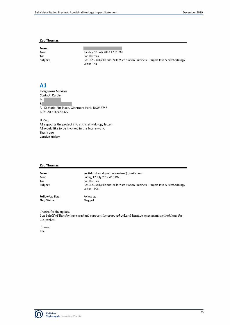
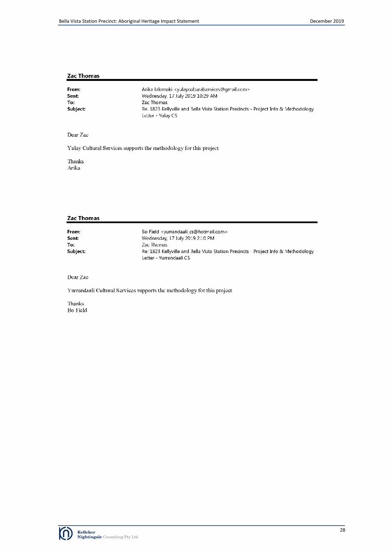
Formal responses to the proposed assessment methodology were received from A1 Indigenous Services (email received 14/07/2019), Barraby Cultural Services (email received 12/07/2019), Murra Bidgee Mullangari Aboriginal Corporation (email dated 11/07/2019), Merrigarn (email dated 23/07/2019), Muragadi Heritage Indigenous Corporation (email dated 23/07/2019), Tocomwall (email dated 25/07/2019), Yulay Cultural Services (17/07/2019) and Yurrandaali Cultural Services (17/07/2019). The respondents expressed a general support for the methodology. No cultural issues or cultural information specific to the study area was supplied. Comments and information received from stakeholders during this period is attached in full in Appendix B.
4.4 Review of draft Aboriginal Heritage Impact Statement and stakeholder responses
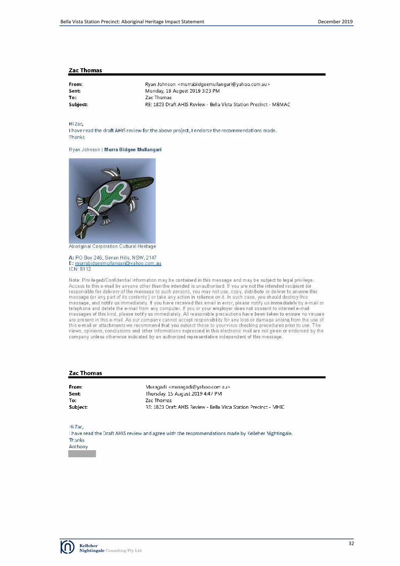
The draft AHIA was provided to stakeholders for a 28 day review and comment period (letters/emails dated 1/08/2019). Stakeholders were invited to comment on the Aboriginal cultural significance of the study area. Formal responses to the draft AHIA were received from Darug Custodian Aboriginal Corporation, Murra Bidgee Mullangari Aboriginal Corporation, Muragadi Heritage Indigenous Corporation and Wailwan Aboriginal Group. Comments and information received from stakeholders during this period is attached in full in Appendix B. Darug Custodian Aboriginal Corporation (DCAC) stated that they had reviewed the draft AHIA and supported the recommendations (letter dated 19/08/2019). DCAC advised that it “has been discussed by our group and with many consultants and researches that our history is generic and is usually from an early colonists perspective or solely based on archaeology and sites. These histories are adequate but they lack the people’s stories and parts of important events and connections of the Darug people and also other Aboriginal people that now call this area home and have done so for numerous generations.” (letter dated 19/08/2019). DCAC stated that “Darug sites are all connected, our country has a complex of sites that hold our heritage and past history, evidence of the Darug lifestyle and occupation are all across our country, due to the rapid development of Sydney many of our sites have been destroyed, our sites are thousands of years old and within the short period of time that Australia has been developed pre contact our sites have disappeared” (letter dated 19/08/2019). Murra Bidgee Mullangari Aboriginal Corporation advised that they had read the draft AHIS and endorsed the recommendations (email dated 19/08/2019). Muragadi Heritage Indigenous Corporation stated that they had read the draft AHIS and agreed with the recommendations (email dated 15/082019). Wailwan Aboriginal Group stated that they had read the draft AHIS and did not identify any issues (email dated 7/08/2019).
4.5 Aboriginal cultural values
It has been identified during the initial consultation process that the wider study area has cultural heritage value to the local Aboriginal community. Some of the Aboriginal cultural heritage values expressed by stakeholders include:
strong association with the land
responsibility to look after the land, including the heritage sites, plants and animals, creeks and the land itself
scarred trees
artefact sites and landscape features
creek lines, particularly Bonds Creek and tributaries
indigenous plants and animals
general concern for burials, as their locations are not always known and they can be found anywhere. Several registered stakeholders have expressed a connection to the study area with several generations of their families living in the region. DCAC stated that “this area is significant to the Darug people due to the evidence of continued occupation, within close proximity to this project site there is a complex of significant sites” and that “landscapes and landforms are significant to us for the information that they hold and the connection to Darug people” (letter dated 19/08/2019). DCAC advised that “Aboriginal people (Darug) had a complex lifestyle that was based on respect and belonging to the land, all aspects of life and survival did not impact on the land but helped to care for and conserve land and the sustenance that the land provided. As Darug people moved through the land there were no impacts left, although there was evidence of movement and lifestyle, the people moved through areas with knowledge of their areas” (letter dated 19/08/2019).

Bella Vista Station Precinct: Aboriginal Heritage Impact Statement December 2019
17
5 Summary and Analysis of Background Information
Analysis of the background information presented in sections 2, 3 and 4 allows an assessment of the cultural heritage values within the study area to be made. Combining data from historical/ethnographic sources, Aboriginal community consultation, landscape evaluation and archaeological context provides an insight into how the landscape around the study area was used and what sort of events took place in the past. This section draws together a variety of information to bring further understanding to the cultural landscape of the study area. The study area and surrounding region are known to have been important to and extensively used by past Aboriginal people. Early colonial interest in the area led to interactions between the British and the local Aboriginal people relatively soon after the arrival of Europeans. The occupation of the region from the late 18
th Century by European
settlers and subsequent government policies radically changed the lifestyle of Aboriginal people living in the area. Contact with the Europeans introduced diseases, such as smallpox, that drastically altered the size and structure of the Aboriginal population, whilst the expansion of settlements and establishment of farmland subsumed the traditional areas used to meet subsistence needs. Government policies further restricted the movement of Aboriginal people and actively attempted to make them adopt European culture; however, Aboriginal culture endures to this day across the Cumberland Plain and has influenced many aspects of Australian culture including in the names of animals, localities, creeks and rivers. Members of the contemporary Aboriginal community continue to experience connection with the area through cultural and family associations. Archaeological investigations within the region have revealed physical traces of a range of Aboriginal land use activities which have survived in the form of archaeological sites. Recorded site types in the region include open artefact scatters (camp sites) and isolated artefacts. Previous archaeological investigations within the study area have consisted of archaeological surveys which identified several low density surface artefact scatters and areas of potential archaeological deposit (PAD). Archaeological salvage excavation at several of these sites and areas of PAD prior to the construction of the Sydney Metro Northwest found moderate to high subsurface artefact density at sites on landforms adjacent to major creeks and low to moderate subsurface artefact density at sites on ridge crest and slope landforms. Overall, the Aboriginal archaeological sites in the vicinity of creeks had low levels of disturbance while the preservation in sites identified on the ridge varied and several were found to be highly disturbed. Radiocarbon samples, taken from contexts associated with artefacts during the Sydney Metro Northwest salvage excavation program, returned dates range from 4,385 years ago to 570 years ago and indicate that the area was being used intermittently over a time span of at least 4,000 years in duration. An Indigenous Heritage Assessment was undertaken by KNC in 2019 as part of preliminary planning for Kellyville and Bella Vista Station Precincts and included the current study area. The assessment determined that four Aboriginal archaeological sites (comprising six AHIMS registrations) had been previous identified within the current study area (Table 2 and Figure 5). The sites consisted of four artefact scatters. The assessment noted that a large portion of the current study area had been cleared of Aboriginal heritage prior to the construction of the Sydney Metro Northwest. As a result, three of the identified Aboriginal archaeological sites and the portion of site NWRL PAD 7 within the current study area had been destroyed. An area of PAD (NWRL PAD5) was also excavated and found not to be an Aboriginal archaeological site.
5.1 Summary of known Aboriginal sites within the study area
Review of background information, Aboriginal community consultation, and archaeological assessment has resulted in the identification of four Aboriginal archaeological sites (comprising six AHIMS registrations) within the study area; however, three of the identified Aboriginal archaeological sites and the portion of site NWRL PAD 7 within the current study area had been destroyed prior to the construction of the Sydney Metro Northwest. An area of PAD (NWRL PAD5) was also excavated and found not to be an Aboriginal archaeological site. The Aboriginal archaeological sites are listed in Table 4. Table 4. Aboriginal archaeological features identified within the study area
Site Name AHIMS ID Site Feature Status
BRO1 45-5-3354 Artefact Destroyed
NWRL PAD4 45-5-4264 (including duplicate
recording 45-5-4839) Artefact Destroyed
NWRL PAD7 45-5-4262 (including duplicate
recording 45-5-4841) Artefact
Remaining portion outside current study area
14 Cumbelege Lane1 and NWRL PAD 6
45-5-4838 Artefact Destroyed
NWRL PAD5 45-5-4263 (including duplicate
recording 45-5-4843) Not a site Not a site

Bella Vista Station Precinct: Aboriginal Heritage Impact Statement December 2019
18
6 Cultural Heritage Values and Statement of Significance
6.1 Significance Assessment Criteria
One of the primary steps in the process of cultural heritage management is the assessment of significance. Not all sites are equally significant and not all are worthy of equal consideration and management (Sullivan and Bowdler 1984; Pearson and Sullivan 1995:7). The determination of significance can be a difficult process as the social and scientific context within which these decisions are made is subject to change (Sullivan and Bowdler 1984). This does not lessen the value of the heritage approach, but enriches both the process and the long term outcomes for future generations as the nature of what is conserved and why, also changes over time. The assessment of significance is a key step in the process of impact assessment for a proposed activity as the significance or value of an object, site or place will be reflected in resultant recommendations for conservation, management or mitigation. The Code of Practice for Archaeological Investigation of Aboriginal Objects in New South Wales (OEH 2010a) requires significance assessment according to criteria established in the Australia ICOMOS Burra Charter, 1999 (Australia ICOMOS 1999). The Burra Charter and its accompanying guidelines are considered best practice standard for cultural heritage management, specifically conservation, in Australia. Guidelines to the Burra Charter set out four criteria for the assessment of cultural significance:
• Aesthetic value - relates to the sense of the beauty of a place, object, site or item
• Historic value - relates to the association of a place, object, site or item with historical events, people, activities or periods
• Scientific value - scientific (or research) value relates to the importance of the data available for a place, object, site or item, based on its rarity, quality or representativeness, as well as on the degree to which the place (object, site or item) may contribute further substantial information
• Social value - relates to the qualities for which a place, object, site or item has become a focus of spiritual, political, national or other cultural sentiment to a group of people. In accordance with the Guide to investigating, assessing and reporting on Aboriginal cultural heritage in NSW, the social or cultural value of a place (object, site or item) may be related to spiritual, traditional, historical or contemporary associations. According to DPIE, “social or cultural value can only be identified though consultation with Aboriginal people” (OEH 2011:8).
There are no remaining locations of scientific value within the study area. Social Values This area of assessment concerns the value/s of a place, feature or site to a particular community group, in this case the local Aboriginal community. Aspects of social significance are relevant to sites, objects and landscapes that are important or have become important to the local Aboriginal community. This importance involves both traditional links with specific areas as well as an overall concern by Aboriginal people for sites generally and their continued protection. Aboriginal cultural significance may include social, spiritual, historic and archaeological values. It has been identified during the consultation process that the local area has cultural heritage value (social value) to the local Aboriginal community. Historic Values Historical research did not identify any information regarding specific historical significance within the study area. No specific historical significance within the study area has been provided by the registered Aboriginal stakeholders to date.

Bella Vista Station Precinct: Aboriginal Heritage Impact Statement December 2019
19
Scientific Values For archaeologists, scientific significance refers to the potential of a site to contribute to current research questions. Alternately, a site may be an in situ repository of demonstrably important information, for example rare artefacts of unusually high antiquity. Scientific significance is assessed using criteria to evaluate the contents of a site, state of preservation, integrity of deposits, representativeness of the site type, rarity/uniqueness and potential to answer research questions on past human behaviour. Recommended criteria for assessing archaeological significance include:
Archaeological Research Potential - significance may be based on the potential of a site or landscape to explain past human behaviour and can incorporate the intactness, stratigraphic integrity or state of preservation of a site, the association of the site to other sites in the region (connectivity), or a datable chronology.
Representativeness - all sites are representative of those in their class (site type/subtype) however the issue here relates to whether particular sites should be conserved to ensure a representative sample of the archaeological record is retained. Representativeness is based on an understanding of the regional archaeological context in terms of site variability in and around the study area, the resources already conserved and the relationship of sites across the landscape.
Rarity – which defines how distinctive a site may be, based on an understanding of what is unique in the archaeological record and consideration of key archaeological research questions (i.e. some sites are considered more important due to their ability to provide certain information). It may be assessed at local, regional, state and national levels.
High significance is usually attributed to sites which are so rare or unique that the loss of the site would affect our ability to understand an aspect of past Aboriginal use/occupation of an area. In some cases a site may be considered highly significant because it is now rare due to destruction of the archaeological record through development. Moderate (medium) significance is attributed to sites which provide information on an established research question. Sites with moderate significance are those that offer the potential to yield information that will contribute to the growing holistic understanding of the Aboriginal cultural landscape of the region. Archaeological investigation of moderately significant sites will contribute knowledge regarding site type interrelationships, cultural use of landscape features and occupation patterns. Low significance is attributed to sites which cannot contribute new information about past Aboriginal use/occupation of an area. This may be due to site disturbance or the nature of the site’s contents. There are no remaining locations of scientific value within the study area. Aesthetic Values Aesthetic values are often closely related to the social values of a site or broader cultural landscape. Aspects may include scenic sights, smells and sounds, architectural fabric and creative aspects of a place. No specific associated aesthetic values have been identified by registered Aboriginal community groups to date. Archaeologically, the study area does not contain these values.
6.2 Statements of Significance
There are no extant Aboriginal archaeological sites as defined under the National Parks and Wildlife Act 1974 within the study area. The previously identified archaeological sites within the study area were destroyed prior to the construction of the Sydney Metro Northwest. Archaeological salvage excavations undertaken prior to the construction of the Sydney Metro Northwest demonstrated that the area had scientific significance and provided information on Aboriginal land use in the area over a time span of at least 4,000 years in duration. Previous investigations and the current consultation process have noted that the local area has cultural heritage value (social value) to the local Aboriginal community.

Bella Vista Station Precinct: Aboriginal Heritage Impact Statement December 2019
20
7 The Proposed Activity and Impact Assessment
Landcom is proposing to redevelopment of surplus government owned land within the Bella Vista Station Precinct to facilitate the renewal of the locality and deliver a greater supply and diversity housing and employment opportunities. The proposed works would include: • Residential dwellings comprising residential flat buildings and terraces • Non-residential land uses including retail and commercial • A new primary school • New streets and intersection connections to the existing road network • Public open space including public domain and parks and • Community facilities. Previously identified archaeological sites within the study area were destroyed prior to the construction of the Sydney Metro Northwest. There are no remaining extant Aboriginal archaeological sites within the study area and the proposal would not impact on Aboriginal heritage.
8 Conclusions and Recommendations
Previously identified archaeological sites within the study area were destroyed prior to the construction of the Sydney Metro Northwest. There are no remaining extant Aboriginal archaeological sites within the study area and the proposal would not impact on Aboriginal heritage. Management measures should be implemented for Aboriginal objects situated within the non-impacted portion of the site NWRL PAD7 (outside study area) to ensure this area is avoided by proposed construction activities. Management measures to be implemented include protective fencing and identification as ‘no-go zones’ on all maps, including the Construction Environmental Management Plan. Documented toolbox talks will also be held to ensure all on-site staff and contractors are aware of obligations and requirements regarding the protection of Aboriginal heritage and the adjacent site area.

Bella Vista Station Precinct: Aboriginal Heritage Impact Statement December 2019
21
References
Attenbrow, V., 2002. Sydney’s Aboriginal Past: Investigating the Archaeological and Historical Records. University of New South Wales Press, Sydney.
Australia ICOMOS (1999). The Burra Charter: The Australia ICOMOS Charter for Places of Cultural Significance 1999.
Australia ICOMOS Incorporated. Burwood, Victoria. Bannerman, S.M., Hazelton, P.A. and Tille, P.J., 1990. Penrith 1:100,000 Soil Landscape Series Sheet 9030. Soil
Conservation Service of NSW, Sydney. Brayshaw & Associates, 1985. Archaeological Survey: Norwest Estate, Baulkham Hills. Report to Gutteridge Haskins &
Davey Pty Ltd Brayshaw McDonald Pty Limited (Brayshaw McDonald), 1994. Balmoral Road Sewer Carrier. Rouse Hill, NSW.
Archaeological Survey for Aboriginal Sites. Report prepared for Rouse Hill [Stage 1] Pty Ltd Brook, J. and Kohen, J.L., 1991. The Parramatta Native Institution and the Black Town: A History. New South Wales
University Press, Kensington. Clark, N.R. and Jones, D.C., (Eds) 1991. Penrith 1:100,000 Geological Sheet 9030. New South Wales Geological Survey,
Sydney Colley, S. 2002. Uncovering Australia. Archaeology, Indigenous People and the Public. Allen & Urwin. Collins, D. 1798. An Account of the English Colony in New South Wales [Volume 1]. T. Cadell Jun. and W. Davies,
London. Doelman, T, Webb, J, Williams, A, May, J and Barry, F. (Doelman et al). 2015. Paleochannels and Patches: A
Geoarchaeological Assessment of Silcrete Sources in the Cumberland Plain, Eastern Australia. Geoarchaeology: An International Journal 30. 495–510
Godden Mackay Logan (GML), 2012. North West Rail Link. EIS 1 – Major civil construction works: Indigenous heritage.
Report prepared for NWRL Planning Approvals Team. Hiscock, P. 2007. The Archaeology of Ancient Australia. Routledge Hunt, J and Ellsmore S. 2016. Navigating a Path through Delays and Destruction: Aboriginal Cultural Heritage
Protection in New South Wales using Native Title and Land Rights. McGrath, P (ed.). 2016. The Right to Protect Sites: Indigenous Heritage Management in the Era of Native Title. Australian Institute of Aboriginal and Torres Strait Islander Studies, Canberra
International Council on Monuments and Sites (ICOMOS) 2008. The ICOMOS Charter for the Interpretation and
Presentation of Cultural Heritage Sites. Ratified by the 16th
General Assembly of ICOMOS, Quebec (Canada), on 4 October 2008.
Jo McDonald Cultural Heritage Management Pty Ltd (JMCHM), 2006. Archaeological Assessment of Indigenous
Heritage for the North West Rail Link. Report prepared for GHD on behalf of TIDC Kelleher Nightingale Consulting (KNC), 2015. Sydney Metro Northwest: Archaeological Salvage Excavation Program.
Report prepared for Transport for NSW KNC. 2019. Kellyville and Bella Vista Station Precincts: Indigenous Heritage Assessment. Report prepared for Landcom. Kohen, J.L., 1986. Prehistoric Settlement in the Western Cumberland Plain: Resources, Environment and Technology.
PhD Thesis, School of Earth Sciences, Macquarie University, Sydney. Kohen, J.L., 1993. The Darug and Their Neighbours. The Traditional Aboriginal Owners of the Sydney Region. DarugLink
in association with Blacktown and District Historical Society, Sydney Kohen, J.L. 2005. 'Pemulwuy (1750–1802)', Australian Dictionary of Biography, National Centre of Biography,
Australian National University, http://adb.anu.edu.au/biography/pemulwuy-13147/text23797, published first in hardcopy 2005, accessed online 24 July 2019
Bella Vista Station Precinct: Aboriginal Heritage Impact Statement December 2019
22
Office of Environment and Heritage (OEH) (formerly Department of Environment, Climate Change and Water), 2010a. Code of Practice for Archaeological Investigation of Aboriginal Objects in New South Wales: Part 6 National Parks and Wildlife Act 1974. Department of Environment, Climate Change and Water NSW, Sydney.
OEH, 2010b. Aboriginal Cultural Heritage Consultation Requirements for Proponents 2010 (Part 6 National Parks and
Wildlife Act, 1974). Department of Environment, Climate Change and Water NSW. OEH, 2011a. Guide to Investigating, Assessing and Reporting on Aboriginal Cultural Heritage in NSW. Office of
Environment and Heritage, Department of Premier and Cabinet, Sydney. Pearson, M. and Sullivan, S. 1995. Looking After Heritage Places: The Basics of Heritage Planning for Managers,
Landowners and Administrators. Melbourne University Press. Sullivan, S. and Bowdler, S. 1984. Site Survey and Significance Assessment in Australian Archaeology Canberra: RSPacS,
Australian National University. Tench, W., 1793. Complete Account of the Settlement at Port Jackson. G. Nicol and J. Sewell, London. Troy, J. 1990. Australian Aboriginal Contact with the English Language in New South Wales: 1788 to 1845. The
Australian National University, Canberra Walsh, M. 1993. Languages and Their Status in Aboriginal Australia. In: Walsh, M and Yallop, C. (eds). 1993. Language
and Culture in Aboriginal Australia. Aboriginal Studies Press

Bella Vista Station Precinct: Aboriginal Heritage Impact Statement December 2019
23
Appendix A Advertisement for registration of interest
Appeared in: Hills Shire Times, Tuesday 25 June 2019, page 46
Bella Vista Station Precinct: Aboriginal Heritage Impact Statement December 2019
24
Appendix B Aboriginal Community Comments
Bella Vista Station Precinct: Aboriginal Heritage Impact Statement December 2019
25

Bella Vista Station Precinct: Aboriginal Heritage Impact Statement December 2019
26

Bella Vista Station Precinct: Aboriginal Heritage Impact Statement December 2019
27
Bella Vista Station Precinct: Aboriginal Heritage Impact Statement December 2019
28

Bella Vista Station Precinct: Aboriginal Heritage Impact Statement December 2019
29

Bella Vista Station Precinct: Aboriginal Heritage Impact Statement December 2019
30

Bella Vista Station Precinct: Aboriginal Heritage Impact Statement December 2019
31
Bella Vista Station Precinct: Aboriginal Heritage Impact Statement December 2019
32

Bella Vista Station Precinct: Aboriginal Heritage Impact Statement December 2019
33