Embed Size (px)
Citation preview

NOAA/NESDIS NOAA-CRN/OSD-2002-0004R0UD0 CRN Series December 10, 2002 X032 DCN 0
Climate Reference Network (CRN)
Program Site Acquisition Plan
December 2002
Prepared by: U.S. Department of Commerce National Oceanic and Atmospheric Administration (NOAA) National Environmental Satellite, Data, and Information Service (NESDIS) NOAA/NESDIS

NOAA/NESDIS NOAA-CRN/OSD-2002-0004R0UD0 CRN Series December 10, 2002 X032 DCN 0
i
Climate Reference Network (CRN)
Program Site Acquisition Plan
December 2002
Prepared by:
U.S. Department of Commerce National Oceanic and Atmospheric Administration (NOAA)
National Environmental Satellite, Data, and Information Service (NESDIS)
NOAA/NESDIS NOAA-CRN/OSD-2002-0004R0UD0 CRN Series December 10, 2002 X032 DCN 0
iii
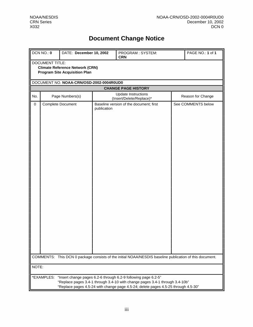
Document Change Notice
DCN NO.: 0 DATE: December 10, 2002 PROGRAM : SYSTEM: CRN
PAGE NO.: 1 of 1
DOCUMENT TITLE: Climate Reference Network (CRN) Program Site Acquisition Plan
DOCUMENT NO. NOAA-CRN/OSD-2002-0004R0UD0
CHANGE PAGE HISTORY
No. Page Numbers(s) Update Instructions (Insert/Delete/Replace)*
Reason for Change
0 Complete Document Baseline version of the document; first publication
See COMMENTS below
COMMENTS: This DCN 0 package consists of the initial NOAA/NESDIS baseline publication of this document.
NOTE:
*EXAMPLES: “Insert change pages 6.2-6 through 6.2-9 following page 6.2-5” “Replace pages 3.4-1 through 3.4-10 with change pages 3.4-1 through 3.4-10b” “Replace pages 4.5-24 with change page 4.5-24; delete pages 4.5-25 through 4.5-30”

NOAA/NESDIS NOAA-CRN/OSD-2002-0004R0UD0 CRN Series December 10, 2002 X032 DCN 0
iv
Version Description Record
DOCUMENT TITLE: Climate Reference Network (CRN) Program Site Acquisition Plan
DOCUMENT NUMBERS: Baseline: NOAA-CRN/OSD-2002-0004R0UD0
SYSTEM: CRN
DOCUMENT BASELINE ISSUE DATE: Original NOAA/NESDIS Baseline: December 10, 2002
DOCUMENT CHANGE HISTORY DCN No.
Revision/Update Nos. Date DCN
No. Revision/Update
Nos. Date
0 R0UD0 December 10, 2002
NOTES:

NOAA/NESDIS NOAA-CRN/OSD-2002-0004R0UD0 CRN Series December 10, 2002 X032 DCN 0
v
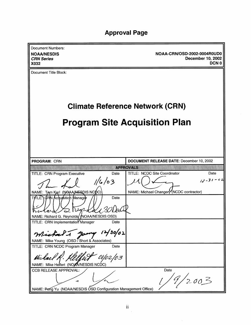
Preface This document comprises the National Oceanic and Atmospheric Administration (NOAA)/ National Environmental Satellite, Data, and Information Service (NESDIS) initial baseline publication of the Climate Reference Network (CRN) Program Site Acquisition Plan (version DCN 0, December 10, 2002, publication). The document number is NOAA-CRN/OSD-2002-0004R0UD0. This document’s purpose is to describe how the CRN program will acquire the sites needed for the CRN monitoring stations. The plan details the steps and procedures that will be used and defines the roles and responsibilities within the extended CRN team for accomplishing the task. The publication of this baseline document closes the following Document Configuration Change Request: DocCCR-Multi-Miscl-2002-0003 NOAA/NESDIS acknowledges the efforts of the NOAA/NESDIS National Climatic Data Center (NCDC) and Short and Associates, Inc., for their preparation of the material in this document. Future updates and revisions to this document will be produced and controlled by NOAA/NESDIS.

NOAA/NESDIS NOAA-CRN/OSD-2002-0004R0UD0 CRN Series December 10, 2002 X032 DCN 0
vi
Table of Contents
Section 1. Introduction .............................................................................................................1 1.1 Background ..........................................................................................................................1 1.2 Purpose.................................................................................................................................1 Section 2. Roles and Responsibilities .................................................................................2 2.1 CRN Executive Board..........................................................................................................2 2.2 National Climactic Data Center (NCDC) ............................................................................2 2.3 Office of Systems Development (OSD)...............................................................................2 2.4 Regional Climate Centers (RCCs) .......................................................................................3 2.5 NOAA Eastern Administrative Support Center (EASC).....................................................3 2.6 CRN Acquisition Team........................................................................................................3 Section 3. Site Acquisition Task Stages..............................................................................4 3.1 Presurvey Stage....................................................................................................................4 3.1.1 CRN Network Plan ..................................................................................................4 3.1.2 Approved Site Standards..........................................................................................4 3.1.3 Candidate Site List ...................................................................................................4 3.1.4 Desk Survey (RCC) .................................................................................................5 3.2 Site Surveys (RCC)..............................................................................................................5 3.3 Postsurvey Stage ..................................................................................................................6 3.3.1 Site Selection Committee.........................................................................................6 3.3.2 Site Approval/Disapproval Followup ......................................................................6 Appendix A. Performing Site Surveys..................................................................................7 Appendix B. Survey Site Checklist .......................................................................................9 Appendix C. USCRN Site Approval Sheet.................................................................27
NOAA/NESDIS NOAA-CRN/OSD-2002-0004R0UD0 CRN Series December 10, 2002 X032 DCN 0
vii
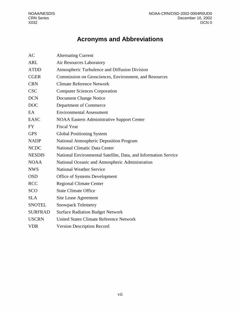
Acronyms and Abbreviations
AC Alternating Current
ARL Air Resources Laboratory
ATDD Atmospheric Turbulence and Diffusion Division
CGER Commission on Geosciences, Environment, and Resources
CRN Climate Reference Network
CSC Computer Sciences Corporation
DCN Document Change Notice
DOC Department of Commerce
EA Environmental Assessment
EASC NOAA Eastern Administrative Support Center
FY Fiscal Year
GPS Global Positioning System
NADP National Atmospheric Deposition Program
NCDC National Climatic Data Center
NESDIS National Environmental Satellite, Data, and Information Service
NOAA National Oceanic and Atmospheric Administration
NWS National Weather Service
OSD Office of Systems Development
RCC Regional Climate Center
SCO State Climate Office
SLA Site Lease Agreement
SNOTEL Snowpack Telemetry
SURFRAD Surface Radiation Budget Network
USCRN United States Climate Reference Network
VDR Version Description Record

NOAA/NESDIS NOAA-CRN/OSD-2002-0004R0UD0 CRN Series December 10, 2002 X032 DCN 0
viii
References
1. Karl, T.R., V.E. Derr, D. R. Easterling, C.K. Folland, D. J. Hoffman, S. Levitus, N. Nicholls, D. E. Parker, and G. W. Withee. 1995. Critical Issues for long-term climate monitoring. Clim. Change 31, 185-221
2. CGER, 1999. Adequacy of Climate Observing Systems, National Academy Press, Washington,
D. C., 51 pp.

NOAA/NESDIS NOAA-CRN/OSD-2002-0004R0UD0 CRN Series December 10, 2002 X032 DCN 0
1
Section 1. Introduction 1.1 Background The National Oceanic and Atmospheric Administration (NOAA) is implementing a program that will provide very-high-quality, long-term (more than 50 years) measurement of surface weather parameters that will be used to monitor changes in the climate of the United States. The program includes the installation of a network of approximately 220 automated observing stations strategically distributed throughout the 50 states, which will form NOAA’s Climate Reference Network (CRN). Establishment of this Network will be guided by the “ten climate monitoring principles” proposed by Karl, et al., (Reference 1) and recommended by the Commission on Geosciences, Environment, and Resources (CGER) (Reference 2). Data from the CRN will also be used as a reference for other existing observational networks. The establishment of the CRN will be a complex and difficult undertaking requiring the best efforts of its various participants. The lead organization within NOAA for the CRN program is NOAA’s National Climatic Data Center (NCDC), which will provide policy definition, direct site selection, and formulate network and siting standards. NOAA’s National Environmental Satellite, Data, and Information Service (NESDIS) Office of Systems Development (OSD) has been tasked with the role of program management and will oversee the acquisition and implementation of the CRN. NOAA’s Atmospheric Turbulence and Diffusion Division (ATDD) of NOAA’s Air Resources Laboratory (ARL) will play a major role in the installation of the observing equipment. NOAA’s Regional Climate Centers (RCCs) have been tasked with performing onsite surveys and their prerequisite suitability/feasibility investigations. Additionally, other NOAA and support elements will make major contributions to the effort needed for successful completion of the CRN. 1.2 Purpose This manual describes the methodology and resources to be used in identifying and acquiring the sites needed for the CRN monitoring stations. The manual details the recommended steps so that the site selection process is standardized as much as possible throughout the network. It also defines the roles and responsibilities within the extended CRN team to accomplish the task. The site acquisition effort within the CRN program includes the entire range of work needed to ensure that the defined observation locations meet stringent, technical, and practical criteria; ensures that all required documentation is accurate and complete; and ensures that the work is scheduled and prioritized in order that station installation schedules are met.
NOAA/NESDIS NOAA-CRN/OSD-2002-0004R0UD0 CRN Series December 10, 2002 X032 DCN 0
2
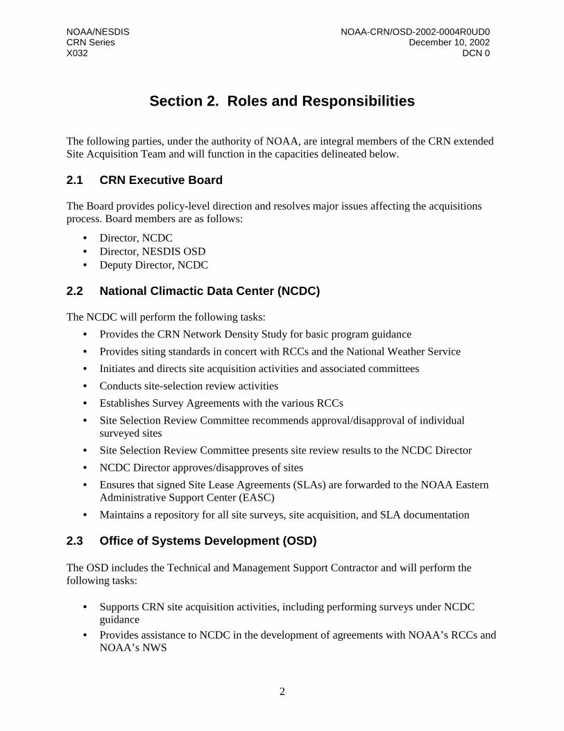
Section 2. Roles and Responsibilities The following parties, under the authority of NOAA, are integral members of the CRN extended Site Acquisition Team and will function in the capacities delineated below. 2.1 CRN Executive Board The Board provides policy-level direction and resolves major issues affecting the acquisitions process. Board members are as follows:
• Director, NCDC • Director, NESDIS OSD • Deputy Director, NCDC
2.2 National Climactic Data Center (NCDC) The NCDC will perform the following tasks:
• Provides the CRN Network Density Study for basic program guidance
• Provides siting standards in concert with RCCs and the National Weather Service
• Initiates and directs site acquisition activities and associated committees
• Conducts site-selection review activities
• Establishes Survey Agreements with the various RCCs
• Site Selection Review Committee recommends approval/disapproval of individual surveyed sites
• Site Selection Review Committee presents site review results to the NCDC Director
• NCDC Director approves/disapproves of sites
• Ensures that signed Site Lease Agreements (SLAs) are forwarded to the NOAA Eastern Administrative Support Center (EASC)
• Maintains a repository for all site surveys, site acquisition, and SLA documentation 2.3 Office of Systems Development (OSD) The OSD includes the Technical and Management Support Contractor and will perform the following tasks:
• Supports CRN site acquisition activities, including performing surveys under NCDC guidance
• Provides assistance to NCDC in the development of agreements with NOAA’s RCCs and NOAA’s NWS

NOAA/NESDIS NOAA-CRN/OSD-2002-0004R0UD0 CRN Series December 10, 2002 X032 DCN 0
3
• Coordinates with the RCCs, NWS, and the NCDC on overall network design and site priorities
• Provides technical assistance and input regarding proposed site criteria and standards
• Participates in site survey activities with the Extended Site Team, which includes RCC and NWS site identification and field assistance personnel
• Facilitates survey activities, monitors progress, and issues status reports • Provides input on site survey schedules • Provides input for the Site Acquisition Database • Supports the review and approval process for all site acquisition activities
2.4 Regional Climate Centers NOAA’s RCCs are the primary resource for the performance of field site surveys. Using the NCDC Network Plan as guidance, a candidate site list will be developed to identify specific potential locations within RCC areas of responsibility. The RCC’s will conduct a feasibility process, including the following:
• Telephone contact with potential site licensors and State Climatologists
• Review of digitized imagery of specific properties acquired from various aerial and space platforms
• Review of topographic, geomorphic, soil, and vegetation maps and charts • Review of other relevant remotely obtainable information
This process minimizes unnecessary and unsuccessful field survey work and attendant resource expenditures. The RCCs, upon completion of the field surveys, will provide documentation needed for NCDC to approve or disapprove the site, and for an SLA to be perfected. 2.5 NOAA Eastern Administrative Support Center (EASC) The NOAA Eastern Administrative Support Center performs the following tasks:
• Facilitates and coordinates acquisition of SLAs • Serves as a repository for completed and signed SLAs
2.6 CRN Acquisition Team The CRN Acquisition Team has been established to specifically oversee all aspects of the site acquisition activity. The team consists of a minimum of five members drawn from NCDC, OSD, and the RCCs. Day-to-day direction, planning, and progress monitoring of the acquisition activity is the responsibility of this Team.
NOAA/NESDIS NOAA-CRN/OSD-2002-0004R0UD0 CRN Series December 10, 2002 X032 DCN 0
4
Section 3. Site Acquisition Task Stages Site acquisition activities include presurvey, survey and postsurvey stages. Basically, presurvey work determines where, when, and whether to survey a particular area; while postsurvey activities document specific site characteristics so that a decision on site inclusion into the CRN can be made. Standard procedures involving site acquisition tasks for the United States Climate Reference Network (USCRN) are summarized below. 3.1 Presurvey Stage
The critical documents that guide the presurvey activities are the following:
• CRN Network Density Plan • Site Standards Documentation • Candidate Site List Identification and Prioritization Plan • Desk Survey
3.1.1 CRN Network Density Plan The CRN Network Density Plan (often referred to as the “spatial density study”) documents the number and general location of the CRN systems to be installed. The Plan provides the specific or approximate number of sites, the network logical basis, the general location of paired sites, regionalization if applicable, preferred sequence if applicable, potential future expansion, and any other available implementation guidance (e.g., identification of key or high-priority locations). The CRN Network Density Plan will be developed by NCDC.
3.1.2 Approved Site Standards
Proposed station siting standards for the CRN may be divided into generalized criteria that can be determined remotely (e.g., avoidance of flood plains, large bodies of water nearby, etc.) and those that require onsite investigation (e.g., soil conditions). These standards have been jointly developed by the RCCs and NCDC and are detailed as Appendix A to this document. 3.1.3 Candidate Site List
The Candidate Site List identifies the number of site surveys to be completed, organized by fiscal year. The continuous development of the candidate site lists is based on the CRN Network Density Plan with the general number and distribution of required sites, and then expanded to identify specific candidate locations to be evaluated. The number of candidate sites per general location is ideally three, based upon expected suitability, as indicated by preliminary site assessment. Suitability will be based upon climate representativeness first and foremost. Secondary considerations include geomorphic, ecotonal, and topographic characteristics; long-term site and area stability; as well as such considerations as ease of construction, all-weather
NOAA/NESDIS NOAA-CRN/OSD-2002-0004R0UD0 CRN Series December 10, 2002 X032 DCN 0
5
access, host agency availability, and the existence of utility access. The development of the lists will be done through coordination among the appropriate RCCs, NCDC, and OSD. State Climate Offices (SCOs) and NWS input will flow to the relevant RCC, or in the instance of Alaska to OSD respectively. Candidate site lists will be structured within the geographic boundaries of both RCC and NWS regions insofar as possible. Site acquisition work will also be prioritized for specific fiscal year (FY) investigations and processing (e.g., FY03, FY04-05) in accordance with meeting established NCDC Performance Measures. 3.1.4 Desk Survey (RCC) The goal of desk survey work is to minimize unnecessary and unproductive field surveys. When a potential site and Licensor have been identified and the response is positive, copies of the CRN Site Information Handbook and Site Survey Checklist (Appendix B), as well as pointers to CRN web site information, are provided. Detailed information is gathered from telephone contact/ e-mail/fax regarding the proposed site property, point-of-contact information, digital imagery of potential sites, physical condition of the site and surrounding area, etc. If the site initially meets CRN criteria, and the potential Host remains positive, an onsite survey will be scheduled. The goal is to examine approximately three possible sites in the field at each location.
3.2 Site Surveys (RCC) The USCRN Site Survey Checklist (Appendix B) provides the basic reference guidance needed in the performance of the site survey. The Checklist includes a quantitative classification scheme by which sites are rated for climatological suitability, as well as facilities information (e.g., distance to alternating current (AC) power), procedures to be followed when performing the survey, and documentation to be completed and distributed upon completion of the survey, i.e., the summary report and recommendations. The SLA should be reviewed with the Host (but not signed) at this time to ascertain whether initial enthusiasm has been tempered by “buyer’s remorse,” or whether minor modifications are needed. Ideally, several different locations within the control of the potential Licensor will have been surveyed and documented, offering the Site Selection Committee a choice. The complete survey package is forwarded to the NCDC Site Coordinator. Minimum field survey equipment required includes the following:
• Hand-held Global Positioning System (GPS) locator • Digital camera • Laptop • Clinometer • Stakes, hammer, flag markers, etc. • Digital rangefinder

NOAA/NESDIS NOAA-CRN/OSD-2002-0004R0UD0 CRN Series December 10, 2002 X032 DCN 0
6
3.3 Postsurvey Stage This stage involves the review of information obtained during presurvey and site survey investigations leading to the approval or disapproval of the specific site. The NCDC Site Coordinator assembles the site information package, which consists of the Site Survey Checklist, photographs, maps, charts, and relevant notes, and schedules a Site Selection Committee meeting. 3.3.1 Site Selection Committee The Site Selection Committee is a permanent body within the CRN organization that is responsible for recommending or not recommending that a surveyed site become part of the reference network. Meetings are scheduled as needed, with the recognition that intensification of survey work may require meetings at frequent intervals. Meetings are open to all interested CRN program participants, and participation by all attendees is a base assumption. The Site Selection Committee is chaired by the NCDC CRN Program Manager and consists of a minimum of eight members. A quorum is defined as five members and is required for a valid recommendation to the Director, NCDC. The possible outcomes of the Committee’s deliberations are the following:
• Recommend • Not recommended • Recommend with conditions
A majority opinion is required for the USRN Site Approval Sheet (Appendix C), which is then submitted to the Director, NCDC, for signature. 3.3.2 Site Approval/Disapproval Followup NCDC will notify the RCCs, OSD, and ATDD of the Director’s decision. If the site is disapproved, NCDC will send a letter of regret to the unsuccessful site host on behalf of the USCRN Program. If the site is approved, NCDC will ensure that the SLA is signed by the Licensor and the Director, NCDC. Any significant modifications to the SLA desired by the Licensor will be submitted to the NOAA General Counsel for legal review (prior to the Director, NCDC, signing the SLA). Assuming there is no adverse NOAA legal review, the Director, NCDC, will sign the SLA and send a letter of congratulations on behalf of the USCRN Program. Additionally, the NCDC Site Coordinator will notify ATDD and OSD that the SLA has been signed and to place the location on the site preparation/installation schedule. At this point, NCDC will begin or complete the Climate Summary for the new site.

NOAA/NESDIS NOAA-CRN/OSD-2002-0004R0UD0 CRN Series December 10, 2002 X032 DCN 0
7
Appendix A. Performing Site Surveys The identification of specific locations on which to site the CRN instrument suite involves an array of factors, both “scientific” and practical, that need to be considered. Many of these factors can be determined remotely (desk survey), while others will require onsite investigation. Still others need a combination of both. A.1 Desk Survey The desk survey is, in a sense, an elimination process. The likelihood that an onsite survey will result in an acceptable CRN site is largely dependent on the quality and thoroughness of the desk survey. The most important criterion for selection is reasonable assurance that the location will remain essentially uninfluenced for 50 years or more by significant changes to the immediate surroundings. The probability of future encroachment by nearby built structures, paved roads, irrigated fields, etc., therefore, must be assessed. As such, National and State parks, University deeded lands, and land grant institutions etc., should be investigated as a first priority. Review of recent (last 10 years) and projected future area population growth is part of the process. It is desirable to locate a CRN site near an observing station with high-quality long-term records, e.g., a U.S. Historical Climate Network site. Location near other observing networks, such as Snowpack Telemetry (SNOTEL), the Surface Radiation Budget Network (SURFRAD), or the National Atmospheric Deposition Program (NADP), provides the significant advantages of complementary observations and the possibility of making use of in-place local technical and maintenance support and metadata (vegetation changes, etc.). Reasonable access to the site can also be assumed if other networks are in the area. In the case of paired sites (40 pairs are planned for the lower 48 states), there are special considerations. Ideally, there will be different Host Organizations controlling each site, so that the risk of both sites being abandoned due to some future policy change is lowered. In the real world, this may not be possible, especially in the western United States. Paired sites should be far enough apart to minimize the chance that a single adverse event (flood, ice storm, etc.) renders both stations inoperable, but close enough that both sites capture the area’s climate. Depending upon the intervening topography and other local factors, a range of 8 to 30 miles is appropriate. High risk locations such as the following are to be avoided:
1. Enclosed locations that may trap air and create high incidence of fog, cold air advection,
etc.
2. Vicinity of orographically induced winds such as Santa Ana and Chinook

NOAA/NESDIS NOAA-CRN/OSD-2002-0004R0UD0 CRN Series December 10, 2002 X032 DCN 0
8
3. Persistent periods of extreme snow depths (tens of feet)
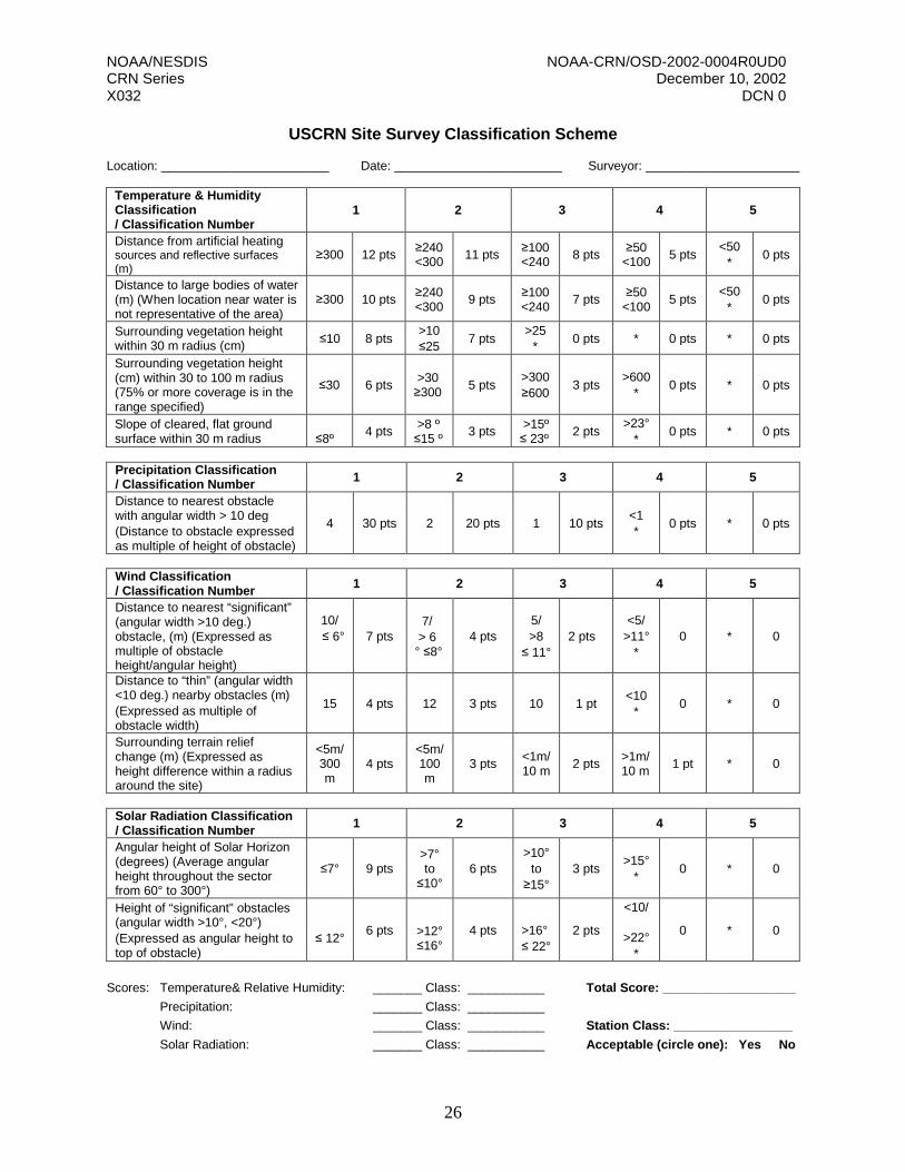
4. Endangered species habitats and sensitive historical locations Digital topographic maps and a climatological profile of the area under consideration, as well as aerial photographs, are useful tools in the presurvey decision making process. A.2 Onsite Survey The most desirable local surrounding landscape is a relatively large and flat open area with low vegetation so that the sky is unobstructed in all directions, except at the lower angles of elevation above the horizon. There is no significant obstruction within 300 meters of the instrument tower. Private land should be at least 500 meters distant and tilled fields are 100 meters distant. The area occupied by the CRN instrument suite is typically 18 meters by 18 meters. Local environmental and nearby terrain factors have an influence on the “quality of a measurement” and its relationship to the National and Regional Climate signal. These must be weighed carefully, such that the location is free of local influences that might mask those signals. Local facilities considerations also have a bearing on site feasibility. For example, soil conditions need to be amenable to equipment installation Thus, the selection of a CRN instrument site will be the result of a balance between sometimes contradictory or competing demands and requires skill and judgment tempered by experience. There will be many sites that are less than ideal, and some Alaska sites will pose a significant challenge to the ingenuity of the survey team. The CRN survey will use the classification scheme given on page 26 to document the representativeness of meteorological measurements at each site.

NOAA/NESDIS NOAA-CRN/OSD-2002-0004R0UD0 CRN Series December 10, 2002 X032 DCN 0
9
Appendix B. Survey Site Checklist This appendix contains the following:
• USCRN Survey Site Checklist (pages 10–20)
• Appendix to the Survey Site Checklist (pages 21–25)
• USCRN Site Survey Classification Scheme (page 26)

NOAA/NESDIS NOAA-CRN/OSD-2002-0004R0UD0 CRN Series December 10, 2002 X032 DCN 0
10
Date: 04/26/02
USCRN SITE SURVEY CHECKLIST
(Complete One Form for Each Property Surveyed)
DATE OF SITE SURVEY LOCATION (City, County, State, and Zip) NAME/PHONE/E-MAIL OF RCC AND SC REPs DOING SURVEY
RCC Person:
SC Person: SITE VISIT CONTACT INFORMATION
Contact Name:
Organization:
Address (street, city, county, zip):
Phone:
Fax:
Email:
HOST ORGANIZATION INFORMATION (Property Owner)
Contact Name:
Name/Title of Person Signing the SLA:
Organization:
Address (street, city, county, zip):
Phone:
Fax:
Email:

NOAA/NESDIS NOAA-CRN/OSD-2002-0004R0UD0 CRN Series December 10, 2002 X032 DCN 0
11
LOCAL CONTACT FOR LONG TERM COORDINATION OF SITE MATTERS
Contact Name:
Organization:
Address (street, city, county, zip):
Phone:
Fax:
Email:
LOCAL CONTACT FOR GENERAL MAINTENANCE/SECURITY SUPPORT Contact Name:
Organization:
Address (street, city, county, zip):
Phone:
Fax:
Email:
Discuss local level of general routine support available (if any) – i.e. periodic visual inspection/security visit, general maintenance (mowing, clean pyranometer lens dust/dirt/snow, remove branches/debris from and periodic empting rain gauge, etc. General CRN policy is not to provide nominal stipend for these services. However, should address this issue. CRN Program Manager will determine if appropriate and offer and negotiate dollar amount. May be written into the SLA. If agreed to pay small stipend, will require to know who/where to send funding. Prefer annual payment.

NOAA/NESDIS NOAA-CRN/OSD-2002-0004R0UD0 CRN Series December 10, 2002 X032 DCN 0
12
LOCAL TECHNICAL SUPPORT PERSON CONTACT INFORMATION
Contact Name:
Organization:
Address (street, city, county, zip):
Phone:
Fax:
Email:
Discuss Option of providing Immediate Local Technical Maintenance Response (May be same person as General Support) – i.e. evaluate potential instrument/equipment problems, such as replacing temperature probe, fan motor, anemometer, etc. working on other observing sites in area, experience, etc. ATDD will provide video, manual, and basic training for routine technical support. Discuss reimbursement cost options – Annual or per hour reimbursement. Need to know who/where to send funding. Prefer annual payment. Quarterly, particularly monthly, less desirable.
BEFORE GOING ON THE SURVEY FIELD TRIP TO THE SITES
- At least two, preferably three or more, pieces of property to survey.
- Discuss CRN Site Information Handbook contents and other items with Host Org.
- Host Organization reviewed SLA and Discussed CRN Long-Term (50+ yrs.) needs. - Get general site description and digital pictures, aerial photos, topographic maps, etc.
- Discuss Access and AC power in the area.
- Discuss current and future uses of offered site and surrounding area with Host Org.
- Look at past growth and potential future (20+ years) growth patterns (N-S-E-W). Some population density growth projections are available from Census Bureau and City Planners. It is useful to engage in pointed questions and discussions with the Host Organization and other local contacts.
- Attempt to identify, talk to, and then meet with, existing local technical support (i.e. SURFRAD, NADP, etc. support).

NOAA/NESDIS NOAA-CRN/OSD-2002-0004R0UD0 CRN Series December 10, 2002 X032 DCN 0
13
SPECIFIC LOCATION INFORMATION
(Note: It is very important that you record the latitude, longitude, and elevation of the exact place where the instrument tower will be installed. It is equally important to get the Host Org. Rep with you on the site survey to agree to that spot.)
Latitude (degree, minutes, tenths):
Longitude (degree, minutes, tenths):
Elevation in Feet {indicate below sea level with a minus (–) sign}:
City/County or Parish/State:
Type Property (National Park, Deeded University, Botanical Garden, Audubon,
Arboretum, etc.)
Other Type Observing Sites in Vicinity (ASOS, COOP, NADP, ARM, BLM, COE, USGS, LITR, Astronomy, etc. – Describe, include Point of Contact Info):
Other Remarks:

NOAA/NESDIS NOAA-CRN/OSD-2002-0004R0UD0 CRN Series December 10, 2002 X032 DCN 0
14
PHYSICAL DESCRIPTION OF THE SITE AND SURROUNDING AREA
(Notes: Take Topographic Maps with you - Best scale for the individual site and best scale which includes all potential sites in the area. If available, bring Aerial Photos. Take lots of pictures – Stand where tower will be and take: distant 360 degree shots all cardinal points of the compass, close-up (out to ~300 meters) 360 degree, zoom of nearby obstructions (<300 meters), best shot of distance between tower and AC power (ensure terrain shown). Step back ~ 30+ feet from tower location and take close-up shots of tower location and ground cover from several points of the compass.) Avoid areas where nearby land is regularly tilled, large bodies of water, flood areas due to streams, etc. A. Describe the Use of the Property and Surrounding Area (i.e. pasture land used
for grazing, grow wheat/barley/soy which is cut once/twice a year, tilled fields, etc.)
B. Describe Terrain (360 degrees) - Long Distance (miles) and Nearer (~300-600 meters), i.e. rolling hills, steep escarpments, relatively flat, distance/direction to nearest town and size of town, etc.

NOAA/NESDIS NOAA-CRN/OSD-2002-0004R0UD0 CRN Series December 10, 2002 X032 DCN 0
15
C. Document all Obstructions (360 degrees) within 300 meters of the tower location, include for each a description (tree, building, etc.), azimuth, distance, and estimated height.
NOAA/NESDIS NOAA-CRN/OSD-2002-0004R0UD0 CRN Series December 10, 2002 X032 DCN 0
16
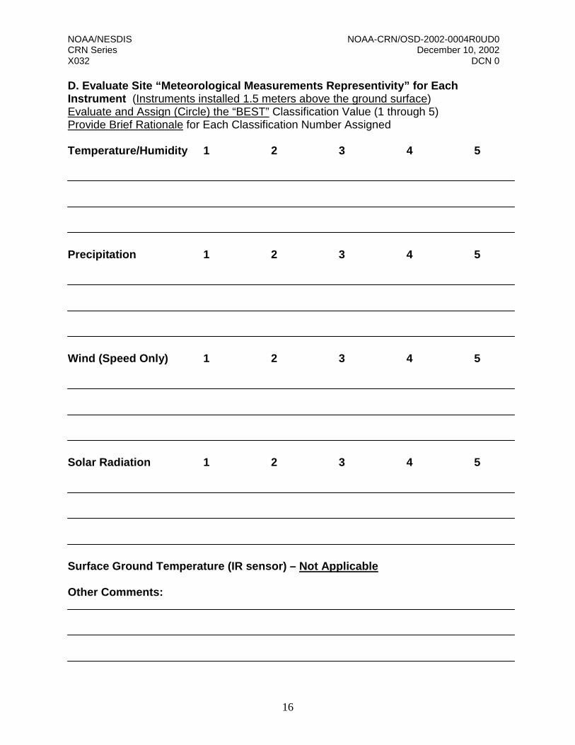
D. Evaluate Site “Meteorological Measurements Representivity” for Each Instrument (Instruments installed 1.5 meters above the ground surface) Evaluate and Assign (Circle) the “BEST” Classification Value (1 through 5) Provide Brief Rationale for Each Classification Number Assigned Temperature/Humidity 1 2 3 4 5 Precipitation 1 2 3 4 5 Wind (Speed Only) 1 2 3 4 5 Solar Radiation 1 2 3 4 5 Surface Ground Temperature (IR sensor) – Not Applicable Other Comments:
NOAA/NESDIS NOAA-CRN/OSD-2002-0004R0UD0 CRN Series December 10, 2002 X032 DCN 0
17
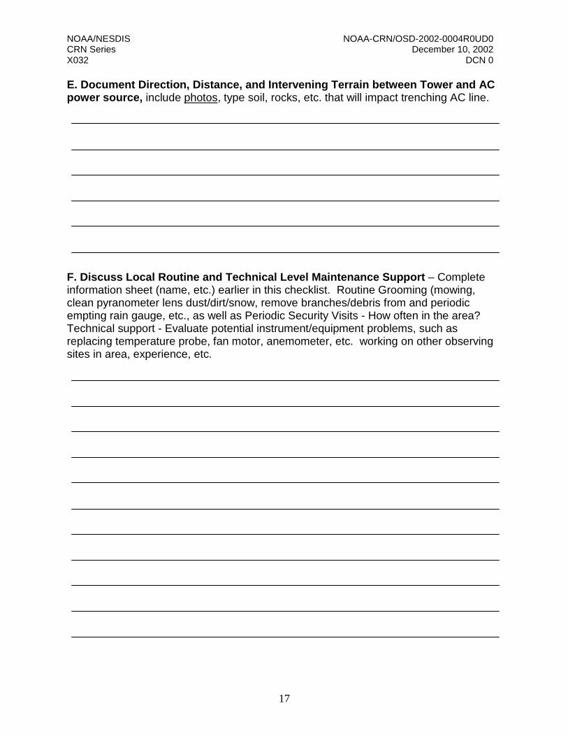
E. Document Direction, Distance, and Intervening Terrain between Tower and AC power source, include photos, type soil, rocks, etc. that will impact trenching AC line.
F. Discuss Local Routine and Technical Level Maintenance Support – Complete information sheet (name, etc.) earlier in this checklist. Routine Grooming (mowing, clean pyranometer lens dust/dirt/snow, remove branches/debris from and periodic empting rain gauge, etc., as well as Periodic Security Visits - How often in the area? Technical support - Evaluate potential instrument/equipment problems, such as replacing temperature probe, fan motor, anemometer, etc. working on other observing sites in area, experience, etc.
NOAA/NESDIS NOAA-CRN/OSD-2002-0004R0UD0 CRN Series December 10, 2002 X032 DCN 0
18
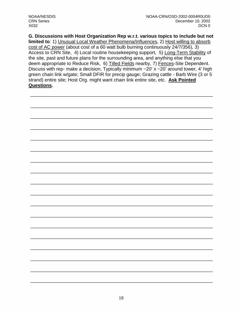
G. Discussions with Host Organization Rep w.r.t. various topics to include but not limited to: 1) Unusual Local Weather Phenomena/Influences, 2) Host willing to absorb cost of AC power (about cost of a 60 watt bulb burning continuously 24/7/356), 3) Access to CRN Site, 4) Local routine housekeeping support, 5) Long-Term Stability of the site, past and future plans for the surrounding area, and anything else that you deem appropriate to Reduce Risk, 6) Tilled Fields nearby, 7) Fences-Site Dependent. Discuss with rep- make a decision, Typically minimum ~20' x ~20’ around tower, 4’ high green chain link w/gate; Small DFIR for precip gauge; Grazing cattle - Barb Wire (3 or 5 strand) entire site; Host Org. might want chain link entire site, etc. Ask Pointed Questions.
NOAA/NESDIS NOAA-CRN/OSD-2002-0004R0UD0 CRN Series December 10, 2002 X032 DCN 0
19
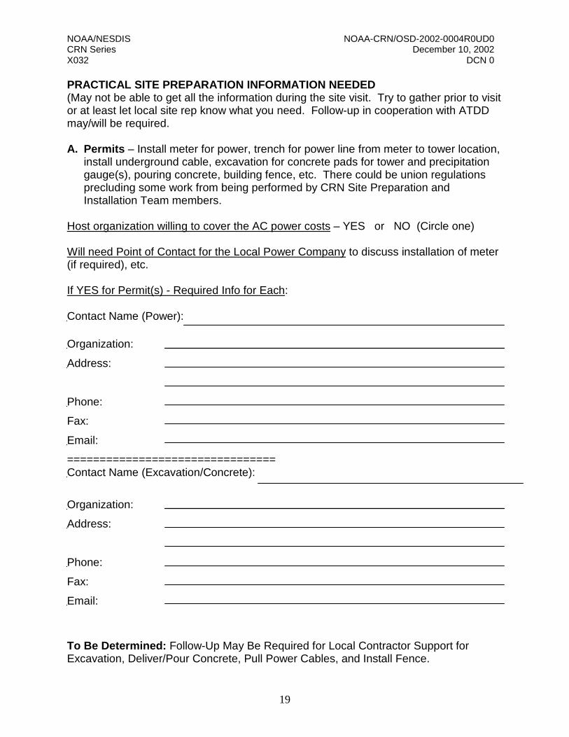
PRACTICAL SITE PREPARATION INFORMATION NEEDED (May not be able to get all the information during the site visit. Try to gather prior to visit or at least let local site rep know what you need. Follow-up in cooperation with ATDD may/will be required. A. Permits – Install meter for power, trench for power line from meter to tower location,
install underground cable, excavation for concrete pads for tower and precipitation gauge(s), pouring concrete, building fence, etc. There could be union regulations precluding some work from being performed by CRN Site Preparation and Installation Team members.
Host organization willing to cover the AC power costs – YES or NO (Circle one) Will need Point of Contact for the Local Power Company to discuss installation of meter (if required), etc. If YES for Permit(s) - Required Info for Each: Contact Name (Power):
Organization:
Address:
Phone:
Fax:
Email:
================================ Contact Name (Excavation/Concrete):
Organization:
Address:
Phone:
Fax:
Email:
To Be Determined: Follow-Up May Be Required for Local Contractor Support for Excavation, Deliver/Pour Concrete, Pull Power Cables, and Install Fence.

NOAA/NESDIS NOAA-CRN/OSD-2002-0004R0UD0 CRN Series December 10, 2002 X032 DCN 0
20
B. Climatological Summary Report – Currently prepared by Grant Goodge, CRN Program Office, National Climatic data center (NCDC), 828-271-4330, [email protected].
Please contact Grant as soon as you have identified a general geographic location and when specific site properties are identified. C. Other Useful Information to Consider and will eventually needed by the Site Preparation and Installation Team (if site approved for CRN) - How close can Trucks/Vehicles get to site for delivery of site equipment/instruments and building materials (concrete truck, fence material deliveries, etc.)
- Roads Nearest Tower location
- Contractor Information for: Excavation Concrete Delivery and pouring Electrical Work Fence Installation
- Driving/Airport Information to point closest to the site
- Local Hotel and Emergency Room/Hospital Locations (Name, Location, Phone Numbers, Web Sites)
- Directions from nearest town to the site
- Local truck rental name/location Miscellaneous Notes:
NOAA/NESDIS NOAA-CRN/OSD-2002-0004R0UD0 CRN Series December 10, 2002 X032 DCN 0
21
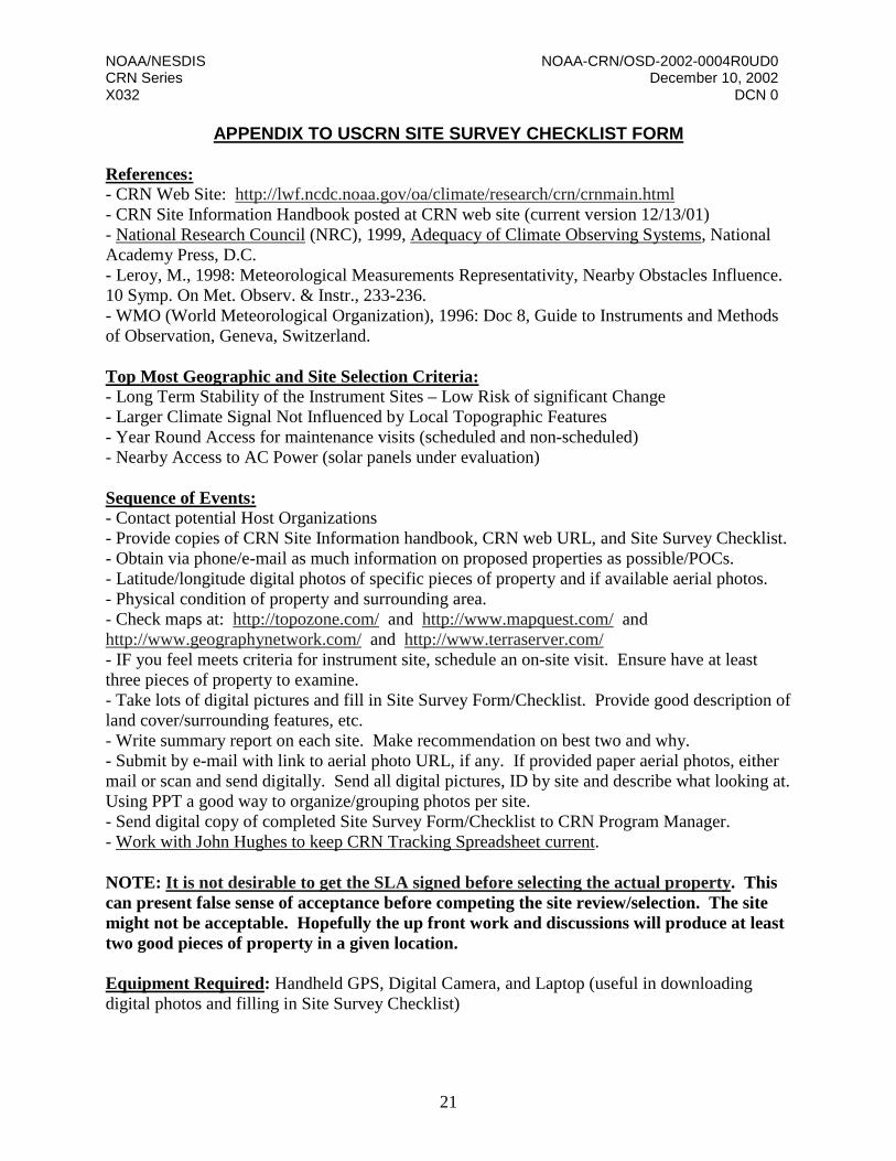
APPENDIX TO USCRN SITE SURVEY CHECKLIST FORM References: - CRN Web Site: http://lwf.ncdc.noaa.gov/oa/climate/research/crn/crnmain.html - CRN Site Information Handbook posted at CRN web site (current version 12/13/01) - National Research Council (NRC), 1999, Adequacy of Climate Observing Systems, National Academy Press, D.C. - Leroy, M., 1998: Meteorological Measurements Representativity, Nearby Obstacles Influence. 10 Symp. On Met. Observ. & Instr., 233-236. - WMO (World Meteorological Organization), 1996: Doc 8, Guide to Instruments and Methods of Observation, Geneva, Switzerland. Top Most Geographic and Site Selection Criteria: - Long Term Stability of the Instrument Sites – Low Risk of significant Change - Larger Climate Signal Not Influenced by Local Topographic Features - Year Round Access for maintenance visits (scheduled and non-scheduled) - Nearby Access to AC Power (solar panels under evaluation) Sequence of Events: - Contact potential Host Organizations - Provide copies of CRN Site Information handbook, CRN web URL, and Site Survey Checklist. - Obtain via phone/e-mail as much information on proposed properties as possible/POCs. - Latitude/longitude digital photos of specific pieces of property and if available aerial photos. - Physical condition of property and surrounding area. - Check maps at: http://topozone.com/ and http://www.mapquest.com/ and http://www.geographynetwork.com/ and http://www.terraserver.com/ - IF you feel meets criteria for instrument site, schedule an on-site visit. Ensure have at least three pieces of property to examine. - Take lots of digital pictures and fill in Site Survey Form/Checklist. Provide good description of land cover/surrounding features, etc. - Write summary report on each site. Make recommendation on best two and why. - Submit by e-mail with link to aerial photo URL, if any. If provided paper aerial photos, either mail or scan and send digitally. Send all digital pictures, ID by site and describe what looking at. Using PPT a good way to organize/grouping photos per site. - Send digital copy of completed Site Survey Form/Checklist to CRN Program Manager. - Work with John Hughes to keep CRN Tracking Spreadsheet current. NOTE: It is not desirable to get the SLA signed before selecting the actual property. This can present false sense of acceptance before competing the site review/selection. The site might not be acceptable. Hopefully the up front work and discussions will produce at least two good pieces of property in a given location. Equipment Required: Handheld GPS, Digital Camera, and Laptop (useful in downloading digital photos and filling in Site Survey Checklist)

NOAA/NESDIS NOAA-CRN/OSD-2002-0004R0UD0 CRN Series December 10, 2002 X032 DCN 0
22
Local Site Representativity Evaluation (Classification Scheme) Local environmental and nearby terrain factors have an influence on the "quality of a measurement." The selection of a CRN instrument site will be the result of a balance between competing demands, such as those highlighted above and an assessment of the “quality of measurements” guidelines outlined below. The most desirable local surrounding landscape is a relatively large and flat open area with low local vegetation in order that the sky view is unobstructed in all directions except at the lower angles of altitude above the horizon. No significant obstruction within 300 meters of the instrument tower. The area occupied by an individual instrument site is typically about 18 m x 18 m (~60 ft x ~60 ft). There will be many sites that are less than ideal. Selecting a site is a series of compromises between a number of factors. The CRN will use the classification scheme below to document the “meteorological measurements representativity” at each site. This scheme, described by Michel Leroy (1998), is being used by Meteo-France to classify their network of approximately 550 stations. The classification ranges from 1 to 5 for each measured parameter. The errors for the different classes are estimated values. Classification for Temperature and Humidity
Class 1: Flat and horizontal ground surrounded by a clear surface with a slope below 1/3 (<19 degrees). Grass/low vegetation ground cover <10 cm high. Sensors located at least 100 meters (m) from artificial heating or reflecting surfaces, such as buildings, concrete surfaces, and parking lots. Far from large bodies of water, except if it is representative of the area, and then located at least 100 meters away. No shading when the sun elevation >3 degrees. Class 2: Same as Class 1 with the following differences. Surrounding Vegetation <25 cm. Artificial heating sources within 30m. No shading for a sun elevation >5 degrees. Class 3 (error 1 C): Same as Class 2, except no artificial heating sources within 10m. Class 4 (error >/= 2 C): Artificial heating sources <10m. Class 5 (error >/= 5 C): Temperature sensor located next to/above an artificial heating source, such a building, roof top, parking lot, or concrete surface. b) Classification for Precipitation One factor to consider is an area surrounded by uniform obstacles of about the same height. Wind speed is a significant factor that affects the accuracy of measuring liquid and frozen precipitation. A wind shield can be placed around the gauge to improve the accuracy of the “catch.” CRN measure only wind speed (no direction) at a height of 1.5m, near the height of the gauge orifice.
Class 1: Flat horizontal ground surround by a cleared surface with a slope below 1/3 (<19 degrees). Any obstacle must be located at a distance of at least 4 times the height of the obstacle. An obstacle is an object seen from the precipitation gauge with an angular width of =/>10 degrees.
Class 2 (error 5%): Same as Class 1, except an obstacle is located at a distance of at least two (2) times its height.

NOAA/NESDIS NOAA-CRN/OSD-2002-0004R0UD0 CRN Series December 10, 2002 X032 DCN 0
23
Class 3 (error 10% to 20%): Ground with a slope below 1/2 (<30 degrees). Any obstacle is located at a distance of at least its height. Class 4 (error >20%): Ground with a slope >30 degrees. Obstacles located at a distance less than their height. Class 5 (error > 50%): Obstacles overhanging the gauge. c) Classification for Solar Radiation Class 1: Flat horizontal ground with a slope of the terrain <2 degrees. No obstacles within 100 meters. Class 2 (error 10%): Slope of the terrain <5 degrees. Obstacles within 100m and an angular height >7 degrees but <10 degrees. Class 3 (error 15%): Slope of the terrain <7 degrees. Obstacles within 100m and an angular height =/>10 degrees. Class 4 (error 20%): Obstructions that would obstruct a significant portion of direct radiation. Class 5 (error 30%): Obstacles overhanging the sensor or near a building. d) Classification for Wind Defined for wind sensor at a height of 10m. CRN measures wind speed only (no direction0 at a height of 1.5m. Class 1: Sensor located at a distance of at least ten (10) times the height of the obstacle (elevation angle <5.7 degrees). Object considered an obstacle if seen at angular width >10 degrees. Obstacle is below 5.5m height within a 150m radius and 7m within a 300m radius. Wind sensor located a minimum distance of 15 times the width of thin nearby obstacles (i.e. mast, tree with angular width <10 degrees). Surrounding terrain relief change </= 5m within a 300m radius. Class 2 (error 10%): Same as Class 1 except terrain change </= 5m within a 100m radius. Class 3 (error 20%): Same as Class 1 except no obstacles within five times the height of the nearby obstacles (elevation angle <11.3 degrees). Wind sensor located a minimum distance of 10 times the width of thin nearby obstacles. Terrain change </= 1m within a 10m radius. Class 4 (error 30%): Same as Class 3 except no obstacles within 2.5 times the height of the nearby obstacles (elevation angle <21.8 degrees). Class 5 (error >40%): Obstacles within 2.5 times the height of the nearby obstacles. Class 6 (error >50%): Obstacles with a height >10m, seen with an angular width greater than 60 degrees are within a 20m distance.

NOAA/NESDIS NOAA-CRN/OSD-2002-0004R0UD0 CRN Series December 10, 2002 X032 DCN 0
24
Other Important Information: How far away should a tilled field be from a USCRN instrument site? As a guide, land that will undergo periodic agricultural projects, such a regular tilling, etc., should be a minimum of 90 meters (~300 feet) from the proposed USCRN instrument site. Ideally, the distance should be 200 meters. In general, Agricultural Experimentation Sites and nearby land used for agricultural purposes should not be the first choice of a USCRN instrument site. Identification and selection of these type potential sites require close examination of the issues before committing to a Site Survey. National Parks, Botanical Gardens, as well as locations near other long term observing sites, such as LTER, PrimeNet, etc., should be considered first as prime candidates. Arboretums, Audubon, and Botanical Gardens might till land. Must ask the right questions and gage the situation. AC Power – How Far Is Too Far? - Distance between the AC source and the CRN instrument site should be as short as possible, typically <300 feet is preferred. However, in some cases the terrain between the AC source and the CRN site may be a more critical consideration of site acceptability than the distance factor. Currently one site has a run of 700 feet. The related cost of installation was driven much higher at this site. The longest run we can make from an AC source is 2,000 feet (less than 10 volt drop over length of power line). If the run were longer than 2,000 feet, a high voltage line and transformer would need to be used. This would have to be done by the electric company. The longest spool of 10-gauge wire typically comes in spools up to 1,000 feet. If the total distance (down power pole, across land, into CRN site terminal box) exceeds 1,000 feet, then there will be a need to come out of the ground to splice the wires. This presents a significant safety issue associated with bring the wire above ground and installing a junction box inside which the power cables are spliced together. CRN needs to avoid this situation. Fences - The size and type fence required will be Site Dependent. You and the Host Org. Rep. will need to make a decision. Need to know the Fence Requirement for Site Prep/Installation. In many cases, the CRN instrument suite will be in a relatively "secure" location. It is not possible to deter the determined trespasser, so no fence arrangement will be completely adequate. The objective of a fence is to provide a physical barrier, which makes a statement - please do not come closer or touch the equipment. Also, if the area is used for grazing, then perhaps a barbwire fence is needed to deter the animals, typically cattle and horses. Typically, the minimum CRN fence requirement is around the instrument tower. Usually ~20' x ~20’, chain link, green, four (4) feet high with a gate. In most cases, the Small DFIR fence should provide an adequate barrier around the precipitation gauge. Barbwire - If the area is used for grazing, then barbwire (three or five strand - ask host) around the entire 60' x 60' perimeter is recommended.
NOAA/NESDIS NOAA-CRN/OSD-2002-0004R0UD0 CRN Series December 10, 2002 X032 DCN 0
25
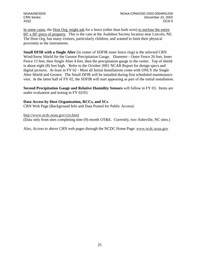
In some cases, the Host Org. might ask for a fence (other than barb wire) to enclose the entire 60’ x 60’ piece of property. This is the case at the Audubon Society location near Lincoln, NE. The Host Org. has many visitors, particularly children, and wanted to limit their physical proximity to the instruments. Small DFIR with a Single Alter (in center of SDFIR inner fence ring) is the selected CRN Wind/Snow Shield for the Geonor Precipitation Gauge. Diameter - Outer Fence 26 feet, Inner Fence 13 feet, then Single Alter 4 feet, then the precipitation gauge in the center. Top of shield is about eight (8) feet high. Refer to the October 2001 NCAR Report for design specs and digital pictures. At least in FY 02 - Most all Initial Installations come with ONLY the Single Alter Shield and Geonor. The Small DFIR will be installed during first scheduled maintenance visit. In the latter half of FY 02, the SDFIR will start appearing as part of the initial installation. Second Precipitation Gauge and Relative Humidity Sensors will follow in FY 03. Items are under evaluation and testing in FY 02/03. Data Access by Host Organization, RCCs, and SCs CRN Web Page (Background Info and Data Posted for Public Access): http://www.ncdc.noaa.gov/crn.html (Data only from sites completing nine (9) month OT&E. Currently, two Asheville, NC sites.) Also, Access to above CRN web pages through the NCDC Home Page: www.ncdc.noaa.gov
NOAA/NESDIS NOAA-CRN/OSD-2002-0004R0UD0 CRN Series December 10, 2002 X032 DCN 0
26
USCRN Site Survey Classification Scheme Location: ________________________ Date: ________________________ Surveyor: ______________________
Temperature & Humidity Classification / Classification Number
1 2 3 4 5
Distance from artificial heating sources and reflective surfaces (m)
≥300 12 pts ≥240<300 11 pts ≥100
<240 8 pts ≥50 <100 5 pts
<50 *
0 pts
Distance to large bodies of water (m) (When location near water is not representative of the area)
≥300 10 pts ≥240<300
9 pts ≥100<240
7 pts ≥50 <100
5 pts <50
* 0 pts
Surrounding vegetation height within 30 m radius (cm) ≤10 8 pts
>10 ≤25
7 pts >25
* 0 pts * 0 pts * 0 pts
Surrounding vegetation height (cm) within 30 to 100 m radius (75% or more coverage is in the range specified)
≤30 6 pts >30 ≥300 5 pts
>300 ≥600
3 pts >600
* 0 pts * 0 pts
Slope of cleared, flat ground surface within 30 m radius
≤8º 4 pts >8 º
≤15 º 3 pts >15º ≤ 23º 2 pts
>23° *
0 pts * 0 pts
Precipitation Classification / Classification Number 1 2 3 4 5
Distance to nearest obstacle with angular width > 10 deg (Distance to obstacle expressed as multiple of height of obstacle)
4 30 pts 2 20 pts 1 10 pts <1 *
0 pts * 0 pts
Wind Classification / Classification Number 1 2 3 4 5
Distance to nearest “significant” (angular width >10 deg.) obstacle, (m) (Expressed as multiple of obstacle height/angular height)
10/ ≤ 6°
7 pts 7/ > 6 ° ≤8°
4 pts
5/ >8 ≤ 11°
2 pts <5/
>11° *
0 * 0
Distance to “thin” (angular width <10 deg.) nearby obstacles (m) (Expressed as multiple of obstacle width)
15 4 pts 12 3 pts 10 1 pt <10
* 0 * 0
Surrounding terrain relief change (m) (Expressed as height difference within a radius around the site)
<5m/300 m
4 pts <5m/ 100 m
3 pts <1m/ 10 m 2 pts >1m/
10 m 1 pt * 0
Solar Radiation Classification / Classification Number 1 2 3 4 5
Angular height of Solar Horizon (degrees) (Average angular height throughout the sector from 60° to 300°)
≤7° 9 pts >7° to ≤10°
6 pts >10°
to ≥15°
3 pts >15°
* 0 * 0
Height of “significant” obstacles (angular width >10°, <20°) (Expressed as angular height to top of obstacle)
≤ 12°
6 pts
>12° ≤16°
4 pts
>16° ≤ 22°
2 pts
<10/
>22° *
0 * 0
Scores: Temperature& Relative Humidity: _______ Class: ___________ Total Score: ___________________
Precipitation: _______ Class: ___________
Wind: _______ Class: ___________ Station Class: _________________
Solar Radiation: _______ Class: ___________ Acceptable (circle one): Yes No

27
Appendix C. USCRN Site Approval Sheet This appendix contains the USCRN Site Approval Sheet (pages 27–30).

28
Date
DECISION PAPER
U. S. CLIMATE REFERENCE NETWORK (USCRN)
USCRN INSTRUMENT SITE APPROVAL
States briefed Decision: Review and Endorse the Site Review Committee Recommendations for the designated USCRN Instrument Sites. Background: Date of briefing, attendee names, sites briefed Detailed discussions

29
Date DECISION PAPER
U. S. CLIMATE REFERENCE NETWORK (USCRN)
USCRN INSTRUMENT SITE APPROVAL
States briefed Recommendations: The Site Review Committee endorses …site names(s) The Site Review Committee does not endorse…. site names(s) Decision for non-endorsement based on……. Name of approved site
Latitude North ……, Longitude West ……. elevation ……….. Description of site, surroundings, noted climatology, power, other observing sites. Looking North: Narrative of view/any obstruction etc Looking East: “ Looking South: “ Looking West “
(One for each approved site) APPROVE Sites as Recommended by the Committee: Thomas R. Karl, Director, National Climatic Data Center (Signature/Date)

30
Date
DECISION PAPER U. S. CLIMATE REFERENCE NETWORK (USCRN)
USCRN INSTRUMENT SITE APPROVAL
States briefed
Name of non-approved site
Latitude North …….Longitude West ………Elevation ……… Description of site, surroundings, noted climatology, power, other observing sites. Looking North: Narrative of view/any obstruction etc Looking East: “ Looking South: “ Looking West “ (One for each non-approved site)
Do Not Endorse/Do Not Approve Site per Committee Recommendation: Thomas R. Karl, Director, National Climatic Data Center (Signature/Date)

NOAA/NESDIS NOAA-CRN/OSD-2002-0004R0UD0 CRN Series December 10, 2002 X032 DCN 0
DL-1
Distribution List
Loc. No. Organization Name Address Copies
National Oceanic and Atmospheric Administration (NOAA)
Library and Floor Locations 001 NOAA OSD Library c/o Verna Cauley FB 4, Room 3307 1 344 NOAA NCDC Library c/o Debra Braun FED, Room 514, Asheville, NC 2
OSD 010 NOAA/OSD3 Richard G. Reynolds FB 4, Room 3308C 1 345 NOAA/OSD3 Richard Brooks FB 4, Room 3301D 1
NCDC 346 NOAA/CC11 Bruce Baker FED, Room 420, Asheville, NC 1 347 NOAA/CC21 Debra Braun FED, Room 514, Asheville, NC 1 348 NOAA/CC2 David Easterling FED, Room 516, Asheville, NC 1 349 NOAA/CC3 Michael Helfert FED, Room 468, Asheville, NC 1 350 NOAA/CC4 John Hughes FED, Room 420F, Asheville, NC 1 351 NOAA/CC Thomas Karl FED, Room 557C, Asheville, NC 1 352 NOAA/CC Sharon LeDuc FED, Room 557A, Asheville, NC 1 370 NOAA/NCDC Contractor Michael Changery NCDC, Asheville, NC 1
OAR 353 NOAA/ARL1 Ray Hosker P.O. Box 2456, Oak Ridge, TN 1 354 NOAA/ARL1 Tilden Meyers P.O. Box 2456, Oak Ridge, TN 1
NWS 355 NOAA/OST32 Doug Gifford SSMC2, Room 12110 1
NOAA / Computer Sciences Corporation (CSC) 094 NOAA/CSC – CMO Copy Kelly Coleman FB 4, Room 3317 1 096 NOAA/CSC Linwood Hegele FB 4, Room 3313 1 097 NOAA/CSC Wayne Taylor FB 4, Room 3311 1 098 NOAA/CSC – DCO Copy c/o Elizabeth Smith FB 4, Room 2326 2 101 NOAA/CSC Pong Yu FB 4, Room 3315 1 173 NOAA/CSC Kelly Coleman FB 4, Room 3317 1 205 NOAA/CSC Forrest Gray FB 4, Room 3315A 1 340 NOAA/CSC Rob Thornton FB 4, Room 2326E 1
NOAA / Short and Associates (S&A) 356 S&A Harold Bogin FB 4, Room 3010E 1 357 S&A James Bradley FB 4, Room 3010E 1 358 S&A Robert Embleton FB 4, Room 3010E 1 359 S&A Edwin Hiner FB 4, Room 3010E 1 360 S&A Edwin May FB 4, Room 3010E 1 363 S&A Steve Short FB 4, Room 3010E 1 364 S&A Michael Young FB 4, Room 3010E 1 375 S&A (at NCDC) Marjorie McGuirk Asheville, NC 1

NOAA/NESDIS NOAA-CRN/OSD-2002-0004R0UD0 CRN Series December 10, 2002 X032 DCN 0
DL-2
Loc. No. Organization Name Address Copies
Regional Climate Centers (RCCs)
365 Southeastern RCC Mike Janis Columbia, SC 1 366 High Plains RCC Ken Hubbard Lincoln, NB 1 367 Western RCC Kelly Redmond Reno, NV 1 368 Western RCC Dick Reinhardt Reno, NV 1
TOTAL 37