Embed Size (px)
Citation preview
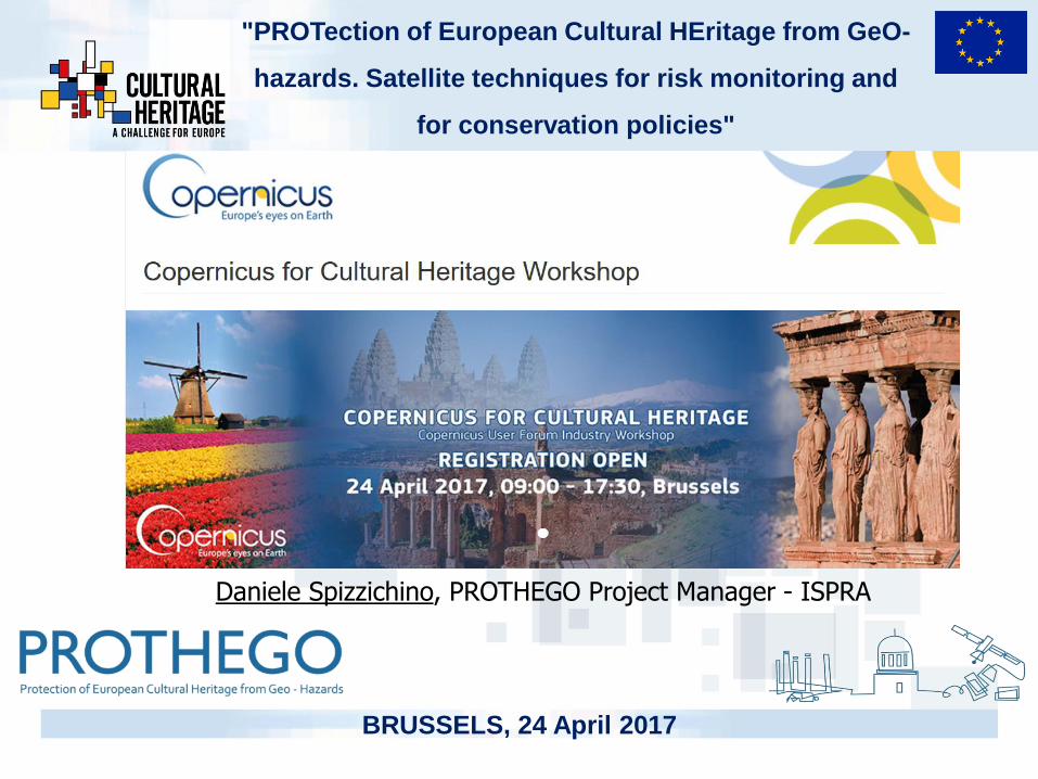
"PROTection of European Cultural HEritage from GeO-
hazards. Satellite techniques for risk monitoring and
for conservation policies"
BRUSSELS, 24 April 2017
Daniele Spizzichino, PROTHEGO Project Manager - ISPRA
2Copernicus for Cultural Heritage, Brussels, 24/04/2017
Daniele Spizzichino (ISPRA)
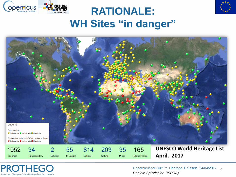
UNESCO World Heritage List April. 2017
RATIONALE:
WH Sites “in danger”
3Copernicus for Cultural Heritage, Brussels, 24/04/2017
Daniele Spizzichino (ISPRA)
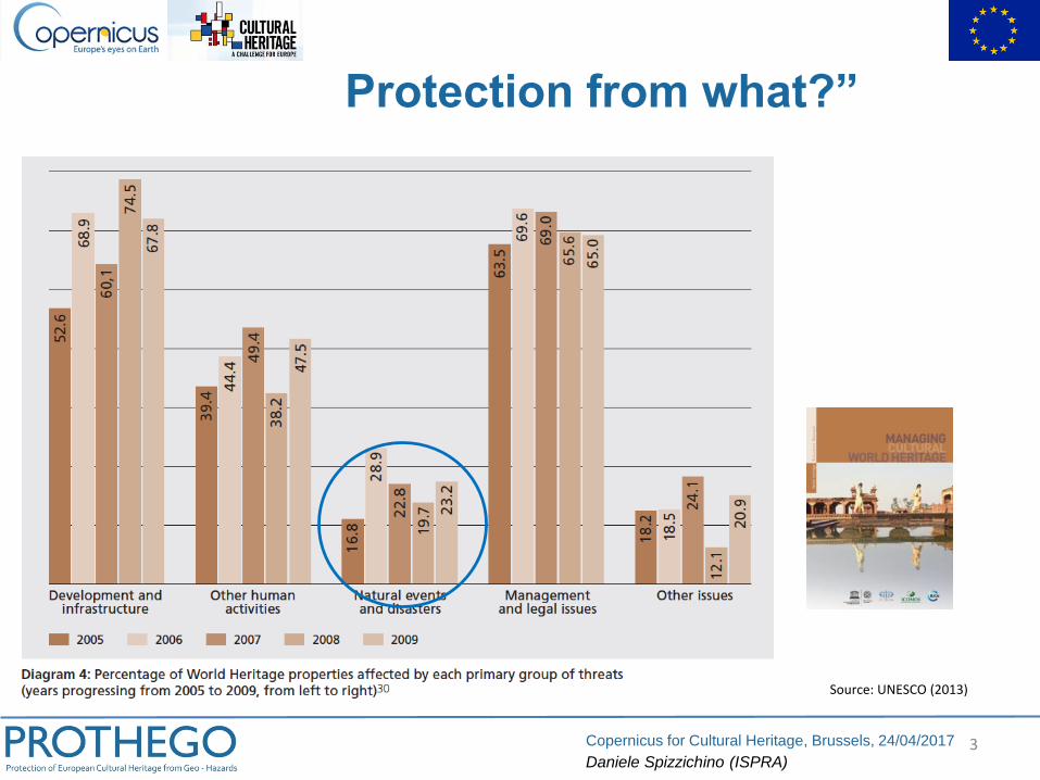
Source: UNESCO (2013)
Protection from what?”
4Copernicus for Cultural Heritage, Brussels, 24/04/2017
Daniele Spizzichino (ISPRA)
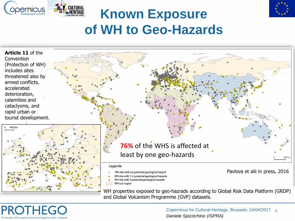
Pavlova et alii in press, 2016
WH properties exposed to geo-hazrads according to Global Risk Data Platform (GRDP) and Global Volcanism Programme (GVP) datasets.
Article 11 of the Convention (Protection of WH) includes sites threatened also by armed conflicts, accelerated deterioration, calamities and cataclysms, and rapid urban or tourist development.
76% of the WHS is affected at least by one geo-hazards
Known Exposure
of WH to Geo-Hazards
5Copernicus for Cultural Heritage, Brussels, 24/04/2017
Daniele Spizzichino (ISPRA)
Enviro
nm
enta
ldynam
ics
……
……
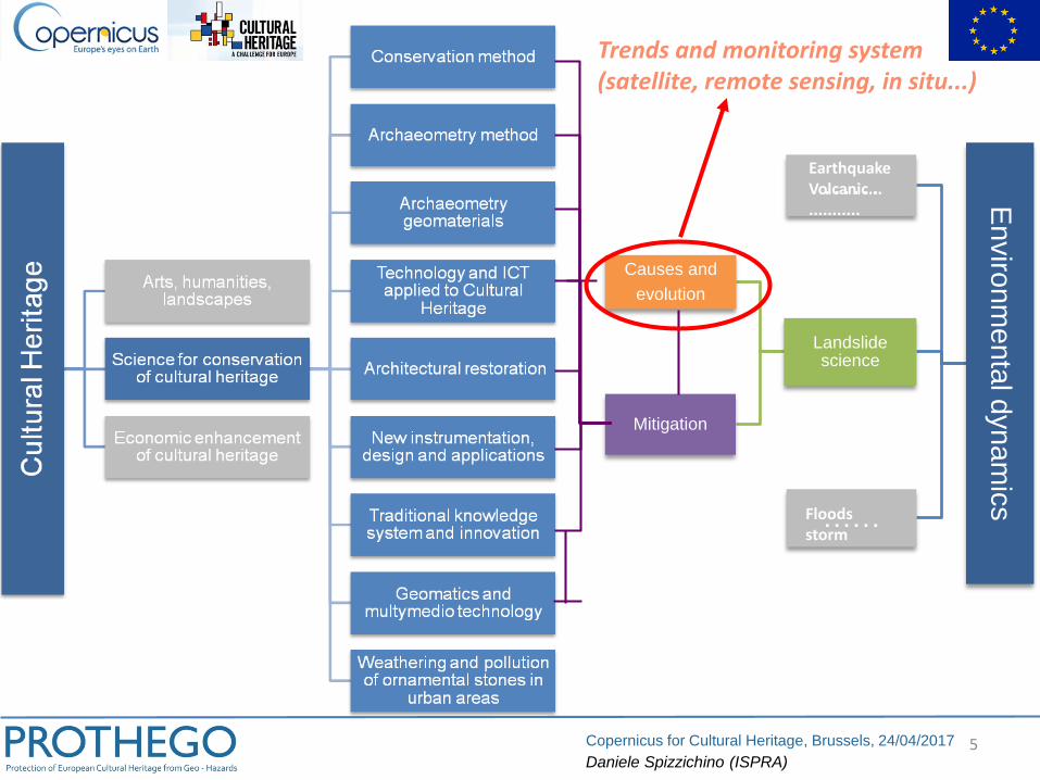
Landslidescience
Causes and
evolution
Mitigation
Trends and monitoring system(satellite, remote sensing, in situ...)
EarthquakeVolcanic..............
Floodsstorm
6Copernicus for Cultural Heritage, Brussels, 24/04/2017
Daniele Spizzichino (ISPRA)
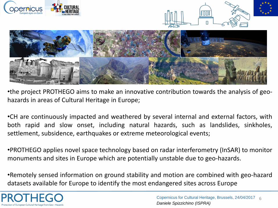
•the project PROTHEGO aims to make an innovative contribution towards the analysis of geo-hazards in areas of Cultural Heritage in Europe;
•CH are continuously impacted and weathered by several internal and external factors, withboth rapid and slow onset, including natural hazards, such as landslides, sinkholes,settlement, subsidence, earthquakes or extreme meteorological events;
•PROTHEGO applies novel space technology based on radar interferometry (InSAR) to monitormonuments and sites in Europe which are potentially unstable due to geo-hazards.
•Remotely sensed information on ground stability and motion are combined with geo-hazarddatasets available for Europe to identify the most endangered sites across Europe
7Copernicus for Cultural Heritage, Brussels, 24/04/2017
Daniele Spizzichino (ISPRA)
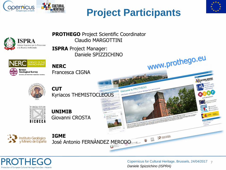
PROTHEGO Project Scientific CoordinatorClaudio MARGOTTINI
ISPRA Project Manager:Daniele SPIZZICHINO
NERCFrancesca CIGNA
CUTKyriacos THEMISTOCLEOUS
UNIMIBGiovanni CROSTA
IGMEJosé Antonio FERNÀNDEZ MERODO
Project Participants
8Copernicus for Cultural Heritage, Brussels, 24/04/2017
Daniele Spizzichino (ISPRA)
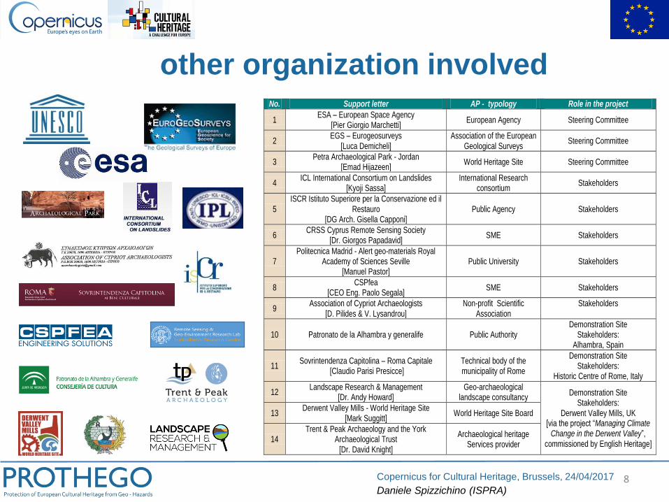
No. Support letter AP - typology Role in the project
1 ESA – European Space Agency
[Pier Giorgio Marchetti] European Agency Steering Committee
2 EGS – Eurogeosurveys
[Luca Demicheli] Association of the European
Geological Surveys Steering Committee
3 Petra Archaeological Park - Jordan
[Emad Hijazeen] World Heritage Site Steering Committee
4 ICL International Consortium on Landslides
[Kyoji Sassa] International Research
consortium Stakeholders
5 ISCR Istituto Superiore per la Conservazione ed il
Restauro [DG Arch. Gisella Capponi]
Public Agency Stakeholders
6 CRSS Cyprus Remote Sensing Society
[Dr. Giorgos Papadavid] SME Stakeholders
7 Politecnica Madrid - Alert geo-materials Royal
Academy of Sciences Seville [Manuel Pastor]
Public University Stakeholders
8 CSPfea
[CEO Eng. Paolo Segala] SME Stakeholders
9 Association of Cypriot Archaeologists
[D. Pilides & V. Lysandrou] Non-profit Scientific
Association Stakeholders
10 Patronato de la Alhambra y generalife Public Authority Demonstration Site
Stakeholders: Alhambra, Spain
11 Sovrintendenza Capitolina – Roma Capitale
[Claudio Parisi Presicce] Technical body of the municipality of Rome
Demonstration Site Stakeholders:
Historic Centre of Rome, Italy
12 Landscape Research & Management
[Dr. Andy Howard] Geo-archaeological
landscape consultancy Demonstration Site
Stakeholders: Derwent Valley Mills, UK
[via the project “Managing Climate Change in the Derwent Valley”,
commissioned by English Heritage]
13 Derwent Valley Mills - World Heritage Site
[Mark Suggitt] World Heritage Site Board
14 Trent & Peak Archaeology and the York
Archaeological Trust [Dr. David Knight]
Archaeological heritage Services provider
other organization involved
9Copernicus for Cultural Heritage, Brussels, 24/04/2017
Daniele Spizzichino (ISPRA)
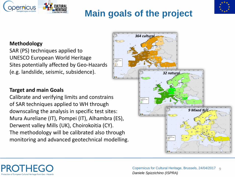
MethodologySAR (PS) techniques applied toUNESCO European World HeritageSites potentially affected by Geo-Hazards(e.g. landslide, seismic, subsidence).
Target and main GoalsCalibrate and verifying limits and constrainsof SAR techniques applied to WH throughdownscaling the analysis in specific test sites:Mura Aureliane (IT), Pompei (IT), Alhambra (ES),Derwent valley Mills (UK), Choirokoitia (CY).The methodology will be calibrated also throughmonitoring and advanced geotechnical modelling.
364 cultural
32 natural
9 Mixed N/C
Main goals of the project
10Copernicus for Cultural Heritage, Brussels, 24/04/2017
Daniele Spizzichino (ISPRA)
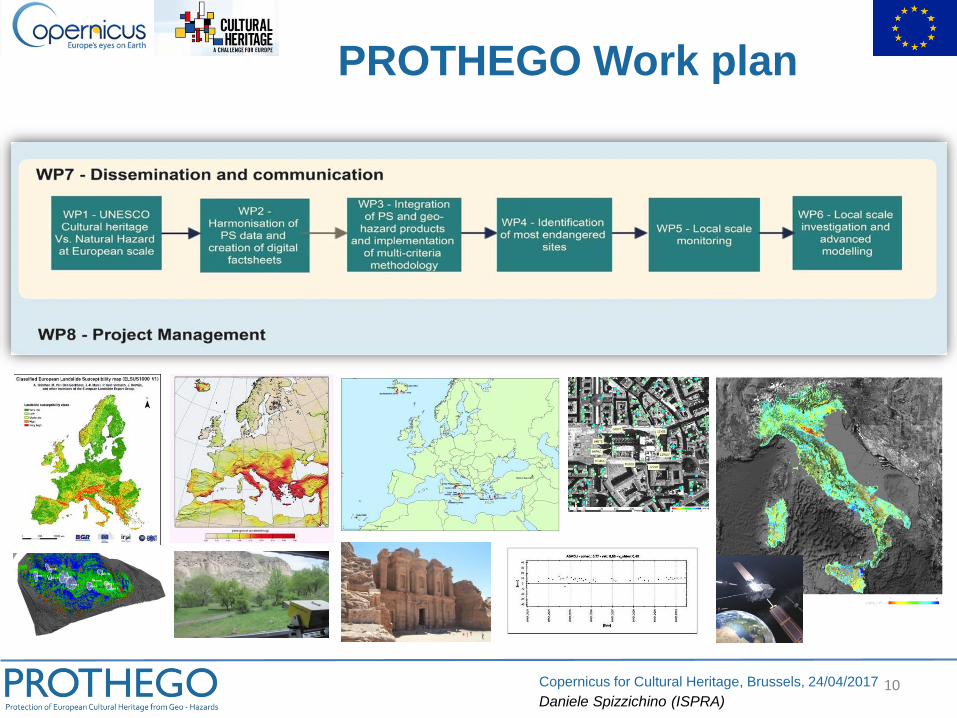
PROTHEGO Work plan
11Copernicus for Cultural Heritage, Brussels, 24/04/2017
Daniele Spizzichino (ISPRA)
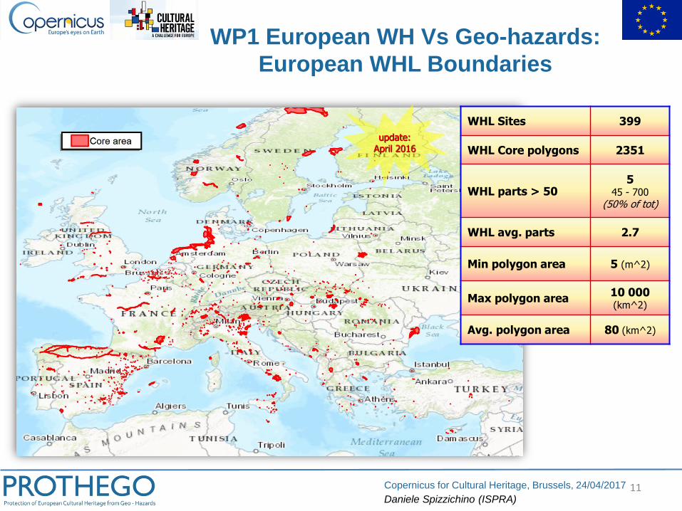
update:April 2016
WHL Sites 399
WHL Core polygons 2351
WHL parts > 505
45 - 700(50% of tot)
WHL avg. parts 2.7
Min polygon area 5 (m^2)
Max polygon area10 000(km^2)
Avg. polygon area 80 (km^2)
WP1 European WH Vs Geo-hazards:
European WHL Boundaries
12Copernicus for Cultural Heritage, Brussels, 24/04/2017
Daniele Spizzichino (ISPRA)
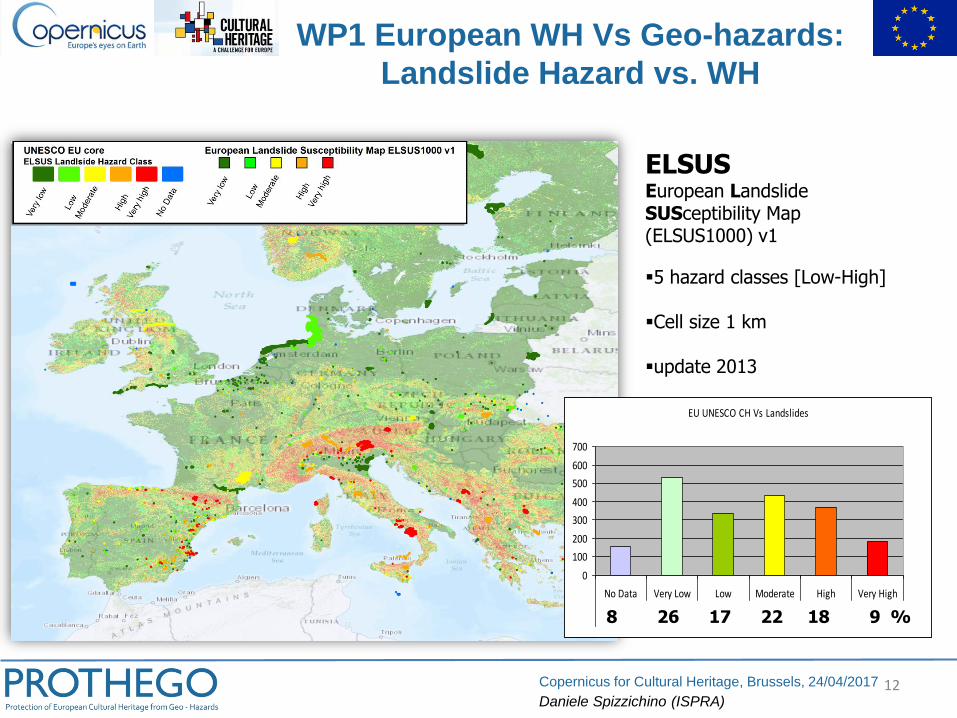
EU UNESCO CH Vs Landslides
0
100
200
300
400
500
600
700
No Data Very Low Low Moderate High Very High
7.6% 26.5% 16.7% 21.7% 18.4% 9.1%8 26 17 22 18 9 %
ELSUSEuropean LandslideSUSceptibility Map(ELSUS1000) v1
▪5 hazard classes [Low-High]
▪Cell size 1 km
▪update 2013
WP1 European WH Vs Geo-hazards:
Landslide Hazard vs. WH
13Copernicus for Cultural Heritage, Brussels, 24/04/2017
Daniele Spizzichino (ISPRA)
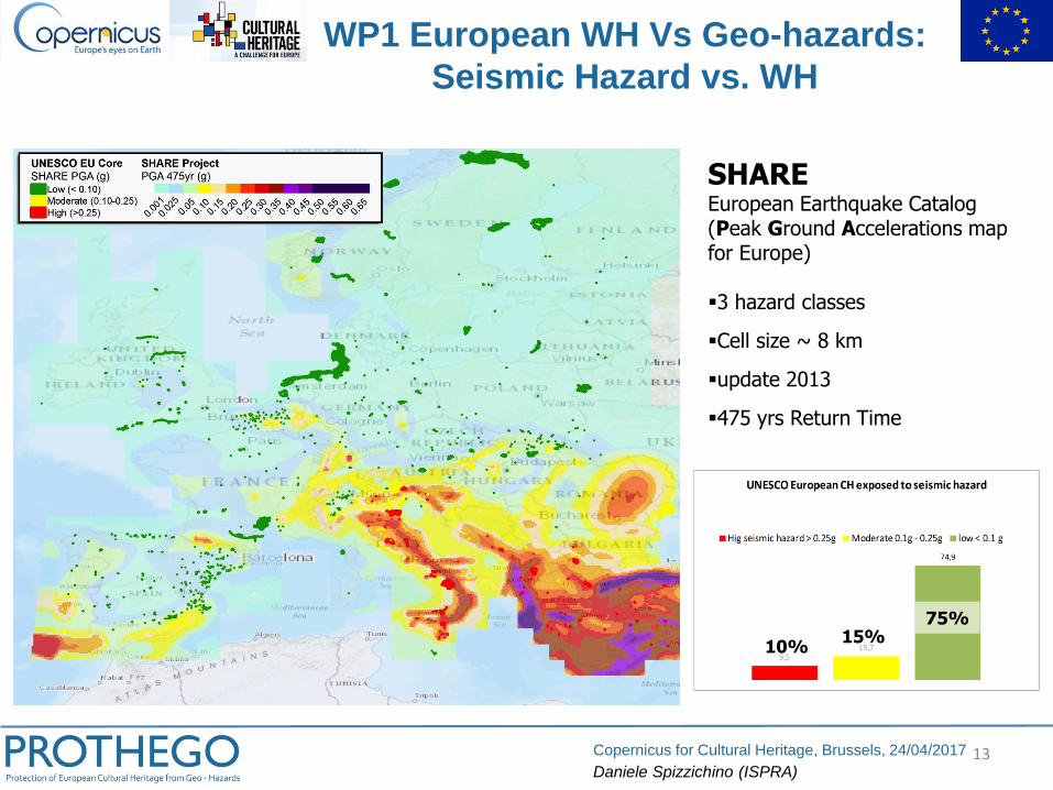
10%15%
75%
SHAREEuropean Earthquake Catalog(Peak Ground Accelerations map for Europe)
▪3 hazard classes
▪Cell size ~ 8 km
▪update 2013
▪475 yrs Return Time
WP1 European WH Vs Geo-hazards:
Seismic Hazard vs. WH
14Copernicus for Cultural Heritage, Brussels, 24/04/2017
Daniele Spizzichino (ISPRA)
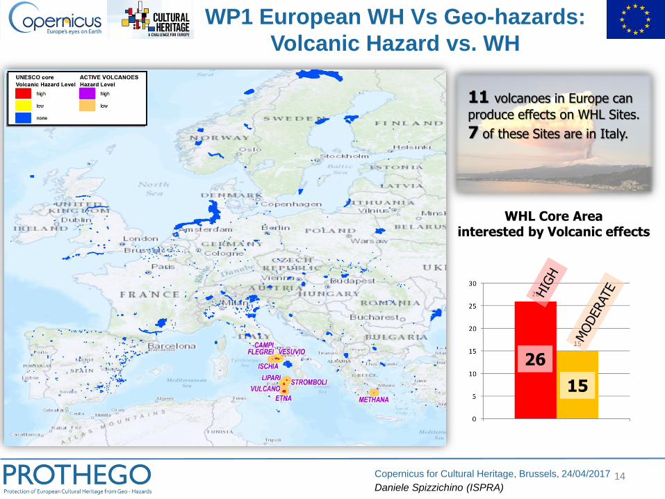
WP1 European WH Vs Geo-hazards:
Volcanic Hazard vs. WH
26
15
WHL Core Areainterested by Volcanic effects
11 volcanoes in Europe can
produce effects on WHL Sites.
7 of these Sites are in Italy.
15Copernicus for Cultural Heritage, Brussels, 24/04/2017
Daniele Spizzichino (ISPRA)
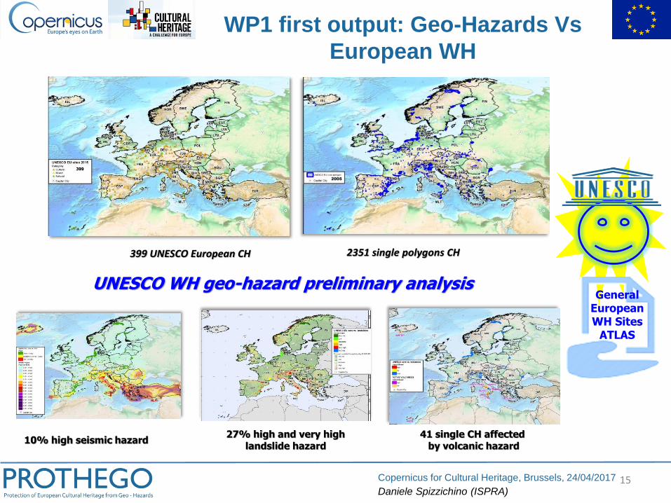
10% high seismic hazard
399 UNESCO European CH 2351 single polygons CH
27% high and very highlandslide hazard
UNESCO WH geo-hazard preliminary analysis
41 single CH affected by volcanic hazard
General European WH Sites
ATLAS
WP1 first output: Geo-Hazards Vs
European WH
16Copernicus for Cultural Heritage, Brussels, 24/04/2017
Daniele Spizzichino (ISPRA)
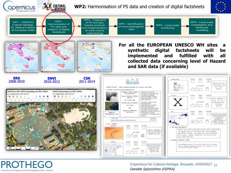
WP2: Harmonisation of PS data and creation of digital factsheets
ERS2008-2010
ENVI2010-2012
CSK2011-2014
For all the EUROPEAN UNESCO WH sites asynthetic digital factsheets will beimplemented and fulfilled with allcollected data concerning level of Hazardand SAR data (if available)
17Copernicus for Cultural Heritage, Brussels, 24/04/2017
Daniele Spizzichino (ISPRA)
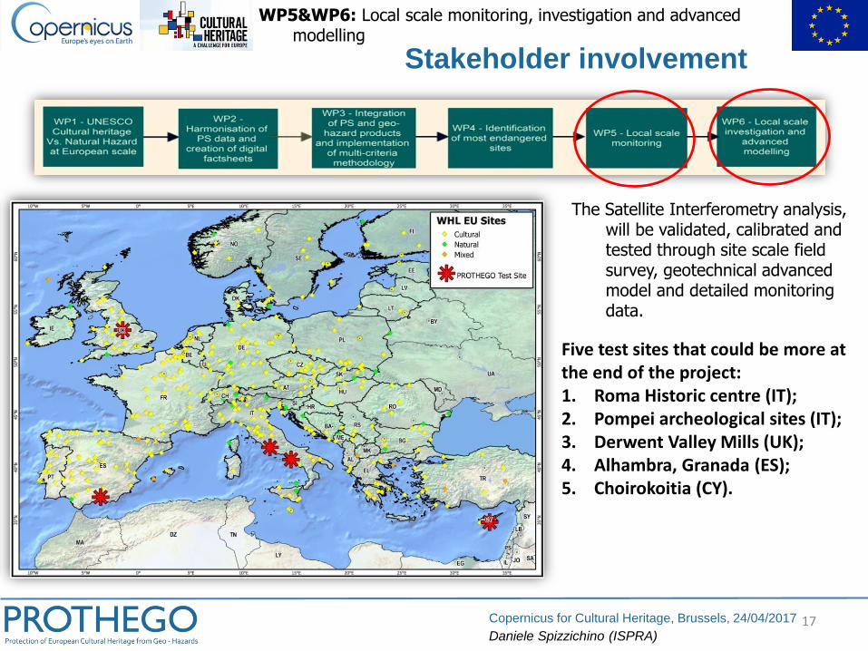
The Satellite Interferometry analysis, will be validated, calibrated and tested through site scale field survey, geotechnical advanced model and detailed monitoring data.
Stakeholder involvement
WP5&WP6: Local scale monitoring, investigation and advanced modelling
Five test sites that could be more at the end of the project:1. Roma Historic centre (IT);2. Pompei archeological sites (IT);3. Derwent Valley Mills (UK);4. Alhambra, Granada (ES);5. Choirokoitia (CY).

18Copernicus for Cultural Heritage, Brussels, 24/04/2017
Daniele Spizzichino (ISPRA)
▪ Text text text... [Arial 18pt]
CITY WALLS
PS ANALYSIS HAZARD
TYPOLOGY
Test Site 1
Rome Historic centre (IT)
19Copernicus for Cultural Heritage, Brussels, 24/04/2017
Daniele Spizzichino (ISPRA)
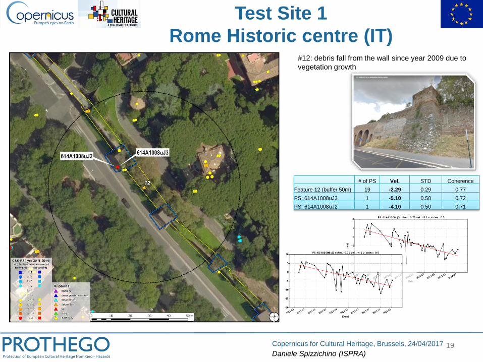
Test Site 1
Rome Historic centre (IT)#12: debris fall from the wall since year 2009 due to
vegetation growth
# of PS Vel. STD Coherence
Feature 12 (buffer 50m) 19 -2.29 0.29 0.77
PS: 614A1008uJ3 1 -5.10 0.50 0.72
PS: 614A1008uJ2 1 -4.10 0.50 0.71
20Copernicus for Cultural Heritage, Brussels, 24/04/2017
Daniele Spizzichino (ISPRA)
Domus Gladiatori NecropoliPorta
Nocera
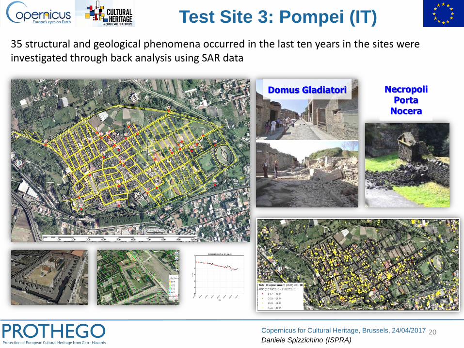
Test Site 3: Pompei (IT)
35 structural and geological phenomena occurred in the last ten years in the sites were investigated through back analysis using SAR data
21Copernicus for Cultural Heritage, Brussels, 24/04/2017
Daniele Spizzichino (ISPRA)
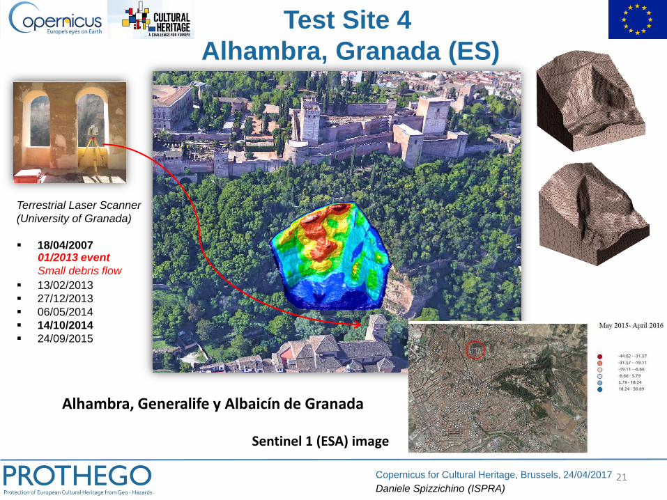
Terrestrial Laser Scanner
(University of Granada)
▪ 18/04/2007
▪ 13/02/2013
▪ 27/12/2013
▪ 06/05/2014
▪ 14/10/2014
▪ 24/09/2015
01/2013 event
Small debris flow
Test Site 4
Alhambra, Granada (ES)
Sentinel 1 (ESA) image
Alhambra, Generalife y Albaicín de Granada
22Copernicus for Cultural Heritage, Brussels, 24/04/2017
Daniele Spizzichino (ISPRA)
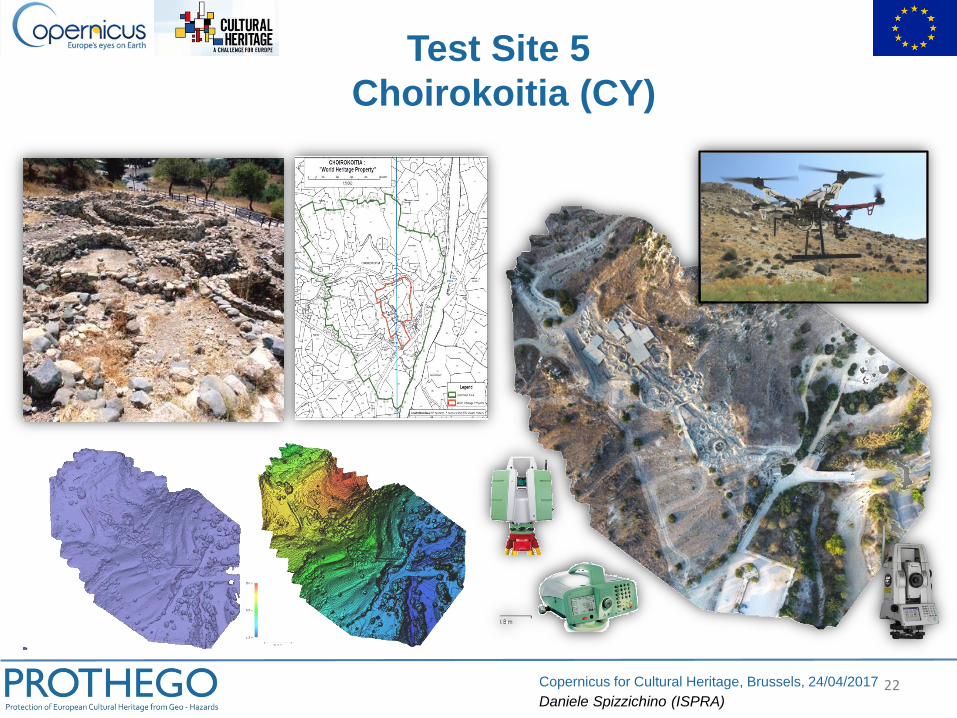
Test Site 5
Choirokoitia (CY)
23Copernicus for Cultural Heritage, Brussels, 24/04/2017
Daniele Spizzichino (ISPRA)
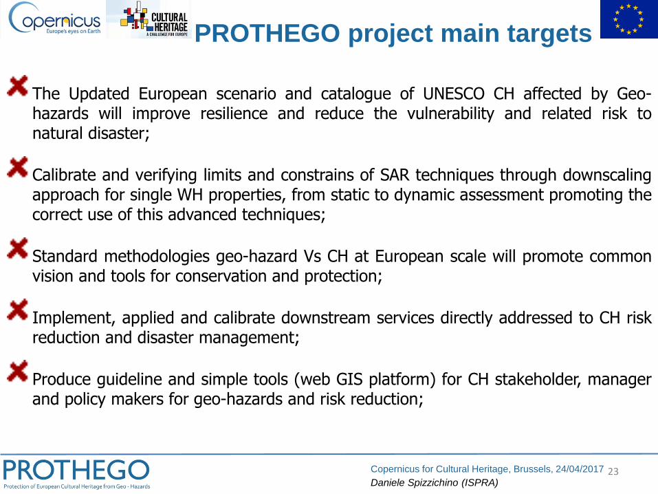
The Updated European scenario and catalogue of UNESCO CH affected by Geo-hazards will improve resilience and reduce the vulnerability and related risk tonatural disaster;
Calibrate and verifying limits and constrains of SAR techniques through downscalingapproach for single WH properties, from static to dynamic assessment promoting thecorrect use of this advanced techniques;
Standard methodologies geo-hazard Vs CH at European scale will promote commonvision and tools for conservation and protection;
Implement, applied and calibrate downstream services directly addressed to CH riskreduction and disaster management;
Produce guideline and simple tools (web GIS platform) for CH stakeholder, managerand policy makers for geo-hazards and risk reduction;
PROTHEGO project main targets
24Copernicus for Cultural Heritage, Brussels, 24/04/2017
Daniele Spizzichino (ISPRA)
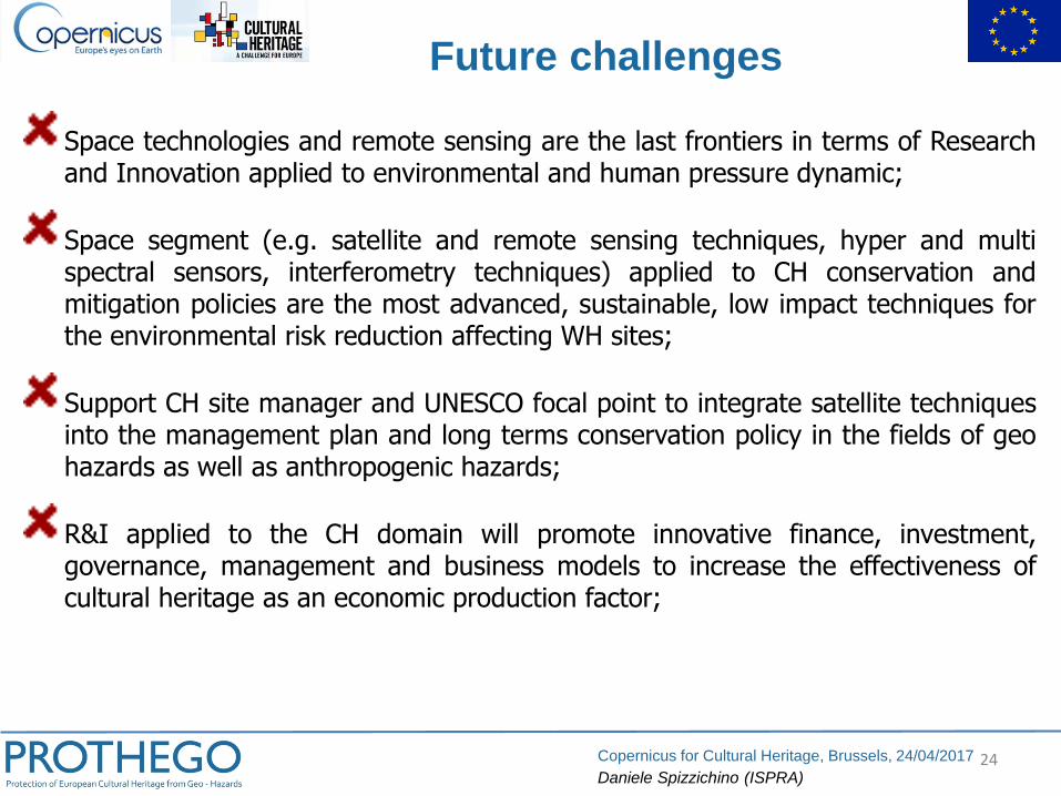
Space technologies and remote sensing are the last frontiers in terms of Researchand Innovation applied to environmental and human pressure dynamic;
Space segment (e.g. satellite and remote sensing techniques, hyper and multispectral sensors, interferometry techniques) applied to CH conservation andmitigation policies are the most advanced, sustainable, low impact techniques forthe environmental risk reduction affecting WH sites;
Support CH site manager and UNESCO focal point to integrate satellite techniquesinto the management plan and long terms conservation policy in the fields of geohazards as well as anthropogenic hazards;
R&I applied to the CH domain will promote innovative finance, investment,governance, management and business models to increase the effectiveness ofcultural heritage as an economic production factor;
Future challenges
25Copernicus for Cultural Heritage, Brussels, 24/04/2017
Daniele Spizzichino (ISPRA)
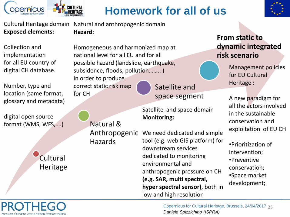
Homework for all of us
Cultural Heritage
Natural & Anthropogenic Hazards
Satellite and space segment
From static to dynamic integrated risk scenario
Cultural Heritage domainExposed elements:
Collection and implementationfor all EU country of digital CH database.
Number, type and location (same format, glossary and metadata)
digital open source format (WMS, WFS,….)
Natural and anthropogenic domainHazard:
Homogeneous and harmonized map at national level for all EU and for all possible hazard (landslide, earthquake, subsidence, floods, pollution…….. )in order to produce correct static risk mapfor CH
Satellite and space domainMonitoring:
We need dedicated and simple tool (e.g. web GIS platform) for downstream services dedicated to monitoring environmental and anthropogenic pressure on CH (e.g. SAR, multi spectral, hyper spectral sensor), both in low and high resolution
Management policies for EU Cultural Heritage :
A new paradigm for all the actors involved in the sustainable conservation and exploitation of EU CH
•Prioritization of intervention;•Preventive conservation;•Space market development;