Embed Size (px)
Citation preview
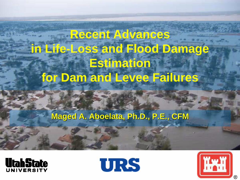
Maged A. Aboelata, Ph.D., P.E., CFM
Recent Advances
in Life-Loss and Flood Damage
Estimation
for Dam and Levee Failures
Presentation Outline
Why estimate life loss?
LIFESim and HEC-FIA Methodologies
Similarities and differences
Future Development
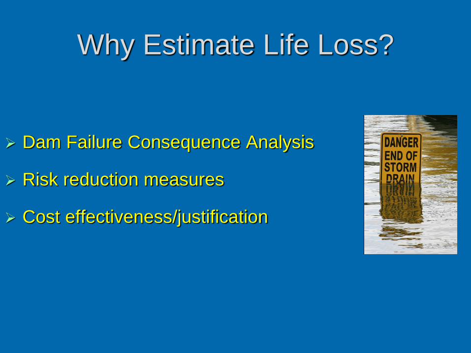
Why Estimate Life Loss?
Dam Failure Consequence Analysis
Risk reduction measures
Cost effectiveness/justification
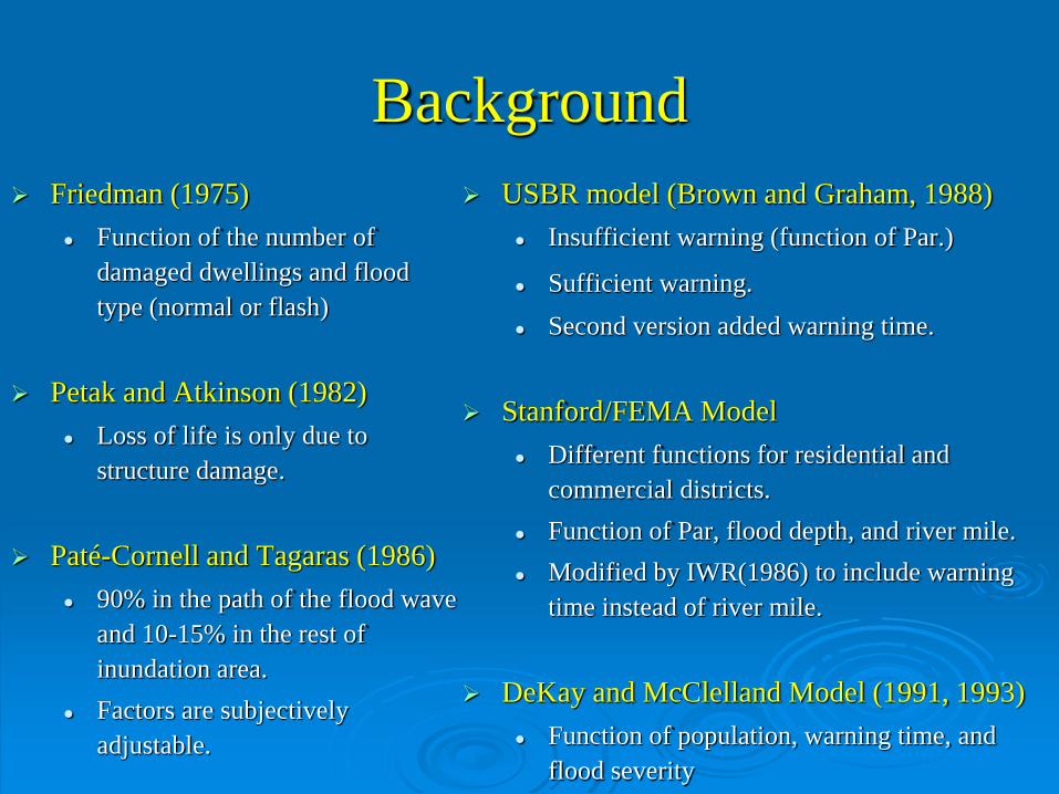
Background
Friedman (1975)
Function of the number of
damaged dwellings and flood
type (normal or flash)
Petak and Atkinson (1982)
Loss of life is only due to
structure damage.
Paté-Cornell and Tagaras (1986)
90% in the path of the flood wave
and 10-15% in the rest of
inundation area.
Factors are subjectively
adjustable.
USBR model (Brown and Graham, 1988)
Insufficient warning (function of Par.)
Sufficient warning.
Second version added warning time.
Stanford/FEMA Model
Different functions for residential and
commercial districts.
Function of Par, flood depth, and river mile.
Modified by IWR(1986) to include warning
time instead of river mile.
DeKay and McClelland Model (1991, 1993)
Function of population, warning time, and
flood severity
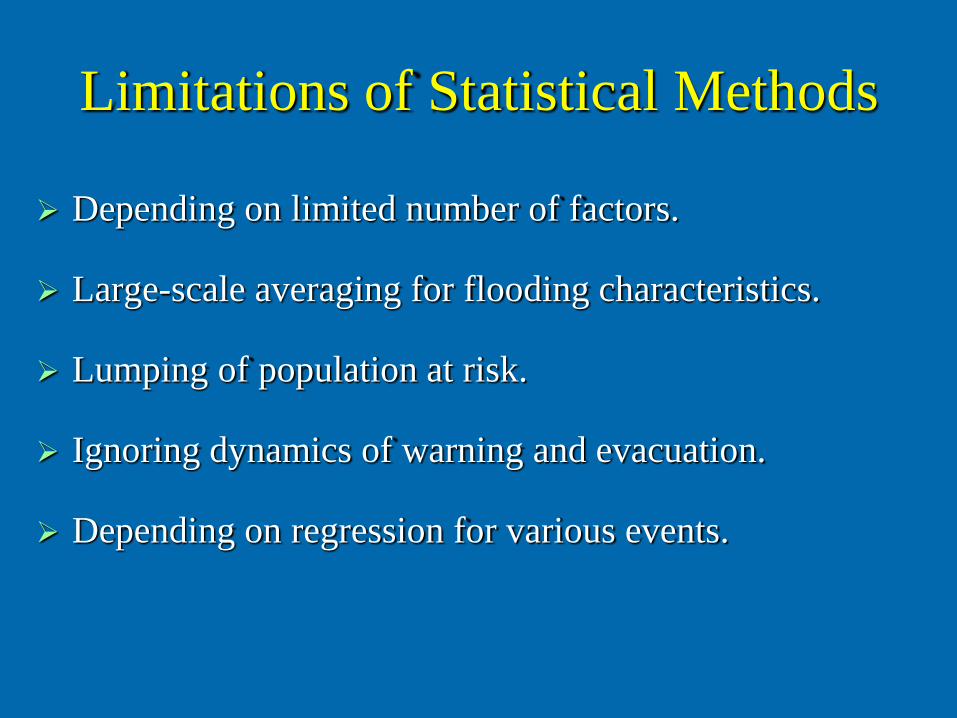
Limitations of Statistical Methods
Depending on limited number of factors.
Large-scale averaging for flooding characteristics.
Lumping of population at risk.
Ignoring dynamics of warning and evacuation.
Depending on regression for various events.
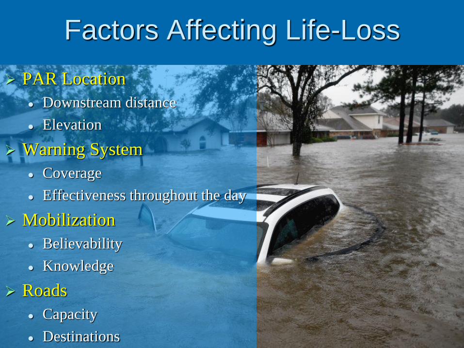
Factors Affecting Life-Loss
PAR Location
Downstream distance
Elevation
Warning System
Coverage
Effectiveness throughout the day
Mobilization
Believability
Knowledge
Roads
Capacity
Destinations
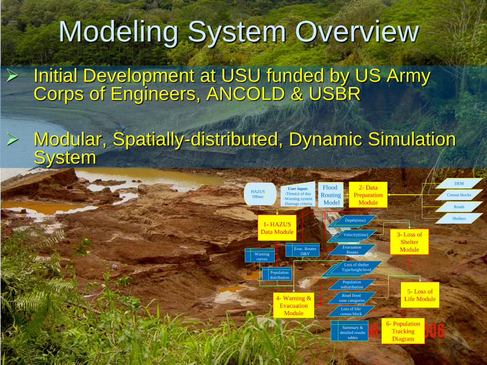
Modeling System Overview
Initial Development at USU funded by US Army Corps of Engineers, ANCOLD & USBR
Modular, Spatially-distributed, Dynamic Simulation System
Flood
Routing
Model
4- Warning &
Evacuation
Module
Depth(time)Depth(time)
Evacuation
Routes
Population
redistribution
Road flood
zone categories
Loss of life/
census block
Census blocks
DEM
Velocity(time)Velocity(time)
Loss of shelter
Type/height/level
Loss of shelter
Type/height/level
Roads
Shelters
3- Loss of
Shelter
Module
5- Loss of
Life Module
1- HAZUS
Data Module
2- Data
Preparation
Module
6- Population
Tracking
Diagram
Population
distribution
Warning
curves
Evac. Routes
D&V
HAZUS
DBase
User input:
-Time(s) of day
-Warning system
-Damage criteria
Summary &
detailed results
tables
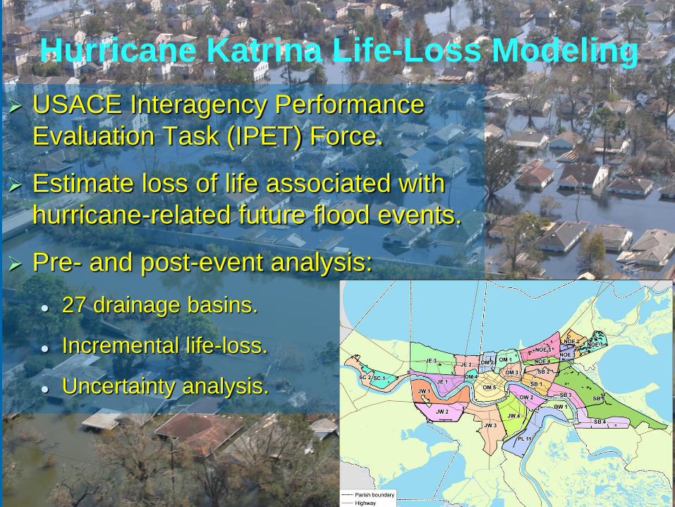
Hurricane Katrina Life-Loss Modeling
USACE Interagency Performance
Evaluation Task (IPET) Force.
Estimate loss of life associated with
hurricane-related future flood events.
Pre- and post-event analysis:
27 drainage basins.
Incremental life-loss.
Uncertainty analysis.
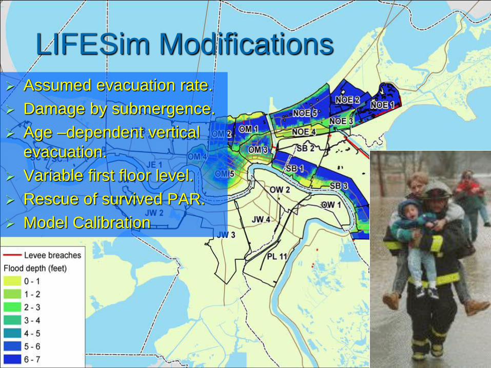
LIFESim Modifications
Assumed evacuation rate.
Damage by submergence.
Age –dependent vertical
evacuation.
Variable first floor level.
Rescue of survived PAR.
Model Calibration
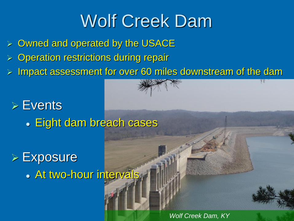
Wolf Creek Dam
Events
Eight dam breach cases
Exposure
At two-hour intervals
Owned and operated by the USACE
Operation restrictions during repair
Impact assessment for over 60 miles downstream of the dam
Wolf Creek Dam, KY
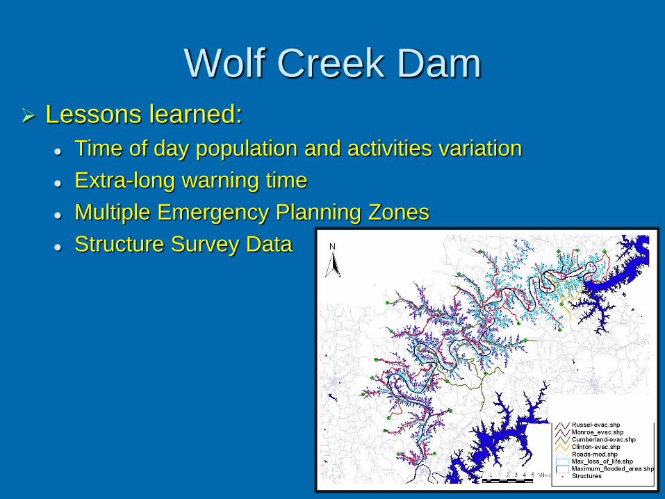
Wolf Creek Dam Lessons learned:
Time of day population and activities variation
Extra-long warning time
Multiple Emergency Planning Zones
Structure Survey Data
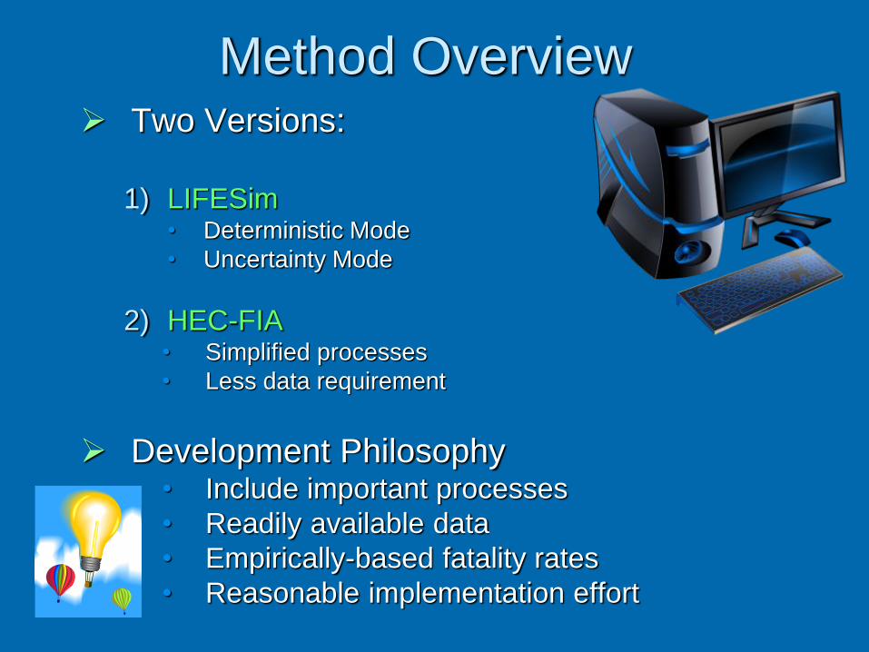
Method Overview Two Versions:
1) LIFESim• Deterministic Mode
• Uncertainty Mode
2) HEC-FIA• Simplified processes
• Less data requirement
Development Philosophy• Include important processes
• Readily available data
• Empirically-based fatality rates
• Reasonable implementation effort
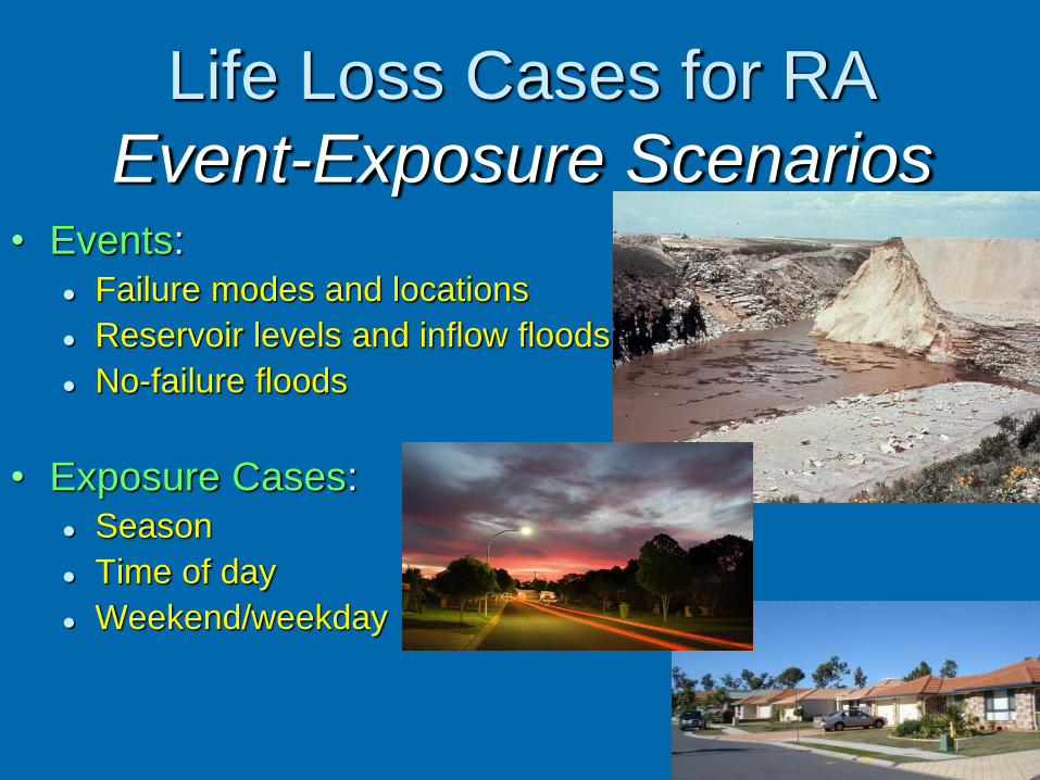
Life Loss Cases for RA
Event-Exposure Scenarios• Events:
Failure modes and locations
Reservoir levels and inflow floods
No-failure floods
• Exposure Cases: Season
Time of day
Weekend/weekday
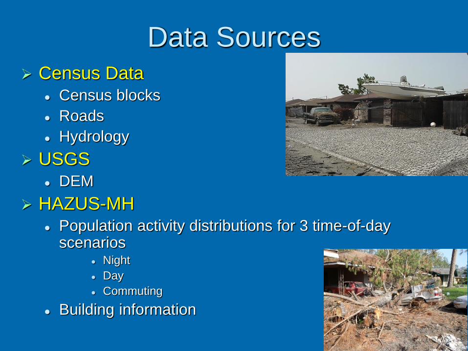
Data Sources Census Data
Census blocks
Roads
Hydrology
USGS DEM
HAZUS-MH Population activity distributions for 3 time-of-day
scenarios Night
Day
Commuting
Building information
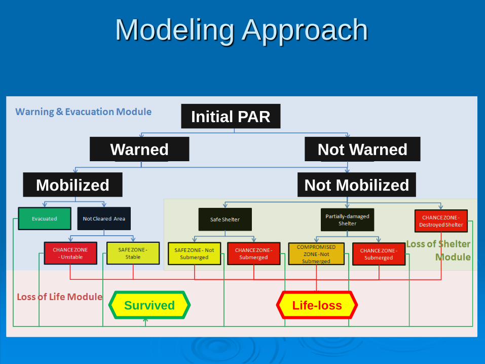
Modeling Approach
Initial PAR
Not MobilizedMobilized
Not WarnedWarned
Survived Life-loss
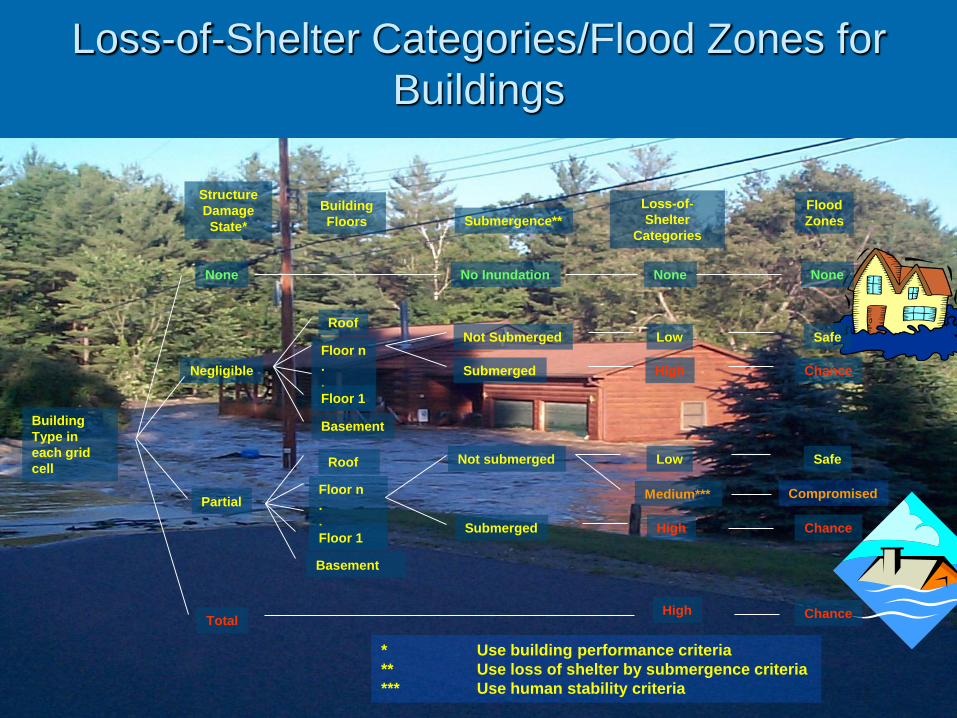
Loss-of-Shelter Categories/Flood Zones for
Buildings
Submerged
Building
Type in
each grid
cell
Roof
Structure
Damage
State*
Floor n
.
.
Basement
Floor 1
Total
Loss-of-
Shelter
Categories
Negligible
Not Submerged
High
Low Safe
Chance
Submergence**Building
Floors
Partial
Submerged
Not submerged
High
Low Safe
Chance
Chance
Medium*** Compromised
Flood
Zones
Roof
Floor n
.
.
Basement
Floor 1
* Use building performance criteria
** Use loss of shelter by submergence criteria
*** Use human stability criteria
None No Inundation None None
High
Distance
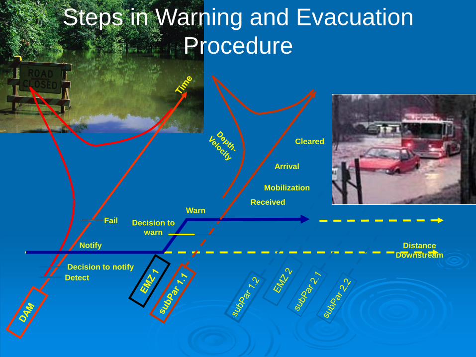
Downstream
Decision to notify
Detect
Fail
Notify
Warn
Mobilization
Received
Decision to
warn
Cleared
Arrival
Steps in Warning and Evacuation
Procedure
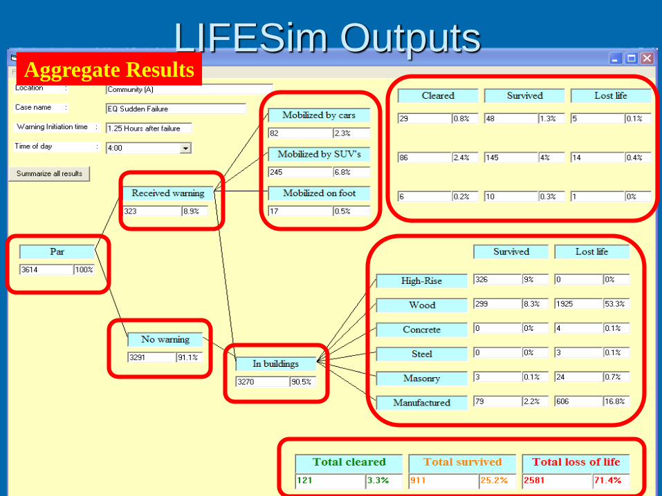
LIFESim OutputsAggregate Results
LIFESim Outputs
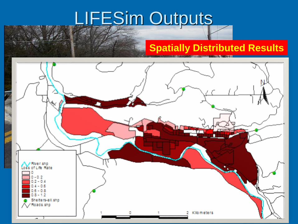
Spatially Distributed Results
0
0.1
0.2
0.3
0.4
0.5
0.6
0.7
0.8
0.9
1
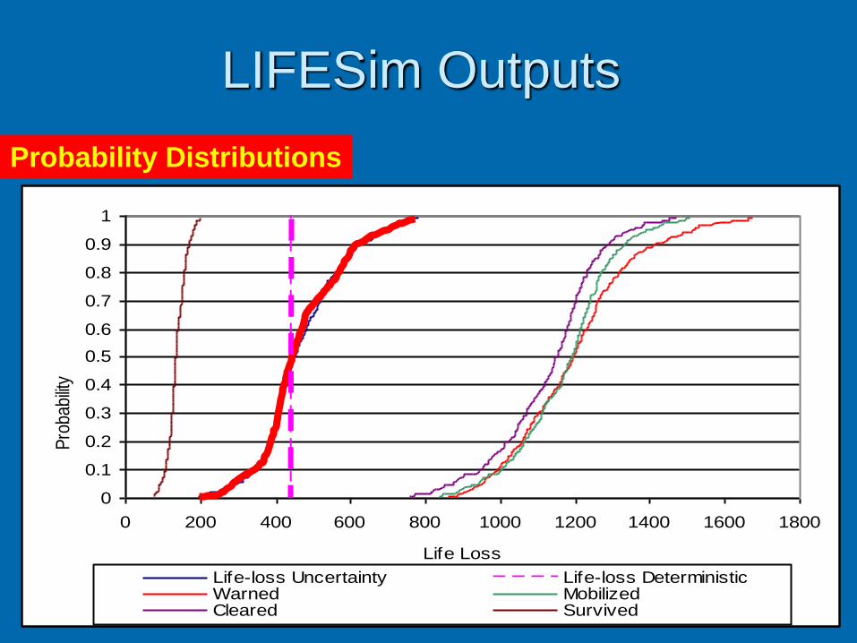
0 200 400 600 800 1000 1200 1400 1600 1800
Life Loss
Pro
babi
lity
of E
xcee
danc
e
Life-loss Uncertainty Life-loss DeterministicWarned MobilizedCleared Survived
LIFESim Outputs
Probability Distributions
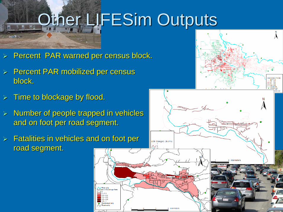
Other LIFESim Outputs
Percent PAR warned per census block.
Percent PAR mobilized per census
block.
Time to blockage by flood.
Number of people trapped in vehicles
and on foot per road segment.
Fatalities in vehicles and on foot per
road segment.
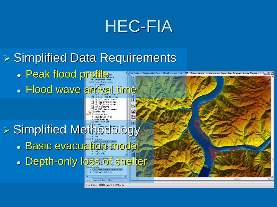
HEC-FIA
Simplified Data Requirements
Peak flood profile
Flood wave arrival time
Simplified Methodology
Basic evacuation model
Depth-only loss of shelter
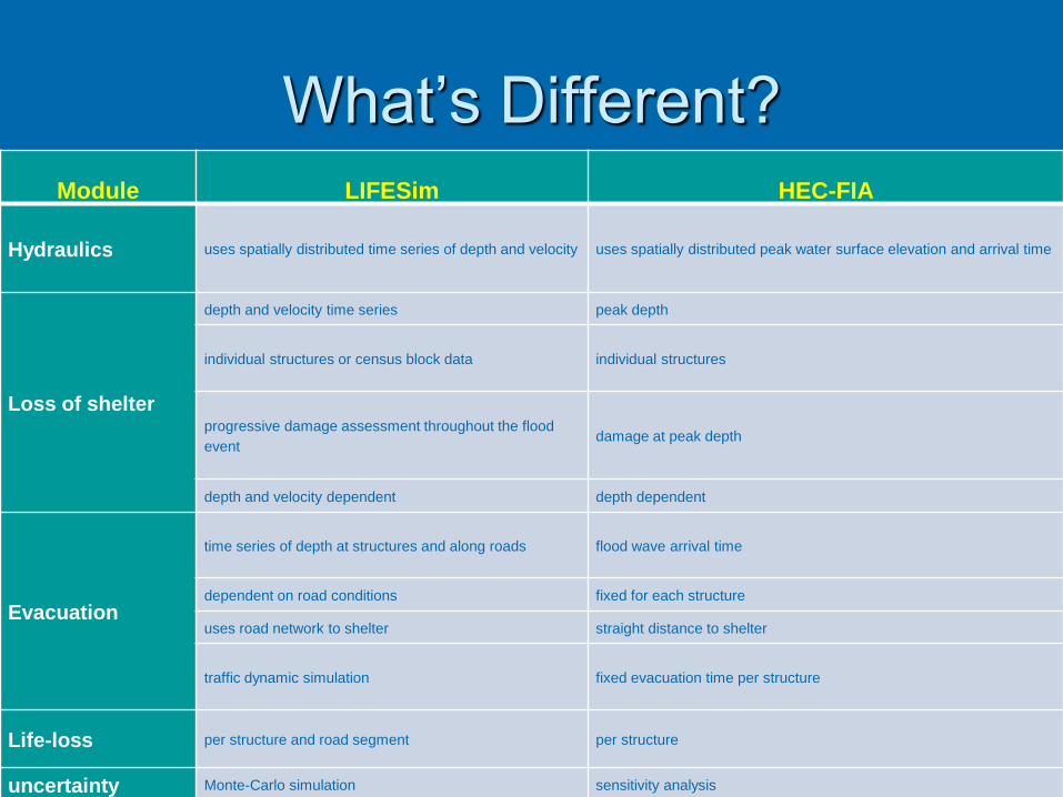
What’s Different?Module LIFESim HEC-FIA
Hydraulics uses spatially distributed time series of depth and velocity uses spatially distributed peak water surface elevation and arrival time
Loss of shelter
depth and velocity time series peak depth
individual structures or census block data individual structures
progressive damage assessment throughout the flood
eventdamage at peak depth
depth and velocity dependent depth dependent
Evacuation
time series of depth at structures and along roads flood wave arrival time
dependent on road conditions fixed for each structure
uses road network to shelter straight distance to shelter
traffic dynamic simulation fixed evacuation time per structure
Life-loss per structure and road segment per structure
uncertainty Monte-Carlo simulation sensitivity analysis
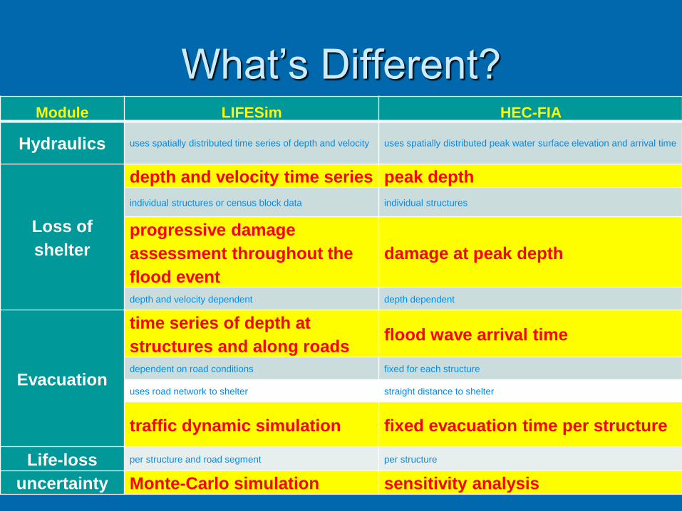
What’s Different?Module LIFESim HEC-FIA
Hydraulics uses spatially distributed time series of depth and velocity uses spatially distributed peak water surface elevation and arrival time
Loss of
shelter
depth and velocity time series peak depth
individual structures or census block data individual structures
progressive damage
assessment throughout the
flood event
damage at peak depth
depth and velocity dependent depth dependent
Evacuation
time series of depth at
structures and along roadsflood wave arrival time
dependent on road conditions fixed for each structure
uses road network to shelter straight distance to shelter
traffic dynamic simulation fixed evacuation time per structure
Life-loss per structure and road segment per structure
uncertainty Monte-Carlo simulation sensitivity analysis
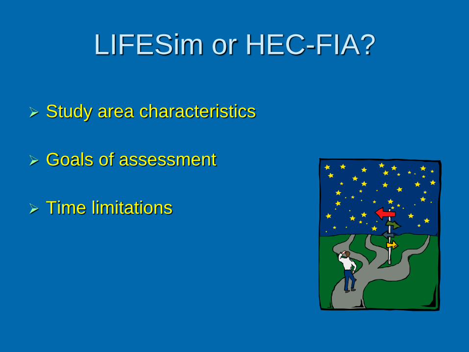
LIFESim or HEC-FIA?
Study area characteristics
Goals of assessment
Time limitations
Current Status
Collaboration with USACE-HEC: Reprogramming to improve user friendliness
Rigorous model verification
Socio-economic analysis for mobilization
HEC-FIA: Requires less data
Produces faster estimate
Additional improvements Rescue simulation
Improve evacuation simulation
Conclusions
Reasonable life-loss estimates are an essential input to Dam Safety Risk Assessment
Life loss is intrinsically uncertain Incorporate uncertainty in
• life-loss estimates and
• Risk Assessment results for decision makers
LIFESim & HEC-FIA Under continuing development
Requires reasonable effort
Multiple levels of details
Demonstrated and applied to several dams and levees
A tool for evacuation planning tool for emergency managers