Embed Size (px)
Citation preview

Runnin’ Against the WindMaking Your Own Forecast
Justin Turcotte
Case: July 17, 2010
- What originally looked like a potential tornado day largely busted.
- I was working the graveyard and got some brief rest before heading south. In the interest of time I did not look closely at the morning model guidance
- I should have done so as there was a significant change between the 00 UTC and 12 UTC NAM output. This could have saved me a an afternoon and tank of gas….
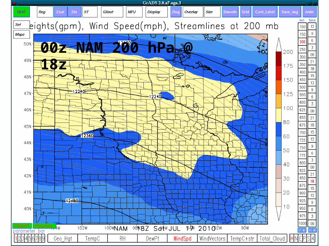
00z NAM 200 hPa @ 18z
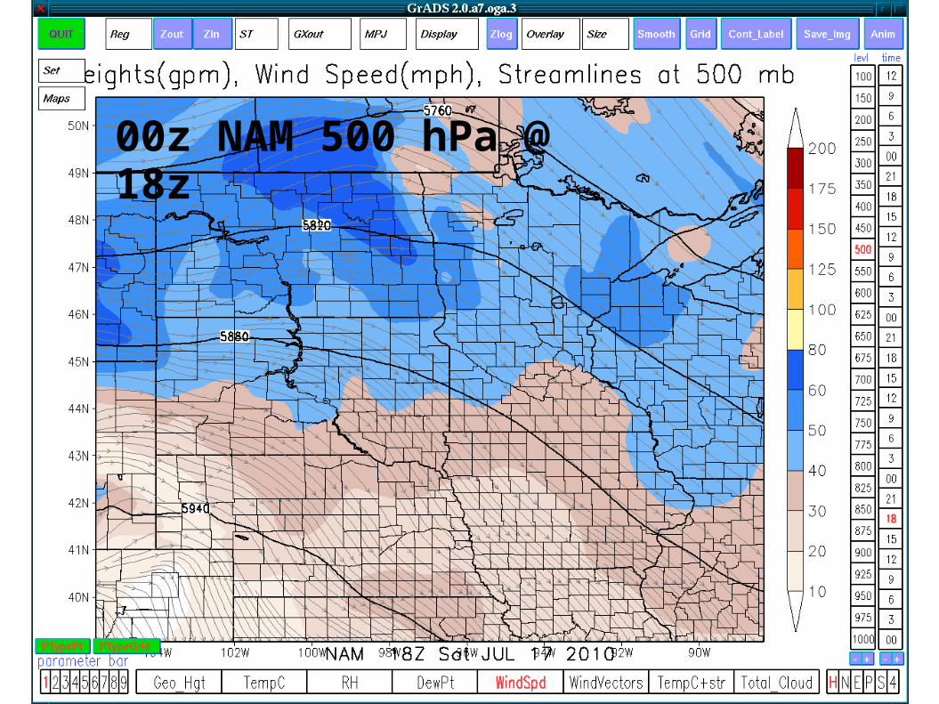
00z NAM 500 hPa @ 18z
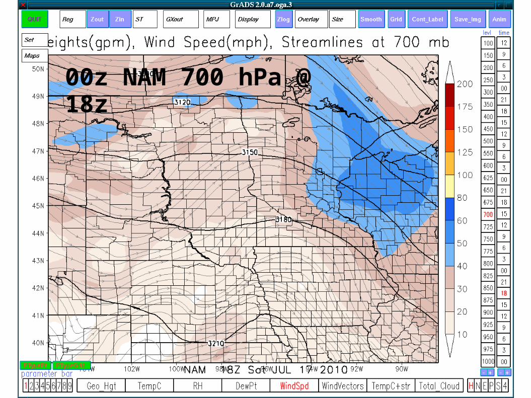
00z NAM 700 hPa @ 18z
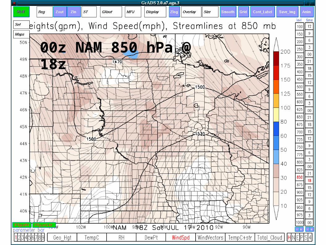
00z NAM 850 hPa @ 18z
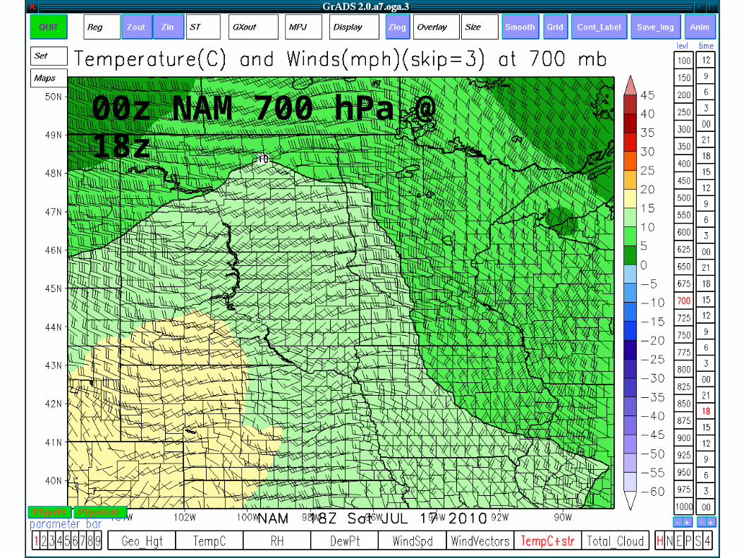
00z NAM 700 hPa @ 18z
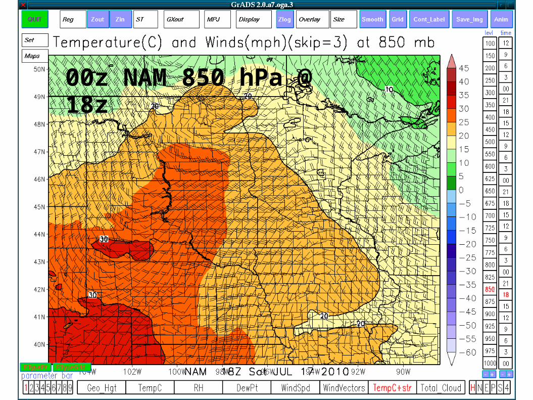
00z NAM 850 hPa @ 18z
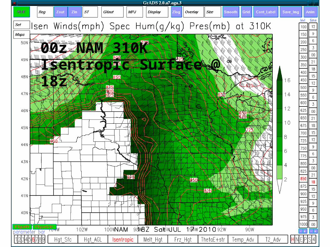
00z NAM 310K Isentropic Surface @ 18z
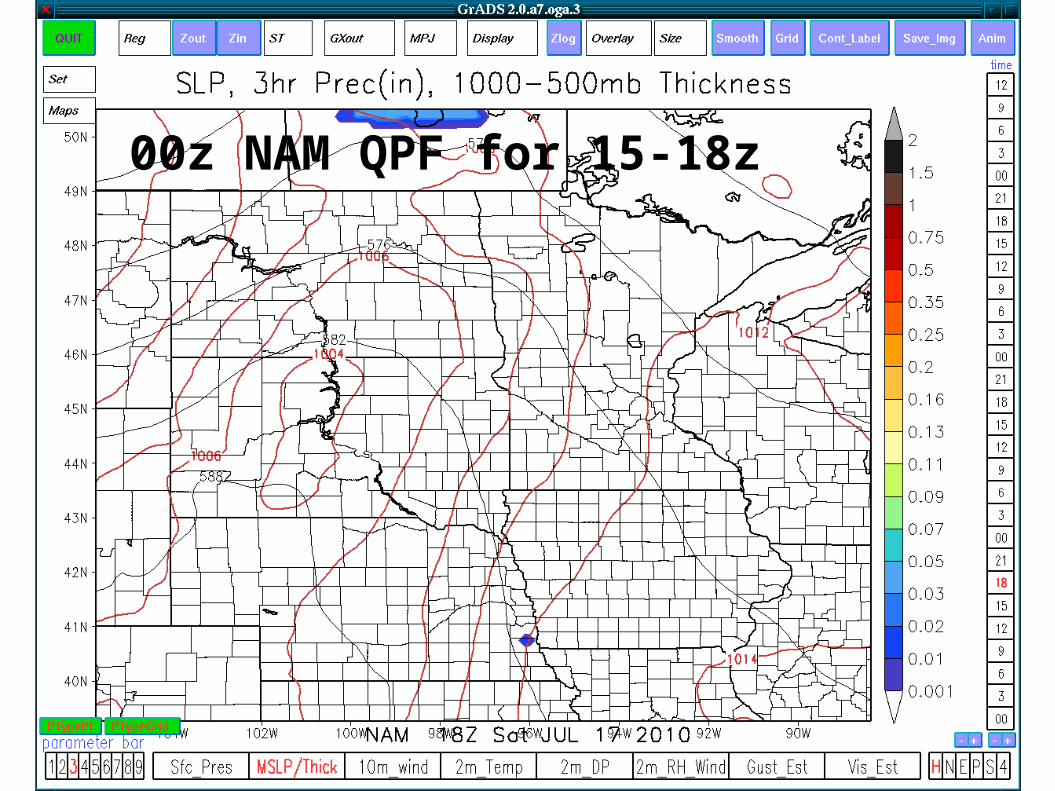
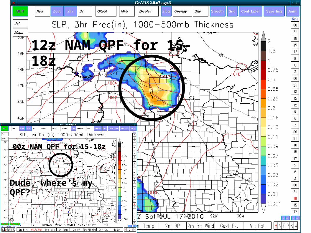
00z NAM QPF for 15-18z
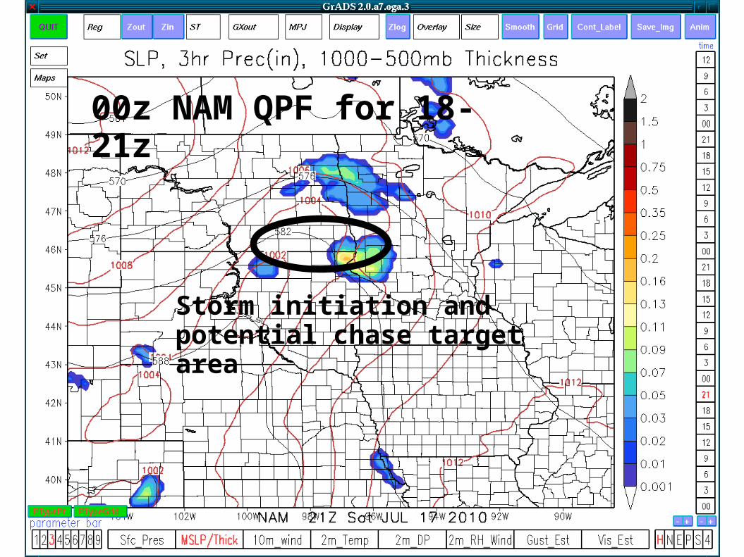
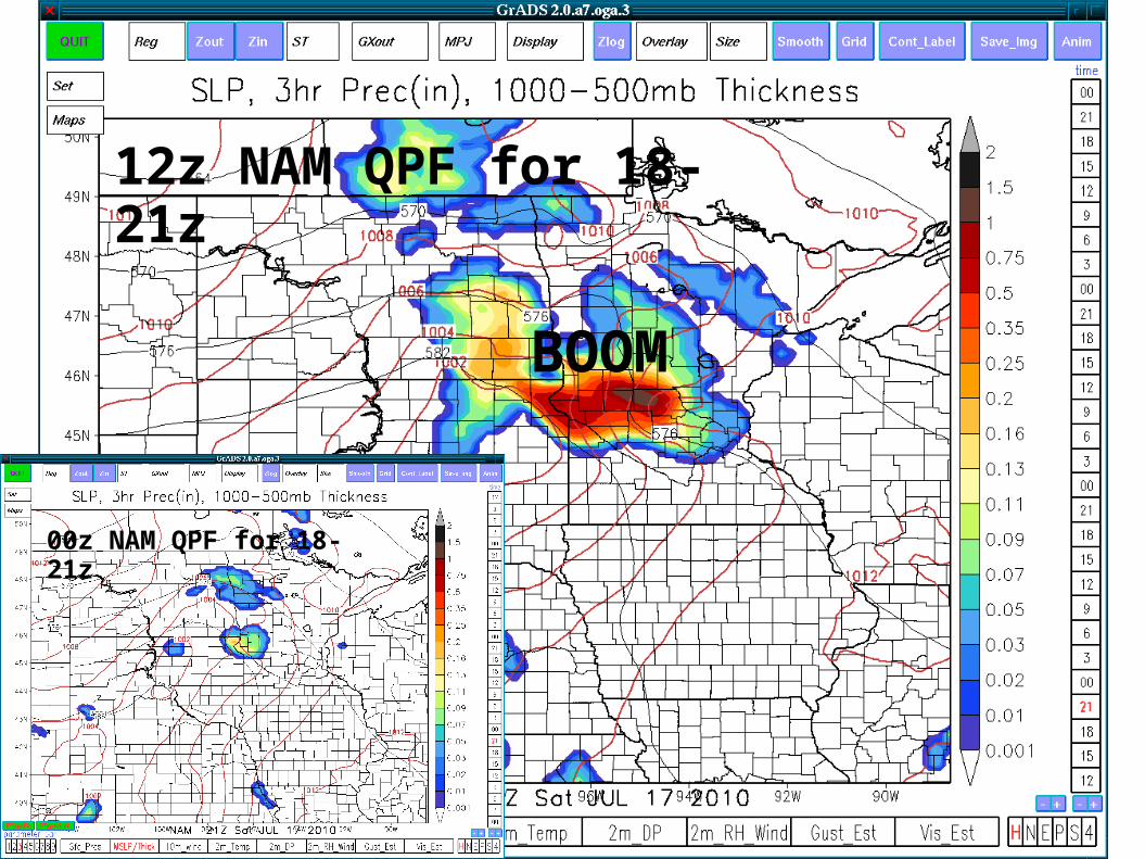
00z NAM QPF for 18-21z
Storm initiation and potential chase target area
Forecast Discussion
Scattered convection associated with the weak shortwave was expected during the early morning hours in western and central North Dakota.
This convection was forecast to fizzle in the east. LLJ not very focused. Perhaps a stray storm cluster in
west central MN around daybreak on edge of cap. Cap forecast to hold off surface based convection in
ND/SD/MN border area until ~5pm. Ample shear and instability expected for supercells and potential tornadoes.
Storms expected congeal into linear MCS across Minnesota and South Dakota through the evening.
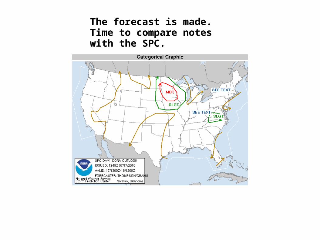
The forecast is made. Time to compare notes with the SPC.
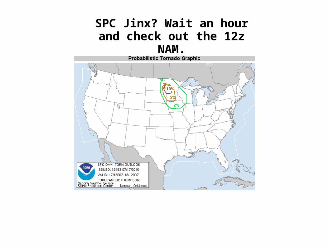
SPC Jinx? Wait an hour and check out the 12z NAM.
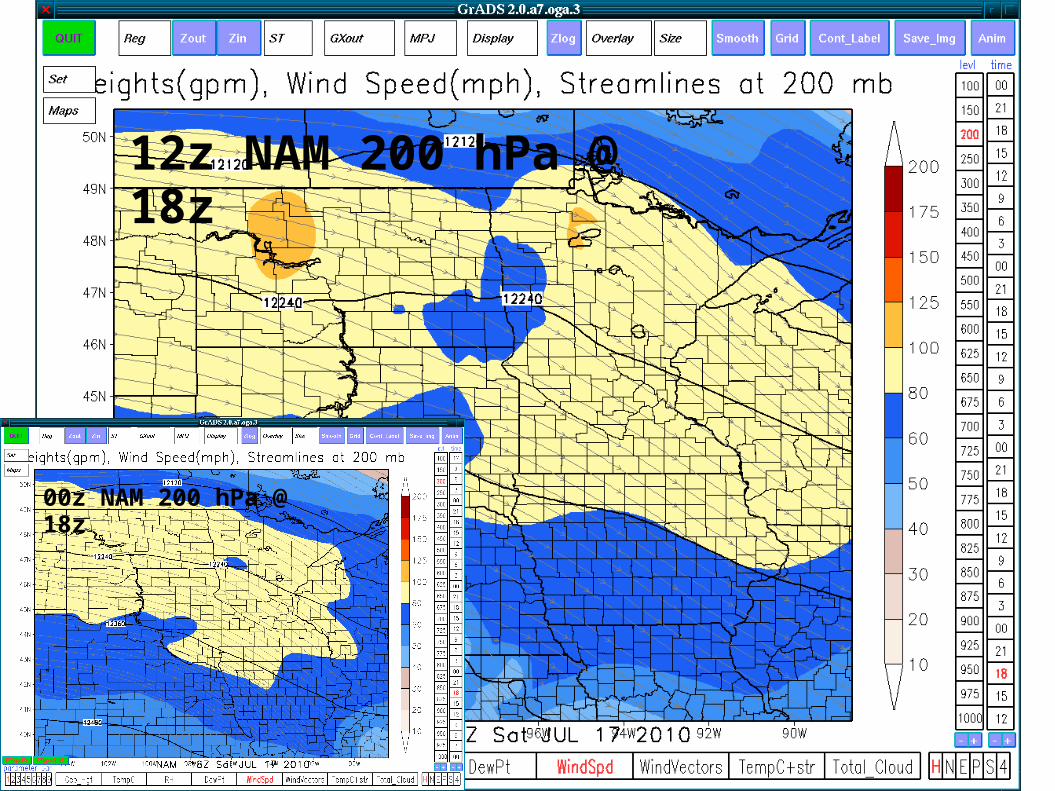
12z NAM 200 hPa @ 18z
00z NAM 200 hPa @ 18z
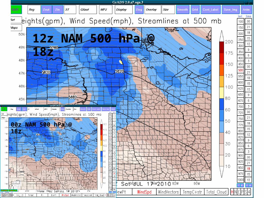
12z NAM 500 hPa @ 18z
00z NAM 500 hPa @ 18z
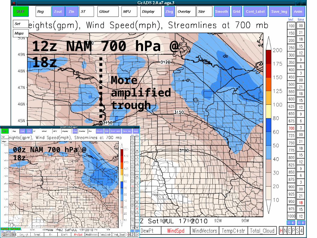
More amplified trough
12z NAM 700 hPa @ 18z
00z NAM 700 hPa @ 18z
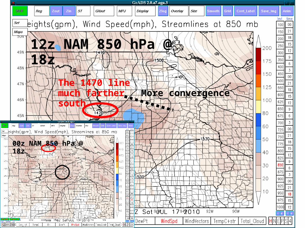
The 1470 line much farther south More convergence
00z NAM 850 hPa @ 18z
12z NAM 850 hPa @ 18z
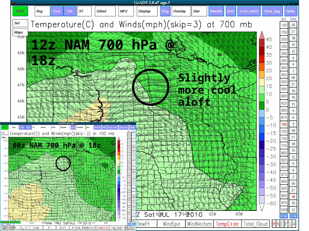
Slightly more cool aloft
12z NAM 700 hPa @ 18z
00z NAM 700 hPa @ 18z
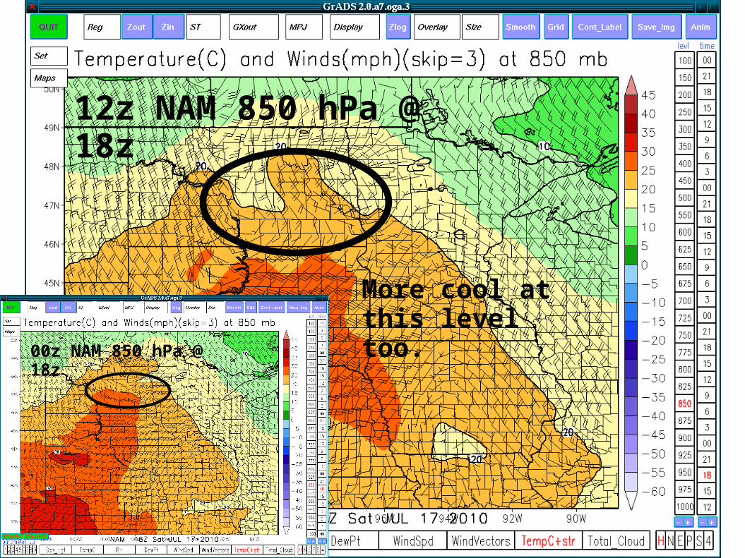
12z NAM 850 hPa @ 18z
00z NAM 850 hPa @ 18z
More cool at this level too.
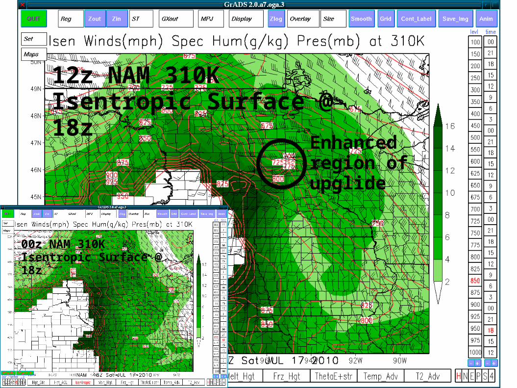
Enhanced region of upglide
12z NAM 310K Isentropic Surface @ 18z
00z NAM 310K Isentropic Surface @ 18z
12z NAM QPF for 15-18z
00z NAM QPF for 15-18z
Dude, where's my QPF?
BOOM
12z NAM QPF for 18-21z
00z NAM QPF for 18-21z
Forecast Discussion
Stronger more convergent LLJ suggests storms more likely to develop along edge of cap in western Minnesota and reflected in NAM QPF.
More prominent shortwave in North Dakota => less cap => earlier storm initiation in ND/SD/MN border area and potential for initial discrete cells to be less isolated.
Stronger forcing suggests transition to linear mode will be faster (already expected to be fast based on 00z model guidance).
Very narrow storm chase window.
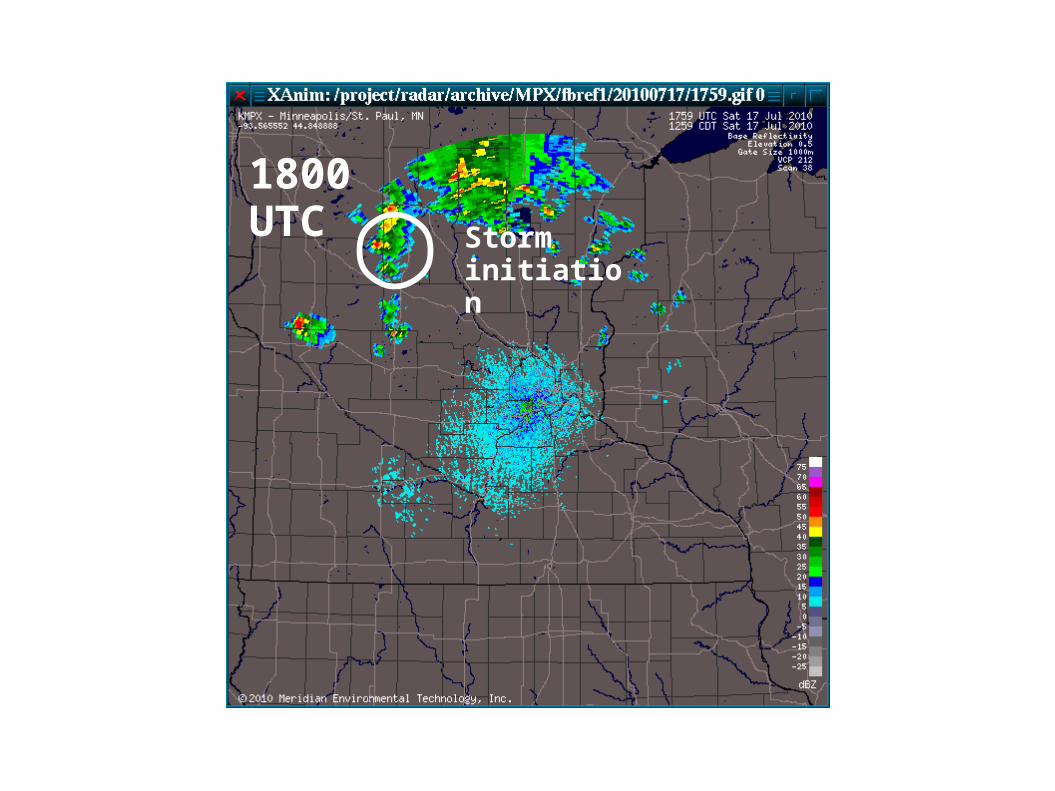
1800 UTCStorm initiation
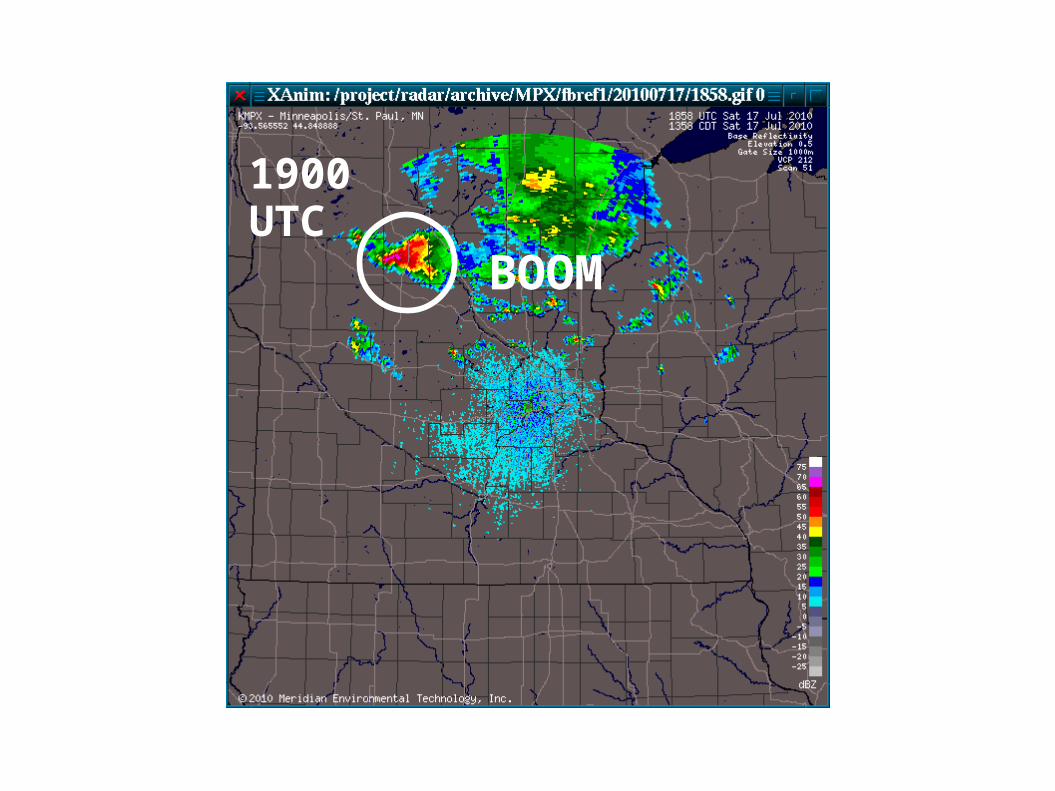
1900 UTC
BOOM
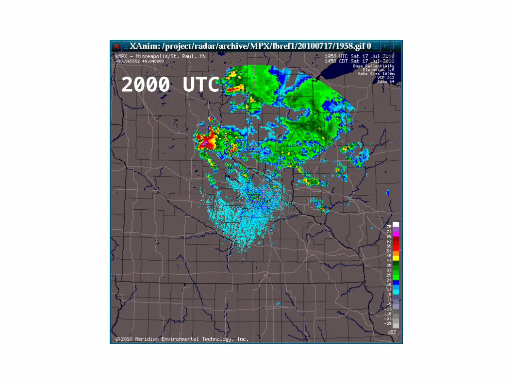
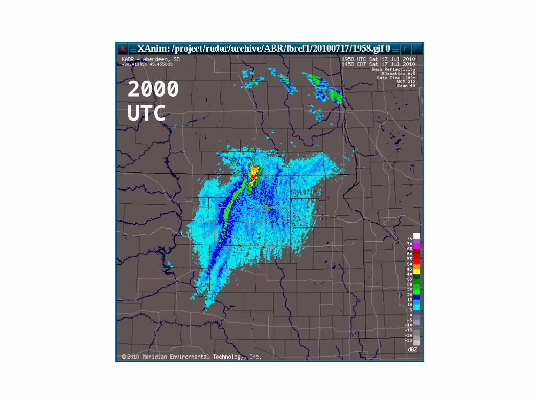
2000 UTC
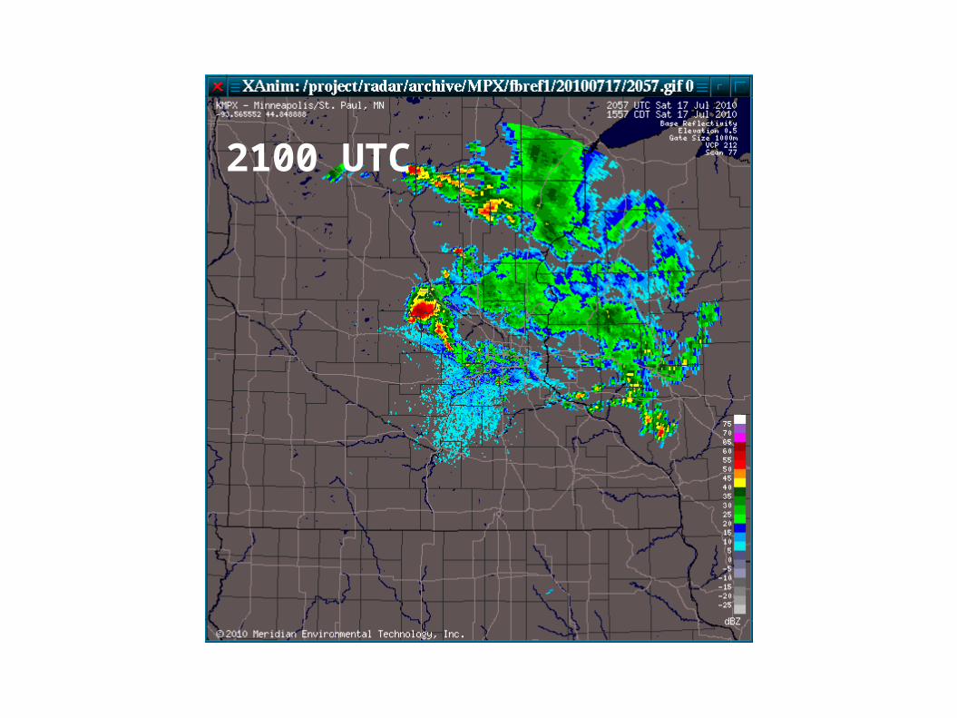
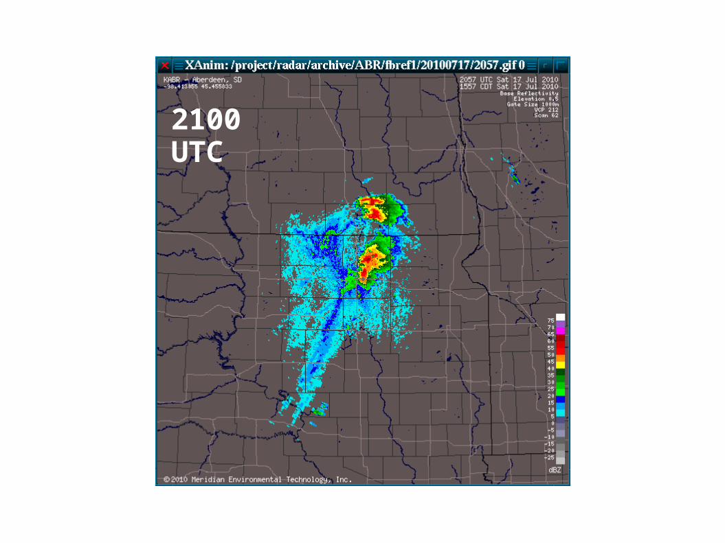
2100 UTC
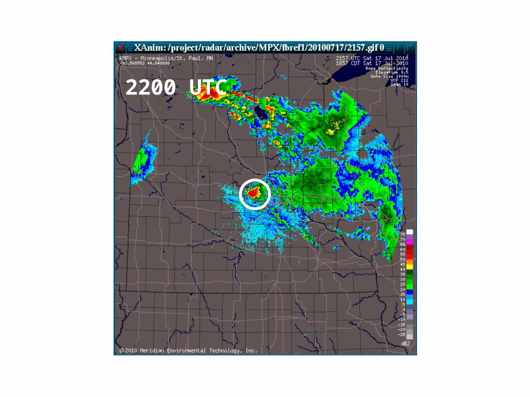
2200 UTC
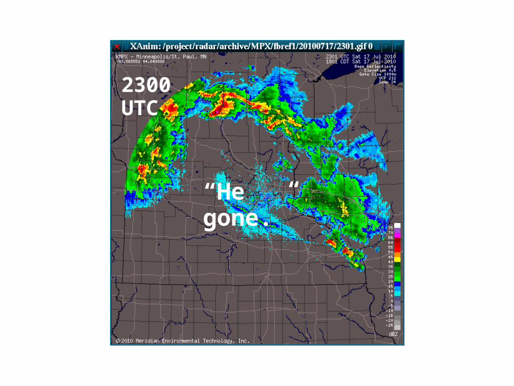
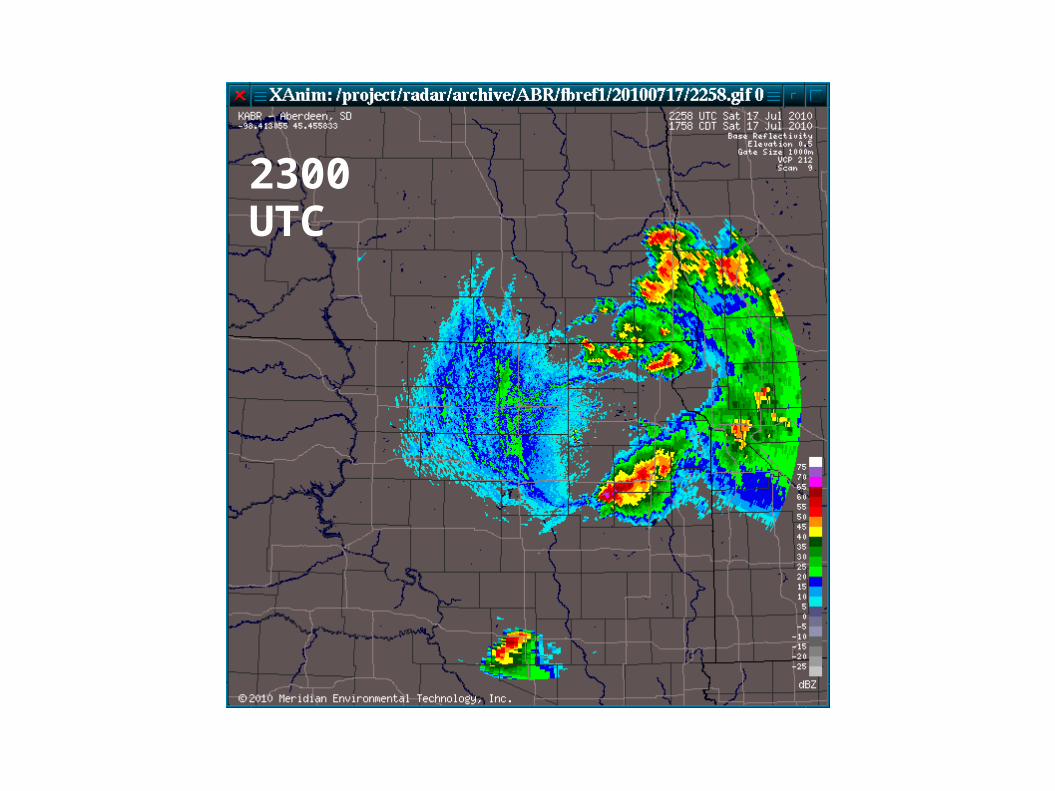
2300 UTC
“He gone.”
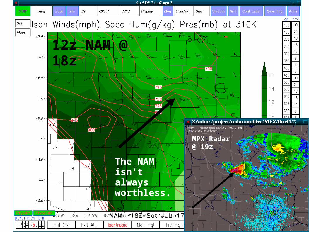
12z NAM @ 18z
MPX Radar @ 19z
The NAM isn't always worthless.
2000 UTC
2100 UTC
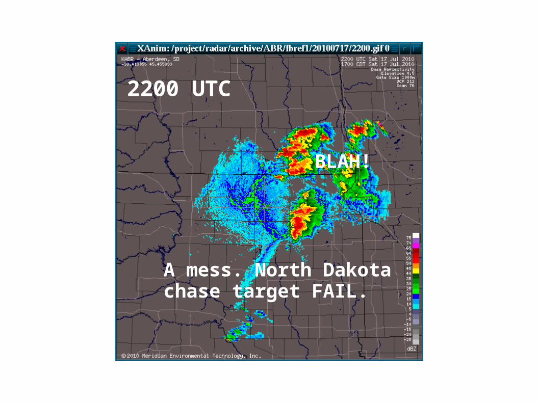
A mess. North Dakota chase target FAIL.
2200 UTC
BLAH!
2300 UTC
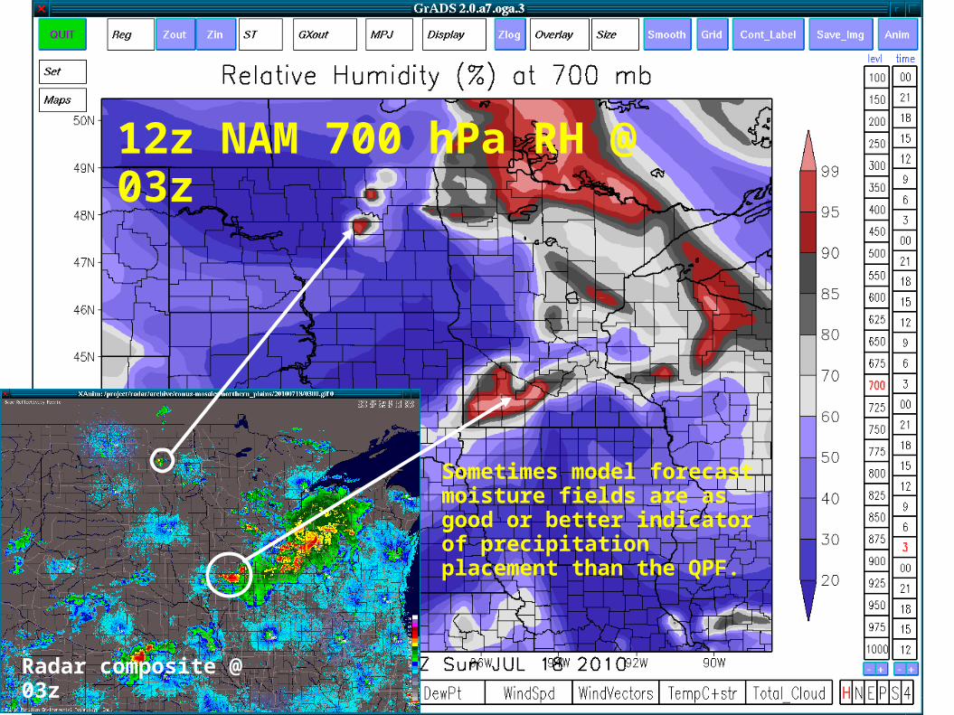
Sometimes model forecast moisture fields are as good or better indicator of precipitation placement than the QPF.
Radar composite @ 03z
12z NAM 700 hPa RH @ 03z
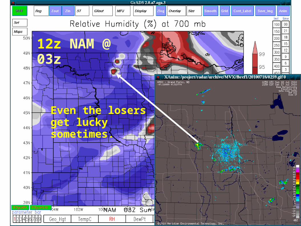
Even the losers get lucky sometimes.
12z NAM @ 03z
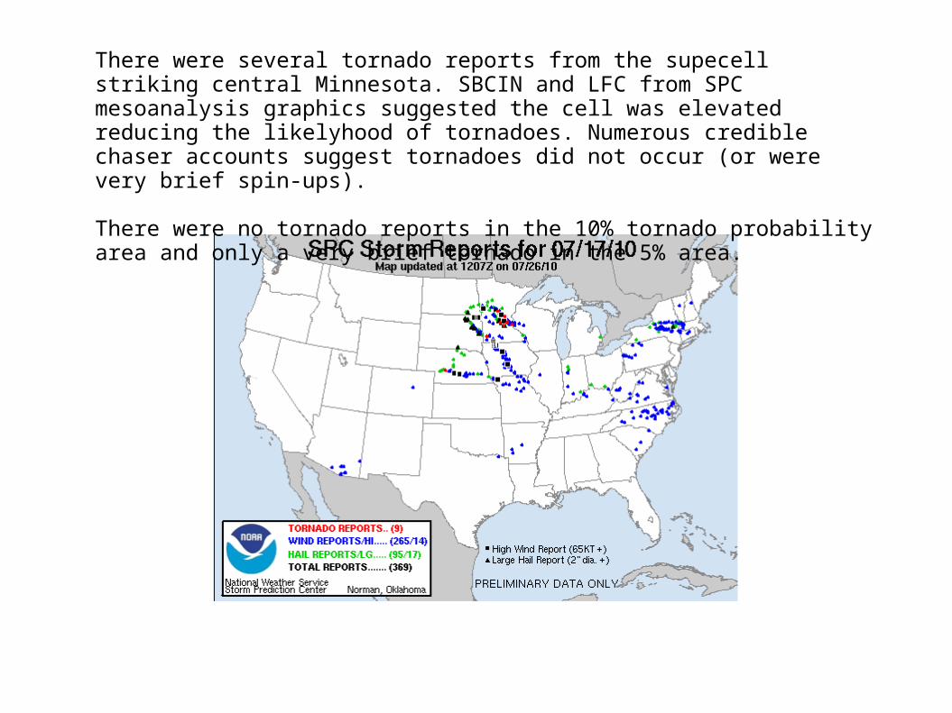
There were several tornado reports from the supecell striking central Minnesota. SBCIN and LFC from SPC mesoanalysis graphics suggested the cell was elevated reducing the likelyhood of tornadoes. Numerous credible chaser accounts suggest tornadoes did not occur (or were very brief spin-ups).
There were no tornado reports in the 10% tornado probability area and only a very brief tornado in the 5% area.
Summary
The 00z NAM ultimately was junk but the later 12z NAM offered redemption.
A forecaster should look at multiple runs of a model in order to track changes with time. Usually, the “trend is your friend”.
Comparing multiple elements from separate model runs will allow you to better diagnose why the QPF changed between these runs.
Small changes in the atmosphere can have a significant impact on timing, placement, and severity of thunderstorms.
Summary
Model QPF is perhaps best utilized as a quick situational awareness tool. If the output was perfect many metorologists would get the pink slip.
Model moisture field forecasts are often quite useful for determining instantaneous precipitation placement (and in some cases, summer or winter, where model QPF is not event present.
Consider looking at more obscure or less utilized foecast variables (In this case an isentropic surface pointed right to where a supercell developed).
END
http://www.plainschase.com