Embed Size (px)
Citation preview
Rwanda base image (Hydrosheds version of the
SRTM DEM).
The background is a false-color Landsat mosaic from 2000. The area of Rwanda is 26,798 km2, but hydrological modeling requires that all of the land surface that drains into Rwanda, as indicated by the blue line, be included.
http://gis.ess.washington.edu/areas/Rwanda/
Spatial approach in Rwanda's Common Framework of Engagement
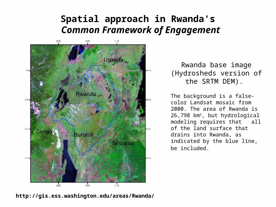
(Transboundary) Political Boundaries
Landuse/Landcover
Physical “Template”
Dynamic Information Framework (DIF)
….. a practical engine, for organizing and processing multi-source information and decision needs - an “information laboratory and forum” - towards a readily accessible Decision Support Framework
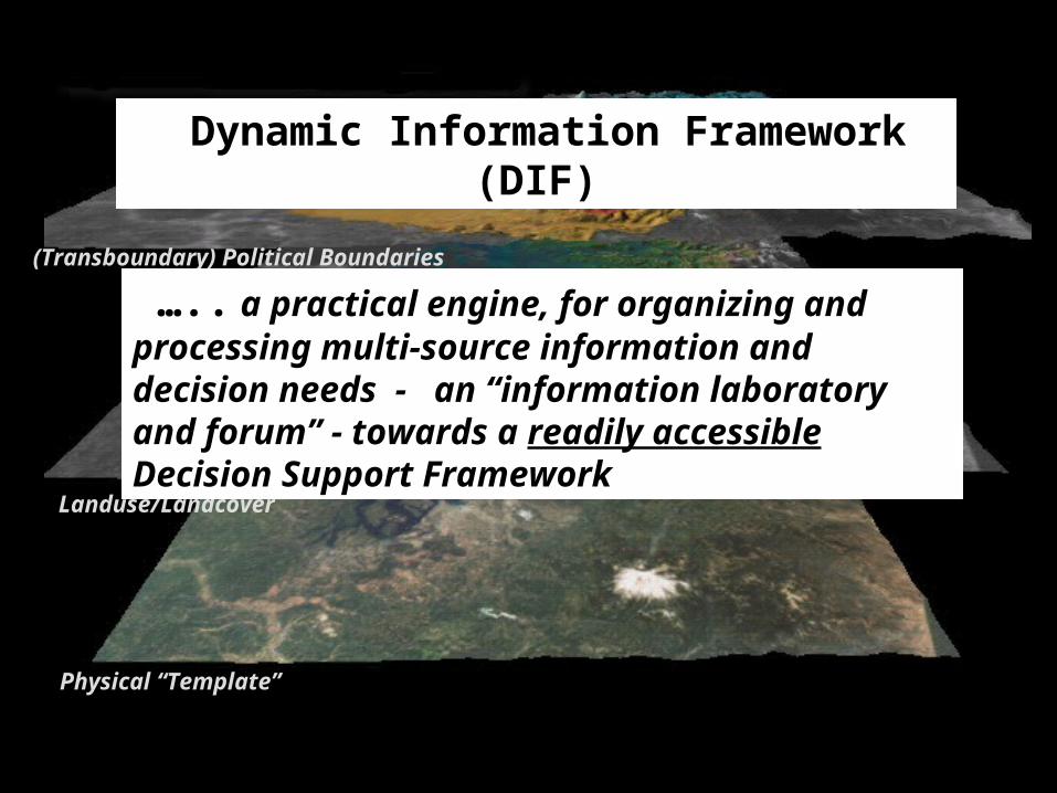
TIME SCALE
Model of Elevations Topography, Mask, River Networks
Geological
Model of Soils Depth-n, types/attributes)
Decades/Centuries
Model of Surface Climate Precip, Temp, Rn, WDaily/Seasonal
Model of Vegetation & BiodiversityTypes, Attributes (“physiology”)
Seasonal/(Inter)Annual
“Models”Movement of water, energy
Express as a geospatially-explicit/process-based (set of) models
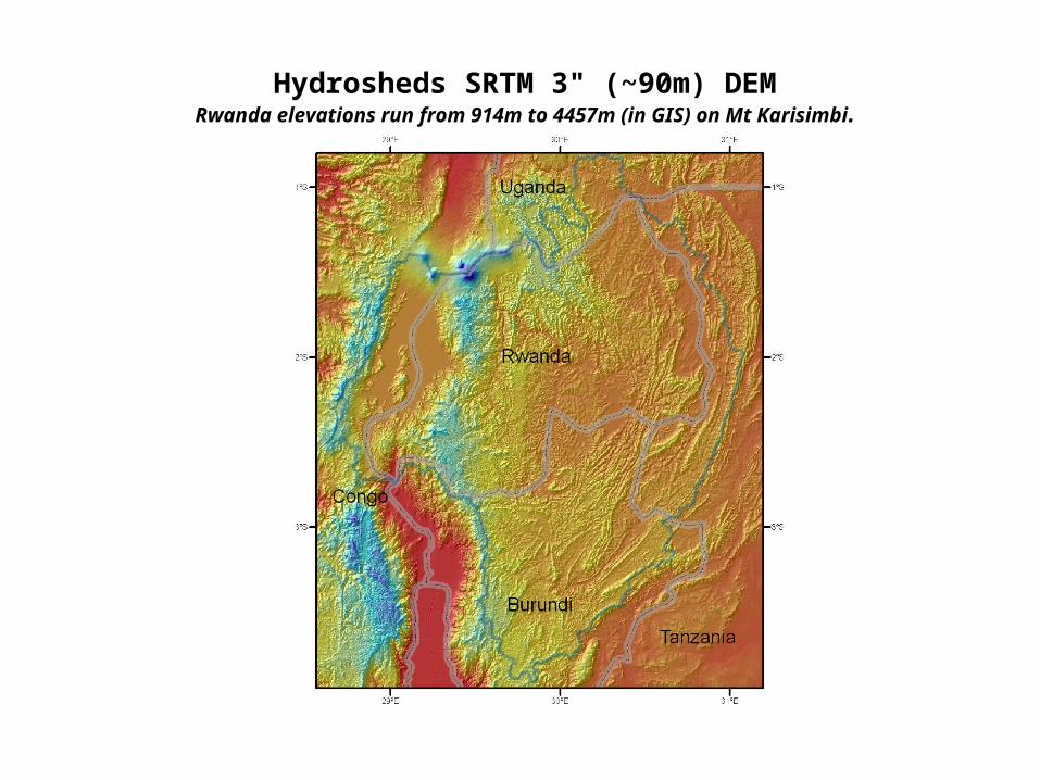
Hydrosheds SRTM 3" (~90m) DEMRwanda elevations run from 914m to 4457m (in GIS) on Mt Karisimbi.
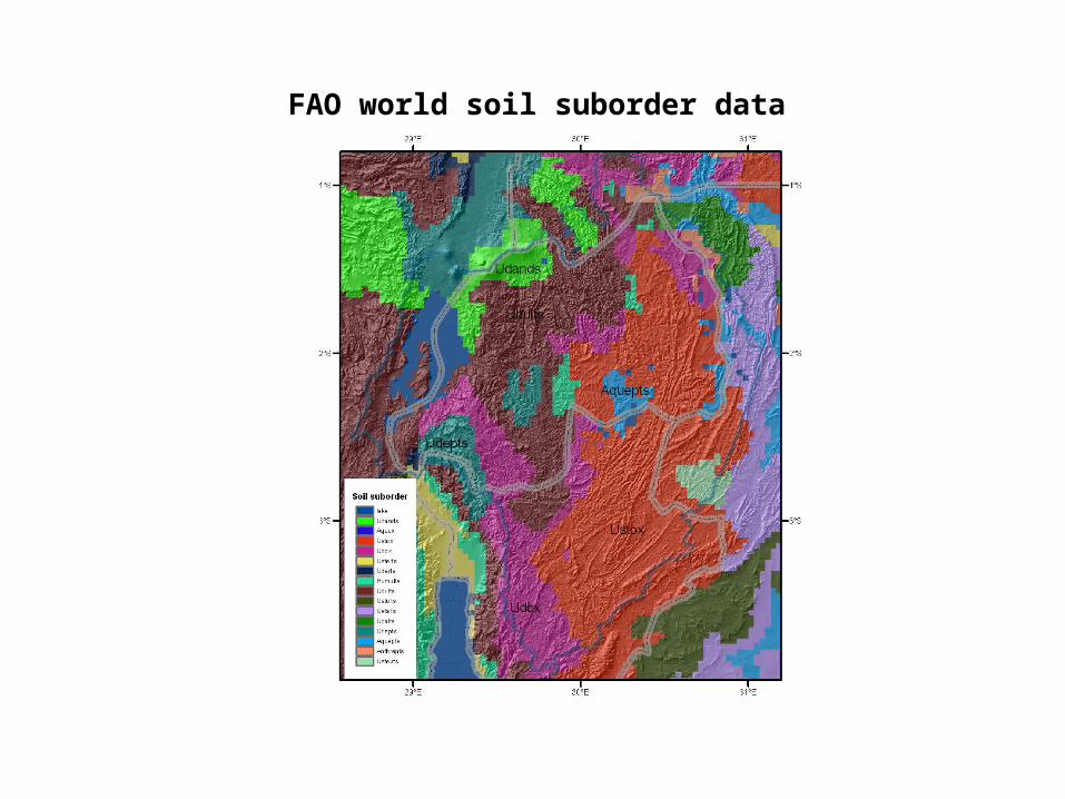
FAO world soil suborder data
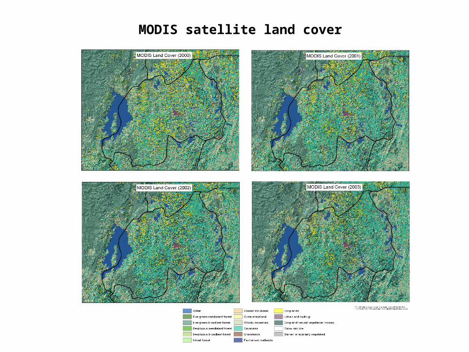
MODIS satellite land cover
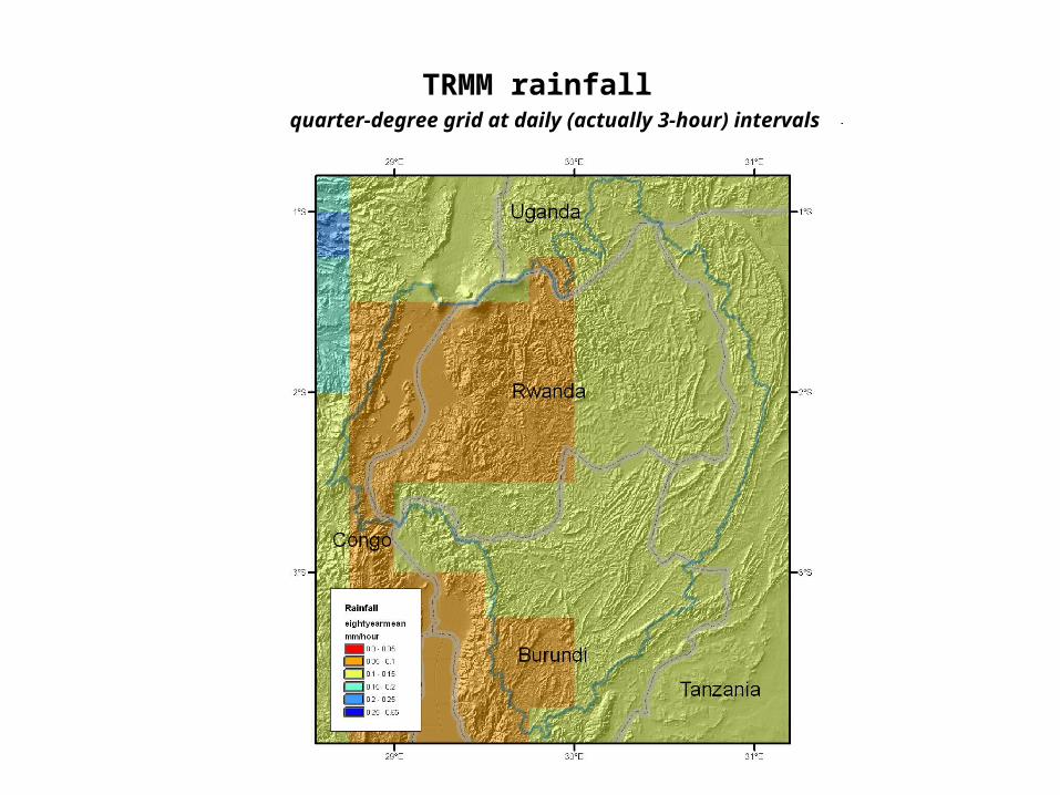
TRMM rainfall quarter-degree grid at daily (actually 3-hour) intervals