Embed Size (px)
Citation preview
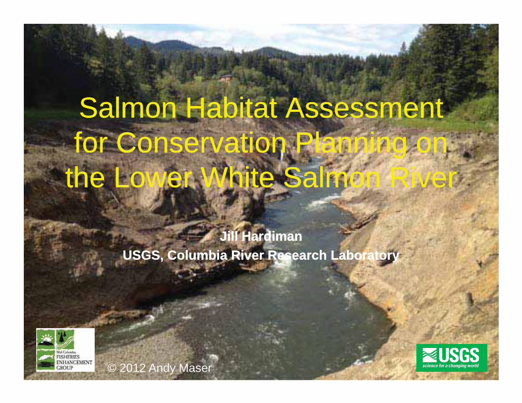
Salmon Habitat Salmon Habitat Assessment Assessmentfor Conservation Planning on for Conservation Planning on
the Lower White Salmon Riverthe Lower White Salmon Riverthe Lower White Salmon Riverthe Lower White Salmon River
Jill HardimanJill HardimanUSGS, Columbia River Research LaboratoryUSGS, Columbia River Research Laboratory
© 2012 Andy Maser
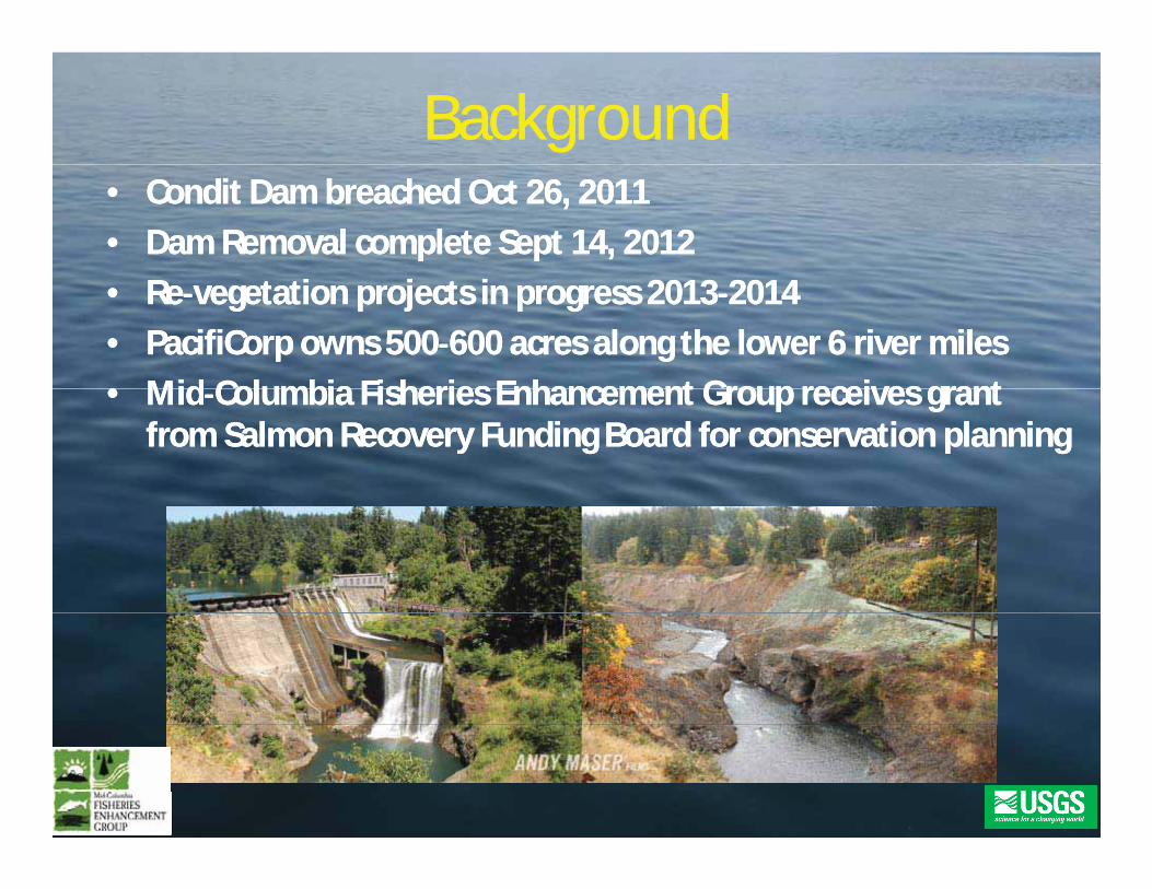
BackgroundBackground•• Condit Dam breached Oct 26, 2011Condit Dam breached Oct 26, 2011•• Dam Removal complete Sept 14, 2012Dam Removal complete Sept 14, 2012•• ReRe vegetation projects in progress 2013vegetation projects in progress 2013 20142014•• PacifiCorp owns 500PacifiCorp owns 500 600 acres along the lower 6 river miles600 acres along the lower 6 river miles•• MidMid Columbia Fisheries Enhancement Group receives grantColumbia Fisheries Enhancement Group receives grant•• MidMid Columbia Fisheries Enhancement Group receives grantColumbia Fisheries Enhancement Group receives grant
from Salmon Recovery Funding Board for conservation planningfrom Salmon Recovery Funding Board for conservation planning
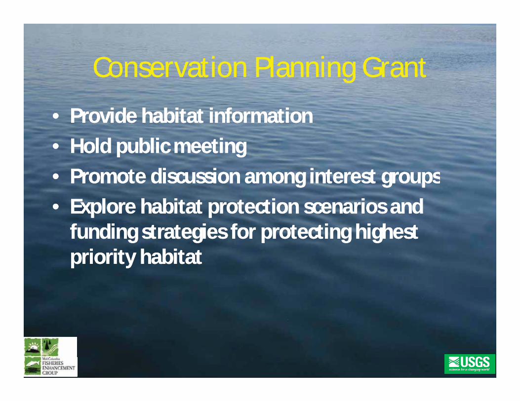
Conservation Planning GrantConservation Planning GrantConservation Planning GrantConservation Planning Grant•• Provide habitat informationProvide habitat information•• Hold publicHold public meetingmeeting•• Promote discussion among interest groupsPromote discussion among interest groups•• Promote discussion among interest groupsPromote discussion among interest groups•• Explore habitat protection scenarios andExplore habitat protection scenarios and
f di i f i hi hf di i f i hi hfunding strategies for protecting highestfunding strategies for protecting highestpriority habitatpriority habitat
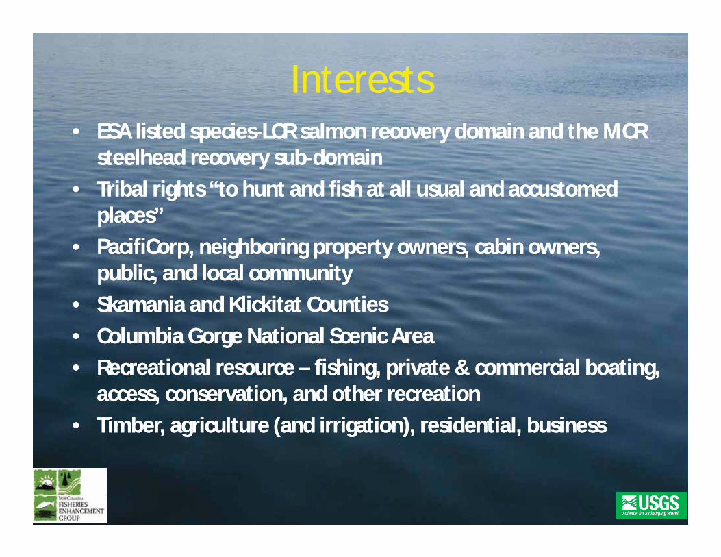
InterestsInterests•• ESA listed speciesESA listed species LCR salmon recovery domain and the MCRLCR salmon recovery domain and the MCR
steelhead recovery substeelhead recovery sub domaindomain•• Tribal rights “to hunt and fish at all usual and accustomedTribal rights “to hunt and fish at all usual and accustomed
places”places”PacifiCorp neighboring propert o ners cabin o nersPacifiCorp neighboring propert o ners cabin o ners•• PacifiCorp, neighboring property owners, cabin owners,PacifiCorp, neighboring property owners, cabin owners,public, and local communitypublic, and local community
•• SkamaniaSkamania and Klickitat Countiesand Klickitat Counties•• Columbia Gorge National Scenic AreaColumbia Gorge National Scenic Area•• Recreational resourceRecreational resource –– fishing, private & commercial boating,fishing, private & commercial boating,
access, conservation, and other recreationaccess, conservation, and other recreation•• Timber, agriculture (and irrigation), residential, businessTimber, agriculture (and irrigation), residential, business
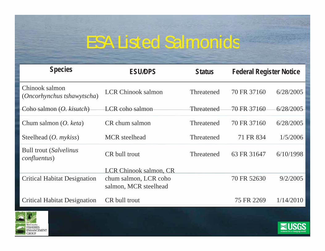
ESA ListedESA Listed SalmonidsSalmonidsESA ListedESA Listed SalmonidsSalmonidsSpecies ESU/DPS Status Federal Register Notice
Chinook salmon (Oncorhynchus tshawytscha) LCR Chinook salmon Threatened 70 FR 37160 6/28/2005
Coho salmon (O kisutch) LCR coho salmon Threatened 70 FR 37160 6/28/2005Coho salmon (O. kisutch) LCR coho salmon Threatened 70 FR 37160 6/28/2005
Chum salmon (O. keta) CR chum salmon Threatened 70 FR 37160 6/28/2005
Steelhead (O. mykiss) MCR steelhead Threatened 71 FR 834 1/5/2006
Bull trout (Salvelinusconfluentus) CR bull trout Threatened 63 FR 31647 6/10/1998
LCR Chinook salmon, CR Critical Habitat Designation
,chum salmon, LCR coho salmon, MCR steelhead
70 FR 52630 9/2/2005
Critical Habitat Designation CR bull trout 75 FR 2269 1/14/2010
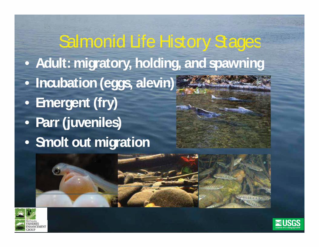
SalmonidSalmonid Life History StagesLife History StagesSalmonidSalmonid Life History StagesLife History Stages•• Adult: migratory, holding, and spawningAdult: migratory, holding, and spawning•• Incubation (eggs,Incubation (eggs, alevinalevin))•• Emergent (fry)Emergent (fry)g ( y)g ( y)•• Parr (juveniles)Parr (juveniles)
S ltS lt t i tit i ti•• SmoltSmolt out migrationout migration
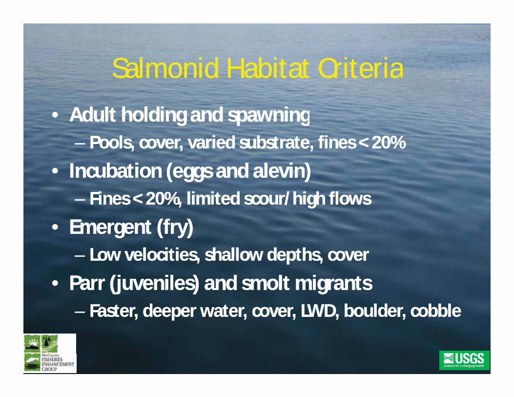
SalmonidSalmonid Habitat CriteriaHabitat CriteriaSalmonidSalmonid Habitat CriteriaHabitat Criteria•• AdultAdult holding andholding and spawningspawninggg p gp g
–– Pools, cover, varied substrate, fines < 20%Pools, cover, varied substrate, fines < 20%
•• IncubationIncubation ((eggs andeggs and alevinalevin))IncubationIncubation ((eggs andeggs and alevinalevin))–– FinesFines < 20< 20%, limited scour/high flows%, limited scour/high flows
E tE t (f(f ))•• EmergentEmergent (fry(fry))–– Low velocities, shallow depths, coverLow velocities, shallow depths, cover
•• ParrParr ((juveniles) andjuveniles) and smoltsmolt migrantsmigrants–– Faster, deeper water, cover, LWD, boulder, cobbleFaster, deeper water, cover, LWD, boulder, cobble
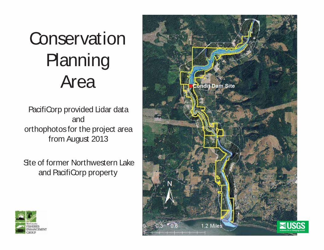
ConservationPlanning
AAreaPacifiCorp provided Lidar dataPacifiCorp provided Lidar data
andorthophotos for the project area
from August 2013
Site of former Northwestern Lakeand PacifiCorp property
from August 2013
and PacifiCorp property
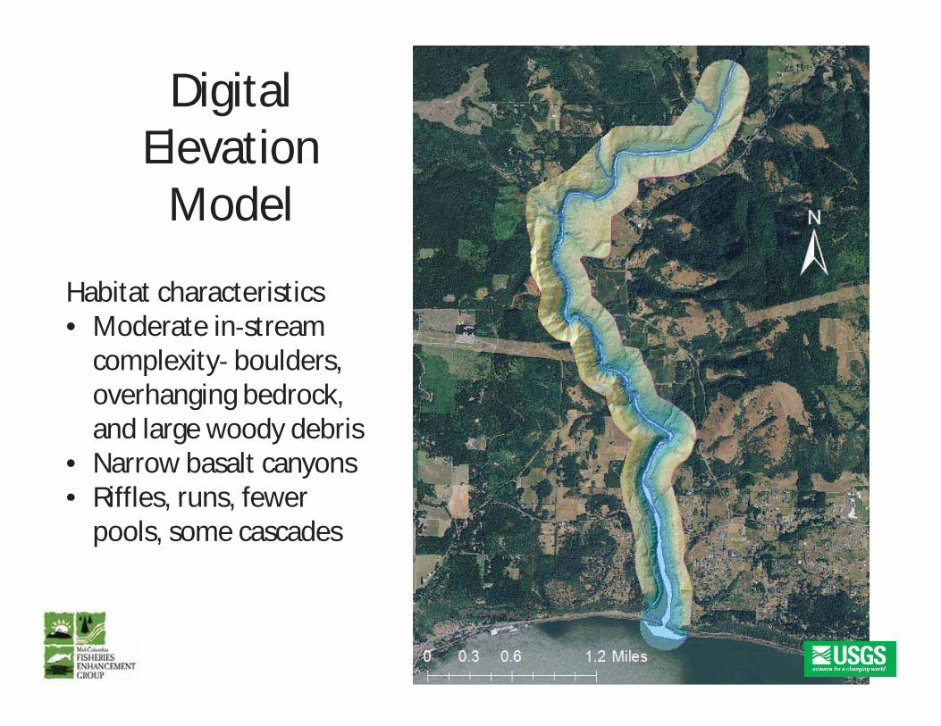
DigitalEl iElevationModel
Habitat characteristicsd i• Moderate in stream
complexity boulders,overhanging bedrock,g gand large woody debris
• Narrow basalt canyons• Riffles runs fewerRiffles, runs, fewer
pools, some cascades
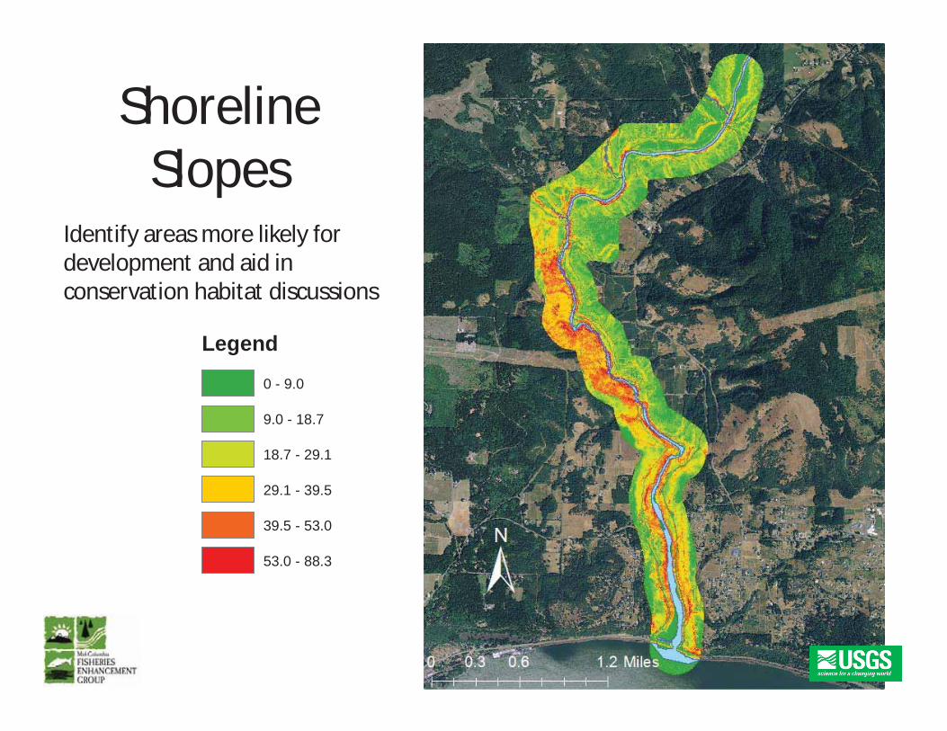
ShorelineSlopes
Id if lik l fIdentify areas more likely fordevelopment and aid inconservation habitat discussions
Legend
0 - 9.0
9.0 - 18.7
18.7 - 29.1
29.1 - 39.5
39.5 - 53.0
53.0 - 88.3
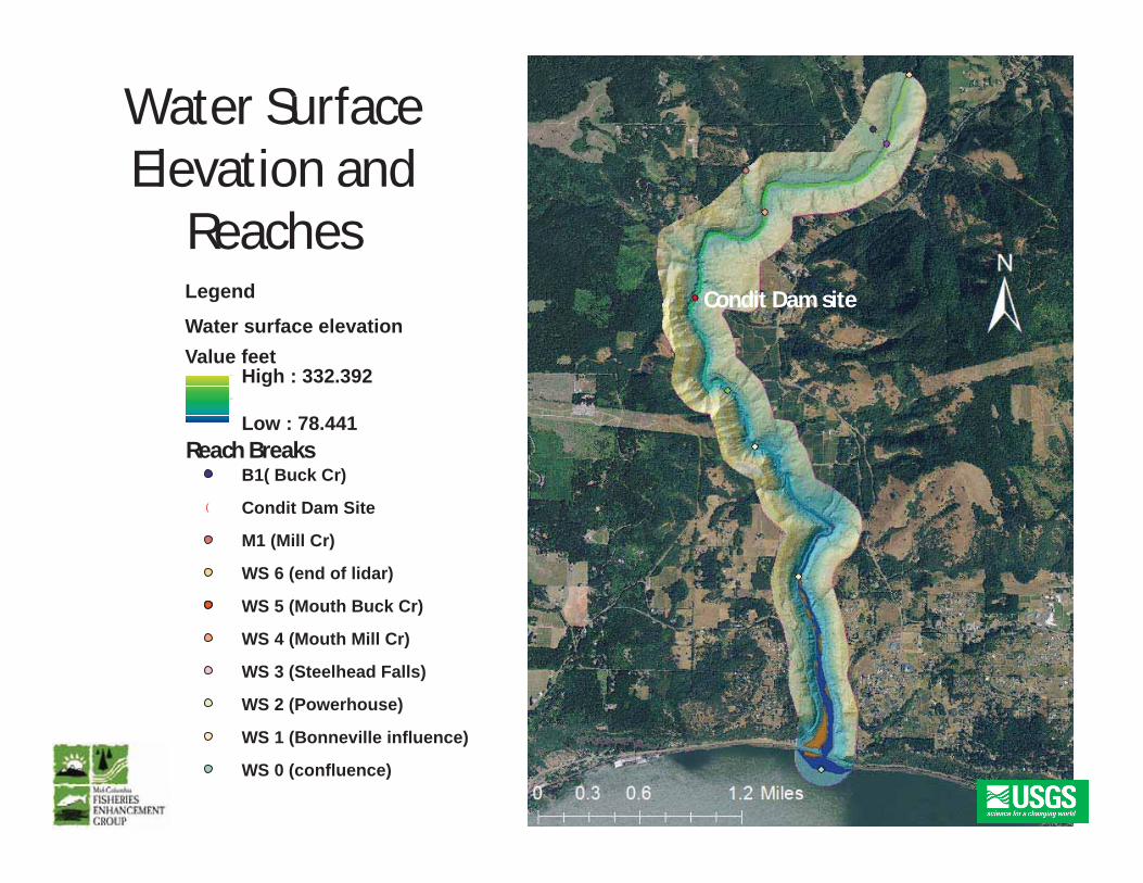
Water SurfaceElevation andElevation and
ReachesCondit Dam siteLegend
Water surface elevationValue feet
High : 332.392g
Low : 78.441
B1( Buck Cr)Reach Breaks
( Condit Dam Site
M1 (Mill Cr)
WS 6 (end of lidar)
WS 5 (Mouth Buck Cr)WS 5 (Mouth Buck Cr)
WS 4 (Mouth Mill Cr)
WS 3 (Steelhead Falls)
WS 2 (Powerhouse)
WS 1 (Bonneville influence)
WS 0 (confluence)
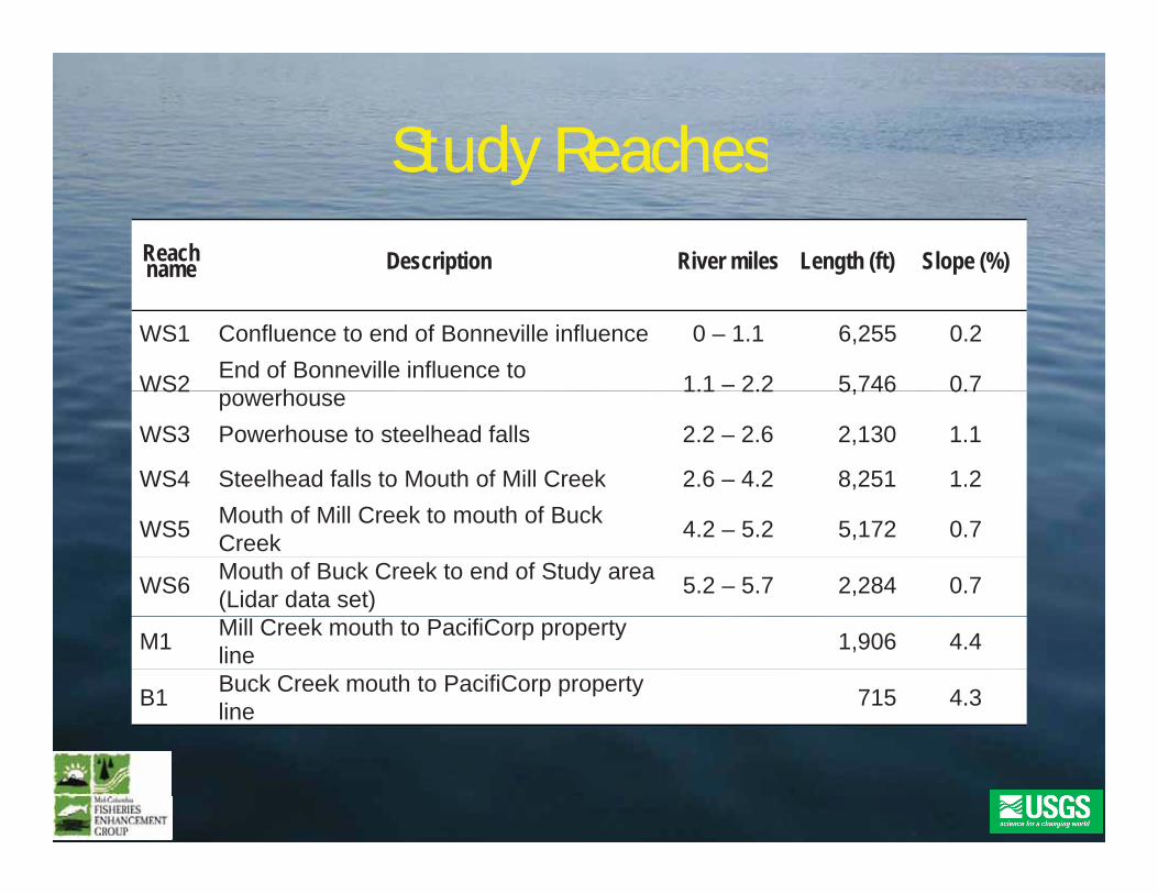
Study ReachesStudy ReachesStudy ReachesStudy ReachesReachname Description River miles Length (ft) Slope (%)
WS1 Confluence to end of Bonneville influence 0 – 1.1 6,255 0.2
WS2 End of Bonneville influence to h 1.1 – 2.2 5,746 0.7WS2 powerhouse 1.1 2.2 5,746 0.7
WS3 Powerhouse to steelhead falls 2.2 – 2.6 2,130 1.1
WS4 Steelhead falls to Mouth of Mill Creek 2.6 – 4.2 8,251 1.2
WS5 Mouth of Mill Creek to mouth of Buck Creek 4.2 – 5.2 5,172 0.7
WS6 Mouth of Buck Creek to end of Study area (Lidar data set) 5.2 – 5.7 2,284 0.7
M1 Mill Creek mouth to PacifiCorp property line 1,906 4.4
B1 Buck Creek mouth to PacifiCorp property line 715 4.3
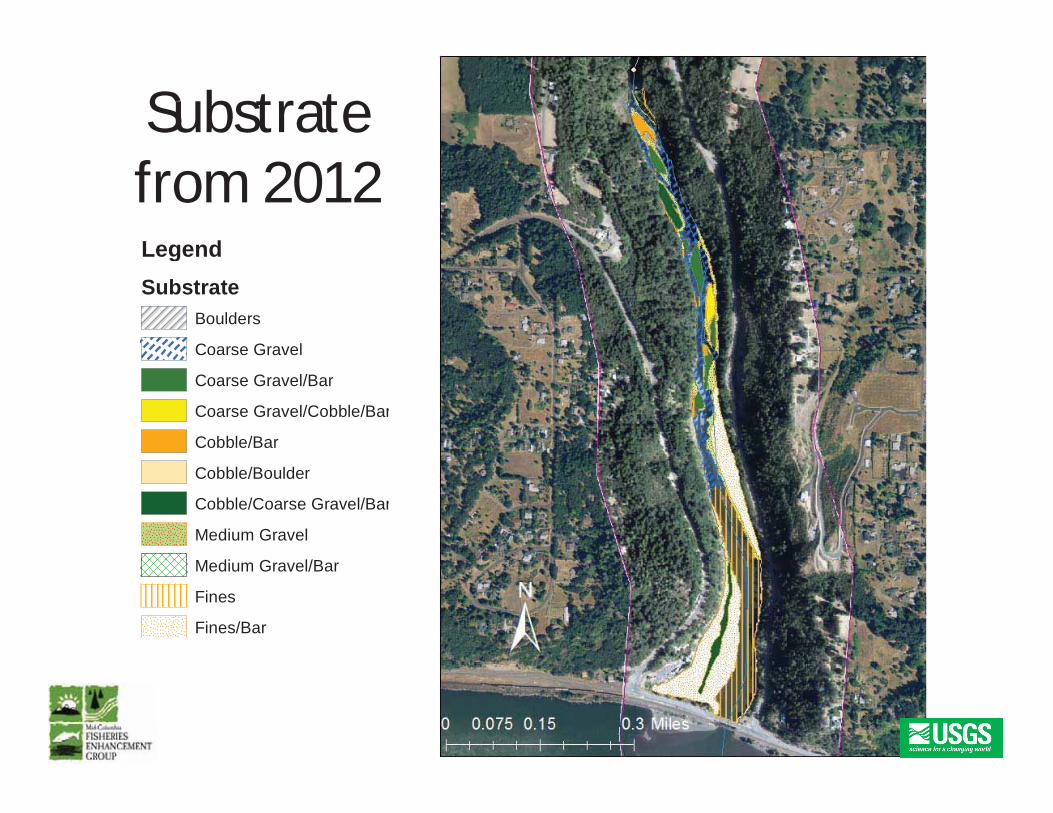
Substratefrom 2012LegendLegendSubstrate
Boulders
Coarse Gravel
Coarse Gravel/Bar
Coarse Gravel/Cobble/Bar
Cobble/Bar
Cobble/Boulder
Cobble/Coarse Gravel/Bar
Medium Gravel
M di G l/BMedium Gravel/Bar
Fines
Fines/Bar
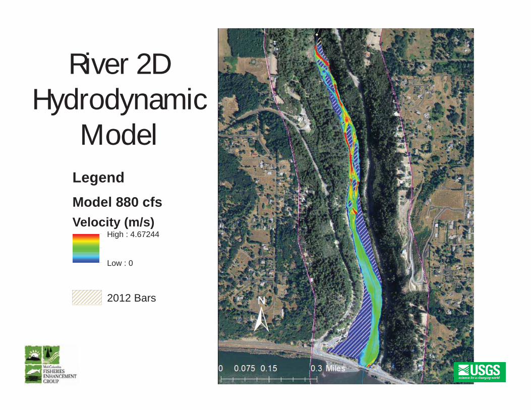
River 2DHydrodynamic
M d lModelLegendLegendModel 880 cfsVelocity (m/s)
High : 4.67244
Low : 0
2012 Bars
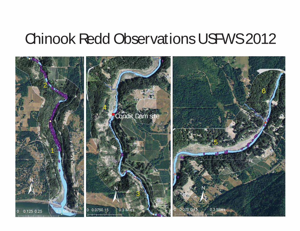
Chinook Redd Observations USFWS 2012Chinook Redd Observations USFWS 2012
26
4Condit Dam site
15
3
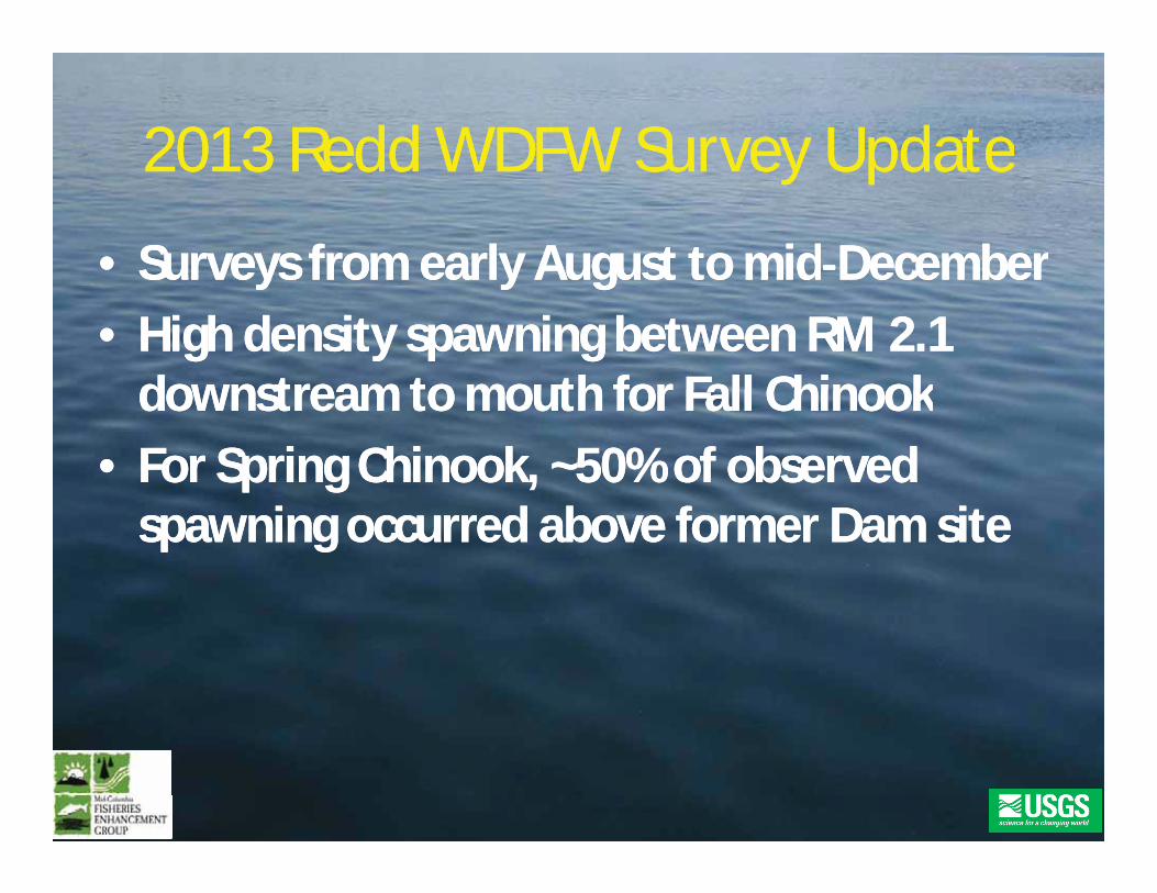
20132013 ReddRedd WDFW Survey UpdateWDFW Survey Update20132013 ReddRedd WDFW Survey UpdateWDFW Survey Update
•• Surveys from early August to midSurveys from early August to mid DecemberDecemberSurveys from early August to midSurveys from early August to mid DecemberDecember•• High density spawning between RM 2.1High density spawning between RM 2.1
downstream to mouth for Fall Chinookdownstream to mouth for Fall Chinookdownstream to mouth for Fall Chinookdownstream to mouth for Fall Chinook•• For Spring Chinook, ~50% of observedFor Spring Chinook, ~50% of observed
spawning occurred above former Dam sitespawning occurred above former Dam site
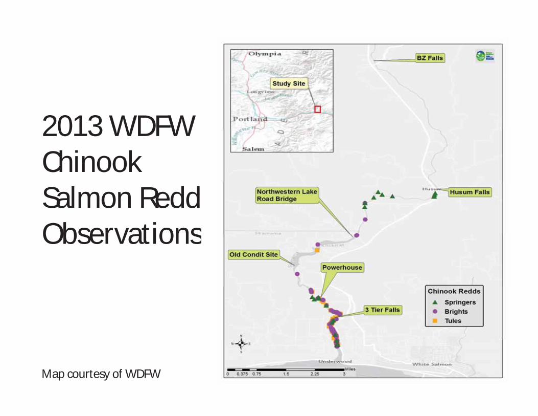
2013 WDFW2013 WDFWChinookSalmon ReddObservationsObservations
Map courtesy of WDFW
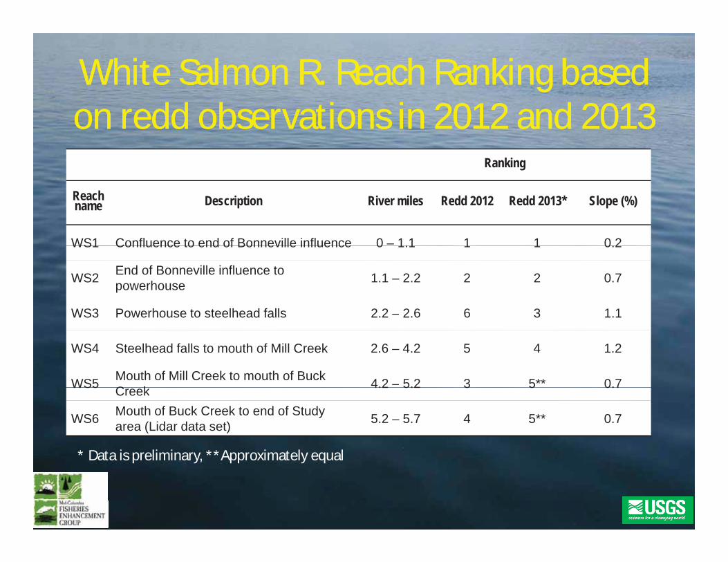
White Salmon R. Reach Ranking basedWhite Salmon R. Reach Ranking baseddddd b db donon reddredd observations in 2012 and 2013observations in 2012 and 2013
Ranking
Reachname Description River miles Redd 2012 Redd 2013* Slope (%)
WS1 Confluence to end of Bonneville influence 0 – 1 1 1 1 0 2WS1 Confluence to end of Bonneville influence 0 1.1 1 1 0.2
WS2 End of Bonneville influence to powerhouse 1.1 – 2.2 2 2 0.7
WS3 Powerhouse to steelhead falls 2.2 – 2.6 6 3 1.1WS3 Powerhouse to steelhead falls 2.2 2.6 6 3 1.1
WS4 Steelhead falls to mouth of Mill Creek 2.6 – 4.2 5 4 1.2
WS5 Mouth of Mill Creek to mouth of Buck C k 4.2 – 5.2 3 5** 0.7WS5 Creek 4.2 5.2 3 5 0.7
WS6 Mouth of Buck Creek to end of Study area (Lidar data set) 5.2 – 5.7 4 5** 0.7
* Data is preliminary **Approximately equalData is preliminary, Approximately equal

Temporal Distribution Based onTemporal Distribution Based onChi k Li C tChi k Li C tChinook Live CountsChinook Live Counts
Graph courtesy of WDFW
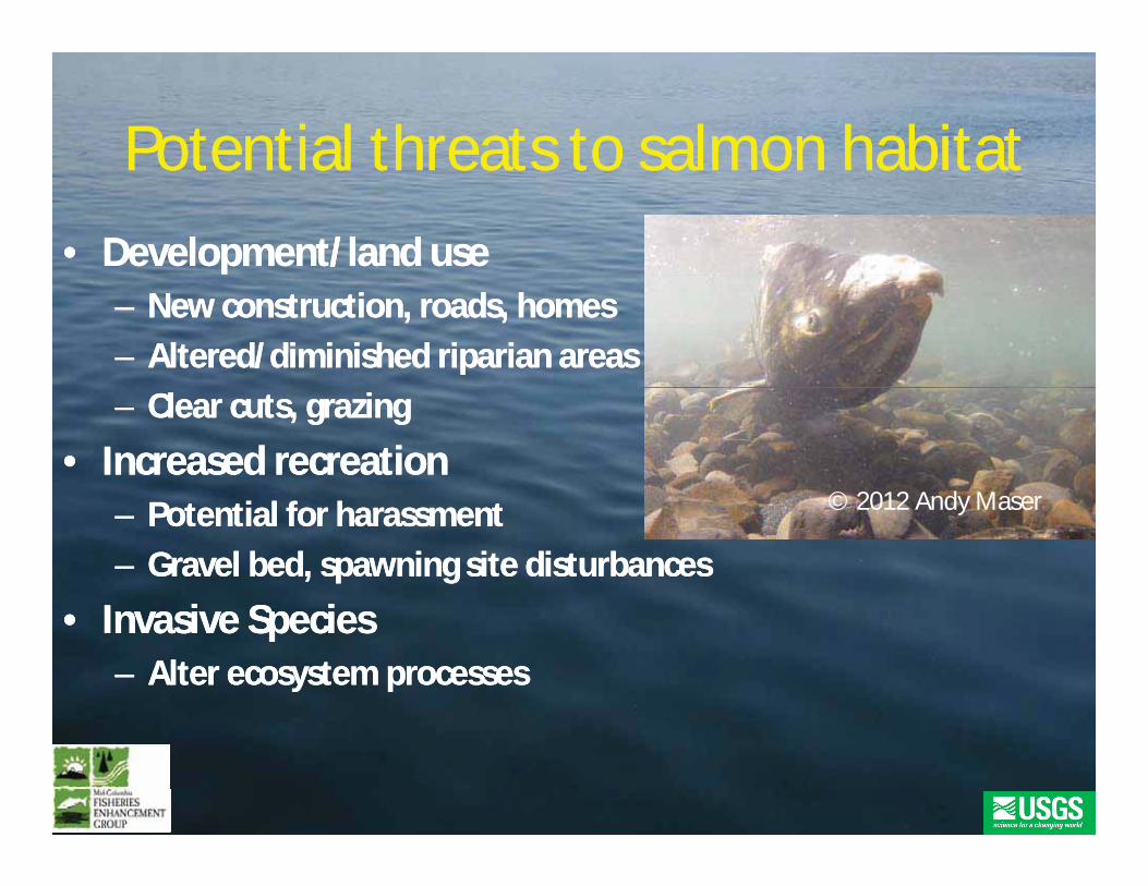
Potential threats to salmon habitatPotential threats to salmon habitatPotential threats to salmon habitatPotential threats to salmon habitat•• Development/land useDevelopment/land use
–– New construction,New construction, roads, homesroads, homes–– Altered/diminished riparian areasAltered/diminished riparian areas–– Clear cuts, grazingClear cuts, grazing
•• Increased recreationIncreased recreation© 2012 Andy Maser–– Potential for harassmentPotential for harassment
–– Gravel bed, spawning site disturbancesGravel bed, spawning site disturbances
I i S iI i S i
© 2012 Andy Maser
•• Invasive SpeciesInvasive Species–– Alter ecosystem processesAlter ecosystem processes
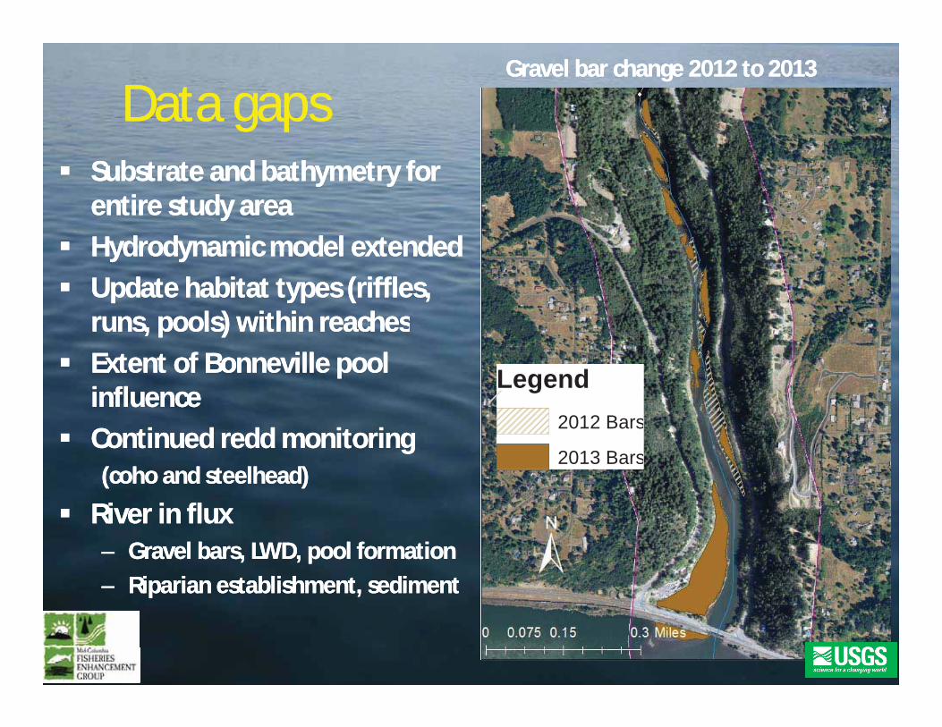
Data gapsData gapsGravel bar change 2012 to 2013Gravel bar change 2012 to 2013
Substrate and bathymetry forSubstrate and bathymetry forentire study areaentire study areaHydrodynamic model extendedHydrodynamic model extendedUpdate habitat types (riffles,Update habitat types (riffles,r ns pools) ithin reachesr ns pools) ithin reachesruns, pools) within reachesruns, pools) within reachesExtent of Bonneville poolExtent of Bonneville poolinfluenceinfluence
Legend
ContinuedContinued reddredd monitoringmonitoring((cohocoho and steelhead)and steelhead)
2012 Bars
2013 Bars
River in fluxRiver in flux–– Gravel bars, LWD, pool formationGravel bars, LWD, pool formation–– Riparian establishment, sedimentRiparian establishment, sedimentRiparian establishment, sedimentRiparian establishment, sediment
SummarySummary•• Study area meets suitable habitat criteria for allStudy area meets suitable habitat criteria for all
salmonidsalmonid life history stageslife history stages•• Lower reaches haveLower reaches have highest observedhighest observed reddredd densitiesdensities
(RM 2.2 to mouth)(RM 2.2 to mouth)•• ReddRedd densities higher in reaches with lowerdensities higher in reaches with lower
slopes/gradientsslopes/gradients•• ReRe vegetation projects will likely enhance habitatvegetation projects will likely enhance habitat
–– Sediment stabilization, cover, and insect/leaf litter inputsSediment stabilization, cover, and insect/leaf litter inputs
ld h l d lld h l d l•• LWD recruitment would enhance pool developmentLWD recruitment would enhance pool developmentand coverand cover

Next stepsNext steps•• IIncorporate 2013ncorporate 2013 reddredd data into GISdata into GIS•• Review and finalize habitat classificationReview and finalize habitat classification
scheme based on life history stages andscheme based on life history stages andspeciesspecies
•• Final fish habitat assessment reportFinal fish habitat assessment reportpp
Th kTh kThank youThank you•• WDFWWDFW Jeremy Wilson and crewJeremy Wilson and crew•• WDFWWDFW –– Jeremy Wilson and crewJeremy Wilson and crew
•• USFWSUSFWS Rod Engle and crewRod Engle and crewgg
•• USGSUSGS Brady Allen, JimBrady Allen, Jim HattenHatten, and Tom, and Tom BattBatt
•• Washington StateWashington State Salmon Recovery FundingSalmon Recovery FundingBoardBoard
•• Andy Maser and SteveAndy Maser and Steve StampfliStampfli