Embed Size (px)
Citation preview

U.S. Department of the Interior Bureau of Reclamation September 2013
Summary Report
Santa Ana Watershed Basin Study

Mission Statements
The mission of the Department of the Interior is to protect and
provide access to our Nation’s natural and cultural heritage and
honor our trust responsibilities to Indian Tribes and our
commitments to island communities.
The mission of the Bureau of Reclamation is to manage, develop,
and protect water and related resources in an environmentally and
economically sound manner in the interest of the American public.

Summary Report
Santa Ana Watershed Basin Study Prepared by: Jack Simes, Project Manager Bureau of Reclamation Southern California Area Office Temecula, California Reviewed by: Mark Norton, P.E., LEED AP Santa Ana Watershed Project Authority Riverside, California
“Water is the most critical resource issue of our lifetime and our children’s lifetime.
The health of our waters is the principal measure how we live on the land.”
~ Luna Leopold Former USGS Chief Hydrologist, and son of conservationist Aldo Leopold

Acknowledgements Effective water resources management approaches like those used in California’s Integrated Regional
Water Management Planning process, also known as the One Water One Watershed (OWOW) 2.0 Plan in
the Santa Ana Watershed, requires much involvement from many sources to craft a useful guide to help
meet future water supply and demand requirements. To that end, the Bureau of Reclamation through the
Basin Study program and many people throughout the Santa Ana River Watershed were engaged in that
intensive planning process in support of accomplishing various objectives over the past two years. Much
thanks goes to:
Santa Ana Watershed Project Authority
Commissioners Terry Catlin, Phil Anthony,
Ron Sullivan, Mark Bulot, and Don
Galleano
Alternate Commissioners Angel Santiago,
Dave Slawson, Harry Sidhu, P.E., Ed
Kilgore, and Tom Evans
General Manager Celeste Cantu and Water
Resources Planning Manager/Co-Study
Manager Mark Norton
SAWPA staff: Jeff Beehler, Rick Whetsel,
Rich Haller, P.E., Carlos Quintero, Peter
Vitt, Dean Unger, Marie Jauregui, Sara
Villa, and Zyanya Blancas
Master Craftsmen: Joe Grindstaff, Wyatt
Troxel, Mark Wildermuth, Gerard
Thibeault, Tim Moore, Jerry King, Larry
McKenney, Don Schroeder, Steve PonTell,
Pete Dangermond, and Jeff Mosher
Bureau of Reclamation
Deputy Commissioner David Murillo
Southern California Area Office Manager
Bill Steele
Technical Services Center staff: Subhrendu
Gangopadhyay, Kristine Blickenstaff, and
Ian Ferguson
Lower Colorado Region Engineering
Services Office staff: Tom Nichols, P.E.
and Colleen Dwyer
Southern California Area Office: Co-Study
Manager Jack Simes and Leslie Cleveland
Kennedy Communications
Maria Elena Kennedy
The OWOW Pillar Chairs and Co-Chairs
Water Resources Optimization: Robert Tincher and Mark Tettemer
Beneficial Use Assurance: Greg Woodside and Mark Adelson
Water Use Efficiency: Pam Pavela and Gail Govey
Low-Impact Development Planning: Susan Lien-Longville and Jerry Blum
Multi-Hazard Preparation: Maryanne Skorpanich and Stewart Mckibben
Natural Resources Stewardship: Lee Reeder and Nancy Gardner
Operational Efficiency and Water Transfers: Behrooz Mortazavi and Craig Miller
Disadvantaged and Tribal Community: Maria Elena Kennedy and Leslie Cleveland
Government Alliance: Eileen Takata and Jack Simes
Energy and Environment Impact Resources: Roy Herndon and Craig Perkins
And all the Santa Ana River Watershed water and wastewater stakeholders and interested parties also
have our sincere thanks. Everyone’s time and expertise in this study is truly appreciated.

Summary Report Santa Ana Watershed Basin Study
Contents
Page
1.0 Summary .......................................................................................................... 1 2.0 Purpose, Scope and Objectives ...................................................................... 5
2.1 Authority ..................................................................................................... 6 2.2 Partner and Stakeholder Involvement ......................................................... 6 2.3 Challenges and Opportunities ..................................................................... 7
3.0 Characterization of Future Conditions ......................................................... 8 4.0 Climate Change Analysis ............................................................................... 9
4.1 Water Supply and Demand Summary....................................................... 14
4.2 Sea Level Rise Impacts ............................................................................. 15
4.3 Addressing Climate Change ..................................................................... 17 4.4 Greenhouse Gas Reduction ....................................................................... 18 4.5 Vulnerabilities ........................................................................................... 21
4.6 Climate Change Adaptation Strategies ..................................................... 22 4.6.1 Tradeoff Analysis............................................................................. 23
4.6.1.0 Urban Water Use Efficiency ................................................... 25
4.6.1.1 Improved Conveyance Systems .............................................. 26 4.6.1.2 Groundwater Management...................................................... 26
4.6.1.3 Pollution Prevention................................................................ 26 4.6.1.4 Stormwater Best Management Practices ................................ 27 4.6.1.5 Forestry Management ............................................................. 27
4.6.2 Additional Strategies ........................................................................ 28
4.7 SARW System Reliability and Risk Assessment ..................................... 28 4.8 Next Steps ................................................................................................. 29
5.0 SARW Brine Management Alternative ...................................................... 31 5.1 Conclusions ............................................................................................... 33 5.2 Recommendations ..................................................................................... 34
6.0 Disadvantaged Communities and Native American Indian Tribes ......... 37 7.0 Future Considerations .................................................................................. 39 8.0 Conclusion ..................................................................................................... 40
9.0 Disclaimer ...................................................................................................... 41
Tables
Table 1: Summary of Effects of Climate Change on Supply ................................ 14
Table 2: Summary of Water Demand for the Santa Ana River Watershed .......... 15 Table 3: OWOW 2.0 Plan Climate Change Information ...................................... 17 Table 4: AB 32 Global Warming Solutions Act Compliance............................... 20 Table 5: SARW Adaptation Strategies ................................................................. 22 Table 6: Cross-reference of vulnerability and adaptation strategies ..................... 24 Table 7: Proposed actions in the ‘no regrets strategy’ .......................................... 25 Table 8: Low regrets strategies ............................................................................. 28

Summary Report Santa Ana Watershed Basin Study
Figures
Figure 1: Santa Ana River headwaters.................................................................... 1
Figure 2: Santa Ana River near Costa Mesa ........................................................... 2
Figure 3: Quail Valley, a disadvantaged community within the SARW ................ 4
Figure 4: Seven Oaks Dam in the San Jacinto Mountains ...................................... 5
Figure 5: Santa Ana River bridge and channel ....................................................... 9
Figure 6: Mill Creek, one of the major tributaries of the Santa Ana River in the
San Bernardino Mountains ........................................................................... 11
Figure 7: Santa Ana River in Los Angeles State Historic Park ............................ 13
Figure 8: Santa Ana River outlet at the Pacific Ocean ......................................... 16
Figure 9: AB 32 GHG emission reduction targets ................................................ 19
Figure 10: Tradeoff analysis methodology ........................................................... 23
Figure 11: SAWPA logo for brine line to the Salton Sea alternative ................... 31
Figure 12: Known contaminant plumes underlying Disadvantaged Communities
and Tribal lands within the Santa Ana Watershed ........................................ 38
Attachments
Appendix A: Santa Ana Watershed Frequently Asked Questions and Findings
A1: Climate and Water Supply
A2: Climate and Groundwater Supply
A3: Climate and Recreation
A4: Climate and Forest Ecosystems
A5: Climate and Snowpack at Big Bear
A6: Climate and Temperature
A7: Climate and Flood Frequency
A8: Climate and Sea Level Rise
Appendix B: SARW Vulnerability Assessment
Appendix C: SARW Groundwater Screening Tool
Supporting Documents
Technical Memorandum No. 1: Climate Change Analysis for the Santa Ana
Watershed
Technical Memorandum No. 2: Greenhouse Gas Emissions Calculator: User’s
Manual
Technical Memorandum No. 3: Inland Empire Interceptor Appraisal Analysis
Report: Overview of Disadvantaged Communities and Native American Tribes in
the Santa Ana River Watershed
Santa Ana Watershed Project Authority ‘One Water One Watershed’ documents –
on-line at: http://www.sawpa.org/owow/

Summary Report Santa Ana Watershed Basin Study
Acronyms and Abbreviations AB Assembly Bill
AF Acre-Feet
BMP Best Management Practice
BOD Biochemical Oxygen Demand
DAC Disadvantaged Community
FAQ Frequently Asked Question
GCM Global Climate Model
GHG Greenhouse Gas
GPD Gallons per day
IRWMP Integrated Regional Water Management Plan
MAFY Million acre-feet per Year
mtCO2e Metric Tons of Carbon Dioxide Gas Equivalent
OCWD Orange County Water District
OWOW One Water One Watershed
Prop California State Proposition
Reclamation Bureau of Reclamation
SAWPA Santa Ana Watershed Project Authority
SARI Santa Ana Regional Interceptor
SARW Santa Ana River Watershed
SLR Sea Level Rise
Study Santa Ana Watershed Basin Study
SWE Snow Water Equivalent
SWP State Water Project
TDS Total Dissolved Solids
TF Treatment Facility
TM Technical Memorandum
Tribe Native American Tribe
TSS Total Suspended Solids
U.S. United States
WaterSMART Sustain and Manage America’s Resources for Tomorrow
WRMS Water Resources Management System

Summary Report Santa Ana Watershed Basin Study

Summary Report Santa Ana Watershed Basin Study
1
1.0 Summary
The U.S. Department of the Interior’s WaterSMART (Sustain and Manage
America’s Resources for Tomorrow) program allows all bureaus of the
Department to collaboratively work with States, Tribes, local governments, and
non-governmental organizations to pursue a sustainable water supply for the
Nation. This is done through a framework that provides federal leadership and
assistance on the efficient use of water, and by integrating water and energy
policies to support the sustainable use of all natural resources. Basin Studies, one
of the tools of this program, are basin-wide efforts to evaluate and address the
impacts of climate change, and define options for meeting future water demands
in river basins in the western United States where imbalances in water supply and
demand exist or are projected.
The Bureau of Reclamation
(Reclamation) and the Santa Ana
Watershed Project Authority
(SAWPA) partnered in the
WaterSMART Santa Ana Watershed
Basin Study (Study). The work done
under the Study was used to help
SAWPA update its One Water One
Watershed (OWOW) Plan. OWOW is
an Integrated Regional Water
Management Plan (IRWMP) for the
Santa Ana River Watershed (SARW)
that serves as the blueprint for
SAWPA, its member agencies and
key stakeholders to effectively manage
water resources over the next
30 years.
The Santa Ana Watershed Basin Study illustrates how effective collaboration can
improve water management. This Study takes a crest-to-coast and corner-to-
corner approach throughout a 2,400-square-mile watershed, which encompasses
everything from beach to mountain communities, to address the area’s unique
water resource challenges. The SARW is home to more than 6 million people, and
tens of millions more people visit the area each year. The region also has a large
manufacturing, industrial, and agricultural base. More than 350 water,
wastewater, and groundwater management, flood control, environmental and
other non-governmental organizations, are working together as partners with
SAWPA on the OWOW Plan. Through the Basin Study Program, Reclamation is
Figure 1: Santa Ana River headwaters (Source: U.S. Forest Service, San Bernardino National Forest)
S

Summary Report Santa Ana Watershed Basin Study
2
partnering with SAWPA and its stakeholders to update key components of the
Plan, now known as OWOW 2.0.
The OWOW 2.0 Plan takes a region-wide look at water supply and demand,
population growth, water quality, flood control, and projected effects of climate
change. Local water sources like the Santa Ana River are critical to the region, but
water imports from the Colorado River and State Water Project (SWP) also play a
key role. However, by the time water from the Colorado River reaches arid
southern California, it contains high concentrations of salt; plus, many of the
region’s agricultural and manufacturing industries generate salt that requires
disposal. This salt imbalance is just one example of the many challenges facing
local water managers who work collaboratively through SAWPA to effectively
and efficiently manage water resources in the region.
Reclamation and SAWPA share a vision for effectively managing the Santa Ana
River basin’s finite water resources to meet future needs. This Basin Study, which
is a 50/50 cost-share partnership, assesses past, present, and future water needs,
especially under climate change scenarios through 2099. The Santa Ana
Watershed Basin Study helped SAWPA and its member agencies identify data
gaps, conduct tradeoff analyses, address the effects of climate change, and
develop effective adaptation strategies.
Reclamation conducted several tasks as part of this Study effort, and provided
SAWPA technical analyses of critical water resources information pertinent to the
Figure 2: Santa Ana River near Costa Mesa (Source: http://geology.campus.ad.csulb.edu/people/bperry/AerialPhotosSoCal/HuntBeachToCostaMesa.htm)

Summary Report Santa Ana Watershed Basin Study
3
SARW, especially those related to climate change, flooding, and sea level rise.
This Study is unique in that this was the first Urban setting in which Reclamation
conducted its climate change analysis. Additionally, decision support tools
developed as part of the analysis helped SAWPA answer a series of frequently
asked questions (FAQs) for the basin. The results are documented in the Climate
Change Analysis Technical Memorandum No. 1 (TM 1); the FAQs are attached as
Appendix A of this report.
The GHG Emissions Calculator for the Water Sector: User’s Manual (TM 2) was
developed by Reclamation as a tool to support the Climate Change Analysis. It
evaluated mitigation strategies, while the Climate Change Analysis focused
primarily on adaptation and vulnerability analysis. The GHG Emission Calculator
is a decision-making tool that can be used to explore the links between water
resources, energy, and GHG emissions. It can be used to determine water supply
and energy demands for a study area ranging from a city block to an entire
watershed, regardless of the level of detailed data available. It is a vital tool for
decision-makers when developing water supply plans for the future, and is also
equipped to evaluate long term GHG emission reduction potential for new
projects that will alter the water supply portfolio.
An appraisal-level analysis was also conducted on the Santa Ana Regional
Interceptor (SARI), also known as the Inland Empire Interceptor or Brine Line.
SARI was one of three salt management alternatives that SAWPA wanted
examined for the basin. In the OWOW 2.0 Plan, the present phase of the OWOW
effort, SAWPA addresses the other two salt management alternatives. One
alternative option considers the cost and impacts of adding an advanced water
treatment system to the Brine Line, and the other option explores direct brine
discharge to the Sea. The appraisal analysis of the Brine Line is found in
Reclamation’s Inland Empire Interceptor Appraisal Analysis Technical
Memorandum No. 3 (TM 3), a 5-volume report which addressed the SARI
history; engineering, brine and flow data; various options and strategies; projected
cost information; recommendations; and an executive summary.
As part of the Study, a Reclamation contractor conducted outreach activities with
Disadvantaged Communities (DACs) within the SARW to develop proposed
actions that would ensure these communities – and their related concerns – would
be included in the water resources planning process. That scope of that work was
coupled with Reclamation’s own outreach effort with Native American Indian
Tribes (Tribes) in and/or associated with the SARW. The merging of these two
outreach engagement efforts expanded SAWPA’s original OWOW 1.0 Plan
approach, which only addressed DACs as part of Environmental Justice activities.
This joint outreach effort paved the way for additional groups to have a voice in
the watershed’s water resources management process. The results of that
engagement are captured in the report entitled Overview of Disadvantaged
Communities and Native American Tribes in the Santa Ana River Watershed.
Summary Report Santa Ana Watershed Basin Study
4
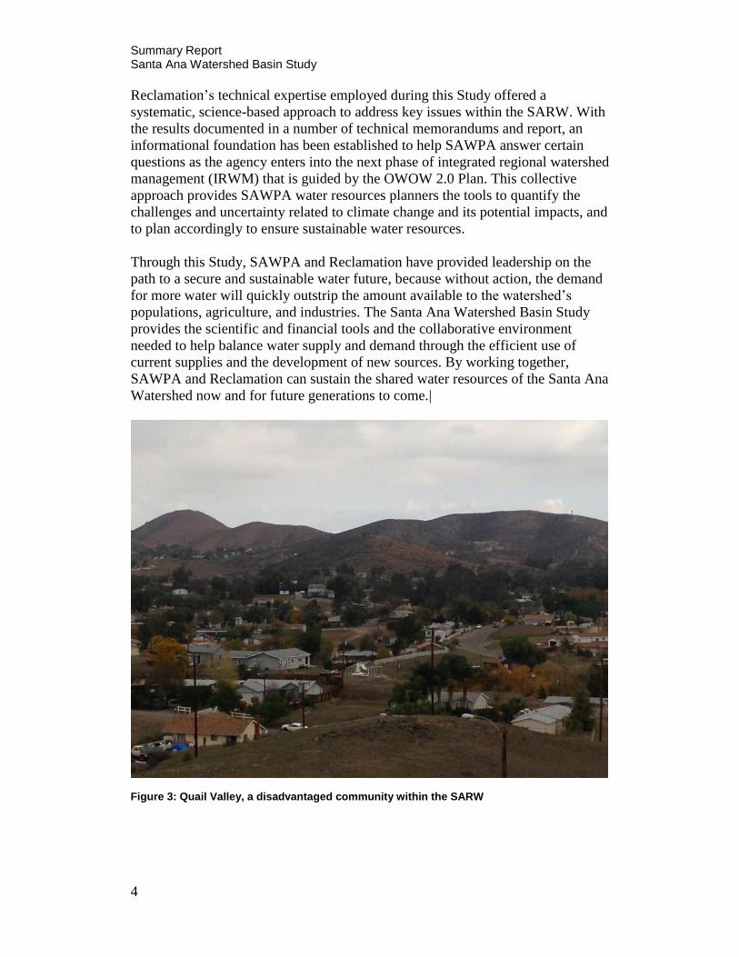
Reclamation’s technical expertise employed during this Study offered a
systematic, science-based approach to address key issues within the SARW. With
the results documented in a number of technical memorandums and report, an
informational foundation has been established to help SAWPA answer certain
questions as the agency enters into the next phase of integrated regional watershed
management (IRWM) that is guided by the OWOW 2.0 Plan. This collective
approach provides SAWPA water resources planners the tools to quantify the
challenges and uncertainty related to climate change and its potential impacts, and
to plan accordingly to ensure sustainable water resources.
Through this Study, SAWPA and Reclamation have provided leadership on the
path to a secure and sustainable water future, because without action, the demand
for more water will quickly outstrip the amount available to the watershed’s
populations, agriculture, and industries. The Santa Ana Watershed Basin Study
provides the scientific and financial tools and the collaborative environment
needed to help balance water supply and demand through the efficient use of
current supplies and the development of new sources. By working together,
SAWPA and Reclamation can sustain the shared water resources of the Santa Ana
Watershed now and for future generations to come.|
Figure 3: Quail Valley, a disadvantaged community within the SARW

Summary Report Santa Ana Watershed Basin Study
5
2.0 Purpose, Scope and Objectives
The Santa Ana River is nearly 100 miles long, the longest river in Southern
California. Today, it retains little of its historical character, but despite being
tamed by two massive dams and confined for much of its course to a flood-control
channel, it remains one of the most important natural features in the highly
urbanized Southern California landscape.
Over the years, the river has supported
a series of increasingly intensive
economic regimes, each one making
more demands on the river’s resources.
The Spanish first introduced irrigation
to their sprawling ranches in the local
floodplains. These cattle ranches were
replaced with towns that rapidly grew
into modern-day Anaheim, San
Bernardino, Santa Ana, Riverside, and
other thriving neighborhoods. To
protect these growing communities
from the threat of floods and to help
capture stormwater runoff that could
support the region’s water supply,
Prado and Seven Oaks dams were
constructed on the river’s mainstem.
This history has shaped much of the regulatory policy and delivery infrastructure
that support SAWPA plans to ensure sustainable, reliable water supplies for the
region. However, new approaches are necessary to adjust to future cycles of
regional growth, aging infrastructure, and economic developments.
SAWPA, formed in 1968 as a Joint Powers Authority, is a water resources
planning agency that plans and builds facilities to protect the water quality of the
Santa Ana River Watershed. It is classified as a government agency that supports
the missions of its member agencies: Inland Empire Utilities Agency, Orange
County Municipal Water District, Eastern Municipal Water District, Western
Municipal Water District, and San Bernardino Valley Municipal Water District. It
also works with more than 350 water, wastewater and groundwater management,
flood control, environmental, and other non-governmental organizations within
and outside the basin.
SAWPA is facilitating efforts to develop a watershed planning framework to
guide water resource management throughout SARW through the year 2030. To
Figure 4: Seven Oaks Dam in the San Jacinto Mountains (Source: http://en.wikipedia.org/wiki/File:Seven_Oaks_Dam.jpg)

Summary Report Santa Ana Watershed Basin Study
6
date, that has resulted in the development of the initial OWOW Plan. The genesis
of this name and process is the recognition of a need for stakeholders across the
watershed to participate in the development of an integrated plan for its water
resources, or an IRWMP. Such a plan ensures all types of water (local surface and
groundwater, imported water, stormwater, and treated wastewater effluent) are
viewed in a comprehensive manner and as a single water resource. Completed in
2010, the OWOW 1.0 Plan provided a foundation for integrated water resource
management throughout the Santa Ana River Watershed.
SAWPA, through the OWOW 2.0 Plan update process, is now exploring future
steps to effectively plan projects that can provide multiple benefits for a variety of
users. As funding resources become scarcer and the challenges of the 21st century
more pronounced, it becomes even more important that each dollar provide the
maximum benefit possible. The OWOW 2.0 Plan examines the connections
between stormwater management and local water supply, land use and water
quality, and accommodation of a growing population with finite water resources,
with the understanding that it is only through a view of the watershed as an
integrated system that successful operational efficiencies can be developed.
This WaterSMART Basin Study offers essential information to help SAWPA
update their OWOW Plan (scheduled to be published in December 2013) to
effectively prepare for the water resources management challenges of the near
future (over the next 30 years).
2.1 Authority
In 2009 Congress passed the SECURE Water Act, directing the U.S. Department
of the Interior to develop a sustainable water management policy. In 2010, the
Secretary of the Interior established WaterSMART, combining existing programs
with new initiatives to create a broad framework for wisely managing the
Nation’s water supplies. Through these programs, Interior is actively working
with Tribal, State, regional, and local water managers to address a range of urgent
issues associated with water scarcity.
2.2 Partner and Stakeholder Involvement
Reclamation and SAWPA collaborated on this Basin Study and throughout the
OWOW 2.0 Plan update process in a variety of ways. Reclamation led a series of
workshops for SAWPA stakeholders to address the basin’s climate change
projections and impacts to water supply, and met and engaged with various
governmental, environmental, regulatory, and business community
representatives.

Summary Report Santa Ana Watershed Basin Study
7
The Study’s core work was completed
through coordination with SAWPA’s staff
and their experts representing various
technical disciplines (known as Pillars) that
addressed specific issues ranging from water
supply and quality to climate change and
environmental justice. SAWPA’s planning
success requires a comprehensive, and at
times, a rigorous systems approach to
adequately address barriers that can serve as
impediments to progress. Reclamation
engagement with SAWPA, its member
agencies and key stakeholders was
paramount for both the Basin Study and the
OWOW 2.0 Plan update to succeed.
2.3 Challenges and Opportunities
OWOW provides a blueprint for SAWPA’s IRWMP approach for the next 30
years. The use of the term ‘integrated’ ascribes multiple meanings in the concept
of water resource management. Not only does it carry the obvious meaning of
managing watershed resources in a cost-effective, efficient manner; it also means
considering multiple needs when managing finite water resources. ‘Integrated’
also means that water agencies, working collaboratively to pool resources with
their watershed neighbors, enables those jurisdictions to accomplish more with
fewer local resources simply because the collaborative effort addresses multiple,
rather than singular, goals. This economy of operation is especially important in
light of today’s environment of scarce resources.
OWOW 1.0 identified numerous projects that support the OWOW vision, but
there continues to be a need to develop high-level watershed management
concepts that, if implemented, can create opportunities to make the watershed
fully sustainable from a water resource perspective within a 30-year planning
horizon. Accordingly, OWOW 2.0 envisions water resources management from a
high-level perspective to help identify concepts that, if adopted and implemented,
would further OWOW’s vision. To that end, SAWPA engaged with Reclamation
through its Basin Study Program to conduct a basin-wide effort to evaluate and
address impacts of climate change, assess an alternative for the basin’s salt
management program, and conduct effective outreach activities with DACs and
Tribes to assess their water resource needs and challenges. The results and
information gathered and reported during the Study will help SAWPA update
their OWOW Plan.
OWOW Pillars
Beneficial Use Assurance
Disadvantaged & Tribal
Community
Energy & Environmental
Response
Government Alliance
Low Impact Development
Planning
Multi-Hazard Preparation
Natural Resource Stewardship
Operational Efficiency & Water
Transfers
Water Resource Optimization
Water Use Efficiency

Summary Report Santa Ana Watershed Basin Study
8
3.0 Characterization of Future Conditions
The following ‘OWOW realities’ were identified by SAWPA’s Steering
Committee and Pillars as assumptions to be included in the Basin Study planning
process and research:
The watershed’s economy has diminished and is changing. It is not
likely to recover to a healthy level within the next 10 years. Utilities
are significantly impacted by local, statewide and national
conditions. The definition of ‘affordability’ has changed. Yet the
need for providing and/or improving services, while at the same time
meeting environmental and regulatory demands, remains the same.
Traditional ways of planning, financing, and implementing projects
for public benefit are not effective in the new economic
environment. New approaches to planning and managing water
resources using improved technologies are needed now. Future
projects require a new economic construct and require extensive
leveraging of resources to ensure their sustainability.
Local projects will continue to be implemented with local and
regional financing, but regional projects that provide broader,
integrated benefits are more economical and sustainable. The gap
between state projects and locally focused projects must be evaluated
and infused with regional projects to reach sustainability goals.
Uncertainty and variability of future water supplies drives the need
for developing regional and sub-regional integrated solutions for
water resource management. All water, regardless of source or
origin, must be treated as a single resource; accordingly, the efforts
to pursue within-watershed management of resources must be
intensified and expanded.
Solutions to Bay-Delta issues, which are expensive and still clouded
in uncertainty, will not be implemented in time to meet the broader
geographic needs of the watershed. SAWPA, using current project
development and economic models, must move ahead with the
development of affordable local and regional watershed solutions.
SAWPA must move expeditiously from short-term to long-term
thinking with regards to water resource management. Sustainability

Summary Report Santa Ana Watershed Basin Study
9
and reliability will be measured by decades. What is collectively
done in this decade will establish the foundation for the future.
Specifically, to achieve success three to four decades out requires
aggressively implementing near-term solutions.
Affordability of needed improvements will require intense pursuit
and development of improved economic technologies and a skilled
workforce. Thus, technology, workforce, and the economy must be
developed simultaneously, not sequentially. Water resource planning
and management must bear responsibility for all three.
SAWPA increasingly experiences regulatory ‘tunnel vision’ because
of the ongoing requirement to comply with program-specific, water-
related regulations. There is a need to look at the watershed as a
whole, identify what needs to be accomplished, and then work with
regulators to ensure that regulatory requirements do not hinder
common sense solutions that enhance water resource sustainability
or limit the ability to address system-wide issues.
Figure 5: Santa Ana River bridge and channel (Source: http://alamar.sdsu.edu/projectphotosrrr.html)

Summary Report Santa Ana Watershed Basin Study
10
4.0 Climate Change Analysis
The climate change TM associated with the Santa Ana Watershed Basin Study
explains the methods used to develop an analysis of potential implications of the
changing climate, and describes how those implications might affect issues of
importance to the SARW. More specifics on Reclamation’s climate change
analysis for the SARW are available in TM 1: Climate Change Analysis.
In 2009, the OWOW 1.0 Plan addressed the impacts of climate change on the
watershed on a very broad scale based on the available science at the time.
Climate change science has and continues to evolve; however, incontrovertible
evidence suggests that changing weather patterns can have a profound impact on
California and within the SARW.
SAWPA, its five member agencies, and key water sector stakeholders know that
warmer temperatures, altered patterns of precipitation and runoff, and rising sea
levels are, in all likelihood, going to continue to increase and may potentially
compromise local and imported water supplies and SARW’s environmental
resources, and challenge the sustainability of SARW communities. SARW’s
water sector managers are aware of these unfolding events and are working
toward developing adaptation strategies as they assess impacts on local water
supply, infrastructure, and imported water sources, including the SWP.
Responding to climate change within the SARW presents significant challenges.
Climate change impacts and vulnerabilities vary in each SARW sub-region, and
the resources available to each water agency to effectively respond to climate
change also differ.
In light of climate change, prolonged drought conditions, potential economic
growth, and population projections, a strong concern exists to ensure an adequate
water supply will be available to meet SARW’s future water demands. The
OWOW 2.0 Plan – through this Basin Study – is incorporating existing regional
and local planning studies within the watershed; sustaining the innovative
“bottom up” approach to regional water resources management planning;
ensuring an integrated, collaborative approach; using science and technology to
assess climate change and greenhouse emissions effects; facilitating watershed
adaptation planning; and expanding outreach to all major water uses and
stakeholders.
Regional solutions and integrated projects, such as those proposed through the
OWOW 1.0 and 2.0 Call for Projects, are vital to SARW’s future and key to
addressing and developing necessary adaptation strategies to help combat effects
of climate change. Reclamation’s TM 1 developed during this Study explains the
methods used to analyze potential implications of changing climate, and how
those implications might affect issues of importance to SAWPA and the SARW.

Summary Report Santa Ana Watershed Basin Study
11
This analysis is vital to planning for climate change to meet future water
demands.
Global climate models (GCMs) used in this study were downscaled to 12-
kilometer grids to make them relevant for regional analysis. The downscaled
GCM projections are produced by internationally recognized climate modeling
centers around the world and make use of greenhouse gas (GHG) emissions
scenarios, which include assumptions of projected population growth and
economic activity.
Future water supply was analyzed
for the SARW using the
downscaled GCMs and a hydrologic
model to project streamflow using
112 different projections of future
climate. Projected climate variables,
including daily precipitation,
minimum temperature, maximum
temperature, and wind speed were
included, as well as historical model
simulations over the period 1950-
1999. Final products include data
sets at key locations for
precipitation, temperature,
evapotranspiration, April 1st Snow
Water Equivalent (SWE), and
streamflow.
These data sets were used to develop key findings for the following frequently
asked questions regarding impacts of climate change on the watershed. (These are
attached to this Summary Report as Appendix A):
Will surface water supply decrease?
• Annual surface water is likely to decrease over future periods.
• Precipitation shows somewhat long-term decreasing trends.
• Temperature will increase, which is likely to cause increased
water demand and reservoir evaporation.
• April 1st SWE will decrease.
Will groundwater availability be reduced?
• Groundwater currently provides approximately 54% of total water
supply in an average year, and groundwater use is projected to
increase over the next 20 years.
Figure 6: Mill Creek, one of the major tributaries of the Santa Ana River in the San Bernardino Mountains (Source: http://www.iewaterkeeper.org/photogallery.html)

Summary Report Santa Ana Watershed Basin Study
12
• Projected decreases in precipitation and increases in temperature
will decrease natural recharge throughout the basin.
• Management actions such as reducing municipal and industrial
water demands or increasing trans-basin water imports and recharge
will be required to maintain current groundwater levels.
• A basin-scale groundwater screening tool was developed to
facilitate analysis of basin-scale effects of conservation, increasing
imported supply, changing agricultural land use, and other factors
that impact basin-scale groundwater conditions.
Is Lake Elsinore in danger of drying up?
• Lake Elsinore has less than a 10% chance of drying up by 2099.
• In the 2000-2049 period, Lake Elsinore has a greater than 75%
chance of meeting the minimum elevation goal of 1,240 ft.
• In the future period 2050-2099, Lake Elsinore has less than a 50%
chance of meeting the minimum elevation goal of 1,240 ft.
• There is less than a 25% chance that Lake Elsinore will drop
below low lake levels (1,234 ft) in either period.
• The Elsinore Valley Municipal Water District project
does aid in stabilizing lake levels; however, for the period 2050-
2099, additional measures will likely be required to help meet the
minimum elevation goal of 1,240 ft.
Will the region continue to support an alpine climate and how will the Jeffrey
Pine ecosystem be impacted?
• Warmer temperatures will likely cause Jeffrey pines to move to
higher elevations and may decrease their total habitat.
• Forest health may also be influenced by changes in the magnitude
and frequency of wildfires or infestations.
• Alpine ecosystems are vulnerable to climate change because they
have little ability to expand to higher elevations.
• Across the State it is projected that alpine forests will decrease in
area by 50-70% by 2100.
Will skiing at Big Bear Mountain Resorts be sustained?
• Simulations indicate significant decreases in April 1st snowpack
that amplify throughout the 21st century.
• Warmer temperatures will also result in a delayed onset and
shortened ski season.
• Lower elevations are most vulnerable to increasing temperatures.
• Both Big Bear Mountain Resorts lie below 3,000 meters and are
projected to experience declining snowpack that could exceed 70%
by 2070.

Summary Report Santa Ana Watershed Basin Study
13
How many additional days over 95°F are expected in Anaheim, Riverside and Big
Bear City?
• All the climate projections demonstrate clear increasing
temperature trends.
• Increasing temperatures will result in a greater number of days
above 95°F in the future.
• The number of days above 95°F gets progressively larger for all
cities advancing into the future.
• By 2070 it is projected that the number of days above 95°F will
quadruple in Anaheim (4 to 16 days) and nearly double in
Riverside (43 to 82 days). The number of days above 95°F at Big
Bear City is projected to increase from 0 days historically to 4
days in 2070.
Will floods become more severe and threaten flood infrastructure?
• Simulations indicate a significant increase in flow for 200-year
storm events in the future.
• The likelihood of experiencing what was historically a 200-year
event will nearly double (i.e. the 200-year historical event is likely
to be closer to a 100-year event in the future).
• Findings indicate an increased risk of severe floods in the future,
though there is large variability between climate simulations.
Figure 7: Santa Ana River in Los Angeles State Historic Park (Source: http://lashp.wordpress.com/2009/07/07/empty-nest-concrete-river-and-lashp/santaana/)

Summary Report Santa Ana Watershed Basin Study
14
How will climate change and sea level rise affect coastal communities and
beaches?
• Climate change will contribute to global Sea Level Rise (SLR)
through melting of glaciers and ice caps and thermal expansion of
ocean waters, both of which increase the volume of ocean water.
• Regional SLR may be higher or lower than global SLR due to
effects of regional ocean and atmospheric circulation.
• Average sea levels along the Southern California coast are projected
to rise by 5 to 24 inches by 2050 and 16 to 66 inches by 2100.
• SLR is likely to inundate beaches and coastal wetlands and may
increase coastal erosion. Effects on local beaches depend on
changes in coastal ocean currents and storm intensity, which are
highly uncertain at this time.
• SLR will increase the area at risk of inundation due to a 100-year
flood event.
• Existing barriers are sufficient to deter seawater intrusion at
Talbert and Alamitos gaps under a 3-foot rise in sea levels.
However, operation of barriers under SLR may be constrained by
shallow groundwater concerns.
As climate science continues to evolve, periodic reanalysis and evaluation will be
needed to inform the decision-making process.
4.1 Water Supply and Demand Summary
Table 1 shown below is a summary of the projected effects of climate change on a
variety of hydroclimate metrics for three future periods (above the most
downstream location, Santa Ana River at Adams St. Bridge). Table 2 shows a
summary of projected water demands out to 2050.
Table 1: Summary of Effects of Climate Change on Supply
Hydroclimate Metric (change from 1990s)
2020s 2050s 2070s
Precipitation (%) 0.67 -5.41 -8.09
Mean Temperature (oF) 1.22 3.11 4.1
April 1st
SWE (%) -38.93 -80.4 -93.07
Annual Runoff (%) 2.6 -10.08 -14.61
Dec-Mar Runoff (%) 9.82 -3.01 -6.38
Apr-Jul Runoff (%) -6.35 -25.24 -31.39

Summary Report Santa Ana Watershed Basin Study
15
Table 2: Summary of Water Demand for the Santa Ana River Watershed
1990 2000 2010 Present 2020 2030 2040 2050
Demand (MAFY) 0.924 1.121 1.298 1.339 1.503 1.723 1.958 2.178
Imported water for the SARW will also likely be affected by the changing
climate. The 2011 SWP Reliability report projects a temperature increase of 1.3°
to 4.0 °F by mid-century and 2.7° to 8.1° F by the end of the 21st century. It
predicts that increased temperatures will lead to less snowfall at lower elevations
and decreased snowpack. By mid-century it predicts that Sierra Nevada snowpack
will reduce by 25% to 40% of its historical average. Decreased snowpack is
projected to be greater in the northern Sierra Nevada, closer to the origin of SWP
water, than in the southern Sierra Nevada. Furthermore, an increase in “rain on
snow” events may lead to earlier runoff.
Given these changes, a water shortage worse than the 1977 drought could occur
one out of every six to eight years by the middle of the 21st century and one out of
every two to four years by the end of 21st century. Also, warmer temperatures
might lead to increased demand. This factor, combined with declining flows, will
likely lead to decreased carryover storage from year to year. Alternative water
supply options such as recycled water, rainwater harvesting, and desalination may
need to be relied upon in order to meet the continually growing demand.
4.2 Sea Level Rise Impacts
Climate change will contribute to global SLR through melting of glaciers and ice
caps and thermal expansion of ocean waters, both of which increase the volume of
water in the oceans. Regional SLR may be higher or lower than global SLR due to
effects of regional ocean and atmospheric circulation.
California’s 2,000 miles of coastline has experienced just under eight inches of
sea level rise over the past decade, a number that is likely to increase drastically
as the climate continues to change. Critical infrastructure, such as roads, hospitals,
schools, emergency facilities, wastewater treatment plants, powerplants, and more
will also be at increased risk of inundation, as are vast areas of wetlands and other
natural ecosystems.
Flooding and erosion already pose a threat to communities along the California
coast and there is compelling evidence that these risks will increase in the future.
In areas where the coast erodes easily, sea level rise will likely accelerate
shoreline recession due to erosion. Erosion of some barrier dunes may expose
previously protected areas to flooding.

Summary Report Santa Ana Watershed Basin Study
16
Within the SARW, Orange County Water District (OCWD) conducted a study to
evaluate the potential effects of projected sea level rise on coastal Orange County
groundwater conditions. Two locations were selected near the Talbert and
Alamitos seawater intrusion injection barriers for analysis. The model for the
analysis used data from well logs, aquifer pump tests, groundwater elevation
measurements, hand-drawn contour maps, geologic cross sections, water budget
spreadsheets, and other data stored in OCWD’s Water Resources Management
System (WRMS) database.
The results showed that regional mean sea level along the southern California
coast is projected to rise by 1.5 to 12 inches by 2030, 5 to 24 inches by 2050, and
16 to 66 inches by 2100. Inundation due to SLR is likely to reduce the area of
beaches and wetlands along the southern California coast. In addition, SLR is
likely to increase erosion of sea cliffs, bluffs, sand bars, dunes, and beaches along
the California coast. However, the overall effects of climate change on local
beaches will depend on changes in coastal ocean currents and storm intensities,
which are less certain at this time.
SLR is likely to increase the coastal area vulnerable to flooding during storm
events. Also, detailed analysis carried out by OCWD found that the Talbert
Barrier would be effective at preventing seawater intrusions through the Talbert
Gap under a 3-foot sea level rise. In the case of the Alamitos Barrier, seawater
intrusion through the Alamitos Gap would likely be prevented once current plans
to construct additional injection wells are implemented. At both barriers,
however, shallow groundwater concerns could limit injection rates and thus
reduce the effectiveness of the barriers.
Figure 8: Santa Ana River outlet at the Pacific Ocean (Source: http://geology.campus.ad.csulb.edu/people/bperry/AerialPhotosSoCal/HuntBeachToCostaMesa.htm)

Summary Report Santa Ana Watershed Basin Study
17
4.3 Addressing Climate Change
Reclamation’s climate change analysis provided SAWPA, its member agencies,
key stakeholders, and OWOW Plan participants specific information necessary to
plan, assess, and rank proposed Proposition (Prop) 84 grant-funded projects
within the Watershed. (Prop 84, the Safe Drinking Water Bond Act, provides
funds to water quality improvement projects that protect drinking water supplies.)
These projects must also address reductions to GHG emissions within their water
management activities. Projects were also given a performance measure to help
determine how effectively the criteria were addressed, which helped with
SAWPA’s ranking process. The table below outlines the climate change analysis
provided by Reclamation that was also included in update of the OWOW 2.0
Plan.
Table 3: OWOW 2.0 Plan Climate Change Information
OWOW Plan Section Climate Change Information Included
SARW Description Describes likely climate change impacts in SARW, determined by a vulnerability assessment (attached to this Summary Report as Appendix B)
OWOW Objectives Adaptation to climate change:
Addresses adapting to changes in amounts, intensity, timing, quality and variability of precipitation, runoff, and recharge.
Considers SLR effects on water supply and other water resource conditions (e.g., recreation, habitat) and identify suitable adaptation measures. Consider Ocean Protection Council’s SLR Policy.
Reducing emissions (mitigation of GHG):
Reduces carbon consumption, embedded energy in water, and GHG emissions.
Strategies adopted by California Air Resources Board in its AB32 Scoping Plan, including innovative applications.
Options for carbon sequestration where options are integrally (direct or indirect) tied to OWOW objectives.

Summary Report Santa Ana Watershed Basin Study
18
Resource Management Strategies Identifies and implements adaptation strategies that address SARW specific or local climate change contributions or impacts.
Project Review Process Includes these factors:
Project contribution to adapt to climate change; and
Project contribution in reducing GHGs, compared to the alternative.
Local Water Planning to OWOW Considers and incorporates water management issues and climate change adaptation and mitigation strategies from local plans into OWOW.
Relation to Local Land Use Planning Demonstrates information sharing and collaboration with regional land use planning in order to manage multiple water demands through the state (as described in California Water Plan Update 2009), adapt water management systems to climate change, and potentially offset climate change impacts to water supply.
Plan Performance and Monitoring Contains policies and procedures that promote adaptive management.
Coordination Considers the following:
• Stay involved in California Natural Resources Agency Adaptation Strategy process, and
Join The California Registry (www.theclimateregistry.org)
(Source: DWR’s 2012 Prop 84 and Prop 1E IRWM Guidelines, Appendix C, Table 7)
4.4 Greenhouse Gas Reduction
Climate change threatens California’s natural environment, economic prosperity,
public health, and quality of life. Recognizing the need for action, California has
put in place ambitious emission reduction goals in the form of Assembly Bill
(AB) 32, the Global Warming Solutions Act. By requiring in law a reduction in
GHG emissions, California has set the stage to transition to a sustainable, clean
energy future. AB 32 directly links GHG emissions and climate change, provides
a timeline for statewide GHG emissions reduction, requires quantitative
accounting of GHG emissions, and enforces disclosure of GHG emissions from
every major sector in the state.

Summary Report Santa Ana Watershed Basin Study
19
AB 32 requires that every major sector in California reduce its GHG emissions to
1990 levels by 2020, and to 80% below the 1990 levels by 2050, shown below in
Figure 9. These targets were developed from the levels of reduction climate
scientists agree is required to stabilize our climate. The red line represents the
projected GHG emissions out to 2050, if no action is taken. In order to reach the
GHG emissions target set by AB 32 for 2020, a reduction of approximately 30%
is required from the ‘no action’ scenario.
Each water agency must address its carbon footprint to help the region meet the
compliance requirements spelled out in AB 32. GHG emissions related to water
consumption in the region must be continually measured and reported. A GHG
Emissions Calculator developed by Reclamation as part of this Basin Study will
help the water sector meet these mandated requirements that drive compliance
with projected GHG targets out to 2050. The Calculator allows users within the
SARW to easily and quickly evaluate how their water management decisions
affect their water demand, energy use, and GHG emissions. More specifics on this
tool are in Reclamation’s GHG Emissions Calculator for the Water Sector:
User’s Manual (TM 2).
TM 2 explains the methods used to develop the calculator and provides
instructions on how to use it by introducing examples. The examples focus on the
SARW and demonstrate how to develop a GHG emissions baseline, evaluate what
actions are required to meet specific GHG emission reduction goals, and illustrate
how the GHG Emissions Calculator can be used to analyze projects.
The GHG analysis was designed to take advantage of best available datasets and
modeling tools and to follow methodologies documented in peer-reviewed
literature. However, there are a number of analytical uncertainties that are not
reflected in Reclamation’s GHG Emission analysis, including uncertainties
Figure 9: AB 32 GHG Emission Reduction Targets

Summary Report Santa Ana Watershed Basin Study
20
associated with the following analytical areas that can be grouped under two
categories—climate projection information and assessing hydrologic impacts that
inform many of the Study FAQs.
The OWOW 2.0 Plan examines current climate change projections to determine
potential impacts, assesses water resource vulnerabilities, and develops a series of
strategies that can be used in projects to adapt to climate change and mitigate
GHGs.
The table below lists suggested implementation actions for SARW stakeholders
that can help reduce energy consumption and ensure AB 32 compliance.
Table 4: AB 32 Global Warming Solutions Act Compliance
Action Ways and Means
Inventory the Water Sector Calculate the watershed’s carbon footprint
Promote Electricity Conservation
Use appliances and vehicles that are efficient; weatherization; implement temperature controls (on A/C and heating units); turn off lights; install CFP bulbs; install LCD computer screens; and use natural light.
Promote Water Conservation
Reduce urban and ag water demands; build resilient communities; integrate water resources management practices; and promote project collaboration and partnerships.
Promote Alternative Energy Use
Install solar, wind, geothermal, tidal, and biomass fuel capacity; and implement any hydropower capabilities.
Implement Offsets Purchase carbon offsets; plant trees; promote innovative approaches and solutions that foster community vitality, environmental quality, and economic prosperity.
Review or Implement Effective Policies
Conduct a gap analysis on the watershed’s policies on dealing with Greenhouse Gas Emissions; create an energy solutions campaign - save energy, reduce your carbon footprint; review applicable laws and ordinances; and promote and implement energy efficiencies and sound conservation practices.
(Source: Climate Adaptation Knowledge Exchange, see: www.cakex.org )

Summary Report Santa Ana Watershed Basin Study
21
4.5 Vulnerabilities
To help SAWPA determine potential watershed vulnerabilities, SAWPA’s Energy
and Environmental Impact Response Pillar assessed Reclamation’s Climate
Change Analysis, and all applicable climate change technical data compiled about
the SARW and its projected outlook through the year 2099. Reclamation used
existing or new climate change models and other resources to help look beyond
what SAWPA described in the OWOW 1.0 Plan and evaluated the amount,
intensity, quality, variability of runoff, recharge, and imported water deliveries to
the watershed that will potentially result from climate change.
Climate change is projected to affect many aspects of water resources
management in the SARW. A critical first step to help prevent and/or mitigate
those impacts is identifying key water sector vulnerabilities. Below is a summary
of four key vulnerabilities in the Santa Ana Watershed (also see Appendix B):
Water Supply
• Insufficient local water supply
• Increased dependence on imported supply
• Inability to meet water demand during droughts
• Shortage in long-term operational water storage capacity
Water Quality
• Poor water quality
• Increased water treatment needs
Flooding
• Increased flash flooding and inland flooding damage
• Increased coastal flooding and inundation of coastal community storm
drains
• Damage to coastal community sewer systems from sea level rise
Ecosystem and Habitat
• Damage to coastal ecosystems and habitats
• Adverse impacts to threatened and sensitive species from reduced
terrestrial flows and sea level rise
Reclamation also coordinated directly with OCWD on SLR modeling in Orange
County that was conducted to help assess potential impacts to the OCWD
seawater intrusion barrier infrastructure and groundwater basins. Another part of
critical criteria in addressing SARW’s vulnerabilities is addressing GHG
emissions from water operations.

Summary Report Santa Ana Watershed Basin Study
22
4.6 Climate Change Adaptation Strategies
Climate adaptation strategies were developed through a consultative process
involving Reclamation and SAWPA staff, and three members of the Energy and
Environmental Impact Response Pillar.
By identifying SARW’s vulnerabilities (listed as a ‘checklist’ in Appendix B),
SAWPA staff, its member agencies, and key water sector stakeholders can work
toward implementing the necessary actions needed to address, adapt to and
mitigate the projected effects of climate change. Detailed in the table below are
adaptation strategies that will be addressed in OWOW 2.0 Plan activities.
Table 5: SARW Adaptation Strategies
SARW Adaptation Activities
Description
Reduce Demand
Promote the State’s 20x2020 Water Conservation Plan in the watershed.
Improve Operational Efficiency
Promote systems reoperations, water transfers, and improved local and regional water conveyance. Optimize operational efficiency, promote water transfers, and develop regional water projects.
Increase Water Supply
Promote conjunctive management and groundwater storage; consider brackish and ocean desalination opportunities and more recycled water use, and local and regional surface storage opportunities. Identify watershed supply sources and increase storage capacity, and improve surface water operating efficiencies.
Land Fallowing
Implement land-use policies that address and reduce ag and urban water use; improve flood and fire risk management; identify ecosystems vulnerabilities, and ways/means to improve water quality. Reduce ag and landscape water demand, promote xeriscape, and improve water supply reliability.
Reduce Coastal Infrastructure Threats
Plan for SLR; optimize coastal infrastructure system operations; maintain and improve infrastructure; and reduce impacts of flooding on habitat and water quality.
Resource Stewardship
Improve management of watershed lands, wildlife, and water resources through conservation, preservation, and ecosystem restoration.

Summary Report Santa Ana Watershed Basin Study
23
4.6.1 Tradeoff Analysis
Based on the OWOW 2.0 Plan Energy and Environmental Impact Response
Pillar’s review and analysis of Reclamation’s Climate Change Analysis TM, the
SARW is potentially highly sensitive to climate change, with a particular
vulnerability to changes in its precipitation, temperature, evapotranspiration, snow
water equivalent, and streamflow. A Tradeoff Analysis was employed to assess
the various climate change adaptation strategies noted in the OWOW 2.0 Plan
update.
Figure 10: Tradeoff Analysis Methodology
Improve Water Quality
Improve drinking water treatment, distribution, and groundwater use. Improve stormwater capture practices; address urban landscape improvements and urban runoff management; improve salinity management practices; implement groundwater remediation and pollution prevention practices.
AB 32 Compliance
Develop methodology for quantifying energy intensity of SARW water supplies and uses. Perform carbon footprint assessment and use the GHG Calculator Tool to identify additional opportunities for reducing carbon emissions.
Public education Increase public outreach and education through the OWOW process

Summary Report Santa Ana Watershed Basin Study
24
Adaptation strategies (listed in Table 5) were cross-referenced with the
vulnerability issues (see Section 4.5) discussed above to determine the number
and type of climate change vulnerabilities that can be addressed. This interaction
is shown in Table 6.
Table 6: Cross-reference of vulnerability and adaptation strategies
Vulnerability
Water Supply Water Quality Flood Ecosystem
Ad
ap
tati
on
Str
ate
gie
s
Reduce Demand
-
Improve Operational Efficiency
Increase Water Supply
-
Land Fallowing -
Reduce Coastal Infrastructure
Threat -
Resource Stewardship
Improve Water Quality
-
AB32 Compliance
Public Education
In this table, the adaptation strategy that will address a vulnerability is marked
with a checkmark (). Analysis of this table shows that four adaptation strategies
– improve operational efficiency, resource stewardship, AB32 compliance, and
public education – would address the four key vulnerabilities in the watershed.

Summary Report Santa Ana Watershed Basin Study
25
These four adaptation strategies collectively form what is referred to as the ‘no
regrets strategy,’ a strategy which argues that energy-saving measures should be
undertaken immediately to help reduce climate change impacts. Such a strategy is
one that would provide benefits in the present while also reducing vulnerability to
future climate change impacts. If immediately implemented, such a strategy may
provide some benefit even under the uncertainty of climate change projections.
Specific actions under the ‘no regrets strategy’ are listed in Table 7.
Table 7: Proposed actions in the ‘no regrets strategy’
Proposed Action
Improve Operational Efficiency
Resource Stewardship
AB32 Compliance
Public Education
Urban Water Use Efficiency
Improved Conveyance
System
GW Management
Pollution Prevention
Stormwater BMP
Forestry Management
(Source of ‘no regrets’: http://economics.socialsciencedictionary.com/Environmental-Economics-Dictionary/No_Regrets_Strategy)
Description of individual proposed actions under the ‘no regrets strategy’ is given
below.
4.6.1.0 Urban Water Use Efficiency
Conservation of existing water supplies is of utmost importance to a growing
population in the SARW. A representative analysis from Orange County (see
TM 1, Chapter 5, Section 5.3) shows that per capita water use will need to be
reduced from the current value of about 175 gpd (gallons per day) to about 98
gpd by 2030.

Summary Report Santa Ana Watershed Basin Study
26
4.6.1.1 Improved Conveyance Systems
By increasing the efficiency of local and regional conveyance systems, water
can be moved at a decreased cost. This is particularly important in the context
of being compliant with the AB32 legislation, and is related to urban water
use efficiency. With reduced per capita water use (see Orange County
example in TM 1, Chapter 5, Section 5.3), greenhouse gas emissions
(mtCO2e) can be reduced from the current level of about 120,000 mtCO2 to
about 75,000 mtCO2e by 2030.
4.6.1.2 Groundwater Management
By taking into account the balance between groundwater and surface water,
managers can improve long-term viability of each resource. Reclamation
developed a Groundwater Screening Tool (included in TM 2) to evaluate
impacts to groundwater from a changing climate, and to evaluate effective
conjunctive surface water groundwater management. The groundwater
screening tool was applied to four groundwater basins (Orange County, Upper
Santa Ana Valley, San Jacinto, and Elsinore) within the watershed. As an
example, potential actions to avoid projected water level declines in Orange
County are listed below. Each alternative listed will protect against
groundwater declines through 2060.
Reduce M&I demand with a gradual reduction of approx. 15% by
2020 (i.e., reduce per capita use from ~175 gpd in 2010 to ~150
gallons per day by 2020 to ~98 gpd by 2030).
Increase local water supplies by ~75,000 af per year through recycled
water treatment capacity, development of seawater desalination
capacity, and increase stormwater capture efficiency.
Increase imports from the Colorado River Aqueduct and State Water
Project gradually from ~30,000 acre-feet (af) per year to ~105,000 af
per year (this may not be feasible due to cost, greenhouse gas
emissions, or availability).
Reduce summertime groundwater pumping.
4.6.1.3 Pollution Prevention
Preventing and remediating polluted water resources improves quality for
users and improves long term viability of local resources. This includes
improved salt management in brackish desalinization and water reuse systems
in the Santa Ana River Watershed. Specific alternatives analyzed (see Inland
Empire Interceptor [IEI] Appraisal Analysis TM 3) include:
Modification to the existing Brine Line system.
Salton Sea considerations including, restoration plans, salt load and
increased water supply to Salton Sea.
Brine pre-treatment strategies.
Alternative pipeline alignments including easement, right of way,
and designs.
Remediate polluted groundwater to reduce treatment of larger
quantities of migrating water (future avoided costs).

Summary Report Santa Ana Watershed Basin Study
27
Further details on water quality and salinity impacts regarding concentrations
and costs are presented in the IEI TM 3.
4.6.1.4 Stormwater Best Management Practices (BMP)
Implementing stormwater BMPs reduces storm runoff and pollution,
improves groundwater recharge, improves air quality, reduces heat island
effect, and decreases sun exposure to asphalt. Best Management Practices
will continue to be required in the Watershed. SAWPA member agencies and
flood control districts, and the Regional Water Quality Control Board will
continue to enforce BMPs.
4.6.1.5 Forestry Management
Create plans to restore, sustain and enhance forest health and watershed
functions within forests. As part of forest management, SAWPA has initiated
a Forest First initiative in collaboration with the U.S. Forest Service. As
home to the headwaters of the Santa Ana River, the San Bernardino and
Cleveland national forests encompass approximately 33% of the Santa Ana
watershed’s land mass. These forest areas also receive 90% of annual
precipitation. Forest management practices have direct effects on both water
quality and quantity, particularly relative to forest fires and the consequential
effects of soil erosion and water storage.
The collaborative efforts in the Forest First plan include four main watershed
restoration strategies that would provide significant benefits to downstream
water supply and quality. The first of these strategies includes forest fuels
management, which would focus on reducing understory growth that can
contribute to the intensity of fires, making them more devastating and
difficult to fight. The second strategy involves restoration of chaparral plant
communities in areas that have not recovered due to repeated fires, and where
native vegetation has been replaced by grasses that increase runoff, instead of
the chaparral capturing and dispersing rainfall, and allowing moisture to
percolate and recharge groundwater basins. The third strategy is meadow
restoration that would involve returning water that had been converted to
conveyance back to a meadow sheet flow so that the meadow can function in
a natural groundwater recharge capacity. The last strategy involves
retrofitting roads in order to reduce water conveyance, reduce fire risk, and
increase the number of fire breaks.
Further details on this initiative are available at:
http://www.sawpa.org/owow/projects/forest-first/.
This analysis of the ‘no regrets strategy’ allows SAWPA, its member agencies,
and key stakeholders an opportunity to assess proposed Prop 84 projects and
specific adaptation strategies and the cost and benefits in terms of productivity,
mitigation potential, resilience, and sustainability. The most promising projects
and strategies can then become part of SAWPA’s toolbox of climate change
adaptation strategies. SAWPA’s ‘no regret strategies’ will, however, tend to

Summary Report Santa Ana Watershed Basin Study
28
encourage incremental adaptation responses as opposed to more expansive
adaptation responses.
4.6.2 Additional Strategies Beyond ‘no regrets strategies’ a group of actions under what could be referred to
as ‘low regrets strategies’ can be formulated. ‘Low regrets strategies’ are designed
to facilitate adaptation with respect to climate change predictions. These strategies
are marginally more costly than ‘no regrets strategies’ and have a stronger
reliance upon climate change predictions, especially more severe scenario
predictions. As such, they provide a scientifically conservative approach to public
health and safety in terms of water supply.
‘Low regret strategies’ are important to consider in terms of a planning horizon.
For example, such strategies for SAWPA might include changing the design of
infrastructure that is intended to last many years to a design that, despite an
incremental cost increase, will serve its intended purpose even under an increased
risk climate change model.
Table 8: Low regrets strategies
Low Regrets Strategy Description
Emissions Targets Conduct a survey of emissions generated from all water related operations and plan for a specific reduction in carbon emissions.
Expanded Flood Control Infrastructure
Climate change projections call for an increase in the intensity of storms and existing infrastructure may not be effective.
Solar Projects for Water Conveyance Systems
Using solar power as part of a renewable energy portfolio helps water districts control variable costs as well as decrease carbon emissions.
Consider high SLR
Model Predictions and Build New Infrastructure Accordingly
When in the planning process for building new water related infrastructure, deliberately plan for SLR and design the project accordingly.
Expansion of Wetlands
By expanding natural wetlands project areas, sea level rise will not inundate existing wetlands. In addition, wetlands provide carbon reduction benefits, water filtration benefits, heat island reduction and habitat benefits.
4.7 SARW System Reliability and Risk Assessment
Under the SECURE Water Act Section 9503(b)(2), the Climate Change analysis
developed by Reclamation in TM 1, Section 3 – Water Supply and Demand
Projections assesses specific risks to SAWR’s water supplies, including those
related to:

Summary Report Santa Ana Watershed Basin Study
29
changes in snowpack;
changes in the timing and quantity of runoff;
changes in groundwater recharge and discharge; and
any increase in the demand for water as a result of increasing temperatures
and the rate of reservoir evaporation.
The impetus for effective integrated water and related resources management in
the SARW is the recognition that the following factors threaten the future of the
region’s water resources:
Drought conditions in the Colorado River Watershed, a primary source of
imported water to the Santa Ana River Watershed
Unpredictability of future water imports from the San Joaquin-Bay Delta
and Colorado River Watershed due to uncertainties in water availability
and changing water management requirements
Continued population growth and development that puts further stress on
the natural hydrology of the watershed and increases the need for
additional assured water supplies
Uncertainties of climate change and its associated hydrologic variability
This Basin Study and Reclamation’s collaborative work effort with SAWPA, its
member agencies and stakeholders on updating the OWOW Plan are the
watershed’s preliminary answer to these threats. The Plan envisions stakeholders
taking an active role in creating a watershed that:
Is sustainable, drought-proofed and salt-balanced by 2030
Protects its water resources and uses water efficiently
Supports economic and environmental viability
Mitigates and adapts to a changing climate
Corrects environmental justice deficiencies
Minimizes interruptions to natural hydrology
Creates a new water ethic at both institutional and personal levels
4.8 Next Steps
Several tools have been developed by Reclamation for SAWPA, its member
agencies and key water sector stakeholders to address the effects of climate
change and plan ways to adapt or mitigate those potential impacts. Adaptation is
the key component in the toolbox to help water resources planners and water
sector decision-makers thoroughly understand and evaluate potential
vulnerabilities from climate change impacts.
Research on climate change impacts is still evolving and as new findings are
developed, they are shared throughout the SARW and California. Reclamation
will continue to explore innovative quantitative tools to help assess vulnerabilities

Summary Report Santa Ana Watershed Basin Study
30
and conduct decision support analysis to help SAWPA progress toward
addressing climate change impacts in SARW. Actions that have been productive,
and will continue to be in working toward this goal include:
Aggregation of climate change knowledge from state and federal research;
Further assess No and Low Regret strategies;
Develop a centralized a clearinghouse of information and lessons learned
for member agencies;
Offer web-based and workshop-delivered information on climate change
impacts for the SARW;
Create adaptation strategies and share that information with the water
sector;
Conduct webinars to further collaboration among water agencies;
Develop regional case studies to discuss implementation actions;
Bring additional agencies and officials into the discussion;
Encourage innovative projects and search for flexibility;
Seek to use evaluation studies/economic analysis as part of the message;
Examine co-benefits to gain more support;
Ensure disadvantaged and tribal communities have roles in the planning;
Continue to involve key watershed stakeholders;
Explore supportive resources/connections: Water Research Foundation,
Water Environment Federation, Climate Ready Estuaries; and
Collaborate whenever possible.

Summary Report Santa Ana Watershed Basin Study
31
5.0 SARW Brine Management Alternative
The Santa Ana
Watershed Basin Study
addressed SAWPA’s
Regional Interceptor
(SARI) system, also
known as the Inland
Empire Interceptor (IEI)
Brine Line. The Brine
Line was constructed to
help SAWPA manage
the basin’s water quality
by exporting highly
saline waters from the
Inland Empire to a
wastewater treatment plant in Orange County where the effluent is processed for
ocean discharge. Like nearly all watersheds in arid climates, salt management is
essential for water resource managers to ensure populations and ecosystems
continue to thrive. Reclamation’s Inland Empire Interceptor Appraisal Analysis is
listed part of this Basin Study as TM 3.
SAWPA’s Brine Line, an important tool in managing inland groundwater basins,
has allowed businesses with industrial processes that produce brine to move into
and expand in the Inland Empire. Orange County also benefits from the Brine
Line through the removal of salinity from the Santa Ana River, providing a
reliable level of protection for its water quality and reducing the area’s
dependence upon imported water.
The salt management alternative analyzed by Reclamation assumes all the flows
in the Brine Line would be collected just below Prado Dam, the lowest elevation
in the upper watershed, and that a separate pipeline would be constructed to
transport that flow directly to the Salton Sea. The Salton Sea, California’s largest
inland lake, is a shallow, highly saline basin with no outfall to external water
bodies. It is 14,000 parts per million saltier than ocean water.
Such a pipeline could accommodate additional saline flows which would be
treated to some extent prior to discharge into the Salton Sea. Reclamation’s
engineering analysis and recommendations are attached as TM 3, and are an
appendix in the OWOW 2.0 Plan. Based on that analysis, SAWPA remains
hopeful that as new partnerships are developed with potential brine customers
throughout the Basin and other parts of the state, the viability of this salt
Figure 11: SAWPA logo for brine line to the Salton Sea alternative

Summary Report Santa Ana Watershed Basin Study
32
management alternative will become a truly system-wide solution. Reclamation’s
TM 3 recommended that SAWPA conduct an economic analysis to help examine
the viability of this proposed undertaking.
Developed as part of the Basin Study, the Conclusions (Opportunities) and
Recommendations (Optimization Strategies) associated with this IEI Brine Line
alternative are summarized in Table 9. Priority rankings are assigned to
Recommendations, which are loosely based on the potential influence on the
estimated project costs and/or the value of anticipated benefits. Details for each of
these elements follow the table.
Table 9: Conclusions and recommendations related to the IEI Brine Line
CONCLUSIONS
(OPPORTUNITIES)
RECOMMENDATIONS (OPTIMIZATION STRATEGIES)
R1
- E
con
om
ic Im
pac
t A
nal
ysis
R2
- S
alto
n S
ea W
ater
Bu
dge
t
R3
- S
alto
n S
ea S
alin
ity
& W
ater
Qu
alit
y M
od
el
R4
- IE
I In
flu
ence
on
Sal
ton
Sea
Sal
init
y
R5
- IE
I In
flu
ence
on
Sal
ton
Sea
Wat
er Q
ual
ity
R6
- In
flu
ence
of
Salt
on
Sea
on
IEI D
esig
n
R7
- B
asin
Pla
n A
me
nd
me
nt
Pro
cess
R8
- Id
enti
fy, I
nve
stig
ate,
& In
itia
te
Par
tner
ship
s
R9
- H
ybri
d S
trat
egie
s fo
r B
rin
e Tr
eatm
ent
R1
0 -
Alt
ern
ativ
e D
esig
ns
for
Surp
lus
Ener
gy
R1
1 -
Alt
ern
ativ
e Li
ner
Mat
eria
ls
R1
2 -
Tu
nn
elin
g in
Lie
u o
f D
irec
t B
ury
R1
3 -
Ph
asin
g o
f Im
pro
vem
ents
PRIORITY 1 2 2 2 2 2 3 4 5 6 7 7 7
C1 - Economic Development 1 X
C2 - Net Impact 2 X X X X X
C3 - Salton Sea Restoration 2 X X X X X
C4 - Basin Plan 3 X
C5 - Stakeholder Partnering 4 X
C6 - Salton Sea Salinity 2 X X X X
C7 - Salton Sea Water
Quality 2 X X X X
C8 - Brine Pre-treatment and
Treatment 5 X
C9 - Management of Surplus
Energy 6 X
C10 - Other Opportunities 7 X X X

Summary Report Santa Ana Watershed Basin Study
33
5.1 Conclusions
The Conclusions from the Appraisal Analysis are summarized as follows:
C1. Economic Development: The economic development potential
associated with the proposed IEI is significant and unique to this option. If
implemented, the proposed IEI would make brine management
infrastructure available to prospective employers located in the San
Gorgonio Pass and Coachella Valley areas.
C2. Net Impact: The proposed IEI would impact the Salton Sea in
various ways, some of which may be considered beneficial and others
negative. Further investigation and analysis of these aspects would help
determine design criteria for associated components of the proposed IEI.
C3. Salton Sea Restoration: Delays to implementation of a restoration
plan for the Salton Sea have contributed to uncertainties regarding salinity
and water quality aspects of the proposed IEI. Improved understanding of
progress toward restoration of the Sea would help determine appropriate
project design criteria for the affected components of the proposed IEI.
C4. Basin Plan: Uncertainties regarding Salton Sea salinity and water
quality regulatory requirements contribute to uncertainties regarding
planning and design of associated components of the proposed IEI and the
associated costs.
C5. Stakeholder Partnering: The standards established in the Basin Plan
for salinity and water quality in the Salton Sea are a deterrent to potential
new sources of water supply to the Sea. Community and stakeholder
support would enhance the likelihood of adoption of changes to those
standards.
C6. Salton Sea Salinity: The salts in the IEI flows would add to the
existing rate of accumulation of salts in the Sea. Whether those salts
would cause total dissolved solids (TDS) concentrations in the Sea to
increase will depend on such factors as the magnitude of the Salton Sea
water budget imbalance over time and progress toward implementation of
a Salton Sea restoration plan.
C7. Salton Sea Water Quality: Similar to salinity, whether the total
suspended solids (TSS) and biochemical oxygen demand (BOD) in the IEI
flows would cause an adverse impact on the water quality in the Salton
Sea will depend on such factors as the magnitude of the Salton Sea water
budget imbalance over time and progress toward implementation of a
Salton Sea restoration plan. The estimated cost of the proposed Water
Quality Treatment Facility (TF) represents a substantial portion of the total

Summary Report Santa Ana Watershed Basin Study
34
estimated costs for the project, which calls for careful scrutiny of the
design criteria for this facility.
C8. Brine Pre-treatment and Treatment Strategies: The proposed TF
could function in place of the Brine Pre-treatment and Treatment
Strategies presented in the Salinity Management Program, or it could
function as part of a hybrid design in combination with a Strategy from the
Salinity Management Program.
C9. Management of Surplus Energy: The large estimated costs of the
proposed IEI Turbine Generator Stations and associated electric
transmission facilities indicate that the time period necessary to recover
that investment in would be long. The estimated cost of the proposed IEI
could likely be significantly reduced by using an alternative approach to
remove surplus energy from flows in the system.
C10. Other Opportunities: Examples of other opportunities to refine,
reduce and/or eliminate estimated costs identified in this Appraisal
Analysis include but are not limited to the following:
Synthetic Membrane Liner - The synthetic membrane liner under the
TF is the largest single component of the estimated cost of that
facility; use of an alternative approach to soil permeability could
likely significantly reduce that cost.
Tunneling – Tunneling in lieu of direct bury of the proposed
pipeline through the Badlands west of the City of Beaumont along
the Gas Main Alignment may reduce impacts associated with
construction of the project.
Phasing - Phasing of certain project components could allow some
project costs to be deferred.
5.2 Recommendations
The recommended next steps for further investigation and analysis of the
proposed IEI to refine the scope, conceptual designs, estimated costs and
anticipated benefits of the proposed IEI include:
R1. Economic Impact Analysis: In response to Conclusion C1
(Economic Development), perform an economic impact analysis for the
proposed IEI to quantify the economic development and other benefits of
the proposed IEI.
R2. Salton Sea Water Budget: In response to Conclusions C2, C3, C6
and C7, develop water budgets for the Salton Sea and for the planned
Salton Sea restoration, or update available existing water budgets.

Summary Report Santa Ana Watershed Basin Study
35
R3. Salton Sea Salinity and Water Quality Models: In response to
Conclusions C2, C3, C6 and C7, develop models for salinity and water
quality in the Salton Sea and for the planned Salton Sea restoration, or
update available existing models.
R4. IEI Influence on Salton Sea Salinity: In response to Conclusions C2,
C3 and C6, use the water budgets and the salinity models for the Salton
Sea to evaluate the impact of proposed IEI flows on TDS concentrations in
the Salton Sea, to evaluate the influence of those impacts on the IEI
design, and to refine estimated costs for the proposed IEI.
R5. IEI Influence on Salton Sea Water Quality: In response to
Conclusions C2, C3 and C7, use the water budgets and the water quality
models for the Salton Sea to evaluate the impact of the proposed IEI flows
on TSS and BOD concentrations in the Salton Sea, to evaluate the
influence of those impacts on the IEI design, and to refine estimated costs
for associated components of the proposed IEI.
R6. Salton Sea Restoration Influence on IEI Design: In response to
Conclusion C2, C3, C6 and C7, use the water budgets and the salinity and
water quality models for the Salton Sea restoration to evaluate the impact
of the proposed IEI flows on the planned restoration, to evaluate the
influence of the planned restoration on the IEI design, and to refine
estimated costs for the proposed IEI.
R7. Basin Plan Amendment Process: In response to Conclusion C4
(Basin Plan), evaluate the process and technical requirements for a Basin
Plan Amendment to modify Salton Sea salinity and water quality
regulatory requirements for the proposed IEI.
R8. Identify, Investigate & Initiate Partnerships: In response to
Conclusion C5 (Stakeholder Partnering), seek opportunities to partner
with other Salton Sea stakeholders in support of regulatory changes to
encourage new sources of water supply to the Salton Sea in support of
restoration efforts. This effort may include:
Establish a dialogue with other organizations serving the San
Gorgonio Pass, Coachella Valley areas, and/or other areas adjacent
to the Salton Sea,
Investigate community support for changes to the regulatory
approach to Salton Sea salinity and water quality standards to
encourage new sources of water supply for the Salton Sea, and
Summary Report Santa Ana Watershed Basin Study
36
Develop specific proposals for suggested regulatory changes and
identify benefits. Communicate the suggested regulatory changes
and associated benefits to the community.
R9. Hybrid Strategies for Brine Treatment: In response to Conclusion
C8 (Brine Pre-treatment and Treatment Strategies), identify and evaluate
alternative strategies for treatment of the IEI flows, which may include
hybrid designs incorporating Salinity Management Program brine pre-
treatment strategies in combination with alternative configurations of the
wastewater treatment ponds and/or constructed wetlands that comprise the
TF considered in this Appraisal Analysis.
R10. Alternative Designs for Surplus Energy: In response to Conclusion
C9 (Management of Surplus Energy), develop and evaluate alternative
strategies for management of surplus energy in IEI flows such as low-head
in-line turbine generators and pressure reducing valves.
R11. Alternative Liner Materials: In response to Conclusion C10 (Other
Opportunities), investigate alternatives to the proposed synthetic
membrane liner under the TF, including site-specific soil investigations to
determine actual soil permeability to facilitate investigation of alternatives
such as soil treatment using clay and suitability of a “leaky wetland”.
R12. Tunneling: In response to Conclusion C10 (Other Opportunities),
investigate the constructability of and the impacts associated with direct-
bury of the proposed pipeline through the Badlands west of the City of
Beaumont along the Gas Main Alignment and the feasibility of tunneling
in lieu of direct bury in that area.
R13. Phasing of Improvements: In response to Conclusion C10 (Other
Opportunities), investigate opportunities for phasing of selected project
components (e.g. use of dual pipelines in Coachella Valley) to defer costs
until warranted by system flows, including a Present Worth analysis of the
phased project costs.

Summary Report Santa Ana Watershed Basin Study
37
6.0 Disadvantaged Communities and Native American Indian Tribes
Disadvantaged Communities (DACs) and Native American Indian Tribes (Tribes)
have water issues and concerns like other SARW communities. During the Basin
Study, Reclamation and a contractor outreached to DACs and Tribes within the
watershed to gather pertinent information on these communities and cultures, and
to develop potential strategies that SAWPA could implement to address their
water needs and challenges. Details of the joint outreach activity for these
communities are captured in the report named Overview of Disadvantaged
Communities and Native American Tribes in the Santa Ana River Watershed.
DACs are economically unique, as defined by the state, and reside in both urban
and rural community settings. To assist in identifying DACs in each of the SARW
sub-region, meetings were held with the California Department of Public Health
and the Santa Ana Regional Water Quality Control Board. Once the DACs were
identified, meetings were held with local public agencies that provided more
detailed knowledge on the challenges DACs may face. Additionally, meetings
were also held with the DAC residents. These outreach activities engaged 14
DACs in four counties that encompass the watershed.
Tribal communities are sovereign nations and must be respected for that
difference. They reside on reservations, whose lands are set aside by the federal
government in perpetuity. Engaging tribes is critical to giving them a voice in the
process, and provides a means to be an equal and active participant with other
watershed stakeholders. As part of the outreach process the four Tribes in the
SARW were contacted, although not all provided input back to Reclamation for
its report. Outreach was also extended to four other Tribes with lands extending
into the watershed boundary.
DACs and Tribes face critical and serious challenges such as failing septic
systems, isolation, language barriers, flooding, lack of funding, contaminant
plumes, and lack of resources to name a few. It is imperative that water sector
managers recognize DAC and Tribal water project needs and engage these
communities early in the planning process. SAWPA’s OWOW 2.0 update process
recognizes the various funding needs for DACs and Tribes and the limitations of
Federal and state funds available to them.
One solution to the issues identified in the report is to ensure that all communities
have the information, financial and technical resources, and administrative and
regulatory policies they need to make informed decisions that can result in
benefits to all members of communities within the watershed. Engaging DACs

Summary Report Santa Ana Watershed Basin Study
38
and Tribes in water and related resources planning through effective outreach is
good for both the community and the water sector itself. Water sector outreach
and engagement should include speaking with DAC residents, listening to issues,
attending Tribal meetings, participating on DAC- and Tribal-related committees,
and continually networking. By recognizing the critical watershed issues within
these communities, SAWPA can continue to foster open communication to find
more immediate solutions to emerging issues.
Figure 12: Known contaminant plumes underlying Disadvantaged Communities and Tribal Lands within the Santa Ana Watershed

Summary Report Santa Ana Watershed Basin Study
39
7.0 Future Considerations
The Santa Ana Watershed Basin Study explored several components that will
help SAWPA meet future challenges in the SARW, including: a thorough review
of historical integrated watershed studies, development of Reclamation’s climate
change analysis, associated FAQs, and decision support tools like the GHG
Emissions Calculator; appraisal analysis of the SARI brine line as a critical salt
management alternative; and implementing effective outreach to DACs and
Tribes. But failure to address the present and projected water supply and demand
and potential imbalances could result in significant impacts to the SARW and the
State of California. A lack of water supply in this region will clearly dampen on-
going economic recovery efforts and stall future SARW development.
SARW water managers, facing increased urbanization in the watershed, know that
it is imperative to protect the quality of groundwater, which meets 69% of the
region’s water demands, and to prevent surface waters from becoming impaired.
Regional treatment approaches are also being proposed to address surface runoff
in order to protect recreational use benefits. SAWPA’s watershed planning group
has stressed that a multi-beneficial, multi-jurisdictional integrated approach to
addressing these challenges makes the most economic sense.
Water and related resource management in the SARW occurs through an intricate,
multi-level array of jurisdictional authorities, each with its own responsibilities at
the local, county, or regional level. That can create significant challenges to
SAWPA, its member agencies and key stakeholders in achieving the OWOW
vision i.e., sustainable water and related resources management. This complexity
is not unique to SARW, as all urban watersheds function within a complex
framework of jurisdictional authorities.
What may be unique to the SARW is the recognition that this complexity exists
and that there is a need to overcome such challenges so that the stakeholders
within this watershed can take ownership of, and move forward with,
implementing solutions that help SAWPA fulfill the OWOW vision. SAWPA’s
partnership with Reclamation in this Basin Study provides a significant first step
toward collaboration , information sharing, and developing a path for future
action.

Summary Report Santa Ana Watershed Basin Study
40
8.0 Conclusion
Sustainable water management means striving for balance – balance between the
water we have, the water we need, and the water we use; between water for the
present and water for the future; and between the water we take from rivers, lakes,
and aquifers, and the water we leave to preserve the healthy ecosystems on which
we depend. Several factors contribute to the urgent need for balancing water
supplies in SARW, including population growth and movement, changes in the
economy, advances in technology, the movement toward energy independence,
and variation in climatic conditions with associated impacts on water. Finite water
resources coupled with growing demands results in shortage. Continued increases
in the demand for all uses of water will place even greater stress on SARW’s
water supplies, especially in this arid Southern California region.
The Santa Ana Watershed Basin Study has enabled Reclamation and SAWPA to
better understand water supply and demand imbalances and potential
vulnerabilities in the SARW, and to comprehend the risk of any continued
imbalances. SAWPA, its member agencies, and key stakeholders can integrate
Reclamation’s information into the OWOW 2.0 update planning process to help
improve and optimize operations of existing water supply infrastructure,
implement adaptation strategies to combat effects from climate change, calculate
GHG emissions to meet AB 32 compliance, investigate the need for new
infrastructure, recommend institutional reforms to improve project collaboration
throughout the region, and discover improved ways to help reduce demands
through conservation and efficiency.
Each of these elements was examined in the context of a changing climate to
prepare the basin for the potential impacts of warmer temperatures and other
variations in climatic conditions on water supply and demand. As a result, the
information gained from this Study contributes to a more informed evaluation of
possible adaptation strategies/options for meeting future water demands and to
careful consideration of the consequences of various actions on water resources
planning.

Summary Report Santa Ana Watershed Basin Study
41
9.0 Disclaimer
The Santa Ana Watershed Basin Study partners recognize this effort was
constrained by funding limits, time, and other restrictions which could potentially
raise future policy questions, in particular as related to the climate change analysis
modeling and the Inland Empire Interceptor appraisal analysis. In such cases,
assumptions were made and incorporated to help complete tasks in support of this
Study effort and do not represent any legal position or interpretation by SAWPA
and its member agencies, any federally recognized Tribe, any specific
community, or the Federal government. Nothing in this Study is intended to
interpret, diminish or modify the rights of SAWPA or its member agencies, or
that of any Tribe, municipality or the Federal government under federal or state
laws or administrative rules, regulations or guidelines.

Summary Report Santa Ana Watershed Basin Study
42

Summary Report Santa Ana Watershed Basin Study
Appendix A:
SARW Climate Change Frequently Asked Questions
and Findings

Summary Report Santa Ana Watershed Basin Study

Summary Report Santa Ana Watershed Basin Study
Appendix A1
A1: Climate and Water Supply

Summary Report Santa Ana Watershed Basin Study
Appendix A2
A2: Climate and Groundwater Supply

Summary Report Santa Ana Watershed Basin Study
Appendix A3
A3: Climate and Recreation

Summary Report Santa Ana Watershed Basin Study
Appendix A4
A4: Climate and Forest Ecosystems

Summary Report Santa Ana Watershed Basin Study
Appendix A5
A5: Climate and Snowpack at Big Bear

Summary Report Santa Ana Watershed Basin Study
Appendix A6
A6: Climate and Temperature

Summary Report Santa Ana Watershed Basin Study
Appendix A7
A7: Climate and Flood Frequency
A4: Climate and Temperature
A5: Climate and Flood Frequency

Summary Report Santa Ana Watershed Basin Study
Appendix A8
A8: Climate and Sea Level Rise
A6: Climate and Seal Level Rise

Summary Report Santa Ana Watershed Basin Study
Appendix B:
SARW Vulnerability Assessment Checklist

Summary Report Santa Ana Watershed Basin Study

Summary Report Santa Ana Watershed Basin Study
Appendix B1
SARW Vulnerability Assessment Checklist SOURCE: Adapted from the U.S. EPA Region 9 and the California Department of Water Resources Climate Change Handbook for Regional Water Planning, dated November 2011, Vulnerability Assessment Check
”If Yes, Check the Box”
Water Demand:
Are there major industries that require cooling/process water in the
SARW? - As average temperatures increase, industrial cooling water needs may increase.
- Identify major industrial water users in your region and assess their current and projected
needs for cooling and process water.
Does water uses vary by more than 50% seasonally in parts of the
Watershed? - Seasonal water use, which is primarily outdoor water use, is expected to increase as average
temperatures increase and droughts become more frequent.
- Where water use records are available, look at total monthly water uses averaged over the
last five years (if available). If maximum and minimum monthly water uses vary by more than
25%, then the answer to this question is "yes".
- Where no water use records exist, is crop irrigation responsible for a significant (say >50%)
percentage of water demand in parts of your region?
Are crops grown in the Watershed climate-sensitive? Would shifts in daily
heat patterns, such as how long heat lingers before night-time cooling, be
prohibitive for some crops? - Fruit and nut crops are climate sensitive and may require additional water as the climate
warms. Landscape nurseries also exist and would require additional water under even a
moderate climate change scenario.
Do groundwater supplies in the Watershed lack resiliency after drought
events? - Droughts are expected to become more frequent and more severe in the future. Areas with an
inelastic demand may be particularly vulnerable to droughts and may become more dependent
on groundwater pumping.
Are water use curtailment measures effective in the Watershed? - Water conservation measures have been very effective in the SARW. Continued education
and increased employment of efficient use technologies are still needed.
Are some instream flow requirements in the Watershed either currently
insufficient to support aquatic life, or occasionally unmet? - Changes in snowmelt patterns in the future may make it difficult to balance water demands.
Vulnerabilities for ecosystems and municipal/agricultural water needs may be exacerbated by
instream flow requirements that are:
1. not quantified,
2. not accurate for ecosystem needs under multiple environmental conditions including
droughts, and
3. not accepted by regional water managers.

Summary Report Santa Ana Watershed Basin Study
Appendix B2
Water Supply
Does a portion of the water supply in the Watershed come from snowmelt? - The snowmelt window is expected to shrink as the climate warms. Water systems supplied
by snowmelt are therefore potentially vulnerable to climate change.
- Where watershed planning documents are available, refer to these in identifying parts of
your region that rely on surface water for supplies.
-Where planning documents are not available, identify major rivers in the Santa Ana River
Watershed with large users. Identify whether the river's headwaters are fed by snowpack.
Does part of the Watershed rely on water diverted from the Delta,
imported from the Colorado River, or imported from other climate-
sensitive systems outside your region? - The Watershed does depend on imported water from sensitive regions; however, it is also
very dependent upon its own groundwater supply.
Does part of the Watershed rely on coastal aquifers? Has salt intrusion
been a problem in the past? - Coastal aquifers are susceptible to salt intrusion as sea levels rise, and many have already
observed salt intrusion due to over-extraction, such as the West Coast Basin in southern
California. Afflicted districts constantly work to manage the salt intrusion problem.
Would the Watershed have difficulty in storing carryover supply surpluses
from year to year? - Droughts are expected to become more severe in the future. Systems that can store more
water may be more resilient to droughts.
Does the Watershed have invasive species management issues at your
facilities, along conveyance structures, or in habitat areas? - Invasive species are an issue with California’s water infrastructure, specifically the quagga
mussel.
Water Quality:
Are increased wildfires a threat in the Watershed? If so, does the
Watershed include reservoirs with fire-susceptible vegetation nearby
which could pose a water quality concern from increased erosion? - Increased wildfires are a major risk due to the location of the SARW basin. Cal-Adapt lists
the upstream areas of the Santa Ana River as a high risk for fire danger.
Does part of the Watershed rely on surface water bodies with current or
recurrent water quality issues related to eutrophication, such as low
dissolved oxygen or algal blooms? Are there other water quality
constituents potentially exacerbated by climate change? - Warming temperatures will result in lower dissolved oxygen levels in water bodies, which
are exacerbated by algal blooms and in turn enhance eutrophication. Changes in stream flows
may alter pollutant concentrations in water bodies.
Summary Report Santa Ana Watershed Basin Study
Appendix B3
Are seasonal low flows decreasing for some water bodies in the
Watershed? If so, are the reduced low flows limiting the water bodies’
assimilative capacity? - In the future, low flow conditions are expected to be more extreme and last longer. This may
result in higher pollutant concentrations where loadings increase or remain constant.
Are there beneficial uses designated for some water bodies in the
Watershed that cannot always be met due to water quality issues? - Ocean pollution from storm water runoff creates a significant impediment to ocean
recreation.
Does part of the Watershed currently observe water quality shifts during
rain events that impact treatment facility operation? - While it is unclear how average precipitation will change with temperature, it is generally
agreed that storm severity will probably increase. More intense, severe storms may lead to
increased erosion, which will increase turbidity in surface waters. Areas that already observe
water quality responses to rainstorm intensity may be especially vulnerable.
Sea Level Rise:
Has coastal erosion already been observed in communities in the Santa
Ana River Watershed? - Coastal erosion is expected to occur over the next century as sea levels rise.
Are there coastal structures, such as levees or breakwaters, in Santa Ana
River Watershed coastal communities? - Coastal structures designed for a specific mean sea level may be impacted by sea level rise.
Is there significant coastal infrastructure, such as residences, recreation,
water and wastewater treatment, tourism, and transportation) at less than
six feet above mean sea level in the Watersheds coastal areas? - Parts of Orange County are less than six feet above mean sea level. These areas contain
significant water supply infrastructure as well as economic infrastructure.
Are there climate-sensitive low-lying coastal habitats in Watershed
communities? - Low-lying coastal habitats that are particularly vulnerable to climate change include
estuaries and coastal wetlands that rely on a delicate balance of freshwater and salt water.
Are there areas in the Watersheds coastal communities that currently
flood during extreme high tides or storm surges? - Areas that are already experiencing flooding during storm surges and very high tides are
more likely to experience increased flooding as sea levels rise.
Is there land subsidence in the coastal areas of the Watersheds coastal
communities? - Land subsidence may compound the impacts of sea level rise.
Do tidal gauges along the coastal parts of the Watersheds communities
show an increase over the past several decades?

Summary Report Santa Ana Watershed Basin Study
Appendix B4
- Local sea level rise may be higher or lower than state, national, or continental projections.
- NOAA suggests that the mean sea level trend at Newport Beach is 2.22 millimeters per year.
Flooding:
Does critical infrastructure in the Watershed lie within the 200-year
floodplain? DWR’s best available floodplain maps are available at:
http://www.water.ca.gov/floodmgmt/lrafmo/fmb/fes/best_available_maps/. - While it is unclear how average precipitation will change with temperature, it is generally
agreed that storm severity will probably increase. More intense, severe storms may lead to
higher peak flows and more severe floods.
- Refer to FEMA floodplain maps and any recent FEMA, U.S. Army Corps of Engineers, or
Department of Water Resources studies that might help identify specific local vulnerabilities
for your region. Other follow-up questions that might help answer this question:
1. What public safety issues could be affected by increased flooding events or intensity? For
example, evacuation routes, emergency personnel access, hospitals, water treatment and
wastewater treatment plants, power generation plants and fire stations should be considered.
2. Could key regional or economic functions be impacted from more frequent and/or intense
flooding?
Does aging critical flood protection infrastructure exist in the Watershed? - Levees and other flood protection facilities across the state of California are aging and in
need of repair. Due to their overall lowered resiliency, these facilities may be particularly
vulnerable to climate change impacts.
- DWR is evaluating more than 300 miles of levees in the San Joaquin and Sacramento Rivers
Valleys and the Delta (http://www.water.ca.gov/levees/).
Have flood control facilities (such as impoundment structures) been
insufficient in the past? - Reservoirs and other facilities with impoundment capacity may be insufficient for severe
storms in the future. Facilities that have been insufficient in the past may be particularly
vulnerable.
- Flood control has been an issue in the past. The Santa Ana River poses a significant flooding
threat to areas in the basin.
Are wildfires a concern in parts of the Watershed? - Wildfires alter the landscape and soil conditions, increasing the risk of flooding within the
burn and downstream areas. Some areas are expected to become more vulnerable to wildfires
over time. To identify whether this is the case for parts of your region, the California Public
Interest Energy Research Program has posted wildfire susceptibility projections as a Google
Earth application at: http://cal-adapt.org/fire/. These projections are the results of only a single
study and are not intended for analysis, but can aid in qualitatively answering this question.
Read the application's disclaimers carefully to be aware of its limitations.
Ecosystem and Habitat Vulnerability:
Does the Watershed include inland or coastal aquatic habitats vulnerable
to erosion and sedimentation issues? - Erosion is expected to increase with climate change, and sedimentation is expected to shift.
Habitats sensitive to these events may be particularly vulnerable to climate change.

Summary Report Santa Ana Watershed Basin Study
Appendix B5
Does the Watershed include estuarine habitats which rely on seasonal
freshwater flow patterns? - Seasonal high and low flows, especially those originating from snowmelt, are already
shifting in many locations.
Do climate-sensitive fauna or flora populations live in the Watershed? - Some specific species are more sensitive to climate variations than others.
Do endangered or threatened species exist in the Watershed? Are changes
in species distribution already being observed in parts of the Watershed? - Species that are already threatened or endangered may have a lowered capacity to adapt to
climate change.
Does the Watershed rely on aquatic or water-dependent habitats for
recreation or other economic activities? - Economic values associated with natural habitat can influence prioritization.
Are there rivers in the Watershed with quantified environmental flow
requirements or known water quality/quantity stressors to aquatic life? - Constrained water quality and quantity requirements may be difficult to meet in the future.
Do estuaries, coastal dunes, wetlands, marshes, or exposed beaches exist
in the Watershed? If so, are coastal storms possible or frequent in these
areas of the Watershed? - Storm surges are expected to result in greater damage in the future due to sea level rise. This
makes fragile coastal ecosystems vulnerable.
Are there areas of fragmented estuarine, aquatic, or wetland wildlife
habitat within the Watershed? Are there movement corridors for species to
naturally migrate? Are there infrastructure projects planned that might
preclude species movement? - These ecosystems are particularly vulnerable to climate change.
Hydropower:
Is hydropower a source of electricity in the Watershed? - While hydropower is not a significant part of the energy production portfolio in the
Watershed, drought implications for the Colorado River and its hydropower generators is
worthy of attention in light of water conveyance energy needs.
Are energy needs in the Watershed expected to increase in the future? If
so, are there future plans for hydropower generation facilities or
conditions for hydropower generation in the Santa Ana River Watershed? - Energy needs are expected to increase in many locations as the climate warms. This increase
in electricity demand may compound decreases in hydropower production, increasing its
priority for a region.


Summary Report Santa Ana Watershed Basin Study
Appendix C:
SARW Groundwater Screening Tool

Summary Report Santa Ana Watershed Basin Study

Summary Report Santa Ana Watershed Basin Study
Appendix C1
Appendix C1: Groundwater Screening Tool Setup

Summary Report Santa Ana Watershed Basin Study
Appendix C2
Appendix C2: Groundwater Screening Tool Screenshot
Simulation Name Select Variable Simulation Name Nam