Embed Size (px)
DESCRIPTION
http://www.uvm.edu/~shali/Scotland_Land_Tenure.pdf
Citation preview
INSTITUTE FOR ENVIRONMENTAL DIPLOMACY AND SECURITY James Jeffords Center for Policy Research University of Vermont, USA Research Paper Series: C: 1: 2010 (1)
Transitioning Land Tenure in Scotland: A Comparative Study of Public, Private and Community Arrangements Saleem H. Ali and Richard Paradis Published by IEDS at the University of Vermont, 153 S. Prospect St., Burlington VT 05401, USA http://www.uvm.edu/ieds © Saleem H. Ali and Richard Paradis, 2010
Ali & Paradis, 2010 2
About the Institute for Environmental Diplomacy and Security (IEDS) Research Paper Series The aim of the IEDS research paper series is to provide clear and timely empirical analysis on issues of relevance to our mandate that covers three broad areas A) Borderlands, B) Pragmatic Peace and C) Resource Values. All papers are reviewed internally and externally for quality control. We are open to various disciplinary perspectives on issues and particularly encourage work that spans fields of enquiry. Submission is encouraged from scholars worldwide who want a flexible electronic venue for their work. We encourage various citation formats and lengths of manuscripts as the goal is to disseminate knowledge as fast and freely as possible. Images and maps embedded into the text are also encouraged. Authors are allowed to retain copyright and can publish papers elsewhere so long as the Institute is acknowledged in subsequent publication venues. As an open-‐source publication that distributes content online, we are also amenable to updating papers which have been placed online with a note on the date of revisions provided as research progresses. The numbering of the series is coded as follows: The letters “A,B and C” referring to one of the three aforementioned thematic areas, followed by the sequence of publication for that theme in the year of publication, followed by the version that is being downloaded in parentheses since the first upload to the IEDS web site. To submit an idea for a research paper in the series, please email: [email protected] with the subject heading “Research paper submission.” About IEDS The Institute for Environmental Diplomacy and Security seeks to be a pioneering research center dedicated to both the study and practice of techniques that can assist in resolving environmental conflicts, and in using ecological processes as a peace-‐building tool. Such praxis of action-‐oriented research is increasingly important for policy-‐makers and community decision-‐makers. Operating at the confluence of natural and social science, the institute aims to engage communities that have endured conflicts with multiple causes and consider what role natural resources have played in their escalation and seek ways by which environmental factors can also catalyze cooperation.
The James Jeffords Center at the University of Vermont,
As an American land grant university, the University of Vermont has the obligation to play a significant role in fundamental research, as well as evaluation and analysis of policies and programs that affect the public at large in a variety of disciplines critical to global policy-‐makers. In recognition of this, the University established the James M. Jeffords Center in 2009, so named to honor former United States Senator James M. Jeffords for his long and distinguished service to Vermont and the nation. The center is, however, a nonpartisan organization and works in the spirit of independence that Senator Jeffords championed during his career. The Institute for Environmental Diplomacy and Security is a signature project of the James M. Jeffords Center.
Board composition and governance structure can be found online at: http://www.uvm.edu/ieds
Ali & Paradis, 2010 3
Transitioning Land Tenure in Scotland: A Comparative Study of Public, Private and Community Arrangements
Saleem H. Ali and Richard Paradis University of Vermont, USA ABSTRACT Land tenure arrangements have been the focus of many struggles to achieve sustainable development in rural communities and are often at the core of contemporary politics in developing countries. Scotland provides an unusual contemporary case of transition from a feudal aristocracy to a more equitable land-use and ownership regimen in a developed country. Our study seeks to address the question of how such transitions are possible with minimal conflict? Using a descriptive comparison matrix, we examine three cases of property transition: i) private industrial ownership, ii) community trust,
and iii) mixed use National Park, to understand the dynamics of such transitions. Our analysis is meant to be exploratory and expository in nature and presents ways in which property ownership and political transitions can help and hinder development trajectories of communities. The findings of the study show that a creative combination of ownership and/or management regimes, rather than either private or public ownership, is most effective. Further research could analyze these cases over time to draw quantitative comparisons to help other communities in transition.
KEYWORDS: community conservation, Scotland national parks, super-quarrying, land
tenure, feudalism, crofting, property devolution, ecotourism, conservation partnerships,
conservation planning.
Ali & Paradis, 2010 4
Introduction Conservation efforts are often
challenged when communities are at the cusp of transition from one source of livelihood to another. However, such transitions can also be opportunities for innovation that can positively shift the development trajectory of communities towards sustainability. Conversely, if such transitions are not handled properly they can lead to irreversible environmental degradation (Glasbergen, 1998).
Scotland is an interesting exemplar of
this transition phenomenon as it has gone through changes in governance regimes at multiple levels from devolution of British state authority to the Scottish legislature as well as cultural movement away from feudal aristocracy. Following the reorganization of local government in 1995, Scotland also introduced a more collaborative planning model (Kumar and Paddison, 2000). In addition, the role of the European Union in articulating conservation priorities and providing resources to this end is of growing importance.
Scottish cultural identity and the
strong vestige of English intervention have also created a vibrant sense of identity assertion through cultural preservation on the one hand and development and globalization on the other. The planning process has therefore had to grapple with egalitarianism and radicalism at the same time (Allmendinger, 2001). Scotland is thus one of the few examples of a developed country with strong conservation laws that still retains vestiges of ownership inequality that are frequently associated with developing countries. This paper attempts to provide a cross-cutting analysis of how such transitions are occurring across different types of ownership regimes.
A History of land Tenure: The Laird and Crofter Feudalism with its system of landed aristocratic gentry and indebted tenants never developed as firm or as long-lasting a foothold in Great Britain as it did in other parts of Europe. In Scotland, however, feudal jurisdictions held on well into the 18th Century (Hunter, 2000). This was likely an indication that the history of Scotland differed markedly from its more prosperous and populous neighbor to the south. During Scotland's many struggles for independence and then eventual subjugation by Great Britain in 1707, these clan societies were viewed as a threat to British rule and thus were ultimately and forcibly disarmed and disbanded. The northern region of Scotland, referred to as the Highlands, eventually became drawn into the social, political, and economic influence of the rest of Great Britain. Many of the former Highland chiefs, who often retained title to large tracts of land, took on new roles as landlords or lairds and their former clansmen as tenant farmers. The success of this transition was fueled by the importation of sheep to the region, as the rigors of the climate and geography would allow for little else in the way of large scale agricultural development. With the price of wool soaring at the onset of the 19th Century, sheep were perceived to be more valuable than people, a situation which led to the wholesale removal of tenants from the
Ali & Paradis, 2010 5
land in an era referred to as the Highland Clearances. Many of these former tenants relocated along the coastal areas of the Highlands and offshore islands on less productive lands where they were settled onto small tenanted agricultural holdings referred to as crofts. Crofters
remained indebted to the landowners or lairds and were often strapped financially by increasing rents. This necessitated supplementing their meager agricultural wages by fishing in coastal waters and harvesting kelp which was burned and converted to alkali for the expanding industries of the south (Hunter, 1994). The eventual collapse of wool markets
Ali & Paradis, 2010 6
concomitant with the increasing popularity of field sports such as hunting and fishing among the Victorian Era elites resulted in many of these large land holdings being converted to sporting estates. As a consequence of this land use history, Scotland is renowned for having an extremely skewed land ownership pattern (McEwen, 1977). In the latter part of the 19th Century, a mere 118 people owned half of Scotland, with much of the land accumulated into large sporting estates. Today, this figure has increased to over 600 landowners, however, Scotland still has the most concentrated pattern of private land ownership of any region in the world (Wightman, 1996). The situation is even more extreme in the northern mountain and western island regions collectively referred to as the Highlands and Islands where 340 sporting estates account for over half of the privately owned land (Wightman and Higgins, 2001). Land Tenure and Conservation in Perspective: Towards Property Devolution. Natural resource professionals have always struggled with what formula of private versus public ownership best serves the cause of conservation. While private property often provides protective incentives to prevent a “tragedy of the commons,” misguided individual choice of the landowner might also cause environmental harm. Government oversight or some form of collective accountability measures often become necessary for conservation and equity goals to be met, depending on the scale of the property (Raymond, 2003).
In light of this skewed ownership
pattern, landowners in Scotland do fall into a variety of categories. Many of the sporting estates have typically been held by the same family for generations. Some have been purchased with "Old
Money" during the expansion era in Victorian times while others have been acquired more recently with "New Money" by wealthy individual, many of which come from beyond Scotland's borders (Price et al., 2002). Currently, 30% of sporting estates are owned by foreign individuals or companies (Wightman, 1996). Other private lands are held for investment purposes, are owned or controlled by farmers and crofters, or are utilized for commercial development purposes such as mineral exploration and extraction. Public lands constitute an important ownership category with the State owning over 12% of Scotland, making it the largest individual landowner. These State lands serve a variety of functions with much of it held by the Forestry Commission and managed for timber products development (Smout,2000; Warren, 2002a). A category somewhat between private and public ownership is lands held by assorted conservation organizations such as the Royal Society for the Protection of Birds and the National Trust for Scotland and emerging community trusts composed of crofters and other collectively held interests. Some of these "social owners" are beginning to acquire and control large parcels of land in Scotland, including a number of formerly private sporting estates. Although Scotland was one of the last regions in the world to establish national parks, it does possess a rather comprehensive -- some would argue an incomprehensible -- system of other types of protected areas and conserved lands (Chevenix-Trench and Philips, 2001). Regional parks and nature reserves are controlled by municipal authorities to protect local natural features and are used for environmental education and outdoor recreation. National Scenic Areas and National Parks are designated by the Scottish government and provide protection for
Ali & Paradis, 2010 7
areas of outstanding natural beauty and cultural heritage and sustainable use and development. The term sustainability for our purposes encompasses environmental, economic and social dimensions and the concept (Dresner, 2002).
The United Kingdom designates
National Nature Reserves and Sites of Special Scientific Interest on both public and private lands. Special Protection Areas identify important bird habitat and Special Areas of Conservation protect plants and animals both designated under the European Union Directive. Ramsar Sites are designated under the Convention on Wetlands of International Importance and Biosphere Reserves are created under the auspices of the United Nations Man and the Biosphere Program linking conservation and sustainable development at the bioregional level. With land reform a rallying cry during the devolution of British control and the establishment of the Scottish Parliament in 1999, this nascent legislative body quickly took up the issue and passed the Land Reform (Scotland) Act in early 2003. The Act addresses land access and ownership problem by creating a public right of responsible access to land (both public and private) for recreation and passage; by providing rural communities with the right to purchase land when it comes on the market; and establishes the right of crofting communities to acquire by direct purchase their crofting lands (Sellar, 2003). This reform has fueled recent interests and action in a variety of community buyout schemes and land conservation initiatives (Boyd and Reid, 1999, 2000, 2001; Chenevix-Trench and Philip, 2003; Rohde, 2004).
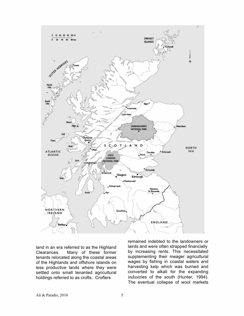
Case Selection This study is meant to
provide an exploratory analysis of conservation planning issues in Scotland and hence we used a mixture of secondary quantitative analysis of land-use data, geographic distribution of resources, and ownership loci at the macro level. We coupled a review of the descriptive statistics with detailed qualitative analysis of each case using standard techniques of ethnography, often referred to as a comparative version of “thick description” (Marcus, 1998). The research was carried out over a period of two summer visits to Scotland by the authors and a team of students who conducted detailed on-site interviews during the first visit, followed by document analysis and follow-up communications during the second visit. While recognizing that there are some peculiarities of the Scottish case which defy applicability elsewhere, there are lessons which can be drawn for future reference. Patton (2002) notes that descriptions of such cases can “illuminate both the unusual and the typical.”
To cover the full range of
proprietary dynamics we chose cases with distinct attributes of ownership: 1) a privately-owned estate on which for-profit enterprises were being conducted, 2) a trust property owned by a collective with social and conservation goals, and 3) a national park with publicly vetted conservation plans. The cases are all situated within the Highland Council planning jurisdiction (Comhairle na Gàidhealtachd in Gaelic). The three cases are also representative of different kinds of development paths and consequent impacts as shown in Table 1.
Ali & Paradis, 2010 8
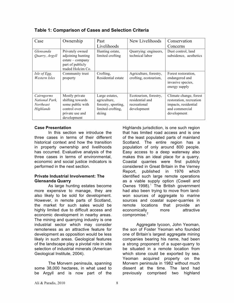
Table 1: Comparison of Cases and Selection Criteria
Case Ownership Past Livelihoods
New Livelihoods Conservation Concerns
Glensanda Quarry, Argyll
Privately owned adjoining hunting estate – company part of publicly traded Holcim Co.
Hunting estate, limited crofting
Quarrying: engineers, technical labor
Dust control, land subsidence, aesthetics
Isle of Egg, Western Isles
Community trust property
Crofting, Residential estate
Agriculture, forestry, crofting, ecotourism,
Forest restoration, endangered and invasive species, energy supply
Cairngorms National Park, Northeast Highlands
Mostly private shifting towards some public with control over private use and development
Large estates, agriculture, forestry, sporting, limited crofting, skiing
Ecotourism, forestry, residential and recreational development
Climate change, forest restoration, recreation impacts, residential and commercial development
Case Presentation In this section we introduce the three cases in terms of their different historical context and how the transition in property ownership and livelihoods has occurred. Evaluative analysis of the three cases in terms of environmental, economic and social justice indicators is performed in the next section. Private Industrial Involvement: The Glensanda Quarry
As large hunting estates become more expensive to manage, they are also likely to be sold for development. However, in remote parts of Scotland, the market for such sales would be highly limited due to difficult access and economic development in nearby areas. The mining and quarrying industry is one industrial sector which may consider remoteness as an attractive feature for development as opposition would be less likely in such areas. Geological features of the landscape play a pivotal role in site selection of industrial minerals (American Geological Institute, 2004).
The Morvern peninsula, spanning
some 38,000 hectares, in what used to be Argyll and is now part of the
Highlands jurisdiction, is one such region that has limited road access and is one of the least populated parts of mainland Scotland. The entire region has a population of only around 800 people. Easy access to a deep waterway also makes this an ideal place for a quarry. Coastal quarries were first publicly considered in Great Britain in the Verney Report, published in 1976 which identified such large remote operations as a viable supply option (Cowell and Ownes 1998).1 The British government had also been trying to move from land-won sources of aggregate to marine sources and coastal super-quarries in remote locations that provide an economically more attractive compromise.2
Aggregate tycoon, John Yeoman,
the son of Foster Yeoman who founded one of Britain’s largest aggregate mining companies bearing his name, had been a strong proponent of a super-quarry to be situated in a remote location from which stone could be exported by sea. Yeoman acquired property on the Morvern peninsula in 1982 without much dissent at the time. The land had previously comprised two highland
Ali & Paradis, 2010 9
hunting estates, Glensanda (2,400 hectares) and Kingairloch (5,800 hectares). The negotiations to develop the quarry also led to the passage of the Glensanda Harbour Act which provides for harbor operations in a leased area of 6000m X 3000m in Loch Linnhe.3 Public access to the quarry is only possible by a half hour boat ride across the loch. The environmental and social review for the Glensanda quarry took about two years and permission for development was granted in 1986. Under Scottish mineral rights belong to the owner except for gold, petroleum products and coal – hence the mineral rights to the aggregate automatically transferred to the owner.4
The acquisition provided a new
livelihood for people of this area that were largely dependent on fishing, tourism and some limited crofting. The quarry now employs 160 people and brings about 20 million British pounds ($40 million) annually to the economy of the region (Crawford, 2005). Capital investment so far for the region resulting from the quarry has been around 40 million pounds ($80 million) and annual operating costs are around 4.2 million pounds ($8.4 million). A majority (70%) of the employment is locally generated (van der Moolen and Wilson, 2003)
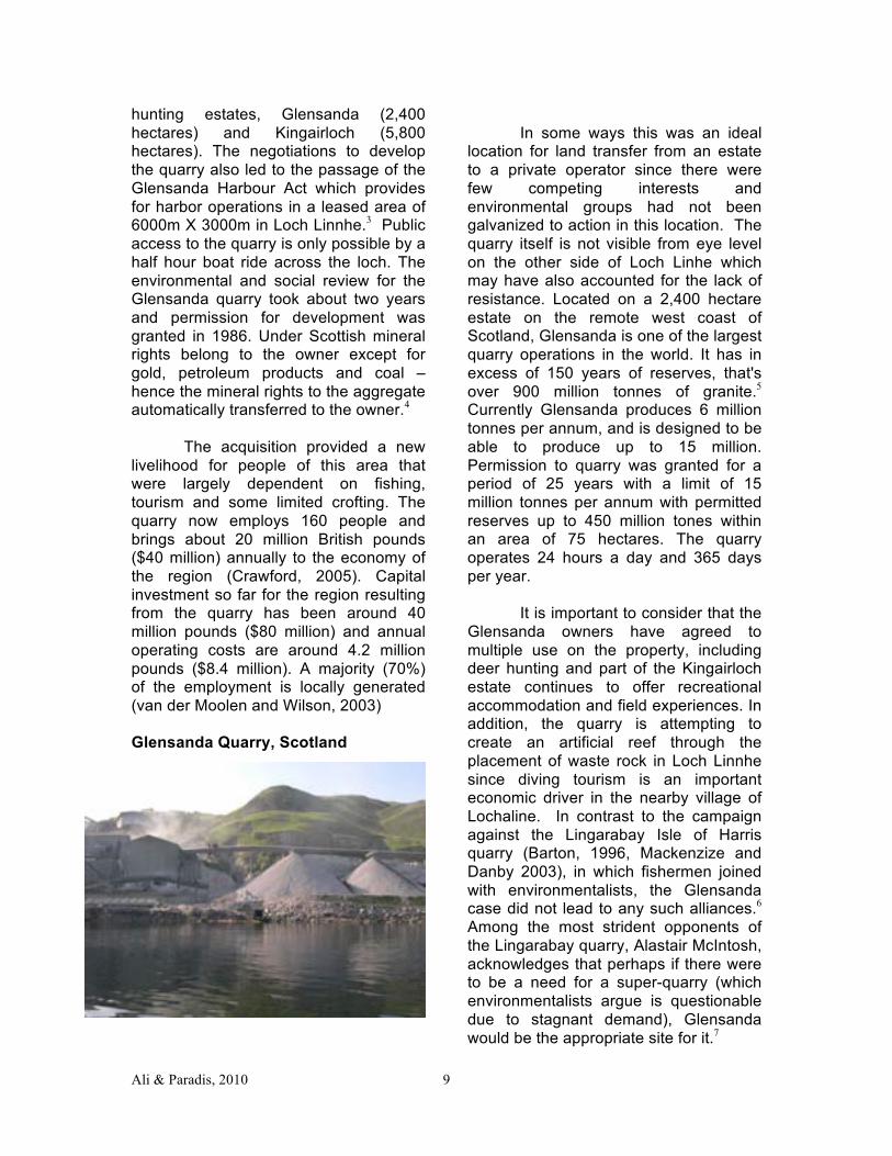
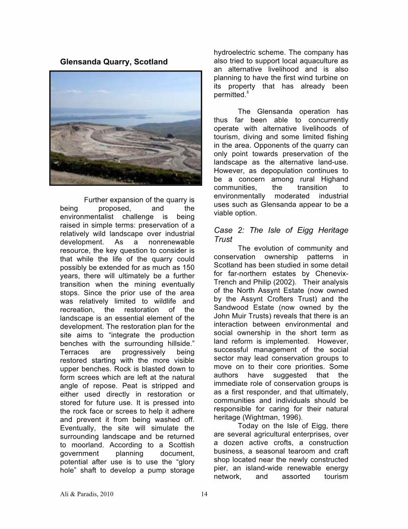
Glensanda Quarry, Scotland
In some ways this was an ideal
location for land transfer from an estate to a private operator since there were few competing interests and environmental groups had not been galvanized to action in this location. The quarry itself is not visible from eye level on the other side of Loch Linhe which may have also accounted for the lack of resistance. Located on a 2,400 hectare estate on the remote west coast of Scotland, Glensanda is one of the largest quarry operations in the world. It has in excess of 150 years of reserves, that's over 900 million tonnes of granite.5 Currently Glensanda produces 6 million tonnes per annum, and is designed to be able to produce up to 15 million. Permission to quarry was granted for a period of 25 years with a limit of 15 million tonnes per annum with permitted reserves up to 450 million tones within an area of 75 hectares. The quarry operates 24 hours a day and 365 days per year. It is important to consider that the Glensanda owners have agreed to multiple use on the property, including deer hunting and part of the Kingairloch estate continues to offer recreational accommodation and field experiences. In addition, the quarry is attempting to create an artificial reef through the placement of waste rock in Loch Linnhe since diving tourism is an important economic driver in the nearby village of Lochaline. In contrast to the campaign against the Lingarabay Isle of Harris quarry (Barton, 1996, Mackenzize and Danby 2003), in which fishermen joined with environmentalists, the Glensanda case did not lead to any such alliances.6 Among the most strident opponents of the Lingarabay quarry, Alastair McIntosh, acknowledges that perhaps if there were to be a need for a super-quarry (which environmentalists argue is questionable due to stagnant demand), Glensanda would be the appropriate site for it.7
Ali & Paradis, 2010 10
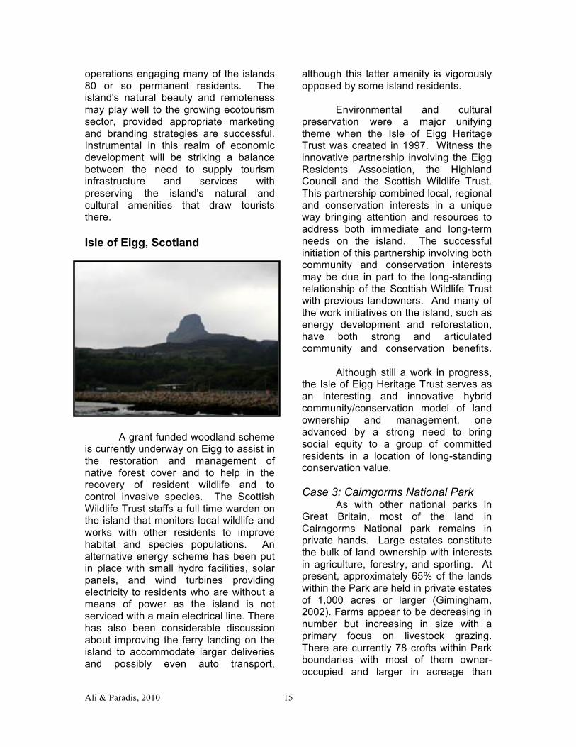
However, since the company announced in early 2005 that it was aiming to expand, considerable concern has been raised that the expansion would begin to affect residents on Lismore and Lochaline. The route the company is taking in this regard is to offer compensation to any households that might see a diminution in their property value. This arrangement appears to have satisfied most of the opponents for now as exemplified by the comments received to the public review of the quarries expansion. The comments received as a result of the public consultation which ended on October 2005 could have been used as a metric of opposition to the expansion of the project. The only organized negative response to the expansion came from the Moutaineering Council of Scotland (2005). In July 2010, a fire broke out on a conveyor belt from the quarry leading to a cargo ship which also ignited. However, the community reaction to this incident was measured and taken in stride as an industrial accident. The quarry this appears to be fairly resilient to the effects of even a major accident. Community Collectives and Trust Development: The Isle of Eigg Heritage Trust Islands off the west coast of Scotland have been of cultural interest in various ways, offering sanctuary for ostracized communities on the one hand while providing territorially isolated fiefdoms for aristocrats on the other. Given its proximity to the mainland, the Isle of Eigg has been inhabited since ancient times, though the population has fluctuated widely. The island was relatively prosperous towards the end of the 18th Century, when it sustained a population of 500, producing potatoes, goats, black cattle, and kelp. The kelp industry is believed to have financed the building of the main farmhouses on the
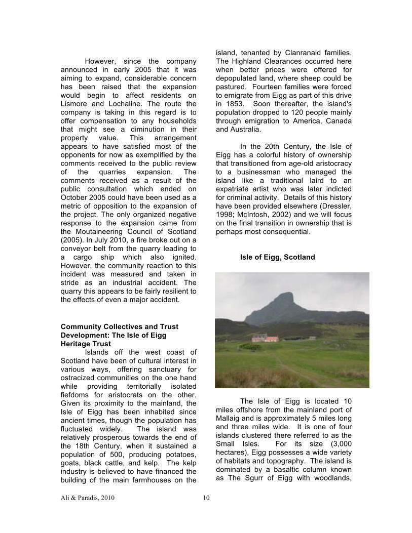
island, tenanted by Clanranald families. The Highland Clearances occurred here when better prices were offered for depopulated land, where sheep could be pastured. Fourteen families were forced to emigrate from Eigg as part of this drive in 1853. Soon thereafter, the island's population dropped to 120 people mainly through emigration to America, Canada and Australia. In the 20th Century, the Isle of Eigg has a colorful history of ownership that transitioned from age-old aristocracy to a businessman who managed the island like a traditional laird to an expatriate artist who was later indicted for criminal activity. Details of this history have been provided elsewhere (Dressler, 1998; McIntosh, 2002) and we will focus on the final transition in ownership that is perhaps most consequential. Isle of Eigg, Scotland
The Isle of Eigg is located 10 miles offshore from the mainland port of Mallaig and is approximately 5 miles long and three miles wide. It is one of four islands clustered there referred to as the Small Isles. For its size (3,000 hectares), Eigg possesses a wide variety of habitats and topography. The island is dominated by a basaltic column known as The Sgurr of Eigg with woodlands,
Ali & Paradis, 2010 11
heaths, meadowlands and bogs comprising a mosaic of habitats surrounded by extensive sea cliffs and occasionally dropping down to coastal lowlands punctuated by a few sandy beaches. Wildlife is abundant with many small mammals, birds and wildflowers found on the island and a diversity of marine life in the offshore waters. Following centuries of quasi-feudal and oftentimes abusive ownership by a string of lairds, the residents of Eigg successfully assumed control of the island in 1997. In a well-celebrated buyout that garnered international attention and considerable emotional and financial support, the residents purchased the island from the most recent landowner for 1.5 million pounds ($3 million). The Isle of Eigg Heritage Trust was established to assume legal control of the island and is a partnership involving the residents of Eigg (Eigg Residents Association), the Highland Council and the Scottish Wildlife Trust. All three entities appoint members to a board of directors with island residents representing half the board membership. The Trust oversees a variety of activities on Eigg from developing local businesses and community programs to negotiating equitable leases for island tenants and assisting in the repair of their homes, something that was next to impossible under previous ownership regimes. Although struggling at times with its own identity and in its efforts to keep the residents of the island up to date and involved in the decision-making process, the Trust has successfully attracted over 900,000 pounds ($1.8 million) of development and planning funds to date. These funds have been used to assist in project implementation and in the exploration of new livelihood options and sustainability schemes that will hopefully address the traditionally high unemployment and underemployment
rates on the island. Effective communication between the Trust's board and the residents is further enhanced by scheduling Residents Association meetings prior to each board meeting thus allowing islanders the opportunity to review board meeting agendas and to encourage their active participation and expression of opinions, something that was also likely discouraged under previous feudal control. In celebration of the 10th anniversary of the community buyout, the Isle of Eigg Heritage Trust published a forward planning document (Isle of Eigg Heritage Trust, 2007) outlining ongoing and anticipated activities to assist moving the community towards economic and environmental sustainability. Renewable energy schemes have been advanced as well, with considerable investments in small-scale hydro, solar and wind bringing the island’s energy portfolio to 90% from renewables and slashing overall energy consumption on the island by 45%. These accomplishments have resulted in the community receiving the Royal Geographical Society’s 2010 prestigious Ashden Award for Sustainable Energy (Ashden Awards for Sustainable Energy, 2010). Public Sector Involvement: The Cairngorms National Park
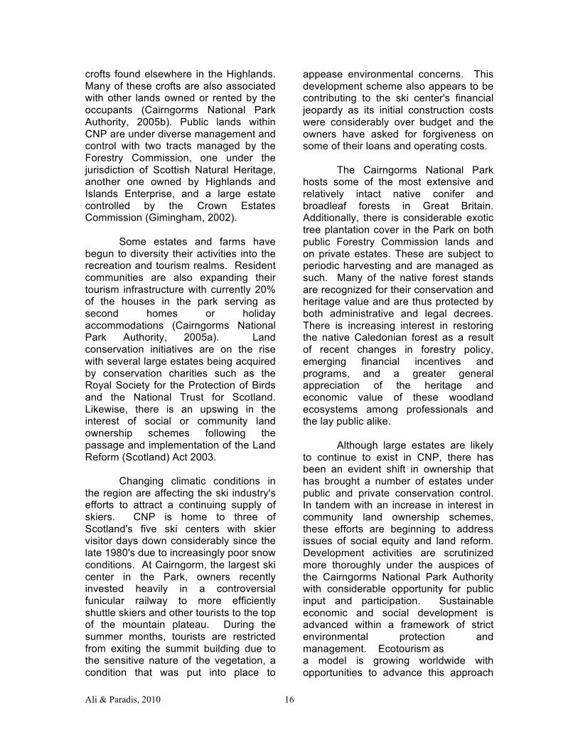
Currently, Scotland has two designated national parks. Loch Lomond & The Trossachs National Park was created in 2002 and Cairngorms National Park one year later in 2003. The Cairngorm Mountains, in the northeast Highlands of Scotland, constitute one of the largest undeveloped and wilderness-like upland landscapes in Great Britain. The extensive subarctic alpine plateau and associated ravines or cirques (coires in Gaelic) that are found in the central region of the mountain range exhibit an extensive variety of pre-glacial and glacial features and landforms. The area
Ali & Paradis, 2010 12
provides habitat for a wealth of plants and animals, many of which are rare and found nowhere else in Scotland or the rest of Great Britain (Gimingham, 2002). The area is regarded as the most important complex of subarctic-oceanic mountains, moorlands, and native boreal forests within the European Union. Prior to the creation of the national park, the region had been recognized by a variety of conservation efforts including designation as a National Nature Reserve (the largest in Great Britain) with many Sites of Special Scientific Interest identified by the national government. As a relatively remote and undeveloped landscape, the Cairngorms offer unparalleled mountain recreation opportunities including skiing, mountaineering, hill walking, biking, deerstalking, and other outdoor pursuits in as near a wild and natural setting as is available in this developed region of the world. With its rigorous climate and rocky substrate exhibiting many areas of thin and poorly structured soils, economic development and land use options have always been limited in the area. Large sporting estates constitute much of the land ownership on the plateau, surrounding hillsides and in the lower glens and straths with some agricultural and forestry enterprises and a handful of crofts located in the area as well. Many of the resident communities found along the periphery of the Cairngorms rely on the service sectors of the economy with tourism contributing considerably to the local welfare and development.
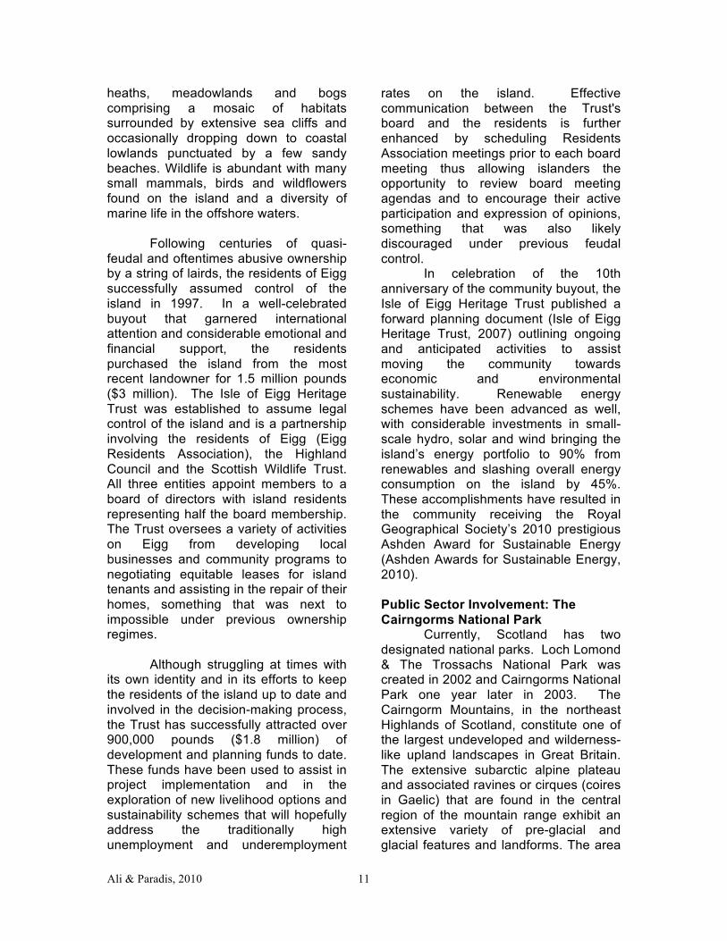
View down into Coire an Lochan, Cairngorm Mountains
Cairngorms National Park (CNP) was created to conserve this important mountain landscape and associated lowlands and to provide an important administrative infrastructure to guide recreational use and development in the region. At 1,467 square miles, it is the largest national park in Scotland and is home to over 17,000 local residents scattered throughout the numerous villages and settlements found primarily along the periphery of the Park (Cairngorms National Park Authority, 2004). The Cairngorms National Park Authority was established the same year the CNP was designated and was delivered the mandate to develop planning and operational programs and guidelines. As with other national parks in Scotland and the rest of Great Britain, CNP is to be administered with guidance provided by the following specific aims: - Conservation of the natural and cultural heritage of the area. - Promotion and sustainable use of the natural resources of the area. - Promotion of understanding and enjoyment (including enjoyment in the form of recreation) of the special qualities of the area by the public.
Ali & Paradis, 2010 13
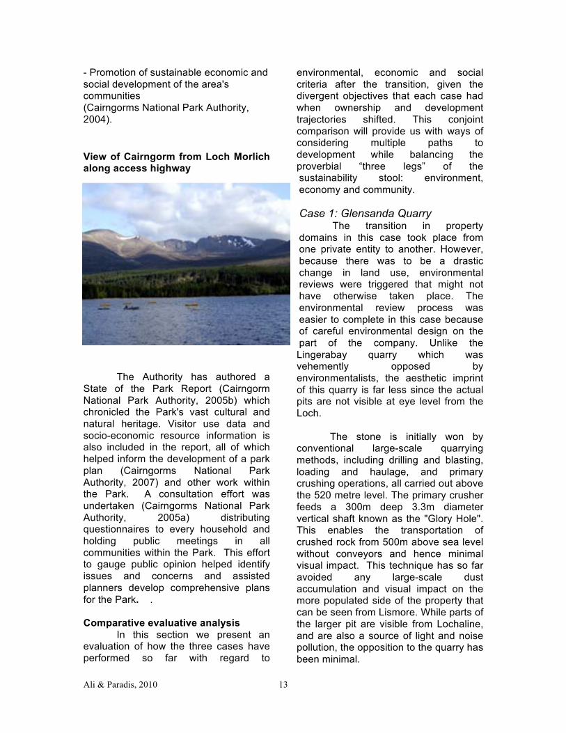
- Promotion of sustainable economic and social development of the area's communities (Cairngorms National Park Authority, 2004). View of Cairngorm from Loch Morlich along access highway
The Authority has authored a State of the Park Report (Cairngorm National Park Authority, 2005b) which chronicled the Park's vast cultural and natural heritage. Visitor use data and socio-economic resource information is also included in the report, all of which helped inform the development of a park plan (Cairngorms National Park Authority, 2007) and other work within the Park. A consultation effort was undertaken (Cairngorms National Park Authority, 2005a) distributing questionnaires to every household and holding public meetings in all communities within the Park. This effort to gauge public opinion helped identify issues and concerns and assisted planners develop comprehensive plans for the Park. . Comparative evaluative analysis In this section we present an evaluation of how the three cases have performed so far with regard to
environmental, economic and social criteria after the transition, given the divergent objectives that each case had when ownership and development trajectories shifted. This conjoint comparison will provide us with ways of considering multiple paths to development while balancing the proverbial “three legs” of the sustainability stool: environment, economy and community. Case 1: Glensanda Quarry
The transition in property domains in this case took place from one private entity to another. However, because there was to be a drastic change in land use, environmental reviews were triggered that might not have otherwise taken place. The environmental review process was easier to complete in this case because of careful environmental design on the part of the company. Unlike the Lingerabay quarry which was vehemently opposed by environmentalists, the aesthetic imprint of this quarry is far less since the actual pits are not visible at eye level from the Loch.
The stone is initially won by
conventional large-scale quarrying methods, including drilling and blasting, loading and haulage, and primary crushing operations, all carried out above the 520 metre level. The primary crusher feeds a 300m deep 3.3m diameter vertical shaft known as the "Glory Hole". This enables the transportation of crushed rock from 500m above sea level without conveyors and hence minimal visual impact. This technique has so far avoided any large-scale dust accumulation and visual impact on the more populated side of the property that can be seen from Lismore. While parts of the larger pit are visible from Lochaline, and are also a source of light and noise pollution, the opposition to the quarry has been minimal.
Ali & Paradis, 2010 14
Glensanda Quarry, Scotland
Further expansion of the quarry is being proposed, and the environmentalist challenge is being raised in simple terms: preservation of a relatively wild landscape over industrial development. As a nonrenewable resource, the key question to consider is that while the life of the quarry could possibly be extended for as much as 150 years, there will ultimately be a further transition when the mining eventually stops. Since the prior use of the area was relatively limited to wildlife and recreation, the restoration of the landscape is an essential element of the development. The restoration plan for the site aims to “integrate the production benches with the surrounding hillside.” Terraces are progressively being restored starting with the more visible upper benches. Rock is blasted down to form screes which are left at the natural angle of repose. Peat is stripped and either used directly in restoration or stored for future use. It is pressed into the rock face or screes to help it adhere and prevent it from being washed off. Eventually, the site will simulate the surrounding landscape and be returned to moorland. According to a Scottish government planning document, potential after use is to use the “glory hole” shaft to develop a pump storage
hydroelectric scheme. The company has also tried to support local aquaculture as an alternative livelihood and is also planning to have the first wind turbine on its property that has already been permitted.8 The Glensanda operation has thus far been able to concurrently operate with alternative livelihoods of tourism, diving and some limited fishing in the area. Opponents of the quarry can only point towards preservation of the landscape as the alternative land-use. However, as depopulation continues to be a concern among rural Highand communities, the transition to environmentally moderated industrial uses such as Glensanda appear to be a viable option. Case 2: The Isle of Eigg Heritage Trust The evolution of community and conservation ownership patterns in Scotland has been studied in some detail for far-northern estates by Chenevix-Trench and Philip (2002). Their analysis of the North Assynt Estate (now owned by the Assynt Crofters Trust) and the Sandwood Estate (now owned by the John Muir Trusts) reveals that there is an interaction between environmental and social ownership in the short term as land reform is implemented. However, successful management of the social sector may lead conservation groups to move on to their core priorities. Some authors have suggested that the immediate role of conservation groups is as a first responder, and that ultimately, communities and individuals should be responsible for caring for their natural heritage (Wightman, 1996). Today on the Isle of Eigg, there are several agricultural enterprises, over a dozen active crofts, a construction business, a seasonal tearoom and craft shop located near the newly constructed pier, an island-wide renewable energy network, and assorted tourism
Ali & Paradis, 2010 15
operations engaging many of the islands 80 or so permanent residents. The island's natural beauty and remoteness may play well to the growing ecotourism sector, provided appropriate marketing and branding strategies are successful. Instrumental in this realm of economic development will be striking a balance between the need to supply tourism infrastructure and services with preserving the island's natural and cultural amenities that draw tourists there. Isle of Eigg, Scotland
A grant funded woodland scheme is currently underway on Eigg to assist in the restoration and management of native forest cover and to help in the recovery of resident wildlife and to control invasive species. The Scottish Wildlife Trust staffs a full time warden on the island that monitors local wildlife and works with other residents to improve habitat and species populations. An alternative energy scheme has been put in place with small hydro facilities, solar panels, and wind turbines providing electricity to residents who are without a means of power as the island is not serviced with a main electrical line. There has also been considerable discussion about improving the ferry landing on the island to accommodate larger deliveries and possibly even auto transport,
although this latter amenity is vigorously opposed by some island residents. Environmental and cultural preservation were a major unifying theme when the Isle of Eigg Heritage Trust was created in 1997. Witness the innovative partnership involving the Eigg Residents Association, the Highland Council and the Scottish Wildlife Trust. This partnership combined local, regional and conservation interests in a unique way bringing attention and resources to address both immediate and long-term needs on the island. The successful initiation of this partnership involving both community and conservation interests may be due in part to the long-standing relationship of the Scottish Wildlife Trust with previous landowners. And many of the work initiatives on the island, such as energy development and reforestation, have both strong and articulated community and conservation benefits. Although still a work in progress, the Isle of Eigg Heritage Trust serves as an interesting and innovative hybrid community/conservation model of land ownership and management, one advanced by a strong need to bring social equity to a group of committed residents in a location of long-standing conservation value. Case 3: Cairngorms National Park As with other national parks in Great Britain, most of the land in Cairngorms National park remains in private hands. Large estates constitute the bulk of land ownership with interests in agriculture, forestry, and sporting. At present, approximately 65% of the lands within the Park are held in private estates of 1,000 acres or larger (Gimingham, 2002). Farms appear to be decreasing in number but increasing in size with a primary focus on livestock grazing. There are currently 78 crofts within Park boundaries with most of them owner-occupied and larger in acreage than
Ali & Paradis, 2010 16
crofts found elsewhere in the Highlands. Many of these crofts are also associated with other lands owned or rented by the occupants (Cairngorms National Park Authority, 2005b). Public lands within CNP are under diverse management and control with two tracts managed by the Forestry Commission, one under the jurisdiction of Scottish Natural Heritage, another one owned by Highlands and Islands Enterprise, and a large estate controlled by the Crown Estates Commission (Gimingham, 2002). Some estates and farms have begun to diversity their activities into the recreation and tourism realms. Resident communities are also expanding their tourism infrastructure with currently 20% of the houses in the park serving as second homes or holiday accommodations (Cairngorms National Park Authority, 2005a). Land conservation initiatives are on the rise with several large estates being acquired by conservation charities such as the Royal Society for the Protection of Birds and the National Trust for Scotland. Likewise, there is an upswing in the interest of social or community land ownership schemes following the passage and implementation of the Land Reform (Scotland) Act 2003. Changing climatic conditions in the region are affecting the ski industry's efforts to attract a continuing supply of skiers. CNP is home to three of Scotland's five ski centers with skier visitor days down considerably since the late 1980's due to increasingly poor snow conditions. At Cairngorm, the largest ski center in the Park, owners recently invested heavily in a controversial funicular railway to more efficiently shuttle skiers and other tourists to the top of the mountain plateau. During the summer months, tourists are restricted from exiting the summit building due to the sensitive nature of the vegetation, a condition that was put into place to
appease environmental concerns. This development scheme also appears to be contributing to the ski center's financial jeopardy as its initial construction costs were considerably over budget and the owners have asked for forgiveness on some of their loans and operating costs. The Cairngorms National Park hosts some of the most extensive and relatively intact native conifer and broadleaf forests in Great Britain. Additionally, there is considerable exotic tree plantation cover in the Park on both public Forestry Commission lands and on private estates. These are subject to periodic harvesting and are managed as such. Many of the native forest stands are recognized for their conservation and heritage value and are thus protected by both administrative and legal decrees. There is increasing interest in restoring the native Caledonian forest as a result of recent changes in forestry policy, emerging financial incentives and programs, and a greater general appreciation of the heritage and economic value of these woodland ecosystems among professionals and the lay public alike. Although large estates are likely to continue to exist in CNP, there has been an evident shift in ownership that has brought a number of estates under public and private conservation control. In tandem with an increase in interest in community land ownership schemes, these efforts are beginning to address issues of social equity and land reform. Development activities are scrutinized more thoroughly under the auspices of the Cairngorms National Park Authority with considerable opportunity for public input and participation. Sustainable economic and social development is advanced within a framework of strict environmental protection and management. Ecotourism as a model is growing worldwide with opportunities to advance this approach
Ali & Paradis, 2010 17
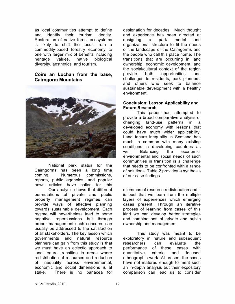
as local communities attempt to define and identify their tourism identity. Restoration of native forest ecosystems is likely to shift the focus from a commodity-based forestry economy to one with larger mix of benefits including heritage values, native biological diversity, aesthetics, and tourism. Coire an Lochan from the base, Cairngorm Mountains
National park status for the Cairngorms has been a long time coming. Numerous commissions, reports, public agencies, and popular news articles have called for this
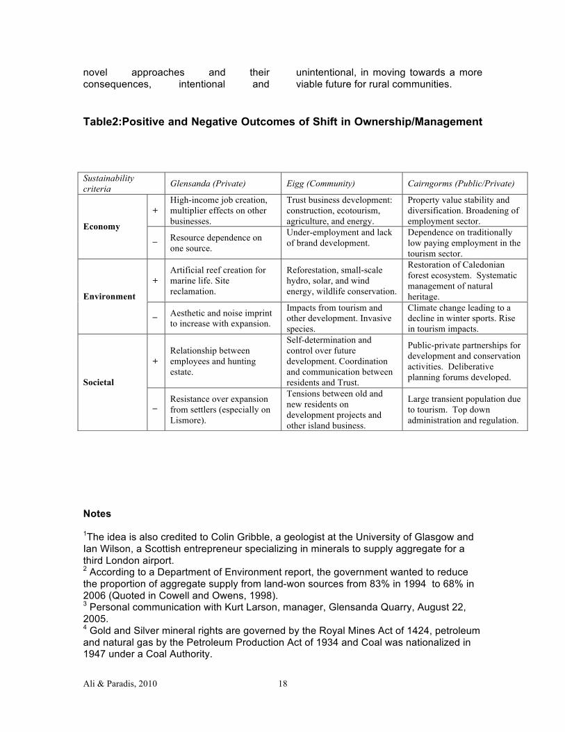
designation for decades. Much thought and experience has been directed at designing a park model and organizational structure to fit the needs of the landscape of the Cairngorms and the people who call this place home. The transitions that are occurring in land ownership, economic development, and the social/cultural context of the region provide both opportunities and challenges to residents, park planners, and others who seek to balance sustainable development with a healthy environment. Conclusion: Lesson Applicability and Future Research This paper has attempted to provide a broad comparative analysis of changing land-use patterns in a developed economy with lessons that could have much wider applicability. Land tenure inequality in Scotland has much in common with many existing conditions in developing countries as well. Balancing the economic, environmental and social needs of such communities in transition is a challenge that needs to be confronted with a range of solutions. Table 2 provides a synthesis of our case findings.
Our analysis shows that different permutations of private and public property management regimes can provide ways of effective planning towards sustainable development. Each regime will nevertheless lead to some negative repercussions but through proper management such concerns can usually be addressed to the satisfaction of all stakeholders. The key lesson which governments and natural resource planners can gain from this study is that we must have an eclectic approach to land tenure transition in areas where redistribution of resources and reduction of inequality across environmental, economic and social dimensions is at stake. There is no panacea for
dilemmas of resource redistribution and it is best that we learn from the multiple layers of experiences which emerging cases present. Through an iterative process of learning from cases of this kind we can develop better strategies and combinations of private and public ownership and management.
This study was meant to be
exploratory in nature and subsequent researchers can evaluate the performance of these cases with quantitative criteria and focused ethnographic work. At present the cases have not matured enough to merit such an in-depth analysis but their expository comparison can lead us to consider
Ali & Paradis, 2010 18
novel approaches and their consequences, intentional and
unintentional, in moving towards a more viable future for rural communities.
Table2:Positive and Negative Outcomes of Shift in Ownership/Management
Notes
1The idea is also credited to Colin Gribble, a geologist at the University of Glasgow and Ian Wilson, a Scottish entrepreneur specializing in minerals to supply aggregate for a third London airport. 2 According to a Department of Environment report, the government wanted to reduce the proportion of aggregate supply from land-won sources from 83% in 1994 to 68% in 2006 (Quoted in Cowell and Owens, 1998). 3 Personal communication with Kurt Larson, manager, Glensanda Quarry, August 22, 2005. 4 Gold and Silver mineral rights are governed by the Royal Mines Act of 1424, petroleum and natural gas by the Petroleum Production Act of 1934 and Coal was nationalized in 1947 under a Coal Authority.
Sustainability criteria Glensanda (Private) Eigg (Community) Cairngorms (Public/Private)
+ High-income job creation, multiplier effects on other businesses.
Trust business development: construction, ecotourism, agriculture, and energy.
Property value stability and diversification. Broadening of employment sector. Economy
_
Resource dependence on one source.
Under-employment and lack of brand development.
Dependence on traditionally low paying employment in the tourism sector.
+ Artificial reef creation for marine life. Site reclamation.
Reforestation, small-scale hydro, solar, and wind energy, wildlife conservation.
Restoration of Caledonian forest ecosystem. Systematic management of natural heritage. Environment
_
Aesthetic and noise imprint to increase with expansion.
Impacts from tourism and other development. Invasive species.
Climate change leading to a decline in winter sports. Rise in tourism impacts.
+ Relationship between employees and hunting estate.
Self-determination and control over future development. Coordination and communication between residents and Trust.
Public-private partnerships for development and conservation activities. Deliberative planning forums developed. Societal
_
Resistance over expansion from settlers (especially on Lismore).
Tensions between old and new residents on development projects and other island business.
Large transient population due to tourism. Top down administration and regulation.
Ali & Paradis, 2010 19
5 Details of Glensanda operation from Foster Yeoman web site < http://www.foster-yeoman.co.uk/> 6 The Lingerbay quarry proposal led to the most protracted and expensive public inquiry in Scottish history. Planning permission was refused by the Minister of Environment in 2000 (Warren, 2002b). A French company Lafarge subsequently bought the property and initiated a more deliberative application for the mine by also hiring consultants and forming partnerships with some groups such as WWF (much to the resentment of more purist groups such as the Scottish Wildlife Trust). However, the company finally concluded that resistance to the project and diminishing economic demand did not warrant proceeding further with the project in 2004. Environmentalists have hailed this as a victory against the super-quarry movement. 7 Personal communication with Alastair McIntosh, Edinburgh, June 2, 2004. In a letter he wrote to Lord Maxwell McLeod, a proponent of Glensanda, McIntosh stated that “I accept that quarrying is necessary and that Glensanda does it in a relatively right-on way.” Letter dated April 9, 2003. 8 The wind farm development is controversial for aesthetic reasons despite its environmental advantages. There are opposition groups who are advocating against the wind turbine development such as http://www.fairwind.org.uk References American Geological Institute (2004). Aggregate and the environment. 2004. Alexandria,
Va.: AGI Publications. Allmendinger, P. (2001). The Head and the Heart. National Identity and Urban Planning
in a Devolved Scotland. International Planning Studies 6(1):33-54. Ashden Awards for Sustainable Energy. 2010. Press Release: Ashden Awards 2010: World’s leading green energy awards announce UK winners. The Ashden Awards for Sustainable Energy, London, England. Ascherson, N. (2002). Stone voices: The search for Scotland. Granta Books, London. Barton, H. 1996. The Isle of Harris superquarry: Concepts of the environment and
sustainability. Environmental Values 5 (2):97-122. Boyd, G. and D. Reid. (1999). Social land ownership: eight case studies from the
Highlands and Islands of Scotland, Volume One. The Not-For-Profit Landowners Project Group, Inverness, Scotland.
Boyd, G. and D. Reid. (2000). Social land ownership: eight case studies from the Highlands and Islands of Scotland, Volume Two. The Not-For-Profit Landowners Project Group, Inverness, Scotland.
Boyd, G. and D. Reid. (2001). Social land ownership: eight case studies from the Highlands and Islands of Scotland, Volume Three. The Not-For-Profit Landowners Project Group, Inverness, Scotland.
Cairngorms National Park Authority. (2004). First annual report: 2003/2004. Cairngorms National Park Authority, Ballater, Scotland.
Cairngorms National Park Authority. (2005a). Local plan consultation report: phase 1; September - December 2004. Cairngorms National Park Authority, Ballater, Scotland.
Cairngorms National Park Authority. (2005b). Draft state of the park report. Cairngorms National Park Authority, Ballater, Scotland.
Cairngorms National Park Authority. (2007). Cairngorms National Park Plan 2007. Cairngorms National Park Authority, Ballater, Scotland.
Ali & Paradis, 2010 20
Chenevix-Trench, Hamish and Lorna J. Philip (2002). Community and Conservation Land Ownership in Highland Scotland: A Common Focus in a Changing Context. Scottish Geographical Journal 117(2): 139-156.
Clemente, A. S., C. Werner, C. Maguas, M. S. Cabral, M. A. Martins-Loucao, and O. Correia. (2004). Restoration of a limestone quarry: Effect of soil amendments on the establishment of native Mediterranean sclerophyllous shrubs. Restoration Ecology 12 (1):20-28.
Cowell, R. (2000). Localities and the international trade in aggregates: Coastal superquarries on the horizon? Geography 85:134-144.
Crawford, Alan. (2005). Divisions over plans to expand Glensanda mine. The Sunday Herald (Glasgow and Edinburgh), October 9.
Dresner, S. (2002). Principles of Sustainability. London UK: Earthscan Publications. Dressler, C. (1998). Eigg: The story of an island. Polygon, Edinburgh, Scotland. Gimingham, C. H. (2002). The ecology, land use and conservation of the Cairngorms.
Chichester: Packard Pub. Ltd. Glasbergen, P. (1998). Co-operative environmental governance: public-private
agreements as a policy strategy, Environment & policy; vol. 12. Dordrecht: Boston.
Gordon, J. E. (2001). The corries of the Cairngorm Mountains. Scottish Geographical Journal 117 (1):49-62.
Gordon, J. E., I. J. Dvorak, C. Jonasson, M. Josefsson, M. Kocianova, and D. B. A. Thompson. (2002). Geo-ecology and management of sensitive montane landscapes. Geografiska Annaler Series A-Physical Geography 84A (3-4):193-203.
Gordon, J. E., D. B. A. Thompson, V. M. Haynes, V. Brazier, and R. Macdonald. (1998). Environmental sensitivity and conservation management in the Cairngorm Mountains, Scotland. Ambio 27 (4):335-344.
Hunter, J. (1994). A dance called America: the Scottish Highlands, the United States and Canada. Mainstream Publishing, Edinburgh, Scotland.
Hunter, J. (2000). The making of the crofting community. New Edition. John Donald, Edinburgh, Scotland.
Kumar, Ashok and Ronan Paddison (2000). Trust and Collaborative Planning Theory: the Case of the Scottish Planning System. International Planning Studies, 5(2):205-223.
Isle of Eigg Heritage Trust, 2007. A forward plan for the Isle of Eigg 2007 and beyond. Isle of Eigg
Heritage Trust, Isle of Eigg, Scotland Mackenzie, A. F. D., and S. Dalby. (2003). Moving mountains: Community and resistance in the Isle of
Harris, Scotland, and Cape Breton, Canada. Antipode 35 (2):309-333. Marcus, G.E. 1998. Ethnography through thick and thin. Princeton NJ: Princeton
University Press. McEwen, J. 1977. Who owns Scotland: a study in land ownership. Edinburgh University
Student Publication Board, Edinburgh, Scotland. McIntosh, Alastair. 2004. Soil and soul: people versus corporate power. London: Aurum. Mountaineering Council of Scotland 2005. Planning objection to the expansion of the
Glensanda quarry. Official response to consultation process, October. Patton, M.Q. 2002. Qualitative research and evaluation methods. Thousand Oaks CA:
Sage Publications. Pollock, S. H. A. 1994. Coastal Superquarries In Scotland. Scottish Geographical
Magazine 110 (3):138-139.
Ali & Paradis, 2010 21
Price, M. F., B. J. Dixon, C. R. Warren, and A. R. Macpherson. 2002. Scotland's mountains: Key issues for their future management. Scottish Natural Heritage, Perth, Scotland.
Raymond, L. 2003. Private Rights in Public Resources : Equity and Property Allocation in Market-Based Environmental Policy. Washington DC: Resources for the Future.
Rohde, 2004. Ideology, bureaucracy and aesthetics: landscape change and land reform in Northwest Scotland. Environmental Valeus 13: 199-221.
Sayer, M. D. J., and T. A. Wilding. 2002. Planning, licensing, and stakeholder consultation in an artificial reef development: the Loch Linnhe reef, a case study. Ices Journal Of Marine Science 59:S178-S185.
Smout, T. C. 2000. Nature contested: environmental history in Scotland and Northern England since 1600. Edinburgh: Edinburgh University Press.
Taylor, K. 1996. Eigg: island of heritage, window of opportunity. Cuagach, Isle of Eigg: Isle of Eigg Trust.
Thompson, G. 1997. An ornithological assessment of potential superquarry sites in Scotland. Edinburgh: RSPB.
United Kingdom, Government of. 1899. Mines and Quarries; Reports of J.M. Ronaldson, H.M. Inspector of Mines, for the West Scotland District (No. 2), to His Majesty's secretary of state for the Home Department. for the year 1898. 1899. British parliamentary papers; [C.-9264-v]. London: H.M.S.O.
Warren, C. 2002a. Managing Scotland's environment. Edinburgh University Press, Edinburgh, Scotland.
Warren, C. 2002b. Of superquarries and mountain railways: Recurring themes in Scottish environmental conflict. Scottish Geographical Journal 118 (2):101-127.
Wightman, A. 1996. Who owns Scotland? Canongate, Edinburgh, Scotland. Wightman, A., and P. Higgins. 2000. Sporting estates and the recreational economy in
the Highlands and Islands of Scotland. Scottish Affairs 31: 18-36.


