Embed Size (px)
Citation preview
Accelerated Certification Training, Soil Basics, September 2013 1
SOIL BASICS
ACT PRESENTATION 4SEPTEMBER 2013
David Hammonds, Environmental ManagerFlorida Department of HealthDivision of Disease Control and Health ProtectionBureau of Environmental HealthOnsite Sewage Programs850-245-4570
Review rule requirements to determine the SHWT
• Called Seasonal High Saturation (SHS) by USDA NRCS
• See 64E‐6.006(2), FAC for rule language.
WHAT WE USE TO DETERMINE SHWT
• County soil surveys and the information contained therein, plus any other soil interpretation records available through USDA NRCS. This includes the Web Soil Survey.
Accelerated Certification Training, Soil Basics, September 2013 2
• Redoximorphic features, formerly called “mottling” (see site evaluation form).
• This is a term that USDA NRCS defines as the color change has been caused by the presence of water. The regulation therefore uses any types of (contemporary) redoximorphic features. This would actually be any soil‐based feature used to determine an estimated seasonal high water table.
• Impermeable layers ‐ Please note this requirement is not just for impermeable or semi‐permeable layers existing with the natural undisturbed soil. In many cases, fill material of some type has been placed either on top of a natural soil, or natural soil has been removed and fill material placed over it, or in place of it. (continued next slide)
• The impermeable soil layers could just as easily be in the fill material, caused by the placement of the fill itself (compaction), dissimilar soil textures, and poor drainage. This could also include affects from
artificial drainageways.
Accelerated Certification Training, Soil Basics, September 2013 3
• Onsite Vegetation ‐ This is where you look at the plant ecological communities to determine the natural vegetation of the area. Since vegetation has differing nutrient and water requirements, an evaluation of the vegetation gives evidence of water levels based on the species of plants in the area.
Note that the vegetation is present due to water/nutrient availability in the area, not the other way around.
• All required sources of information must be used as discussed in previous slides. The site evaluation must take into consideration things such as: drought or excessively wet time; is it the dry season or wet season; what happened during the past few days to weeks before the site evaluation was performed?? (next slide for more)
• For example, if the site evaluation was performed three weeks after the last significant rainfall in a “normal rainfall” year, and an observed water table was at 30 inches, this should be given a different weight of evidence when compared to a site if the observed water table was at 30 inches one day after significant rainfall during a normal rainfall year. This type of information must be included in the site evaluation in the remarks section to help validate the SHWT determination. DOCUMENT THIS INFORMATION!!
Accelerated Certification Training, Soil Basics, September 2013 4
Is there a time when the DOH can question the soil profiles/SHWT estimation of non‐departmental evaluators?
Yes ‐ See s. 381.0065(4)(n), FS
• …The department shall accept evaluations submitted by professional engineers and such other persons as meet the expertise established by this section or by rule (persons certified per s. 381.0101, FS) unless the department has a reasonable scientific basis for questioning the accuracy or completeness of the evaluation.
What does this mean?
• If the site evaluation is not validated by appropriate information, the department cannot accept the evaluation. For example, if the SHWT were stated to be at 36” but no validation for that “conclusion” were present, the department has a reasonable scientific basis to question the evaluation. So, all work must be scientifically validated, and the work must be complete.
Accelerated Certification Training, Soil Basics, September 2013 5
QUESTIONS???
Now that we’ve talked about what the rule requires, let’s talk
about
SOIL.
SOIL DEFINEDDefinition of Soil. Soil is the collection of dynamic natural bodies, at or near the earth’s surface, made up of earthly materials and supports or is capable of supporting plant growth. For the purpose of soil survey investigations, the soil is usually described to a depth of 80 inches, or to hard bedrock, which ever comes first. ‐ ‐ derived from Soil Taxonomy
Accelerated Certification Training, Soil Basics, September 2013 6
EXCLUSIONS TO THE DEFINITION
• Potting soil
• Sediments at bottom of lakes, seas, oceans, etc.
• Fill material
Essential Elements in the Definition:
• Landforms (hills, slopes, flatwoods• Soil Material (sands/clays)• Soil Genesis (formation of soil)• Soil Morphology (observable characteristics of the soil within soil horizons, including description of kind and arrangement of the soil horizons)
• Soil Horizons
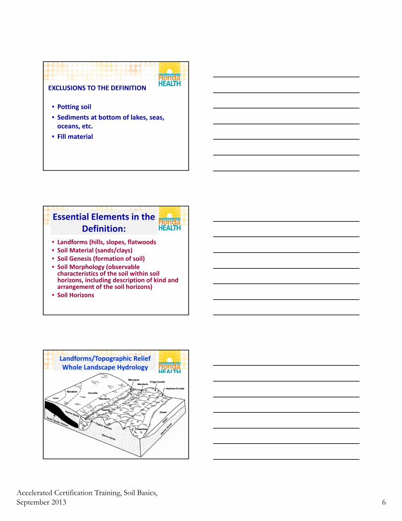
Landforms/Topographic ReliefWhole Landscape Hydrology
Accelerated Certification Training, Soil Basics, September 2013 7
A closer look at landscape hydrology:
• Leon – SHWT 0.5‐1.5’; poorly to very poorly drained. Depressional areas are ponded
• Mandarin – SHWT 1.5‐3.5’; somewhat poorly drained
• Cornelia – SHWT >6’; excessively drained
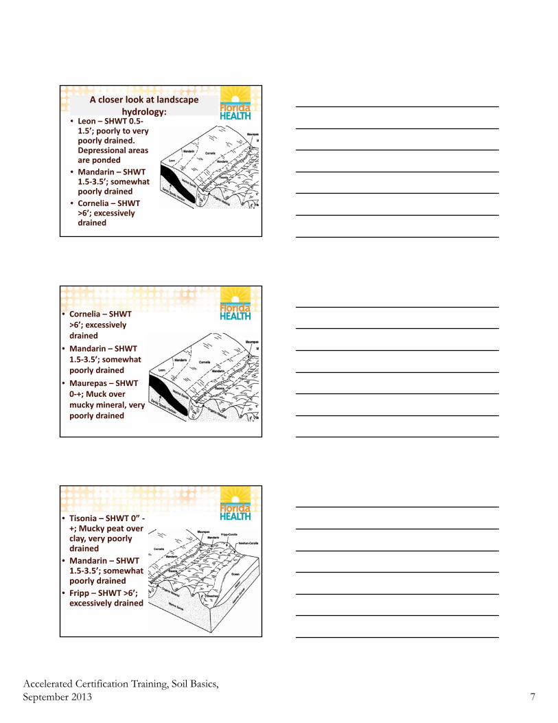
• Cornelia – SHWT >6’; excessively drained
• Mandarin – SHWT 1.5‐3.5’; somewhat poorly drained
• Maurepas – SHWT 0‐+; Muck over mucky mineral, very poorly drained
• Tisonia – SHWT 0” ‐+; Mucky peat over clay, very poorly drained
• Mandarin – SHWT 1.5‐3.5’; somewhat poorly drained
• Fripp – SHWT >6’; excessively drained
Accelerated Certification Training, Soil Basics, September 2013 8
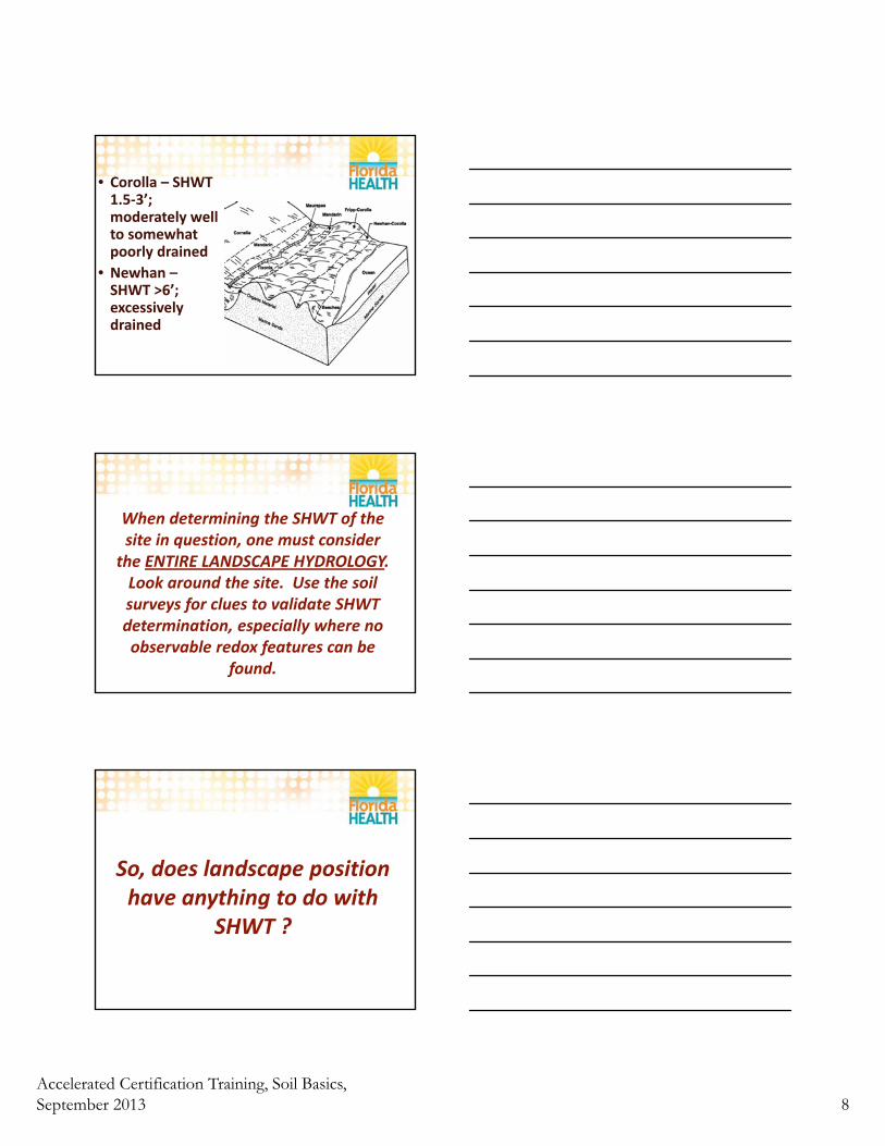
• Corolla – SHWT 1.5‐3’; moderately well to somewhat poorly drained
• Newhan –SHWT >6’; excessively drained
When determining the SHWT of the site in question, one must consider
the ENTIRE LANDSCAPE HYDROLOGY. Look around the site. Use the soil surveys for clues to validate SHWT determination, especially where no observable redox features can be
found.
So, does landscape position have anything to do with
SHWT ?
Accelerated Certification Training, Soil Basics, September 2013 9
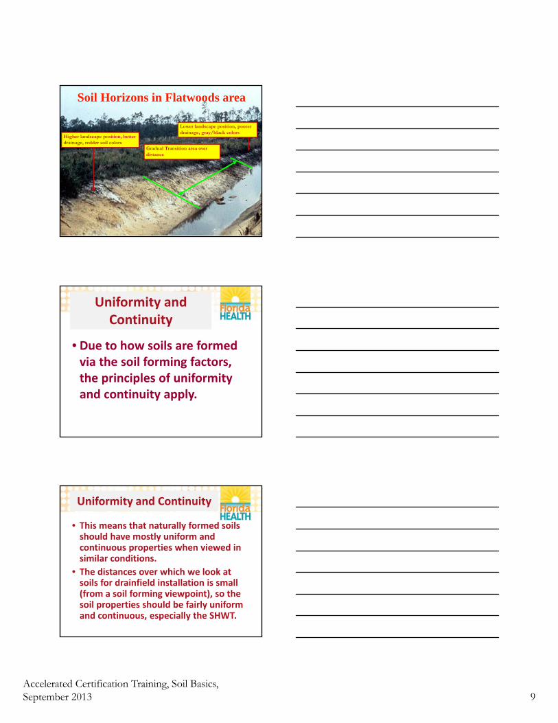
Soil Horizons in Flatwoods area
Higher landscape position, better drainage, redder soil colors
Lower landscape position, poorer drainage, gray/black colors
Gradual Transition area over distance
Uniformity and Continuity
• Due to how soils are formed via the soil forming factors, the principles of uniformity and continuity apply.
Uniformity and Continuity
• This means that naturally formed soils should have mostly uniform and continuous properties when viewed in similar conditions.
• The distances over which we look at soils for drainfield installation is small (from a soil forming viewpoint), so the soil properties should be fairly uniform and continuous, especially the SHWT.
Accelerated Certification Training, Soil Basics, September 2013 10
Uniformity and Continuity
• This is why we are able to look at areas immediately surrounding the location of the drainfield and determine the most likely SHWT in the area of the drainfield.
Uniformity and Continuity in Anthropogenic Soils
• Soil textures and morphology may vary over just a few feet, but SHWT should remain fairly consistent when considering whole landscape hydrology.
• Need to consider many more sample sites to properly determine anthropogenic soil properties.
Uniformity and Continuity in Anthropogenic Soils
• Anthropogenic soils (soil changes that have been influenced by man, e.g. soil replacement) are routinely difficult.
• Given where the fill material came from, if it was parent material to begin with, the soil could have a fair amount of variability in its makeup.
• Judging Uniformity and Continuity should be done in light of these factors.
Accelerated Certification Training, Soil Basics, September 2013 11
Anthropogenic Soils
• Try and determine the amount of time that the fill material has been on site.
• May be able to use Google Earth’s historic imagery feature to look back to approximately 1994.
• Could also use other aerial photography sites like Florida Aerial Photography at http://ufdc.ufl.edu/aerials.
What is texture of fill and how long has it been on site?
• Some filled areas are much more recent.
• Filled areas present additional problems.
• It is advisable to conduct many more soil profiles in the area of the drainfield to properly view the possibly very different and complex soil properties.
Anthropogenic Soils
• Many areas in Florida have been filled for decades.
• This occurred over large areas during the 1950’s through the 1970’s, especially in SW Florida.
• One of the reasons that they were filled is because they were VERY WET and unbuildable.
Accelerated Certification Training, Soil Basics, September 2013 12
Use of Hydric Soils Technical Note 5 (updated April 2005)
• Use Hydric Soils Technical Note 5 (updated April 2005)
• Go to this website: http://soils.usda.gov/use/hydric/ntchs/tech_notes/note5.html
• SHWT indicator ramifications for filled areas and anthropogenic soils are discussed in Presentation 2.
QUESTIONS???
Soil HorizonsLayers on layers
Accelerated Certification Training, Soil Basics, September 2013 13
Soil Horizons and Soil Profiles
• Soil: has natural organization and is biologically active. This inherent organization results from climatic and biological forces altering the properties of the materials of the earth’s surface (Sprecher. 2000). Because these soil-forming forces exert progressively less influence with depth, they result in more or less horizontal layers that are termed “soil horizons.” Individual kinds of soils are distinguished by their specific sequence of horizons, or “soil profile.” The characteristics and vertical sequence of these horizons vary in natural patterns across the landscape.
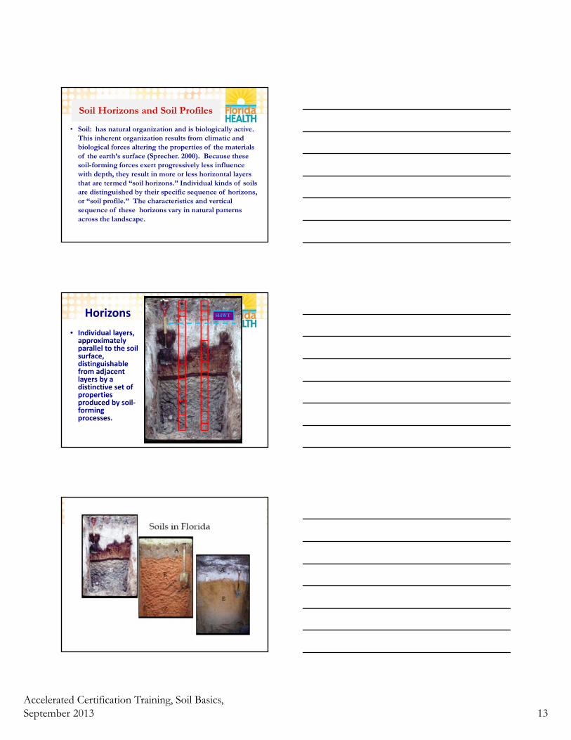
Horizons
• Individual layers, approximately parallel to the soil surface, distinguishable from adjacent layers by a distinctive set of properties produced by soil‐forming processes.
SHWT
E
Accelerated Certification Training, Soil Basics, September 2013 14
USDA Horizon DesignationsSoil Profiles ‐ contain the sequence of horizons. USDA NRCS describe horizons by an alphabetic or alpha‐numeric symbol for the type of layer, upper and lower boundary depth, Munsell notation and texture. The parameters to describe a soil for OSTDS purposes are similar and will be discussed later.
Ex.
A1 ‐‐ 0 to 9 inches;(10YR 2/1)fine sand;
Master Horizons
• All master horizons are designated by a capital letter
Major Horizon Designations
• O Horizon – Surface organic layer
• A Horizon – Surface mineral layer
• E Horizon‐ Leached layer
• B Horizon‐ Subsoil
• C Horizon‐ Underlying material
• R Horizon‐ Bedrock
Accelerated Certification Training, Soil Basics, September 2013 15
Major Horizon Designations
• O Horizon ‐ surface layer in extreme wet soils comprised of organic matter, muck, peat, mucky peat (also the leaf, twigs, root material, etc. in drier soils, especially for OSTDS purposes)
• A Horizon ‐ topsoil or surface layer, the surface layer in a mineral soil characterized by accumulation of organic matter and/or loss of materials (e.g., clays) to deeper layers
• E Horizon ‐ a subsurface layer, the leached layer, materials are removed from this layer and deposited in the B horizon. Often lighter than layers above or below. Always followed by a B horizon.
Major Horizon Designations
• B Horizon ‐ the subsoil layer, characterized by accumulation of clays or other materials such as aluminum, iron and organic matter and greater structural development. Can occur directly under an A horizon. (e.g., a spodic layer). Have not formed in all soils.
• C Horizon ‐ the underlying material, unconsolidated parent material little influenced by soil‐forming processes.
• R Horizon – bedrock, normally limestone in Florida
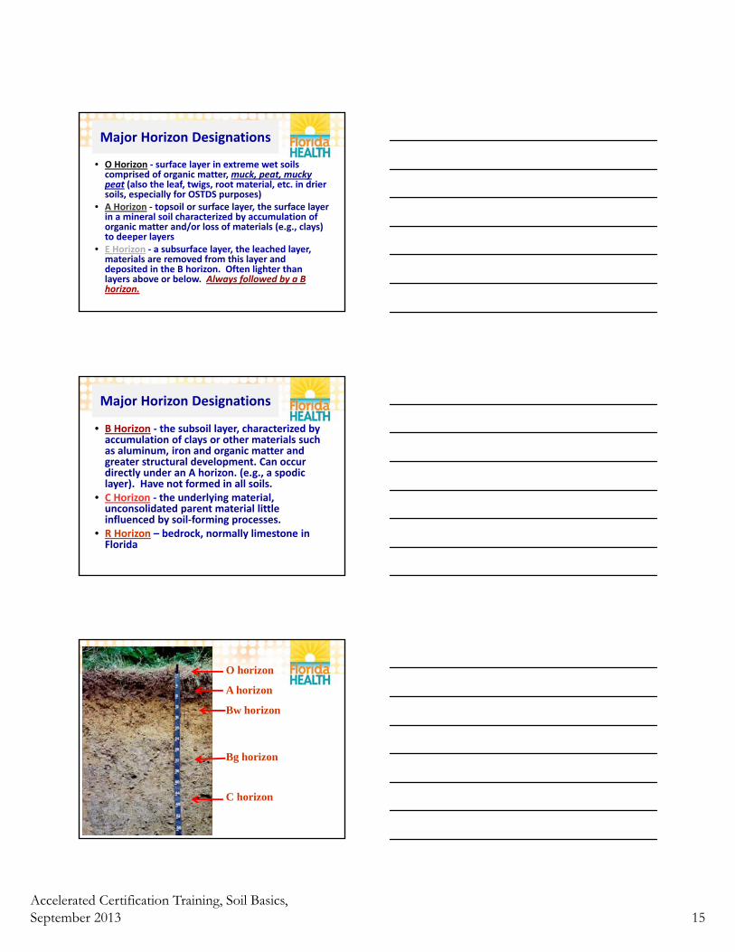
O horizon
A horizon
Bw horizon
Bg horizon
C horizon
Accelerated Certification Training, Soil Basics, September 2013 16
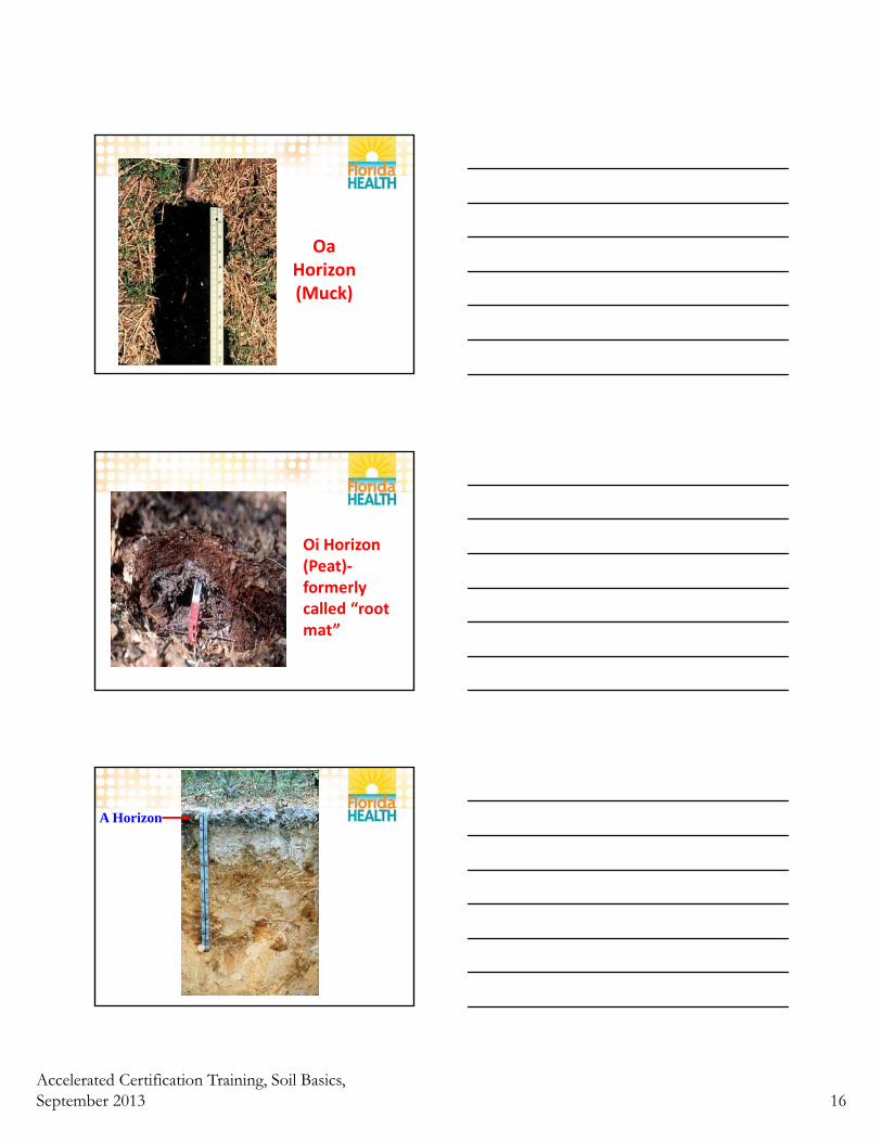
Oa Horizon(Muck)
Oi Horizon(Peat)‐formerly called “root mat”
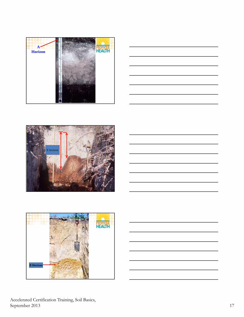
A Horizon
Accelerated Certification Training, Soil Basics, September 2013 17
A Horizon
E horizon
B Horizon
Accelerated Certification Training, Soil Basics, September 2013 18
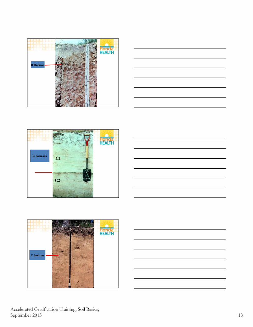
B Horizon
C horizonsC1
C2
C horizon
Accelerated Certification Training, Soil Basics, September 2013 19
R horizon
(Limestone)
Transitional Horizons, horizon subscripts, and the classic soil profile
Transitional Horizons
• Sometimes a layer of soil is similar to two master horizons. It is written in this format.
• AB – Mostly like A ‐ some of B
• BA – Mostly like B ‐ some of A
• Examples: AE EA AC BC
Accelerated Certification Training, Soil Basics, September 2013 20
• E/B ‐ Both E and B particles are present, more E than B percentage wise, but are more distinct than merged.
• Horizons in which distinct parts have recognizable properties of the two kinds of master horizons indicated by the capital letters. The two capital letters are separated by a virgule (/), as E/B, B/E, or B/C. Most of the individual parts of one of the components are surrounded by the other.
Notes on soil horizon designation in older soil surveys
• Before about 1981, soil surveys and other documents contained profile descriptions that used a slightly different group of horizon designations. Following is a list of some old designations and their equivalent designations in the new system.
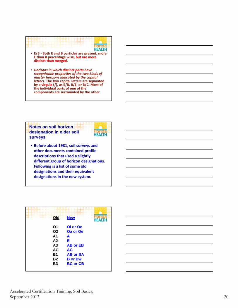
Old New
O1 Oi or OeO2 Oa or OeA1 A A2 EA3 AB or EBAC ACB1 AB or BAB2 B or BwB3 BC or CB
Accelerated Certification Training, Soil Basics, September 2013 21
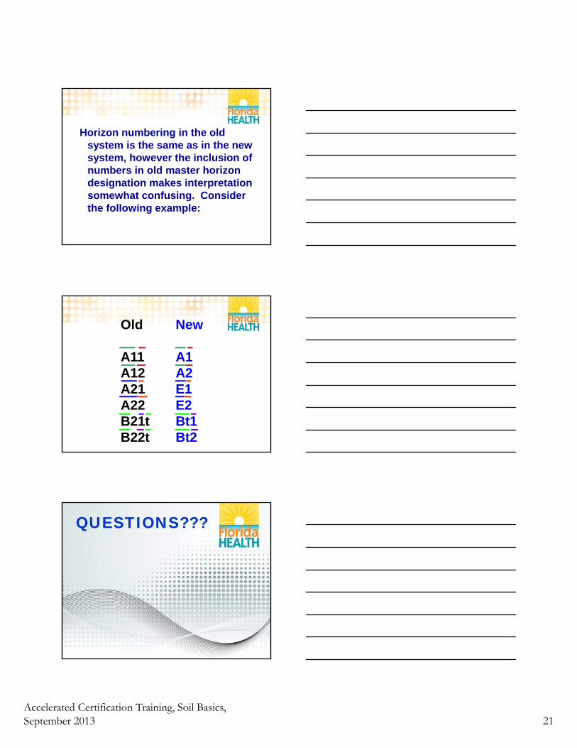
Horizon numbering in the old system is the same as in the new system, however the inclusion of numbers in old master horizon designation makes interpretation somewhat confusing. Consider the following example:
Old New
A11 A1A12 A2A21 E1A22 E2B21t Bt1B22t Bt2
QUESTIONS???
Accelerated Certification Training, Soil Basics, September 2013 22
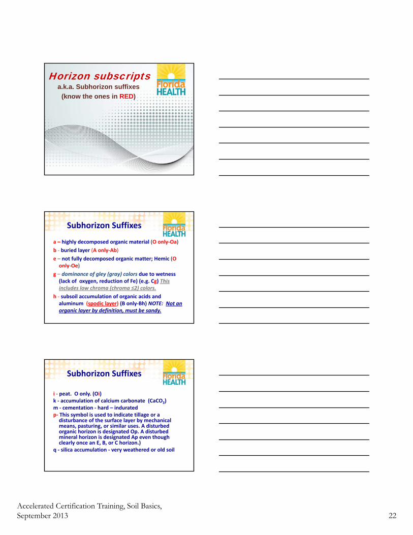
Horizon subscriptsa.k.a. Subhorizon suffixes
(know the ones in RED)
Subhorizon Suffixes
a – highly decomposed organic material (O only‐Oa)
b ‐ buried layer (A only‐Ab)
e – not fully decomposed organic matter; Hemic (O only‐Oe)
g – dominance of gley (gray) colors due to wetness (lack of oxygen, reduction of Fe) (e.g. Cg) This includes low chroma (chroma ≤2) colors.
h ‐ subsoil accumulation of organic acids and aluminum (spodic layer) (B only‐Bh) NOTE: Not an organic layer by definition, must be sandy.
Subhorizon Suffixes
i ‐ peat. O only. (Oi)k ‐ accumulation of calcium carbonate (CaCO3)m ‐ cementation ‐ hard – induratedp‐ This symbol is used to indicate tillage or a disturbance of the surface layer by mechanical means, pasturing, or similar uses. A disturbed organic horizon is designated Op. A disturbed mineral horizon is designated Ap even though clearly once an E, B, or C horizon.)
q ‐ silica accumulation ‐ very weathered or old soil
Accelerated Certification Training, Soil Basics, September 2013 23
Subhorizon Suffixes
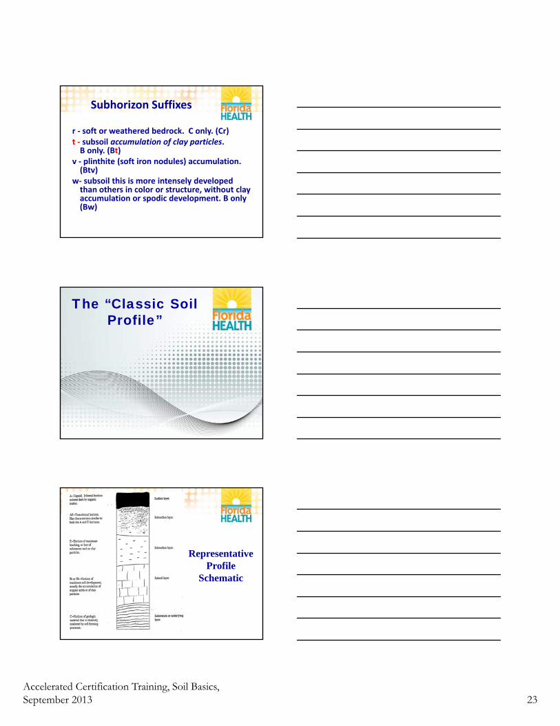
r ‐ soft or weathered bedrock. C only. (Cr)t ‐ subsoil accumulation of clay particles. B only. (Bt)
v ‐ plinthite (soft iron nodules) accumulation. (Btv)
w‐ subsoil this is more intensely developed than others in color or structure, without clay accumulation or spodic development. B only(Bw)
The “Classic Soil Profile”
Representative Profile
Schematic
Accelerated Certification Training, Soil Basics, September 2013 24
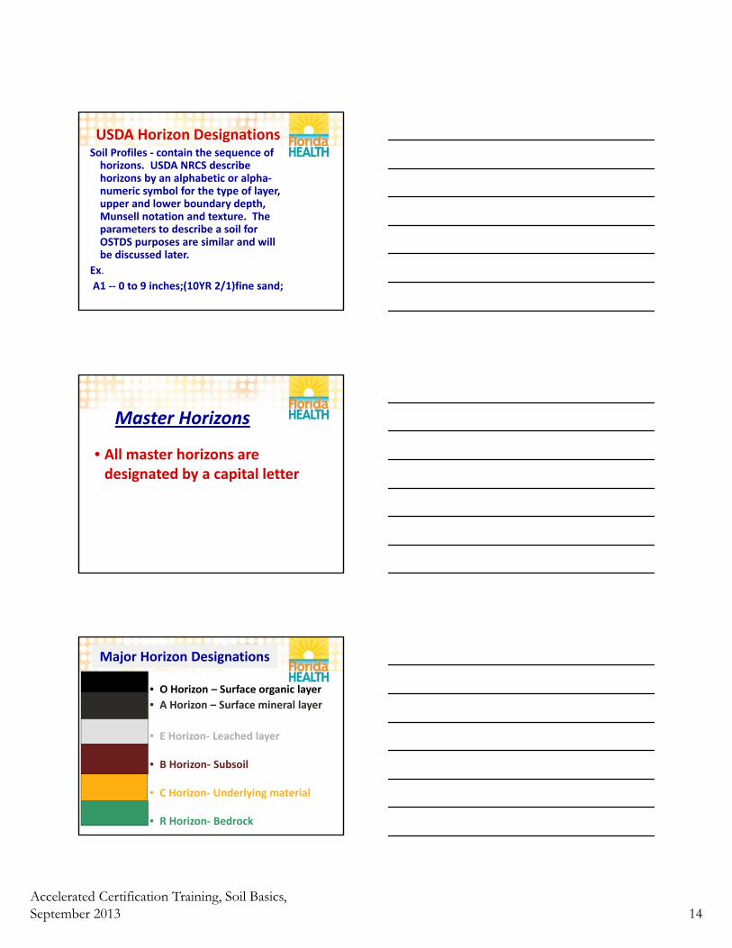
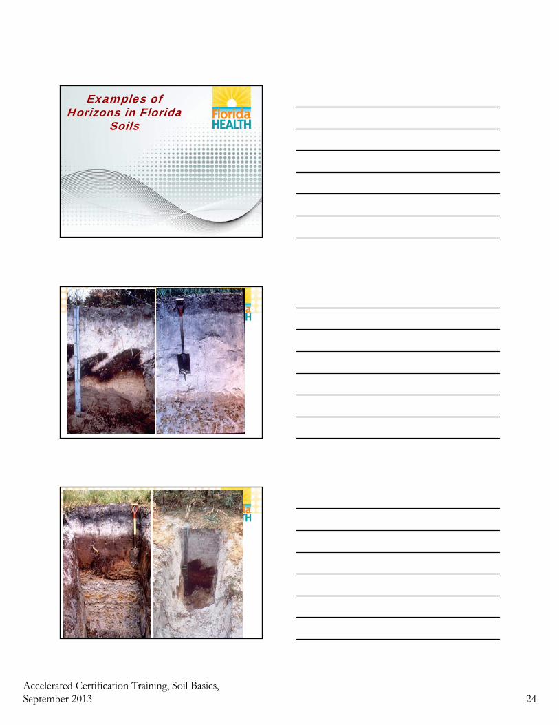
Examples of Horizons in Florida
Soils
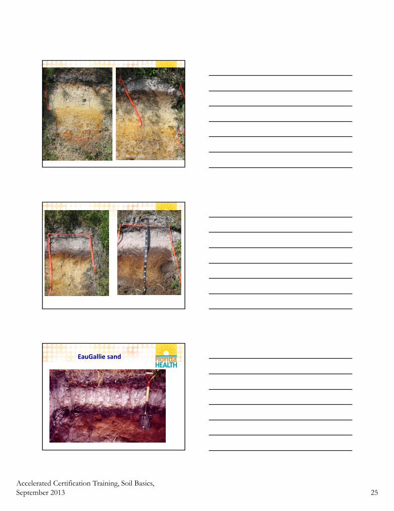
Accelerated Certification Training, Soil Basics, September 2013 25
EauGallie sand
Accelerated Certification Training, Soil Basics, September 2013 26
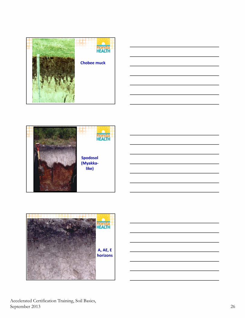
Chobee muck
Spodosol (Myakka‐
like)
A, AE, E horizons
Accelerated Certification Training, Soil Basics, September 2013 27
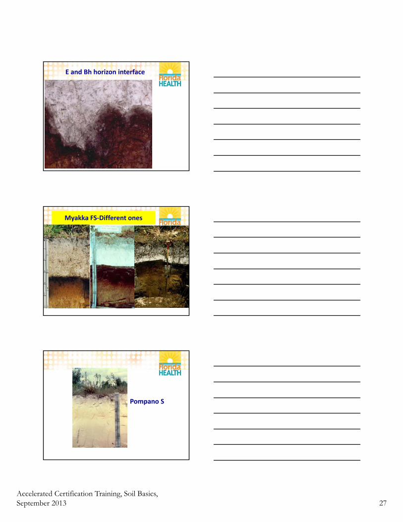
E and Bh horizon interface
Myakka FS‐Different ones
Pompano S
Accelerated Certification Training, Soil Basics, September 2013 28
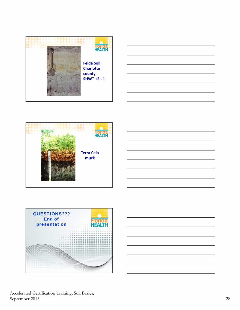
Felda Soil, Charlotte countySHWT +2 ‐ 1
Terra Ceia muck
QUESTIONS???End of
presentation


![Beekeeping Basics [small handout] WW](https://img.pdfslide.net/doc/110x75/613cab969cc893456e1e9a33/beekeeping-basics-small-handout-ww.jpg)
