Embed Size (px)
Citation preview
Oxford View Cones Assessment: South Park
1
South Park View Analysis Summary
Introduction
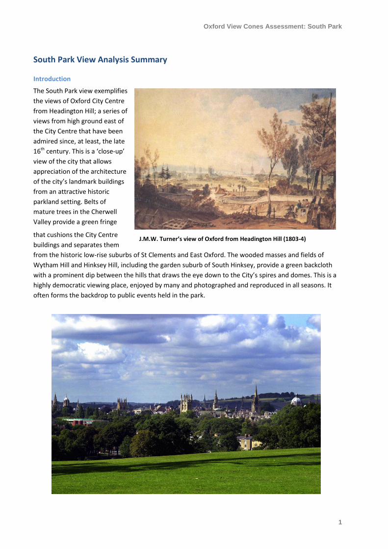
The South Park view exemplifies
the views of Oxford City Centre
from Headington Hill; a series of
views from high ground east of
the City Centre that have been
admired since, at least, the late
16th century. This is a ‘close-up’
view of the city that allows
appreciation of the architecture
of the city’s landmark buildings
from an attractive historic
parkland setting. Belts of
mature trees in the Cherwell
Valley provide a green fringe
that cushions the City Centre
buildings and separates them
from the historic low-rise suburbs of St Clements and East Oxford. The wooded masses and fields of
Wytham Hill and Hinksey Hill, including the garden suburb of South Hinksey, provide a green backcloth
with a prominent dip between the hills that draws the eye down to the City’s spires and domes. This is a
highly democratic viewing place, enjoyed by many and photographed and reproduced in all seasons. It
often forms the backdrop to public events held in the park.
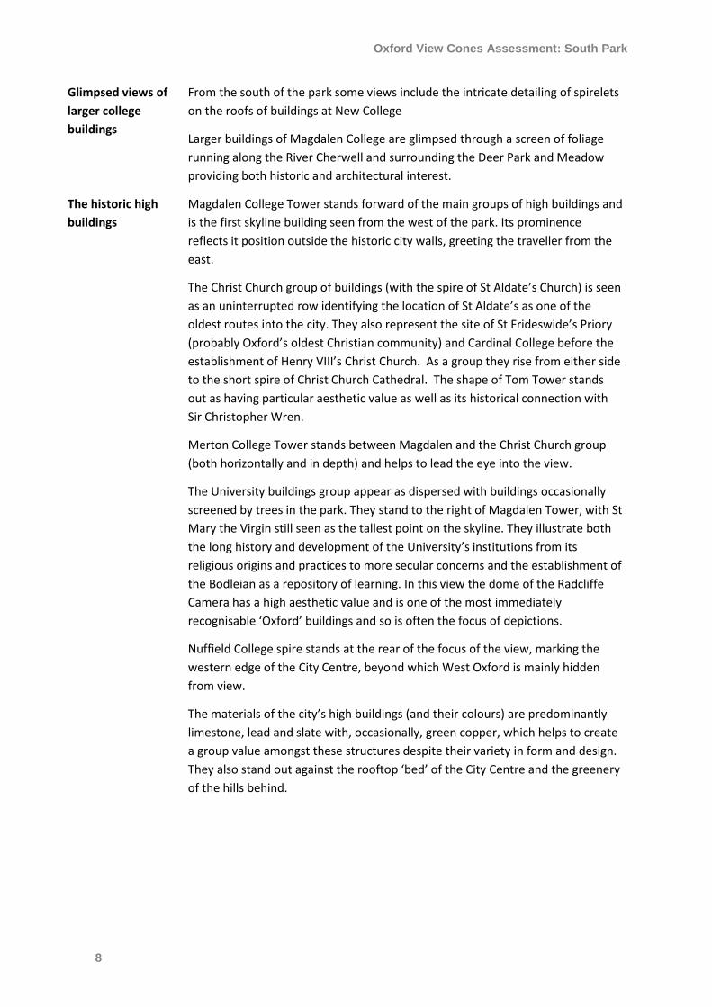
J.M.W. Turner’s view of Oxford from Headington Hill (1803-4)
Oxford View Cones Assessment: South Park
2
The Viewers
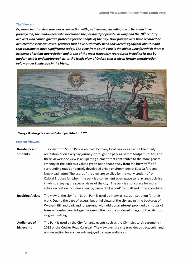
Experiencing this view provides a connection with past viewers, including the artists who have
portrayed it, the landowners who developed the parkland for private viewing and the 20th century
activists who campaigned to protect it for the people of the City. How past viewers have recorded or
depicted the view can reveal features that have historically been considered significant about it and
that continue to have significance today. The view from South Park is the oldest view for which there is
evidence of artistic appreciation and is one of the most frequently reproduced including its use by
modern artists and photographers as the iconic view of Oxford (this is given further consideration
below under Landscape in the View).
#
Present Viewers
Residents and
students
The view from South Park is enjoyed by many local people as part of their daily
recreation or on everyday journeys through the park as part of footpath routes. For
these viewers the view is an uplifting element that contributes to the more general
amenity of the park as a valued green open space away from the busy traffic of
surrounding roads or densely developed urban environments of East Oxford and
New Headington. The users of the view are swelled by the many students from
Oxford Brookes for whom the park is a convenient open space to relax and socialise
in whilst enjoying the special views of the city. The park is also a place for more
active recreation including running, casual ‘kick-about’ football and fitness coaching.
Inspiring Artists The view of the city from South Park is used by many artists as inspiration for their
work. Due to the ease of access, beautiful views of the city against the backdrop of
Wytham Hill and parkland foreground with additional interest provided by groups of
trees or overhanging foliage it is one of the most reproduced images of the city from
its green setting.
Audiences of
big events
The Park is used by the City for large events such as the Olympics torch ceremony in
2012 or the Cowley Road Carnival. The view over the city provides a spectacular and
unique setting for such events enjoyed by large audiences.
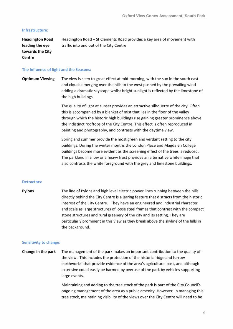
George Hoefnagel’s view of Oxford published in 1575
Oxford View Cones Assessment: South Park
3
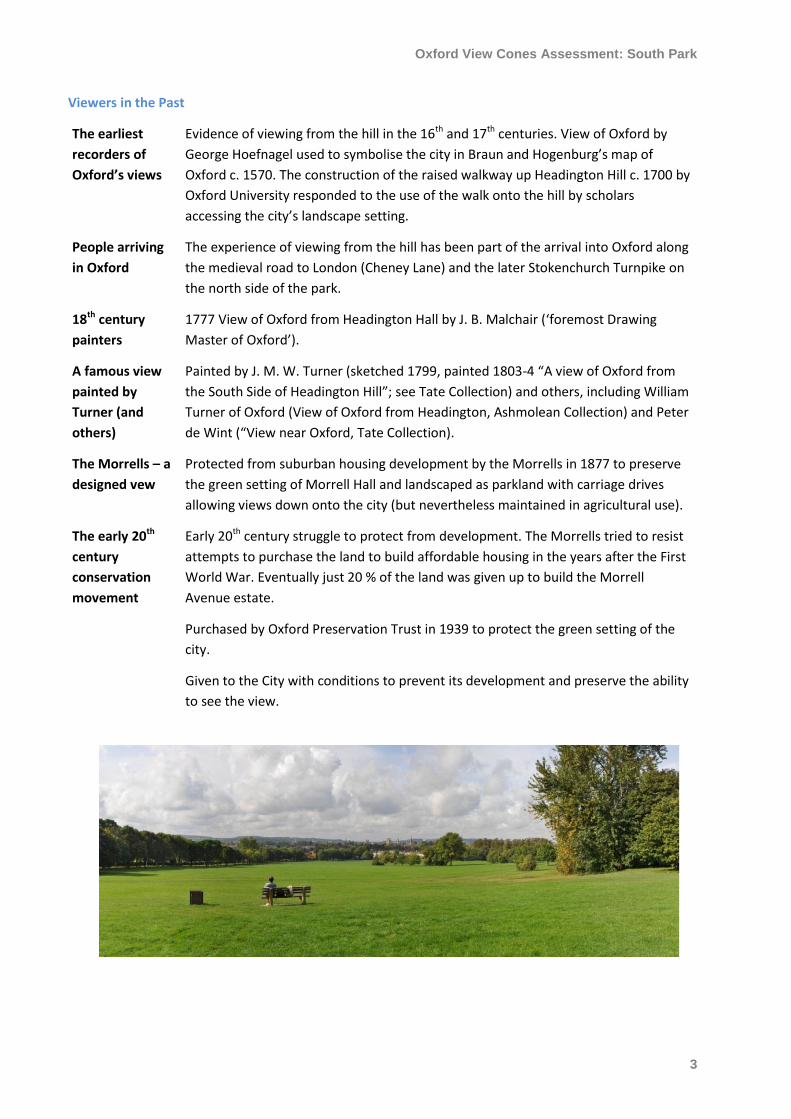
Viewers in the Past
The earliest
recorders of
Oxford’s views
Evidence of viewing from the hill in the 16th and 17th centuries. View of Oxford by
George Hoefnagel used to symbolise the city in Braun and Hogenburg’s map of
Oxford c. 1570. The construction of the raised walkway up Headington Hill c. 1700 by
Oxford University responded to the use of the walk onto the hill by scholars
accessing the city’s landscape setting.
People arriving
in Oxford
The experience of viewing from the hill has been part of the arrival into Oxford along
the medieval road to London (Cheney Lane) and the later Stokenchurch Turnpike on
the north side of the park.
18th century
painters
1777 View of Oxford from Headington Hall by J. B. Malchair (‘foremost Drawing
Master of Oxford’).
A famous view
painted by
Turner (and
others)
Painted by J. M. W. Turner (sketched 1799, painted 1803-4 “A view of Oxford from
the South Side of Headington Hill”; see Tate Collection) and others, including William
Turner of Oxford (View of Oxford from Headington, Ashmolean Collection) and Peter
de Wint (“View near Oxford, Tate Collection).
The Morrells – a
designed vew
Protected from suburban housing development by the Morrells in 1877 to preserve
the green setting of Morrell Hall and landscaped as parkland with carriage drives
allowing views down onto the city (but nevertheless maintained in agricultural use).
The early 20th
century
conservation
movement
Early 20th century struggle to protect from development. The Morrells tried to resist
attempts to purchase the land to build affordable housing in the years after the First
World War. Eventually just 20 % of the land was given up to build the Morrell
Avenue estate.
Purchased by Oxford Preservation Trust in 1939 to protect the green setting of the
city.
Given to the City with conditions to prevent its development and preserve the ability
to see the view.
Oxford View Cones Assessment: South Park
4
The Viewing Place
The viewing place will contribute to what is seen in the view but may also have historical, evidential or
communal value as a place for viewing the city that adds to the significance of the view. The Park
provides the southern end of the Headington Hill (or eastern) group of viewing places with links via
footpaths to a series of viewing places along the west facing slopes of the hill that have been influential
to the area’s development in the past 150 years.
Aesthetic value of
the foreground
South Park is a large urban park with parkland landscaping creating a green
viewing place that forms an attractive Arcadian foreground to the view.
Historical value of
the rural setting
The park retains evidence of the former agricultural environs of Oxford up to the
late 19th century in its green open spaces and the ridge-and-furrow earthworks
of ploughing. Trees within the park also provide remnants of former hedgerows.
This illustrates the development of Oxford and its early post-medieval suburb of
St Clement’s into the rural setting and preserved the coherence of the historic
city core
Historical and
aesthetic value of
the parkland
landscape
The park retains evidence of the landscaping undertaken by the Morrells and,
subsequently, the City Council, to turn the agricultural land into a picturesque
landscape. This includes the openness of the space and the boundary tree
planting and tree groups.
A number of ever-
changing views
The mix of large open space and densely planted tree groups changes the focus
of the view between different groups of City Centre landmarks as the viewer
moves through the space.
Archaeological
value of the Civil
War view
The park has potential for the survival of remains of the encampment made by
the Parliamentarian army during the siege of Oxford in 1646. Studying how the
encampment utilised the views over the city could reveal more about the siege
and the history of Oxford during this significant period in the city’s history.
The Landscape in the View
What is seen in the view has been admired for centuries for both its designed and fortuitous aesthetic
quality – that is, the high quality of features in the view that were intended to be beautiful and the
development of groups of features by chance that we consider to be beautiful because of our taste and
cultural associations. The characteristic features in the view; the green foreground, compact medieval
City Centre, high buildings of architectural quality rising above the general roofscape and Magdalen
Tower in a position of primacy, as well as the green backcloth of the hills beyond, have essentially
remained unchanged since the 16th century providing a connection with those who have seen and
portrayed this view before. Seeing the City Centre in its green setting, with St Clement’s suburb in the
foreground, provides understanding of its development as a medieval urban centre at the junction of
two river valleys. The high buildings of the colleges and University, with strong Gothic styling, reflect
the influence of the church on the development of Oxford as a centre of medieval and early modern
religion and learning. Later buildings, including the domes of the Sheldonian and Radcliffe Camera,
reflect the development of classical taste in the University in the 17th and 18th centuries. The growth of
St Clement’s suburb, seen in this view as the gateway to the city, reflects the importance of the roads
Oxford View Cones Assessment: South Park
5
from the city up Headington Hill as the route to London, with which Oxford has held a strong
connection, occasionally replacing the capital as the country’s centre of government and often
providing the seat of learning from which governance has sprung.
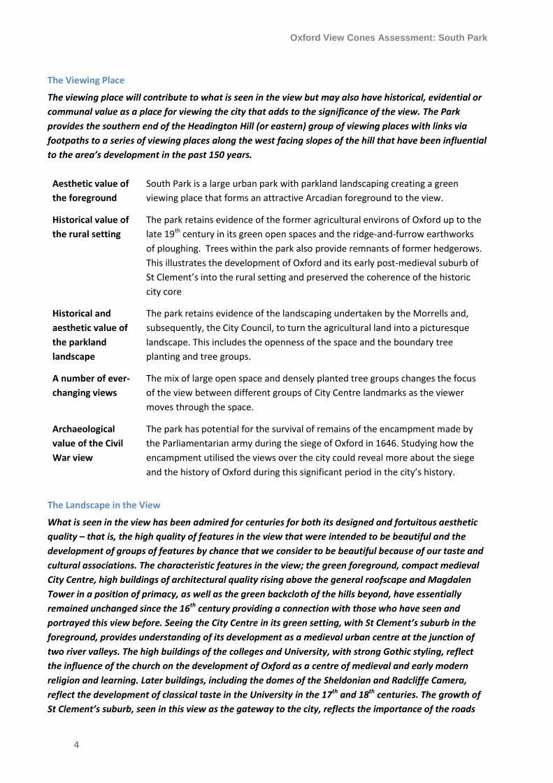
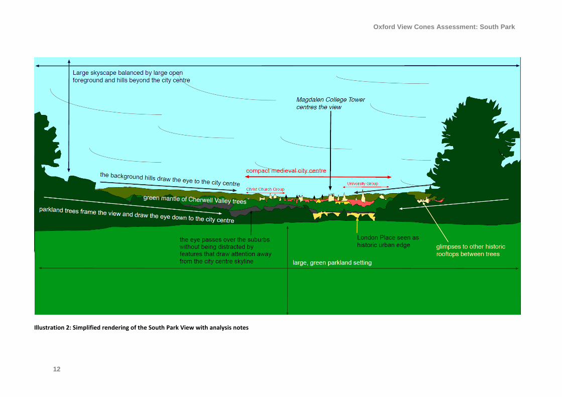
The view from the hillside looks down on the city with extensive parkland, including traces of an
agricultural past in the foreground, leading the eye down to the suburb of St Clement’s, indicated by
Georgian town houses at London Place. From this frontage the eye passes easily over the low-level
rooftops to the City Centre, wrapped in a mantle of mature trees in the Cherwell Valley parklands. The
City Centre provides a fine grain roofscape with the appearance of a consistent height, broken
occasionally by the mounds of foliage of mature trees. Only the traditional towers, spires and domes of
great aesthetic worth and architectural quality, signifying high status buildings of the University and
colleges, rise above the general level of the rooftops and so stand out and these are limited to the
carefully designed prestigious features of towers, spires and domes. Occasionally, the lower portions of
college buildings are glimpsed between the Cherwell Valley trees. The city’s position on a gravel island
holds it up above the surrounding valleys and screens the buildings of West Oxford in this view such
that the City Centre is seen against the green backdrop of Hinksey Hill and Wytham Hill. A dip between
the hills draws the eye down to the City Centre. Magdalen College Tower (originally located just outside
the city) stands forward amongst the high buildings and has primacy. A group of high buildings centred
on Christ Church (the Christ Church Group) stand to the left and indicate the former sites of St
Frideswide’s Abbey and Cardinal College on the historic route into the city from the south. A second
group of high buildings; including St Mary the Virgin Church, the Radcliffe Camera and the Sheldonian
Theatre (the University Group) stand to the left and are seen to a greater or lesser extent as the viewer
moves around the park, becoming screened by trees and the shoulder of Headington Hill in the east of
the park.
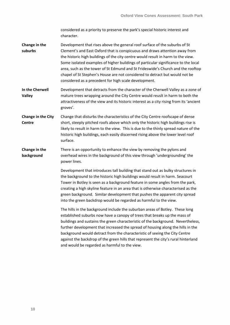
The city skyline in silhouette at dusk in September
Oxford View Cones Assessment: South Park
6
Topography and layout of the view:
The City Centre sits
prominently in the
middle ground
with a green
backcloth of hills
and a mixed
foreground of
green parkland,
historic St
Clement’s Suburb
and the Green Belt
of trees in the
Cherwell Valley.
The park provides a large foreground area and a range of different elevations
with views down onto the City Centre. Houses outside the park and trees lines
within it provide a well-defined edge to the green foreground.
The dip into the valley of the River Cherwell reduces the prominence of the
buildings in St Clement’s suburb and of the open spaces on the valley floor,
which reduces the apparent depth of these areas in the view and allows the eye
to pass easily over the buildings to the greenery and City Centre beyond.
The City Centre’s slight elevation above the floodplain adds to its prominence in
the mid-ground, making it seem closer and hiding the townscape of west Oxford
beyond.
The high buildings in the middle ground rise from a fine grain roofscape in the
historic City Centre but appear as a row of towers, spires and domes rising in
spread across the city.
The dip between the two hills in the background draws the eye down to the city
centre as the focus of the view.
Changing elevation
and perspectives
with a progression
from silhouette
skyline, to
roofscape and
finally a
breathtaking
panorama.
The topography, with the rise in ground level increasing distance from the City
Centre from west to east, means that moving around the park provides an ever-
changing view.
From the west of the park: the towers are seen in silhouette against the sky
above the roofline of buildings at London Place, Morrell Avenue and Glebe
Street.
As the viewer moves eastward: the city’s towers and spires are seen standing
within the context of the wider city roofscape, with the western hills providing a
green backcloth indicating the city’s green setting.
From the eastern extremity of the park: the skyline buildings recede into the
distance becoming less easily identified individually, whilst the general extent of
the southern part of the City Centre can be appreciated within its green setting,
although the northern half (including The University Group) are increasingly
screened from view.
The view to the north is confined by the topography of the hill and tree planting.
The view to the south west is more open (there is a secondary view over East
Oxford towards Boars Hill including the spire of Ss Edmund and Frideswide and
the rooftop chapel of St Stephen’s House as landmarks).
Green Characteristics:
Green foreground The green parkland foreground is aesthetically pleasing and illustrates both the
earlier agricultural use and the picturesque landscaped parkland of the Morrell’s
Oxford View Cones Assessment: South Park
7
country estate, adding historical value.
Trees in the park
frame the views
Groups of trees frame views screening some areas of the skyline that are
revealed and disappear as the viewer moves through the space.
Trees on the park’s boundaries lead the eye down to the City Centre.
Trees in the
Cherwell floodplain
The trees running alongside the River Cherwell and in the green spaces in its
floodplain (including the grounds of Magdalen College and School, St Hilda’s
College and Merton and Christ Church Meadows beyond), form a green mantle
of foliage that defines the limits of the historic City Centre and provides soft
green masses that complement harder forms of towers, spires and domes.
Trees in the City
Centre
Occasional taller trees rise amongst the spires, towers and domes and over the
lower level roofscape (indicating the locations of green spaces of college gardens
in the City Centre) and provide greenery and softening in the skyline.
Architectural Characteristics:
Historical value of
St Clement’s
buildings as a
gateway to the City
Centre
Terraces of Georgian and Victorian townhouses at London Place and Glebe Street
illustrate the 18th and 19th century gateway to the city (reflected in the naming of
London Place) creating an edge to the historic urban area. This is the entrance to
the historic St Clement’s suburb, established in the Middle Ages and rebuilt after
the Civil War as a distinct community.
Low rise suburbs
between fore and
middle ground
The low rise suburbs of East Oxford (mostly two-storey) and St Clements’ (mostly
three-storey) provide an introduction to the middle ground with no distracting
high points that would compete with the City Centre spires for precedence.
The rooftop and horse-shoe plan of Sir James Sterling’s Florey Building can be
identified in the St Clement’s suburb by the distinctive Lancashire red brick walls
that make it stand out from other buildings in Oxford.
Intricate City
Centre roofscape
of small pitched
roofs
The City Centre roofscape is formed of a compact area with a densely developed
pattern of generally uniform height and predominantly pitched roofs with some
larger roofs representing historic college buildings. The large red brick gable end
of Oxford Town Hall stands above the roofscape, giving this important civic
building a presence in the skyline. The compact area of roofscape seen illustrates
the confined nature of the medieval city within its circuit of walls.
The main materials of the rooftop bed of the City Centre are natural slate and
plain clay tile, which are dark, essentially recessive and provide a strong contrast
to the limestone of the high buildings which, therefore, stand out.
Occasionally the more intricate detailing of medieval college roofs can be seen
including highly ornamented spirelets rising from parapets.
Oxford View Cones Assessment: South Park
8
Glimpsed views of
larger college
buildings
From the south of the park some views include the intricate detailing of spirelets
on the roofs of buildings at New College
Larger buildings of Magdalen College are glimpsed through a screen of foliage
running along the River Cherwell and surrounding the Deer Park and Meadow
providing both historic and architectural interest.
The historic high
buildings
Magdalen College Tower stands forward of the main groups of high buildings and
is the first skyline building seen from the west of the park. Its prominence
reflects it position outside the historic city walls, greeting the traveller from the
east.
The Christ Church group of buildings (with the spire of St Aldate’s Church) is seen
as an uninterrupted row identifying the location of St Aldate’s as one of the
oldest routes into the city. They also represent the site of St Frideswide’s Priory
(probably Oxford’s oldest Christian community) and Cardinal College before the
establishment of Henry VIII’s Christ Church. As a group they rise from either side
to the short spire of Christ Church Cathedral. The shape of Tom Tower stands
out as having particular aesthetic value as well as its historical connection with
Sir Christopher Wren.
Merton College Tower stands between Magdalen and the Christ Church group
(both horizontally and in depth) and helps to lead the eye into the view.
The University buildings group appear as dispersed with buildings occasionally
screened by trees in the park. They stand to the right of Magdalen Tower, with St
Mary the Virgin still seen as the tallest point on the skyline. They illustrate both
the long history and development of the University’s institutions from its
religious origins and practices to more secular concerns and the establishment of
the Bodleian as a repository of learning. In this view the dome of the Radcliffe
Camera has a high aesthetic value and is one of the most immediately
recognisable ‘Oxford’ buildings and so is often the focus of depictions.
Nuffield College spire stands at the rear of the focus of the view, marking the
western edge of the City Centre, beyond which West Oxford is mainly hidden
from view.
The materials of the city’s high buildings (and their colours) are predominantly
limestone, lead and slate with, occasionally, green copper, which helps to create
a group value amongst these structures despite their variety in form and design.
They also stand out against the rooftop ‘bed’ of the City Centre and the greenery
of the hills behind.
Oxford View Cones Assessment: South Park
9
Infrastructure:
Headington Road
leading the eye
towards the City
Centre
Headington Road – St Clements Road provides a key area of movement with
traffic into and out of the City Centre
The Influence of light and the Seasons:
Optimum Viewing The view is seen to great effect at mid-morning, with the sun in the south east
and clouds emerging over the hills to the west pushed by the prevailing wind
adding a dramatic skyscape whilst bright sunlight is reflected by the limestone of
the high buildings.
The quality of light at sunset provides an attractive silhouette of the city. Often
this is accompanied by a blanket of mist that lies in the floor of the valley
through which the historic high buildings rise gaining greater prominence above
the indistinct rooftops of the City Centre. This effect is often reproduced in
painting and photography, and contrasts with the daytime view.
Spring and summer provide the most green and verdant setting to the city
buildings. During the winter months the London Place and Magdalen College
buildings become more evident as the screening effect of the trees is reduced.
The parkland in snow or a heavy frost provides an alternative white image that
also contrasts the white foreground with the grey and limestone buildings.
Detractors:
Pylons The line of Pylons and high level electric power lines running between the hills
directly behind the City Centre is a jarring feature that distracts from the historic
interest of the City Centre. They have an engineered and industrial character
and scale as large structures of loose steel frames that contrast with the compact
stone structures and rural greenery of the city and its setting. They are
particularly prominent in this view as they break above the skyline of the hills in
the background.
Sensitivity to change:
Change in the park The management of the park makes an important contribution to the quality of
the view. This includes the protection of the historic ‘ridge and furrow
earthworks’ that provide evidence of the area’s agricultural past, and although
extensive could easily be harmed by overuse of the park by vehicles supporting
large events.
Maintaining and adding to the tree stock of the park is part of the City Council’s
ongoing management of the area as a public amenity. However, in managing this
tree stock, maintaining visibility of the views over the City Centre will need to be
Oxford View Cones Assessment: South Park
10
considered as a priority to preserve the park’s special historic interest and
character.
Change in the
suburbs
Development that rises above the general roof surface of the suburbs of St
Clement’s and East Oxford that is conspicuous and draws attention away from
the historic high buildings of the city centre would result in harm to the view.
Some isolated examples of higher buildings of particular significance to the local
area, such as the tower of St Edmund and St Frideswide’s Church and the rooftop
chapel of St Stephen’s House are not considered to detract but would not be
considered as a precedent for high scale development.
In the Cherwell
Valley
Development that detracts from the character of the Cherwell Valley as a zone of
mature trees wrapping around the City Centre would reuslt in harm to both the
attractiveness of the view and its historic interest as a city rising from its ‘ancient
groves’.
Change in the City
Centre
Change that disturbs the characteristics of the City Centre roofscape of dense
short, steeply pitched roofs above which only the historic high buildings rise is
likely to result in harm to the view. This is due to the thinly spread nature of the
historic high buildings, each easily discerned rising above the lower level roof
surface.
Change in the
background
There is an opportunity to enhance the view by removing the pylons and
overhead wires in the background of this view through ‘undergrounding’ the
power lines.
Development that introduces tall building that stand out as bulky structures in
the background to the historic high buildings would result in harm. Seacourt
Tower in Botley is seen as a background feature in some angles from the park,
creating a high skyline feature in an area that is otherwise characterised as the
green background. Similar development that pushes the apparent city spread
into the green backdrop would be regarded as harmful to the view.
The hills in the background include the suburban areas of Botley. These long
established suburbs now have a canopy of trees that breaks up the mass of
buildings and sustains the green characteristic of the background. Nevertheless,
further development that increased the spread of housing along the hills in the
background would detract from the characteristic of seeing the City Centre
against the backdrop of the green hills that represent the city’s rural hinterland
and would be regarded as harmful to the view.
Oxford View Cones Assessment: South Park
11
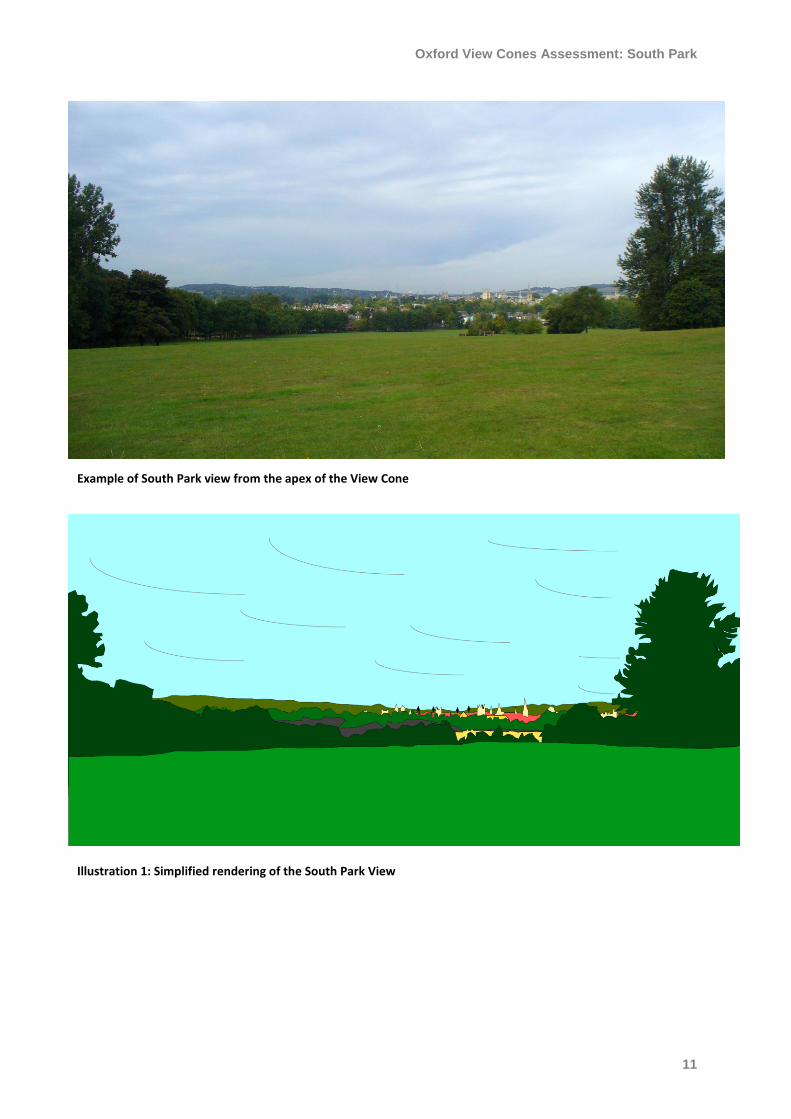
Example of South Park view from the apex of the View Cone
Illustration 1: Simplified rendering of the South Park View
Oxford View Cones Assessment: South Park
12
Illustration 2: Simplified rendering of the South Park View with analysis notes