Embed Size (px)
Citation preview
1 1 1 1
Global Near Space Services Proprietary Information
11
StarTower Aerostat for
Turkey National Security
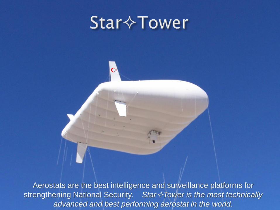
Aerostats are the best intelligence and surveillance platforms for
strengthening National Security. StarTower is the most technically
advanced and best performing aerostat in the world.
1. Continuous Surveillance (unblinking eye):
• Deter hostile actions by always being present and
always watching
• Watch for changes to the daily “Pattern of Life”
• Identity (ID) “deliberate pre-attack sequence of events”
• Detect imminent hostile actions before the enemy has
contact with civilians and Friendly Forces
2. Timely & Effective Response:
• Early detection & positive identification of threats allow
time to develop the proper tactical response
• Turkey response forces will always have the initiative
and can engage the threats with overwhelming tactical
advantage
• Keen situational awareness and communications for
precise Command & Control
• Real-time, 2-way intelligence sharing between
Command & Control and Response Forces
3. Intelligence Collection & Archiving:
• Multiple sensors (radar and imaging) increase
probability of detection & positive identification of
threats
• ‘Track Continuity’ is essential to backtracking of
threats and identification of strongholds
• Documentation of hostile forces and Turkish response
will assure citizens and global community of Turkey’s
justified response
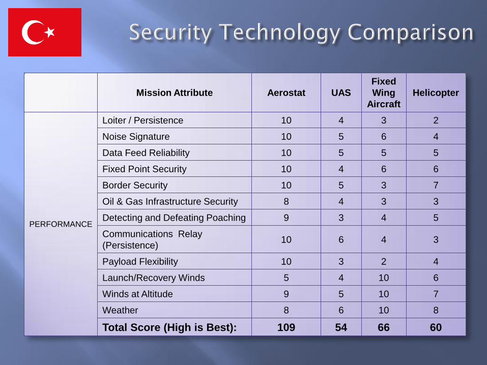
Mission Attribute Aerostat UAS
Fixed
Wing
Aircraft
Helicopter
PERFORMANCE
Loiter / Persistence 10 4 3 2
Noise Signature 10 5 6 4
Data Feed Reliability 10 5 5 5
Fixed Point Security 10 4 6 6
Border Security 10 5 3 7
Oil & Gas Infrastructure Security 8 4 3 3
Detecting and Defeating Poaching 9 3 4 5
Communications Relay
(Persistence) 10 6 4 3
Payload Flexibility 10 3 2 4
Launch/Recovery Winds 5 4 10 6
Winds at Altitude 9 5 10 7
Weather 8 6 10 8
Total Score (High is Best): 109 54 66 60
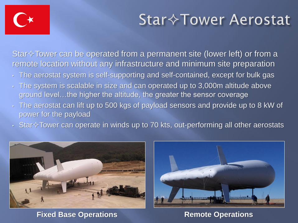
StarTower can be operated from a permanent site (lower left) or from a
remote location without any infrastructure and minimum site preparation
• The aerostat system is self-supporting and self-contained, except for bulk gas
• The system is scalable in size and can operated up to 3,000m altitude above
ground level…the higher the altitude, the greater the sensor coverage
• The aerostat can lift up to 500 kgs of payload sensors and provide up to 8 kW of
power for the payload
• StarTower can operate in winds up to 70 kts, out-performing all other aerostats
Fixed Base Operations Remote Operations
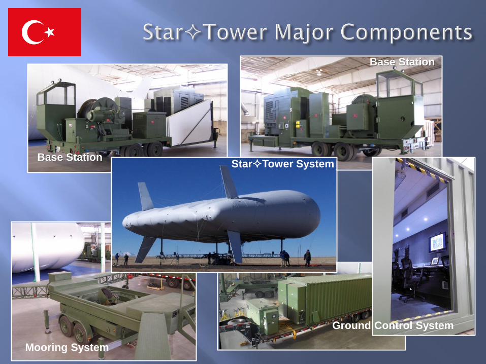
Base Station
Base Station
Ground Control System
StarTower System
Mooring System
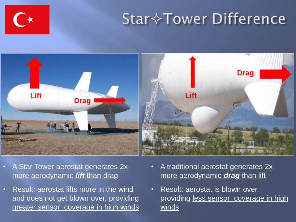
• A traditional aerostat generates 2x
more aerodynamic drag than lift
• Result: aerostat is blown over,
providing less sensor coverage in high
winds
• A Star Tower aerostat generates 2x
more aerodynamic lift than drag
• Result: aerostat lifts more in the wind
and does not get blown over, providing
greater sensor coverage in high winds
Drag Lift Lift
Drag
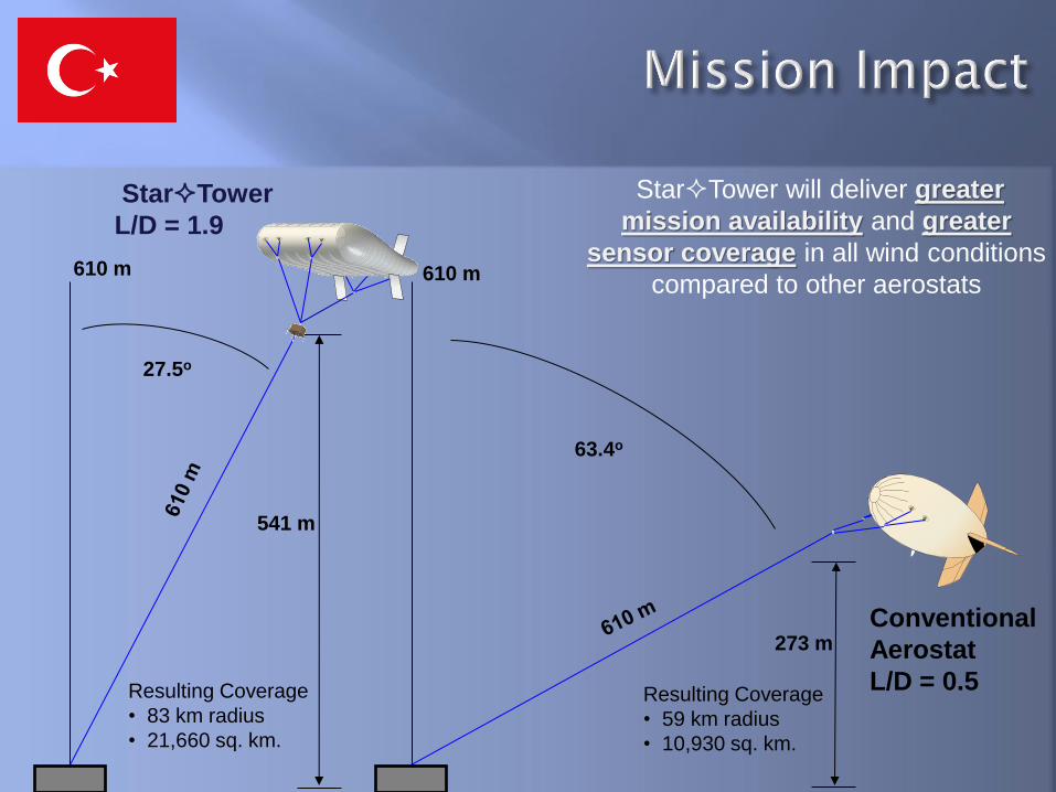
541 m
273 m
63.4o
27.5o
StarTower
L/D = 1.9
Conventional
Aerostat
L/D = 0.5
610 m 610 m
Resulting Coverage
• 83 km radius
• 21,660 sq. km.
Resulting Coverage
• 59 km radius
• 10,930 sq. km.
StarTower will deliver greater
mission availability and greater
sensor coverage in all wind conditions
compared to other aerostats
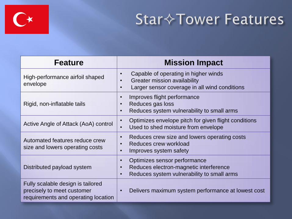
Feature Mission Impact
High-performance airfoil shaped
envelope
• Capable of operating in higher winds
• Greater mission availability
• Larger sensor coverage in all wind conditions
Rigid, non-inflatable tails
• Improves flight performance
• Reduces gas loss
• Reduces system vulnerability to small arms
Active Angle of Attack (AoA) control • Optimizes envelope pitch for given flight conditions
• Used to shed moisture from envelope
Automated features reduce crew
size and lowers operating costs
• Reduces crew size and lowers operating costs
• Reduces crew workload
• Improves system safety
Distributed payload system
• Optimizes sensor performance
• Reduces electron-magnetic interference
• Reduces system vulnerability to small arms
Fully scalable design is tailored
precisely to meet customer
requirements and operating location
• Delivers maximum system performance at lowest cost
13
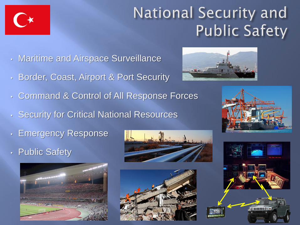
• Maritime and Airspace Surveillance
• Border, Coast, Airport & Port Security
• Command & Control of All Response Forces
• Security for Critical National Resources
• Emergency Response
• Public Safety
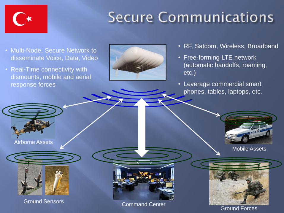
• Multi-Node, Secure Network to
disseminate Voice, Data, Video
• Real-Time connectivity with
dismounts, mobile and aerial
response forces
Command Center Ground Sensors
• RF, Satcom, Wireless, Broadband
• Free-forming LTE network
(automatic handoffs, roaming,
etc.)
• Leverage commercial smart
phones, tables, laptops, etc.
Airborne Assets
Ground Forces
Mobile Assets
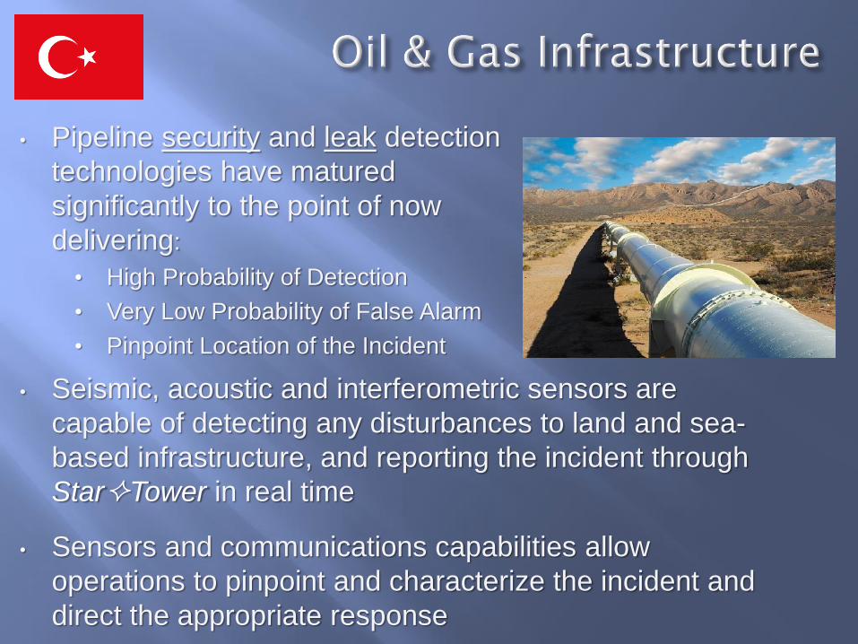
• Pipeline security and leak detection
technologies have matured
significantly to the point of now
delivering:
• High Probability of Detection
• Very Low Probability of False Alarm
• Pinpoint Location of the Incident
• Seismic, acoustic and interferometric sensors are
capable of detecting any disturbances to land and sea-
based infrastructure, and reporting the incident through
StarTower in real time
• Sensors and communications capabilities allow
operations to pinpoint and characterize the incident and
direct the appropriate response
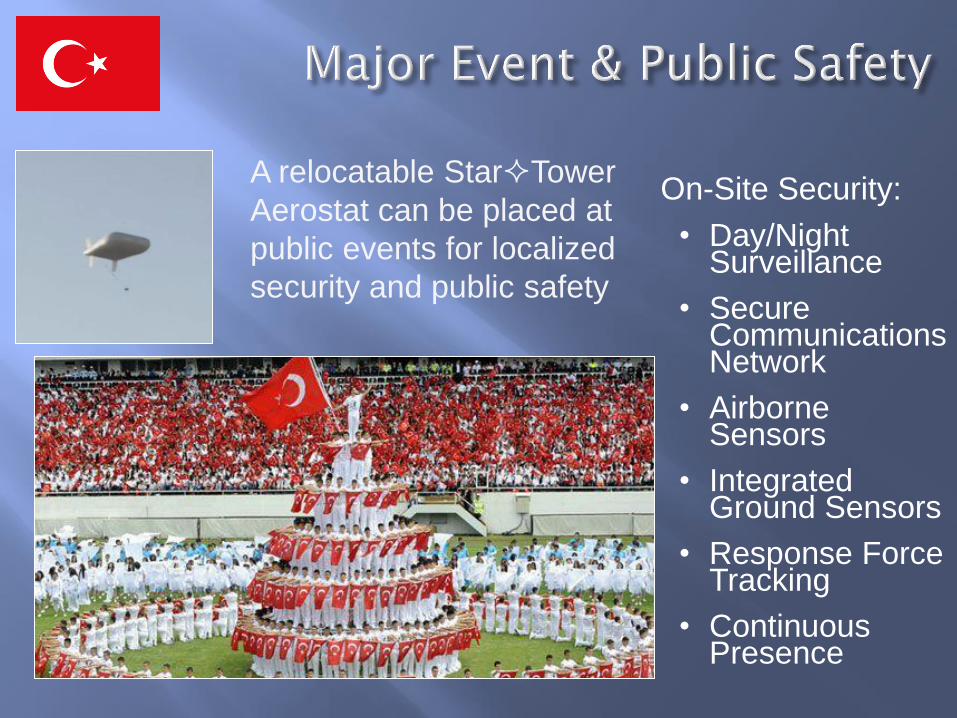
On-Site Security:
• Day/Night Surveillance
• Secure Communications Network
• Airborne Sensors
• Integrated Ground Sensors
• Response Force Tracking
• Continuous Presence
A relocatable StarTower
Aerostat can be placed at
public events for localized
security and public safety
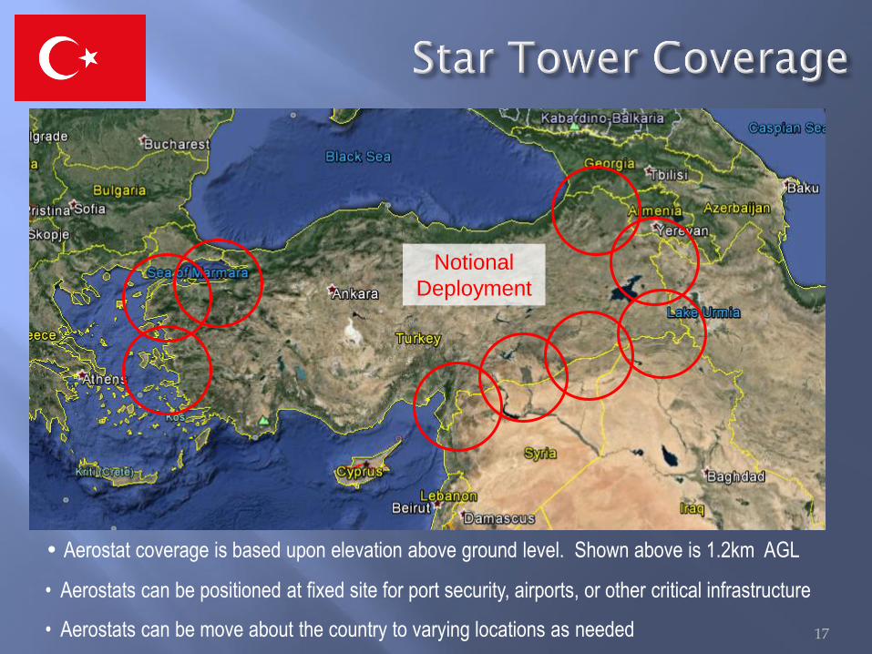
Notional
Deployment
17
• Aerostat coverage is based upon elevation above ground level. Shown above is 1.2km AGL
• Aerostats can be positioned at fixed site for port security, airports, or other critical infrastructure
• Aerostats can be move about the country to varying locations as needed
Notional
Deployment
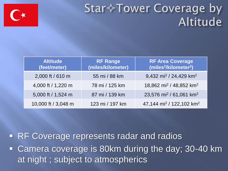
Altitude
(feet/meter)
RF Range
(miles/kilometer)
RF Area Coverage
(miles2/kilometer2)
2,000 ft / 610 m 55 mi / 88 km 9,432 mi2 / 24,429 km2
4,000 ft / 1,220 m 78 mi / 125 km 18,862 mi2 / 48,852 km2
5,000 ft / 1,524 m 87 mi / 139 km 23,576 mi2 / 61,061 km2
10,000 ft / 3,048 m 123 mi / 197 km 47,144 mi2 / 122,102 km2
RF Coverage represents radar and radios
Camera coverage is 80km during the day; 30-40 km
at night ; subject to atmospherics
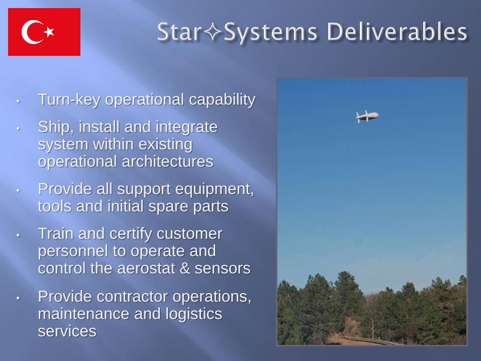
• Turn-key operational capability
• Ship, install and integrate system within existing operational architectures
• Provide all support equipment, tools and initial spare parts
• Train and certify customer personnel to operate and control the aerostat & sensors
• Provide contractor operations, maintenance and logistics services
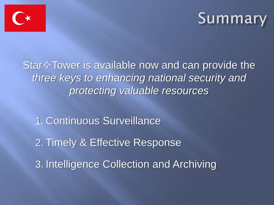
StarTower is available now and can provide the
three keys to enhancing national security and
protecting valuable resources
1. Continuous Surveillance
2. Timely & Effective Response
3. Intelligence Collection and Archiving
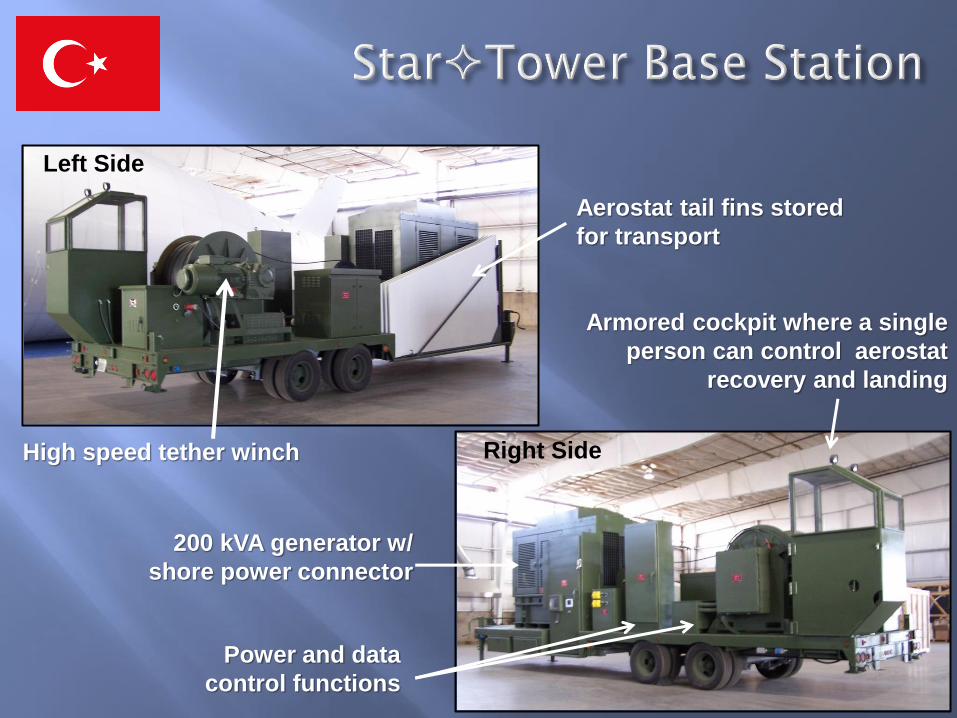
Left Side
Right Side
200 kVA generator w/
shore power connector
Power and data
control functions
High speed tether winch
Aerostat tail fins stored
for transport
Armored cockpit where a single
person can control aerostat
recovery and landing
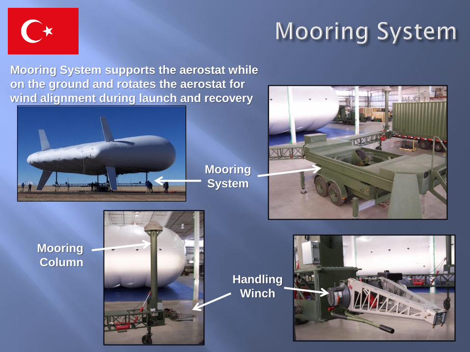
Mooring
Column
Handling
Winch
Mooring
System
Mooring System supports the aerostat while
on the ground and rotates the aerostat for
wind alignment during launch and recovery
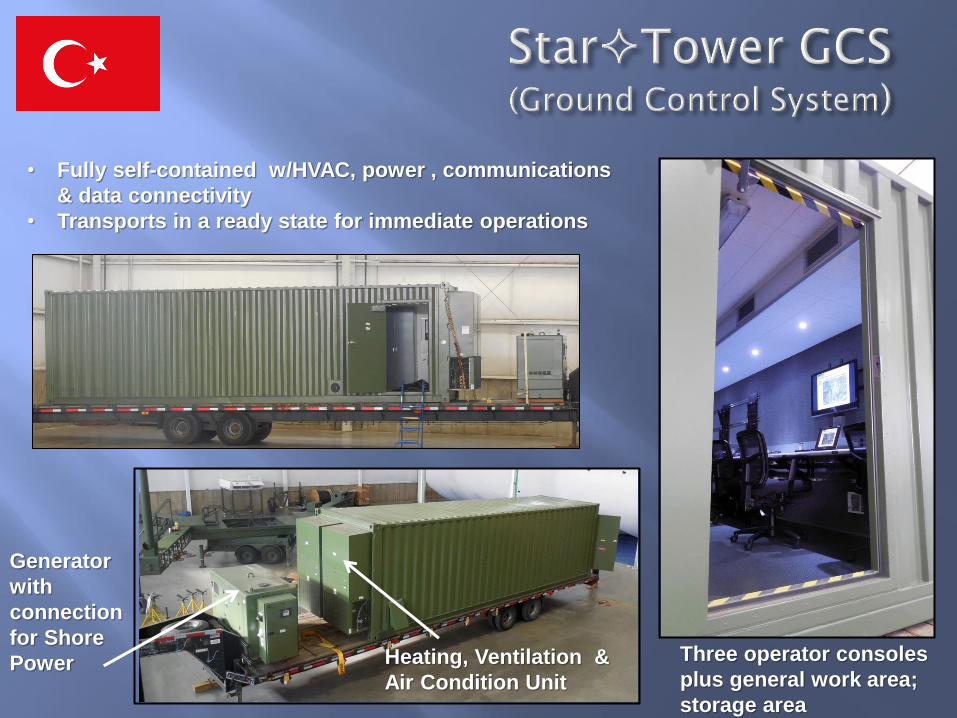
Three operator consoles
plus general work area;
storage area
Heating, Ventilation &
Air Condition Unit
Generator
with
connection
for Shore
Power
• Fully self-contained w/HVAC, power , communications
& data connectivity
• Transports in a ready state for immediate operations
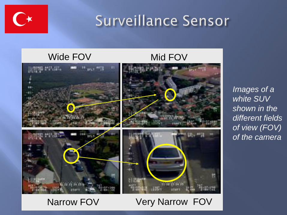
Wide FOV Mid FOV
Narrow FOV Very Narrow FOV
Images of a
white SUV
shown in the
different fields
of view (FOV)
of the camera
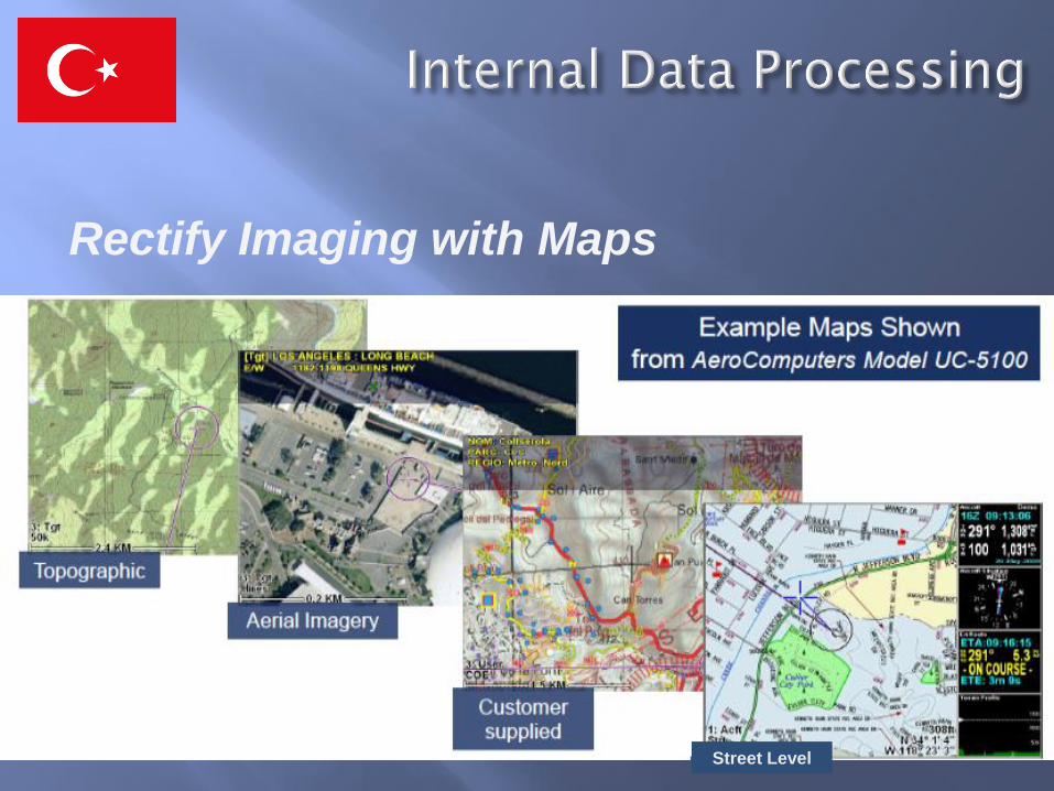
Street Level
Rectify Imaging with Maps
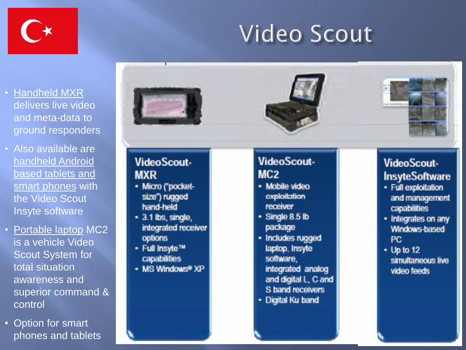
• Handheld MXR
delivers live video
and meta-data to
ground responders
• Also available are
handheld Android
based tablets and
smart phones with
the Video Scout
Insyte software
• Portable laptop MC2
is a vehicle Video
Scout System for
total situation
awareness and
superior command &
control
• Option for smart
phones and tablets
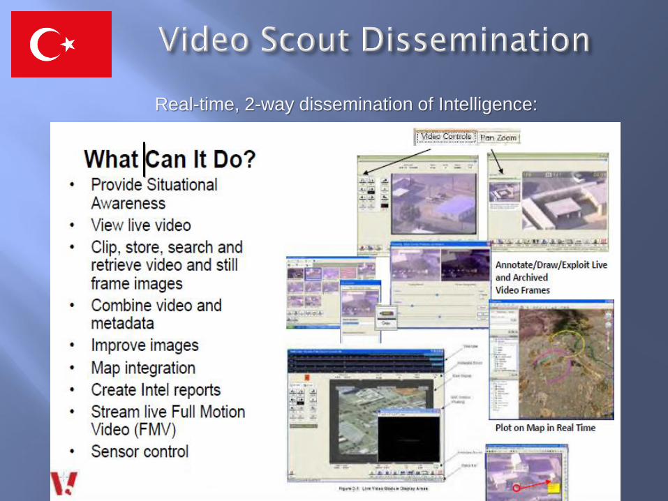
Real-time, 2-way dissemination of Intelligence:
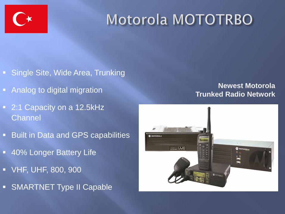
Single Site, Wide Area, Trunking
Analog to digital migration
2:1 Capacity on a 12.5kHz
Channel
Built in Data and GPS capabilities
40% Longer Battery Life
VHF, UHF, 800, 900
SMARTNET Type II Capable
Newest Motorola
Trunked Radio Network