Embed Size (px)
Citation preview
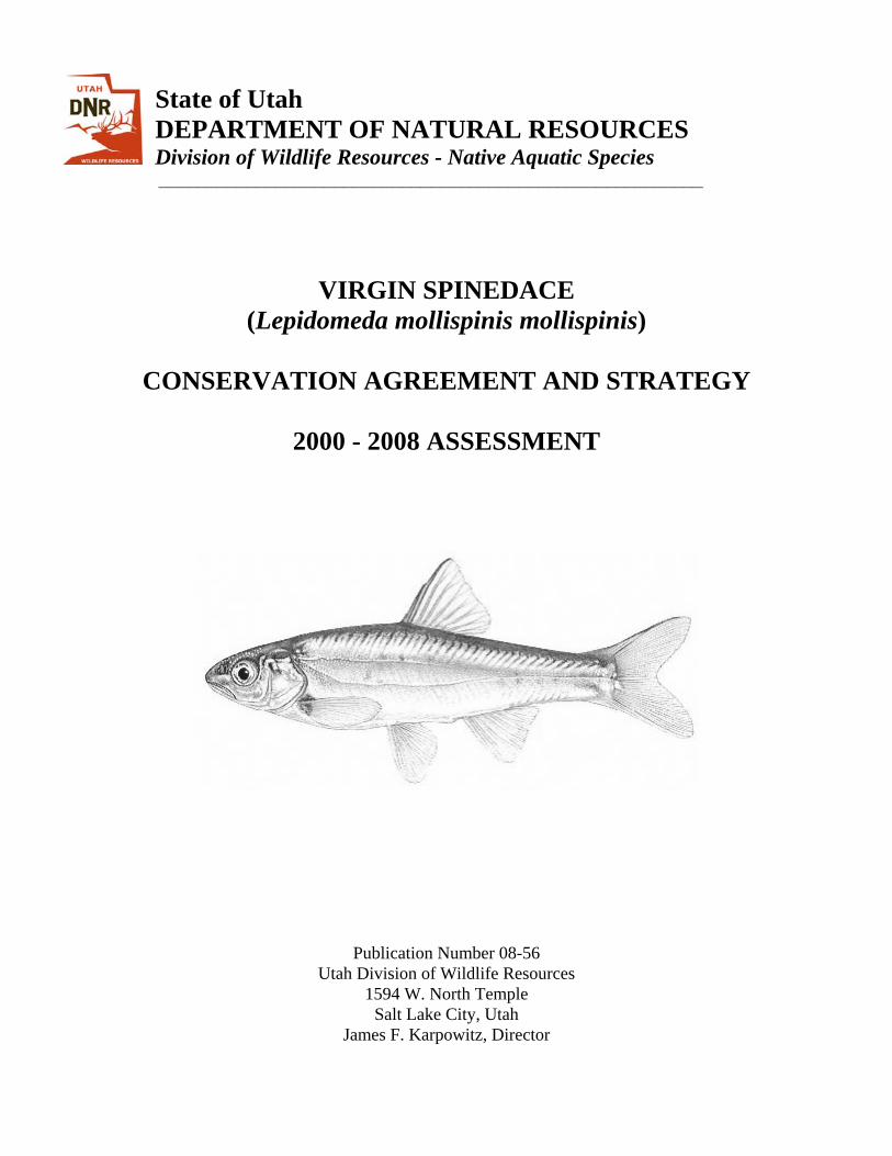
State of Utah DEPARTMENT OF NATURAL RESOURCES Division of Wildlife Resources - Native Aquatic Species
________________________________________________________
VIRGIN SPINEDACE (Lepidomeda mollispinis mollispinis)
CONSERVATION AGREEMENT AND STRATEGY
2000 - 2008 ASSESSMENT
Publication Number 08-56 Utah Division of Wildlife Resources
1594 W. North Temple Salt Lake City, Utah
James F. Karpowitz, Director
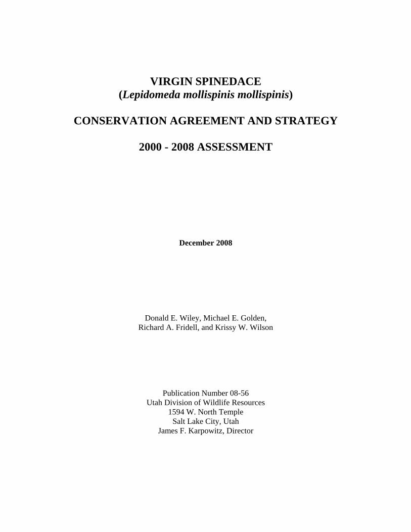
VIRGIN SPINEDACE (Lepidomeda mollispinis mollispinis)
CONSERVATION AGREEMENT AND STRATEGY
2000 - 2008 ASSESSMENT
December 2008
Donald E. Wiley, Michael E. Golden, Richard A. Fridell, and Krissy W. Wilson
Publication Number 08-56 Utah Division of Wildlife Resources
1594 W. North Temple Salt Lake City, Utah
James F. Karpowitz, Director

ii
The Utah Department of Natural Resources receives federal aid and prohibits discrimination on the basis of race, color, sex, national origin, or handicap. For information or complaints regarding discrimination, contact Executive Director, Utah Department of Natural Resources, 1636 West North Temple #316, Salt Lake City, Utah 84116-3193, or the Equal Opportunity Commission, 1801 L Street NW, Washington D.C. 20507.
iii
TABLE OF CONTENTS TABLE OF CONTENTS............................................................................................................... iii LIST OF TABLES......................................................................................................................... iv EXECUTIVE SUMMARY .............................................................................................................v DEFINITIONS AND ABBREVIATIONS.................................................................................... vi INTRODUCTION ...........................................................................................................................1
Conservation Agreement .....................................................................................................1 Purpose.................................................................................................................................1 Background..........................................................................................................................1
SUMMARY OF CONSERVATION ACTIONS IMPLEMENTED...............................................2 Establish existing conditions as baseline .............................................................................2 Re-establish population maintenance flows ........................................................................5 Enhance and maintain habitat ..............................................................................................8 Selectively control non-indigenous fish ............................................................................10 Re-establish Virgin spinedace populations........................................................................13 Monitor populations...........................................................................................................16 Mitigate for projects that impact Virgin spinedace ...........................................................19
EVALUATION OF ACTIONS .....................................................................................................20
Current status of threats to Virgin spinedace.....................................................................20 Recommendations..............................................................................................................22
CONCLUSION..............................................................................................................................23 LITERATURE CITED ..................................................................................................................25

iv
LIST OF TABLES
Table 1. Native fish captured in UDWR fish clearances for the NRCS EWP Project from December 8, 2005 through June 7, 2006. ......................................................................................5
v
EXECUTIVE SUMMARY Many conservation actions have been directed to protect and enhance populations of Virgin spinedace (Lepidomeda mollispinis mollispinis) in Utah, Arizona, and Nevada since the inception of the Virgin Spinedace Conservation Agreement and Strategy (VSCAS) in 1995. The VSCAS was initiated following a proposal for federal listing of the Virgin spinedace under the Endangered Species Act of 1973 because of population declines resulting from habitat loss and modification. This Assessment reviews the effectiveness of each prescribed conservation action in the VSCAS by reviewing results of implemented actions and providing recommendations. Seven broad conservation actions are outlined in the revised VSCAS (Lentsch et al. 2002):
1. Establish existing conditions as a baseline 2. Re-establish population maintenance flows 3. Enhance and maintain habitat 4. Selectively control non-indigenous fish 5. Re-establish Virgin spinedace populations 6. Monitor populations 7. Mitigate for projects that impact Virgin spinedace
Specific conservation actions implemented from 2000 through 2008 were evaluated for each of these categories. Under the management of the VSCAS, much progress has been made to protect and restore Virgin spinedace populations throughout the Virgin River Basin. Instream flow has been secured in several key reaches, large- and small-scale removal of problematic non-native fish species has occurred, and efforts to purchase, protect, maintain, and improve habitats have been undertaken. In addition Virgin spinedace reintroductions into several areas of historic habitat have been successful, or shown the potential for success. While climatic conditions, flow depletions, water quality, and stream alterations have presented challenges in certain areas, the efforts of the Virgin spinedace Conservation Team to improve the long-term status of and habitat for Virgin spinedace populations will continue.
vi
DEFINITIONS AND ABBREVIATIONS For the purpose of this Assessment, the following terms are defined as follows: BLM – The United States Bureau of Land Management EA – Environmental Assessment ESA – Endangered Species Act EWP – Emergency Watershed Protection KCWCD - Kane County Water Conservancy District OIC - Orderville Irrigation Company MOU – Memorandum of Understanding NEPA - National Environmental Policy Act NRCS – Natural Resources Conservation Service RDCC – Resource Development Coordinating Committee SCA – Stream Channel Alteration UDWR – Utah Division of Wildlife Resources FWS – United States Fish and Wildlife Service VRRMRP - Virgin River Resource Management and Recovery Program VSCAS - Virgin Spinedace Conservation Agreement and Strategy WFD – Washington Fields Diversion WCWCD – Washington County Water Conservancy District ZNP – Zion National Park

INTRODUCTION CONSERVATION AGREEMENT The Virgin Spinedace Conservation Agreement and Strategy (VSCAS; Lentsch et al. 1995) was developed in 1995, and modified and revised in 2002 (Lentsch et al. 2002), as a collaborative and cooperative effort among resource agencies to expedite the implementation of conservation actions for Virgin spinedace (Lepidomeda mollispinis mollispinis). The goal of the VSCAS is to return Virgin spinedace populations to at least 80% of their historic habitat. To achieve this goal, seven required actions are described in the VSCAS, including: 1) establish existing conditions of historic habitat as baseline; 2) re-establish population maintenance flows; 3) enhance and maintain habitat; 4) selectively control non-indigenous fishes; 5) re-establish Virgin spinedace populations; 6) monitor populations; and 7) mitigate for projects that impact Virgin spinedace (Lentsch et al. 2002). Implementation of the VSCAS should provide for the continued existence and conservation of Virgin spinedace. PURPOSE The purpose of this report is to summarize and evaluate conservation actions that were conducted for the recovery of Virgin spinedace under the VSCAS (Lentsch et al. 2002). Hogrefe (2002) summarizes conservation actions completed between 1995 and 2000. This summary has been prepared to determine the extent to which conservation actions outlined in the VSCAS have been implemented, to evaluate how effectively threats to Virgin spinedace have been eliminated or reduced, and to assess how conservation efforts need to be directed in the future. BACKGROUND In 1994, the Virgin spinedace was proposed for federal listing under the Endangered Species Act of 1973, as amended, because of population declines resulting from habitat loss and modification (U.S. Fish and Wildlife Service 1994). Historically, Virgin spinedace distribution included several Virgin River mainstem reaches and tributaries in southwestern Utah, northwestern Arizona, and southeastern Nevada and encompassed approximately 231.6 stream kilometers (Addley and Hardy 1993, Valdez et al. 1991). By 1994, the distribution had been reduced to approximately 140.0 stream kilometers and was limited to the Virgin River mainstem and seven tributaries in Utah (Addley and Hardy 1993, Valdez et al. 1991). This decline has been attributed to habitat destruction and degradation caused by water depletions, livestock grazing, adverse interactions with non-native species, inadequacy of regulatory mechanisms, and other natural or human-induced factors including drought, mining, and recreational use (Lentsch et al. 1995, U.S. Fish and Wildlife Service 1994). A complete summary of Virgin spinedace life history, background information, and historic distribution is included in U.S. Fish and Wildlife Service (1994), Lentsch et al. (1995 and 2002).
SUMMARY OF CONSERVATON ACTIONS IMPLEMENTED The following headings indicate the seven conservation actions required under the revised VSCAS. Under each heading, specific requirements for each action are described, followed by a description of actions completed to fulfill those requirements from 2000 through 2008. 1. Establish existing conditions as baseline Requirements: To evaluate potential impacts of proposed projects, the VSCAS requires a description of existing conditions to define a baseline. Existing conditions are to be described in terms of three primary attributes: 1) basin hydrology averaged over the last 20 years; 2) water rights and depletions; and 3) Virgin spinedace populations. Using these baseline conditions, all management actions are to be evaluated for effectiveness and proposed modifications to the existing conditions are to be evaluated for potential impacts to Virgin spinedace. Completed actions: Baseline conditions, water rights and depletions, and Virgin spinedace populations were described as part of the Virgin River Resource Management and Recovery Program (Lentsch et al. 1998, UDNR 2002) and will not be discussed in detail for this assessment. The VSCAS five-year assessment provides a detailed description of earlier accomplishments (Hogrefe 2000). Additionally, the VRRMRP funded a description of baseline conditions in the Santa Clara River and an assessment of basin-wide conditions throughout the Virgin River Basin during the assessment period. The goals of these projects were to (1) assess the quality of the habitat within the watershed using a quantitative index, (2) identify the critical factors that contribute to habitat quality, and (3) develop management tools to aid in decision-making regarding protection and enhancement of native aquatic and riparian communities (Addley et al. 2005, Thompson et al. 2008). In addition to a report providing a habitat quality index and ranking system, the USU Institute for Natural Resources Engineering supplied a GIS-based Decision Support System for use in identifying problem areas and aiding in management decisions. Proposed modifications to existing conditions were evaluated. The Utah Division of Water Resources issues Stream Channel Alteration (SCA) permits for projects that may alter current stream channel conditions. In response to implementation of the VSCAS, the SCA application review process was modified to consider and prevent potential impacts to Virgin spinedace. From 2000 through 2008, Utah Division of Wildlife Resources (UDWR) and FWS reviewed approximately 30 SCA applications per year. The responsibility for reviewing permits under Section 404 of the Clean Water Act was delegated to Division of Water Rights by the Army Corps of Engineers. The following conditions, or those to similar effect, were typically recommended for inclusion in SCA permits to protect aquatic species and habitat:
1. Wet cement is toxic to aquatic organisms, and its introduction into waters of the United States would constitute a violation of the Clean Water Act. Wet cement or concrete may not be allowed to enter stream flows. Water must be excluded from
2
areas where concrete or cement is used until it has set. Contaminated water pumped from the construction area may not be discharged in a manner that will allow it to enter flows. Equipment used during this type of work must be washed well away from the channel.
2. Impacts to the stream channel and surrounding environment must be minimized. Native vegetation should not be destroyed, but all non-native vegetation should be removed. Disturbed and denuded areas should be re-vegetated with native species is required, especially of woody shrubs. Plantings shall be protected from grazing animals by fencing. If beaver or other rodent damage should occur, other methods, such as metal collars placed around the trees, must be included. The channel contours and configuration must not be changed except in the case of bank contouring for stabilization purposes.
3. Work must be accomplished during a period of low flow. Sediment introduced into stream flows during construction must be controlled to prevent increases in turbidity downstream. Flows must be diverted away from the construction area using a non-erodible cofferdam.
4. Excavated material and construction debris may not be wasted in any stream channel or placed in flowing waters, including material such as grease, oil, joint coating, or any possible pollutant. Excess materials must be wasted at an upland site well away from any channel. Construction materials, bedding material, excavated material, etc. may not be stockpiled in riparian or channel areas.
5. Machinery must be properly cleaned and fueled offsite prior to construction. 6. Fill materials must be free of fines, waste, pollutants, and noxious weeds/seeds. 7. Erosion controls should be accomplished using bio-engineering wherever possible.
Stream bank hardening should be discouraged and hard structures should be used ONLY as a last resort. If hard structures must be used then riprap must consist of only clean, properly sized, angular rock. Riprap must be keyed deeply into the streambed to prevent undercutting. A filter shall be placed behind riprap if necessary (i.e., if soils are fine grained, non-cohesive, and/or erodible). Demolition debris or refuse will not be allowed, nor material such as bricks, concrete, asphalt material [either natural (tar sand, oil shale, etc.) or man made].
When a proposed project could specifically impact Virgin spinedace, or other sensitive fish populations and habitat, recommendations were made to include the following additional conditions in SCA permits:
1. Work shall not be performed in the stream channel or other flowing water from April 1 through June 30 to protect spawning fish and eggs.
2. Avoid operating equipment in the stream channel, when possible. 3. UDWR must perform a fish clearance prior to any in stream work.
Certain SCAs proposed projects/activities that required additional stipulations or special conditions. UDWR and FWS, with assistance from the VRRMRP, reviewed several projects where excessive stream bank hardening was proposed and worked with Water Rights and the ACOE to reduce or eliminate hard structures. Rock levees and rip-rap areas were found to harbor freshwater refuge areas for non-native fish species during chemical treatments in the Virgin River downstream from
3
the WFD. The VRRMRP, UDWR, and FWS proposed designs for new hard structures to reduce the potential for piping of fresh water and to allow for better chemical treatment of these areas. In a few cases, impacts from proposed projects were seen as so detrimental that UDWR and FWS opposed the project and the SCA application was denied. One such example was Interstate Rock Products 2006 SCA application to build a low water crossing on the Virgin River near Hurricane Utah. The decision on this project was remanded to the USACOE after objections by UDWR and USFWS. The application was denied because of high potential to impact endangered and sensitive fish. In addition to normal SCA permitting issues, FWS, UDWR, the VRRMRP, NRCS, and local governments all worked together to minimize the impacts of stream bank stabilization efforts following large-scale flooding in January 2005. The magnitude of this flood event was estimated to be about a 10-year flood event for the Virgin River at Virgin, a 25-year flood event for the Virgin River at Bloomington, a 100-year flood event for the Santa Clara River at Gunlock, a 25-year flood event for the Santa Clara River at the Virgin River confluence, and over a 100-year flood event for the Beaver Dam Wash. During and following the high flow events, many landowners, and federal, state, and local agencies worked together to document the event with photos and evaluate work to be conducted as part of the Emergency Watershed Protection (EWP) response. Several agencies were involved developing a master plan outlining necessary long-term measures needed to prevent future losses for communities built in/or near the floodplain of the Virgin and Santa Clara Rivers (Natural Channel Designs 2005, Natural Channel Designs 2007); commenting on proposed stream alteration permit applications; and evaluating the impacts of the flood on native fish populations and habitat. The section of the Santa Clara River from the confluence of Moody and Mogatsu Washes to the confluence with the Virgin River experienced significant changes as a result of the 100+-year flood event. Lateral bank erosion damaged homes, agricultural lands, roads, pipelines, and public facilities especially in the communities of Gunlock, Santa Clara, and St. George. Washington County, the VRRMRP, and the communities of Santa Clara and St. George combined resources to develop a master plan to guide post-flood stabilization efforts, provide a road map to development and recovery along the river, and describe long-term maintenance needs of the Santa Clara River (Natural Channel Designs 2005). The FWS submitted a draft biological opinion to NRCS to cover actions conducted under the “emergency” conditions, as well as proposed actions on the Santa Clara and Virgin Rivers, Ash and La Verkin Creeks, and in Beaver Dam Wash. Terms and conditions of the biological opinion focused on re-vegetation of the floodplain and upland areas at project sites. The FWS also completed a biological opinion with FEMA to cover further flood-related activities on Virgin River and its tributaries. The FWS also shared an unofficial draft biological opinion with the USACE / District on sediment management at Quail Creek Diversion. Potential effects to Virgin spinedace were addressed in all of these biological opinions, and conservation recommendations specific to the species were identified where appropriate. In December 2005, the NRCS Emergency Watershed Protection Project (EWP) began river alteration efforts on the Virgin River, Santa Clara River, Beaver Dam Wash, La Verkin Creek, and Ash Creek to prevent future damage to infrastructure from large flood events. The UDWR was contracted by the NRCS to monitor stream alteration efforts and salvage native fish species of concern from areas of river alteration. Additionally, the UDWR monitored operations and salvaged
4
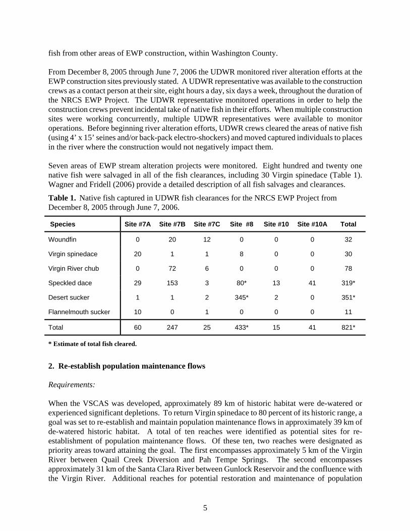
fish from other areas of EWP construction, within Washington County. From December 8, 2005 through June 7, 2006 the UDWR monitored river alteration efforts at the EWP construction sites previously stated. A UDWR representative was available to the construction crews as a contact person at their site, eight hours a day, six days a week, throughout the duration of the NRCS EWP Project. The UDWR representative monitored operations in order to help the construction crews prevent incidental take of native fish in their efforts. When multiple construction sites were working concurrently, multiple UDWR representatives were available to monitor operations. Before beginning river alteration efforts, UDWR crews cleared the areas of native fish (using 4’ x 15’ seines and/or back-pack electro-shockers) and moved captured individuals to places in the river where the construction would not negatively impact them. Seven areas of EWP stream alteration projects were monitored. Eight hundred and twenty one native fish were salvaged in all of the fish clearances, including 30 Virgin spinedace (Table 1). Wagner and Fridell (2006) provide a detailed description of all fish salvages and clearances.
Table 1. Native fish captured in UDWR fish clearances for the NRCS EWP Project from December 8, 2005 through June 7, 2006.
Species Site #7A Site #7B Site #7C Site #8 Site #10 Site #10A Total
Woundfin 0 20 12 0 0 0 32
Virgin spinedace 20 1 1 8 0 0 30
Virgin River chub 0 72 6 0 0 0 78
Speckled dace 29 153 3 80* 13 41 319*
Desert sucker 1 1 2 345* 2 0 351*
Flannelmouth sucker 10 0 1 0 0 0 11
Total 60 247 25 433* 15 41 821*
* Estimate of total fish cleared.
2. Re-establish population maintenance flows Requirements: When the VSCAS was developed, approximately 89 km of historic habitat were de-watered or experienced significant depletions. To return Virgin spinedace to 80 percent of its historic range, a goal was set to re-establish and maintain population maintenance flows in approximately 39 km of de-watered historic habitat. A total of ten reaches were identified as potential sites for re-establishment of population maintenance flows. Of these ten, two reaches were designated as priority areas toward attaining the goal. The first encompasses approximately 5 km of the Virgin River between Quail Creek Diversion and Pah Tempe Springs. The second encompasses approximately 31 km of the Santa Clara River between Gunlock Reservoir and the confluence with the Virgin River. Additional reaches for potential restoration and maintenance of population
5
maintenance flows are described in the VSCAS. Completed actions: In order to determine flow quantity and duration of Virgin River flows in current woundfin, Virgin River chub, and spinedace habitats, the VRRMRP funded the construction of two stream gage stations between Pah Tempe and the USGS Hurricane gage. Water quality parameters and discharge are recorded at the gage stations. In addition to these gaging stations, the VRRMRP funded an intensive cooperative study by USU and UDWR to monitor temperature and discharge throughout the Virgin River basin (Gardberg et al. 2004, Rehm et al. 2006, Rehm and Fridell 2007a, Rehm and Fridell In prep). These studies placed additional gages to monitor discharge, temperature, and turbidity throughout the Virgin River Basin, including all tributaries that contained Virgin spinedace. Results of these studies have been used to guide annual work plan development for Virgin spinedace conservation actions. In addition to discharge and temperature monitoring, several management activities were implemented to increase flow volume, thereby reducing limiting factors to Virgin spinedace and other native fish species. A Memorandum of Understanding (MOU) was developed among UDWR, the FWS, the Kane County Water Conservancy District (KCWCD), and the Orderville Irrigation Company (OIC) to regulate water flows in 3.2 miles (5.2 km) of the East Fork Virgin River between the OIC water diversion structure and the Mount Carmel Irrigation Company Diversion. The MOU was developed in response to concerns about an application by KCWCD to divert water through a hydroelectric plant to produce electrical power. The objective of the MOU was to preserve stream channel dimensions and aquatic habitat features by providing a channel maintenance regime with at least 70% of existing bank full flow days. To achieve 70% of bank full flow days, OIC will reduce or cease diversion of water for a ten-day period each spring when high flows exist in the channel. Although this MOU pertains to a reach upstream of Virgin spinedace habitat, other native fish species are present and it provides a mechanism to maintain legal flows in the Virgin River. It may also set a precedent for re-establishing flows in other sections of the upper river that are seasonally de-watered. The WCWCD continued to provide and maintain a minimum flow of 3 cfs in the Virgin River Narrows below the Quail Creek Diversion. The installation of a valve to allow constant passage of water around the Quail Creek Diversion ensures continuous flow below the diversion downstream to Pah Tempe Springs. This action has returned flow to approximately 2.8 miles (4.5 km) of Virgin spinedace habitat and supplied year-round connectivity to downstream areas that were seasonally de-watered for approximately 80 years. An instream flow water right on La Verkin Creek was acquired in 2000. The state engineer approved the change application. The purchase added approximately 5 cfs to La Verkin Creek providing year-round flow to approximately 11.4 miles (18.4 km) of historic Virgin spinedace habitat. In 2004, the WCWCD, in cooperation with the VRRMRP, agreed to release 3 cfs of water from Gunlock Reservoir into the Santa Clara River via a release pipe located in the old channel below the Gunlock Diversion as part of the Santa Clara Pipeline Project. The VRRMRP also entered into a
6
one-year agreement with the Shivwits Band of the Paiute Tribe (Shivwits) to lease 2.5 cfs of their federally reserved water right to be piped into the Santa Clara River below Windsor Dam (Shivwits Inflow). In 2006, the VRRMRP negotiated another two-year agreement with the Shivwits to continue this release. The current VRRMRP agreement with the Shivwits extends the operation of the Shivwits Inflow through 2011. One of the goals of these releases is to restore population maintenance flows for Virgin spinedace to nearly 24 miles (38.6 km) of their historic habitat in the Santa Clara River between Gunlock Reservoir and the confluence with the Virgin River. The VRRMRP and UDWR monitored both the volume and extent of these releases in order to guide future management activities on the Santa Clara River. Monitoring of the 3 cfs release below Gunlock Reservoir from 2004-2007 showed that during the dry summer months the three cfs was quickly reduced to less than 2 cfs and the entire flow often disappeared within 0.75 miles (1.2 km) of the outflow channel. When this information was combined with information on the success of Virgin spinedace reintroductions in this area, UDWR recommended moving a portion of the release downstream. In 2008, 2 cfs of the 3 cfs obtained from the WCWCD began to be released on Ed Bowler’s property over 2 miles (3.2 km) downstream from the bottom of the outflow channel. Monitoring throughout 2008 showed that even during summer low flows releasing 2 cfs at the Bowler property provided connectivity down to the Shivwits release approximately 3 miles (4.8 km) downstream. Additionally, during low flow months the 1 cfs still being released at the base of Gunlock Reservoir wetted the channel to within 20 m of the distance that the full 3 cfs release had in the previous two summers. New release strategies will continue to be evaluated until one that provides the maximum restoration of Virgin spinedace populations and habitat can be found. UDWR also monitored the volume and flow extent of the Shivwits release from 2005 to 2008. In the absence of the cessation of releases caused by leasing issues and operational problems, the 2.5 cfs release, in conjunction with spring systems on the Shivwits Reservation, managed to provide connectivity from the release point downstream to the Santa Clara River below Rosenbruch Diversion the majority of the time. The decommissioning of the Rosenbruch Diversion and other diversions in the lower Santa Clara River through the Santa Clara Pipeline Project, along with increased urban runoff returns, provided connectivity down to the confluence with the Virgin River. Operational problems and shortage sharing during drought years resulted in flow from the Shivwits releases falling below 2 cfs within a short distance of the release. Further downstream depletions kept volumes below Virgin spinedace population maintenance levels during the driest times of the year. After moving 2 cfs of the Gunlock release to the Bowler property, flows downstream from the Shivwits release were bolstered and consistently maintained at greater than 3 cfs for at least 5 miles (8 km) downstream from the Shivwits release. Reintroductions of Virgin spinedace to the area between the Bowler release site and the Rosenbruch Diversion are planned for 2009, following proposed construction on Gunlock Reservoir. In 2005, a fish screen was completed on the WFD canal. The resulting FWS biological opinion required the WCWCD to release a 5 cfs bypass to move native fishes from the canal to the Virgin River. The VRRMRP monitored fish populations in this area (Bennion and Fridell 2006, Bennion and Fridell 2007, Bennion et al. 2008). Water loss caused by operation issues has muddled the potential of these flows to maintain fish populations; however, in the absence of operational issues, the water release at the WFD has created continuous flow down to the Johnson Diversion during most of the summer. Alternative release strategies and plans to cope with operational difficulties are
7
still being investigated. At the end of the five-year research period a more permanent water release strategy will be recommended. 3. Enhance and maintain habitat Requirements: The VSCAS requires habitat enhancement projects in approximately 26 km of occupied habitat. Projects are to include maintenance and construction of boundary-line fences between federal and private parcels to control unauthorized grazing and recreational use along riparian zones, establishment of intensive grazing management programs for federal lands along streams, and development of barriers and conservation easements within the Virgin River floodplain to reduce additional agricultural, recreational, and developmental impacts. Completed actions: In 2001, the Confluence Property (Ash Creek, La Verkin Creek, and Virgin River) was purchased with money available from the VRRMRP. Ownership of the property was transferred to Washington County; however UDNR maintains a conservation easement on the parcel. A committee was established by Washington County to determine and guide management of the property. Grand Canyon Trust developed a restoration proposal, which was preliminarily approved by the VRRMRP to be implemented in phases (Grand Canyon Trust 2003). Plans included the removal of diversions on La Verkin Creek and restoration of flow. Flooding in 2005 removed the lower most diversion on La Verkin Creek and resulted in increased and improved habitat in lower La Verkin Creek. In 2008, the VRRMRP and WCWCD completed a fish passage project on the Wilson Diversion, in La Verkin Creek upstream from the Confluence property. The passage structure should allow connectivity from the Virgin River upstream to the Jones Diversion. The BLM completed Grazing Allotment Health Assessments for three allotments on the Santa Clara River (4 miles [6.4 km]) and West Fork Beaver Dam Wash (10.5 miles [16.9 km]) including the Bull Mountain, Santa Clara Creek, and Gunlock allotments. These assessments were conducted to ensure that stream and riparian habitats are functioning properly and if not, to identify necessary changes to restore ecosystem function. The health assessment completed on the West Fork Beaver Dam Wash determined that the reach was functioning properly and no changes to livestock grazing were recommended. Based on the health assessments completed along the Santa Clara River, it was determined that some changes will be required. BLM is working with the livestock grazing permittees to determine the nature of the changes and an implementation schedule. In 2002 and 2003, UDWR collected data on Virgin spinedace populations on the North Fork of the Virgin River, within Zion National Park (ZNP) to provide a baseline fish data to evaluate proposed floodplain restoration activities (Fridell et al. 2003a, Morvilius and Fridell 2004). The study area was divided into four reaches: a proposed restoration reach, a reference reach, and two transition reaches. Native fish composition, Virgin spinedace density, age structure and reproductive success were examined for each station. Additionally, instream measurements were taken along the thalweg for the entire study area. These measurements, which included habitat type, and average width and depth of the wetted channel, were used to examine differences in habitat structures between reaches.
8
A flood event in January 2005 resulted in removing some of the revetments proposed in the restoration. Additional follow-up surveys by UDWR in July 2005 found that pool depth, as well as in-stream structures (e.g. woody debris), had increased as a result of the flooding (Morvilius-Auer and Fridell 2006), thus increasing spinedace habitat availability. A variety of non-native vegetation removal projects were undertaken during the assessment period. In 2004, the Shivwits Band of the Paiute Tribe initiated a tamarisk removal project along the Santa Clara River. This project will help with spinedace recovery on the Santa Clara River by improving and protecting habitat within the Reservation. The City of Saint George has initiated several tamarisk removal efforts on the Virgin River within their city limits. In further attempts to control and remove tamarisk the City of Saint George coordinated the release of tamarisk beetles in 2006. UDWR, WCWCD, and the VRRMRP have undertaken several small tamarisk removal projects, often in association with community volunteers. As mentioned previously in this document, FWS and UDWR also establish provisions in SCA permits requiring the removal of non-native vegetation in the project areas. Large-scale tamarisk removal also occurred during the 2005 flood event and the subsequent emergency stream bank stabilization work. In addition to removal of non-native vegetation, native vegetation has also been planted in many areas during the assessment period. UDWR and the VRRMRP have assisted the City of Saint George and other SCA permittees with re-vegetation efforts in several areas along the Santa Clara and Virgin Rivers. For example in 2008, following the completion of a new sewer line project, VRRMRP personnel led volunteer efforts to re-vegetate an area along the Virgin River near the Santa Clara River confluence. In addition, UDWR, VRRMRP, and the NRCS have coordinated with the City of Saint George to assist with several large community-based planting efforts on Fort Pearce Wash and the lower Santa Clara River, resulting in the planting of several thousand willows along several miles of stream. As mitigation for impacts caused by stream bank stabilization efforts by the NRCS during EWP activities following the 2005 flood event, several large bars and bank areas along the Virgin River between Johnson Diversion and Bloomington were planted with native vegetation. In an effort to facilitate re-vegetation efforts the VRRMRP funded UDWR, to establish a willow nursery. From 2006-2008, the nursery has been created and maintained with the assistance of a wide variety of volunteers groups and interns. Stems from the nursery will be used to re-vegetate disturbed areas and areas where non-native vegetation is removed. Similarly, the WCWCD and VRRMRP have co-sponsored a workshop on restoring riparian habitats and stream bank stabilization along the Virgin River three times since 2005. The course highlights the benefits and use of bioengineering practices for stream bank stabilization and was attended by city planners, engineers, and natural resource professionals. During the flood events of 2005, the dam on Schroeder Reservoir in Beaver Dam State Park, Nevada, was breached. The Nevada Department of Wildlife and Nevada Division of State Parks decided not to rebuild this dam. Schroeder Reservoir had been a source for non-native rainbow trout in the Beaver Dam Wash. Depredation by rainbow trout on Virgin spinedace and the prevention of upstream migration by the dam were the major reasons Virgin spinedace were absent from Beaver Dam Wash above and below the former reservoir. The breach of the reservoir opened up habitat previously unavailable to Virgin spinedace. Plans are currently underway to restore and stabilize the
9
Beaver Dam Wash where it flows through the site of the former reservoir. In addition the removal of the reservoir resulted in the loss of the source of rainbow trout in the Beaver Dam Wash below Schroeder Reservoir. 4. Selectively control non-indigenous fish Requirements: Management and control of non-indigenous fish will be achieved through implementation of stocking and introduction procedures and control and/or eradication of selected populations of these fish in the Virgin River basin. Completed Actions: The UDWR completed a chemical treatment of Baker Reservoir in the Santa Clara River drainage in January 2001 (Hepworth and Fridell 2001). The project was conducted to remove non-native green sunfish (Lepomis cyanellus) from the reservoir and the upper portion of the Santa Clara watershed. The RDCC and NEPA clearances were completed prior to the chemical treatment and are documented in a publication titled “Environmental Assessment for Use of Rotenone in Southwestern Utah Waters, July 1996". This Environmental Assessment allowed five years to complete the Baker Reservoir project. Baker Reservoir was treated near the end of the five-year period to coincide with draining of the reservoir. Approximately, 18 acre-feet of water was treated in the reservoir. In addition, green sunfish were removed from the Santa Clara River upstream of the reservoir (1.0 mile [1.6 km]) and from all associated springs, seeps, and inflows. In July 2000 green sunfish were found in several ponds in Lydia’s Canyon in the headwaters of the East Fork of the Virgin River. This was the first documentation of green sunfish this high in the watershed. Investigations determined that the fish had been illegally introduced from Saint George golf course ponds. To prevent colonization into the East Fork of the Virgin River, these ponds were chemically treated and green sunfish were successfully removed. Additionally, in October 2001, a series of ponds in the Santa Fe development of Saint George were chemically treated to control goldfish and other non-native fish species. Since red shiner invaded the Utah portion of the Virgin River in 1984, the upstream extent of their invasion had been the WFD. In 2002 the first red shiner were documented above the WFD. This triggered an intensive mechanical removal effort in that portion of the river (Fridell et al. 2003b). Because of the potential ramifications on Virgin River fish, all other activities were suspended and this project was top priority between April and December 2002. Crews performed daily distribution sampling and removal of red shiner (Fridell et al. 2003b). Additionally, an exhaustive search for potential off channel sources revealed large numbers of red shiner, fathead minnow, and tiger salamanders in a small pond just upstream from the WFD. The pond was chemically treated in May 2002. The illegal introduction of fish to that pond turned out to be the source of red shiner above the WFD. Once the source was removed, mechanical removal efforts resulted in the elimination of red shiner above the WFD (Fridell et al. 2003b, Fridell et al. 2004a). From 2000-2008, the VRRMRP and UDWR have coordinated a comprehensive red shiner
10
eradication program on the Utah portion of the Virgin River. Efforts include numerous rotenone treatments in the Virgin River from WFD to the Utah/Arizona border (border barrier) in an attempt to eradicate the non-native red shiner (Cyprinella lutrensis) from the Virgin River Basin in Utah (Fridell et al. 2001, Fridell et al. 2004b, Fridell et al. 2005, Rehm and Fridell 2007, Rehm and Fridell 2008). In addition to mainstem treatment activities, many off channel ponds and marshes, as well as irrigation ditches in the Washington Fields have been treated during this time period. Following treatments of several irrigation returns and Seegmiller Marsh in 2001, 2003, 2004 and 2006, red shiner appeared to be absent from the Washington Fields irrigation system through autumn 2007. Between November 2007 and February 2008 13 red shiner were collected in the “Middle Drain,” an irrigation drain which feeds the Seegmiller Marsh complex. The Seegmiller Marsh and its drain system were chemically treated in February 2008 and again in September 2008. The Virgin River between WFD and Johnson Diversion, as well as in various other irrigation ditches, ponds and marshes in the Washington Fields have remained free of red shiner since autumn 2006 chemical treatment activities. While the Virgin River from Johnson Diversion to the fish barrier near the Utah/Arizona border had the lowest levels of red shiner since their invasion into Utah in 1984 in 2007 and 2008, two red shiner were collected in the mainstem Virgin River between October 2007 treatment activities and September 2008. Therefore this reach was chemically treated along with Seegmiller Marsh in September 2008. No red shiner were observed during this treatment. Rehm and Fridell (2008) contains a complete summary of red shiner eradication efforts through 2007. In addition to chemical removal efforts, red shiner and other non-native fish were also removed during intensive distribution inventories and monitoring. These surveys were conducted on the Virgin River between the Washington Fields and Johnson Diversions, the Washington Fields, Fort Pearce Wash, Seegmiller, and Riverside Marshes. While great gains were made in red shiner eradication on the mainstem Virgin River during the assessment period, two potential setbacks to red shiner eradication occurred in tributaries of the Virgin River since 2005. Red shiner were found near Lytle Ranch in the Beaver Dam Wash for the first time in October 2005. Additional sampling in 2006 found that their numbers remained low near Lytle Ranch, and following intensive removal efforts, sampling in 2007 indicated that they had failed to establish in that area. Unfortunately, on October 2, 2007 during annual monitoring at the Motoqua station on the Beaver Dam Wash a single red shiner was collected. Immediate distribution monitoring found five red shiner within the first 0.25 miles (0.4 km) downstream from the annual monitoring station. Additional sampling in mid-October 2007 found five additional red shiner; two were found in the vicinity of the Virgin spinedace monitoring station and three more were in a pool upstream. Three sampling efforts over the winter of 2007-2008 found no red shiner, but sampling efforts from Holt’s Cabin downstream to ~ 1 km upstream from Slaughter Creek on July 9 and July 31, 2008 located three red shiner. Additional sampling and mechanical removal efforts on the Beaver Dam Wash are planned. Two red shiner were collected in the Santa Clara River below Valley View Bridge, during collection of sentinel fish for chemical treatments in October 2006. As with the fish collected near Lytle Ranch, it was suspected that these fish circumvented the barrier near the mouth of the Virgin River during the 2005 high flow events. Intensive sampling between the Rosenbruch Diversion and the Virgin River confluence in October and November 2006 found four (three adult, one young-of-year)
11
more red shiner. Similar intensive sampling was completed two times between November 2006 and September 2007, along with three targeted sampling efforts and no additional red shiner were collected. During this time inflows and off channel sources were mapped and sampled, but no red shiner were collected. On October 1, 2007 two red shiner were again collected in the vicinity of the Valley View Bridge. Three intensive surveys and four targeted surveys have not found red shiner in the Santa Clara River since that time. Intensive survey efforts will be continued to try to identify and mechanically remove any remaining red shiner from the lower Santa Clara River. In 2002 the VRRMRP funded a study to determine what non-native fish species might be a major problem upstream from WFD and whether mechanical removal methods might be effective (Golden and Holden 2002). The report pointed out several off channel non-native fish source areas, which combined with the off channel source of red shiner above the WFD, stimulated the VRRMRP to also fund an inventory of all potential off channel ponds along the Virgin River between Zion National Park and the Utah border with Arizona, as well as in the Santa Clara River, Ash Creek, La Verkin Creek, and North Creek (Meismer 2003) The UDWR designed and completed a pilot study to assess the efficacy of mechanical removal of non-native virile crayfish (Orconectes virilis) at Lytle Ranch (Bennion and Fridell In prep). Over 26,000 crayfish were removed during the study; however, mechanical removal appeared relatively ineffective at substantially reducing crayfish numbers. Conversely, the January 2005 flood event, and associated high flows, significantly reduced crayfish populations in this area. NDOW personnel conducted several surveys and removed all species of non-native fish from several reaches of Beaver Dam Wash to provide optimal conditions for Virgin spinedace re-introductions. Protocols outlined in the policy for Fish Stocking and Transfer Procedures (UDWR 1997) were followed for all proposals to introduce non-native species into area waters. This policy includes specific steps for the introduction of non-native species into Utah waters. The policy indicates that all activities are to be consistent with ongoing recovery and conservation actions for sensitive species. Fish stocking and introductions into the Virgin River basin by UDWR were not conducted unless they were consistent with this policy, the procedures outlined in the VSCAS, and the American Fisheries Society procedures for non-native fish introductions. The UDWR continued to review applications/requests for fish stocking in private fish ponds. The process for approval of fish introductions into approved private ponds was modified due to the VSCAS. Only bluegill (Lepomis macrochirus), largemouth bass, and rainbow trout introductions were allowed. Requests for the introduction of other non-native species were not approved. Species that were denied included: channel catfish (Ictalurus punctatus), smallmouth bass (Micropterus dolomieu), yellow perch (Perca flavescens), walleye (Stizosedion vitreum), carp (Cyprinus carpio), brown trout, white bass (Morone chrysops), black crappie (Pomoxis nigromaculatus), white crappie (Pomoxis annularis), western mosquitofish (Gambusia affinis), and fathead minnow (Pimephales promelas). 5. Re-establish Virgin Spinedace Populations Requirements:
12
Virgin spinedace populations will be re-established in areas within the historic distribution when suitable habitat conditions have been restored. Natural colonization will likely be the primary mechanism to re-establish populations. Artificial re-introduction will be necessary, however, when natural colonization is unlikely because of habitat fragmentation. Completed Actions: The Virgin spinedace transplant and refuge plan (Morvilius and Fridell 2005) was completed. The plan outlines how Virgin spinedace are to be used for beneficial management purposes, consistent with the VSCAS, and identifies priorities, procedures, protocols, and rationale for use of Virgin spinedace that are salvaged from the river or obtained from refuge populations. Objectives outlined in the transplant and refuge plan are listed below:
1. Obtain state and county approvals for transplants of Virgin spinedace to supplement populations in currently occupied areas of historic habitat with in the Virgin River drainage.
2. Obtain state and county approvals for re-introductions of Virgin spinedace in currently
unoccupied areas of historic habitat within the Virgin River drainage.
3. Obtain state and county approvals for transplants of Virgin spinedace to off-stream ponds and other artificial refuges within the Virgin River drainage for population maintenance.
4. Obtain state and county approvals for re-introductions of Virgin spinedace in unoccupied
areas outside of historic habitat, but within the Virgin River drainage, if appropriate.
5. Obtain state and county approvals for transplants of Virgin spinedace to the Wahweap Hatchery, Utah and/or the Dexter Hatchery, New Mexico, if deemed necessary.
In addition, all transplants will require approval from the State of Utah Fish Health Policy Board. Individual transplant plans will be coordinated with the UDWR Fisheries Experiment Station to inspect for pathogens and assist in obtaining approval from the State Fish Health Policy Board. In order to facilitate planned spinedace re-introductions, annual fish health clearances were obtained from FES for Beaver Dam Wash, Virgin River, and the Santa Clara River. Fish samples were collected in July of each year, analyzed, and screened for known pathogens for each site. Surrogate fish species were used (primarily, red shiner, western mosquitofish, and speckled dace) and no prohibited pathogens were detected during the fish health inspections, therefore native woundfin and Virgin spinedace from these drainages were given fish health approval. From 2004-2007 UDWR performed several Virgin spinedace reintroductions into historic habitat in the Virgin River, Santa Clara River, North Creek, Beaver Dam Wash, and Quail Creek. The majority of reintroduction activities occurred in association with flow restoration activities below Gunlock Reservoir on the Santa Clara River. In 2004, Virgin spinedace were collected from the Santa Clara River near Veyo (n = 237) and reintroduced into the Santa Clara River at the pool near the return pipeline outflow below Gunlock Dam. These reintroduced fish were supplemented with
13
an additional 57 spinedace captured near the Moody Wash annual spinedace population monitoring station on November 4, 2004. In July 2005, an additional 100 Virgin spinedace from Magotsu Creek were translocated to the Santa Clara River immediately below Gunlock Reservoir. Another 116 Virgin spinedace from the Santa Clara River near the Veyo Bridge were translocated to the confluence of the pipeline outflow channel and the channel from Gunlock Reservoir spillway. Finally in September 2005 Virgin spinedace (n=185) were re-introduced into the Santa Clara River at the Shivwits inflow release site below the Windsor Dam / Highway 91 Bridge. Representatives from the Shivwits Band of the Paiute Tribe and the FWS assisted with the release. From 2004-2006 UDWR monitoring of the Virgin spinedace placed immediately below Gunlock Reservoir showed that while Virgin spinedace survived in the pipeline outflow channel, few Virgin spinedace moved out into the main channel of the Santa Clara. This was likely the result of the 3 cfs release only wetting the main channel of the Santa Clara River for 0.75 miles downstream from the bottom of the outflow channel during warm summer months. In 2007, the first reproduction from Virgin spinedace translocated below Gunlock Reservoir was documented. In addition the first major use of the mainstem Santa Clara River below the outflow channel was documented, but use was restricted to the first 0.75 miles. In August 2007, storm-induced high flows clogged the pipeline with sediment, completely eliminating flow releases for nearly two weeks. This resulted in the total loss of the fish population in the Santa Clara River from Gunlock Reservoir to a series of springs downstream from the Shivwits Inflow. Additional reintroduction efforts were placed on hold until 2009, when an evaluation of alternative water release points and the proposed draining and maintenance of Gunlock Reservoir are completed. The Santa Clara pipeline project in combination with increasing urban runoff along the lower Santa Clara River has resulted in more consistent flows in this portion of the river. Therefore, in March 2007 UDWR personnel translocated 159 Virgin spinedace from Moody Wash to two locations in the lower Santa Clara River below Mathis Park Bridge. Sampling through the end of 2007 showed that these fish had both survived and reproduced; however, numbers were fairly low by spring 2008. UDWR supplemented the small population in the lower Santa Clara with 300 Virgin spinedace collected from the Santa Clara River near the Veyo Bridge and Magotsu Creek near the Veyo/Shoal Creek road crossing. Follow-up sampling has confirmed population persistence and a second year of successful reproduction in the lower Santa Clara River. In 2004, Virgin spinedace (n= 552) were collected by UDWR personnel at Lytle Ranch, Utah and transferred to Nevada hatchery personnel for stocking into several reaches in the upper Beaver Dam Wash. Fish were divided equally among the segments with no mortality observed during the transfer. In October, 2005, an additional 500 spinedace were captured at the Lytle reach and transplanted by NDOW to the upper Beaver Dam Wash. Monitoring by UDWR and NDOW in 2007 and 2008 showed that Virgin spinedace were surviving, reproducing, and recruiting in the upper Beaver Dam Wash below the former Schroeder Dam down to the Mathews Ranch. Additionally, Virgin spinedace were found as far as 1 mile (1.6 km) upstream from the former location of Schroeder Reservoir. AZGFD, NDOW, and UDWR cooperatively salvaged 374 Virgin spinedace from the Mormon Well area of Beaver Dam Wash and translocated them to the Beaver Dam Wash below the former Schroeder Reservoir in November 2007 with the hope of bolstering this newly successful population. Because of the success of the re-introduction effort, a standard long-term population monitoring station was added below on the upper Beaver Dam Wash in autumn 2007.
14
In March 2006, 200 salvaged Virgin spinedace were stocked in Quail Creek below the Red Cliffs Recreation Area. The 1.2-mile (1.9 km) long reach of Quail Creek was identified by the Virgin Spinedace Conservation Team and the Virgin River Program as a spinedace re-introduction site in an area of historic habitat. One year later, UDWR personnel sampled Quail Creek from the confluence with Leeds Creek to the upper end of Quail Creek Reservoir. During the sampling, 235 Virgin spinedace were collected, the bulk of which (216) appeared to have been spawned the previous year. The reintroduced Virgin spinedace and other native fish appeared to be thriving in Quail Creek between the confluence with Leeds Creek and the I-15 Bridge. Sampling in autumn 2007 continued to find good numbers of Virgin spinedace and other native fish. A March 2008 sampling effort showed substantially reduced numbers and catch rates, however low temperatures during this sampling effort likely had a negative impact on sampling efficiency. Additional sampling efforts are planned to determine the long-term success of this reintroduction, and if/when the population becomes established a standard long-term spinedace population monitoring station will be established. North Creek has seen chronic local extirpation of Virgin spinedace and other native fish populations during the assessment period. In summer 2002, low flows and drought conditions contributed to the temporary loss of Virgin spinedace in upper North Creek. In November 2002, 198 Virgin spinedace were re-introduced because population levels were severely depleted, and three downstream irrigation structures impede natural re-colonization of Virgin spinedace from lower North Creek. Virgin spinedace populations rebounded in North Creek following the 2002 re-introduction, and in 2005 the highest numbers of native fish (n = 787) were captured at the North Creek station, showing that with favorable environmental conditions North Creek can have a healthy native fishery (Morvilius-Auer and Fridell 2006). Unfortunately, these favorable environmental conditions did not persist in the North Creek drainage. Much of the upper North Creek drainage burned in early July of 2006 and a high flow event later that month was laden with the ash from those fires, which appeared to kill or displace fish throughout North Creek. On November 3, 2006, 250 Virgin spinedace, 224 speckled dace, and 79 desert suckers were collected from lower North Creek near the Virgin River confluence and re-introduced into North Creek at the long-term monitoring station site (Auer and Fridell 2007). Subsequent monitoring showed Virgin spinedace and speckled dace to be present at the monitoring station as late as March 2007; however, subsequent flood events in late July and early August 2007 transported extremely high sediment and organic debris loads through North Creek. No fish were captured during annual monitoring in September 2007 (Larson et al. 2008). On November 6, 2007, 304 Virgin spinedace were re-introduced to North Creek near the monitoring station. Follow-up sampling in March 2008 collected a single Virgin spinedace, and no other fish, from the private property boundary upstream from the Virgin spinedace monitoring station downstream to the Virgin Diversion. Virgin spinedace population monitoring in October 2008, and subsequent distribution sampling, confirmed that very few fish remained in this portion of North Creek. North Creek clearly has the potential to support a high quality native fish population and reintroductions and other conservation actions will continue to be pursued. After being informed by the landowners that the bulk of flow would be diverted from Ash Creek at the Lichfield Diversion, UDWR personnel initiated distribution surveys and salvage activities
15

between the Lichfield and Krom Diversions in late June 2007. Distribution surveys on June 28, 2007 found large numbers of native fish (388 Virgin spinedace, 469 desert sucker, 45 Virgin River chub, and 40 speckled dace). The combination of large numbers of native fish and decreasing flows prompted fish salvage efforts. In total, 754 Virgin spinedace were salvaged from below the Lichfield Diversion. Of these Virgin spinedace, 488 were translocated to just above the Lichfield Diversion, 16 were released at the West Field Road bridge in Toquerville, and 250 were translocated to the outflow of the south dike of Quail Creek Reservoir to establish a refuge population. In addition to Virgin spinedace, 2,475 desert sucker, 114 Virgin River chub, 29 speckled dace, and two flannelmouth sucker were salvaged and moved above the Lichfield Diversion, to the West Field Road Bridge, or to the confluence of Ash Creek and the Virgin River. The WFD structure has been screened to reduce the numbers of fish that are entrained into the canal during the irrigation season. The WCWCD intensively maintained and operated the Washington Fields Fish Screens since the construction. 6. Monitor populations Requirements: To determine if management actions are attaining the objectives set forth in the VSCAS. Completed Actions: Virgin spinedace populations are monitored in a variety of ways including annual monitoring at set stations, distribution monitoring, and monitoring accomplished for all Virgin River fish. The primary tool for assessing Virgin spinedace populations are the annual monitoring stations developed in 1994 to assess spinedace population trends throughout their range in Utah. The primary objective of this population monitoring is to gather long-term data on species composition, Virgin spinedace density, age structure, and reproductive success. This data is utilized for annual analysis of reproduction, population trends, and evaluation of current management actions. Population monitoring has occurred at the following 11 stations during the entire assessment period (Fridell et al. 2000, Fridell and Curtis 2002, Morvilius et al. 2003, Morvilius and Fridell 2004a, Morvilius et al. 2005, Morvilius and Fridell 2006, Auer and Fridell 2007, Larson et al. 2008)
1. North Fork Virgin River 2. East Fork Virgin River 3. North Creek – west of Zion boundary 4. La Verkin Creek 5. Ash Creek 6. Moody Wash 7. Santa Clara River – Above Gunlock 8. Beaver Dam Wash – Lytle Ranch 9. Beaver Dam Wash – Above Motoqua 10. Virgin River Mainstem – Below Rockville 11. Virgin River Mainstem – Virgin River Gage
16
In 2007, a twelfth station was added on the upper end of Beaver Dam Wash below the old Schroeder Reservoir. The breaching of Schroeder Dam during flooding in the winter of 2005 and successful re-introduction of spinedace prompted the addition of the station below Schroeder Reservoir (Larson et al. 2008). Annual Virgin spinedace density estimates for each station have been highly variable over the period of record. Large fluctuations have been observed in both YOY and adult Virgin spinedace densities. At many stations these fluctuations are probably caused by spatial and temporal variation in habitat conditions, which in turn are probably related to variations in annual discharge. In general, the main stem stations on the Virgin River have maintained more consistent Virgin spinedace populations than the tributary populations, most likely because the large river environment is more stable. In addition, the main stem stations all have source populations upstream that probably allow for rapid recolonization should local extirpation occur. Conversely, the tributary populations appear much more susceptible to major fluctuations in population size based on flow and habitat changes. For example, six consecutive years (1999-2004) of drought conditions in the Virgin River Basin had negative impacts on some tributary stations (e.g. Ash Creek, North Creek, Motoqua) related to low flows and high temperatures. During this same period Virgin spinedace densities remained relatively stable at the main stem stations. An above average water year in 2005 alleviated drought conditions throughout the Basin, which appeared to cause a positive response in many of the tributary stations (e.g. Ash Creek, North Creek, and Motoqua) in 2005 or 2006. While long-term drought and variations in discharge may be responsible for some of the differences in Virgin spinedace abundance, the Ash Creek, North Creek, and Santa Clara stations appear to be experiencing chronic problems in Virgin spinedace survival and reproduction. Daily and seasonal flow variations, habitat degradation, and catastrophic flood events are several factors that appear to be influencing Virgin spinedace density across their range. UDWR has also performed considerable distribution sampling for Virgin spinedace throughout their range during the assessment period. In 2002, distribution sampling was completed in Magotsu Creek, Moody Wash, the lower Santa Clara River, and North Creek (Morvilius et al. 2003). In 2003, distribution sampling was conducted in Ash Creek, Beaver Dam Wash and La Verkin Creek (Morvilius and Fridell 2004c). With the exception of Moody Wash and Magotsu Creek, most of these areas were also surveyed between 2006 and 2008. Ash Creek below the Lichfield Diversion had variable numbers of Virgin spinedace between 2000 and 2004 because drought and human water use caused periodic dewatering of the channel. Distribution sampling in 2003 found one Virgin spinedace above the Lichfield Diversion. Higher flows in 2005 and 2006 allowed for the channel to remain flowing all year. Prior to the drying of Ash Creek in the summers of 2007 and 2008, Virgin spinedace were found in relatively high numbers during multiple sampling efforts from the Krom Diversion to the Virgin River confluence. Over 2,000 Virgin spinedace were collected between the Lichfield Diversion and the Toquerville Springs Diversion in 2007. During 2003 distribution sampling, few Virgin spinedace were collected below the Terry West Diversion of La Verkin Creek. Higher numbers were found from the Terry West Diversion upstream to Chute Falls. While restoration options for circumventing the Terry West Diversion
17
were being evaluated, the January 2005 flood event washed out the diversion creating connectivity between the Wilson Diversion and the Virgin River confluence. From 2006-2008, repeated sampling efforts in La Verkin Creek between Wilson Diversion and the Virgin River confluence have found Virgin spinedace distributed throughout the area. Distribution sampling between the Jones Diversion and Chute Falls in 2007 found 260 Virgin spinedace. While distribution sampling in the Beaver Dam Wash in 2003 found that Virgin spinedace were present throughout the range identified by Addley and Hardy (1993), distribution sampling from 2006-2008 has found extremely high numbers of Virgin spinedace near Lytle Ranch and upstream from Motoqua. In addition distribution sampling around the former site of Schroeder Reservoir found that Virgin spinedace were distributed from Matthew’s Ranch to 1 mile (1.6 km) upstream from the former reservoir. Distribution sampling in the lower Santa Clara River in 2002 found a few Virgin spinedace in the vicinity of the Valley View bridge crossing. Two re-introductions near that area in 2007 and 2008 appear to have been successful from distribution data collected in multiple sampling efforts in those years. Moody Wash had Virgin spinedace present above the Dixie National Forest boundary in 2002, while no Virgin spinedace were found between the Bigelow Diversion and 12 foot Falls on Magotsu Creek. As described in the re-introduction section, multiple distribution sampling efforts have been undertaken on North Creek associated with the repeated extirpations and re-introductions in this system. Distribution monitoring in 2002, 2007, and 2008 indicate that a barrier approximately 1 mile (1.6 km) upstream from the Virgin River, along with the 2 miles (3.2 km) of often dewatered stream between that barrier and the Virgin Diversion upstream, prevent recolonization of Virgin spinedace from the lower North Creek and the Virgin River into upper North Creek. In addition to annual monitoring and distribution monitoring specifically for Virgin spinedace, abundance and distribution information is obtained by many other VRRMRP-funded monitoring programs implemented by UDWR. Since 2002, UDWR has implemented full pass distribution monitoring on the mainstem Virgin River between Pah Tempe Hot Springs and the WFD (Fridell et al. 2003b, Fridell et al. 2004a, Fridell and Morvilius 2005, Golden et al. In prep). As with the other Virgin River Basin minnow species, Virgin spinedace populations in this portion of the mainstem peaked in 2005 as the result of a large reproductive event associated with the high runoff in that year. Virgin spinedace numbers in this portion of the mainstem reached their lowest point in autumn 2007 after poor water quality associated with two successive flood events in late July and early August 2007 dropped dissolved oxygen levels to near zero for up to two hours. Sampling data and mortality counts indicated that nearly 90% of the fish population of this area was eliminated during these two events. Native fish re-introduction efforts were conducted in fall 2007. UDWR is also funded by the VRRMRP to collect monthly data on native fish populations at six stations in the Virgin River between the River Road Bridge in Saint George and Grafton from 2003-2008 (Bennion and Fridell 2006, Bennion and Fridell 2007, Bennion et al. 2008). Trends in Virgin spinedace data from these “Population Response Stations” show the same increase in 2005 and decrease in 2007 found in the full pass distribution monitoring data for stations between Pah Tempe Hot Springs and the WFD. Virgin spinedace at the Grafton station near Rockville did not show the
18
major decline seen in downstream areas in August 2007. Virgin spinedace numbers have generally been higher and more consistent at this station. The station immediately above the River Road Bridge was instituted in 2007 to monitor native fish recovery following red shiner eradication activities. Few native fish were captured in this area because it was chemically treated in October 2007 and September 2008. 7. Mitigate for projects that impact Virgin spinedace Requirements: To evaluate, assess, and mitigate any new water depletion or habitat alteration, the VSCAS requires a plan for mitigating future activities. Under the plan, any new water depletion or alteration of historic habitat baseline conditions will require prior evaluation, assessment, and approval. Completed Actions: As referenced throughout many other sections of this document, the VRRMRP, NPS, BLM, FWS, and UDWR have actively evaluated alterations to baseline conditions through both NEPA and SCA application processes. Recommendations on how to limit impacts were provided and in cases where impacts could not be avoided options for mitigation were provided and in some cases requests to deny the project were made. In addition, sediment sluicing at the Quail Creek Diversion was identified as a problematic water quality issue downstream from Pah Tempe Hot Springs in 2003. Subsequent to the discovery of the problem, the WCWCD worked with UDWR, FWS, and an outside contractor to develop a sediment management protocol for the Quail Creek Diversion (Olsen 2004). The plan is intended to minimize impacts on Virgin River fishes from sediment contained in water that bypasses the diversion structure. Since its publication the plan has been followed with an adaptive management approach. With the exception of the previously mentioned July and August 2007 flood events, the measurements of dissolved oxygen during sluicing events have remained within target parameters. Program partners are actively working to determine the cause of the 2007 low dissolved oxygen events and implement strategies to avoid negative water quality issues in the future. ZNP conducted a study in 2005 and 2006 to evaluate the impacts of waders in the Zion Narrows on aquatic invertebrates. The results of this study indicated that benthic invertebrate assemblages are not severely affected by in-stream hiking (Caires 2007).
EVALUATION OF ACTIONS The evaluation of the VSCAS as an effective mechanism for Virgin spinedace conservation is based on the extent to which threats to the species have been reduced or eliminated. The following discussion summarizes the significant threats to Virgin spinedace that have been addressed by the VSCAS during this assessment. Current status of threats to Virgin spinedace
19
Present or threatened destruction, modification, or curtailment of habitat or range: Threats to Virgin spinedace habitat have been reduced or controlled through implementation of actions under the VSCAS. The original description of existing conditions combined with additional data collection funded by the VRRMRP during this assessment period provides a baseline for assessing habitat modifications and potential effects of proposed projects. As a result of the VSCAS, both UDWR and FWS review federal actions and SCA applications to evaluate potential impacts to Virgin spinedace and their habitat. Major stream bank stabilization projects occurred following the 2005 flooding throughout the basin. The VRRMRP, FWS, and UDWR attempted to minimize the impacts of these activities on Virgin spinedace and their habitat. In addition the Cities of Santa Clara and Saint George, with assistance from WCWCD, state and federal agencies, and the VRRMRP, developed a “Master Plan” for both the Santa Clara and Virgin Rivers (Natural Channel Designs 2005, Natural Channel Designs 2007). The goal of these Master Plans is to guide post-flood stabilization efforts and provide a road map to development and recovery along the rivers. Additionally, threats from de-watering have been reduced during the assessment period. Steps have been taken to restore and maintain flows in the two priority reaches specified in the VSCAS. The completion of the Santa Clara pipeline provided 3 cfs of water released into the Santa Clara River below Gunlock Reservoir. In addition, the VRRMRP is leasing 2.5 cfs from the Shivwits to be returned to the middle Santa Clara River across the reservation and downstream to the confluence with the Virgin River. Studies are underway to determine the most efficient use of this water. When an appropriate release strategy is found, this water should provide population maintenance flows and allow re-colonization of Virgin spinedace into historically occupied habitat. In addition, water has been returned to the following streams; 5 cfs throughout 11.4 km of La Verkin Creek, 5 cfs to the Virgin River during summer months between Washington Fields and Johnson Diversions, and 3 cfs below the Quail Creek Diversion. Threats to habitat have also been reduced through the Zion National Park Water Rights Settlement Agreement. This agreement protects adequate instream flows for Virgin spinedace in the North Fork and East Fork of the Virgin River. Restored flows will be evaluated under the VRRMRP, and supplemented with additional flows, as necessary. Threats posed by livestock grazing have been reduced in several reaches by habitat enhancement projects. In addition to the aquatic and riparian habitats acquired and reported in the previous five year assessment (Hogrefe 2000), the BLM continues to complete Grazing Allotment Health Assessments to ensure that stream and riparian habitats are functioning properly. The BLM completed Grazing Allotment Health Assessments for three allotments on Santa Clara River (4 miles) and West Fork Beaver Dam Wash (10.5 miles) including the Bull Mountain, Santa Clara Creek and Gunlock Allotments. Changes to grazing management were proposed, as necessary, to restore ecosystem function. The health assessment completed on the West Fork Beaver Dam Wash determined that the reach was functioning properly and no changes to livestock grazing were recommended. Based on the health assessments completed along the Santa Clara River, it was determined that some changes will be required. BLM is working with the livestock grazing permittees to determine the nature of the changes and an implementation schedule. Habitat along the Santa Clara and Virgin Rivers has been improved through a variety of tamarisk removal efforts. The Shivwits, the City of Saint George, and VRRMRP partners have all participated in removal efforts. Tamarisk removal has also been required during stream bank
20
development and protection activities. Similarly, replanting disturbed areas has been a requirement for stream alteration activities and has also been used as mitigation for certain projects. The City of Saint George, local communities, and the VRRMRP and its partners have also participated in native re-vegetation efforts on the Santa Clara and Virgin Rivers. All these efforts should improve riparian habitat and aid in Virgin spinedace recovery. The establishment and maintenance of willow nurseries should assist with future riparian restoration efforts. The purchase of the Confluence property (Ash Creek, La Verkin Creek, and Virgin River confluence) and subsequent removal of the Terry West Diversion on lower La Verkin Creek, improved habitat for native fishes, including Virgin spinedace. In addition, the cessation of water diversion at the Wilson Diversion in association with the new fish passage at that location should both improve habitat in lower La Verkin Creek as well as provide increased connectivity to upstream areas. Similarly, the breaching of the Schroeder Reservoir Dam, along with planned restoration activities at this location will improve habitat and connectivity for Virgin spinedace in the upper Beaver Dam Wash. Predation, competition, and disease: New regulations and policy on fish stocking and introductions have reduced threats posed by non-native species. Non-native species are no longer stocked in areas where they may adversely affect Virgin spinedace. Mechanical and chemical removal efforts have also significantly reduced predation and competition posed by non-native species. Red shiner eradication efforts have reduced red shiners to their lowest numbers since they were first found in Utah in 1984. The elimination of red shiner will result in a dramatic decrease in competition and predation issues for native fish in the Virgin River, including Virgin spinedace. Additional monitoring and chemical treatments will further reduce threats posed by red shiners. The removal of Schroeder Reservoir combined with changes in stocking protocols and efforts to mechanically remove rainbow trout has resulted in reduced predation threats to Virgin spinedace in the upper Beaver Dam Wash. Inadequacy of existing regulatory mechanisms: The VSCAS provides a guiding document for a multi-agency collaborative effort to conserve Virgin spinedace. As signatories to this agreement, resource agencies agreed their management practices would not conflict with the objectives for Virgin spinedace recovery indicated in the VSCAS. The process of SCA permit review was also modified to consider and minimize new threats to Virgin spinedace habitat. Additionally, new regulations restrict certain fish stocking and introductions and reduce the threats posed by non-native species. Other natural or manmade factors affecting the continued existence of the species:
21
Threats of stranding Virgin spinedace in diversion canals downstream of the WFD have been reduced with the installation of a fish screen. With the completion of the fish screen came a 5 cfs bypass to move native fishes from the canal to the Virgin River. This added water should provide population maintenance in the reach below the WFD and provide downstream connectivity to the Johnson Diversion the majority of the time. Previously, this section has been dewatered during summer months for the past several decades. Schroeder Dam was breached during the flooding in the winter of 2005. Stream habitat stabilization and improvement is currently planned for this area. Recommendations The majority of required actions have been implemented since the initial draft of the VSCAS. Several actions, however, have not been fully implemented within this time period because of the prolonged effort necessary to resolve complex issues surrounding certain projects. In addition, certain actions are ongoing, with implementation occurring at regular intervals or as necessary. The following actions are priorities actions for Virgin spinedace conservation: Re-establish population maintenance flows: While flows have been acquired in priority reaches, determining if those flows are enough to maintain Virgin spinedace populations and the best strategies for releasing those flows is ongoing. Additional flow restoration should be investigated and implemented in the following potential reaches: East Fork Beaver Dam Slope, Magotsu Creek, lower Santa Clara River, Leeds Creek, Quail Creek, Ash Creek, La Verkin Creek, and North Creek. Enhance and maintain habitat: Habitat enhancement projects should continue to be conducted in unimproved, occupied reaches. As specified in the VSCAS, these reaches include: Beaver Dam Wash near former Schroeder Reservoir, near Littlefield, and in the East Fork; the Santa Clara River above Gunlock Reservoir and from Rosenbruch Diversion to the Virgin River confluence; lower Ash Creek, lower La Verkin Creek, and North Creek. Additional reaches should be identified for enhancement, as necessary. Selectively control non-indigenous fish: The introduction of non-native fish species including red shiner has had detrimental impacts on native fish populations in the Virgin River system (Fridell et al. 2005). Many projects to eradicate non-native fish species have occurred, and are ongoing. Continued implementation of the stepwise approach to red shiner eradication should continue. Where possible, sources of other non-native fish to Virgin spinedace habitat should be identified and controlled. Re-establish Virgin spinedace populations: During the last 7 years, several Virgin spinedace translocation projects have successfully occurred. The combination of annual monitoring that captures trends, distribution monitoring which identifies
22
the loss of occupied habitat and potential Virgin spinedace re-introduction projects, and tributary temperature and flow monitoring, provides information necessary for timely management decisions that benefit Virgin spinedace populations (Larson et al. 2008). Efforts to re-establish Virgin spinedace populations in areas within the historic distribution should continue to occur following the guidelines presented in the Virgin Spinedace Transplant and Refuge Plan (Morvilius and Fridell 2005).
CONCLUSION Many of the threats that warranted the listing of Virgin spinedace as threatened under ESA have been reduced. Much has been accomplished under the management of the VSCAS. Progress has been made to selectively control non-indigenous fish, re-establish Virgin spinedace populations, and re-establish population maintenance flows into key areas. Habitats have been maintained and improved by changes in land-use management, as well as non-native vegetation removal, native vegetation plantings, and flow additions. While improvements have been made to the SCA permit process, as urbanization increases throughout the Basin, VRRMRP partners need to be vigilant in identifying projects that will diminish or deteriorate Virgin spinedace habitat. The increase in the number of stream bank stabilization projects that want to utilize hard structures such as rip-rap and rock levees are potential new threats to Virgin spinedace habitat, as well as habitat for other native fish species. UDWR’s monitoring program for Virgin spinedace has been ongoing for approximately 14 years. The purpose of monitoring population trends allows the VSCAS Conservation Team to assess the effectiveness of management actions. Although a time lag is expected between the reduction of threats and population responses, population monitoring data suggest that further basin-wide declines have been halted and Virgin spinedace populations are stable in many areas of the Basin. During annual monitoring and distribution sampling efforts from 1994 through 2007, data suggests that Virgin spinedace populations are temporally and spatially variable (Auer and Fridell 2007, Larson et al. 2008). Long-term monitoring data show that, while environmental conditions were harsh during the assessment period (2000-2008), on the whole Virgin spinedace were relatively stable in the Virgin River Basin. The upper mainstem Virgin River, the Beaver Dam Wash, and the tributaries to the Santa Clara River all maintain large and relatively stable Virgin spinedace populations. Annual monitoring has helped to identify reaches with chronic problems such as Ash Creek and North Creek, and distribution sampling has helped to identify the sources of those problems. Flow depletions, water quality issues, habitat degradation, and competition and predation by non-native fish species continue to be problems in certain areas. Limited flow and high water temperatures also threaten the long-term persistence of Virgin spinedace in many additional reaches during summer low flow periods (Rehm et al., 2006). Future management activities should be directed at these discrete problem areas, while maintaining a focus on following through with the long-term management actions initiated since 1995. In addition to maintaining viable Virgin spinedace populations in many locations throughout a severe drought period, re-introduction efforts, often in association with other management activities, have shown promise in restoring Virgin spinedace populations to historic habitat in the upper Beaver Dam Wash, Quail Creek, North Creek, and the Santa Clara River. With continued efforts by
23

participating resource agencies to implement conservation and management activities outlined in the VSCAS, Virgin spinedace should become a secured native species in Utah.
24
LITERATURE CITED
Addley, R.C., and T.B. Hardy. 1993. The current distribution and status of spinedace in the
Virgin River Basin. Prepared for Washington County Water Conservancy District by Hardy, Addley, and Associates, Inc., Logan, UT.
Addley, R.C., T.B. Hardy, B. Bradford, J. Ludlow, J. Thompson, and M.Combes. 2005. Santa
Clara River Baseline Report. Final report for the Virgin River Resource Management and Recovery Program. Institute for Natural Systems Engineering, Utah Water Research Lab, Utah StateUniversity, Logan, UT.
Auer, M.K., and R.A. Fridell. 2007. Virgin spinedace (Lepidomeda mollispinis mollispinis)
population monitoring summary, 1994 - 2006. Utah Division of Wildlife Resources Publication Number 07-01. 58 pp.
Bennion, M.R.M., and R.A. Fridell. 2006. Virgin River fishes population response stations
2005. Utah Division of Wildlife Resources Publication Number 06-11. 166pp. Bennion, M.R.M., and R.A. Fridell. 2007. Virgin River fishes population response stations
2006. Utah Division of Wildlife Resources Publication Number 07-15. 208pp. Bennion, M.R.M., and R.A. Fridell. In prep. Crayfish removal pilot study in the Beaver Dam
Wash, Lytle Ranch, Utah 2004-2005. Utah Division of Wildlife Resources Publication. Bennion, M.R.M., R.A. Fridell, and C.A.W. Grover. 2008. Virgin River fish population
response stations 2007. Utah Division of Wildlife Resources Publication Number 08-09. 220pp.
Caires, A.M. 2007. Hiker impacts on aquatic invertebrate assemblages in the North Fork of the
Virgin River in Zion National Park, Utah. M.S. Thesis. Utah State University, Logan, UT. 67 pp.
Fridell, R.A., and A.H. Rehm. 2006. Virgin River Basin 2005 Treatment Projects Utah Division
of Wildlife Resources Publication Number 06-05. 30 pp. Fridell, R.A., and M.K. Morvilius. 2005. Distribution and abundance of fish in the Virgin River
between the Washington Fields Diversion and Pah Tempe, 2004. Utah Division of Wildlife Resources Publication Number 05-21. 38pp
Fridell, R.A, and R.J. Curtis. 2002. Virgin spinedace (Lepidomeda mollispinis mollispinis)
population monitoring summary, 1994 - 2001. Utah Division of Wildlife Resources Publication Number 02-01. 41 pp.
Fridell R.A., K.D. Pleasant, and M.K. Morvilius. 2003b. Red shiner (Cyprinella lutrensis)
distribution, monitoring and removal in the Virgin River above the Washington Fields
25
Diversion, 2002. Utah Division of Wildlife Resources Publication number 03-09. 91pp. Fridell, R.A., K.M. Comella, and T.C. Hogrefe. 2000. Virgin spinedace (Lepidomeda
mollispinis mollispinis) population monitoring summary 1994 - 1998. Utah Division of Wildlife Resources Publication Number 00-05. 28 pp.
Fridell, R.A., M.A. Schijf, and M.K. Morvilius. 2004a. Virgin River fish distribution between
the Washington Fields Diversion and Pah Tempe. Utah Division of Wildlife Resources Publication Number 04-12. 34pp.
Fridell, R.A., M.K. Morvilius, and C.B. Rognan. 2005. Virgin River Basin 2004 treatment
projects. Publication No. 05-05. Utah Division of Wildlife Resources Publication Number 05-05. 38 pp.
Fridell, R.A., M.K. Morvilius, K.D. Pleasant, and K.K. Wheeler. 2003a. Baseline Virgin
spinedace (Lepidomeda mollispinis mollispinis) population demographics in an area proposed for floodplain restoration and a reference reach, North Fork of the Virgin River, Zion National Park, Fall 2002. Utah Division of Wildlife Resources Publication Number 03-10. 44pp.
Fridell, R.A., M.K. Morvilius, M.A. Schijf, and K.K. Wheeler. 2004b. Virgin River Basin 2003
treatment projects. Utah Division of Wildlife Resources, Salt Lake City, UT. Publication No. 04-03. 33 pp.
Fridell, R.A., R.W. Malecki, K.K. Wheeler, A.H. Townshend, and R. J. Curtis. 2001. Virgin
River treatment report: October 2001. Utah Division of Wildlife Resources Publication Number 01-25. 36 pp.
Gardberg, J., R.C. Addley, T.B. Hardy, S. Clemens, and M. Winkelaar. 2004. Temperature and
synoptic flow monitoring of the Virgin River watershed. Institute of Natural Systems Engineering, Utah State University, Logan, UT. 71 pp.
Golden, M.E., and P.B. Holden. 2002. Nonnative fish impacts and control options between
Washington Fields Diversion and Pah Tempe Springs on the Virgin River. Report prepared for the Virgin River Resource Management and Recovery Program, Utah Department of Natural Resources. BIO-WEST Report PR 821-1.
Golden, M.E., A.H. Rehm, and R.A. Fridell. In prep. An evaluation of Virgin River fish
population status and the influence of management activities from Pah Tempe Hot Springs to the Washington Fields Diversion 2002-2007. Utah Division of Wildlife Resources Publication. Salt Lake City, UT.
Grand Canyon Trust. 2003. Confluence Park Project Assessment report and preliminary
enhancement alternatives. Prepared for the Virgin River Resource Management and Recovery Program by the Grand Canyon Trust.
26
Hepworth, D.K., and R.A. Fridell. 2001. Baker Reservoir chemical treatment project, January 2001. Utah Division of Wildlife Resources Publication. 10 pp.
Hogrefe, T.C. 2000. Virgin Spinedace (Lepidomeda mollispinis mollispinis) conservation
agreement and strategy five-year assessment. Utah Division of Wildlife Resources Publication Number. 00-20. 28 pp.
Larson, P.M., M.E. Golden, and R.A. Fridell. 2008. Virgin spinedace (Lepidomeda mollispinis
mollispinis) population monitoring summary 1994-2007. Utah Division of Wildlife Resources Publication Number 08-08. 55 pp.
Lentsch, L.D., M.J. Perkins, and H. Maddux. 1995. Virgin spinedace (Lepidomeda mollispinis
mollispinis) conservation agreement and strategy. Utah Division of Wildlife Resources, Publication Number 95-13. 31 pp.
Lentsch, L.D., M.J. Perkins, H. Maddux, and T. Hogrefe. 2002. Virgin spinedace (Lepidomeda
mollispinis mollispinis) conservation agreement and strategy, revised. Utah Division of Wildlife Resources Publication Number 02-22.
Lentsch, L.D., R.C. Addley, T. Hardy, R. Williams, H. Maddux, N. Stauffer, T. Adams, and M.J.
Perkins. 1998. Description of baseline conditions for the Virgin River resource management and recovery program. Utah Department of Natural Resources, Utah Division of Wildlife Resources, Salt Lake City, UT.
Meismer, S. M. 2003. Status of ponds, lakes, and impoundments in the Virgin River Basin and
potential impacts on Virgin River fishes recovery. Virgin River Resource Management and Recovery Program, Program Director’s Office. 33pp.
Morvilius M.K. and R.A. Fridell. 2004a. Baseline Virgin spinedace (Lepidomeda mollispinis
mollispinis) population demographics in an area proposed for floodplain restoration and a reference reach, North Fork of the Virgin River, Zion National Park, 2003. Utah Division of Wildlife Resources Publication Number 04-23. 61 pp.
Morvilius, M.K., and R.A. Fridell. 2004b. Virgin spinedace (Lepidomeda mollispinis
mollispinis) population monitoring summary, 1994 – 2003. Utah Division of Wildlife Resources Publication Number 04-06. 50 pp.
Morvilius, M.K., and R.A. Fridell. 2004c. Virgin spinedace 2003 distribution monitoring: La
Verkin Creek, Ash Creek, and Beaver Dam Wash. Utah Division of Wildlife Resources Publication Number 04-07. 27 pp.
Morvilius, M.K., and R.A Fridell. 2005. Virgin spinedace (Lepidomeda mollispinis
mollispinis) transplant and refuge plan. Utah Division of Wildlife Resources Publication Number 05-06. 11 pp.
Morvilius, M.K., K.D. Pleasant, and R.A. Fridell. 2003. Virgin spinedace (Lepidomeda
27
mollispinis mollispinis) population monitoring summary, 1994 - 2002. Utah Division of Wildlife Resources Publication Number 03-01. 51 pp.
Morvilius, M.K., R.A. Fridell, and J.A. Huebner. 2005. Virgin spinedace (Lepidomeda
mollispinis mollispinis) population monitoring summary, 1994 – 2004. Utah Division of Wildlife Resources Publication Number 05-01. 50 pp.
Morvilius-Auer, M.K., and R.A. Fridell. 2006a. Baseline Virgin spinedace (Lepidomeda
mollispinis mollispinis) population demographics in an area proposed for floodplain restoration and a reference reach, North Fork of the Virgin River, Zion National Park, July 2005. Utah Division of Wildlife Resources Publication Number 06-12. 33 pp.
Morvilius-Auer, M.K., and R.A. Fridell. 2006b. Virgin spinedace (Lepidomeda mollispinis
mollispinis) population monitoring summary 1994-2005. Utah Division of Wildlife Resources Publication No. 06-04. 56 pp.
Natural Channel Designs. 2007. Draft Final Report. Virgin River Master Plan, A road map for
reconstruction, management, and long-term maintenance, Virgin River, Washington County, UT. Submitted to the Washington County Water Conservancy District. 89 pp.
Natural Channel Designs. 2005. Master Plan, A road map for reconstruction, management, and
long-term maintenance, Santa Clara River, Washington County, UT. Submitted to the Washington County Water Conservancy District. 95 pp.
Olsen, D. 2004. Quail Creek Diversion interim sediment management plan. Prepared for the
Washington County Water District, by BIO-WEST, Inc., Logan, UT. PR916. 10 pp + Appendices.
Rehm, A.H., and R.A. Fridell. In prep. Virgin River Basin 2007 water quality and volume
monitoring data report. Utah Division of Wildlife Resources Publication. Rehm, A.H., and R.A. Fridell. 2008. Virgin River Basin red shiner eradication projects 2007.
Utah Division of Wildlife Resources Publication Number 08-06. 60pp. Rehm, A.H., and R.A. Fridell. 2007a. Virgin River Basin 2006 water quality and volume
monitoring data report. Utah Division of Wildlife Resources Publication Number 07-09. Rehm, A.H., and R.A. Fridell. 2007b. Virgin River Basin red shiner eradication program 2006.
Utah Division of Wildlife Resources Publication Number 07-18. 60 pp. Rehm, A.H., R.A. Fridell, and R.C. Addley. 2006. Virgin River Basin 2004-2005 temperature
and flow monitoring. Utah Division of Wildlife Resources Publication Number 06-09. 88pp.
Thompson, J.W., T.B. Hardy, R.C. Addley, and N. Tew. 2008. Virgin River watershed basin
wide assessment of instream and riparian habitats. Final Report the Virgin River
28
Resource Management and Recovery Program. Institute for Natural Systems Engineering, Utah Water Research Lab, Utah State University, Logan, UT.
U.S. Fish and Wildlife Service. 1994. Endangered and threatened wildlife and plants; proposal
to list the fish Virgin spinedace as a threatened species. Federal Register 59 (95): 25875 - 25880.
U.S. Fish and Wildlife Service. 2000. Environmental assessment for federal agency participation in the Virgin River Resource Management and Recovery Program.
September. Prepared by The Conservation Association, Auburn, CA, and Jones & Stokes, Sacramento, CA.
Utah Department of Natural Resources (UDNR). 2002. Program Document for the Virgin River
Resource Management and Recovery Program. Utah Department of Natural Resources, Salt Lake City, UT. 37pp.
Utah Division of Wildlife Resources. 1997. Policy Number W2ADM-1. Fish Stocking and
Transfer Procedures. Effective date: September 24, 1997. Valdez, R.A., W.J. Masslich, R. Radant, and D. Knight. 1991. Status of the Virgin spinedace
(Lepidomeda mollispinis mollispinis) in the Virgin River drainage, Utah. BIO/WEST, Inc. Report No. PR-197-1.
Wagner, J., and R.A. Fridell. 2006. NRCS Emergency Watershed Protection project summary
from December 2005 through June 2006. Field report on activities conducted under USDA Contract 53-8D43-6-01. Utah Division of Wildlife Resources Field Report. 11 pp.
29


![2003 UTAH FOOTBALL - CBSSports.comgraphics.fansonly.com/photos/schools/utah/sports/m-footbl/auto_pdf/... · Memphis, Tenn. [Liberty Bowl Stadium/62,921/Natural Grass] 2003 UTAH SCHEDULE](https://img.pdfslide.net/doc/110x75/5c84c37409d3f2b27b8bbc0d/2003-utah-football-memphis-tenn-liberty-bowl-stadium62921natural-grass.jpg)