Embed Size (px)
Citation preview
2
Introduction 4Legend 5NCDOT Programs 6Blue Ridge Parkway 8Scenic Byways State Map 10
MOUNTAINSWaterfall Byway 14Nantahala Byway 17Cherohala Skyway 20Indian Lakes Scenic Byway 22Whitewater Way 24Forest Heritage Scenic Byway 26Appalachian Medley 28French Broad Overview 31Historic Flat Rock Scenic Byway 33Drovers Road 35Black Mountain Rag 37Pacolet River Byway 39South Mountain Scenery 40Mission Crossing 42Little Parkway 44New River Valley Byway 46Upper Yadkin Way 48
PIEDMONTHanging Rock Scenic Byway 52Colonial Heritage Byway 54Football Road 56Crowders Mountain Drive 58
TA B L E O FC O N T E N T S
Millbridge Scenic Byway 60Uwharrie Scenic Road 62Rolling Kansas Byway 64Pee Dee Valley Drive 66Grassy Island Crossing 68Sandhills Scenic Drive 70Birkhead Wilderness Route 72Flint Hill Ramble 74Indian Heritage Trail 76Pottery Road 78Devil’s Stompin’ Ground Road 80North Durham Country Byway 82
COASTAL PLAINBlue-Gray Scenic Byway 88Meteor Lakes Byway 92Green Swamp Byway 94Brunswick Town Road 96Lafayette’s Tour 98Tar Heel Trace 103Edenton-Windsor Loop 105Perquimans Crossing 108Pamlico Scenic Byway 110Alligator River Route 114Roanoke Voyages Corridor 117Outer Banks Scenic Byway 119
State Parks & Recreation Areas 124Historic Sites 130For More Information 144Bibliography 145
3
TA B L E O FC O N T E N T S
4
The North Carolina Department of Transportation (NCDOT) has designated 45 Scenic Byways
to give visitors and residents a chance to experience a bit of North Carolina history, geography
and culture while raising awareness for the protection and preservation of these treasures. Routes
are carefully selected to embody the diverse beauty and culture of the Tar Heel State and provide
travelers with a safe and interesting alternate route.
These byways are intended as an option to the faster-paced traffic and commercial areas
found along our major highways and interstates. Following the byways, you will see some of the
most breathtaking scenery from the Blue Ridge Mountains to fertile plains and the crystal blue
coastline.
The routes are clearly marked with highway signs and the Scenic Byways logo (shown below).
Please follow the maps and route descriptions carefully. A North Carolina Transportation Map is
recommended for use in conjunction with the maps in this booklet.
Portions of some routes are not suitable for recreational vehicles because of vehicle weight limits
and curvy roads. These byways have been identified in the descriptions at the end of the text with
a . Alternative routes are given when possible. Also, a few routes may be briefly interrupted by
commercial or municipal areas. In such cases where the scenic byway temporarily ends, directions are
given where to resume the route.
Approximate travel times and mileage also are included for each byway to help motorists plan
their travels accordingly. These times are intended as a general guide. Please allow extra time to visit
some of the specific sites.
North Carolina Scenic Byways are selected based on natural, cultural and historic features along
the route. They vary in length from three to 173 miles and in character from curvy mountain roads to
ferry rides across coastal sounds. You will see little or no development along the routes which detracts
from the natural character and quality of the byway.
If you follow the byways in reverse order from the descriptions given, please keep in mind that
the directions will reverse.
Enjoy your journey as you explore along these roads less traveled.
I N T R O D U C T I O N
NCDOT – Scenic Byways
1557 Mail Service Center
Raleigh, NC 27699-1577
Visit our web site atwww.dot.state.nc.us/scenicbyways
5
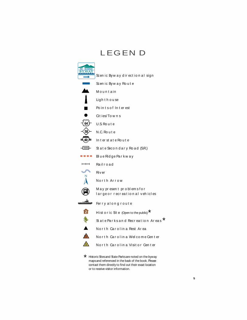
L E G E N D
W
Scenic Byway directional sign
Scenic Byway Route
Mountain
Lighthouse
Points of Interest
Cities/Towns
U.S. Route
N.C. Route
Interstate Route
State Secondary Road (S.R.)
Blue Ridge Parkway
Railroad
River
North Arrow
64
58
1111
40
May present problems forlarge or recreational vehicles
Ferry along route
Historic Site (Open to the public)
State Parks and Recreation Areas
North Carolina Rest Area
North Carolina Welcome Center
North Carolina Visitor Center
**
* Historic Sites and State Parks are noted on the byway maps and referenced in the back of the book. Please contact them directly to find out their exact location or to receive visitor information.
V
2
Adopt-A-Highway
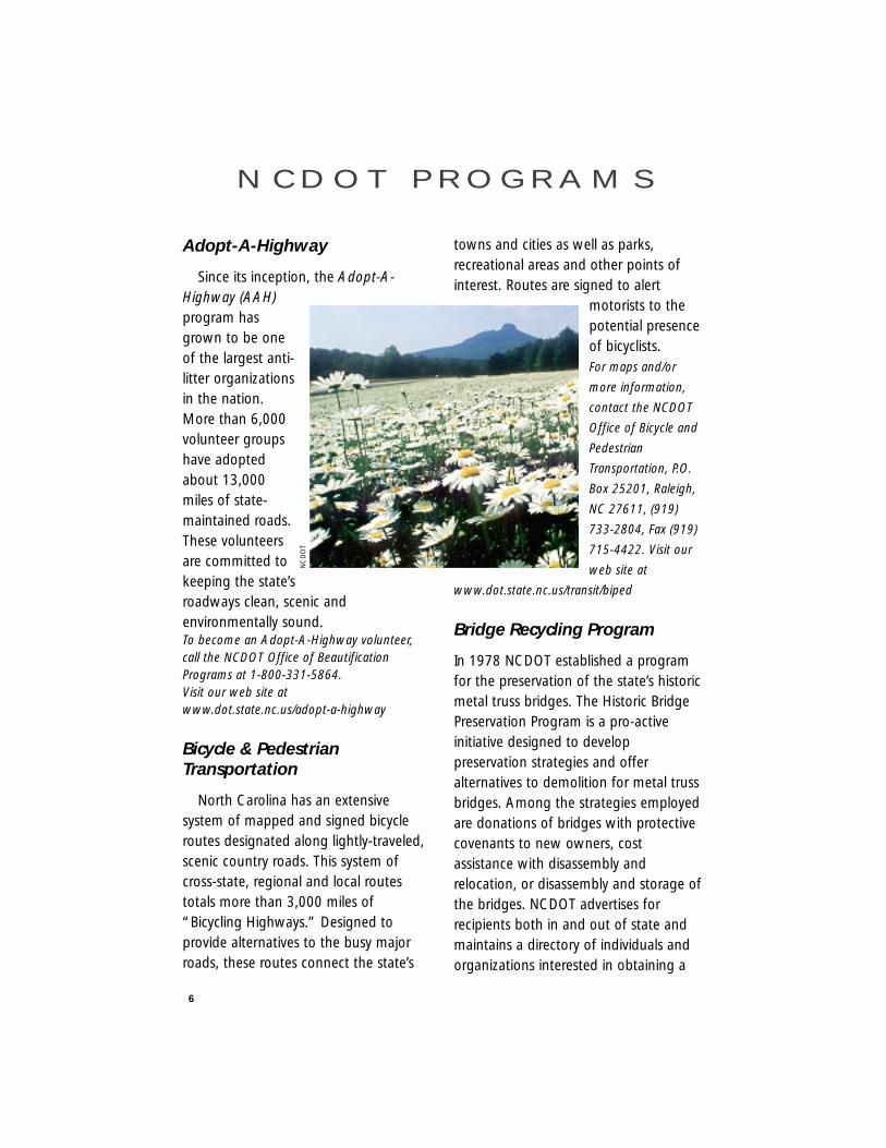
Since its inception, the Adopt-A-Highway (AAH)program hasgrown to be oneof the largest anti-litter organizationsin the nation.More than 6,000volunteer groupshave adoptedabout 13,000miles of state-maintained roads.These volunteersare committed tokeeping the state’sroadways clean, scenic andenvironmentally sound.To become an Adopt-A-Highway volunteer,call the NCDOT Office of BeautificationPrograms at 1-800-331-5864. Visit our web site atwww.dot.state.nc.us/adopt-a-highway
Bicycle & PedestrianTransportation
North Carolina has an extensivesystem of mapped and signed bicycleroutes designated along lightly-traveled,scenic country roads. This system ofcross-state, regional and local routestotals more than 3,000 miles of“Bicycling Highways.” Designed toprovide alternatives to the busy majorroads, these routes connect the state’s
towns and cities as well as parks,recreational areas and other points ofinterest. Routes are signed to alert
motorists to thepotential presenceof bicyclists.For maps and/or
more information,
contact the NCDOT
Office of Bicycle and
Pedestrian
Transportation, P.O.
Box 25201, Raleigh,
NC 27611, (919)
733-2804, Fax (919)
715-4422. Visit our
web site at
www.dot.state.nc.us/transit/biped
Bridge Recycling Program
In 1978 NCDOT established a programfor the preservation of the state’s historicmetal truss bridges. The Historic BridgePreservation Program is a pro-activeinitiative designed to developpreservation strategies and offeralternatives to demolition for metal trussbridges. Among the strategies employedare donations of bridges with protectivecovenants to new owners, costassistance with disassembly andrelocation, or disassembly and storage ofthe bridges. NCDOT advertises forrecipients both in and out of state andmaintains a directory of individuals andorganizations interested in obtaining a
6
N C D O T P R O G R A M S
NC
DO
T
bridge. For further information on thisprogram contact our ProjectDevelopment and Environmental Analysisat (919) 733-3141.For more information visit our web site at
www.doh.dot.state.nc.us/planning/pe/bridge
The Environment & Recycling
The NCDOT is committed to helpingprotect and preserve North Carolina’senvironment. In highway constructionprojects, the department protects rivers,streams and wetlands and buildspassageways so wildlife can cross underfreeways.
Through the department’s recyclingprogram, the NCDOT explores manyinnovative uses for recycled products.Metal from scrap cars is used in retainingwalls and bridges. Beads from recycledglass are mixed with paint to makereflective pavement markings and signseasier to see. Recycled scrap tires areused to build highways. Erosion controlmethods also are being used inconstruction and maintenance to protectthe environment.
Rail
Taking the train is not only a greatalternative form of transportation – it’s alot of fun! Climb aboard to visit relativesand friends, see museums, attendsporting events, go shopping – or visitthe N.C. State Fair. The train also is idealfor business travelers who want extratime to work or relax while traveling. Sixpassenger trains provide daily service to17 North Carolina cities and towns.
North Carolina’s state-owned train,
the Piedmont, provides daily round-tripservice from Raleigh to Charlotte. TheCarolinian provides daily round-tripservice from Charlotte to Raleigh withcontinuing service to Washington, D.C.and New York City. Both trains are jointlyoperated by the NCDOT and Amtrak.Four daily, long-distance passenger trains– the Crescent, Silver Meteor, Silver Starand Silver Palm – travel through the stateproviding service to destinationsthroughout the United States.For ticket, schedule and reservationinformation, call 1-800-USA-RAIL (872-7245).Visit our web site at www.bytrain.org.
Wildflowers
The wildflowers you see bloomingalong our highways are the work of theNCDOT’s Wildflower Program. Severaltimes each year the RoadsideEnvironmental Unit seeds and maintainsflower beds across the state. Theprogram is supported by personalizedlicense plate funds and by citizens’donations.
These colorful flowers, ranging fromCosmos to Queen Anne’s Lace, can beidentified in the Wildflowers On NorthCarolina Roadsides booklet. Anyone whoreceives the booklet can help pay for itscost by making a donation to theWildflower Program. Funds donated inexcess of the costs will be used to plantmore wildflowers along our roadsides.For more information or to receive a brochureon promotional items, write to NCDOTRoadside Environmental Unit, 1540 MailService Center, Raleigh, NC 27699-1540. Visitour web site atwww.dot.state.nc.us/wildflowers
7
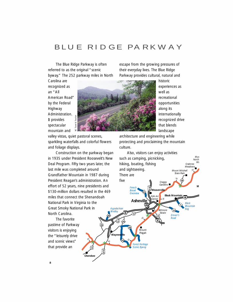
The Blue Ridge Parkway is oftenreferred to as the original “scenicbyway.” The 252 parkway miles in NorthCarolina arerecognized asan “AllAmerican Road”by the FederalHighwayAdministration.It providesspectacularmountain andvalley vistas, quiet pastoral scenes,sparkling waterfalls and colorful flowersand foliage displays.
Construction on the parkway beganin 1935 under President Roosevelt’s NewDeal Program. Fifty two years later, thelast mile was completed aroundGrandfather Mountain in 1987 duringPresident Reagan’s administration. Aneffort of 52 years, nine presidents and$130-million dollars resulted in the 469miles that connect the ShenandoahNational Park in Virginia to theGreat Smoky National Park inNorth Carolina.
The favoritepastime of Parkwayvisitors is enjoyingthe “leisurely driveand scenic views”that provide an
escape from the growing pressures oftheir everyday lives. The Blue RidgeParkway provides cultural, natural and
historicexperiences aswell asrecreationalopportunitiesalong itsinternationallyrecognized drivethat blendslandscape
architecture and engineering whileprotecting and proclaiming the mountainculture.
Also, visitors can enjoy activitiessuch as camping, picnicking,hiking, boating, fishingand sightseeing.There arefive
8
B L U E R I D G E PA R K W AY
340
360
380
400
420440460
Asheville
MountPisgah
BiltmoreEstate
Folk ArtCenter
Craggy Gardens
Mount MitchellState Park
CrabtreeMeadows
MuseNorth
Min
40
40
26
240
25
74
74
276
1923
1923
2374
251
215
110
9
209
276
19
128
Weaverville
Black Mountain
Ma
Cherokee
**
**
*
Waynesville
Appalachian Medley
FrenchBroadOverview
Drover'sRoad
BlackMountainRag
Forest HeritageScenic Byway**
NC
Tra
vel &
Tour
ism

campgrounds forovernight visitors as
well as 72 trails and 25tunnels for exploring. For
interested hikers – the highestelevation point of the byway is
Richland-Balsam Gap, N.C. which ismore than 6,000 feet above sea level.
If you would like to receive furtherinformation on the Blue Ridge Parkwayyou can contact them directly at:
199 Hemphill Knob RoadAsheville, NC 28803
(828) 271-4779or
Visit their Web Page at http://www.nps.gov/blri
9
To find out more about the nation’sother All American Roads and NationalScenic Byways, visit their web site at
http://www.byways.org/
440
200
220
320
300
280260
240
seum ofh Carolinainerals
GrandfatherMountain
Julian PriceMem. Park
Moses H. ConeMemorial Park
E.B. JefferessPark
DoughtonPark
BrinegarCabin
CumberlandKnob
LinvilleFalls
221
221
221
221
21
321
421105
184
194
194
194
88
16
16
18
18
18
89
97
89
77
7758221
58221
Linville
Blowing Rock
Laurel Springs
FancyGap
Galax
Boone
Marion
*
*
**
**
* ***
* *VANC
MissionCrossing
Little Parkway
New RiverValley Byway
New RiverValley Byway
L E G E N D
Point of Interest
City or Town
NC Scenic Byway
Blue Ridge Parkway
Exit along Parkway
Distance Marker(mileage begins in Virginia)
Cherokee
Clay
Graham
Macon
Swain
Jackson
Transylvania
HaywoodBuncombe
Madison
Henderson
Yancey
Mitchell
McDowell
Rutherford
Polk
Burke
Cleveland
Caldwell
Avery
Watauga
Gaston
Lincoln
Catawba
Alexander
Wilkes
Ashe
Alleghany
Surry
Yadkin
Iredell
Rowan
CabarrusMecklenburg
Stokes
Forsyth
Davie
Davidson
UnionAnson
Montg
R
Ra
G
Ro
Stanly
40
40
26
40 85
77
74
77
158
321
321
19
52
19129
1923
6474
22
74
21
38
W
W WW
W
V
V221
421
27
44
14
31
4 40
8
37 33
43
16
18
25
23 42
28
26
15
6
2
45
1012
64
19
10
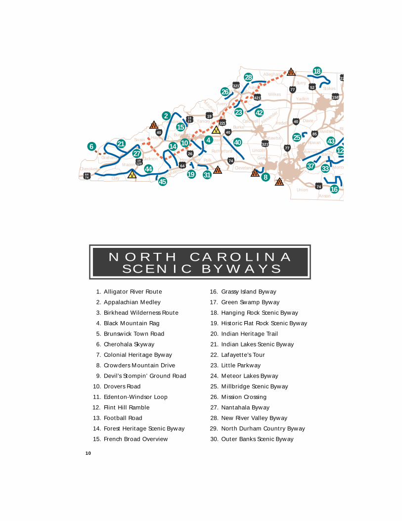
1. Alligator River Route
2. Appalachian Medley
3. Birkhead Wilderness Route
4. Black Mountain Rag
5. Brunswick Town Road
6. Cherohala Skyway
7. Colonial Heritage Byway
8. Crowders Mountain Drive
9. Devil’s Stompin’ Ground Road
10. Drovers Road
11. Edenton-Windsor Loop
12. Flint Hill Ramble
13. Football Road
14. Forest Heritage Scenic Byway
15. French Broad Overview
16. Grassy Island Byway
17. Green Swamp Byway
18. Hanging Rock Scenic Byway
19. Historic Flat Rock Scenic Byway
20. Indian Heritage Trail
21. Indian Lakes Scenic Byway
22. Lafayette’s Tour
23. Little Parkway
24. Meteor Lakes Byway
25. Millbridge Scenic Byway
26. Mission Crossing
27. Nantahala Byway
28. New River Valley Byway
29. North Durham Country Byway
30. Outer Banks Scenic Byway
N O R T H C A R O L I N AS C E N I C B Y W AY S
tgomery
Richmond
Moore
andolph
Guilford
CaswellRockingham
Alam
ance
Chatham
Orange
Person
Durham
Granville
Wake
Lee
Harnett
Cumberland
Hoke
Scot
land
RobesonBladen
Columbus
Sampson
Johnston
Brunswick
Pender
Duplin
Onslow
Jones
Lenoir
Wayne Greene
Carteret
Craven
Beaufort
NewHanover
Wilson
NashFranklin
WarrenHalifax
Edgecombe
PittHyde
WashingtonMartin
Chowan
Gates
Hertford
Northampton
Bertie
Perqui-
mans
PasquotankCam
denCurrituck
Pamlico
Tyrrell Dare
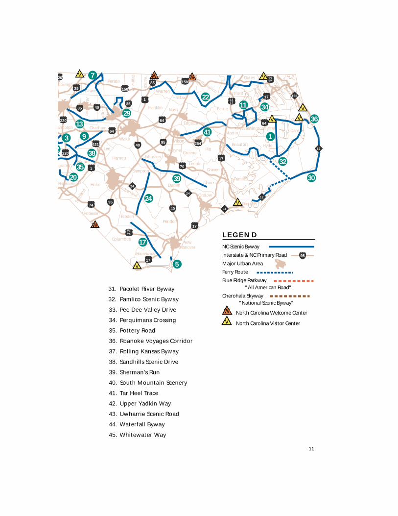
Vance
L E G E N D
NC Scenic Byway
Interstate & NC Primary Road
Major Urban Area
Ferry Route
Blue Ridge Parkway "All American Road"
Cherohala Skyway "National Scenic Byway"
8585
85
95
95
95
40
40
40
158
12
1224
24
24
158
158
17
17
70
17
17
64
1
64
421
1
264
1317
7476
20
29
220
220
74
W
VNorth Carolina Welcome Center
North Carolina Visitor Center
W W
W
V
V
V
V 1317
64
V
V
3
35
38
20
17
24
5
39 30
36
34
1
32
11
41
22
7
13
9
2
29V
11
31. Pacolet River Byway
32. Pamlico Scenic Byway
33. Pee Dee Valley Drive
34. Perquimans Crossing
35. Pottery Road
36. Roanoke Voyages Corridor
37. Rolling Kansas Byway
38. Sandhills Scenic Drive
39. Sherman’s Run
40. South Mountain Scenery
41. Tar Heel Trace
42. Upper Yadkin Way
43. Uwharrie Scenic Road
44. Waterfall Byway
45. Whitewater Way
ROUTES
Waterfall Byway
Nantahala Byway
Cherohala Skyway
Indian Lakes Scenic Byway
Whitewater Way
Forest Heritage Scenic Byway
Appalachian Medley
French Broad Overview
Historic Flat Rock Scenic Byway
Drovers Road
Black Mountain Rag
Pacolet River Byway
South Mountain Scenery
Mission Crossing
Little Parkway
New River Valley Byway
Upper Yadkin Way
14
17
20
22
24
26
28
31
33
35
37
39
40
42
44
46
48
M O U N T A I N R E G I O N
Follow the winding Waterfall Bywaywest along U.S. 64 beginning at theintersection with N.C. 215, north ofRosman inTransylvania County.This byway earns itsname from the 200waterfalls thatsurround the route.In fact, the county, inwhich the routebegins, is known asthe ‘Land ofWaterfalls’ for themany waterfalls andtrout streams in thearea.
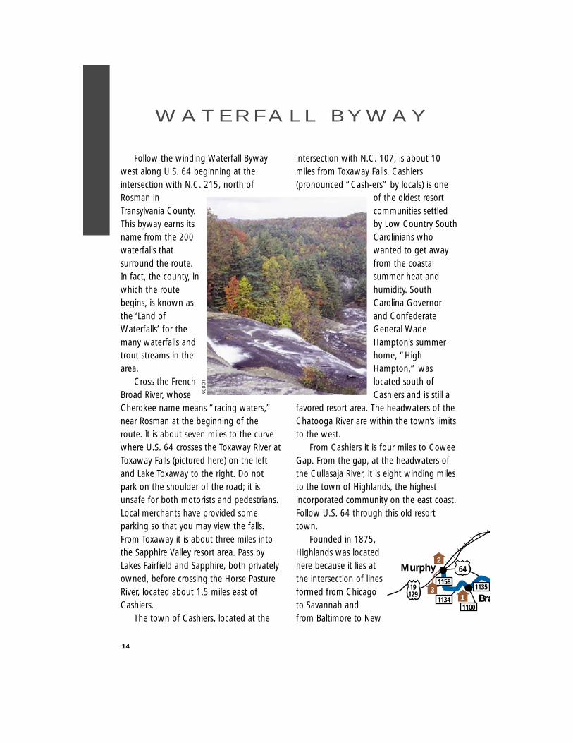
Cross the FrenchBroad River, whoseCherokee name means “racing waters,”near Rosman at the beginning of theroute. It is about seven miles to the curvewhere U.S. 64 crosses the Toxaway River atToxaway Falls (pictured here) on the leftand Lake Toxaway to the right. Do notpark on the shoulder of the road; it isunsafe for both motorists and pedestrians.Local merchants have provided someparking so that you may view the falls.From Toxaway it is about three miles intothe Sapphire Valley resort area. Pass byLakes Fairfield and Sapphire, both privatelyowned, before crossing the Horse PastureRiver, located about 1.5 miles east ofCashiers.
The town of Cashiers, located at the
intersection with N.C. 107, is about 10miles from Toxaway Falls. Cashiers(pronounced “Cash-ers” by locals) is one
of the oldest resortcommunities settledby Low Country SouthCarolinians whowanted to get awayfrom the coastalsummer heat andhumidity. SouthCarolina Governorand ConfederateGeneral WadeHampton’s summerhome, “HighHampton,” waslocated south ofCashiers and is still a
favored resort area. The headwaters of theChatooga River are within the town’s limitsto the west.
From Cashiers it is four miles to CoweeGap. From the gap, at the headwaters ofthe Cullasaja River, it is eight winding milesto the town of Highlands, the highestincorporated community on the east coast.Follow U.S. 64 through this old resorttown.
Founded in 1875,Highlands was locatedhere because it lies atthe intersection of linesformed from Chicagoto Savannah andfrom Baltimore to New
14
W AT E R F A L L B Y W AY
Murphy
Bra
1158
11341100
113519129
642
13
NC
DO
T
Orleans. Highlands was designed byCharles Hutchins and Samuel T. Kelsey ofKansas, who also designed the resortcommunity of Linville.
Cross Lake Sequayah on the outskirtsof Highlands. Two miles west of Highlandspass by the 120-foot drop of Bridal VeilFalls. The water from this fall flows into theCullasaja River to the south. Use theprovided parking area (just west of thefalls) to enjoy its beauty from either side orunderneath where the old highway ran.
Dry Falls, located about one mile westof Bridal Veil, is on the left. This fall, on theCullasaja River, is so named because youcan walk underneath the roaring waterand not get wet. The U.S. Forest Servicehas developed a parking area for visitors toexplore and enjoy this waterfall.
Enter the Cullasaja Gorge six miles westof Dry Falls. The gorge is formed by theCullasaja River as it flows west into theLittle Tennessee River. Note that the UnitedStates Forest Service has designated aportion of this route as the MountainWaters
Scenic Byway. About four miles from DryFalls are the Cullasaja Falls. Located on theleft heading west, this impressive cascadedrops 310 feet in one-half mile. The dropmay be difficult to see, so look carefullybehind the trees far below. While in theCullasaja Gorge you will be able to catchglimpses of the Cullasaja River below as itwinds its way west. Also, enjoy the viewsof the Smoky Mountains and the Pisgahand Nantahala National Forests whilelooking for falcons in the trees along thegorge’s cliffs. From the Cullasaja Falls, it isanother two miles to the community ofGneiss, named for the metamorphic rockthat abounds in this area.
From Gneiss it is about five miles to thecommunity of Cullasaja where the gorgeends. From there it is another 2.5 miles tothe U.S. 23/441 interchange with U.S. 64in Franklin. Franklin is best known for thetreaty council held here between SirAlexander Cuming and the CherokeeIndians in 1730. In 1761 the Cherokeewere defeated by a force of whites,
15
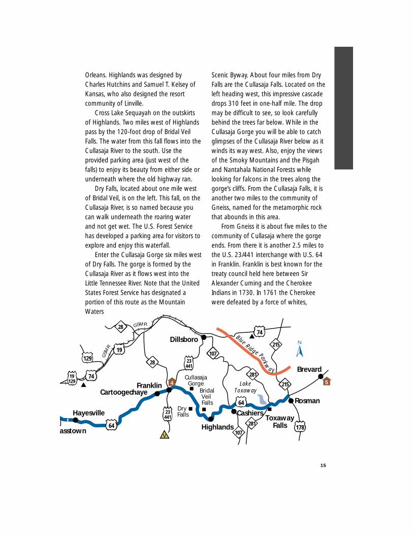
Blue Ridge Parkw
a y
GSM
R
GSMR
Hayesville
asstown
Franklin
RosmanCartoogechaye Bridal
Veil Falls
LakeToxaway
CullasajaGorge
ToxawayFalls
19129
129107
19
64
23441
23441
107
64
178
281
215
215
28
74
74Dillsboro
281
Dry Falls
Highlands
28
Cashiers
Brevard
V
4 5
Chickasaws and Creeks. A mound in townmarks the site of an early Indian village,Nikwasi.
Follow U.S. 23/441 South and U.S. 64about 7.5 miles on the divided highway tothe community of Cartoogechaye(pronounced “Car-too-gi-chay”). Themountains nearby are part of theNantahala Mountain range in theNantahala National Forest. Approximatelyfour miles west, cross Winding Stair Gap,one of the early western passages alongthe Appalachian Trail. From here it isanother two miles to the community ofRainbow Springs. It is 1.7 miles to BlackGap on the Clay and Macon county line.
While driving the 10 miles along theridge crests of the Chunky Gal Mountains,enjoy the occasional scenic overlooks.Indian lore has it that a chunky maidenfrom nearby ran away to get marriedwithout her father’s permission. Thedismayed thinner maidens of her tribegave her the name ‘Chunky Gal.’
From the community of Shooting Creekit is about 8.5 miles to the town ofHayesville. About four miles east ofHayesville pass by Lake Chatuga, known asthe “Crown Jewel” of the Tennessee ValleyAuthority lakes. The water is part of theHiawasee River. Now the Clay County seat,Hayesville was named in 1891 for thecounty’s founder. Located in town is thesite of Fort Hembree, one of the gatheringplaces for the Cherokee who were forcedto leave this part of the country forOklahoma on what is known as the “Trailof Tears.”
About seven miles west of Hayesville,turn left onto Settawig Rd. (S.R. 1135) and
follow it for 2.5 miles towards Brasstown.While in Brasstown visit the John C.Campbell Folk School, where craftsmenlearn trades such as pottery, weaving andblacksmithing. From Settawig Rd. turnright onto Phillips Rd. (S.R. 1100) for onetenth of a mile to Brasstown Rd. (S.R.1134). Turn left and follow Brasstown Rd.for three-tenths of a mile then turn rightonto Cheringhelli Rd. (S.R. 1558). FollowCheringhelli Rd. for 6.5 miles where theroute ends in Murphy at the intersectionwith US 19/129 Bypass.
Murphy is the site of Fort Butler, afrontier fort in the early 1800s and atemporary stockade for the Cherokee whowere on the “Trail of Tears.” Located at thejunction of the Hiawasee and Valley Rivers,the town also was an early trading post. Itis the southern terminus of the GreatSmoky Mountains Railway (GSMR).
Because of winding mountain roads,travel time may be slow along the route.Travel time also may vary with the season.
Other scenic byways near this route arethe Nantahala Byway which begins northof Murphy in Marble and the ForestHeritage Scenic Byway which ties in withthe beginning of this route.
Length: 98 milesDriving Time: 3.5 hoursCounties: Cherokee, Clay,
Jackson, Macon,Transylvania
16
Begin the byway in Marble as the fourlanes of U.S. 19/74/129 take motoriststhrough eight miles of farming valley toAndrews. Thecommunity ofMarble, founded in1911, was so namedbecause it is nearthe state’s largestmarble deposit. Thismarble, in additionto other mineralresources found inthis area, is of suchhigh quality that it was used extensively atArlington National Cemetery. The valleyhas very rich soil which helps the crops oneither side of the road. The soil wasdeposited by the Valley River which flowson the eastern side of the valley towardsthe Hiawasee River in Murphy.
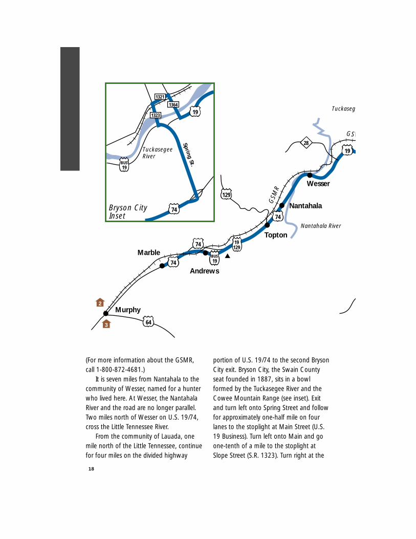
At Andrews, named for the man whodeveloped the Western North CarolinaRailroad, turn right onto U.S. 19 Businessand drive through this turn-of-the-centurymountain town. Meet back with U.S.19/129 on the north side of town wherethe road becomes two lanes.
From Andrews it is approximately sevenmiles to the community of Topton. TheIndian Lakes Scenic Byway intersects at thispoint and runs north on U.S. 129. For thenext 20 miles you will be passing throughthe Nantahala Gorge. First cross theNantahala River. At the Clay and MaconCounty Line look for the 360-foot Camp
Branch Falls just before entering thecommunity of Nantahala, founded in1882. This is where the gorge’s true nature
begins. Notice thatthe U.S. ForestService Scenic Byway‘Mountain Waters’merges with ourbyway just prior toNantahala.The Nantahala Gorgewas called the “Landof the Midday Sun.”From this phrase, the
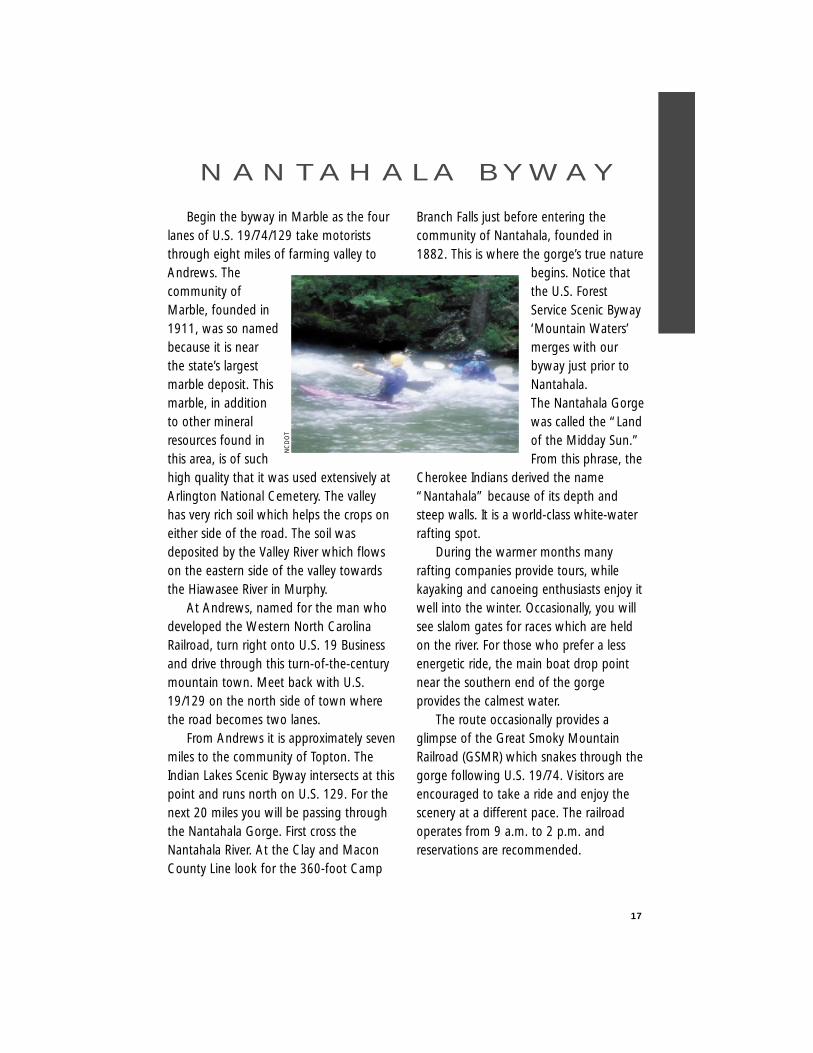
Cherokee Indians derived the name“Nantahala” because of its depth andsteep walls. It is a world-class white-waterrafting spot.
During the warmer months manyrafting companies provide tours, whilekayaking and canoeing enthusiasts enjoy itwell into the winter. Occasionally, you willsee slalom gates for races which are heldon the river. For those who prefer a lessenergetic ride, the main boat drop pointnear the southern end of the gorgeprovides the calmest water.
The route occasionally provides aglimpse of the Great Smoky MountainRailroad (GSMR) which snakes through thegorge following U.S. 19/74. Visitors areencouraged to take a ride and enjoy thescenery at a different pace. The railroadoperates from 9 a.m. to 2 p.m. andreservations are recommended.
17
N A N TA H A L A B Y W AY
NC
DO
T
(For more information about the GSMR,call 1-800-872-4681.)
It is seven miles from Nantahala to thecommunity of Wesser, named for a hunterwho lived here. At Wesser, the NantahalaRiver and the road are no longer parallel.Two miles north of Wesser on U.S. 19/74,cross the Little Tennessee River.
From the community of Lauada, onemile north of the Little Tennessee, continuefor four miles on the divided highway
portion of U.S. 19/74 to the second BrysonCity exit. Bryson City, the Swain Countyseat founded in 1887, sits in a bowlformed by the Tuckasegee River and theCowee Mountain Range (see inset). Exitand turn left onto Spring Street and followfor approximately one-half mile on fourlanes to the stoplight at Main Street (U.S.19 Business). Turn left onto Main and goone-tenth of a mile to the stoplight atSlope Street (S.R. 1323). Turn right at the
18
GSM
R
GS M
19
Marble
129
28
64
74
74
Murphy
Nantahala
Nantahala River
19129
BUS19
BUS19
191323
1321
1364
74
Wesser
Topton
Andrews
Tuckasege
Spring St.
74
TuckasegeeRiver
Bryson CityInset
2
3
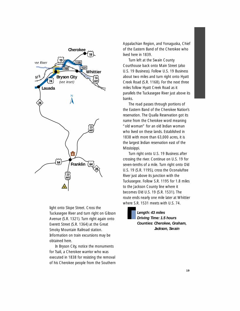
light onto Slope Street. Cross theTuckasegee River and turn right on GibsonAvenue (S.R. 1321). Turn right again ontoEverett Street (S.R. 1364) at the GreatSmoky Mountain Railroad station.Information on train excursions may beobtained here.
In Bryson City, notice the monumentsfor Tsali, a Cherokee warrior who wasexecuted in 1838 for resisting the removalof his Cherokee people from the Southern
Appalachian Region, and Yonaguska, Chiefof the Eastern Band of the Cherokee wholived here in 1839.
Turn left at the Swain CountyCourthouse back onto Main Street (alsoU.S. 19 Business). Follow U.S. 19 Businessabout two miles and turn right onto HyattCreek Road (S.R. 1168). For the next threemiles follow Hyatt Creek Road as itparallels the Tuckasegee River just above itsbanks.
The road passes through portions ofthe Eastern Band of the Cherokee Nation’sreservation. The Qualla Reservation got itsname from the Cherokee word meaning“old woman” for an old Indian womanwho lived on these lands. Established in1838 with more than 63,000 acres, it isthe largest Indian reservation east of theMississippi.
Turn right onto U.S. 19 Business aftercrossing the river. Continue on U.S. 19 forseven-tenths of a mile. Turn right onto OldU.S. 19 (S.R. 1195), cross the OconalufteeRiver just above its junction with theTuckasegee. Follow S.R. 1195 for 1.8 milesto the Jackson County line where itbecomes Old U.S. 19 (S.R. 1531). Theroute ends nearly one mile later at Whittierwhere S.R. 1531 meets with U.S. 74.
Length: 43 milesDriving Time: 1.5 hoursCounties: Cherokee, Graham,
Jackson, Swain
19
S MRWhittier
Bryson City
Lauada
28
64
1531
1195
19
64
23441
74441
23441
28Franklin
1168
19gee River
74 (see inset)
Cherokee
V
4
This National Scenic Byway is oftencompared to the Blue Ridge Parkwaybecause of its scenic attractions and theroad’s naturaltopography. Theskyway is aconnectorbetween theCherokeeNational Forest inTennessee andthe NantahalaNational Forest inNorth Carolina(therefore, thenameCherohala).
Native Americans first occupiedGraham County before the progressionof settlers reached into this territory inthe early 1830s. The homesteadersfollowed Indian paths and game trailsinto this unbroken land. In 1836,President Andrew Jackson ordered theremoval of the Cherokees from thismountain region.
You can access the route by driving12 miles west out of Robbinsville alongN.C. 143 in Graham County. A scenicoverlook marks the start of the scenicbyway. Stop and catch the tranquil viewor read about the development of thisroute and recreational opportunitieshighlighted on the information kiosk. Atthis juncture you can visit Joyce KilmerMemorial Forest as well – dedicated on
July 30, 1936 to the late great author ofthe poem “Trees.” This virginal forest,one of the finest stands of its type in
America, includespoplar, hemlockand oak. Sometulip-poplars havegrown in excessof 100 feet highand 20 feet incircumference.More than ahundred speciesof trees can beseen here whilehiking over 60miles of trails.
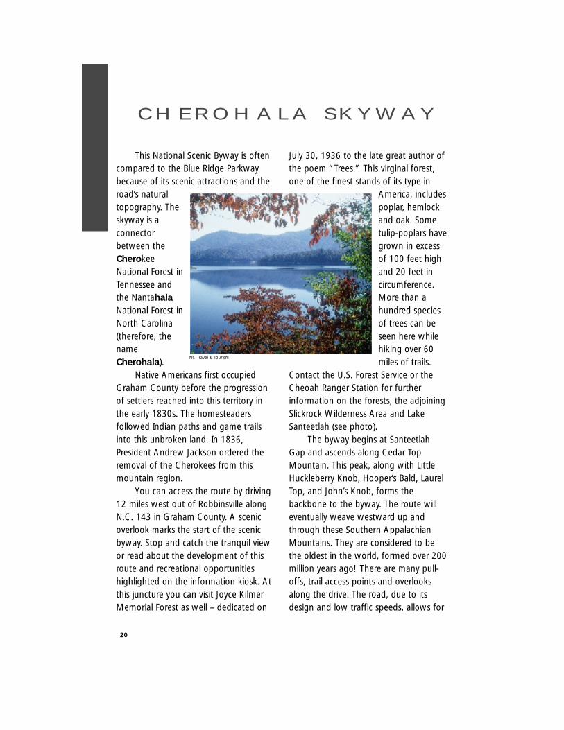
Contact the U.S. Forest Service or theCheoah Ranger Station for furtherinformation on the forests, the adjoiningSlickrock Wilderness Area and LakeSanteetlah (see photo).
The byway begins at SanteetlahGap and ascends along Cedar TopMountain. This peak, along with LittleHuckleberry Knob, Hooper’s Bald, LaurelTop, and John’s Knob, forms thebackbone to the byway. The route willeventually weave westward up andthrough these Southern AppalachianMountains. They are considered to bethe oldest in the world, formed over 200million years ago! There are many pull-offs, trail access points and overlooksalong the drive. The road, due to itsdesign and low traffic speeds, allows for
20
C H E R O H A L A S K Y W AY
NC Travel & Tourism
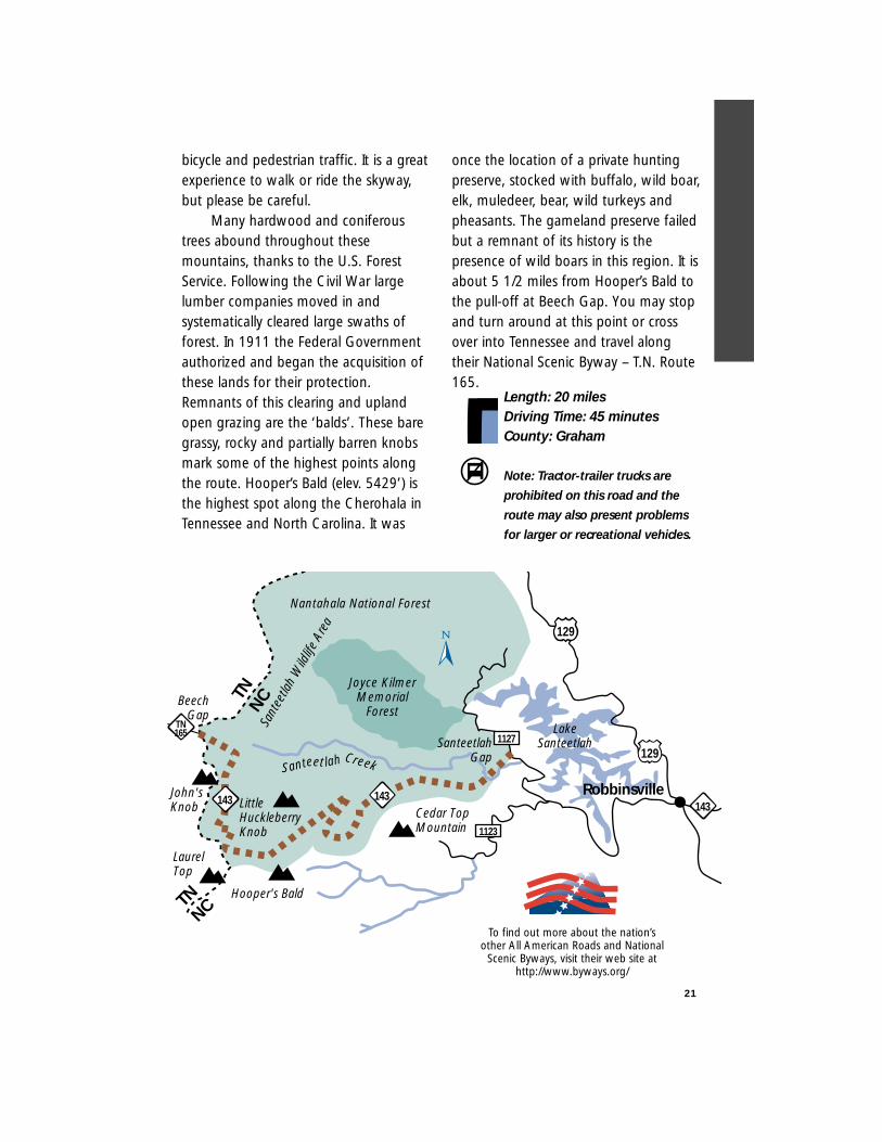
bicycle and pedestrian traffic. It is a greatexperience to walk or ride the skyway,but please be careful.
Many hardwood and coniferoustrees abound throughout thesemountains, thanks to the U.S. ForestService. Following the Civil War largelumber companies moved in andsystematically cleared large swaths offorest. In 1911 the Federal Governmentauthorized and began the acquisition ofthese lands for their protection.Remnants of this clearing and uplandopen grazing are the ‘balds’. These baregrassy, rocky and partially barren knobsmark some of the highest points alongthe route. Hooper’s Bald (elev. 5429’) isthe highest spot along the Cherohala inTennessee and North Carolina. It was
once the location of a private huntingpreserve, stocked with buffalo, wild boar,elk, muledeer, bear, wild turkeys andpheasants. The gameland preserve failedbut a remnant of its history is thepresence of wild boars in this region. It isabout 5 1/2 miles from Hooper’s Bald tothe pull-off at Beech Gap. You may stopand turn around at this point or crossover into Tennessee and travel alongtheir National Scenic Byway – T.N. Route165.
Length: 20 milesDriving Time: 45 minutesCounty: Graham
Note: Tractor-trailer trucks are
prohibited on this road and the
route may also present problems
for larger or recreational vehicles.
21
Joyce KilmerMemorial
Forest
Nantahala National Forest
Santeet lah Creek
TNNC
1127
1123
Hooper's Bald
John'sKnob
LaurelTop
Cedar TopMountain
SanteetlahGap
BeechGap
Little HuckleberryKnob
TNNC
143143143
TN165
Robbinsville
LakeSanteetlah
129
129
Sant
eetla
h W
ildlif
e Ar
ea
To find out more about the nation’sother All American Roads and National
Scenic Byways, visit their web site athttp://www.byways.org/
22
This route takes its name from themany lakes along the route with Indiannames. Begin the byway in Almond,incorporated in1905 and locatedjust north of theNantahala Gorge.Cross theNantahala Riverand take N.C. 28north to FontanaVillage. On the23-mile trek fromAlmond toFontana Village,take advantageof the many overlooks with parking forroadside picnics to enjoy the scenery. Crossthrough Calf Pen Gap and the StecoahPanther Divide from Swain County intoGraham County. The numerous creeks allfeed into the Little Tennessee River to thenorth. The Little Tennessee was discoveredin 1540 by the Spanish Conquistador,Hernando DeSoto, as the first tributary tothe Mississippi River. The community ofStecoah carries an Indian name thought tomean “lean” or “no game at this site.”
Along the way, watch for large pipesshooting up the mountain sides. Thesesurge pipes take water overflow up themountain for storage when overflow gatesare closed in the hydroelectric dams seenalong the route. When water levels arelow, the water is released and flows downthe mountains through the pipes to turn
the turbines in generator houses next tothe dams.
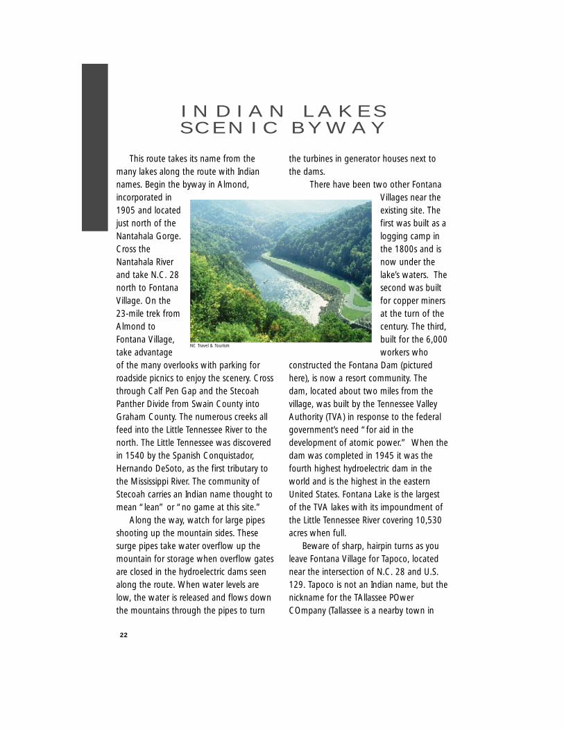
There have been two other FontanaVillages near theexisting site. Thefirst was built as alogging camp inthe 1800s and isnow under thelake’s waters. Thesecond was builtfor copper minersat the turn of thecentury. The third,built for the 6,000workers who
constructed the Fontana Dam (picturedhere), is now a resort community. Thedam, located about two miles from thevillage, was built by the Tennessee ValleyAuthority (TVA) in response to the federalgovernment’s need “for aid in thedevelopment of atomic power.” When thedam was completed in 1945 it was thefourth highest hydroelectric dam in theworld and is the highest in the easternUnited States. Fontana Lake is the largestof the TVA lakes with its impoundment ofthe Little Tennessee River covering 10,530acres when full.
Beware of sharp, hairpin turns as youleave Fontana Village for Tapoco, locatednear the intersection of N.C. 28 and U.S.129. Tapoco is not an Indian name, but thenickname for the TAllassee POwerCOmpany (Tallassee is a nearby town in
I N D I A N L A K E SS C E N I C B Y W AY
NC Travel & Tourism

Tennessee). It was established in 1930 andhoused the builders of the Cheoah dam,located two miles further along this route.Cheoah is derived from the Cherokeeword for “otter.”
The Cheoah Dam, built of hand-cutstone and covered with a layer of concrete,began in 1917 by the Aluminum Companyof America. At the time of its constructionit was the highest overflow dam in theworld and had the world’s largest turbines.The waters of the Little Tennessee Riverand the Cheoah River meet at this dam.Just past the lake and dam is a very largepipe crossing over the road. This pipe ispart of an aqueduct which connectsCheoah Lake to Santeetlah Lake.
Continue south along U.S. 129 whilenoticing the Cheoah River which parallelsthe route. This stream would be flowingmuch fuller if the hydroelectric damnswere not nearby. From Cheoah Dam it is16 miles to the Graham County seat ofRobbinsville, founded in 1843.
Along the way look for the SanteetlahDam at Lake Santeetlah to the right.Santeetlah comes from an Indian wordmeaning “blue waters.” To the westnotice the mountain peaks in the JoyceKilmer Memorial Forest. This 3,849 acreforest was dedicated to the poet in1936 and is hallowed with virgin standsof oak, yellow-poplar, basswood andsycamore.
Because of the mountain rangessurrounding this area, Graham Countyis one of the most isolated areas in theeastern United States. The grave ofJunaluska, a Cherokee chief and warriorwho saved Andrew Jackson’s life at the
Battle of Horseshoe Bend in the 1812Creek War, is located in Robbinsville.
Just after Robbinsville, cross the TululaCreek (Cherokee for “cry of the frog”)which joins with the Sweetwater Creek toform the Cheoah River. Continue alongU.S. 129 for approximately 12 miles to theintersection with U.S. 19/74. The routeends just south of the Nantahala Gorge atTopton, located at the top of the RedMarble Gap.
The Indian Lakes Scenic Bywayconnects with the Nantahala Byway atboth ends.
Length: 60 milesDriving Time: Two hoursCounties: Swain, Graham,
Cherokee
Note: The route is difficult for recreational vehicles and buses.
23
Tapoco
FontanaVillage
Topton
AlmondRobbinsville
Fontana Lake
Nantahala
Santeetlah Dam& Lake
NantahalaDam & Lake
Fontana Dam
TN
19129 74
28
129
1974143
129
NC
Stecoah
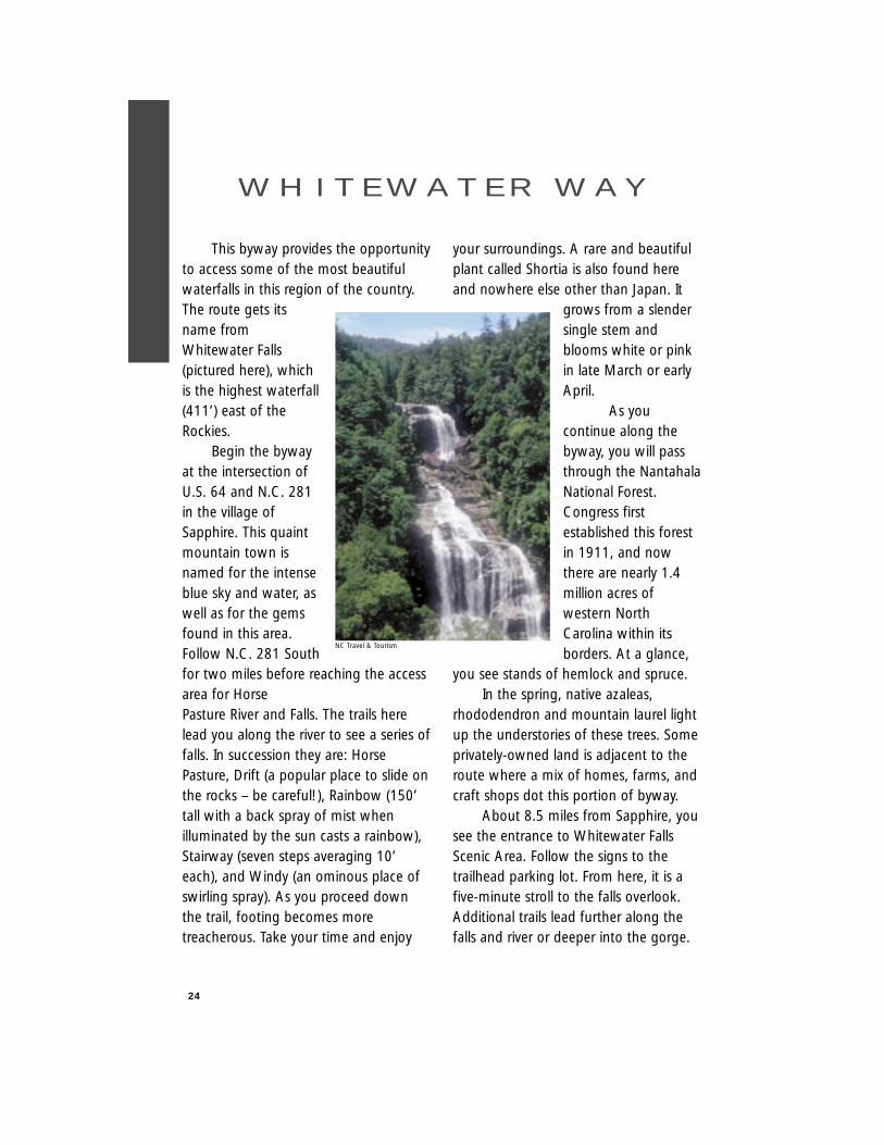
This byway provides the opportunityto access some of the most beautifulwaterfalls in this region of the country.The route gets itsname fromWhitewater Falls(pictured here), whichis the highest waterfall(411’) east of theRockies.
Begin the bywayat the intersection ofU.S. 64 and N.C. 281in the village ofSapphire. This quaintmountain town isnamed for the intenseblue sky and water, aswell as for the gemsfound in this area.Follow N.C. 281 Southfor two miles before reaching the accessarea for Horse Pasture River and Falls. The trails herelead you along the river to see a series offalls. In succession they are: HorsePasture, Drift (a popular place to slide onthe rocks – be careful!), Rainbow (150’tall with a back spray of mist whenilluminated by the sun casts a rainbow),Stairway (seven steps averaging 10’each), and Windy (an ominous place ofswirling spray). As you proceed downthe trail, footing becomes moretreacherous. Take your time and enjoy
your surroundings. A rare and beautifulplant called Shortia is also found hereand nowhere else other than Japan. It
grows from a slendersingle stem andblooms white or pinkin late March or earlyApril.
As youcontinue along thebyway, you will passthrough the NantahalaNational Forest.Congress firstestablished this forestin 1911, and nowthere are nearly 1.4million acres ofwestern NorthCarolina within itsborders. At a glance,
you see stands of hemlock and spruce. In the spring, native azaleas,
rhododendron and mountain laurel lightup the understories of these trees. Someprivately-owned land is adjacent to theroute where a mix of homes, farms, andcraft shops dot this portion of byway.
About 8.5 miles from Sapphire, yousee the entrance to Whitewater FallsScenic Area. Follow the signs to thetrailhead parking lot. From here, it is afive-minute stroll to the falls overlook.Additional trails lead further along thefalls and river or deeper into the gorge.
24
W H I T E W AT E R W AY
NC Travel & Tourism
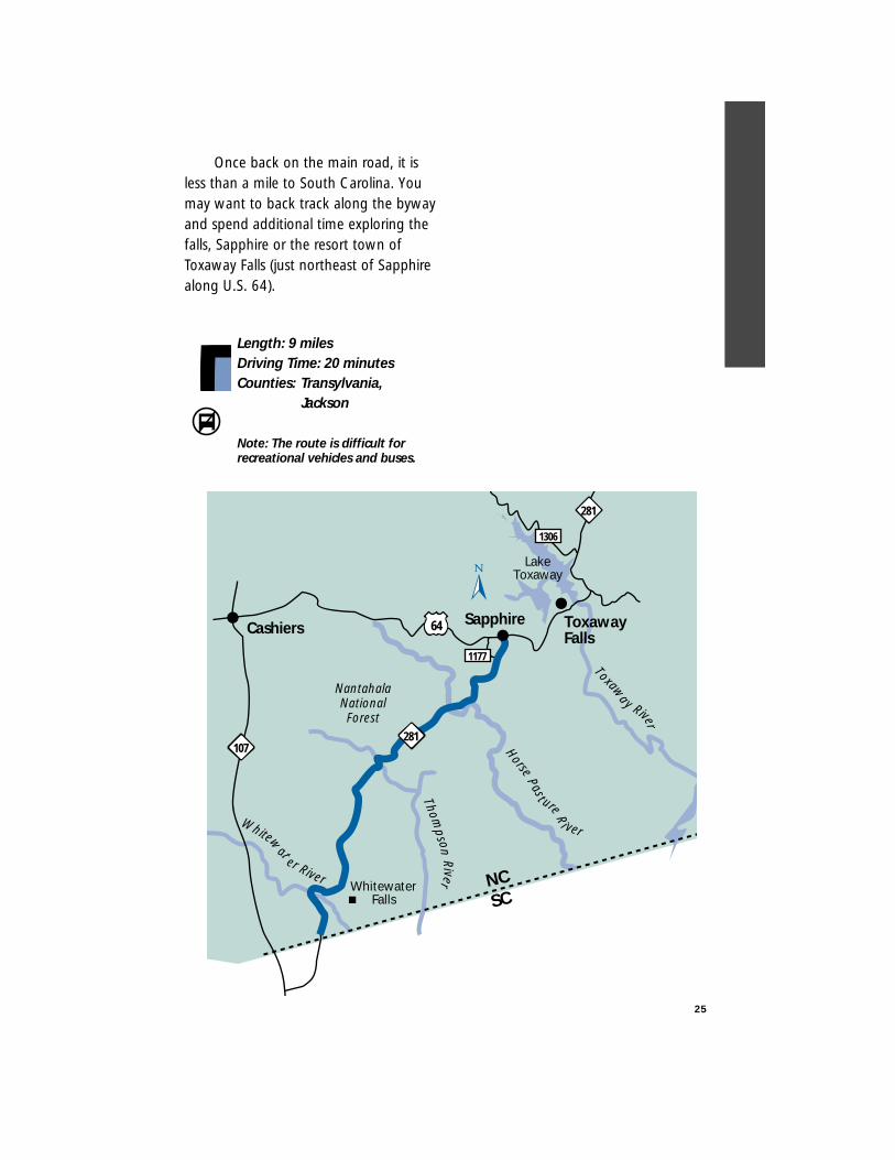
Once back on the main road, it isless than a mile to South Carolina. Youmay want to back track along the bywayand spend additional time exploring thefalls, Sapphire or the resort town ofToxaway Falls (just northeast of Sapphirealong U.S. 64).
Length: 9 milesDriving Time: 20 minutesCounties: Transylvania,
Jackson
Note: The route is difficult for recreational vehicles and buses.
25
ToxawayFalls
SapphireCashiers
WhitewaterFalls
Whitew
at
er River
Toxaway River
HorseP as t ure
R
i ver
NantahalaNationalForest
64
281
281
1306
1177
NCSC
Thomp
sonRi ver
LakeToxaway
107
26
Enjoy mountain scenery while travelingnorth along U.S. 276 from the intersectionwith N.C. 280 and U.S. 64 near Brevard.Established in 1861,Brevard was named forEphriam Brevard whodrafted theMecklenburg Resolvesof 1775. At thebeginning of this routeis a pair of stone pillarsbuilt to honorTransylvania Countyresidents who served inWorld War I. They markthe entrance to thePisgah National Forest.The Forest wasestablished in 1916 andconsists of more thanone million acres. Abouttwo miles from the pillars is a Forest ServiceInformation Center with more informationon the National Forests in this region.
West of the information center is thePisgah Forest National Fish Hatchery whichraises trout to be released into mountainstreams. Three-tenths of a mile furtheralong U.S. 276 notice the breathtaking 85-foot tall Looking Glass Falls on the right. Apull-off is provided so you may safely enjoythe falls. The falls are named for themountain above to the left, known asLooking Glass Rock. Its monolithic graniteface gleams like a mirror from the waterseeping out of the mountain across the
stone. About 2.5 miles north, pass Sliding
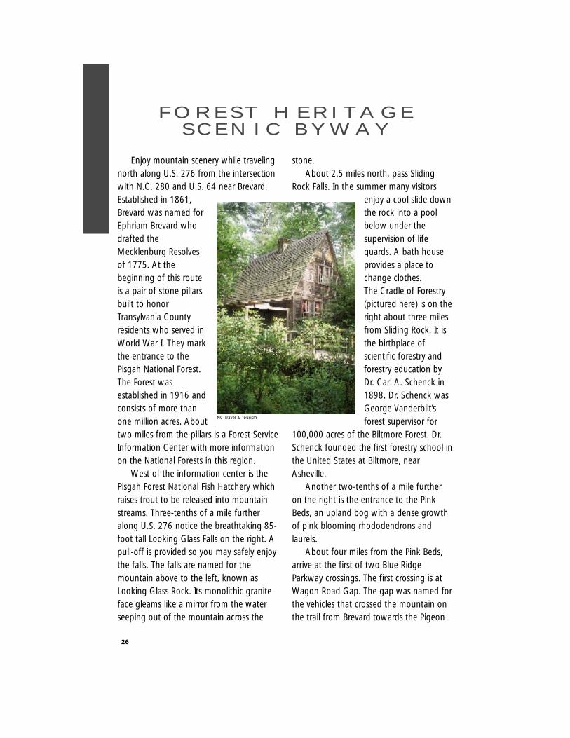
Rock Falls. In the summer many visitorsenjoy a cool slide downthe rock into a poolbelow under thesupervision of lifeguards. A bath houseprovides a place tochange clothes. The Cradle of Forestry(pictured here) is on theright about three milesfrom Sliding Rock. It isthe birthplace ofscientific forestry andforestry education byDr. Carl A. Schenck in1898. Dr. Schenck wasGeorge Vanderbilt’sforest supervisor for
100,000 acres of the Biltmore Forest. Dr.Schenck founded the first forestry school inthe United States at Biltmore, nearAsheville.
Another two-tenths of a mile furtheron the right is the entrance to the PinkBeds, an upland bog with a dense growthof pink blooming rhododendrons andlaurels.
About four miles from the Pink Beds,arrive at the first of two Blue RidgeParkway crossings. The first crossing is atWagon Road Gap. The gap was named forthe vehicles that crossed the mountain onthe trail from Brevard towards the Pigeon
F O R E S T H E R I TA G ES C E N I C B Y W AY
NC Travel & Tourism
27
River Gorge and Tennessee. To the left isthe Shining Rock Wilderness. Accessibleonly by foot trails, this primitive area is aunique natural resource. From here, followthe upper reaches of the East Fork of thePigeon River through rural mountainvillages and farm lands for 14 miles to thecommunity of Bethel.
The nearby community of Woodrow,just north of Bethel, was named for our28th president Woodrow Wilson, turn leftat the stoplight onto N.C. 215. Follow theWest Fork of the Pigeon River for 18 milesuntil you reach the second crossingof the Blue Ridge Parkway at BeechGap. Along this portion of N.C.215, pass by more mountain farmsand numerous streams and falls. Sixmiles from Woodrow, pass a localreservoir, Lake Logan. Thecommunity of Sunburst, locatedalong the shores of the lake, getsits name from the swiftness of thesun as it rises over Cold Mountainto announce the morning.
About 8.5 miles from the BlueRidge Parkway arrive in the BalsamGrove community near Balsam Lakewhich feeds into the French BroadRiver. The river was named for theFrench who inhabited the territoryduring the 18th century. For the lasteight miles, the road parallels theNorth Fork of the French BroadRiver. The route ends at theintersection of N.C. 215 with U.S.64 near Rosman.
Continue your scenic journey byfollowing the Waterfall Byway west alongU.S. 64 from this point or turn left andfollow the U.S. Forest Service scenic bywaynorth to Brevard.
Length: 65 milesDriving Time: Two hoursCounties: Haywood,
Transylvania,Jackson
Note: The route is difficult for recreational vehicles and buses.
Blue Rid
ge Parkw
ay
Davidson R iver
Rosman
Bethel
178
276
215110
Cradle of Forestry
Looking Glass Falls
PisgahFish
Hatchery
215
FrenchBroad
River
64
280
64
64215
Brevard
SunburstShining
Rock
SlidingRock
PisgahNational
Forest
276
276
5
6
To Ashe
ville
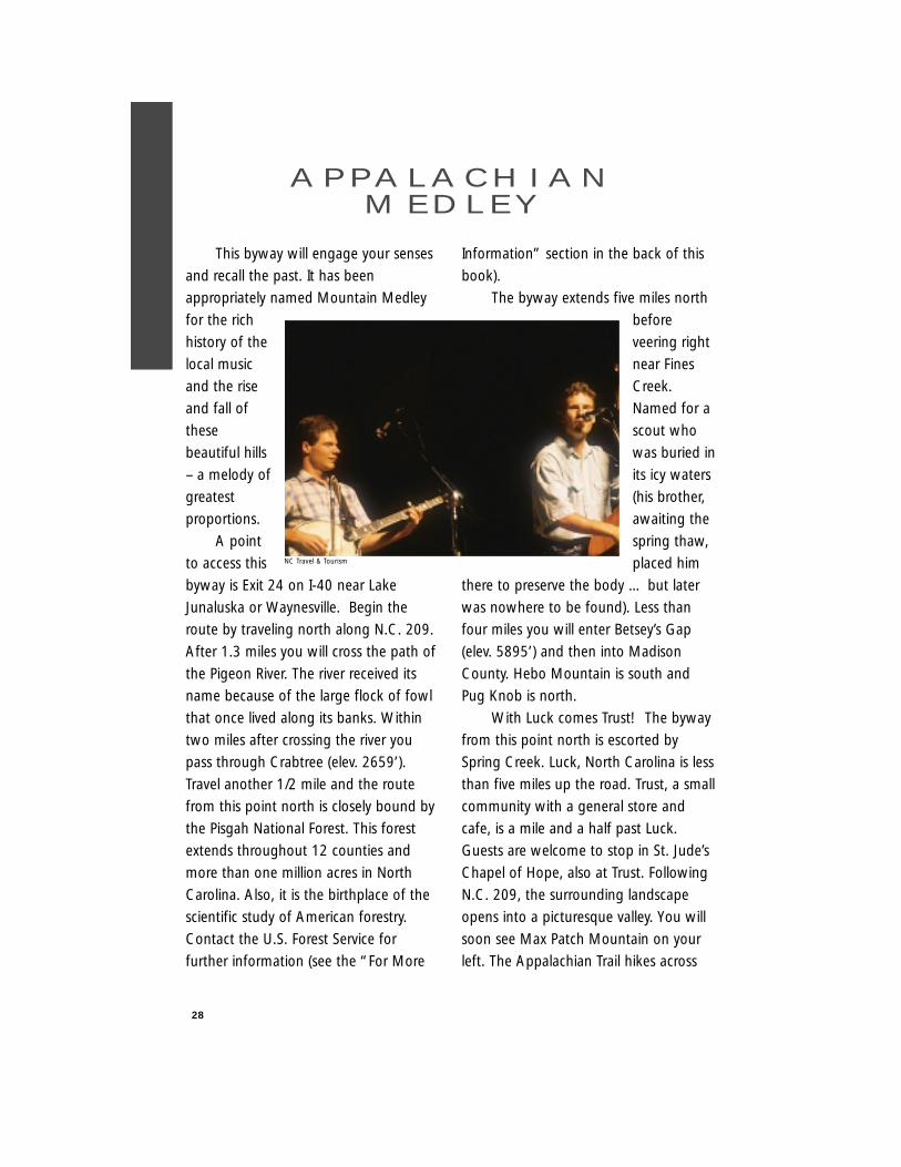
This byway will engage your senses
and recall the past. It has been
appropriately named Mountain Medley
for the rich
history of the
local music
and the rise
and fall of
these
beautiful hills
– a melody of
greatest
proportions.
A point
to access this
byway is Exit 24 on I-40 near Lake
Junaluska or Waynesville. Begin the
route by traveling north along N.C. 209.
After 1.3 miles you will cross the path of
the Pigeon River. The river received its
name because of the large flock of fowl
that once lived along its banks. Within
two miles after crossing the river you
pass through Crabtree (elev. 2659’).
Travel another 1/2 mile and the route
from this point north is closely bound by
the Pisgah National Forest. This forest
extends throughout 12 counties and
more than one million acres in North
Carolina. Also, it is the birthplace of the
scientific study of American forestry.
Contact the U.S. Forest Service for
further information (see the “For More
Information” section in the back of this
book).
The byway extends five miles north
before
veering right
near Fines
Creek.
Named for a
scout who
was buried in
its icy waters
(his brother,
awaiting the
spring thaw,
placed him
there to preserve the body … but later
was nowhere to be found). Less than
four miles you will enter Betsey’s Gap
(elev. 5895’) and then into Madison
County. Hebo Mountain is south and
Pug Knob is north.
With Luck comes Trust! The byway
from this point north is escorted by
Spring Creek. Luck, North Carolina is less
than five miles up the road. Trust, a small
community with a general store and
cafe, is a mile and a half past Luck.
Guests are welcome to stop in St. Jude’s
Chapel of Hope, also at Trust. Following
N.C. 209, the surrounding landscape
opens into a picturesque valley. You will
soon see Max Patch Mountain on your
left. The Appalachian Trail hikes across
28
A P PA L A C H I A NM E D L E Y
NC Travel & Tourism
the top of this mountain bald (elev.
4629’). Travel a little over four miles and
you have the option of stopping at the
Rocky Bluff Recreation Area. Stop and
use the picnic facilities, bathrooms,
campsites, or hiking trails.
Hot Springs is 3.3 miles beyond the
recreation area. Two scouts, Henry
Reynolds and Thomas Morgan first
discovered the springs here in 1778.
Originally known as Warm Springs
(changed to Hot Springs in 1886), it was
29
Waynesville
FinesCreek
Crabtree
Walnut
Marshall
FrenchB
road River
1153
209
208
63
209
1338
40
40
P igeo n Riv
er
2374
192374
2570
PisgahNationalForest
LakeJunaluska
HeboMountain
Betsey's Gap
PugKnob
Max PatchMountain
Luck
Trust
TNNC
Appalachian Trail
276
19
276
2570
HotSprings
Rocky BluffRecreation Area
2570
a main stop for drovers that led cattle,
hogs and horses to markets in South
Carolina and Georgia. During this time,
this area had a reputation of debauchery,
drunkenness, murder and prostitution. A
toll road with regular stagecoach traffic
and private carriages slowly changed the
character of these
towns. The drover’s
stands were
converted to better
accommodate a
higher clientele
seeking the healing
waters of the
springs. The history
of this area also
includes the first
golf course in the
southeast, the
imprisonment of
German merchants
during World War I
and the presence of
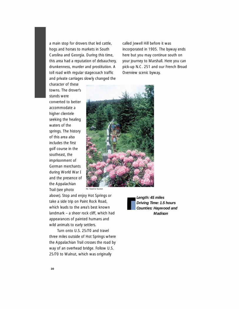
the Appalachian
Trail (see photo
above). Stop and enjoy Hot Springs or
take a side trip on Paint Rock Road,
which leads to the area’s best known
landmark – a sheer rock cliff, which had
appearances of painted humans and
wild animals to early settlers.
Turn onto U.S. 25/70 and travel
three miles outside of Hot Springs where
the Appalachian Trail crosses the road by
way of an overhead bridge. Follow U.S.
25/70 to Walnut, which was originally
called Jewell Hill before it was
incorporated in 1905. The byway ends
here but you may continue south on
your journey to Marshall. Here you can
pick-up N.C. 251 and our French Broad
Overview scenic byway.
Length: 45 milesDriving Time: 1.5 hoursCounties: Haywood and
Madison
30
NC Travel & Tourism
31
The byway begins in Weaverville, first
settled in the 1700s. The small town was
called Pine Cabin until it was incorporated
in 1850. It also is the
site of the Vance
Birthplace State Historic
Site. Zebulon B. Vance
was governor of North
Carolina from 1862-
1865 and a United
States Senator. The
historic site is unusual
in its presentation of
early mountain settler
life.
Begin the route by
exiting U.S. 19/23 at
Weaverville and
traveling U.S. 25/70
Bypass towards Marshall. Turn left at the
first stoplight onto Monticello Road (S.R.
1727). Follow Monticello Road for about
three miles through a rural residential area
until it ends at N.C. 251. Notice the French
Broad River ahead as it makes its way
west. The river was named for the French
who inhabited the territory during the 18th
century. Turn right onto N.C. 251 near the
community of Alexander. Established in
1828, Alexander was named for the owner
of a local stagecoach tavern.
This road, like many others in river
valleys, was built following old Indian
trading paths that led to trading posts and
villages in the Tennessee and Ohio River
valleys. Note the palisades, or sheer rock
walls, that line the right
side of the road. During
the years, the wide river
cut away at the rock
valley walls. Migrating
animals and native
American Indians used
this passage to cross
through the east’s tallest
mountains. When
settlers of European
descent arrived, they
too followed the river
valleys and paths set by
the natives before them
and widened the paths
into roads. With the arrival of trains, river
valleys again provided the path of least
resistance.
While following the French Broad you
will catch glimpses of a railroad on the
other side of the river. Near Marshall the
tracks will cross the river and parallel it on
the same side as the road.
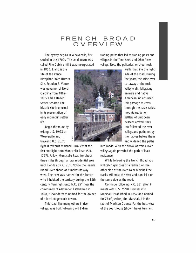
Continue following N.C. 251 after it
meets with U.S. 25/70 Business into
Marshall. Established in 1852 and named
for Chief Justice John Marshall, it is the
seat of Madison County. For the best view
of the courthouse (shown here), turn left
F R E N C H B R O A DO V E R V I E W
NC
DO
T
32
at the stop light, cross the river, turn
around in the school parking lot to your
right and come back across the river to see
this community perched upon the banks of
the river.
Turn left at the stoplight in front of the
courthouse to continue on the final portion
of this trip. Follow U.S. 25/70 Business as it
winds up the hill past a beautifully laid
stone wall and finally meets with U.S.
25/70 Bypass one mile from the
courthouse in Marshall. The route ends
here.
During summer months, the French
Broad River is a popular site for white-
water rafting and canoeing.
Length: 17 milesDriving Time: 25 minutesCounties: Madison
Buncombe
Weaverville
Mars HillMarshall
Walnut
FrenchBroad
Rive r
Alexander
23
1727
19
Asheville
2570
BUS
2570
BYP
213
251
8
911
10
7
2570
12
13
74A40
26
The community of Flat Rock derivedits name from a large expanse of graniteused long ago as a meeting andceremonial site bythe Cherokee. Thehistoric village hasalso been the havenfor affluentCharlestonians,Europeans, andprominentplantation owners.Evidence of theirresidence can beseen in the manybeautiful historichomes, and alineage of southernaristocracy is in thefamily plots at St.John in theWilderness Episcopal Church.
The scenic byway route consists oftwo roads intersecting as a “T”. Themain road running north and southalong the byway and through Flat Rock,is US 25. The intersecting road is LittleRiver Road (S.R. 1123) and it continueswest for four miles from US 25.
You access the route by exiting fromI-26 and follow US 64 west into thetown of Hendersonville (established in1841 as the Henderson County seat). InHendersonville, turn left onto US 25 andfollow it south for 2+ miles. The bywaybegins at the intersection of HighlandLake Road (S.R. 1783). Immediately onyour right, you will see the St. John inthe Wilderness gothic revival church
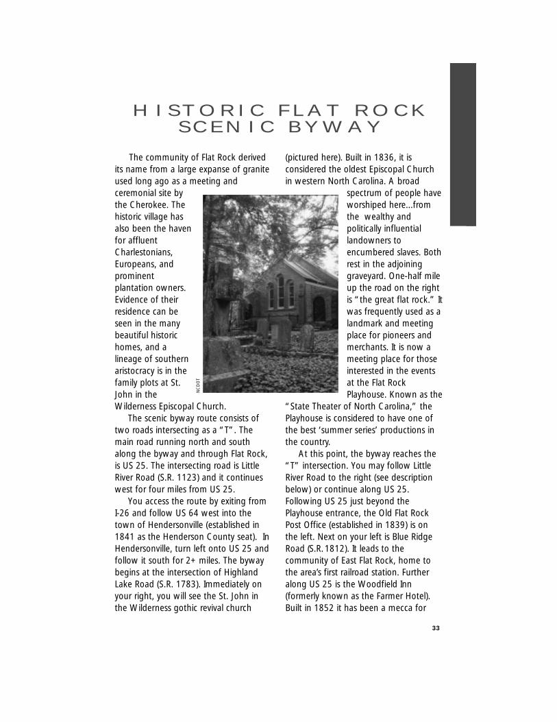
(pictured here). Built in 1836, it isconsidered the oldest Episcopal Churchin western North Carolina. A broad
spectrum of people haveworshiped here...fromthe wealthy andpolitically influentiallandowners toencumbered slaves. Bothrest in the adjoininggraveyard. One-half mileup the road on the rightis “the great flat rock.” Itwas frequently used as alandmark and meetingplace for pioneers andmerchants. It is now ameeting place for thoseinterested in the eventsat the Flat RockPlayhouse. Known as the
“State Theater of North Carolina,” thePlayhouse is considered to have one ofthe best ‘summer series’ productions inthe country.
At this point, the byway reaches the“T” intersection. You may follow LittleRiver Road to the right (see descriptionbelow) or continue along US 25.Following US 25 just beyond thePlayhouse entrance, the Old Flat RockPost Office (established in 1839) is onthe left. Next on your left is Blue RidgeRoad (S.R.1812). It leads to thecommunity of East Flat Rock, home tothe area’s first railroad station. Furtheralong US 25 is the Woodfield Inn(formerly known as the Farmer Hotel).Built in 1852 it has been a mecca for
33
H I S T O R I C F L AT R O C KS C E N I C B Y W AY
NC
DO
T
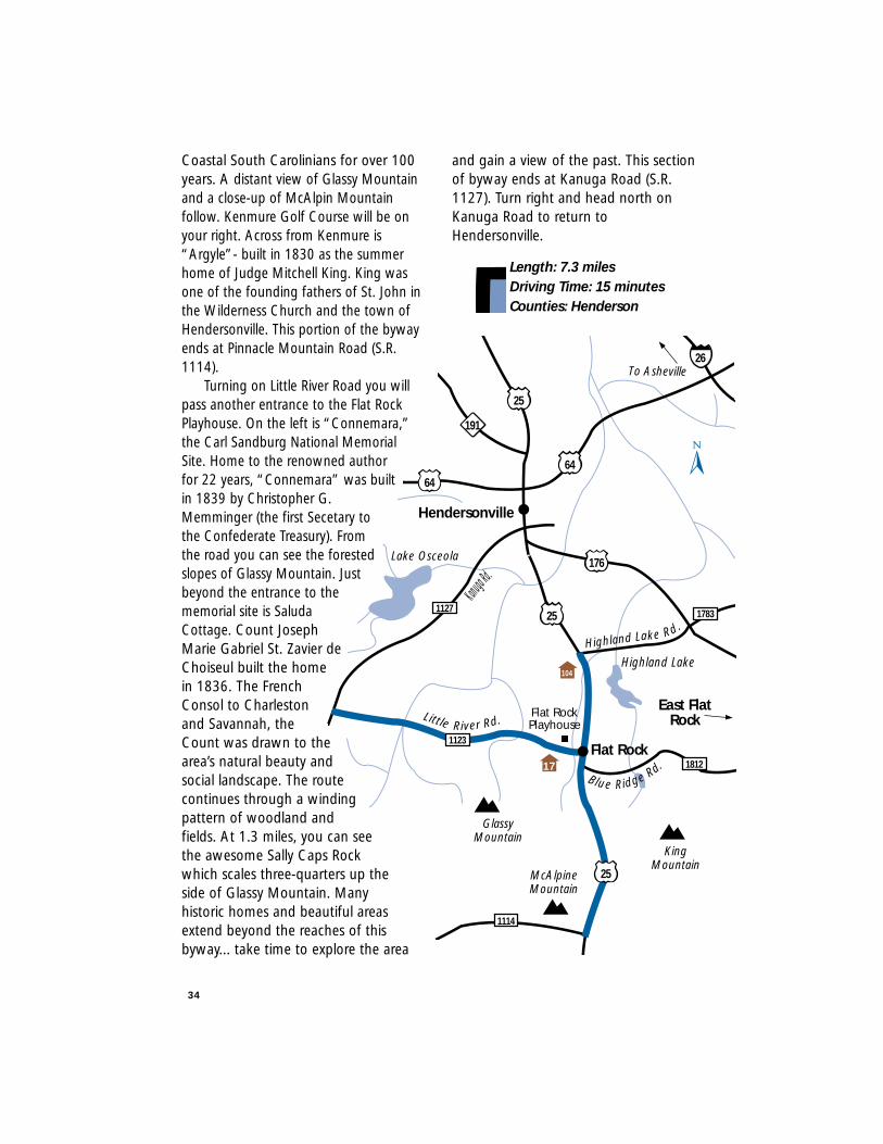
Coastal South Carolinians for over 100years. A distant view of Glassy Mountainand a close-up of McAlpin Mountainfollow. Kenmure Golf Course will be onyour right. Across from Kenmure is“Argyle”- built in 1830 as the summerhome of Judge Mitchell King. King wasone of the founding fathers of St. John inthe Wilderness Church and the town ofHendersonville. This portion of the bywayends at Pinnacle Mountain Road (S.R.1114).
Turning on Little River Road you willpass another entrance to the Flat RockPlayhouse. On the left is “Connemara,”the Carl Sandburg National MemorialSite. Home to the renowned authorfor 22 years, “Connemara” was builtin 1839 by Christopher G.Memminger (the first Secetary tothe Confederate Treasury). Fromthe road you can see the forestedslopes of Glassy Mountain. Justbeyond the entrance to thememorial site is SaludaCottage. Count JosephMarie Gabriel St. Zavier deChoiseul built the homein 1836. The FrenchConsol to Charlestonand Savannah, theCount was drawn to thearea’s natural beauty andsocial landscape. The routecontinues through a windingpattern of woodland andfields. At 1.3 miles, you can seethe awesome Sally Caps Rockwhich scales three-quarters up theside of Glassy Mountain. Manyhistoric homes and beautiful areasextend beyond the reaches of thisbyway... take time to explore the area
and gain a view of the past. This sectionof byway ends at Kanuga Road (S.R.1127). Turn right and head north onKanuga Road to return toHendersonville.
34
Length: 7.3 milesDriving Time: 15 minutesCounties: Henderson
6464
25
25
25
1127
26
176
191
1783
1812
1123
1114
104
17
GlassyMountain
McAlpineMountain
KingMountain
Kanuga Rd.
Blue Ridge Rd.
Highland Lake Rd.
Rd.
Lake Osceola
Highland Lake
Hendersonville
East FlatRock
Flat Rock
Flat RockPlayhouse
Little River Rd.
To Asheville
This route passes through Hickory
Nut Gap, one of only two gaps in the
Blue Ridge Mountains which early
eastern settlers
took to reach the
beautiful Asheville
plateaus. Many
farmers drove
flocks of their
market-bound
livestock through
this gap, hence
the byway’s
name.
Imagine back
100 years ago, to see the undaunted
beauty of this area. The route is now
quite different. Its beauty still abounds
and the paths blazed a century ago are
also the avenues of choice today. The
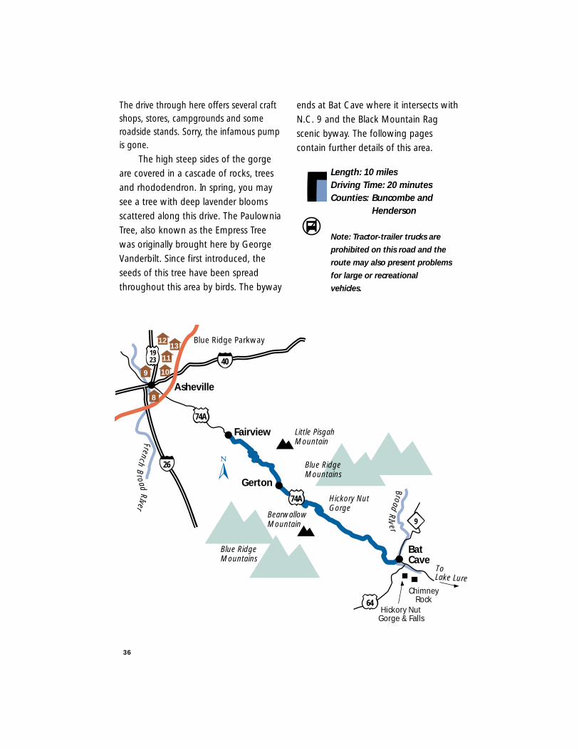
route U.S. 74A works its way down from
Asheville and the Blue Ridge Parkway.
The byway begins just south of the
community of Fairview. As you travel
south/southeast, notice the tall peak to
your left – the Little Pisgah Mountain
(elev. 4,412’) once known to the
Cherokee Indians as Konnatoga.
This forewarns the climb up and
through Hickory Nut Gap. Long ago this
gap was known as Sherrill’s Gap –
named after a historic inn and tavern
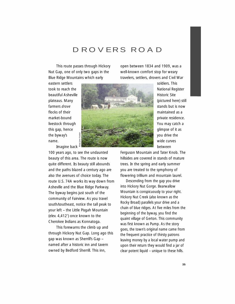
owned by Bedford Sherrill. This inn,
open between 1834 and 1909, was a
well-known comfort stop for weary
travelers, settlers, drovers and Civil War
soldiers. This
National Register
Historic Site
(pictured here) still
stands but is now
maintained as a
private residence.
You may catch a
glimpse of it as
you drive the
wide curves
between
Ferguson Mountain and Tater Knob. The
hillsides are covered in stands of mature
trees. In the spring and early summer
you are treated to the symphony of
flowering trillium and mountain laurel.Descending from the gap you drive
into Hickory Nut Gorge. BearwallowMountain is conspicuously to your right.Hickory Nut Creek (also known as theRocky Broad) parallels your drive and achain of blue ridges. At five miles from thebeginning of the byway, you find thequaint village of Gerton. This communitywas first known as Pump. As the storygoes, the town’s original name came fromthe frequent practice of thirsty patronsleaving money by a local water pump andupon their return they would find a jar ofclear potent liquid – unique to these hills.
35
D R O V E R S R O A D
Mar
y Ja
ne H
unte
r
36
The drive through here offers several craftshops, stores, campgrounds and someroadside stands. Sorry, the infamous pumpis gone.
The high steep sides of the gorge
are covered in a cascade of rocks, trees
and rhododendron. In spring, you may
see a tree with deep lavender blooms
scattered along this drive. The Paulownia
Tree, also known as the Empress Tree
was originally brought here by George
Vanderbilt. Since first introduced, the
seeds of this tree have been spread
throughout this area by birds. The byway
ends at Bat Cave where it intersects with
N.C. 9 and the Black Mountain Rag
scenic byway. The following pages
contain further details of this area.
Length: 10 milesDriving Time: 20 minutesCounties: Buncombe and
Henderson
Note: Tractor-trailer trucks are
prohibited on this road and the
route may also present problems
for large or recreational
vehicles.
BroadRIv er
FrenchB
roadRIver
Little PisgahMountain
Fairview
Asheville
Gerton
BatCave
9
ToLake Lure
64
74A
74A
Blue RidgeMountains
Blue RidgeMountains
Hickory NutGorge
BearwallowMountain
40
26
Hickory NutGorge & Falls
ChimneyRock
1923
Blue Ridge Parkway
8
9 10
1312
11
37
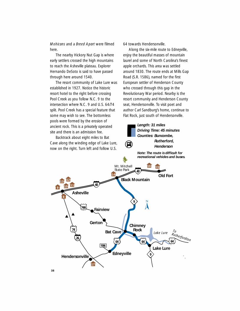
This route earns its name from an oldfiddle tune named for the BlackMountains. A “rag” is a type of musicalscore with multipletwists and curves upand down scales. Theroads along this routealso have multipletwists and turns.
Take Exit 64 on I-40 at Black Mountain,a resort communitynamed for themountain rangebelow which it stands.The Black Mountainswere named becauseof the dark greenfoliage of the LauadaFirs covering themountain sides.Mount Mitchell is the highest mountaineast of the Mississippi River. MountMitchell State Park may be reached fromthe nearby Blue Ridge Parkway.
Follow N.C. 9 to Bat Cave which wasnamed for a nearby cave inhabited by batsand other rare mammals. Although thestretch is only 16 miles, sharp curves mayprovide problems for recreational vehicles.Motorists driving recreational vehicles orbuses may want to consider following U.S. 74 from Asheville or Rutherfordton asalternate routes to the Lake Lure and BatCave area. Venture along the sharp curvesand hairpin turns of N.C. 9 to Bat Cave
while enjoying rural mountain scenery. The river flowing to the right of N.C. 9
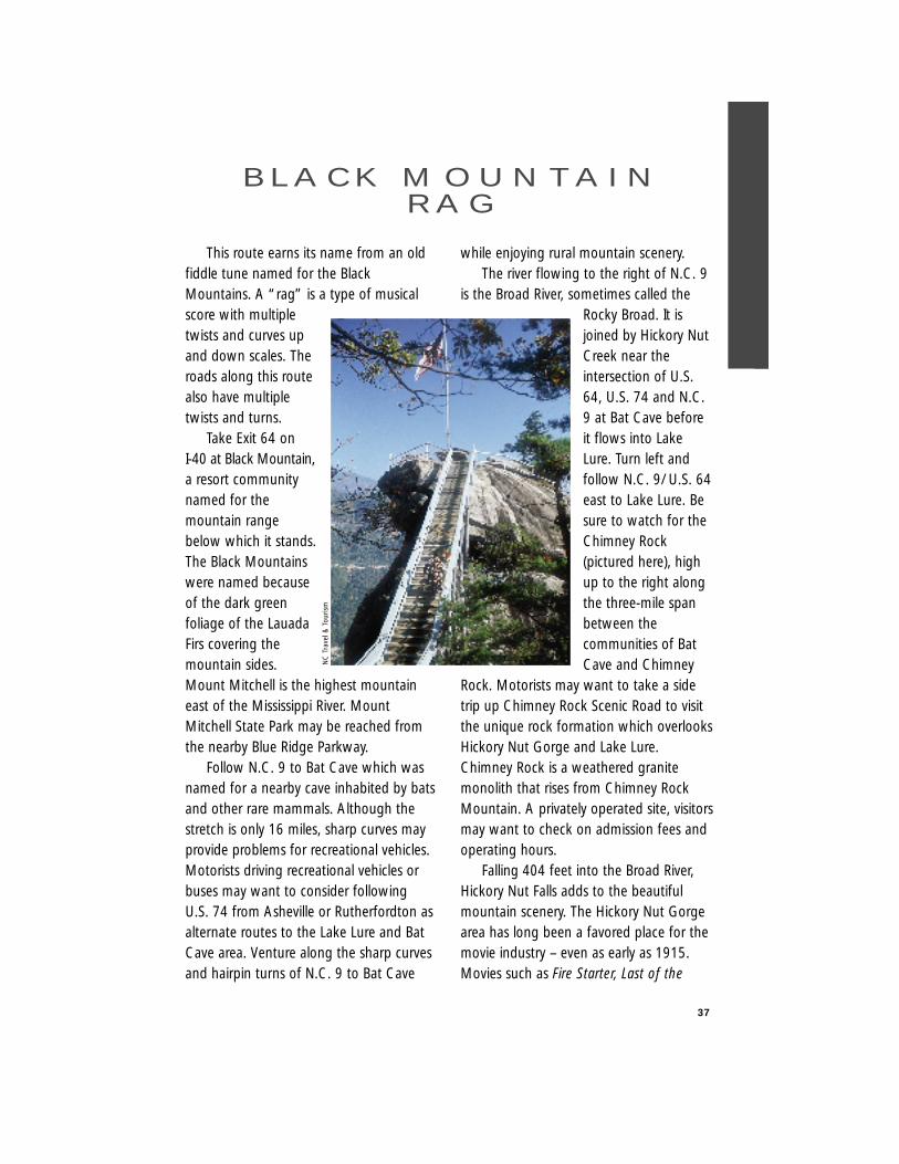
is the Broad River, sometimes called theRocky Broad. It isjoined by Hickory NutCreek near theintersection of U.S.64, U.S. 74 and N.C.9 at Bat Cave beforeit flows into LakeLure. Turn left andfollow N.C. 9/ U.S. 64east to Lake Lure. Besure to watch for theChimney Rock(pictured here), highup to the right alongthe three-mile spanbetween thecommunities of BatCave and Chimney
Rock. Motorists may want to take a sidetrip up Chimney Rock Scenic Road to visitthe unique rock formation which overlooksHickory Nut Gorge and Lake Lure.Chimney Rock is a weathered granitemonolith that rises from Chimney RockMountain. A privately operated site, visitorsmay want to check on admission fees andoperating hours.
Falling 404 feet into the Broad River,Hickory Nut Falls adds to the beautifulmountain scenery. The Hickory Nut Gorgearea has long been a favored place for themovie industry – even as early as 1915.Movies such as Fire Starter, Last of the
B L A C K M O U N TA I NR A G
NC
Tra
vel &
Tou
rism
38
Mohicans and a Breed Apart were filmedhere.
The nearby Hickory Nut Gap is whereearly settlers crossed the high mountainsto reach the Asheville plateau. ExplorerHernando DeSoto is said to have passedthrough here around 1540.
The resort community of Lake Lure wasestablished in 1927. Notice the historicresort hotel to the right before crossingPool Creek as you follow N.C. 9 to theintersection where N.C. 9 and U.S. 64/74split. Pool Creek has a special feature thatsome may wish to see. The bottomlesspools were formed by the erosion ofancient rock. This is a privately operatedsite and there is an admission fee.
Backtrack about eight miles to BatCave along the winding edge of Lake Lure,now on the right. Turn left and follow U.S.
64 towards Hendersonville. Along the six-mile route to Edneyville,
enjoy the beautiful masses of mountainlaurel and some of North Carolina’s finestapple orchards. This area was settledaround 1830. The route ends at Mills GapRoad (S.R. 1586), named for the firstEuropean settler of Henderson Countywho crossed through this gap in theRevolutionary War period. Nearby is theresort community and Henderson Countyseat, Hendersonville. To visit poet andauthor Carl Sandburg’s home, continue toFlat Rock, just south of Hendersonville.
Length: 31 milesDriving Time: 45 minutesCounties: Buncombe,
Rutherford,Henderson
Black Mountain
Bat Cave
Fairview
Gerton
Lake Lure
Lake Lure
ChimneyRock
40
9
40
Asheville
64 64 64
9
Mt. MitchellState Park
Edneyville
26
Hendersonville
1586
ToRutherfordton
74
Old Fort14
1516
74A
17
8
91110
1213
Note: The route is difficult for recreational vehicles and buses.
39
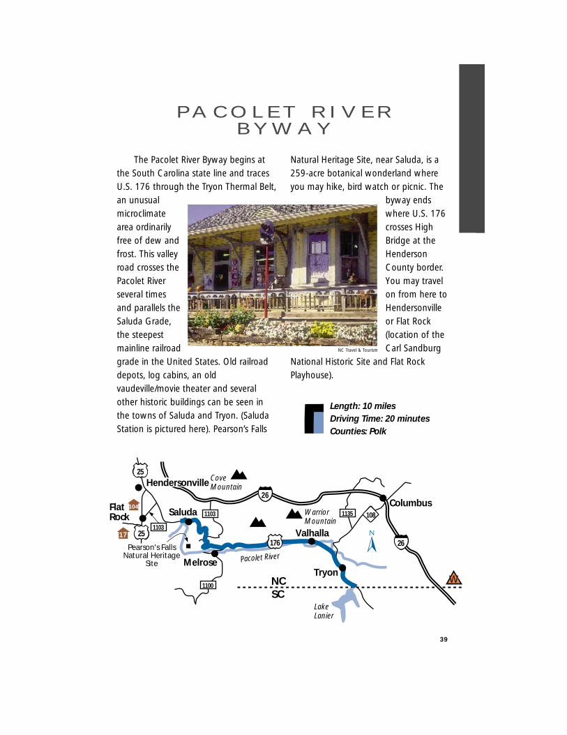
Length: 10 milesDriving Time: 20 minutesCounties: Polk
The Pacolet River Byway begins atthe South Carolina state line and tracesU.S. 176 through the Tryon Thermal Belt,an unusualmicroclimatearea ordinarilyfree of dew andfrost. This valleyroad crosses thePacolet Riverseveral timesand parallels theSaluda Grade,the steepestmainline railroadgrade in the United States. Old railroaddepots, log cabins, an oldvaudeville/movie theater and severalother historic buildings can be seen inthe towns of Saluda and Tryon. (SaludaStation is pictured here). Pearson’s Falls
Natural Heritage Site, near Saluda, is a259-acre botanical wonderland whereyou may hike, bird watch or picnic. The
byway endswhere U.S. 176crosses HighBridge at theHendersonCounty border.You may travelon from here toHendersonvilleor Flat Rock(location of theCarl Sandburg
National Historic Site and Flat RockPlayhouse).
PA C O L E T R I V E RB Y W AY
Columbus
Tryon
Valhalla
Melrose
176
26
26
1100
1103 1135 108SaludaFlat Rock
LakeLanier
WarriorMountain
CoveMountain
NCSC
Pacolet RiverPearson's Falls
Natural HeritageSite
25
25
W
1103
Hendersonville
17
104
NC Travel & Tourism

40
For a transitional drive from the
Piedmont to the mountains, take N.C. 226
from the community of Metcalf (about 3.5
miles northwest of
Shelby) to Marion.
The city of Shelby
was named for
Isaac Shelby, a
Revolutionary War
Commander.
Cleveland County
was formed in
1841 and named
for Benjamin
Cleaveland, a hero
of the Battle at
Kings Mountain.
Around the community of Polkville,
located in the First Broad River valley, look
for glimpses of the South Mountains
ahead to the right. Along the way, enjoy
the upper piedmont farmlands and
spectacular views of the mountains. Corn
and apples are some of the crops that may
be seen from the road. This part of the
route is in Rutherford County. Formed in
1779, the county was named for Griffith
Rutherford, a member of the Provincial
Congress and a Revolutionary War general.
As you pass into Rutherford County,
Cherry Mountain lies to the southwest.
After the Civil War, liquor and ‘cherry
bounce’ (produced from local cherry trees)
were brewed here.
The South Mountains are an isolated
range located in Burke, Rutherford and
Cleveland counties. The Cherokee Indians
called them the
“Oakanoahs.”
South Mountains
State Park and the
South Mountain
Wildlife
Management
Area may provide
an interesting side
trip. The park
(pictured here) is
16 miles south of
Morganton off of
Old N.C. 18 (S.R.
1924). Both are located in Burke County.
Pass through the Dysartsville
community, named for the family who
settled this area.
While driving the last ten miles towards
Marion, you will begin to catch glimpses of
North Carolina’s Appalachian Mountains.
The route ends at the intersection with S.R.
1819, one-tenth mile before I-40 and
south of the city of Marion.
Marion was named for South Carolina’s
Francis Marion - farmer and Revolutionary
War general. McDowell County, formed in
1842, was named for Joseph McDowell
who fought at Kings Mountain and was a
member of Congress.
Another beautiful (and close) scenic
S O U T H M O U N TA I NS C E N E R Y
NCDOT
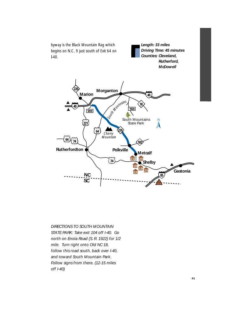
byway is the Black Mountain Rag which
begins on N.C. 9 just south of Exit 64 on
I-40.
DIRECTIONS TO SOUTH MOUNTAINSTATE PARK: Take exit 104 off I-40. Gonorth on Enola Road (S. R. 1922) for 1/2mile. Turn right onto Old NC 18,follow this road south, back over I-40,and toward South Mountain Park.Follow signs from there. (12-15 milesoff I-40)
Length: 33 milesDriving Time: 45 minutesCounties: Cleveland,
Rutherford,McDowell
41
40
74
221
64
64
40
226
Shelby
Metcalf
MarionMorganton
74
NCSC
226
South MountainsState Park
1819
Gastonia
Sout
hM
ou
ntains
182
Polkville
Cherry Mountain
Rutherfordton
181924
85
189
22
21
2319
20
W
42
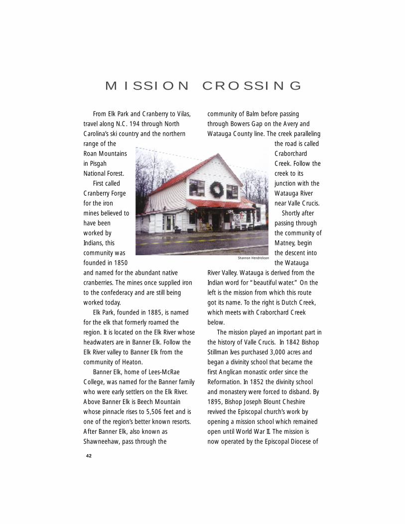
From Elk Park and Cranberry to Vilas,
travel along N.C. 194 through North
Carolina’s ski country and the northern
range of the
Roan Mountains
in Pisgah
National Forest.
First called
Cranberry Forge
for the iron
mines believed to
have been
worked by
Indians, this
community was
founded in 1850
and named for the abundant native
cranberries. The mines once supplied iron
to the confederacy and are still being
worked today.
Elk Park, founded in 1885, is named
for the elk that formerly roamed the
region. It is located on the Elk River whose
headwaters are in Banner Elk. Follow the
Elk River valley to Banner Elk from the
community of Heaton.
Banner Elk, home of Lees-McRae
College, was named for the Banner family
who were early settlers on the Elk River.
Above Banner Elk is Beech Mountain
whose pinnacle rises to 5,506 feet and is
one of the region’s better known resorts.
After Banner Elk, also known as
Shawneehaw, pass through the
community of Balm before passing
through Bowers Gap on the Avery and
Watauga County line. The creek paralleling
the road is called
Craborchard
Creek. Follow the
creek to its
junction with the
Watauga River
near Valle Crucis.
Shortly after
passing through
the community of
Matney, begin
the descent into
the Watauga
River Valley. Watauga is derived from the
Indian word for “beautiful water.” On the
left is the mission from which this route
got its name. To the right is Dutch Creek,
which meets with Craborchard Creek
below.
The mission played an important part in
the history of Valle Crucis. In 1842 Bishop
Stillman Ives purchased 3,000 acres and
began a divinity school that became the
first Anglican monastic order since the
Reformation. In 1852 the divinity school
and monastery were forced to disband. By
1895, Bishop Joseph Blount Cheshire
revived the Episcopal church’s work by
opening a mission school which remained
open until World War II. The mission is
now operated by the Episcopal Diocese of
M I S S I O N C R O S S I N G
Shannon Hendrickson
43
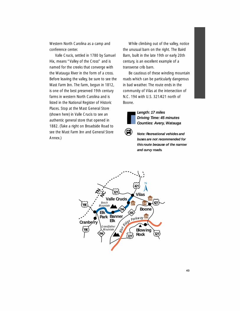
Western North Carolina as a camp and
conference center.
Valle Crucis, settled in 1780 by Samuel
Hix, means “Valley of the Cross” and is
named for the creeks that converge with
the Watauga River in the form of a cross.
Before leaving the valley, be sure to see the
Mast Farm Inn. The farm, begun in 1812,
is one of the best preserved 19th century
farms in western North Carolina and is
listed in the National Register of Historic
Places. Stop at the Mast General Store
(shown here) in Valle Crucis to see an
authentic general store that opened in
1882. (Take a right on Broadside Road to
see the Mast Farm Inn and General Store
Annex.)
While climbing out of the valley, notice
the unusual barn on the right. The Baird
Barn, built in the late 19th or early 20th
century, is an excellent example of a
transverse crib barn.
Be cautious of these winding mountain
roads which can be particularly dangerous
in bad weather. The route ends in the
community of Vilas at the intersection of
N.C. 194 with U.S. 321/421 north of
Boone.
Length: 17 milesDriving Time: 45 minutesCounties: Avery, Watauga
Note: Recreational vehicles and
buses are not recommended for
this route because of the narrow
and curvy roads.
25
27
Banner Elk
Elk Park
Boone
Vilas
Blue
Ridge Parkway
194105
TNN
C
321221
421
421
321
Grandfather Mountain
194
Valle Crucis
Cranberry
Beech Mountain
19E
19E
Blowing Rock
2624
44
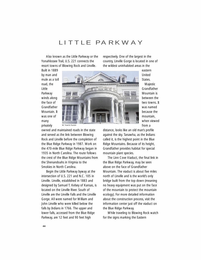
Also known as the Little Parkway or theYonahlossee Trail, U.S. 221 connects theresort towns of Blowing Rock and Linville.Built in 1889by man andmule as a tollroad, theLittleParkwaywinds alongthe face ofGrandfatherMountain. Itwas one ofmanyprivatelyowned and maintained roads in the stateand served as the link between BlowingRock and Linville before the completion ofthe Blue Ridge Parkway in 1987. Work onthe 470-mile Blue Ridge Parkway began in1935 in North Carolina. The route followsthe crest of the Blue Ridge Mountains fromthe Shenandoahs in Virginia to theSmokies in North Carolina.
Begin the Little Parkway byway at theintersection of U.S. 221 and N.C. 105 inLinville. Linville, established in 1883 anddesigned by Samuel T. Kelsey of Kansas, islocated on the Linville River. South ofLinville are the Linville Falls and the LinvilleGorge. All were named for William andJohn Linville who were killed below thefalls by Indians in 1766. The upper andlower falls, accessed from the Blue RidgeParkway, are 12 feet and 90 feet high
respectively. One of the largest in thecountry, Linville Gorge is located in one ofthe wildest uninhabited areas in the
easternUnitedStates.
MajesticGrandfatherMountain isbetween thetwo towns. Itwas namedbecause themountain,when viewedfrom a
distance, looks like an old man’s profileagainst the sky. Tanawha, as the Indianscalled it, is the highest point in the BlueRidge Mountains. Because of its height,Grandfather provides habitat for specialmountain plant species.
The Linn Cove Viaduct, the final link inthe Blue Ridge Parkway, may be seenabove on the face of GrandfatherMountain. The viaduct is about five milesnorth of Linville and is the world’s onlybridge built from the top down (meaningno heavy equipment was put on the faceof the mountain to protect the mountainecology). For more detailed informationabout the construction process, visit theinformation center just off the viaduct onthe Blue Ridge Parkway.
While traveling to Blowing Rock watchfor the signs marking the Eastern
L I T T L E PA R K W AY
NC Travel & Tourism
45
Continental Divide. Also, notice theresidential areas along the edges of thePisgah National Forest through which thisroad passes. On the left near BlowingRock, look for a large colonial revival housewith huge columns on the front.Westglow, as this house is named, wasbuilt by the artist Elliott Daingerfield as hissummer residence. One of North Carolina’smost renowned artists, Daingerfield haswork at the Metropolitan Museum in NewYork and the National Gallery inWashington. But to see one of his bestpieces, continue into Blowing Rock to viewthe “Madonna of the Hills” hanging in St.Mary’s–of–the–Hills Episcopal Church.
One and one half miles farther, look forthe back entrance to the Moses H. ConeMemorial Park. (However, visitors mustenter through the main gate on the BlueRidge Parkway). The 3,516-acre park isnamed for the textile manufacturer whoseestate makes up the park. Flat Top Manor,named for the mountain under which itstands, is now a museum and craft center
(pictured here). Tiffany windows areamong the many unusual aspects of thishouse. Take advantage of the great picnicand hiking areas, as well as breathtakinglybeautiful views of the Blue RidgeMountains.
One-half mile from the rear entrance tothe park is the town of Blowing Rock.Settled in 1870, the town was named forthe nearby cliff rising above the Johns RiverValley from which air currents rise to allowlight objects to be blown back to thesender. This resort community, the onlyincorporated town on the Blue RidgeParkway, has seasonal festivals in the park.The byway ends at the stoplight at U.S.321 Business.
Length: 18 milesDriving Time: 45 minutesCounties: Avery, Caldwell,
Watauga
Note: The route is difficult for recreational vehicles and buses.
24
Blue
Ridge ParkwayGrandfatherMountain
BlowingRock
194
321
181
321
Linville
221
221
Boone
181
221321
VilasValle Crucis
421221
421
194
194
105
26
25
27
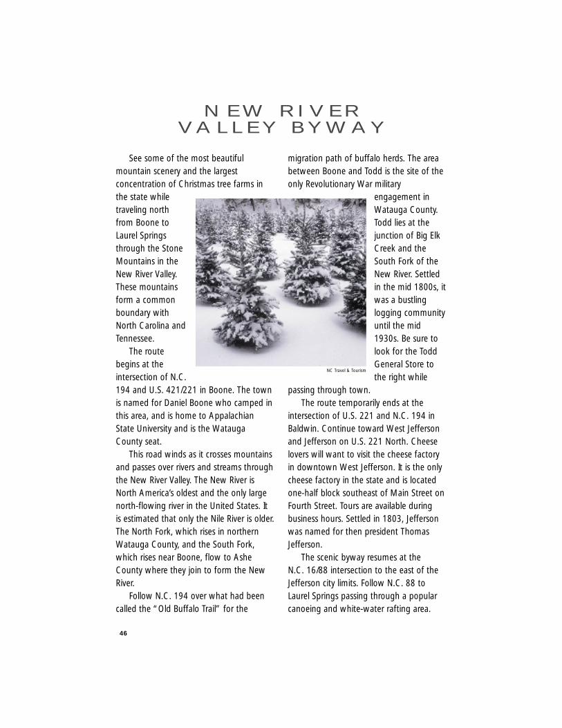
46
See some of the most beautifulmountain scenery and the largestconcentration of Christmas tree farms inthe state whiletraveling northfrom Boone toLaurel Springsthrough the StoneMountains in theNew River Valley.These mountainsform a commonboundary withNorth Carolina andTennessee.
The routebegins at theintersection of N.C.194 and U.S. 421/221 in Boone. The townis named for Daniel Boone who camped inthis area, and is home to AppalachianState University and is the WataugaCounty seat.
This road winds as it crosses mountainsand passes over rivers and streams throughthe New River Valley. The New River isNorth America’s oldest and the only largenorth-flowing river in the United States. Itis estimated that only the Nile River is older.The North Fork, which rises in northernWatauga County, and the South Fork,which rises near Boone, flow to AsheCounty where they join to form the NewRiver.
Follow N.C. 194 over what had beencalled the “Old Buffalo Trail” for the
migration path of buffalo herds. The areabetween Boone and Todd is the site of theonly Revolutionary War military
engagement inWatauga County.Todd lies at thejunction of Big ElkCreek and theSouth Fork of theNew River. Settledin the mid 1800s, itwas a bustlinglogging communityuntil the mid1930s. Be sure tolook for the ToddGeneral Store tothe right while
passing through town.The route temporarily ends at the
intersection of U.S. 221 and N.C. 194 inBaldwin. Continue toward West Jeffersonand Jefferson on U.S. 221 North. Cheeselovers will want to visit the cheese factoryin downtown West Jefferson. It is the onlycheese factory in the state and is locatedone-half block southeast of Main Street onFourth Street. Tours are available duringbusiness hours. Settled in 1803, Jeffersonwas named for then president ThomasJefferson.
The scenic byway resumes at the N.C. 16/88 intersection to the east of theJefferson city limits. Follow N.C. 88 toLaurel Springs passing through a popularcanoeing and white-water rafting area.
N E W R I V E RVA L L E Y B Y W AY
NC Travel & Tourism
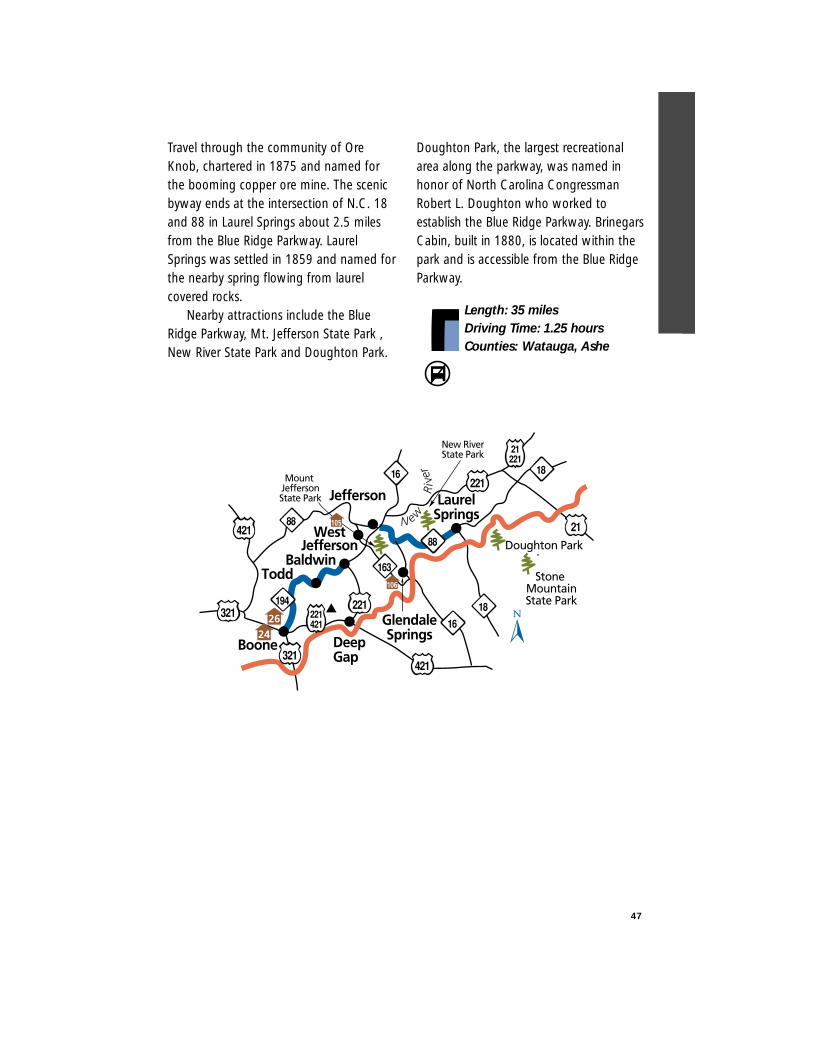
47
Travel through the community of OreKnob, chartered in 1875 and named forthe booming copper ore mine. The scenicbyway ends at the intersection of N.C. 18and 88 in Laurel Springs about 2.5 milesfrom the Blue Ridge Parkway. LaurelSprings was settled in 1859 and named forthe nearby spring flowing from laurelcovered rocks.
Nearby attractions include the BlueRidge Parkway, Mt. Jefferson State Park ,New River State Park and Doughton Park.
Doughton Park, the largest recreationalarea along the parkway, was named inhonor of North Carolina CongressmanRobert L. Doughton who worked toestablish the Blue Ridge Parkway. BrinegarsCabin, built in 1880, is located within thepark and is accessible from the Blue RidgeParkway.
Length: 35 milesDriving Time: 1.25 hoursCounties: Watauga, Ashe
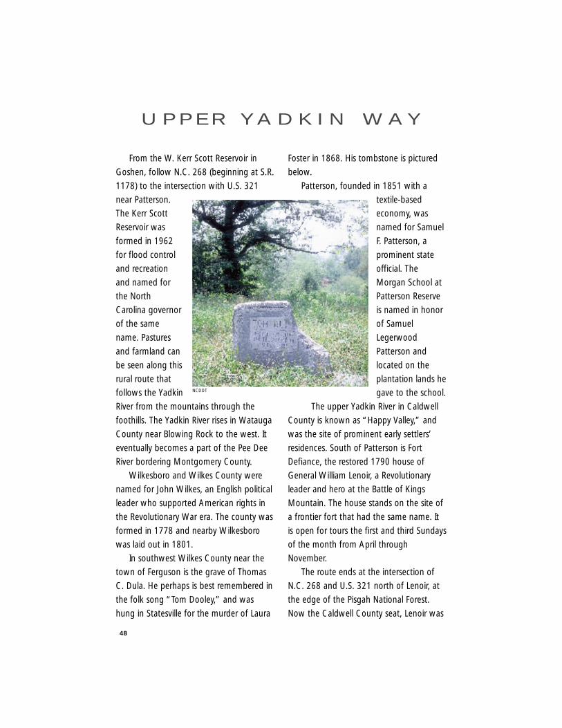
48
From the W. Kerr Scott Reservoir in
Goshen, follow N.C. 268 (beginning at S.R.
1178) to the intersection with U.S. 321
near Patterson.
The Kerr Scott
Reservoir was
formed in 1962
for flood control
and recreation
and named for
the North
Carolina governor
of the same
name. Pastures
and farmland can
be seen along this
rural route that
follows the Yadkin
River from the mountains through the
foothills. The Yadkin River rises in Watauga
County near Blowing Rock to the west. It
eventually becomes a part of the Pee Dee
River bordering Montgomery County.
Wilkesboro and Wilkes County were
named for John Wilkes, an English political
leader who supported American rights in
the Revolutionary War era. The county was
formed in 1778 and nearby Wilkesboro
was laid out in 1801.
In southwest Wilkes County near the
town of Ferguson is the grave of Thomas
C. Dula. He perhaps is best remembered in
the folk song “Tom Dooley,” and was
hung in Statesville for the murder of Laura
Foster in 1868. His tombstone is pictured
below.
Patterson, founded in 1851 with a
textile-based
economy, was
named for Samuel
F. Patterson, a
prominent state
official. The
Morgan School at
Patterson Reserve
is named in honor
of Samuel
Legerwood
Patterson and
located on the
plantation lands he
gave to the school.
The upper Yadkin River in Caldwell
County is known as “Happy Valley,” and
was the site of prominent early settlers’
residences. South of Patterson is Fort
Defiance, the restored 1790 house of
General William Lenoir, a Revolutionary
leader and hero at the Battle of Kings
Mountain. The house stands on the site of
a frontier fort that had the same name. It
is open for tours the first and third Sundays
of the month from April through
November.
The route ends at the intersection of
N.C. 268 and U.S. 321 north of Lenoir, at
the edge of the Pisgah National Forest.
Now the Caldwell County seat, Lenoir was
U P P E R YA D K I N W AY
NCDOT
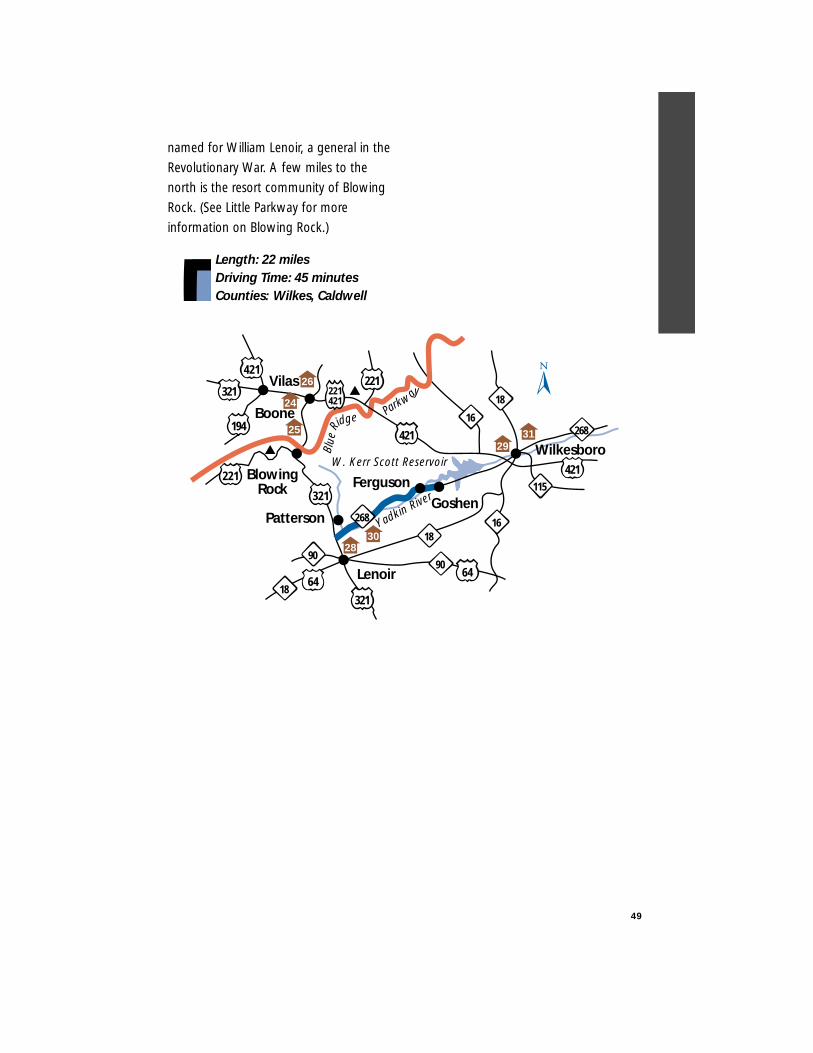
49
named for William Lenoir, a general in the
Revolutionary War. A few miles to the
north is the resort community of Blowing
Rock. (See Little Parkway for more
information on Blowing Rock.)
Length: 22 milesDriving Time: 45 minutesCounties: Wilkes, Caldwell
Lenoir
W. Kerr Scott Reservoir
16
18
16
GoshenYadkin River
115Blowing
Rock
Boone
221
90
268
18
90
Blue
Ridge Par
kwayVilas
194
421
18
221
6464
268
Ferguson
Wilkesboro
Patterson
421
421
221421
321
321
321
24
26
2830
293125

Hanging Rock Scenic Byway
Colonial Heritage Byway
Football Road
Crowders Mountain Drive
Millbridge Scenic Byway
Uwharrie Scenic Road
Rolling Kansas Byway
Pee Dee Valley Drive
Grassy Island Crossing
Sandhills Scenic Drive
Birkhead Wilderness Route
Flint Hill Ramble
Indian Heritage Trail
Pottery Road
Devil’s Stompin’ Ground Road
North Durham County Byway
ROUTES
52
54
56
58
60
62
64
66
68
70
72
74
76
78
80
82
P I E D M O N T R E G I O N
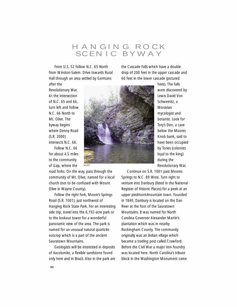
52
From U.S. 52 follow N.C. 65 North
from Winston-Salem. Drive towards Rural
Hall through an area settled by Germans
after the
Revolutionary War.
At the intersection
of N.C. 65 and 66,
turn left and follow
N.C. 66 North to
Mt. Olive. The
byway begins
where Denny Road
(S.R. 2000)
intersects N.C. 66.
Follow N.C. 66
for about 4.5 miles
to the community
of Gap, where the
road forks. On the way, pass through the
community of Mt. Olive, named for a local
church (not to be confused with Mount
Olive in Wayne County).
Follow the right fork, Moore’s Springs
Road (S.R. 1001), just northwest of
Hanging Rock State Park. For an interesting
side trip, travel into the 6,192-acre park or
to the lookout tower for a wonderful
panoramic view of the area. The park is
named for an unusual natural quartzite
outcrop which is a part of the ancient
Sauratown Mountains.
Geologists will be interested in deposits
of itacolumite, a flexible sandstone found
only here and in Brazil. Also in the park are
the Cascade Falls which have a double
drop of 200 feet in the upper cascade and
60 feet in the lower cascade (pictured
here). The falls
were discovered by
Lewis David Von
Schweinitz, a
Moravian
mycologist and
botanist. Look for
Tory’s Den, a cave
below the Moores
Knob bank, said to
have been occupied
by Tories (colonists
loyal to the king)
during the
Revolutionary War.
Continue on S.R. 1001 past Moores
Springs to N.C. 89 West. Turn right to
venture into Danbury (listed in the National
Register of Historic Places) for a peek at an
upper piedmont/mountain town. Founded
in 1849, Danbury is located on the Dan
River at the foot of the Sauratown
Mountains. It was named for North
Carolina Governor Alexander Martin’s
plantation which was in nearby
Rockingham County. The community
originally was an Indian village which
became a trading post called Crawford.
Before the Civil War a major iron foundry
was located here. North Carolina’s tribute
block in the Washington Monument came
H A N G I N G R O C KS C E N I C B Y W AY
NCDOT
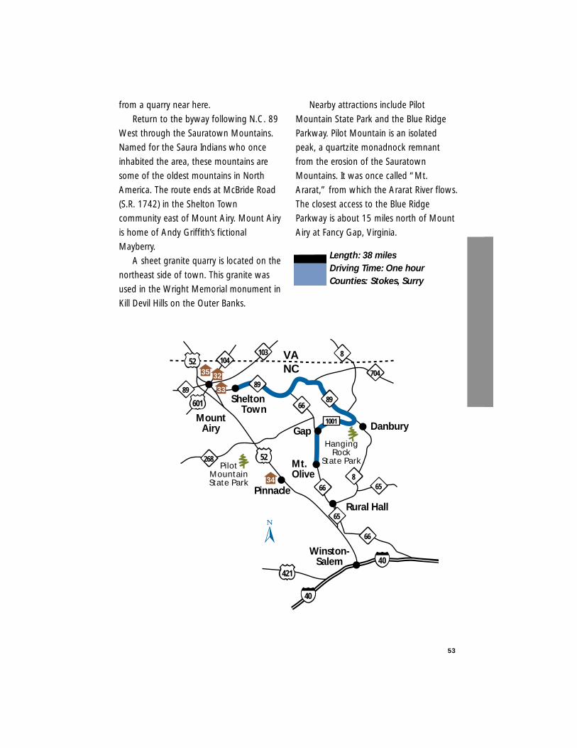
53
from a quarry near here.
Return to the byway following N.C. 89
West through the Sauratown Mountains.
Named for the Saura Indians who once
inhabited the area, these mountains are
some of the oldest mountains in North
America. The route ends at McBride Road
(S.R. 1742) in the Shelton Town
community east of Mount Airy. Mount Airy
is home of Andy Griffith’s fictional
Mayberry.
A sheet granite quarry is located on the
northeast side of town. This granite was
used in the Wright Memorial monument in
Kill Devil Hills on the Outer Banks.
Nearby attractions include Pilot
Mountain State Park and the Blue Ridge
Parkway. Pilot Mountain is an isolated
peak, a quartzite monadnock remnant
from the erosion of the Sauratown
Mountains. It was once called “Mt.
Ararat,” from which the Ararat River flows.
The closest access to the Blue Ridge
Parkway is about 15 miles north of Mount
Airy at Fancy Gap, Virginia.
Length: 38 milesDriving Time: One hourCounties: Stokes, Surry
MountAiry
268
89
Rural Hall
Gap
658
89
8
Shelton Town
89
103104
704
66
66
Mt.Olive
Danbury1001
VANC
Winston-Salem
HangingRock
State Park
52
52
601
421
32
33
34
Pinnacle
PilotMountainState Park
40
40
65
66
35
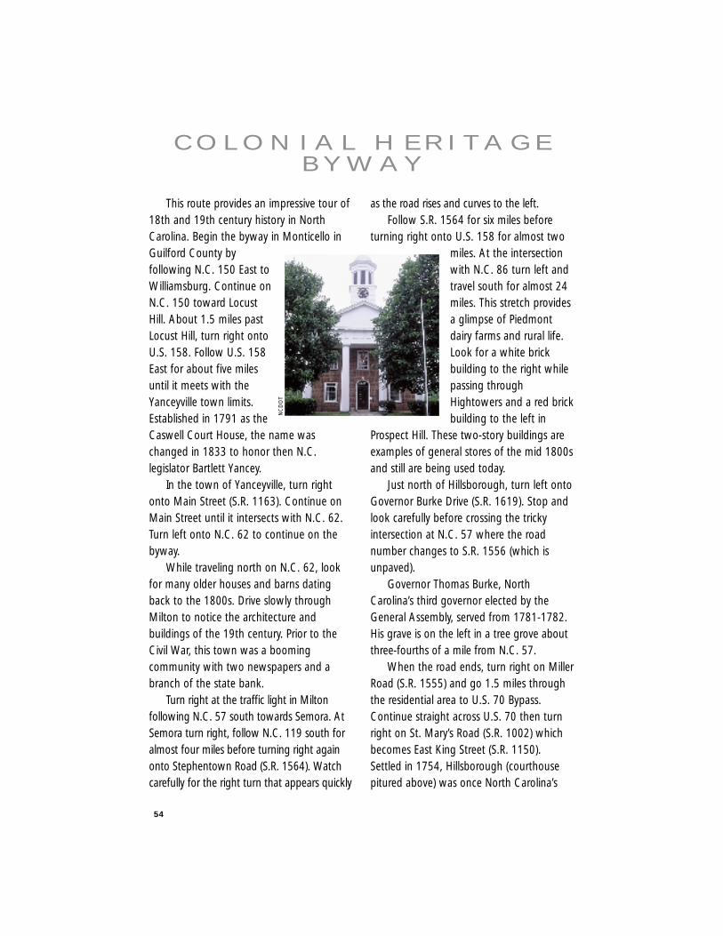
54
This route provides an impressive tour of18th and 19th century history in NorthCarolina. Begin the byway in Monticello inGuilford County byfollowing N.C. 150 East toWilliamsburg. Continue onN.C. 150 toward LocustHill. About 1.5 miles pastLocust Hill, turn right ontoU.S. 158. Follow U.S. 158East for about five milesuntil it meets with theYanceyville town limits.Established in 1791 as theCaswell Court House, the name waschanged in 1833 to honor then N.C.legislator Bartlett Yancey.
In the town of Yanceyville, turn rightonto Main Street (S.R. 1163). Continue onMain Street until it intersects with N.C. 62.Turn left onto N.C. 62 to continue on thebyway.
While traveling north on N.C. 62, lookfor many older houses and barns datingback to the 1800s. Drive slowly throughMilton to notice the architecture andbuildings of the 19th century. Prior to theCivil War, this town was a boomingcommunity with two newspapers and abranch of the state bank.
Turn right at the traffic light in Miltonfollowing N.C. 57 south towards Semora. AtSemora turn right, follow N.C. 119 south foralmost four miles before turning right againonto Stephentown Road (S.R. 1564). Watchcarefully for the right turn that appears quickly
as the road rises and curves to the left.Follow S.R. 1564 for six miles before
turning right onto U.S. 158 for almost twomiles. At the intersectionwith N.C. 86 turn left andtravel south for almost 24miles. This stretch providesa glimpse of Piedmontdairy farms and rural life.Look for a white brickbuilding to the right whilepassing throughHightowers and a red brickbuilding to the left in
Prospect Hill. These two-story buildings areexamples of general stores of the mid 1800sand still are being used today.
Just north of Hillsborough, turn left ontoGovernor Burke Drive (S.R. 1619). Stop andlook carefully before crossing the trickyintersection at N.C. 57 where the roadnumber changes to S.R. 1556 (which isunpaved).
Governor Thomas Burke, NorthCarolina’s third governor elected by theGeneral Assembly, served from 1781-1782.His grave is on the left in a tree grove aboutthree-fourths of a mile from N.C. 57.
When the road ends, turn right on MillerRoad (S.R. 1555) and go 1.5 miles throughthe residential area to U.S. 70 Bypass.Continue straight across U.S. 70 then turnright on St. Mary’s Road (S.R. 1002) whichbecomes East King Street (S.R. 1150).Settled in 1754, Hillsborough (courthousepitured above) was once North Carolina’s
C O L O N I A L H E R I TA G EB Y W AY
NC
DO
T
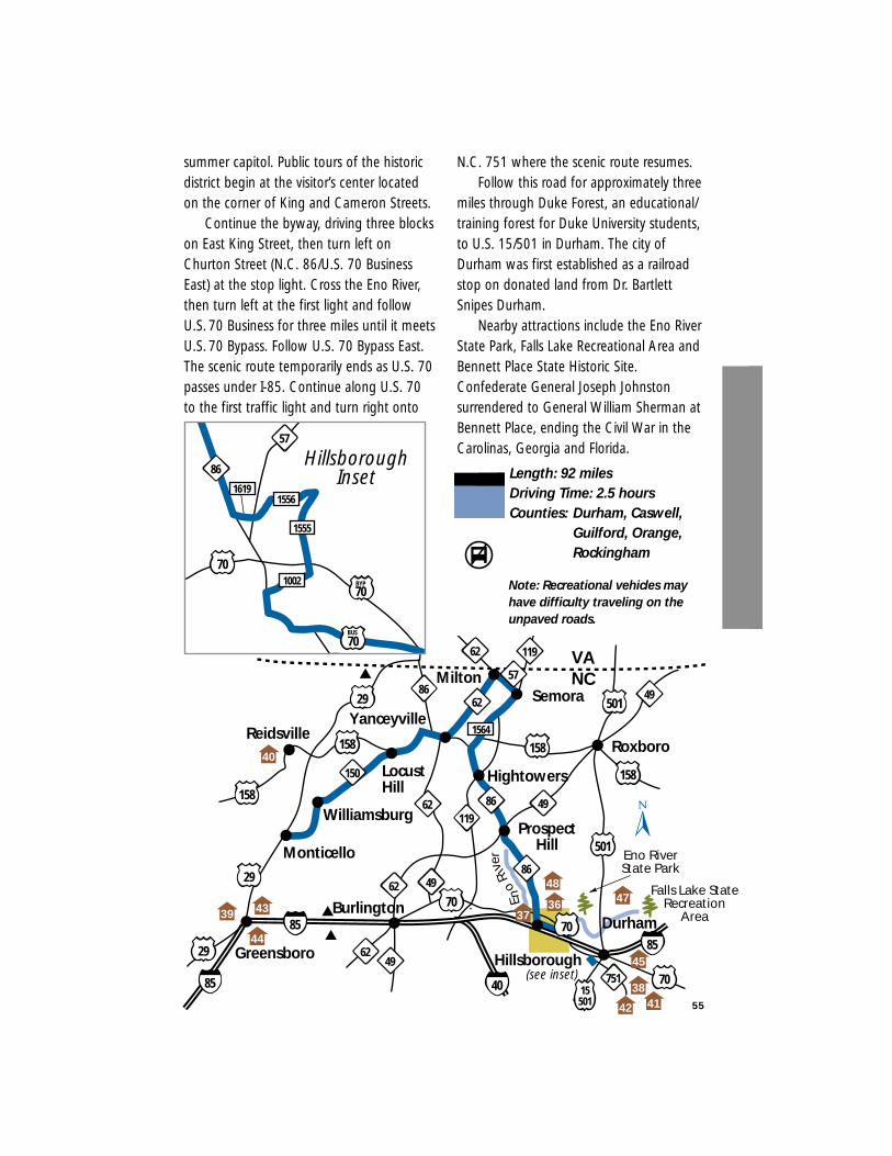
55
summer capitol. Public tours of the historicdistrict begin at the visitor’s center locatedon the corner of King and Cameron Streets.
Continue the byway, driving three blockson East King Street, then turn left onChurton Street (N.C. 86/U.S. 70 BusinessEast) at the stop light. Cross the Eno River,then turn left at the first light and followU.S. 70 Business for three miles until it meetsU.S. 70 Bypass. Follow U.S. 70 Bypass East.The scenic route temporarily ends as U.S. 70passes under I-85. Continue along U.S. 70to the first traffic light and turn right onto
N.C. 751 where the scenic route resumes.Follow this road for approximately three
miles through Duke Forest, an educational/training forest for Duke University students,to U.S. 15/501 in Durham. The city ofDurham was first established as a railroadstop on donated land from Dr. BartlettSnipes Durham.
Nearby attractions include the Eno RiverState Park, Falls Lake Recreational Area andBennett Place State Historic Site.Confederate General Joseph Johnstonsurrendered to General William Sherman atBennett Place, ending the Civil War in theCarolinas, Georgia and Florida.
Length: 92 milesDriving Time: 2.5 hoursCounties: Durham, Caswell,
Guilford, Orange,Rockingham
Reidsville
Williamsburg
Yanceyville
Hillsborough
Roxboro
Semora
85
LocustHill
VANC
Burlington
Monticello
Greensboro
Durham
15501
158
49
62
704962
29
158
158
501
501
119
86
62
29
85
29
6249
158
1564
751
86
86
62
57
119
70
150
Milton
Hightowers
ProspectHill
49
(see inset) 70
85
40
39 43
40
3736
44
Eno RiverState Park
Falls Lake StateRecreation
Area
Eno
R
iver
48
42 4138
45
47
1556
70
57
1555
1002
1619
70BUS
86Hillsborough
Inset
70BYP Note: Recreational vehicles may
have difficulty traveling on theunpaved roads.
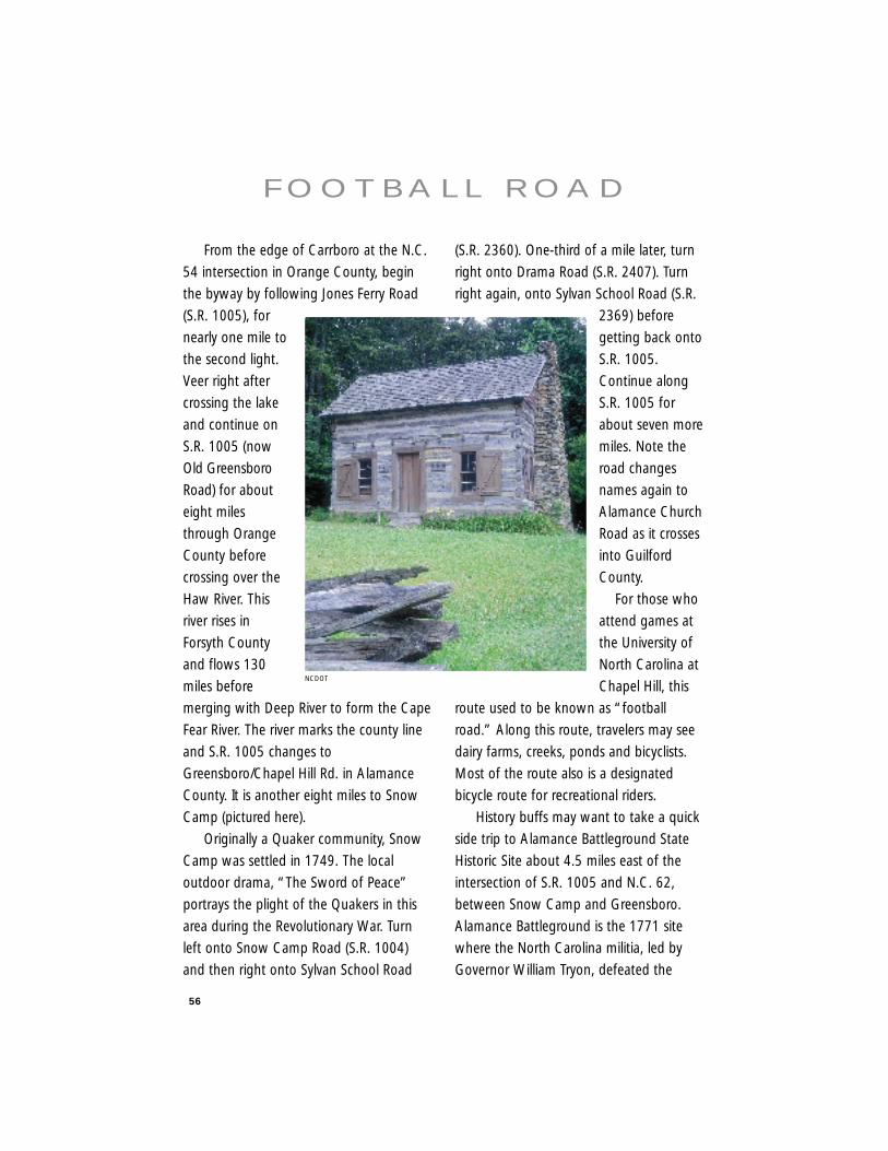
56
From the edge of Carrboro at the N.C.
54 intersection in Orange County, begin
the byway by following Jones Ferry Road
(S.R. 1005), for
nearly one mile to
the second light.
Veer right after
crossing the lake
and continue on
S.R. 1005 (now
Old Greensboro
Road) for about
eight miles
through Orange
County before
crossing over the
Haw River. This
river rises in
Forsyth County
and flows 130
miles before
merging with Deep River to form the Cape
Fear River. The river marks the county line
and S.R. 1005 changes to
Greensboro/Chapel Hill Rd. in Alamance
County. It is another eight miles to Snow
Camp (pictured here).
Originally a Quaker community, Snow
Camp was settled in 1749. The local
outdoor drama, “The Sword of Peace”
portrays the plight of the Quakers in this
area during the Revolutionary War. Turn
left onto Snow Camp Road (S.R. 1004)
and then right onto Sylvan School Road
(S.R. 2360). One-third of a mile later, turn
right onto Drama Road (S.R. 2407). Turn
right again, onto Sylvan School Road (S.R.
2369) before
getting back onto
S.R. 1005.
Continue along
S.R. 1005 for
about seven more
miles. Note the
road changes
names again to
Alamance Church
Road as it crosses
into Guilford
County.
For those who
attend games at
the University of
North Carolina at
Chapel Hill, this
route used to be known as “football
road.” Along this route, travelers may see
dairy farms, creeks, ponds and bicyclists.
Most of the route also is a designated
bicycle route for recreational riders.
History buffs may want to take a quick
side trip to Alamance Battleground State
Historic Site about 4.5 miles east of the
intersection of S.R. 1005 and N.C. 62,
between Snow Camp and Greensboro.
Alamance Battleground is the 1771 site
where the North Carolina militia, led by
Governor William Tryon, defeated the
F O O T B A L L R O A D
NCDOT
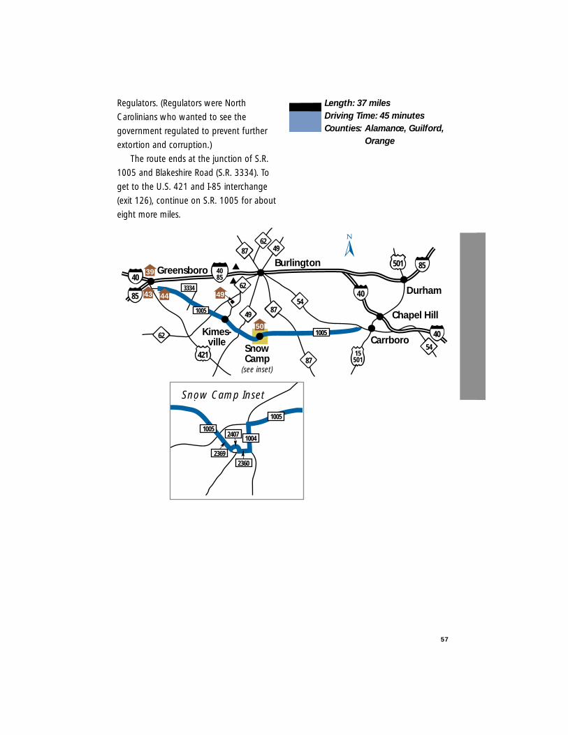
Regulators. (Regulators were North
Carolinians who wanted to see the
government regulated to prevent further
extortion and corruption.)
The route ends at the junction of S.R.
1005 and Blakeshire Road (S.R. 3334). To
get to the U.S. 421 and I-85 interchange
(exit 126), continue on S.R. 1005 for about
eight more miles.
Length: 37 milesDriving Time: 45 minutesCounties: Alamance, Guilford,
Orange
57
Greensboro
421
Kimes-ville Carrboro
SnowCamp
(see inset)
54
62
Burlington
4085
87
87
Durham
Chapel Hill
15501
49
6287 49
501
54
40
3334
8540
62
1005
1005
39
43 44
50
4085
49
1005
10041005
2369
2407
2360
Snow Camp Inset
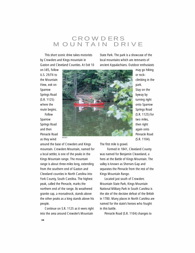
58
This short scenic drive takes motorists
by Crowders and Kings mountain in
Gaston and Cleveland Counties. At Exit 10
on I-85, follow
U.S. 29/74 to
the Mountain
View, exit on
Sparrow
Springs Road
(S.R. 1125)
where the
route begins.
Follow
Sparrow
Springs Road
and then
Pinnacle Road
as they wind
around the base of Crowders and Kings
mountain. Crowders Mountain, named for
a local settler, is one of the peaks in the
Kings Mountain range. The mountain
range is about three-miles long, extending
from the southern end of Gaston and
Cleveland counties in North Carolina into
York County, South Carolina. The highest
peak, called the Pinnacle, marks the
northern end of the range. Its weathered
granite cap, a monadnock, stands above
the other peaks as a king stands above his
people.
Continue on S.R. 1125 as it veers right
into the area around Crowder’s Mountain
State Park. The park is a showcase of the
local mountains which are remnants of
ancient Appalachians. Outdoor enthusiasts
may go hiking
or rock-
climbing in the
park.
Stay on the
byway by
turning right
onto Sparrow
Springs Road
(S.R. 1125) for
two miles,
then right
again onto
Pinnacle Road
(S.R. 1104).
The first mile is gravel.
Formed in 1841, Cleveland County
was named for Benjamin Cleaveland, a
hero at the Battle of Kings Mountain. The
valley is known as Sherrars Gap and
separates the Pinnacle from the rest of the
Kings Mountain Range.
Located just south of Crowders
Mountain State Park, Kings Mountain
National Military Park in South Carolina is
the site of the decisive defeat of the British
in 1780. Many places in North Carolina are
named for the state’s heroes who fought
in this battle.
Pinnacle Road (S.R. 1104) changes to
C R O W D E R S M O U N TA I N D R I V E
NCDOT
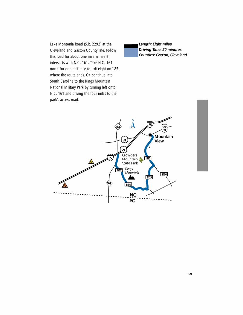
Lake Montonia Road (S.R. 2292) at the
Cleveland and Gaston County line. Follow
this road for about one mile where it
intersects with N.C. 161. Take N.C. 161
north for one-half mile to exit eight on I-85
where the route ends. Or, continue into
South Carolina to the Kings Mountain
National Military Park by turning left onto
N.C. 161 and driving the four miles to the
park’s access road.
Length: Eight milesDriving Time: 20 minutesCounties: Gaston, Cleveland
59
MountainView
CrowdersMountainState Park
KingsMountain
74
1125
1125
2292
85
29
85
NCSC
2974
1104
1106
161
161
V
W
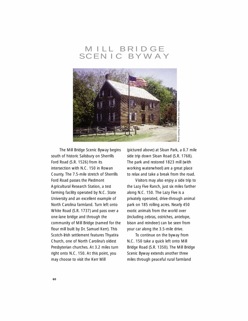
60
The Mill Bridge Scenic Byway begins
south of historic Salisbury on Sherrills
Ford Road (S.R. 1526) from its
intersection with N.C. 150 in Rowan
County. The 7.5-mile stretch of Sherrills
Ford Road passes the Piedmont
Agricultural Research Station, a test
farming facility operated by N.C. State
University and an excellent example of
North Carolina farmland. Turn left onto
White Road (S.R. 1737) and pass over a
one-lane bridge and through the
community of Mill Bridge (named for the
flour mill built by Dr. Samuel Kerr). This
Scotch-Irish settlement features Thyatira
Church, one of North Carolina’s oldest
Presbyterian churches. At 3.2 miles turn
right onto N.C. 150. At this point, you
may choose to visit the Kerr Mill
(pictured above) at Sloan Park, a 0.7 mile
side trip down Sloan Road (S.R. 1768).
The park and restored 1823 mill (with
working waterwheel) are a great place
to relax and take a break from the road.
Visitors may also enjoy a side trip to
the Lazy Five Ranch, just six miles farther
along N.C. 150. The Lazy Five is a
privately operated, drive-through animal
park on 185 rolling acres. Nearly 450
exotic animals from the world over
(including zebras, ostriches, antelope,
bison and reindeer) can be seen from
your car along the 3.5-mile drive.
To continue on the byway from
N.C. 150 take a quick left onto Mill
Bridge Road (S.R. 1350). The Mill Bridge
Scenic Byway extends another three
miles through peaceful rural farmland
M I L L B R I D G ES C E N I C B Y W AY
Phot
o co
urte
sy o
f Ya
dkin
/Pee
Dee
Lak
es P
roje
ct
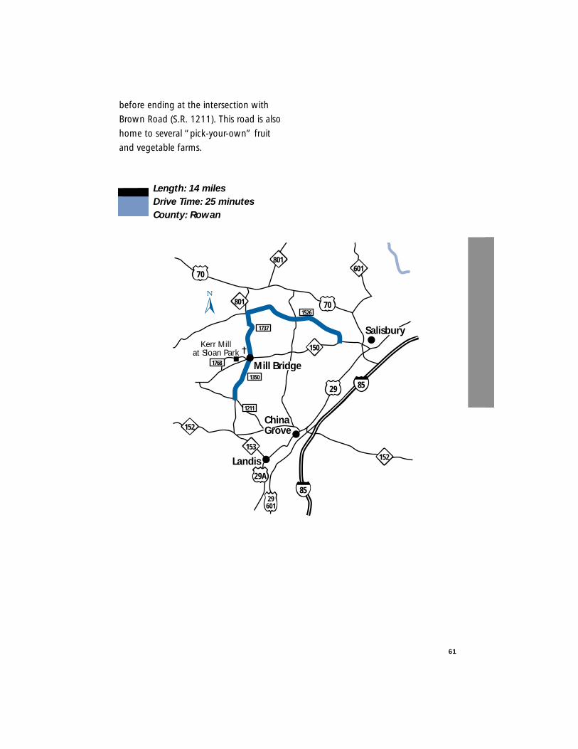
before ending at the intersection with
Brown Road (S.R. 1211). This road is also
home to several “pick-your-own” fruit
and vegetable farms.
Length: 14 milesDrive Time: 25 minutesCounty: Rowan
61
Kerr Millat Sloan Park
29601
85
85
1350
1211
1737
1526
801601
801 70
70
150
153
152
Salisbury
29
152
29A
ChinaGrove
Landis
1768 Mill Bridge
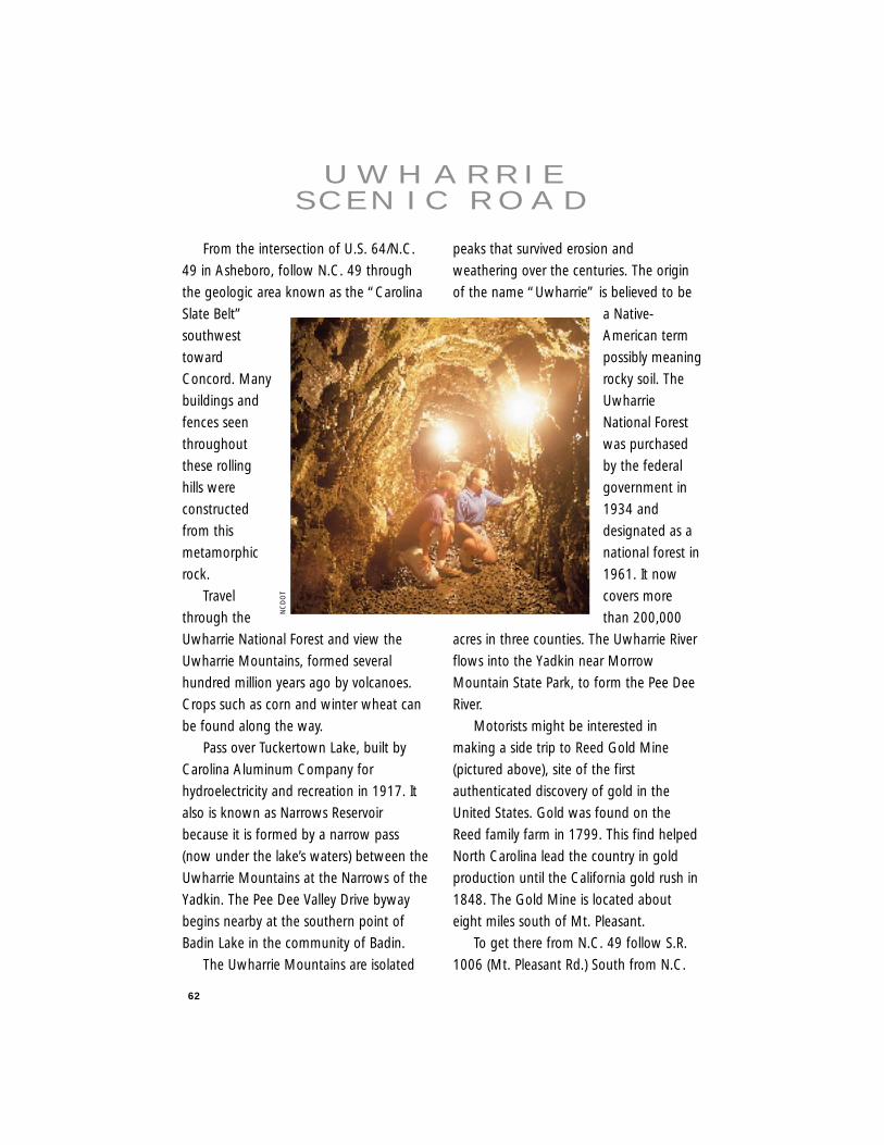
62
From the intersection of U.S. 64/N.C.
49 in Asheboro, follow N.C. 49 through
the geologic area known as the “Carolina
Slate Belt”
southwest
toward
Concord. Many
buildings and
fences seen
throughout
these rolling
hills were
constructed
from this
metamorphic
rock.
Travel
through the
Uwharrie National Forest and view the
Uwharrie Mountains, formed several
hundred million years ago by volcanoes.
Crops such as corn and winter wheat can
be found along the way.
Pass over Tuckertown Lake, built by
Carolina Aluminum Company for
hydroelectricity and recreation in 1917. It
also is known as Narrows Reservoir
because it is formed by a narrow pass
(now under the lake’s waters) between the
Uwharrie Mountains at the Narrows of the
Yadkin. The Pee Dee Valley Drive byway
begins nearby at the southern point of
Badin Lake in the community of Badin.
The Uwharrie Mountains are isolated
peaks that survived erosion and
weathering over the centuries. The origin
of the name “Uwharrie” is believed to be
a Native-
American term
possibly meaning
rocky soil. The
Uwharrie
National Forest
was purchased
by the federal
government in
1934 and
designated as a
national forest in
1961. It now
covers more
than 200,000
acres in three counties. The Uwharrie River
flows into the Yadkin near Morrow
Mountain State Park, to form the Pee Dee
River.
Motorists might be interested in
making a side trip to Reed Gold Mine
(pictured above), site of the first
authenticated discovery of gold in the
United States. Gold was found on the
Reed family farm in 1799. This find helped
North Carolina lead the country in gold
production until the California gold rush in
1848. The Gold Mine is located about
eight miles south of Mt. Pleasant.
To get there from N.C. 49 follow S.R.
1006 (Mt. Pleasant Rd.) South from N.C.
U W H A R R I ES C E N I C R O A D
NC
DO
T
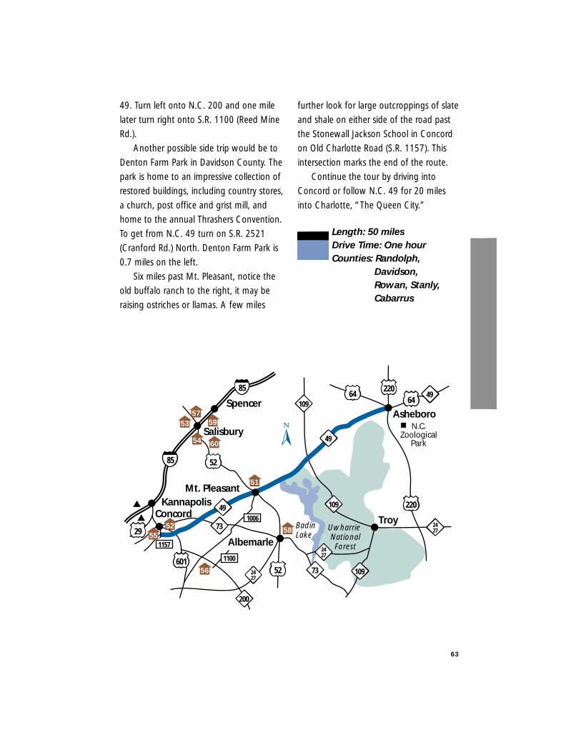
63
49. Turn left onto N.C. 200 and one mile
later turn right onto S.R. 1100 (Reed Mine
Rd.).
Another possible side trip would be to
Denton Farm Park in Davidson County. The
park is home to an impressive collection of
restored buildings, including country stores,
a church, post office and grist mill, and
home to the annual Thrashers Convention.
To get from N.C. 49 turn on S.R. 2521
(Cranford Rd.) North. Denton Farm Park is
0.7 miles on the left.
Six miles past Mt. Pleasant, notice the
old buffalo ranch to the right, it may be
raising ostriches or llamas. A few miles
further look for large outcroppings of slate
and shale on either side of the road past
the Stonewall Jackson School in Concord
on Old Charlotte Road (S.R. 1157). This
intersection marks the end of the route.
Continue the tour by driving into
Concord or follow N.C. 49 for 20 miles
into Charlotte, “The Queen City.”
Length: 50 milesDrive Time: One hourCounties: Randolph,
Davidson,Rowan, Stanly,Cabarrus
Asheboro
Badin Lake
Uwharrie NationalForest
109
109
220
Albemarle
Troy
601
220
Mt. Pleasant
49
200
73
52
Concord
85
1157
64
49
2427
Kannapolis
Salisbury
6449
52
1100
2427
85
1006
29
Spencer
56
51
5255
54
5357
59
58
109
2427
73
N.C.Zoological
Park60
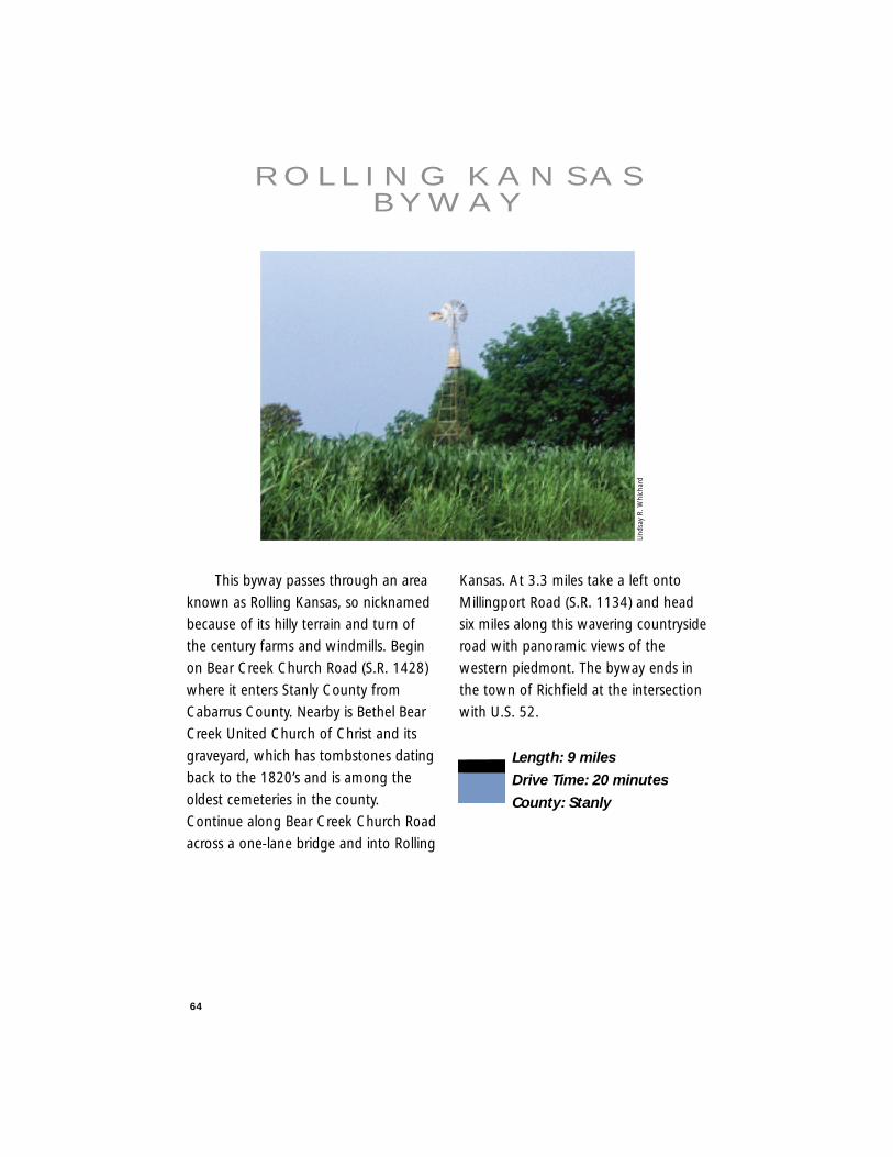
64
This byway passes through an area
known as Rolling Kansas, so nicknamed
because of its hilly terrain and turn of
the century farms and windmills. Begin
on Bear Creek Church Road (S.R. 1428)
where it enters Stanly County from
Cabarrus County. Nearby is Bethel Bear
Creek United Church of Christ and its
graveyard, which has tombstones dating
back to the 1820’s and is among the
oldest cemeteries in the county.
Continue along Bear Creek Church Road
across a one-lane bridge and into Rolling
Kansas. At 3.3 miles take a left onto
Millingport Road (S.R. 1134) and head
six miles along this wavering countryside
road with panoramic views of the
western piedmont. The byway ends in
the town of Richfield at the intersection
with U.S. 52.
Length: 9 miles
Drive Time: 20 minutes
County: Stanly
R O L L I N G K A N S A SB Y W AY
Lind
say
R. W
hich
ard

65
Albemarle
Richfield
Millingport
58
49
52
73
1134
1134 740
8
52
73
New London
Gold Hill
1428
BigBe
arC
reek
Little
Bea
rCre
ek
2453
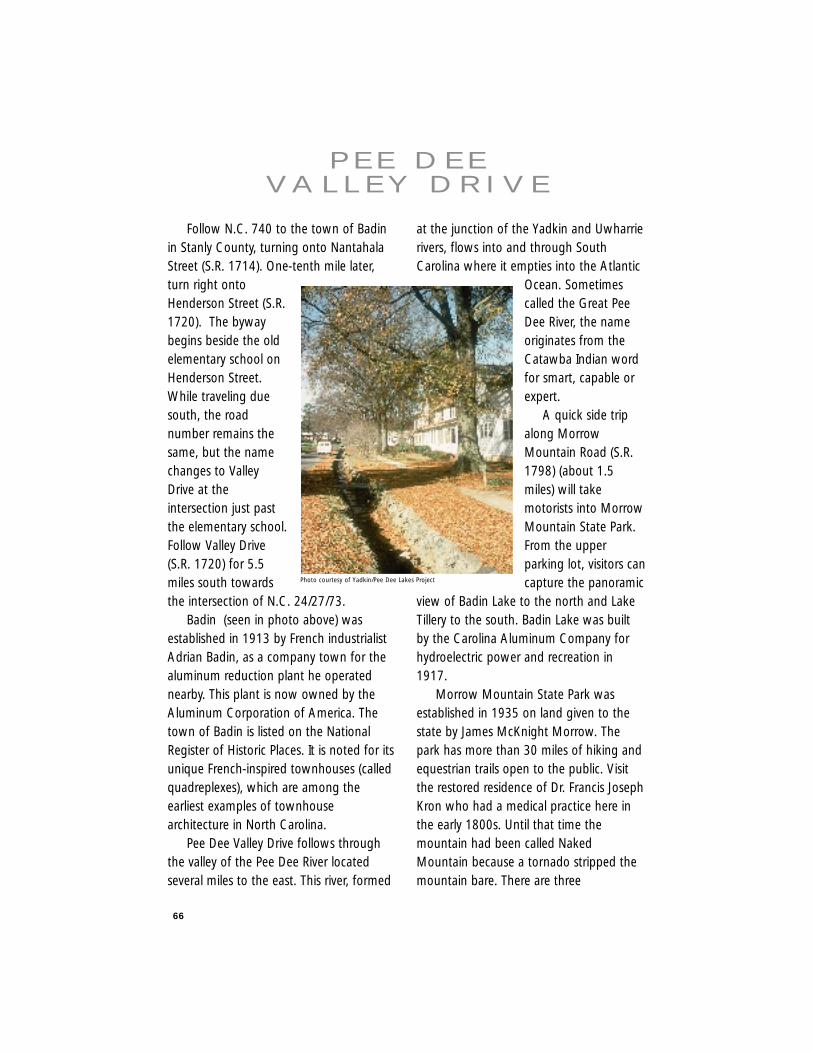
66
Follow N.C. 740 to the town of Badinin Stanly County, turning onto NantahalaStreet (S.R. 1714). One-tenth mile later,turn right ontoHenderson Street (S.R.1720). The bywaybegins beside the oldelementary school onHenderson Street.While traveling duesouth, the roadnumber remains thesame, but the namechanges to ValleyDrive at theintersection just pastthe elementary school.Follow Valley Drive(S.R. 1720) for 5.5miles south towardsthe intersection of N.C. 24/27/73.
Badin (seen in photo above) wasestablished in 1913 by French industrialistAdrian Badin, as a company town for thealuminum reduction plant he operatednearby. This plant is now owned by theAluminum Corporation of America. Thetown of Badin is listed on the NationalRegister of Historic Places. It is noted for itsunique French-inspired townhouses (calledquadreplexes), which are among theearliest examples of townhousearchitecture in North Carolina.
Pee Dee Valley Drive follows throughthe valley of the Pee Dee River locatedseveral miles to the east. This river, formed
at the junction of the Yadkin and Uwharrierivers, flows into and through SouthCarolina where it empties into the Atlantic
Ocean. Sometimescalled the Great PeeDee River, the nameoriginates from theCatawba Indian wordfor smart, capable orexpert.
A quick side tripalong MorrowMountain Road (S.R.1798) (about 1.5miles) will takemotorists into MorrowMountain State Park.From the upperparking lot, visitors cancapture the panoramic
view of Badin Lake to the north and LakeTillery to the south. Badin Lake was builtby the Carolina Aluminum Company forhydroelectric power and recreation in1917.
Morrow Mountain State Park wasestablished in 1935 on land given to thestate by James McKnight Morrow. Thepark has more than 30 miles of hiking andequestrian trails open to the public. Visitthe restored residence of Dr. Francis JosephKron who had a medical practice here inthe early 1800s. Until that time themountain had been called NakedMountain because a tornado stripped themountain bare. There are three
P E E D E EVA L L E Y D R I V E
Photo courtesy of Yadkin/Pee Dee Lakes Project
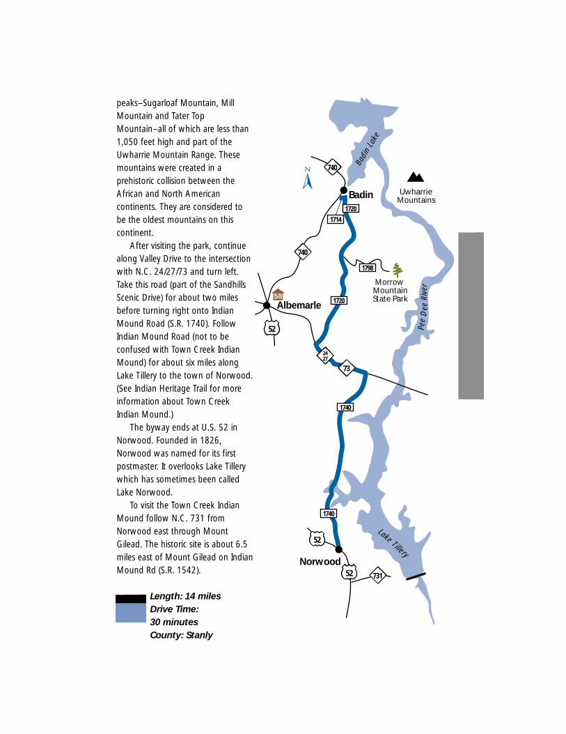
peaks–Sugarloaf Mountain, MillMountain and Tater TopMountain–all of which are less than1,050 feet high and part of theUwharrie Mountain Range. Thesemountains were created in aprehistoric collision between theAfrican and North Americancontinents. They are considered tobe the oldest mountains on thiscontinent.
After visiting the park, continuealong Valley Drive to the intersectionwith N.C. 24/27/73 and turn left.Take this road (part of the SandhillsScenic Drive) for about two milesbefore turning right onto IndianMound Road (S.R. 1740). FollowIndian Mound Road (not to beconfused with Town Creek IndianMound) for about six miles alongLake Tillery to the town of Norwood.(See Indian Heritage Trail for moreinformation about Town CreekIndian Mound.)
The byway ends at U.S. 52 inNorwood. Founded in 1826,Norwood was named for its firstpostmaster. It overlooks Lake Tillerywhich has sometimes been calledLake Norwood.
To visit the Town Creek IndianMound follow N.C. 731 fromNorwood east through MountGilead. The historic site is about 6.5miles east of Mount Gilead on IndianMound Rd (S.R. 1542).
Length: 14 milesDrive Time: 30 minutesCounty: Stanly
1720
Badin
52
740
Morrow MountainState Park
UwharrieMountains
731
52
52
1714
1740
1740
Norwood
2427
73
Pee
Dee
Rive
r
Badi
n La
ke
Lake Tillery
1798
Albemarle
740
172058
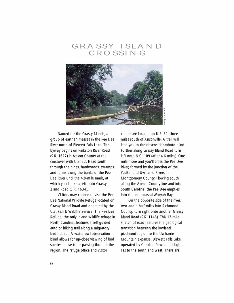
68
Named for the Grassy Islands, agroup of earthen masses in the Pee DeeRiver north of Blewett Falls Lake. Thebyway begins on Pinkston River Road(S.R. 1627) in Anson County at thecrossover with U.S. 52. Head souththrough the pines, hardwoods, swampsand farms along the banks of the PeeDee River until the 4.8-mile mark, atwhich you’ll take a left onto GrassyIsland Road (S.R. 1634).
Visitors may choose to visit the PeeDee National Wildlife Refuge located onGrassy Island Road and operated by theU.S. Fish & Wildlife Service. The Pee DeeRefuge, the only inland wildlife refuge inNorth Carolina, features a self-guidedauto or hiking trail along a migratorybird habitat. A waterfowl observationblind allows for up-close viewing of birdspecies native to or passing through theregion. The refuge office and visitor
center are located on U.S. 52, threemiles south of Ansonville. A trail willlead you to the observation/photo blind.Further along Grassy Island Road turnleft onto N.C. 109 (after 4.6 miles). Onemile more and you’ll cross the Pee DeeRiver, formed by the junction of theYadkin and Uwharrie Rivers inMontgomery County. Flowing southalong the Anson County line and intoSouth Carolina, the Pee Dee emptiesinto the intercoastal Winyah Bay.
On the opposite side of the river,two-and-a-half miles into RichmondCounty, turn right onto another GrassyIsland Road (S.R. 1148). This 13-milestretch of road features the geologicaltransition between the lowlandpiedmont region to the UwharrieMountain expanse. Blewett Falls Lake,operated by Carolina Power and Light,lies to the south and west. There are
G R A S S Y I S L A N DC R O S S I N G
Lind
say
R. W
hich
ard
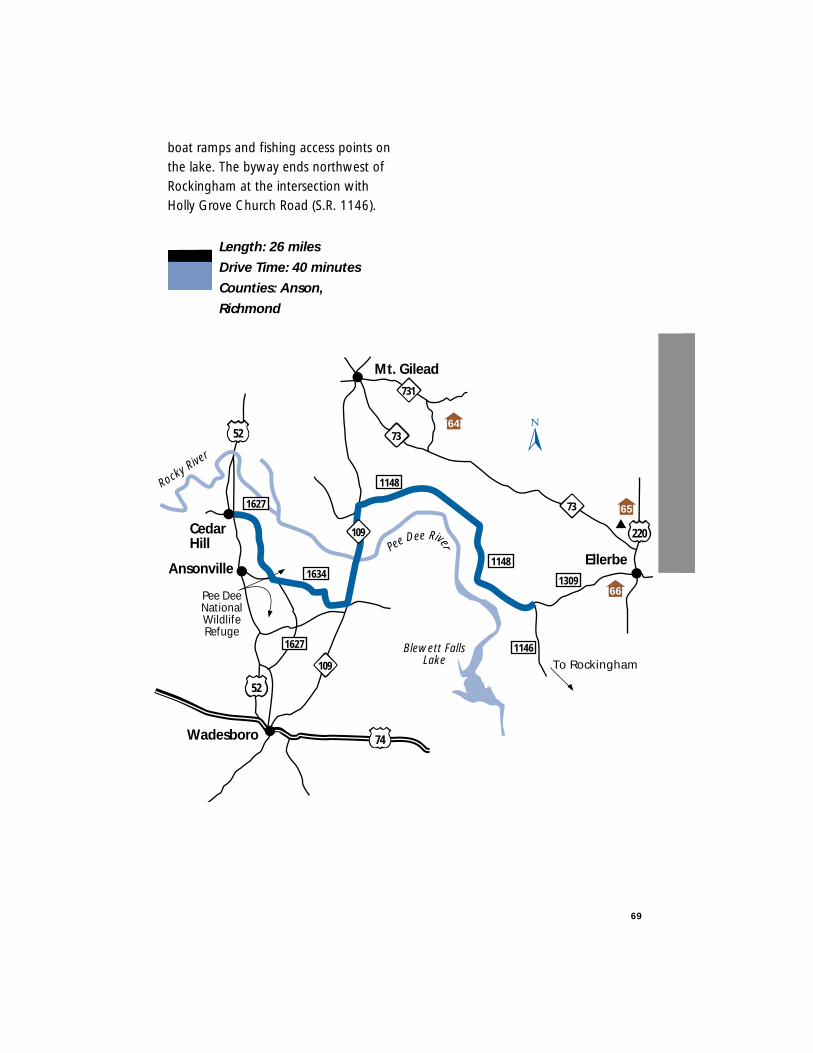
boat ramps and fishing access points onthe lake. The byway ends northwest ofRockingham at the intersection withHolly Grove Church Road (S.R. 1146).
Length: 26 miles
Drive Time: 40 minutes
Counties: Anson,
Richmond
69
1148
1146
64
Mt. Gilead
Ellerbe
Wadesboro
CedarHill
Ansonville1309
73
1148
731
73
PeeDee River
74
52
52
109
Blewett FallsLake
Rocky Rive
r
Pee DeeNationalWildlifeRefuge
1627
1634
1627
109
To Rockingham
220
66
65
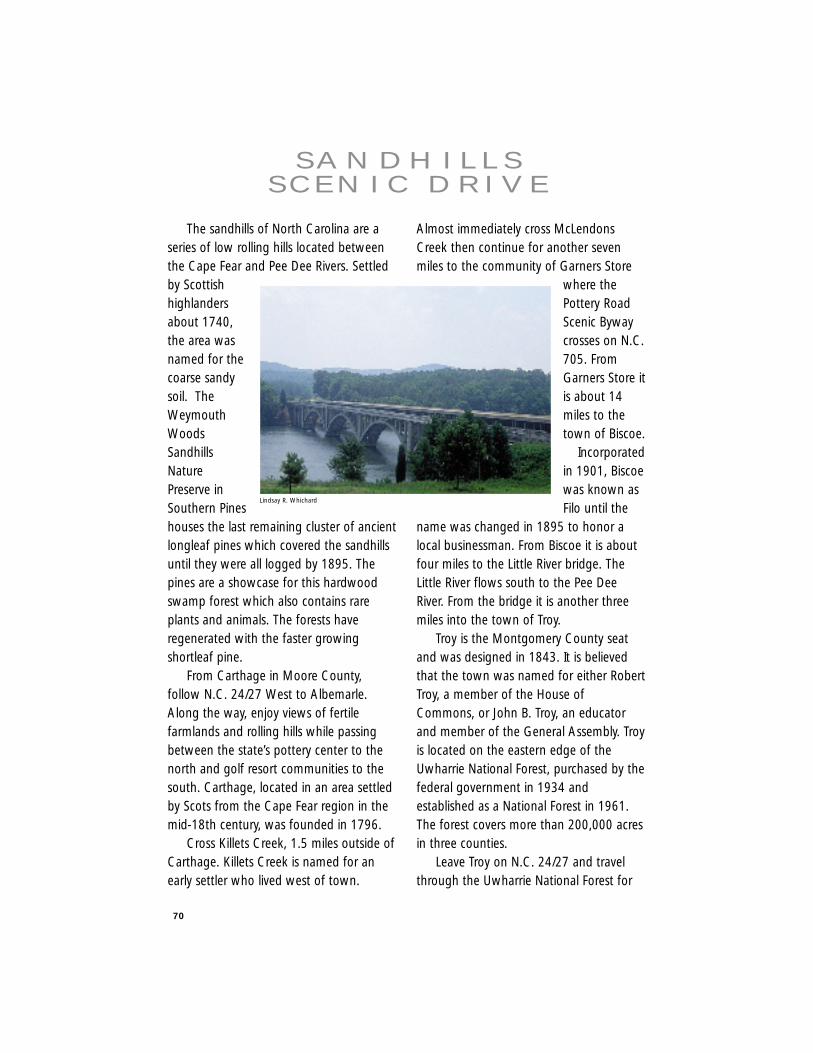
70
The sandhills of North Carolina are aseries of low rolling hills located betweenthe Cape Fear and Pee Dee Rivers. Settledby Scottishhighlandersabout 1740,the area wasnamed for thecoarse sandysoil. TheWeymouthWoodsSandhillsNaturePreserve inSouthern Pineshouses the last remaining cluster of ancientlongleaf pines which covered the sandhillsuntil they were all logged by 1895. Thepines are a showcase for this hardwoodswamp forest which also contains rareplants and animals. The forests haveregenerated with the faster growingshortleaf pine.
From Carthage in Moore County,follow N.C. 24/27 West to Albemarle.Along the way, enjoy views of fertilefarmlands and rolling hills while passingbetween the state’s pottery center to thenorth and golf resort communities to thesouth. Carthage, located in an area settledby Scots from the Cape Fear region in themid-18th century, was founded in 1796.
Cross Killets Creek, 1.5 miles outside ofCarthage. Killets Creek is named for anearly settler who lived west of town.
Almost immediately cross McLendonsCreek then continue for another sevenmiles to the community of Garners Store
where thePottery RoadScenic Bywaycrosses on N.C.705. FromGarners Store itis about 14miles to thetown of Biscoe.
Incorporatedin 1901, Biscoewas known asFilo until the
name was changed in 1895 to honor alocal businessman. From Biscoe it is aboutfour miles to the Little River bridge. TheLittle River flows south to the Pee DeeRiver. From the bridge it is another threemiles into the town of Troy.
Troy is the Montgomery County seatand was designed in 1843. It is believedthat the town was named for either RobertTroy, a member of the House ofCommons, or John B. Troy, an educatorand member of the General Assembly. Troyis located on the eastern edge of theUwharrie National Forest, purchased by thefederal government in 1934 andestablished as a National Forest in 1961.The forest covers more than 200,000 acresin three counties.
Leave Troy on N.C. 24/27 and travelthrough the Uwharrie National Forest for
S A N D H I L L SS C E N I C D R I V E
Lindsay R. Whichard
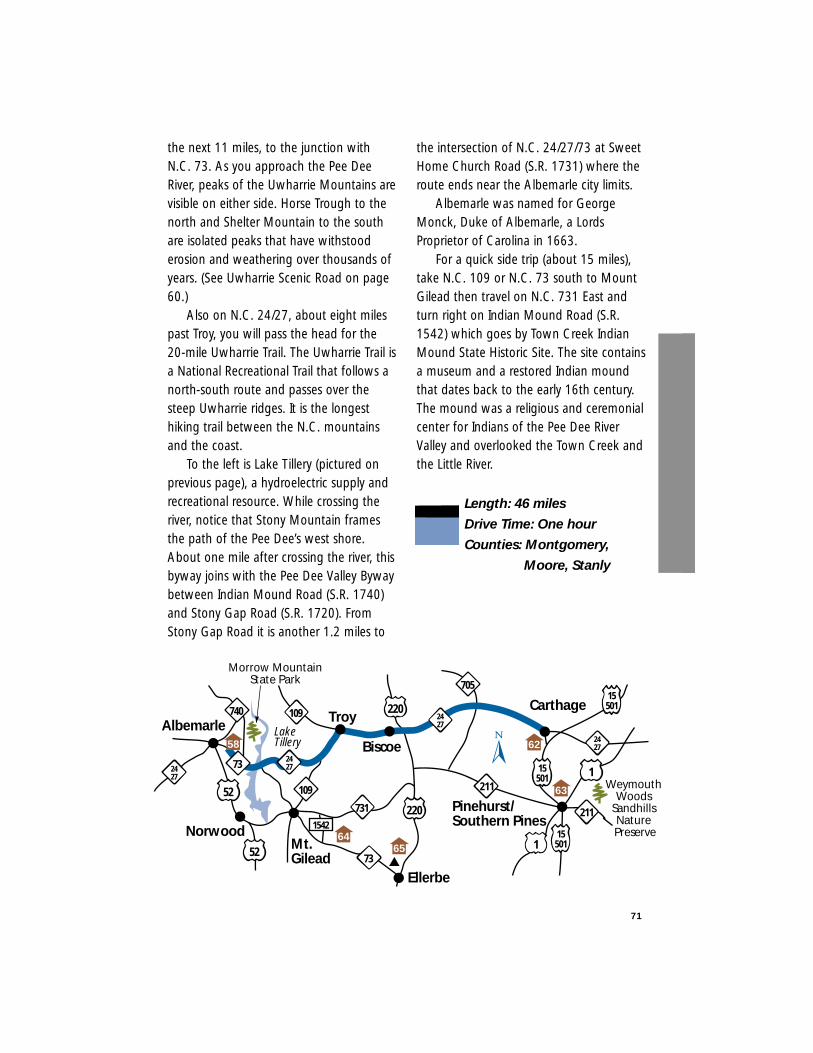
71
the next 11 miles, to the junction withN.C. 73. As you approach the Pee DeeRiver, peaks of the Uwharrie Mountains arevisible on either side. Horse Trough to thenorth and Shelter Mountain to the southare isolated peaks that have withstooderosion and weathering over thousands ofyears. (See Uwharrie Scenic Road on page60.)
Also on N.C. 24/27, about eight milespast Troy, you will pass the head for the20-mile Uwharrie Trail. The Uwharrie Trail isa National Recreational Trail that follows anorth-south route and passes over thesteep Uwharrie ridges. It is the longesthiking trail between the N.C. mountainsand the coast.
To the left is Lake Tillery (pictured onprevious page), a hydroelectric supply andrecreational resource. While crossing theriver, notice that Stony Mountain framesthe path of the Pee Dee’s west shore.About one mile after crossing the river, thisbyway joins with the Pee Dee Valley Bywaybetween Indian Mound Road (S.R. 1740)and Stony Gap Road (S.R. 1720). FromStony Gap Road it is another 1.2 miles to
the intersection of N.C. 24/27/73 at SweetHome Church Road (S.R. 1731) where theroute ends near the Albemarle city limits.
Albemarle was named for GeorgeMonck, Duke of Albemarle, a LordsProprietor of Carolina in 1663.
For a quick side trip (about 15 miles),take N.C. 109 or N.C. 73 south to MountGilead then travel on N.C. 731 East andturn right on Indian Mound Road (S.R.1542) which goes by Town Creek IndianMound State Historic Site. The site containsa museum and a restored Indian moundthat dates back to the early 16th century.The mound was a religious and ceremonialcenter for Indians of the Pee Dee RiverValley and overlooked the Town Creek andthe Little River.
Length: 46 miles
Drive Time: One hour
Counties: Montgomery,
Moore, Stanly
2427
220
220
740
109
2427
TroyAlbemarleCarthage
705
109
Lake Tillery Biscoe
Ellerbe
2427
15501
15501
155011
211
211731
731
Pinehurst/Southern Pines
2427
73Mt. Gilead
1542Norwood
52
52
Morrow MountainState Park
Weymouth Woods
Sandhills Nature Preserve
58
64
63
62
65
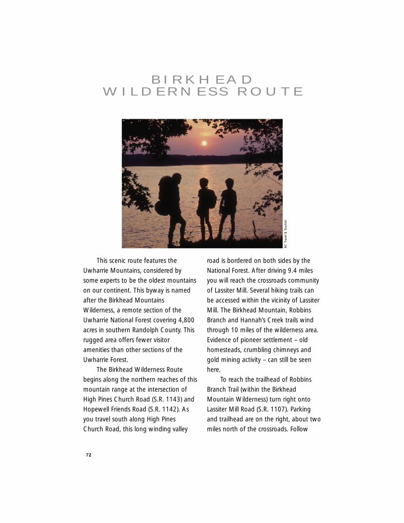
72
This scenic route features the
Uwharrie Mountains, considered by
some experts to be the oldest mountains
on our continent. This byway is named
after the Birkhead Mountains
Wilderness, a remote section of the
Uwharrie National Forest covering 4,800
acres in southern Randolph County. This
rugged area offers fewer visitor
amenities than other sections of the
Uwharrie Forest.
The Birkhead Wilderness Route
begins along the northern reaches of this
mountain range at the intersection of
High Pines Church Road (S.R. 1143) and
Hopewell Friends Road (S.R. 1142). As
you travel south along High Pines
Church Road, this long winding valley
road is bordered on both sides by the
National Forest. After driving 9.4 miles
you will reach the crossroads community
of Lassiter Mill. Several hiking trails can
be accessed within the vicinity of Lassiter
Mill. The Birkhead Mountain, Robbins
Branch and Hannah’s Creek trails wind
through 10 miles of the wilderness area.
Evidence of pioneer settlement – old
homesteads, crumbling chimneys and
gold mining activity – can still be seen
here.
To reach the trailhead of Robbins
Branch Trail (within the Birkhead
Mountain Wilderness) turn right onto
Lassiter Mill Road (S.R. 1107). Parking
and trailhead are on the right, about two
miles north of the crossroads. Follow
B I R K H E A DW I L D E R N E S S R O U T E
NC
Tra
vel &
Tour
ism
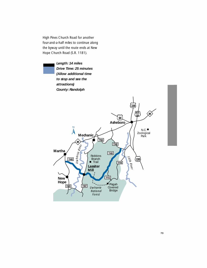
High Pines Church Road for another
four-and-a-half miles to continue along
the byway until the route ends at New
Hope Church Road (S.R. 1181).
Length: 14 miles
Drive Time: 25 minutes
(Allow additional time
to stop and see the
attractions)
County: Randolph
73
Martha
NewHope
Mechanic
49
49
220
64
220
1163
1107
1143
1143
1142
1114
1181
1112
Lassiter Mill
Asheboro
BUS220
N.C.Zoological
Park
RobbinsBranch
Trail
PisgahCovered Bridge
Uw
har r
ieR
iver
Uwharrie NationalForest
LittleR
iver
This remote, yet very beautiful,
scenic byway begins on Flint Hill Road
(S.R. 1306), just northeast of the
community of
Uwharrie in
Montgomery
County. To access
this route, begin on
N.C. 109 in
Uwharrie and travel
north before
turning right on
Ophir Road (S.R.
1303). Travel five
miles along this
road before
reaching the Ophir
community.
This town was
settled in the mid-
1800s during the gold boom in this area.
Also, Ophir is the name of the biblical
area where gold was produced for King
Solomon’s Temple. Once in Ophir, turn
right onto Flint Hill Road. This road
transports you from the central
piedmont to feeling as if you are riding
along a Smoky Mountain Road. At 2.1
miles there is a shady parking area and
trailhead for the Uwharrie National
Recreational Trail. This is the northern
end for the 20-mile trail that begins on
N.C. 24/27 (the Sandhills Scenic Drive). A
short hike up the trail reveals a striking
view of the surrounding Uwharrie
Mountains.
Continue
along Flint Hill Road
another 0.2 miles
where there is a
small, turn-off on
the left. A quick
stroll from the car
will lead you to
what is locally
known as
“Jumping off
Rock” (pictured
here). This rocky
bluff overlooks a
cascading stream
and the
surrounding
Uwharrie National Forest. Actually,
jumping off “Jumping off Rock” is
strongly discouraged. The Flint Hill
Ramble ends where the road intersects
with Lovejoy Road (S.R. 1310). Turning
right onto Lovejoy Road will lead back to
N.C. 109 and the town of Troy.
Length: 5 miles
Drive Time: 10 minutes
County: Montgomery
74
F L I N T H I L LR A M B L E
Lind
say
R. W
hich
ard
75
Troy
FlintHill
Uw
harr
ie R
iver
Litt
le R
iver
Wes
t For
k
1310
1307
1311
1349
109
109
134
2427
1303
1306Ophir
220
Little River
Uwharrie Trailhead
Uwharrie NationalForest
BadinLake
PeeD
eeRiv
er
Uwharrie
Jumplngoff Rock
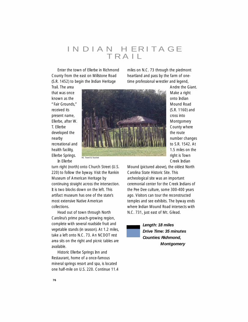
76
Enter the town of Ellerbe in RichmondCounty from the east on Millstone Road(S.R. 1452) to begin the Indian HeritageTrail. The areathat was onceknown as the“Fair Grounds,”received itspresent name,Ellerbe, after W.T. Ellerbedeveloped thenearbyrecreational andhealth facility,Ellerbe Springs.
In Ellerbeturn right (north) onto Church Street (U.S.220) to follow the byway. Visit the RankinMuseum of American Heritage bycontinuing straight across the intersection.It is two blocks down on the left. Thisartifact museum has one of the state’smost extensive Native Americancollections.
Head out of town through NorthCarolina’s prime peach-growing region,complete with several roadside fruit andvegetable stands (in season). At 1.2 miles,take a left onto N.C. 73. An NCDOT restarea sits on the right and picnic tables areavailable.
Historic Ellerbe Springs Inn andRestaurant, home of a once-famousmineral springs resort and spa, is locatedone half-mile on U.S. 220. Continue 11.4
miles on N.C. 73 through the piedmontheartland and pass by the farm of one-time professional wrestler and legend,
Andre the Giant.Make a rightonto IndianMound Road(S.R. 1160) andcross intoMontgomeryCounty wherethe routenumber changesto S.R. 1542. At1.5 miles on theright is TownCreek Indian
Mound (pictured above), the oldest NorthCarolina State Historic Site. Thisarcheological site was an importantceremonial center for the Creek Indians ofthe Pee Dee culture, some 300-400 yearsago. Visitors can tour the reconstructedtemples and see exhibits. The byway endswhere Indian Mound Road intersects withN.C. 731, just east of Mt. Gilead.
Length: 18 miles
Drive Time: 35 minutes
Counties: Richmond,
Montgomery
I N D I A N H E R I TA G ET R A I L
NC Travel & Tourism
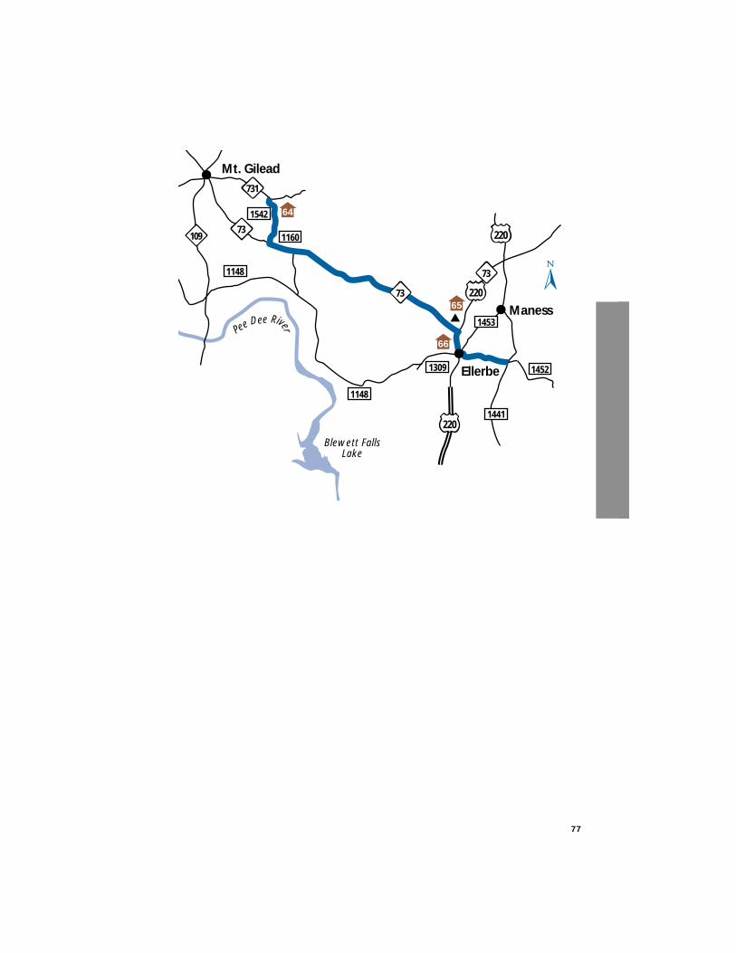
77
1148
65
64
Mt. Gilead
Ellerbe
Maness
220
220
220
73
1309
1453
1452
73
1148
1160
1542
109
731
1441
73
PeeDee River
Blewett FallsLake
66
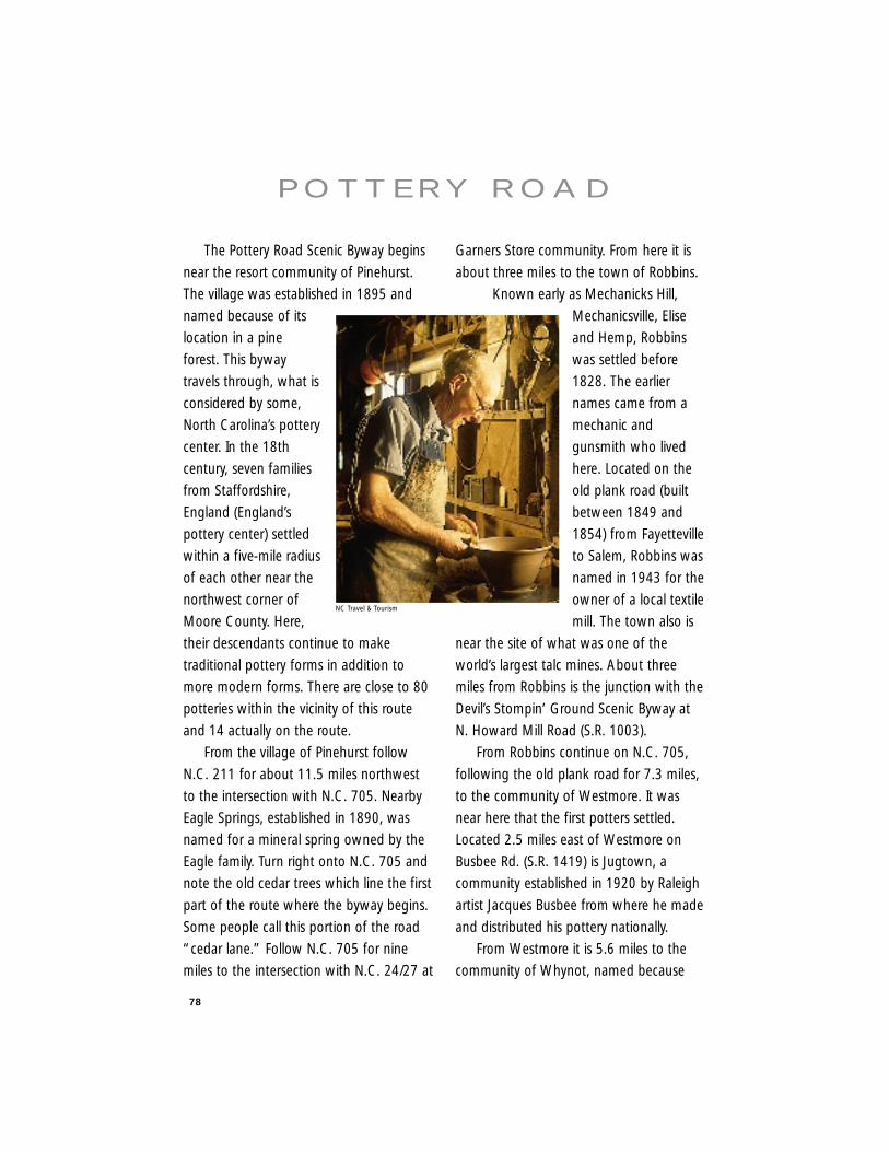
78
The Pottery Road Scenic Byway begins
near the resort community of Pinehurst.
The village was established in 1895 and
named because of its
location in a pine
forest. This byway
travels through, what is
considered by some,
North Carolina’s pottery
center. In the 18th
century, seven families
from Staffordshire,
England (England’s
pottery center) settled
within a five-mile radius
of each other near the
northwest corner of
Moore County. Here,
their descendants continue to make
traditional pottery forms in addition to
more modern forms. There are close to 80
potteries within the vicinity of this route
and 14 actually on the route.
From the village of Pinehurst follow
N.C. 211 for about 11.5 miles northwest
to the intersection with N.C. 705. Nearby
Eagle Springs, established in 1890, was
named for a mineral spring owned by the
Eagle family. Turn right onto N.C. 705 and
note the old cedar trees which line the first
part of the route where the byway begins.
Some people call this portion of the road
“cedar lane.” Follow N.C. 705 for nine
miles to the intersection with N.C. 24/27 at
Garners Store community. From here it is
about three miles to the town of Robbins.
Known early as Mechanicks Hill,
Mechanicsville, Elise
and Hemp, Robbins
was settled before
1828. The earlier
names came from a
mechanic and
gunsmith who lived
here. Located on the
old plank road (built
between 1849 and
1854) from Fayetteville
to Salem, Robbins was
named in 1943 for the
owner of a local textile
mill. The town also is
near the site of what was one of the
world’s largest talc mines. About three
miles from Robbins is the junction with the
Devil’s Stompin’ Ground Scenic Byway at
N. Howard Mill Road (S.R. 1003).
From Robbins continue on N.C. 705,
following the old plank road for 7.3 miles,
to the community of Westmore. It was
near here that the first potters settled.
Located 2.5 miles east of Westmore on
Busbee Rd. (S.R. 1419) is Jugtown, a
community established in 1920 by Raleigh
artist Jacques Busbee from where he made
and distributed his pottery nationally.
From Westmore it is 5.6 miles to the
community of Whynot, named because
P O T T E R Y R O A D
NC Travel & Tourism
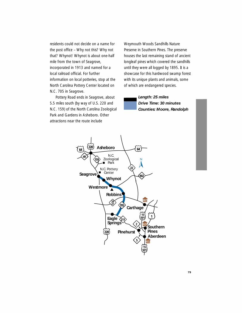
79
residents could not decide on a name for
the post office – Why not this? Why not
that? Whynot! Whynot is about one-half
mile from the town of Seagrove,
incorporated in 1913 and named for a
local railroad official. For further
information on local potteries, stop at the
North Carolina Pottery Center located on
N.C. 705 in Seagrove.
Pottery Road ends in Seagrove, about
5.5 miles south (by way of U.S. 220 and
N.C. 159) of the North Carolina Zoological
Park and Gardens in Asheboro. Other
attractions near the route include
Weymouth Woods Sandhills Nature
Preserve in Southern Pines. The preserve
houses the last remaining stand of ancient
longleaf pines which covered the sandhills
until they were all logged by 1895. It is a
showcase for this hardwood swamp forest
with its unique plants and animals, some
of which are endangered species.
Length: 25 miles
Drive Time: 30 minutes
Counties: Moore, Randolph
N.C.Zoological
Park
N.C. PotteryCenter
211
220
Asheboro
SeagroveWhynot
Carthage
Pinehurst
220
159
EagleSprings
705
64 64
49
22
902
SouthernPines
115501
15501
5
2
2427
Aberdeen
Westmore
Robbins62
63
61
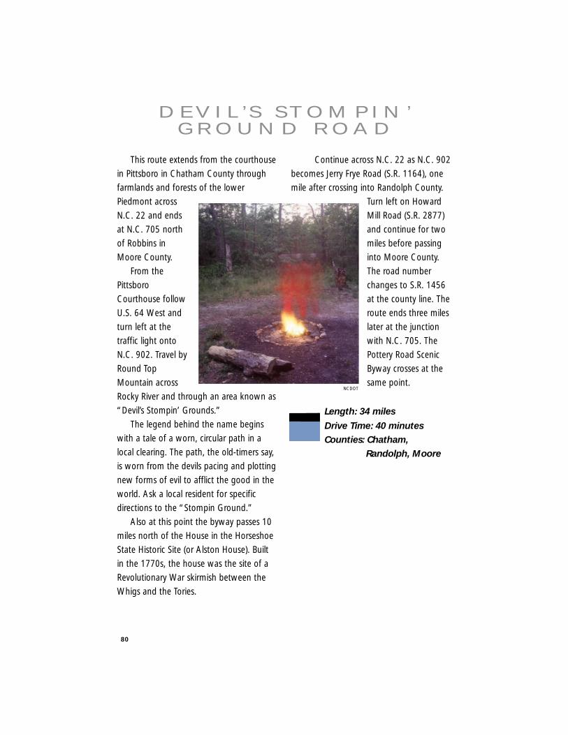
80
This route extends from the courthouse
in Pittsboro in Chatham County through
farmlands and forests of the lower
Piedmont across
N.C. 22 and ends
at N.C. 705 north
of Robbins in
Moore County.
From the
Pittsboro
Courthouse follow
U.S. 64 West and
turn left at the
traffic light onto
N.C. 902. Travel by
Round Top
Mountain across
Rocky River and through an area known as
“Devil’s Stompin’ Grounds.”
The legend behind the name begins
with a tale of a worn, circular path in a
local clearing. The path, the old-timers say,
is worn from the devils pacing and plotting
new forms of evil to afflict the good in the
world. Ask a local resident for specific
directions to the “Stompin Ground.”
Also at this point the byway passes 10
miles north of the House in the Horseshoe
State Historic Site (or Alston House). Built
in the 1770s, the house was the site of a
Revolutionary War skirmish between the
Whigs and the Tories.
Continue across N.C. 22 as N.C. 902
becomes Jerry Frye Road (S.R. 1164), one
mile after crossing into Randolph County.
Turn left on Howard
Mill Road (S.R. 2877)
and continue for two
miles before passing
into Moore County.
The road number
changes to S.R. 1456
at the county line. The
route ends three miles
later at the junction
with N.C. 705. The
Pottery Road Scenic
Byway crosses at the
same point.
Length: 34 miles
Drive Time: 40 minutesCounties: Chatham,
Randolph, Moore
D E V I L ’ S S T O M P I N ’G R O U N D R O A D
NCDOT
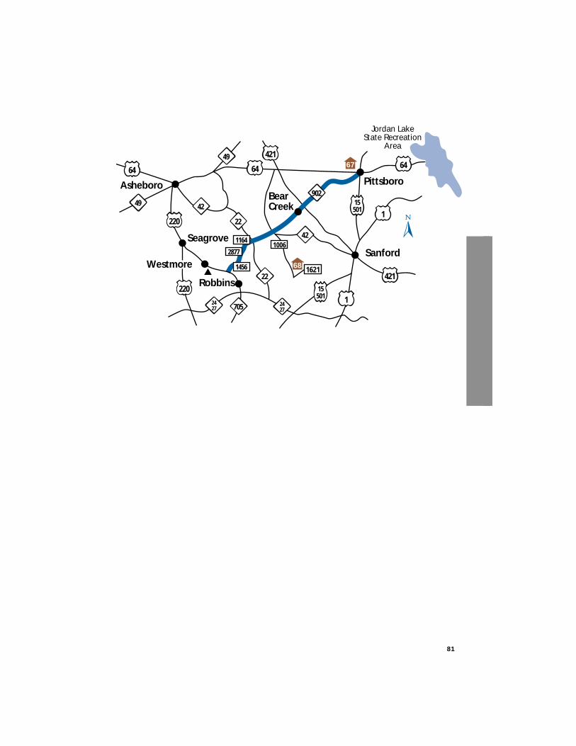
81
64 64
Seagrove
42
Robbins
BearCreek
Asheboro Pittsboro
Sanford
22
220
Westmore
2427
1
421
421
705
220
2427
221621
15501
1456
2877
116442
902
64
49
1
1006
15501
49
67
68
Jordan LakeState Recreation
Area
82
While Durham is famous as thehome of Research Triangle Park, Dukeand North Carolina CentralUniversities,Durham is alsoknown for itsbeautifulcountryside,waterways andhistoricplantationfarmlands.
ExploreNorthDurham’sscenic bywayand glimpseinto Durham’s history and its forests,lakes and rivers. One way to access theroute is off I-85 (exit 182) and travelnorth on Red Mill Road (S.R. 1632) for4.5 miles. To continue on Red MillRoad you must briefly follow TeknikaParkway by turning right and then atthe first stop sign turn left back ontoRed Mill Road. You will soon intersectwith Old Hwy. 75 (SR 1004) – turnright and the byway begins here nearthe historic plantations of Fairntoshand Stagville. Today, a variety ofpreservation and African-Americanhistory studies are conducted atStagville (the N.C. State Historic Sitepictured here), once among the largestplantation holdings in the south.
You travel along Old Hwy. 75 for1.5 miles before turning left ontoStagville Road (S.R. 1615). After
passing theplannedHorton GroveCommercialCenter andtravelingalmost fourmiles, youarrive in thetown ofBahama. Thebyway turnsright at thispoint to follow
Bahama Road, but turn left toinvestigate the village, the old-timehardware store or country store.
Bahama’s name originates fromthe first two letters of three prominentfamilies- Ball, Harris and Mangum.Bahama road will lead you by thetranquil waters of Lake Michie(pronounced mick-e) and itsrecreational facilities including boating,hiking and picnicking. On the righthand side, after 3.2 miles, is MountTabor United Methodist Church – thefinal resting place of Governor WilliamB. Umstead. After 2.6 more miles, turnleft onto Red Mountain Road (S.R.1471).
N O R T H D U R H A MC O U N T R Y B Y W AY
Lindsay R. Whichard
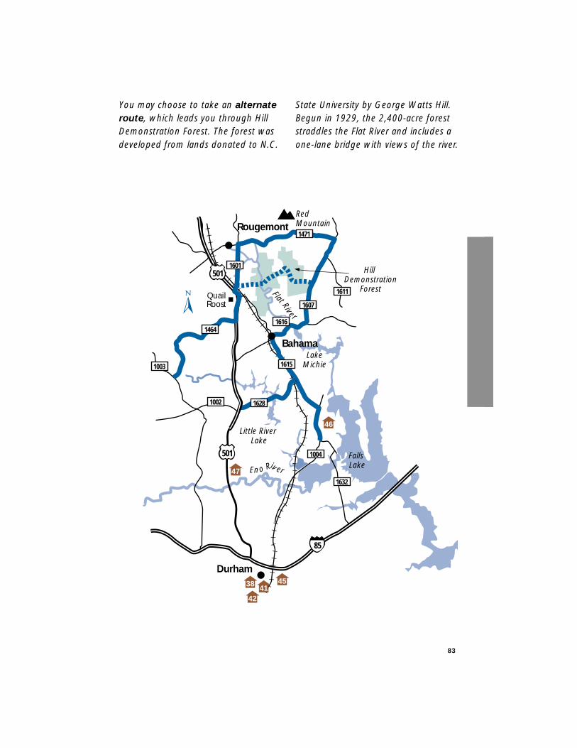
You may choose to take an alternateroute, which leads you through HillDemonstration Forest. The forest wasdeveloped from lands donated to N.C.
State University by George Watts Hill.Begun in 1929, the 2,400-acre foreststraddles the Flat River and includes aone-lane bridge with views of the river.
83
Eno Riv er
Little River Lake
Falls Lake
Rougemont
Durham
Bahama
Hill Demonstration
Forest
RedMountain
LakeMichie
1004
1611Flat River
1601
1464
1615
1616
1607
1471
501
501
46
38 4145
QuailRoost
1002 1628
1003
1632
85
42
47
You may see a wide range of birds andrare plant species. More then 200species of birds live here, includingegrets, herons, ibis and osprey. Aftergoing 3.7 miles on Bahama Rd. turnleft onto Hampton Road (S.R. 1603)and then after 1.6 miles turn left ontothe second Wilkins Road (S.R. 1613). Aquick right, soon thereafter, will putyou onto State Forest Road (S.R. 1614)and into Hill Forest. Be careful of wateron the road and the one lane bridge(weight limit 17 tons) a few milesahead. State Forest Road leads toMoores Mill Road and back onto thebyway.
Red Mountain Road is a left turnoff Bahama Road and a 4.6-milesegment of rural life. You’ll pass theFlat River, offering kayaking, fishingand hiking. Turn left onto Moores MillRoad and follow the rolling hills to U.S.501. After turning left onto U.S. 501you catch a glimpse of Quail Roost,which was organized as a hunt club in1875 by influential Durhamites. Itbecame one of the nation’s leadingstables and dairy farms. It is now atraining stable and home for Duke’sequestrian team and the RougemontRed Mountain Hounds Hunt Club.After 1.4 miles, turn right onto SouthLowell Road. The five-mile driveweaves in and out of this rollingterrain with frequent views of farms.The byway ends at the intersection ofGuess Road and South Lowell.
To experience the last portion ofthe scenic byway, turn left onto GuessRoad (S.R. 1003) and drive 1.3 miles.
The Great Indian Trading Path ranthrough this area along what ispresent day Snow Hill, St. Mary’s andMason’s roads. It was a famouspiedmont fur and deerskin tradingroute that began in 1670, used byEuropean explorers, hunters andsettlers. Turn left onto Mason Road,follow this road to U.S. 501, turn leftand after only 0.3 of a mile turn rightonto Orange Factory Road (S.R. 1628).The byway resumes here andcontinues three miles past Little RiverLake and the entrance to Treyburn(country club and living community)before ending at the intersection withStagville Road.
Length: 27 milesDrive Time: 45 minutesCounty: Durham
84

85
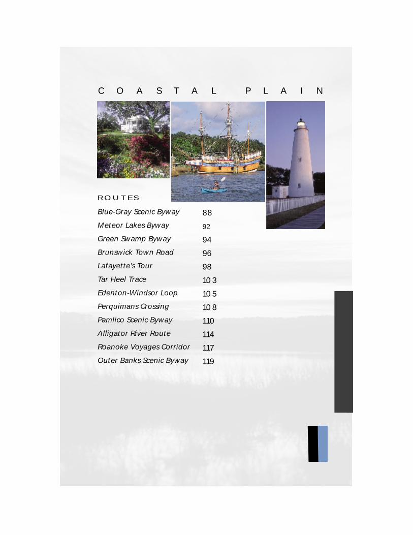
ROUTES
Blue-Gray Scenic Byway
Meteor Lakes Byway
Green Swamp Byway
Brunswick Town Road
Lafayette’s Tour
Tar Heel Trace
Edenton-Windsor Loop
Perquimans Crossing
Pamlico Scenic Byway
Alligator River Route
Roanoke Voyages Corridor
Outer Banks Scenic Byway
88
92
94
96
98
103
105
108
110
114
117
119
C O A S T A L P L A I N
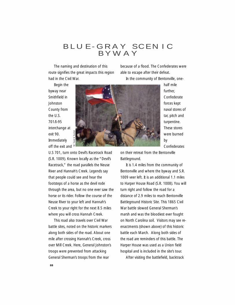
88
The naming and destination of this
route signifies the great impacts this region
had in the Civil War.
Begin the
byway near
Smithfield in
Johnston
County from
the U.S.
701/I–95
interchange at
exit 90.
Immediately
off the exit and
U.S 701, turn onto Devil’s Racetrack Road
(S.R. 1009). Known locally as the “Devil’s
Racetrack,” the road parallels the Neuse
River and Hannah’s Creek. Legends say
that people could see and hear the
footsteps of a horse as the devil rode
through the area, but no one ever saw the
horse or its rider. Follow the course of the
Neuse River to your left and Hannah’s
Creek to your right for the next 8.5 miles
where you will cross Hannah Creek.
This road also travels over Civil War
battle sites, noted on the historic markers
along both sides of the road. About one
mile after crossing Hannah’s Creek, cross
over Mill Creek. Here, General Johnston’s
troops were prevented from attacking
General Sherman’s troops from the rear
because of a flood. The Confederates were
able to escape after their defeat.
In the community of Bentonville, one-
half mile
further,
Confederate
forces kept
naval stores of
tar, pitch and
turpentine.
These stores
were burned
by
Confederates
on their retreat from the Bentonville
Battleground.
It is 1.4 miles from the community of
Bentonville and where the byway and S.R.
1009 veer left. It is an additional 1.1 miles
to Harper House Road (S.R. 1008). You will
turn right and follow the road for a
distance of 2.9 miles to reach Bentonville
Battleground Historic Site. This 1865 Civil
War battle slowed General Sherman’s
marsh and was the bloodiest ever fought
on North Carolina soil. Visitors may see re-
enactments (shown above) of this historic
battle each March. Along both sides of
the road are reminders of this battle. The
Harper House was used as a Union field
hospital and is included in the site’s tour.
After visiting the battlefield, backtrack
B L U E - G R AY S C E N I CB Y W AY
NC
Tra
vel &
Tou
rism
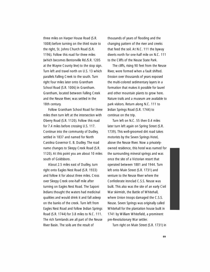
89
three miles on Harper House Road (S.R.
1008) before turning on the third route to
the right, St. Johns Church Road (S.R.
1196). Follow this road for three miles
(which becomes Bentonville Rd./S.R. 1205
at the Wayne County line) to the stop sign.
Turn left and travel north on U.S. 13 which
parallels Falling Creek to the south. Turn
right four miles later onto Grantham
School Road (S.R. 1006) in Grantham.
Grantham, located between Falling Creek
and the Neuse River, was settled in the
18th century.
Follow Grantham School Road for three
miles then turn left at the intersection with
Oberry Road (S.R. 1120). Follow this road
for 7.4 miles before crossing U.S. 117.
Continue into the community of Dudley,
settled in 1837 and named for North
Carolina Governor E. B. Dudley. The road
name changes to Sleepy Creek Road (S.R.
1120). At this point you are about 10 miles
south of Goldsboro.
About 2.5 miles east of Dudley, turn
right onto Eagles Nest Road (S.R. 1933)
and follow it for about three miles. Cross
over Sleepy Creek one-half mile after
turning on Eagles Nest Road. The Saponi
Indians thought the waters had medicinal
qualities and would drink it and fall asleep
on the banks of the creek. Turn left from
Eagles Nest Road and follow Indian Springs
Road (S.R. 1744) for 3.8 miles to N.C. 111.
The rich farmlands are all part of the Neuse
River Basin. The soils are the result of
thousands of years of flooding and the
changing pattern of the river and creeks
that feed the soil. At N.C. 111 the byway
diverts north for one-half mile on N.C. 111
to the Cliffs of the Neuse State Park.
The cliffs, rising 90 feet from the Neuse
River, were formed when a fault shifted.
Erosion over thousands of years exposed
the multi-colored sedimentary layers in a
formation that makes it possible for laurel
and other mountain plants to grow here.
Nature trails and a museum are available to
park visitors. Return along N.C. 111 to
Indian Springs Road (S.R. 1744) to
continue on the trip.
Turn left on N.C. 55 then 0.4 miles
later turn left again on Spring Street (S.R.
1739). This well-groomed dirt road takes
motorists by the Seven Springs Hotel,
above the Neuse River. Now a privately-
owned residence, this hotel was named for
the surrounding mineral springs and was
once the site of a Victorian resort that
operated between 1881 and 1944. Turn
left onto Main Street (S.R. 1731) and
venture to the Neuse River where the
Confederate ironclad C.S.S. Neuse was
built. This also was the site of an early Civil
War skirmish, the Battle of Whitehall,
where Union troops damaged the C.S.S.
Neuse. Seven Springs was originally called
Whitehall for the plantation house built in
1741 by William Whitefield, a prominent
pre-Revolutionary War settler.
Turn right on Main Street (S.R. 1731) in
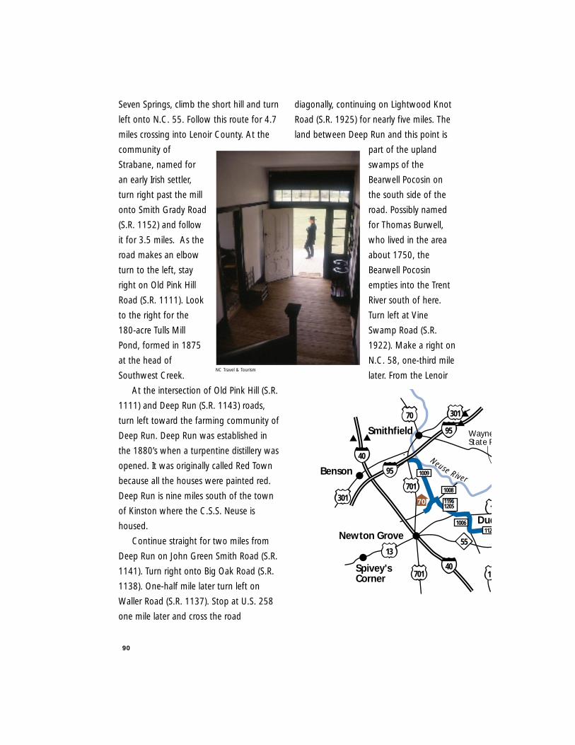
90
Seven Springs, climb the short hill and turn
left onto N.C. 55. Follow this route for 4.7
miles crossing into Lenoir County. At the
community of
Strabane, named for
an early Irish settler,
turn right past the mill
onto Smith Grady Road
(S.R. 1152) and follow
it for 3.5 miles. As the
road makes an elbow
turn to the left, stay
right on Old Pink Hill
Road (S.R. 1111). Look
to the right for the
180-acre Tulls Mill
Pond, formed in 1875
at the head of
Southwest Creek.
At the intersection of Old Pink Hill (S.R.
1111) and Deep Run (S.R. 1143) roads,
turn left toward the farming community of
Deep Run. Deep Run was established in
the 1880’s when a turpentine distillery was
opened. It was originally called Red Town
because all the houses were painted red.
Deep Run is nine miles south of the town
of Kinston where the C.S.S. Neuse is
housed.
Continue straight for two miles from
Deep Run on John Green Smith Road (S.R.
1141). Turn right onto Big Oak Road (S.R.
1138). One-half mile later turn left on
Waller Road (S.R. 1137). Stop at U.S. 258
one mile later and cross the road
diagonally, continuing on Lightwood Knot
Road (S.R. 1925) for nearly five miles. The
land between Deep Run and this point is
part of the upland
swamps of the
Bearwell Pocosin on
the south side of the
road. Possibly named
for Thomas Burwell,
who lived in the area
about 1750, the
Bearwell Pocosin
empties into the Trent
River south of here.
Turn left at Vine
Swamp Road (S.R.
1922). Make a right on
N.C. 58, one-third mile
later. From the Lenoir
Newton Grove
40
1
70 301
Smithfield
Neuse River
40
Dud
301
11
5513
Spivey'sCorner
701
Benson 1009
11201006
11961205
1008
701
95
95
70
WayneState P
NC Travel & Tourism
91
and Jones County line it is nine miles to
the Trent River and another three miles into
Trenton along N.C. 58.
Trenton was established as Trent
Courthouse in 1779 and was named for
the river which was named for the Trent
River in England. By 1784 the name
Trenton was adopted. The route ends near
the mill and pond on the south end of
town at S.R. 1165.
Nearby places of interest include New
Bern and the beaches of the Crystal Coast.
New Bern, the colonial and state capital
from 1746 - 1792, is 25 miles northeast of
Trenton. About 35 miles southwest of
Trenton is Bogue Sound and beach
recreation areas. This route is an interesting
alternative to U.S. 70 to Emerald Isle,
Atlantic Beach and Beaufort.
Length: 82 miles
Drive Time: Two hours
Counties: Jones, Lenoir,
Johnston, Wayne
Goldsboro
Kinston
NewBern
Trenton58
58
13
17
41
58
DeepRun
dley
70
70
258
117
13
MountOlive
55
111
11
1143
1731
17391744
1922
1141
1138
19251152
1111
1933
112020
Cliffs ofthe NeuseState Park
17
41
258
SevenSprings
1137
71
7273
esboroughPark
69117
74
75
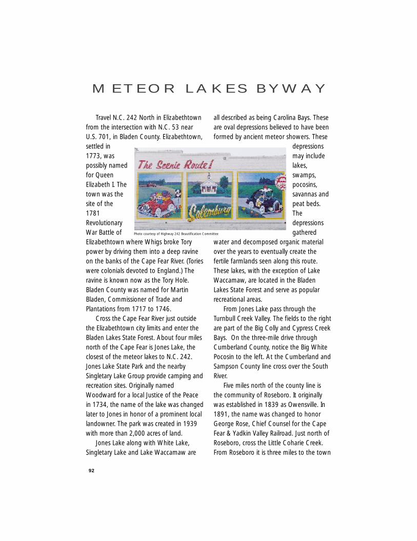
92
Travel N.C. 242 North in Elizabethtownfrom the intersection with N.C. 53 nearU.S. 701, in Bladen County. Elizabethtown,settled in1773, waspossibly namedfor QueenElizabeth I. Thetown was thesite of the1781RevolutionaryWar Battle ofElizabethtown where Whigs broke Torypower by driving them into a deep ravineon the banks of the Cape Fear River. (Torieswere colonials devoted to England.) Theravine is known now as the Tory Hole.Bladen County was named for MartinBladen, Commissioner of Trade andPlantations from 1717 to 1746.
Cross the Cape Fear River just outsidethe Elizabethtown city limits and enter theBladen Lakes State Forest. About four milesnorth of the Cape Fear is Jones Lake, theclosest of the meteor lakes to N.C. 242.Jones Lake State Park and the nearbySingletary Lake Group provide camping andrecreation sites. Originally namedWoodward for a local Justice of the Peacein 1734, the name of the lake was changedlater to Jones in honor of a prominent locallandowner. The park was created in 1939with more than 2,000 acres of land.
Jones Lake along with White Lake,Singletary Lake and Lake Waccamaw are
all described as being Carolina Bays. Theseare oval depressions believed to have beenformed by ancient meteor showers. These
depressionsmay includelakes,swamps,pocosins,savannas andpeat beds.Thedepressionsgathered
water and decomposed organic materialover the years to eventually create thefertile farmlands seen along this route.These lakes, with the exception of LakeWaccamaw, are located in the BladenLakes State Forest and serve as popularrecreational areas.
From Jones Lake pass through theTurnbull Creek Valley. The fields to the rightare part of the Big Colly and Cypress CreekBays. On the three-mile drive throughCumberland County, notice the Big WhitePocosin to the left. At the Cumberland andSampson County line cross over the SouthRiver.
Five miles north of the county line isthe community of Roseboro. It originallywas established in 1839 as Owensville. In1891, the name was changed to honorGeorge Rose, Chief Counsel for the CapeFear & Yadkin Valley Railroad. Just north ofRoseboro, cross the Little Coharie Creek.From Roseboro it is three miles to the town
M E T E O R L A K E S B Y W AY
Photo courtesy of Highway 242 Beautification Committee
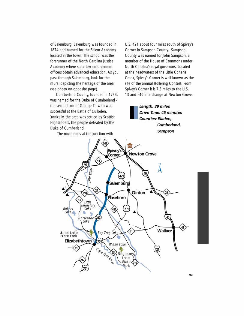
of Salemburg. Salemburg was founded in1874 and named for the Salem Academylocated in the town. The school was theforerunner of the North Carolina JusticeAcademy where state law enforcementofficers obtain advanced education. As youpass through Salemburg, look for themural depicting the heritage of the area(see photo on opposite page).
Cumberland County, founded in 1754,was named for the Duke of Cumberland -the second son of George II - who wassuccessful at the Battle of Culloden.Ironically, the area was settled by ScottishHighlanders, the people defeated by theDuke of Cumberland.
The route ends at the junction with
U.S. 421 about four miles south of Spivey’sCorner in Sampson County. SampsonCounty was named for John Sampson, amember of the House of Commons underNorth Carolina’s royal governors. Locatedat the headwaters of the Little CoharieCreek, Spivey’s Corner is well-known as thesite of the annual Hollering Contest. FromSpivey’s Corner it is 7.5 miles to the U.S.13 and I-40 interchange at Newton Grove.
Length: 39 miles
Drive Time: 45 minutes
Counties: Bladen,
Cumberland,
Sampson
93
Elizabethtown
421
411
Wallace
Roseboro
Spivey'sCorner Newton Grove
Salemburg
LittleSingletary
Lake
95
40
53
210
13
Jones LakeState Park
HorseshoeLake
White Lake
Singletary Lake StatePark
701
SouthR
iver
Cape Fear River
40242
701
701
41
Clinton24
242
24
41
421
210
53
242
41
BakersLake
Bay Tree Lake
70
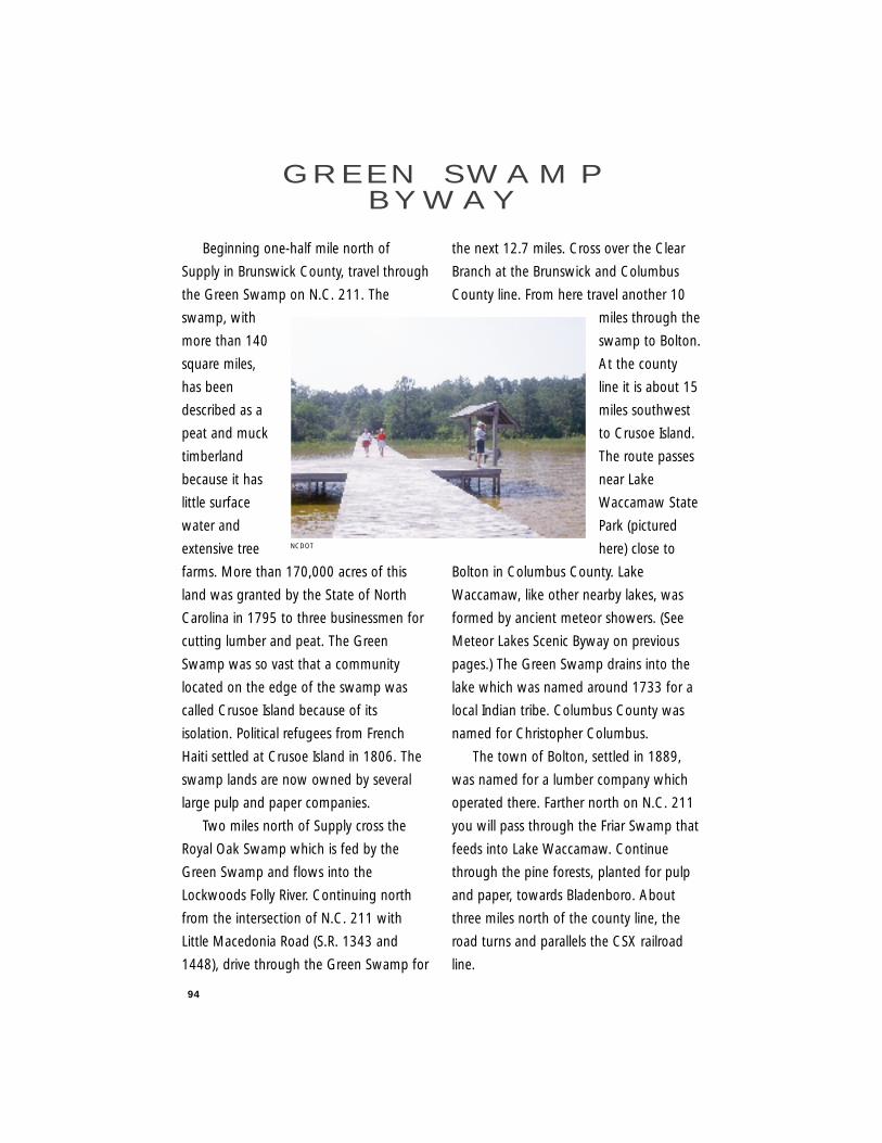
94
Beginning one-half mile north of
Supply in Brunswick County, travel through
the Green Swamp on N.C. 211. The
swamp, with
more than 140
square miles,
has been
described as a
peat and muck
timberland
because it has
little surface
water and
extensive tree
farms. More than 170,000 acres of this
land was granted by the State of North
Carolina in 1795 to three businessmen for
cutting lumber and peat. The Green
Swamp was so vast that a community
located on the edge of the swamp was
called Crusoe Island because of its
isolation. Political refugees from French
Haiti settled at Crusoe Island in 1806. The
swamp lands are now owned by several
large pulp and paper companies.
Two miles north of Supply cross the
Royal Oak Swamp which is fed by the
Green Swamp and flows into the
Lockwoods Folly River. Continuing north
from the intersection of N.C. 211 with
Little Macedonia Road (S.R. 1343 and
1448), drive through the Green Swamp for
the next 12.7 miles. Cross over the Clear
Branch at the Brunswick and Columbus
County line. From here travel another 10
miles through the
swamp to Bolton.
At the county
line it is about 15
miles southwest
to Crusoe Island.
The route passes
near Lake
Waccamaw State
Park (pictured
here) close to
Bolton in Columbus County. Lake
Waccamaw, like other nearby lakes, was
formed by ancient meteor showers. (See
Meteor Lakes Scenic Byway on previous
pages.) The Green Swamp drains into the
lake which was named around 1733 for a
local Indian tribe. Columbus County was
named for Christopher Columbus.
The town of Bolton, settled in 1889,
was named for a lumber company which
operated there. Farther north on N.C. 211
you will pass through the Friar Swamp that
feeds into Lake Waccamaw. Continue
through the pine forests, planted for pulp
and paper, towards Bladenboro. About
three miles north of the county line, the
road turns and parallels the CSX railroad
line.
G R E E N S W A M PB Y W AY
NCDOT
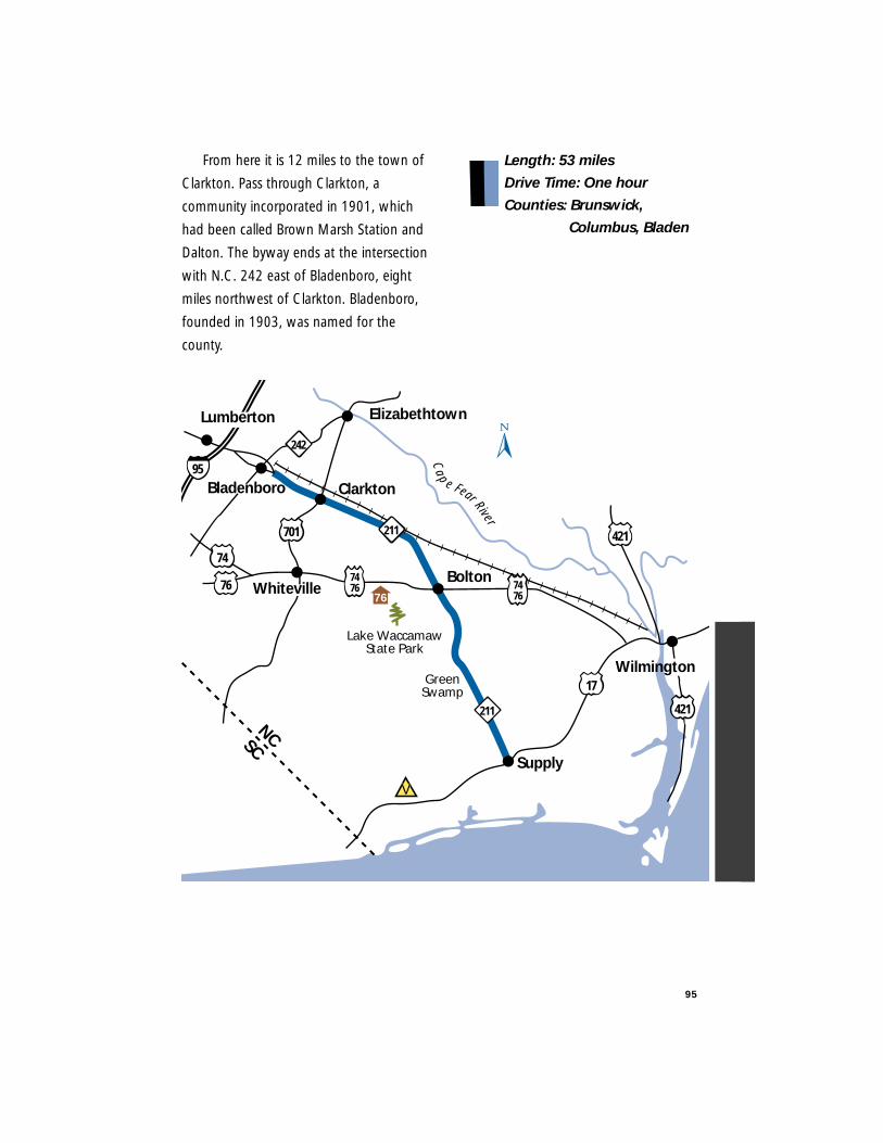
95
From here it is 12 miles to the town of
Clarkton. Pass through Clarkton, a
community incorporated in 1901, which
had been called Brown Marsh Station and
Dalton. The byway ends at the intersection
with N.C. 242 east of Bladenboro, eight
miles northwest of Clarkton. Bladenboro,
founded in 1903, was named for the
county.
Length: 53 miles
Drive Time: One hour
Counties: Brunswick,
Columbus, Bladen
Clarkton
Bolton
Supply
17GreenSwamp
211
NCSCLake Waccamaw
State Park
Cap e Fear River
701 421
421
Elizabethtown
74
242
747676
Wilmington
95
Lumberton
211
747676
Bladenboro
Whiteville
V
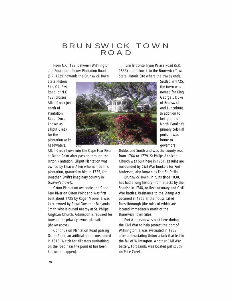
96
From N.C. 133, between Wilmingtonand Southport, follow Plantation Road(S.R. 1529) towards the Brunswick TownState HistoricSite. Old RiverRoad, or N.C.133, crossesAllen Creek justnorth ofPlantationRoad. Onceknown asLilliput Creekfor theplantation at itsheadwaters,Allen Creek flows into the Cape Fear Riverat Orton Point after passing through theOrton Plantation. Lilliput Plantation wasowned by Eleazar Allen who named thisplantation, granted to him in 1725, forJonathan Swift’s imaginary country inGulliver’s Travels.
Orton Plantation overlooks the CapeFear River on Orton Point and was firstbuilt about 1725 by Roger Moore. It waslater owned by Royal Governor BenjaminSmith who is buried nearby at St. PhilipsAnglican Church. Admission is required fortours of the privately-owned plantation(shown above).
Continue on Plantation Road passingOrton Pond, an artificial pond constructedin 1810. Watch for alligators sunbathingon the road near the pond (it has beenknown to happen).
Turn left onto Tryon Palace Road (S.R.1533) and follow it to the Brunswick TownState Historic Site where the byway ends.
Settled in 1725,the town wasnamed for KingGeorge I, Dukeof Brunswickand Lunenburg.In addition tobeing one ofNorth Carolina’sprimary colonialports, it washome togovernors
Dobbs and Smith and was the county seatfrom 1764 to 1779. St Philips AnglicanChurch was built here in 1751. Its ruins aresurrounded by Civil War bunkers for FortAnderson, also known as Fort St. Philip.
Brunswick Town, in ruins since 1830,has had a long history–from attacks by theSpanish in 1748, to Revolutionary and CivilWar battles. Resistance to the Stamp Actoccurred in 1765 at the house calledRusselborough (the ruins of which arelocated immediately north of theBrunswick Town Site).
Fort Anderson was built here duringthe Civil War to help protect the port ofWilmington. It was evacuated in 1865after a devastating Union attack that led tothe fall of Wilmington. Another Civil Warbattery, Fort Lamb, was located just southon Price Creek.
B R U N S W I C K T O W NR O A D
NCDOT
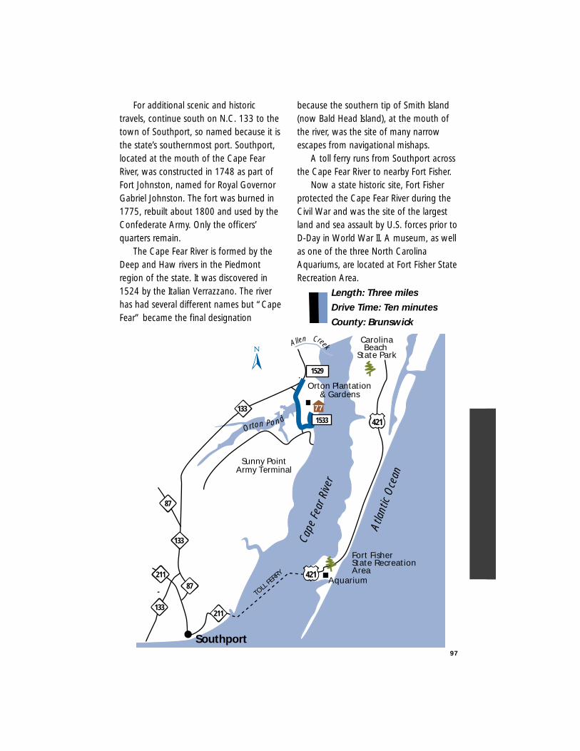
For additional scenic and historictravels, continue south on N.C. 133 to thetown of Southport, so named because it isthe state’s southernmost port. Southport,located at the mouth of the Cape FearRiver, was constructed in 1748 as part ofFort Johnston, named for Royal GovernorGabriel Johnston. The fort was burned in1775, rebuilt about 1800 and used by theConfederate Army. Only the officers’quarters remain.
The Cape Fear River is formed by theDeep and Haw rivers in the Piedmontregion of the state. It was discovered in1524 by the Italian Verrazzano. The riverhas had several different names but “CapeFear” became the final designation
because the southern tip of Smith Island(now Bald Head Island), at the mouth ofthe river, was the site of many narrowescapes from navigational mishaps.
A toll ferry runs from Southport acrossthe Cape Fear River to nearby Fort Fisher.
Now a state historic site, Fort Fisherprotected the Cape Fear River during theCivil War and was the site of the largestland and sea assault by U.S. forces prior toD-Day in World War II. A museum, as wellas one of the three North CarolinaAquariums, are located at Fort Fisher StateRecreation Area.
Length: Three miles
Drive Time: Ten minutes
County: Brunswick
97
TOLL
FERRY
421
87
211
211
421
Sunny PointArmy Terminal
Southport
Orton Pond
Orton Plantation& Gardens
Cape
Fear
Rive
rAllen Creek
Atla
ntic
Oce
an
133
133
133
1529
87
77
CarolinaBeach
State Park
Aquarium
Fort FisherState Recreation Area
1533
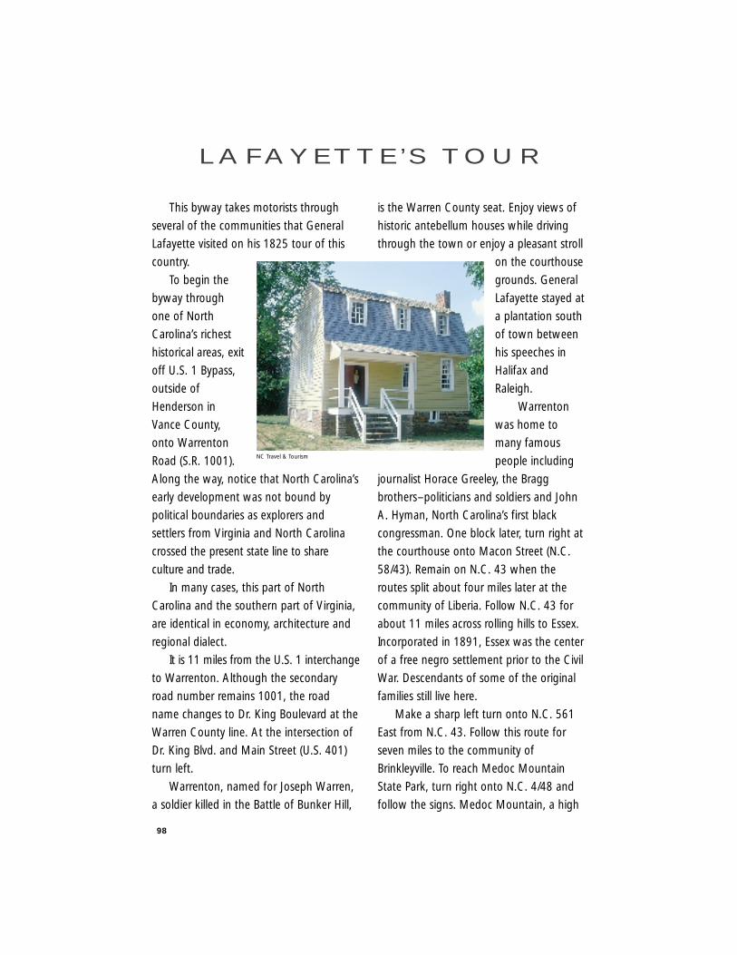
98
This byway takes motorists through
several of the communities that General
Lafayette visited on his 1825 tour of this
country.
To begin the
byway through
one of North
Carolina’s richest
historical areas, exit
off U.S. 1 Bypass,
outside of
Henderson in
Vance County,
onto Warrenton
Road (S.R. 1001).
Along the way, notice that North Carolina’s
early development was not bound by
political boundaries as explorers and
settlers from Virginia and North Carolina
crossed the present state line to share
culture and trade.
In many cases, this part of North
Carolina and the southern part of Virginia,
are identical in economy, architecture and
regional dialect.
It is 11 miles from the U.S. 1 interchange
to Warrenton. Although the secondary
road number remains 1001, the road
name changes to Dr. King Boulevard at the
Warren County line. At the intersection of
Dr. King Blvd. and Main Street (U.S. 401)
turn left.
Warrenton, named for Joseph Warren,
a soldier killed in the Battle of Bunker Hill,
is the Warren County seat. Enjoy views of
historic antebellum houses while driving
through the town or enjoy a pleasant stroll
on the courthouse
grounds. General
Lafayette stayed at
a plantation south
of town between
his speeches in
Halifax and
Raleigh.
Warrenton
was home to
many famous
people including
journalist Horace Greeley, the Bragg
brothers–politicians and soldiers and John
A. Hyman, North Carolina’s first black
congressman. One block later, turn right at
the courthouse onto Macon Street (N.C.
58/43). Remain on N.C. 43 when the
routes split about four miles later at the
community of Liberia. Follow N.C. 43 for
about 11 miles across rolling hills to Essex.
Incorporated in 1891, Essex was the center
of a free negro settlement prior to the Civil
War. Descendants of some of the original
families still live here.
Make a sharp left turn onto N.C. 561
East from N.C. 43. Follow this route for
seven miles to the community of
Brinkleyville. To reach Medoc Mountain
State Park, turn right onto N.C. 4/48 and
follow the signs. Medoc Mountain, a high
L A F AY E T T E ’ S T O U R
NC Travel & Tourism
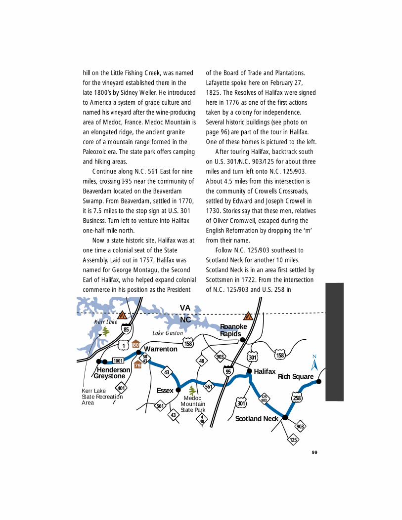
hill on the Little Fishing Creek, was named
for the vineyard established there in the
late 1800’s by Sidney Weller. He introduced
to America a system of grape culture and
named his vineyard after the wine-producing
area of Medoc, France. Medoc Mountain is
an elongated ridge, the ancient granite
core of a mountain range formed in the
Paleozoic era. The state park offers camping
and hiking areas.
Continue along N.C. 561 East for nine
miles, crossing I-95 near the community of
Beaverdam located on the Beaverdam
Swamp. From Beaverdam, settled in 1770,
it is 7.5 miles to the stop sign at U.S. 301
Business. Turn left to venture into Halifax
one-half mile north.
Now a state historic site, Halifax was at
one time a colonial seat of the State
Assembly. Laid out in 1757, Halifax was
named for George Montagu, the Second
Earl of Halifax, who helped expand colonial
commerce in his position as the President
of the Board of Trade and Plantations.
Lafayette spoke here on February 27,
1825. The Resolves of Halifax were signed
here in 1776 as one of the first actions
taken by a colony for independence.
Several historic buildings (see photo on
page 96) are part of the tour in Halifax.
One of these homes is pictured to the left.
After touring Halifax, backtrack south
on U.S. 301/N.C. 903/125 for about three
miles and turn left onto N.C. 125/903.
About 4.5 miles from this intersection is
the community of Crowells Crossroads,
settled by Edward and Joseph Crowell in
1730. Stories say that these men, relatives
of Oliver Cromwell, escaped during the
English Reformation by dropping the ‘m’
from their name.
Follow N.C. 125/903 southeast to
Scotland Neck for another 10 miles.
Scotland Neck is in an area first settled by
Scottsmen in 1722. From the intersection
of N.C. 125/903 and U.S. 258 in
99
Halifax
301
Rich Square
Scotland Neck
Warrenton
43
Essex
Greystone
158
561
95
561
VA
NC
1
Henderson1001
401
Lake Gaston
Kerr Lake
5843
301
125903
158
258
RoanokeRapids
903
448
48903
Medoc MountainState Park
43
85
125
Kerr LakeState RecreationArea
W W
79
80
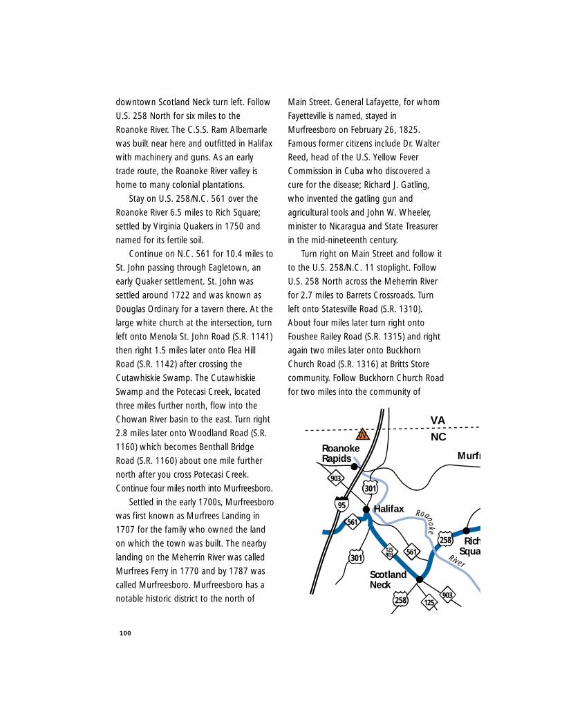
100
downtown Scotland Neck turn left. Follow
U.S. 258 North for six miles to the
Roanoke River. The C.S.S. Ram Albemarle
was built near here and outfitted in Halifax
with machinery and guns. As an early
trade route, the Roanoke River valley is
home to many colonial plantations.
Stay on U.S. 258/N.C. 561 over the
Roanoke River 6.5 miles to Rich Square;
settled by Virginia Quakers in 1750 and
named for its fertile soil.
Continue on N.C. 561 for 10.4 miles to
St. John passing through Eagletown, an
early Quaker settlement. St. John was
settled around 1722 and was known as
Douglas Ordinary for a tavern there. At the
large white church at the intersection, turn
left onto Menola St. John Road (S.R. 1141)
then right 1.5 miles later onto Flea Hill
Road (S.R. 1142) after crossing the
Cutawhiskie Swamp. The Cutawhiskie
Swamp and the Potecasi Creek, located
three miles further north, flow into the
Chowan River basin to the east. Turn right
2.8 miles later onto Woodland Road (S.R.
1160) which becomes Benthall Bridge
Road (S.R. 1160) about one mile further
north after you cross Potecasi Creek.
Continue four miles north into Murfreesboro.
Settled in the early 1700s, Murfreesboro
was first known as Murfrees Landing in
1707 for the family who owned the land
on which the town was built. The nearby
landing on the Meherrin River was called
Murfrees Ferry in 1770 and by 1787 was
called Murfreesboro. Murfreesboro has a
notable historic district to the north of
Main Street. General Lafayette, for whom
Fayetteville is named, stayed in
Murfreesboro on February 26, 1825.
Famous former citizens include Dr. Walter
Reed, head of the U.S. Yellow Fever
Commission in Cuba who discovered a
cure for the disease; Richard J. Gatling,
who invented the gatling gun and
agricultural tools and John W. Wheeler,
minister to Nicaragua and State Treasurer
in the mid-nineteenth century.
Turn right on Main Street and follow it
to the U.S. 258/N.C. 11 stoplight. Follow
U.S. 258 North across the Meherrin River
for 2.7 miles to Barrets Crossroads. Turn
left onto Statesville Road (S.R. 1310).
About four miles later turn right onto
Foushee Railey Road (S.R. 1315) and right
again two miles later onto Buckhorn
Church Road (S.R. 1316) at Britts Store
community. Follow Buckhorn Church Road
for two miles into the community of
Roanoke
River
Halifax
301
RichSqua
Murfr
258
Scotland Neck
561
95
VA
NC
301
125903 561
903125258
903
RoanokeRapids
W
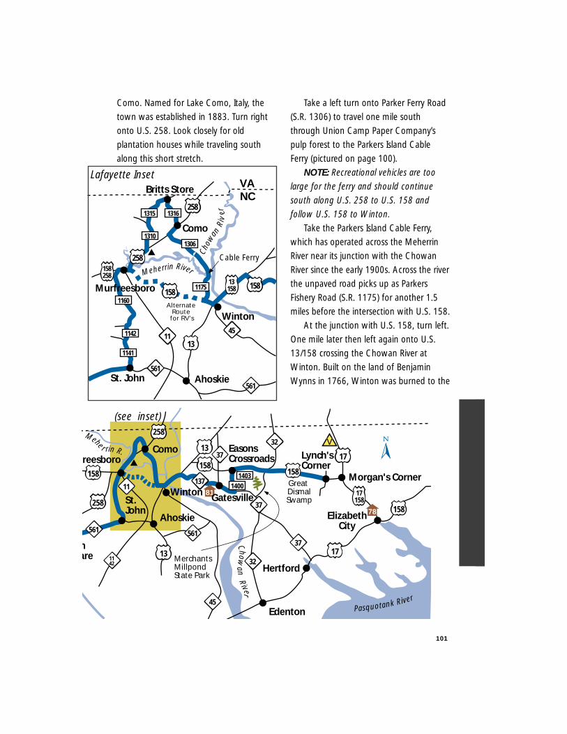
101
Como. Named for Lake Como, Italy, the
town was established in 1883. Turn right
onto U.S. 258. Look closely for old
plantation houses while traveling south
along this short stretch.
Take a left turn onto Parker Ferry Road
(S.R. 1306) to travel one mile south
through Union Camp Paper Company’s
pulp forest to the Parkers Island Cable
Ferry (pictured on page 100).
NOTE: Recreational vehicles are too
large for the ferry and should continue
south along U.S. 258 to U.S. 158 and
follow U.S. 158 to Winton.
Take the Parkers Island Cable Ferry,
which has operated across the Meherrin
River near its junction with the Chowan
River since the early 1900s. Across the river
the unpaved road picks up as Parkers
Fishery Road (S.R. 1175) for another 1.5
miles before the intersection with U.S. 158.
At the junction with U.S. 158, turn left.
One mile later then left again onto U.S.
13/158 crossing the Chowan River at
Winton. Built on the land of Benjamin
Wynns in 1766, Winton was burned to the
13158
1141
258
45
1310
1315 1316
258
St. John
VANC
Ahoskie
Winton
1160
1142
561
13
1175
158258
Alternate Route for RV’s
158
Cable Ferry
158
561
Meherrin River
Chow
anR
iver
Como
Britts Store
11
Murfreesboro
1306
Lafayette Inset
137
17h are
St. John
freesboro
561
37
Lynch'sCorner
Morgan's Corner
ElizabethCity
158
13
158
25817158
1317
Ahoskie
Winton
158
Great DismalSwamp
11
1142
ComoMehe r rin R. 37
32
37
Edenton
Hertford
Pasquotank River
158
561
45
14031400
(see inset)258
81
78
MerchantsMillpondState Park
EasonsCrossroads
32
Gatesville
Chowan
River
V
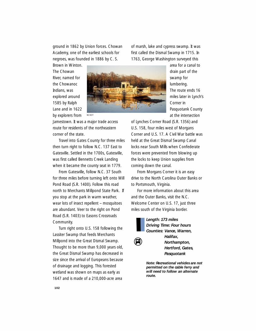
102
ground in 1862 by Union forces. Chowan
Academy, one of the earliest schools for
negroes, was founded in 1886 by C. S.
Brown in Winton.
The Chowan
River, named for
the Chowanoc
Indians, was
explored around
1585 by Ralph
Lane and in 1622
by explorers from
Jamestown. It was a major trade access
route for residents of the northeastern
corner of the state.
Travel into Gates County for three miles
then turn right to follow N.C. 137 East to
Gatesville. Settled in the 1700s, Gatesville,
was first called Bennetts Creek Landing
when it became the county seat in 1779.
From Gatesville, follow N.C. 37 South
for three miles before turning left onto Mill
Pond Road (S.R. 1400). Follow this road
north to Merchants Millpond State Park. If
you stop at the park in warm weather,
wear lots of insect repellent – mosquitoes
are abundant. Veer to the right on Pond
Road (S.R. 1403) to Easons Crossroads
Community.
Turn right onto U.S. 158 following the
Lassiter Swamp that feeds Merchants
Millpond into the Great Dismal Swamp.
Thought to be more than 9,000 years old,
the Great Dismal Swamp has decreased in
size since the arrival of Europeans because
of drainage and logging. This forested
wetland was shown on maps as early as
1647 and is made of a 210,000-acre area
of marsh, lake and cypress swamp. It was
first called the Dismal Swamp in 1715. In
1763, George Washington surveyed this
area for a canal to
drain part of the
swamp for
lumbering.
The route ends 16
miles later in Lynch’s
Corner in
Pasquotank County
at the intersection
of Lynches Corner Road (S.R. 1356) and
U.S. 158, four miles west of Morgans
Corner and U.S. 17. A Civil War battle was
held at the Great Dismal Swamp Canal
locks near South Mills when Confederate
forces were prevented from blowing up
the locks to keep Union supplies from
coming down the canal.
From Morgans Corner it is an easy
drive to the North Carolina Outer Banks or
to Portsmouth, Virginia.
For more information about this area
and the Outer Banks, visit the N.C.
Welcome Center on U.S. 17, just three
miles south of the Virginia border.
Length: 173 milesDriving Time: Four hoursCounties: Vance, Warren,
Halifax,Northampton,Hertford, Gates,Pasquotank
Note: Recreational vehicles are notpermitted on the cable ferry and will need to follow an alternate route.
NCDOT
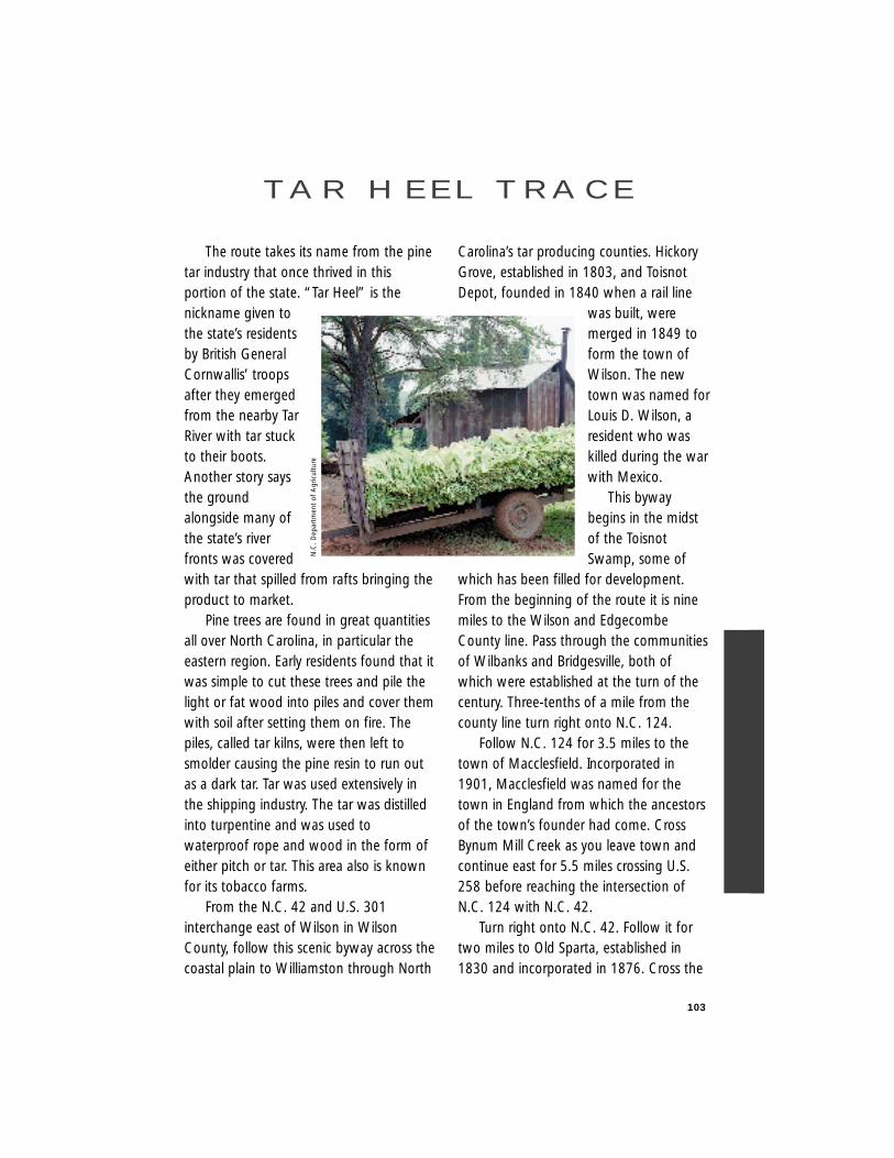
103
The route takes its name from the pinetar industry that once thrived in thisportion of the state. “Tar Heel” is thenickname given tothe state’s residentsby British GeneralCornwallis’ troopsafter they emergedfrom the nearby TarRiver with tar stuckto their boots.Another story saysthe groundalongside many ofthe state’s riverfronts was coveredwith tar that spilled from rafts bringing theproduct to market.
Pine trees are found in great quantitiesall over North Carolina, in particular theeastern region. Early residents found that itwas simple to cut these trees and pile thelight or fat wood into piles and cover themwith soil after setting them on fire. Thepiles, called tar kilns, were then left tosmolder causing the pine resin to run outas a dark tar. Tar was used extensively inthe shipping industry. The tar was distilledinto turpentine and was used towaterproof rope and wood in the form ofeither pitch or tar. This area also is knownfor its tobacco farms.
From the N.C. 42 and U.S. 301interchange east of Wilson in WilsonCounty, follow this scenic byway across thecoastal plain to Williamston through North
Carolina’s tar producing counties. HickoryGrove, established in 1803, and ToisnotDepot, founded in 1840 when a rail line
was built, weremerged in 1849 toform the town ofWilson. The newtown was named forLouis D. Wilson, aresident who waskilled during the warwith Mexico.
This bywaybegins in the midstof the ToisnotSwamp, some of
which has been filled for development.From the beginning of the route it is ninemiles to the Wilson and EdgecombeCounty line. Pass through the communitiesof Wilbanks and Bridgesville, both ofwhich were established at the turn of thecentury. Three-tenths of a mile from thecounty line turn right onto N.C. 124.
Follow N.C. 124 for 3.5 miles to thetown of Macclesfield. Incorporated in1901, Macclesfield was named for thetown in England from which the ancestorsof the town’s founder had come. CrossBynum Mill Creek as you leave town andcontinue east for 5.5 miles crossing U.S.258 before reaching the intersection ofN.C. 124 with N.C. 42.
Turn right onto N.C. 42. Follow it fortwo miles to Old Sparta, established in1830 and incorporated in 1876. Cross the
TA R H E E L T R A C E
N.C
. D
epar
tmen
t of
Agr
icul
ture
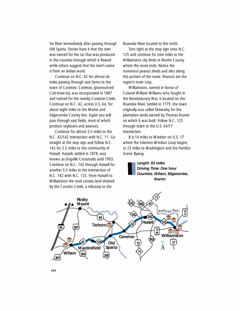
Tar River immediately after passing throughOld Sparta. Stories have it that the riverwas named for the tar that was producedin the counties through which it flowedwhile others suggest that the river’s nameis from an Indian word.
Continue on N.C. 42 for almost sixmiles passing through vast farms to thetown of Conetoe. Conetoe, (pronouncedCuh-knee-ta), was incorporated in 1887and named for the nearby Conetoe Creek.Continue on N.C. 42, across U.S. 64, forabout eight miles to the Martin andEdgecombe County line. Again you willpass through vast fields, most of whichproduce soybeans and peanuts.
Continue for almost 2.5 miles to theN.C. 42/142 intersection with N.C. 11. Gostraight at the stop sign and follow N.C.142 for 2.5 miles to the community ofHassell. Hassell, settled in 1878, wasknown as Dogville Crossroads until 1903.Continue on N.C. 142 through Hassell foranother 3.5 miles to the intersection ofN.C. 142 with N.C. 125. From Hassell toWilliamston the road crosses land drainedby the Conoho Creek, a tributary to the
Roanoke River located to the north.Turn right at the stop sign onto N.C.
125 and continue for nine miles to theWilliamston city limits in Martin Countywhere the route ends. Notice thenumerous peanut sheds and silos alongthis portion of the route. Peanuts are theregion’s main crop.
Williamston, named in honor ofColonel William Williams who fought inthe Revolutionary War, is located on theRoanoke River. Settled in 1779, the townoriginally was called Skewarky for theplantation lands owned by Thomas Hunteron which it was built. Follow N.C. 125through town to the U.S. 64/17intersection.
It is 14 miles to Windsor on U.S. 17where the Edenton-Windsor Loop beginsor 23 miles to Washington and the PamlicoScenic Byway.
Length: 53 milesDriving Time: One hourCounties: Wilson, Edgecombe,
Martin
104
Conetoe
Roano ke River
42 17
95
64
301
Macclesfield124
Wilson
142
125Tarboro
30142
264
42903125
13903
1364
1317
OldSparta
258
142
11
11
Williamston
Hassell
RockyMount
89
8588
86
82
8784
83
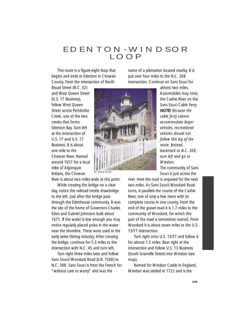
105
This route is a figure-eight loop thatbegins and ends in Edenton in ChowanCounty. From the intersection of NorthBroad Street (N.C. 32)and West Queen Street(U.S. 17 Business),follow West QueenStreet across PembrokeCreek, one of the twocreeks that formsEdenton Bay. Turn leftat the intersection ofU.S. 17 and U.S. 17Business. It is aboutone mile to theChowan River. Namedaround 1657 for a localtribe of AlgonquinIndians, the ChowanRiver is about two miles wide at this point.
While crossing the bridge on a clearday, notice the railroad trestle drawbridgeto the left. Just after the bridge passthrough the Edenhouse community. It wasthe site of the home of Governors CharlesEden and Gabriel Johnston built about1671. If the water is low enough you maynotice regularly placed poles in the waternear the shoreline. These were used in theearly seine fishing industry. After crossingthe bridge, continue for 5.3 miles to theintersection with N.C. 45 and turn left.
Turn right three miles later and followSans Souci/ Woodard Road (S.R. 1500) toN.C. 308. Sans Souci is from the French for“without care or worry” and was the
name of a plantation located nearby. It isjust over four miles to the N.C. 308intersection. Continue on Sans Souci for
almost two miles.Automobiles may crossthe Cashie River on theSans Souci Cable Ferry.NOTE: Because thecable ferry cannotaccommodate largervehicles, recreationalvehicles should notfollow this leg of theroute. Instead,backtrack to N.C. 308,turn left and go toWindsor.The community of SansSouci is just across the
river. Here the road is unpaved for the nexttwo miles. As Sans Souci/ Woodard Roadturns, it parallels the course of the CashieRiver, one of only a few rivers with itscomplete course in one county. From theend of the gravel road it is 1.7 miles to thecommunity of Woodard, for which thispart of the road is sometimes named. FromWoodard it is about seven miles to the U.S.13/17 intersection.
Turn right onto U.S. 13/17 and follow itfor almost 1.5 miles. Bear right at theintersection and follow U.S. 13 Business(South Granville Street) into Windsor (seemap).
Named for Windsor Castle in England,Windsor was settled in 1722 and is the
E D E N T O N - W I N D S O RL O O P
NC Travel & Tourism
Bertie County seat. It was the site of GraysLanding, an early trading point at theestate of William Gray. Prior to the CivilWar, Windsor was a major port of entryand business center on the road to Halifax.The main streets in town are King, Yorkand Queen with the cross streets beingnamed for the Lords Proprietors.
Northwest of town is Hope Plantation,the home of Governor David Stone. Builtabout 1800, it is an impressive example offederal architecture. Admission is chargedto this privately-owned National RegisterHistoric site.
South Granville Street becomesGranville Street at the U.S. 13 Businessintersection with N.C. 308. Continuestraight and then turn right onto KingStreet (N.C. 308). Enjoy views of some ofNorth Carolina’s finest residentialarchitecture of the 19th and early 20thcenturies. It is three-tenths of a mile untilKing Street crosses the Cashie River. Forthe next 1.5 miles N.C. 308 and U.S. 17share the road. Follow N.C. 308 by turningright off of U.S. 17. The next 11 milesagain parallel the Cashie River.
At the stop sign turn right and followN.C. 45/308 across the Three Rivers bridge.Located at the mouth of Bachelor Bay, theCashie, Middle and Roanoke rivers meet inthe beautiful flowing delta below. BatchelorBay forms the head of the AlbemarleSound and was the site of a Civil WarBattle that the Confederates won in 1864.
Continue on N.C. 308 by turning left atthe light. Follow this road for about sevenmiles, past Mackeys (known locally asMackeys Ferry), originally the southterminal of the Albemarle Sound ferry
which once operated where the railroadnow crosses the sound. The earliestrecorded ferry was known as T. Bells ferryin 1733. Settled in 1765, Mackeys wasnamed for Colonel William Mackey, a localland owner who bought the ferry from Bellin 1735.
Turn left onto U.S. 64 East and followfor five miles until N.C. 32 turns left. Alocal landmark on U.S. 64 nearSkinnersville is Rehoboth Church, built byslaves in 1853. This chapel is built on thesite of an earlier colonial Anglican church.It also is listed in the National Register ofHistoric Places.
Follow N.C. 32 across the AlbemarleSound Bridge, opened in 1989. At morethan three miles long, it is the longestbridge over water in the state. TheAlbemarle Sound was explored byEuropeans as early as 1586 when it wascalled the Sea of Roanoke. Named forGeorge Monck, Duke of Albemarle, mostof North Carolina’s earliest settlements maybe found along its shores.
One mile after crossing the bridge turnleft onto Soundside Road (S.R. 1114). Thissix-mile road follows a road built by earlysettlers who followed old Indian trailsalong the shores of the sound. CalledSoundside Road for more than 200 years,early plantations were found along itspath. Follow Soundside Road until itintersects with N.C. 32.
Turn left onto N.C. 32. One mile latercross Queen Anne Creek, one of the twocreeks that forms Edenton Bay. Enter thetown of Edenton, North Carolina’s firstprovincial capital, one mile after crossingthe creek on East Church Street.
106
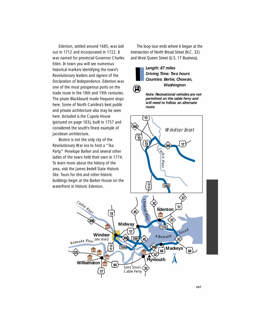
Edenton, settled around 1685, was laidout in 1712 and incorporated in 1722. Itwas named for provincial Governor CharlesEden. In town you will see numeroushistorical markers identifying the town’sRevolutionary leaders and signers of theDeclaration of Independence. Edenton wasone of the most prosperous ports on thetrade route in the 18th and 19th centuries.The pirate Blackbeard made frequent stopshere. Some of North Carolina’s best publicand private architecture also may be seenhere. Included is the Cupola House(pictured on page 103), built in 1757 andconsidered the south’s finest example ofJacobean architecture.
Boston is not the only city of theRevolutionary War era to host a “TeaParty.” Penelope Barker and several otherladies of the town held their own in 1774.To learn more about the history of thearea, visit the James Iredell State HistoricSite. Tours for this and other historicbuildings begin at the Barker House on thewaterfront in Historic Edenton.
The loop tour ends where it began at theintersection of North Broad Street (N.C. 32)and West Queen Street (U.S. 17 Business).
Length: 87 milesDriving Time: Two hoursCounties: Bertie, Chowan,
Washington
Note: Recreational vehicles are notpermitted on the cable ferry and will need to follow an alternate route.
107
(see inset)Windsor
Midway
Edenton
WilliamstonPlymouth
Mackeys1500
1500
1114
17
6464
64
17
13
17
1317
Roanoke River
CashieRive r
Chow
anRiver
AlbemarleSound
32
32
32
32
45308
125
308
308
37
37
45
92
91
88
Sans SouciCable Ferry
90
8784
86
83
Cashie
River
1317 1500
17
308
308
13BYP
Windsor Inset
13
13BUS
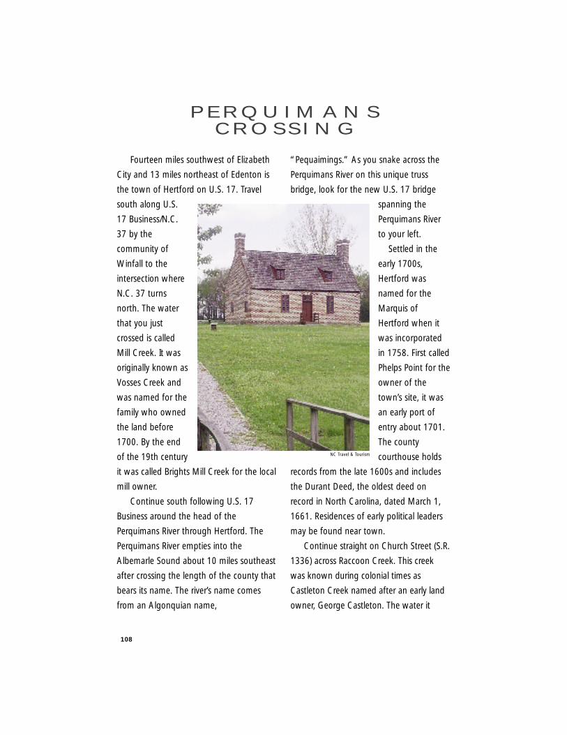
108
Fourteen miles southwest of Elizabeth
City and 13 miles northeast of Edenton is
the town of Hertford on U.S. 17. Travel
south along U.S.
17 Business/N.C.
37 by the
community of
Winfall to the
intersection where
N.C. 37 turns
north. The water
that you just
crossed is called
Mill Creek. It was
originally known as
Vosses Creek and
was named for the
family who owned
the land before
1700. By the end
of the 19th century
it was called Brights Mill Creek for the local
mill owner.
Continue south following U.S. 17
Business around the head of the
Perquimans River through Hertford. The
Perquimans River empties into the
Albemarle Sound about 10 miles southeast
after crossing the length of the county that
bears its name. The river’s name comes
from an Algonquian name,
“Pequaimings.” As you snake across the
Perquimans River on this unique truss
bridge, look for the new U.S. 17 bridge
spanning the
Perquimans River
to your left.
Settled in the
early 1700s,
Hertford was
named for the
Marquis of
Hertford when it
was incorporated
in 1758. First called
Phelps Point for the
owner of the
town’s site, it was
an early port of
entry about 1701.
The county
courthouse holds
records from the late 1600s and includes
the Durant Deed, the oldest deed on
record in North Carolina, dated March 1,
1661. Residences of early political leaders
may be found near town.
Continue straight on Church Street (S.R.
1336) across Raccoon Creek. This creek
was known during colonial times as
Castleton Creek named after an early land
owner, George Castleton. The water it
P E R Q U I M A N SC R O S S I N G
NC Travel & Tourism
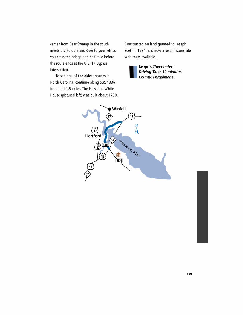
109
carries from Bear Swamp in the south
meets the Perquimans River to your left as
you cross the bridge one-half mile before
the route ends at the U.S. 17 Bypass
intersection.
To see one of the oldest houses in
North Carolina, continue along S.R. 1336
for about 1.5 miles. The Newbold-White
House (pictured left) was built about 1730.
Constructed on land granted to Joseph
Scott in 1684, it is now a local historic site
with tours available.
Length: Three milesDriving Time: 10 minutesCounty: Perquimans
Hertford
BUS
17
Perquimans River1336
17
371336
37
BUS
17
BYP
17
17
Winfall
37
93
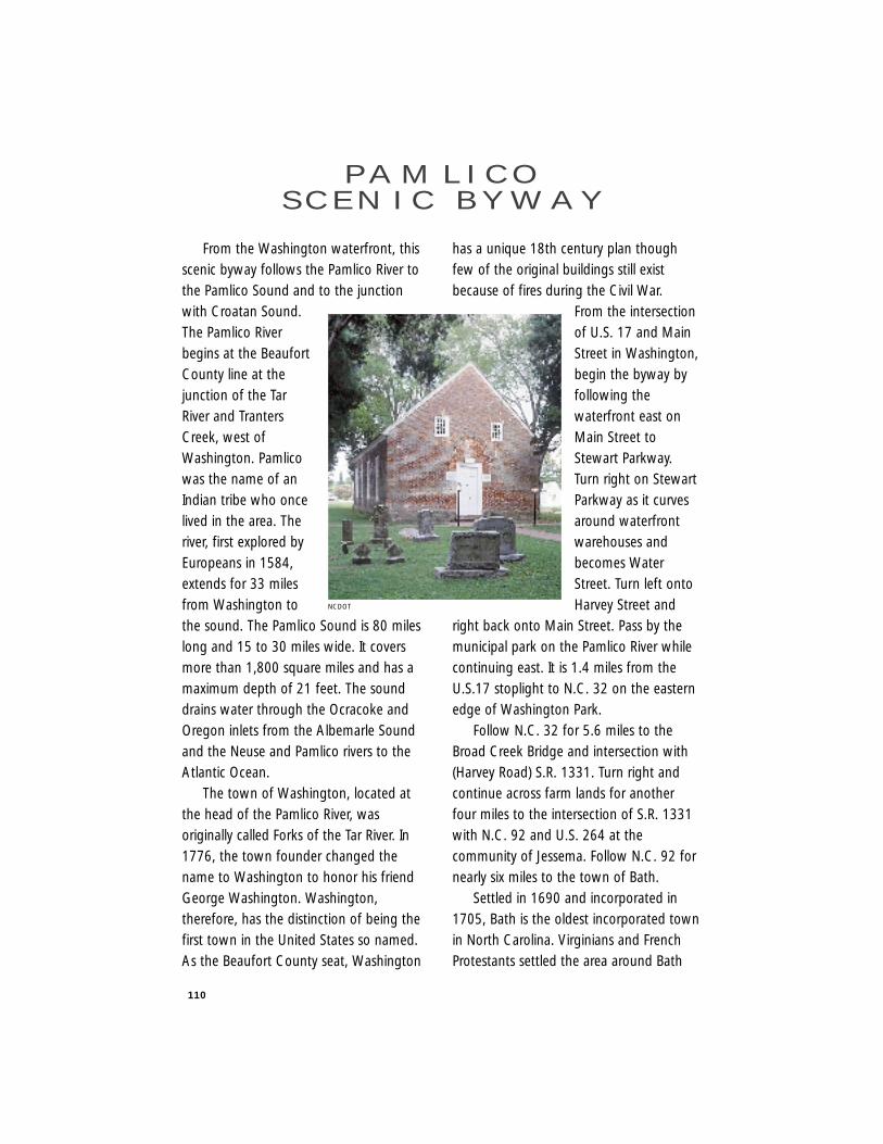
110
From the Washington waterfront, thisscenic byway follows the Pamlico River tothe Pamlico Sound and to the junctionwith Croatan Sound.The Pamlico Riverbegins at the BeaufortCounty line at thejunction of the TarRiver and TrantersCreek, west ofWashington. Pamlicowas the name of anIndian tribe who oncelived in the area. Theriver, first explored byEuropeans in 1584,extends for 33 milesfrom Washington tothe sound. The Pamlico Sound is 80 mileslong and 15 to 30 miles wide. It coversmore than 1,800 square miles and has amaximum depth of 21 feet. The sounddrains water through the Ocracoke andOregon inlets from the Albemarle Soundand the Neuse and Pamlico rivers to theAtlantic Ocean.
The town of Washington, located atthe head of the Pamlico River, wasoriginally called Forks of the Tar River. In1776, the town founder changed thename to Washington to honor his friendGeorge Washington. Washington,therefore, has the distinction of being thefirst town in the United States so named.As the Beaufort County seat, Washington
has a unique 18th century plan thoughfew of the original buildings still existbecause of fires during the Civil War.
From the intersectionof U.S. 17 and MainStreet in Washington,begin the byway byfollowing thewaterfront east onMain Street toStewart Parkway.Turn right on StewartParkway as it curvesaround waterfrontwarehouses andbecomes WaterStreet. Turn left ontoHarvey Street and
right back onto Main Street. Pass by themunicipal park on the Pamlico River whilecontinuing east. It is 1.4 miles from theU.S.17 stoplight to N.C. 32 on the easternedge of Washington Park.
Follow N.C. 32 for 5.6 miles to theBroad Creek Bridge and intersection with(Harvey Road) S.R. 1331. Turn right andcontinue across farm lands for anotherfour miles to the intersection of S.R. 1331with N.C. 92 and U.S. 264 at thecommunity of Jessema. Follow N.C. 92 fornearly six miles to the town of Bath.
Settled in 1690 and incorporated in1705, Bath is the oldest incorporated townin North Carolina. Virginians and FrenchProtestants settled the area around Bath
PA M L I C OS C E N I C B Y W AY
NCDOT
111
when the town was called the Town ofPamticoe (an early version of Pamlico).Located on what was called Town Creekand now Bath Creek, Bath is the home ofthe oldest church in North Carolina, St.Thomas Church, built in 1734 (pictured atthe left). Royal Governor Charles Eden hada provincial capital at Bath while EdwardTeach, better known as Blackbeard, madehis home on nearby Plum Point. Bath is nowa state historic site with several restoredbuildings open to the public. Take awalking tour of the town to truly appreciatethe flavor of this 18th century town.
After touring Bath, cross Back Creekand continue along N.C. 92 for about fivemiles to the intersection with N.C. 306where it becomes N.C. 99. From here theroad turns north to skirt Jackson Swamp tothe northwest and the Pungo River to theeast. Follow N.C. 99 for seven miles to thebridge at Pungo Creek. The creek and theriver both derive their names fromMachapunga, an Indian name given themas early as 1733. From here it is 3.5 milesto the Pantego Creek and Belhaven townlimits.
At the traffic light in Belhaven, turnright to follow U.S. 264 Business throughtown. Located on the site of an Indianvillage called Aquascogoc, Belhaven,settled in 1890 and incorporated in 1899,derives its name from the French words‘belle’ and ‘haven’–meaning beautifulharbor. The town is a major stopping pointfor boats traveling the IntracoastalWaterway. Join U.S. 264 and continue eastfor about 5.5 miles to the Pungo RiverBridge at the community of Leechville.
Continue for another 4.5 miles to theIntracoastal Waterway bridge whichpresents an impressive view of thewaterway for miles to the northeast.
Continue along U.S. 264/N.C. 45 forfour miles to Scranton, named for alumber mill owner who came fromScranton, Pennsylvania. Just past Scrantonenjoy an unusual stretch of road wheredrainage canals and trees on either sideform a unique and protective seven-miletunnel with views of vast fields and treefarms on either side. While passingthrough the community of Rose Bay, travelparallel to the Swan Quarter NationalWildlife Refuge which covers the PamlicoSound coast around the Swan Quarterarea.
Turn right, 2.5 miles after Rose Bay,onto N.C. 45 and follow it into the townof Swan Quarter. Settled before 1836, it isthe Hyde County seat and a fishingcommunity. Continue through town onN.C. 45 to reach the Swan Quarter/Ocracoke Ferry and the Outer Banks ScenicByway. Or, continue this route leavingtown by way of Main St. (S.R. 1129) whichleads back to U.S. 264 just east of SwanQuarter. The farms on either side of theroad are on lands reclaimed by drainingthe surrounding swamps. This is nowillegal, because the swamps are animportant part of the natural cycles toclean water for both humans and theanimals that are part of the food chain.
Continue east on U.S. 264, but becautious of the elbow curves at SwindellFork about one mile from S.R. 1129 andanother two miles further. At the second
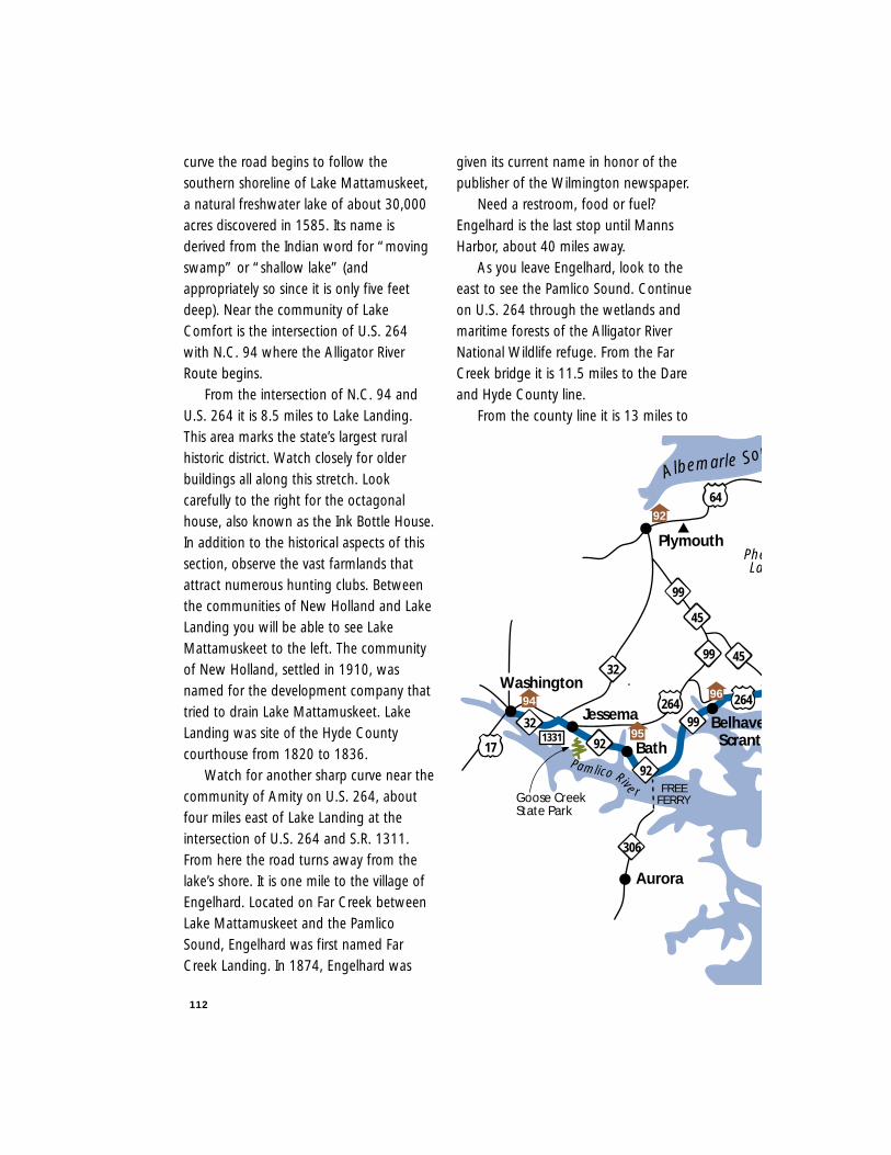
112
curve the road begins to follow thesouthern shoreline of Lake Mattamuskeet,a natural freshwater lake of about 30,000acres discovered in 1585. Its name isderived from the Indian word for “movingswamp” or “shallow lake” (andappropriately so since it is only five feetdeep). Near the community of LakeComfort is the intersection of U.S. 264with N.C. 94 where the Alligator RiverRoute begins.
From the intersection of N.C. 94 andU.S. 264 it is 8.5 miles to Lake Landing.This area marks the state’s largest ruralhistoric district. Watch closely for olderbuildings all along this stretch. Lookcarefully to the right for the octagonalhouse, also known as the Ink Bottle House.In addition to the historical aspects of thissection, observe the vast farmlands thatattract numerous hunting clubs. Betweenthe communities of New Holland and LakeLanding you will be able to see LakeMattamuskeet to the left. The communityof New Holland, settled in 1910, wasnamed for the development company thattried to drain Lake Mattamuskeet. LakeLanding was site of the Hyde Countycourthouse from 1820 to 1836.
Watch for another sharp curve near thecommunity of Amity on U.S. 264, aboutfour miles east of Lake Landing at theintersection of U.S. 264 and S.R. 1311.From here the road turns away from thelake’s shore. It is one mile to the village ofEngelhard. Located on Far Creek betweenLake Mattamuskeet and the PamlicoSound, Engelhard was first named FarCreek Landing. In 1874, Engelhard was
given its current name in honor of thepublisher of the Wilmington newspaper.
Need a restroom, food or fuel?Engelhard is the last stop until MannsHarbor, about 40 miles away.
As you leave Engelhard, look to theeast to see the Pamlico Sound. Continueon U.S. 264 through the wetlands andmaritime forests of the Alligator RiverNational Wildlife refuge. From the FarCreek bridge it is 11.5 miles to the Dareand Hyde County line.
From the county line it is 13 miles to
45
32
264
Bath
Jessema Belhave
64
Pamlico Rive r
Scranto
FREEFERRY
Albemarle Sou
Aurora
92
32
92
264
99
45
99
99
17
Washington
Plymouth
1331
306
9694
92
95
Goose CreekState Park
PheLa
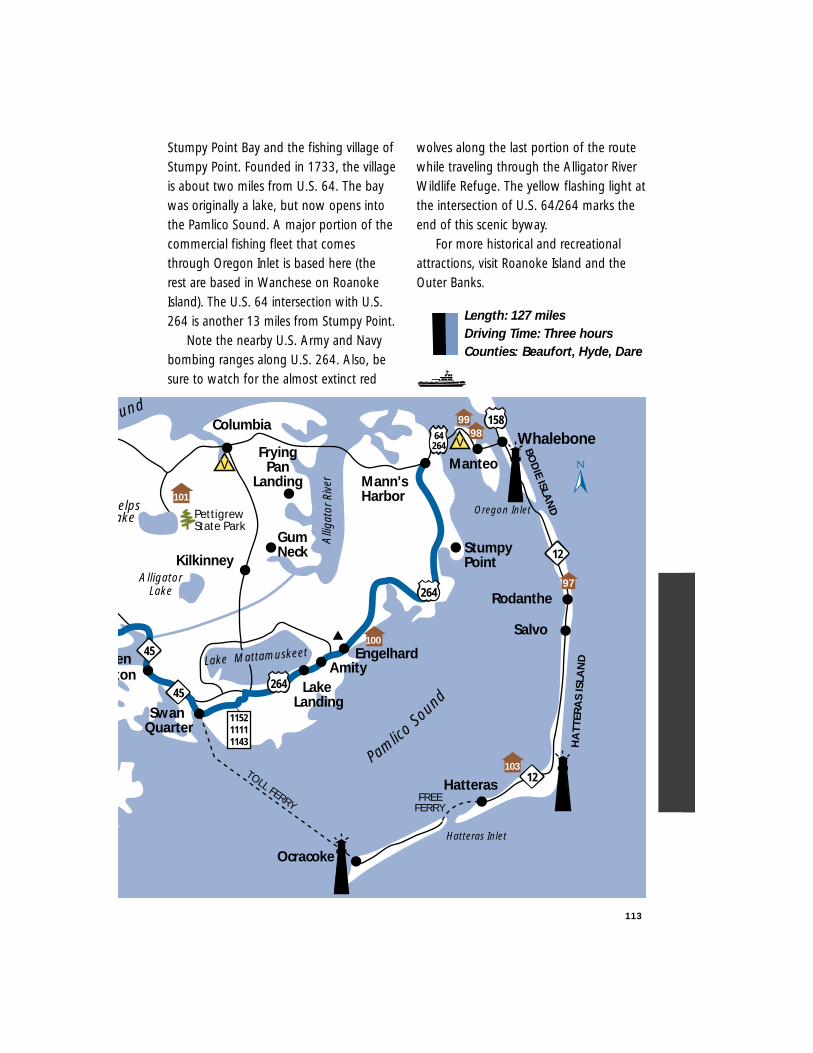
Stumpy Point Bay and the fishing village ofStumpy Point. Founded in 1733, the villageis about two miles from U.S. 64. The baywas originally a lake, but now opens intothe Pamlico Sound. A major portion of thecommercial fishing fleet that comesthrough Oregon Inlet is based here (therest are based in Wanchese on RoanokeIsland). The U.S. 64 intersection with U.S.264 is another 13 miles from Stumpy Point.
Note the nearby U.S. Army and Navybombing ranges along U.S. 264. Also, besure to watch for the almost extinct red
wolves along the last portion of the routewhile traveling through the Alligator RiverWildlife Refuge. The yellow flashing light atthe intersection of U.S. 64/264 marks theend of this scenic byway.
For more historical and recreationalattractions, visit Roanoke Island and theOuter Banks.
Length: 127 milesDriving Time: Three hoursCounties: Beaufort, Hyde, Dare
113
TOLL FERRY
enton
Swan Quarter
Engelhard
Ocracoke
Salvo
Whalebone
HatterasFREE
FERRY
Oregon Inlet
Pamlico
Soun
d
BOD
IE ISLAN
D
Hatteras Inlet
Alli
gato
rRiv
er
158
Manteo
ound
AlligatorLake
12
Rodanthe
HA
TTER
AS
ISLA
ND
45
264
45264
12
115211111143
AmityLake
Landing
64264
Kilkinney
Columbia
FryingPan
Landing
GumNeck
Mann'sHarbor
Lake Mattamuskeet
9899
97
StumpyPoint
PettigrewState Park
elpsake
100
103
101
V
V
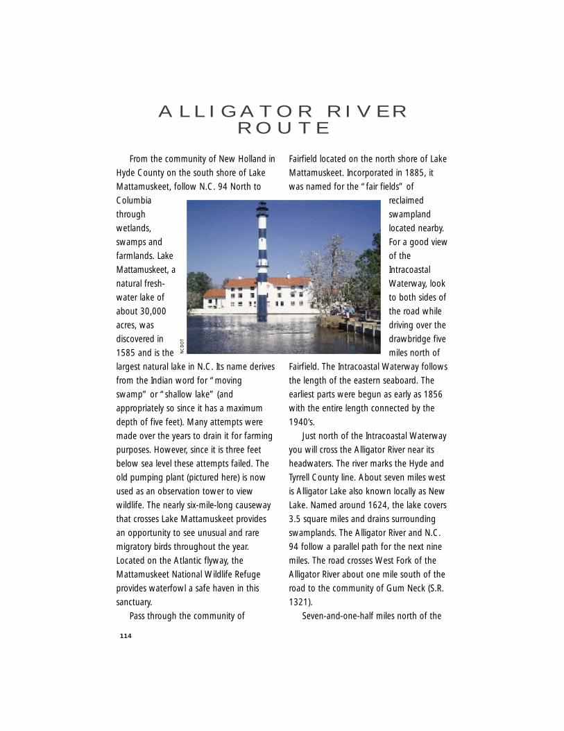
114
From the community of New Holland in
Hyde County on the south shore of Lake
Mattamuskeet, follow N.C. 94 North to
Columbia
through
wetlands,
swamps and
farmlands. Lake
Mattamuskeet, a
natural fresh-
water lake of
about 30,000
acres, was
discovered in
1585 and is the
largest natural lake in N.C. Its name derives
from the Indian word for “moving
swamp” or “shallow lake” (and
appropriately so since it has a maximum
depth of five feet). Many attempts were
made over the years to drain it for farming
purposes. However, since it is three feet
below sea level these attempts failed. The
old pumping plant (pictured here) is now
used as an observation tower to view
wildlife. The nearly six-mile-long causeway
that crosses Lake Mattamuskeet provides
an opportunity to see unusual and rare
migratory birds throughout the year.
Located on the Atlantic flyway, the
Mattamuskeet National Wildlife Refuge
provides waterfowl a safe haven in this
sanctuary.
Pass through the community of
Fairfield located on the north shore of Lake
Mattamuskeet. Incorporated in 1885, it
was named for the “fair fields” of
reclaimed
swampland
located nearby.
For a good view
of the
Intracoastal
Waterway, look
to both sides of
the road while
driving over the
drawbridge five
miles north of
Fairfield. The Intracoastal Waterway follows
the length of the eastern seaboard. The
earliest parts were begun as early as 1856
with the entire length connected by the
1940’s.
Just north of the Intracoastal Waterway
you will cross the Alligator River near its
headwaters. The river marks the Hyde and
Tyrrell County line. About seven miles west
is Alligator Lake also known locally as New
Lake. Named around 1624, the lake covers
3.5 square miles and drains surrounding
swamplands. The Alligator River and N.C.
94 follow a parallel path for the next nine
miles. The road crosses West Fork of the
Alligator River about one mile south of the
road to the community of Gum Neck (S.R.
1321).
Seven-and-one-half miles north of the
A L L I G AT O R R I V E RR O U T E
NC
DO
T
115
Gum Neck intersection is the road to Frying
Pan Landing (S.R. 1307). The community,
named for the unusually shaped bay off
the Alligator River, is located six miles east.
The flat lands that you are driving through
are all part of the Hollow Ground Swamp.
Some of them were claimed through a
process called “swamp busting” to create
farmlands. In this now-prohibited process,
farmers drained the swamps by constructing
canals and installing drainage ways to direct
the water away from the rich swamp soils.
Seven miles north of Frying Pan
Landing is Columbia. Columbia, founded
in the early 1700s as a trading post on the
Scuppernong River, is the Tyrrell County
seat. At the traffic light in Columbia at U.S.
64 and N.C. 94, continue straight. At the
next block turn right onto U.S. 64 Business
and drive through downtown. Turn left
onto U.S. 64 and continue east through
the Big Savannah.
The Big Savannah, a straight marsh or
slough, covers the area from Columbia to
the community of Alligator, a distance of
8.2 miles. The canal that follows the road
was dug to provide drainage for U.S. 64.
Though you cannot see Alligator Creek
from the road, it flows east as it parallels
the road to the north. From the community
of Alligator it is five miles to the Alligator
River. To your distant left is the mouth of
the river where it enters the Albemarle
Sound. The 2.7-mile-long bridge has an
active swing section for boats following
the Intracoastal Waterway, so be prepared
to stop.
Once across the Alligator River you will
enter into Dare County and the Alligator
River National Wildlife Refuge. The wildlife
refuge was established to protect a unique
pocosin habitat and restore wetlands for
native and endangered species. Look
carefully for wildlife in and near the
drainage canal alongside the road. The
community of East Lake is a mile from the
bridge. From here it is 13 miles to the
intersection of U.S. 64 with U.S. 264 at the
flashing light. Turn left and follow U.S.
64/.264 for 1.5 miles to the stop sign.
Turn left again and drive through the
fishing village of Mann’s Harbor. Mann’s
Harbor, named for a German fishing
captain who sheltered here during a storm,
was settled in the 19th century. Note the
tiny white frame post office building on
the right as you travel through the
community before crossing the Croatan
Sound to Roanoke Island.
The Croatan Sound, named for an
Indian tribe, connects the Albemarle and
Pamlico sounds by way of the 2.7-mile-
long bridge. Roanoke Island was the site of
the first English settlement in the United
States. Travel for one mile from the bridge
to the Fort Raleigh National Monument
and Elizabethan Gardens where the route
ends (S.R. 1161/1186). This national
historic site is the approximate location of a
settlement, sponsored in part by Sir Walter
Raleigh for Queen Elizabeth I, from 1584
to 1587 when it disappeared.
During the summer months, visitors
may see productions of the “Lost Colony,”
the outdoor drama about Sir Walter
Raleigh and the first American settlement.

116
History buffs also may want to visit the
Elizabeth II State Historic Site in Manteo in
Dare County.
Representative of the type of ship used
during the 1585 voyage to Roanoke, the
Elizabeth II is a living museum about life in
the 16th century and is located on
Shallowbag Bay. For those interested in
marine life, visit the North Carolina
Aquarium on Roanoke Island beside the
airport.
Other points of interest and recreation
may be found on the Outer Banks islands
to the east, including the Wright Brothers
Monument and Jockeys Ridge, the largest
active sand dune on the east coast. If you
would like to travel along other scenic
byways, the Outer Banks Scenic Byway
runs along N.C. 12 to Beaufort or
backtrack on U.S. 264 to drive the Pamlico
Scenic Byway to Washington.
Length: 71 milesDriving Time: 1.5 hoursCounties: Hyde, Tyrrell, Dare
Columbia
264
Frying Pan Landing
Gum Neck
EastLake
Manteo
StumpyPoint
Mann'sHarbor
Roanoke Island
Pamlico
Soun
d
Albemarle Sound
Kilkinney
Creswell
Fairfield
AtlanticO
cean
Alli
gato
rRi
ver
12
158
CroatanSound
264
Alligator Lake
64
EngelhardAmity
NewHolland
Rodanthe
Salvo
Lake Landing
Roanoke Sound
Intracoastal Waterw
ay
94
64
Lake Mattamuskeet
97
9899
PettigrewState Park
PhelpsLake 101
100
64264
V
V
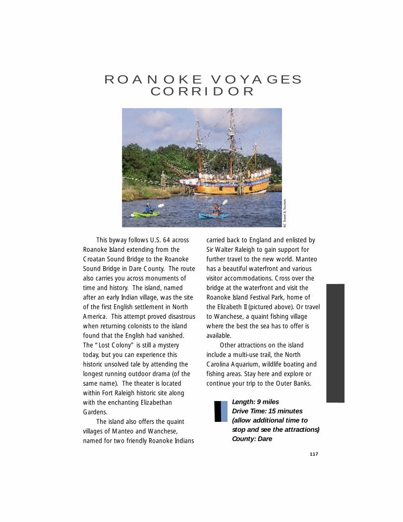
117
This byway follows U.S. 64 acrossRoanoke Island extending from theCroatan Sound Bridge to the RoanokeSound Bridge in Dare County. The routealso carries you across monuments oftime and history. The island, namedafter an early Indian village, was the siteof the first English settlement in NorthAmerica. This attempt proved disastrouswhen returning colonists to the islandfound that the English had vanished.The “Lost Colony” is still a mysterytoday, but you can experience thishistoric unsolved tale by attending thelongest running outdoor drama (of thesame name). The theater is locatedwithin Fort Raleigh historic site alongwith the enchanting ElizabethanGardens.
The island also offers the quaintvillages of Manteo and Wanchese,named for two friendly Roanoke Indians
carried back to England and enlisted bySir Walter Raleigh to gain support forfurther travel to the new world. Manteohas a beautiful waterfront and variousvisitor accommodations. Cross over thebridge at the waterfront and visit theRoanoke Island Festival Park, home ofthe Elizabeth II (pictured above). Or travelto Wanchese, a quaint fishing villagewhere the best the sea has to offer isavailable.
Other attractions on the islandinclude a multi-use trail, the NorthCarolina Aquarium, wildlife boating andfishing areas. Stay here and explore orcontinue your trip to the Outer Banks.
Length: 9 milesDrive Time: 15 minutes (allow additional time to stop and see the attractions)County: Dare
R O A N O K E V O YA G E SC O R R I D O R
NC
Tra
vel &
Tou
rism
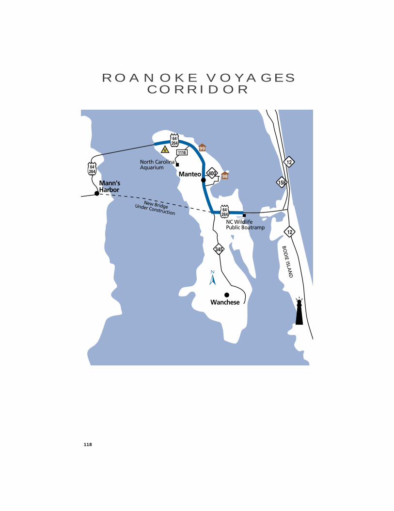
118
R O A N O K E V O YA G E SC O R R I D O R
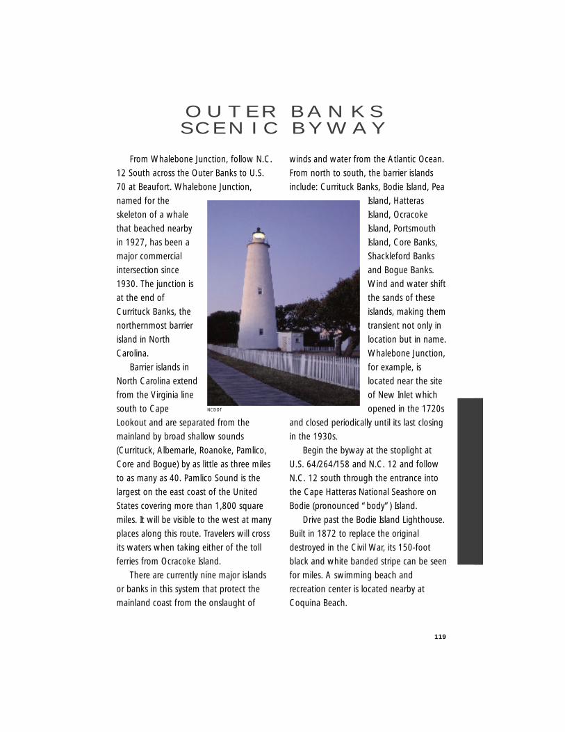
119
From Whalebone Junction, follow N.C.
12 South across the Outer Banks to U.S.
70 at Beaufort. Whalebone Junction,
named for the
skeleton of a whale
that beached nearby
in 1927, has been a
major commercial
intersection since
1930. The junction is
at the end of
Currituck Banks, the
northernmost barrier
island in North
Carolina.
Barrier islands in
North Carolina extend
from the Virginia line
south to Cape
Lookout and are separated from the
mainland by broad shallow sounds
(Currituck, Albemarle, Roanoke, Pamlico,
Core and Bogue) by as little as three miles
to as many as 40. Pamlico Sound is the
largest on the east coast of the United
States covering more than 1,800 square
miles. It will be visible to the west at many
places along this route. Travelers will cross
its waters when taking either of the toll
ferries from Ocracoke Island.
There are currently nine major islands
or banks in this system that protect the
mainland coast from the onslaught of
winds and water from the Atlantic Ocean.
From north to south, the barrier islands
include: Currituck Banks, Bodie Island, Pea
Island, Hatteras
Island, Ocracoke
Island, Portsmouth
Island, Core Banks,
Shackleford Banks
and Bogue Banks.
Wind and water shift
the sands of these
islands, making them
transient not only in
location but in name.
Whalebone Junction,
for example, is
located near the site
of New Inlet which
opened in the 1720s
and closed periodically until its last closing
in the 1930s.
Begin the byway at the stoplight at
U.S. 64/264/158 and N.C. 12 and follow
N.C. 12 south through the entrance into
the Cape Hatteras National Seashore on
Bodie (pronounced “body”) Island.
Drive past the Bodie Island Lighthouse.
Built in 1872 to replace the original
destroyed in the Civil War, its 150-foot
black and white banded stripe can be seen
for miles. A swimming beach and
recreation center is located nearby at
Coquina Beach.
O U T E R B A N K SS C E N I C B Y W AY
NCDOT
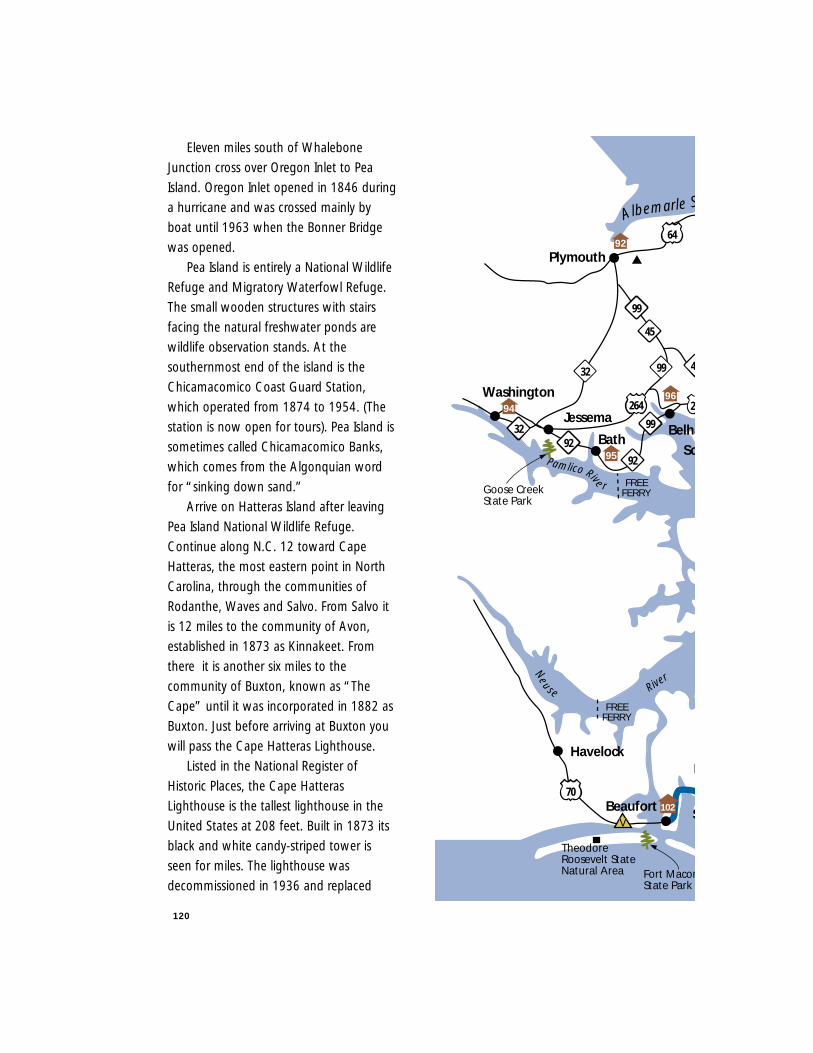
120
Eleven miles south of Whalebone
Junction cross over Oregon Inlet to Pea
Island. Oregon Inlet opened in 1846 during
a hurricane and was crossed mainly by
boat until 1963 when the Bonner Bridge
was opened.
Pea Island is entirely a National Wildlife
Refuge and Migratory Waterfowl Refuge.
The small wooden structures with stairs
facing the natural freshwater ponds are
wildlife observation stands. At the
southernmost end of the island is the
Chicamacomico Coast Guard Station,
which operated from 1874 to 1954. (The
station is now open for tours). Pea Island is
sometimes called Chicamacomico Banks,
which comes from the Algonquian word
for “sinking down sand.”
Arrive on Hatteras Island after leaving
Pea Island National Wildlife Refuge.
Continue along N.C. 12 toward Cape
Hatteras, the most eastern point in North
Carolina, through the communities of
Rodanthe, Waves and Salvo. From Salvo it
is 12 miles to the community of Avon,
established in 1873 as Kinnakeet. From
there it is another six miles to the
community of Buxton, known as “The
Cape” until it was incorporated in 1882 as
Buxton. Just before arriving at Buxton you
will pass the Cape Hatteras Lighthouse.
Listed in the National Register of
Historic Places, the Cape Hatteras
Lighthouse is the tallest lighthouse in the
United States at 208 feet. Built in 1873 its
black and white candy-striped tower is
seen for miles. The lighthouse was
decommissioned in 1936 and replaced
Havelock
4532
26
Bath
Jessema
Washington
Belha
264
92
99
64
Pamlico Rive r
Sc
FREEFERRY
Albemarle S
70
FREEFERRY
3292
Neuse River
Beaufort
99
45
99
S
D
V
Plymouth
96
95
94
Theodore Roosevelt StateNatural Area Fort Macon
State Park
Goose CreekState Park
92
102
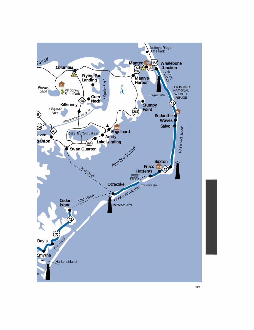
121
Intracoastal Waterway
TOLL FERRY
12
70
12
45
264
haven
264
cranton
Swan Quarter
Engelhard
Ocracoke
SalvoWaves
Buxton
Whalebone Junction
HatterasFrisco
FREEFERRY
Ocracoke Inlet
Oregon Inlet
PamlicoSo
und
BOD
IE
ISLAN
D
OCRACOKE ISLANDHatteras Inlet
Alli
gato
rRiv
er
Sound
AlligatorLake
45
264
12
Rodanthe
HA
TTER
AS
ISLA
ND
TOLL FERRY
94
64264
Kilkinney
GumNeck
Frying PanLanding
Columbia
Lake LandingAmity
Mann'sHarbor
Smyrna
Davis
CedarIsland
Core S
ound
Lake Mattamuskeet
97
9998
n
Harkers Island
158Manteo
Jockey's RidgeState Park
StumpyPoint
PettigrewState Park
PhelpsLake
PEA ISLANDNATIONALWILDLIFEREFUGE
101
100
103
V
V
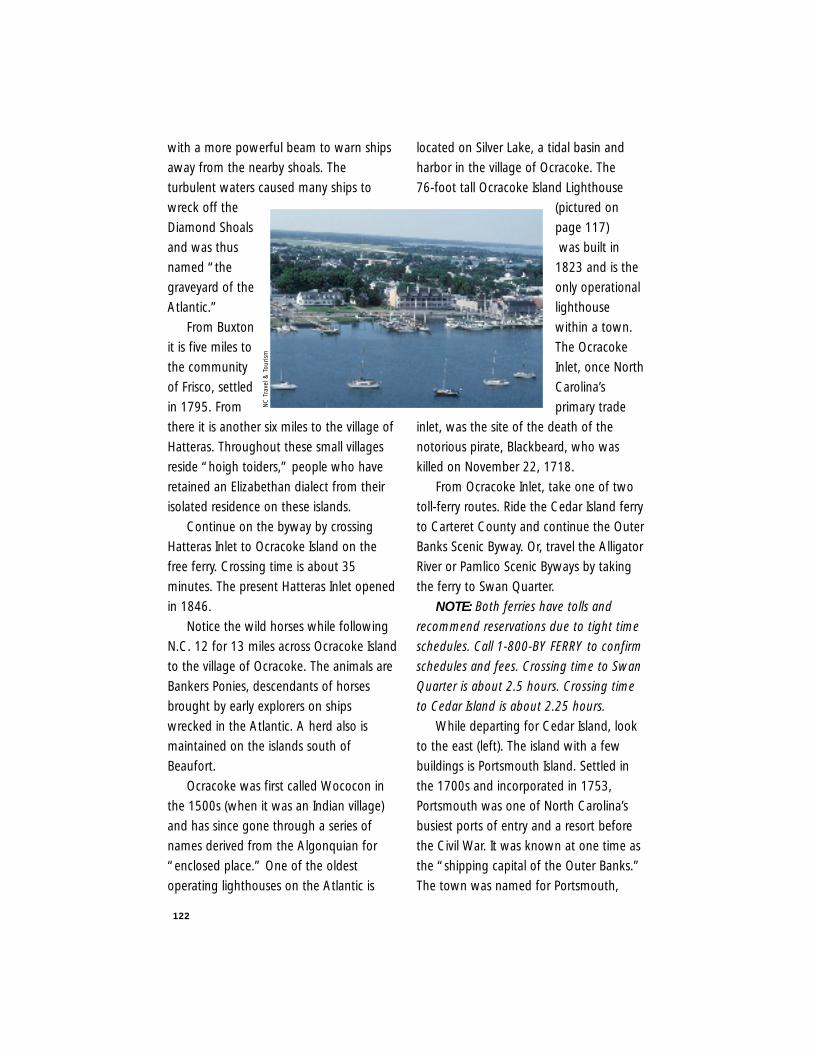
122
with a more powerful beam to warn ships
away from the nearby shoals. The
turbulent waters caused many ships to
wreck off the
Diamond Shoals
and was thus
named “the
graveyard of the
Atlantic.”
From Buxton
it is five miles to
the community
of Frisco, settled
in 1795. From
there it is another six miles to the village of
Hatteras. Throughout these small villages
reside “hoigh toiders,” people who have
retained an Elizabethan dialect from their
isolated residence on these islands.
Continue on the byway by crossing
Hatteras Inlet to Ocracoke Island on the
free ferry. Crossing time is about 35
minutes. The present Hatteras Inlet opened
in 1846.
Notice the wild horses while following
N.C. 12 for 13 miles across Ocracoke Island
to the village of Ocracoke. The animals are
Bankers Ponies, descendants of horses
brought by early explorers on ships
wrecked in the Atlantic. A herd also is
maintained on the islands south of
Beaufort.
Ocracoke was first called Wococon in
the 1500s (when it was an Indian village)
and has since gone through a series of
names derived from the Algonquian for
“enclosed place.” One of the oldest
operating lighthouses on the Atlantic is
located on Silver Lake, a tidal basin and
harbor in the village of Ocracoke. The
76-foot tall Ocracoke Island Lighthouse
(pictured on
page 117)
was built in
1823 and is the
only operational
lighthouse
within a town.
The Ocracoke
Inlet, once North
Carolina’s
primary trade
inlet, was the site of the death of the
notorious pirate, Blackbeard, who was
killed on November 22, 1718.
From Ocracoke Inlet, take one of two
toll-ferry routes. Ride the Cedar Island ferry
to Carteret County and continue the Outer
Banks Scenic Byway. Or, travel the Alligator
River or Pamlico Scenic Byways by taking
the ferry to Swan Quarter.
NOTE: Both ferries have tolls and
recommend reservations due to tight time
schedules. Call 1-800-BY FERRY to confirm
schedules and fees. Crossing time to Swan
Quarter is about 2.5 hours. Crossing time
to Cedar Island is about 2.25 hours.
While departing for Cedar Island, look
to the east (left). The island with a few
buildings is Portsmouth Island. Settled in
the 1700s and incorporated in 1753,
Portsmouth was one of North Carolina’s
busiest ports of entry and a resort before
the Civil War. It was known at one time as
the “shipping capital of the Outer Banks.”
The town was named for Portsmouth,
NC
Tra
vel &
Tou
rism
123
England. The buildings on the island are
the few remaining houses and church of
the townspeople, the last of whom left in
1971. The Cape Lookout National
Seashore manages the island and allows a
limited number of day visitors
(accommodated by private ferry) to explore
the island. Portsmouth Island is a National
Register Historic District.
The ferry docks at the northern end of
Carteret County on Cedar Island. From
Cedar Island, continue south on N.C. 12
through the Cedar Island National Wildlife
Refuge, home to waterfowl on their winter
migration. Enjoy spectacular views of salt
marshes and other small fishing villages.
N.C. 12 becomes U.S. 70 about 12 miles
south of the ferry terminal. The water to
the left is the Core Sound, named for the
Coree Indians who once lived in this area.
Along this route you may be able to
see the Cape Lookout Lighthouse from the
community of Davis. Built in 1859, the
Cape Lookout Lighthouse is distinct with
its black and white diamond pattern
covering the 160-foot tower. About 14
miles from the intersection of N.C. 12 with
U.S. 70 the road turns to the west at the
community of Smyrna. From Smyrna it is
another five miles to the crossing of the
North River.
From the North River, it is an additional
five miles to the Beaufort city limits where
the route ends.
Beaufort (pictured here) was designed
in 1715 and settled soon thereafter. It was
incorporated in 1723 and named for Henry
Somerset, Duke of Beaufort, a Lords
Proprietor. The town is located on the site
of an earlier Indian village. A walk through
historic Beaufort and along the waterfront
provides a great place to stretch and enjoy
a historic coastal community. From whaling
to salt works, with military battles in
between, Beaufort offers a lot to the
history of North Carolina.
NOTE: In warmer weather this is a
well-traveled road. Plan for extra time to
make the ferry connections and to
accommodate bicyclists and beach goers.
Also, park only in designated places. Sand
is more difficult to get out of than ice and
snow.
Length: 111 driving milesDriving Time: 5.5 hours(Including 3.5 hours on two ferries)Counties: Dare, Hyde,
Carteret
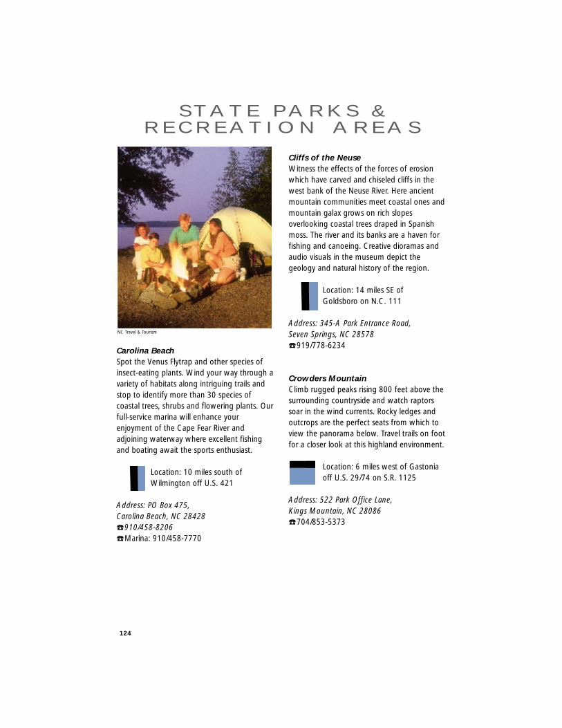
124
Carolina BeachSpot the Venus Flytrap and other species ofinsect-eating plants. Wind your way through avariety of habitats along intriguing trails andstop to identify more than 30 species ofcoastal trees, shrubs and flowering plants. Ourfull-service marina will enhance yourenjoyment of the Cape Fear River andadjoining waterway where excellent fishingand boating await the sports enthusiast.
Location: 10 miles south of Wilmington off U.S. 421
Address: PO Box 475, Carolina Beach, NC 28428 ☎ 910/458-8206☎ Marina: 910/458-7770
Cliffs of the NeuseWitness the effects of the forces of erosionwhich have carved and chiseled cliffs in thewest bank of the Neuse River. Here ancientmountain communities meet coastal ones andmountain galax grows on rich slopesoverlooking coastal trees draped in Spanishmoss. The river and its banks are a haven forfishing and canoeing. Creative dioramas andaudio visuals in the museum depict thegeology and natural history of the region.
Location: 14 miles SE of Goldsboro on N.C. 111
Address: 345-A Park Entrance Road, Seven Springs, NC 28578☎ 919/778-6234
Crowders MountainClimb rugged peaks rising 800 feet above thesurrounding countryside and watch raptorssoar in the wind currents. Rocky ledges andoutcrops are the perfect seats from which toview the panorama below. Travel trails on footfor a closer look at this highland environment.
Location: 6 miles west of Gastonia off U.S. 29/74 on S.R. 1125
Address: 522 Park Office Lane, Kings Mountain, NC 28086 ☎ 704/853-5373
S TAT E PA R K S &R E C R E AT I O N A R E A S
NC Travel & Tourism
125
Eno RiverTest your skills in a raft or canoe. Spring andfall months often bring swirling rapids to theEno. Try your luck fishing along the river banksor stroll across the swinging bridge for a hikethrough the woods. Backpack primitivecamping offers refuge from the hustle andbustle of the city.
Location: 3 miles NW of Durham off S.R. 1569
Address: 6101 Cole Mill Road, Durham, NC 27705 ☎ 919/383-1686
Falls Lake State Recreation AreaFor fun in the sun or just a place to get awayfrom it all, escape to Falls Lake and leavebehind the pressures of urban life. Momentsaway from the hustle and bustle of theResearch Triangle, this 12,000-acre lake and26,000 acres of woodlands offer a variety ofactivities. Come for the day and bring alongyour fishing gear and picnic basket. Put yourboat in the water. Take a dip in one of thedesignated swimming areas. Or spend a fewdays in the family or group campgrounds.B.W. Wells, U.S. 50, Holly Point, Rollingview,Beaverdam, Sanding Beach and Shinleaf aswell as the privately-operated RollingviewMarina will fill the bill no matter what yourfancy.
Location: 10 miles north of Raleigh on N.C. 50
Address: 13304 Creedmoor Road, Wake Forest, NC 27587☎ 919/676-1027 ☎ Rollingview 919/596-2194
919/833-8584
Fort Fisher State Recreation AreaSpend the day away from the crowds on afour-mile stretch of undeveloped beach whereshell-seekers still find treasures and nestingloggerhead sea turtles still find seclusion.Watch pelicans and other colonial nestingbirds swirl and turn with the wind and waves.Licensed four-wheel drive vehicles may travelon the beach in designated areas for access toexcellent surf fishing.
Location: 5 miles south of Carolina Beach off U.S. 421
Address: PO Box 475 Carolina Beach, NC 28428 ☎ 910/458-8206
Fort MaconEnjoy all of the sun, sand, sea and history youcan soak up in a day. Even Blackbeard thePirate used to drop by once upon a time. Aftera day of beach combing, cool off on a tour ofthe restored fort that stood guard overBeaufort Harbor during the Civil War.
Location: 2 miles east of Atlantic Beach on S.R. 1190
Address: PO Box 127, Atlantic Beach, NC 28512 ☎ 919/726-3775
126
Goose CreekCanoe the unhurried creeks or cast your lineinto the Pamlico River. Stately live oaks drapedwith Spanish moss form the perfect backdropfor outdoor relaxation. Experience themysterious wonders of marsh and swampfrom wooded trails and two observationdecks.
Location: 10 miles east of Washington, off S.R. 1334
Address: 2190 Camp Leach Road,Washington, NC 27889 ☎ 919/923-2191
Hanging RockVisit the “mountains away from themountains” and choose your accommodationsfrom cabins to campsites. Sparkling mountainstreams, waterfalls and cascades travel overrugged terrain. Encounter more than 300species of mountain plants along miles ofnature and hiking trails. The observation toweratop Moore’s Knob offers rewardingpanoramic views.
Location: 5 miles west of Danbury, off S.R. 1101
Address: PO Box 278, Danbury, NC 27016 ☎ 910/593-8480
Jockey’s RidgeGo fly a kite on the highest sand dune on theeast coast. Orville and Wilbur Wright were thefirst to take advantage of the area’s prevailingwinds, ranging from 10 to 15 miles per hour.The ridge, a favorite spot for playing in thesand, offers an exhilarating view of coastalNorth Carolina. Fascinating facts about thismagnificent pile of sand can be learned at themuseum.
Location: U.S. 158 Bypass in Nags Head
Address: PO Box 592, Nags Head, NC 27959 ☎ 919/441-7132
Jones LakePicnic under a canopy of old cypress trees orgo for a dip in the cool, tea-colored lake.Jones Lake is one of the few remainingCarolina bay lakes, the origin of which haslong been a subject of speculation and debate.Enjoy the lake while rowing or fishing, or stayfor a while in the family campground.
Location: 4 miles north of Elizabethtown on N.C. 242
Address: 113 Jones Lake Rd., Elizabethtown, NC 28337 ☎ 910/588-4550
127
Kerr Lake State Recreation AreaSet sail for Kerr Lake. 1,000 family campsitesin seven recreation areas are home away fromhome to boaters, skiers and fishermen. Ofcourse, there’s plenty of reason to come justfor the day. Special events held throughout theyear include a spring art show, amateur stripedbass fishing tournament and the Governor’sCup Invitational Regatta. Tucked along theshoreline are some of the best fishing holes inNorth Carolina. Picnic spots are plentiful. Twocommercial marinas offer full service forboaters and campers, including cabins. Meetyour friends at Bullocksville, County Line,Henderson Point, Hibernia, Kimball Point,Nutbush Bridge and Satterwhite Point.
Office Location: 11 miles north of Henderson off I-85 to S.R. 1319
Address: 269 Glass House Rd.Henderson, NC 27536 ☎ 919/438-7791Marinas: ☎ Satterwhite 919/438-4441☎ Steele Creek 919/492-1426
Lake WaccamawDiscover one-of-a-kind aquatic animals foundnowhere else on earth. The lake is home tothe Lake Waccamaw killifish and a number ofother unique fish mollusks. Spend an eveningin the primitive campground or enjoy a picnicunder stately trees hung with Spanish moss.
Location: 6 miles south of Lake Waccamaw off US 74/76
Address: 1866 State Park Drive, Lake Waccamaw, NC 28450 ☎ 910/646-4748
Medoc MountainCanoe the creeks or hike the trails toappreciate the beauty of this unusual mixtureof plant and animal life. Not really a mountain,but a granite ridge, Medoc Mountain is theremains of an ancient mountain range formedby volcanic action. A rewarding experience inany season, but especially in the spring whenthe bluffs and ravines are covered with theblossoms of mountain laurel.
Location: 15 miles SW of Roanoke Rapids off N.C. 561
Address: PO Box 400, Hollister, NC 27844 ☎ 919/445-2280
Merchants MillpondDiscover one of the state’s rarest ecologicalcommunities. Massive cypress and gum treescovered with Spanish moss form a canopy forthe dark, acid waters of the millpond –wilderness sanctuary for wetland wildlife.Paddle quietly through the pond and creekand encounter beavers, otters and owls.
Location: 6 miles NE of Gatesville on S.R. 1403
Address: Rte. 1, Box 141A, Gatesville, NC 27938 ☎ 919/357-1191
128
Morrow MountainView the skeletal remains of a once-mightyrange of peaks. Located along the Pee DeeRiver and Lake Tillery. Morrow Mountainfeatures miles of mountain trails to wander onfoot or horseback. Visit the historic KronHouse, residence, greenhouse and hospital ofan early 19th century physician. Stay for awhile in a cabin or a campsite and enjoy a dipin the pool or a boat ride on the lake.
Location: 5 miles east of Albemarle off N.C. 24/27/73/740 on Morrow Mtn. Rd.
Address: 49104 Morrow Mountain Rd.,Albemarle, NC 28001 ☎ 704/982-4402
Mount JeffersonBroaden your horizons with scenic vistas andcolorful displays of mountain flora. You cansee forever on a clear day. Stroll the shortnature trail through the magnificent forest, aNational Natural Landmark.
Location: 1.5 miles south of `Jefferson on U.S. 221
Address: PO Box 48, Jefferson, NC 28640☎ 910/246-9653
Mount MitchellExplore miles of hiking trails and rewardyourself with breathtaking views of the BlueRidge Mountains. Ascend the highest peakeast of the Mississippi, riding to 6,684 feetand watch the world take on a newperspective from the observation tower. Visitthe museum and learn about the natural andcultural history of North Carolina’s first statepark. The famished hiker or the hungry touristcan enjoy a relaxing meal in the restaurant.
Location: 30 miles NE of Asheville off the Blue Ridge Parkway on N.C. 128
Address: Rte. 5, Box 700, Burnsville, NC 28714☎ 704/675- 4611 Restaurant ☎ 704/675-9907
New RiverCanoe more than 26 miles of the national wildand scenic south fork of the New River, one ofthe oldest rivers in the world. Embark uponthis gentle river from any of four access pointsfor fishing, picnicking and inspiring mountainscenery.
Location: 8 miles SE of Jefferson off N.C. 88 on S.R. 1588
Address: PO Box 48, Jefferson, NC 28640 ☎ 910/982-2587
129
PettigrewReel ‘em in at this 16,000-acre angler’sparadise, teeming with largemouth bass,yellow perch and various panfish. Lake andwind conditions make Lake Phelps ideal forshallow-draft sailboats, canoeing andwindsurfing. View displays of prehistoric Indianculture and take a journey back in time, or visitSomerset place – a state historic site.
Location: 9 miles south of Creswell off U.S. 64 on S.R. 1166
Address: 2252 Lake Shore Drive, Creswell, NC 27928 ☎ 919/797-4475
Pilot MountainImagine a majestic pinnacle rising from out ofnowhere, 1,400 feet above the surroundingcountryside. Experienced climbers may climbLittle Pinnacle Wall while others explore theadjoining woodland corridor on foot orhorseback for a memorable view.
Location: 24 miles north of Winston-Salem off U.S. 52
Address: Rte. 3, Box 21, Pinnacle, NC 27043 ☎ 910/325-2355
Singletary LakeFor canoeing, swimming and nature walks,bring the group to an area designed fororganized camping. Two group camps containmess halls, kitchens, campers’ cabins andwash houses. Our rangers will conduct specialnature programs for your group and explainthe unique phenomenon of the Carolina bays.
Location: 12 miles SE of Elizabethtown on N.C. 53
Address: 6707 NC 53 Hwy. E, Kelly, NC 28448 ☎ 910/669-2928
South MountainsHike the rugged trail to High Shoals Falls andenjoy the crystal clear waters as they plunge80 feet into a large pool. For a true wildernessexperience, backpack through the woodlandsfor primitive camping or fish for trout in 12miles of sparkling mountain streams.
Location: 18 miles south of Morganton on S.R. 1904
Address: Rte 1, Box 206, Connelly Springs, NC 28612 ☎ 704/443-4772
Theodore Roosevelt Natural AreaIt’s for the birds, crabs and the snails. Plus thesea oats, the salt grass and the marshes.Donated to the state by the family of the 26thPresident, this nature preserve attractsnaturalists and photographers. The N.C.Aquarium at Pine Knoll Shores interprets thecoastal environment with exhibits andmultimedia programs.
Location: 7 miles west of Atlantic Beach on S.R. 1201
Address: PO Box 127, Atlantic Beach, NC 28512 ☎ 919/726-3775
Weymouth Woods Sandhills NaturePreserveImagine the trees of Weymouth, England asyou view the longleaf pines. Listen for theendangered red-cockaded woodpecker, apermanent resident of the Sandhills. Tour thenature center musem where the uniquefeatures of the Sandhills region are studied,interpretated and protected.
Location: 2 miles south of Southern Pines off U.S. 1 on S.R. 2074
Address: 1024 N. Fort Bragg Road Southern Pines, NC 28387 ☎ 910/692-2167
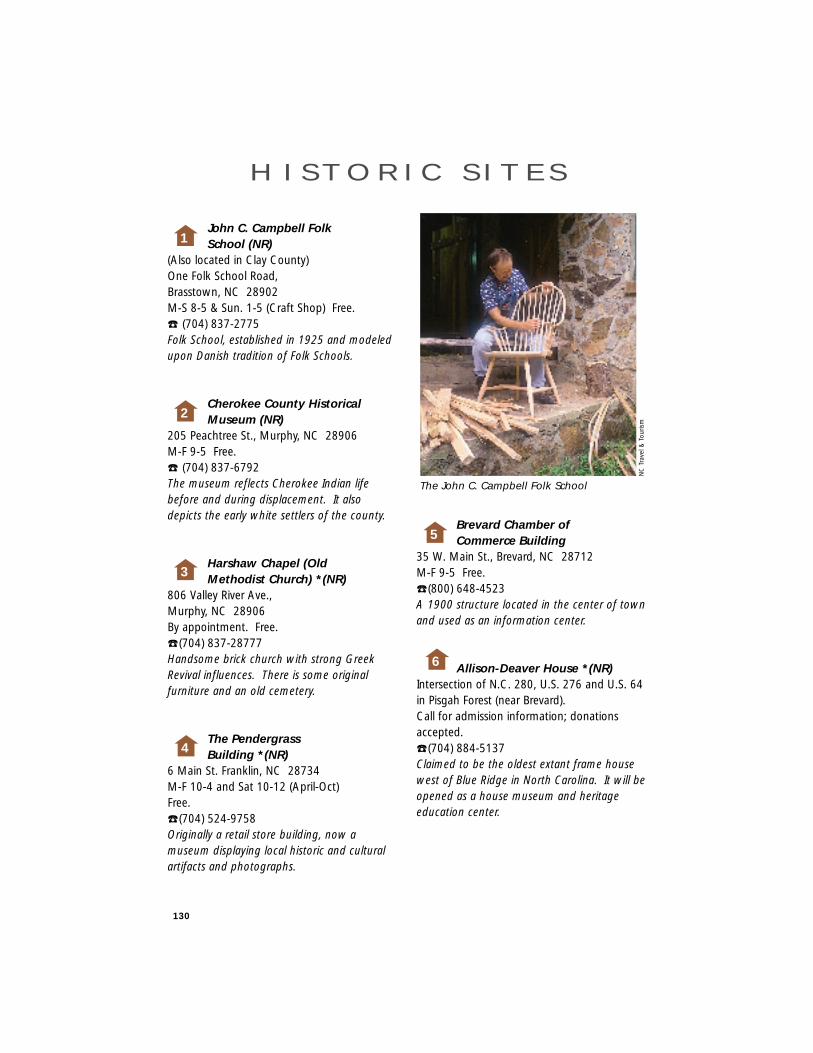
130
John C. Campbell Folk School (NR)
(Also located in Clay County)One Folk School Road,Brasstown, NC 28902M-S 8-5 & Sun. 1-5 (Craft Shop) Free. ☎ (704) 837-2775Folk School, established in 1925 and modeledupon Danish tradition of Folk Schools.
Cherokee County Historical Museum (NR)
205 Peachtree St., Murphy, NC 28906M-F 9-5 Free. ☎ (704) 837-6792The museum reflects Cherokee Indian lifebefore and during displacement. It alsodepicts the early white settlers of the county.
Harshaw Chapel (Old Methodist Church) *(NR)
806 Valley River Ave.,Murphy, NC 28906By appointment. Free. ☎ (704) 837-28777Handsome brick church with strong GreekRevival influences. There is some originalfurniture and an old cemetery.
The Pendergrass Building *(NR)
6 Main St. Franklin, NC 28734M-F 10-4 and Sat 10-12 (April-Oct)Free. ☎ (704) 524-9758Originally a retail store building, now amuseum displaying local historic and culturalartifacts and photographs.
Brevard Chamber of Commerce Building
35 W. Main St., Brevard, NC 28712M-F 9-5 Free. ☎ (800) 648-4523A 1900 structure located in the center of townand used as an information center.
Allison-Deaver House *(NR)Intersection of N.C. 280, U.S. 276 and U.S. 64in Pisgah Forest (near Brevard).Call for admission information; donationsaccepted.☎ (704) 884-5137Claimed to be the oldest extant frame housewest of Blue Ridge in North Carolina. It will beopened as a house museum and heritageeducation center.
6
H I S T O R I C S I T E S
NC
Tra
vel &
Tou
rism
1
2
3
4
5
The John C. Campbell Folk School
131
Gov. Zebulon Vance Birthplace
911 Reems Creek Rd., Weaverville, NC 28787(April-Oct) M-Sat 9-5 and Sun 1-5(Nov-March) Tu-Sat 10-4 and Sun 1-4.Free. ☎ (704) 645-6706A reconstructed 1830’s mountain farmsteadwith a log house and six outbuildings,birthplace of the state’s Civil War governor andlater U.S. Senator.
Biltmore Estate *(NR)One North Pack Square,Asheville, NC 28801M-F 9-5 (Closed Christmas, Thanksgiving and New Year’s Day)Call for admission information.☎ 1-800-543-2961A 250-room French Chateau which containsoriginal artwork and furnishings surrounded by75 acres of elaborate gardens andlandscaping.
Biltmore Village Historic Museum *(NR)
7 Biltmore Plaza, Asheville, NC 28803M-S 1-4 Free. ☎ (704) 274-9707A museum of Biltmore Village, a local historicdistrict containing three Richard Morris Huntbuildings.
Estes-Winn Memorial Automobile Museum *(NR)
111 Grovewood Rd., Asheville, NC 28804(April-Dec) M-Sat 10-5, Sun 1-5; (Jan-Mar) Fri & Sat 10-5. Free. ☎ (704) 253-7651An English cottage style building, one of theformer buildings of the Biltmore Industrieshandweaving plant, housing a collection ofautomobiles dating 1913-1957.
North Carolina Homespun Museum *(NR)
Same as Estes-Winn Memorial Museum.A 1919 English cottage-style building exhibitsfeature the history of the Biltmore Industrieshandweaving operation in film, pictures andartifacts.
The Thomas Wolfe Memorial (NR)
52 N. Market St., Asheville, NC 28801(April-Oct) M-Sat 9-5 and Sun 1-5(Nov-March) Tu-Sat 10-4 and Sun 1-4Admission $1 Adults, 50¢ children.☎ (704) 253-8304Boyhood home of author Thomas Wolfe. AQueen Anne style dwelling which provided thesetting for “Look Homeward Angel”.
Smith-McDowell House Museum *(NR)
283 Victoria Rd., Asheville, NC 28801(April-Dec) Tu-F 10-4, Sun 1-4(Jan-Mar) Tu-Sat 10-4Admission $3.50 for adults, $2.00 for children ages 7-15. ☎ (704) 253-9231Tours, programs and exhibits are featured inthis 1840’s brick plantation home.
The Old Depot *(NR)207 Sutton Ave.,Black Mountain, NC 28711(April-Dec) Tu-Sat 10-5; Gift ShopFree. ☎ (704) 669-6583A small town train station built about 1893.
7
8
9
10
11
12
13
14
* Handicap Accessible(NR) National Register of Historic Places
State Historic Site
132
Carson House (NR)US. Hwy 70W., Old Fort, NC 28762(Mailing Address only)Tu-Sat 10-5 and Sun 2-5Admission $3 adults $1.50 children from ages 12-17. ☎ (704) 724-4640The 19th century plantation house is now arepository for pioneer artifacts and furnishings.
Mountain Gateway Museum*Catawba/Water Streets, Old Fort, NC 28762T-Sat 9-5, Sun 2-5 and Mon 12-5 Free. ☎ (704) 668-9259A museum of western North Carolina frontierlife with two restored early log houses.
Carl Sandburg Home National Historic Site
Across from Flat Rock Playhouse. Through theweek, 9-5, except Christmas. A fee of $3 forhouse tour, children 16 & under, free. ☎ (704) 693-4178.The home of Carl Sandburg during his lateryears. The house is built in low-countryplantation style. Books and memorabilia.
Cleveland County Historical Museum *(NR)
Courtsquare, Shelby, NC 28150Tu-F 9-4 Free. ☎ (704) 482-8186A Classical Revival courthouse housinghistorical artifacts pertaining to local history.
Historic Webbley *(NR)403 S. Washington St.,Shelby, NC 28150Now a Bed & Breakfast.Seven days a week. Free. ☎ (704) 487-0616Built in 1852 in Italianate style by AugustusBurton, this home has been visited by everyN.C. Governor at least once.
Kouris Warehouse *200 W. Warren, Shelby, NC 28150Tu-Sat 8-6 Free.A Colonial Revival brick warehouse housingthe Shelby Farmers Market.
The Former Post Office of Shelby *(NR)
111 S. Washington St. Shelby, NC 28150Cleveland County Arts Council showing localand regional art.M-F 10-4 Free. ☎ (704) 484-2787A Colonial Revival post office built in 1916which has been converted into an arts center.
Well House *(NR)Courtsquare, Shelby, NC 28151MWF 10-5 Free. ☎ (704) 481-1842Formerly an open, brick-arched well house, itnow houses the Historic Shelby Foundation.
Shelby City Hall *(NR)300 S. Washington St., Shelby, NC 28150M-F 8-5 Free. ☎ (704) 484-6801A Georgian Revival brick building constructedin 1939 used as city hall and firehouse.
18
19
20
21
22
23
15
16
17
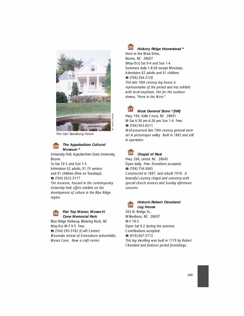
133
The Appalachian Cultural Museum *
University Hall, Appalachian State University,BooneTu-Sat 10-5 and Sun 1-5Admission $2 adults, $1.75 seniors and $1 children (Free on Tuesdays). ☎ (704) 2622-3117The museum, housed in the contemporaryUniversity Hall, offers exhibits on thedevelopment of culture in the Blue Ridgeregion.
Flat Top Manor, Moses H. Cone Memorial Park
Blue Ridge Parkway, Blowing Rock, NCMay-Oct M-F 9-5 Free. ☎ (704) 295-3782 (Craft Center)Mountain retreat of Greensboro industrialist,Moses Cone. Now a craft center.
Hickory Ridge Homestead *Horn in the West Drive, Boone, NC 28607(May-Oct) Sat 9-4 and Sun 1-4Summers daily 1-8:30 except Mondays.Admission $2 adults and $1 children. ☎ (704) 264-2120This late 18th century log house isrepresentative of the period and has exhibitswith local emphasis. Site for the outdoordrama, “Horn in the West.”
Mast General Store *(NR)Hwy. 194, Valle Crucis, NC 28691M-Sat 6:30 am-6:30 pm Sun 1-6 Free. ☎ (704) 963-6511Well preserved late 19th century general storeset in picturesque valley. Built in 1883 and stillin operation.
Chapel of RestHwy. 268, Lenoir, NC 28645Open daily. Free. Donations accepted.☎ (704) 754-5065Constructed in 1887, and rebuilt 1918. Abeautiful country chapel and cemetery withspecial church services and Sunday afternoonconcerts.
Historic Robert Cleveland Log House
203 N. Bridge St., Wilkesboro, NC 28697M-F 10-5 Open Sat 9-2 during the summer.Contributions accepted.☎ (910) 667-3712.This log dwelling was built in 1779 by RobertCleveland and features period furnishings.
NC
Tra
vel &
Tou
rism
25
26
27
28
29
24
The Carl Sandburg Home
134
Fort Defiance (NR)N.C. 268 Between Lenoir and Wilkesboro, P.O. Box 686Lenior, NC 286451st and 3rd Sundays 2-5 (April-Oct), Summer Fri & Sat 10-5, Sun 1:30-5 and arranged tours. ☎ (704) 758-16711792 home of Revolutionary War GeneralWilliam Lenoir featuring original furnishings.
Old Wilkes Jail Museum (NR)203 N. Bridge St., Wilkesboro, NC 28697M-F 9-4 Open on Sat 9-2 during the summer.Contributions accepted. ☎ (910) 667-3712Built by Mr. Shipwash (also the first escapee), itcontains furnished living quarters and the jailcell where Tom Duly was incarcerated.
Andy Griffith Playhouse *218 Rockford St., Mt. Airy, NC 27030M-F 8-5 Free. ☎ (910) 786-7998A renovated theater and arts center named forNorth Carolina’s most famous actor.
The Gertrude Smith House *(NR)
708 N. Main St., Mt. Airy, NC 27030By appointment. Free. ☎ (910) 786-6856A 1903 Victorian home with periodfurnishings.
Horne Creek Living Historical Farm
320 Hauser Rd., Pinnacle, NC 27043Tu-Sat 9-5 and Sun 1-5 Free. ☎ (910) 325-2298A hands-on display of turn-of-the century farmlife in the piedmont area of NC.
The Robert Smith House *(NR)
615 N. Main St., Mt. Airy, NC 27030M-S 10-5 Sun 11:30-4:30 Free. ☎ (910) 786-68561910 Colonial Revival home housing the Mt.Airy Visitors Center.
The Alexander Dickson House *(NR)
E. King St., Hillsborough, NC 27278Sat. 10-4 and Sun 2-5. Free. ☎ (910) 732-8156Late 18th century piedmont farmhouse. Thesmall office to the rear was used by Gen.Joseph E. Johnston at the time of his surrenderto Sherman.
Ayr Mount (NR)376 St. Mary’s Road, Hillsborough, NC 27278Sun, T, Th-2 pm Guided Tour.Admission $5. ☎ (919) 732-6886Beautifully restored 1817 brick plantationhouse with excellent decorative arts collectionand pastoral setting.
30
31
32
33
34
35
36
37
135
Bennett Place State Historic Site *(NR)
4409 Bennett Memorial Rd., Durham, NC 27705(Nov-March) T-Sat 10-4 and Sun 1-4(April-Oct) M-Sat 9-5 and Sun 1-5 Free. ☎ (919) 383-4345Reconstructed farmhouse where GeneralsJohnston and Sherman met to sign the largestsurrender of the Civil War.
Blandwood (NR)447 W. Washington St., Greensboro, NC 27401T-Sat 11-2 and Sun 2-5Admission varies. ☎ (910) 272-5003Former house of N.C. Gov. John M.Morehead. The addition designed in 1844 byA.J. Davis is the oldest remaining example ofItalian Villa architecture in the U.S.
Chinqua-Penn Plantation (NR)
2138 Wentworth St., Reidsville, NC 27320T-S 9-5, Sun 12-5 Adults $10 ☎ (910) 349-4576A 1920’s country manor filled with eclectic arttreasures on 23 acres with formal gardens.
Duke Homestead State Historic Site and Tobacco Museum *(NR)
2828 Duke Homestead Rd., Durham, NC 27705(Nov-March) T-Sat 10-4 and Sun 1-4(April-Oct) M-Sat 9-5 and Sun 1-5Free. ☎ (919) 477-5498An 1852 vernacular piedmont farmhouse withoutbuildings and a museum.
Duke University Chapel*Campus, Durham, NC 27708-0974(May-Aug.) 8-8 (Sept-April) 8am-10pm Free. ☎ (919) 684-2572Beautiful Gothic church on main Dukecampus, worship services and tours.
William Fields House *(NR)447 Arlington St., Greensboro, NC 27406M-F 9-5. Free. ☎ (910) 272-6617A Gothic Revival dwelling featuring steepgabled roof and arched former windows.
Greensboro Historical Museum *(NR)
130 Summit Ave., Greensboro, NC 27401Tu-Sat 10-5 and Sun 2-5 Closed on holidays.Free. ☎ (910) 373-2043Museum complex contains buildings dating asearly as 1892. It includes a renovated church,two historic houses and local history exhibits.
Hayti Heritage Center *(NR)804 Old Fayetteville St., Durham, NC 27701M-F 9-5 and Sat 10-2:30 Free. ☎ (919) 683-1709Constructed in the Hayti community in 1891,the old St. Joseph’s A.M.E. Church, one ofDurham’s oldest ecclesiastical structures,houses a heritage center which promotes theunderstanding of the African-Americanexperience.
43
44
45
38
39
40
41
42
136
Historic Stagville Center*(NR)5825 Old Oxford Hwy., Bahama, NC 27503M-F 9-4 Free. ☎ (919) 620-0120Plantation seat of the Bennehan and Cameronfamilies featuring a late 18th century dwelling,rare four-room slave houses and a massivetimber frame barn.
Hugh Mangum Museum of Photography/McCown-Mangum House (NR)
5101 N. Roxboro Rd., Durham, NC 27704(March-Dec) Sat and Sun 1-5 Free. ☎ (919) 471-1623Modified Greek Revival dwelling restored to itslate 1890’s appearance contains the works ofHugh Mangum, a 20th century photographer,as well as contemporary exhibits.
Orange Co. Historical Museum (NR)
201 N. Churton St., Hillsborough, NC 27278Tu-Sun 1:30-4:30 Free. ☎ (919) 732-2201Museum houses a fine collection of pre-historic to Civil War period household goods.
Alamance Battleground*(NR)5803 South NC 62, Burlington, NC 27215(April-Oct) M-Sat. 9-5 and Sun 1-5(Nov-March) Tu-Sat 10-4 and Sun 1-4 Free. ☎ (910) 227-4785Site of the 1771 battle between the forces ofRegulators and Royal Gov. William Tryon. Onthe site is an 18th century log house whichbelonged to John Allen, containing someoriginal furniture and period artifacts.
Snow Camp Historic Site*Drama Rd., Snow Camp, NC 27349(June-Aug.) 6-8pm Free. Drama begins at 8:30pm ☎ (910) 376-6948A replica of a historic Quaker communityfeaturing log houses and Quaker meetinghouses with some period furnishings andartifacts.
Eastern Cabarrus Historical Society Museum *(NR)
Main St., Mt. Pleasant, NC 28124Times vary. Free. ☎ (704) 436-6612An 1855 Greek Revival boy’s school displayingmemorabilia and artifacts.
Historic Cabarrus County Courthouse *(NR)
65 Union St., Concord, NC 28026-0966M-F 9-12 Free. ☎ (704) 786-8515Built in 1876, the building contains a museumdisplaying artifacts from the Revolutionarythrough the Vietnam Wars.
Josephus W. Hall House (NR)226 S. Jackson St., Salisbury, NC 28144-0103Sat and Sun 1-4. Tours can be arranged.Admission $3 adult and $2 child. ☎ (704) 636-0103Large 1820 antebellum home. Tours given byguides in 1860’s period costumes.
Archibald Henderson Law Office (NR)
201 W. Fisher St., Salisbury, NC 28144By appointment.Admission Varies. ☎ (704) 638-5207An 1825 Federal-style law office.
46
48
47
49
50
51
52
53
54
137
Memorial Garden36 Spring St., Concord, NC 28025M-Sat 9-5 and Sun 1-5:30 (Spring, Summerand Fall)M-Sat 9-4 and Sun 1-5 (Winter) Free. ☎ (704) 786-8009A former graveyard for First PresbyterianChurch founded in 1804. It was establishedas a memorial garden in 1930 and has floraldisplays throughout the botanical garden.
Reed Gold Mine *(NR)9621 Reed Mine Rd., Stanfield, NC 28163M-Sat 9-5 and Sun 1-5 (Summer)Tu-Sat 10-4 and Sun 1-4 (Winter)Tour is free, panning $2. ☎ (704) 786-8337Site of the first documented gold find in theU.S. Tours of the mine, stamp mill andpanning operation.
Rowan Museum/Utzman-Chambers House (NR)
116 S. Jackson St., Salisbury, NC 28144Th-Sun 1-4Admission $3 adults. ☎ (704) 633-5946 An 1814 townhouse featuring two periodrooms and six other rooms with historicalcollections—costumes, military, toys and china.Also a 19th century formal garden.
Snuggs House and Marks House *(NR)
245 E. Main St., Albemarle, NC 28001T-F 9-5 Free. ☎ (704) 983-7316The Snuggs House is an 1870’s two-storyfarmhouse with a museum. The Marks houseis a completely restored and furnished mid-19th century dwelling.
NC Transportation Museum at Historic Spencer Shops *(NR)
411 S. Salisbury Ave., Spencer, NC 28159M-Sat 9-6 and Sun 12-5. Free. ☎ (704) 636-2889The museum interprets the development oftransportation in N.C. at the site of the oldsteam repair facility for Southern Railway.
”Old Stone House” (NR) orMichael Braun House
2077 Robin Rd., Salisbury, NC 28144(April-Nov) Sat and Sun 1-4Admission $3 adults. ☎ (704) 278-3000A large 1766 stone house built by MichaelBraun, an early German immigrant. Only pre-revolutionary dwelling in Rowan County.
Malcolm Blue Farmstead and Museum *(NR)
Bethesda Rd., Aberdeen, NC 28315By appointment only. Free. Mid-19th century farmhouse, grist mill andwindmill, and a museum featuring Scottishheritage, agricultural and local history.
Joel McLendon Cabin/James Bryant House (NR)
3361 Mt. Carmel Rd., Carthage, NC 28388Sun 2-5 and by appointment. Free. ☎ (910) 947-3995Furnished early 19th century farmhouse andlate 18th century log building.
55
58
56
59
57
60
61
62
138
Shaw House Properties (NR)Corner of Morganton and Broad St., SouthernPines, NC 28387☎ (910) 692-8120Three houses representing life in the earlyyears of the Sandhills from 1700’s to 1840’s.Now used for business offices.
Town Creek Indian Mound *(NR)
509 Town Creek Mound Rd.,Mt. Gilead, NC 27306(April-Oct) M-Sat 9-5 and Sun 1-5(Nov-March) T-Sat 10-4 and Sun 1-4 Free. ☎ (910) 439-6802Reconstructed 13th century Indian ceremonialcenter.
Ellerbe Springs Inn *(NR)Hwy 220, North Ellerbe, NC 28379M-S 7am-9pm Free. ☎ (910) 652-5600Victorian inn built by H. E. Bonitz ofWilmington.
Rankin Museum of American Heritage *
131 Church St., Ellerbe, NC 28338Tu-F 10-4 and Sat-Sun 2-5Admission $2 adults and $1 students andchildren. ☎ (910) 652-6378A 5,000 sq. ft. building housing Indianartifacts, an African exhibit and relatedartifacts.
Chatham County Historical Museum *(NR)
Courthouse Square,Pittsboro, NC 27312Fridays, 10-2 and by appointment. Free. ☎ (919) 542-3603Built in 1881 by T. B. Womack, this courthousedominates downtown Pittsboro.
House in the Horseshoe (NR)324 Alston House Rd., Sanford, NC 27330(5 miles from Carbonton on SR 1644)(April-Oct) M-Sat. 9-5 and Sun 1-5(Nov-March) Tu-Sat 10-4 and Sun 1-4 Free. ☎ (910) 947-2051Plantation house dating to 1770, containingperiod antiques and surrounded by a lovelygarden in the spring and summer.
Charles B. Aycock Birthplace (NR)
264 Gov. Aycock Rd., Freemont, NC 27830(April-Sept.) 9-5 M-Sat and 1-5 Sun(Nov-March) 10-4 Tu-Sat and 1-4 Sun Free. ☎ (919) 242-5581The 1846 coastal cottage is the birthplace ofthe former governor. An 1893 one-roomschoolhouse is also on the site.
Bentonville Battleground (NR)PO Box 27, Newton Grove, NC 28366(April-Oct) M-Sat. 9-5 and Sun 1-5(Nov-March) Tu-Sat 10-4 and Sun 1-4 Free. ☎ (910) 594-0789Site of one of the last great Civil War battles.Also site of the Harper House which was usedas an improvised hospital after the battle.
68
69
70
63
64
65
66
67
139
Caswell-Neuse State Historic Site
US 70 Business, Kinston, NC 28501(April-Oct) M-Sat. 9-5 and Sun. 1-5(Nov-March) Tu-Sat 10-4 and Sun 1-4 Free. ☎(919) 522-2091An 1862 ironclad-ramming Confederate vesselsunk during the Civil War and pulled from theNeuse River in 1963.
Community Council for the Arts *(NR)
400 N. Queen St., Kinston, NC 28501T-F 10-6 and Sat 10-5 Free. ☎ (919) 527-2517Community Council for the Arts features sixgalleries, shopping and artist studios in ahistoric downtown commercial building.
Harmony Hall *(NR)100 S. King St., Kinston, NC 28501Tu, W, Th 9-12 M,W,F 10-1Admission is free (donations requested). ☎ (919) 522-0421The house contains 18th and 19th centuryperiod furnishings.
Wayne County Museum *116 N. William St., Goldsboro, NCCall for hours.☎ (919) 734-5023Neo-classical museum housing local art.
Old Waynesborough Park *U.S. 117 S Bypass, Goldsboro, NC 27530Sat and Sun 1-4 Free. Park constructed on the site of the originalcounty seat, Waynesborough, to preserve thetradition, history, structures and artifacts ofpre-1875 Wayne County.
Lake Waccamaw Depot Museum *(NR)
Flemington Dr., Lake Waccamaw, NC 28450T-F 1-5, Sun 3-5 Sat 3-5 during July and August.Free. ☎ (910) 646-1992
Brunswick Town (NR)N.C. 133 adjacent to Orton Plantation8884 St. Phillips Rd. SE, Winnabow, NC 28479(April-Oct) M-Sat 9-5 and Sun 1-5(Nov-March) Tu-Sat 10-4 and Sun 1-4Free. ☎ (910) 371-6613Archaeological remains of a major pre-Revolutionary port along the Cape Fear River,including the ruins of St. Phillip’s Church.
Museum of the Albemarle *1116 U.S. 17 S., Elizabeth City, NC 27909-9806T-Sat 9-5 and Sun 2-5 Free. ☎ (919) 335-1453Museum housing exhibits and artifacts datingback to the earliest settlements in N.C.
Cherry Hill (NR)N.C. 58 at Inez, Rt. 3, Box 98, Warrenton, NC 27589Please make an appointment.Free. ☎ (919) 257-4432.1858 Italianate plantation house attributed tobuilder John Waddell. Site of concert seriesand other cultural activities in spring and fall.
71
72
73
74
75
76
77
78
79
140
Jacob Holt House *(NR)Bragg St., Warrenton, NC 27589Currently not open. Free.1857 Italianate residence of Warren Countybuilder, Jacob Holt, who is credited withbuilding many plantation homes in the area.
Old Gates County Courthouse *(NR)
Court St., Gatesville, NC 27938M, T, Th, F 10:30-6; W 1-8:30; Sat 9:30-12:30Free. ☎ (919) 357-0110A rare example of a Federal-style seat of localgovernment, now serving as a county librarywith exhibits.
BB&T (Arts Council of Wilson) *(NR)
124 E. Nash, Wilson, NC 27893M-F 8:30-5 Free. ☎ (919) 291-4329A 1903 Neo-Classical bank building nowconverted into arts center.
Asa Biggs House (NR)100 E. Church St., Williamston, NC 27892M-F 8-5. Under renovation. Free. ☎ (919) 792-6605Early 19th century house with Greek Revivaladditions.
Fort Branch - Confederate Earthen Fort *(NR)
Fort Branch Rd., Hamilton, NC 27840Sat and Sun 1-5 (April-Nov) Free. ☎ 1-800-776-8566Confederate fort with museum, originalcannons, local Indian and colonial artifacts andan annual battle reenactment in November.
Blount-Bridgers House/Hobson Pittman Memorial Gallery *(NR)
130 Bridgers St., Tarboro, NC 27886(March-Dec) M-F 10-4 Sat and Sun 2-4(Jan-Feb) Sun 2-4 $2 donation. ☎ (919) 823-41591808 plantation home of Thomas Blount.Historic period rooms on the first floor andpermanent collection of N.C. artist, HobsonPittman on the second floor.
Old Martin County Courthouse (NR)
East Main St., Williamston, NC 27892By appointment. Restoration in progress. ☎ (919) 792-3562Built in 1885, an unusual example of late 19thcentury architecture, combining Italianate,Medieval and Victorian elements in a castle-like structure.
St. Martin’s Church *(NR)Front St., Hamilton, NC 27840By appointment and on Christmas Eve. Free.Built in 1874, this Gothic Revival churchcontains unique English stained glasswindows.
NC
Tra
vel &
Tou
rism
80
81
84
85
82
83
86
87
The Cupola House in Historic Edenton.
141
Williamston Historic Commercial District
National Register of Historic Places. Includesparts of a seven-block downtown areabounded by Main, Watts, Church andHaughton streets. Treat yourself to a vanillacoke at Clark’s Drugstore or try some greatcountry cooking at R & C Restaurant. Eat andshop downtown!
Edna Boykin Cultural Center108 W. Nash St., Wilson, NC 27894-0637☎ (919) 291-4329Reopening in 1998 as a 650-seat prosceniumtheatre with an exhibition gallery in its lobby,the EBCC becomes Wilson’s home for theperfoming arts.
Historic Edenton Tour (NR)108 N. Broad St., Edenton, NC 27932(April-Oct) M-Sat 9-5, Sun 1-5(Nov-March) Tu-Sat 10-4 and Sun 1-4Tours are at set times.Tour charge $5 adults, $2.50 K-12. ☎ (919) 482-2637Tour starts at 1892 Ziegler House (VisitorsCenter), goes to 1767 Chowan CountyCourthouse; 1757 Cupola House, finestJacobean-style house south of Conneticut; theJames Iredell House, home of a prominent18th century North Carolinian; the PenelopeBarker House; and St. Paul’s Church(Episcopal), the second oldest church in thestate.
Hope Plantation (NR)Governor’s Lane, Four miles north of Windsoron NC 308(Jan-Dec), M-Sat 10-5 and Sun 2-5Admission for adults $6.50 and students $2 ☎ (919) 794-3140Mansion built circa 1803. King-Bazemore andSamuel Cox homes also on grounds. ViewAgrarian Society and rural domestic plantationlife.
Port o’Plymouth Roanoke Museum *(NR)
302 E. Water St., Plymouth, NC 27962T-Sat 8-5Admission $1 adults, $.50 students ☎ (919) 793-1377Historic train depot is now a museum housingexhibits about the Battle of Plymouth andWashington County.
Newbold-White House *(NR)Harvey Point Rd., Hertford, NC 27944M-Sat 10-4:30 (March 1 -Thanksgiving)Admission $1 adults and $.50 students. ☎ (919) 426-7567North Carolina’s oldest brick house, featuringleaded casement windows, Flemish bondbrickwork and period furnishings.
Atlantic Coastline Railroad Station & Warehouse*(NR)
108 Gladden St.,Washington, NC 27889M-F 9-5 Free. ☎ (919) 946-2504The first stop on Washington’s historic walkingtour. Built in 1906, it features bimonthly artexhibits.
Historic Bath State Historic Site *(NR)
Carteret St., Bath, NC 27808(April-Oct) M-Sat 9-5 and Sun 1-5(Nov-March) Tu-Sat 10-4 and Sun 1-4Admission varies. ☎ (919) 923-3971Four buildings featuring Colonial, Federal andlate Federal styles. Each displays aspects ofearly life of the oldest town in North Carolina,incorporated in 1705.
88
89
90
91
92
93
94
95
142
102
Belhaven Memorial Museum*
East Main St., Belhaven, NC 27810M-Sun 1-5. Free. ☎ (919) 943-3055An early 20th century structure which housesa collection of “everything” – like browsingthrough your grandmother’s attic.
Chicamacomico Lifesaving Station (NR)
N.C. 12, Rodanthe, NC 27968(May-Oct) Tu, Th and Sat 11-5Year-round by appointment. Free. ☎ (919) 987-24011911 lifesaving station is a museum of thelifesaving service. Several buildings date to1874.
Roanoke Island Festival ParkHome of the Elizabeth II *
N.C. Hwy 400, opposite Manteo waterfrontManteo, NC 27954Hours vary with seasons. Please call for details.Small admission fee. ☎ (919) 475-1500A full-scale reproduction of a sailing vesseltypical of those that brought the first coloniststo America.
The Lost Colony Outdoor Drama *
U.S. 64/Fort Raleigh, Manteo, NC 27954Mid-June-Late Aug.$10 adults $5 children under 12 ☎ (919) 473-3414Waterside theater is home to the nation’s firstand longest running outdoor drama, “The LostColony.”
Octagon House Restoration (NR)
U.S. 264, Engelhard, NC 27824F, Sat and Sun 1-5. Free. ☎ (919) 925-5201One of the few octagonal houses in NorthCarolina – it serves as home to the Chamberof Commerce and has a local museum.
Somerset Place (NR)Rt. 1, Box 337, Creswell, NC 27928 (on Lake Phelps in Pettigrew State Park)(April-Oct) M-Sat 9-5 and Sun 1-5(Nov-March) Tu-Sat 10-4 and Sun 1-4 Free. ☎ (919) 797-4560Collins family rice plantation, including 1830home built for Josiah Collins III. One of thelargest antebellum plantations in NorthCarolina at 1,400 cultivated acres. It is locatedon the grounds of Pettigrew State Park.
NC
Tra
vel &
Tou
rism
98
99 100
97
96
The Lost Colony Outdoor Drama
143
Beaufort Historic Site (NR)100 Block of Turner St., Beaufort, NC 28516-0363Open seven days a week. No tours on Sunday.Admission is $5. ☎ (919) 728-5225A tour of authentically restored and furnishedhouses and public buildings of the 18th and19th centuries.
Frisco Native American Museum and Natural History Center (NR)
N.C. 12, Frisco, NC 27936T-Sun 11-5. Free. ☎ (919) 995-4440Native American artifacts, historical andeducational exhibits and self-guided trailsthrough woods.
St. John in the Wilderness Church (NR)
N.C. Hwy 25 S.Flat Rock, NC 28731Admission Free.☎ (828) 693-9783Est. 1836. First Episcopal Church in WesternN.C. many well-known members of SouthernAristocracy have family plots in the churchyard.
Churches of the Frescoes-St. Mary’s
N.C. Hwy 194West Jefferson, NC 28694Admission Free.☎ (336) 982-3076Created by native North Carolinian, Ben Long.Mary, Great with Child, John the Baptist andThe Mystery of Faith grace the sanctuary.Creations by Long’s students also line the wallsof this early 20th-century church.
Churches of the Frescoes-Holy Trinity Church
195 J.W. Luke Rd.Glendale Springs, NC 28629Admission Free.☎ (336) 982-3076Features the Fresco of the Lord’s Supper byBen Long, a North Carolina native. Holy Trinitydates to the early 1900’s. Other works includeJeffrey Mims’ Fresco of Christ’s Departure.
103
101
104
105
106
144
N.C. Scenic Byways Program:NCDOT – Scenic BywaysP.O. Box 25201, Raleigh, NC 27611
Travel Information: Attractions,Special Events Calendar, WelcomeCenters, etc. :N.C. Travel & Tourism DivisionN.C. Department of Commerce430 N. Salisbury St., Raleigh, NC 27611(919) 733-4171 OR 1-800-VISIT NCwww.visitnc.com
N.C. Ferry Rates & Schedules:Ferry DivisionN.C. Department of Transportation113 Arendell St.,Morehead City, NC 285571-800-BY FERRYwww.ncferry.org
N.C. State Parks:Division of Parks & RecreationN.C. Department of Environment,Health and Natural Resources512 N. Salisbury St., Raleigh, NC 27611(919) 733-4181http:/ils.unc.edu/parkproject/ncparks
National Forests in N.C. :U.S. Forest Service160A Zillicoa St., Asheville, NC 28802(828)257-4200www.cs.unca.edu/nfsnc
N.C. Historic Sites:Division of Archives & HistoryN.C. Department of Cultural Resources532 N. Wilmington St., Raleigh, NC27604-1147(919) 733-7862www.ah.dcr.state.nc.us/sections/hs
Blue Ridge Parkway:Superintendent, 199 Hemphill Knob Rd.,Asheville, NC 28803(828)271-4779 www.nps.gov/blri
For Information onAccommodations:N.C. Bed & Breakfast Association509 Pollock St., New Bern, NC 285601-800-849-5392
N.C. Campground Owners Association1002 Vandora Springs Rd.Garner, NC 27529(919) 779-5709
Call the N.C. Travel & Tourism Division for localConvention and Visitor Bureaus.
For Emergencies:N.C. Highway Patrol1-800-662-7956Cellular phones: call *47 (toll free)
F O R M O R E I N F O R M AT I O N

145
Barrett, John G. Sherman’s MarchThrough the Carolinas. The University ofNorth Carolina Press, 1956.
Bisher, Catherine W., and Michael T.Southern. A Guide to the HistoricArchitecture of Eastern North Carolina.
Division of Archives and History. Guideto North Carolina Highway HistoricalMarkers. North Carolina Division ofArchives and History, 1990, 8.
Powell, William S. North CarolinaGazetteer. The University of NorthCarolina Press. 1968, 3.
Federal Writers Project. North Carolina:A Guide to the Old North State. NorthCarolina Department of Conservationand Development, 1939.
Powell, William S. The W.P.A. Guide tothe Old North State. The University ofSouth Carolina Press, 1988.
Preservation/North Carolina. TheComplete Guide to North Carolina’sHistoric Sites.
Robinson, Blackwell P. The NorthCarolina Adventure. Moore PublishingCompany, 1969.
Sakowski, Carolyn. Touring the WesternNorth Carolina Backroads. John F. Blair,Publisher.
Schoenbaum, Thomas J. Islands, Capes,and Sounds. John F. Blair, Publisher, 1982.
The North Carolina Division of Parks andRecreation. Yours to Discover! NorthCarolina State Parks and RecreationAreas,1995.
Warren, Jule B. North Carolina Yesterdayand Today. The North CarolinaEducation Association, 1941.
B I B L I O G R A P H Y

146
notes

147
notes

148
notes

149

150

151

152

153