Embed Size (px)
DESCRIPTION
The Aral Sea and Vozrozhdeniye Island. Aerial photo of the Aral Sea (1985). Satellite image of Voz Island (1970). Vozrozhdeniye Island Biological Test Facility, Uzbekistan. Aral Sea – 1977 to 1995. 1977. 1995. November 1999. Aral Sea – November 2000. Aral Sea – December 2001. Aral Sea. - PowerPoint PPT Presentation
Citation preview

1
The Aral Sea and Vozrozhdeniye Island
Satellite image of Voz Island (1970)
Aerial photo of the Aral Sea (1985)

2
Vozrozhdeniye Island Biological Test Facility, Uzbekistan
Vozrozhdeniye Island Biological Test Facility, Uzbekistan

3
Aral Sea – 1977 to 1995
November 1999
1977
1995
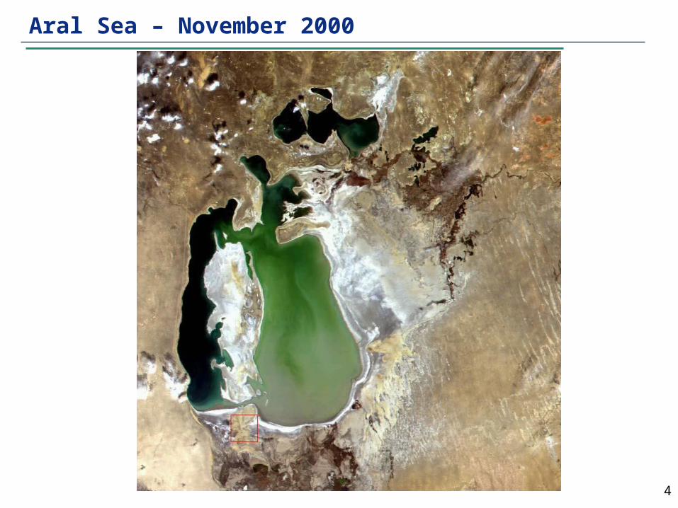
4
Aral Sea – November 2000

5
Aral Sea – December 2001
Land Bridge
Aral Sea
Vozrozhdeniye Island

6
Aral Sea as Public Health Calamity

7
Devastating Regional Economic Consequences
Former coastal fishing village and marooned fishing vessels in
Kyzylorda Oblast, Kazakhstan
Agricultural opportunities crippled by environmental conditions

8
Important Unanswered Questions
Amu Darya, 200 km above its mouth at the Aral Sea
Boys drawing untreated water in Khiva