Embed Size (px)
Citation preview

1
INTERNATIONAL SEMINAR
HARBOUR CITIES ALONG THE SILK ROADS
The development of Kota Banten Lama
Its relation to the “Silk Route”
Uka Tjandrasasmita
Indonesia
Surabaya, Indonesia
9 – 14 January 1991

2
The development of Kota Banten Lama
Its relation to the “Silk Route”
By Drs. Uka Tjandrasasmita
1. Introduction
In this paper efforts will be made to analyze the development of old Banten (town) with
the "Silk Route" based on historical data (sources) and especially based on archeological data.
The name Silk Road as Seiden Strassen was for the first time used by Bacon Ferdinand von
Richhafen in the 19th century to indicate the old route which connected countries of Asia and
the West, which beside created trade contacts also created cultural contacts.1
Old Banten (town) which development and prospered since 16th century up to early 19th
century which had strategical and geographical location at the northern coast of western Java
not far from the Strait of Sunda, no doubt would have close relation which the silk road, the
historic data, consisting of foreign sources, archives travel reports, added by historic narrative
like “Babat, Hikavat”, a real tradition, would be able to give a picture about the development
of old Banten (town) old geographical maps, which showed old Banten could also add to the
historical data especially to its morphological development, its town panning, etc.2
Those historical data do not seem sufficient to reconstruct the history of the people of a
nation is well understood by any historian, this is in accordance with what Loris Guttschalk
said, that “The Fatal reconstruction of man's past, although being the aim of the historian,
would never be realized”3 The same case is with the reconstruction of the historic
development of a town like old Banten (town) which covered for about three centuries.
Especially when we consider the meaning of the word town itself, then things would become
1 Joseph Needam, F. R. G. F. S. A: In the traduction: “Silk Roads, China Ships. An Exibition of East west trade “John H. Volmer H. J. Keal, E. Nagai – Berthrong Ron. Royal Ontario Museum, Toronto, Ontario 1983, p. 1 – 4. 2 Mr. J. A. Van des Clys : “Oud Banten”, I. B. G. XXVI 1881, p. 1- 62. Using old Dutch sources and maps (Topography). As present Sonny Wibisono is analyzing the use of land in relation with the development of kota Banten Lama based on old maps of the Kota Banten Lama his article is on Pola Penggunaan lahan Dalam Sejarah Perkembangan Kota Lama “Pandeglang 5-9 December 1990. Evaluation on archeological research III. Dep. Of. Ed. 1988. P. 16-47. 3 Louis Gottchalk : “Mengerki Sejarah Pengantar Metode Sejarah”, Translation by Nugroho Notosusanto Yayasan Penerbit U. I. 1975, p. 27.

3
complicated, like many experts on town history found out. Take for instance the meaning or
definition of town by Peter J.M Nas. He gave five main definitions about town.4
1. A man made environment
2. A center of production
3. A social community
4. A cultural community
5. A controlled community
From those definition it is clear that to study a town's history a variety of scientific
approaches like history, town planning, social geography, economy, sociology, anthropology,
human ecology, phytology, technology, etc. are needed. In this connection archeology also is
very important to solidify the historical data mentioned before Archeology will be of great
help since in principle, archeology and history have the same aim, that is “the reconstruction
of human life in past”5 To study a town especially when remands of it are only to be found
town archeology, urban archeology, would be most important. The application of urban
archeology to study old Banten (town) started a few years ago about (1976)6
II. The historical data of Kota Banten Lama (Old ' Banten Town)
In reconstructing the urban history in Banten, we quote the report of Tome Pires about
1512 - 1515. In this report he explained.
“The kingdom of Sunda has its ports. The first is the port of Bantam Junks anchor in this
port. It is (a) trading port. There is a good city on the river. The city has a captain, a very
important person. This port trades with the Maldives islands and with the islands of Sumatra
on the Pancur side. This port is almost the most important of all; a river empties there by the
sea. It has a great deal of rice and foodstuffs and pepper”.
4 Peter J. M. Nas : “Introduction a general view on the Indonesia Town”, in the Indonesia City Studies in Urban Development and Planning “Peter J. M. Mast Editor, Verban delingan Van KITLV fars Publication Dordrecht Holland/Cinaminson. USA 1986, p. 14 (p. 1-17). 5 Nugroho Notosusanto : “Hubungan erat antara disiplin Arkelog dans disiplin Sejarah” MISI, dl. I No 1, 1963, hal. 39-64. 6 Uka Tjandra Sasmita: “Research Restoration, and Conservation Activities of Ancient Cities in Indonesia and/or Settlement, Jakarta, Malang, Indonesia June 21-28, 1987 halaman 47-56.

4
From the above mentioned report some conclusion could be drawn, i.e. that the Banten
Harbour was of the most important among harbours in the Kingdom of Sunda. This Harbour
was under the control of a Kadipaten of the Sunda Kingdom, which capital is located at a
riverside, headed by a captain (adipati?) or a chieftain (raja bawahan).
The Banten Harbour had already insisted be ships (boats) from the Maldives and Sumatra.
This mean that it had already connection with the Silk Route (Road) Banten was rich i n rich a
rice and other food commodities and also pepper.
The historical data from Tome Pires about the Kadipaten Banten under the King of Sunda
could be connected with data from the Babat or Sejarah Banten, pupuh XVIII It mentioned
that “Sunan GunungJati” and his son Maulana Hasanuddin went to Ban ten Girang and
conquered that place. For this occasion two Sanqkalas were issued, The Brasta qempung
warna tunqqal, and Ilanq hari warna lanaqri, which meant 1400 and 1480 or 1478 AD and
1557 AD. 7 After living in Ban ten Girang for a short time Hasanuddin moved and thereafter
was crowned as the king of Banten: he was suggested to build the Surasowan Town (=Old
Banten – Banten lama) and got the title of Panembahan Surasowan.8
Based on the XIX pupuh of the Sejarah Banten, Maulana Hasanuddin after a few years
living in Banten Girang received a message from his father Sunan Gunung Jati to build a town
on the coast, where the istana, palace (dalem) is situated, with a market, an open space (alun-
alun). He was also told that the watu gigilang should not be removed, since it would mean the
downfall of the kingdom.9
In the XXII pupuh it was said the building of the town was continued by Maulana Yusuf,
The son of Maul ana Hasanuddin. It also said that Maulana Yusuf was physically very strong.
He built a stronghold (gawe kuta baluwasti bata kelawan kawis) and also built villages, dry
and wet rice fields, canals and dams.10 Most interesting was that pupuh XLIV of the sejarah
Banten mentioned the functions of the buildings in a row.11 The report started from the main
gate of the palace (Kraton). Made Bahan the guard house of the wong tambakbaya. The Made
Gayam and the Siti Luhur where close by building was found was the arsenal and the Stables
for the horses of the kingdom. The Pakombalan was for the Wong Gunung (people from the 7 Hoesein Djajadiningrat: “Tinjauan Kritis Tentang Sejarah Banten “Sumbangan bagi pengenalan sifat – sifat Penulisan Sejarah Jawa, Jambatan, 1983 p. 35. 8 Hoesein Djajadiningrat : Ibid, p. 35. 9 Hoesein Djajadiningrat : Ibid, p. 36. 10 Hoesein Djajadiningrat : Ibid, p. 32. 11 Hoesein Djajadiningrat : Ibid, p. 57, 58.

5
mountain or from the island), to the north is the financial building and to its west is a small
praying house (langgar, surau) with a tower. Furthermore one could find a settler’s compound
called candi Raras, where a lot of houses could be found, two of those houses were given the
names Made Babat and Made Sirap. To the east of Made Babat one could find an open
building as Mandapa where cannon named Ki Jimat was placed directed to the north. Not far
from srimanganti was the waringin kurung and watu gigilang. At the river side there was a
horbouring placed for the kingdom’s boats (panyurungan). North West of it was the market
and a mosque. At the riverbank is a post where the Gajah Rara Kandi was tightened, and
within a short distance there was a big wooden bridge crossing the river from where a twin
fence was placed up to the strongholds. The inner part of the stronghold (baluwarti dalam)
was named Lawang Sademi. To the west it was a big bunion tree and a stronghold Sampar
Lebu close - by: This is the story told by the Babad or SeJarah Banten about the buildings
(structures) from the time of Maulana-Hasanuddin (1526-1570) up-to Maulana Yusuf ( 1570-
1580) .
During Maulana Muhamùad’s (The son of Maulana Yusuf) reign in 1596, Banten was
visited for the first time by Dutch people under the leadership of Cornelis de Houtman.12
From them a description about the situation and condition of that time was obtained. From the
old Kota Banten Lama sketch with indicating letters, we could recognize the group of houses
or buildings and its functions:
A. the palace of the king, B. Paseban, C. the land gate, D. the mountain gate, E. the
water gate, F. sluit-boom, G. the tower, H. the Mosque, I. the Chinese Quarter, J.
the Residents of Pangerang Gebang (the Commander in chief from Banten) : M.
the river which cut the town in two; N. the Residence of the Syah Bandar; O. the
Residence of the Admiral; P. the residence of Cheti from the Moluccas; Q. the
Residence of the Brother of the Mangkubumi (Governor); R. The Residence of the
Senopati; S. The Residence of (Ngabehi) PanJang Jiwa; T. The Pacinan market
(Chinese Market); V. The Residence of Admiral Keling; X. the Dutch office and
storing place; Y. the Gujarat quartes; Z. the Arsenal.
From the stories in the Sejarah Banten and from Dutch sources, and from the
sketch and town plan of Kota Banten Lama, from about 1596 we have a clear in
12 H. J. De Graaf en Th. Pigeaud : « De Eerste Moslimse Vorstendommen Geschiendenis van de 15 de en 16 de Eeuw » Verhandeligen KITLV 69, Sgravenhage-Martinus Nijhott 1974, 124. « De Eerste Scheepvaart der Nederlanders naar Oost Indie onder Cornelis de Houtman 1595-1597, Het Earste Boel van Wwillem Lodewycksz by Rouffaer G. P. and Ijzerman J. W. Martinus Nijhoff, 1915.

6
formation about the condition of the town and some buildings of Kota banten Lama
or Kota Surosowan as mentioned in the Sejarah Banten. From both sources some
aspects of the town planning, the function of a capital as the center of the kingdom
and the Harbour could be recognized.
a. The Keraton as the center of the rules
b. The alun-alun (paseban) open space, as a meeting place for people from all
walks of life.
c. The Mosque as the center for religious activities
d. The Market as the center of economic life and trade
e. The Harbour as a stopover place for ships to import and export commodities
inter island and beyond.
f. The strongholds to safeguard against outside attacks.
g. Living quarties based on profession and ethnicity like the Pacina, Gujarat and
Bengala and the Dutch Loge.
h. The town was surrounded by a wall with gates
i. Canal system and bridges and roads to separate the different quarter in and
outside the town.
It was very difficult to know how vast kota Banten was at the end of the 16th century from the
map without scale. The sources from the Dutch people from around 1596 only gave an
estimation i. e. like old Amsterdam in 1480 in 1678 it was estimated that Kota Banten was 1
mile (square) vast. According to Nalentya the town was 2 English miles long but now (1694)
no more since it got burned in 1682. According to Messe in 1683 Kota Banten was bigger
than Batavia. According to Nalentya, in 1694 the lenth of the townalong the coast is was less
than ½ mile. In 1906 de Bruin estimated that walking the length of the town took only ¼ hour
around the town, 2 hours. Heyat only said that the town is rather big. Stavorive said it was
difficult to say how big kota Banten was. 13 If the reports given by Tome Period, then this
town had developed if looked from the morphological and the had developed if looked or
early Islamic Period, then this town had developed if looked from the morphological and the
population aspect. The trades who lived in Banten consisted of a variety of nations the
description given about the busy trade and living quarters for the foreign trades could be
abstained from the report of Willem Lodewycksz of 1596 when Cornelis de Hetman visited
Banten. He said that people living in Kota Banten consisted of a variety of nations along the
13 Mr. J. A. Van der Chijs : Opcit, 1881, p. 15-16.

7
coast were houses of the Malang people, Benggala, Gujerats and Abesenians. The Chinese
merchants had their own living quarter at the western coast together with the Portuguese. The
Dutch living quarter was well fenced in anticipation of over land attacks also to be found are
the living quarters of the mentioned groups of traders. There were also traders from the
Moluccas, Ambon, Banda, Solar, Makasar, SUmbawa, Jagotan, Gresik, Pati, Juwana Sumatra
and Kalimatan (Borneo)14 The - commodities traded by those foreign merchants at the Banten
market,as told by William Lodewycksz, especially the ones traded by the Chinese were a
variety of silk with beautiful colours laken, velvet satin, golden thread, porcelain plates,
beautiful table cloth, brass pots, big and small pans from bras and tempaan (?), combs
spectacles, sulfur, swords made in China, quicksilver, beautiful cases (?) coloured writing
paper, calendars, gold, sarung pedang (sword cases) with lacquer, roots from China fans and
umbrellas.15 It was also mentioned that the Arabs and Persians traded in a variety of gems like
the ruby and also medicine. The Indian traders had small shops where they sold commodities
from glass, ivory, precious stones, especially those from Cambay. The same is the case with
the Benggala traders, who also traded in commodities from their own country like rice, wheat,
oil, butter, sugar, lacquer, lambaya (a kind of clothing, silk, handkerchief, and fine kassa
textile, male and female slaves. Base on this report and the market sketch of Banten, besides
the imported commodities, there were also crops and self-made commodities. The crops
traded consisted of melons, cucumber, coconut, vegetables, beans, chili, and honey in jars,
sugar, and beetle nuts. The sketch also showed that at the market were sold bamboo, palm leaf
roof, weapons, like the kris, swords, lance and bullets, chickens, goats, rice, pepper, oil, salt,
(also from Jaratan) and findings in ceramic plates. 16 The most important export commodity
from Banten was pepper. The pepper traders were men and women farmers. The Chinese
traders sometimes brought the pepper directly from the farmers in the villages. The means of
exchange, or money used were in the villages. The means of exchange, or money used were
caza and the price of one qantangs equivalent to 8 or 9 hundred caza, while the qantang is 3
pounds. Jan Janaz Karel reported that every day he went to the big market to buy pepper
which price changed every day. He also reported that at the big market there were little shops
of Bengalese, Gujarats, Chinese, and from the picture one could also notice Dutch people.
From the market description one could draw the conclusion that trade did not take place only 14 G. P. Roffaer en J. W. Ijzerman : Ibid, 1915, p. 108, 109, 110, 121. 15 G. P. Rouffaer en J. W. Ijzerman : Ibid 1915, p. 112 See Uka Tjandrasasmita editor of vol. III Sejarah Nasional Indonesia in Pertumbuhan dan perkembangan Kerajaan Islam di Indonesia, 2nd editor. Dep. Pendidikan dan Kebudayaa 1976, p. 222. 16 G. P. Rouffaer en J. W. Ijzerman : Ibid, 1915, p. 110-113, picture 12. See Uka Tjandrasasmita (ed.), Ibid, 1976, p. 222.

8
among the indigenous people, but also with other nations and so had an international
character.
In the 17th century the Sultanate of Banten prospered politically, commercially,
agriculturally, and culturally. This development actually started already during the reign of
Sultan Abul Mufakhir Mahmud Kadir (1596-1640) and reached its climax during the reign of
Sultan Abul Fath Abdul Fattah who was known by the title of Sultan Ageng Tirtayasa (1651-
1672)17.
Since the middle of the 17th century the VOC started to harass the Sultanate of Ban ten
politically and economically; this attitude was reciprocated by the Sultanate and it
strengthened its power. As a consequence since 1656 wars were waged continuously,
especially between May 1658 and July 1659, at the border regions between Angke and
Tangerang, even on the waters in the bay of Banten.18 For these wars Banten strengthened its
troops on land and out sea and foster alliances with the neighbouring regions. Banten took up
contacts with India, Mongolia, Arabia, Turkey and England. A delegation to England was sent
on November 10th 1685, headed by Ngabai Naya wrpraya and Jaya Sendana. The delegation
was not only sent for friendly ties, but to obtain support in weapons. In 1671, Banten sent the
Crown prince, Sultan Haji, to Mecca and to have a stopover in Turkey.19 One of the causes of
conflict between Banten and the Company was on the issue of trade with spices producing
regions in the Molucas. The Dutctch Company always tried to stand in the way between
Banten and those regions, since it wanted to uphold its monopoly. Since the middle of the 17th
Century Banten was the gate for the incoming commodities from the islands (Nusantara)20
Trade agent offices were established in Banten, i. e. English, French Danish,
Portuguese. As a consequence The Banten Harbour had a high frequency of visiting boats
from countries that had their trade representative there; these trading activities were increased
by ships coming from the Philippines, Japan, China, India, Persia and Arabia.
In the field of agriculture, to support the producing of export commodities, irrigation
was made from Pontang to Tanaza and Pasilan, from the year 1660 up to 1678. The over
17 Uka Tjandrasasmita : Sultan Agung Tirtayasa musuh besar kompeni Belanda, yayasan Nusa Larang, Jakarta 1967. 18 Uka Tjandrasasmita : “Abu Nasar Abdul Kahar” Ibid 1967, p. 12, 13, 16. 19 Uka Tjandrasaslmita : “Sultan Agung Tirtayasa”. Directorat Seni Tradisional 1984, p. 34. 20 Burger and Prajudi : Sejarah Ekonomi, Sociologis, Indonesia, Pradnya Paramita, Jakarta 1962, p. 63.

9
production of pepper from Banten and environment for export (from 1680- 1780) reached the
average of 3.375.000 pound pro annum. 21
To evaluate Sultan Agung Tirtayasa built a Keraton as Tirtayasa Tanara which
sometimes became his residence. In 1682 the Surasowan palace was burned down during the
war. It was characterized by a fortified Keraton the building of a Tiamah and a watch tower in
front of the Agung mosque in Banten which could also be used to call for prayers (adzan).
There building and renovation of those mentioned buildings were carried out under a Dutch
architect who had confessed the Muslim religion and who became a Banten citizen, his name
was Hendrick Lucaszoon Cardeel, he was given the title: Pangeran Wiraguna since Sultan
Agung Tirtayasa appointed his son Sultan Abu'n Nasr Abdul Kahar (1672).The Dutch
influence started to grow, not only politically by influenced but the behavior of Sultan
imitated the habits of the Dutch: In every important state occasion the Dutch representative
was always invited and present.
The consequence was that the wish to control the Sultan etc. of Sultan Agung
Tirtayasa emerged, who at that time resided at Tirtayasa. With the assistance of the Dutch
Company war broke out and ended in the takeover of power by Sultan Abu’s Nasr Abdul
Kahar. The Victory obtained with the assistance of the Dutch Company had to be paid by
fulfilling to accept the monopoly in trade and the building of a stronghold north of the
Surasowan Keraton on the coast next, to the pabean and tol gate. The stronghold or wall on
the coast which was built in previous times became the Dutch Company's stronghold and was
given the name Speelwyk (1684-1685) and the construction of it was carried out under the
architect Hendrich Lucazroon Cardeel.22 Since the reign of Sultan Abu'n Nasr Abdul Kaharup
to the 18th century many uprisings broke out like the uprising under the leadership of Tubagus
Buang and Kyai Tapa. The destruction of the Surasowan Kraton by Daendels in 1809 which
was followed by the abolition of Sultan etc. whose territories came under the Dutch control, a
kind of Kabupaten and the administration seal was in Sekong and Caringin.
III Archaeological data
In pre Islamic time the region of Banten was ever ruled or under the influence of a
Hindu - Indonesia kingdom, this could be proved by archeological findings even from the era
of Tarumanegara Cidamghyang, Pandeglang an inscription was found from the Tarumanegara
21 Mr. J. Van der Chijs: Opcit 1881, p. 62. 22 V. J. Van de Wall : Bouw geschiedenis van het fort Speelwijk te Banten O. V. 1920 Bijdrage L., p. 137-157.

10
Kingdom from the 5th century.23 In the succeeding years statues were found at Cimanuk and
Caringin with the shape of Civa Mahadewa, Guru, Brahma, Druga, Ganesha, Lingga and
Yoni.24 The same case is with the Nandi Statue which was found at Karangantu25 and statues
from Padarincang. All these statues indicated that Banten had already experienced a Hindu
influence at the Banten Girang sites which was assumed to be the center of government of the
Vassalage of the Sunda Kingdom of Pajajaran. In 1976 a research excavation was ever held.
From the surface of the Banten Girang site broken ceramics were found especially from one
excavated site with of a depth of 40 cm, broken foreign ceramics and beads were found. The
founding were assumed to be from the.26 Sung era From the location of the Ban ten Girang
sites which was surrounded by a river called Cibanten upstream baqian Udik (Sunda-Girang)
about 13 km from Ban ten Lama (old Banten), reconfirmed the above mentioned ceramic
findings.
Based on these, it is assumed the Banten Girang situs was the center of government of
the Sunda Pajajaran kingdom. The Harbour mentioned by Tome Pires in his Sunna Orienta;
was located most probably at the mouth of the Cibanten since at Java's north coast, where
Kota Banten Lama (the old Banten Town) was built by kings who already confessed Islam
and spread this religion in this environment. At that time the distance of the Harbour was
already known situated on the international trade route, where the Portuguese, Maladive boats
had already trade contacts with Banten, this indicated that during the Hindu Indonesia period,
Banten was already to touched by the" silk route ".After following the historical development
of Banten especially with its capital which is called Banten Lama or Surosowan, based on
historical sources we now look at the archeological data which could reconfirm the written
historical data from the Babad or Sajarah Banten and the old map.
Archaeological data
The development of· the Banten Harbour was fast in connection with the silk route
(road), a since the beginning of the Islamic kingdom, based on historical data told by the
Babad or Sejarah Banten which reported about the establishment of the capital as the center of
the Kingdom or Sultanate. 23 Bamvang Sumardio (Editor): Sejarah Nasional Indonesia Jilid II edisi 4 Jaman Kuno. Dep Dik Bud, PN Balai Pustaka 1984, p. 42. See also Laporan Tahunan Dinas Purbakala RI 1954, p. 5-6. 24 N. J. Krom : “Inleiding tot the Hidoe-Javaanscke Kust” Tweebe Nerziene Druk, tweede deel, S – Gravenhage Martinus Nijhoff, 1923, p. 394. 25 Nandi found in Karangantu the slower kept at the Museum Lapangan (Site Museum) Banten. 26 Mudarjito C. S.: Laporan Penelitian Arkeologi Banten 1978, No. 76. Proyek Penelitian dan Penggalian Purbakala Depdikbud, 1978, p. 26.

11
The report by Willem Lodewyckz who joined the first sea trip of the Dutch under the
leadership of Cornelis de Houtman to Banten in 1596 and the sketch of Kota Banten Lama,
represented a very important historical data. The archeological data consisting of remnants
and findings needed to be studied in order to show how far they supported the historical data.
At the former the location of Kota Banten Lama or Surasowan is now a 1ittle village in the
Kaseman district, under the demand of Serang, few ruins could be found on the surface. The
ruins are from:
1. The stronghold of the Keraton, 3 ha
2. Mesjid Agung (Mosque) west of the alun=alun (open Space) at left and right side of
the mosque are galleries of the tombs of the Sultans which starting from Sultan Hasanuddin
and so on.
3. The Alun=alun (open space) in front of the former Keraton, not far from the gate.
4. Water gigilang one in front of the Keraton not far from the Keraton gate, and
another one at a small distance from the Keraton north of the Alun=alun.
5. The wooden bridge across the Cibanten in the north.
6. The Cibanten River and a canal surrounding the Keraton and the mentioned
buildings
7. A former straight road to Tasik Ardi with broken water pipes from terracotta, which
connected the Keraton with an imitation lake known with the name Tasik Ardi, about 3 km
south to purify the water to reservoirs were built and the first was named Panqindelan
Abangan the second Panqindelan Putihan.
8. The Dutch Company’s stronghold, named Speelwyk was located in the north at the
mouth of the river Cibanten.
9. Some graves of Dutch Company officials, east of the stronghold, not far from the
river’s mouth.
10. A temple or wihara, west of the stronghold. At present the biggest part had been
removed.

12
11. The Pacinan quarter, where remnants of the tower and mosque could still be found,
and also graves with Chinese script.
12. The Kaibon Keraton remnants, southeast to the Keraton Surosowan.
13. The Karangantu market which could be recognized from some parts of its
foundation, on which a new market is built.
14. The Karangantu Harbour, which caped in the direction to the front of the
Karangantu market.
15. The canon, named Kyai Amuk, before 1979 placed at the Karangantu Harbour.
16. Tasik Ardi (Ardi, lake) with the abangen filter (Pangindelan) and Patikan filter,
which were connected with terracotta pipes to that lake.
Names of villages (quarters) in 1596 which were on the map of 1900, could still be
recognized by their toponyms which now adays are still heard even still used for new quarters
(villages). Based on archaeological data which still no doubt was in the past the Banten Lama
Sites and surroundings, had been a town with physical building elements related to aspects
common in old towns, including the capital of a kingdom. 27
l. Keraton (palace), the king or sultan's residence, the center of political power and
government.
2. The residences of government officials and living quarters on ethnicity and
profession.
3. The alun-alun in front of the Keraton and land roads and the use of water pipes for
the town.
4. The Mesjid (mosque) Agung as the center of religious activities.
5. The markets as centers of economic and commercial activities.
6. The harbours as transit place which were very important for the foreign and
domestic boats to carry out export and import needed commodities.
27 W. F. Werthein : « De stad in Indonesia : oud Indoneshe steden ». On Indonesia, 1951, p. 29-40. See also Peter J. M. Nas, the early Indonesian town: rise and decline of the Cuty state and Capital” in the Indonesian City, Opcit 1986, p. 18-38, Bantam p. 26-28.
13
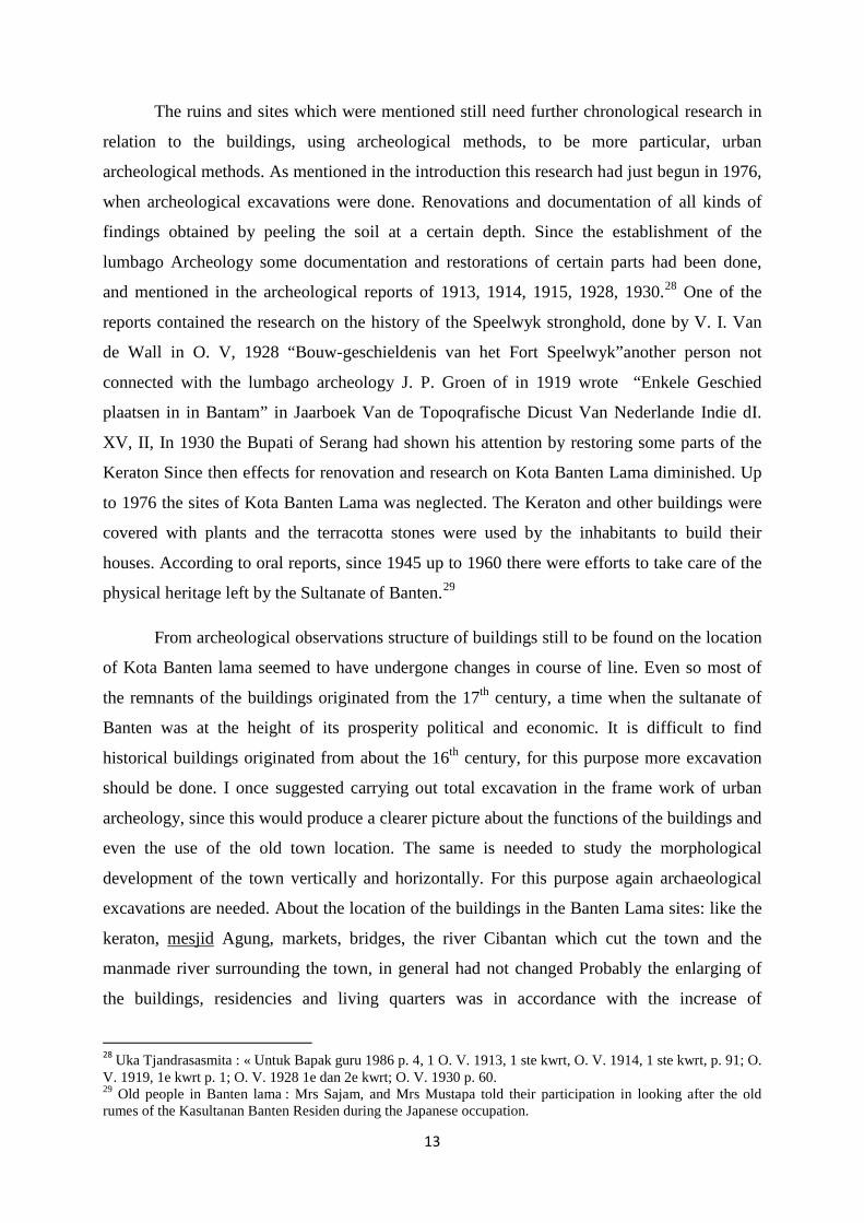
The ruins and sites which were mentioned still need further chronological research in
relation to the buildings, using archeological methods, to be more particular, urban
archeological methods. As mentioned in the introduction this research had just begun in 1976,
when archeological excavations were done. Renovations and documentation of all kinds of
findings obtained by peeling the soil at a certain depth. Since the establishment of the
lumbago Archeology some documentation and restorations of certain parts had been done,
and mentioned in the archeological reports of 1913, 1914, 1915, 1928, 1930.28 One of the
reports contained the research on the history of the Speelwyk stronghold, done by V. I. Van
de Wall in O. V, 1928 “Bouw-geschieldenis van het Fort Speelwyk”another person not
connected with the lumbago archeology J. P. Groen of in 1919 wrote “Enkele Geschied
plaatsen in in Bantam” in Jaarboek Van de Topoqrafische Dicust Van Nederlande Indie dI.
XV, II, In 1930 the Bupati of Serang had shown his attention by restoring some parts of the
Keraton Since then effects for renovation and research on Kota Banten Lama diminished. Up
to 1976 the sites of Kota Banten Lama was neglected. The Keraton and other buildings were
covered with plants and the terracotta stones were used by the inhabitants to build their
houses. According to oral reports, since 1945 up to 1960 there were efforts to take care of the
physical heritage left by the Sultanate of Banten.29
From archeological observations structure of buildings still to be found on the location
of Kota Banten lama seemed to have undergone changes in course of line. Even so most of
the remnants of the buildings originated from the 17th century, a time when the sultanate of
Banten was at the height of its prosperity political and economic. It is difficult to find
historical buildings originated from about the 16th century, for this purpose more excavation
should be done. I once suggested carrying out total excavation in the frame work of urban
archeology, since this would produce a clearer picture about the functions of the buildings and
even the use of the old town location. The same is needed to study the morphological
development of the town vertically and horizontally. For this purpose again archaeological
excavations are needed. About the location of the buildings in the Banten Lama sites: like the
keraton, mesjid Agung, markets, bridges, the river Cibantan which cut the town and the
manmade river surrounding the town, in general had not changed Probably the enlarging of
the buildings, residencies and living quarters was in accordance with the increase of
28 Uka Tjandrasasmita : « Untuk Bapak guru 1986 p. 4, 1 O. V. 1913, 1 ste kwrt, O. V. 1914, 1 ste kwrt, p. 91; O. V. 1919, 1e kwrt p. 1; O. V. 1928 1e dan 2e kwrt; O. V. 1930 p. 60. 29 Old people in Banten lama : Mrs Sajam, and Mrs Mustapa told their participation in looking after the old rumes of the Kasultanan Banten Residen during the Japanese occupation.

14
population especially in the 17th century. In 1694 based on the senses during the rule of Sultan
Abdul Mahasim Jenul Ngabidin, the number of the population was 31.848. In 1708 there was
another senses, the outcome was 36.362 inhabitants had increased by 4.454 only.
During the archeological excavation in the Keraton vicinities, near the Lara Denok
pond with a depth of 0, 50 m under a building with terracotta stones foundation without space,
the terracotta stones were only put together by rubbing. This is a traditional technic applied by
the Majapahit town, named Trowulan, and up to now still used in Bali. This technic was also
used at several buildings of the early Islamic period in Indonesia, like the Setinggil building,
the Bentar temple in Cheribon, Kuto Kosod the former Keraton Pangkungowati at Kasepuhan
Chirebo, the Islamic grave at Gedang Suro Palembang and some other places. It, therefore,
could be assumed that the foundation of terracotta stones without space at the above location
(Surosowan vicinity) should be from the period when the Keraton was just started to be built.
While the foundation with space between the terracotta stones and found on the surface in the
stronghold of the Keraton and the stronghold itself, no doubt were from the succeeding
centuries i.e. since the 17th century.
The terracotta stone wall with space and a few buildings with folding at its pillar's-
foundation, no doubt indicated the western art influence. Broken roof tiles of the roof top
were found during the exsavacation and renovation in the Keraton, no doubt indicated western
decorating art.
The floor is still genuine and consisted of tiles made from clay 30 x 30 cm in size, it
had the same size and colour with those in early colonial buildings of the 17th and 18th
century,The Tiamah floar and the structure indicated the connection with Gurape, this is also
the case with some buildings in Jakarta. At the arsenal, a part of the stronghold of the Keraton
there was a door with a half circled top made from terracotta stones and is called the real bow
(Lengkung sebenarnya). This type of door was not known in the pre Islamic period in
Indonesia. This proved that this is an Islamic architectural element and is named Moorse
Kunst (Seni Islam). The floor of the Keraton was done in the direction of the Kiblat, may be
done on purpose. This no doubt is Islamic impact. The mosque is a clear Islamic product; its
architecture still carried some elements from preceding architectures, east side of the
stronghold, west to the Keraton gate foundation were found in 1ong square form, the same is
with the east. On the foundation there were a few umpak tiang (pillar foundation), which
indicated a building. This probably was called Srimanganti in the Sajalah Banten and the was

15
not built at the beginning of the Sultanate was indicated by the excavations east of the
Keraton gate, in front of the middle baluwarti, which had a half circle shape a foundation was
found with a westward door looking on the Keraton's stronghold (as can be seen now).
This was built at the end of the 17 century, when conflicts between Banten and the
Dutch Company increased. These all could be commented with the finding of iron pieces,
rests, from bullet making and furnishes at the back of the building or in the Keraton's
stronghold.
In front of the Keraton is the Watu gigilang long squared used for crowning a king, as
told by the Sajarah Banten. Another one is placed north of the alun = alun, which according to
the Babad or Sajarah Banten and also foreign reports, was used to crown the Sultan Muda
Both stones were from andasit stone, and were most probably from the early days of the
founding of the Sultanate etc., early 16th Century. This is in accordance with reports in the
Sejarah Banten, as already mentioned. About the Mesjid Agung which still exists, although
the architecture had not altered, the material used no doubt had altered in curse of time. The
form or structure of the mosque wall with the folding and the half circle on the top of the
doors could be originated from the renovation in the 17th century. The floor tiles which were
no more in use were of the same kind used at the Keraton. Tiamah or the shape of the building
was not from European origin. The mosque was built with roof stages. This should be the
tradition in building of mosques in Indonesia, i.e. without a tower, since the calling for prayer
(adzan) could be done from the top floor of the mosque which was a staged roof.
In the left (north) and right (South) gallery (serambi) one could find the tombs of the
kings or sultans since Malauna Hassanudin. The bridge accroos the Cibanten to the north of
the Alun = alun, could still be seen although having undergone renovations. In the Sejarah
Banten is mentioned that it was made from teakwood. The foreign sources called it a
Jembatan Angkit (ophaal bruq) and Van Bengel called it chain bridge of the Banten kings and
most probably had undergone changes in structure.
The strongholds in the coastal area could probably be built before the Speelwyk and
the remaining were from the wall at the northern side. During an archeological excavation
foundations of strongholds were found in the eastern part of it. According to Willem
Lodedwyksz when the Dutch came for the first time, this stronghold was called sea curtain
(sea gardya) but was no more existing in 1769, according to Stavorinus Reports on the
Speelwijk stronghold which was built in 1685 were given by F.Valentyn de Bruin and

16
Stavorinus. They reported about the buildings within the Speelwyk, like one for the
stronghold commander hospital, church, the arsenal etc. When yseldyk made an inspection 35
conditions had deteriorated.30
This stronghold was probably deserted by the Dutch during the reign of (Governor
General) Daendels.
To reconfirm the historical data concerning the Muslim kingdom to Banten as
explained before research and archeological excavations had been reactivated since 1976 up
to 1990 Renovations were also done to Banten Lama by the Pusat Penelitian archeologi
Nasional Directorat Perlindungan Pembinaan Peninqgalan Sejarah Purbakala, Directorat
Jenderal Kebudayaan Departemen Fendidikan dan Kebudayaan. To implement this, students
and lecturers of the University of Indonesia or Gajah Mada University are invited to
participate. This activity would be significant for their field practice.
The following had been discovered as a result of excavations and peeling the surface,
to renovate the inner part of the Keraton and the outer side of the stronghold. !.The structure
of the buildings became better known also the foundations which in course of time had
undergone changes so that the upper and lower part of the buildings underwent changes. The
lower part indicated older buildings than upper parts. At the lower part the placing of
terracotta stones were without space, but they were rubbed then put one immediately on the
other a pre Islamic building technic. The lower past seemed to have originated from the early
stages of the building of Keraton. The foundations on it had already used Lepa and specy
(Space filled with mixed sand and lime.) This technic was applied after European building
technics were in traduced in the 17th century. Especially during the reign of Sultan Agung
Tirtayasa and sultan Haji Sultan Abu'n Nasr Abdul Kahar (1672 - 1681/82).
The other findings consisted of artefact i.e. foreign and local ceramics including roof
tiles and floor tiles red in colour and big in size. About the stronghold, when peeling was done
there, it turned out that the outer part consisted of rocks, while in the inner part of terracotta
stones and sand were used. About the foothold of the stronghold, the condition was only
known after the surface of the ground had been dug for about 0.5 meter.
2. Artefact discovered in a great numbers was foreign ceramics and local ones. From the
same sites tiles and the Keraton roof decoration made of terracotta with genuine
30 Mrs J. Van der Chijs : Opcit. 1881, p. 59.

17
European ornamental motifs were also found. From the outer side of the stronghold
local and foreign ceramics were also found and parts of iron bullets small and big in
size. Outside the Keraton stronghold many broken parts of bottles and bone pipes
known as "Gouda pypen" (pipes from Gouda) which were from Holland were found
Since 1981 after removing the people's houses from the sites east and north east of the
alun - alun archeological .excavations were carried out there (Kebalen) according to
plan. After no more houses were on their site it was planned to build a situs museum at
taht very place. But before the plan was carried out excavations were done to check
whether possible archeological structures were underneath. The results of the Kebalen
excavation was the discovery of a two phased building, one with old building t ethnics
and the other one with recent building technics. From the old building technics which
we called phase Kebalen Lama consisted of two depth i.e.70-90 cm from the surface
and 30 - 40 cm from the surface.
3. From ke Kebalen excavations many broken foreign ceramics were found and pieces of
metoal, kerak logam and a stone anvil. The excavation in June – July, resulted in the
discovery of 500 metal melting pots, the material to melt were iron, copper and lead.
The pots with the size 1-5 cm were used to melt the iron for small things like
jewellery. At present one could find about 650 pieces of broken melting pots, 15
melting pots are still in good shape. From excavations at Surasowa Keraton, outside
the stronghold (at Kebalen) Sukadiri (not far from the chain bridge) and the present
Darmajaya village were places with metal industries. At Kebalen other artefacts were
also found, like broken ceramic plates, cups of all kinds.
4. From some excavations by the Pusat Penelitian Arkeologi Nasional and its reports
(1978) a lot of archeological data were exposed i.e. the number of findings,
chronological data, classification of the findings. Part of those findings is useful to
indicate the characteristics of the sites, urban system and reconfirm the foreign
historical data.
The sites where the excavation was suggested are:
l. Sukadiri (SKD)
2. Pakojan (PKJ)
3. Panjinan (PJN)

18
4. Banten Girang (BG)
Those sites produced broken local ceramics, foreign ceramics, metal, coins and sea animal
rests. Local broken ceramics consisted of 29.494 pieces taken from the surface 12.808 and
from excavations 16.686 pieces. This local ceramics had 75 ornamental motifs. About the
above mentioned findings see enclosures.
From the total amount 5.944 pieces had been analysed i.e. 3.147 edges, 16 necks, 7
carnations, l9 cucuk, 19 bottoms, 26 feet, 447 broken plates decorated, and 1.859 pieces
unknown, based on the analysed examples, 9 were not broken and consisted of two kinds.
1. 8 types of containers: Pasu, plate, pots, vase, water pot, pan, frying pan and kuali.
2. Non containers, only one type, i.e. a stone.
Among the containers the pasu were the biggest in number and rom all sizes. Next to
all this, 77 anvils were found from baked limestone or stone and were used from the outside.
At Sukadiri 62 anvils were found, at Pajunan 12 and in Banten Lama (Surasowan) 3 anvils.
Based on these findings one could draw the conclusion that there were local ceramics home
industries. The topomin Panjunan clearly could easily be connected with old towns. One
could usually find a place named Panjungan, like in cheribon, and it indicated a place
producing ceramic pots and pans. At excavations of 35 cm depth a Sukadiri a thin artifact was
dug out the center had a cekunqan. It probably served as the base for the well. All what was
found there consisted pf 762 pieces, of which 18 pieces were not broken. Printing forms,
melting pots were also found, around the melting pot. Hard pieces of copper were found
Spread around the melting pot and hard pieces of copper were found spread on an area 1.50 x
1.50 m. This of course has a contextual value. Other things found were metal forms, net
pendulum, gacuk made of baked limestone.
Like the findings in and outside the Kraton, at Kebalen, Sukadiri, Pekojan, Panjunan
and even at Banten Girang a big amount of broken foreign ceramic were found. The 1976
excavation produced 3109 pieces of foreign ceramics. In comparison with the Banten Lama
findings, the Banten Girang findings were less. At the last mentioned place only 316 pieces of
ceramics were found on the surface, while from excavations 21 pieces, total 337 pieces.
Banten Lama, including Pakojan and Pnjunan, had the amount of 1431 pieces on the surface
and 1341 from excavations, made the total amount of 2773 pieces. The findings at Banten
Lama is 8 times more than Banten Girang. Most of the foreign ceramics have been classified

19
(1.724 pieces). There were 11 kinds of types i.e. plates, cups, cepuk, bottles, water container
(tempayan), mangkok (bowls), vase, pots, water pot, spoon and decorations.
The ceramics findings whether found on the surf ace or excavated came from China,
Annam Japan and Europe. The oldest ceramic found in Banten Lama is from China during the
Ch'ing dynasty (1644-1912). There were 1885 pieces or 86.30% of the findings. From the
Ming dynasty 265 pieces, 12%, from Annam (14th – 16th century) 6 pieces, from Japan (17th –
19th century) 3 pieces, from Europe (17th – 19th century) 10 pieces. The findings from Banten
Girang could be seen at enclosed tabel.38. Since 1976 the findings have increased (by
thousands) classified and put at Museum site in Banten.
During excavations in 1976 at the above mentioned sites, coins were found made by
the Sultanate of Banten and by the VOC, Republic Batavia, Nederlandsch Indie (18th – 19th
century) see enclosed table. The six cornered coin with a hole in the middle was produced by
the Sultanate of Banten. The 1976 excavations also produced sea animals remain like shells,
snails, fins (at Sukadiri VI excavation). These findings were close to where the pots and pans
were found so that it could be assumed to be one kind of dish.
IV. THE RECONSTRUCTION OF BANTEN LAMA HISTORICAL
DEVELOPMENT AND ITS CONNECTION WITH TRADE ACTIVITIES OF THE SILK
ROUTE.
Based on limited historical sources wheth it may be foreign or from Banten itself, a
rough picture of Banten during the Hindu-Indonesia period could be obtained in particular of
the Sunda Pajajaran Kingdom which had its capital at Boger. The historical data from Tome
Pires had given us an idea about the role of Banten and its Harbour. From these data it was
obvious that Banten Harbour was visited by ships from Maldives and Sumatra for the purpose
of trade. Looking from the point of view of the Silk Road "this Harbour was very important.
Although the report made by Tome Pires did not explicitly explain the consequence of this
trading and maritime contacts on the cultural development of Banten, we could take it from
granted that acculturation had taken place between Hindu religion and the local belief. If we
connected to the political and cultural condition of the central government which had a
Hinduistic character as mentioned by Tome Pires, the more it would be obvious. It was said
that the Banter Harbour was the most important Harbour in Pajajaran Sunda in comparison
with Pontang, Tanggerang, Kalapa, Ciguede, Cimanuk. That Banten was ruled under a
Hinduistic power not only reported by Tome Pires, but Sun an also by the Babad or Sajarah

20
Banten. It mentioned that Gunung Jati and his son Hasan Uddin confronted the Pucuk Umum
who professed the Hindu religion and was a vassal from the Sunda Pajajaran kingdom.
The above mentioned sources were reconfirmed by archeological findings, like stone
statues from Cimanuk and Caringin which had a Hinduistic character. At Banten Lama the
statue of Nandi was found (at Karangantu). This place at that time was already a Harbour and
later developed as the Sultanate of Banten. In Banten Girang caves were found and they are
assumed to be places for semedi for people who professed the Hindu religion. From
excavations at Banten Girang foreign ceramic pieces were found from Sung era. The Banten
Girang location and its water system indicated that the place was very important and so
should be well defended. Most probably, that place is the most important spot within the
territory of the Sunda-Pajajaran kingdom. The contacts between Banten and the silk route
developed the more when the Harbour changed master, i.e. it came under the Sultanate of
Banten. This development was the consequence of an Islamic ruler but also because Banten
was no more only a Harbour but the capital of the Sultanate and Banten was located at the
mouth of a river, at the coast. As a capital the government had its seat there. Politics and trade
economy were two most important factors supporting the development of a town.31 But if the
history of Banten Lama is evaluated, the two factors could also mean its downfall. This was
the case with Sultan Abu'n Noer Abdul Kahar, after the downfall of the reign of Sultan Ageng
Tirtayasa. During the reign of Maulana Hasanudin, Maulana Yusuf, Maulana Muhammad,
Sultan Abdul mufakir Mahmud Abdul Kadir, Abu'l Maali Ahmad, Sultan Abdul Fath, Abdul
Fattab or Sultan Ageng Tirtayasa. The sultanate of Ban ten experienced quite a good
development in politics, economic, trade and culture. The climes of prosperity were during
the reign of Sultan Ageng Tirtayasa. The effects of Sultan Agung Tirtayasa to increase
Prosperity and power brought in conveniences to the company. Every effect taken by Sultan
Agung Tirtayasa was always made by conflict (war) of the Company, and this was again
retaliated by Banten. The conditions was unboreable for the company and this was reported
by governor general Rijklof van goens on January 31st 1679, to his government in Holland.
The report was: “what is highly needed to save guard our interest is the abolishment of
Banten. Banten has to be demolished had, is not, the company will”.
In treaties imposed by the company on Banten, The Dutch always tried to forbid
Banten to have trade and maritime contacts with the Spice Islands, in the Moluccas. This
31 Max Weber : The City Prefatory Remarks the Teory of the City translated and edited by John Martindale and Getrude Neu wirth the free Press, New York, Londong, 1968 p. 17.

21
prohibition always led to war. The sending of delegations to Arabia, Turkey and England
were efforts of Banten to increase its influence on the above mentioned countries and also to
increase trade. During Sultan Agung Tirtayas’s reign, trade with foreign countries increased
rapidly. Many foreign traders had their agency in Kota Banten Lama.
Agriculture was also stimulated especially on rice in dry and wet fields and also in
pepper planting. The construction of irrigation was to increase the rice production which is a
trade commodity that could increase the kingdom's income. This in turn would influence also
the people's economic life. With the presence of the foreign traders who at certain periods stay
for a certain time to store export commodities in their own living quarters, created contact
with the local population and brought changes of behaviours and acculturation. As an
example of these contacts was the adaption of certain European traditional habits by Sultan
Abun Nasr Abdul Kahar or Sultan Haji, as a consequence of the contacts by the Sultan and
the Dutch trade representatives. About this, there is a report in Sejarah Banten and some
diaries.32
The above mentioned sources clearly indicated the influence of the Islamic religion,
the process of Islamization was carried out by Sunan Gunung Jati and Maulana Hasanuddin.
The Islamic religion spreaded and mosques were built including mesjid Agung at Surasowan
Pacinan and the one near the market place at Karangantu. About this there were reports by the
Sejarah Banten, foreign sources and a sketch, which indicated how strong Islamic influence
was in Banten.
These mosques, although architectural represented a continuity of Indonesia Hindu
character, but no doubt it had undergone acculturation with Islamic culture.
In the succeeding developments one could European architectural elements being
adopted. Next to the mosque was the Tymah, which clearly represented a European
influenced architecture which was brought in by the architect H. L. Cardeel (17th century).
With the sending of delegations to Mecca, Turkey as told by historical data, indicated the
close relations between Banten and the Islamic countries. The title of Sultan, was officially
given for the first time by Mecca to Sultan Abul Mafakir Mahmud Abdul Kadir, on the return
of a Banten delegation from Mecca.
32 Uka Tjandrasasmita : pcit 967. P. 35

22
The historical data on the big amount of foreign traders from several countries, who
stayed for a while in their living quarters and brought in commodities from their country.
These historical data found support in the obtained objects through support in the obtained
objects, through archeological excavations like broken ceramics from China, Annam, Japan
and other countries previously mentioned in this paper. The pipes named "Gouda Pijpen"
which was found; clearly indicated its origin in Holland. The coins found at the Banten Lama
site indicated that foreign. Currency was also used in trade transactions. The coins issued by
the Banten Sultanate indicated its ability in developing a money economy. The Canons and
bullets produced by Banten, most probably were influenced by China and Turkey the Turks
were famous in producing big canons. The Ki Amuk cannon with Arabic script "Akibatul
Chaeri Salamatul Imani" found at the Banten site had a Turkish character the same type of
canon could be found in the Military Museum in Istanbul. According to K.C. Crueg, the
Arabic script on the Ki Amuk canon was a candrasengkala, which indicated the Caka year of
1450 (=1528/1529'AD).
The trade contacts had a big impact on cultural life, religious elements and some
cultural elements brought by the trader were adopted by the local population, and political
contacts also stimulated the acculturation.
In other words the foreign cultural elements were brought in through the activities
taken place along the "Silk roads"(routes) as a consequence Banten or Surasowan and its
Harbour prospered as a political and commercial center, since it was one of the lines of one of
"Silk roads" (routes), which connected some Asian countries (Japan, China etc) with countries
in the west i.e.Portugal, Denmark, Germany and others. The same was valued for the
countries in South East, Central and West Asia like India, Persia Turkey, Arabia and other
countries in this region. Merchants from South East Asia also visited Banten for trade
purposes, i.e. from Pegu (Burma), Thailand, Malayu, Amman and Philippines.
The Babad and foreign sources had given report about that foreign trader who came to
Banten.
Those same historical sources also mentioned that traders (people) from the islands of
Indonesia had also come to Banten, i.e. from Java itself (Central Java) Ambon, Bali, Macassar
and other Molucca islands. The above mentioned explanations speak for it, i. e. that Kota
Banten Lama developed and prospered because of its location and potentialities, along the

23
Silk Road (route). Nevertheless for a better historical reconstruction on its role, more research
and archaeological excavations are needed.
Uka Tjandra Sasmita