Embed Size (px)
Citation preview

Key for Route Maps
The route of a19th century tramway that carried coal from Coalpit Heath down to the River Avon
M
�����
������
� ���
� ���
����� ���
���
����
����
�������
����� ���������
������ �����
������� �����
���������
������� �
������ !���"�� ��#���
�����$�� ����
%������
�����
&�������
!�����
'��( ������
�����"
!��� �( (��"�� �������
��� !����
������� �� ��� ���� ���Designed by Graphics & Mapping 1075/8/06
www.southglos.gov.uk (Access is free from your local library)South Gloucestershire Council
Printed on recycled paper
Countryside Code
Advice for the publicBe safe - plan ahead and follow any signsLeave gates and property as you find themProtect plants and animals, and take your
litter home Keep your dog under close control
Consider other people
Advice for land managersKnow your rights, responsibilities
and liabilities Make it easy for visitors to act responsiblyIdentify possible threats to the safety of
visitors
To find out more about the Countryside Code, contact www.countrysideaccess.gov.uk or email
[email protected] or telephone 0845 100 3298
T h e D r a m w a y
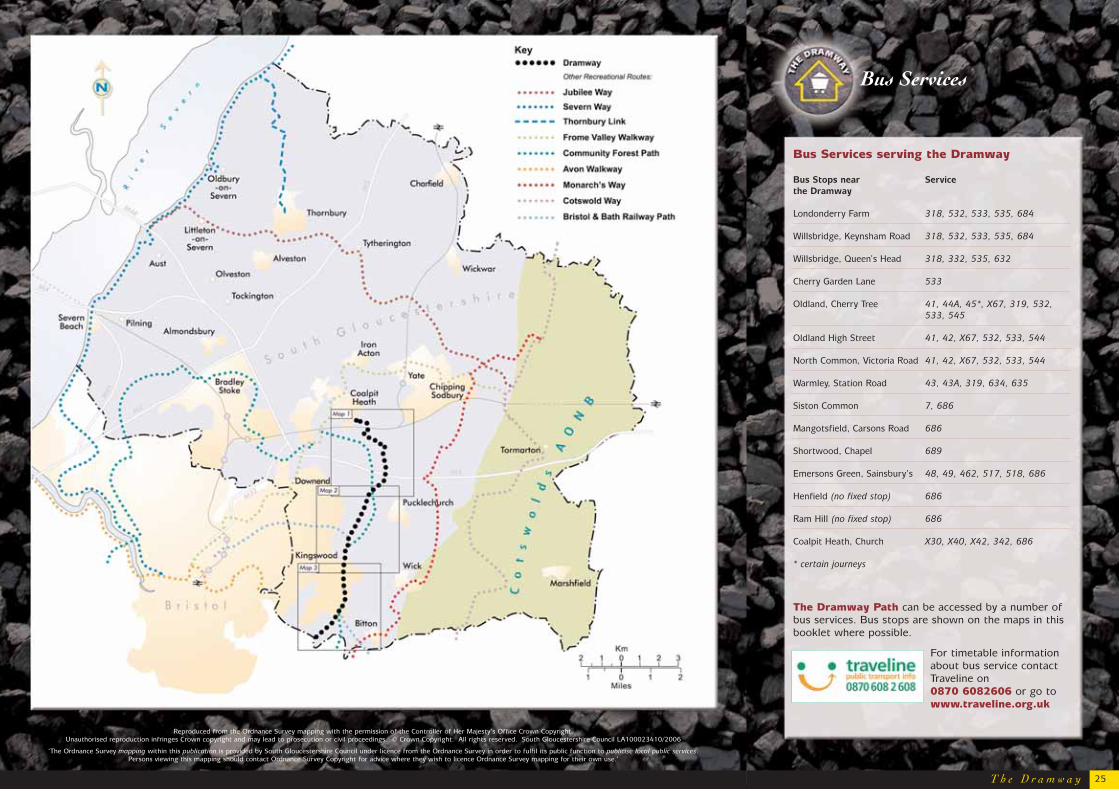
Bus Services
Reproduced from the Ordnance Survey mapping with the permission of the Controller of Her Majesty’s Office Crown Copyright. Unauthorised reproduction infringes Crown copyright and may lead to prosecution or civil proceedings. © Crown Copyright. All rights reserved. South Gloucestershire Council LA100023410/2006
‘The Ordnance Survey mapping within this publication is provided by South Gloucestershire Council under licence from the Ordnance Survey in order to fulfil its public function to publicise local public services. Persons viewing this mapping should contact Ordnance Survey Copyright for advice where they wish to licence Ordnance Survey mapping for their own use.’
25
Bus Services serving the Dramway
Bus Stops near Service
the Dramway
Londonderry Farm 318, 532, 533, 535, 684
Willsbridge, Keynsham Road 318, 532, 533, 535, 684
Willsbridge, Queen’s Head 318, 332, 535, 632
Cherry Garden Lane 533
Oldland, Cherry Tree 41, 44A, 45*, X67, 319, 532, 533, 545
Oldland High Street 41, 42, X67, 532, 533, 544
North Common, Victoria Road 41, 42, X67, 532, 533, 544
Warmley, Station Road 43, 43A, 319, 634, 635
Siston Common 7, 686
Mangotsfield, Carsons Road 686
Shortwood, Chapel 689
Emersons Green, Sainsbury’s 48, 49, 462, 517, 518, 686
Henfield (no fixed stop) 686
Ram Hill (no fixed stop) 686
Coalpit Heath, Church X30, X40, X42, 342, 686
* certain journeys
The Dramway Path can be accessed by a number ofbus services. Bus stops are shown on the maps in thisbooklet where possible.
For timetable informationabout bus service contactTraveline on 0870 6082606 or go towww.traveline.org.uk

Introduction
The Dramway Path is a 15km/ 9 mile linearwalk that follows sections of the route of a nineteenth century tramway which carried
coal from Coalpit Heath in the Bristolcoalfield down to the River
Avon.
This booklet describessome of the fascinatingremains of the Dramwayand the features found
alongside the linear route ofthe Dramway Path. There are
also excellent opportunities tocreate your own attractive circular walks, usingexisting footpaths to connect sections of theDramway Path with villages, towns and otherplaces of interest that are within easy walkingdistance.
The Avon Wildlife Trust has developed a series ofshort, circular walks around their visitor centre atWillsbridge Mill, and there are pleasantcountryside footpaths that link the Dramway Pathwith the village of Pucklechurch. The mainfootpaths that join or cross the Dramway Path arealso marked on the maps.
Willsbridge Mill
T h e D r a m w a y 1
What kind of walking to expect
This is comfortable walking, along the gentlyrolling hills that slope down to the River Avon.There are no steep inclines and much of the routeis along the original route of the Dramway, ahorse-drawn railway that carried coal from CoalpitHeath to the River Avon. Sections of the Dramwayshare the route of the Bristol and Bath RailwayPath, and, between Warmley and Willsbridge Mill,the two routes run close to each other, offeringopportunities to return along a different route.The Bristol and Bath Railway Path has an all-weather surface and is ideal for cycling withyoung children as it is all off-road, on flat or verygently sloping ground.
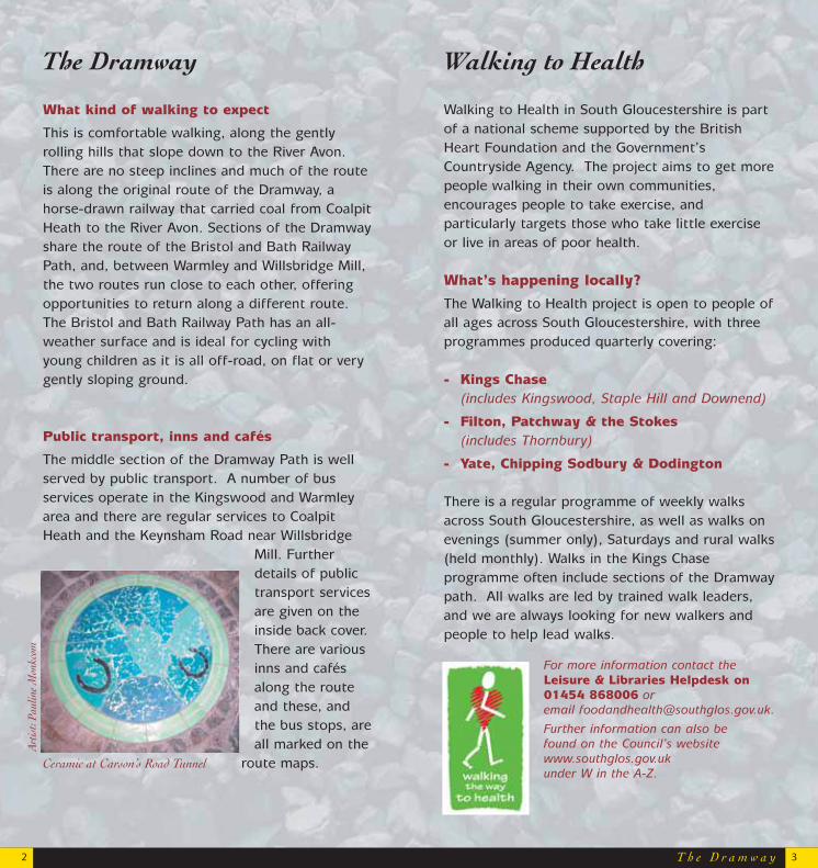
Public transport, inns and cafés
The middle section of the Dramway Path is wellserved by public transport. A number of busservices operate in the Kingswood and Warmleyarea and there are regular services to CoalpitHeath and the Keynsham Road near Willsbridge
Mill. Furtherdetails of publictransport servicesare given on theinside back cover. There are variousinns and cafésalong the routeand these, andthe bus stops, areall marked on the
route maps.
T h e D r a m w a y
The Dramway Walking to Health
Ceramic at Carson’s Road Tunnel
Walking to Health in South Gloucestershire is partof a national scheme supported by the BritishHeart Foundation and the Government’sCountryside Agency. The project aims to get morepeople walking in their own communities,encourages people to take exercise, andparticularly targets those who take little exerciseor live in areas of poor health.
What’s happening locally?
The Walking to Health project is open to people ofall ages across South Gloucestershire, with threeprogrammes produced quarterly covering:
- Kings Chase(includes Kingswood, Staple Hill and Downend)
- Filton, Patchway & the Stokes(includes Thornbury)
- Yate, Chipping Sodbury & Dodington
There is a regular programme of weekly walksacross South Gloucestershire, as well as walks onevenings (summer only), Saturdays and rural walks(held monthly). Walks in the Kings Chaseprogramme often include sections of the Dramwaypath. All walks are led by trained walk leaders,and we are always looking for new walkers andpeople to help lead walks.
For more information contact theLeisure & Libraries Helpdesk on01454 868006 or email [email protected].
Further information can also be found on the Council’s websitewww.southglos.gov.uk under W in the A-Z.
2 3
Art
ist:
Paul
ine
Mon
kcom
The Dramway is the local name for the Avon andGloucestershire Railway that carried coal from theCoalpit Heath collieries near Yate, down to theRiver Avon in the south. It was a horse-drawnrailway and got its name from the ‘drams’ or cartsthat carried the coal. Construction work started in1829, with sections opening between 1830 and1834, and the line was in use until around 1866.The route of the Dramway was carefullyconstructed to make maximum use of the slope ofthe land down to the River Avon, and there areseveral cuttings and embankments along theroute, to give an even, gentle gradient. Coal wasloaded into carts and these rolled slowly down theslope, led by horses and controlled by a brakemanor ‘guide’. Horses pulled the empty carts back upthe track to the coal mines.
An intriguing legacyAlthough the Dramway has been abandoned formany years, it has left an intriguing legacy of landmarks and features in the landscape. This walk follows the original route of theDramway for much of its length, and passes somefascinating features and buildings along the way,
giving glimpses of the past whenthis area was part of a
booming coalfield and aburgeoning, busy
industrial area.
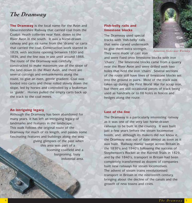
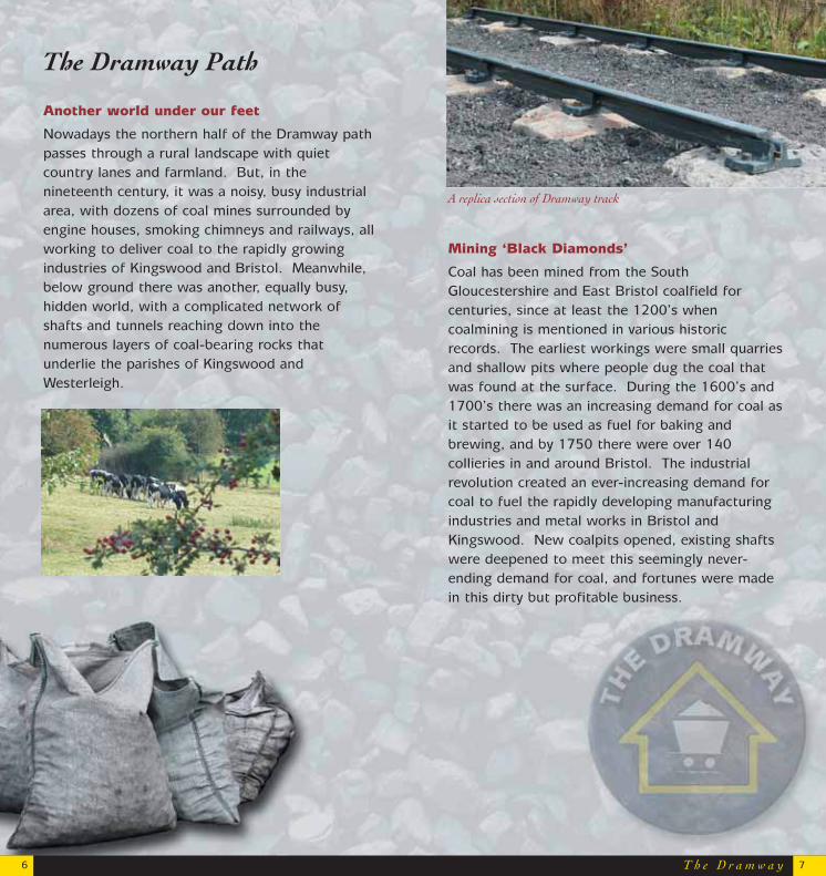
Fish-belly rails and limestone blocks
The Dramway used specialtracks with ‘fish-belly’ railsthat were curved underneathto give them extra strength.They were made of cast ironand were fixed onto limestone blocks with iron‘chairs’. The limestone blocks came from a quarrynear the River Avon and were drilled with twoholes that held the iron ‘chairs’. Several sectionsof the route still have lines of limestone blocks setinto the ground in pairs. Most of the track wastaken up during the First World War for scrap iron,but there are still occasional pieces of track beingused as handrails or to fill holes in fences andhedges along the route.
Last of the line
The Dramway is a particularly interesting railwayas it was one of the very last horse-drawnrailways to be built in the country. It was builtjust a few years before the steam locomotiveboom, and, although its makers did not know it,the Dramway was out of date almost as soon as itwas built. ‘Railway mania’ swept across Britain inthe 1830’s and 1840’s following the success ofStephenson’s Rocket at the Rainhill Trials in 1829,and by the 1840’s, transport in Britain had beencompletely transformed as dozens of companiesbuilt new railways for steam locomotives. The advent of steam trains revolutionisedtransport in Britain in the nineteenth century,bringing about the decline of the canals and thegrowth of new towns and cities.
The Dramway
T h e D r a m w a y
Limestone blocks near Warmley
54
Another world under our feet
Nowadays the northern half of the Dramway pathpasses through a rural landscape with quietcountry lanes and farmland. But, in thenineteenth century, it was a noisy, busy industrialarea, with dozens of coal mines surrounded byengine houses, smoking chimneys and railways, allworking to deliver coal to the rapidly growingindustries of Kingswood and Bristol. Meanwhile,below ground there was another, equally busy,hidden world, with a complicated network ofshafts and tunnels reaching down into thenumerous layers of coal-bearing rocks thatunderlie the parishes of Kingswood andWesterleigh.
Mining ‘Black Diamonds’
Coal has been mined from the SouthGloucestershire and East Bristol coalfield forcenturies, since at least the 1200’s whencoalmining is mentioned in various historicrecords. The earliest workings were small quarriesand shallow pits where people dug the coal thatwas found at the surface. During the 1600’s and1700’s there was an increasing demand for coal asit started to be used as fuel for baking andbrewing, and by 1750 there were over 140collieries in and around Bristol. The industrialrevolution created an ever-increasing demand forcoal to fuel the rapidly developing manufacturingindustries and metal works in Bristol andKingswood. New coalpits opened, existing shaftswere deepened to meet this seemingly never-ending demand for coal, and fortunes were madein this dirty but profitable business.
T h e D r a m w a y6 7
The Dramway Path
A replica section of Dramway track
Lines of transport
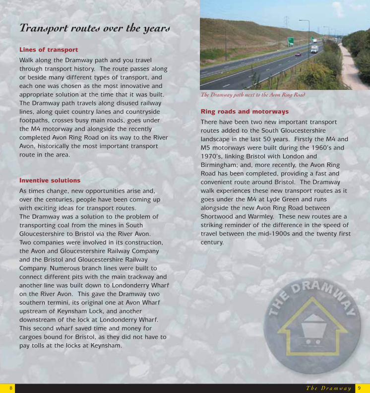
Walk along the Dramway path and you travelthrough transport history. The route passes alongor beside many different types of transport, andeach one was chosen as the most innovative andappropriate solution at the time that it was built.The Dramway path travels along disused railwaylines, along quiet country lanes and countrysidefootpaths, crosses busy main roads, goes underthe M4 motorway and alongside the recentlycompleted Avon Ring Road on its way to the RiverAvon, historically the most important transportroute in the area.
Inventive solutions
As times change, new opportunities arise and,over the centuries, people have been coming upwith exciting ideas for transport routes. The Dramway was a solution to the problem oftransporting coal from the mines in SouthGloucestershire to Bristol via the River Avon. Two companies were involved in its construction,the Avon and Gloucestershire Railway Companyand the Bristol and Gloucestershire RailwayCompany. Numerous branch lines were built to connect different pits with the main trackway andanother line was built down to Londonderry Wharfon the River Avon. This gave the Dramway twosouthern termini, its original one at Avon Wharfupstream of Keynsham Lock, and another downstream of the lock at Londonderry Wharf. This second wharf saved time and money forcargoes bound for Bristol, as they did not have topay tolls at the locks at Keynsham.
T h e D r a m w a y8 9
Transport routes over the years
Ring roads and motorways
There have been two new important transportroutes added to the South Gloucestershirelandscape in the last 50 years. Firstly the M4 andM5 motorways were built during the 1960’s and1970’s, linking Bristol with London andBirmingham; and, more recently, the Avon RingRoad has been completed, providing a fast andconvenient route around Bristol. The Dramwaywalk experiences these new transport routes as itgoes under the M4 at Lyde Green and runsalongside the new Avon Ring Road betweenShortwood and Warmley. These new routes are astriking reminder of the difference in the speed oftravel between the mid-1900s and the twenty firstcentury.
The Dramway path next to the Avon Ring Road
T h e D r a m w a y10 11
Avon Valley Railway
Bristol and Bath Railway Path and other footpaths
When the former Midland Railway line betweenBristol and Bath was closed to passengers in the1960’s, a local campaign group created theRailway Path, a cycling and walking route, alongpart of the line. Now the Bristol and BathRailway Path (www.bristolbathrailwaypath.org.uk)
is a 21km/13 mileoff-road routebetween the twocities. TheDramway pathfollows a similarroute to theRailway Pathbetween CoxgroveHill and Bitton.The southern endof the Dramwaypath joins theRiver Avon Trail
on the banks of the river near Keynsham, offeringlinks with this 45km/28 mile path that follows theRiver Avon from Bath to Pill on the SevernEstuary.
Transport routes over the years
River Avon and the Kennet and Avon Canal
The River Avon has been a major transport routefor centuries, carrying passengers and cargo alongthe valley to Bristol and Bath ever since 1727when it was officially opened to water trafficbetween Hanham and Bath. Travel on the riverwas not particularly fast; it could take a week totravel from Avonmouth in the Bristol Channel toHanham, but it was much easier than carryingheavy cargo by horse-drawn cart. The river wasideal for moving large, heavy loads like coal, stoneand foodstuffs, and these were the barges’ maincargoes. Locks and weirs were constructed atvarious points along the river to make it navigableas far as Bath, where it joined the Kennet andAvon Canal and the rest of the canal network ofEngland.
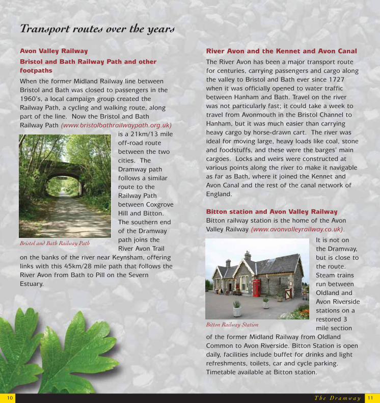
Bitton station and Avon Valley Railway Bitton railway station is the home of the AvonValley Railway (www.avonvalleyrailway.co.uk).
It is not onthe Dramway,but is close tothe route.Steam trainsrun betweenOldland andAvon Riversidestations on arestored 3mile section
of the former Midland Railway from OldlandCommon to Avon Riverside. Bitton Station is opendaily, facilities include buffet for drinks and lightrefreshments, toilets, car and cycle parking.Timetable available at Bitton station.
Bristol and Bath Railway Path
Bitton Railway Station
Coalpit Heath and the Ram Hill Colliery
As its name suggests, coal mining has beenassociated with this area for centuries and manypits have been sunk here over the years. TheDramway path goes through the site of Ram HillColliery, which dates from the early 1800’s. Themine’s main period of activity was between 1830and 1860. It was the northern terminus of theDramway and the line split into two branch lines,each with a loading bay. Today the Ram Hill site isbeing researched and managed by the Friends ofRam Hill Group.
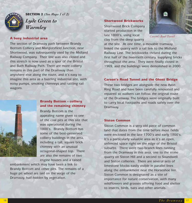
Bitterwell Lake
This man-made lake is now used as a fishing lakeand is owned by the villagers of Henfield. GeorgeNewman, a local benefactor, gave the lake to the village in 1930. In the past the lake was used tosoak the pit props for the mine, and more recentlyas a local swimming pool and a site for modelboats.
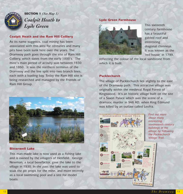
Lyde Green Farmhouse
This sixteenthcentury farmhousehas a beautifulgabled roof andinteresting diagonal chimneys. It was known as the‘red house’ in 1799,
reflecting the colour of the local sandstone fromwhich it is built.
Pucklechurch
The village of Pucklechurch lies slightly to the eastof the Dramway path. This attractive village was originally within the medieval Royal Forest ofKingswood. It’s an historic village built on the siteof a Saxon Palace which was the scene of adramatic murder in 946 AD, when King Edmundwas killed by an outlaw called Leofra.
Find out moreabout manyinterestingseventeenth centurybuildings in thevillage by followingthe PucklechurchVillage Trail.
T h e D r a m w a y12 13
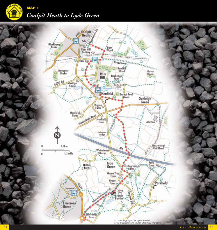
SECTION 1 (See Map 1)
Coalpit Heath toLyde Green
Community Hall
and parking
Village activities take place in the Community Hall, from displays tomeetings. You are in the ConservationArea which was designated in 1975 and as you walk towards the centre ofPucklechurch you will see on your lefthouses of the seventeenth to eighteenthcenturies providing a fine entrance to thevillage.
This is the bustling centre ofthe village with fine houses
and has long been on important coaching routes. The
old Fleur de Llys Inn formerly catered fortravellers. The large stone house in thecentre �No. 1 used to be the White HartInn, where, if a visitor wanted a bed forthe night, tradition said that they had tobe accommodated no matter how full thehostelry was at the time.
Parish Church
of St. Thomas a Becket.This beautiful church with its
fine tower has a blocked Norman doorway but generally dates from thethirteenth century. There are two stoneeffigies in the North Aisle, probably ofman and wife, dated around the mid-fourteenth century. Today the churchis the centre of a very busy parish.
Homefield Road
There has been much new development in the village over
the years, either as estates bordering theConservation Area, as here at HomefieldRoad, or as in-filling within the villagecore itself. Today Pucklechurch has adynamic community, but care will have tobe taken not to spoil its historic heritage.
3
1
2
2
4
Village Green
It is thought that there werethree village greens in
Pucklechurch in medieval times atthe top of three roads �Westerleigh,Parkfield and Shortwood Roads whichstopped at the great �Burrell� enclosure�see Stop 11.
This suggests that the medieval villageplan was of three small street hamlets.Where you are standing is the vestige ofone of these greens.
7Kings Lane
You are now in Kings Laneand in one of the most historic
parts of the village.Nearby is GreyHouse, one of themany great houses ofthe sixteenth to eighteenth centuriesof which the village is so proud.Along this lane it isreputed that the slainKing Edmund was
carried to his final resting-place atGlastonbury.
5
Moat House
Moat House, formerly calledthe �Great House�, was the
great manor-house of Pucklechurchand excavations on the site haveunearthed evidence of Saxon and Romanactivity.
It is thought that it formerly had a moaton three sides and seven gables to itsfrontage. It might even have had royalconnections.
6
is a village with an incredi-bly rich past, from the Bronze Age with itstumulus on Shortwood Hill, up to the siting of abarrage balloon depot in World War II. This walk aimsto guide people both local and visitor, aroundsome of the fascinating historic sites in the vil-
lage centre.
�A.D. 946 .
Take a walk aroundthe centre ofPucklechurch,a village steeped inhistory and heritageand site of a SaxonRoyal palace.
T h e D r a m w a y
MAP 1
Coalpit Heath to Lyde Green
14 15
© Crown Copyright. All rights reserved. South Gloucestershire Council LA100023410/2006
T h e D r a m w a y16 17
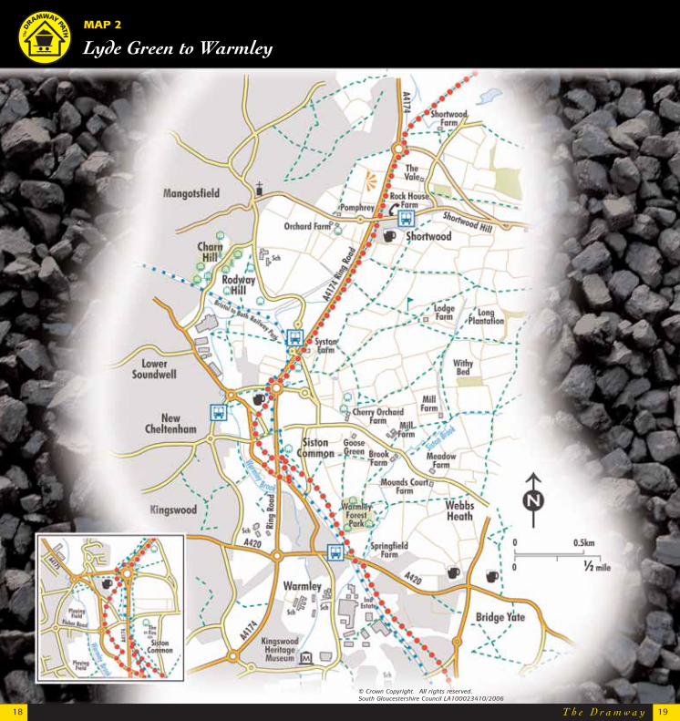
SECTION 2 (See Maps 1 & 2)
Lyde Green toWarmley
A busy industrial area
The section of Dramway path between BrandyBottom Colliery and Mangotsfield Junction, nearShortwood, was subsequently used by the MidlandRailway Company. Their line was also closed andthis stretch is now used as a spur of the Bristoland Bath Railway Path. There are more collieryremains in this part of the Dramway thananywhere else along the route, and it’s easy toimagine this area as a bustling industrial site, withnoisy pumps, smoking chimneys and rattling railwagons.
Brandy Bottom - collieryand the remaining chimney
Brandy Bottom is theappealing name given to oneof the coal pits at this site thatwas operational during the1800’s. Brandy Bottom hassome of the best-preservedcolliery buildings in the area,including a tall, square brickchimney with an unusualoctagonal-shaped top. Thereare also the remains of twoengine houses and a raised
embankment which may have been a link toBrandy Bottom and other pits. The remains of ahuge pit wheel are laid on the verge of theDramway, half-hidden by vegetation.
Shortwood Brickworks
Shortwood Brick Companystarted production in thelate 1800’s, using localclay from the deep quarryat the site. At one time, a movable tramwaylinked the quarry with a rail link to the MidlandRailway Line. The brickworks thrived during thefirst half of the twentieth century, supplying bricksthroughout the area. They were finally closed in1969, and the buildings were demolished in 2000.
Carson’s Road Tunnel and the Ghost Bridge
These two bridges are alongside the new AvonRing Road and have been carefully renovated andrepaired so walkers can follow the original routeof the Dramway. The bridges were originally builtto carry local footpaths and roads safely over theDramway.
Siston Common
Siston Common is a very old piece of commonland that dates from the time before most fieldswere enclosed in the late 1700’s and early 1800’s. It’s a particularly valuable area as it’s an open,unfenced space right on the edge of the Bristol suburbs. There were two branch lines runningfrom the Dramway in this area, one to the stonequarry on Siston Hill and a second to Soundwelland Siston collieries. There are several sets oflimestone blocks easily visible in parallel linesalong the embankment near the Horseshoe Inn.Siston Common is designated as a site ofimportance for nature conservation, with manywildflowers and grasses offering food and shelterto insects, birds, bats and other animals.
Carson’s Road Tunnel
T h e D r a m w a y18 19
MAP 2
Lyde Green to Warmley
© Crown Copyright. All rights reserved. South Gloucestershire Council LA100023410/2006
T h e D r a m w a y20 21
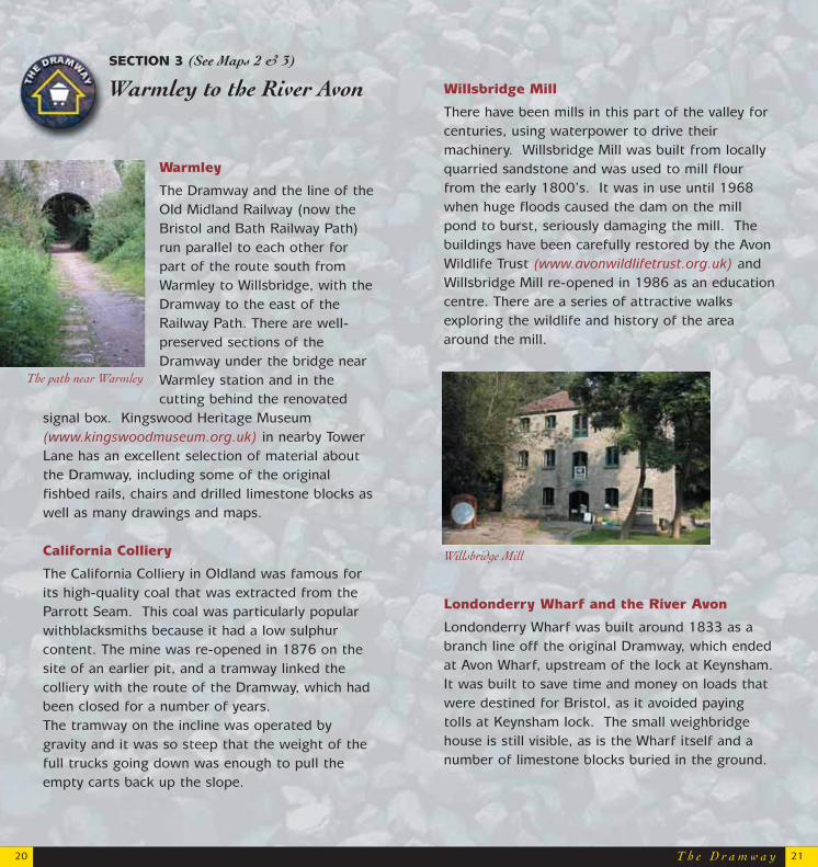
Warmley
The Dramway and the line of theOld Midland Railway (now theBristol and Bath Railway Path)run parallel to each other forpart of the route south fromWarmley to Willsbridge, with theDramway to the east of theRailway Path. There are well-preserved sections of theDramway under the bridge nearWarmley station and in thecutting behind the renovated
signal box. Kingswood Heritage Museum(www.kingswoodmuseum.org.uk) in nearby TowerLane has an excellent selection of material aboutthe Dramway, including some of the originalfishbed rails, chairs and drilled limestone blocks aswell as many drawings and maps.
California Colliery
The California Colliery in Oldland was famous forits high-quality coal that was extracted from theParrott Seam. This coal was particularly popularwithblacksmiths because it had a low sulphurcontent. The mine was re-opened in 1876 on thesite of an earlier pit, and a tramway linked thecolliery with the route of the Dramway, which hadbeen closed for a number of years. The tramway on the incline was operated bygravity and it was so steep that the weight of thefull trucks going down was enough to pull theempty carts back up the slope.
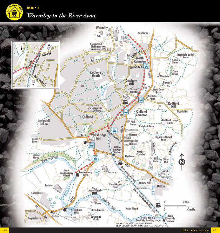
SECTION 3 (See Maps 2 & 3)
Warmley to the River Avon Willsbridge Mill
There have been mills in this part of the valley forcenturies, using waterpower to drive their machinery. Willsbridge Mill was built from locallyquarried sandstone and was used to mill flourfrom the early 1800’s. It was in use until 1968when huge floods caused the dam on the millpond to burst, seriously damaging the mill. Thebuildings have been carefully restored by the AvonWildlife Trust (www.avonwildlifetrust.org.uk) andWillsbridge Mill re-opened in 1986 as an educationcentre. There are a series of attractive walksexploring the wildlife and history of the areaaround the mill.
Londonderry Wharf and the River Avon
Londonderry Wharf was built around 1833 as abranch line off the original Dramway, which endedat Avon Wharf, upstream of the lock at Keynsham. It was built to save time and money on loads thatwere destined for Bristol, as it avoided payingtolls at Keynsham lock. The small weighbridgehouse is still visible, as is the Wharf itself and anumber of limestone blocks buried in the ground.
Willsbridge Mill
The path near Warmley
T h e D r a m w a y22
MAP 3
Warmley to the River Avon
23
© Crown Copyright. All rights reserved. South Gloucestershire Council LA100023410/2006
24
Enjoy walking Parts of the northern section of the Dramway can bemuddy at times, especially after rain and during thewinter months. Wear sensible shoes or boots and carry awaterproof so that poor weather won’t spoil your walk.
Ordnance Survey MapsOS Explorer map 155 covers the entire route of theDramway path
Links with other promoted walksThe fold-out map on the front inside cover shows all thepromoted recreational path networks in SouthGloucestershire. The Dramway links with theCommunity Forest Path and the River Avon Trail, and theBristol and Bath Railway Path
Useful Contacts
The Public Rights of Way Team in SouthGloucestershire Council look after the Dramway pathas well as all local footpaths in the area. They undertake essential maintenance on public rights ofway. Based at Broad Lane, Yate, South Gloucestershire;Tel: 01454 868686 or go to www.southglos.gov.uk
The Community Forest Path is looked after by theForest of Avon Team, who are based at Ashton CourtVisitor Centre, Long Ashton, Bristol, BS41 9JN; Tel: 0117 9532141 www.forestofavon.org.uk
The Avon Frome Partnership Officer is based atColston House, Colston Street Bristol, BS1 5AQ. Thisofficer works on a number of projects within the AvonValley, including the River Avon Trail. Tel: 0117 922 4325
South Gloucestershire Heritage ForumThe South Gloucestershire Heritage Forum representsthose involved in heritage activities, arranges visits toheritage sites, lectures, exhibitions, open days andspecial events. It is a voice in the protection, publicaccess and recording of the heritage of SouthGloucestershire. Tel: 01454 865783
Additional information