Embed Size (px)
Citation preview
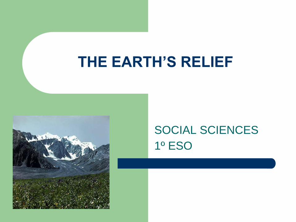
THE EARTH’S RELIEF
SOCIAL SCIENCES
1º ESO
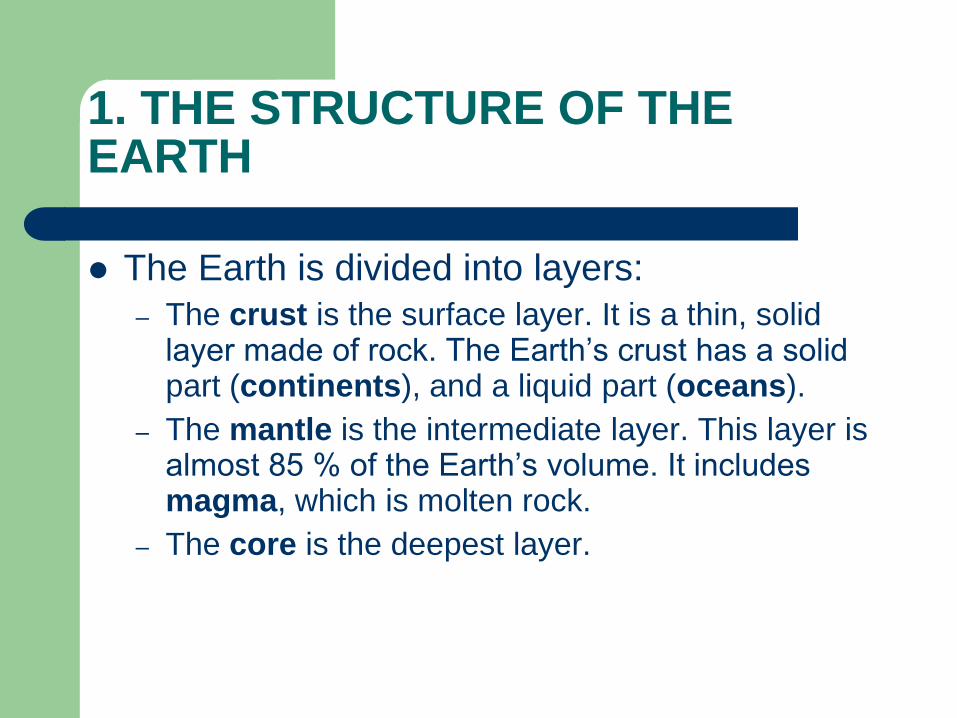
1. THE STRUCTURE OF THE EARTH
The Earth is divided into layers:
– The crust is the surface layer. It is a thin, solid layer made of rock. The Earth’s crust has a solid part (continents), and a liquid part (oceans).
– The mantle is the intermediate layer. This layer is almost 85 % of the Earth’s volume. It includes magma, which is molten rock.
– The core is the deepest layer.
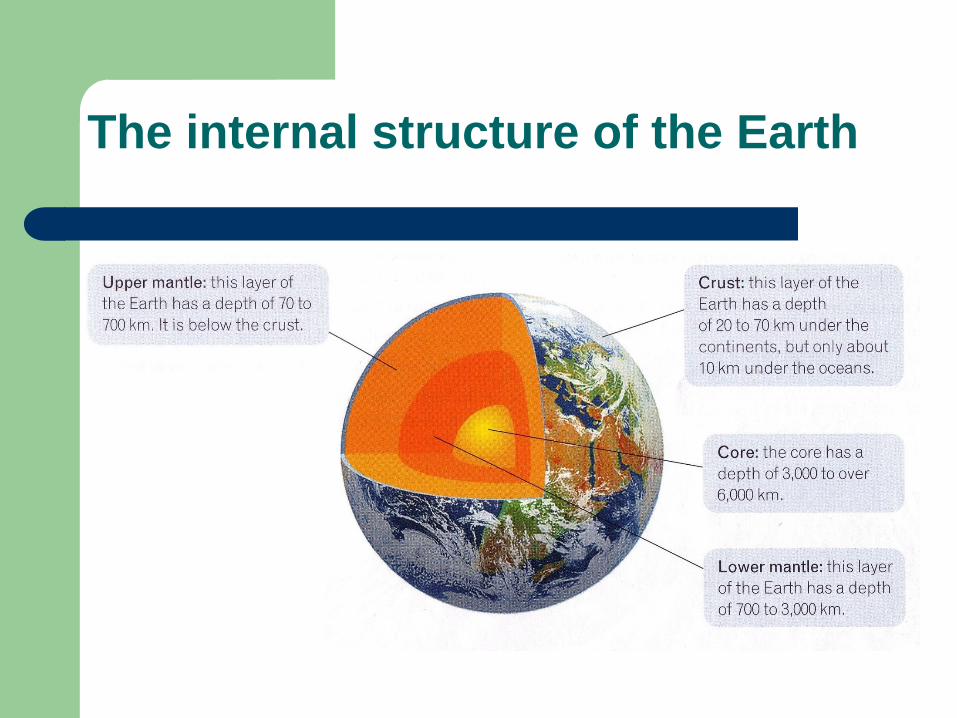
The internal structure of the Earth
1. THE STRUCTURE OF THE EARTH
The Earth’s temperature increases with depth. The temperature in the core reaches about 4.500 ºc.
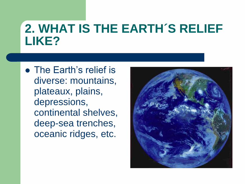
2. WHAT IS THE EARTH´S RELIEF LIKE?
The Earth’s relief is diverse: mountains, plateaux, plains, depressions, continental shelves, deep-sea trenches, oceanic ridges, etc.
3. HOW IS THE RELIEF FORMED?
The Earth’s relief changes.
In 1912 the German Alfred Wegener outlined his continental drift theory. According to this theory 200 millions years ago there was a single giant land mass (one supercontinent), called Pangaea. This Pangaea was surrounded by a single ocean, called Tethys Sea.
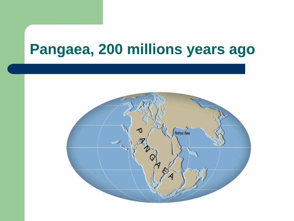
Pangaea, 200 millions years ago
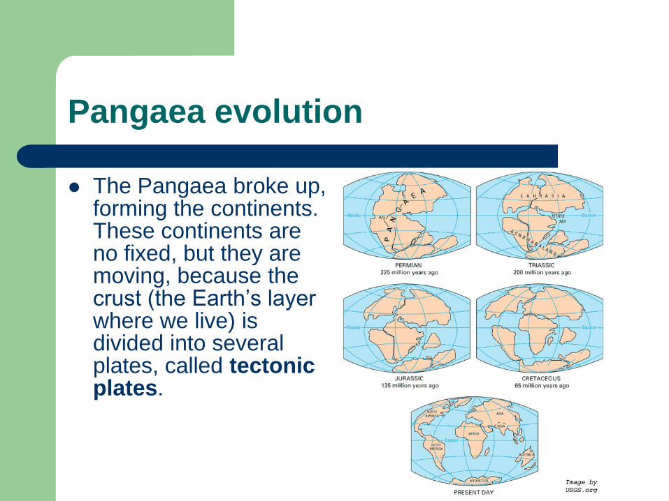
Pangaea evolution
The Pangaea broke up, forming the continents. These continents are no fixed, but they are moving, because the crust (the Earth’s layer where we live) is divided into several plates, called tectonic plates.
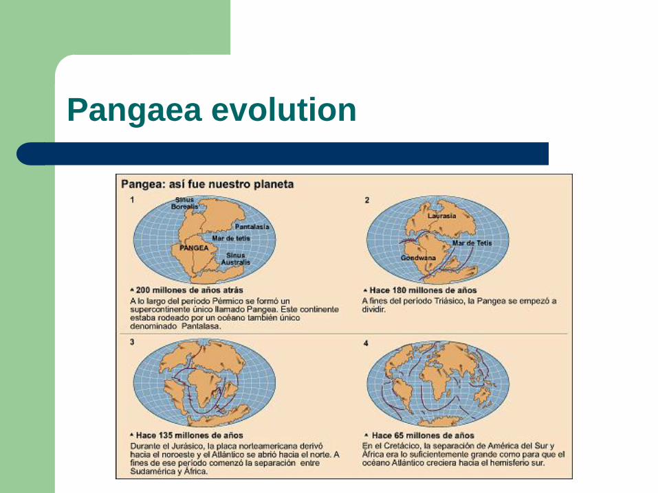
Pangaea evolution
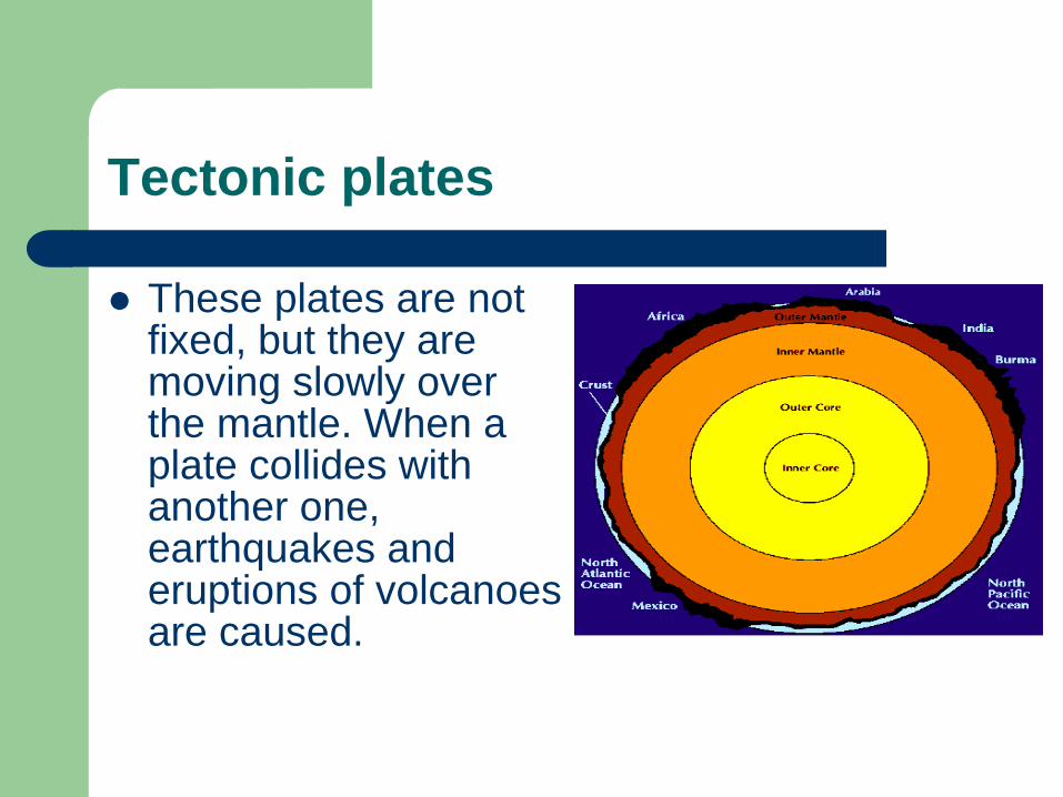
Tectonic plates
These plates are not fixed, but they are moving slowly over the mantle. When a plate collides with another one, earthquakes and eruptions of volcanoes are caused.
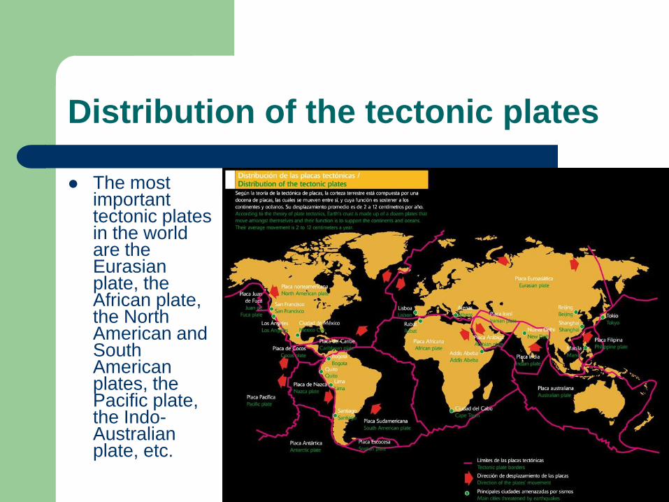
Distribution of the tectonic plates
The most important tectonic plates in the world are the Eurasian plate, the African plate, the North American and South American plates, the Pacific plate, the Indo-Australian plate, etc.
4. CONTINENTS AND OCEANS
On the earth’s crust there are emergent and submerged lands:
– Continents. Continents occupy 30% of the land surface and are surrounded by oceans and seas. There are six continents: Asia, America, Africa, Antarctica, Europe and Oceania. Most of the emerged land is in the northern hemisphere.
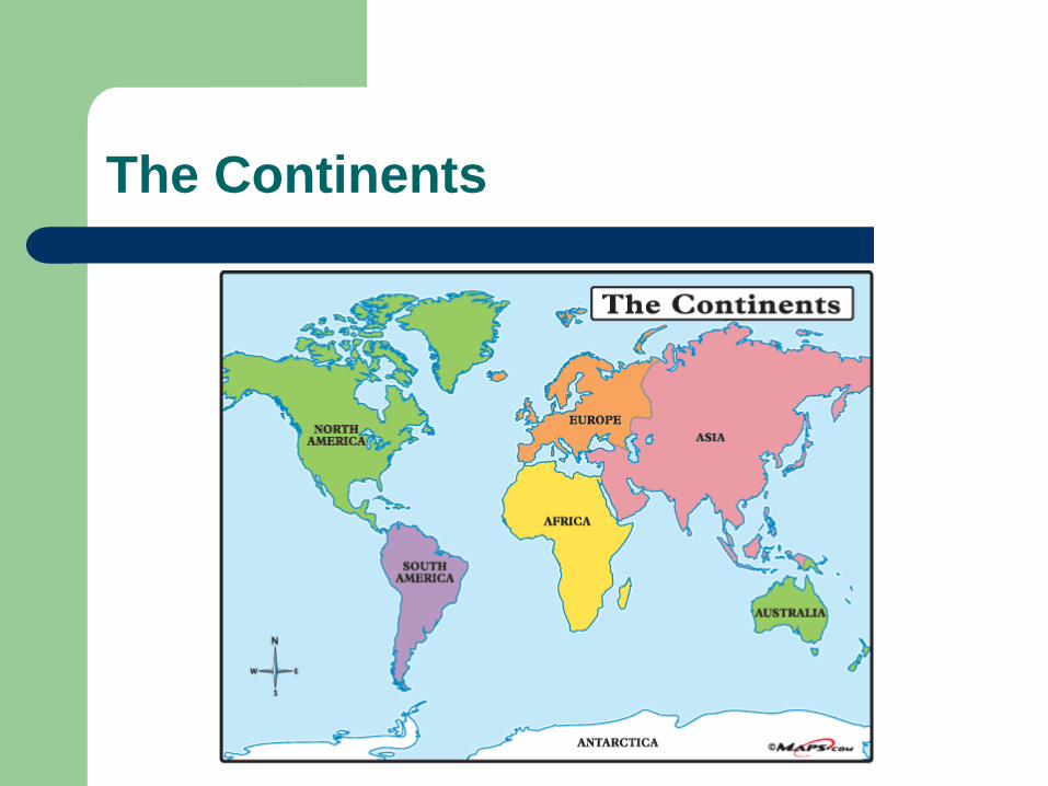
The Continents
Oceans
– Oceans. Oceans are large masses of salt water. There are five oceans: The Pacific Ocean, The Atlantic Ocean, The Indian Ocean, The Arctic Ocean and the Southern Ocean. Most oceans are in the southern hemisphere.
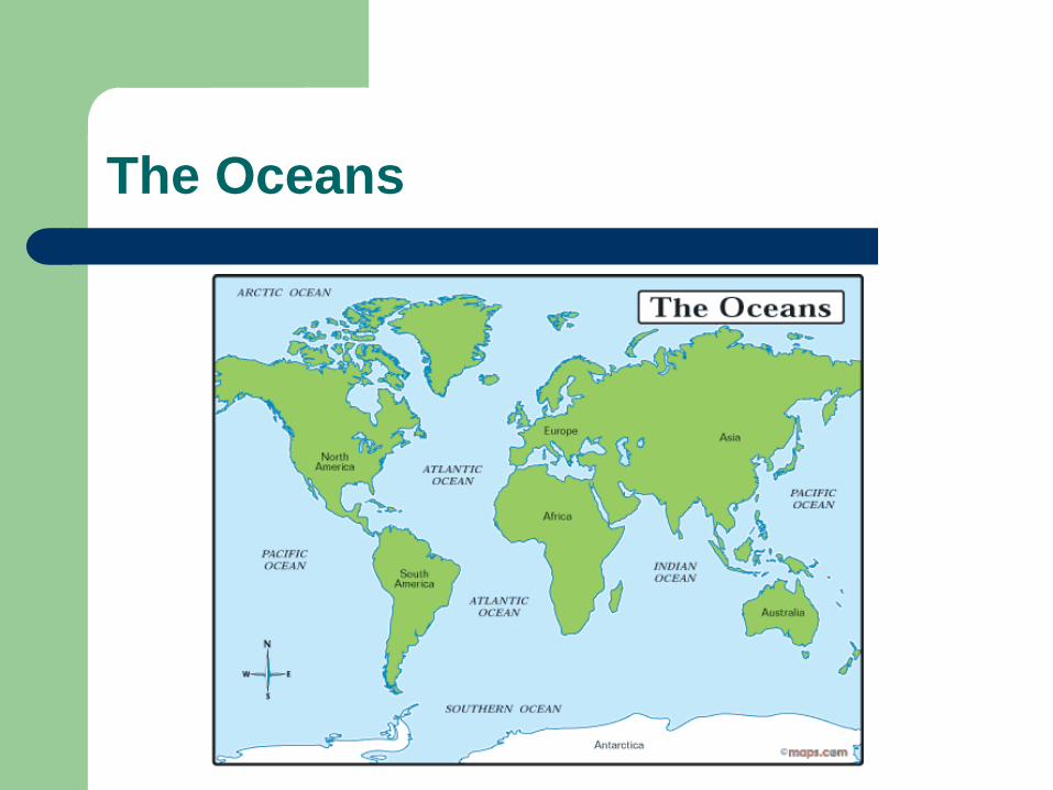
The Oceans
5. LAND RELIEF
Continental relief
– The Earth’s surface isn’t flat, there are mountains, plains, plateaux, valleys, etc. The relief of the continents is very varied.
5. LAND RELIEF
– The relief is the result of the internal forces of the Earth (plate movements, volcanoes, earthquakes, etc.) and external agents (wind, rain, temperatures, rivers, groundwater, lakes, ice... and human-beings). The internal forces are responsible for the origin and the elevation of topography and external agents cause the erosion and modeling of the Earth’s relief.
5. LAND RELIEF
The main forms of continental relief are:
– Mountains. A mountain is a land mass that rises high above the area around it. There are ranges of mountains that are higher and larger than others. The largest ranges of mountains are called ridges.
– Plains. Plains are large flats tracts of land.
– Plateaux. Plateaux are large areas of high land. They are high well above sea level. They are higher than plains.
– Valleys. They are sunken land and are surrounded by mountains or ridges. In valleys rivers may flow.
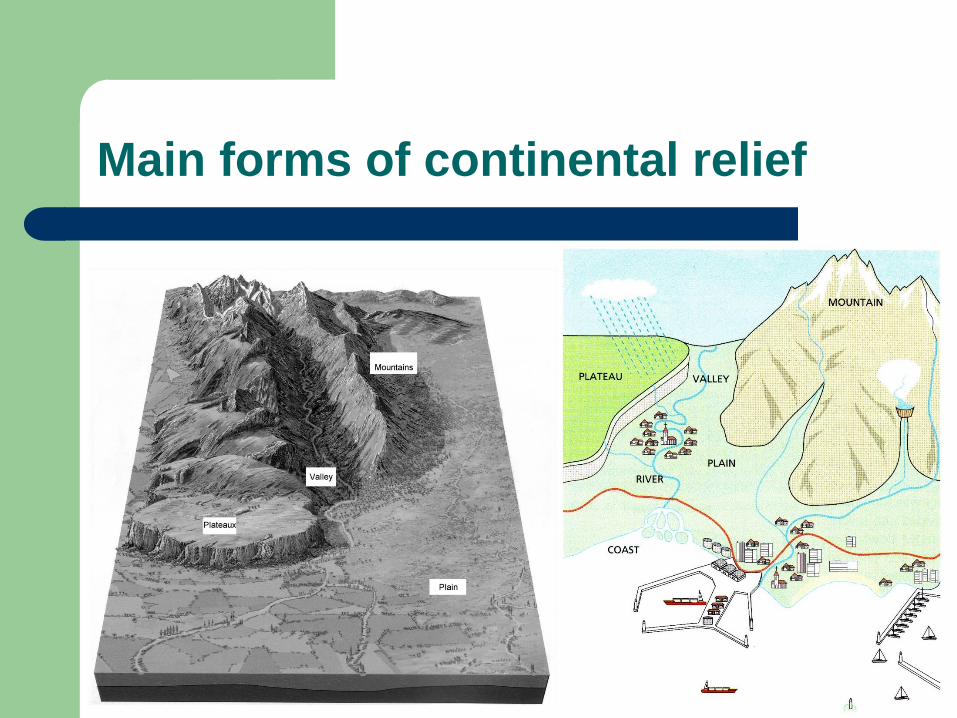
Main forms of continental relief
5. LAND RELIEF
Continental waters
– Continental waters are: rivers, glaciers, groundwaters, lakes and inner seas.
Rivers
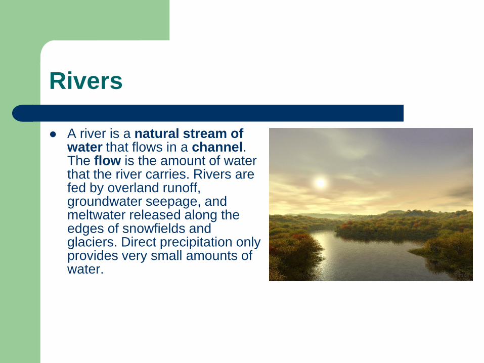
A river is a natural stream of water that flows in a channel. The flow is the amount of water that the river carries. Rivers are fed by overland runoff, groundwater seepage, and meltwater released along the edges of snowfields and glaciers. Direct precipitation only provides very small amounts of water.
Rivers
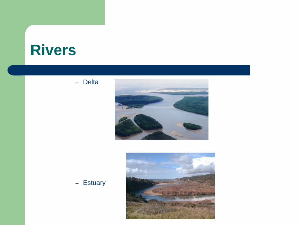
The mouth is where the river flows into the sea. It can be:
– A delta: Low-lying plain composed of stream-borne sediments deposited by a river at its mouth.
– An estuary: A flow of water in a channel like a small river.
Rivers
– Delta
– Estuary
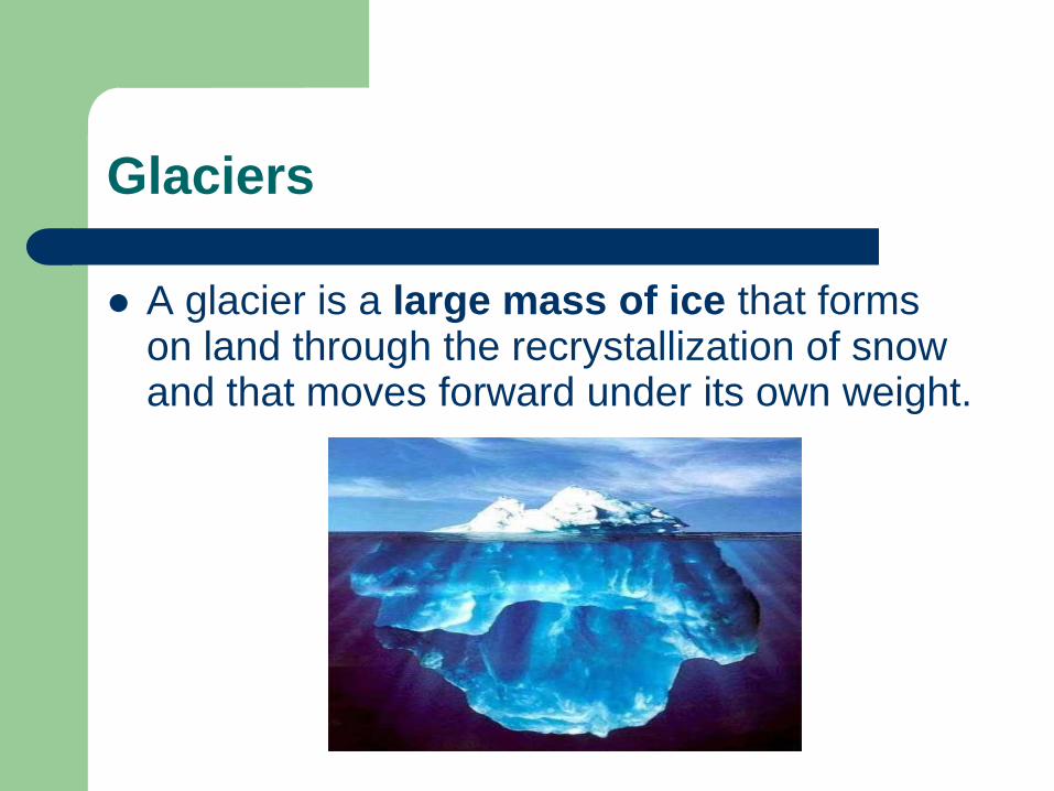
Glaciers
A glacier is a large mass of ice that forms on land through the recrystallization of snow and that moves forward under its own weight.
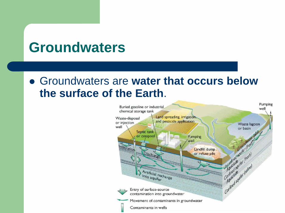
Groundwaters
Groundwaters are water that occurs below the surface of the Earth.
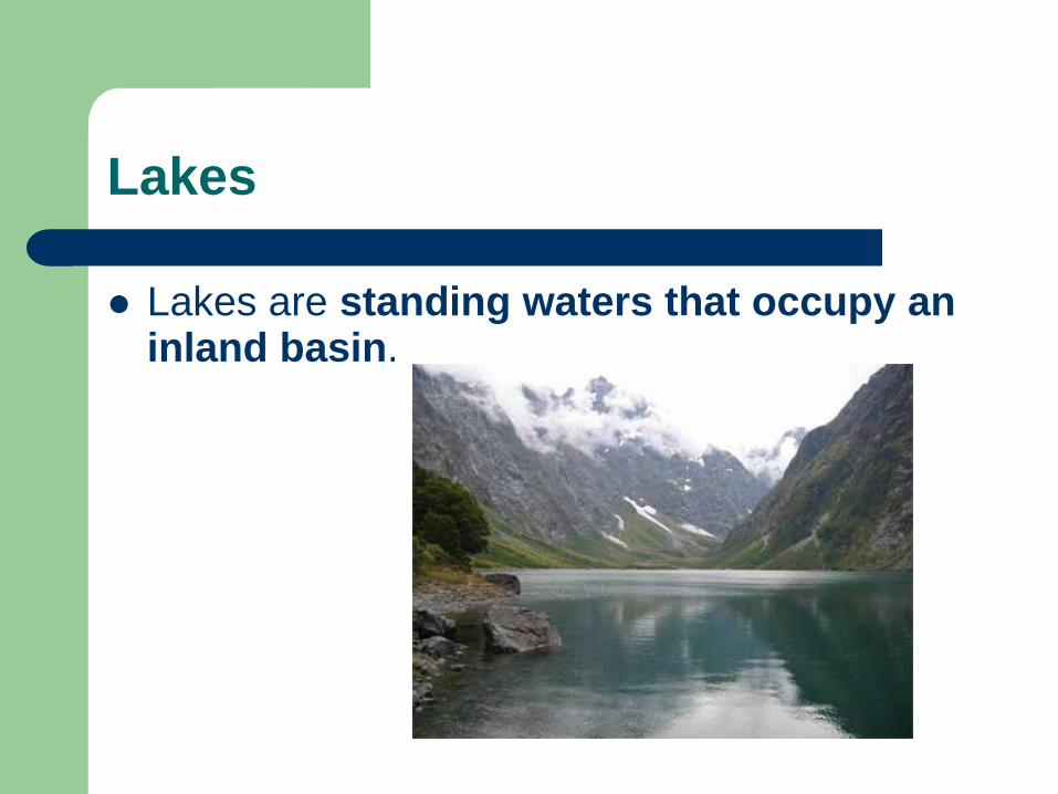
Lakes
Lakes are standing waters that occupy an inland basin.
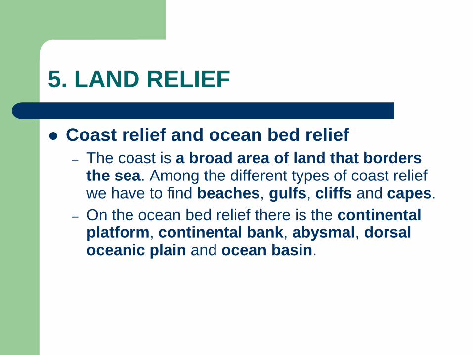
5. LAND RELIEF
Coast relief and ocean bed relief
– The coast is a broad area of land that borders the sea. Among the different types of coast relief we have to find beaches, gulfs, cliffs and capes.
– On the ocean bed relief there is the continental platform, continental bank, abysmal, dorsal oceanic plain and ocean basin.
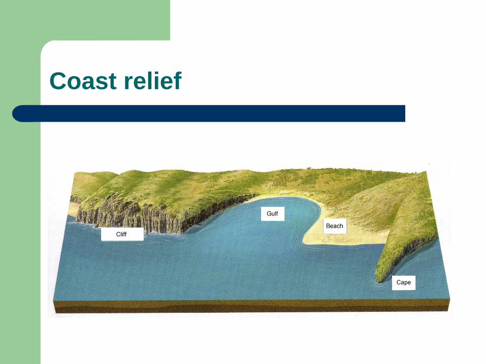
Coast relief
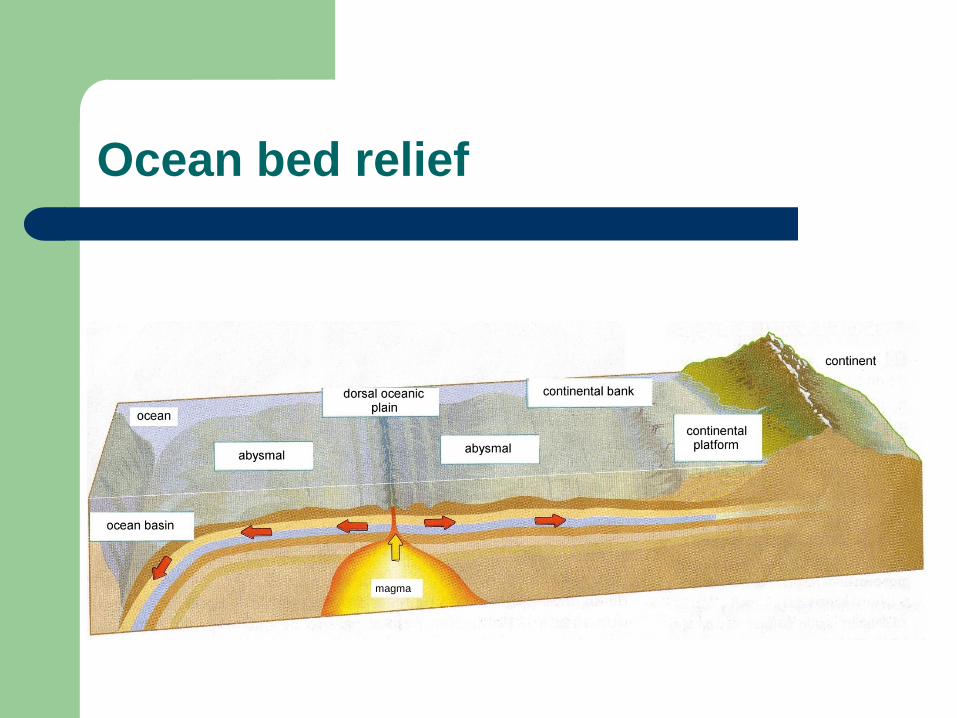
Ocean bed relief
magma
6. NATURAL RISKS
The displacement of the plates also gives rise to other phenomena: volcanoes and seisms or earthquakes.
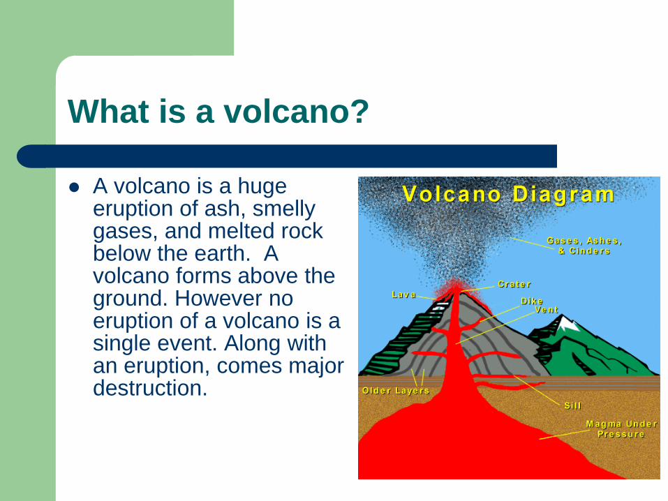
What is a volcano?
A volcano is a huge eruption of ash, smelly gases, and melted rock below the earth. A volcano forms above the ground. However no eruption of a volcano is a single event. Along with an eruption, comes major destruction.
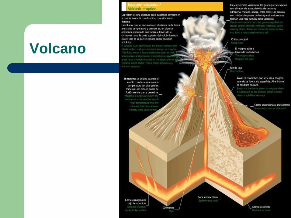
Volcano
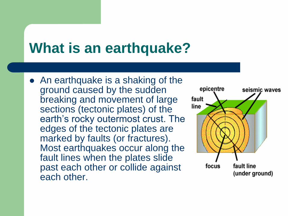
What is an earthquake?
An earthquake is a shaking of the ground caused by the sudden breaking and movement of large sections (tectonic plates) of the earth’s rocky outermost crust. The edges of the tectonic plates are marked by faults (or fractures). Most earthquakes occur along the fault lines when the plates slide past each other or collide against each other.