Embed Size (px)
Citation preview
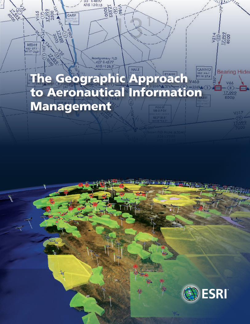
The Geographic Approach to Aeronautical Information Management
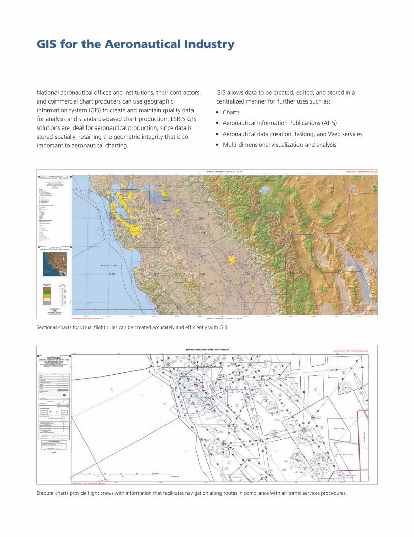
National aeronautical offices and institutions, their contractors, and commercial chart producers can use geographic information system (GIS) to create and maintain quality data for analysis and standards-based chart production. ESRI’s GIS solutions are ideal for aeronautical production, since data is stored spatially, retaining the geometric integrity that is so important to aeronautical charting.
GIS for the Aeronautical Industry
Sectional charts for visual flight rules can be created accurately and efficiently with GIS.
GIS allows data to be created, edited, and stored in a centralized manner for further uses such as:
Charts•
Aeronautical Information Publications (AIPs)•
Aeronautical data creation, tasking, and Web services•
Multi-dimensional visualization and analysis•
Enroute charts provide flight crews with information that facilitates navigation along routes in compliance with air traffic services procedures.

Reduce the probability of editing errors or using out-of-date or inaccurate data by ensuring that data is stored in only one location instead of several. Create navigational products using the correct data every time, maintaining safe navigation.
Manage large collections of obstacle and terrain data necessary for Electronic Terrain and Obstacle Database (eTOD) compliance. GIS allows the creation, viewing, and analysis of this data and gives a replicable workflow that makes aeronautical information system (AIS) updates easier.
The eANP allows authorized users to submit, store, update, manipulate, analyze, and chart global air navigation planning data from a centralized ICAO server using ArcGIS®.
Case StudyRomanian Civil Aeronautical Authority Enhances Safety, Security, and Efficiency with GIS
As with many other aviation authorities, the Romanian Civil Aeronautical Authority (RCAA) is faced with doing more with less. Historically, the organization used computer-aided design and drafting software for creating maps and charts. Looking for a solution that would allow it to efficiently create the products required to do its job, as well as share data with the International Civil Aviation Organization (ICAO) in the best way possible, RCAA chose ArcGIS® because the software provides a standards-based platform for the spatial analysis, data management, and mapping the organization was required to perform. ArcGIS and specialized extensions are used for data management and mapping and viewing spatial data. To find out more and read more case studies, visit www.esri.com/aeronautical.
The Romanian Civil Aeronautical Authority uses GIS for data management, creating and editing cartographic products, and viewing spatial data.
Aviation administrations like RCAA rely on ESRI GIS to help them maintain digital aeronautical datasets for chart production.
“[ESRI GIS] is very efficient and allows me to produce data and chart products faster with better quality.”
Iuliana RaduAeronautical Inspector
RCAA
Safe Air Navigation

All charts can be stored in one common database. Data can be updated once and reflected in all the products that are needed: charts, maps, AIPs, electronic AIPs, and supplements. This reduces the chance of errors, streamlines workflows, and condenses the size of data that needs to be physically stored, reducing costs.
Efficiently produce and disseminate charts such as this radar minimum altitude chart.
Your Products Delivered on Time
Case StudyThe National Geospatial-Intelligence Agency
The National Geospatial-Intelligence Agency (NGA) is a U.S. Department of Defense (DoD) combat support agency and member of the national intelligence community. Its primary mission is to provide geospatial intelligence (GEOINT) to U.S. armed forces and government agencies in support of national security.
Geospatial intelligence is a critical tool for U.S. armed forces and the intelligence community, aiding the front line by providing accurate depictions of the geographic features relevant to the mission at hand. For NGA’s GEOINT operations to function successfully, the data must be timely, relevant, and correct. Beginning in 2001, NGA began transforming its processes and systems to better support its mission. NGA’s Aeronautical Division created an automated GIS-based charting process that significantly reduced the time required to update, produce, and disseminate Flight Information Publications (FLIPs). Three years later, NGA created Enterprise Product on Demand
Service (ePODS) to automate map and chart creation, gain efficiency, and reduce errors. The ePODS application allows NGA to focus more of its resources on data quality, integrity, and currency rather than cartographic product generation. With ePODS, NGA is able to provide its customers with timely access to relevant and accurate GEOINT data. Safety of navigation is also significantly improved for both military personnel and civilians with the improvements in accuracy and timeliness of charts.
The ePODS implementation lets a user preview the extent of an existing Operational Navigation Chart (ONC) for a region of the United States, then select that chart for printing. (International copyright 2007, NGA, U.S. government)

Knowing where data comes from and that it is accurate and quality checked is important. GIS provides quality control and data review on-the-fly so everyone can see when and how data was edited. Database changes can be automatically synchronized between offices, teams, and Civil Aviation Authority (CAA) contractors. Managers can monitor workflows, overseeing the progress of projects.
Dependable Information
Case StudyThe International Civil Aviation Organization Headquarters, Montreal, Improves Air Navigation Planning Workflow and Data Management
ICAO is a specialized agency of the United Nations and serves as a global forum for member states to work together toward safe, secure, and sustainable development of civil aviation. For many years, ICAO staff members did not have an efficient way to visualize aviation data. ICAO needed a better process to update data more frequently and efficiently. It developed the ICAO electronic Air Navigation Planning (eANP) GIS portal, a gateway combining database and Internet-based GIS that allows
authorized users to submit, store, update, manipulate, analyze, and chart global air navigation planning data from a centralized ICAO server. The eANP interactive maps are gradually replacing the air navigation plans that are delivered on paper. This is beneficial to ICAO, as the data accessed via eANP is up-to-date and accurate. Through eANP, air navigation systems are being implemented more efficiently at the national, regional, inter-regional, and global levels. Planning and implementation groups are able to take the information and expedite plans in accordance with ICAO priorities. To read more about ICAO and other case studies, visit www.esri.com/aeronautical.
“ArcGIS Server provides the platform for ICAO to develop more robust, user-friendly, and secure enterprise GIS applications.”
Gilbert LasneirGIS Services Manager
ICAO
The global aeronautical community can access ICAO GIS information via the Internet using ArcGIS.
Everyone can view the information they need.

Using GIS to manage and analyze navigational data opens up a world of opportunities through sharing common data to do many different tasks, reaching out to new communities of users.
Reduced Emissions The number of people who fly grows every year. GIS can model reduced taxi times, slower flying speeds, and more direct routes to help reduce fuel consumption and lessen the impact of carbon emissions and noise pollution.
Real-Time Tracking and AnalysisProvide the ability to track assets, conduct real-time analysis, and produce what-if scenarios on live or recorded aeronautical information feeds.
Sustainable GrowthUse GIS throughout an airport for all aspects of operation. Sharing the use of the technology ensures that the correct data is used throughout the organization and that resources are shared for more viable growth.
Case StudyManchester Airport
For more than 10 years, GIS has helped Manchester Airport transform itself from a transportation hub to a sustainable business. The technology has assisted in mapping, analyzing, and mitigating the business, social, and environmental aspects of the airport, ensuring that it remains a profitable business sensitive to its impact on the community. Having the data managed centrally allows it to be kept up-to-date easily and shared effectively with contractors and other agencies. This saves time and ensures that the data is accurate, consistent, and timely.
GIS is estimated to have saved the airport upwards of US$220,000 and 1,200 person-hours a year just in the operational costs of map production and data collection.
Manchester Airport has three terminals and two runways serving nearly 2.3 million passengers per year. GIS helps the airport plan sustained growth through the year 2030.
“GIS is an efficient way to manage time, effort, and budgets. It integrates seamlessly into our business and evolves with our needs, helping us fulfill our stated aims of being a responsible neighbor, investing in our community, and spending money on the things that really matter.”
Vickie WithnellChief Technology Officer
Manchester Airport
New Opportunities
View the volume of controlled airspace to protect air traffic operating to and from airports in real time.
South Carolina GIS consulting firm and ESRI business partner ROK Technologies serves flight-tracking maps to the general aviation industry easily with GIS.
For more information, visit www.esri.com/aeronautical.
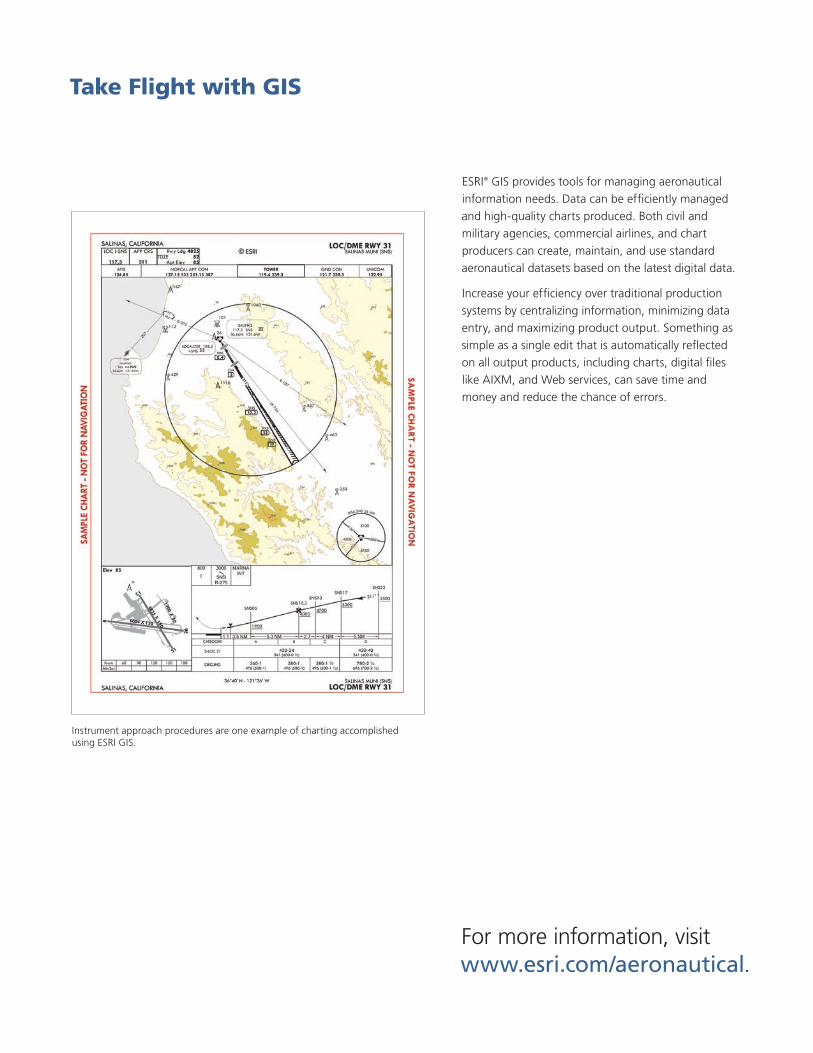
ESRI® GIS provides tools for managing aeronautical information needs. Data can be efficiently managed and high-quality charts produced. Both civil and military agencies, commercial airlines, and chart producers can create, maintain, and use standard aeronautical datasets based on the latest digital data.
Increase your efficiency over traditional production systems by centralizing information, minimizing data entry, and maximizing product output. Something as simple as a single edit that is automatically reflected on all output products, including charts, digital files like AIXM, and Web services, can save time and money and reduce the chance of errors.
Take Flight with GIS
Instrument approach procedures are one example of charting accomplished using ESRI GIS.

Copyright © 2010 ESRI. All rights reserved. ESRI, the ESRI globe logo, ArcGIS, ArcGlobe, ArcInfo, ArcMap, ArcToolbox, 3D Analyst, PLTS, The Geographic Approach, @esri.com, and www.esri.com are trademarks, registered trademarks, or service marks of ESRI in the United States, the European Community, or certain other jurisdictions. Other companies and products mentioned herein may be trademarks or registered trademarks of their respective trademark owners.
112622INLD6M4/10dh Printed in USA
About ESRI
Since 1969, ESRI has been helping
organizations map and model our
world. ESRI’s GIS software tools
and methodologies enable these
organizations to effectively analyze
and manage their geographic
information and make better
decisions. They are supported by our
experienced and knowledgeable staff
and extensive network of business
partners and international distributors.
A full-service GIS company, ESRI
supports the implementation of GIS
technology on desktops, servers,
online services, and mobile devices.
These GIS solutions are flexible,
customizable, and easy to use.
Our Focus
ESRI software is used by hundreds
of thousands of organizations that
apply GIS to solve problems and
make our world a better place to
live. We pay close attention to our
users to ensure they have the best
tools possible to accomplish their
missions. A comprehensive suite of
training options offered worldwide
helps our users fully leverage their
GIS applications.
ESRI is a socially conscious business,
actively supporting organizations
involved in education, conservation,
sustainable development, and
humanitarian affairs.
Contact ESRI
1-800-GIS-XPRT (1-800-447-9778)
Phone: 909-793-2853
Fax: 909-793-5953
www.esri.com
Offices worldwide
www.esri.com/locations
380 New York Street
Redlands, CA 92373-8100 USA