Embed Size (px)
Citation preview
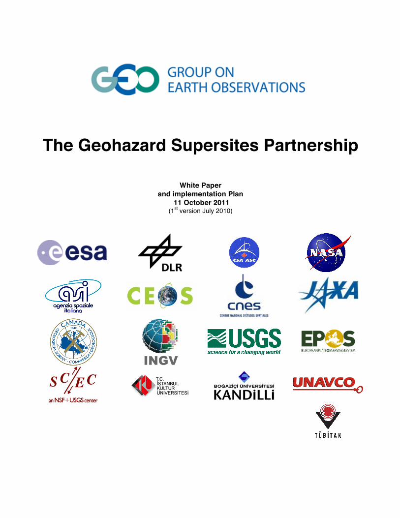
The Geohazard Supersites Partnership
White Paper
and implementation Plan 11 October 2011
(1st version July 2010)
Geohazard Supersites
Final version, October 2011 2
Participating Organizations and Contributors
Canadian Space Agency (CSA) Centre Nationale d’Etudes Spatiales (CNES), France Committee of Earth Observation Satellites (CEOS)
European Plate Boundary Observatory (EPOS) European Space Agency (ESA)
Italian Space Agency (ASI) Geological Survey of Canada (GSC)
Geospatial Information Authority of Japan (GSI) German Aerospace Center (DLR)
Kultur University, Istanbul, Turkey Kandilli Observatory, Istanbul, Turkey
National Aeronautics and Space Administration (NASA) Istituto Nazionale di Geofisica e Vulcanologia (INGV), Italy
Japanese Space Exploration Agency (JAXA) Southern California Earthquake Center (SCEC), USA Tubitak Marmara Research Center, Istanbul, Turkey
Unavco, USA United States Geological Survey (USGS)
Potentially Participating Organizations
National Research Institute for Earth Science and Disaster Prevention of Japan (NIED) Geological Survey or Japan (GSJ) Geological Survey Institute (GSI)
Japan Meteorological Agency (JMA)
Preamble Geological extreme events such as large earthquakes, volcanic eruptions and landslides unfold as natural disasters when they meet with vulnerability. Precise geophysical measurements prior to, during, and following the events lead to a better scientific understanding of these events. The Geohazard Supersites partnership pool and coordinate the existing space-based and ground-based observation resources of GEO members to mitigate and to improve the preparedness for geologic disasters. The Geohazard Supersites are designed to broaden our knowledge about geological extreme events and to reduce our vulnerability to geologic hazards.
1. Purpose of this White Paper The purpose of this White Paper is to express the mutual agreement of the participating organizations to support the Geohazard Supersites initiative according to their best abilities. Details about the implementation of the partnership are described in the supplement to this White Paper which is updated when new information becomes available.
2. Vision The vision of the Geohazard Supersites partnership is to reduce the vulnerability to geological hazards by improving the scientific understanding of hazardous events through worldwide scientific collaboration.
Geohazard Supersites
Final version, October 2011 3
3. Background on this White Paper and outlook The Geohazard Supersites partnership began with the "Frascati declaration" at the conclusion of the 3rd International Geohazards workshop of the Group of Earth Observation (GEO), held in November 2007 in Frascati, Italy. The recommendation of the workshop was “to stimulate an international effort to monitor and study selected reference sites by establishing open access to relevant datasets according to GEO principles to foster the collaboration between all various partners and end-users”. This recommendation was formalized as GEO task DI-09-01. It was the result of the IGOS-Geohazards activities.
In response to this recommendation many data providers and scientists established an informal, collaborative cyber-infrastructure containing large space-based and ground-based data sets, applying the GEO principles of “data sharing” and “cross-cutting”. The Supersites concept proved itself following the disastrous Haiti earthquake of January 2010. Within a very short time period multi-satellite SAR data, and results and interpretations drawn from the data were openly available to all stakeholders through this cyber-infrastructure, advancing the knowledge of potential future threats, which are now considered for the rebuilding of Port-aux-Prince.
The Haiti Earthquake has provided the proof of concept that freely available large data sets across disciplines (INSAR, seismology and geotechnical engineering), in combination with a cyber-infrastructure can lead to a substantial progress in observing, measuring and modeling of geohazards. It has further proven that synergetic exploitation of globally available resources (data and knowledge) provides an outmost exploitation of the individual investments.
Why are the Japanese partners listed as potentially contributing? The Supersites partnership started in Europe and in the U.S. and the Japanese Science community was the last which was briefed (in form of a break-out session at the Alos-PI meeting in Tokyo in November 2010). The Japanese InSAR community generally supports the concept but there has not been enough time to fully inform the Japanese ground-based organizations of the benefits of the Supersites.
4. Mandate from GEO The Group of Earth Observation (GEO) has been charged by its members to ensure comprehensive and sustained Earth observations using existing Earth observation systems (ground-based and space-based). GEO’s disaster theme is “Reducing the loss of life and property from natural disasters”. This will be achieved through coordination, data and information sharing, cross-cutting and by promoting interoperability. The Geohazard Supersites initiative makes two important steps towards achieving this goal. First, the Geohazard Supersites aim at combining multi-satellite SAR observations with ground-based observation networks for selected test sites. Second, the Geohazard Supersites establish a cyber-infrastructure for international geohazard research.
5. Difference Geohazard Supersites and International Charter on Space and Major Disasters
The Geohazard Supersites and International Charter on Space and Major Disasters are two separate, independent but complementary initiatives. The International Charter on Space and Major Disasters is concerned with data provision for response and rescue efforts for disasters. Charter data are available to local Civil Protection agencies during the crisis. In contrast, the Geohazard Supersites are concerned with disaster mitigation and disaster preparedness. Targeted data acquisition for selected sites and readily data availability encourages fundamental geohazard research. In addition, event Supersites are concerned with the scientific aspects of geological disasters, such as which fault ruptured during an earthquake and whether a volcanic crisis is associated with the ascent of new magma to shallow levels. The Geohazards Supersites data will be available to all members of the Partnership for an indefinite amount of time. For geological disasters some satellite data provider will provide data independently to both, the Charter and the Geohazard Supersites.
Geohazard Supersites
Final version, October 2011 4
6. Executive Summary The Geohazard Supersites is a membership-based partnership of universities, research institutions, national agencies responsible for geohazard observations, and space agencies. The aim is to systematically acquire, and provide access to, remote sensing and in-situ geophysical data for selected regional areas exposed to geological threats (“Supersites”). The Geohazard Supersites provide a cyber-infrastructure platform allowing fast, easy and free-of-charge access to complete satellite and ground-based geophysical data sets derived from different sources and different disciplines. This inter-disciplinary approach of using satellite radar data (SAR interferometry), seismology, and other earth science domains, provides the unique potential in making scientific steps in narrowing down the uncertainty of future disastrous events and providing information to policymakers for urbanization in geohazards endangered areas.
There are four earthquake Supersites (Tokyo, Vancouver-Seattle, Los Angeles and Istanbul) and four volcano Supersites (Mt. Fuji, Vesuvius, Campi Phlegreii, Mt Etna and Hawaii) (Tokyo and Mt. Fuji form the Tokyo-Mt. Fuji Supersite). In addition, there are event Supersites for earthquake and volcanic disasters. The Geohazard Supersites can provide critical scientific information about the nature of the geologic events. The initial objectives of the Geohazard Supersites are to establish a free-of-charge multi-satellite on-line SAR data repository for the selected Supersites and to dramatically enhance access for the scientific community to the remote sensing and to the in-situ data. The long-term objective is to develop an international, sustainable and integrated approach to geohazards, optimally utilizing the remote sensing and in-situ resources of GEO members.
At current stage several large data sets are already accessible via the cyber-infrastructure. However the data sets are not yet complete.
7. Motivation, Purpose and Scope of the Geohazard Supersites Motivation The vulnerability of populations to geologic hazards can be significantly reduced by systematic preparation for the hazardous events. It is well known that the effect of large earthquakes can be mitigated by earthquake-proof building. The effect of catastrophic volcanic eruptions can be mitigated by warning and evacuation of the population. Critical for better disaster preparedness are integrated geophysical observation and fundamental geohazard research utilizing the full spectrum of geophysical data sets.
Geohazards versus geo-risks. To understand the purpose of the Geohazard Supersites it is instructive to review the difference between hazards and risks. The hazard is the natural occurrence of earthquakes and volcanic eruptions and their resulting effects such as ground shaking and volcanic explosions. The risk is the danger the hazard poses to life and property. The hazard is a geological fact. The risk depends on humans, for example where they live and how they build. Areas of high hazard can be of low risk if nobody lives there (e.g. some faults in Tibet). The risks can be reduced but not the hazards. The Geohazard Supersites are about better estimation of hazards. This information can then be used by local government agencies for risk reduction. Space agencies can stimulate hazard estimation by the provision of data for specific geographical regions.
Purpose To integrate satellite-based and ground-based geohazard observations. National authorities in charge of geohazards (geological surveys) monitor regions susceptible to geologic risk using real-time seismic and GPS networks. SAR imagery could greatly enrich the monitoring programs but are commonly not integrated with the in-situ networks because the data are sparse and the acquisition procedures are complex. The purpose of the Supersites is to acquire multi-satellite temporally dense SAR imagery to encourage the integration of SAR with ground-based monitoring schemes.
Geohazard Supersites
Final version, October 2011 5
To stimulate fundamental geohazard research. The diverse access policies for remote sensing and in-situ data has been an important barrier inhibiting scientific advancement. The national authorities in charge of geohazard monitoring and the scientific community have only limited access to the excellent observation resources of the GEO members. The purpose of the Geohazard Supersites is to stimulate fundamental geohazard research by providing the worldwide scientific community with access to the full spectrum of remote sensing and in-situ data sets.
Scope The scopes of the Geohazard Supersites are the hazards associated with the natural processes in the Earth’s crust that lead to earthquakes, volcanic eruptions and landslides.
8. Specific Aims of the Geohazard Supersites The Supersites initiative has the following specific aims:
Aim 1 – To facilitate new scientific discoveries through unprecedented data sets. Scientific discoveries are based on new observations. The Geohazard Supersites initiative uses existing space-based and ground-based geophysical observation assets to develop unprecedented data sets (daily or sub-daily SAR acquisitions) to facilitate new discoveries about earthquake and volcanic processes. The Geohazard Supersites lead to a better understanding of the selected Supersites and about the geophysical processes underlying geological disasters.
Aim 2 – To develop and transfer timely scientific knowledge about earthquakes. In the case of a disastrous earthquake there is an urgent need for scientific information about the precise mapping of the earthquake fault and about the distribution of fault slip. The most reliable scientific data are ground-deformation measurements derived from satellite-based interferometric Synthetic Aperture Radar (SAR interferometry). The Geohazard Supersites can provide SAR interferometry data shortly after satellite data acquisition and a portal for sharing of preliminary information amongst scientists and for optimizing the data acquisition strategy. Of particular importance is the access to archived, multi-satellite legacy data of the epicentral region.
Aim 3 – To develop and transfer timely scientific knowledge about volcanic crises. In the case of volcanic unrest there is need for scientific information about subsurface magma movements. Did magma ascend towards shallow levels indicating an incipient eruption and how much? SAR interferometry can provide information during a crisis about the amount, location and depth of newly arrived magma within or beneath the volcanic edifice. The Geohazard Supersites can provide temporally dense SAR interferometry data and critical information about new magma approaching the Earth’s surface.
Aim 4 – To improve earthquake preparedness by systematic SAR imagery acquisition. Many destructive earthquakes occur along faults for which major earthquakes were expected within a 10-50 year time frame. Long time-series of interferometric SAR can precisely estimate contemporaneous strain accumulation from which fault slip rates and earthquake potential can be estimated. The Geohazard Supersites will acquire multi-decade, multi-satellite time-series for selected sites to better estimate earthquake risk.
Aim 5 – To develop sustainable long-term Earth observation strategies following earthquakes and eruptions. Large earthquakes and eruptions are associated with enormous mass movements and provide opportunities to understand how the Earth’s crust responds to sudden forcing (a process known as post-seismic relaxation). Information about the crust’s response is critical to better estimate the risk of future earthquakes and eruptions in a given geographic region. The Geohazard Supersites provide a platform to coordinate decade-long multi-satellite SAR observations to ensure that these important data sets are acquired.
Aim 6 – To establish user requirements for the Global Earth Observation System of Systems (GEOSS). The Geohazard Supersites deepen the dialogue between the national authorities in charge of geohazard monitoring, the
Geohazard Supersites
Final version, October 2011 6
space agencies, and the worldwide scientific community. This dialogue will lead to a better articulation of the user requirements for sustained Earth observations of geohazards with GEOSS.
9. Benefits of Geohazard Supersites Benefits for Policy Makers and Governments • Scientists around the world will work on the Geohazard Supersites in a collaborative, inter-disciplinary and
cross-cutting manner and deliver new scientific discoveries at “no cost” to the governments. • The national authorities in charge of geohazard monitoring can use the Supersites as a resource for monitoring
and advising governments. • The multi-disciplinary nature of the Supersites will lead to improved geohazard observations and to improved
preparedness for geological disasters.
Benefits for Scientists • The Supersites will acquire SAR data set with daily to sub-daily sampling rate. These unprecedented, new
data sets in combination with ground-based data will facilitate new scientific discoveries. • The Supersites facilitate the development, testing and comparison of new data analysis algorithms leading to
improved observation techniques. • The Supersites make long time-series of SAR data sets readily available for data mining.
Benefits for Satellite Data Providers • The Supersites provide a platform to disseminate relevant data to the scientific community enhancing the
exploitation of the data without cost for dedicated stimulus projects. This is of particular importance for commercial satellite operators, allocating limited resources for science exploitation of their missions which at the end help could help in deriving new commercial applications.
• The Supersites provide a platform to establish a complete long term (decades) data set of different sources (SAR, GPS, Seismic) having the unique potential of becoming considered a digital world heritage for Earth Observation.
• Satellite providers can demonstrate the specific capabilities of their systems to a broad user community.
Benefits for In-situ Data Providers • Involvement in the satellite data acquisition planning. • Improved satellite coverage may lead to new scientific discoveries and better assessment of earthquake and
volcano hazard. • Facilitates the collaboration with national and international research teams to more efficiently extract
information from satellite and in-situ data • Advanced processing techniques of satellite data combined with ready data availability may lead to better
monitoring systems. • Easy access to satellite data; no need to maintain local SAR data repositories; guaranteed long-term access to
legacy satellite data.
10. GEO priorities addressed by Geohazard Supersites The Supersite initiative addresses the following GEO priorities for GEOSS: • Coordination of existing satellite resources for improving Earth observation. • Data sharing and free-of-charge data access for research and education.
Geohazard Supersites
Final version, October 2011 7
11. Relation to GEO workplan The Geohazard Supersites is a response to the task outlined in the GEO work plan:
• DI-09-01c Geohazard Supersites and Natural Laboratories
And also address the CEOS tasks:
• DI-09-01 Systematic monitoring for geohazards risks assessment • DI-09-01a Vulnerability mapping and risk assessment • DI-09-01a_2 INSAR Data Use for Geohazards • DI-09-01a_3 INSAR Data for Operational Hazard Mapping
A specific task for Geohazard Supersites will be included in the next update of the GEO workplan.
12. Implementation Plan This section outlines the general concept for the implementation of the Geohazard Supersites. Details are described in the supplement to this White Paper, which will be updated when new information becomes available.
12.1 What are Geohazard Supersites The Geohazard Supersites are a representative selection of areas exposed to geological threats (large earthquakes, volcanic eruptions or landslides) for which events are expected in the near future and which are appropriate places to stimulate fundamental research. The Geohazard Supersites are monitored by the national agencies in charge of geohazards using in-situ networks (seismic and GPS) and by the participating space agencies with radar SAR satellites. The in-situ and satellite data listed in the Supplement to this White Paper and will be accessible from the Supersites data portal.
12.2 Which are the Geohazard Supersites The ad-hoc scientific advisory committee has selected the initial Supersite candidates listed below. The earthquake Supersites are very big metropolitan areas with very high earthquake risk. For each site, there is a 30-60% probability for a destructive earthquake (magnitude > 7) in the next 30 years (except for Vancouver-Seattle which has a lower probability). Earthquake Supersite candidates Tokyo (Japan). Los Angeles (USA), Vancouver-Seattle (Canada-USA), Istanbul (Turkey). Volcano Supersite candidates Hawaii (USA), Mt. Etna (Italy), Vesuvius/Campi Flegreii (Italy), Mt. Fuji. Event Supersites Event Supersites are established for significant earthquake or volcanic unrest to satisfy the need of rapid scientific information after a geological disaster. Significant earthquakes have a magnitude larger than 8 or have affected a population of more than 1 million (according to the USGS pager system). Event Supersites are established at the discretion of the Scientific Committee.
12.3 Terminology “Supersites” and “Supersite candidates” Sites are termed “Supersites” when all relevant data sets are available. When only a portion of the data is available sites are termed “Supersite candidates”. Initially all sites are “Supersites candidates” because not all data sets are
Geohazard Supersites
Final version, October 2011 8
immediately available. The Scientific Advisory Committee determines the metrics for “Supersite” status (see Supplement). Supersites data portal The Supersites data portal provides access or information to all satellite-based and in-situ data provided by the participating organizations. The next generation data portal will use HMA technology. Supersites website The Supersites website provides a platform for scientists to publicize preliminary results derived from Supersites data. The “open” ad-hoc peer discussions of world leading scientists are important for earthquake or volcanic crises. Virtual Archive A robust ITC infrastructure of the European Space Agency for the rapid dissemination of large amounts of satellite data over the Internet.
12.4 What are the Data Sets and how to access them Data sets The Geohazard Supersites are concerned with geophysical data sets that lead to a better scientific understanding of the natural processes associated with earthquakes, volcanic eruptions and landslides. The principal data sets are SAR, seismic (short-period and broadband) and continuous GPS. For volcano Supersites the data sets includes gas, gravity and tilt meter measurements. Other data sets of interest include campaign GPS, strain meter, high-resolution digital elevation models and lidar observations.
Timeliness Data access will be provided according to the best abilities and constraints of the participating organizations. SAR and in-situ data are fed in near-real-time into the data systems whenever possible. For volcano Supersites with crisis response concerns there can be a delay for data access of six month.
SAR wavelength The Supersites combine multiple sensors with different wavelengths to facilitate outstanding new science results:
• L-Band (ALOS) provides high interferometric coherence in vegetated areas. ALOS’ wavelength combined with the global data acquisition plan ensures InSAR data for most earthquakes and volcanic crisis. ALOS is particularly important for event supersites in tropical settings such as Haiti.
• C-Band (ESA and CSA SAR missions: ERS, Envisat, Sentinel, Radarsat-1,2,C ) provides good accuracy but has limited coherence in dense vegetated areas. Most C-band satellites have operational objectives and therefore large foot prints and long duty cycles. Long time-series of C-Band data are well suited to resolve tectonic strain accumulation.
• X-Band (TerraSAR-X, Cosmo-Skymed) provides high spatial resolution and very accurate measurements. This, together with the short repeat time, makes X-Band particular well suited to resolve time-variable processes at volcano Supersites. Uninterrupted time-series can provide very accurate deformation measurements in any environment.
Data location Most data are accessible through the Supersites data portal but are physically located elsewhere. The satellite data are located at the Space Agency premise. The European Space Agency is using a Cloud Computing asset, the Virtual Archive to make the very large data set of 20 years of observation robustly and fast available. Many of the seismic, GPS and some SAR data are located on servers of the national monitoring agencies or at well-established
Geohazard Supersites
Final version, October 2011 9
data centers such as Iris, Orpheus, Unavco or Geonet and DLR. The Supersite office can host data sets that can’t be fed into any of the centers.
Data access rules Satellite data. The data access rules vary according to the data provider (see Suplement).
In-situ data. All ground-based data are open access according to the policies of the respective data provider unless specified otherwise. Users of ground-based data originating from volcano observatories agree to give proper attribution and to refrain from making public predictions or forecasts of volcanic activity, pursuant to established international protocols (IAVCEI, 1999, Professional conduct during volcanic crises, Bull. Volcano. 60: 323-334).
12.5 What are the Participating Organizations and the Data Users of the Geohazard Supersites Partnership?
Participating organizations • Space agencies. They provide the satellite observation data (mainly radar SAR data). • National authorities or research institutions in charge of geohazard monitoring (geological surveys). They
provide the in-situ data.
Data users • The worldwide scientific community identified as Co-Principal Investigators in the Geohazard Supersite
project.
12.6 What are Natural Laboratories The cyber-infrastructure of the Geohazard Supersites is also available for other geohazard sites. These geographical areas are termed Natural Laboratories. For example, the Japanese or Italian Space Agencies could use the Supersite cyber-infrastructure to make SAR data sets for Japan or Italy available to the worldwide scientific community. In the same way, Geological Survey offices can contribute in-situ data for sites not yet selected as Supersites.
12.7 Governance Structure See the supplement to this White Paper.
12.8 Science Objectives The general objective of the Supersites is to facilitate new scientific discoveries about earthquake and volcanic processes using unprecedented time series of synthetic aperture radar (SAR) data and by combining this and other satellite imagery with in-situ geophysical data. This section outlines the context of each Supersite and the particular objectives for SAR data acquisition. Tokyo-Mt. Fuji Supersite Earthquake hazard. The greater Tokyo area has the highest risk of earthquakes among the world’s mega-cities because of the high seismic hazard and the vulnerability associated with a population of 35 million. Japan’s Central Disaster and Prevention Council estimates that a large earthquake may cause up to 10,000 fatalities and 1 trillion dollars in damage. The probability for an earthquake with magnitude 7.3 or larger in the next 30 years is about 30%. This implies an annual probable loss of $13 billion dollars. A destructive earthquake in Tokyo will have global economic impact. The objectives of the Supersites are:
Geohazard Supersites
Final version, October 2011 10
• To acquire daily to sub-daily multi-sensor SAR imagery so that InSAR measurements will be available hours to days after an earthquake.
• To use decade-long multi-sensor SAR time-series to develop InSAR-ground displacement measurements with sub-millimeter accuracy for the larger Tokyo area. The new data will lead to improved slip rate estimates for the major faults and improve seismic hazard assessment.
• To identify unknown, blind faults using InSAR to further refine seismic risk. Volcano hazard. The volcano with the highest risk in Japan is Mt. Fuji because eruptions may affect the greater Tokyo Metropolitan area. The last plinian eruption of Mt. Fuji occurred in 1707, only 49 days after the Hoei earthquake, the largest earthquake to hit Honshu island in historic times (with an estimated magnitude of 8.6). Currently, Mt. Fuji does not show any signs of unrest. The focus of the Supersite will be on Izu-Oshima, a volcanic island 80 km south of Tokyo and on Mt. Asama 100 km northwest of Tokyo. Both volcanoes are very active and strong eruptions have potentially have significant impact on Tokyo. Mt. Asama erupted last in 2009 and Izu-Oshima in 1990. The objectives are: • To infer the nature of the magmatic plumbing systems, including the location and geometry of the magma
reservoirs, areas of preferred dike and sill intrusions, and the connectivity between the reservoirs and the active vents.
• To precisely resolve all aspects of the volcanic cycle, such as pre-eruptive inflation (if it occurs), co-eruptive deflation and the rapid replenishment of the reservoirs following an eruption. Of particular interest is whether the volcanoes exhibit any cyclic behavior and whether eruptions are preceded by typical ground deformation signals that could serve to forecast the next eruption.
Vancouver-Seattle Supersite Vancouver, British Columbia, is the city with the highest seismic risk in Canada. It is located at the northern end of the Cascadia subduction zone, at the boundary between two tectonic plates. Every 300-500 years the plate boundary moves by ~20 m along a 90 by 1000 km rupture zone, generating magnitude ~9.0 earthquakes. The total population of the Supersite region is 7 million people with about 2.5 million in the Greater Vancouver and 4.5 million in the Greater Seattle area. The major hazards are megathrust earthquakes, tsunamis, and smaller earthquakes relieving stress in the Earth’s crust above the subduction fault. The last megathrust earthquake occurred in 1700 and generated a tsunami which affected and destroyed parts of coastal Japan. A striking feature of the Cascadia subduction is the series of episodic slow slip events, in which parts of the plate interface loosen up and move by ~10 cm over a 2 week time period (repeating every ~450 days). The slow-slip events are a top-priority for research because they may provide clues about the next megathrust earthquake. The science objectives for the Vancouver-Seattle Supersite are: • To better constrain the present-day strain accumulation across the subduction interface using a combination of
InSAR and GPS. • To better characterize the spatial extent and progression of slow-slip events using InSAR. • To identify shallow, secondary structures that may respond to the slow-slip events at greater depth. • To identify strain accumulation along crustal, slow moving faults.
Given the small size of the expected signals (of the order of a few mm) and the difficult environmental conditions (dense vegetation and seasonal snow cover) several hundreds of SAR images densely sampled in space and time are required to resolve and image these phenomena.
Los Angeles Supersite Los Angeles, California, is one of the cities with the highest seismic risk in the U.S. About 12.5 million people live in an area characterized by crustal shortening of ~6-8 mm/yr related to a bend in the neighboring San Andreas fault system. The major hazards are earthquakes along the San Andreas itself, as well as on thrust faults in and near the
Geohazard Supersites
Final version, October 2011 11
Los Angeles Basin similar to, or larger than, the 1971 magnitude 6.7 San Fernando and the 1994 magnitude 6.7 Northridge earthquakes; each caused more than 60 fatalities and damages of $50 billon and $15 billion, respectively. The objectives of the Supersites are: • To improve seismic hazard estimates by better constraining slip rates on known thrust faults using the InSAR-
GPS derived ground velocity field, including the vertical component. • To identify motions on blind thrust faults using InSAR-derived ground deformation data. • To image earthquakes and constrain their mechanisms and fault slip distributions in the greatest possible
detail. • To discriminate between hydrological and tectonic sources of deformation signal, so as to identify and localize
seismic hazards and to properly associate deformation with specific faults. • In the event of a significant earthquake, observe the postseismic deformation and scan for any anomalous
deformation on neighboring faults that might indicate a change in activity.
Istanbul Supersite Istanbul, Turkey, is Europe’s city with the highest seismic risk. About 12.5 million people are threatened by an earthquake along the North Anatolian fault under the Sea of Marmara, 20 km south of Istanbul. The 1999 disastrous Izmit earthquake (Mw=7.4) was not a surprise because westward migrating earthquakes that broke ~1000 km-long section of North Anatolian Fault (NAF) in a manner of falling dominos had already arrived nearby Izmit. Historical documents going back two millennia indicate that many destructive earthquakes stroke the city of Istanbul. The probability of a large earthquake to strike Istanbul again is estimated to be about 65% over the next 30 years. The objectives are:
• To measure the tectonic strain accumulation across the metropolitan area and western section of the 1999 Izmit rupture by combining the InSAR and GPS data.
• To search for unknown faults to improve and spatially refine seismic hazard maps using InSAR-derived maps.
• To image surface deformation caused by earthquakes and to constrain their focal mechanisms with greatest possible detail with the contribution of the continuous GPS data.
• To better determine the 4D postseismic deformation of Izmit earthquake with PSInSAR analysis in order to understand earthquake cycle processes and to constrain the seismic hazard models.
• To demonstrate the earthquake/landslide triggering mechanisms along the shorelines of the Istanbul.
Hawaii Supersite Mauna Loa and Kīlauea volcanoes are among the most active volcanoes in the World. Kīlauea has been in continuous eruption from vents on the east rift zone since 1983 and from the summit since 2008, and Mauna Loa has erupted 33 times since 1843. The Island of Hawai’i has a population of over 150,000, and over 1.5 million people visit Hawai’i Volcanoes National Park each year. Volcanic hazards include lava flows, explosive eruptions, earthquakes, flank instability, and gas emissions. The flanks of Kīlauea volcano are rapidly deforming at rates of up to 10 cm/yr, and frequent volcanic activity can cause tens of meters of surface deformation in just a few hours. InSAR data from the Supersites initiative will better define the surface velocity field and can detect transient deformation that, upon analysis, will provide insights into the island’s magmatic and tectonic systems. The specific objectives of the Supersite are: • To characterize the location and size of the magma reservoirs and magma transport systems at Mauna Loa and
Kīlauea volcanoes. • To map the spatial extent and rate of flank motion, and to provide better constraints on driving forces. • To detect transient magmatic and tectonic activity, including dike intrusions and aseismic flank slip events.
Etna Supersite
Geohazard Supersites
Final version, October 2011 12
Mt Etna in Italy is Europe’s most active volcano with almost yearly eruptions. It is a high-risk volcano with 0.5 million people living on its lower flanks. Similar to Hawaii, the volcanic hazards are lava flows threatening populated areas, occasional explosive eruptions, and sliding of the east flank. The Supersites science objectives are: • To study the evolution in time and space of the long-term inflation / deflation cycles for inferring on the
relationship between magmatic system and tectonic setting. • To image the effects of the magmatic processes during the next eruptions. InSAR data just before and during
the dike propagation led to new insights on where exactly the erupted magma comes from, what forces bring the magma to the surface and what structural systems are involved.
• To precisely map the spatial extent of flank motions and temporal variations of flank instability. To infer on the “hidden” structures involved in the flank dynamics (e.g. the decollement plane/s) and on the magmatic and/or tectonic processes causing acceleration and deceleration of the flank?
• To identify local scale deformations, such as those related to the compaction of the recent lava flows or to the exploitation of shallow ground water reservoirs, for discriminate them from tectonic or volcanic signals.
Vesuvius/Campi Flegrei Supersite Italy’s Vesuvius is one of the world’s most dangerous volcanoes. The well-known 79 A.D. explosive eruption destroyed the ancient roman city of Pompeii. The neighboring Campi Flegrei is a 10-km wide caldera that lies partly under water. The subareal portion of the caldera is part of the greater Napoli area. The population inside the caldera is about 350,000 people. Campi Flegrei had explosive eruptions in the geologic past. The highest hazards are landward surges generated by plinian eruptions and the potentially explosive interaction between magma and seawater. Campi Flegrei’s activity is characterized by unrest periods associated with uplift or subsidence. During the unrest period in the 1980s about ~1.5 m of uplift occurred over 2 years. The Supersites will focus on Campi Flegrei because Vesuvius currently does not show any unrest. • To precisely characterize the time-dependent displacement field at Campi Flegrei to better constrain the
magmatic source of the ground deformation.
Earthquake event Supersites (as listed in June 2010 first version of White Paper) The objectives of earthquake event Supersites is to image and understand the events with greatest possible detail to better estimate how the shocks affected the earthquake potential along-strike on the causative faults, as well as on neighboring faults. Haiti. Ongoing research suggests that the 2010, magnitude 7 Haiti earthquake occurred primarily on a concealed thrust fault, with only minor slip on the mapped Enriquillo – Plantain Garden Fault zone. Identifying the fault planes that broke in the 2010 earthquake, and the pattern of slip on these planes, is of paramount importance for stress change modeling and seismic hazard assessment for the future of the Port-au-Prince area. The top research priority is: • To combine multi-satellite InSAR data with ground-based data to better constrain the earthquake source. • On an ongoing basis, to search for any evidence of transient or anomalous behavior that may occur, as a
possible indicator of temporal change in seismic hazard during reconstruction efforts. Wenchuan, China. The fault movement during the 2008 magnitude 7.9 Wenchuan earthquake instantaneously changed the state of stress in the crust and the earthquake potential of all the active faults in the Wenchuan area. The earthquake potential has changed by a similar amount due to the relaxation of the earthquake-imposed stress in or below the Earth’s crust. This process occurs over a time-period from several years to several decades and can be inferred from ground-deformation data. The top research priorities are: • To precisely infer the earthquake slip distribution by combing InSAR with in-situ data. • To precisely track time-variable post-earthquake ground displacements (post-seismic deformation) to constrain
models for stress relaxation and any associated change in hazard.
Geohazard Supersites
Final version, October 2011 13
Volcano event Supersites The objectives of volcano event Supersites are (1) to provide satellite-based geophysical data for monitoring the progress of an eruption, (2) to aid emergency management (designation of evacuation zones), (3) to conduct fundamental research on eruption processes and (4) to conduct fundament research on remote sensing techniques in support of eruption monitoring. Of particular importance are strong explosive eruptions as we were reminded by the 2010 Merapi eruption. With many ground-based geophysical instruments destroyed InSAR may be one of the few geophysical data sets that can provide information about the progress of an eruption. Of particular importance are high-resolution SARs with rapid revisiting capability (Cosmo-Skymed and TerraSAR-X). Satellite-based radar imagery plays a particular role for the management of volcanic emergencies. Only radar can look through the ash clouds and through meteoric clouds associated with strong eruptions. Whereas it is straight-forward to determine the areas affected by an eruption a scientific understanding of the eruption is required to determine when it is save to enter those areas. InSAR ground deformation measurements and SAR back-scatter imagery during volcanic crises have the following objectives: • To gauge the volume of magma involved by resolving inflation of the volcanic edifice. • To monitor the waxing or waning of the eruption. Are quiescence phases associated with the ascent of new
magma to shallow levels and bulging of the volcano surface? • To detect flank instabilities that could be precursors for catastrophic mass wasting events. • To gauge changes of the dome (growth and destruction) • To precisely map changes in the summit area, such as the development of lateral structures that could pose
future threats to previously believed safe zones. • To understand how volcanic ash affects radar measurements. Can delays of the radar signal associated with
ash clouds be misinterpreted as ground deformation? How does volcanic ash affects the interferometric coherence at X-, C- and L-band? Which radar wavelength is most suited for volcanic crisis monitoring?
13. The 2010 Beijing GEO Plenary and the Wenchuan Supersite The Geohazard Supersites is a bold initiative that charters new waters of international collaboration in Earth Observation. The geographical location of the Plenary provides the opportunity to integrate the Chinese Earth Observation and geophysical community with the international geohazard community of practice. To facilitate this, an event Supersite has been established for the 2008 Wenchuan, China earthquake, the worst earthquake disaster in China in the last thirty years. The excellent in-situ data acquired in the aftermath of the earthquake combined with the multi-satellite SAR data have the potential to significantly improve our scientific understanding about large continental earthquakes. Although the Chinese government has in principle embraced the GEO data sharing principles many geophysical data sets are not openly accessible because of restrictions for the distribution of raw data and because of technical reasons. The Wenchuan Supersite provides an opportunity (1) for China to demonstrate to the international community the commitment to the GEO data sharing principles, and (2) for the GEO members to demonstrate to China the benefits of open data sharing.
14. Contributors to this White Paper Falk Amelung, University of Miami, Florida, USA, (Geohazard Supersite Task Co-Leader) Wolfgang Lengert, European Space Agency (ESA), Frascati, Italy (Geohazard Supersite Task Co-Leader) Meghan Miller, President of Unavco, Boulder, USA Massimo Cocco, European Plate Boundary Observatory (EPOS) and INGV Rome Hans-Peter Plag, University of Nevada (for the Geohazard Community of Practice) Stuart Marsh, British Geological Survey (BGS) (for the Geohazard Community of Practice) Ivan Petiteville, European Space Agency (for the Committee of Earth Observation Satellites, CEOS) Michael Eineder, German Space Agency (DLR) Craig Dobson, National Aeronautics and Space Administration (NASA) Vern Singroy, Canada Center for Remote Sensing (CCRS)
Geohazard Supersites
Final version, October 2011 14
Yosuke Aoki, Earthquake Research Institue (ERI), University of Tokyo, Japan Yo Fukushima, Disaster Prevention Research Institute (DPRI), Kyoto University, Japan Giuseppe Puglisi, Istituto Nazionale di Geosifica e Vulcanologia (INGV) (for the INGV Catania, Etna Supersite) Semih Ergintav, Tubitak Marmara Research Center, Istanbul, Turkey Kamil Eren, Kultur University, Istanbul, Turkey Haluk Ozener, Kandilli Observatory, Istanbul, Turkey John Eichelberger, United States Geological Survey (USGS) (for the Hawaii Supersite) David Applegate, United States Geological Survey (USGS) (for the Los Angeles and Vancouver-Seattle Supersite) Tom Jordan, Southern California Earthquake Center (SCEC) (for the Los Angeles Supersite) Ken Hudnut, United States Geological Survey (USGS) (for the Los Angeles Supersite) Herb Dragert, Geological Survey of Canada (for the Vancouver-Seattle Supersite)


![Tacloban geohazard assessment report [12.05.13]](https://img.pdfslide.net/doc/110x75/5551c368b4c905922b8b475b/tacloban-geohazard-assessment-report-120513.jpg)


![Tacloban geohazard assessment report [11.28.13]](https://img.pdfslide.net/doc/110x75/5551c3d8b4c905ca7f8b5449/tacloban-geohazard-assessment-report-112813.jpg)