Embed Size (px)
Citation preview

The Lunar Mapping and Modeling Project
Mark Nall, Raymond French, Sarah Noble, and Kimberly Muery
NASA Marshall Space Flight Center

Project Background and Overview• LMMP was initiated in 2007 to help in making the anticipated
results of the LRO spacecraft useful
and accessible
to
Constellation
• The LMMP is managing and developing a suite of lunar
mapping and modeling tools and products that support the
Constellation Program (CxP) and other lunar exploration
activities
• In addition to the LRO Principal Investigators, relevant
activities and expertise that had already been funded by
NASA was identified at ARC, CRREL (Army Cold Regions
Research & Engineering Laboratory), GSFC, JPL, & USGS
• LMMP is a cost capped, design‐to‐cost project (Project budget
was established prior to obtaining Constellation needs)

Customers
• Main customer is the Constellation program The information provided through LMMP will assist them in:
– planning tasks in the areas of landing site evaluation and selection– design and placement of landers and other stationary assets
– design of rovers and other mobile assets
– developing terrain‐relative navigation (TRN) capabilities– assessment and planning of science traverses
• Other customers– Science community
– Commercial community (e.g. GLXP teams)
– Education/Public Outreach community

LMMP Team
4
ARC
GSFC
JPL
CRREL
USGS
• Regional Apollo visible base imagery mosaics • Regional DEMs • EPO web-based neo-geography interfaces
• Desktop visualization client – Integrated Lunar Information Architecture for Decision Support
• Visualization system infrastructure, web portal and interoperable GIS infrastructure
• Local/site DEMs (stereo photoclinometry)• Hazard assessment maps (including slope maps)
• Web-based visualization system digital overlay tools
• Local/site visible base imagery mosaics• Regional/polar visible base imagery mosaics• Local/site DEMs
ASU • Local/site DEMs

Data Sources
• LRO• M3
• Kaguya (gravity model)
• Apollo (metric
& panoramic cameras)
• Clementine
• Prospector

Created Products ‐
DEMs
Regional DEMs using scanned Apollo metric camera data
Covers ~18% of the Moon (low latitudes)
Map showing coverage of metric camera data
Small section of DEM from orbit 33. DEM resolution ~40m/pixel
DEMs
Preliminary USGS Aristarchus Plateau (DEM 1) from JSC/ASU Apollo Pan Cam Scans
Local DEMs from LOLA NAC covering the 50 CxP regions of interest
Malapert (left) and Ap 15 (right) ROIs showing in red the NAC images acquired through the 1st
month of mapping orbit

Created Products ‐
Hazard Maps
• Craters• Boulders• Slopes• Surface
Roughness

LMMP Portal Browse Window

Search for Feature

Download Auxiliary Files

Polar Projection (North)

Attach Your Own Project Data
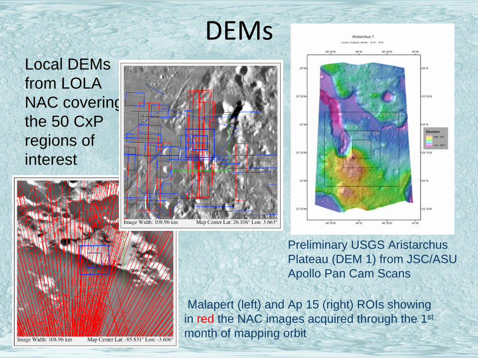
Tools

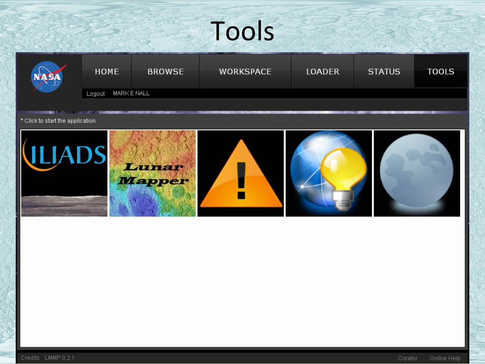
Lunar Mapper

Apollo Image Overlay on LOLA

Distance Measuring
LOLA Colorized

Project Files

20
Integrated Lunar Information Architecture for Decision Support (ILIADS)
Lunar Surface Traverse Tool (oblique view)
Goldstone Radar of South Pole (oblique view)

ILIADS Displays Multiple Data Sources

ILIADS Product Overlays
Select Hydrogen from Lunar Prospector SourceSelect Hydrogen from
Lunar Prospector Source

Modifying Overlays
5. Adjus
t Layer
Opacity5. A
djust Lay
er
Opacity
4. Select
a Color
4. Select
a Color

LMMP Milestones• Apr 2009 – Formulation review
• Jun 2009 – LRO launched!• Aug‐Sep 2009 –
Individual product process
validation audits
• Sep 2009 –
Preliminary System design audit
• Dec 3rd
2009 – Beta release of Mapper, ILIADS, Portal, infrastructure and content
• November 2010 – Version 1 audit
• Late 2010/Early 2011 – Version 1 release


![Lunar&Dynamical&Modeling& with&Improved&IRLunar&Laser ... · Lunar&Dynamical&Modeling& with&Improved&IRLunar&Laser&Ranging&data& V.Viswanathan [1,2], A.Fienga[1], H.Manche[2], C.Courde[1],](https://img.pdfslide.net/doc/110x75/60362aef580c2647732639d6/lunardynamicalmodeling-withimprovedirlunarlaser-.jpg)