Embed Size (px)
Citation preview
The Proposed Auckland Unitary Plan (notified 30 September 2013)
6 South
6.1 Ardmore 1
The objectives and policies of the underlying Special Purpose Airport zone do not apply in the following precinct. Refer to planning maps for the location and extent of the precinct.
Precinct descriptionArdmore Airport is recognised as existing significant infrastructure. Private operators, such as Ardmore Airport, are identified as being the key agencies involved in delivering infrastructure to Auckland. The objectives, policies and rules for the Ardmore 1 precinct override those for the Special Purpose Airport zone.
To make efficient and viable use of vacant land, this precinct can meet a small portion of the projected industrial land demand in south Auckland, which can be supported by existing infrastructure. Other nonaviation activities can also be accommodated in the precinct to provide for the needs of visitors, employees and businesses located at the airport, within specified limits. These limits are necessary to protect the long term growth and development of the airport, and maintain the amenity values of adjoining rural and urban areas.
ObjectivesThe objectives for this precinct are those listed below. The objectives in the Special Purpose Airport zone do not apply.
1. The efficient use and development of the land and operational facilities at Ardmore Airport is enabled.
2. The development of Ardmore Airport is managed to maintain the amenity values of adjoining rural and urban areas.
3. Ardmore Airport is protected from reverse sensitivity effects.
4. The positive effects arising from the operation of Ardmore Airport are recognised and its continued development to meet future demand is enabled.
PoliciesThe policies for this precinct are those listed below. The policies in the Special Purpose Airport zone do not apply.
1. Provide for activities related to the operation of Ardmore Airport.
2. Provide for activities associated with the needs of visitors, employees and businesses located at the airport.
3. Enable a limited range of nonaviation activities, where these activities do not hinder the long term growth and development of the airport.
4. Prevent the establishment of residential activities within the airport.
5. Require development of the airport to be of a high standard of amenity through the layout and placement of buildings, car parking, access and landscape elements.
Page 1 of 67
The Proposed Auckland Unitary Plan (notified 30 September 2013)
6.2 Ardmore 2
The objectives and policies of the underlying Special Purpose Airport zone do not apply in the following precinct. Refer to planning maps for the location and extent of the precinct.
Precinct descriptionVillage Way, Ardmore is a culdesac lying immediately to the west of Ardmore Airport which contains 24 residential sites. Its underlying zoning is the Special Purpose Airport Zone, which provides for specialised aviation related activities. The Ardmore 2 precinct applies to the 24 Village Way residential sites while a separate precinct, the Ardmore 1 precinct, applies to remainder of the Special Purpose Airport Zone at Ardmore.
The purpose of the Ardmore 2 precinct is to protect the residential character of the properties in Village Way, while not unduly restricting the operations of Ardmore Airport.
The Ardmore 2 precinct is within the Aircraft Noise overlay. The purpose of that overlay is to manage the subdivision of land and location of sensitive activities in areas of high cumulative noise around the airport, so that its continued operation is not compromised and reverse sensitivity issues are addressed.
Objectives, policies, and rules for the Aircraft Noise overlay are found in the Overlay objectives and policies Infrastructure section and the Overlay rules Infrastructure section of the Unitary Plan and reflect the need to:
• protect noise sensitive activities within the vicinity of the Ardmore Airport so as to avoid, remedy or mitigate adverse effects associated with airport noise
• avoid, remedy or mitigate potential adverse effects of activities sensitive to aircraft noise establishing or expanding in the areas of high and moderate aircraft noise.
The provisions of the Aircraft Noise overlay affect the dwellings in Village Way by limiting the establishment or extension of “activities sensitive to aircraft noise” (ASAN) close to the airport. ASAN are defined in the provisions for Designation 200 (Ardmore Airport Ltd) in Part 7 of the Unitary Plan. The provisions of the Aircraft Noise overlay for Ardmore Airport also require the installation of acoustic insulation to control the internal noise environment and mechanical ventilation to control internal air quality when new household units are built or alterations made to habitable rooms.
To restrict the development of additional dwellings within the Aircraft Noise overlay, density in the Ardmore 2 precinct is restricted to one dwelling per site. Subdivision is also limited to avoid the establishment of additional ASANs.
ObjectivesThe objectives for this precinct are those listed below. The objectives in the Special Purpose Airport zone do not apply.
1. The continued residential use, character, and amenity of the 24 Village Way properties is provided for.
2. The establishment of additional dwellings in Village Way is prevented given the location of the properties within the Aircraft Noise overlay for Ardmore Airport.
PoliciesThe policies for this precinct are those listed below. The policies in the Special Purpose Airport zone do not apply.
1. Restrict future land use development and subdivision in Village Way through density and subdivision restrictions and through the provisions relating to the Aircraft Noise overlay for Ardmore Airport.
2. Maintain the residential character and amenity of Village Way.
Page 2 of 67
The Proposed Auckland Unitary Plan (notified 30 September 2013)
6.3 Auckland Airport
The objectives, policies, and associated controls for the Auckland Airport precinct override those for the Airport zone.
Refer to planning maps for the location and extent of the precinct and subprecincts.
Most of the following provisions form part of the district plan. All provisions relating to the CMA are regional coastal plan provisions.
Precinct descriptionAuckland Airport plays a key role in connecting Auckland to other parts of New Zealand and the world. It contributes to Auckland and New Zealand’s prosperity. Auckland Airport precinct comprises three subprecincts Core, Gateway and Coastal. The Core subprecinct encompasses all of the land surrounding the existing runway and northern runway. The Gateway subprecinct includes all of the land to the north of the northern runway alignment. The Coastal subprecinct comprises the airport’s operational area within the CMA. Current development includes a single runway, taxiways, aircraft manoeuvring, flight and passenger terminals, and facilities for aircraft maintenance. It also includes support facilities such as administration, businesses and recreation.
The airport runway is largely located on land reclaimed from Manukau Harbour and has a significant impact on the coastal environment. The runways and associated structures influence the landscape which is predominantly manmade and free of vegetation. The impacts on the CMA include noise associated with aircraft movements, aircraft in the airspace above the CMA, and restrictions on use of the harbour around the airport. The CMA also receives stormwater discharges from the airport and has various associated structures, such as ramps, bridges, lighting and navigation devices.
Most of the water area to the south of the southern runway is valued for its habitat, particularly as a feeding ground for thousands of international migratory wading birds. Within this area, Wiroa Island has been developed by Auckland Airport with an artificial bird roost to encourage birds away from the runway and aircraft flight paths. Impounded behind the shell banks is one of the largest, best, and leastdisturbed areas of salt marsh remaining in the Manukau Harbour.
Framework plans are a voluntary mechanism to encourage integrated and comprehensive development of the policy areas A – F in the Core and Gateway subprecincts. Once a framework plan has been approved for a policy area, subsequent resource consent applications can be made for land use, development or subdivision within the land covered by the framework plan as restricted discretionary activities, provided that the application complies with the approved framework plan.
If an applicant elects not to prepare a framework plan, applications for resource consent can still be made on a noncomplying activity basis.
The airport holds designations over part of the land that enables current operations and provides for further development, including the new northern runway.
Objectives[rcp/dp]
1. The positive effects arising from the operation of the airport are recognised, enabling its continued development to meet future demand.
2. The efficient use and development of the business land and operational facilities are enabled.
3. Publicly accessible areas of the airport and areas visible from main transport routes and the Māngere Gateway heritage route are designed to a highquality and meet amenity standards relating to
Page 3 of 67
The Proposed Auckland Unitary Plan (notified 30 September 2013)
streetscape, site design and appearance.
4. The operation of the airport is protected from reverse sensitivity effects.
[rcp/dp]
5. The ecological, geological, recreational, cultural, spiritual and landscape values of the Manukau Harbour coastal environment in the vicinity of the airport are protected.
Policies1. Provide for activities related to the operation and development of the airport and business land within
the precinct.
2. Provide for activities associated with the needs of airport passengers, visitors and employees and businesses located within the precinct.
3. Require precinct developments to achieve a high standard of amenity in the layout of buildings, car parking, access and landscape elements in publicly accessible areas.
[rcp/dp]
4.
5.
6.
7.
8.
Require adverse effects on the ecological, cultural and historic heritage values of the coastal environment in the vicinity of the airport to be avoided, remedied or mitigated when further development occurs.
Require development of sites adjoining the Gateway heritage route to be designed in a way that users of those roads will perceive an environment where natural design elements are integrated with the built environment.
Require development to include provision of safe, amenity linkages, including straight links where possible, to public open space and esplanade reserves/strips.
Encourage framework plans to be prepared prior to subdivision, the establishment of land use activities or development within policy areas AF of the precinct to achieve a high standard of urban design and amenity.
Require a framework plan to demonstrate the interrelationship and future integration with:a. any neighbouring policy area within the precinct
b. any neighbouring precinct or subprecinct (including the Māngere Gateway precinct).
9.
10.
Encourage consultation with any other owners of land within the precinct or any neighbouring precinct.
Manage land use activities in the Auckland Airport Gateway subprecinct to:a. require that the predominant land use activities in the precinct are those involving warehousing and
distribution, transport, storage, manufacturing, construction and wholesale trade
b. confine retail activities to those required to provide the convenience and shopping needs of employees in and visitors to the Auckland Airport precinct, adjacent business zones, and aviation activities.
11. Manage activities associated with runways, aircraft operations and testing of aircraft engines in such a way that the adverse effects of high and moderate levels of aircraft noise on the amenity values and quality of life in existing and future residential areas are appropriately controlled and mitigated.
[rcp/dp]
12.
13.
Avoid uses and developments within the Coastal subprecinct which would adversely affect airport operations or pose any risk to safety.
Provide for activities and structures associated with bird management that encourage birds away from the runway and flight paths of aircraft.
Page 4 of 67
The Proposed Auckland Unitary Plan (notified 30 September 2013)
6.4 Beachlands 1
The Single House zone objectives 12 and policies 14 apply in the Beachlands 1 precinct unless otherwise specified. Refer to planning maps for the location and extent of the precinct.
Precinct descriptionBeachlands is a rural and coastal village located on the eastern side of Auckland city, adjoining the Tamaki Strait coastline. The original Beachlands village was laid out in the 1920s as a marine garden suburb. It is characterised by the following key features:
• a gridbased roads pattern with informal road construction and generous verges
• A “green” landscape resulting from significantly vegetated front and rear yards.
• a lowdensity character with rectangularshaped allotments of a consistent size and frontage (20m).
• few or no rear sites.
More recent subdivision in the area bounded by Bell Road, Third View Avenue, Beachlands Road and Whitford Maraetai Road has seen some departure from this pattern; however the village retains a significant rural and coastal character.
The Beachlands 1 precinct is zoned as Single House and covers approximately 122ha of land. Its purpose is to provide for residential expansion to the south of the existing Beachlands village and to the west of the Pine Harbour marina development in a way that integrates with and maintains and enhances the key features of Beachlands village.
Precinct Plan 1: Beachlands 1 precinct guides the future development of this precinct. The grid based roads pattern shown on Precinct Plan 2: Beachlands 1 precinct road network is a critical element in achieving integration between the precinct, Beachlands village and Pine Harbour marina. Site sizes, site shape, pedestrian linkages and reserve network connectivity in the precinct enables integration with the existing village. The location of the proposed stormwater ponds has been identified in the Precinct Plan 1: Beachlands 1 precinct following a detailed design process and is fixed. The size of the proposed stormwater ponds is indicative only and shall be defined as part of the subdivision consent process.
ObjectivesThe objectives are as listed in the Single House zone except as specified below:
1. The precinct contributes to the growth and development of Beachlands village and ensures that future land use, subdivision and development is contained within the precinct and integrates with the existing Beachlands village to the north, Pine Harbour marina development to the west and the business area in Beachlands 2 precinct.
2. A low density, open, spacious rural and coastal village character is established and maintained.
3. Subdivision, use and development maintains and enhances the lowdensity rural and coastal character of Beachlands village.
4. A well connected and integrated transport network is achieved that reflects the rectilinear grid roads pattern of Beachlands and the importance of transportation links between Beachlands and Pine Harbour Marina.
5. Public open space is provided for and treated as integrated features in any development.
6. Infrastructure is provided in an effective and efficient way.
7. Stormwater runoff and riparian margins are managed in a sustainable way.
8. The rural character and appearance of Jack Lachlan Drive is maintained.
Page 5 of 67
The Proposed Auckland Unitary Plan (notified 30 September 2013)
PoliciesThe policies are as listed in the Single House zone as specified below:
1. Require that land use, subdivision and development be generally in accordance with the Beachlands 1 precinct structure plan shown in the Precinct Plan 1: Beachlands 1 precinct
2. Maintain the longterm growth limit of Beachlands village with the precinct boundary.
3. Create a clear distinction between the urban area of Beachlands and the Whitford rural area to the south and east by requiring edge treatment planting along the full length of Jack Lachlan Drive.
Integrated growth4. Require subdivision and land use activities to be designed in a way that integrates with the roads
pattern, open space pattern and rural and coastal character of the Beachlands village.
Lowdensity coastal character5. Maintain the existing pattern of development and lowdensity character of the area.
Subdivision, use and development6.
7.
8.
9.
10.
11.
12.
13.
14.
15.
16.
Require a development pattern characterised as one house per site.
Require a minimum site size of 800m2 unless otherwise stated in the Precinct Plan 1: Beachlands 1 precinct.
Require the road layout to be designed and constructed to achieve a grid based pattern of development as shown in the Precinct Plan 1: Beachlands 1 precinct.
Avoid the creation of rear sites unless otherwise stated in the Precinct Plan 1: Beachlands 1 precinct.
Encourage the development of buildings that have a coastal appearance using materials, colours and features that complement the rural and coastal character of the original village.
Require that accessory buildings are single storey.
Retain a sense of openness between properties, and create a vegetated appearance through tree planting.
Limit high fencing that dominates the streetscape and creates an urban appearance.
Encourage the retention of significant native vegetation and trees.
Require planting of new vegetation to achieve privacy and maintain a coastal landscaped appearance.
Encourage development to front natural watercourses and public open spaces.
Business development17.
18.
Avoid activities that adversely affect the amenities of residential sites or sense of residential cohesion within the precinct.
Require retail and commercial activities to be located within existing business zones.
Public open space19. Require public open spaces to be fronted by park edge roads as shown in the Precinct Plan 1:
Beachlands 1 precinct.
Page 6 of 67
The Proposed Auckland Unitary Plan (notified 30 September 2013)
Infrastructure20.
21.
Require that all development is connected to a public reticulated sewerage system.
Require sustainable supply of potable water to meet the servicing demands of expected activities on the site.
Stormwater management22.
23.
24.
Require the design and management of stormwater to incorporate the stormwater management areas and stormwater ponds shown in the Precinct Plan 1: Beachlands 1 precinct.
Require the planting of vegetation along the riparian margins of stormwater management areas shown in the Precinct Plan 1: Beachlands 1 precinct.
Require development to front to natural watercourses, generally across public roads.
Landscaping along Whitford–Maraetai Road25.
26.
27.
Require the provision of a landscaped buffer area along the full length of WhitfordMaraetai Road as shown in the Precinct Plan 1: Beachlands 1 precinct.
Require planting of the landscape buffer area with native and exotic species in accordance withAppendix 11.6.1.
Protect views from WhitfordMaraetai Road to the Hauraki Gulf by means of the view corridor through the landscape buffer area identified in Appendix 11.6.1
Jack Lachlan Drive28.
29.
30.
31.
32.
Maintain the appearance of Jack Lachlan Drive as a rural road.
Limit the number of roads that intersect with Jack Lachlan Drive.
Limit direct vehicle access from adjoining sites to Jack Lachlan Drive, and where direct access is required, encourage the use of shared driveways.
Require screen planting between any development and the boundary of sites adjoining Jack Lachlan Drive except where it is necessary to provide access.
Require street tree planting on the north side of Jack Lachlan Drive to create a lineal effect and reduce the visual impact of urban development.
Page 7 of 67
The Proposed Auckland Unitary Plan (notified 30 September 2013)
6.5 Clevedon
The objectives and policies of the underlying Single House zone, Neighbourhood Centre zone, Countryside living zone or Civic and Community zone apply in the following precinct and subprecincts unless otherwise specified. Refer to planning maps for the location and extent of the precinct and subprecincts.
Precinct descriptionClevedon is a rural village situated on the Wairoa River. The precinct area is between the Wairoa River and Taitaia Stream and comprises 558.1ha. It lies at a key interface between town and country and, for many urban Aucklanders, provides an important connection to rural living and rural activities.
The purpose of the precinct is to incorporate the provisions of the Clevedon Village Structure Plan and provide for integrated growth in a coordinated manner and sustainable management of the area. Although within Auckland’s commuter belt, Clevedon is a rural village with a strong sense of place.
The Clevedon Village Precinct Structure Plan applies to the whole precinct area and shows subprecinct boundaries, key features including open space, indicative walkways, wetlands and ponds. Precinct Plan 2: Road networks shows the indicative road network.
The precinct is made up of four subprecincts:• Clevedon Village subprecincts 1A, 1B and 4 are zoned Single House
• Clevedon Village subprecinct 2 is zoned Neighbourhood Centre
• Clevedon Village subprecinct 3 is zoned Countryside Living
Subprecincts 1A and 1BSubprecinct 1A is generally located within an 800m radius of the Village Centre. The purpose of the sub precinct is to create a compact residential area within 10 minutes walking distance of the village centre.
Subprecinct 1B applies to land located on the outer edge of the existing village. The purpose of the sub precinct is to create a transition from the more compact village to the surrounding rural farming area beyond. The subprecinct provides for homestead type residential development set within larger grounds reflecting a more rural residential character.
Subprecinct 2Subprecinct 2 applies on and to the west of the main street of Clevedon. The purpose of the subprecinct is to reinforce the area as a local service centre for Clevedon Village precinct and surrounds and recognise Clevedon village provides services for those travelling, visiting or passing through Clevedon.
Subprecinct 3Subprecinct 3 is situated at the outer edges of the Clevedon Structure Plan area. The purpose of the sub precinct is to provide for a range of part time farming activities from which produce can support local activities, such as the Clevedon Farmers’ Market. The subprecinct provides for small rural holdings as a transition between the new residential area and the wider rural area beyond. It is envisaged that these land holdings can enable lifestyle farming and other rural activities. Precinct Plan 3: Increased Subdivision Potential identifies areas where additional subdivision is contemplated up to a density of 1 dwelling per 2 hectares. The sites identified for increased density opportunity are generally located within 800m from the edge of the business sub precinct, which is an accepted walkable distance when intensifying areas.
The provisions within the subprecinct promote cluster housing to deter the fragmentation of land and at the same time enable small scale equestrian or farming activities within the subprecinct. Cluster housing will also assist in reducing the visual impact of development and in preserving key views by grouping buildings,
Page 8 of 67
The Proposed Auckland Unitary Plan (notified 30 September 2013)
maintaining wildlife corridors and enabling parcels of land partly impacted by the Stormwater Management Area to be more efficiently developed.
Subprecinct 4Subprecinct 4 is intended to accommodate an integrated church complex with a range of associated activities. Development in this subprecinct is required to be undertaken in a comprehensive manner.
Stormwater Management AreasThe Clevedon Village Precinct Structure Plan shows Stormwater Management Areas. Land within the Stormwater Management Areas is subject to provisions relating to use, development and subdivision of land. In Clevedon, the Stormwater Management Areas are applied to waterways and land within 100 year flood plains. The purpose of the Stormwater Management Areas is to enable the use of this land for sustainable stormwater management practices, including enhancing the overall ecological condition of these gullies and waterways by requiring riparian planting.
Land in Stormwater Management Areas has been given an underlying zoning which will take effect from the date a resource consent application for a subdivision or development is approved, provided that hydrological and other evidence submitted with the application shows that the subject land is no longer required for the purposes of stormwater management
ObjectivesThe objectives are as listed in the Single House zone, Neighbourhood Centre zone, or Countryside living zone except as specified below:
1.
2.
3.
4.
5.
6.
7.
8.
9.
10.
11.
A new boundary for the expansion of Clevedon is established that provides a clear differentiation between urban and rural areas.
Clevedon is recognised as a service centre for the surrounding rural area and provides a diversity of living, working and recreational opportunities.
The visual impact of development in subprecinct 3 is reduced and view corridors from the village centre are protected.
Development within Clevedon Village precincts achieves a built form that complements its existing character and scale.
An appropriate range of development opportunities are provided that recognise and enhance the character, historic heritage and amenity within Clevedon Village precinct and its rural environs.
A safe, efficient, well connected transport system within and around Clevedon Village precinct with a choice of travel modes, including pedestrian, cycling, equestrian, and motor vehicles is achieved.
The collection, treatment and disposal of wastewater is managed to avoid, remedy or mitigate any adverse effects on the water quality of the receiving environments of the Wairoa river catchment.
The adverse effects on property and the environment from flooding caused by watercourses, stormwater overflow, and inundation by future climatic effects is minimised.
The natural and cultural importance of the Wairoa River and the opportunities the river may provide for access to recreational and boating activities is recognised.
Smallscale retail activities are enabled and large scale retail is restricted within subprecinct 2.
Development is serviced with a reliable supply of water of an appropriate quality and quantity for both domestic use and fire fighting purposes.
PoliciesThe policies are as listed in the Single House zone, Neighbourhood Centre zone or Countryside Living zone
Page 9 of 67
The Proposed Auckland Unitary Plan (notified 30 September 2013)
except as specified below:1. Require subdivision, use and development to be generally in accordance with the Precinct Plan 1:
Clevedon Precinct and for land within subprecinct 4 to be developed in a comprehensive manner.
2. Encourage framework plans to be prepared in subprecincts 1A, 1B, 2 and 3 prior to subdivision that ensures subdivision is implemented in a comprehensive manner and in general accordance with the Precinct Plan 1: Clevedon Precinct.
3. Encourage framework plans to be prepared in subprecinct 4 prior to land use, development or subdivision to ensure that the subprecinct is developed in an integrated and comprehensive manner and in general accordance with the Precinct Plan 1: Clevedon Precinct.
4. Encourage consultation with any other owners of land within a subprecinct when preparing a framework plan.
5. Require the framework plan to demonstrate the interrelationship and future integration with:a. other land within the subprecinct, where a framework plan can only be prepared for part of the
subprecinct
b. any neighbouring subprecinct.
6. Establish a development pattern that has the village core at its centre dispersing through to the rural environs.
7. Subdivision, use and development must:a. provide a range of living choices and lifestyles
b. retain significant landscape elements and key views along identified corridors
c. provide a high degree of connectivity through a well connected movement network and facilitate safe walking, cycling and horse riding, including the identification of walking, cycling and bridle paths
d. protect water quality and ensure that the rate of runoff throughout the development cycle is similar to predevelopment levels
e. provide open space and public access to the Wairoa River
f. promote passive surveillance of public space by design and placement of buildings
g. ensure that there is a legible boundary to the urban area and countryside living
h. maintain or enhance the existing character and its rural environs.
8.
9.
10.
11.
Enable residential, business, community facilities, rural lifestyle and farming activities and a range of public open spaces including a village green within the Clevedon Village precinct.
Enable the clustering of dwellings in areas identified on Precinct Plan 3. Increased Subdivision Potential as having increased subdivision opportunity to reduce the visual impact development and protect key views.
Enable development opportunities associated with the Wairoa River for recreational and boating activities.
Require new roads and activities within the road reserve to be designed, located and constructed to ensure:a. Safe and integrated movement of pedestrians, equestrian, cyclists and vehicles around Clevedon
Village precinct
b. physical integration with other transport modes and routes, where appropriate.
Page 10 of 67
The Proposed Auckland Unitary Plan (notified 30 September 2013)
12. Require wastewater disposal in all subprecincts except Clevedon Village subprecinct 3 to connect to a public wastewater collection and disposal system.
[rp/dp]
13.
14.
Require stormwater runoff to be collected, treated and disposed of in a way that avoids, remedies or mitigates adverse effects on adjacent sites or sites upstream or downstream in the catchment area.
Require subdivision, use and development within the stormwater management area to:a. locate within natural contours/landform
b. avoid any modification to the stormwater management area
c. avoid constraining any natural flowpaths
d. balance the risk between providing critical infrastructure and the effects of the modification on the wider hydrology.
15. Ensure sufficient capacity of water supply of potable standard is available for use including (but not limited to) fire fighting requirements.
Page 11 of 67
The Proposed Auckland Unitary Plan (notified 30 September 2013)
6.6 Flat Bush
The objectives and policies of the underlying zones apply:• Mixed Housing Suburban
• Terrace Housing and Apartment Building
• Large Lot
• Countryside Living
• Neighbourhood Centre
• Town Centre
• Future Urban
• Public Open Space.
Refer to planning maps for the location and extent of the precinct and subprecincts.
Precinct descriptionThe Flat Bush precinct covers approximately 1730ha of land adjacent to the Rural Urban Boundary.
The Flat Bush Precinct incorporates the provisions of the Flat Bush Precinct plan and includes two sub precincts. The subprecincts vary the subdivision controls of the respective underlying zones in relation to block design, road design and road construction standards. They also apply additional standards for asbestos containing material and yards.
The precinct is divided into the following subprecincts and areas and contains the objectives, policies and clauses relevant to subdivision, development and earthworks in the precinct plan area.
Table 1Unitary Plan zones SubPrecincts Areas
Mixed Housing suburban
Terraced Housing and Apartment Zone
Flat Bush Residential SubPrecinct A
Flat Bush Area 1 (General) Flat Bush Area 2 (Central) Flat Bush Area 3 (Arterial)Flat Bush Area 4 (Barry Curtis Edge)Flat Bush Area 5 (Local Centre) Flat Bush Area 6 (Public OpenSpace)
Large Lot
Countryside Living
Flat Bush Residential SubPrecinct B
Flat Bush Area 7 (Large Lot) Flat Bush Area 8 (Countryside Transition)Flat Bush Area 9 (Conservation andStormwater Management)
Neighbourhood Centre
Town Centre
NA NA
Future Urban zone NA NA
Flat Bush Residential SubPrecinct AFlat Bush Residential SubPrecinct A encompasses:
• land to the north and east of Barry Curtis Park and adjoining the Flat Bush Town Centre
Page 12 of 67
The Proposed Auckland Unitary Plan (notified 30 September 2013)
• land in the mid catchment foothills area in the northern part of Flat Bush
• land to the south of Flat Bush School Road and to the east of Murphy’s Road.
The subprecinct primarily has a residential emphasis although it is envisaged that home based and small scale business activities will form a part of the urban fabric.
Parts of this subprecinct also fall within the Moderate Aircraft Noise Area (MANA) for Auckland International Airport and controls on Activities Sensitive to Aircraft Noise therefore apply.
Six areas are included in the subprecinct:• Flat Bush Area 1 (General) – This area is generally located on the lowlying lands within 1.5 km of
the Flat Bush Town Centre and Barry Curtis Park. It promotes higher residential densities than have been achieved in the past, and is characterised by a diverse range of housing types.
• Flat Bush Area 2 (Central) – This area has a residential emphasis and is generally located within a 5 minute walk of the Flat Bush Town Centre. It is an area where higher residential densities are to be promoted.
• Flat Bush Area 3 (Arterial) – This area is generally located within 60m of the main road networks and enables a range of residential activities. It is envisaged that sites fronting arterial routes will contain apartments and terrace/semi detached housing up to a maximum height of 4 storeys.
• Flat Bush Area 4 (Barry Curtis Edge) – This area is located around the perimeter of Barry Curtis Park, which is a substantial public open space of approximately 90 ha. All parts of this area are located within a 10 to 15 minute walk from the Flat Bush Town Centre. It is anticipated that the highest residential densities in the Flat Bush area will be developed in this area, including apartment buildings overlooking the Park of generally up to 6 storeys.
• Flat Bush Area 5 (Local Centre) – This area is similar to the Flat Bush Area 1 (General) but is located immediately around the three neighbourhood nodes that are identified in Flat Bush Business SubPrecinct C. It has a residential emphasis and is generally located within 400m or a five minute walk of the Neighbourhood Centres.
• Flat Bush Area 6 (Public Open Space) – The land contained within this area surrounds the main waterways (Stormwater Management Areas) within the Flat Bush catchment and as a result is generally linear in shape. It runs along key identified corridors from the lower end of the catchment in the vicinity of Barry Curtis Park, through to the upper catchment. It is noted that land within this area does not include land within the 100year flood plain, as this land is specifically required for drainage purposes. The fundamental purpose of this area is to include land to be set aside as open space for passive informal recreation and leisure activities and to mitigate the adverse environmental effects created by urban development.
Flat Bush Residential SubPrecinct BFlat Bush Residential SubPrecinct B includes three areas:
• Flat Bush Area 7 (Large Lot) – This area relates to steeper land in the upper McQuoids Road / Flat Bush School Road area that transitions to the upper catchment area. It therefore anticipates a lower density residential environment that has larger sites with development controls to ensure a degree of spaciousness.
• Flat Bush Area 8 (Countryside Transition) – This area relates to land within the upper catchment area and alongside the many streams and waterways in the area. The area further functions to protect and enhance the natural environmental qualities found within the area, while providing for appropriate countryside living.
Page 13 of 67
The Proposed Auckland Unitary Plan (notified 30 September 2013)
• Flat Bush Area 9 (Conservation and Stormwater Management) – This area covers the steep gully areas and waterways that have been identified as warranting environmental enhancement. The function of the area is to improve the overall ecological condition of these gullies and waterways and ensure a level of open space by limiting development in these sensitive areas and undertaking riparian planting and allowing areas of existing native vegetation to regenerate. Land covered by this area is to remain in private ownership and is to be kept free from buildings and structures.
Flat Bush conservation and stormwater management areaThe Flat Bush conservation and stormwater management area lies over part of the land within the Flat Bush subprecincts. Land within these subprecincts is subject to provisions relating to use, development andsubdivision of land. The purpose of this overlay is to improve the overall ecological condition of these gullies and waterways by requiring riparian planting and allowing areas of existing native vegetation to regenerate. The riparian planting will enhance the ecological condition of streams, maintain stream bank stability and reduce the level of erosion and flooding created within the catchment where existing exotic planting exists.
Areas covered by this area are to remain in private ownership and are to be kept free from buildings and structures.
ObjectivesThe objectives are as listed in the relevant underlying zones except as specified below:
1. A wellconnected, adaptable, safe, attractive and healthy environment for living, working and movement with an emphasis on the importance of the public realm, is achieved.
2. An appropriate range of physical and social infrastructure and facilities enhance the resulting urban environment and address any adverse effects of urbanisation.
3. Ecology of remnant native vegetation and waterways are protected, sustained, restored and enhanced.
4. A pattern of commercial activities based on an identifiable community focus is established which is supported by office or institutional activities and small scale business and mixed use activities along nominated main roads and in close proximity to the town and neighbourhood centres.
5. A safe, efficient, wellconnected and integrated transport system is established within and beyond the Flat Bush area that provides a choice of travel modes.
6. High quality residential amenity is promoted for all types of housing that reflects and responds to community needs and the physical environment both now and in the future.
7. Stormwater runoff is managed to enable the maintenance and enhancement of natural waterways, native forest and wetlands and to provide passive recreational opportunities as well as pedestrian and cycle access.
8. The adverse effects on Auckland International Airport of activities sensitive to aircraft noise within the medium aircraft noise area (MANA) in the Flat Bush Precinct are minimised.
Flat Bush Subprecinct A9.
10.
An integrated, medium to high density residential environment which has high levels of amenity, supports a range of travel modes, allows for a range of living opportunities and incorporates opportunities for compatible small scale employment.
A regular street grid that, combined with the park edge road network, provides a legible urban pattern that reveals the Flat Bush landscape.
Flat Bush Subprecinct B11. The landscape quality, water and soil resources, native forest, wetlands and open space amenity
Page 14 of 67
The Proposed Auckland Unitary Plan (notified 30 September 2013)
values of this highly visible landscape in the mid to upper reaches of the Flat Bush basin along with the spaciousness in this low density residential subprecinct is maintained and enhanced.
PoliciesThe policies are as listed in the relevant underlying zones except as specified below:
1. Enable land uses within subprecincts that orient primarily towards business, residential and open space activities and provide a gradation of residential activity density by:a. focusing the highest allowable densities around the Flat Bush Town Centre, Flat Bush
Neighbourhood Centres, the perimeter of Barry Curtis Park and along arterial roads,
b. allowing medium/higher densities within the remaining residential areas,
c. locating less intensive residential areas at the extremities of the Flat Bush Precinct Plan area.
2. Enable an integrated roads and transport system by guiding the design and layout of subdivision to provide connectivity and the opportunity for a variety of travel modes.
3. Encourage riparian planting along waterways to:a. maintain and enhance water quality and aquatic habitats, and
b. enhance existing native forest and wetland areas within the catchment within the catchment and
c. reduce stream bank erosion
4. Require subdivision and development to be of a type, density and design that does not detract from, and is supportive of, the specific environmental outcomes identified for each subprecinct.
5. Require subdivision and development to incorporate sustainable management principles as part of the land modification process to comply with safe practices in the identification, assessment, treatment and/or remediation of asbestoscontaining materials.
6. Require subdivision, land use and development to maintain and enhance the natural character and ecological values of the wider Flat Bush precinct and provide access to such features so they contribute to the unique character of the area by:a. using the conservation and stormwater management area and subdivision standards to maintain
and enhance identified watercourses and environmental corridors.
b. requiring street patterns to maximise long views to the environmental corridors where practical and having regard to topography.
7. Require open space corridors to be edged by streets and maintain physical integration between the open space and street environment e.g. significant grade changes are avoided.
8. Avoid residential development beyond the average site size control within the medium aircraft noise area to minimise the effects of aircraft noise on residents.
Flat Bush Subprecinct A9.
10.
11.
Encourage higher density residential development in close proximity to the Town Centre/Neighbourhood Centres, main arterials and public open space including Barry Curtis Park.
Maximise vehicular and pedestrian connectivity/permeability of the street network wherever possible.
Promote development where streets are to form blocks that ensure:a. future development can conform to a perimeter block pattern of development where buildings front
roads, and
b. there is sufficient space between the rear of opposing dwellings to provide privacy.
12. Promote and maintain interconnectivity between sub catchments.
Page 15 of 67
The Proposed Auckland Unitary Plan (notified 30 September 2013)
Flat Bush Subprecinct B13.
14.
Require lower densities and site coverage to create spacious urban development with reduced visual impact.
Require riparian planting of native species within the conservation and stormwater management area to:a. maintain and enhance water quality and aquatic habitats, existing native forest and wetland areas
within the catchment, and
b. improve general landscape qualities and to prevent stream bank erosion.
15. Require that activities, buildings and structures are designed and located toa. retain significant native vegetation, including riparian vegetation, and
b. protect the ecological and landscape values associated with the area.
Page 16 of 67
The Proposed Auckland Unitary Plan (notified 30 September 2013)
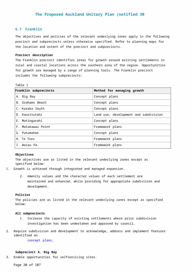
6.7 Franklin
The objectives and policies of the relevant underlying zones apply in the following precinct and subprecincts unless otherwise specified. Refer to planning maps for the location and extent of the precinct and subprecincts.
Precinct descriptionThe Franklin precinct identifies areas for growth around existing settlements in rural and coastal locations across the southern area of the region. Opportunities for growth are managed by a range of planning tools. The Franklin precinct includes the following subprecincts:
Table 1Franklin subprecincts Method for managing growth
A. Big Bay Concept plans
B. Grahams Beach Concept plans
C. Karaka South Concept plans
D. Kauritutahi Land use, development and subdivision controls
E. Matingarahi Concept plans
F. Matakawau Point Framework plans
G. Patumahoe Concept plans
H. Te Toro Framework plans
I. Waiau Pa. Framework plans
ObjectivesThe objectives are as listed in the relevant underlying zones except as specified below:
1. Growth is achieved through integrated and managed expansion.
2. Amenity values and the character values of each settlement are maintained and enhanced, while providing for appropriate subdivision and development.
PoliciesThe policies are as listed in the relevant underlying zones except as specified below:
All subprecincts1. Increase the capacity of existing settlements where prior subdivision investigation has been undertaken
and approved by council.
2. Require subdivision and development to acknowledge, address and implement features identified onconcept plans.
Subprecinct A. Big Bay3. Enable opportunities for selfservicing sites.
4. Enable subdivision and development opportunities that:a. achieve site sizes appropriate to the amenity and character of the subprecinct
b. requires lowerdensity sites at the edge of the settlement
c. limits growth through a contained village form
d. avoid inappropriate development in visually prominent locations including the Mako Point headland
e. include amenity and ecological enhancement plantings and protect these plantings and existing
Page 17 of 67
The Proposed Auckland Unitary Plan (notified 30 September 2013)
indigenous vegetation.
5. Require esplanade reserves on land adjoining the coast and other qualifying waterbodies.
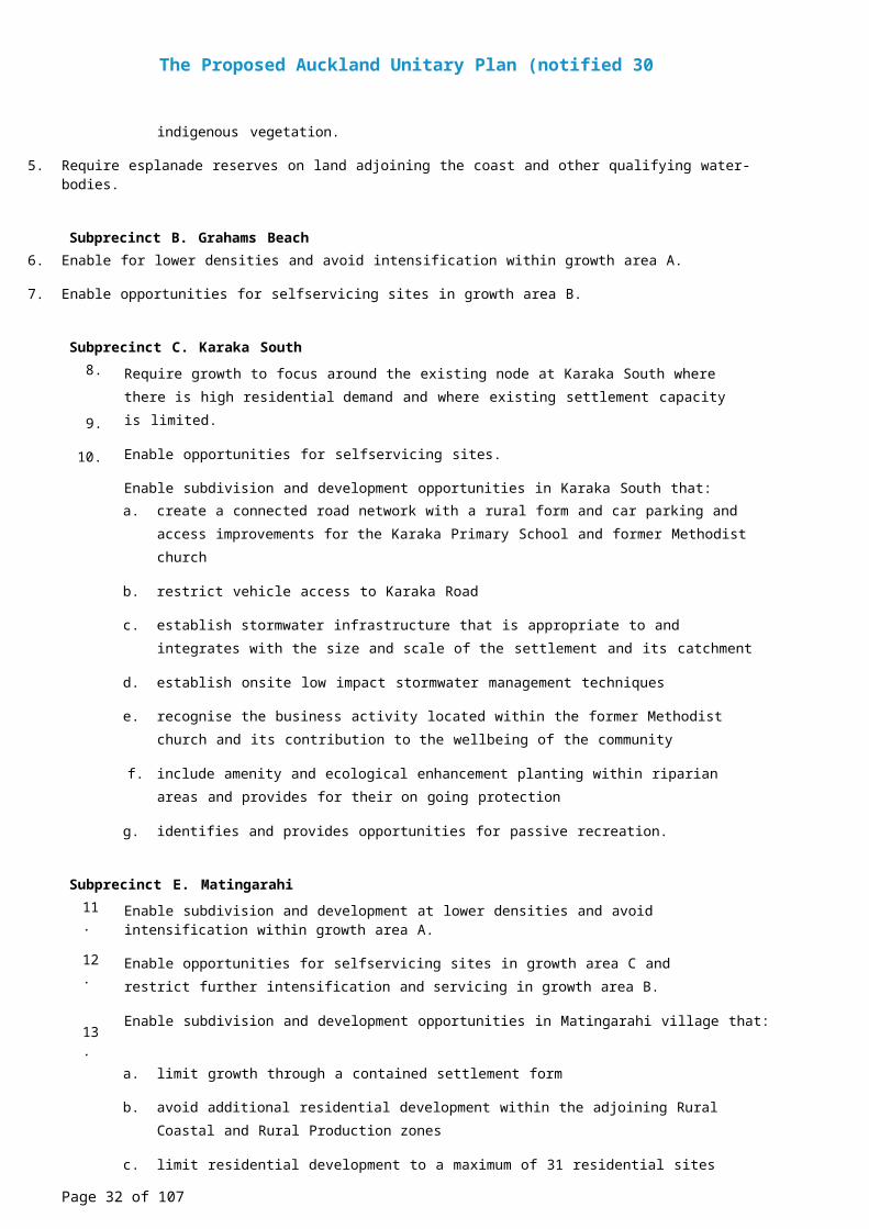
Subprecinct B. Grahams Beach6. Enable for lower densities and avoid intensification within growth area A.
7. Enable opportunities for selfservicing sites in growth area B.
Subprecinct C. Karaka South8.
9.
10.
Require growth to focus around the existing node at Karaka South where there is high residential demand and where existing settlement capacity is limited.
Enable opportunities for selfservicing sites.
Enable subdivision and development opportunities in Karaka South that:a. create a connected road network with a rural form and car parking and access improvements for
the Karaka Primary School and former Methodist church
b. restrict vehicle access to Karaka Road
c. establish stormwater infrastructure that is appropriate to and integrates with the size and scale of the settlement and its catchment
d. establish onsite low impact stormwater management techniques
e. recognise the business activity located within the former Methodist church and its contribution to the wellbeing of the community
f. include amenity and ecological enhancement planting within riparian areas and provides for their on going protection
g. identifies and provides opportunities for passive recreation.
Subprecinct E. Matingarahi11.
12.
13.
Enable subdivision and development at lower densities and avoid intensification within growth area A.
Enable opportunities for selfservicing sites in growth area C and restrict further intensification and servicing in growth area B.
Enable subdivision and development opportunities in Matingarahi village that:a. limit growth through a contained settlement form
b. avoid additional residential development within the adjoining Rural Coastal and Rural Production zones
c. limit residential development to a maximum of 31 residential sites (including three existing dwellings), distributed in accordance with the Matingarahi Village staging plan
d. provide a lowscale settlement that limits building coverage and height
e. encourage highquality building design
f. protect approximately 280ha of existing indigenous vegetation on properties described in certificates of title NA24A/278, NZ1129/72 and NA458/64
g. protect approximately 10ha of land revegetated with amenity and ecological enhancement plantings.
Page 18 of 67
The Proposed Auckland Unitary Plan (notified 30 September 2013)
h. provide community services within the neighbourhood centre zone for the well being of the local community.
14. Require esplanade reserves on land adjoining the coast and other qualifying waterbodies.
Subprecinct G. Patumahoe15.
16.
17.
18.
19.
20.
21.
Require a suitable transition or buffer between rural and urban land use at the northern boundary of the Patumahoe subprecinct
Retain existing trees on the northern boundary of the subprecinct during subdivision.
Maximise the number of dwellings developed within the subprecinct, to make efficient use of land and infrastructure while achieving an overall pattern and intensity of development compatible with the rural character of Patumahoe.
Enable a range of site sizes catering for different lifestyle choices, while maintaining a compact, centre focused urban form that is compatible with the current scale and development pattern of Patumahoe.
Require subdivision and design of residential, open space, and infrastructure to enhance landscape amenity and recreational values associated with the principal watercourse including the bush gully and waterfall area at the northwestern corner of the subprecinct.
Require esplanade reserves on subdivided land adjoining waterbodies.
Require the development of a pedestrian bridge across the principal watercourse running through the Patumahoe subprecinct.
Sub precinct F. Matakawa Point, Subprecinct H. Te Toro, Subprecinct I. Waiau Pa and SubprecinctD. Kauritutahi
22.
23.
24.
25.
Enable opportunities for selfservicing sites.
Enable comprehensively planned development and encourage the development of a framework plan in these subprecincts to ensure subdivision and development are designed and implemented in a coordinated manner.
Encourage consultation with any other owners of land within the subprecinct when preparing a framework plan.
Require a framework plan to demonstrate the interrelationship and future integration with:a. other land within the subprecinct, where a framework plan can only be prepared for part of the
subprecinct
b. any other neighbouring land within the settlement and surrounding environment
Page 19 of 67
The Proposed Auckland Unitary Plan (notified 30 September 2013)
6.8 Karaka 1
The objectives and policies of the underlying Light Industry zone do not apply in the following precinct. Refer to planning maps for the location and extent of the precinct.
Precinct descriptionThe Karaka 1 precinct adjoins the Southern Motorway and the Papakura Interchange. The underlying zone is Light Industry. The purpose of the precinct is to provide for the continued use and development of the New Zealand Bloodstock Karaka Sales Centre which attracts national and international visitors to its annual sales.
The primary activities undertaken within the precinct relate to the sale and auction of horses and stock. This activity includes buildings and areas within the precinct that are used for administrative offices associated with the sales centre, stables, horse exercise areas and parking and circulation areas. There is a need to support these activities by providing for a range of accessory activities such as onsite accommodation for staff, equestrian shows and competitions and reception functions. The precinct therefore enables these activities to be undertaken.
The extent of this precinct can be found in Precinct Plan 1: Karaka 1.
ObjectivesThe objectives for this precinct are those listed below. The objectives in the Light Industry zone do not apply.
1. Bloodstock sales and associated accessory activities continue to operate and any adverse effects on the environment are managed.
2. New buildings contribute positively to the character of the surrounding area.
PoliciesThe policies for this precinct are those listed below. The policies in the Light Industry zone do not apply.
1. Allow bloodstock sales and accessory activities to establish and operate within the precinct.
2. Restrict the scale, intensity, frequency and hours of operation of accessory activities.
3. Require the location and design of buildings and structures to avoid or mitigate adverse effects on adjoining residential zoned sites.
Page 20 of 67
The Proposed Auckland Unitary Plan (notified 30 September 2013)
6.9 Karaka 2
The objectives and policies of the underlying Local Centre, Mixed housing suburban and Single House zones apply in the Karaka 2 precinct unless otherwise specified. The location and extent of the precinct is shown in Precinct Plan 1. Karaka 2.
Precinct descriptionThe purpose of the Karaka 2 precinct is to provide for the integrated development of a small, spatially defined village centred at the intersection of Dyke, Blackbridge and Linwood Roads. The underlying zones include Local Centre, Mixed Housing and Single House. The Local Centre provided for within the precinct will enable the development of local retail, service and community activities to support the village and the wider rural community. Development in the Local Centre area is expected to occur in an integrated manner providing a high quality amenity and slow traffic and pedestrian environment. The precinct will also provide for both medium density and more traditional residential development therefore enabling local housing choice. Amenity tree planting is proposed along Linwood, Dyke and Blackbridge Roads to create an avenue along these roads and to contribute to a visually interesting and cohesive village environment.
ObjectivesThe objectives are as listed in the Local Centre, Mixed Housing Suburban and Single House zones except as specified below:
1. A range of residential living opportunities are created within a well connected village that includes a commercial and community centre.
2. Amenity is promoted through a slow speed road system characterised by tree planting.
3. Efficient infrastructure is provided to service the needs of the community.
4. Development maintains and enhances the public realm.
PoliciesThe policies are as listed in the Local Centre, Mixed Housing and Single House zones except as specified below:
1.
2.
3.
4.
5.
6.
7.
8.
9.
10.
Enable a range of residential living opportunities with more intensive housing located immediately adjacent to the business area.
Enable a compact, contained village form with a high level of amenity that is developed in accordance with its precinct plan.
Encourage the enhance streams and riparian areas.
Require a slow speed, pedestrian orientated village environment with pedestrian and roads access to the village from Linwood, Dyke and Blackridge roads.
Enable retail, service and community activities to establish in a pedestrian oriented Local Centre with active building frontages oriented to Linwood and Dyke Roads.
Provide a Village square as a focal point for the community.
Require development to establish a distinctive, sustainable rural community.
Require existing vegetation (particularly that on Lot 1 DP 40523 and Lot 1 DP 123078 and any subsequent legal descriptions should these properties be modified) to be incorporated into the design of subdivision and development.
Avoid large sites and self serviced individual sites.
Integrate and coordinate the provision of a reticulated wastewater treatment and disposal facility, water supply, stormwater and roads networks.
Page 21 of 67
The Proposed Auckland Unitary Plan (notified 30 September 2013)
11.
12.
13.
Avoid multiple small scale wastewater treatment and disposal systems.
Require integrated stormwater management using water sensitive design techniques.
Require an interconnected road network that has a rural village form and character and which is designed in accordance with the Karaka 2 Precinct Roading Typologies in Figure 1 3. Roading Typologies.
Page 22 of 67
The Proposed Auckland Unitary Plan (notified 30 September 2013)
6.10 Kelly's Cove
The objectives and policies of the underlying Single House, Public Open Space Informal Recreation and Public Open Space Conservation zones apply in the following precinct unless otherwise specified. Refer to planning maps for the location and extent of the precinct.
Precinct descriptionThe Kelly’s Cove precinct comprises approximately 70ha of land between the existing urbanised area of Beachlands to the west, and Te Puru Reserve and Whitford–Maraetai Road to the east. The underlying zones of the precinct are:
• Single house
• Public open space informal recreation
• Public open space conservation.
Special density controls and other provisions are applied to the Kelly’s Cove precinct so that development of this land is sensitive to the character and amenity values of the existing Beachlands settlement, the coastal environment and the reserve areas in the locality.
Objective1. Subdivision design protects and enhances the natural environment and responds to established
development patterns of the broader area and the coast.
Policies1. Protect and enhance the open gully system and natural ecosystems.
2. Design and locate subdivision and development using a road pattern which:a. limits access to WhitfordMaraetai Road and does not allow dwellings to front this road
b. locates dwellings to front Beachlands Road (west of Constellation Avenue)
c. reflects the rectilinear road pattern of the existing Beachlands Village with all connecting roads running northsouth to obtain views of the coastal reserve
d. adjoins coastal public open spaces and is designed to utilise the amenity of coastal views as well as providing public access.
Page 23 of 67
The Proposed Auckland Unitary Plan (notified 30 September 2013)
6.11 Kingseat
The objectives and policies of the underlying Single House, Mixed Housing Suburban, Local Centre, Light Industry and Public Open Space (Conservation, Informal Recreation, Sport and Active Recreation) zones apply in the following precinct and subprecincts unless otherwise specified. Refer to planning maps for the location and extent of the precinct and subprecincts.
Precinct descriptionThe Kingseat Precinct covers some 298 hectares. It adjoins the Whatapaka Creek of the Manukau Harbour (which is of significant importance to the Tangata Whenua of the area) and encompasses the existing Kingseat village, the former Kingseat Hospital site and parts of the surrounding rural area.
The purpose of the Kingseat Precinct is to provide for the integrated and comprehensively planned expansion of the urban village of Kingseat. The precinct provides the opportunity for an appropriately designed, managed, and environmentally sensitive town to serve this community and surrounding area. The precinct should be of a sufficient size and mass to provide a range of facilities and services, and accommodate the demands of growth. The precinct also gives recognition to the historic, cultural and environmental attributes, and character of the area, for example providing for the adaptive reuse of the former Kingseat Hospital site.
The Kingseat Precinct incorporates the provisions of the Kingseat Structure Plan and modifies the underlying Unitary Plan zones where appropriate to provide for the precinct's integrated and sustainable management.
The Kingseat Precinct comprises of the following subprecincts and areas with the following underlying zones:• Subprecinct A: Single House zone
• Subprecinct B:
• Area 1: Single House zone
• Area 2: Mixed Housing Suburban zone
• Area 3: Mixed Housing Suburban zone
• Area 4: Local Centre zone
• Area 5: Light Industry zone
• Subprecinct C: Single House zone
• Subprecinct D: Single House zone
Subprecinct ASubprecinct A encompasses the following buildings on the former Kingseat Hospital site and provides opportunities for their protection and reuse, as well as allowing for complementary new development:
1. a group of Heritage Buildings (Ancillary Hospital Buildings)
2. the Heritage Nurses Home
3. Heritage Villas 11, 12, and 13.
These buildings and protected trees are identified in on Kingseat precinct plan 3: Protected heritage place and protected trees in the map diagrams. The underlying zoning for subprecinct A is modified by specific provisions that promote the reuse of the heritage buildings on the former Kingseat Hospital site while recognising their heritage values. Subprecinct A also provides for activities that are complementary to the local centre, and that do not undermine the commercial and retail functions of the local centre.
Subprecinct B
Page 24 of 67
The Proposed Auckland Unitary Plan (notified 30 September 2013)
Subprecinct B applies to the land area surrounding and adjacent to the local centre. The purpose of sub precinct B is to:
1. provide for single house development in the large expanse of area outside of the local centre
2. create a compact residential area adjacent to the local centre and to maintain or enhance the historic heritage values of the former Kingseat Hospital site. In this respect the subprecinct also implements elements of the Kingseat Precinct Plan 4: Subprecinct Map A
3. provide a retail and commercial local centre.
Area 1Area 1 surrounds both the local centre and the land in subprecinct A that is not identified for adaptive reuse
the land in Area 2 below). It is zoned Single House.
Area 2Area 2 is located within the former Kingseat Hospital site and encompasses all of the areas not identified for adaptive reuse in subprecinct A that is within the local centre overlay. Its purpose is to provide for a more intensive form of housing that consolidates and supports the local centre while having regard to the amenity and heritage values of the former Kingseat Hospital site. It is zoned for Mixed Housing Suburban. Specific density provisions apply.
Area 3Area 3 is an area that surrounds the local centre. Its purpose is to provide for a more intensive form of residential development that consolidates and supports the local centre. It is zoned as Mixed Housing Suburban.
Area 4Area 4 is the local centre as identified on Kingseat precinct plan 2 and Kingseat precinct plan 8. It is zoned Local Centre. The local centre's purpose is to serve both the settlement and wider surrounding rural areas. Activities and development in this area is required to be consistent with design elements.
Area 5Area 5 is zoned as Light Industry and is identified on on Kingseat precinct plan: 1 Subprecincts and areas. Light Industry areas are required to be consistent with design elements. The Light Industry zone provides for a range of employment activities that complement the local centre.
Subprecinct CSubprecinct C provides a transition or rural interface area between the urban settlement in subprecinct B and the adjoining rural land. This subprecinct provides for a more spacious type of residential development set within larger grounds than in subprecinct B Area 1, and reflects the relationship with the adjoining rural areas. The larger minimum site requirements for development in this subprecinct are intended to reduce potential reverse sensitivity conflicts with adjoining rural activities and land uses, and recognises elements of rural character.
Subprecinct DKingseat precinct plan 1: Subprecincts and areas identifies this area as being located along the length of the coastal environment of the Whatapaka Creek. It provides a buffer and a transition between the urban settlement area and the coastal edge and environment. The provision of large spacious sites for subdivision and development in this subprecinct maintains the cultural heritage and natural environmental values of this area, and reduces potential adverse impacts upon the coastal environment. An area of conservation reserve (existing and proposed esplanade reserve) is identified along the coastal edge of the subprecinct providing a buffer to the coastal environment.
Page 25 of 67
The Proposed Auckland Unitary Plan (notified 30 September 2013)
ObjectivesThe objectives are as listed in the Single House, Mixed Housing Suburban, Local Centre, Light Industry and Public Open Space (Conservation, Informal Recreation, and Sport and Active Recreation) zones except as specified below:
1. All stormwater and wastewater infrastructure is adequately serviced and appropriately managed for the type, location and extent of subdivision and development, and the cultural heritage values of the coastal and stream environments are recognised.
2. The significant heritage, environmental and cultural values of the former Kingseat Hospital site are recognised and enhanced.
3. Subdivision and development, as well as adaptive reuse activities, takes place in a manner that accounts for the heritage value of buildings in the precinct, particularly those on the former Kingseat hospital site.
4. The existing amenity values and character of the Kingseat precinct, including the former Kingseat hospital site, the coastal environment of the Whatapaka Inlet of the Manukau Harbour, and its surrounding rural environment are maintained and enhanced.
5. The interface between urban, coastal and rural environments is recognised and protected.
6. The local centre is maintained or further developed in a way that achieves its key functions and role as a commercial and retail centre for the precinct.
7. A range of residential densities that support the development of an integrated multimodal transport system (private vehicles, public transport, walking, cycling) is provided.
8. Protected heritage places and the relationship of Mana Whenua to the surrounding area and Whatapaka Creek is recognised, provided for and protected by appropriate subdivision and development.
PoliciesThe policies are as listed in the underlying Single House, Mixed Housing Suburban, Local Centre, Light Industry and Public Open Space (Conservation, Informal Recreation, and Sport and Active Recreation) zones except as specified below:
1. Undertake subdivision and development in a manner that is consistent with the Kingseat Precinct Planin Map 2 and the controls that apply to the subprecincts.
2. Undertake subdivision and development within the former Kingseat Hospital site in a manner consistent with the subprecinct A Plan in Maps 4 and 5.
3. Require developers of the Kingseat precinct to provide appropriate stormwater infrastructure to service developments at no cost to the council.
4. Avoid large selfserviced individual sites.
5. Undertake subdivision and development in a manner that maintains, protects and/or enhances those elements identified on the Kingseat precinct plan and relevant planning maps that contribute towards protecting and/or enhancing:a. the existing amenity and character values of the coastal environment of the Whatapaka Inlet,
significant watercourses and riparian margins, significant trees and vegetation
b. heritage places including the former Kingseat Hospital site
c. the interface between the urban village / development areas and the adjoining rural and coastal environments.
6. The relationship of Mana Whenua with the coastal environment is recognised and protected, and in particular adverse effects on wāhi tapu and other taonga in land use and subdivision activities in close
Page 26 of 67
The Proposed Auckland Unitary Plan (notified 30 September 2013)
proximity to the coastal edge.
7. Promote and support the development of a defined local centre with an appropriate range of accessible, walkable and convenientlylocated retailing activities, service and commercial activities, and community facilities that serve the daytoday needs of the precinct and of residents in the wider area.
8. Ensure that subdivision and land use activities establish a transport network that provides for the safe and efficient movement of motor vehicles, pedestrians, horse riders (coastal and rural trails), and cyclists.
Page 27 of 67
The Proposed Auckland Unitary Plan (notified 30 September 2013)
6.12 Māngere 1
The objectives and policies of the underlying Light Industry zone apply in the following precinct unless otherwise specified. Refer to planning maps for the location and extent of the precinct.
Precinct descriptionThe purpose of this precinct is to accommodate the SPCA Auckland Animal Village at 50 Westney Road, Māngere. The SPCA was established on 1978 and is a regionally significant resource providing animal welfare and associated services for Auckland. The facility occupies approximately 40 per cent of the 4ha site and includes administration buildings, an animal hospital, dog and cat adoption facilities, kennels, stables, an on site custodian’s dwelling and a significant amount of land for grazing. The precinct is made up of three sub precincts A, B and C, which delineate the areas within which certain types of activities should take place.
The SPCA is located at the interface of land zoned mixed housing and light industry. Adjacent activities on residential zoned land include Zayed College for Girls immediately to the north, and a row of established houses occupying the land to the west on the opposite side of Westney Road.
Until recently, the site was relatively isolated from other activities, but gradual development of vacant land adjacent to the village has led to incompatible land uses being established in the area. This has created reverse sensitivity effects. It is therefore important to provide certainty about the range of activities that can occur on the site. The Māngere 1 Precinct Concept Plan provides guidance on how the site will be developed and used.
ObjectivesThe objectives for this precinct are those listed below. The objectives in the Business – Light Industry zone do not apply.
1. Certainty is given to current and future activities within the Māngere 1 precinct.
2. Adverse effects associated with current and future activities within the Māngere 1 precinct are recognised and managed.
PoliciesThe policies for this precinct are those listed below. The policies in the Business – Light Industry zone do not apply.
1. Require current and future activities to align with the Māngere 1 Precinct Concept Plan.
2. Protect the amenity of adjoining residential and education land uses through appropriate built form, scale and location and the implementation of best practice noise management.
3. Recognise the significance of the the animal welfare facility by avoiding competing land uses within the site.
Page 28 of 67
The Proposed Auckland Unitary Plan (notified 30 September 2013)
6.13 Māngere 2
The objectives and policies of the underlying Single House zone apply in the following precinct unless otherwise specified. Refer to planning maps for the location and extent of the precinct.
Precinct descriptionThe Māngere 2 precinct seeks to protect one of the first examples of cluster housing in New Zealand in Teo and Tioro lanes. This state housing was built in 1978 and is significant because it represents a change in the government’s housing policies relating to architectural and subdivision design.
ObjectiveThe objectives are as listed in the Single House zone in addition to that specified below:
1. The unique and established character of Teo and Tioro lanes is protected.
PoliciesThe policies are as listed in the Single House zone in addition to those specified below:
1. Manage the demolition of buildings to ensure that the established built character of Teo and Tioro lanes is protected.
2. Manage new development to ensure it does not detract from the established built and landscape character of Teo and Tioro lanes.
Page 29 of 67
The Proposed Auckland Unitary Plan (notified 30 September 2013)
6.14 Māngere Bridge
The objectives and policies of the underlying Single House zone apply in the following precinct unless otherwise specified. Refer to planning maps for the location and extent of the precinct.
Precinct descriptionThe Māngere Bridge precinct seeks to protect the traditional suburban development of the area, with single large houses on relatively large sites arranged around a distinctive street pattern of the area. In the older eastern half of the Māngere Bridge area, the streets follow a grid pattern. In the newer western half of the area, the streets are curvilinear with cul de sacs. Overall suburban development maintains a spacious character with site sizes ranging from 600m2 to 1000m2. The underlying zoning is the Single House zone.
ObjectiveThe objectives are as listed in the Single House zone in addition to that specified below:
1. The aesthetic qualities, including the spaciousness of Māngere Bridge's residential environment are maintained.
PolicyThe policies are as listed in the Single House zone in addition to that specified below:
1. Retain the spacious residential character of residential development located to the north of Māngere volcanic cone.
Page 30 of 67
The Proposed Auckland Unitary Plan (notified 30 September 2013)
6.15 Māngere Gateway
The objectives and policies of the underlying Future Urban and Light Industry zones apply in the following precinct unless otherwise specified. Refer to planning maps for the location and extent of the precinct.
Precinct descriptionThe Māngere Gateway precinct is comprised of land generally north of the northern runway of the Auckland International Airport and west of George Bolt Memorial Drive and Kirkbride Road. The area currently comprises mainly rural land, but also contains important resources such as the Makaurau Marae and papakāinga area, and the Ōtuataua Stonefields Historic Reserve. The underlying zone for subprecincts A, B and C is Light Industry, and for subprecinct D the underlying zone is Future Urban.
The Māngere Gateway precinct contains rules encouraging the establishment of a framework plan to implement the precinct objectives and policies. The precinct contains land use and development controls for:
• retail
• public open space
• yards
• landscape design.
The subdivision standards are specific to the subprecincts and control:• site size
• frontage
• rear sites
• protection of heritage and landscape features.
The area has significance extending over hundreds of years as a centre of food gathering and production. Local iwi fished from the harbour, harvested shellfish, grew kūmara in the highquality volcanic soils, and lengthened the growing season using volcanic rock gardens to heat the soils and increase drainage. Iwi have strong ancestral and spiritual associations with the whole area. It also contains significant natural, cultural and built heritage resources, and public open space.
Significant characteristics of subprecinct D include:Māori cultural associations with the area, including wāhi tapu. Examples include:
• The Ōruarangi awa into which some of subprecinct D drains, and the harvest of food from the awa
• The cultural and use values of the harbour, including coastal access, and harvesting of kaimoana
• The potential for koiwi and archaeological remain surviving under the pasture within the subject land
• The adjoining Māori special purpose zone, containing the Ihumātao Papakainga and Makaurau Marae, representing almost continuous Māori occupation of the Ihumātao Peninsula over many centuries.
Heritage and historic associations, including:• Cultivation of much of the area as part of a larger food production area over approximately eight
centuries by local Māori and (from the mid 19th century) Europeans
• Examples of 19th century dry stone walls
• Historic farmhouses
• The archaeological, architectural, cultural, historic, scientific and technological values associated with the natural and physical resources of Ihumātao that relate to both the Māori and European occupation
Page 31 of 67
The Proposed Auckland Unitary Plan (notified 30 September 2013)
and use of the land.
Landscape and amenity values, including;• The coastal environment east and north of the quarried Maungataketake cone, extending to the site of
the former Ihumātao Wesleyan Mission Station and farmstead and nearby settlements, which retains its rural context and surroundings
• The open space context within which the Ihumātao Papakainga and Makaurau Marae lies
• The open space context within which the Ōtuataua Stonefields Reserve lies
• Ihumātao Quarry Road and its rural context. This road passes through subprecinct D, and is the main entry road to the Ōtuataua Stonefields reserve.
The adjoining Ōtuataua Stonefields reserve, which contains and protects the bulk of know remnants of past farming practices and wāhi tapu. Within the reserve, the Ōtuataua and Pukeiti volcanic cones immediately adjoin subprecinct D
• Volcanic cone slopes and lava caves that extend into subprecinct D
• Ellett’s Quarry.
The council has identified a Māngere Gateway heritage route, part of which runs through this precinct to recognise the character and identity for this area. The entire route runs from Auckland International Airport to Māngere Bridge township and Māngere Mountain. The heritage route is intended to create a visitor experience highlighting the natural and cultural heritage resources of the Māngere area.
The precinct provisions should be read in conjunction with the Auckland Airport precinct.
Subprecinct AThis subprecinct covers approximately 25.5ha land fronting Kirkbride, Creamery and Ascot roads, with an extensive frontage to Kirkbride Road.
Subprecincts B and CThese subprecincts cover approximately 29ha east of Ōruarangi Road. They form part of the Māngere Gateway heritage area and, within the precinct, are the areas closest to the most sensitive cultural, heritage and landscape areas around Ōruarangi Road, the Ōtuataua Stonefields and the Ihumātao papakāinga.
Subprecinct DThis subprecinct covers the future urban areas located adjacent to the Ōtuataua Stonefields reserve.
Objectives1. Business activities in Kirkbride subprecinct are provided for, allowing for a range of low impact
commercial, office and light industrial activities.
2. The unique cultural, natural and built heritage resources of the Māngere Gateway area is recognised.
3. Consistent and highquality urban design and amenity standards, relating to streetscape, site design, and appearance are created and maintained along and adjacent to the Māngere gateway heritage route.
4. A limited range of business activities is provided for in the Ōruarangi subprecincts, including visitor related activities in the area of the heritage route.
Page 32 of 67
The Proposed Auckland Unitary Plan (notified 30 September 2013)
5. The relationship of Mana Whenua with their ancestral lands, water sites, wāhi tapu, and other tāonga is recognised.
6. The Māngere wastewater treatment plant is protected from the reverse sensitivity and other adverse effects of the land use and subdivision activities that could compromise its future operations.
7. Infrastructure, including road, cycle and pedestrian networks, public transport networks, stormwater and wastewater drainage networks and water, power, gas and telecommunication supply networks, is provided for within the precinct.
Page 33 of 67
The Proposed Auckland Unitary Plan (notified 30 September 2013)
Policies1. Encourage framework plans to be prepared in the Māngere Gateway subprecincts A, B and C prior to
subdivision, the establishment of land use activities and/or development that:a. retain opportunities within the Māngere Gateway precinct for warehousing and distribution
activities on sites of at least 4000m2 in area
b. achieve a high and consistent standard of amenity, particularly along the heritage route
c. incorporate consistent features, such as coherent street planting, street lighting and vehicle crossing placement and design.
2. Encourage consultation with any other owners of land within a subprecinct when preparing a framework plan.
3. Require the framework plan to demonstrate the interrelationship and future integration with:a. other land within the subprecinct, where a framework plan can only be prepared for part of the
subprecinct
b. any neighbouring subprecinct (including within the Auckland Airport precinct).
4.
5.
6.
7.
8.
9.
10.
11.
12.
13.
14.
15.
16.
17.
Require a high standard of urban design for subdivision and land use activities, including the location and design of buildings, outdoor areas and signs, and avoid or mitigate adverse effects on the natural, cultural, built heritage and landscape values.
Enable the safe and efficient movement of vehicles, cyclists and pedestrians through well designed street network, with particular regard to maintenance of residential amenities in the Māori Purpose zone.
Require development of the heritage route, Ōruarangi Road and adjoining areas to integrate the natural and built environment through design elements.
Establish protocols in the consent process to manage any finding of archaeological interest, including wāhi tapu that may be identified through development works.
Require subdivision and land use activities in subprecinct A to avoid or mitigate any potential for significant adverse effects, including reverse sensitivity effects on the operations of the Māngere Wastewater Treatment Plant.
Avoid any new road access from Kirkbride Road.
Enable large scale warehousing in subprecinct B.
Restrict activities to appropriately scaled visitor and tourist facilities in subprecinct C that will not compromise existing heritage features, include the Paul Homestead.
Require business activities in subprecinct A to avoid adverse effects on the adjacent residential areas.
Recognise the public open space adjoining the Waitomokia Creek as having important natural, landscape and heritage values.
Require the establishment of an 18mwide area public open space between subprecinct C and the Māori Purpose zone as a buffer between urban development and the papakāinga.
Require a structure plan for subprecinct D to take into account significant cultural heritage and landscape values associated with this area.
Require the structure plan for subprecinct D to include consultation with Mana Whenua to identify significant Māori cultural associations with the area, and identify wāhi tapu.
Require large scale buildings in subprecinct D to avoid adverse impacts on the features and values of significance in the area.
Page 34 of 67

The Proposed Auckland Unitary Plan (notified 30 September 2013)
Page 35 of 67
The Proposed Auckland Unitary Plan (notified 30 September 2013)
6.16 Māngere Puhinui
The objectives and policies of the underlying Rural Production zone, Public Open Space Informal Recreation zone, Coastal Transition zone and Special Purpose Cemetery zone apply in the following precinct unless otherwise specified. Refer to planning maps for the location and extent of the precinct.
Precinct descriptionThe Mangere Puhinui precinct is comprised of land to the north and east of the Auckland International Airport, outside of the rural urban boundary. It includes areas of Mangere and Puhinui which were once main areas of Māori settlement (c1000AD – 1860s) as documented in the Report of the Waitangi Tribunal on the Manukau Claim 1985, and which are now largely in rural or public open space use today.
Mangere and Puhinui were strategic areas for settlement by early Māori due to their proximity to the coast (Manukau Harbour and its tributaries) for collecting kaimoana and access, fertile soils for food growing, and maunga for defense purposes. Evidence of Māori settlement has been and continues to be identified through the large number of archaeological sites found within the Mangere and Puhinui areas, and documenting of history passed through the generations of local iwi.
The area contains important geological features, including Pukaki Lagoon, Crater Hill, Mangere Lagoon Explosion Crater, Puketutu Island, and the remnants of Maungataketake. Most of these have been modified through quarrying, but the remnants still remain. The volcanic soils of Mangere and Puhinui are well known as a prolific food growing area, particularly compared to other areas around the region, due to the highly fertile soils, moderate climate and gentle topography.
Mangere Mountain, Pukeiti, and Otuataua also form part of the Mangere volcanic field in the locality, however these are protected via the Public Open Space Conservation zone controls. Waitomokoia which is located within the Villa Maria Estate and within the urban boundary sits outside of the precinct.
The purpose of the precinct is to recognise the relationship and values that tangata whenua have with the area, maintain an open rural character and areas for food growing, and to protect waahi tapu from being destroyed during site development. The purpose of the precinct is also to protect the significant geological features that remain in the area from damage or further development.
The underlying zones are Rural Production, Public Open space – Informal Recreation, Coastal Transition, and Special Purpose – Cemetery.
The precinct should also be read in conjunction with the Mangere Gateway Precinct.
ObjectivesThe objectives are as listed in the Rural Production zone, Public Open Space – Informal Recreation zone, Coastal Transition zone, and Special Purpose – Cemetery zone except as specified below:
1. Landscape features, areas of high landscape quality, and areas with high levels of sensitivity to landscape modification are protected.
2. The open rural character of the Mangere Puhinui area is maintained, and soil resources are managed in a way that retains their productive potential.
3. Natural and cultural heritage resources are protected.
4. Recognition or provision is made for the relationship of tangata whenua and their culture and traditions with their ancestral lands, water, sites, waahi tapu and other taonga.
5. The natural coastal environment of the Manukau Harbour coastline and its tributaries is preserved.
Page 36 of 67
The Proposed Auckland Unitary Plan (notified 30 September 2013)
PoliciesThe policies are as listed in the Rural Production zone except as specified below:
1. Require buildings to be sited and designed to avoid any adverse effects on the rural character and visual amenity values of the Mangere Puhinui area.
2. Require development to avoid adverse effects on the landscape amenity values of the area, particularly in areas of high quality landscapes.
3. Avoid adverse effects on natural heritage resources, including geological features and high class soils.
4. Require the use or development of land to avoid adverse effects on the relationship of tangata whenua with their lands.
5. Require development to avoid adverse effects on any sites of historic, cultural or spiritual significance to tangata whenua.
Page 37 of 67
The Proposed Auckland Unitary Plan (notified 30 September 2013)
6.17 Manukau
The objectives and policies of the underlying Metroplitan Centre zone apply in the following precinct unless otherwise specified. Refer to planning maps for the location and extent of the precinct.
Precinct descriptionManukau Square is a focus of activity in the Manukau metropolitan centre and contributes to a high standard of amenity in the area. This precinct seeks to protect the admission of sunlight to Manukau Square during the daytime hours when it will be commonly used and will maintain both the amenity of this square and its function as a community focal point. To achieve this, building controls are placed on sites adjacent to Manukau Square to ensure adequate sunlight for seated areas in the square.
ObjectiveThe objectives are as listed in the Metropolitan Centre zone in addition to that specified below:
1. Manukau Square receives direct sunlight to maintain its amenity and retains its function as a focus of community activity.
PoliciesThe policies are as listed in the Metropolitan Centre zone in addition to that specified below:
1. Control the built form of development on sites adjacent to Manukau Square, to ensure the admission of sunlight to areas of seating and pedestrian movement during times of high use.
Page 38 of 67
The Proposed Auckland Unitary Plan (notified 30 September 2013)
6.18 Mill Road
The objectives and policies of the underlying Single House zone apply in the following precinct unless otherwise specified. Refer to planning maps for the location and extent of the precinct.
Precinct descriptionThe purpose of the precinct is to allow residential development while establishing a defensible urban boundary along Mill Road in the form of a vegetation buffer. The precinct covers 5.1ha of land at 49, 57 and 71 Mill Road and is zoned as Single House zone in the Unitary Plan.
ObjectiveThe objectives are as listed in the Single House zone except as specified below:
1. The topographical constraints of the Mill Road precinct are recognised.
PoliciesThe policies are as listed in the Single House zone except as specified below:
1. Limit the total number of residential sites in the Mill Road precinct to 45.
2. Require development to be sensitive to the topography of the area.
Page 39 of 67
The Proposed Auckland Unitary Plan (notified 30 September 2013)
6.19 Papakura
The objectives and policies of the underlying Metropolitan Centre zone apply in the following precinct unless otherwise specified. Refer to planning maps for the location and extent of the precinct.
Precinct descriptionThe purpose of the Papakura precinct is to ensure that thea key pedestrian linkage between the Papakura railway station, a key part of the southern rapid transit corridor, and the Papakura metropolitan centre is retained. The pedestrian linkage and frontage controls will facilitate access to public transport as the metropolitan centre grows.
Objectives1. Pedestrians have convenient and safe access to the Papakura railway station. that is a key
2. Multimodal passenger transport facilities are integrated with business and residential development.
Policy1. Improve pedestrian accessibility between the metropolitan centre and Papakura railway station.
Page 40 of 67
The Proposed Auckland Unitary Plan (notified 30 September 2013)
6.20 Pararēkau and Kōpuahingahinga Islands
The objectives and policies of the underlying Countryside zone apply unless otherwise specified. Refer to planning maps for the location and extent of the precinct.
Precinct descriptionPararēkau and Kōpuahingahinga islands are located within the Pahurēhure Inlet of the Manukau Harbour. The Hingaia Peninsula lies to the south of the islands, with the established residential suburbs of Conifer Grove and Wattle Downs to the north. As a result, the majority of land located close to Pararēkau and Kōpuahingahinga islands is, or will become, urban. Historically, Pararēkau Island has operated as a pastoral farm located within a wider rural environment.
The purpose of the precinct is to provide for the subdivision and development of Pararēkau Island for countryside living. It will retain and enhance the ecology and character that contributes to the amenity of the area.
The precinct allows for a 11 site subdivision of land on Pararēkau Island while providing for limited public access, protection of sites of significance, including Kōpuahingahinga Island and establishment of vegetation along the coastal edge. Development is managed by precinct plan 1 which shows subdivision layout and precinct plan 2 which shows landscaping and access area plans.
Water quality and coastal margins will be safeguarded through the incorporation of stormwater treatment mechanisms in the precinct. Development will be required to conform with the approved stormwater catchment management plan for Pararēkau Island, which includes measures to avoid or mitigate the potential for sediment removal and flooding.
ObjectivesThe objectives are as listed in the Countryside Living zone except as specified below.
1. Pararēkau Island is developed in a manner that retains and enhances the island’s amenity and heritage values, and mitigates potential adverse environmental effects.
2. The natural character of the coastal environment of Pararēkau and Kōpuahingahinga islands are protected from inappropriate subdivision, use and development.
3. The open space and rural character of the islands is protected.
4. The landscape, heritage and ecological values of Kōpuahingahinga Island are protected and enhanced.
5. Safe public access to and along the coastline of the islands is provided.
6. Coastal erosion on the islands and causeways is managed in a precautionary way to avoid hazards from coastal erosion and rising sea levels.
PoliciesThe policies area as listed in the Countryside Living zone except as specified below.
1. Enable the comprehensive development of Pararēkau Island for lowdensity countryside living activities in a manner that:a. creates a permanent pattern of settlement
b. provides a high quality of amenity for residents and visitors
c. preserves the natural character of the coastal environment from inappropriate subdivision, use, or development
d. protects and enhances the landscape character and rural amenity values of the island
e. retains the largely unbuilt landscape
Page 41 of 67
The Proposed Auckland Unitary Plan (notified 30 September 2013)
f. provides safe public pedestrian and cycle access to, and around, the island
g. incorporates appropriate landscaping within Pararēkau Island and the retention of the native vegetation of Kōpuahingahinga Island.
2. Protect the ecological, heritage, visual amenity and landscape values of Kōpuahingahinga Island from inappropriate subdivision use and development.
3. Require an integrated, sustainable approach to the management of development on the islands and the causeways, and to coastal hazard risk including coastal erosion and sea level changes due to climate change.
4. Recognise the importance of the natural coastal margins as a form of coastal defence and as an environmental, social and cultural resource.
Page 42 of 67
The Proposed Auckland Unitary Plan (notified 30 September 2013)
6.21 Pine Harbour
The objectives and policies of the underlying Marina, Mixed Housing Suburban, and Terrace Housing and Apartment Buildings zones apply in the following precinct unless otherwise specified. Refer to planning maps for the location and extent of the precinct.
Precinct descriptionPine Harbour marina is located in Beachlands. It is a public transport node which provides passenger ferry services to the Auckland Central Business District for the Beachlands and Maraetai settlements and the surrounding rural area. A higher density of development is provided for in the Pine Harbour precinct to reinforce its role as a passenger transport node.
The Pine Harbour precinct provides for the mixed used development of the landward component of the Pine Harbour marina into a distinctive marina based community. The precinct covers approximately 11ha.
The key purpose of the Pine Harbour precinct is to implement the precinct plan (Precinct plan 1: Pine Harbour precinct Extent of areas 13) to ensure that the precinct creates high quality mixed use development which is integrated with the wider Beachlands settlement. The integration of the built form (including buildings, street pattern and open spaces) with the existing Beachlands settlement (along the northern boundary) and the adjoining Beachlands precinct (along the eastern boundary) is important. The Pine Harbour precinct plan includes provision for a road connection with Karaka Road in the event that the existing reserve located at the Karaka Road and Sunkist Bay Road intersection is not developed.
The precinct is divided into three subprecincts for marina, residential and open space purposes. Precinct plan 1 also identifies the indicative location of the stormwater management area. This covers the existing watercourse, stormwater pond and the area which may be required for the future expansion of the pond. The longterm objective is to investigate the rehabilitation of the watercourse with riparian planting on either side where practicable. The stormwater management area is to remain in private ownership and is not required to be vested in the council.
Subprecinct A: Marina
Area 1 IndustryArea 1 provides specifically for marine industrial activities. Marine related uses which are nonindustrial in nature(such as offices and marine retail) are noncomplying activities to recognise the limited spatial extent of Area 1. This is to ensure that nonmarine industrial activities do not undermine the efficient use of this limited space. Area 1 has a maximum building height of 9m and a building restriction line to ensure that coastal views from the established residential area along Pine Harbour Parade are generally retained.
Area 2 CommercialArea 2 covers the existing commercial buildings and the additional area which may be required for future commercial buildings servicing the marina and marinerelated uses, such as marine retail and offices. Area 2 does not provide for marine industrial activities. Area 2 is located adjacent to the current ferry berthing area.
Buildings within Area 2 front onto the subprecinct B Open Space area to form a strong edge and define the open space.
Subprecinct B: Open SpaceSubprecinct B overlooks the Marina and will be bordered by a range of mixed use buildings. It is to operate as a multifunctional area and is the “green heart” of Pine Harbour. The green itself will be largely free of landscape interventions or buildings and can be used for a range of passive recreational activities.
Subprecinct B incorporates a future plaza area between subprecinct C Area 4 (Northern Apartments) and sub
Page 43 of 67
The Proposed Auckland Unitary Plan (notified 30 September 2013)
precinct C Area 5 (Southern Apartments). This plaza is the pedestrian extension of Ninth View Avenue into Pine Harbour from the Beachlands Precinct. The landscape features of this plaza will provide a strong focal connection through to the Marina itself.
The Pine Harbour precinct plan illustrates the location of the future excavation area to extend the marina. The provisions of subprecinct B will continue to apply to this area until resource consent for the extension of the marina is granted.
Subprecinct C: ResidentialSubprecinct C contains the residential components of the Pine Harbour precinct. It consists of three distinct areas: Transition (Area 3), Northern Apartments (Area 4) and Southern Apartments (Area 5).
Area 3 TransitionArea 3 is the transitional area between the existing low density residential development in Beachlands and the higher density apartments within the Pine Harbour precinct. Mixed Housing Suburban zone provisions apply to Area 3. The purpose of Area 3 is to ensure transitional quality and integration with existing Beachlands urban area and the Beachlands Precinct.
Area 4 – Northern Apartments and Area 5 – Southern ApartmentsTerrace Housing and Apartment Buildings zone is applied to Area 4 (Northern Apartments) and Area 5 (Southern Apartments). The majority of Area 4 is to contain apartments up to four storeys high and Area 5 up to three storeys high.
The Additional Height Overlay areas shown in the Pine Harbour precinct plan enable maximum height of 18m, which allows for apartments of five storeys. These buildings are key marker buildings, which require the design to clearly address each street frontage. The additional height will be used to articulate the prominence of the corners.
The Mixed Use overlay areas shown in the Pine Harbour precinct plan enable the ground floor of apartment buildings to be designed to allow for either commercial or residential use.
The objectives and policies of the underlying Marina, Mixed Housing Suburban and Terrace Housing and Apartment Buildings zones apply in the Pine Harbour precinct unless otherwise specified. Refer to planning maps for the location and extent of the precinct and subprecincts.
ObjectivesThe objectives are as listed in the Marina, Mixed Housing Suburban and Terrace Housing and Apartment Buildings zones except as specified below:
1. The precinct allows for the development of an integrated mix of residential, business, open space and marine related activities, creating a distinctive marina based community.
2. An appropriate development density and mix of land uses are provided in the precinct to support its function as an efficient passenger transport node.
3. The precinct is integrated with both the existing and future urban form of the Beachlands settlement (including the Beachlands 1 precinct area).
4. A safe and efficient transport network is integrated and connected with the existing and planned transportation network, including connections between Beachlands and Pine Harbour.
5. Public access is maintained, enhanced and integrated with the public open space zoned land, coastal marine area and the Beachlands 1 precinct.
6. A high amenity environment is created through the placement and design of buildings, roads and open spaces recognising the coastal setting of Pine Harbour Marina.
Page 44 of 67
The Proposed Auckland Unitary Plan (notified 30 September 2013)
7. Stormwater infrastructure is provided in an effective and efficient way, including integration with the wider catchment.
8. Water and wastewater infrastructure is provided in an effective and efficient way, including the ability to connect to the BeachlandsMaraetai Sewage Treatment Plant.
PoliciesThe policies are as listed in the Marina, Mixed Housing Suburban and Terrace Housing and Apartment Buildings zones except as specified below:
1. Require land use, subdivision and development to be generally in accordance with the Pine Harbour Structure Plan shown in Figure 1.
2. Provide for increased development density to promote the role of the precinct as a passenger transport node.
3. Provide for a range of activities at a scale complementary with the amenity values of the precinct.
4. Require the layout, form and design of buildings, roads and open spaces within the precinct to:a. integrate with the existing and future form of the Beachlands settlement (including alignment of
roads);
b. address potential adverse effects on adjoining land uses;
c. assist with the implementation of transportation connections between Beachlands and Pine Harbour;
d. assist with the integration of passenger transport services;
e. create opportunities for multifunctional, safe, passive or active recreation;
f. ensure ongoing public access to the coastal marine area;
g. ensure the provision of walkways providing pedestrian linkages through the precinct; and
h. recognise and provide for the character of the coastal environment and its associated amenity values.
5. Require potential adverse effects (including reverse sensitivity) of any development and activities within the precinct on the character of the coastal environment and on the amenity values of the surrounding area to be avoided, remedied or mitigated.
6. Require that all development is connected to a public reticulated wastewater treatment and disposal system.
Page 45 of 67
The Proposed Auckland Unitary Plan (notified 30 September 2013)
6.22 Pukekohe Hill
The objectives and policies of the Single House, Large Lot, Countryside Living and Rural Production zone(s) apply in the Pukekohe Hill precinct unless otherwise specified. Refer to planning maps for the location and extent of the precinct.
Precinct descriptionThe Pukekohe Hill precinct covers approximately 196ha of land and is located at the southern urban edge of Pukekohe.
Development with the precinct addresses groundwater recharge effects by limiting the amount of impervious surfaces and requiring specified onsite stormwater detention and soakage systems together with the need to protect the heritage and amenity values of the summit and the northern slopes of Pukekohe Hill.
All subdivision and development within the area should be generally in accordance with the Pukekohe Hill concept plan.
The precinct includes five subprecincts:• Pukekohe Hill SubPrecinct A which covers the underlying Single House zone
• Pukekohe Hill SubPrecinct B which covers the underlying Large Lot zone
• Pukekohe Hill SubPrecinct C which covers the underlying Countryside Living zone
• Pukekohe Hill SubPrecinct D which covers the underlying Countryside Living Zone (but has additional activity controls)
• Pukekohe Hill SubPrecinct E which covers the underlying Rural Production Zone
The precinct provides for the preparation of framework plans designed to accommodate development whilst protecting vegetation, views and the character of the landscape.
ObjectivesThe objectives as listed in the Single House, Large Lot, Countryside Living and Rural Production zone(s) apply in addition to the objectives specified below.
1. Subdivision and development is designed to complement and integrate with the rural landscape character.
2. Stormwater runoff, flooding, soil erosion and siltation from the Pukekohe Hill precinct are minimised.
3. Significant heritage and amenity values of the summit and the northern slopes of Pukekohe Hill are protected from inappropriate development.
PoliciesThe policies as listed in the Single House, Large Lot, Countryside Living and Rural Production zone(s) apply in addition to the policies specified below.
1. Contain subdivision within the boundaries of the Pukekohe Hill precinct.
2. Require subdivision and development to incorporate sustainable stormwater management systems including onsite detention and soakage to ground.
3. Enable council to provide a stormwater system as generally shown on the Pukekohe Hill precinct plan.
4. Restrict the size of sites to minimise the effects of development on the open landscape character of the area.
5. Maintain the open landscape character of the middle and upper slopes by graduating the intensity of
Page 46 of 67
The Proposed Auckland Unitary Plan (notified 30 September 2013)
development from the bottom to the top of Pukekohe Hill.
6. Control development in subprecincts D and E with respect to:a. its design and appearance relative to the Hill's form and shape, natural vegetation, pattern of rural
land uses and the position and appearance of the structures and roads on it, and
b. the extent to which it would be visually incongruous with the Hill or incompatible with other developments in the vicinity.
7. That views from the public reserves at the summit of Pukekohe Hill be protected and, where possible, enhanced.
8. Design subdivision and development to:a. minimise the amount of earthworks
b. avoid modifying natural watercourses
c. incorporate sustainable stormwater management design including onsite detention and groundwater recharge.
9.
10.
11.
Encourage the use of public roads as a buffer between residential and rural land uses.
Encourage the preparation and development of framework plans in subprecinct B to manage growth in a manner that supports a liveable rural urban environment whilst protecting the open landscape values of Pukekohe Hill.
Discourage amendments to approved framework plans, unless they ensure:a. that development is clustered in areas that are not prominent when viewed from beyond the Hill to
the north, or from other public places such as roads and walkways
b. a decrease in site density from the lower slopes of the Hill to the upper slopes continues
c. sites and dwellings are served by the minimum number of access points off roads
d. subdivision and associated development can achieve a comprehensive, complementary and consistent character through the use of design guidelines, covenants or similar mechanisms.
Page 47 of 67
The Proposed Auckland Unitary Plan (notified 30 September 2013)
6.23 Rosella Road
The objectives and policies of the underlying Single House zone apply in the following precinct unless otherwise specified. Refer to planning maps for the location and extent of the precinct.
Precinct descriptionThe Rosella Road precinct seeks to protect the group of californian bungalows, transitional bungalow cottages, english cottage and english cottage revival houses built around the 1920s and 1930s in Rosella Road, Mangere East. The precinct seeks to protect building spacing, orientation, setback, scale, height, roof forms and the extent of site coverage.
ObjectiveThe objectives are as listed in the Single House zone in addition to that specified below.
1. The unique and established character of Rosella Road is protected.
PoliciesThe policies are as listed in the Single House zone in addition to those specified below.
1. Manage the demolition of buildings so that the established built character of Rosella Road is protected.
2. Manage new development so it does not detract from the established built and landscape character of Rosella Road.
Page 48 of 67
The Proposed Auckland Unitary Plan (notified 30 September 2013)
6.24 Runciman
The objectives and policies of the underlying Countryside Living zone apply in the following precinct unless otherwise specified. Refer to planning maps for the location and extent of the precinct
Precinct descriptionThe Runciman precinct is located east of Pukekohe in the vicinity of Runciman.
The purpose of the Runciman precinct is to provide a rural countryside living opportunity where subdivision and development is able to be undertaken in a comprehensive and integrated manner recognising the environmental values and character of the area.
The Runciman precinct contains two subprecincts. These are Runciman subprecinct A – Hills and Runciman sub-precinct B Flats. Runciman subprecinct A – Hills is a lower density environment with a lower capacity to absorb development. Runciman subprecinct B Flats, has the greater potential to absorb development. Both subprecincts use a clustering method for managing development. The precinct is considered unsuitable for transfer development sites due to the sensitivity of the landscape. The precinct is characterised by a number of waterways which can be enhanced to improve terrestrial and aquatic biodiversity, catchment quality and the natural environment.
The precinct incorporates the following plans:
Precinct Plan 1: Landscape and Visual Absorption Capacity Plan Precinct Plan 2: Reserves and ConnectionsPrecinct Plan 3: Natural and Physical Resources Precinct Plan 4: Riparian CorridorsPrecinct Plan 5: Park Concept Plan Development Areas
ObjectivesThe objectives are as listed in the Countryside Living zone except as specified below:
1. Rural countryside living is managed in an integrated manner recognising the location and visual characteristics, existing environment and natural values, and relationship to the surrounding area with good accessibility to major transport networks (in particular State Highway 1).
2. Rural countryside living subdivision and development is accommodated in a form that has an open and spacious rural character.
3. Rural countryside living subdivision and development recognises the area’s distinct landscape characteristics.
4. Subdivision and development results in significant environmental benefits, protecting, enhancing and/or restoring ecological values and natural features.
5. Subdivision and development provides appropriately designed and functioning infrastructure.
6. Subdivision provides for safe, wellconnected vehicle access and recreation trails.
PoliciesThe policies are as listed in the Countryside Living zones except as specified below:
1. Manage rural countryside living through a comprehensive process to direct and guide development and subdivision to achieve development that is integrated with the natural and physical environment and infrastructure.
2. Require rural countryside living subdivision, use and development to achieve an open and spacious rural character and recognises existing landscape characteristics and attributes by:a. limiting the density of sites in a manner appropriate to rural countryside living
Page 49 of 67
The Proposed Auckland Unitary Plan (notified 30 September 2013)
b. promoting subdivision opportunities based on the extent of identified landscape areas and their visual absorption capacity
c. enabling cluster style rural countryside living, ensuring that specified building areas are grouped in clusters and that clusters are separated from identified road corridors and other clusters, to achieve an appropriate form of open spacious rural character in between clusters
d. requiring separation distances between specified building areas located outside clusters
e. Locating specified building areas and dwellings to integrate these within the undulating landforms, steep slopes and prominent ridgelines
f. establishing visual amenity enhancements (screening, landscaping or woodlots) and incorporating notable vegetation and retention of rural structures into the design and layout
g. avoiding linear ribbon subdivision and development along road corridors
h. avoiding urban forms of residential subdivision
i. avoiding significant modifications to landforms and natural features
j. avoiding the precinct being used as a receiver environment for transferable rural site subdivision rights.
3.
4.
5.
6.
7.
8.
9.
10.
11.
Require the integrated and comprehensive development of sites to ensure that the adverse effects of development are managed and all environmental enhancement obligations are implemented.
Prevent the creation of further sites where subdivision entitlements have been fully utilised so as to avoid undermining the precinct's character.
Avoid adverse effects on the visual landscape character of the road corridors and the area as a whole by preventing the further fragmentation of existing smaller rural sites (less than 5 hectares).
Protect and enhance the ecological values of existing indigenous vegetation and wetlands, and plant, restore and protect the riparian margins of streams to develop riparian corridors.
Promote efficient low impact infrastructure serving subdivision and development.
Require subdivision and development to provide an appropriate wastewater disposal system and low impact stormwater discharge system to service the proposal.
Establish a network of recreational trails for walking, cycling and horse riding.
Avoid adverse effects on nationally and regionally significant infrastructure.
Provide for opportunities for appropriate rural activities to be integrated with countryside living.
Page 50 of 67
The Proposed Auckland Unitary Plan (notified 30 September 2013)
6.25 Takanini
The objectives and policies of the following underlying zones apply to the subprecincts below, unless otherwise specified:
Subprecinct A:• Public Open Space Informal Recreation
• Light Industry
• Mixed Housing Suburban.
Subprecinct B: Local Centre Subprecinct C: Mixed UseSubprecinct D: Mixed Housing Suburban Subprecinct E: Single House .
Refer to Takanini Precinct Plan 1 for the location and extent of the Takanini precinct and subprecincts. Figure 1 relates to soakage pit requirements. Takanini Precinct Plan 2 is a landscape plan for subprecinct A. Takanini Precinct Plan 3 identifies two retail areas within subprecinct C (Areas 1 and 2).
Precinct descriptionThe Takanini precinct applies to some 320 hectares of land. The precinct is divided into 5 subprecincts (A to E) which seek to encourage the subdivision and development of this land in a comprehensive manner to achieve a quality built and wellconnected environment.The Takanini precinct contains development controls in response to known geotechnical limitations.
Subprecinct ATakanini subprecinct A applies to some 41.5 hectares of land between the Papakura Stream, Takanini School Road, Manuroa Road and Porchester Road. This land is currently undeveloped. The subprecinct provisions include specific development controls relating to vehicle access, overland flowpaths and geotechnical constraints. Subdivision is to be in compliance with Takanini Precinct Plan 1 in order to require connections to the surrounding area.
The underlying zones within the subprecinct are:• Public Open Space Informal Recreation
• Light Industry
• Mixed Housing Suburban
Subdivision and development in subprecinct A must comply with the landscape plan in Takanini Precinct Plan 2.An extension to the Mahia Branch Sewer is proposed within subprecinct A. Its indicative location is shown on Takanini Precinct Plan 1. A Mahia Branch Sewer Network Utility Yard applies to subprecinct A to protect the future alignment of the Sewer Line.When proposing a new site or building part or all of which will be located within the Mahia Branch Sewer Line Network Utility Yard, consultation with Watercare Services Limited is advised. Evidence of consultation with and support or comments from Watercare should be included in the subdivision or resource consent application.
Subprecinct BTakanini subprecinct B applies to some 4.5 hectares of land with frontage to Porchester Road. This land is currently undeveloped. Subdivision and development should achieve a quality and wellconnected environment, which will principally serve the local convenience needs of the surrounding residential area within Takanini sub precinct D. The preparation and development of framework plans is encouraged in this subprecinct to avoid ad hoc development. The underlying zone is Local Centre.
Page 51 of 67
The Proposed Auckland Unitary Plan (notified 30 September 2013)
Subprecinct CTakanini subprecinct C applies to some 5.4 hectares of land bounded by Walters Road, Arion Road and the North Island Main Trunk Railway. This land is partly developed. This subprecinct is intended to provide a transition between the Takanini Town Centre and residential land in Takanini subprecinct D. It provides for residential and smaller scale commercial activity that does not cumulatively affect the viability of nearby centres. A mix of activities is encouraged in this subprecinct, however there is a limitation on the total gross floor area of large format retail. This limitation is intended to ensure that development is of a scale that isappropriate to the adjoining residential area. Subprecinct C is also subject to a number of development controls in response to known geotechnical limitations. The underlying zone is Mixed Use.Takanini Precinct Plan 3 identifies two retail areas within subprecinct C (Areas 1 and 2), for which special provision is made in the activity table.
Subprecinct DTakanini subprecinct D applies to some 214 hectares of land throughout the wider precinct, and covers the largest land area of the five subprecincts. It also contains a number of development controls in response to known geotechnical limitations which have been identified through legacy structure planning. The preparation and development of framework plans is encouraged in this subprecinct to avoid ad hoc development. The underlying zone is Mixed Housing Suburban.
Subprecinct ETakanini subprecinct E applies to two areas of land. The eastern portion is between PapakuraClevedon and Old Wairoa roads. The western portion includes the Papakura Military Camp site previously occupied by the NZ Army. The Papakura Military Camp encompasses Lot 1 DP 329779 Secs 14 SO 317074, Pt Lot 1 DP 168748 Secs 34 SO 70474 and Pt Lot 1 DP 170957. Development at a low density is encouraged in this subprecinct to assist in maintaining the elements of amenity and open space character. The area bounded by Papakura Clevdon and Wairoa roads incorporates aspects of the relevant legacy structure plan. Subprecinct E contains development controls in response to the known geotechnical limitations in the area, and provides for a landscape buffer between development along PapakuraClevdon road and the adjacent rural zone. So thatdevelopment in this subprecinct takes place in a manner that maintains amenity and open space character, the preparation of framework plans is encouraged before subdivision and development commences. The underlying zone is Single House.
ObjectivesThe objectives are as listed in the relevant underlying zones except as specified below:
1. Subdivision and development occurs in a coordinated way that implements Takanini Precinct Plan 1.
2. Subdivision and development avoids, remedies or mitigates the potential adverse effects from developing on land subject to stormwater and geotechnical constraints.
Subprecinct A3. Subdivision supports walking, cycling, and public transport use and takes advantage of proximity to
public transport routes, neighbourhood centres and local parks.
4. Subdivision and development implements the landscape plan in Takanini Precinct Plan 2.
Subprecinct B5. Subdivision and development occurs in a way that avoids ad hoc development and implements any
approved framework plan.
6. Commercial activity development is of a scale that is appropriate to the adjoining residential area.
Page 52 of 67
The Proposed Auckland Unitary Plan (notified 30 September 2013)
Subprecinct C7. Large format retail development is of a scale that provides a transition between the residential area and
the Takanini Town Centre.
8. Retail tenancies are of a scale appropriate to the subprecinct's size and adjoining residential area.
Subprecinct D9.
10.
Subdivision supports walking, cycling, and public transport use and takes advantage of proximity to public transport routes, neighbourhood centres and local parks.
Subdivision and development occurs in a way that avoids ad hoc development and implements any approved framework plan.
Subprecinct E11. Subdivision and development is designed so that it maintains significant elements of existing amenity
values and character, and implements any approved framework plan.
PoliciesThe policies in the relevant residential and business zones apply except as specified below:
1. Require subdivision and development to be designed to avoid, remedy or mitigate the potential adverse effects from developing on land subject to stormwater and geotechnical constraints.
2. Require the key structural elements of Takanini Precinct Plan 1 to be incorporated into all subdivision and development.
Subprecinct A3. Subdivision should occur in a way that supports various transport choices and takes advantage of
proximity to public transport routes, neighbourhood centres and local parks.
Subprecinct B4. Encourage the preparation and development of a framework plan to enable comprehensively planned
subdivision and development, and avoid ad hoc development.
5. Limit the total gross floor area of commercial activities.
Subprecinct C6. Limit the total gross floor area of large format retail.
7. Limit the size of retail tenancies on Arion Road.
Subprecinct D8. Subdivision should occur in a way that supports various transport choices and takes advantage of
proximity to public transport routes, neighbourhood centres and local parks.
9. Encourage the preparation and development of a framework plan to enable comprehensively planned subdivision and development, and avoid ad hoc development.
Subprecinct E10. Framework plans are encouraged to ensure subdivision and development in subprecinct E is designed
and implemented in a manner that maintains significant elements of existing amenity values and character.
Page 53 of 67
The Proposed Auckland Unitary Plan (notified 30 September 2013)
Subprecincts B, D and E11.
12.
Encourage consultation with any other owners of land within a subprecinct when preparing a framework plan.
Require a framework plan to demonstrate the interrelationship and future integration with:a. other land within in the subprecinct, where a framework plan can only be prepared for part of a
subprecinct.
b. any neighbouring subprecinct.
Page 54 of 67
The Proposed Auckland Unitary Plan (notified 30 September 2013)
6.26 Waiouru
The objectives and policies of the underlying Light Industry zone apply in the following precinct unless otherwise specified. Refer to planning maps for the location and extent of the precinct
Precinct descriptionThe Waiouru precinct in East Tamaki comprises around 200ha of land at the western end of the Waiouru Peninsula. It has an extensive coastline comprising mainly cliffs. The tidal Pakuranga Creek and the upper reaches of the Tamaki River are to the north and northwest. To the southwest are the remnants of the Waiouru Tuff Mound, a regionally important and ancient volcano. To the south is the tidal Otara Creek.
The land is mostly gently rolling, with two distinct terraces. Historically, the area was generally used for pastoral farming and before that, the area was occupied by Māori. The former homestead of Sir Woolf Fisher is also located within the precinct.
There is extensive evidence of preEuropean Māori occupation along the lowerlying western and northern areas within approximately 2030m of MHWS tides. These archaeological sites are largely located within public open space areas, particularly the esplanade reserves.
The land is traversed by high voltage electricity transmission lines which connect to the Otara substation; the AucklandRuakaka high pressure gas pipeline; and two major trunk sewer lines (the East Tamaki Interceptor and the Tamaki South East Branch).
Development of the Waiouru Peninsula, also known as Highbrook, began around 2000. The area forms a significant business centre, and in the future it is envisaged that there will be 10,000 – 15,000 employees working in the area. Business types locating there include light industrial activities, warehouses and associated head offices, some retail to support workers, a hotel and large office complexes. At 2013, around 50 per cent of the area had been developed.
The zone underlying the precinct is the Light Industry zone. The purpose of the precinct is to promote a location where lowimpact technology businesses and offices can group together in a lowintensity parklike environment. The precinct will allow for development of a business centre containing offices, with supporting retail and food and beverage outlets which are surrounded by light industrial activity areas and accessoryoffices.
The precinct is comprised of three subprecincts:• Subprecinct A covers most of the precinct and the purpose of this subprecinct is to enable light
industrial activities and associated offices.
• Subprecinct B is similar to subprecinct A, but subprecinct B is aimed at high tech tenants requiring a relatively high proportion of office space alongside warehousing. Subprecinct B also creates atransition area between subprecincts A and C.
• Subprecinct C, at the centre of the precinct, comprises higher intensity activities and predominantly contains offices and businesses which support the precinct, such as food and beverage outlets.
ObjectivesThe objectives are as listed in the Light Industry zone in addition to those specified below.
1. A highquality business centre on the Waiouru Peninsula is provided for which enables a mix of activities appropriate to each subprecinct area, including light industry activities and accessory offices, with supporting retail and food and beverage outlets.
2. Development connects well with the surrounding street network.
3. Views to the Waiouru Tuff Mound are protected when viewed from the southwest on Highbrook Drive.
Page 55 of 67
The Proposed Auckland Unitary Plan (notified 30 September 2013)
Page 56 of 67
The Proposed Auckland Unitary Plan (notified 30 September 2013)
PoliciesThe policies are as listed in the Light Industry zone in addition to those specified below.
1. Enable offices and supporting retail and food and beverage outlets in the central area of the precinct.
2. Limit the development of offices outside the central area of the precinct where they are accessory to light industrial activities.
3. Require new developments in the central area of the precinct to provide a high standard of amenity (including building design and external appearance and landscaping) to create a highquality environment.
4. Enable development that integrates well with the surrounding road network.
5. Protect views to the Waiouru Tuff Mound when viewed from the southwest on Highbrook Drive.
Page 57 of 67

The Proposed Auckland Unitary Plan (notified 30 September 2013)
6.27 Waiuku
The objectives and policies of the underlying Light Industry and Rural Production zone apply in the following precinct unless otherwise specified. Refer to planning maps for the location and extent of the precinct
Precinct descriptionThe Waiuku precinct area comprises approximately 107ha of land which lies to the east of Waiuku and is strategically situated adjacent to two important roads, which are:
• GlenbrookWaiuku Road, the main road that leads to the steel mill at Glenbrook and to State Highway 1
• Waiuku Road, the main road that leads to Pukekohe
The location of the precinct at this strategic intersection means that heavy vehicles will not be required to pass through the town in order to get to the two most significant destinations near Waiuku, namely State Highway 1 and Pukekohe.
The precinct is comprised of four subprecincts:• Three subprecincts (AC) which have an underlying zone of Light Industry.
• Subprecinct D which has an underlying zone of Rural Production.
The Waiuku precinct is currently being used for rural activities. The existing vegetation in the precinct consists of shelterbelts, native bush, pasture and crops. One area of bush is a large 2.2ha covenanted area located centrally to subprecinct A. This natural feature contributes to the amenity of the industrial areas contained within the precinct.
Subprecinct C is the gateway from Auckland to urban Waiuku, and it is anticipated that this subprecinct will contribute to the character and image of Waiuku as an attractive rural town.
Subprecinct D includes rural areas that interface with the nearby business areas. The activities provided for in subprecinct D support the rural economy and the visitor sector.
All subdivision and development within the area should be in general accordance with the precinct plan.
The precinct falls outside any approved urban stormwater catchment area for Waiuku. However, the precinct recognises that stormwater is a constraint to development and a stormwater network discharge consent for the catchment is required prior to development occurring.
ObjectivesThe objectives for subprecincts AC are as listed in the Light Industry zone except as specified below, and the objectives for subprecinct D are as listed in the Rural Production Zone except as specified below:
1. An industrial centre in Waiuku that provides for a mix of activities, which includes light industry and supporting retail and food and beverage outlets is encouraged.
2. Actual and/or potential conflicts at the interface between the industrial areas in the precinct and the Glenbrook Vintage Railway, and on the character of rural roads are managed.
3. Urban activities and/or intensification are prevented, prior to the approval of a stormwater network discharge consent.
4. Development must give effect to, and be in general accordance with the intent of the precinct plan.
Policies
Page 58 of 67
The Proposed Auckland Unitary Plan (notified 30 September 2013)
The policies for subprecincts AC are as listed in the Light Industry zone, except as specified below and the policies for subprecinct D are as listed in the Rural Production zone except as specified below:
1. Encourage supporting commercial services, retail and food and beverage outlets to locate in sub precinct A.
2. Limit the ability of nonindustrial activities to locate in subprecinct B.
3. Provide for a diverse range of activities including visitor attractions and activities in subprecinct C.
4. Provide for a range of activities which support the rural economy and provide for visitor attractions in subprecinct D.
5. Limit access for commercial and industrial traffic from Shakespeare and Hall Roads.
6. Manage potential adverse visual effects along the Glenbrook Vintage Railway through the use of development controls.
7. Require development to occur in a manner which is consistent with the precinct plan and in a manner which takes into consideration the requirements of an approved stormwater network discharge consent.
Page 59 of 67
The Proposed Auckland Unitary Plan (notified 30 September 2013)
6.28 Whitford
The objectives and policies of the underlying Countryside Living zone apply in the Whitford precinct unless otherwise specified. Refer to planning maps for the location and extent of the precinct.
Precinct descriptionThe Whitford precinct covers approximately 3735ha of rural land that lies entirely within Tūranga, Waikōpua, Te Puru and Beachlands stream catchments, collectively known as the Whitford catchment. The precinct is a rural area located close to the urban areas of Botany, Howick and Flat Bush. The precinct provisions provide for countryside living development that maintains and enhances landscape character, rural amenity values and environmental quality of the area.
A carrying capacity approach is applied to the precinct. This has been identified as 925 dwellings, including existing and possible dwellings. Subject to strict controls, including careful placement of development, mitigation and enhancement, there is potential for up to a maximum of 925 household units to be established within the precinct without generating significant adverse effects on existing character and amenity values.
This precinct includes two subprecincts Whitford subprecinct A and Whitford subprecinct B, and six mapped indicative constraints areas. Land not located within any of the six constraints areas is generally considered to be the least sensitive of all land within the precinct and the most appropriate location for development. However, as the constraints are indicative, council will require detailed analysis and design to accompany resource consent applications to subdivide or develop land.
Whitford subprecinct AThis contains three distinct areas of land. The first lies within the Tūranga Stream catchment. It is characterised as rolling hill country, which generally consists of slopes between 1020 degrees, and occasional steeper slopes. The second area includes all the land that lies immediately north of the Trig Road ridge and south of WhitfordMaraetai Road. The third area lies in both the Turanga and Waikōpua Stream catchments and is characterised as steep hill country. This area contains some of the steepest land within the Whitford Catchment. The Whitford subprecinct A contains a significant proportion of slopes steeper than 15 degrees within the precinct. An average site size of 3.5ha is applied to this subprecinct.
Whitford subprecinct BThis area lies within both the Te Puru and the Beachlands south stream catchments. It has a coastal edge and, as a result, it includes specific provisions addressing both the landscape character and environmental considerations. An average site size of 5ha is applied to this subprecinct.
Road corridor indicative constraints areaThis constraints area is based on a visibility out to 300m every 50m along arterial roads within the Whitford precinct, being Whitford Park Road, Sandstone Road and WhitfordMaraetai Road, shown in Figure 4 (refer Part 4.5.6.3),so that:
• existing views of the wider countryside are maintained along the roads network
• separation distances between developments are maintained by dispersing dwellings or clusters of dwellings.
Scenic amenity indicative constraints areaThis constraints area applies to all sensitive ridgelines above the 80m (RL) contour within the Whitford precinct that are visible from the main roads, shown in Figure 3 (refer Part 4.5.6.3) to:
• maintain the existing balance between the built environment and existing natural areas, including areas of native vegetation, pastoral lands and production forestry, particularly along the ridgelines that enclose the precinct
Page 60 of 67
The Proposed Auckland Unitary Plan (notified 30 September 2013)
• maintain separation by dispersing development.
The hill country and ridgelines surrounding the precinct not only contribute significantly to landscape character and rural amenity values within the area, but also to the surrounding suburbs of Howick and Cockle Bay and the wider Whitford area. Limiting the number of buildings and structures in the skyline ridge and hill country areas is therefore critical to maintaining rural amenity and the perception that the precinct is rural in character.
Riparian management indicative constraints areaThis constraints area applies, as a minimum, to all land lying 10m either side of all existing permanent streams within the precinct, shown in Figure 2 (refer Part 4.5.6.3) to:
• protect existing landscape features associated with riparian margins
• allow for sediment control between household units and streams
• provide visual screening opportunities between household units
• provide for possible future recreational and ecological corridors.
No development is permitted within the constraints area. The objective is to limit the amount of development in gully areas and in proximity to streams, and to allow the setting aside and replanting of these areas with native vegetation. The 20m width of the constraints area is the minimum requirement only. The actual area of riparian margin that may be required to be enhanced and/or protected may be greater, depending on the topography and physical characteristics of the stream. This would be assessed at resource consent stage.
Coastal indicative constraints areaThe coastal edge contributes to the existing character and amenity values of Whitford’s landscape, refer to Figure 3 (refer Part 4.5.6.3). Views of the coastal edge, estuarine areas and the inner Hauraki Gulf are a source of significant amenity to the area. This constraints area covers the area where land subdivision, use and development can influence coastal landscape and amenity within the precinct. The primary purpose of this constraints area is to protect existing landscape character and amenity values associated with the coastal edge including beaches, intertidal areas, estuaries, cliffs, escarpments and coastal slopes.
Native vegetation indicative constraints areaThis constraints area identifies areas of native vegetation for protection and enhancement, shown in Figure 2(refer Part 4.5.6.3) to:
• protect existing native vegetation for future generations
• provide opportunities for increased diversity through permanent legal protection of existing areas of native vegetation through fencing, weed and pest control
• enhance the landscape to ensure ecological services are maintained during and after development
• protect the quality and resilience of the resource.
Slopes indicative constraints areaA significant portion of the precinct consists of slopes steeper than 15 degrees, refer to Figure 1 (refer Part 4.5.6.3). The northern and eastern parts of the precinct form a series of prominent hills and valleys. Large tracts of unstable ground are situated in the southern part of the precinct. This is delineated as the Southern Landslide zone and covers approximately one third of the precinct. Within this zone there is evidence of mass land movement and benched topography, typical of deepseated block sliding.
The location of the slopes steeper than 15 degrees is mapped as an indicative constraints area to:• avoid development within these areas unless it can be proven that the building platform is stable
Page 61 of 67
The Proposed Auckland Unitary Plan (notified 30 September 2013)
• encourage stabilisation and landscape and ecological enhancement through revegetation of steep and erosionprone slopes.
ObjectivesThe objectives are as listed in the Countryside Living zone except as specified below:
1. Countryside living development occurs while the:a. landscape character and rural amenity values are maintained and enhanced
b. operation of rural production activities continue without being constrained by the adverse effects of reverse sensitivity.
2. Subdivision, use and development of land protects and enhances the terrestrial and aquatic ecology of remnant native bush and vegetation, perennial and ephemeral streams, wetlands, and estuarine and coastal areas within the Whitford precinct.
PoliciesThe policies are as listed in the Countryside Living zone except as specified below:
1. Identify areas where constraints on development are necessary to prevent them from being visually prominent or obtrusive when viewed from public places.
2. Monitor development trends to ensure no more than 925 dwellings are built.
3. Require land subdivision, use, and development to maintain and enhance the natural character and ecological values of native bush and vegetation areas, the streams and coastal waters.
4. Require the retention and enhancement of the natural character and ecological values of native vegetation, riparian areas and streams within the precinct.
5. Identify areas subject to significant erosion or land instability risk, and ensure development avoids them.
6. Provide incentives for biodiversity enhancement.
7. Maintain or enhance water quality in tributaries and the wider Whitford estuary system by:a. minimising land disturbing activities
b. protecting and enhancing remnants of native vegetation, riparian vegetation and wetlands
c. improving biodiversity values through design.
8. Manage the erosion and sediment generation effects of activities within the precinct on the sensitive coastal receiving environment.
9. Enable onsite manufacturing within the Whitford precinct provided:a. they are accessory to the site being used as a productive vineyard
b. any wine sold is produced from the Whitford area
10. Encourage public open spaces within the Whitford precinct to:a. provide for a range of outdoor recreational activities including passive and active recreation
b. provide for a wellconnected, integrated and accessible network of recreational trails for walking, cycling and horse riding that offer a variety of different routes, links and circuits
c. protect key areas of ecological, heritage and landscape significance
d. provide an appropriate amount of space for community buildings or facilities
e. provide opportunities for visual appreciation of the area.
11. Encourage dwellings to be clustered and to provide share community facilities where it supports the
Page 62 of 67
The Proposed Auckland Unitary Plan (notified 30 September 2013)
countryside living character of the precinct.
Page 63 of 67
The Proposed Auckland Unitary Plan (notified 30 September 2013)
6.29 Whitford Village
The objectives and policies of the underlying Single House, Neighbourhood Centre, Public Open Space Community and General Coastal Marine zones apply in the following precinct and subprecincts unless otherwise specified. Refer to planning maps for the location and extent of the precinct and subprecincts.
Precinct descriptionThe Whitford Village precinct incorporates the provisions of the Whitford Village Structure Plan (refer Figure 1 Part 4.5.10.7). Whitford Village comprises approximately 204.14 ha of land and is located at the head of Turanga Creek on the Pohutukawa Coast, 3km from the Auckland rural urban boundary.
The precinct provides for the limited expansion of Whitford Village for both business and residential land uses and to provide and enhance public open space and connections within the precinct. Expansion will be enabled through the provision of a reticulated wastewater treatment and disposal system and improved water and stormwater infrastructure. The timing, provision and development of physical infrastructure is critical in managing the overall environmental effects of growth, particularly on Turanga Creek.
Change is to be managed to ensure the existing open space resources, historic heritage, landscape values and amenity values are complemented and enhanced so that a village character is retained.
The precinct is divided into three areas:• subprecinct A applies to the existing business centre straddling Whitford Maraetai Road.
• subprecinct B applies to existing residential areas in the village.
• subprecinct C applies to greenfield land to the south of the existing village bounded by Whitford Park Road, Turanga Creek and Saleyard Road.
The underlying zones within subprecinct A are Neighbourhood Centre and Civic and Community. The Single House zone applies to subprecincts B and C.
Overall, subdivision and development should be in general accordance with the Whitford Village Structure Plan. Subprecinct C encourages the development of a framework plan, to be approved before subdivision and development in this area starts
ObjectivesThe objectives are as listed in the Single House, Neighbourhood Centre and Civic and Community zones except as specified below:
1. Subdivision and development within Whitford Village is designed and implemented in a comprehensive, efficient and integrated manner that protects its historic heritage, creates a distinct village centre which facilitates social interactions, avoiding ad hoc development.
2. A variety of housing types and site sizes is provided for the growth of Whitford Village which maintains a distinctive village character and is supported by business and social facilities and public open space.
3. Subdivision and development recognises, maintains and where possible enhances the natural environment, character and amenity values of Whitford Village.
4. Business development is consistent with the character of existing commercial activity and responsive to the amenity values of Whitford Village.
5. Subdivision and development in Whitford Village achieves a high standard of urban design and uses sustainable low impact design methods.
6. The form and layout of subdivision and development in Whitford Village avoids adverse effects on the coastal environment, Turanga Creek, and its contributing streams.
Page 64 of 67
The Proposed Auckland Unitary Plan (notified 30 September 2013)
7.
8.
9.
10.
Whitford Village has a sustainable reticulated water supply, wastewater treatment and disposal system and stormwater infrastructure.
The impact of vehicular traffic is managed.
Areas of open space and local reserve are provided so as to protect the values of the natural environment, the wellbeing of the community and the landscape character of Whitford Village.
Connectivity within and through the precinct to the coastal and riparian margins by the provision of pathways and open space linkages.
PoliciesThe policies are as listed in the Single House, Neighbourhood Centre and Civic and Community zones except as specified below:
1. Identify, reflect and, where appropriate, protect and enhance the historic heritage, archaeology and cultural values of Whitford Village.
2. Subdivision, use and development to be consistent with the Whitford Village Design Guidelines which provide the best practice urban design for the precinct.
3. Locate, design and manage commercial development and activities in a manner which protects the amenity values of adjacent residential activities.
4. Enable comprehensively planned development and encourage the development of a framework plan in subprecinct C (Figure 2) to ensure subdivision and development are designed and implemented in general accordance with the Whitford Village Structure Plan.
5. Encourage consultation with any other owners of land within subprecinct C when preparing a framework plan.
6. Require the framework plan to demonstrate the interrelationship and future integration with:a. other land within the subprecinct, where a framework plan can only be prepared for part of the
subprecinct
b. any neighbouring subprecinct.
7.
8.
9.
10.
11.
12.
13.
14.
Enable consolidation of the existing higher density residential area, subprecinct B, and greater flexibility of housing densities in the greenfields residential area, subprecinct C, to create a neighbourhood with a distinctly mixed built form and character.
Obtain land for public open space on land north of Whitford Maraetai Road and between subprecinct A and the Turanga Creek, as shown in the Whitford Village Structure Plan.
Restrict new development in Whitford Village occurring ahead of connections being available to a reticulated wastewater treatment and disposal system constructed to any applicable industry standardsand provided by developers of land within Whitford Village.
Require subdivision and land use activities to provide a sustainable supply of potable water to meet the servicing demands expected by activities on the site.
Require all new developments to manage stormwater impacts on receiving environments in a manner that is consistent with the Whitford Integrated Catchment Management Plan.
Avoid potential reverse sensitivity effects on the Whitford bypass from subdivision, development and activities occurring near the designated route of the Whitford bypass.
Design traffic calming and parking management methods within the business area to minimise the adverse effects of traffic on the village character.
Provide for open space and connectivity at no cost to the council in a manner consistent with the
Page 65 of 67
The Proposed Auckland Unitary Plan (notified 30 September 2013)
Whitford Village Structure Plan.
15. Promote the adoption and maintenance of design that provides for energy efficiency, maximisation of the admission of natural light to buildings, the use of low environmental impact materials and water saving and reuse devices in all new development and buildings.
Page 66 of 67
The Proposed Auckland Unitary Plan (notified 30 September 2013)
Page 67 of 67


![[rps/rcp/rp/dp] - Auckland Unitary Plan Operative in Partunitaryplan.aucklandcouncil.govt.nz/Images/Auckland Unitary Plan... · plan and district plan provisions[rps/rcp/rp/dp].](https://img.pdfslide.net/doc/110x75/5aff7d9a7f8b9a68498fd696/rpsrcprpdp-auckland-unitary-plan-operative-in-unitary-planplan-and-district.jpg)


![E3. Lakes, rivers, streams and wetlands - Auckland Council Unitary... · E3 Lakes, rivers, streams and wetlands Auckland Unitary Plan Operative in part 3 E3.3. Policies [rp] General](https://img.pdfslide.net/doc/110x75/5f0920277e708231d425598d/e3-lakes-rivers-streams-and-wetlands-auckland-council-unitary-e3-lakes.jpg)