Embed Size (px)
Citation preview
The Santa Ana Winds
Ryan KittellAS 240A
2004
Well Known
Fire wind oh desert windShe was born in a desert breezeAnd wind her wayThrough canyon wayFrom the desert to the silvery sea
- The Beach Boys
What Are They
• North to Easterly Wind• Warm and Dry Wind on Leeside of Local
Mtns• Originates from the Great Basin• Impacts:
– Wind damage below passes and canyons– Favorable wildfire environment– Aircraft hazards– Beach busy-ness
Wildfires
Where Did the Name Come From?
• Named after Mexican president and general Antonio Lopez de Santa Anna
• First to occur on Saint Anne’s Day - July 26th
• Derived from the Spanish word Satana
• Derived from the Native American word Santana – “Big Bad Wind”
• Named by early Orange County settlers
Reporter and casual historian Terry E. Stephenson researched the origin of the name in 1943. He concluded that early Spanish settlers living near the Santa Ana Canyon named the wind after the canyon.
Climatology
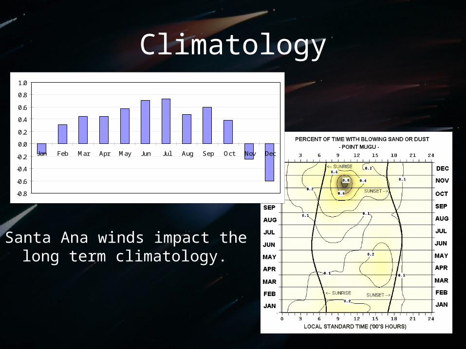
Santa Ana winds impact the long term climatology.
-0.8
-0.6
-0.4
-0.2
0.0
0.2
0.4
0.6
0.8
1.0
Jan Feb Mar Apr May Jun Jul Aug Sep Oct Nov Dec
Climatology
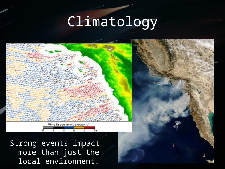
Strong events impact more than just the local environment.
Climatology
• Have occurred between September – June– Most occur between October – February
• Last 1 ½ days on average• Average winds 35kts, Gust 50kts canyon
winds• ~20 events per year• Gusts over 100kts possible
– Mt Wilson, early 1900’s, Cat 2 Hurricane Strength
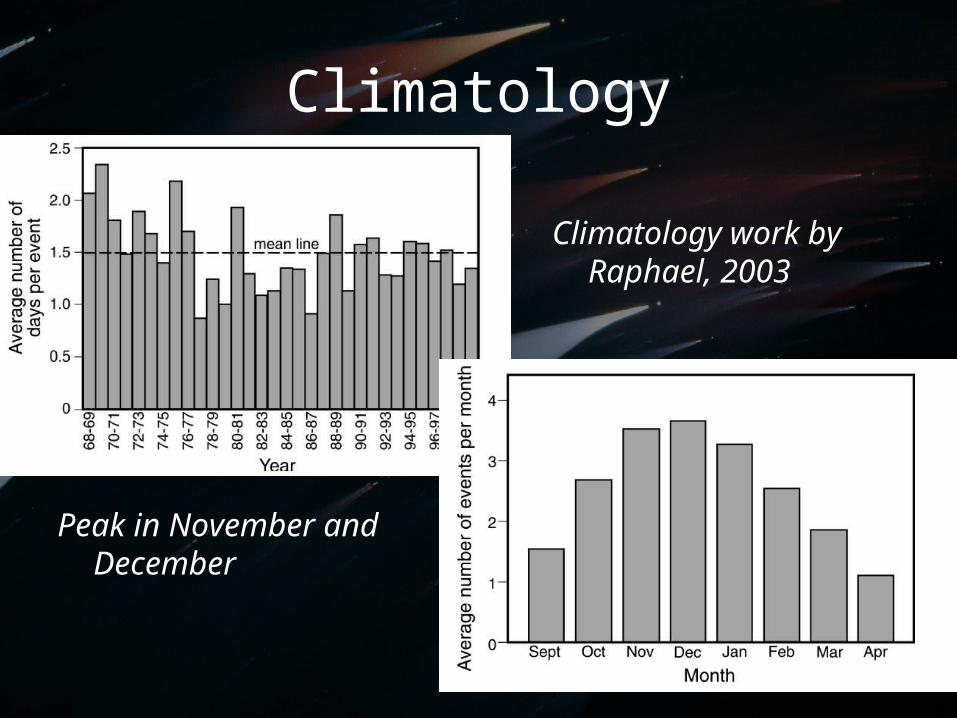
Climatology
Climatology work by Raphael, 2003
Peak in November and December
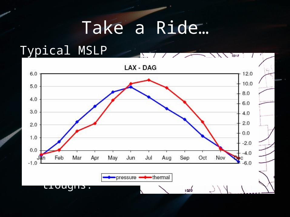
Take a Ride…Typical MSLP
pattern
• High pressure in eastern deserts and Great Basin– From passing
upper-level troughs.
H
LL
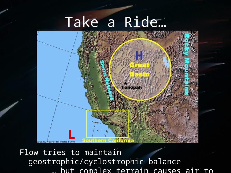
Take a Ride…
H
LFlow tries to maintain geostrophic/cyclostrophic
balance… but complex terrain causes air to flow
across isobars
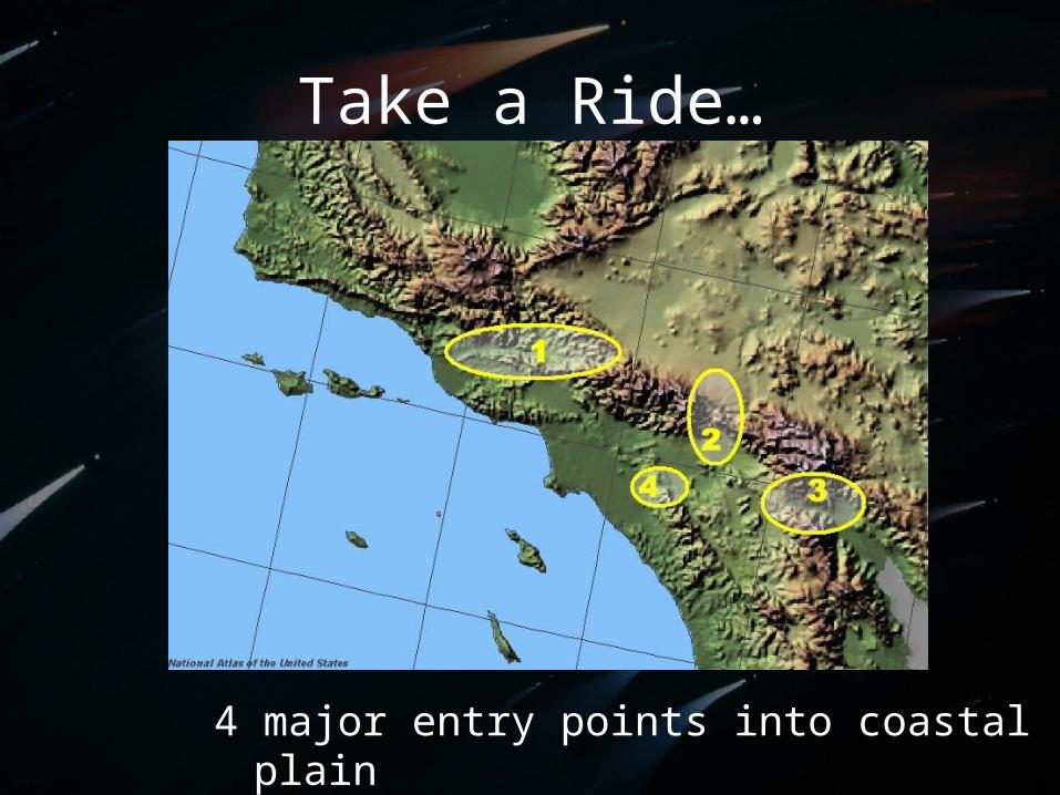
Take a Ride…
4 major entry points into coastal plain
Why So Hot and Dry?
• Great Basin: elevation 4000- 6000 feet– Tonopah: 5426 ft.
• Air compresses along the way.– Warming ~ 5.4oF per 1000ft– ~30oF warming potential– Beaches often warmest
• Relative Humidity ~ inverse temperature
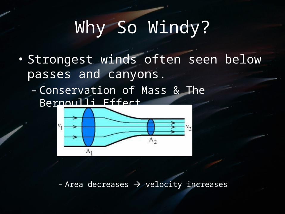
Why So Windy?
• Strongest winds often seen below passes and canyons.– Conservation of Mass & The Bernoulli
Effect
– Area decreases velocity increases
Why So Windy?
• During strong Santa Ana events, intense winds felt throughout the leeside of the Southern California mountains– Strong event large airmass– Flow spills over mountains– Downslope wind amplification
• Often surface winds are stronger than aloft• Energy source needed to accelerate wind
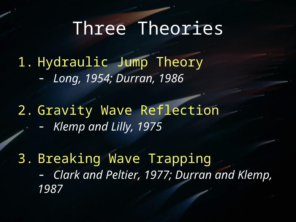
Three Theories
1. Hydraulic Jump Theory- Long, 1954; Durran, 1986
2. Gravity Wave Reflection- Klemp and Lilly, 1975
3. Breaking Wave Trapping- Clark and Peltier, 1977; Durran and Klemp, 1987
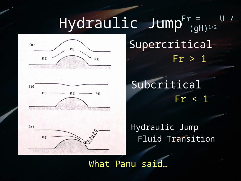
Hydraulic Jump
What Panu said…
SupercriticalFr > 1
SubcriticalFr < 1
Hydraulic JumpFluid Transition
Fr = U / (gH)1/2
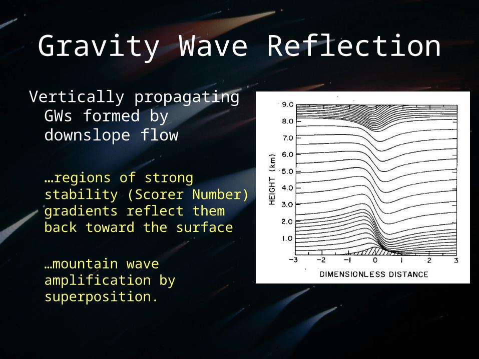
Gravity Wave Reflection
Vertically propagating GWs formed by downslope flow
…regions of strong stability (Scorer Number) gradients reflect them back toward the surface
…mountain wave amplification by superposition.
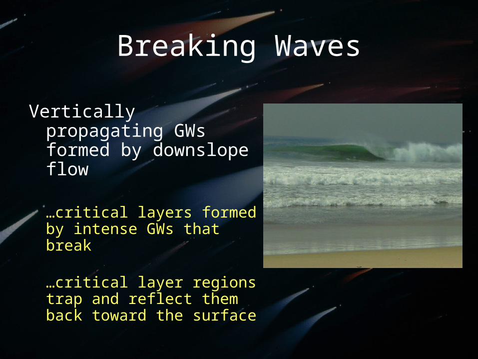
Breaking Waves
Vertically propagating GWs formed by downslope flow
…critical layers formed by intense GWs that break
…critical layer regions trap and reflect them back toward the surface
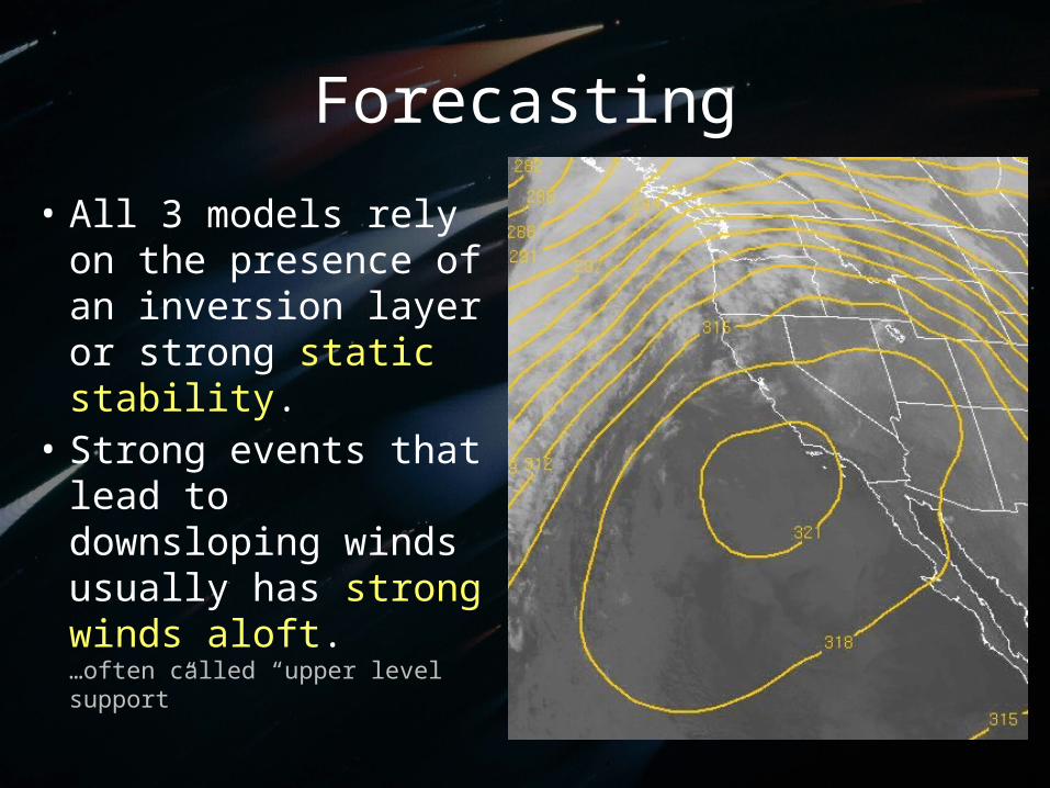
Forecasting
• All 3 models rely on the presence of an inversion layer or strong static stability.
• Strong events that lead to downsloping winds usually has strong winds aloft.…often called “upper level support”
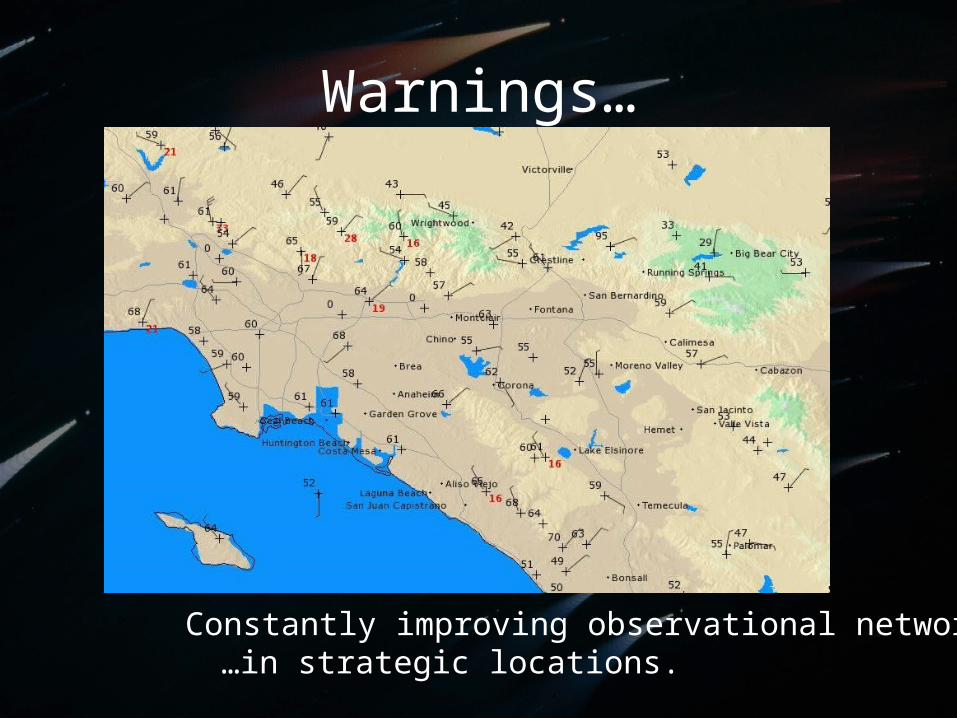
Warnings…
Constantly improving observational network…in strategic locations.

Merry Christmas


![Landforms Mady By Wind [Desert Landforms]](https://img.pdfslide.net/doc/110x75/56813971550346895da1066c/landforms-mady-by-wind-desert-landforms.jpg)