Embed Size (px)
Citation preview
#
Tidal Datum Consistency for
Marine Cadastre Littoral Zone
Commencement in Malaysia
Commission No. 4
#
Rasheila Rahibulsadri, Abdullah Hisam Omar, Ashraf Abdullah,
Wan Muhammad Aizzat Wan Azhar, Chan Keat Lim, Teng Chee Hua,
Tan Ah Bah And Hasan Jamil, Malaysia
Email: [email protected]
#
• Introduction
• Current issues in Malaysia
• Objectives
• Method
• Analysis
• Conclusion
Presentation Outlines
XXV International Federation of Surveyors
Congress, Kuala Lumpur, Malaysia, 16 – 21
June 2014
#
• The definition on Marine Cadastre
• Consistency of Tidal Datum
• Littoral Zone Generation
• Case Study :
Langkawi Island
OVERVIEW
XXV International Federation of Surveyors
Congress, Kuala Lumpur, Malaysia, 16 – 21
June 2014
#
Malaysia’s Marine Cadastre Definition (Ashraf et. al, 2013)
• 3D marine parcel administration system with respect to the
legal and systematic technical arrangement of marine spatial
rights, restrictions and responsibilities for marine space
activities.
Littoral Zone :
• The region that lies between the lines of high tide and low
tide.
• The tidal lines are formed by the intersection of the tidal
datum and the foreshore terrain.
Introduction
XXV International Federation of Surveyors
Congress, Kuala Lumpur, Malaysia, 16 – 21
June 2014
#
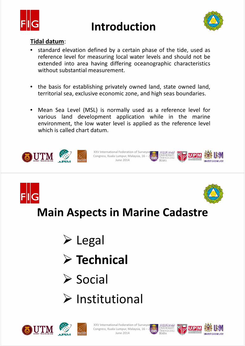
Tidal datum:
• standard elevation defined by a certain phase of the tide, used asreference level for measuring local water levels and should not beextended into area having differing oceanographic characteristicswithout substantial measurement.
• the basis for establishing privately owned land, state owned land,territorial sea, exclusive economic zone, and high seas boundaries.
• Mean Sea Level (MSL) is normally used as a reference level forvarious land development application while in the marineenvironment, the low water level is applied as the reference levelwhich is called chart datum.
Introduction
XXV International Federation of Surveyors
Congress, Kuala Lumpur, Malaysia, 16 – 21
June 2014
#
� Legal
� Technical
� Social
� Institutional
Main Aspects in Marine Cadastre
XXV International Federation of Surveyors
Congress, Kuala Lumpur, Malaysia, 16 – 21
June 2014
#
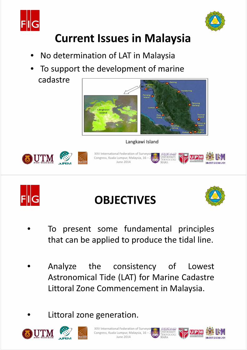
• No determination of LAT in Malaysia
• To support the development of marine
cadastre
Current Issues in Malaysia
Langkawi Island
XXV International Federation of Surveyors
Congress, Kuala Lumpur, Malaysia, 16 – 21
June 2014
#
• To present some fundamental principles
that can be applied to produce the tidal line.
• Analyze the consistency of Lowest
Astronomical Tide (LAT) for Marine Cadastre
Littoral Zone Commencement in Malaysia.
• Littoral zone generation.
OBJECTIVES
XXV International Federation of Surveyors
Congress, Kuala Lumpur, Malaysia, 16 – 21
June 2014
#
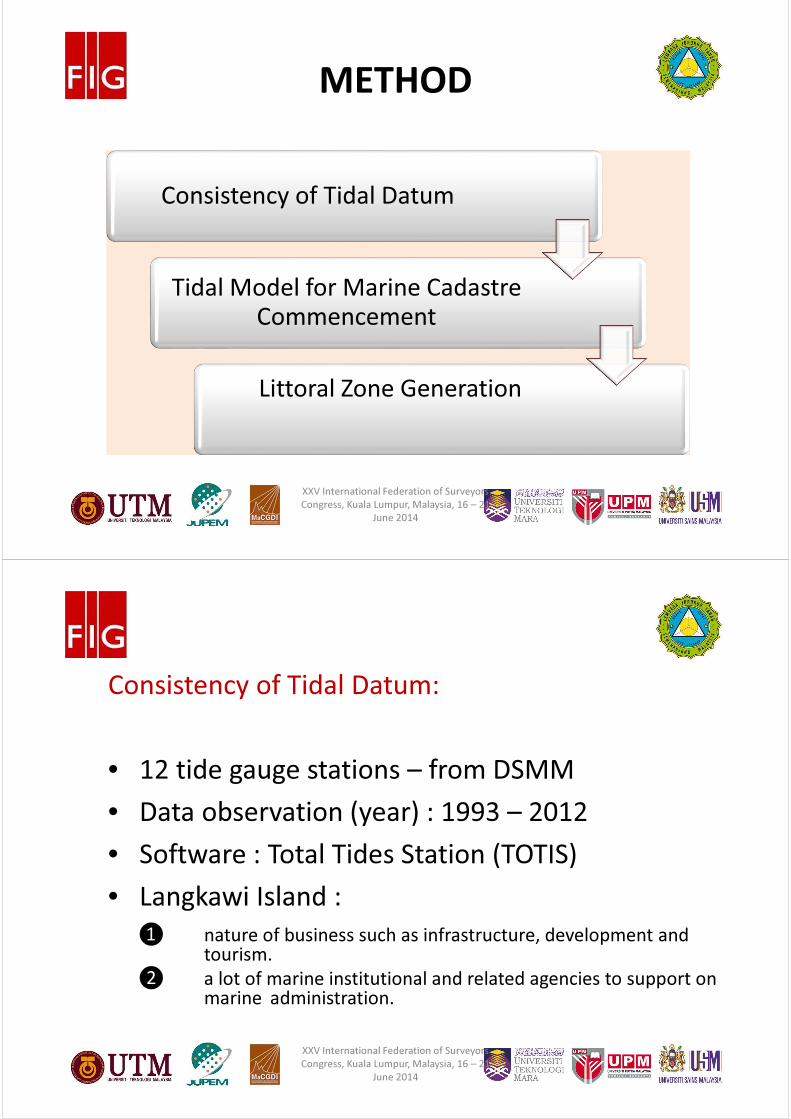
METHOD
Consistency of Tidal Datum
Tidal Model for Marine Cadastre
Commencement
Littoral Zone Generation
XXV International Federation of Surveyors
Congress, Kuala Lumpur, Malaysia, 16 – 21
June 2014
#
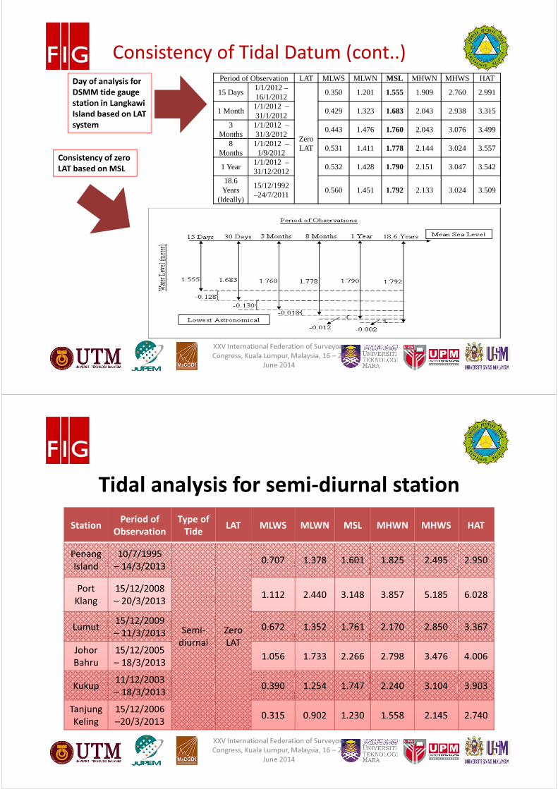
Consistency of Tidal Datum:
• 12 tide gauge stations – from DSMM
• Data observation (year) : 1993 – 2012
• Software : Total Tides Station (TOTIS)
• Langkawi Island :
❶ nature of business such as infrastructure, development and tourism.
❷ a lot of marine institutional and related agencies to support on marine administration.
XXV International Federation of Surveyors
Congress, Kuala Lumpur, Malaysia, 16 – 21
June 2014
#
Period of Observation LAT MLWS MLWN MSL MHWN MHWS HAT
15 Days1/1/2012 –16/1/2012
Zero LAT
0.350 1.201 1.555 1.909 2.760 2.991
1 Month1/1/2012 –31/1/2012
0.429 1.323 1.683 2.043 2.938 3.315
3 Months
1/1/2012 –31/3/2012
0.443 1.476 1.760 2.043 3.076 3.499
8 Months
1/1/2012 –1/9/2012
0.531 1.411 1.778 2.144 3.024 3.557
1 Year1/1/2012 –31/12/2012
0.532 1.428 1.790 2.151 3.047 3.542
18.6 Years
(Ideally)
15/12/1992 –24/7/2011
0.560 1.451 1.792 2.133 3.024 3.509
Day of analysis for
DSMM tide gauge
station in Langkawi
Island based on LAT
system
Consistency of zero
LAT based on MSL
Consistency of Tidal Datum (cont..)
XXV International Federation of Surveyors
Congress, Kuala Lumpur, Malaysia, 16 – 21
June 2014
#
StationPeriod of
Observation
Type of
TideLAT MLWS MLWN MSL MHWN MHWS HAT
Penang
Island
10/7/1995
– 14/3/2013
Semi-
diurnal
Zero
LAT
0.707 1.378 1.601 1.825 2.495 2.950
Port
Klang
15/12/2008
– 20/3/20131.112 2.440 3.148 3.857 5.185 6.028
Lumut15/12/2009
– 11/3/20130.672 1.352 1.761 2.170 2.850 3.367
Johor
Bahru
15/12/2005
– 18/3/20131.056 1.733 2.266 2.798 3.476 4.006
Kukup11/12/2003
– 18/3/20130.390 1.254 1.747 2.240 3.104 3.903
Tanjung
Keling
15/12/2006
–20/3/20130.315 0.902 1.230 1.558 2.145 2.740
Tidal analysis for semi-diurnal station
XXV International Federation of Surveyors
Congress, Kuala Lumpur, Malaysia, 16 – 21
June 2014
#
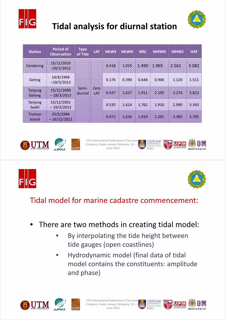
Tidal analysis for diurnal station
StationPeriod of
Observation
Type
of TideLAT MLWS MLWN MSL MHWN MHWS HAT
Cendering15/12/2010
–20/1/2012
Semi-
diurnal
Zero
LAT
0.418 1.015 1.490 1.965 2.561 3.082
Geting14/8/1994
–19/3/2013 0.176 0.390 0.648 0.906 1.120 1.511
Tanjung
Gelang
15/12/2009
– 18/3/20130.547 1.627 1.911 2.195 3.274 3.823
Tanjung
Sedili
15/12/2001
– 19/3/20130.535 1.614 1.762 1.910 2.990 3.343
Tioman
Island
25/5/1994
– 16/12/20120.472 1.636 1.919 2.201 3.365 3.795
XXV International Federation of Surveyors
Congress, Kuala Lumpur, Malaysia, 16 – 21
June 2014
#
Tidal model for marine cadastre commencement:
• There are two methods in creating tidal model:
• By interpolating the tide height between
tide gauges (open coastlines)
• Hydrodynamic model (final data of tidal
model contains the constituents: amplitude
and phase)
XXV International Federation of Surveyors
Congress, Kuala Lumpur, Malaysia, 16 – 21
June 2014
#
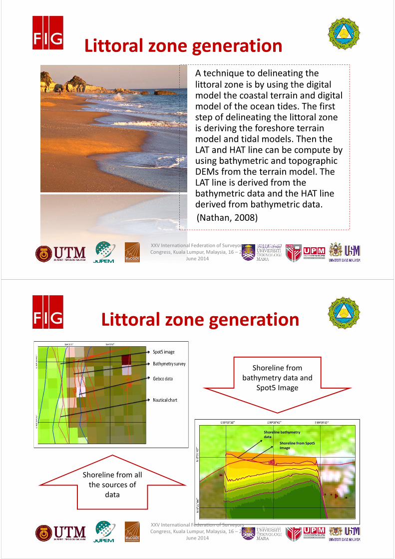
A technique to delineating the littoral zone is by using the digital model the coastal terrain and digital model of the ocean tides. The first step of delineating the littoral zone is deriving the foreshore terrain model and tidal models. Then the LAT and HAT line can be compute by using bathymetric and topographic DEMs from the terrain model. The LAT line is derived from the bathymetric data and the HAT line derived from bathymetric data. (Nathan, 2008)
Littoral zone generation
XXV International Federation of Surveyors
Congress, Kuala Lumpur, Malaysia, 16 – 21
June 2014
#
Littoral zone generation
Shoreline from all
the sources of
data
Shoreline from
bathymetry data and
Spot5 Image
XXV International Federation of Surveyors
Congress, Kuala Lumpur, Malaysia, 16 – 21
June 2014
#
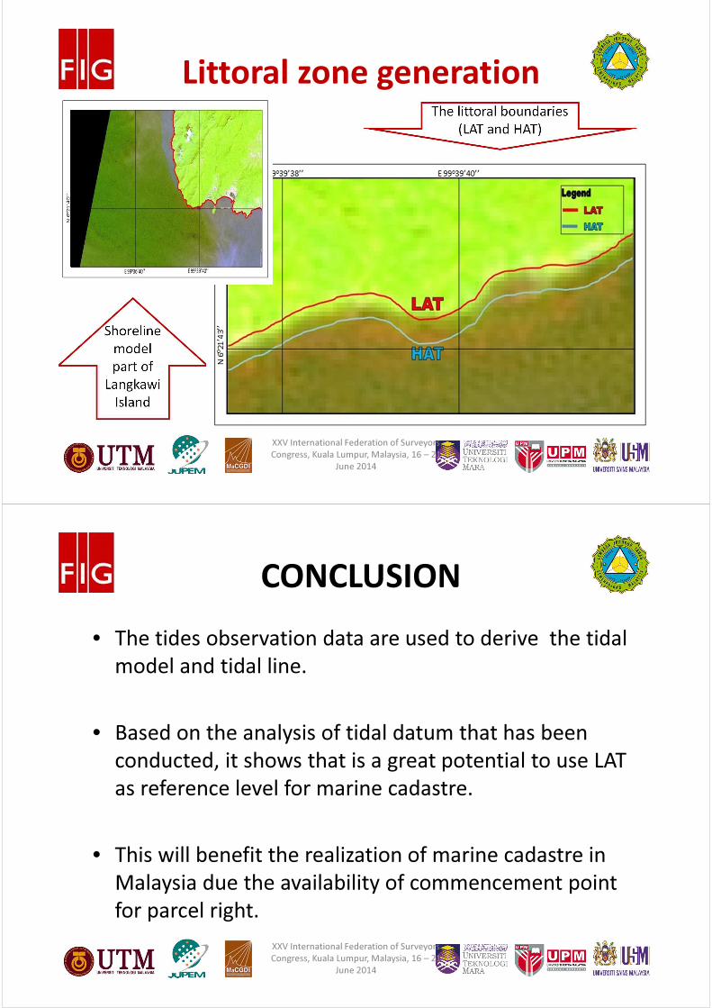
Littoral zone generation
Shoreline
model
part of
Langkawi
Island
The littoral boundaries
(LAT and HAT)
XXV International Federation of Surveyors
Congress, Kuala Lumpur, Malaysia, 16 – 21
June 2014
#
• The tides observation data are used to derive the tidal
model and tidal line.
• Based on the analysis of tidal datum that has been
conducted, it shows that is a great potential to use LAT
as reference level for marine cadastre.
• This will benefit the realization of marine cadastre in
Malaysia due the availability of commencement point
for parcel right.
CONCLUSION
XXV International Federation of Surveyors
Congress, Kuala Lumpur, Malaysia, 16 – 21
June 2014
#
• However, to develop the homogenous datum for land
and sea, there is a need to develop a model for
defining the relationship between different vertical
reference surfaces.
• Large scale map of LAT tidal line and littoral zone for
Malaysia is important towards the realization of
marine cadastre in Malaysia.
CONCLUSION
XXV International Federation of Surveyors
Congress, Kuala Lumpur, Malaysia, 16 – 21
June 2014
#
Acknowledgement
• Financial assistance from Malaysian Peninsular
Land Surveyors Board (LJT)
• Universiti Teknologi Malaysia (UTM)
• eScienceFund – Ministry of Science,
Technology and Innovation (MOSTI)
• Universiti Teknologi Mara (UiTM)
• Department of Survey and Mapping Malaysia
(DSMM)
XXV International Federation of Surveyors
Congress, Kuala Lumpur, Malaysia, 16 – 21
June 2014

#
Thank you for your
attention!
http://marinespaceadmin.blogspot.com/
XXV International Federation of Surveyors
Congress, Kuala Lumpur, Malaysia, 16 – 21
June 2014