Embed Size (px)
Citation preview
Timeline of DiscoveryTracing the Development of the
Theory of Plate Tectonics
Timeline of Discovery
• As you progress through the slide show, please add events to your timeline.
• Notice that your version of the timeline has the events already labeled on it.
• Your task is to add how each event supports the theory of plate tectonics.
• This is a great review for the mastery check. More information is shared at the end…
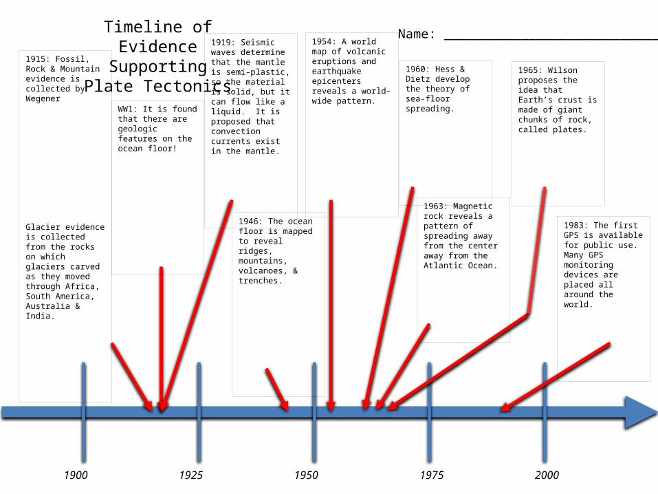
20001975195019251900
1915: Fossil, Rock & Mountain evidence is collected by Wegener
Glacier evidence is collected from the rocks on which glaciers carved as they moved through Africa, South America, Australia & India.
WW1: It is found that there are geologic features on the ocean floor!
1919: Seismic waves determine that the mantle is semi-plastic, so the material is solid, but it can flow like a liquid. It is proposed that convection currents exist in the mantle.
1946: The ocean floor is mapped to reveal ridges, mountains, volcanoes, & trenches.
1954: A world map of volcanic eruptions and earthquake epicenters reveals a world-wide pattern.
1960: Hess & Dietz develop the theory of sea-floor spreading.
1963: Magnetic rock reveals a pattern of spreading away from the center away from the Atlantic Ocean.
1965: Wilson proposes the idea that Earth’s crust is made of giant chunks of rock, called plates.
1983: The first GPS is available for public use. Many GPS monitoring devices are placed all around the world.
Name: ____________________________Timeline ofEvidence
SupportingPlate Tectonics
20001975195019251900
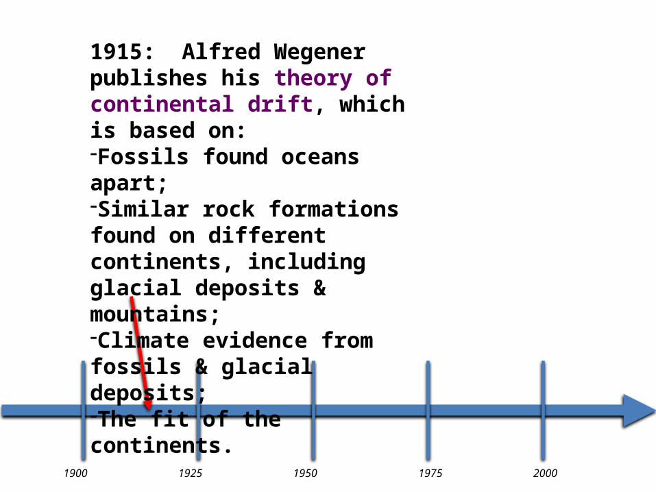
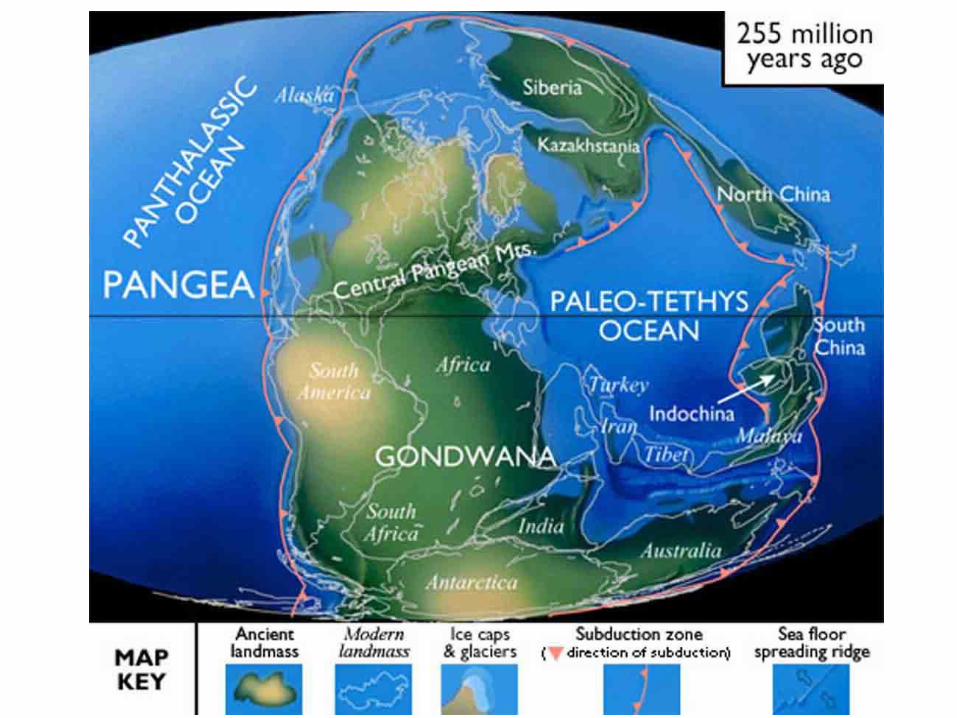
1915: Alfred Wegener publishes his theory of continental drift, which is based on:-Fossils found oceans apart;-Similar rock formations found on different continents, including glacial deposits & mountains;-Climate evidence from fossils & glacial deposits;-The fit of the continents.
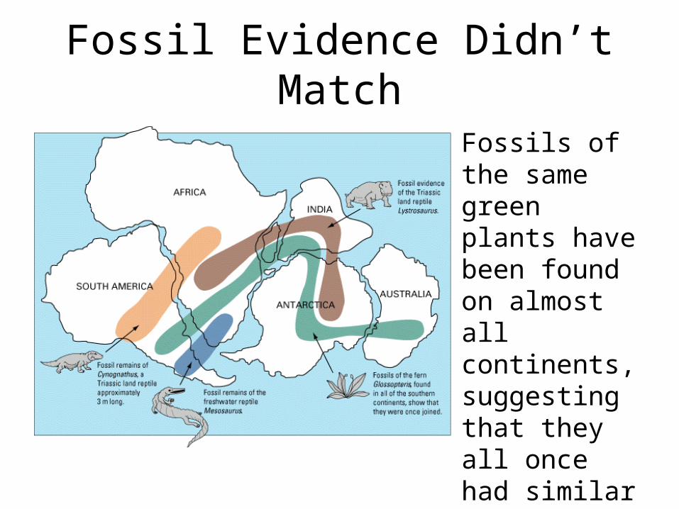
Fossil Evidence Didn’t Match
Fossils of the same green plants have been found on almost all continents, suggesting that they all once had similar climates.
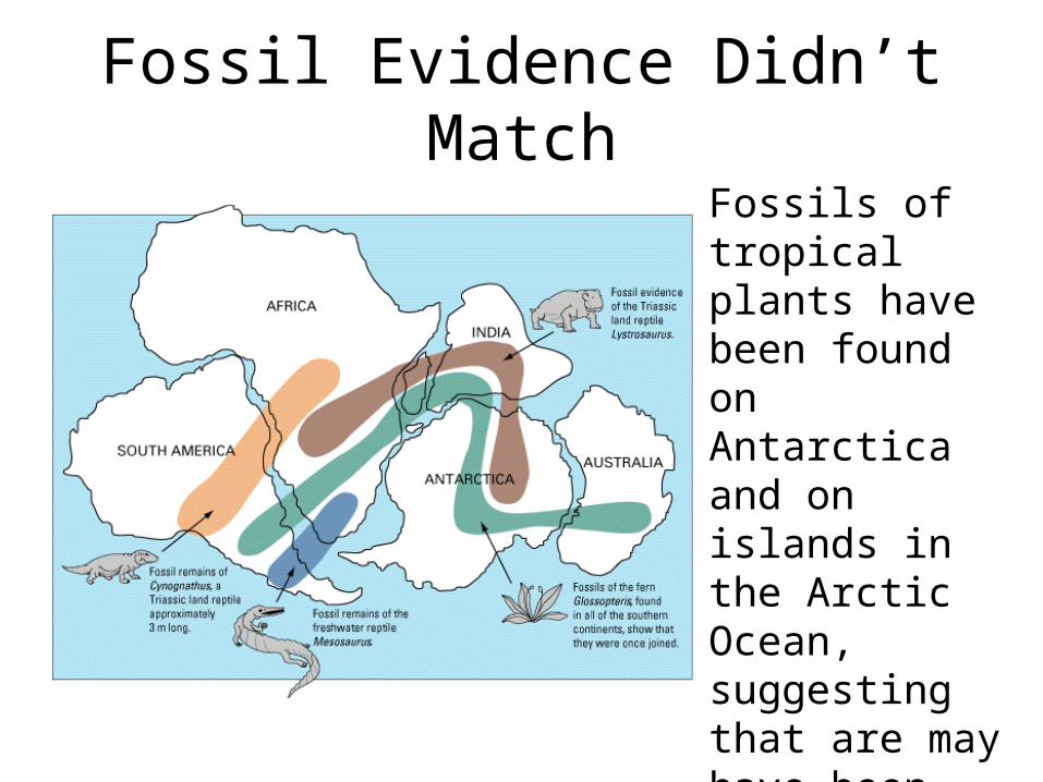
Fossil Evidence Didn’t MatchFossils of tropical plants have been found on Antarctica and on islands in the Arctic Ocean, suggesting that are may have been much warmer in the past.
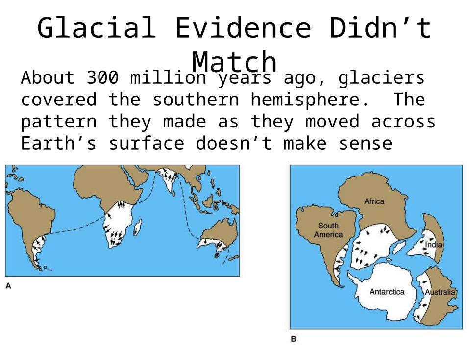
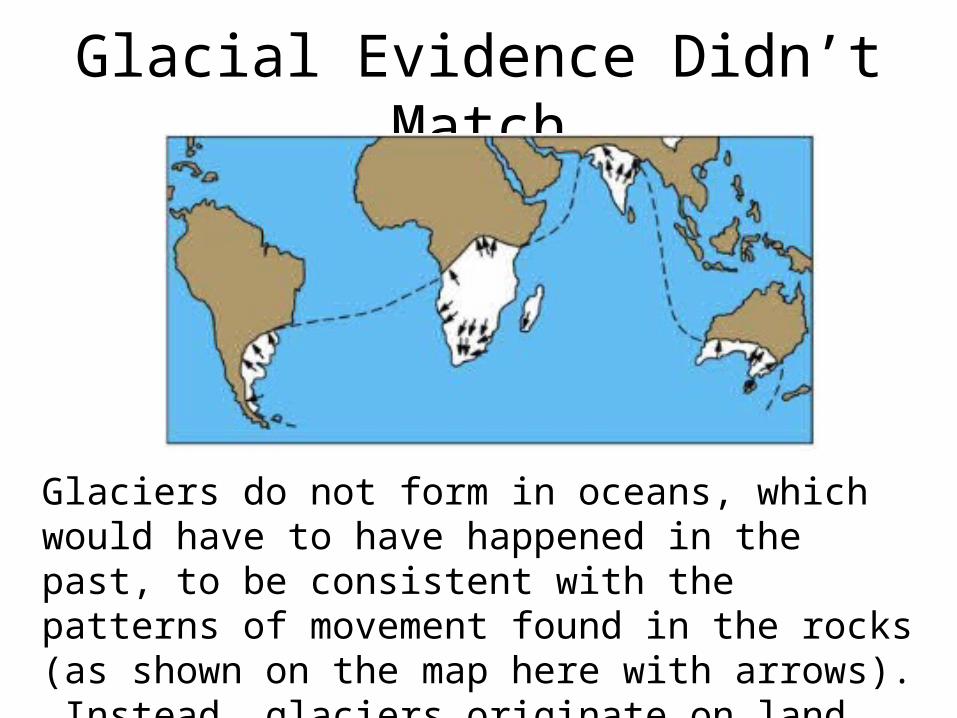
Glacial Evidence Didn’t MatchAbout 300 million years ago, glaciers covered the southern hemisphere. The pattern they made as they moved across Earth’s surface doesn’t make sense unless the continents are arranged as Wegener proposed (B).
Glacial Evidence Didn’t Match
Glaciers do not form in oceans, which would have to have happened in the past, to be consistent with the patterns of movement found in the rocks (as shown on the map here with arrows). Instead, glaciers originate on land and move toward the ocean.
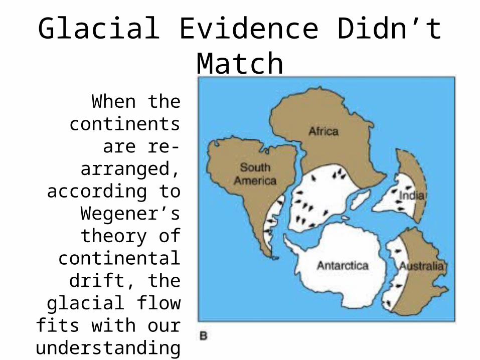
Glacial Evidence Didn’t Match
When the continents are re-
arranged, according to Wegener’s
theory of continental drift,
the glacial flow fits with our
understanding of how glaciers move.
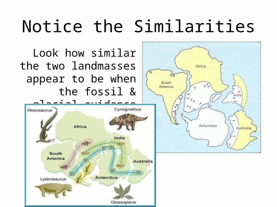
Notice the SimilaritiesLook how similar the two landmasses appear to be when the fossil & glacial
evidence are mapped.
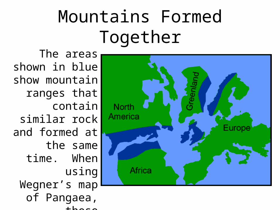
Mountains Formed TogetherThe areas shown in
blue show mountain ranges
that contain similar rock and formed at
the same time. When using
Wegner’s map of Pangaea, these
mountains line up into one major
range.
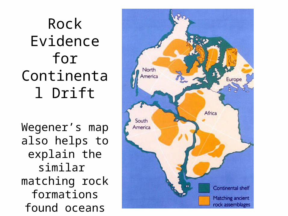
Rock Evidence for Continental
Drift
Wegener’s map also helps to
explain the similar matching rock
formations found oceans apart.
The Problem with Wegener’s Theory
• The main problem with Wegener’s theory of continental drift was that he could not explain what causes the continents to move.
• Alfred Wegener collected substantial evidence to support his work, but since he could not explain the mechanism responsible for the motion of the land masses, he theory was discounted by most scientists.
20001975195019251900
1915: Alfred Wegener publishes his theory of continental drift, which is based on:-Fossils found oceans apart;-Similar rock formations found on different continents, including glacial deposits & mountains;;-Climate evidence from fossils & glacial deposits;-The fit of the continents.
What were people saying
about the movement of
the Earth’s Surface?
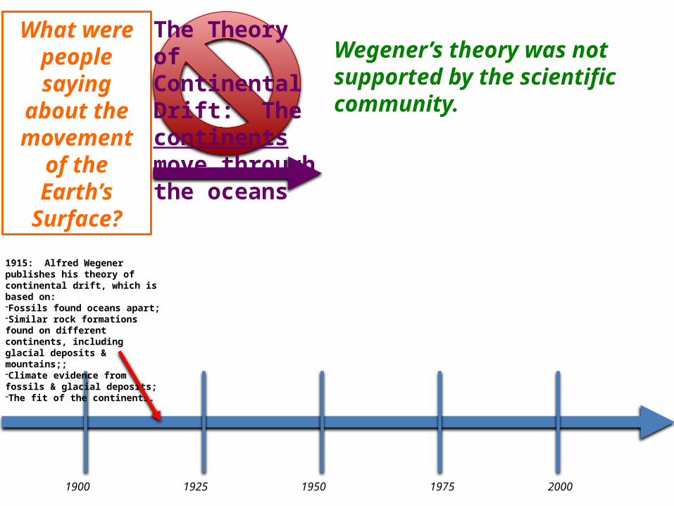
The Theory of Continental Drift: The continents move through the oceans
Wegener’s theory was not supported by the scientific community.
20001975195019251900
What were people saying
about the movement of
the Earth’s Surface?
The Theory of Continental Drift: The continents move through the oceans
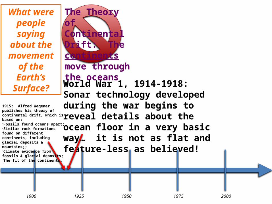
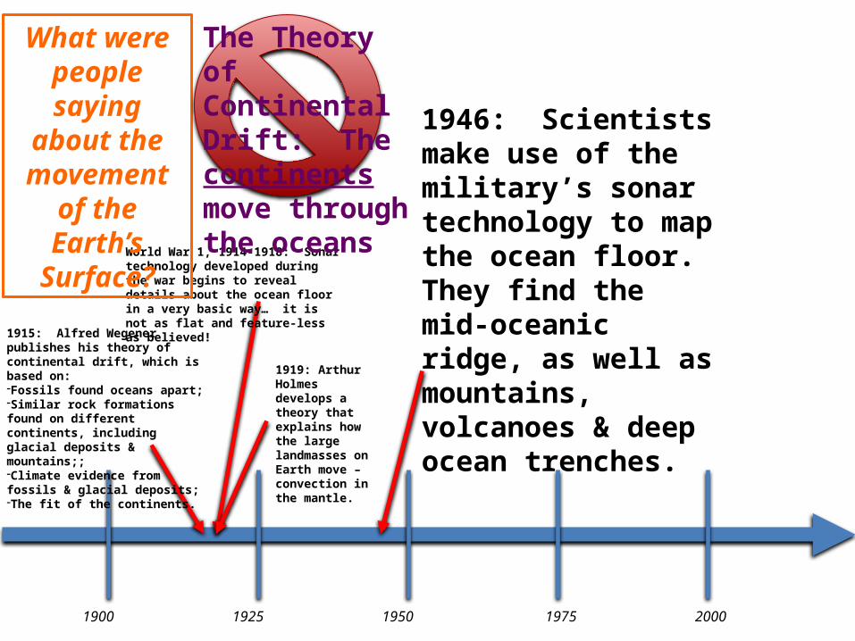
World War 1, 1914-1918: Sonar technology developed during the war begins to reveal details about the ocean floor in a very basic way… it is not as flat and feature-less as believed!
1915: Alfred Wegener publishes his theory of continental drift, which is based on:-Fossils found oceans apart;-Similar rock formations found on different continents, including glacial deposits & mountains;;-Climate evidence from fossils & glacial deposits;-The fit of the continents.
20001975195019251900
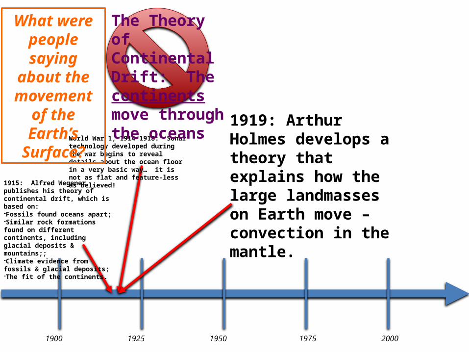
World War 1, 1914-1918: Sonar technology developed during the war begins to reveal details about the ocean floor in a very basic way… it is not as flat and feature-less as believed!
1919: Arthur Holmes develops a theory that explains how the large landmasses on Earth move – convection in the mantle.
What were people saying
about the movement of
the Earth’s Surface?
The Theory of Continental Drift: The continents move through the oceans
1915: Alfred Wegener publishes his theory of continental drift, which is based on:-Fossils found oceans apart;-Similar rock formations found on different continents, including glacial deposits & mountains;;-Climate evidence from fossils & glacial deposits;-The fit of the continents.
Convection Currents
• Now that scientists are aware of the crust that exists under the world’s oceans, it becomes an assumption that not just the continents move, but the ocean floor does, too. Although this theory is still not credible in the scientific community, it is gaining support.
• Arthur Holmes came up with a response to the biggest criticism of Alfred Wegener’s theory of continental drift… convection in the mantle.
Convection Currents• Holmes theorized that convection currents move through
the mantle the same way heated air circulates through a room, and radically reshape the Earth’s surface in the process.
• He proposed that upward convection might lift or even rupture the crust, that lateral movement could propel the crust sideways like a conveyor belt, and that where convection turned downwards, the buoyant continents would crumple up and form mountains.
• Holmes also understood the importance of convection as a mechanism for loss of heat from the Earth and of cooling its deep interior.
Taken from http://www.amnh.org/education/resources/rfl/web/essaybooks/earth/p_holmes.html
Convection Currents• Holmes’ theory has been updated to include the
more current observations that support his work.• A circular pattern that forms when matter (in this
case located in the mantle) heats and cools, changing the material’s density
• Thought to be the force responsible for moving Earth’s tectonic plates
• Also known as…- Convection cells- Convection cycles
Convection Currents• According to the convection current hypothesis, the
Earth’s mantle is not the exact same temperature throughout.
• Since the heat is not evenly distributed, the material moves within the mantle.
• The pattern of heat flow is circular, creating cycles of hot, less-dense material rising and cool (comparatively), more-dense material sinking.
• The motion in the mantle move the tectonic plates resting above. The direction of the convection in the mantle determines how the plate interact.
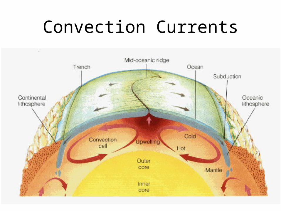
Convection Currents
20001975195019251900
World War 1, 1914-1918: Sonar technology developed during the war begins to reveal details about the ocean floor in a very basic way… it is not as flat and feature-less as believed!
1946: Scientists make use of the military’s sonar technology to map the ocean floor. They find the mid-oceanic ridge, as well as mountains, volcanoes & deep ocean trenches.
What were people saying
about the movement of
the Earth’s Surface?
The Theory of Continental Drift: The continents move through the oceans
1915: Alfred Wegener publishes his theory of continental drift, which is based on:-Fossils found oceans apart;-Similar rock formations found on different continents, including glacial deposits & mountains;;-Climate evidence from fossils & glacial deposits;-The fit of the continents.
1919: Arthur Holmes develops a theory that explains how the large landmasses on Earth move – convection in the mantle.

Topography of the Earth’s Surface
Notice the high elevation under the oceans, as shown on this map in dark blue. They are underwater mountain ranges, some are volcanic.
20001975195019251900
World War 1, 1914-1918: Sonar technology developed during the war begins to reveal details about the ocean floor in a very basic way… it is not as flat and feature-less as believed!
1954: The first world map of volcanic eruptions and earthquake zones is published
What were people saying
about the movement of
the Earth’s Surface?
The Theory of Continental Drift: The continents move through the oceans
1946: Scientists make use of the military’s sonar technology to map the ocean floor. They find the mid-oceanic ridge, as well as mountains, volcanoes & deep ocean trenches.
1915: Alfred Wegener publishes his theory of continental drift, which is based on:-Fossils found oceans apart;-Similar rock formations found on different continents, including glacial deposits & mountains;;-Climate evidence from fossils & glacial deposits;-The fit of the continents.
1919: Arthur Holmes develops a theory that explains how the large landmasses on Earth move – convection in the mantle.
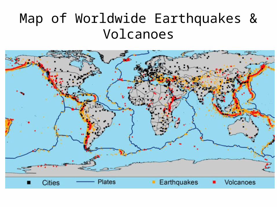
Map of Worldwide Earthquakes & Volcanoes
20001975195019251900
World War 1, 1914-1918: Sonar technology developed during the war begins to reveal details about the ocean floor in a very basic way… it is not as flat and feature-less as believed!
1954: The first world map of volcanic eruptions and earthquake zones is published
1960: Harry Hess & Robert Dietz propose the theory of sea-floor spreading: molten rock (magma) oozes up from the Earth's interior along the mid-oceanic ridges, creating new seafloor that spreads away from the active ridge.
What were people saying
about the movement of
the Earth’s Surface?
The Theory of Continental Drift: The continents move through the oceans
1946: Scientists make use of the military’s sonar technology to map the ocean floor. They find the mid-oceanic ridge, as well as mountains, volcanoes & deep ocean trenches.
1915: Alfred Wegener publishes his theory of continental drift, which is based on:-Fossils found oceans apart;-Similar rock formations found on different continents, including glacial deposits & mountains;;-Climate evidence from fossils & glacial deposits;-The fit of the continents.
1919: Arthur Holmes develops a theory that explains how the large landmasses on Earth move – convection in the mantle.
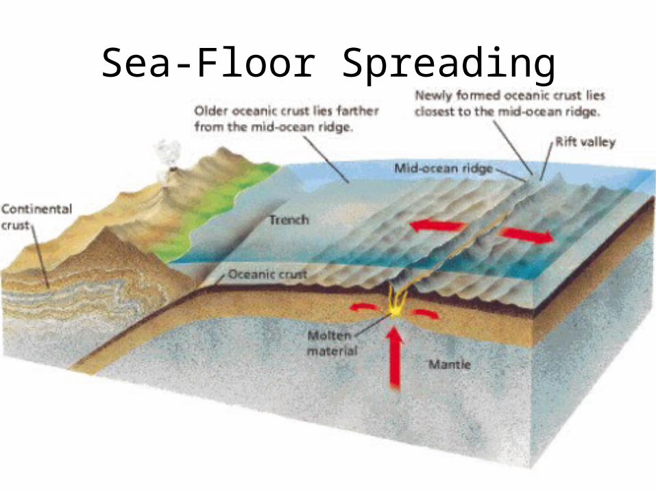
Sea-Floor Spreading
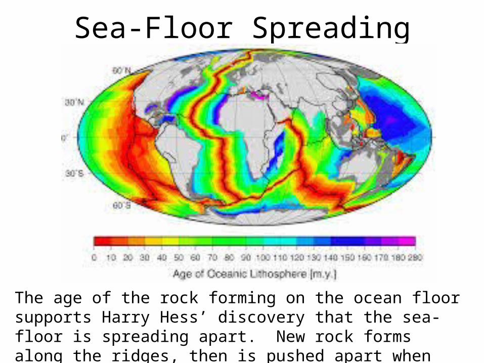
Sea-Floor Spreading
The age of the rock forming on the ocean floor supports Harry Hess’ discovery that the sea-floor is spreading apart. New rock forms along the ridges, then is pushed apart when even newer rock forms.

20001975195019251900
World War 1, 1914-1918: Sonar technology developed during the war begins to reveal details about the ocean floor in a very basic way… it is not as flat and feature-less as believed!
1960: Harry Hess & Robert Dietz propose the theory of sea-floor spreading molten rock (magma) oozes up from the Earth's interior along the mid-oceanic ridges, creating new seafloor that spreads away from the active ridge.
1963: A pattern of magnetic-striped rock on the ocean floor that provides evidence to support Hess & Dietz’s theory of sea-floor spreading
What were people saying
about the movement of
the Earth’s Surface?
The Theory of Continental Drift: The continents move through the oceans
1954: The first world map of volcanic eruptions and earthquake zones is published
1946: Scientists make use of the military’s sonar technology to map the ocean floor. They find the mid-oceanic ridge, as well as mountains, volcanoes & deep ocean trenches.
1915: Alfred Wegener publishes his theory of continental drift, which is based on:-Fossils found oceans apart;-Similar rock formations found on different continents, including glacial deposits & mountains;;-Climate evidence from fossils & glacial deposits;-The fit of the continents.
1919: Arthur Holmes develops a theory that explains how the large landmasses on Earth move – convection in the mantle.
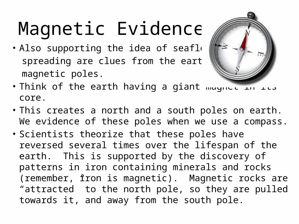
Magnetic Evidence• Also supporting the idea of seafloor
spreading are clues from the earth’s magnetic poles.
• Think of the earth having a giant magnet in its core.• This creates a north and a south poles on earth. We
evidence of these poles when we use a compass.• Scientists theorize that these poles have reversed several
times over the lifespan of the earth. This is supported by the discovery of patterns in iron containing minerals and rocks (remember, iron is magnetic). Magnetic rocks are “attracted” to the north pole, so they are pulled towards it, and away from the south pole.
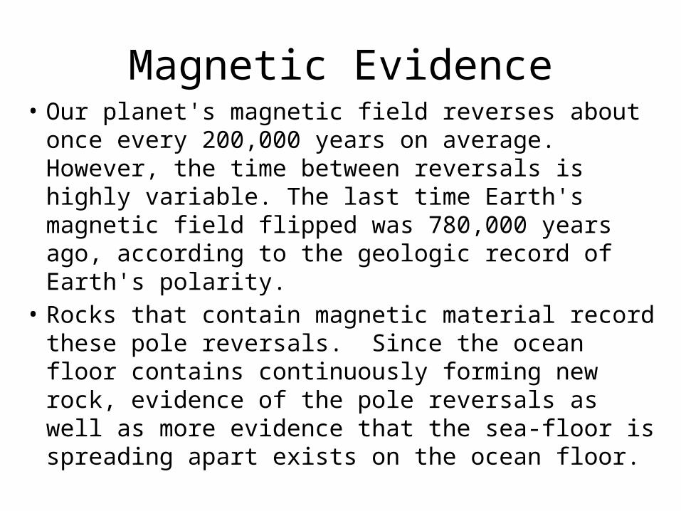
Magnetic Evidence• Our planet's magnetic field reverses about once
every 200,000 years on average. However, the time between reversals is highly variable. The last time Earth's magnetic field flipped was 780,000 years ago, according to the geologic record of Earth's polarity.
• Rocks that contain magnetic material record these pole reversals. Since the ocean floor contains continuously forming new rock, evidence of the pole reversals as well as more evidence that the sea-floor is spreading apart exists on the ocean floor.
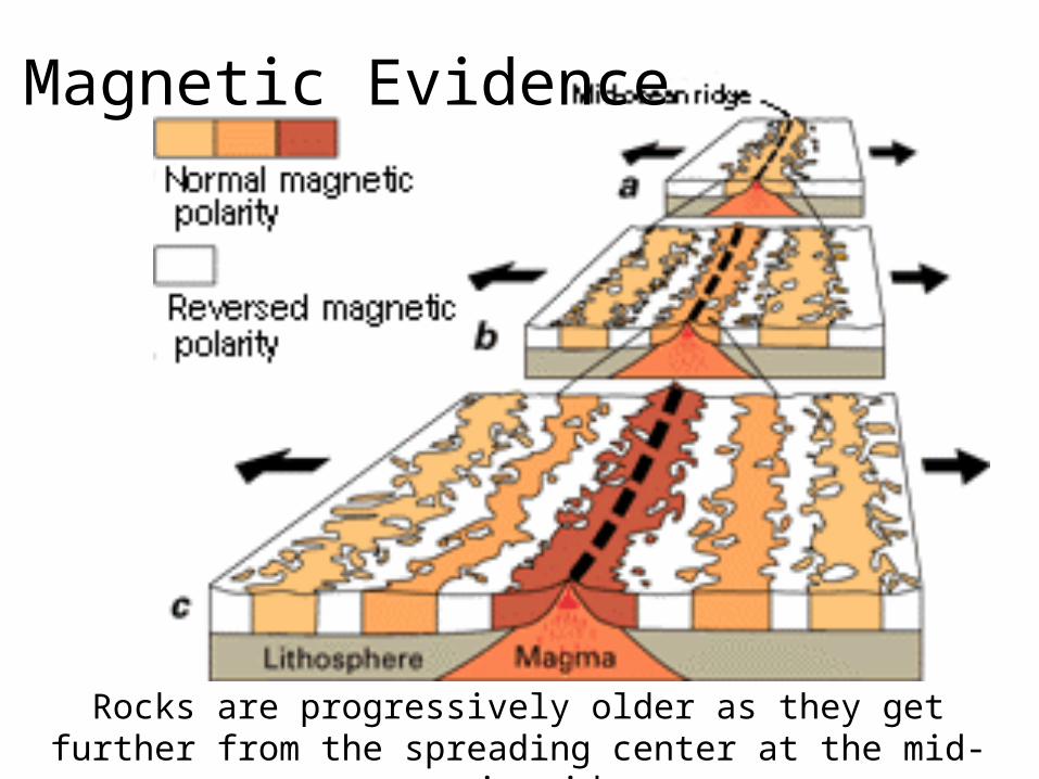
Magnetic Evidence
Rocks are progressively older as they get further from the spreading center at the mid-oceanic ridge.
20001975195019251900
World War 1, 1914-1918: Sonar technology developed during the war begins to reveal details about the ocean floor in a very basic way… it is not as flat and feature-less as believed!
1963: A pattern of magnetic-striped rock on the ocean floor that provides evidence to support Hess’s theory of sea-floor spreading
What were people saying
about the movement of
the Earth’s Surface?
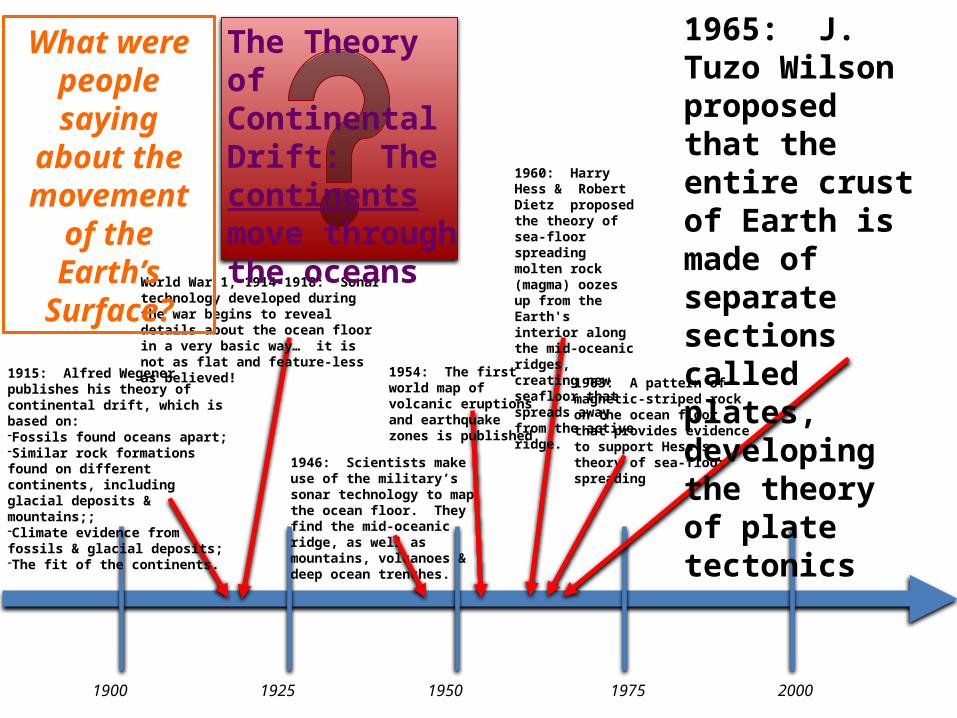
1965: J. Tuzo Wilson proposed that the entire crust of Earth is made of separate sections called plates, developing the theory of plate tectonics
1954: The first world map of volcanic eruptions and earthquake zones is published
1946: Scientists make use of the military’s sonar technology to map the ocean floor. They find the mid-oceanic ridge, as well as mountains, volcanoes & deep ocean trenches.
The Theory of Continental Drift: The continents move through the oceans
1960: Harry Hess & Robert Dietz proposed the theory of sea-floor spreading molten rock (magma) oozes up from the Earth's interior along the mid-oceanic ridges, creating new seafloor that spreads away from the active ridge.
1915: Alfred Wegener publishes his theory of continental drift, which is based on:-Fossils found oceans apart;-Similar rock formations found on different continents, including glacial deposits & mountains;;-Climate evidence from fossils & glacial deposits;-The fit of the continents.
20001975195019251900
World War 1, 1914-1918: Sonar technology developed during the war begins to reveal details about the ocean floor in a very basic way… it is not as flat and feature-less as believed!
1954: The first world map of volcanic eruptions and earthquake zones is published
1960: Harry Hess & Robert Dietz proposed the theory of sea-floor spreading
1963: A pattern of magnetic-striped rock on the ocean floor that provides evidence to support Hess’s theory of sea-floor spreading
The Theory of Continental Drift: The continents move through the oceans
What were people saying
about the movement of
the Earth’s Surface?
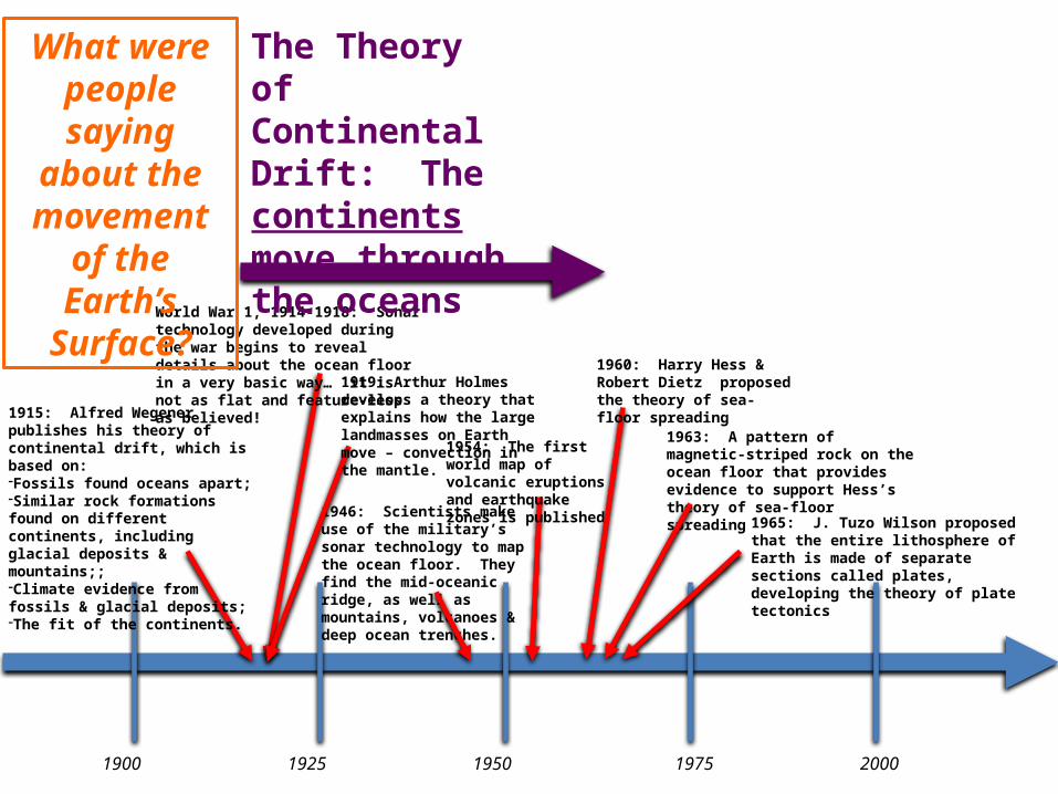
1965: J. Tuzo Wilson proposed that the entire lithosphere of Earth is made of separate sections called plates, developing the theory of plate tectonics
1946: Scientists make use of the military’s sonar technology to map the ocean floor. They find the mid-oceanic ridge, as well as mountains, volcanoes & deep ocean trenches.
1915: Alfred Wegener publishes his theory of continental drift, which is based on:-Fossils found oceans apart;-Similar rock formations found on different continents, including glacial deposits & mountains;;-Climate evidence from fossils & glacial deposits;-The fit of the continents.
1919: Arthur Holmes develops a theory that explains how the large landmasses on Earth move – convection in the mantle.
20001975195019251900
World War 1, 1914-1918: Sonar technology developed during the war begins to reveal details about the ocean floor in a very basic way… it is not as flat and feature-less as believed!
1954: The first world map of volcanic eruptions and earthquake zones is published
1960: Harry Hess & Robert Dietz proposed the theory of sea-floor spreading
1963: A pattern of magnetic-striped rock on the ocean floor that provides evidence to support Hess’s theory of sea-floor spreading
The Theory of Continental Drift: The continents move through the oceans
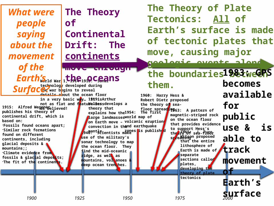
The Theory of Plate Tectonics: All of Earth’s surface is made of tectonic plates that move, causing major geologic events along the boundaries between them.
What were people saying
about the movement of
the Earth’s Surface?
1965: J. Tuzo Wilson proposed that the entire lithosphere of Earth is made of separate sections called plates, developing the theory of plate tectonics
1946: Scientists make use of the military’s sonar technology to map the ocean floor. They find the mid-oceanic ridge, as well as mountains, volcanoes & deep ocean trenches.
1915: Alfred Wegener publishes his theory of continental drift, which is based on:-Fossils found oceans apart;-Similar rock formations found on different continents, including glacial deposits & mountains;;-Climate evidence from fossils & glacial deposits;-The fit of the continents.
1919: Arthur Holmes develops a theory that explains how the large landmasses on Earth move – convection in the mantle.
1983: GPS becomes available for public use & is able to track movement of Earth’s surface
GPS Tracks Earth’s Surface• Prior to 1983, the Global Positioning System
(GPS) was only used by the military. • Over time, technology advanced, satellites were
added to the fleet that aid in collecting GPS data on Earth, and more and more applications for the information emerged.
• To date, measurements on land can be made within centimeters, giving precise information about the changes to Earth’s surface (among other things).
• For more information visit IRIS GPS Site.
Plate Tectonics
• The Theory of Plate Tectonics states: All of Earth’s surface is made of tectonic plates that move, causing major geologic events along the boundaries between them.
• This is the modern accepted theory that explains significant geological changes to the Earth’s surface.
• It is a revision of the theory of continental drift – closely related but includes information collected since Alfred Wegener’s time.
Why is the theory of plate tectonics such a significant idea in science?
• The theory of plate tectonics tied together the following concepts into a single theory that completely changed the science of geology: – continental drift, – seafloor spreading, –magnetic field reversals and– convection in the mantle
Why is the theory of plate tectonics such a significant idea in science?
• Geologists finally had one theory that could explain all the different evidence they had accumulated to support previous observation, theories and discoveries. Until then, these ideas were scattered and some-what unrelated.
• Geologists now use the theory of plate tectonics to – show the relationship among geologic events,– explain the occurrence of earthquakes & volcanic
eruptions, and– explain the formation of mountain ranges & oceans.

Mastery Check
• You will be asked to explain how the discoveries we just outlined supports the theory of plate tectonics.
• Make sure you know the role that Wegener played in developing the theory.
• Be able to select one of the discoveries that you think is the most convincing in support of the theory of plate tectonics.
• Worth 9 points.