Embed Size (px)
DESCRIPTION
tiahuanaco
Citation preview
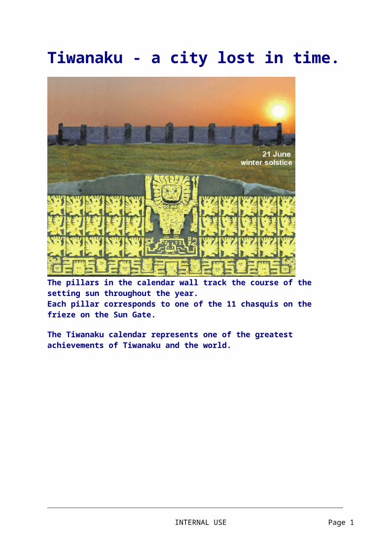
Tiwanaku - a city lost in time.
The pillars in the calendar wall track the course of the setting sun throughout the year.Each pillar corresponds to one of the 11 chasquis on the frieze on the Sun Gate.
The Tiwanaku calendar represents one of the greatest achievements of Tiwanaku and the world.
INTERNAL USE Page 1
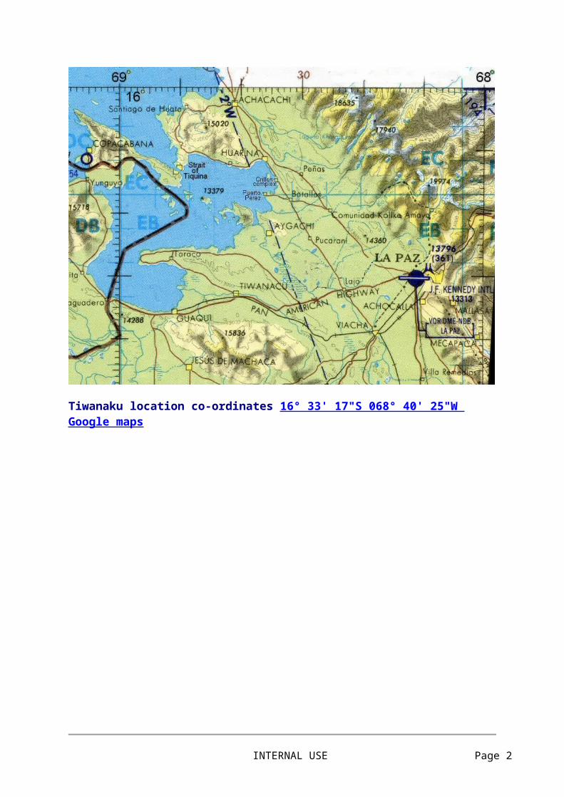
Tiwanaku location co-ordinates 16° 33' 17"S 068° 40' 25"W Google maps
Above, satellite image of the Kalasasaya compound and the
INTERNAL USE Page 2
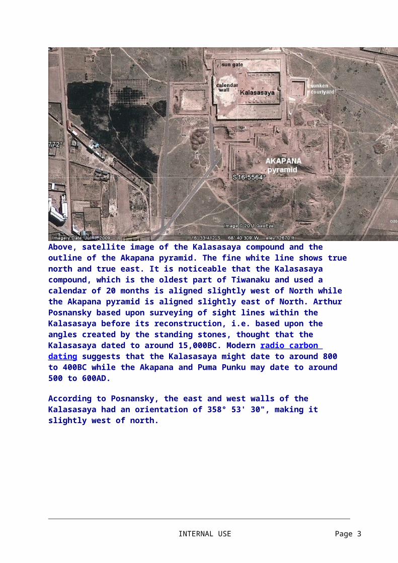
outline of the Akapana pyramid. The fine white line shows true north and true east. It is noticeable that the Kalasasaya compound, which is the oldest part of Tiwanaku and used a calendar of 20 months is aligned slightly west of North while the Akapana pyramid is aligned slightly east of North. Arthur Posnansky based upon surveying of sight lines within the Kalasasaya before its reconstruction, i.e. based upon the angles created by the standing stones, thought that the Kalasasaya dated to around 15,000BC. Modern radio carbon dating suggests that the Kalasasaya might date to around 800 to 400BC while the Akapana and Puma Punku may date to around 500 to 600AD.
According to Posnansky, the east and west walls of the Kalasasaya had an orientation of 358° 53' 30", making it slightly west of north.
Above, plan of Kalasasaya compound according to H.S.Bellamy. The length of the eastern side, 118.66m (389.3ft) could be considered as 320 Egyptian remen of 14.58 inches. The length from the eastern wall to the western calendar wall of 135.26m (443.7664ft) could be considered as 365.24 Egyptian remen and as relating to the days in a year.
INTERNAL USE Page 3

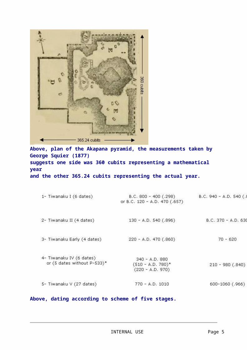
Above, plan of the Akapana pyramid, the measurements taken by George Squier (1877) suggests one side was 360 cubits representing a mathematical year and the other 365.24 cubits representing the actual year.
Above, dating according to scheme of five stages.
INTERNAL USE Page 4
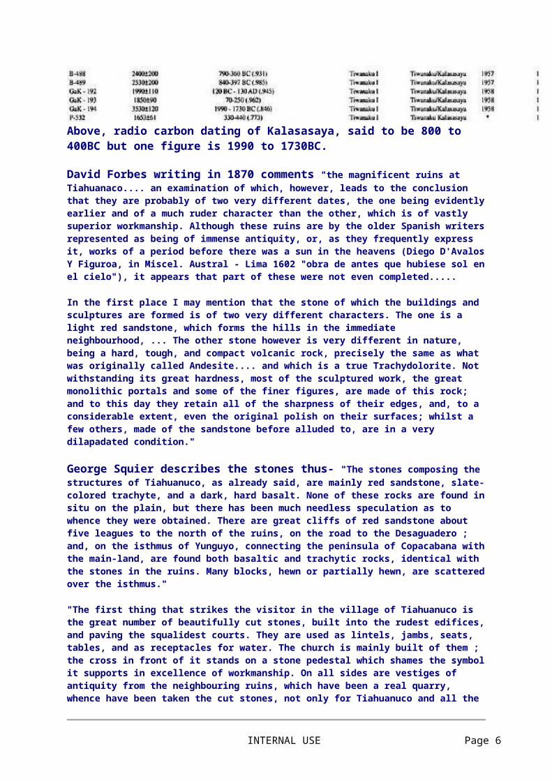
Above, radio carbon dating of Kalasasaya, said to be 800 to 400BC but one figure is 1990 to 1730BC.
David Forbes writing in 1870 comments "the magnificent ruins at Tiahuanaco.... an examination of which, however, leads to the conclusion that they are probably of two very different dates, the one being evidently earlier and of a much ruder character than the other, which is of vastly superior workmanship. Although these ruins are by the older Spanish writers represented as being of immense antiquity, or, as they frequently express it, works of a period before there was a sun in the heavens (Diego D'Avalos Y Figuroa, in Miscel. Austral - Lima 1602 "obra de antes que hubiese sol en el cielo"), it appears that part of these were not even completed.....
In the first place I may mention that the stone of which the buildings and sculptures are formed is of two very different characters. The one is a light red sandstone, which forms the hills in the immediate neighbourhood, ... The other stone however is very different in nature, being a hard, tough, and compact volcanic rock, precisely the same as what was originally called Andesite.... and which is a true Trachydolorite. Not withstanding its great hardness, most of the sculptured work, the great monolithic portals and some of the finer figures, are made of this rock; and to this day they retain all of the sharpness of their edges, and, to a considerable extent, even the original polish on their surfaces; whilst a few others, made of the sandstone before alluded to, are in a very dilapadated condition."
George Squier describes the stones thus- "The stones composing the structures of Tiahuanuco, as already said, are mainly red sandstone, slate-colored trachyte, and a dark, hard basalt. None of these rocks are found in situ on the plain, but there has been much needless speculation as to whence they were obtained. There are great cliffs of red sandstone about five leagues to the north of the ruins, on the road to the Desaguadero ; and, on the isthmus of Yunguyo, connecting the peninsula of Copacabana with the main-land, are found both basaltic and trachytic rocks, identical with the stones in the ruins. Many blocks, hewn or partially hewn, are scattered over the isthmus."
"The first thing that strikes the visitor in the village of Tiahuanuco is the great number of beautifully cut stones, built into the rudest edifices, and paving the squalidest courts. They are used as lintels, jambs, seats, tables, and as receptacles for water. The church is mainly built of them ; the cross in front of it stands on a stone pedestal which shames the symbol it supports in excellence of workmanship. On all sides are vestiges of antiquity from the neighbouring ruins, which have been a real quarry, whence have been taken the cut stones, not only for Tiahuanuco and all the villages and churches of its valley, but for erecting the cathedral of La Paz, the capital of Bolivia, situated in the deep valley of one of the streams falling into the river Beni, twenty leagues distant. And what is true here is also true of most parts of the Sierra. The monuments of the past have furnished most of the materials for the public edifices, the bridges, and highways of the present day.
The ruins of Tiahuanuco have been regarded by all students of American antiquities as in many respects the most interesting and important, and at the same time most enigmatical, of any on the continent. They have excited the
INTERNAL USE Page 5
admiration and wonder alike of the earliest and latest travellers, most of whom, vanquished in their attempts to penetrate the mystery of their origin, have been content to assign them an antiquity beyond that of the other monuments of America, and to regard them as the solitary remains of a civilization that disappeared before that of the Incas began, and contemporaneous with that of Egypt and the East. Unique, yet perfect in type and harmonious in style, they appear to be the work of a people who were thorough masters of an architecture which had no infancy, passed through no period of growth, and of which we find no other examples. Tradition, which mumbles more or less intelligibly of the origin of many other American monuments, is dumb concerning these. The wondering Indians told the first Spaniards that "they existed before the sun shone in the heavens," that they were raised by giants, or that they were the remains of an impious people whom an angry Deity had converted into stone because they had refused hospitality to his vicegerent and messenger"
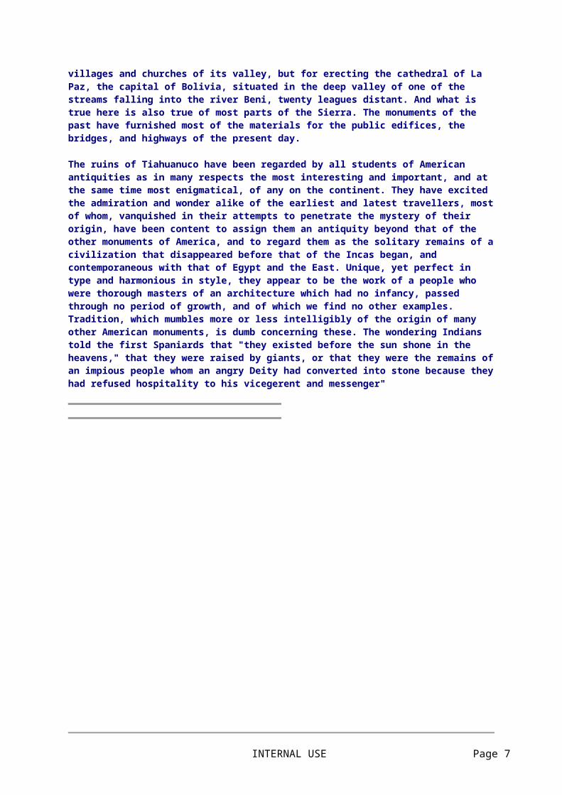
Above, statue from Tiwanaku, note the crab design on chest and the turban on head.
THE TRAVELS OF PEDRO CIEZA DE LEON (1549) "There are other things to be said concerning Tiahuanaco, which I pass over, concluding with a statement of my belief that this ruin is the most ancient in all Peru. It is asserted that these edifices were commenced before the time of the Yncas, and I have heard some Indians affirm that the Yncas built their grand edifices at Cuzco on the plan which they had observed at the wall near these ruins. They even say that the first Yncas thought of establishing their court at Tiahuanaco. Another remarkable thing is, that in all this district there are no quarries whence the numerous stones can have been brought, the carrying of which must have
INTERNAL USE Page 6
required many people. I asked the natives, in presence of Juan de Varagas (who holds them in encomienda), whether these edifices were built in the time of the Yncas, and they laughed at the question, affirming that they were made before the Yncas ever reigned, but that they could not say who made them. They added that they had heard from their fathers that all we saw was done in one night. From this, and from the fact that they also speak of bearded men on the island of Titicaca, and of others who built the edifice of Vinaque, it may, perhaps, be inferred that, before the Yncas reigned, there was an intelligent race who came from some unknown part, and who did these things. Being few, and the natives many, they may all have been killed in the wars."
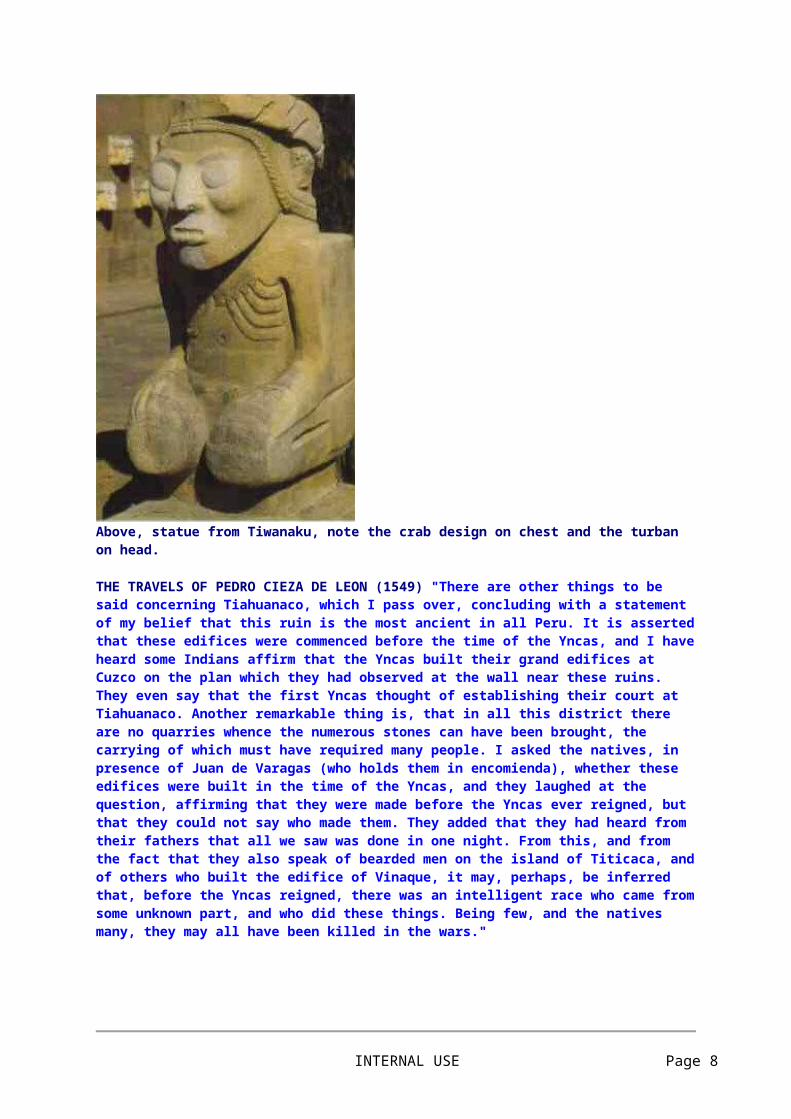
Above, stones of the Kalasasaya as it appeared in 1851 (Von Tschudi), view from west side looking east. The Akapana hill is in the background.
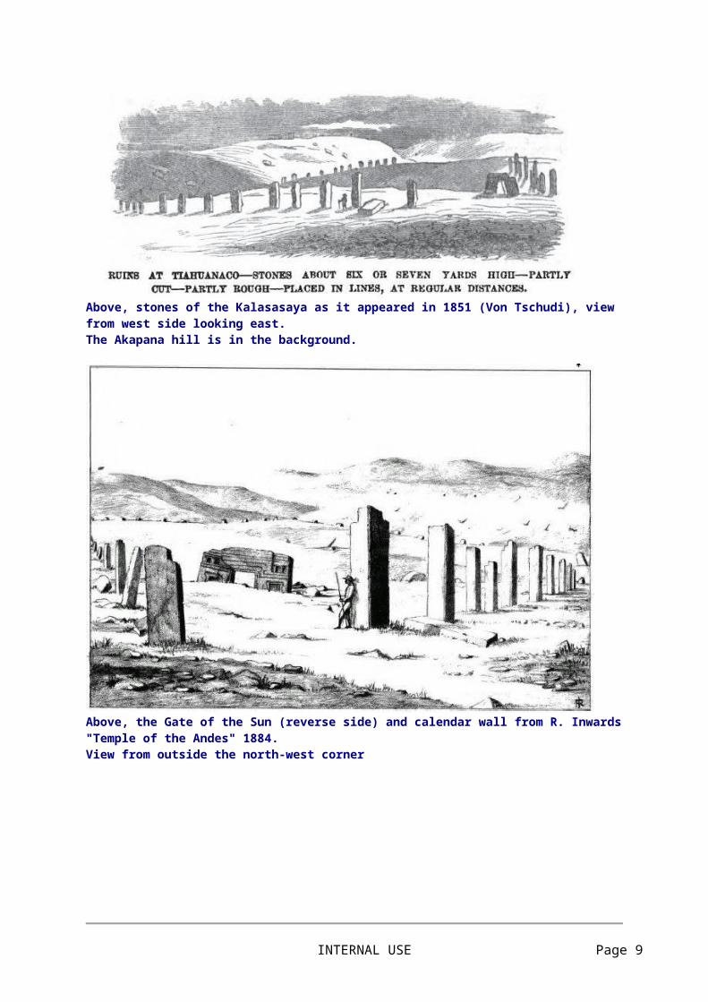
Above, the Gate of the Sun (reverse side) and calendar wall from R. Inwards "Temple of the Andes" 1884. View from outside the north-west corner
INTERNAL USE Page 7
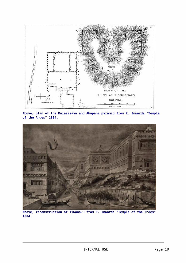
Above, plan of the Kalasasaya and Akapana pyramid from R. Inwards "Temple of the Andes" 1884.
Above, reconstruction of Tiwanaku from R. Inwards "Temple of the Andes" 1884.
INTERNAL USE Page 8
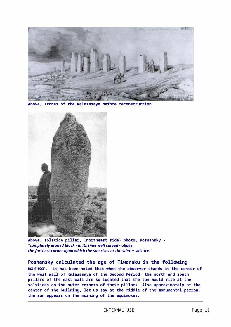
Above, stones of the Kalasasaya before reconstruction
Above, solstice pillar, (northeast side) photo, Posnansky - "completely eroded block - in its time well carved - abovethe farthest corner upon which the sun rises at the winter solstice."
Posnansky calculated the age of Tiwanaku in the following manner, "it has been noted that when the observer stands at the center of the west wall of Kalasasaya of the Second Period, the north and south pillars of the east wall are so located that the sun would rise at the solstices on the outer corners of these pillars. Also approximately at the center of the building, let us say at the middle of the monumental perron, the sun appears on the morning of the equinoxes.
INTERNAL USE Page 9
Now then: if, at the solstices, one observes the sunrise without the aid of instruments, it will be noted that it does indeed still come up on the corners of these pillars. However, if we examine this phenomenon with precision instruments, we note a difference of approximately eighteen angular minutes, which represents the change in the obliquity of the ecliptic between that of the period in which Kalasasaya was built and that which it has today. </P
This difference has served as the basis for the calculation of the age of Tihuanacu. From what has been discussed in previous chapters, there is not the least doubt that this building was indeed built on the astronomic meridian and its angles were the points marked exactly by the amplitude of the sun between the solstices. These few introductory words will explain to the reader in a summary fashion how the basis for calculating the probable age of Tihuanacu was obtained. However, in practice, the question is not as simple as the foregoing lines might indicate.
The aforementioned difference of eighteen angular minutes noted in Kalasasaya is the basis for our calculations and this coefficient was applied to a curve constituted on the basis of the formula of extrapolation recommended by the Ephemeris Conference of Paris in the year 1911 and which is as follows:
eps (t) = 23° 27' 8.26" - 468.44" t - 0.60" t2 + 1.83" t3
If this curve should vary with future studies and trials in the coming centuries of exact astronomy, then the calculation in regard to the age of Tihuanacu would also vary. However, in any event, even leaving aside the calculation by astronomical methods, the age of Tihuanacu, a figure somewhere beyond ten thousand years (the age of the Second and Third periods) will always be, on the basis of geology, paleontology and anthropology, very great --- no matter by what method or standard it is judged."
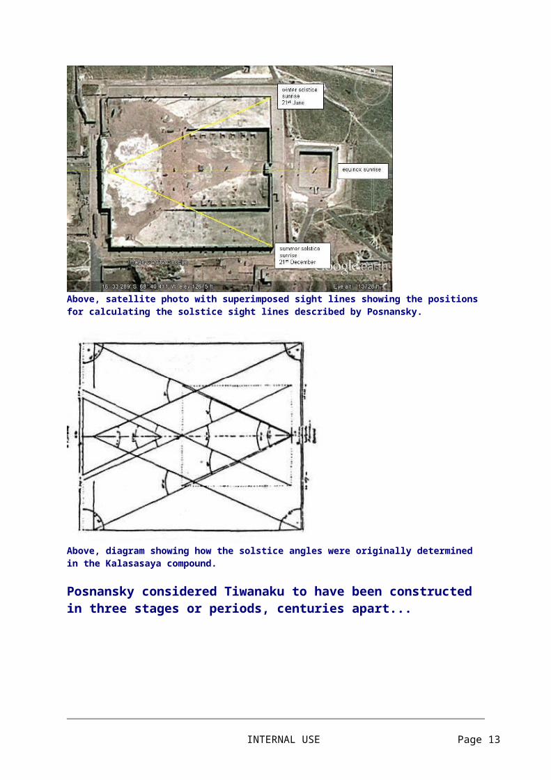
Above, satellite photo with superimposed sight lines showing the positions for calculating the solstice sight lines described by Posnansky.
INTERNAL USE Page 10
Above, diagram showing how the solstice angles were originally determined in the Kalasasaya compound.
Posnansky considered Tiwanaku to have been constructedin three stages or periods, centuries apart...
Above, to the west (sunset) the inner blue triangle dotted line shows sight lines based upon drawing to the left, the solid blue line shows sight line to present western wall "of the third period" based on observation block in centre of Kalasasaya. The yellow lines show sight lines to the original corner stones which
INTERNAL USE Page 11

Posnansky calls "of the second period". To the east, (sunrise) the yellow sight line is to the original solstice pillars of the compound. The viewing positions are marked by large stone blocks which were recovered on site.
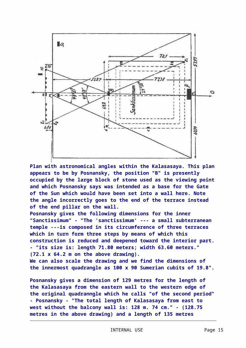
Plan with astronomical angles within the Kalasasaya. This plan appears to be by Posnansky, the position "B" is presently occupied by the large block of stone used as the viewing point and which Posnansky says was intended as a base for the Gate of the Sun which would have been set into a wall here. Note the angle incorrectly goes to the end of the terrace instead of the end pillar on the wall. Posnansky gives the following dimensions for the inner "Sanctissimum" - "The 'sanctissimum' --- a small subterranean temple ---is composed in its circumference of three terraces which in turn form three steps by means of which this construction is reduced and deepened toward the interior part. - "its size is: length 71.80 meters; width 63.60 meters." (72.1 x 64.2 m on the above drawing). We can also scale the drawing and we find the dimensions of the innermost quadrangle as 100 x 90 Sumerian cubits of 19.8".
Posnansky gives a dimension of 129 metres for the length of the Kalasasaya from the eastern wall to the western edge of the original quadranngle which he calls "of the second period" - Posnansky - "The total length of Kalasasaya from east to west
INTERNAL USE Page 12
without the balcony wall is: 128 m. 74 cm." - (128.75 metres in the above drawing) and a length of 135 metres (135.54 metres in above drawing) for the distance from the eastern wall to the row of calendar stones shown in the drawing which he calls the calendar wall "of the third period". The position of the calendar wall shown also represents an earlier wall, now demolished. Posnansky - "AFTER HAVING EXCAVATED IT. Kalasasaya of the Second Period is 128 meters 74 centimeters long by 118 meters 26 centimeters wide." (128.75 x 118.31 metres in the above drawing) - this refers to the original quadrangle of the second period, and does not include the row of stones shown on the above drawing outside the original quadrilateral and which represents the present calendar wall which he calls "of the third period". (Posnansky - "The west balcony wall which belonged to the SECOND PERIOD, is not in existence at the present time and we have found only remains of the short corner wall of the south side. On June 18, 1939, we discovered remains of the north side..")
Sometimes Posnansky's data is difficult to understand due to lack of access to the original books and drawings.... there may also be errors in translation since in one part he says in the English version "the sun set between pillars "K" and "A" about the solstices; as for pillars "B" and "J" they observed that the sun set between them about a month before and after these times", while later he says "one notes that the sun sets in the center of the pillars "A" and "K" at the solstices" which is correct, the sun is intended to set over the centre of the pillars, but elsewhere Posnansky describes incorrectly how the sun set in the spaces between the pillars..... but then these spaces were also occupied by a wall as the pillars themselves were carved on their sides to receive the blocks forming a continuous wall..... Posnansky also thought that above the pillars was a continuous lintel which supported small windows through which the sun may have shone at the appropriate times. The intersection of sight line "W" on the western edge of the compound is the point for observation of the original solstice stones on the east side "of the second period" while "B" appears to be where the "observation block" which Posnansky thought may have been built into a wall and intended to receive the Gate of the Sun was located.
We can note on the plan of Kalasasaya that the entrance staircase or "perron" is not in the exact centre of the eastern wall. Posnansky offers this explanation "The sun not being in the center of the orbit but in a center of the eclipse in which the earth turns about the sun the earth needs a greater length of time to go from the autumnal equinox to the winter solstice and return to the vernal equinox than to go from the vernal equinox to the summer solstice and return to the autumnal equinox. That is to say, that for the moving of the earth from the twenty-first of March
INTERNAL USE Page 13

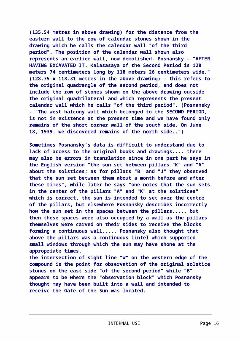
(autumnal equinox) to the twenty-third of September (vernal equinox) it needs 186 days, 11 hours (winter) while to travel from the vernal equinox to the autumnal equinox it needs only 178 days, 19 hours (summer). Thus there is a difference of 7 days and 16 hours between the winter and summer semesters. This is the crux of the problem as to why the perron of Tihuanacu is not in the center of Kalasasaya but is located 1 m. 116 mm. to the north. Thus, since they wished to divide the year into four equal parts, they made further observations in order to determine where the sun would rise at the exact middle of the year, on the twenty-fourth of March and the twenty-first of September, and they then noted --- surely with no little surprise --- that the sun did not rise in the center of the temple but 1 m. 116 mm. to the north. With this observation they were perhaps the first men in the world to note the perihelion and the aphelion, or the eccentricity of the terrestrial orbit."
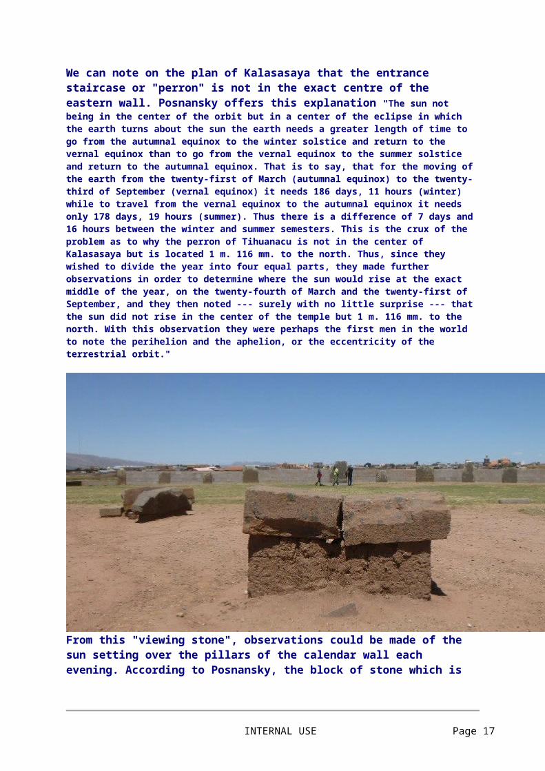
From this "viewing stone", observations could be made of the sun setting over the pillars of the calendar wall each evening. According to Posnansky, the block of stone which is now split in two, was originally at ground level and intended as a base upon which the Gate of the Sun would be constructed.
INTERNAL USE Page 14
The block of stone which Posnansky says was originally part of a wall and intended as a base upon which the Gate of the Sun would be constructed, presumably the same stone seen in previous photo set up as an observation stone.
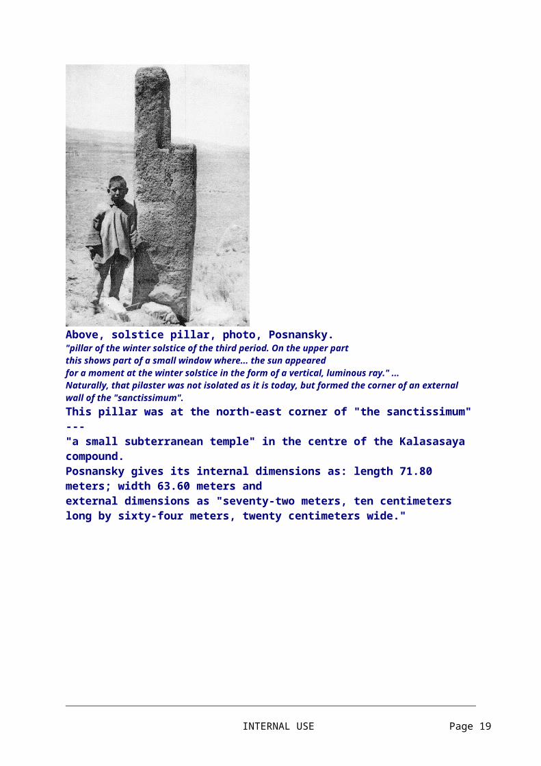
Above, solstice pillar, photo, Posnansky. "pillar of the winter solstice of the third period. On the upper part this shows part of a small window where... the sun appeared
INTERNAL USE Page 15
for a moment at the winter solstice in the form of a vertical, luminous ray." ... Naturally, that pilaster was not isolated as it is today, but formed the corner of an external wall of the "sanctissimum". This pillar was at the north-east corner of "the sanctissimum" --- "a small subterranean temple" in the centre of the Kalasasaya compound. Posnansky gives its internal dimensions as: length 71.80 meters; width 63.60 meters and external dimensions as "seventy-two meters, ten centimeters long by sixty-four meters, twenty centimeters wide."
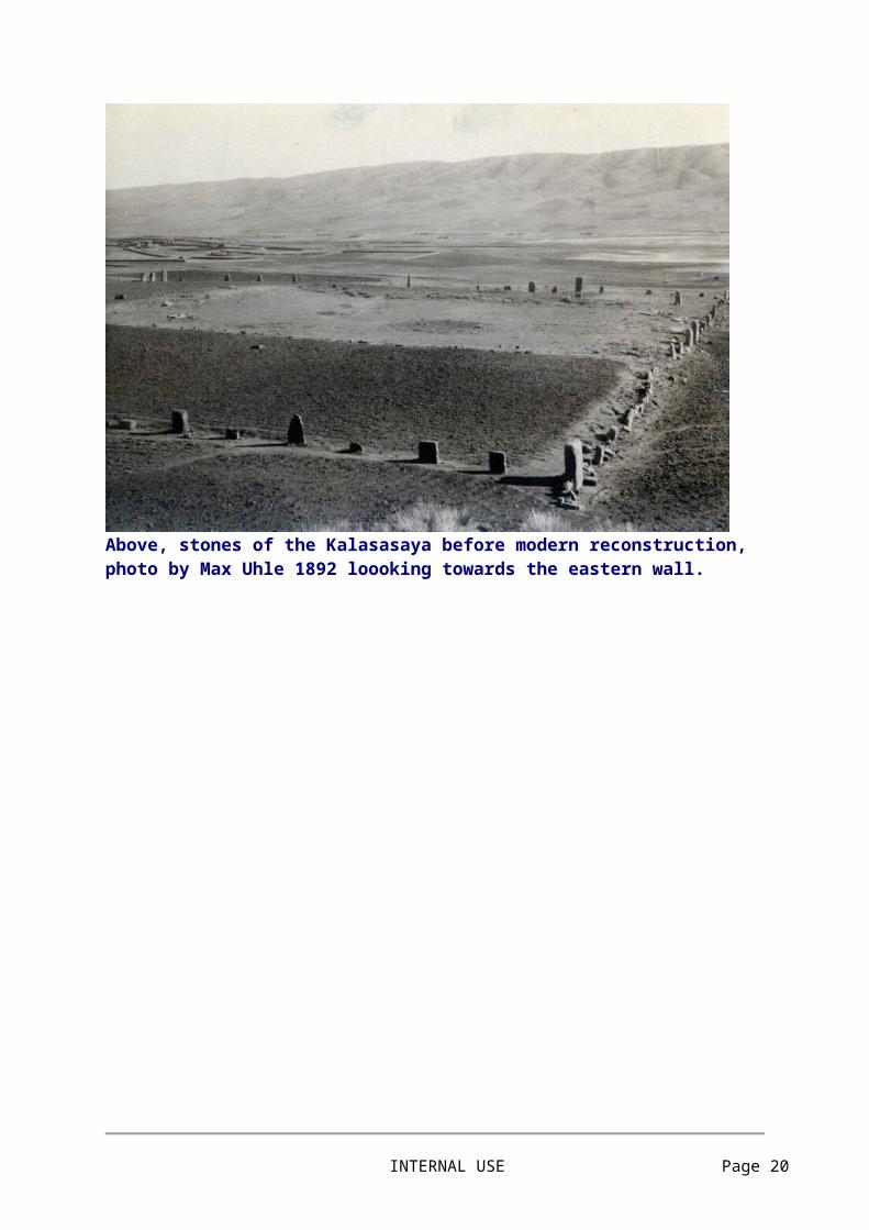
Above, stones of the Kalasasaya before modern reconstruction, photo by Max Uhle 1892 loooking towards the eastern wall.
INTERNAL USE Page 16
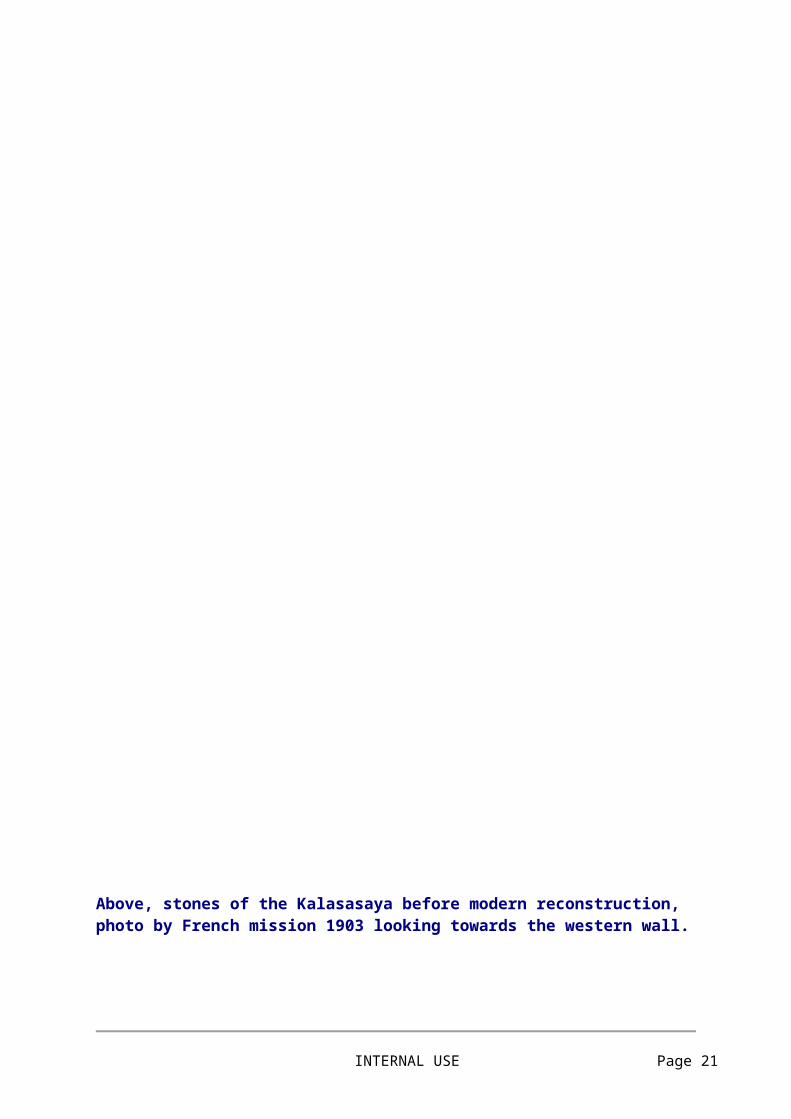
Above, stones of the Kalasasaya before modern reconstruction, photo by French mission 1903 looking towards the western wall.
INTERNAL USE Page 17
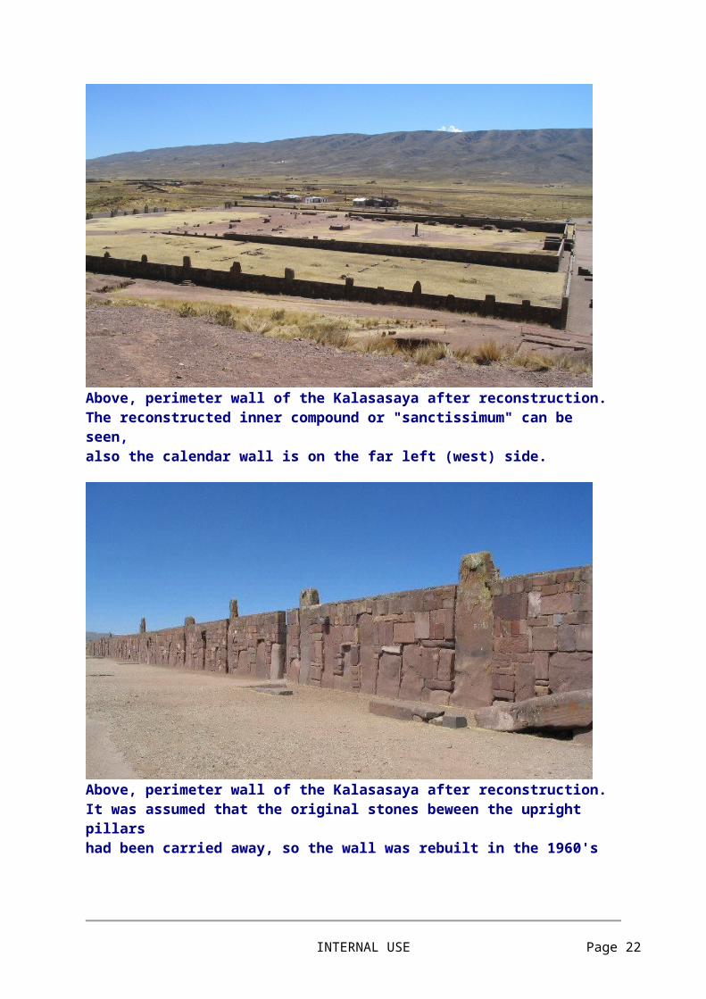
Above, perimeter wall of the Kalasasaya after reconstruction. The reconstructed inner compound or "sanctissimum" can be seen,also the calendar wall is on the far left (west) side.
Above, perimeter wall of the Kalasasaya after reconstruction. It was assumed that the original stones beween the upright pillars had been carried away, so the wall was rebuilt in the 1960's
INTERNAL USE Page 18
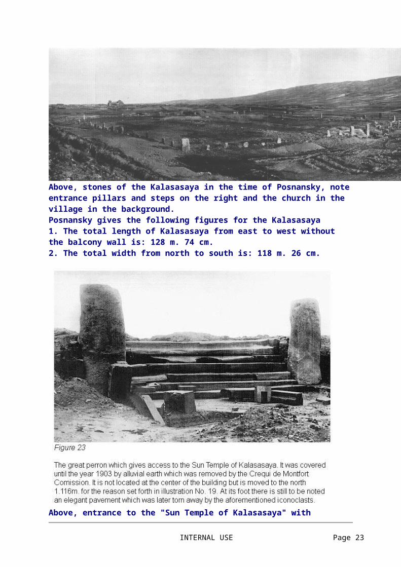
Above, stones of the Kalasasaya in the time of Posnansky, note entrance pillars and steps on the right and the church in the village in the background. Posnansky gives the following figures for the Kalasasaya 1. The total length of Kalasasaya from east to west without the balcony wall is: 128 m. 74 cm. 2. The total width from north to south is: 118 m. 26 cm.
Above, entrance to the "Sun Temple of Kalasasaya" with
INTERNAL USE Page 19
comments by Posnansky. The photograph appears to be one taken by the French mission in 1903.
Above, entrance to the Kalasasaya before modern reconstruction.
Above, Posnansky's plan drawing of the Kalasasaya entrance.
INTERNAL USE Page 20
Above, entrance to the Kalasasaya after restoration, the modern archaeologists appear to have followed Posnansky's plan.
Above, entrance to the Kalasasaya, reconstruction envisaged by Edmund Kiss, 1937.
INTERNAL USE Page 21
Above, interior of the Kalasasaya, reconstruction envisaged by Edmund Kiss, 1937.
Above, plan of the Kalasasaya, ruins with observation angles by Edmund Kiss, 1937. On this drawing, an angle is shown from the original position of the Gate of the Sun (A) west to the ends of the calendar wall terrace whereas the angle should go from an observation stone inside the compound to the end of the calendar stones themselves. See drawing on following page.
INTERNAL USE Page 22
Above, plan of the Kalasasaya, reconstruction envisaged by Edmund Kiss, 1937.
Above, oblique view of the Kalasasaya, reconstruction envisaged by Edmund Kiss, 1937.
INTERNAL USE Page 23

Above, plan of the palace of the sarcophagus, reconstruction envisaged by Edmund Kiss, 1937.
Above, palace of the sarcophagus, reconstruction envisaged by Edmund Kiss, 1937.
INTERNAL USE Page 24