Embed Size (px)
Citation preview
USGS 3D Elevation
Program
Quality Control at the National
Geospatial Technical Operations Center
(NGTOC)
FL-ASPRS/UF Fall 2017 LiDAR Workshop
Lou Driber
Physical Scientist, Geospatial Liaison
U.S. Geological Survey
National Geospatial Program

2222
3DEP Products
• Classified Point Cloud
• Lidar-derived 1-meter raster bare-earth DEM
Products publish through the National Map
nationalmap.gov
3333
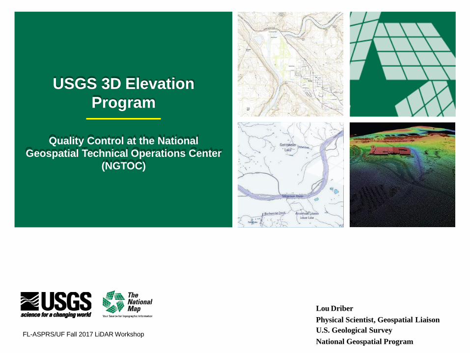
NGTOC Quality Control Overview
Standard Checks:
• Metadata
• Data processed to meet applicable
USGS Lidar Base Specification
• Lidar Point Cloud file (Swath LAS and
Classified LAS) header information/format
• Point Classification
• Spatial Accuracy
• Lidar-derived DEM meets required
format/specifications, accuracy, and
portrayal of bare-earth surface
DEM with Vegetation not removed
Profile of DEM with
Vegetation not removed
4444
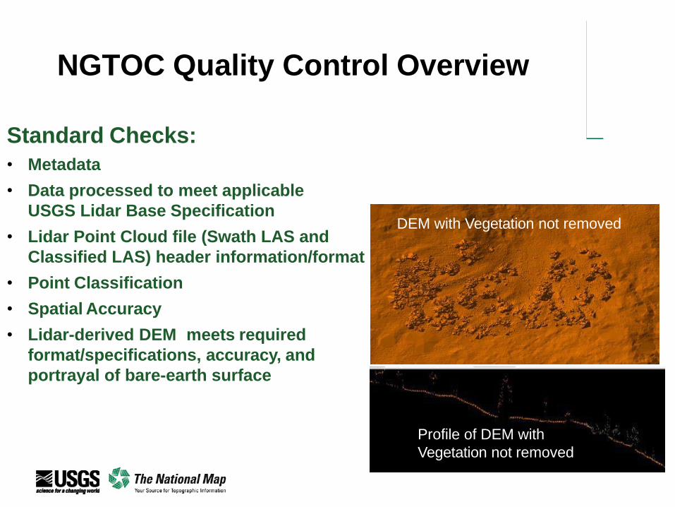
Lidar Base Specification
▪ All current 3DEP projects adhere
to the USGS Lidar Base
Specification Version 1.2 adopted
November of 2014
▪ Many projects have customer-
specific requirements beyond the
LBS documented in the Project
Task Order or contract agreement

5555
Note: Doesn’t address Lidar Emerging Technologies

6666
3DEP Data Source Points
7777
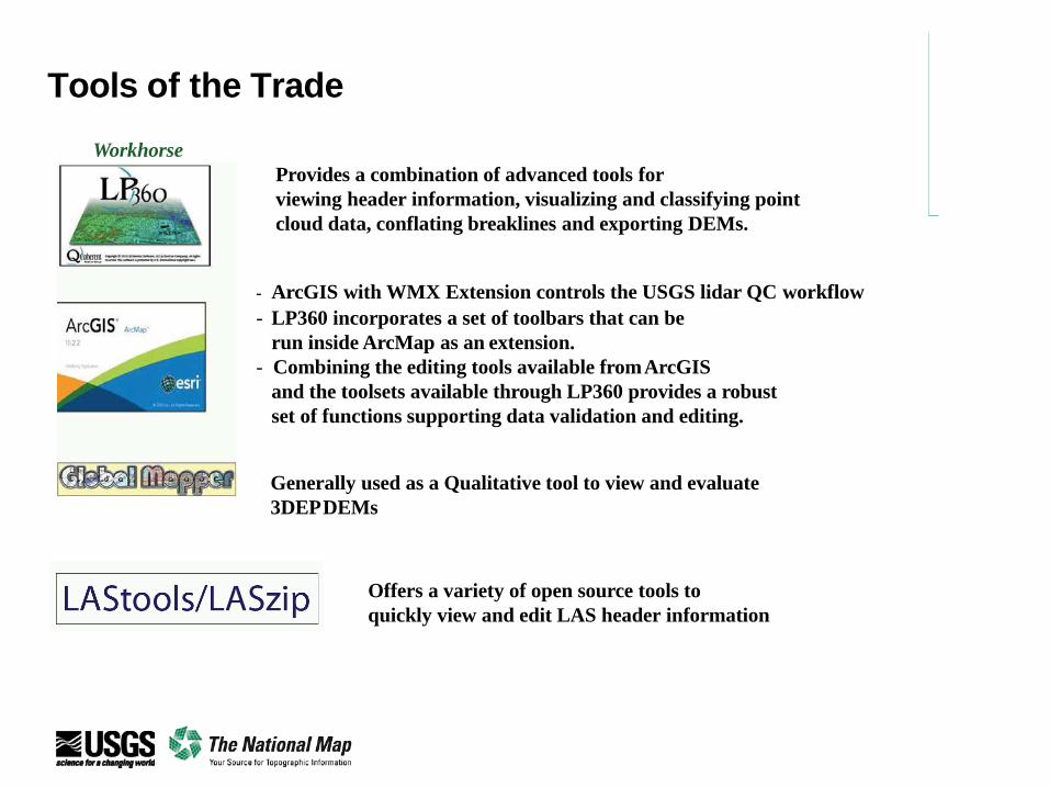
Tools of the Trade
Workhorse
Provides a combination of advanced tools for
viewing header information, visualizing and classifying point
cloud data, conflating breaklines and exporting DEMs.
- ArcGIS with WMX Extension controls the USGS lidar QC workflow
- LP360 incorporates a set of toolbars that can be
run inside ArcMap as an extension.
- Combining the editing tools available fromArcGIS
and the toolsets available through LP360 provides a robust
set of functions supporting data validation and editing.
Generally used as a Qualitative tool to view and evaluate
3DEPDEMs
Offers a variety of open source tools to
quickly view and edit LAS header information
8888
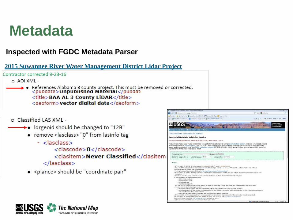
Metadata
Inspected with FGDC Metadata Parser
2015 Suwannee River Water Management District Lidar Project

9999Data Content / Formatting
In-House Applications
▪ LAS_Check (in-house)
▪ Verify LAS 1.4 files follow format standards
▪ LAS_QC (in-house)
▪ Reads LAS header and point information
▪ Reports:
▪ Spatial Reference System
▪ Point Form ID
▪ Number of Classes Used
▪ Returns Used
▪ Point Density
▪ Intensity and Scan Angle
▪ GDAL (in-house)
▪ Checks each LAS file references correct coordinate system
▪ File expressed in the proper Well Known Text (WKT-LAS 1.4) format
▪ Las Point Classifications meets project requirements
▪ Point count totals are correct

10101010
Procedures Include:
▪ Visually review the Swath and Classified LAS Point cloud for
missing data
▪ Horizontal Position check (relative) for issues such as sensor
miscalibration
Overlap area between two
flight lines showing relative
horizontal offset.
Swath Point cloud with Calibration Issues
Initial Qualitative Review
11111111
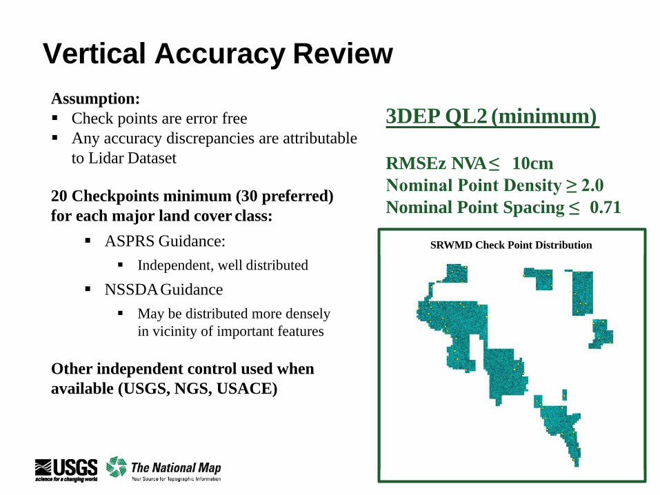
Vertical Accuracy Review
Assumption:
▪ Check points are error free
▪ Any accuracy discrepancies are attributable
to Lidar Dataset
20 Checkpoints minimum (30 preferred)
for each major land cover class:
▪ ASPRS Guidance:
▪ Independent, well distributed
▪ NSSDAGuidance
▪ May be distributed more densely
in vicinity of important features
Other independent control used when
available (USGS, NGS, USACE)
3DEP QL2 (minimum)
RMSEz NVA≤ 10cm
Nominal Point Density ≥ 2.0
Nominal Point Spacing ≤ 0.71
SRWMD Check Point Distribution

12121212
Vertical Accuracy Review
Tools
ArcMap
• Load Project Area Polygon and Check Points
• Verify
• Checkpoint Distribution
• Checkpoint Quantity
• Checkpoint Quality
LP360
• Load Swath files to compute NVA
• Compare value of checkpoint to those of the TIN at that location
• Verify
• Accuracy results computed to those reported by Contractor
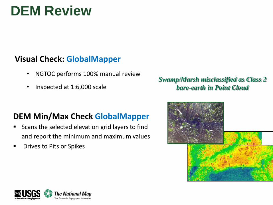
13131313DEM Review
Swamp/Marsh misclassified as Class 2
bare-earth in Point Cloud
Visual Check: GlobalMapper
• NGTOC performs 100% manual review
• Inspected at 1:6,000 scale
DEM Min/Max Check GlobalMapper▪ Scans the selected elevation grid layers to find
and report the minimum and maximum values
▪ Drives to Pits or Spikes

14141414Lidar Point Classification
DEM: Vegetation Classified as Ground
ORANGE
GREY
Ground Points
Unclassified Points
Profile highlights
misclassified points

15151515
DEM Review: Hydrography
• Verify DEM tiles are Hydro-Flattened
• Culverts are maintained (Not Hydro-Enforced)
• Bridges/Overpasses are properly removed

16161616
DEM Review:
Floating Water Bodies
Hydro-Flattening Water Bodies
Typically caused by:
incorrectly conflating water breaklines
developing breaklines with incorrect elevation value.
17171717
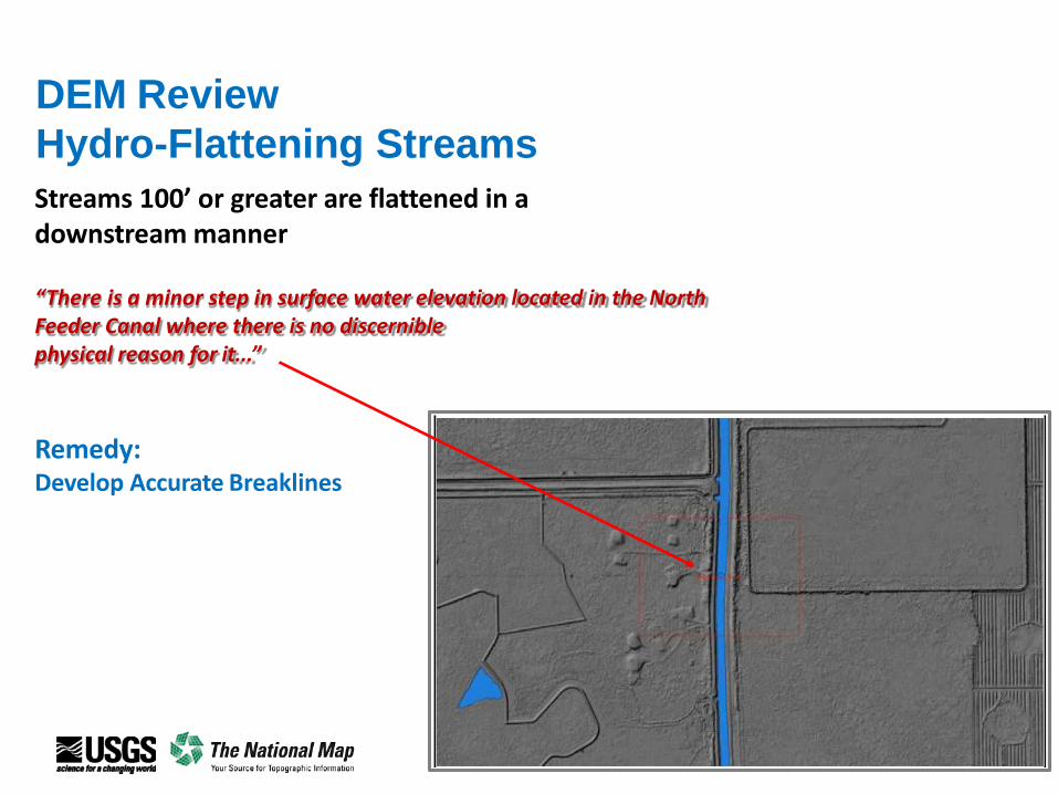
DEM Review
Hydro-Flattening Streams
Streams 100’ or greater are flattened in a downstream manner
“There is a minor step in surface water elevation located in the North Feeder Canal where there is no discerniblephysical reason for it...”
Remedy:Develop Accurate Breaklines
18181818
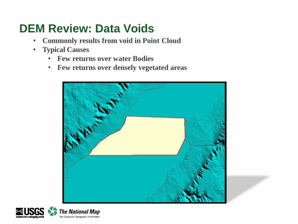
DEM Review: Data Voids• Commonly results from void in Point Cloud
• Typical Causes
• Few returns over water Bodies
• Few returns over densely vegetated areas

19191919
DEM Review:
Building Removal
• Cause for rejection
of both the DEM
and the point cloud
data
• Typically caused by
incorrect point
classification
2020
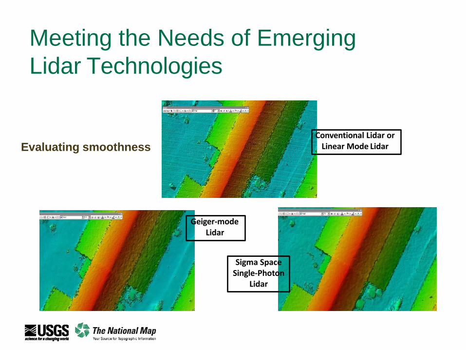
Meeting the Needs of Emerging
Lidar Technologies
Conventional Lidar or Linear Mode Lidar
Geiger-mode Lidar
Sigma Space Single-Photon
Lidar
Evaluating smoothness
21212121
Thank-you
Lou Driber
Physical Scientist, Geospatial Liaison
U.S. Geological Survey
National Geospatial Program