Embed Size (px)
Citation preview
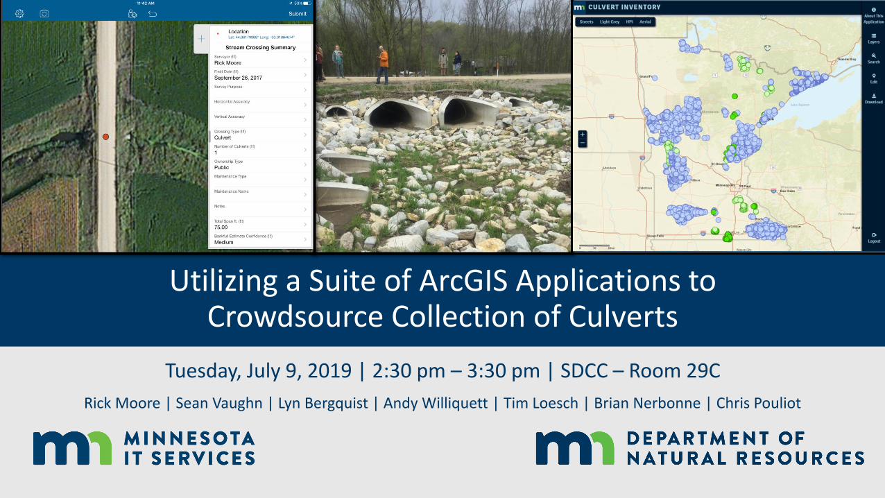
Utilizing a Suite of ArcGIS Applications to Crowdsource Collection of Culverts
Tuesday, July 9, 2019 | 2:30 pm – 3:30 pm | SDCC – Room 29C
Rick Moore | Sean Vaughn | Lyn Bergquist | Andy Williquett | Tim Loesch | Brian Nerbonne | Chris Pouliot

Stakeholder Funding
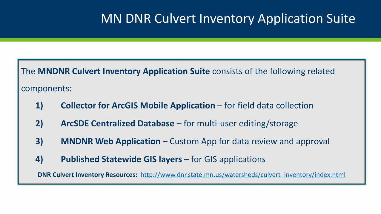
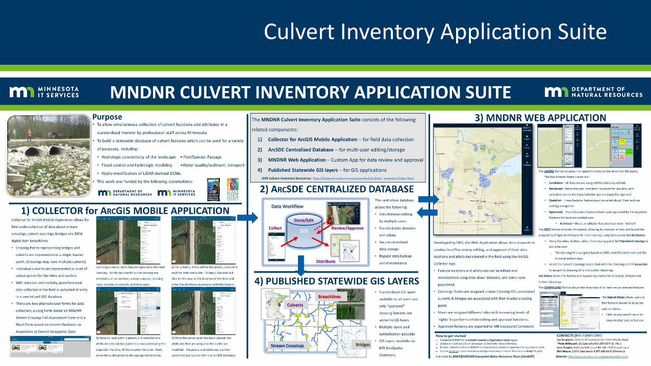
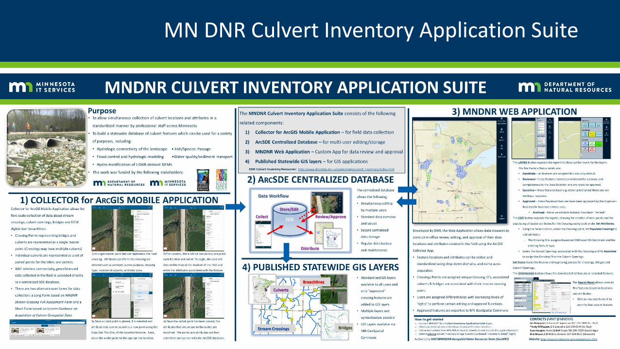
MN DNR Culvert Inventory Application Suite
The MNDNR Culvert Inventory Application Suite consists of the following related
components:
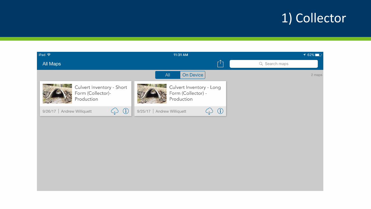
1) Collector for ArcGIS Mobile Application – for field data collection
2) ArcSDE Centralized Database – for multi-user editing/storage
3) MNDNR Web Application – Custom App for data review and approval
4) Published Statewide GIS layers – for GIS applications
DNR Culvert Inventory Resources: http://www.dnr.state.mn.us/watersheds/culvert_inventory/index.html
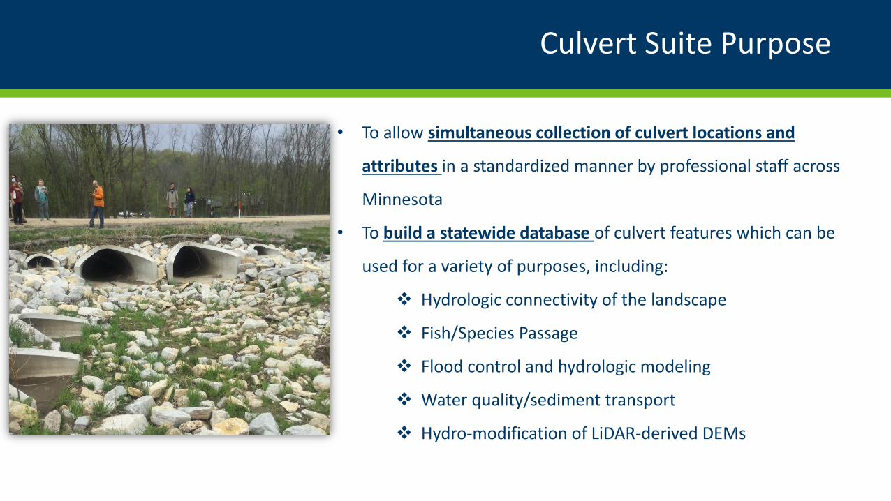
Culvert Suite Purpose
• To allow simultaneous collection of culvert locations and
attributes in a standardized manner by professional staff across
Minnesota
• To build a statewide database of culvert features which can be
used for a variety of purposes, including:
Hydrologic connectivity of the landscape
Fish/Species Passage
Flood control and hydrologic modeling
Water quality/sediment transport
Hydro-modification of LiDAR-derived DEMs
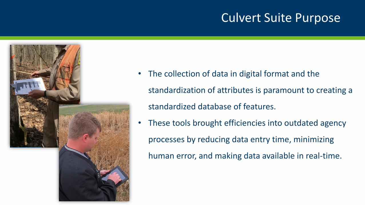
Culvert Suite Purpose
• The collection of data in digital format and the
standardization of attributes is paramount to creating a
standardized database of features.
• These tools brought efficiencies into outdated agency
processes by reducing data entry time, minimizing
human error, and making data available in real-time.
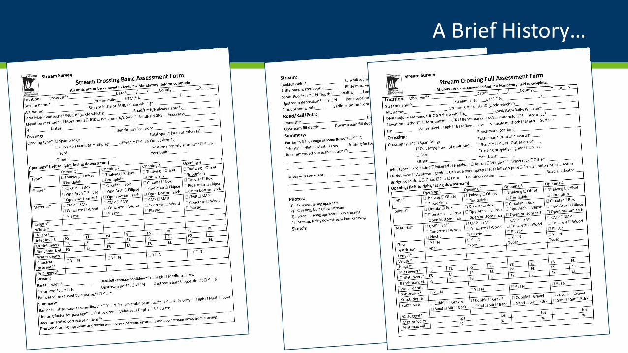
A Brief History…
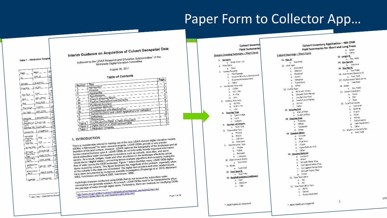
Paper Form to Collector App…
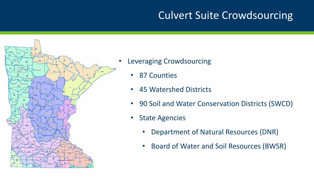
Culvert Suite Crowdsourcing
• Leveraging Crowdsourcing
• 87 Counties
• 45 Watershed Districts
• 90 Soil and Water Conservation Districts (SWCD)
• State Agencies
• Department of Natural Resources (DNR)
• Board of Water and Soil Resources (BWSR)
Culvert Inventory Application Suite
1) Collector
1) Collector
1) Collector
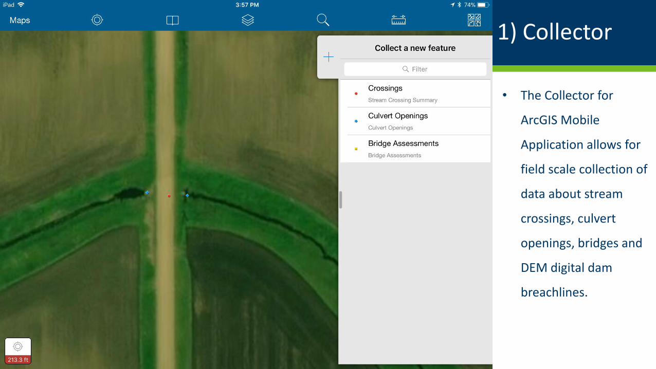
• The Collector for
ArcGIS Mobile
Application allows for
field scale collection of
data about stream
crossings, culvert
openings, bridges and
DEM digital dam
breachlines.
1) Collector
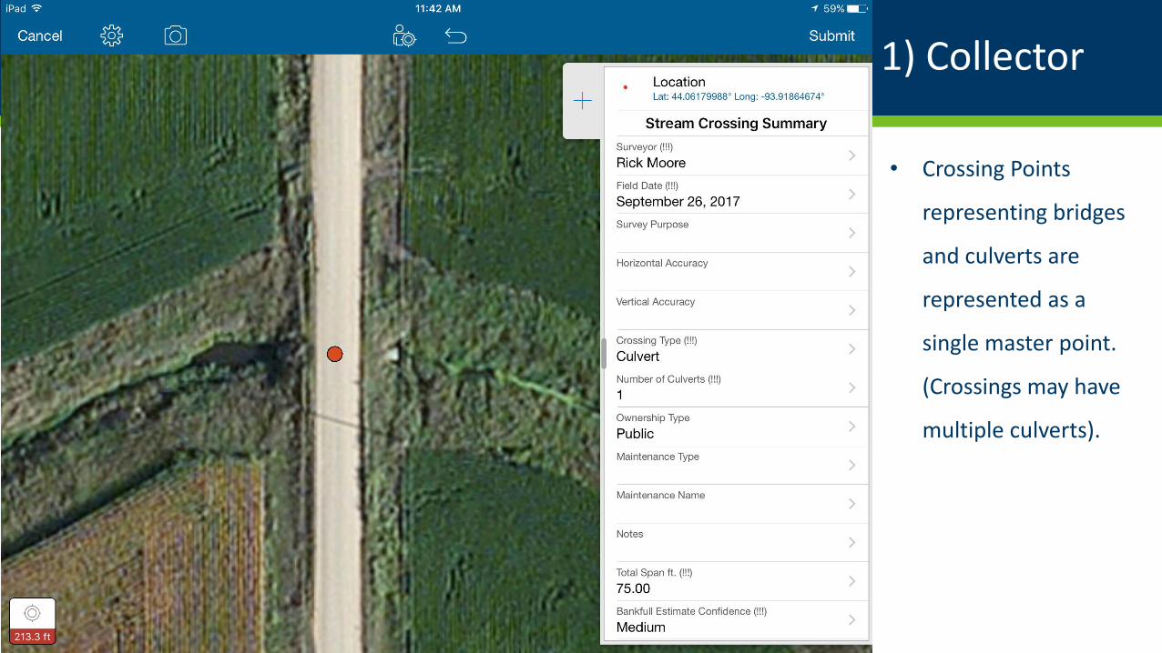
• Crossing Points
representing bridges
and culverts are
represented as a
single master point.
(Crossings may have
multiple culverts).
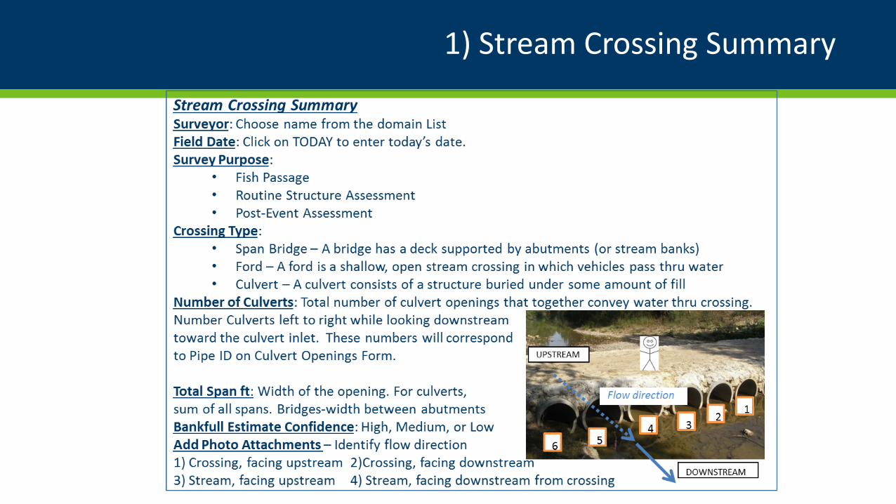
1) Stream Crossing Summary
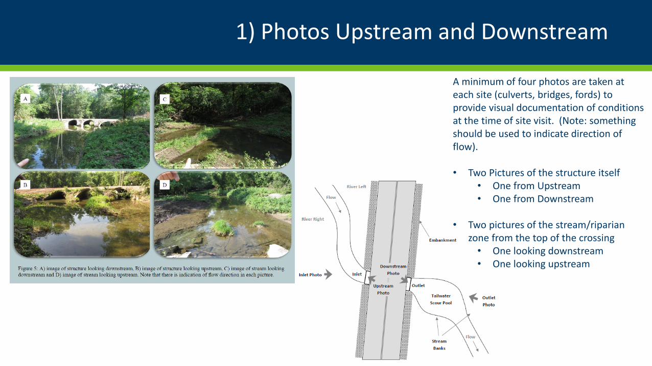
1) Photos Upstream and Downstream
A minimum of four photos are taken at each site (culverts, bridges, fords) to provide visual documentation of conditions at the time of site visit. (Note: something should be used to indicate direction of flow).
• Two Pictures of the structure itself• One from Upstream• One from Downstream
• Two pictures of the stream/riparian zone from the top of the crossing• One looking downstream• One looking upstream
1) Collector
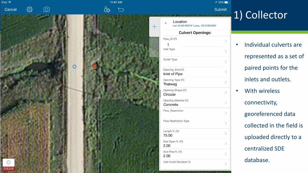
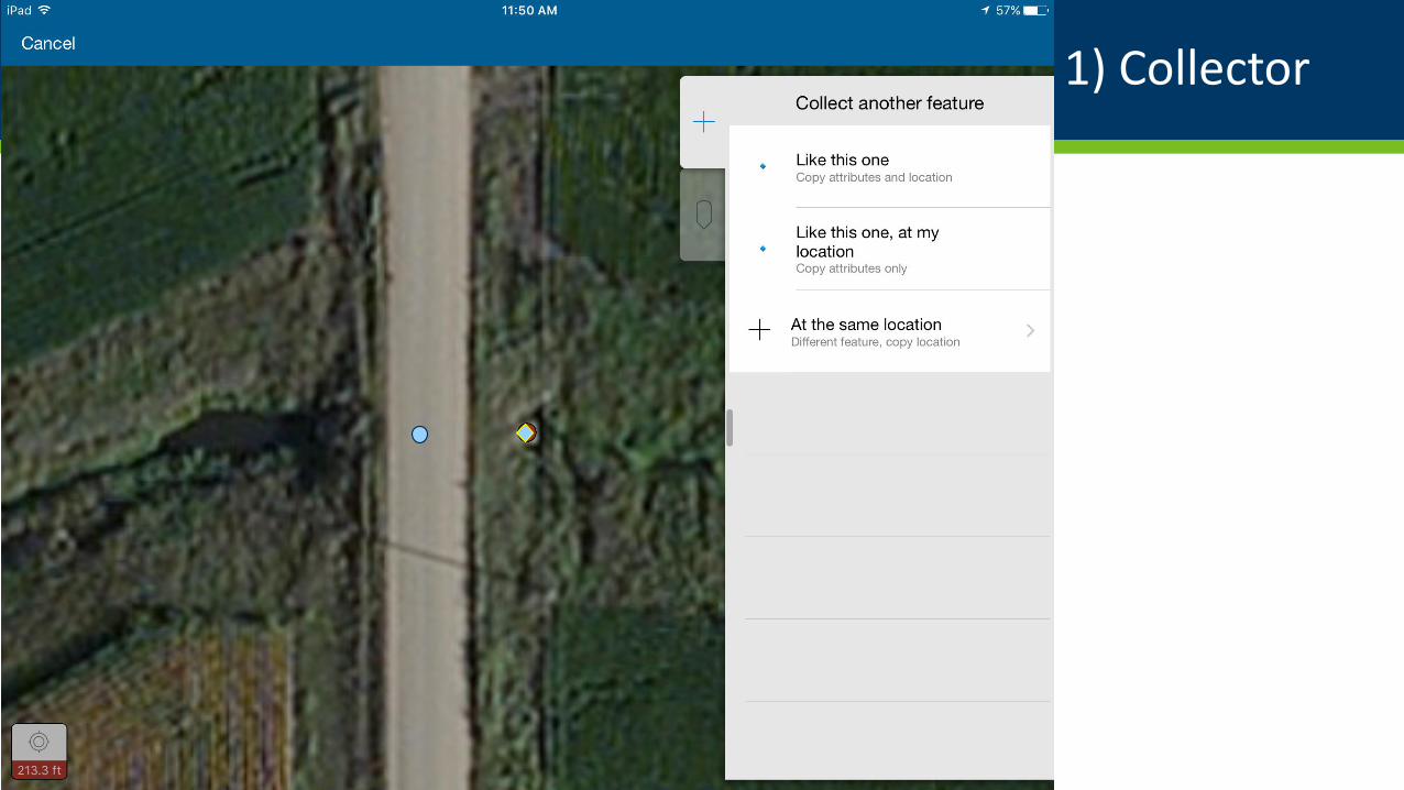
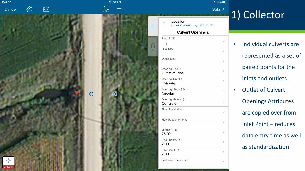
1 • Individual culverts are
represented as a set of
paired points for the
inlets and outlets.
• With wireless
connectivity,
georeferenced data
collected in the field is
uploaded directly to a
centralized SDE
database.
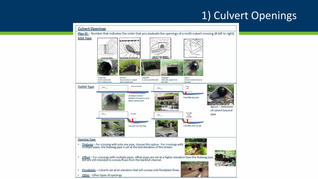
1) Culvert Openings
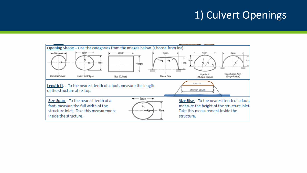
1) Culvert Openings
1) Collector
1) Collector
1) Collector
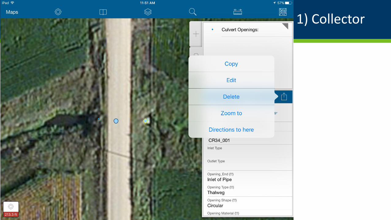
1 • Individual culverts are
represented as a set of
paired points for the
inlets and outlets.
• Outlet of Culvert
Openings Attributes
are copied over from
Inlet Point – reduces
data entry time as well
as standardization
1
1) Stream Crossing Summary & Culvert Openings
DEMO
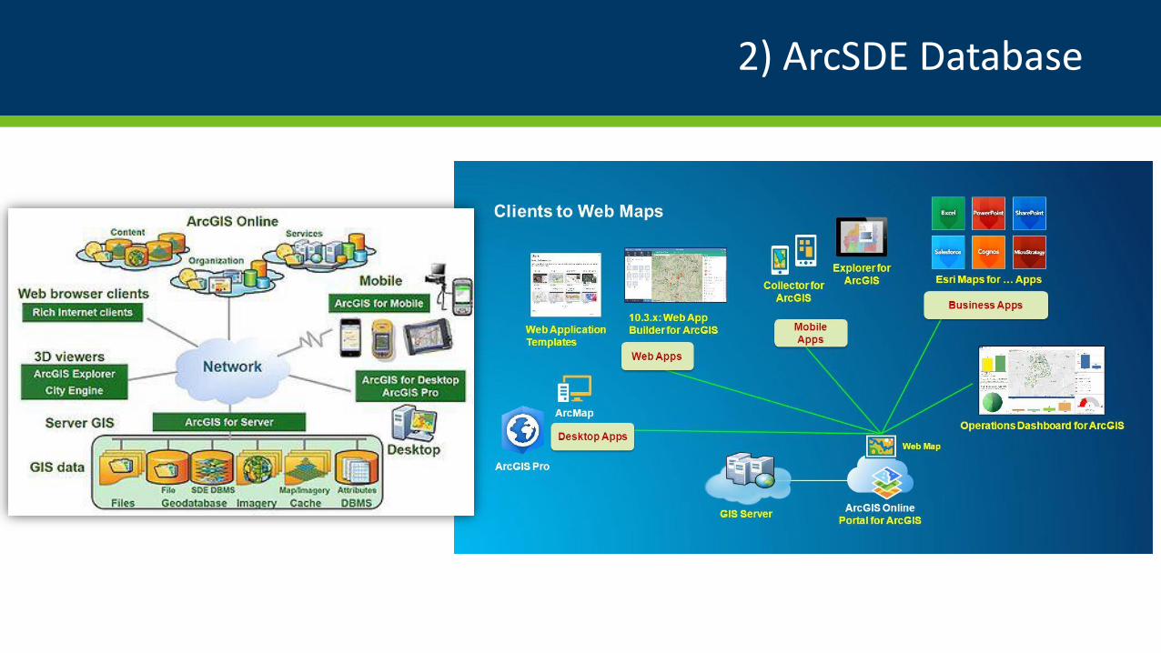
2) ArcSDE Database
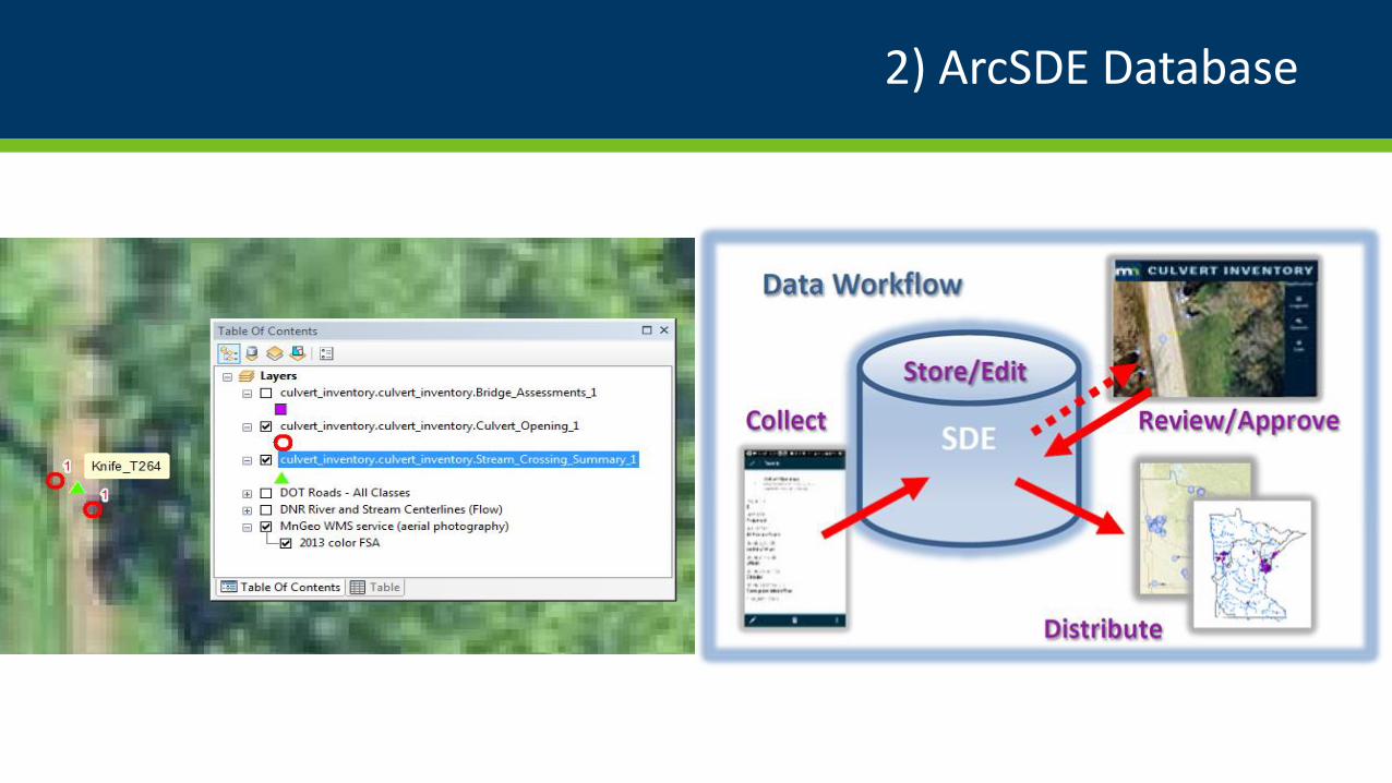
2) ArcSDE Database
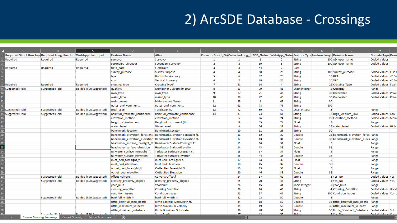
2) ArcSDE Database - Crossings
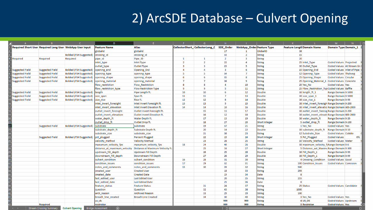
2) ArcSDE Database – Culvert Opening
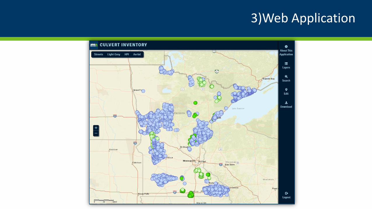
3)Web Application
3)Web Application
• Developed by DNR, the Web
Application allows data
stewards to conduct in-office
review, editing, and approval
of their data locations and
attributes created in the field
using the ArcGIS Collector
App.
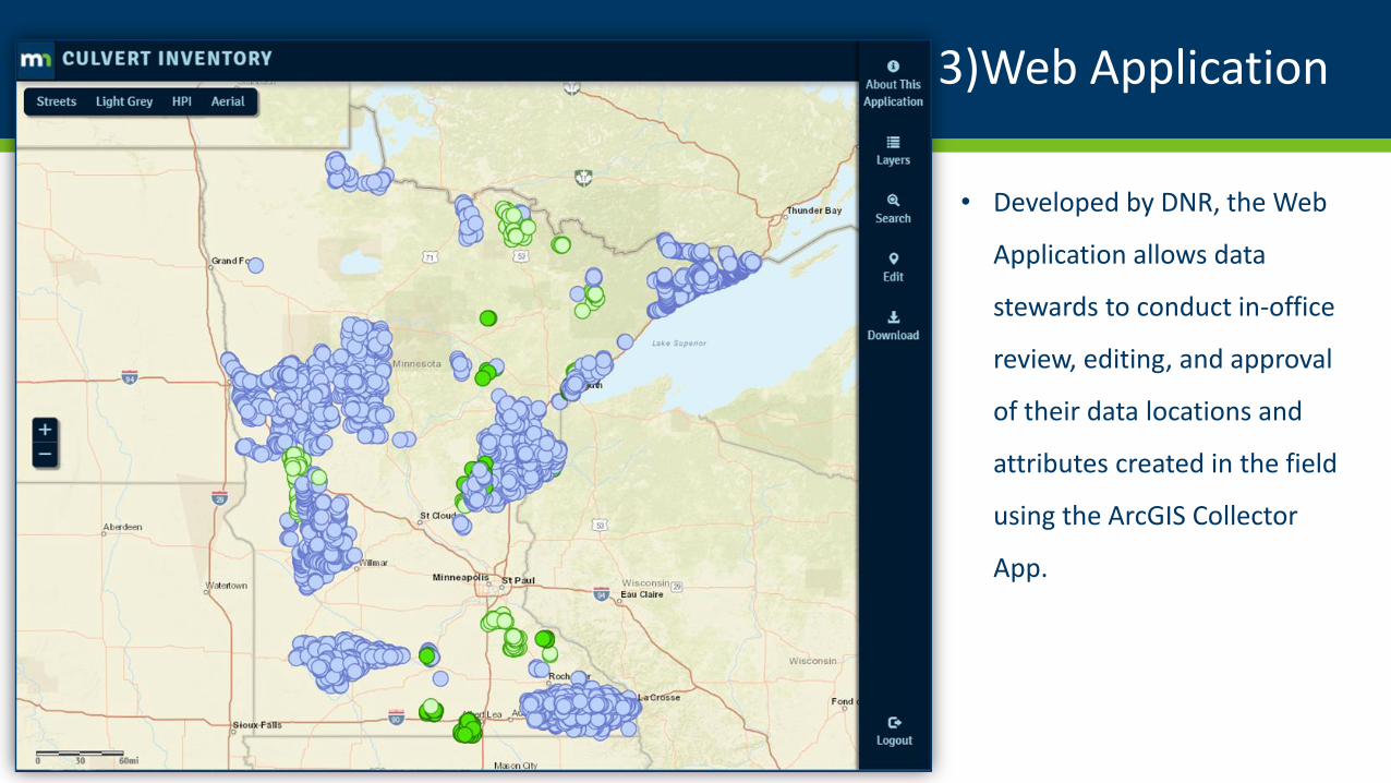
3)Web Application
• Crossings Points are assigned
unique Crossing ID’s, associated
culverts & bridges are
associated with their master
crossing point.
• Users are assigned different
roles with increasing levels of
‘rights’ to perform certain
editing and approval functions.
• Approved features are exported
to MN GeoSpatial Commons
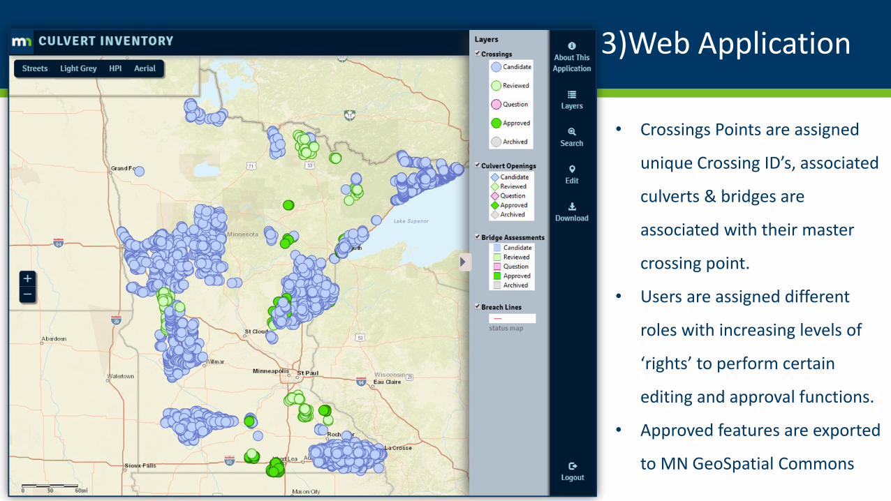
3)Web Application
• The EDIT Button expands the
legend, allowing for creation of
new points and the populating
of Spatial attributes for the
Crossings using tools under Set
Attributes.
• Set Status tracks the Review and
Approving process for Crossings,
Bridges and Culvert Openings.
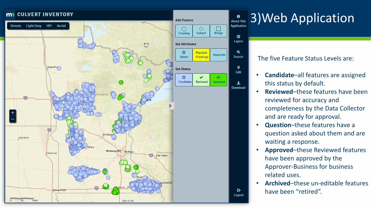
3)Web Application
The five Feature Status Levels are:
• Candidate–all features are assigned this status by default.
• Reviewed–these features have been reviewed for accuracy and completeness by the Data Collector and are ready for approval.
• Question–these features have a question asked about them and are waiting a response.
• Approved–these Reviewed features have been approved by the Approver-Business for business related uses.
• Archived–these un-editable features have been “retired”.
3)Web Application
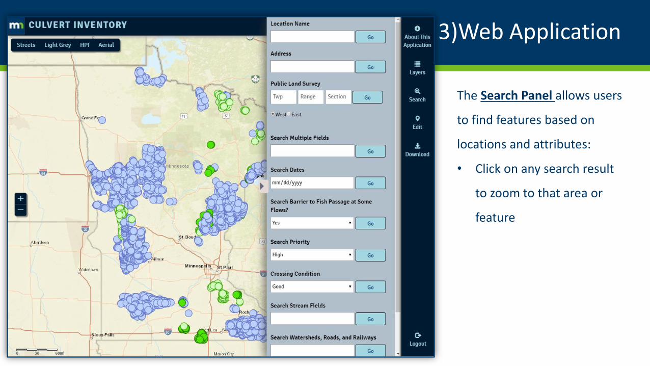
The Search Panel allows users
to find features based on
locations and attributes:
• Click on any search result
to zoom to that area or
feature
3)Web Application
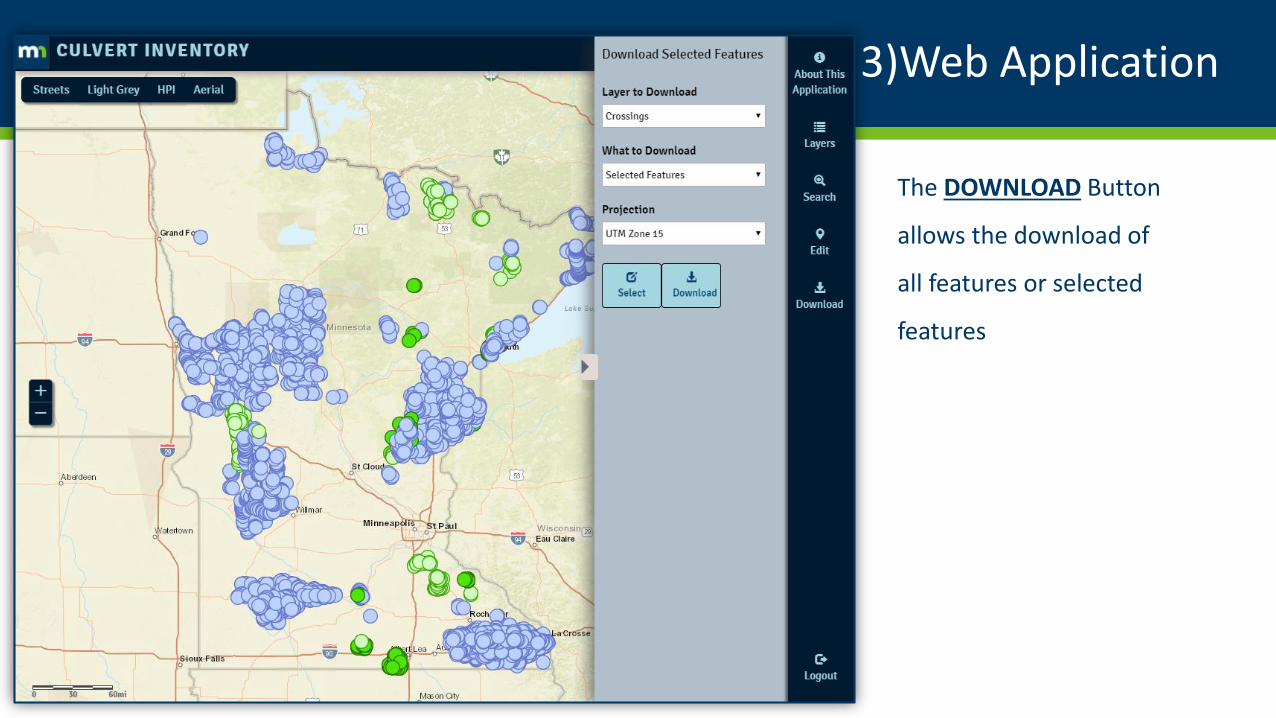
The DOWNLOAD Button
allows the download of
all features or selected
features

3) Stream Crossing Summary & Culvert Openings
DEMO
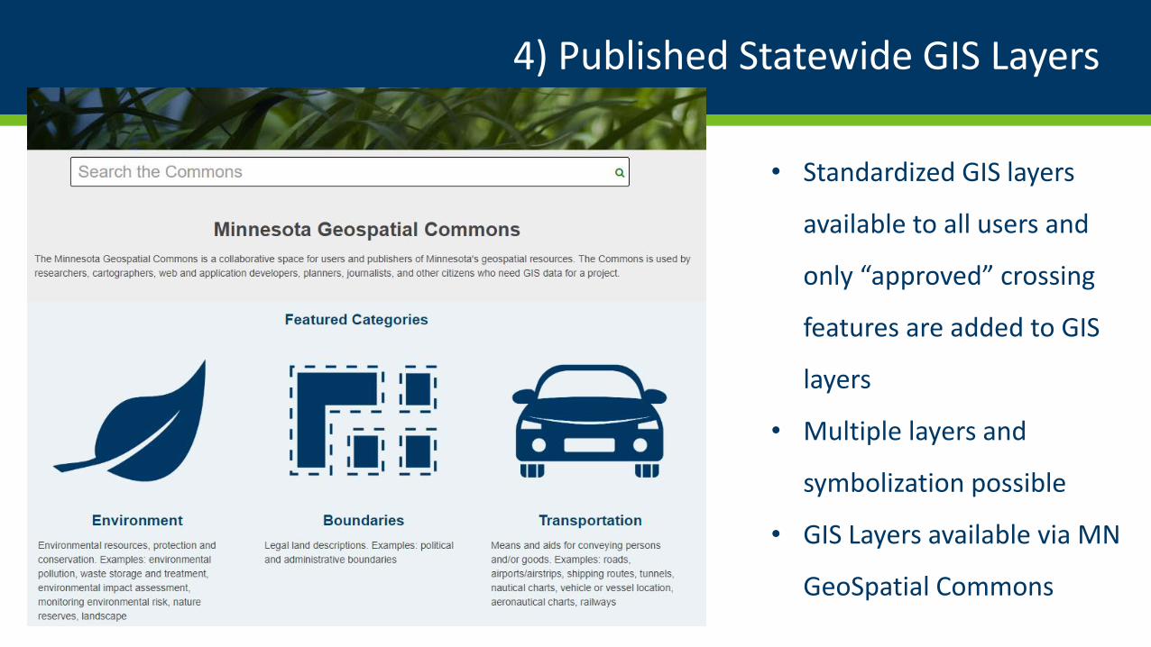
4) Published Statewide GIS Layers
• Standardized GIS layers
available to all users and
only “approved” crossing
features are added to GIS
layers
• Multiple layers and
symbolization possible
• GIS Layers available via MN
GeoSpatial Commons
MN DNR Culvert Inventory Application Suite

Thank You!
Rick Moore | Sean Vaughn | Lyn Bergquist | Andy Williquett| Tim Loesch | Brian Nerbonne | Chris Pouliot
[email protected] [email protected]
763-284-7223 507-389-8810
7/18/2019Culvert Collector App |
https://arcgis.dnr.state.mn.us/faw/culvert_inventory/main.html#37
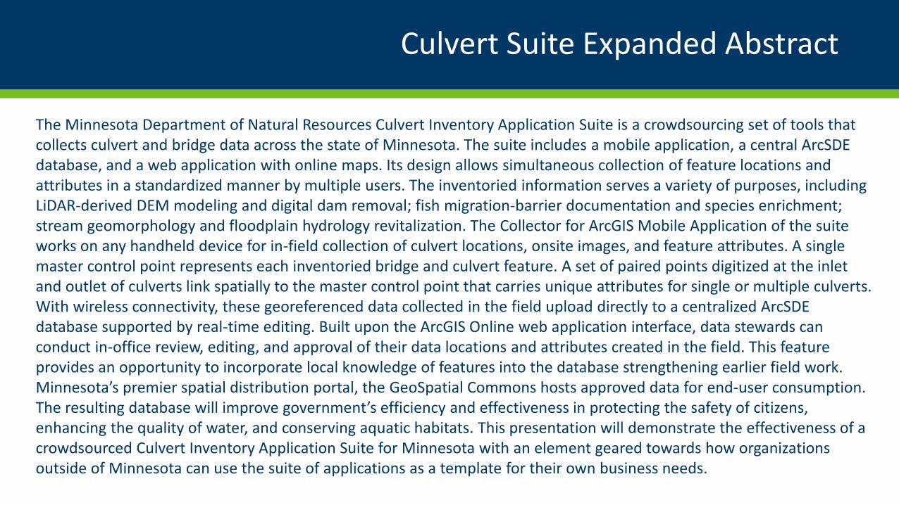
Culvert Suite Expanded Abstract
The Minnesota Department of Natural Resources Culvert Inventory Application Suite is a crowdsourcing set of tools that collects culvert and bridge data across the state of Minnesota. The suite includes a mobile application, a central ArcSDE database, and a web application with online maps. Its design allows simultaneous collection of feature locations and attributes in a standardized manner by multiple users. The inventoried information serves a variety of purposes, including LiDAR-derived DEM modeling and digital dam removal; fish migration-barrier documentation and species enrichment; stream geomorphology and floodplain hydrology revitalization. The Collector for ArcGIS Mobile Application of the suite works on any handheld device for in-field collection of culvert locations, onsite images, and feature attributes. A single master control point represents each inventoried bridge and culvert feature. A set of paired points digitized at the inlet and outlet of culverts link spatially to the master control point that carries unique attributes for single or multiple culverts. With wireless connectivity, these georeferenced data collected in the field upload directly to a centralized ArcSDE database supported by real-time editing. Built upon the ArcGIS Online web application interface, data stewards can conduct in-office review, editing, and approval of their data locations and attributes created in the field. This feature provides an opportunity to incorporate local knowledge of features into the database strengthening earlier field work. Minnesota’s premier spatial distribution portal, the GeoSpatial Commons hosts approved data for end-user consumption. The resulting database will improve government’s efficiency and effectiveness in protecting the safety of citizens, enhancing the quality of water, and conserving aquatic habitats. This presentation will demonstrate the effectiveness of a crowdsourced Culvert Inventory Application Suite for Minnesota with an element geared towards how organizations outside of Minnesota can use the suite of applications as a template for their own business needs.


![[eBook] GIS - Esri - ArcGIS - Complete Manual](https://img.pdfslide.net/doc/110x75/5572018f4979599169a1dad6/ebook-gis-esri-arcgis-complete-manual.jpg)