Embed Size (px)
Citation preview
• C:\Eudora\Attach\Overview.gif
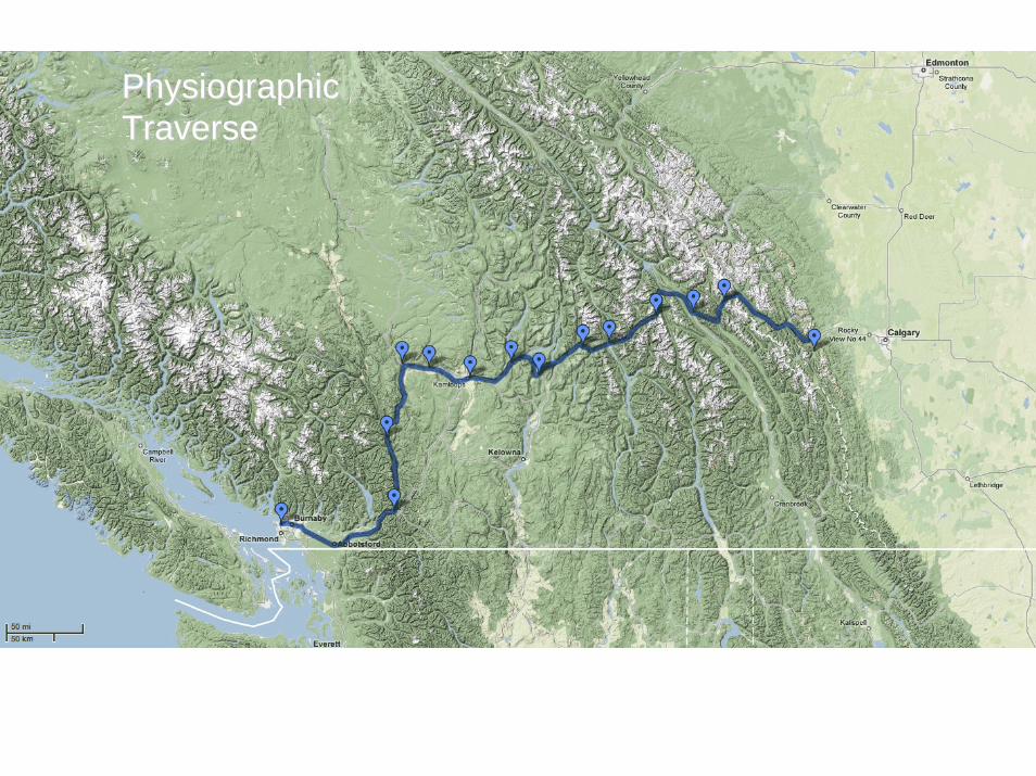
Physiographic Physiographic TraverseTraverse
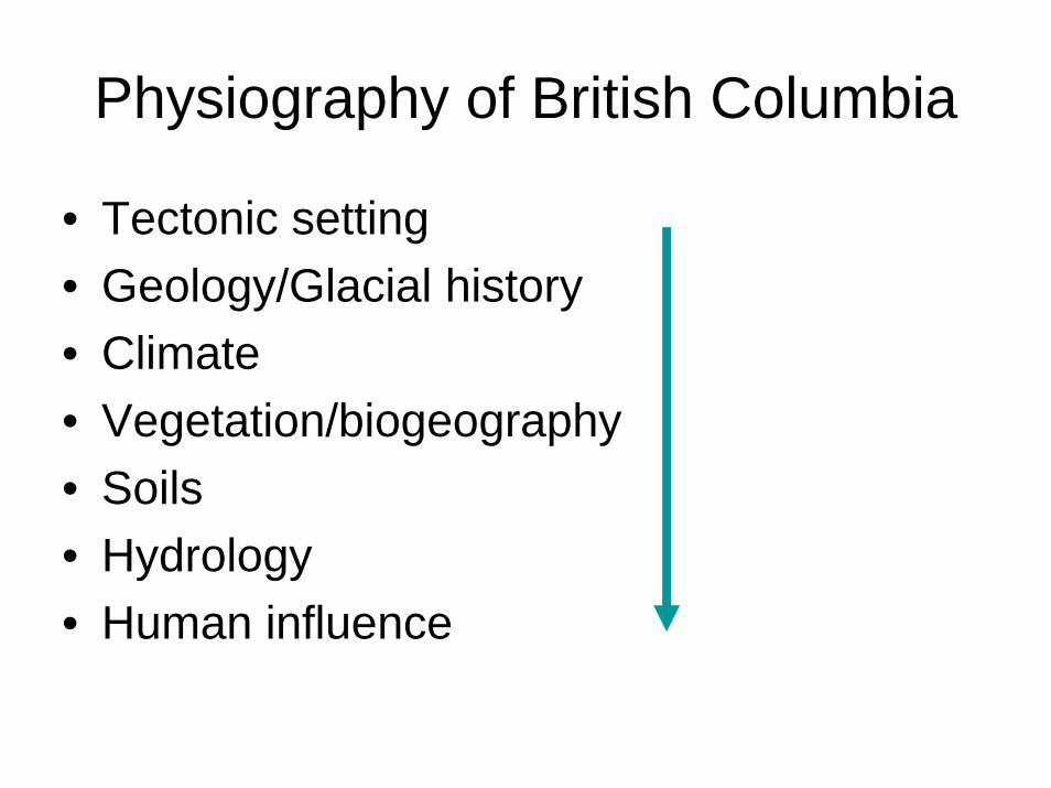
Physiography of British Columbia
• Tectonic setting• Geology/Glacial history• Climate• Vegetation/biogeography• Soils• Hydrology • Human influence
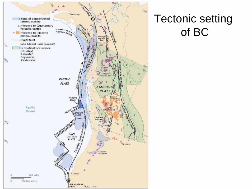
Tectonic setting of BC
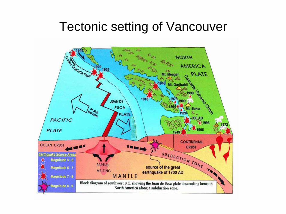
Tectonic setting of Vancouver
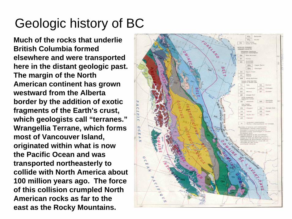
Geologic history of BCMuch of the rocks that underlie British Columbia formed elsewhere and were transported here in the distant geologic past. The margin of the North American continent has grown westward from the Alberta border by the addition of exotic fragments of the Earth's crust, which geologists call “terranes.”Wrangellia Terrane, which forms most of Vancouver Island, originated within what is now the Pacific Ocean and was transported northeasterly to collide with North America about 100 million years ago. The force of this collision crumpled North American rocks as far to the east as the Rocky Mountains.
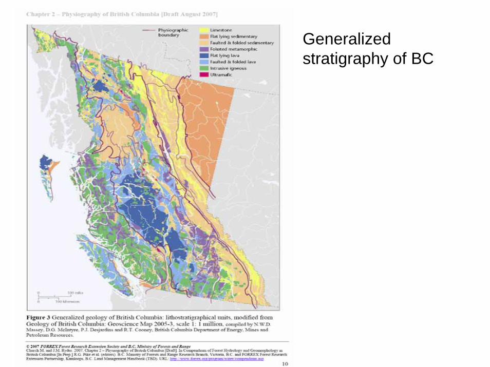
Generalized stratigraphy of BC
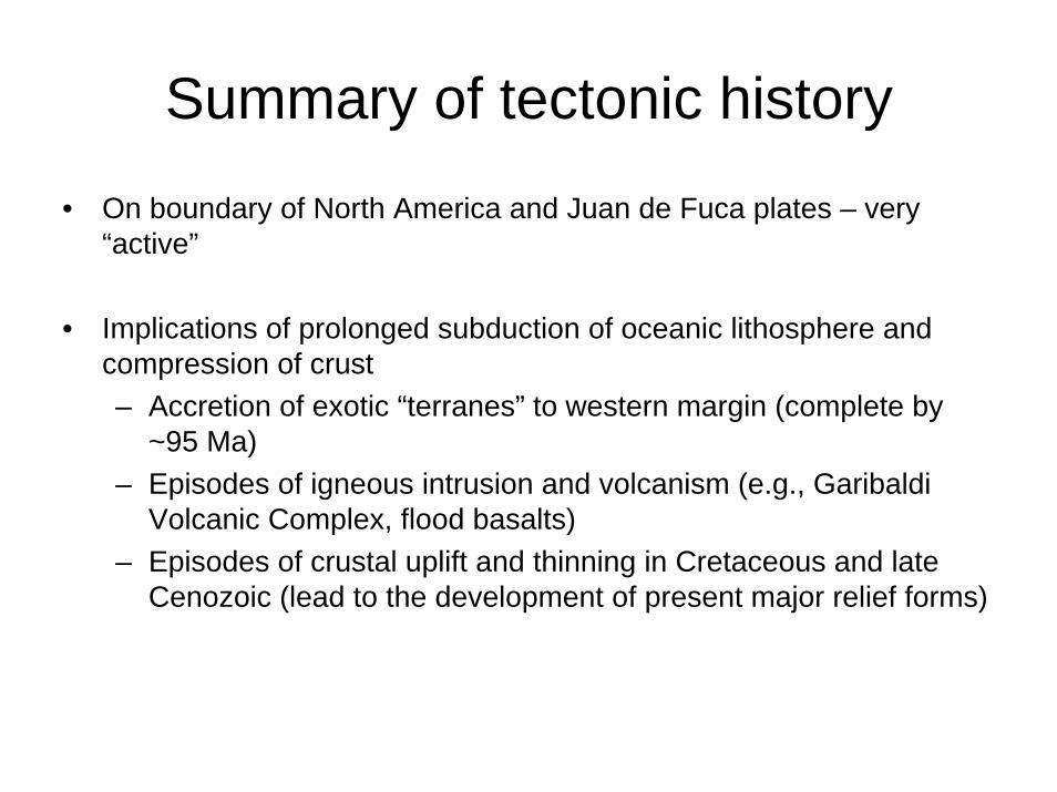
Summary of tectonic history
• On boundary of North America and Juan de Fuca plates – very “active”
• Implications of prolonged subduction of oceanic lithosphere and compression of crust– Accretion of exotic “terranes” to western margin (complete by
~95 Ma)– Episodes of igneous intrusion and volcanism (e.g., Garibaldi
Volcanic Complex, flood basalts)– Episodes of crustal uplift and thinning in Cretaceous and late
Cenozoic (lead to the development of present major relief forms)
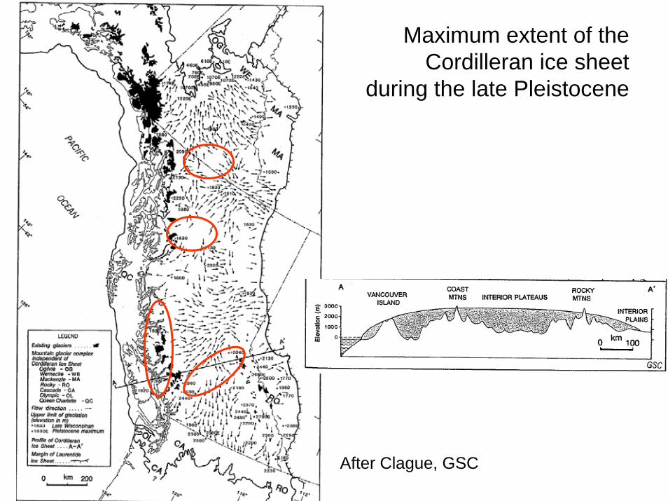
Maximum extent of the Cordilleran ice sheet
during the late Pleistocene
After Clague, GSC
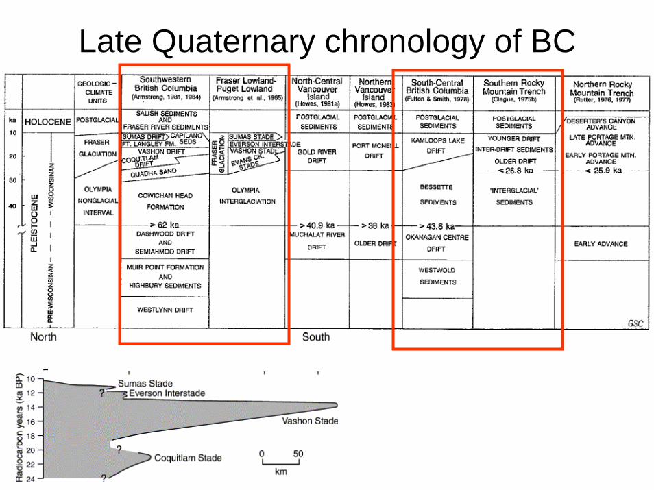
Late Quaternary chronology of BC
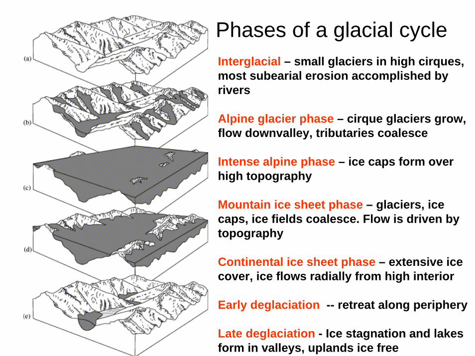
Phases of a glacial cycleInterglacial – small glaciers in high cirques, most subearial erosion accomplished by rivers
Alpine glacier phase – cirque glaciers grow, flow downvalley, tributaries coalesce
Intense alpine phase – ice caps form over high topography
Mountain ice sheet phase – glaciers, ice caps, ice fields coalesce. Flow is driven by topography
Continental ice sheet phase – extensive ice cover, ice flows radially from high interior
Early deglaciation -- retreat along periphery
Late deglaciation - Ice stagnation and lakes form in valleys, uplands ice free
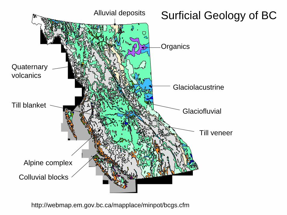
Surficial Geology of BC
http://webmap.em.gov.bc.ca/mapplace/minpot/bcgs.cfm
Glaciolacustrine
Alpine complex
Till blanket
Quaternary volcanics
Glaciofluvial
Colluvial blocks
Till veneer
Organics
Alluvial deposits
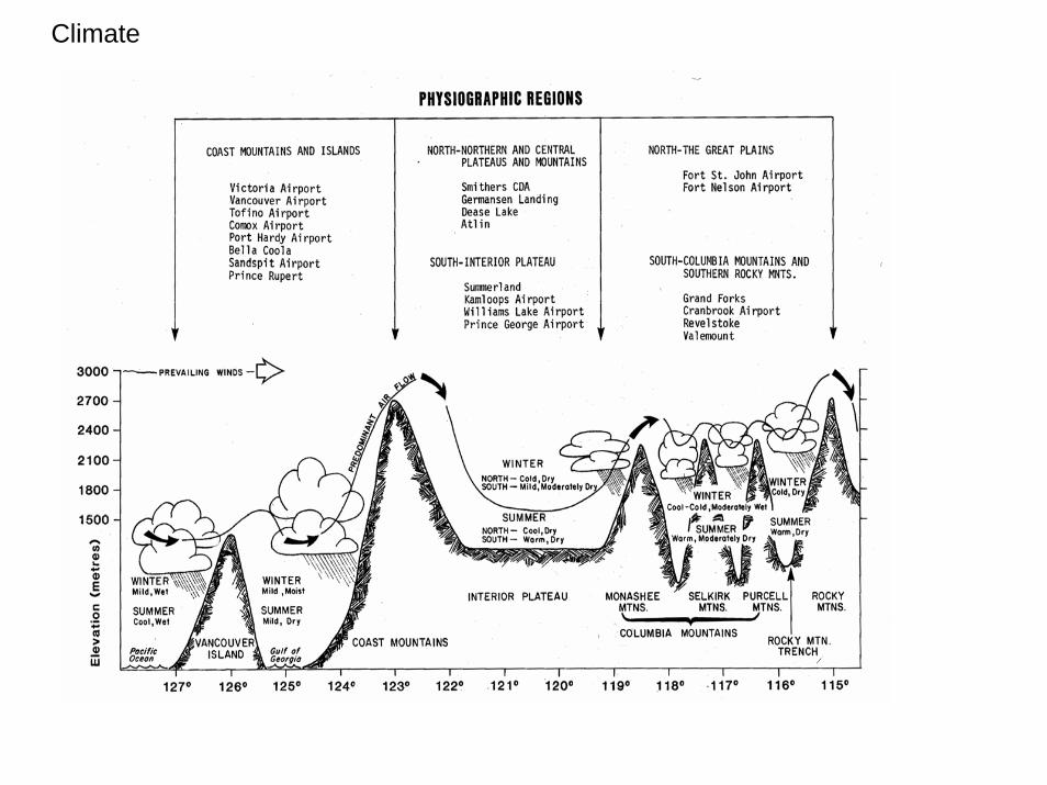
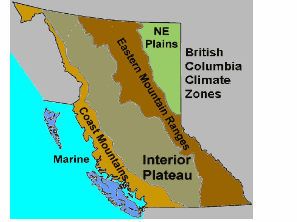
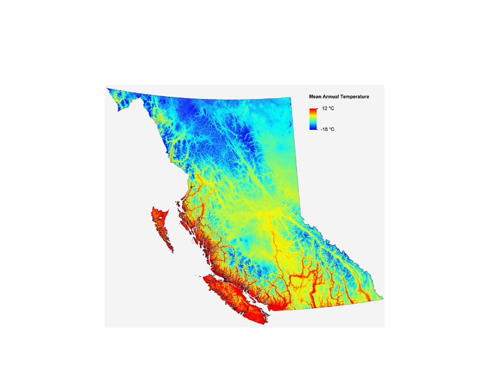
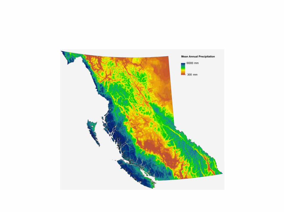
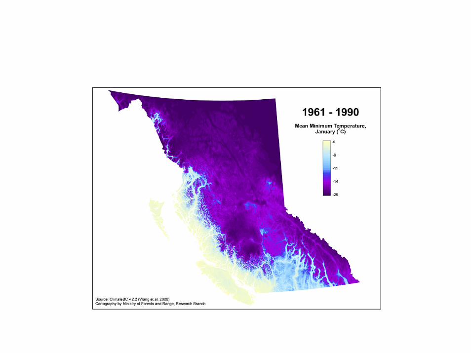
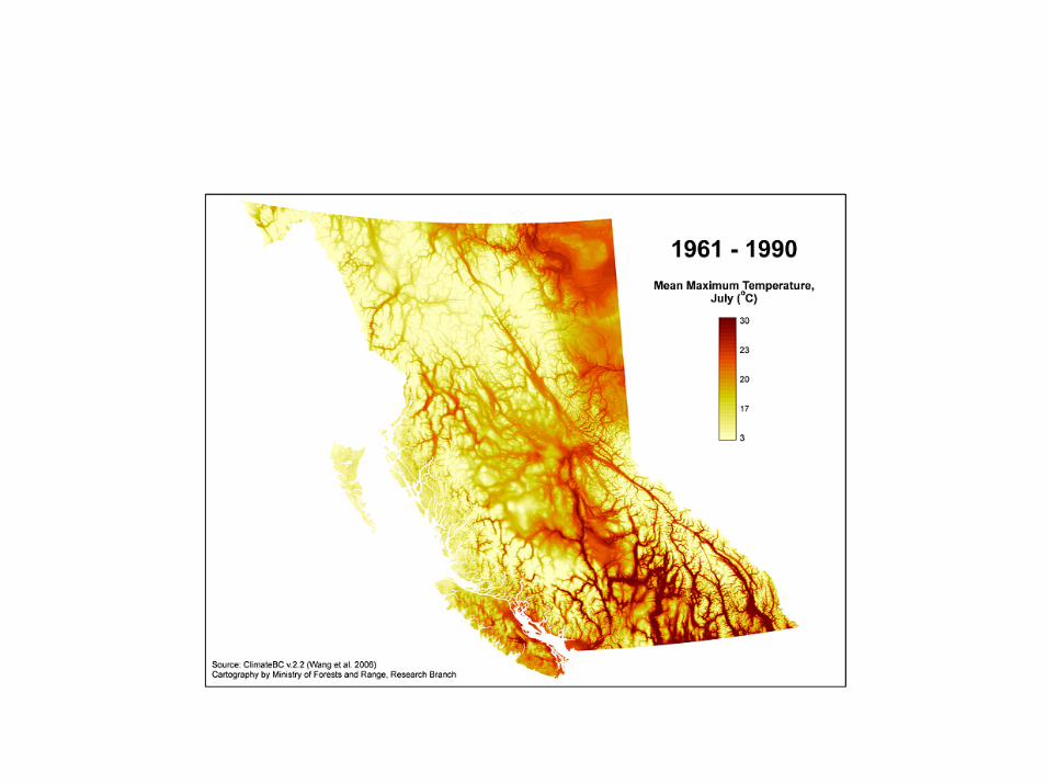
Climate
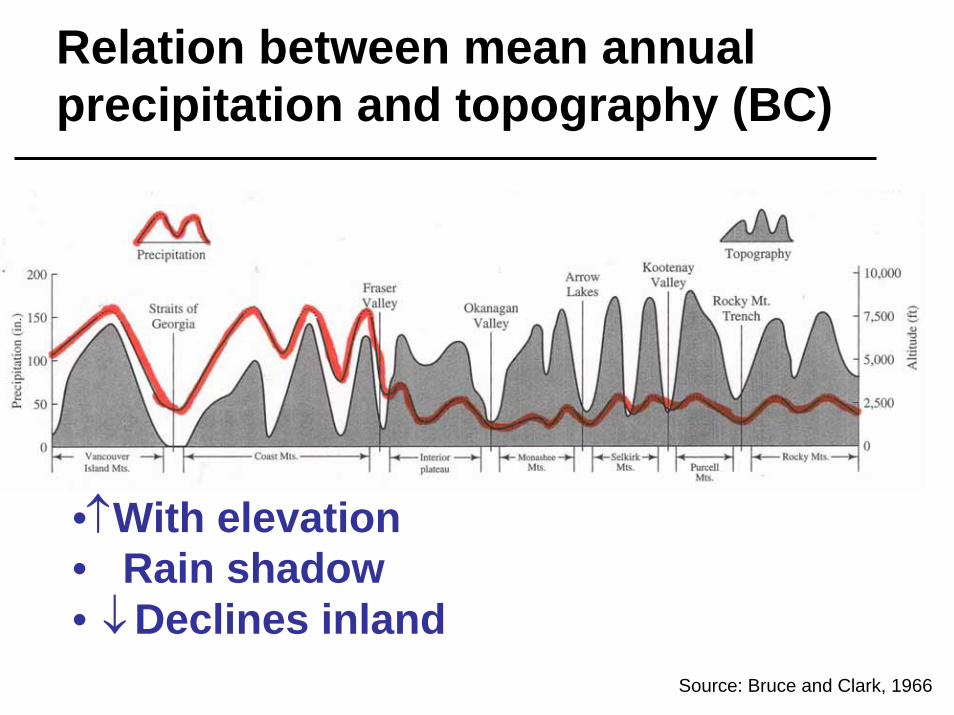
Relation between mean annual precipitation and topography (BC)
•↑With elevation• Rain shadow• Declines inland
↑
Source: Bruce and Clark, 1966
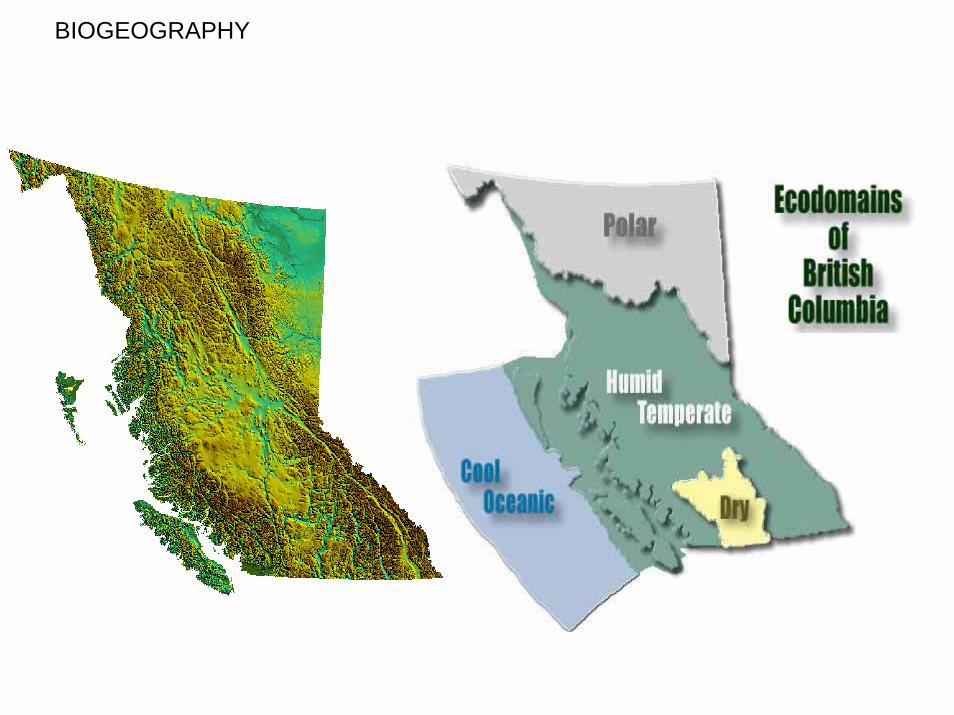
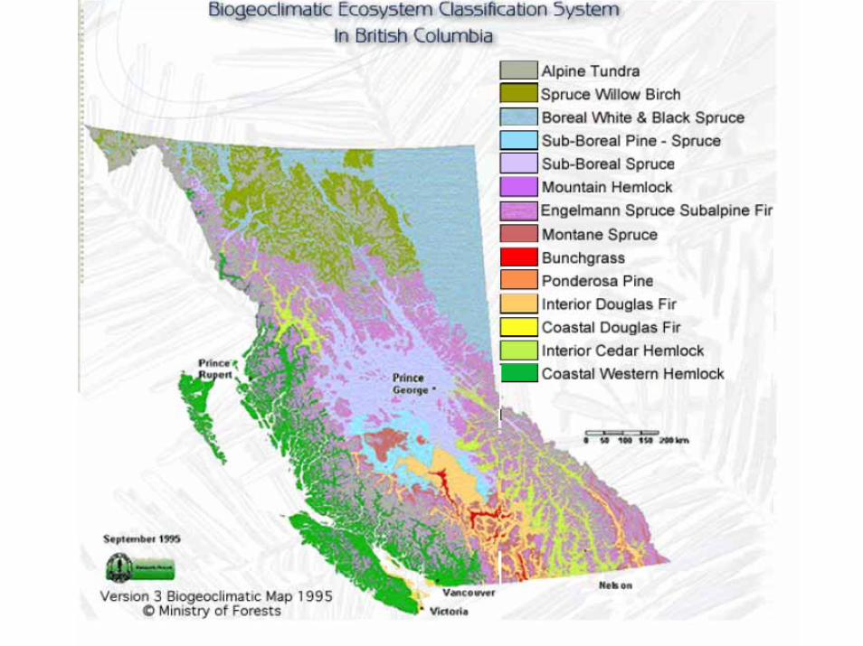
BIOGEOGRAPHY
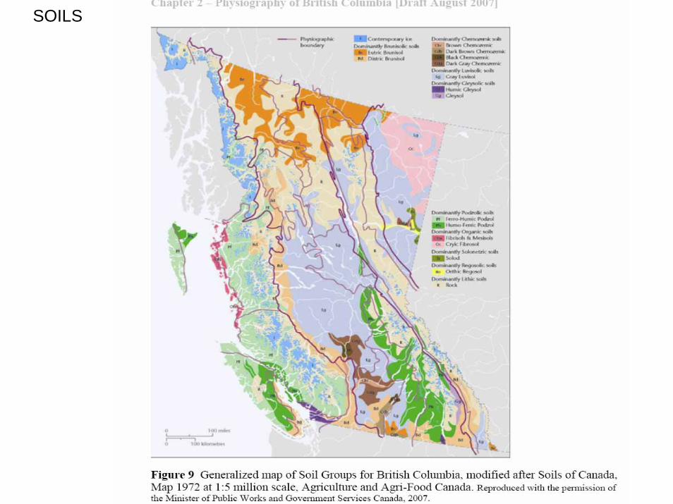
SOILS
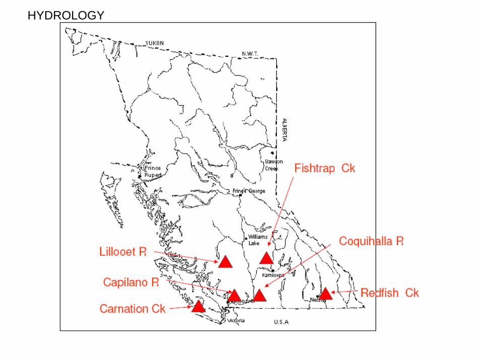
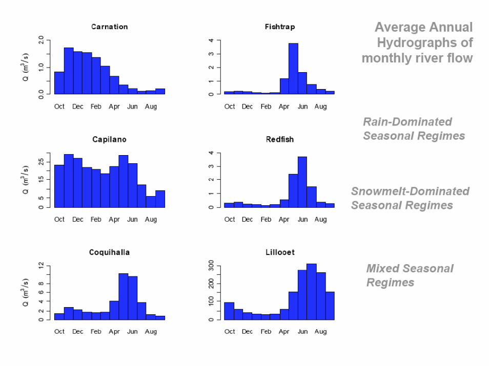
HYDROLOGY
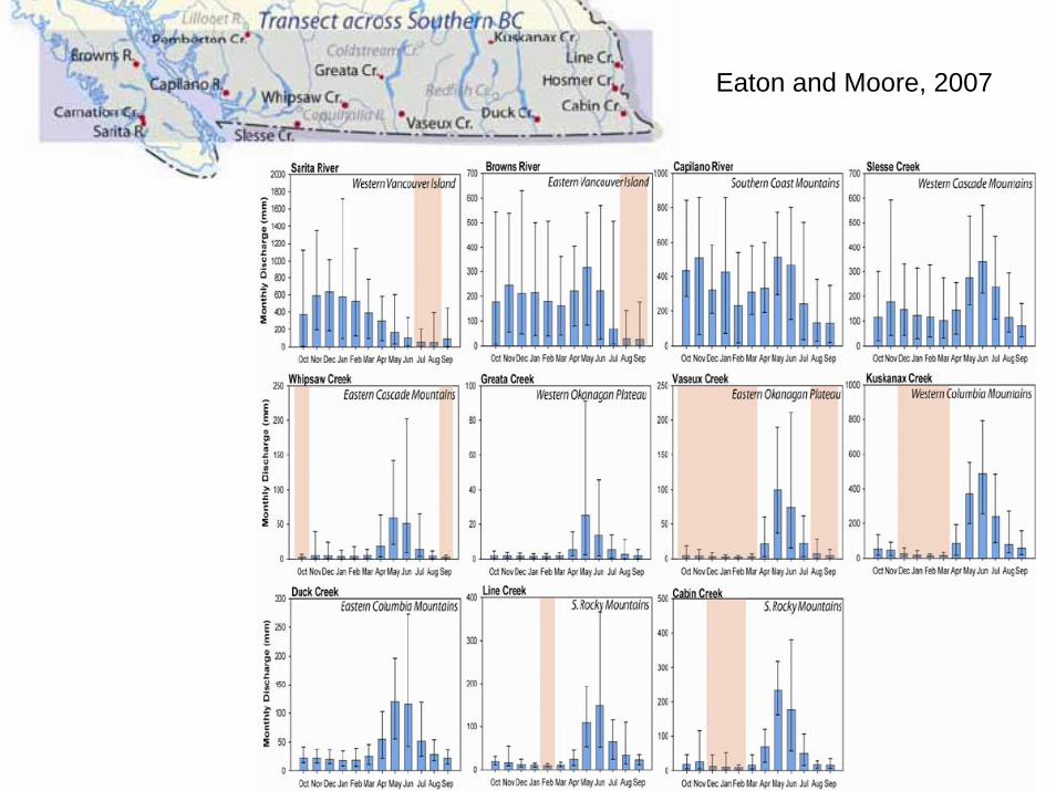
Eaton and Moore, 2007
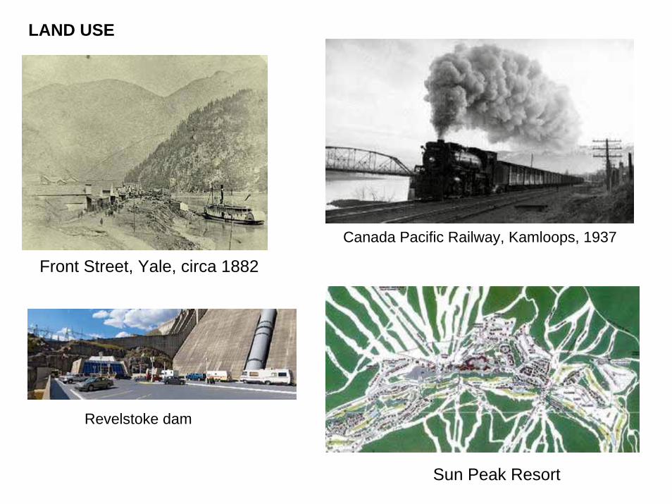
LAND USE
Canada Pacific Railway, Kamloops, 1937
Front Street, Yale, circa 1882
Revelstoke dam
Sun Peak Resort
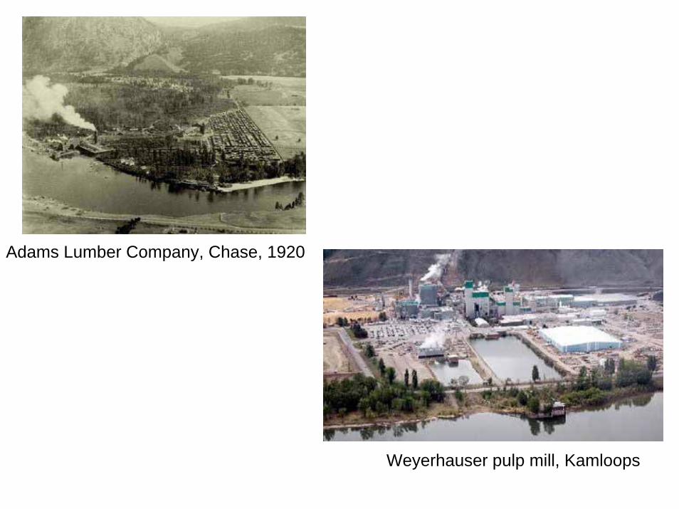
Adams Lumber Company, Chase, 1920
Weyerhauser pulp mill, Kamloops
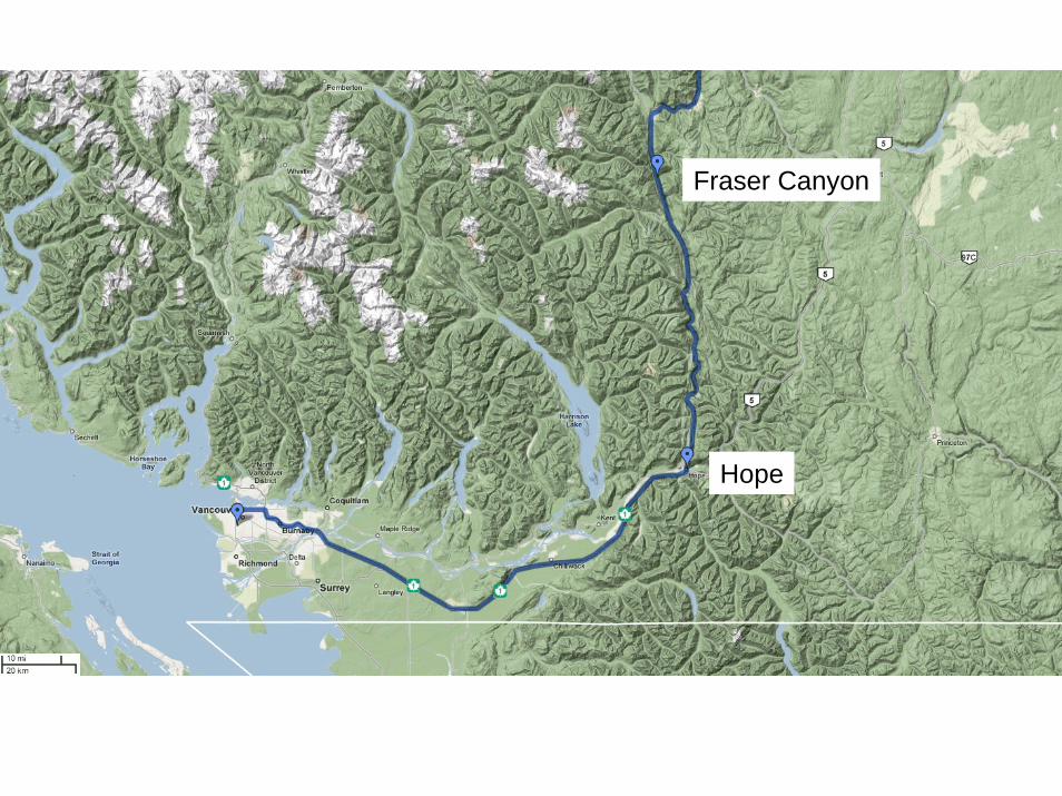
Hope
Fraser Canyon
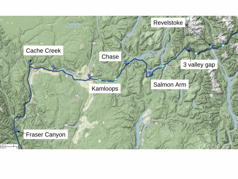
Chase
Kamloops
Cache Creek
Fraser Canyon
Revelstoke
Salmon Arm
3 valley gap
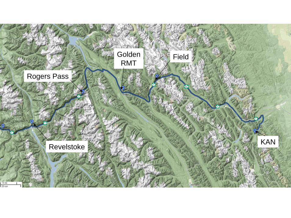
FieldGoldenRMT
Rogers Pass
RevelstokeKAN