Embed Size (px)
Citation preview
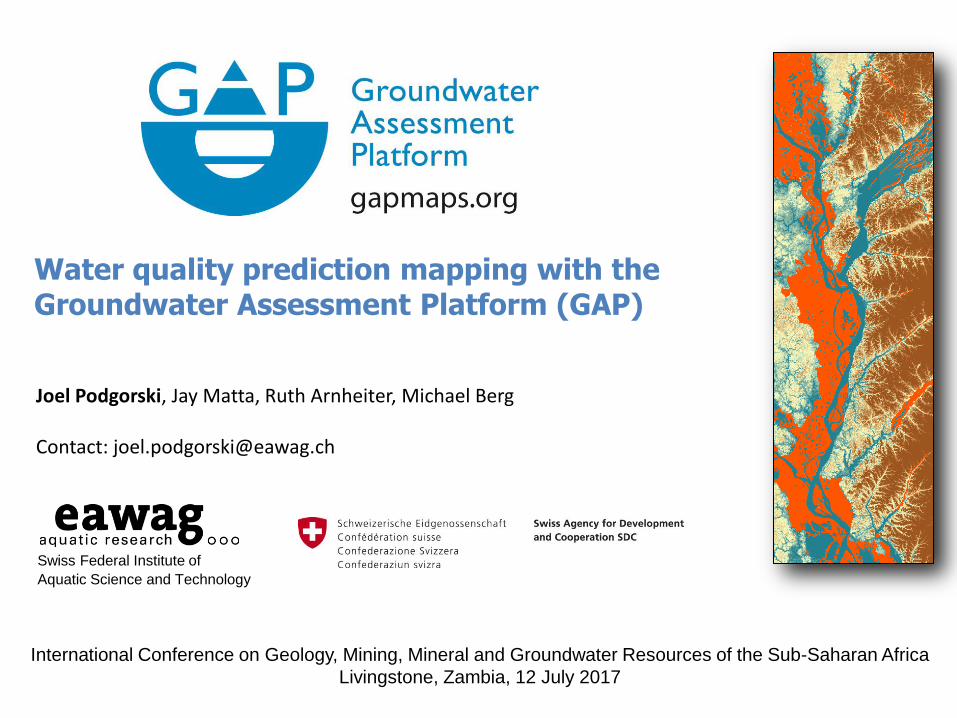
Water quality prediction mapping with the Groundwater Assessment Platform (GAP)
Swiss Federal Institute of
Aquatic Science and Technology
Joel Podgorski, Jay Matta, Ruth Arnheiter, Michael Berg Contact: [email protected]
International Conference on Geology, Mining, Mineral and Groundwater Resources of the Sub-Saharan Africa
Livingstone, Zambia, 12 July 2017

• Geogenic contamination is widespread, affecting up to 10% of wells worldwide
• Over 300 million people globally are exposed to high levels of arsenic (As) and fluoride (F)
• Little is being done to combat the situation in low-income countries
Arsenic (~140 million)
causes skin lesions,
pulmonary disorders,
internal cancers
WHO: 10 g/L
Fluoride (~200 million) causes dental mottling & decay and crippling skeletal deformation WHO: 1.5 mg/L
Geogenic (natural) groundwater contamination
Groundwater Assessment Platform (GAP) www.gapmaps.org [email protected]

Global arsenic map, 2008
Various regions discovered in recent years
But large areas are still uncharted
(Ravenscroft et al., 2008)
Groundwater Assessment Platform (GAP) www.gapmaps.org [email protected]
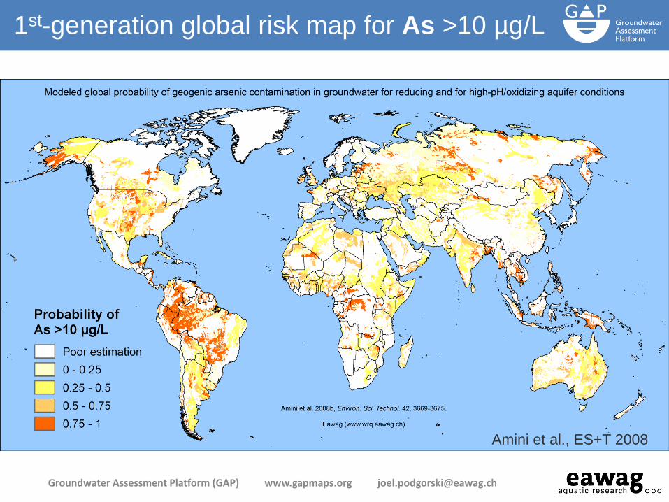
Amini et al., ES+T 2008
1st-generation global risk map for As >10 µg/L
Groundwater Assessment Platform (GAP) www.gapmaps.org [email protected]
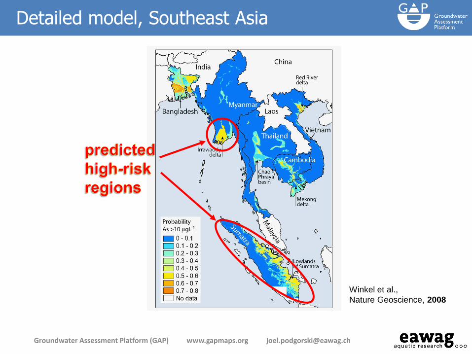
SE Asia
probability
map
Winkel et al.,
Nature Geoscience, 2008
Detailed model, Southeast Asia
Groundwater Assessment Platform (GAP) www.gapmaps.org [email protected]
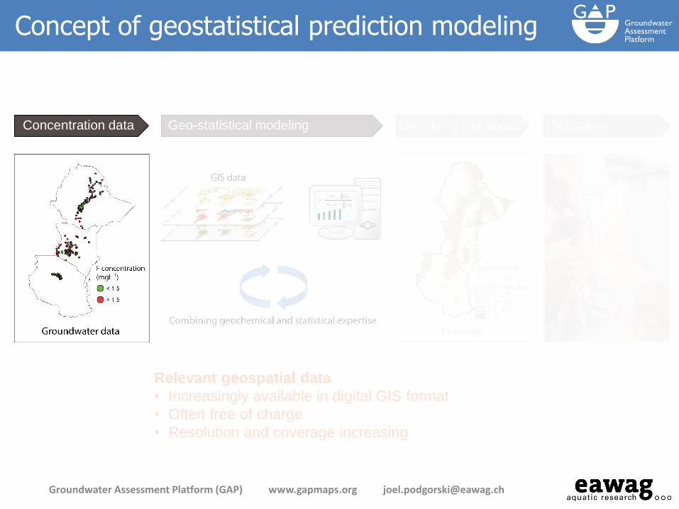
Relevant geospatial data
• Increasingly available in digital GIS format
• Often free of charge
• Resolution and coverage increasing
Concentration data Geo-statistical modeling Identifying risk areas Mitigation
Concept of geostatistical prediction modeling
Groundwater Assessment Platform (GAP) www.gapmaps.org [email protected]

where P is probability, β is a regression coefficient, x is an independent variable.
Gives the probability of a binary (0 or 1) target variable being "positive" (i.e. true or 1) for a linear combination of predictor variables:
Logistic regression
Groundwater Assessment Platform (GAP) www.gapmaps.org [email protected]
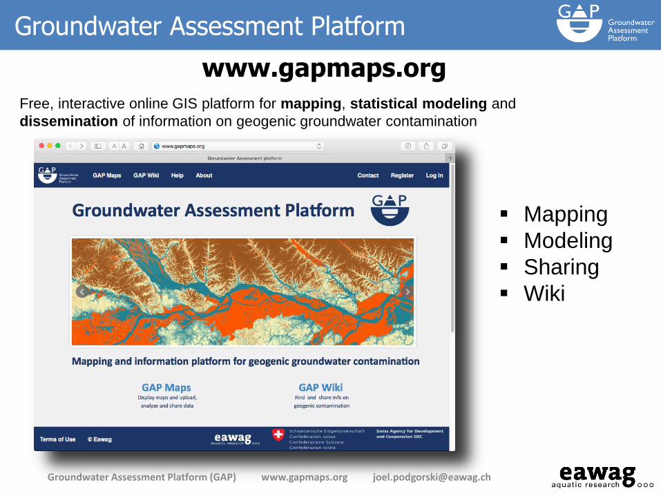
Mapping
Modeling
Sharing
Wiki
Free, interactive online GIS platform for mapping, statistical modeling and
dissemination of information on geogenic groundwater contamination
Groundwater Assessment Platform
www.gapmaps.org
Groundwater Assessment Platform (GAP) www.gapmaps.org [email protected]
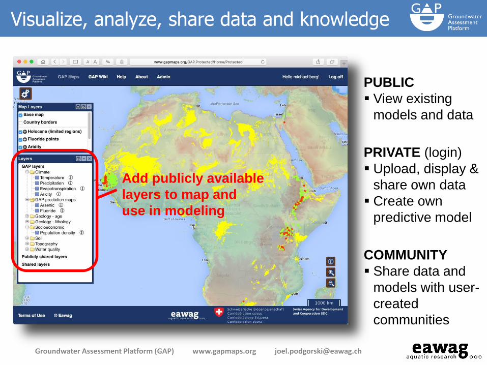
Visualize, analyze, share data and knowledge
Groundwater Assessment Platform (GAP) www.gapmaps.org [email protected]
PRIVATE (login)
Upload, display &
share own data
Create own
predictive model
PUBLIC
View existing
models and data
COMMUNITY
Share data and
models with user-
created
communities
Add publicly available
layers to map and
use in modeling
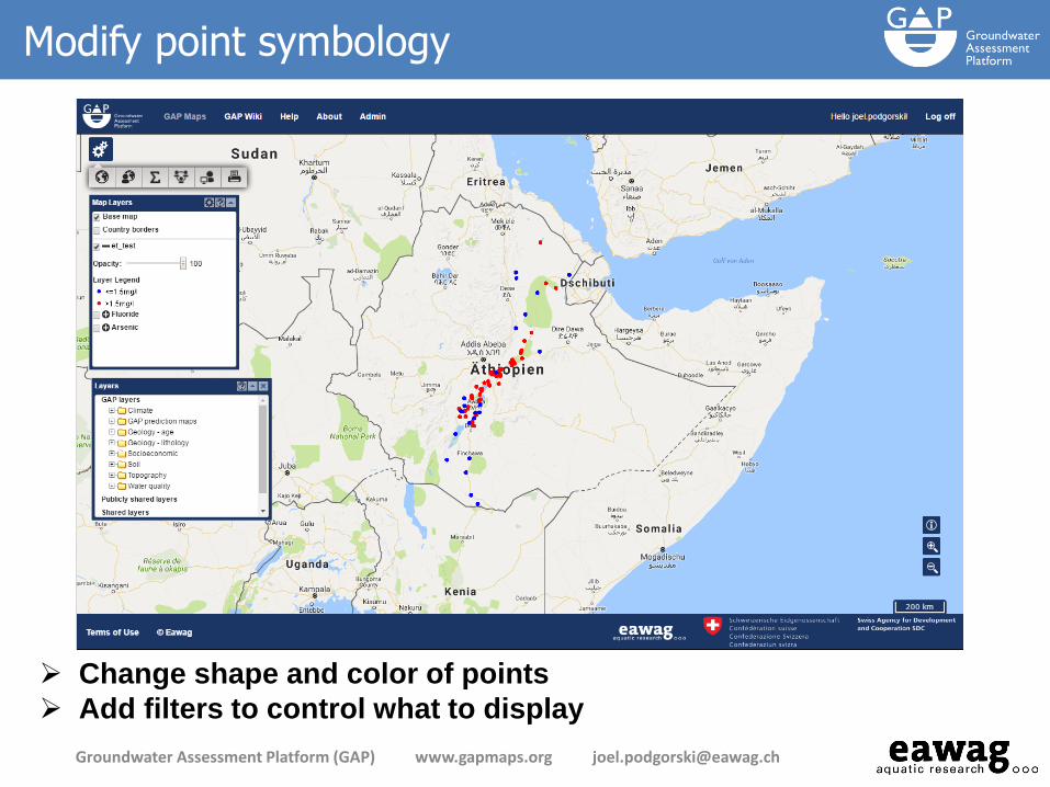
Modify point symbology
Groundwater Assessment Platform (GAP) www.gapmaps.org [email protected]
Change shape and color of points
Add filters to control what to display
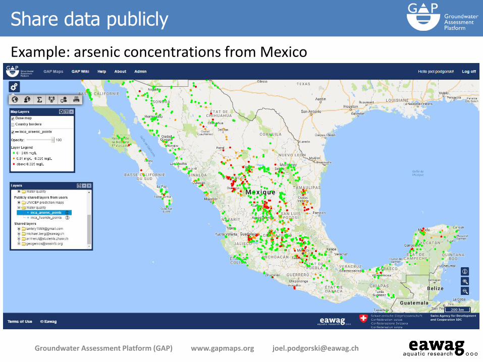
Share data publicly
Example: arsenic concentrations from Mexico
Groundwater Assessment Platform (GAP) www.gapmaps.org [email protected]

Statistical modeling
Groundwater Assessment Platform (GAP) www.gapmaps.org [email protected]
Target variable
Threshold
Independent variables
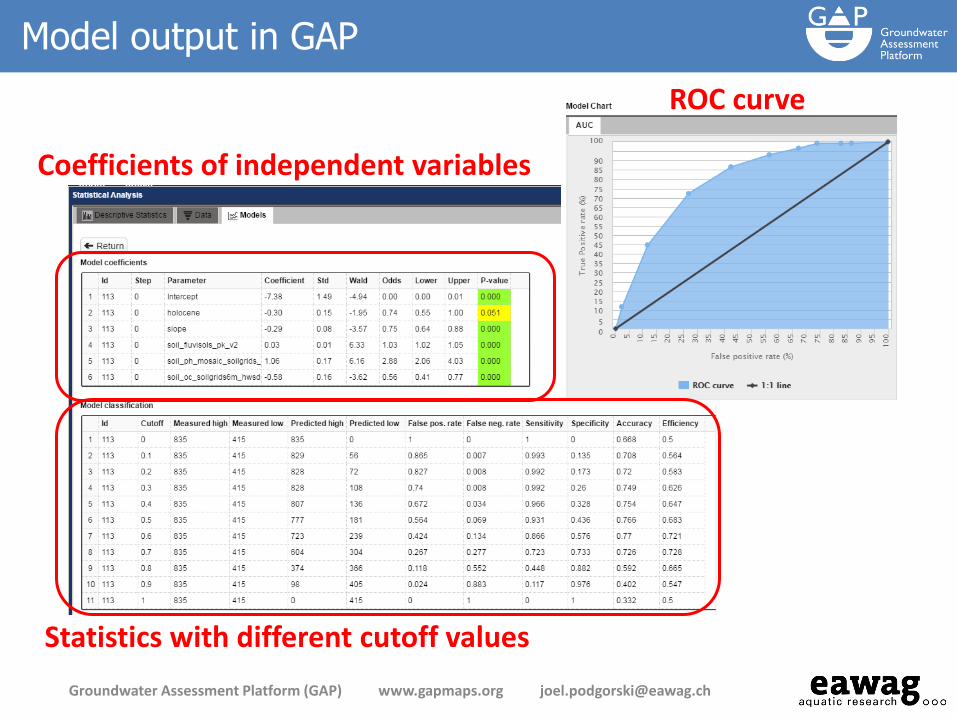
Model output in GAP
Groundwater Assessment Platform (GAP) www.gapmaps.org [email protected]
ROC curve
Coefficients of independent variables
Statistics with different cutoff values

Modeling comparison: manual coding vs. GAP
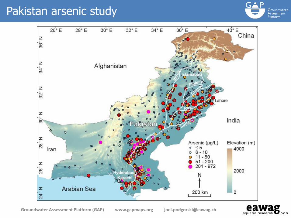
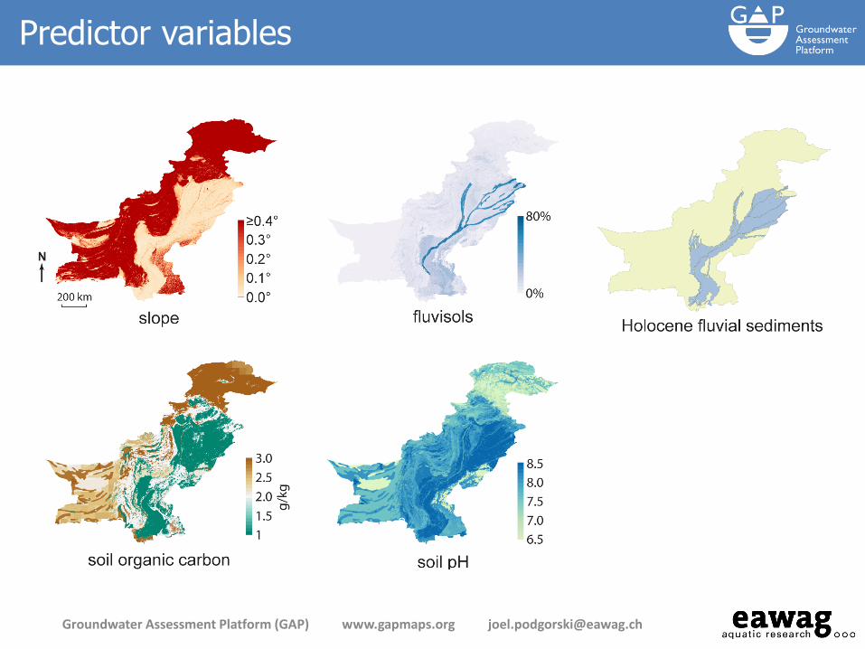
Arsenic prediction map for Pakistan
created offline with the R language
Arsenic prediction map for Pakistan
created on GAP
Groundwater Assessment Platform (GAP) www.gapmaps.org [email protected]
Podgorski et al., 2017, in review
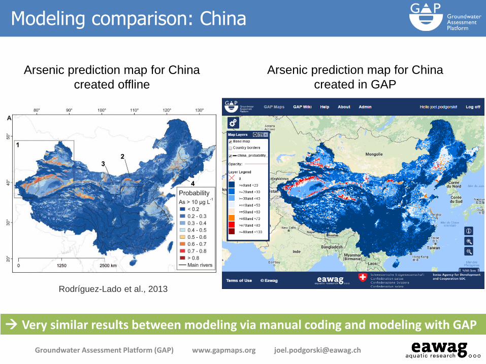
Modeling comparison: China
Arsenic prediction map for China
created offline
Arsenic prediction map for China
created in GAP
Rodríguez-Lado et al., 2013
Very similar results between modeling via manual coding and modeling with GAP
Groundwater Assessment Platform (GAP) www.gapmaps.org [email protected]
www.gapmaps.org
Thank you


The following gaps have been identified: • Gaps in knowledge of potential arsenic and fluoride contamination • Gaps in expertise to create and manage data • Gaps in opportunity to share and exchange information
Goal to reduce number of people affected
• Water treatment, covered in the Geogenic Contamination Handbook (at www.gapmaps.org)
• Identify contaminated regions through prediction modeling
Groundwater Assessment Platform (GAP) www.gapmaps.org [email protected]

• GAP was launched in mid-2014 and is funded by Swiss Agency for
Development and Cooperation (SDC) until end of 2017
• GAP is a follow-up to the Water Resource Quality (WRQ) project
(2006-2012), which:
• focused on detection & mitigation of geogenic
contaminants (As, F) in groundwater;
• culminated in the publication (2015) of the
Geogenic Contamination Handbook
• Both projects initiated/led by the late
Annette Johnson
Background to GAP
Groundwater Assessment Platform (GAP) www.gapmaps.org [email protected]
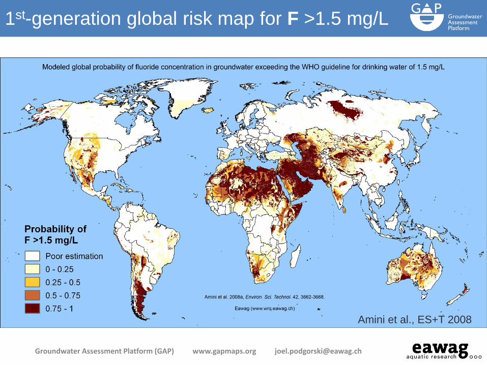
Amini et al., ES+T 2008
1st-generation global risk map for F >1.5 mg/L
Groundwater Assessment Platform (GAP) www.gapmaps.org [email protected]
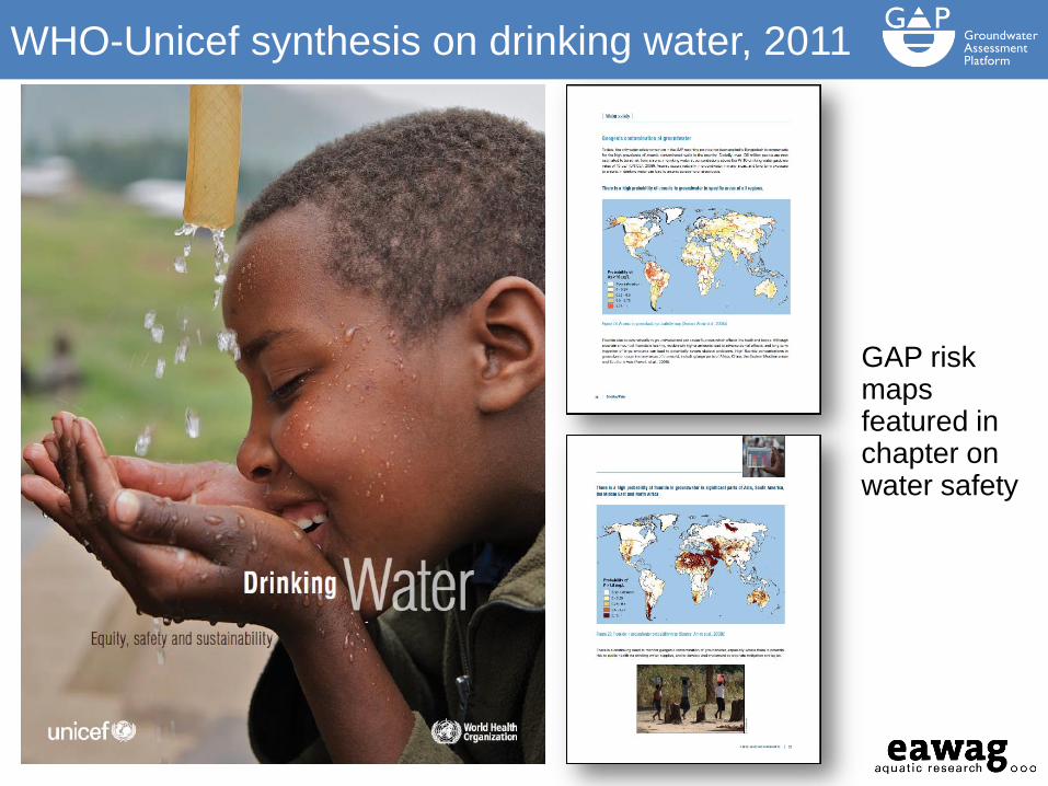
GAP risk maps featured in chapter on water safety
WHO-Unicef synthesis on drinking water, 2011
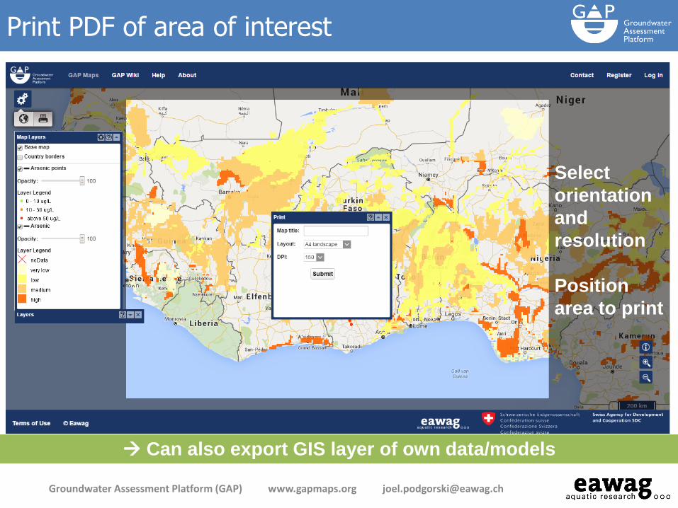
Select
orientation
and
resolution
Position
area to print
Print PDF of area of interest
Groundwater Assessment Platform (GAP) www.gapmaps.org [email protected]
Can also export GIS layer of own data/models

Communities
Groundwater Assessment Platform (GAP) www.gapmaps.org [email protected]
Share data and models with a select group of users
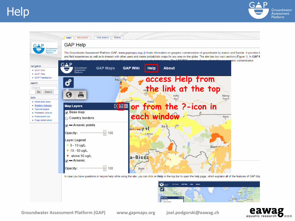
Help
Groundwater Assessment Platform (GAP) www.gapmaps.org [email protected]
access Help from the link at the top
or from the ?-icon in each window

Additional functionality when logged in
Groundwater Assessment Platform (GAP) www.gapmaps.org [email protected]
Sta
tist
ical Ana
lysis
Com
mun
ities
Mana
ge A
ccou
nt
My L
ayers

gapmaps.org
GAP Wiki – help to expand the compendium
Groundwater Assessment Platform (GAP) www.gapmaps.org [email protected]
Features the
Geogenic
Contamination
Handbook
Read/add/edit
pages on the
subject of
geogenic
contamination