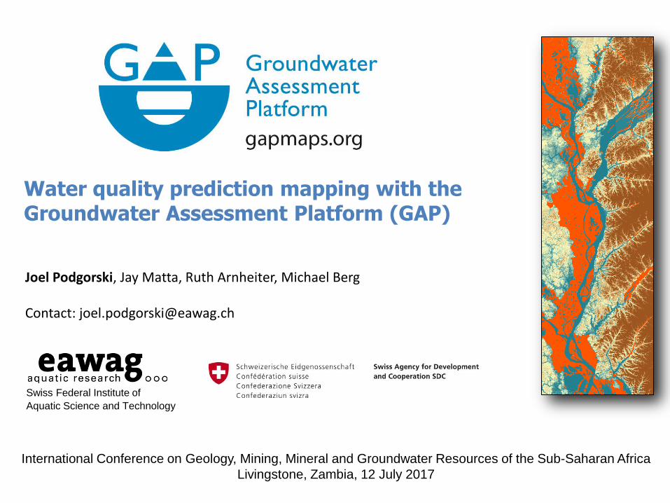
Water quality prediction mapping with the Groundwater Assessment Platform (GAP)
Swiss Federal Institute of
Aquatic Science and Technology
Joel Podgorski, Jay Matta, Ruth Arnheiter, Michael Berg Contact: [email protected]
International Conference on Geology, Mining, Mineral and Groundwater Resources of the Sub-Saharan Africa
Livingstone, Zambia, 12 July 2017

• Geogenic contamination is widespread, affecting up to 10% of wells worldwide
• Over 300 million people globally are exposed to high levels of arsenic (As) and fluoride (F)
• Little is being done to combat the situation in low-income countries
Arsenic (~140 million)
causes skin lesions,
pulmonary disorders,
internal cancers
WHO: 10 g/L
Fluoride (~200 million) causes dental mottling & decay and crippling skeletal deformation WHO: 1.5 mg/L
Geogenic (natural) groundwater contamination
Groundwater Assessment Platform (GAP) www.gapmaps.org [email protected]

Global arsenic map, 2008
Various regions discovered in recent years
But large areas are still uncharted
(Ravenscroft et al., 2008)
Groundwater Assessment Platform (GAP) www.gapmaps.org [email protected]
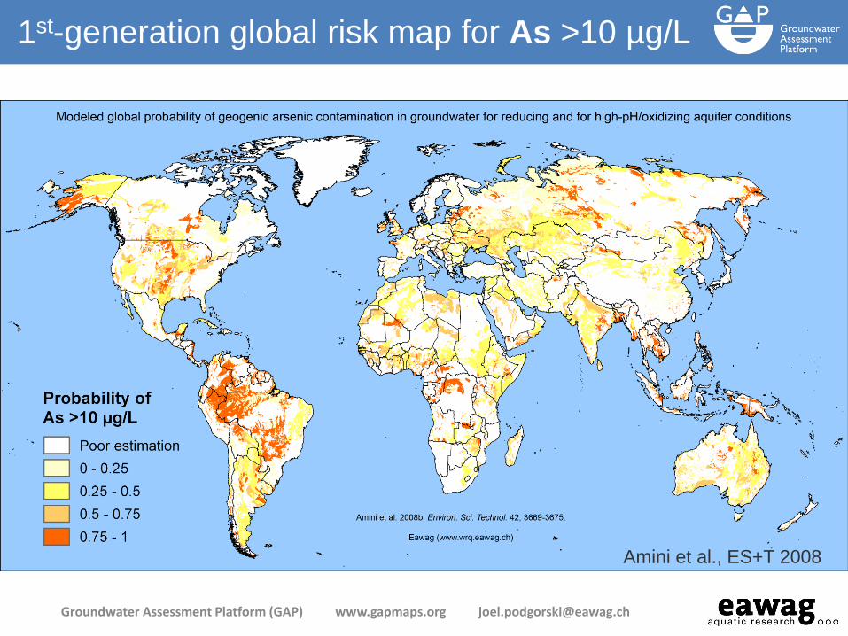
Amini et al., ES+T 2008
1st-generation global risk map for As >10 µg/L
Groundwater Assessment Platform (GAP) www.gapmaps.org [email protected]
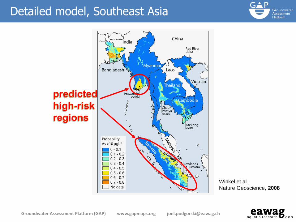
SE Asia
probability
map
Winkel et al.,
Nature Geoscience, 2008
Detailed model, Southeast Asia
Groundwater Assessment Platform (GAP) www.gapmaps.org [email protected]
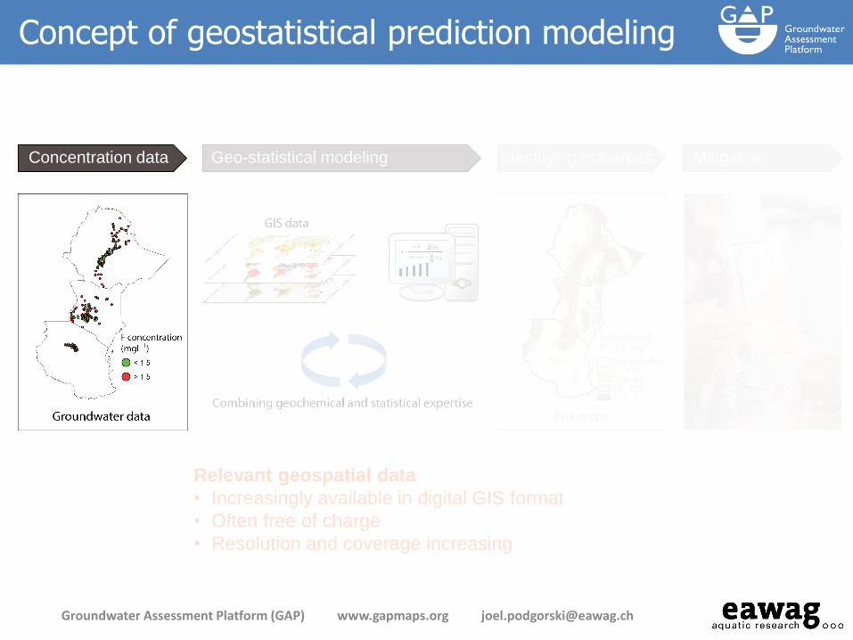
Relevant geospatial data
• Increasingly available in digital GIS format
• Often free of charge
• Resolution and coverage increasing
Concentration data Geo-statistical modeling Identifying risk areas Mitigation
Concept of geostatistical prediction modeling
Groundwater Assessment Platform (GAP) www.gapmaps.org [email protected]

where P is probability, β is a regression coefficient, x is an independent variable.
Gives the probability of a binary (0 or 1) target variable being "positive" (i.e. true or 1) for a linear combination of predictor variables:
Logistic regression
Groundwater Assessment Platform (GAP) www.gapmaps.org [email protected]
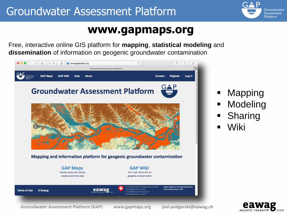
Mapping
Modeling
Sharing
Wiki
Free, interactive online GIS platform for mapping, statistical modeling and
dissemination of information on geogenic groundwater contamination
Groundwater Assessment Platform
www.gapmaps.org
Groundwater Assessment Platform (GAP) www.gapmaps.org [email protected]
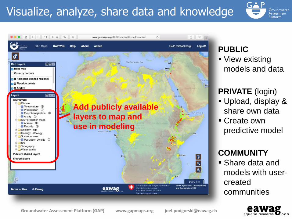
Visualize, analyze, share data and knowledge
Groundwater Assessment Platform (GAP) www.gapmaps.org [email protected]
PRIVATE (login)
Upload, display &
share own data
Create own
predictive model
PUBLIC
View existing
models and data
COMMUNITY
Share data and
models with user-
created
communities
Add publicly available
layers to map and
use in modeling
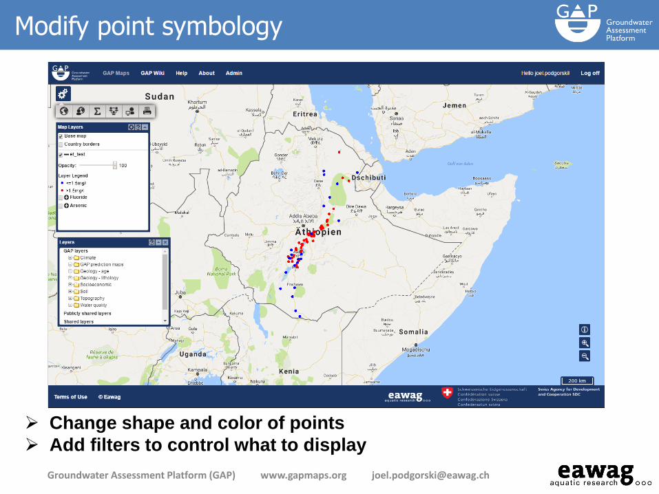
Modify point symbology
Groundwater Assessment Platform (GAP) www.gapmaps.org [email protected]
Change shape and color of points
Add filters to control what to display
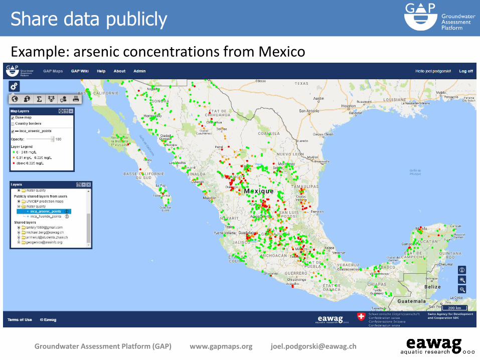
Share data publicly
Example: arsenic concentrations from Mexico
Groundwater Assessment Platform (GAP) www.gapmaps.org [email protected]

Statistical modeling
Groundwater Assessment Platform (GAP) www.gapmaps.org [email protected]
Target variable
Threshold
Independent variables
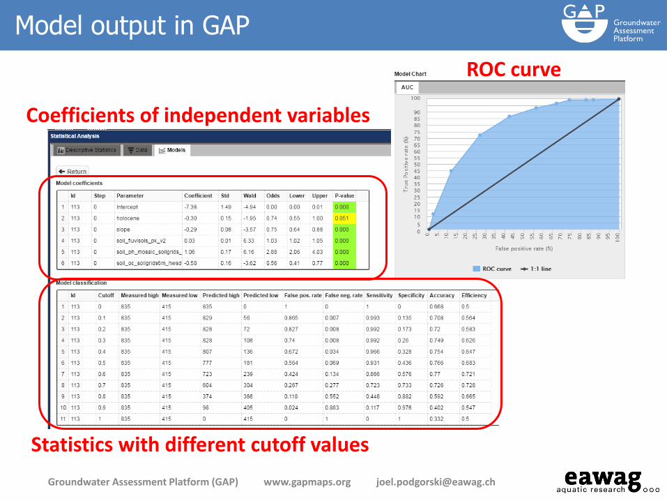
Model output in GAP
Groundwater Assessment Platform (GAP) www.gapmaps.org [email protected]
ROC curve
Coefficients of independent variables
Statistics with different cutoff values

Modeling comparison: manual coding vs. GAP
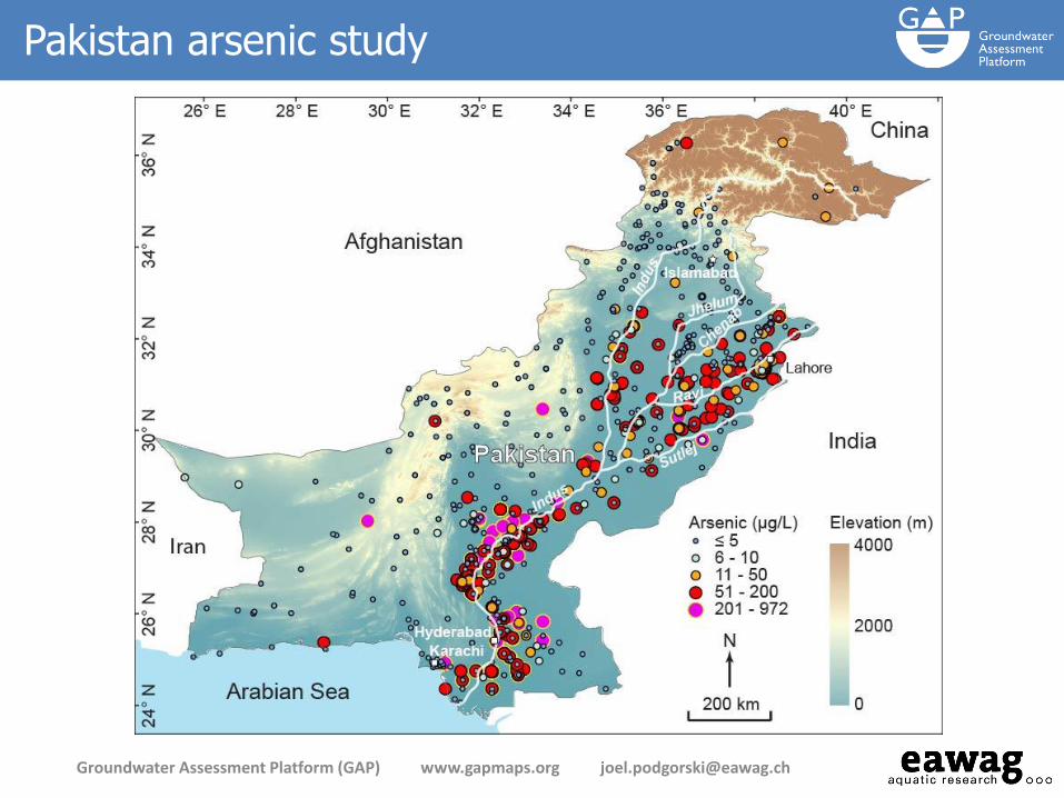
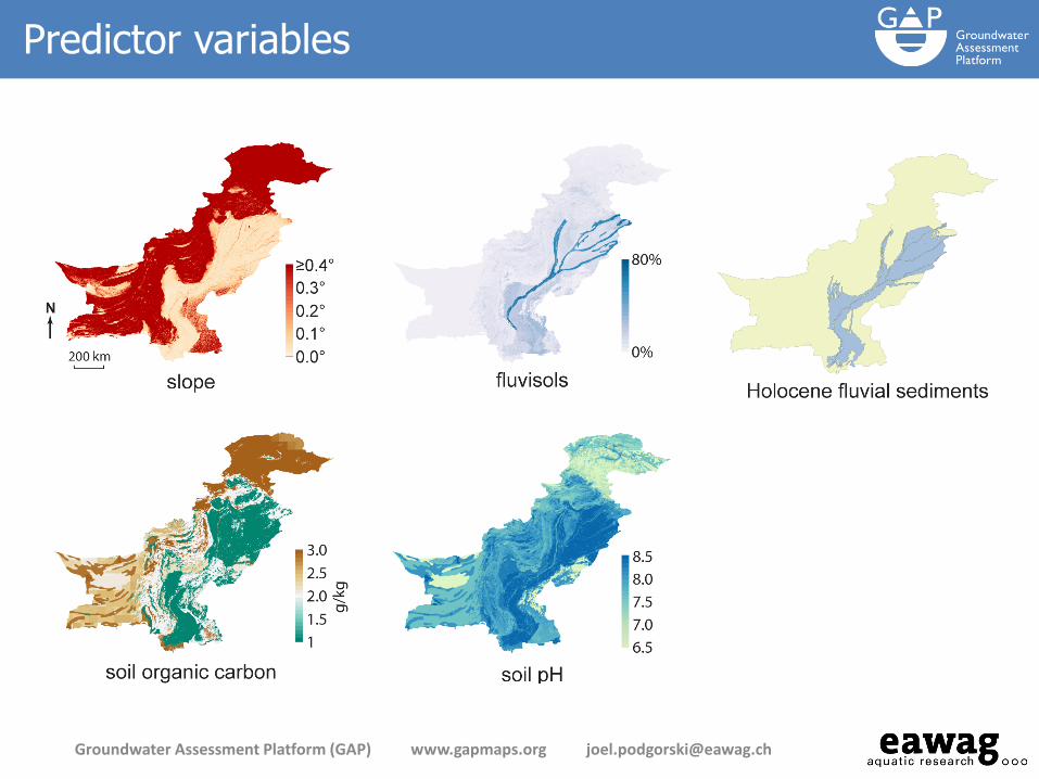
Arsenic prediction map for Pakistan
created offline with the R language
Arsenic prediction map for Pakistan
created on GAP
Groundwater Assessment Platform (GAP) www.gapmaps.org [email protected]
Podgorski et al., 2017, in review
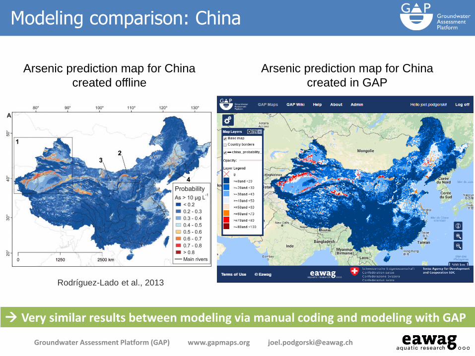
Modeling comparison: China
Arsenic prediction map for China
created offline
Arsenic prediction map for China
created in GAP
Rodríguez-Lado et al., 2013
Very similar results between modeling via manual coding and modeling with GAP
Groundwater Assessment Platform (GAP) www.gapmaps.org [email protected]
www.gapmaps.org
Thank you


The following gaps have been identified: • Gaps in knowledge of potential arsenic and fluoride contamination • Gaps in expertise to create and manage data • Gaps in opportunity to share and exchange information
Goal to reduce number of people affected
• Water treatment, covered in the Geogenic Contamination Handbook (at www.gapmaps.org)
• Identify contaminated regions through prediction modeling
Groundwater Assessment Platform (GAP) www.gapmaps.org [email protected]

• GAP was launched in mid-2014 and is funded by Swiss Agency for
Development and Cooperation (SDC) until end of 2017
• GAP is a follow-up to the Water Resource Quality (WRQ) project
(2006-2012), which:
• focused on detection & mitigation of geogenic
contaminants (As, F) in groundwater;
• culminated in the publication (2015) of the
Geogenic Contamination Handbook
• Both projects initiated/led by the late
Annette Johnson
Background to GAP
Groundwater Assessment Platform (GAP) www.gapmaps.org [email protected]
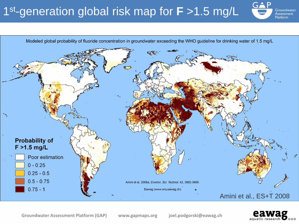
Amini et al., ES+T 2008
1st-generation global risk map for F >1.5 mg/L
Groundwater Assessment Platform (GAP) www.gapmaps.org [email protected]
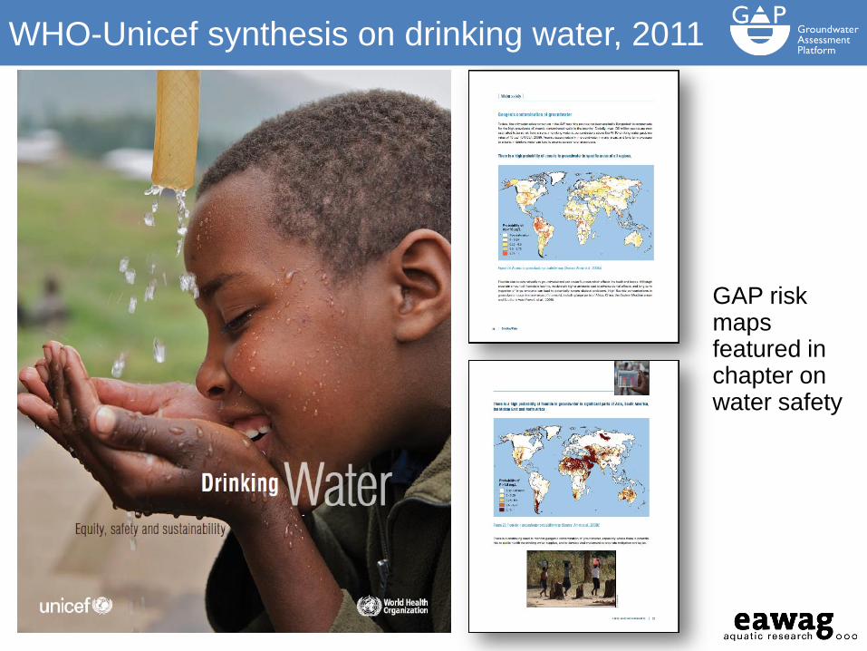
GAP risk maps featured in chapter on water safety
WHO-Unicef synthesis on drinking water, 2011
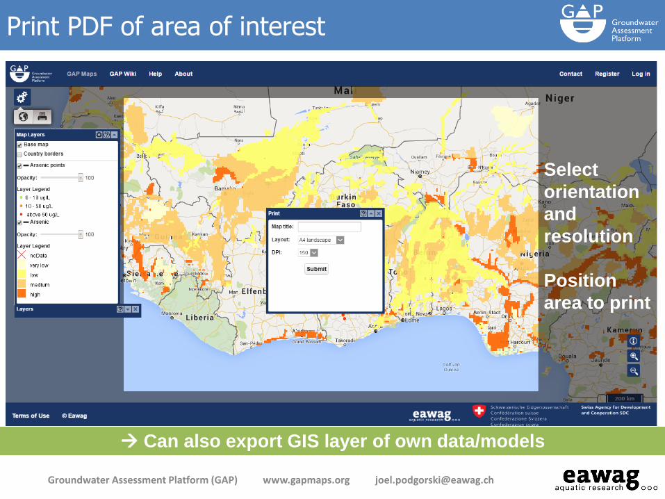
Select
orientation
and
resolution
Position
area to print
Print PDF of area of interest
Groundwater Assessment Platform (GAP) www.gapmaps.org [email protected]
Can also export GIS layer of own data/models

Communities
Groundwater Assessment Platform (GAP) www.gapmaps.org [email protected]
Share data and models with a select group of users
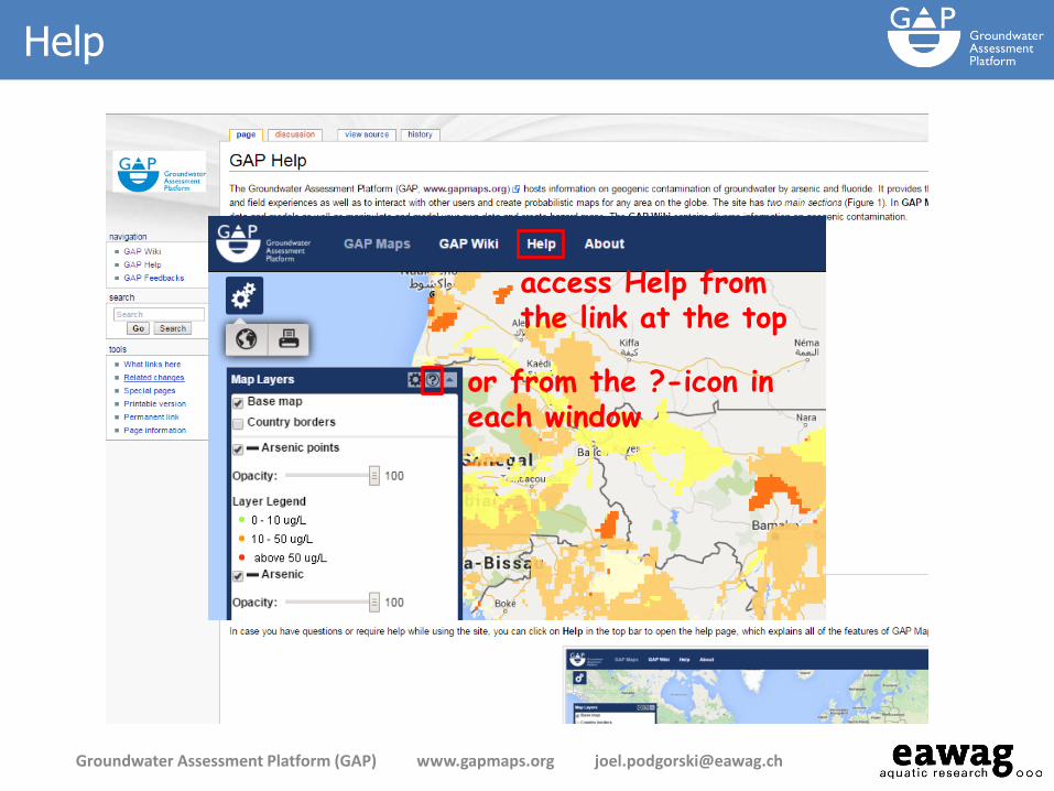
Help
Groundwater Assessment Platform (GAP) www.gapmaps.org [email protected]
access Help from the link at the top
or from the ?-icon in each window

Additional functionality when logged in
Groundwater Assessment Platform (GAP) www.gapmaps.org [email protected]
Sta
tist
ical Ana
lysis
Com
mun
ities
Mana
ge A
ccou
nt
My L
ayers

gapmaps.org
GAP Wiki – help to expand the compendium
Groundwater Assessment Platform (GAP) www.gapmaps.org [email protected]
Features the
Geogenic
Contamination
Handbook
Read/add/edit
pages on the
subject of
geogenic
contamination
Recommended