Embed Size (px)
Citation preview
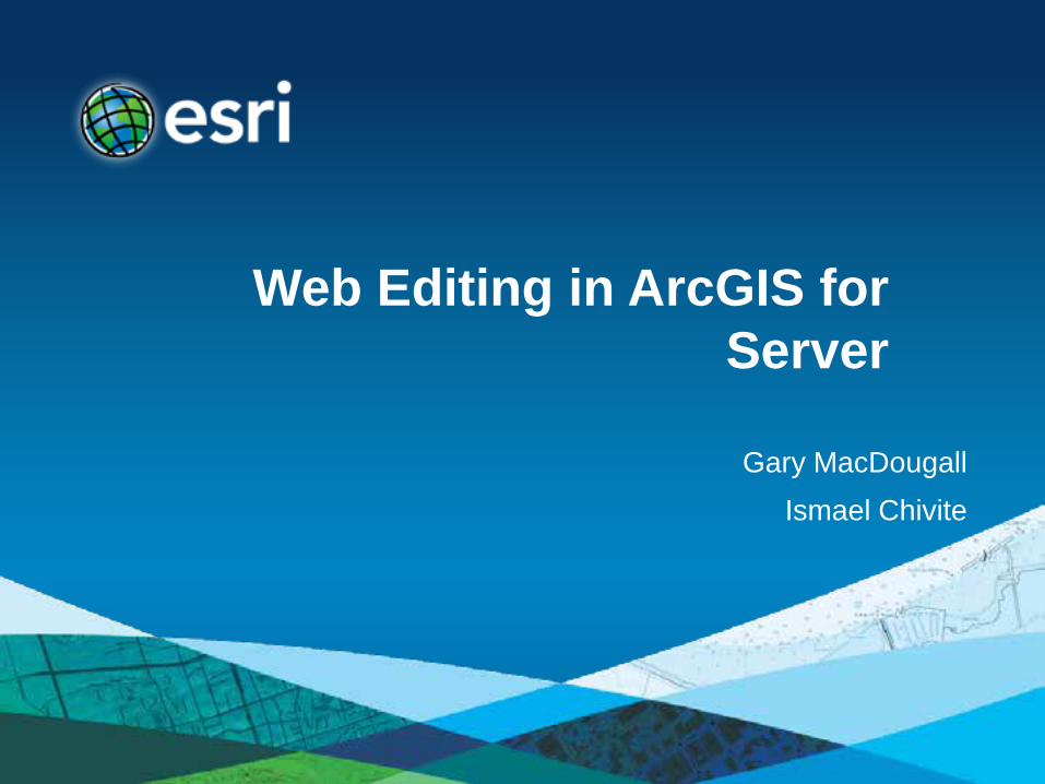
Web Editing in ArcGIS for Server
Gary MacDougall
Ismael Chivite

Agenda
• The basics of Web Editing in ArcGIS Server • Web Editing scenarios • Typical Server Configurations • Q&A
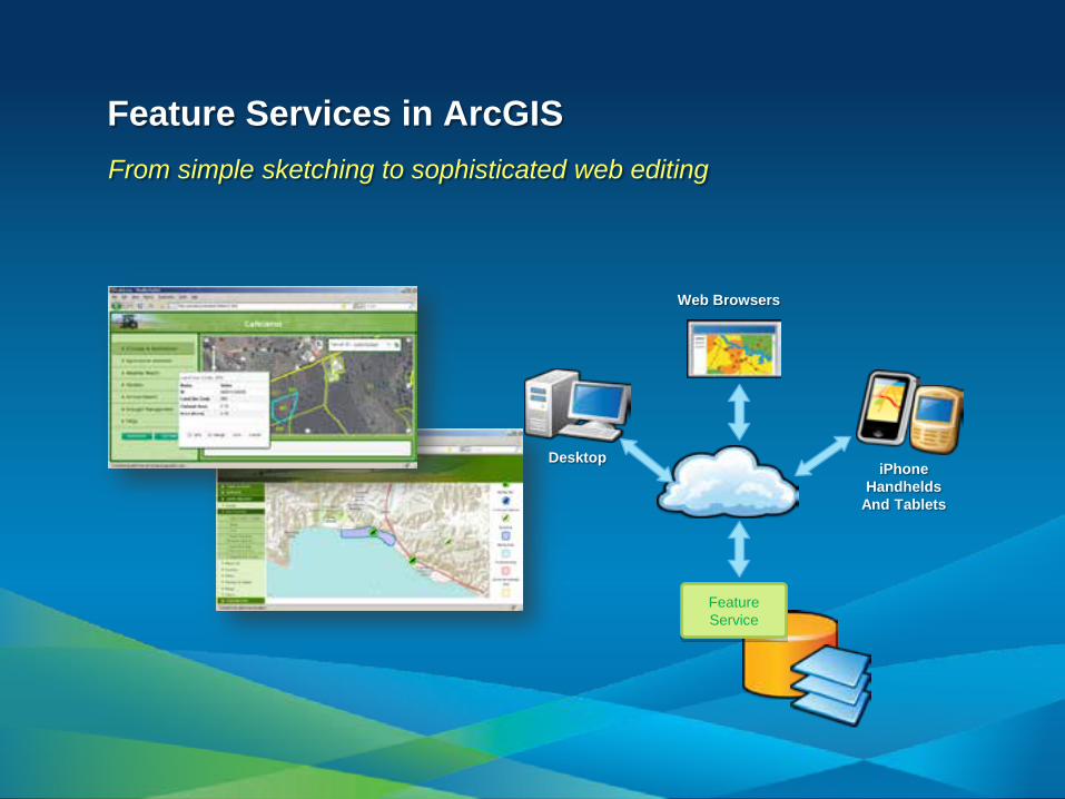
iPhone Handhelds
And Tablets
Web Browsers
Desktop
Feature Service
Feature Services in ArcGIS From simple sketching to sophisticated web editing
1
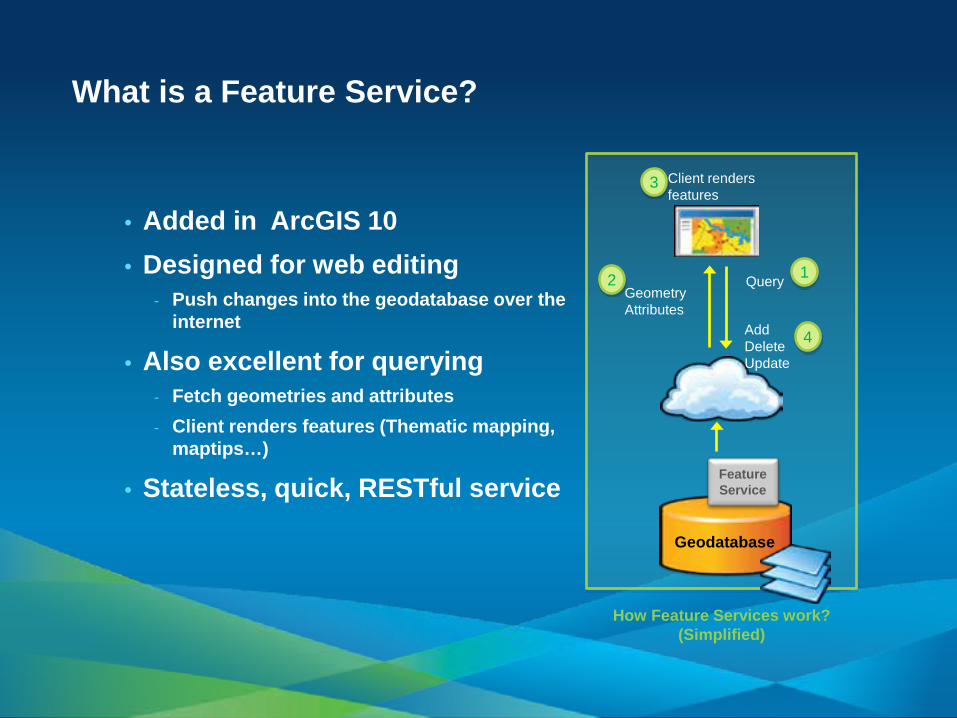
What is a Feature Service?
• Added in ArcGIS 10 • Designed for web editing
- Push changes into the geodatabase over the internet
• Also excellent for querying - Fetch geometries and attributes - Client renders features (Thematic mapping,
maptips…)
• Stateless, quick, RESTful service
Geodatabase
Query Geometry Attributes
Feature Service
Client renders features
2
3
How Feature Services work? (Simplified)
4 Add Delete Update
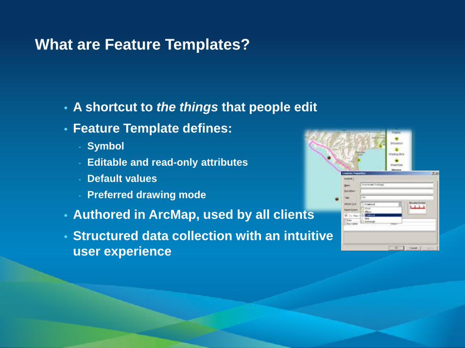
What are Feature Templates?
• A shortcut to the things that people edit • Feature Template defines:
- Symbol - Editable and read-only attributes - Default values - Preferred drawing mode
• Authored in ArcMap, used by all clients • Structured data collection with an intuitive
user experience
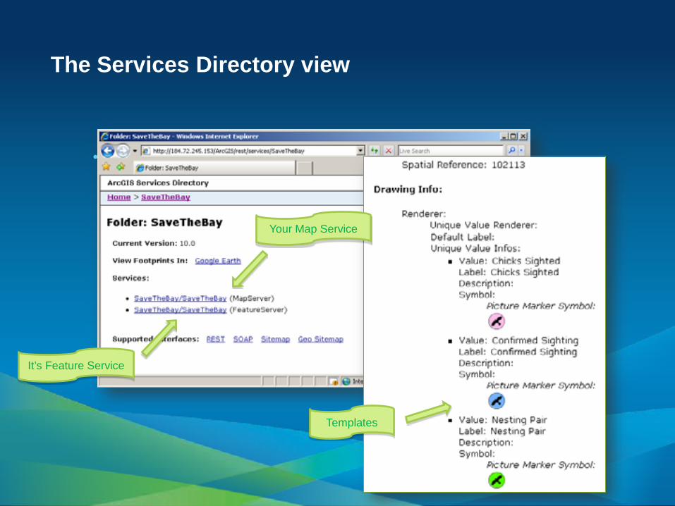
The Services Directory view
• of your Feature Service
Your Map Service
It’s Feature Service
Templates
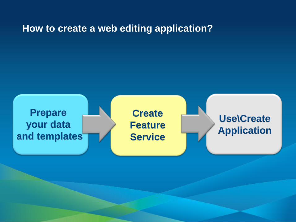
How to create a web editing application?
Prepare your data
and templates
Create Feature Service
Use\Create Application
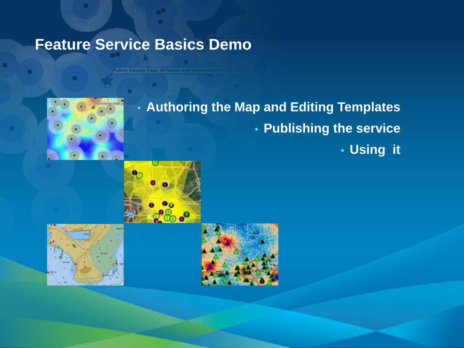
Feature Service Basics Demo
• Authoring the Map and Editing Templates • Publishing the service
• Using it

Agenda
• The basics of Web Editing in ArcGIS Server • Web Editing scenarios • Typical Server Configurations • Q&A

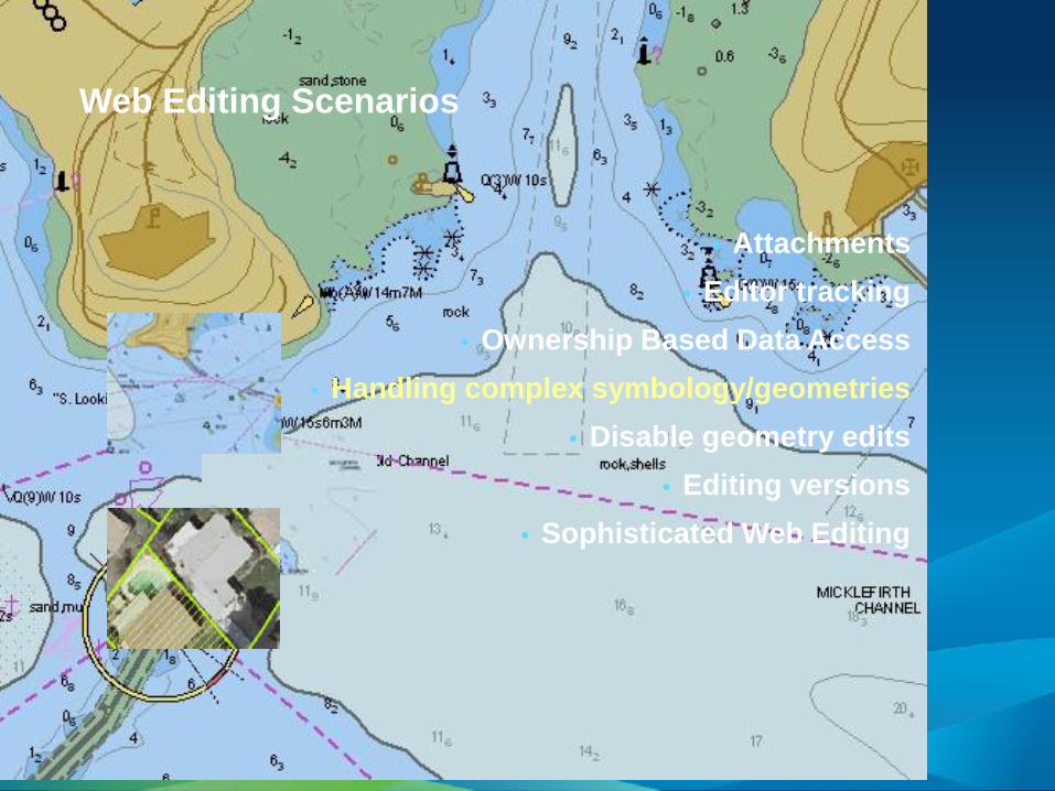
Web Editing Scenarios
• Attachments • Editor tracking
• Ownership Based Data Access • Handling complex symbology/geometries
• Disable geometry edits • Editing versions
• Sophisticated Web Editing

Web Editing Scenarios
• Attachments • Editor tracking
• Ownership Based Data Access • Handling complex symbology/geometries
• Disable geometry edits • Editing versions
• Sophisticated Web Editing
Web Editing Scenarios
• Attachments • Editor tracking
• Ownership Based Data Access • Handling complex symbology/geometries
• Disable geometry edits • Editing versions
• Sophisticated Web Editing
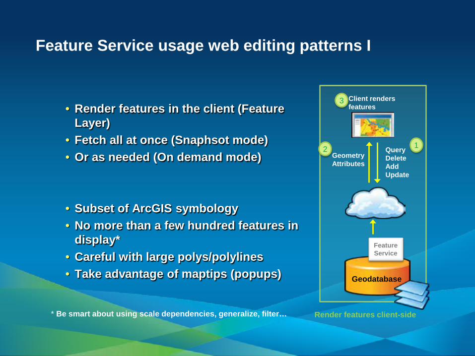
Feature Service usage web editing patterns I
• Render features in the client (Feature Layer)
• Fetch all at once (Snaphsot mode) • Or as needed (On demand mode)
• Subset of ArcGIS symbology • No more than a few hundred features in
display* • Careful with large polys/polylines • Take advantage of maptips (popups)
1
Geodatabase
Query Delete Add Update
Geometry Attributes
Client renders features
2
3
Render features client-side
* Be smart about using scale dependencies, generalize, filter…
Feature Service
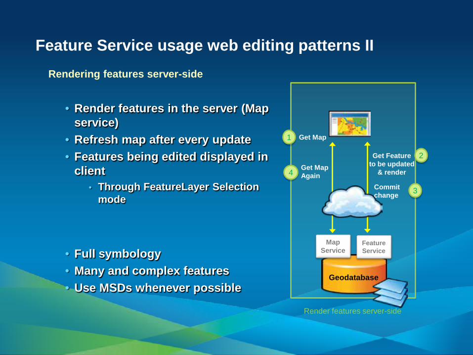
Feature Service usage web editing patterns II
• Render features in the server (Map service)
• Refresh map after every update • Features being edited displayed in
client • Through FeatureLayer Selection
mode
• Full symbology • Many and complex features • Use MSDs whenever possible
1
Geodatabase
Get Feature to be updated
& render
Get Map
Feature Service
Commit change
2
3
Map Service
4 Get Map Again
Render features server-side
Rendering features server-side

Web Editing Scenarios
• Attachments • Editor tracking
• Ownership Based Data Access • Handling complex symbology/geometries
• Disable geometry edits • Editing versions
• Sophisticated Web Editing

Web Editing Scenarios
• Attachments • Editor tracking
• Ownership Based Data Access • Handling complex symbology/geometries
• Disable geometry edits • Editing versions
• Sophisticated Web Editing
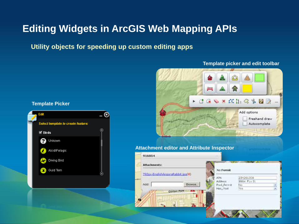
Editing Widgets in ArcGIS Web Mapping APIs
Template Picker
Template picker and edit toolbar
Attachment editor and Attribute Inspector
Utility objects for speeding up custom editing apps
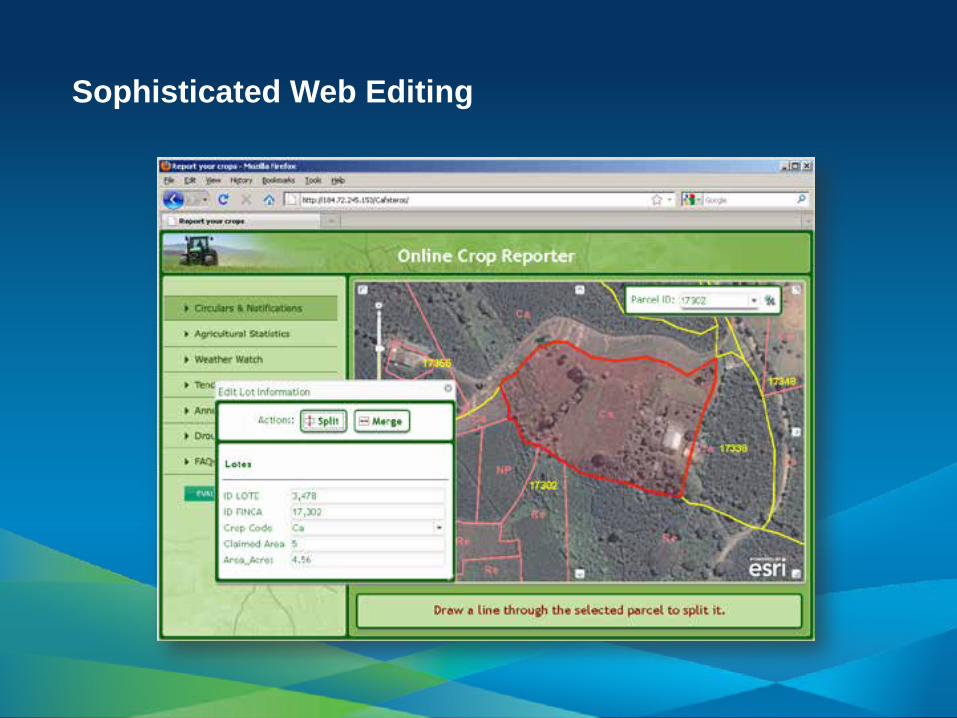
Sophisticated Web Editing
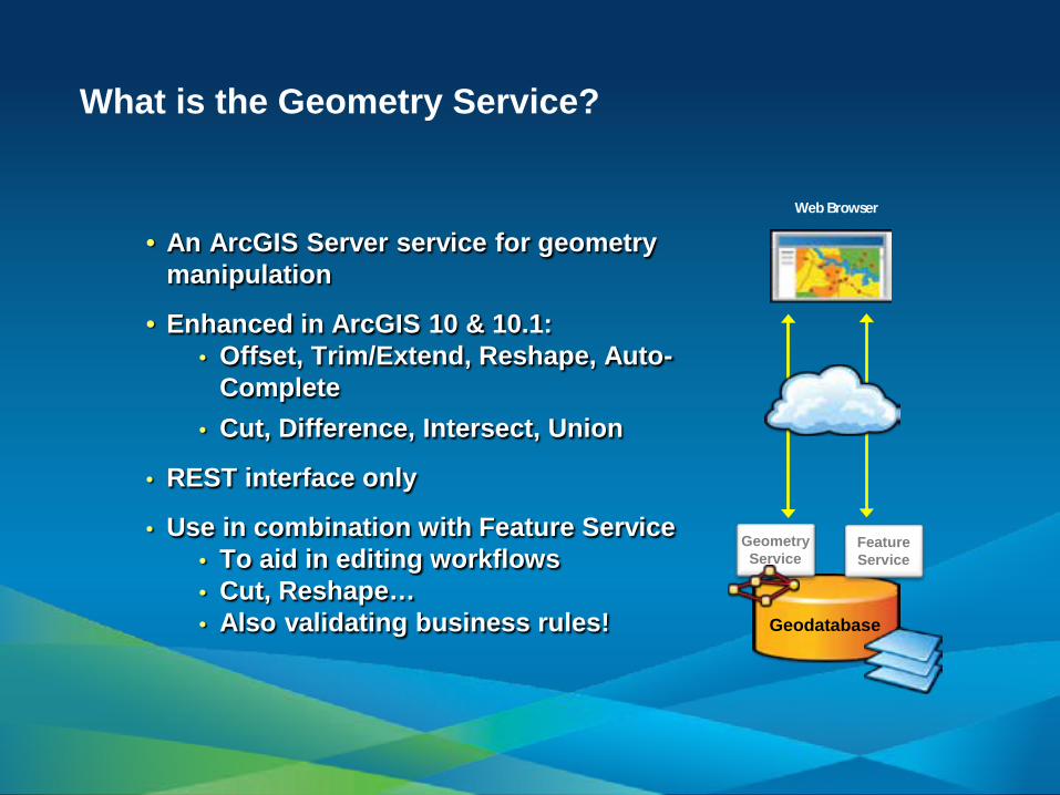
What is the Geometry Service?
• An ArcGIS Server service for geometry manipulation
• Enhanced in ArcGIS 10 & 10.1: • Offset, Trim/Extend, Reshape, Auto-
Complete • Cut, Difference, Intersect, Union
• REST interface only
• Use in combination with Feature Service • To aid in editing workflows • Cut, Reshape… • Also validating business rules!
Web Browser
Geodatabase
Feature Service
Geometry Service
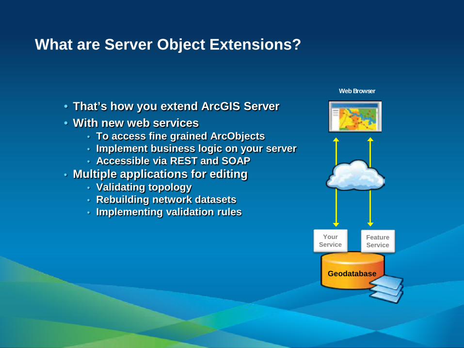
What are Server Object Extensions?
• That’s how you extend ArcGIS Server • With new web services
• To access fine grained ArcObjects • Implement business logic on your server • Accessible via REST and SOAP
• Multiple applications for editing • Validating topology • Rebuilding network datasets • Implementing validation rules
Web Browser
Geodatabase
Feature Service
Your Service
The challenge is the user experience
• Adding many tools is an easy and often unnecessary part
• Build focused editing apps • The necessary tools, no more • The workflow drives the design, not the opposite!
• Start by selecting the right client
• Do not reinvent the wheel • Do not push the technology beyond its comfort level • Or your users!
• Develop if needed
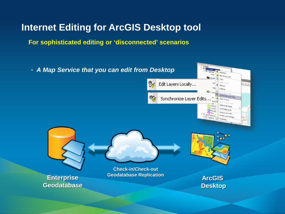
Internet Editing for ArcGIS Desktop tool For sophisticated editing or ‘disconnected’ scenarios
• A Map Service that you can edit from Desktop
Enterprise Geodatabase
ArcGIS Desktop
Check-in/Check-out Geodatabase Replication
Summary
• ArcGIS Server 10 features built-in web editing capabilities
• Enabling many exciting applications - Crowd sourcing, geocollaboration, web editing…
• New Feature Service • Out of the box editing clients
- ArcGIS.com Viewer - ArcGIS Viewer for Flex
• ArcGIS Web Mapping APIs • Geometry Service and Server Object Extensions