Embed Size (px)
Citation preview
The following documentation is an electronically‐submitted vendor response to an advertised solicitation from the West Virginia Purchasing Bulletin within the Vendor Self‐Service portal at wvOASIS.gov. As part of the State of West Virginia’s procurement process, and to maintain the transparency of the bid‐opening process, this documentation submitted online is publicly posted by the West Virginia Purchasing Division at WVPurchasing.gov with any other vendor responses to this solicitation submitted to the Purchasing Division in hard copy format.
Page : 1
VersionSolicitation NoSolicitation ClosesDate issued
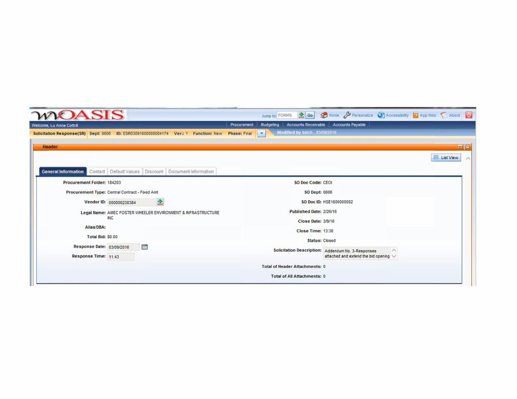
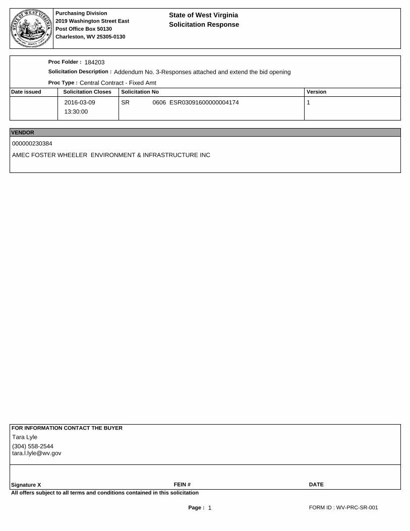
Proc Folder :
Solicitation Description :
Proc Type :
Solicitation Response
Purchasing Division2019 Washington Street East
Charleston, WV 25305-0130Post Office Box 50130
State of West Virginia
184203
Addendum No. 3-Responses attached and extend the bid opening
Central Contract - Fixed Amt
2016-03-09
13:30:00
SR 0606 ESR03091600000004174 1
VENDOR
000000230384
AMEC FOSTER WHEELER ENVIRONMENT & INFRASTRUCTURE INC
FOR INFORMATION CONTACT THE BUYER
Signature X FEIN # DATE
All offers subject to all terms and conditions contained in this solicitation
FORM ID : WV-PRC-SR-001
Tara Lyle
(304) [email protected]
Page : 2
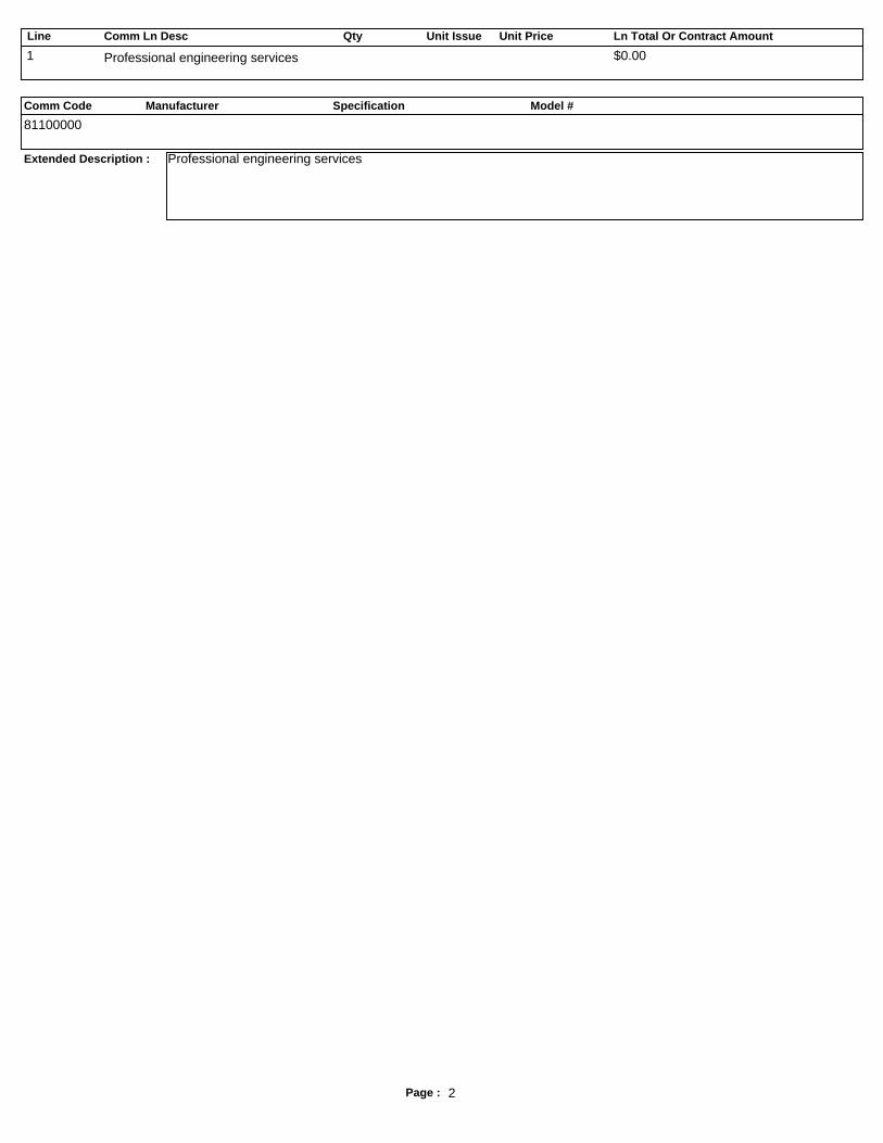
Line Comm Ln Desc Qty Unit Issue Unit Price Ln Total Or Contract Amount
Comm Code Manufacturer Specification Model #
Extended Description :
1 Professional engineering services $0.00
81100000
Professional engineering services
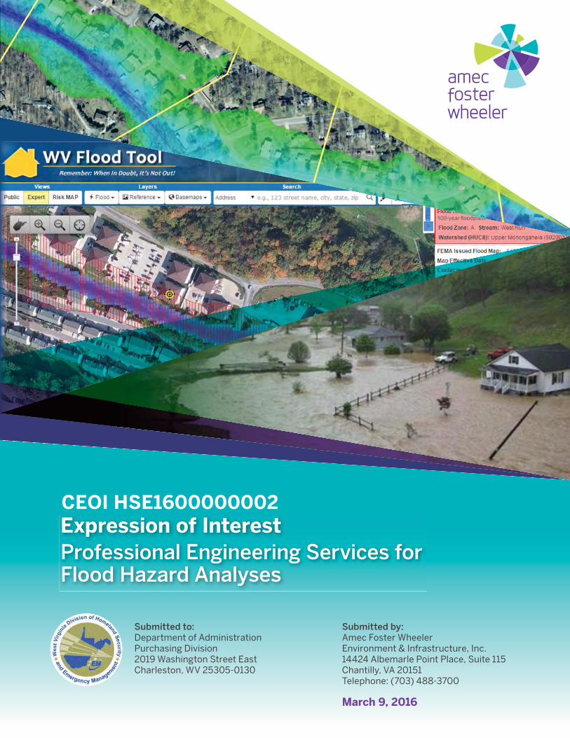
Submitted to:Department of AdministrationPurchasing Division2019 Washington Street EastCharleston, WV 25305-0130
Submitted by:Amec Foster WheelerEnvironment & Infrastructure, Inc.14424 Albemarle Point Place, Suite 115Chantilly, VA 20151Telephone: (703) 488-3700
March 9, 2016
Expression of InterestProfessional Engineering Services for Flood Hazard Analyses
CEOI HSE1600000002
Qualifi cations and Experience
Qualifi cations and Experience
Amec Foster Wheeler Environment & Infrastructure Inc.
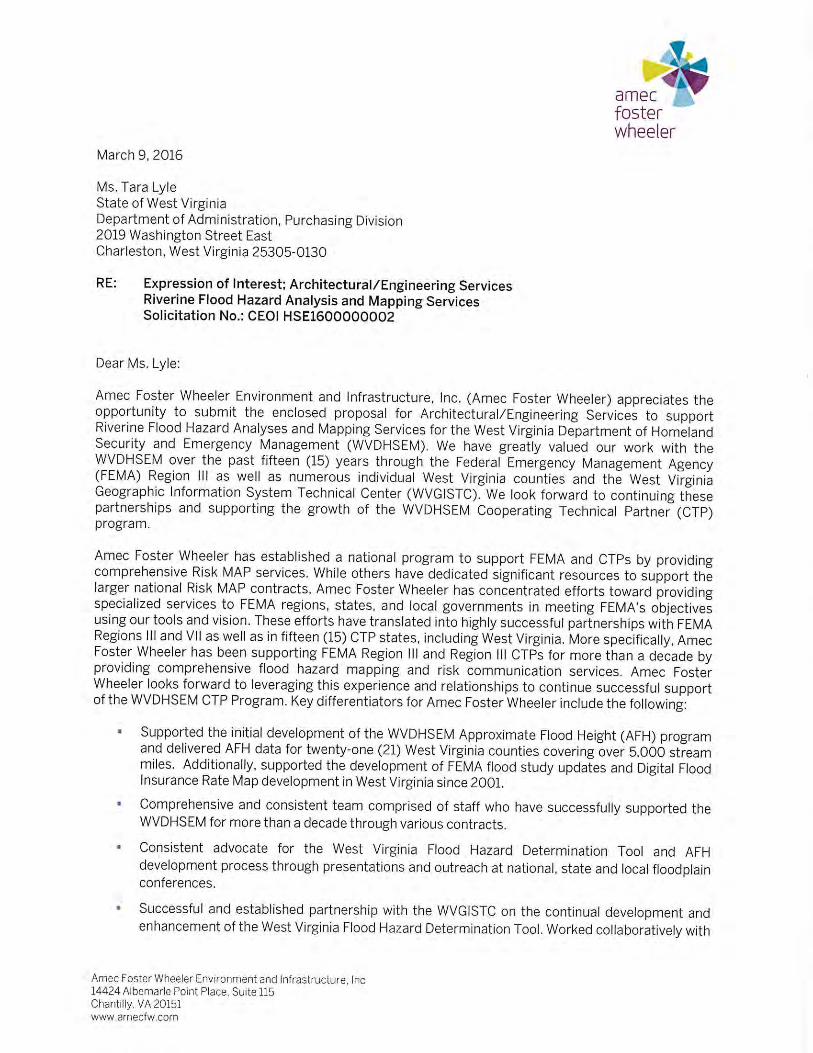
Expression of Interest: Professional Engineering Services for Flood Hazard Analyses
Page 1 of 41
March 9, 2016
Introduction
Amec Foster Wheeler Environment & Infrastructure, Inc. (Amec Foster Wheeler) is pleased to present our response to Expression of Interest (EOI) HSE1600000002 for Professional Engineering Services for Flood Hazard Analyses to West Virginia’s Division of Homeland Security and Emergency Management (WVDHSEM). This EOI response includes our Qualifications and Experience, Technical Approach, and requested additional documentation. Amec Foster Wheeler continues to work closely with WVDHSEM and the West Virginia Geographic Information Systems Technical Center (WVGISTC) on the development of enhanced approximate 1% annual chance (Zone A) floodplain studies and associated Advisory Flood Height (AFH) data, a collaboration that started more than a decade ago. Amec Foster Wheeler’s existing relationships and processes will save the state money in reduced coordination time and the guarantee of a deliverable consistent in quality and format as 21 previously completed Counties. Amec Foster Wheeler’s proposed Program/Client Manager, Tucker Clevenger, PE, CFM, and Project Manager, Matthew Breen, PE, CFM, have supported the WVDHSEM AFH initiative since its inception and have also consistently worked to engage the broader floodplain community and drive awareness and reliance on AFH information to build/re-build sustainable communities. We look forward to the opportunity to continue to successfully provide these services, and additional Risk Mapping, Assessment, and Planning (Risk MAP) program support for the State. Representative highlights of Amec Foster Wheeler value-added services provided to WVDHSEM along with associated benefits are provided in the following table:
WVDHSEM KEY CHALLENGES
AMEC FOSTER WHEELER SOLUTION
WVDHSEM BENEFIT REPRESENTATIVE
EXPERIENCE
Economically developing Statewide AFH data
Automated Floodplain Generator (AFG) automated modeling software
AFG has reduced the cost of HEC-RAS model backed flood studies by thousands of dollars per mile
AFG has been the basis for 21 AFH Counties throughout the State of West Virginia
West Virginia Flood Hazard Determination Tool and AFH Outreach
Consistent presence at conferences/workshops/ outreach meetings targeting WV Flood Tool stakeholders
More integrated and proactive floodplain management, permitting and mitigation at a local level, ultimately reducing flood risk
Amec Foster Wheeler presents annually as WVAFM and has supported WVDHSEM in additional ASFPM and WV conferences
Programmatic Support/Funding
Leverage established FEMA Region III relationships to position for additional funding. Proven high quality and timely AFH delivery.
Strategic positioning for program funding to support additional AFH development and future comprehensive Risk MAP program implementation
Disaster-funded AFH Counties are unique to West Virginia and were a collaboration between WVDHSEM, FEMA Region III, and Amec Foster Wheeler. Helped position WVDHSEM for additional FEMA funding through effective delivery of 21 AFH counties.
AFH acceptance for FEMA Letters of Map Amendment (LOMAs)
Collaborate with FEMA Region III and HQ and implementing a program for AFH acceptance for LOMAs
Reduced burden on property owners and expedited processing of LOMAs, ultimately saving WV residents money.
FEMA has approved the use of AFH data in support of LOMAs as well as eLOMAs and has reduced turnaround time on WV LOMAs,
Amec Foster Wheeler Environment & Infrastructure Inc.
Expression of Interest: Professional Engineering Services for Flood Hazard Analyses
Page 2 of 41
March 9, 2016
Amec Foster Wheeler Company Background
Previously AMEC Environment and Infrastructure, Inc., we recently purchased Foster Wheeler, Inc., and as of January 1, 2015, are named Amec Foster Wheeler Environment and Infrastructure, Inc. Amec Foster Wheeler Environment and Infrastructure has more than 4,200 employees in 76 different office locations across the United States and is a subsidiary of Amec Foster Wheeler, plc. Amec Foster Wheeler, plc designs, delivers and maintains strategic and complex assets for its customers across the global energy, environment, infrastructure and related sectors. Founded in 1848, the AMEC family of companies represents the 6th largest international engineering services organization in the world, according to rankings by Engineering News Record. We are one of the world’s largest engineering and project management companies with over 40,000 employees, a 150-year history, and revenues over $10 billion. Amec Foster Wheeler has established a national program to support both FEMA and Cooperating Technical Partners (CTPs) by providing complete Flood Map Modernization and Risk MAP program services. We have served as FEMA Region III’s preferred provider since 2001 and have worked with the West Virginia CTP Flood Hazard Mapping Program for the past decade.
Amec Foster Wheeler’s Support to FEMA Partners
In addition to supporting the West Virginia Floodplain Mapping program for the past decade, Amec Foster Wheeler has been a long standing partner with FEMA to assist with implementation and management of the National Flood Insurance Program (NFIP). Amec Foster Wheeler has concentrated efforts to support FEMA Regions, states and local governments in meeting FEMA’s objectives utilizing our national program experience, tools, and vision. In addition to our support of the West Virginia program, these efforts have translated into highly successful partnerships with FEMA Region III as well as in fifteen (15) other CTP states including Arkansas, Colorado, Delaware, Florida, Iowa, Indiana, Kansas, Kentucky, Maryland, Missouri, Montana, North Carolina, Nebraska, South Dakota, and Utah. In total, Amec Foster Wheeler maintains a nationwide team of more than 100 water resources engineers and Geographic Information System (GIS) analysts dedicated to Flood Insurance Study (FIS) development, Digital Flood Insurance Rate Map (FIRM) production, and NFIP assistance across the United States. The team performs all work to a consistent process for effective program management and quality. While others have significant resources dedicated to supporting FEMA’s national Production and Technical Services (PTS) Contract, Amec Foster Wheeler has focused on continuing to provide state CTPs with high level floodplain mapping services. We have been supporting the West Virginia floodplain mapping program since 2001, initially through FEMA Region III and more recently directly with the WVDHSEM and local municipalities. We look forward to grow the West Virginia CTP program through this successful partnership.
Amec has effectively supported the WV Floodplain Mapping program since 2001 through FEMA Region III. They have played a key role in pioneering the West Virginia Approximate Flood Height program in partnership with the Region, WVDHSEM, the West Virginia GIS Technical Center and local municipalities. AMEC to date has worked on 21 countywide projects for the WV approximate flood height program. They have continually demonstrated a thorough understanding of both the regulatory and technical aspects of the NFIP and have consistently delivered high quality products.
Robert Pierson, Senior Engineer, FEMA Region III
Amec Foster Wheeler Environment & Infrastructure Inc.
Expression of Interest: Professional Engineering Services for Flood Hazard Analyses
Page 3 of 41
March 9, 2016
1.0 Qualifications and Experience
1.1 Qualifications Overview
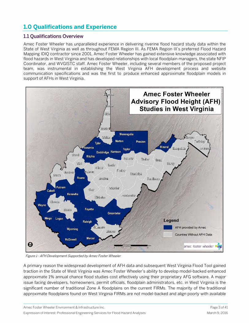
Amec Foster Wheeler has unparalleled experience in delivering riverine flood hazard study data within the State of West Virginia as well as throughout FEMA Region III. As FEMA Region III’s preferred Flood Hazard Mapping IDIQ contractor since 2001, Amec Foster Wheeler has gained extensive knowledge associated with flood hazards in West Virginia and has developed relationships with local floodplain managers, the state NFIP Coordinator, and WVGISTC staff. Amec Foster Wheeler, including several members of the proposed project team, was instrumental in establishing the West Virginia AFH development process and website communication specifications and was the first to produce enhanced approximate floodplain models in support of AFHs in West Virginia.
A primary reason the widespread development of AFH data and subsequent West Virginia Flood Tool gained traction in the State of West Virginia was Amec Foster Wheeler’s ability to develop model-backed enhanced approximate 1% annual chance flood studies cost effectively using their proprietary AFG software. A major issue facing developers, homeowners, permit officials, floodplain administrators, etc. in West Virginia is the significant number of traditional Zone A floodplains on the current FIRMs. The majority of the traditional approximate floodplains found on West Virginia FIRMs are not model-backed and align poorly with available
Figure 1 - AFH Development Supported by Amec Foster Wheeler
Amec Foster Wheeler Environment & Infrastructure Inc.
Expression of Interest: Professional Engineering Services for Flood Hazard Analyses
Page 4 of 41
March 9, 2016
topographic data, yet serve as the regulatory boundary – complicating the process for all of the stakeholders and often putting the burden and expense of proof on a single property owner. A coordinated effort between WVDHSEM, FEMA Region III, WVGISTC, and Amec Foster Wheeler offered a solution that was highly dependent on cost-efficient, fundamentally sound, AFH development and outreach driven by the West Virginia Flood Tool, such that disconnect between regulatory data and AFH data could be bridged for all users. AFG is a suite of tools that takes advantage of the flexible nature of ArcGIS and HEC-RAS. It has been endorsed by FEMA Region III for the development of flood studies and is the driving force behind Amec Foster Wheeler’s ability to produce flood studies efficiently. Amec Foster Wheeler initially partnered with FEMA Region III on the development of West Virginia AFH data utilizing disaster declaration funding based on the proven AFG process. For more detail on AFG, please refer to Section 2.2.3 Hydraulic Stream Analyses.
Our skillsets and expertise align perfectly with WVDHSEM’s primary objectives as outlined in the Professional Engineering Services for Flood hazard Analyses EOI request, including Zone A floodplain modeling and digital product development statewide. In addition to hydrologic and hydraulic analyses and floodplain mapping services necessary to support flood hazard studies, Amec Foster Wheeler has produced DFIRMs for over 130 counties in FEMA Region IlI alone. Whether under FEMA’s Map Modernization or Risk MAP programs, the majority of countywide DFIRM projects include data management, topographic data development, and community outreach components. The information below provides highlights of Amec Foster Wheeler’s qualifications in West Virginia and throughout FEMA Region III, as well as nationwide Hazard Mitigation experience.
West Virginia Qualification Highlights
Successfully performed enhanced approximate floodplain analyses in support of AFHs for twenty-one (21) counties across the State of West Virginia
First to deliver enhanced approximate floodplain analyses to support AFHs in West Virginia Delivered more than 5,100 miles of enhanced approximate flood hazard analyses across West Virginia
in support of AFHs Delivered FEMA compliant hydrologic and hydraulic modeling, water-surface and depth grid
information to support the aforementioned flood hazard analyses Cost-effective automated hydraulic modeling and floodplain mapping tools enable enhanced
approximate flood studies to be delivered at a fraction of the cost of full detailed studies Worked closely with the WVGISTC over the last decade on the development of the West Virginia Flood
Hazard Determination Tool Worked together with FEMA Region III, WVGISTC and WVDHSEM on developing standards for
floodplain modeling, mapping and water-surface depth and elevation grid submission and hosting on the West Virginia Flood Hazard Determination Tool website
Under contract to FEMA Region III, executed 19 West Virginia Countywide DFIRMs, encompassing 93 communities and more than 650 DFIRM panels, including updated flood studies for 107 miles of limited detailed reaches and 34 miles of detailed study reaches.
Gained extensive familiarity with West Virginia topographic and GIS datasets as a result of previous experience
Provided floodplain mapping and DFIRM training to WVGISTC staff and performed independent quality reviews on their work
Amec Foster Wheeler Team Members Tucker Clevenger and Matthew Breen have presented at numerous technical conferences to promote the use of the West Virginia Flood Tool
Continually providing technical support to West Virginia community officials and floodplain managers on the application and use of AFH data
Amec Foster Wheeler Environment & Infrastructure Inc.
Expression of Interest: Professional Engineering Services for Flood Hazard Analyses
Page 5 of 41
March 9, 2016
FEMA Region III Qualification Highlights
Topographic Data Development
Processed and utilized various formats of topographic datasets in more than 45 counties and 480 municipalities within FEMA Region III.
Successfully performed numerous LiDAR and aerial topographic data reviews on behalf of FEMA Region III.
Unique understanding of available topographic datasets within West Virginia as a result of our extensive experience in producing AFH data.
Hydrologic and Hydraulic Modeling
Extensive experience in performing FEMA compliant watershed modeling, both in FEMA Region III and across the country – more than 100 FEMA approved hydrologic models
Contracted by FEMA Region III to perform independent reviews of CTP and other Federal Agency hydrologic models
Developed several GIS-based tools to aid in hydrologic analyses, realizing cost savings that are passed on to clients
Performed over 900 miles of FEMA compliant detailed and limited detailed hydraulic studies throughout FEMA Region III
More than 15,000 miles of approximate floodplain refinement using cost-effective GIS-based proprietary methodologies endorsed by FEMA Region III
Automated tools assure DCS compliance and Mapping Information Platform (MIP) upload success
Floodplain Identification/Mapping and DFIRM Development
Successfully produced more than 5,000 DFIRM panels in FEMA Region III Developed a custom suite of tools to improve efficiency and cost effectiveness in floodplain
mapping and DFIRM production Maintain a DFIRM Production Center in our Chantilly, VA office led by a core team of engineers and
GIS professionals all with significant DFIRM experience Expertise in compliance with FEMA’s Guidelines and Specifications for Flood Hazard Mapping
Partners and developed automated tools that ensure compliance with all FEMA specifications Risk MAP Services
Among first contractors to develop and deliver riverine Risk MAP products in FEMA Region III First to develop and deliver coastal Risk MAP products within FEMA Region III (Delaware and
Maryland) Supported the development of three unique, state-specific web-based risk communication
solutions for Delaware, Maryland, and West Virginia, capitalizing on the flexibility for ingenuity within Risk MAP
Through nearly 15 years of direct experience with FEMA Region III, Amec Foster Wheeler maintains close working relationships with regional staff
Hazard Mitigation Planning
Nationally established hazard mitigation program with a wealth of risk assessment, mitigation planning, and outreach experience. This program includes a team of Hazus professionals with NFIP experience. Amec Foster Wheeler is focused on bridging the gap between Risk MAP and Hazard Mitigation planning to achieve the common goal of optimal flood risk reduction.
Completed over 210 Local Hazard Mitigation Plans Completed 17 State Hazard Mitigation Plans encompassing more than 1,100 communities First in FEMA Region III to leverage FEMA Risk MAP products for use in Hazard Mitigation Plans
Amec Foster Wheeler Environment & Infrastructure Inc.
Expression of Interest: Professional Engineering Services for Flood Hazard Analyses
Page 6 of 41
March 9, 2016
Community Outreach
Planned and executed over 450 Final Consultation Coordination Officer (CCO) Meetings Nationally
First to produce Non Regulatory products in FEMA Region III and has completed Flood Risk Assessment, Flood Risk Database, and Flood Risk Maps for 20 Counties in total in the Region and dozens more nationally
Represented FEMA Region III and other CTP clients at final DFIRM and outreach meetings for more than 130 different counties
Amec Foster Wheeler has developed customized presentation tools endorsed by FEMA Region III for use in final meetings
Amec Foster Wheeler and MES have worked together to support MDE’s statewide DFIRM outreach program with a customized approach that has proved highly successful Amec Foster Wheeler has supported DNREC at several stakeholder meetings to support DNREC’s watershed-based flood study prioritization effort
Qualifications of Key Personnel
Amec Foster Wheeler has a wealth of qualified professionals capable of providing WVDHSEM with exceptional services as required in the Professional Engineering Services for Flood Hazard Analyses EOI request. The majority of these key staff have successfully supported FEMA Region III and the West Virginia State CTP program for at least the past 10 years. A summary of the expertise of key personnel and support services is provided below to illustrate Amec Foster Wheeler’s qualifications.
Tucker Clevenger, PE, CFM will serve as the Client and Program Manager for the Flood Hazard Analysis contract. He has extensive experience in all aspects of flood hazard mapping in support of DFIRM production through final approval and community adoption. He has been directly involved in NFIP flood hazard mapping within FEMA Region III for the past 17 years and has worked closely with the WVDHSEM, WVGISTC, and numerous West Virginia Counties over the course of the last 15 years. Mr. Clevenger has overseen the development of AFHs in twenty-one different West Virginia counties and presents at the West Virginia Association of Floodplain Managers annually on the AFH development process Mr. Clevenger also previously served as the Program Manager for Amec Foster Wheeler’s five-year, $40 million IDIQ contract with FEMA Region III and is currently managing Amec Foster Wheeler’s Region III State CTP Program.
Matthew Breen, PE, CFM will serve as the Project Manager for this project. Mr. Breen has served as the Project Manager and Engineering Lead on the majority of Amec Foster Wheeler’s floodplain study work throughout the state of West Virginia. Mr. Breen previously served as lead Riverine Hydrology and Hydraulics engineer for Amec Foster Wheeler’s Map Modernization IDIQ contract with FEMA Region III and has been actively involved in the NFIP for the past 15 years. His main responsibility included the technical direction for thousands of miles of new floodplain development while also serving as a resource for other production elements. He currently manages a group of water resources engineers focused on H&H modeling, GIS-based automation, watershed planning, and stormwater compliance and design. Stephen Noe has over 30 years of experience performing all the services leading up to the production of a final DFIRM and will serve as the Quality Assurance/Quality Control (QA/QC) Lead. Mr. Noe has managed the development of numerous Amec Foster Wheeler tools and facilitates the production of hydrology and hydraulic studies resulting in DFIRM production. He will draw on his experience as the Project Manager for several DFIRM production projects to develop and assure implementation of QA/QC procedures that exceed FEMA compliance accuracies and provide WVDHSEM with the most accurate product the data can produce.
Jason Sevanick, CFM will serve as the GIS Lead for this project. Mr. Sevanick has extensive experience in floodplain mapping, DFIRM development and GIS applications and will lead digital dataset development and GIS services associated with this project. Mr. Sevanick has been directly involved in the management and production of over 5,000 DFIRM and DFIRM database panels including multiple
Amec Foster Wheeler Environment & Infrastructure Inc.
Expression of Interest: Professional Engineering Services for Flood Hazard Analyses
Page 7 of 41
March 9, 2016
DFIRM projects throughout the state of WV. He currently manages a group of technical support staff responsible for DFIRM production under the FEMA Region III Contract and CTP contracts. In addition, Mr. Sevanick has previously provided the WVGISTC with training on DFIRM and floodplain digital dataset development. Mr. Sevanick is also responsible for coordination with FEMA’s independent DFIRM database review contractor and has served as a valuable resource to both FEMA and the Production and Technical Services Contractor in this capacity.
Jennifer McGee, PE, CFM, GISP will serve as a Water Resources Engineer/Data Management Specialist for this project. Ms. McGee has over 10 years of experience in hydrologic and hydraulic modeling and geospatial analysis. She has developed HEC-RAS models for hundreds of miles of streams in West Virginia and other states, completed over a dozen countywide HAZUS flood risk assessments, and supported the initial development of the FEMA Coordinated Needs Management Strategy (CNMS) database for NVUE Reporting. Ms. McGee also focuses on software development and has built tools to automate FEMA workflows, perform spatial analysis, manage data and generate new products such as depth and water surface grids. Sravan Krovidi, PE will serve as Senior Water Resources Engineer for this project. Mr. Krovidi’s experience includes hydrologic and hydraulic analysis, flood hazard studies, flood control planning and design, and site/infrastructure engineering. He specialized in application of a variety of surface water modeling techniques including 1-dimensional/steady-flow hydraulic modeling (HEC-RAS); rainfall-runoff modeling (HEC-HMS, HydroCAD and TR-20), applying ArcGIS to a variety of hydrologic and hydraulic analysis, water resources & civil design projects. He extensively worked as the hydraulics engineer on the Map Modernization IDIQ contracts for FEMA Region III that includes West Virginia counties of Doddridge, Monongalia, Preston, Ritchie, Roane, Tylor, Pleasants, Putnam, and Cabell, as well as several counties of MD and DE. Yukun Xing, Ph. D., CFM will serve as a Senior GIS Analyst for this project. Mr. Xing has nine years of experience working on DFIRM projects. He managed the FEMA Map Modernization projects for Tucker and Randolph Counties in West Virginia, and participated at various capacities in many more West Virginia counties. He is well-versed in DFIRM production, FEMA specifications, standards, and processes, and GIS applications. Mr. Xing has also been keen to identify improvements in DFIRM workflows and opportunities to automate them with either standard or custom tools. This practice has resulted in increased productivity and improved quality of final deliverables. Brandon Cramer will serve as a GIS analyst for this project. Mr. Cramer has over three years of experience in FEMA-related floodplain mapping, including both DFIRM and Flood Risk products. He has extensively worked on the production and development of new streamlines, depth grids, and floodplain polygons for approximate] stream studies in over 10 West Virginia counties from 2012 through 2015. He also managed the GIS and engineering data for those stream studies and prepared them for submittal to WVGISSTC. In addition to his floodplain work in West Virginia, Mr. Cramer was highly involved with development of DFIRM products for several counties in Pennsylvania, Maryland, and Delaware, as well as the production of Coastal Flood Risk Products for 15 counties in Maryland.
Troy Biggs, PE, PH, D.WRE will serve as Senior Water Resources Specialist for this project. Mr. Biggs is a Senior Civil/Water Resources Engineer / Project Manager with over 15 years of experience and is skilled in hydrologic and hydraulic modelling, watershed assessment, green infrastructure design, stream restoration, floodplain analysis, and water resources engineering design. He has served as project manager and design engineer in preparation of construction plans and specifications for a wide variety of water resources related projects. He currently serves as a Project Manager/Water Resources Engineer and technical lead specializing in H&H modelling and water resources design using HEC-RAS, HEC-HMS, AutoCAD, and GIS mapping tools. David Stroud, CFM will serve as the Hazard Mitigation Lead for this project. Mr. Stroud has over 24 years of experience as a floodplain/hazard mitigation planner. Mr. Stroud’s hazard mitigation planning
Amec Foster Wheeler Environment & Infrastructure Inc.
Expression of Interest: Professional Engineering Services for Flood Hazard Analyses
Page 8 of 41
March 9, 2016
experience includes both development of hazard mitigation plans and reviewing and scoring plans for FEMA. David has also worked for the Insurance Services Office (ISO) on behalf of FEMA’s National Flood Insurance Program’s (NFIP) Community Rating System (CRS) Program as the lead hazard mitigation planner and Flood Training Coordinator for 18 years. Mr. Stroud has significant experience with the minimum regulations of the National Flood Insurance Program (NFIP), FEMA Grant programs and FEMA’s Repetitive Loss Program. David works with communities, states and FEMA Regional offices on all aspects of hazard mitigation planning and the FEMA’s CRS Program.
Please refer to Section 1.4 Resumes for additional details on Amec Foster Wheeler’s flood hazard mapping qualifications.
Applicable certifications for Amec Foster Wheeler staff can be found under the Forms tab.
Amec Foster Wheeler Environment & Infrastructure Inc.
Expression of Interest: Professional Engineering Services for Flood Hazard Analyses
Page 9 of 41
March 9, 2016
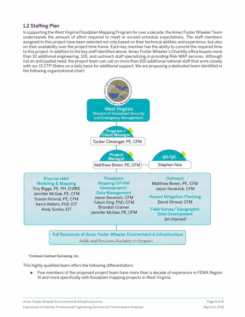
1.2 Staffing Plan In supporting the West Virginia Floodplain Mapping Program for over a decade, the Amec Foster Wheeler Team understands the amount of effort required to meet or exceed schedule expectations. The staff members assigned to this project have been selected not only based on their technical abilities and experience, but also on their availability over the project time frame. Each key member has the ability to commit the required time to this project. In addition to the key staff identified above, Amec Foster Wheeler’s Chantilly office boasts more than 10 additional engineering, GIS, and outreach staff specializing in providing Risk MAP services. Although not an anticipated need, the project team can call on more than 100 additional national staff that work closely with our 15 CTP States on a daily basis for additional support. We are proposing a dedicated team identified in the following organizational chart:
This highly qualified team offers the following differentiators:
Five members of the proposed project team have more than a decade of experience in FEMA Region III and more specifically with floodplain mapping projects in West Virginia.
Amec Foster Wheeler Environment & Infrastructure Inc.
Expression of Interest: Professional Engineering Services for Flood Hazard Analyses
Page 10 of 41
March 9, 2016
Our Chantilly, VA Production Center has successfully delivered AFH data in 21 West Virginia counties. In addition, we have produced updated flood studies and DFIRMs in 19 West Virginia counties throughout the state under contract to FEMA Region III.
Our team has worked closely with the WVGISTC from the time they were first introduced as a CTP in 2003 and has supported the development of the West Virginia Flood Hazard Determination Tool since its inception.
Amec Foster Wheeler has met annually in Morgantown, West Virginia with WVDHSEM, FEMA Region III, and WVGISTC staff to identify needs and opportunities for the upcoming year and collaborate on potential enhancements to the West Virginia Flood Hazard Determination Tool.
Our team has maintained strong relationships with FEMA Region III for over 15 years, serving as their preferred Flood Hazard Mapping IDIQ contractor since 2001 and more recently transitioned to support state CTP programs within the Region. We have been successful in leveraging these relationships to help support CTPs in positioning for funding on an annual basis.
Amec Foster Wheeler has a proven track record of collaborating with FEMA Region III and their State CTPs on solutions that address needs at the local level, rather than at the national level.
Amec Foster Wheeler has invested substantial resources in the West Virginia State CTP Program and is committed to the continued dedication of resources required to deliver high quality products on schedule and within budget. As a company, we have focused on supporting FEMA’s CTPs at a state and local level. This focus will continue to enable Amec Foster Wheeler to provide a higher level of service to CTPs as significant resources are not dedicated at a national level. To support this project, Amec Foster Wheeler is committed to dedicating a consistent team which has successfully supported the West Virginia program for the last 15 years. Tucker Clevenger, who currently manages Amec Foster Wheeler’s Region III CTP flood hazard mapping program, will serve as the WVDHSEM Client and Program Manager and will assure that appropriate resources are dedicated to meet the to the project. Matthew Breen will lead a select team water resources engineers and GIS analysts to support the county. As a result of our experience working on the current West Virginia program, it is anticipated that all work will continue to be accommodated out of our local production center in Chantilly, VA. We have a flexible team in place that can quickly meet WVDHSEM’s program needs. However, Amec Foster Wheeler’s national Risk MAP Team of more than 100 H&H engineers, GIS specialists, and program support staff, will be available to assist the Northern Virginia team if necessary.
Communication Plan
Through our more than 15 years of working with WVDHSEM, FEMA Region III, WVGISTC and local West Virginia officials, we have developed a comprehensive network of relationships throughout the state which will help facilitate effective communication throughout the life of the contract. We are in consistent communication with WVDHSEM, FEMA Region III, WVGISTC and local officials throughout the life of existing projects. At a minimum, individual project status reports will be provided on a monthly basis and supplemented by either in-person or web-based meetings as necessary with WVDHSEM. A specific communication plan will be identified for each individual Task Order issued by the WVDHSEM as part of the Project Management Plan. Standard components of these plans will typically include:
Project Kickoff Meeting (in-person or web-based) Monthly status updates and invoicing Periodic status calls/web-meetings (frequency to be agreed upon with WVDHSEM on a task order
specific basis) FEMA Region III status/monitoring meetings Final task order wrap-up meeting Coordination call with WVGISTC on data delivery Community outreach/engagement demonstration
Specific project issues will be communicated immediately with the client and if necessary, Amec Foster Wheeler will also act as a liaison with FEMA Region III in order to resolve any Special Problem Reports (SPRs). Through our previous FEMA Region III, we have an extensive track record of proactively addressing SPRs in
Amec Foster Wheeler Environment & Infrastructure Inc.
Expression of Interest: Professional Engineering Services for Flood Hazard Analyses
Page 11 of 41
March 9, 2016
order to limit impacts to project budget and schedules. Through our various FEMA Region III CTP contracts, we have regular monitoring meetings with FEMA Region III staff to help convey state CTP project status and confirm alignment with FEMA Region III metrics and expectations. This communication is critical in order to better position for future funding. Furthermore, Amec Foster Wheeler’s communication plan extends beyond standard project and task order communication. Through our experience, we understand that communication and outreach are critical to the success of the West Virginia AFH initiative. As a result, we plan on providing continued and expanded outreach support to include (but not limited to) the following:
West Virginia Association of Floodplain Presentations/Training West Virginia Surveyor’s Conference Presentations/Support National Association of State Floodplain Managers Conference AFH Promotion Individual West Virginia County Outreach Meetings FEMA Region III AFH promotion
As a result of the West Virginia AFH initiative, the state has received a significant amount of positive recognition from FEMA Region III as well as other FEMA CTP states. We have been proud to support the West Virginia communication and outreach initiative and look forward to helping to continue to positive momentum to further advance the West Virginia CTP Program.
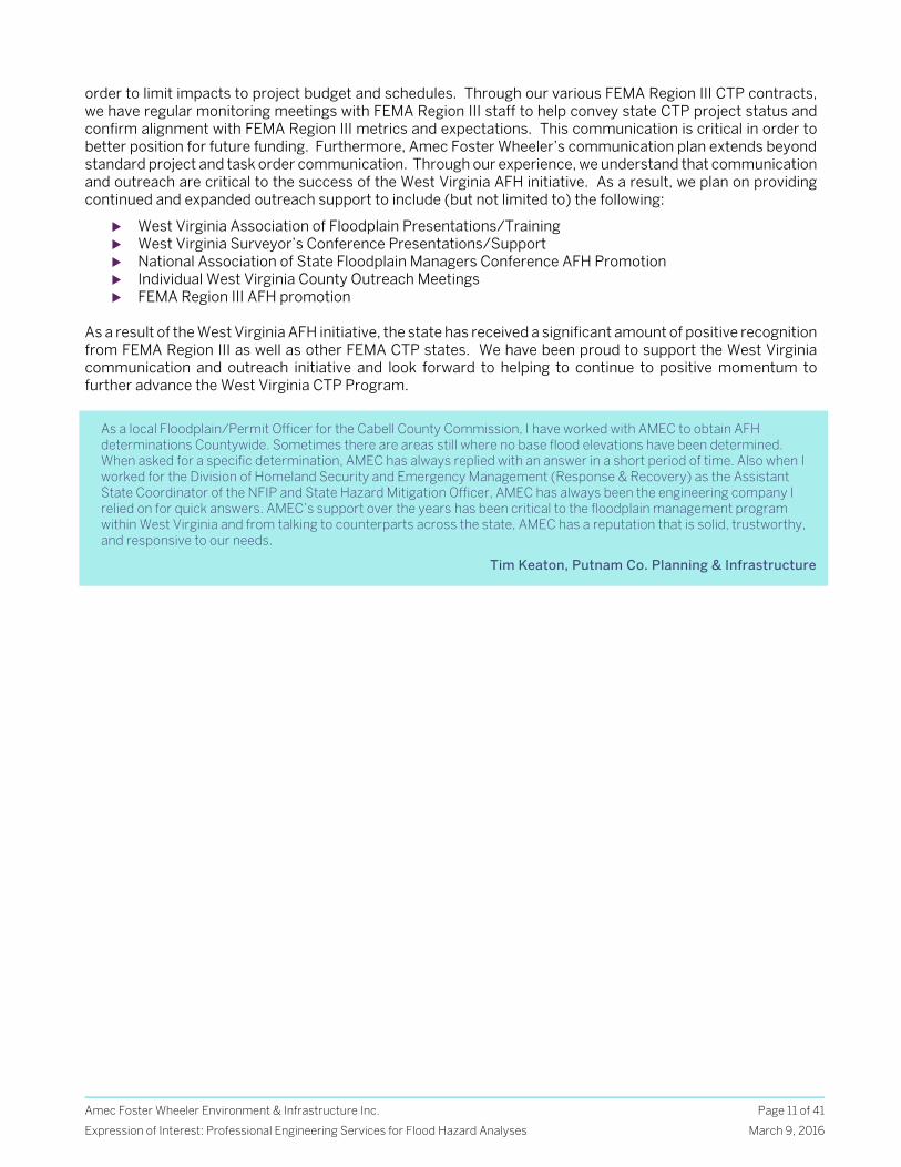
As a local Floodplain/Permit Officer for the Cabell County Commission, I have worked with AMEC to obtain AFH determinations Countywide. Sometimes there are areas still where no base flood elevations have been determined. When asked for a specific determination, AMEC has always replied with an answer in a short period of time. Also when I worked for the Division of Homeland Security and Emergency Management (Response & Recovery) as the Assistant State Coordinator of the NFIP and State Hazard Mitigation Officer, AMEC has always been the engineering company I relied on for quick answers. AMEC’s support over the years has been critical to the floodplain management program within West Virginia and from talking to counterparts across the state, AMEC has a reputation that is solid, trustworthy, and responsive to our needs.
Tim Keaton, Putnam Co. Planning & Infrastructure
Amec Foster Wheeler Environment & Infrastructure Inc.
Expression of Interest: Professional Engineering Services for Flood Hazard Analyses
Page 12 of 41
March 9, 2016
1.3 Past Projects
West Virginia Approximate Flood Hazard Studies and Risk Communication
CLIENT/ LOCATION DATES SIZE CLIENT CONTACT
FEMA Region III/WV Division of Homeland Security and Emergency Mgmt. (WVDHSEM) Statewide West Virginia
2009 – present $1.2M
Robert Pierson 215-931-5650 Kevin Sneed 304-957-2571
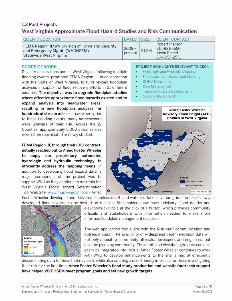
SCOPE OF WORK Disaster declarations across West Virginia following multiple flooding events, prompted FEMA Region III, in collaboration with the State of West Virginia, to fund revised floodplain analyses in support of flood recovery efforts in 21 different counties. The objective was to upgrade floodplain studies where effective approximate flood hazards existed and to expand analysis into headwater areas, resulting in new floodplain analyses for hundreds of stream miles – areas where prior to these flooding events, many homeowners were unaware of their risk. Across the 21 Counties, approximately 5,000 stream miles were either reevaluated or newly studied. FEMA Region III, through their IDIQ contract, initially reached out to Amec Foster Wheeler to apply our proprietary automated hydrologic and hydraulic technology to efficiently address the mapping needs. In addition to developing flood hazard data, a major component of the project was to support WVU as they continue to maintain the West Virginia Flood Hazard Determination Tool Web Site (www.mapwv.gov/flood). Amec Foster Wheeler developed and delivered seamless depth and water-surface elevation grid data for all newly developed flood hazards to be hosted on the site. Stakeholders now have ‘advisory’ flood depths and
elevations available at the click of a button, which provides community officials and stakeholders with information needed to make more informed floodplain management decisions. The web application tool aligns with the Risk MAP communication and outreach vision. The availibility of widespread depth/elevation data will not only appeal to community offiicials, developers and engineers, but also the planning community. The depth and elevation grid data can also easily be integrated into Hazus. Amec Foster Wheeler continues to work with WVU to develop enhancements to the site, aimed at effeciently
disseminating data to those that rely on it, while also creating a user-friendly interface for those investigating their risk for the first time. Amec Foster Wheeler’s flood study production and website/outreach support have helped WVDHSEM meet program goals and set new growth targets.
PROJECT HIGHLIGHTS RELEVANT TO CEOI: Hydrologic and Hydraulic Mapping Floodplain Identification and Mapping DFIRM Development Data Management Topographic Data Development Community Outreach
Amec Foster Wheeler Environment & Infrastructure Inc.
Expression of Interest: Professional Engineering Services for Flood Hazard Analyses
Page 13 of 41
March 9, 2016
Federal Emergency Management Agency (FEMA) Region III IDIQ Riverine Flood Hazard Studies
CLIENT/ LOCATION DATES SIZE CLIENT CONTACT FEMA Region III States of DE, MD, PA, WV and VA
2001 – 2015 $23M Robert Pierson 215-931-5650
SCOPE OF WORK Since 2001, Amec Foster Wheeler has supported FEMA Region III by providing complete Map Modernization services and Risk MAP Program support across 49 multi-county task orders, including analyzing flood hazards for select streams within a county, developing new flood hazard data (detailed, limited detailed, approximate) for entire counties, preliminary DFIRM development, DFIRM database creation, Post Preliminary processing, terrain data capture, GPS land surveys, CTP support and training, and various other support services. Amec Foster Wheeler is also the first to produce Risk MAP products in FEMA Region III for both Riverine and Coastal studies. A primary goal of FEMA Region III during this time frame was to completely digitize their DFIRM inventory. As a result of Amec Foster Wheeler’s creative use of GIS for flood hazard modeling and mapping (including many proprietary tools developed to maximize accuracy and efficiency – most notably our Approximate Floodplain Generator), We have produced more than 5,000 panels for FEMA Region III, covering 130 counties and more than 800 communities taken from preliminary to effective status, helping make Region III the first ‘all-digital’ FEMA Region. To date, Amec Foster Wheeler has performed hydrologic and hydraulic restudies and associated flood hazard mapping for over 15,000 stream miles with varying levels of complexity. Beyond technical expertise, Amec Foster Wheeler has played an integral role supporting FEMA Region III at 110 community coordination and outreach meetings. Amec Foster Wheeler knows that municipal and public involvement in the flood mapping update process is critical to facilitate the efficient adoption of the new flood hazard data and achieve stakeholder consensus. Thus, Amec Foster Wheeler has presented results of complex technical procedures to community officials and residents, facilitated the collection of applicable floodplain mapping data, and provided insight and direction on DFIRM development. This integrated approach has cultivated relationships with community officials that assist in expediting the map acceptance process for FEMA. Under the FEMA Region III IDIQ contract, Amec Foster Wheeler was contracted to perform DFIRM production/flood hazard analysis for thirteen different counties in West Virginia. This included DFIRM
development, preliminary issuance and post preliminary processing for 460 panels in Barbour, Cabell, Jackson, Kanawha, Lewis, McDowell, Monongalia, Pendleton, Raleigh, Randolph, Tucker, Upshur and Wyoming Counties. These countywide DFIRMs were delivered ahead of schedule and within budget. Included in these DFIRM updates were new flood studies for 107 miles of Limited Detailed analyses and 34 Miles of Detailed analyses. FEMA Region III also tasked Amec Foster Wheeler with providing technical assistance and independent QA/QC to WVUGISTC as a CTP. Amec Foster Wheeler provided technical guidance and training to WVU as they utilized FEMA’s DFIRM tools administered through the Citrix server solution. Amec Foster Wheeler was able to assist WVU in the effective production of DFIRMs and laid the groundwork for a partnership on the West Virginia Flood Hazard Determination Tool initiative.
“AMEC has continuously worked with FEMA Region III, Risk Analysis Branch on our Map Modernization and Risk MAP programs since 2001. AMEC successfully completed many annual task orders to modernize our map products across the Region. They have lead or participated in the engineering, mapping and administration of over 100 countywide projects for Region III. AMEC staff have excelled at coordination with us as clients; with local & state government staff; and with other consultants as project partners.”
Jon Janowicz, FEMA Former FEMA Risk Analysis Branch Chief
PROJECT HIGHLIGHTS RELEVANT TO CEOI: Hydrologic and Hydraulic Mapping Floodplain Identification and Mapping DFIRM Development Data Management Topographic Data Development Hazard Mitigation Planning Community Outreach
Amec Foster Wheeler Environment & Infrastructure Inc.
Expression of Interest: Professional Engineering Services for Flood Hazard Analyses
Page 14 of 41
March 9, 2016
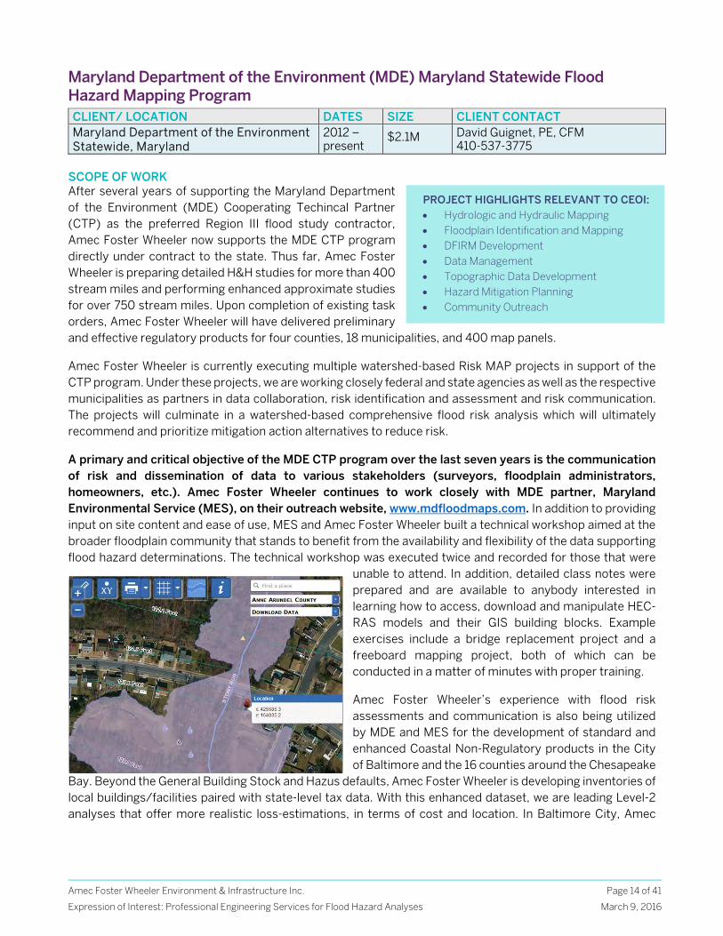
Maryland Department of the Environment (MDE) Maryland Statewide Flood Hazard Mapping Program CLIENT/ LOCATION DATES SIZE CLIENT CONTACT Maryland Department of the Environment Statewide, Maryland
2012 – present
$2.1M David Guignet, PE, CFM 410-537-3775
SCOPE OF WORK After several years of supporting the Maryland Department of the Environment (MDE) Cooperating Techincal Partner (CTP) as the preferred Region III flood study contractor, Amec Foster Wheeler now supports the MDE CTP program directly under contract to the state. Thus far, Amec Foster Wheeler is preparing detailed H&H studies for more than 400 stream miles and performing enhanced approximate studies for over 750 stream miles. Upon completion of existing task orders, Amec Foster Wheeler will have delivered preliminary and effective regulatory products for four counties, 18 municipalities, and 400 map panels.
Amec Foster Wheeler is currently executing multiple watershed-based Risk MAP projects in support of the CTP program. Under these projects, we are working closely federal and state agencies as well as the respective municipalities as partners in data collaboration, risk identification and assessment and risk communication. The projects will culminate in a watershed-based comprehensive flood risk analysis which will ultimately recommend and prioritize mitigation action alternatives to reduce risk.
A primary and critical objective of the MDE CTP program over the last seven years is the communication of risk and dissemination of data to various stakeholders (surveyors, floodplain administrators, homeowners, etc.). Amec Foster Wheeler continues to work closely with MDE partner, Maryland Environmental Service (MES), on their outreach website, www.mdfloodmaps.com. In addition to providing input on site content and ease of use, MES and Amec Foster Wheeler built a technical workshop aimed at the broader floodplain community that stands to benefit from the availability and flexibility of the data supporting flood hazard determinations. The technical workshop was executed twice and recorded for those that were
unable to attend. In addition, detailed class notes were prepared and are available to anybody interested in learning how to access, download and manipulate HEC-RAS models and their GIS building blocks. Example exercises include a bridge replacement project and a freeboard mapping project, both of which can be conducted in a matter of minutes with proper training.
Amec Foster Wheeler’s experience with flood risk assessments and communication is also being utilized by MDE and MES for the development of standard and enhanced Coastal Non-Regulatory products in the City of Baltimore and the 16 counties around the Chesapeake
Bay. Beyond the General Building Stock and Hazus defaults, Amec Foster Wheeler is developing inventories of local buildings/facilities paired with state-level tax data. With this enhanced dataset, we are leading Level-2 analyses that offer more realistic loss-estimations, in terms of cost and location. In Baltimore City, Amec
PROJECT HIGHLIGHTS RELEVANT TO CEOI: Hydrologic and Hydraulic Mapping Floodplain Identification and Mapping DFIRM Development Data Management Topographic Data Development Hazard Mitigation Planning Community Outreach
Amec Foster Wheeler Environment & Infrastructure Inc.
Expression of Interest: Professional Engineering Services for Flood Hazard Analyses
Page 15 of 41
March 9, 2016
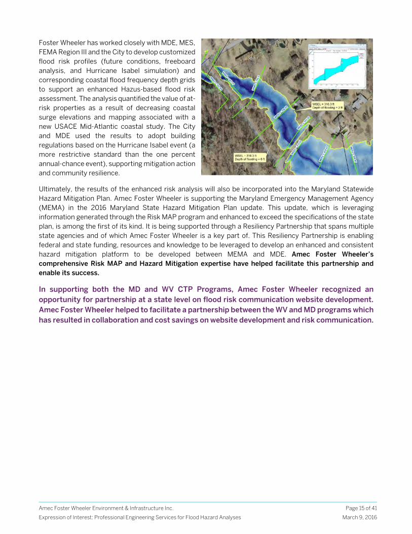
Foster Wheeler has worked closely with MDE, MES, FEMA Region III and the City to develop customized flood risk profiles (future conditions, freeboard analysis, and Hurricane Isabel simulation) and corresponding coastal flood frequency depth grids to support an enhanced Hazus-based flood risk assessment. The analysis quantified the value of at-risk properties as a result of decreasing coastal surge elevations and mapping associated with a new USACE Mid-Atlantic coastal study. The City and MDE used the results to adopt building regulations based on the Hurricane Isabel event (a more restrictive standard than the one percent annual-chance event), supporting mitigation action and community resilience.
Ultimately, the results of the enhanced risk analysis will also be incorporated into the Maryland Statewide Hazard Mitigation Plan. Amec Foster Wheeler is supporting the Maryland Emergency Management Agency (MEMA) in the 2016 Maryland State Hazard Mitigation Plan update. This update, which is leveraging information generated through the Risk MAP program and enhanced to exceed the specifications of the state plan, is among the first of its kind. It is being supported through a Resiliency Partnership that spans multiple state agencies and of which Amec Foster Wheeler is a key part of. This Resiliency Partnership is enabling federal and state funding, resources and knowledge to be leveraged to develop an enhanced and consistent hazard mitigation platform to be developed between MEMA and MDE. Amec Foster Wheeler’s comprehensive Risk MAP and Hazard Mitigation expertise have helped facilitate this partnership and enable its success.
In supporting both the MD and WV CTP Programs, Amec Foster Wheeler recognized an opportunity for partnership at a state level on flood risk communication website development. Amec Foster Wheeler helped to facilitate a partnership between the WV and MD programs which has resulted in collaboration and cost savings on website development and risk communication.
Amec Foster Wheeler Environment & Infrastructure Inc.
Expression of Interest: Professional Engineering Services for Flood Hazard Analyses
Page 16 of 41
March 9, 2016
State of Delaware Flood and Coastal Hazard Analysis and Floodplain Map Production
CLIENT/ LOCATION DATES SIZE CLIENT CONTACT Department of Natural Resources and Environmental Control (DNREC) Statewide Delaware
2009 to current $500K
Michael Powell 302-739-9921
SCOPE OF WORK Since 2010, Amec Foster Wheeler has assisted DNREC with the identification and management of flood risk through their CTP with FEMA. Our ongoing task order, Brandywine-Christina/New Castle County Risk MAP Flood Studies, includes riverine hydrologic and hydraulic updates for approximately 100 miles of reach length throughout New Castle County. Amec Foster Wheeler is performing field reconnaissance for all limited detailed bridge/culvert collections and full survey of cross sections and road crossings for detailed streams was performed by Harned. In addition to the updated hydrologic and hydraulic data, Amec Foster Wheeler is responsible for all map production, outreach and Non-Regulatory product development while continuing to work with DNREC on reducing costs by taking advantage of State resources and leverage data, including DelDOTs bridge and culvert inventories.
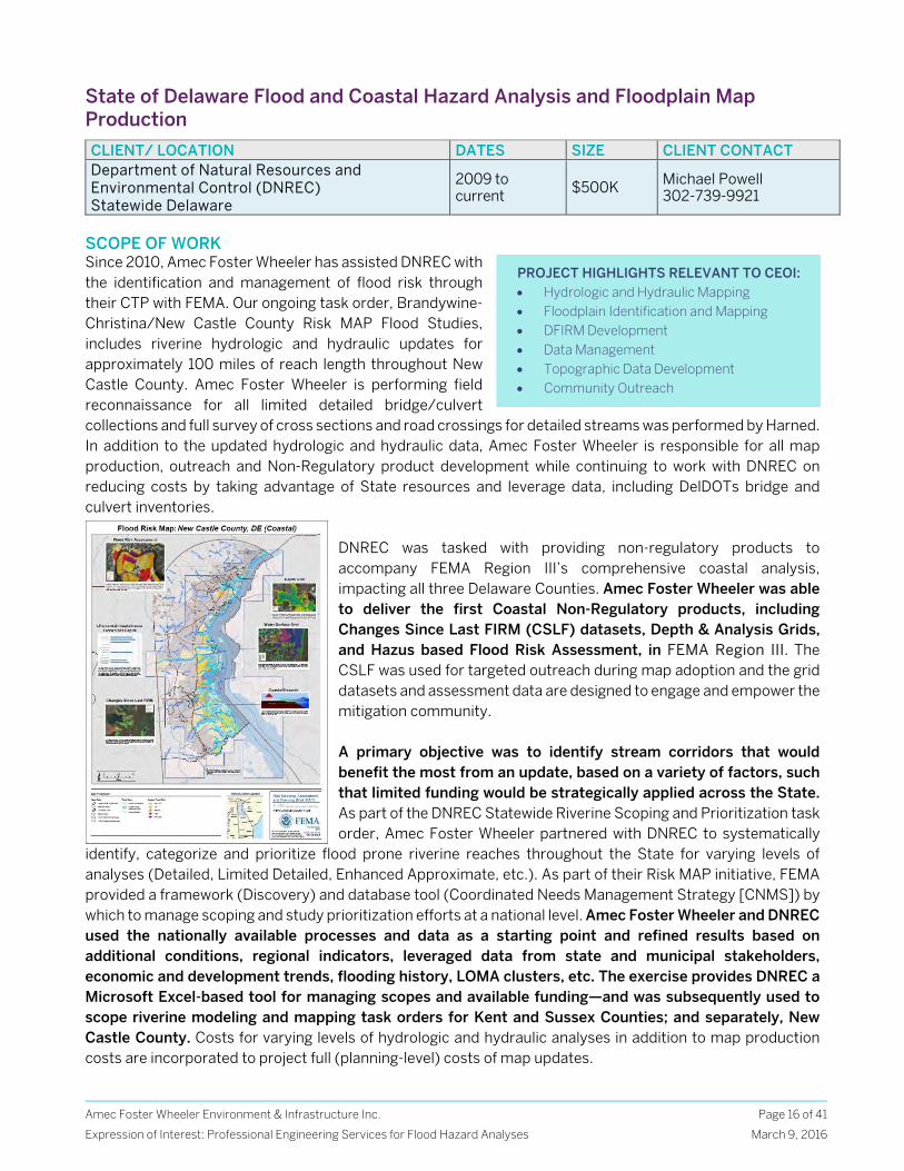
DNREC was tasked with providing non-regulatory products to accompany FEMA Region III’s comprehensive coastal analysis, impacting all three Delaware Counties. Amec Foster Wheeler was able to deliver the first Coastal Non-Regulatory products, including Changes Since Last FIRM (CSLF) datasets, Depth & Analysis Grids, and Hazus based Flood Risk Assessment, in FEMA Region III. The CSLF was used for targeted outreach during map adoption and the grid datasets and assessment data are designed to engage and empower the mitigation community. A primary objective was to identify stream corridors that would benefit the most from an update, based on a variety of factors, such that limited funding would be strategically applied across the State. As part of the DNREC Statewide Riverine Scoping and Prioritization task order, Amec Foster Wheeler partnered with DNREC to systematically
identify, categorize and prioritize flood prone riverine reaches throughout the State for varying levels of analyses (Detailed, Limited Detailed, Enhanced Approximate, etc.). As part of their Risk MAP initiative, FEMA provided a framework (Discovery) and database tool (Coordinated Needs Management Strategy [CNMS]) by which to manage scoping and study prioritization efforts at a national level. Amec Foster Wheeler and DNREC used the nationally available processes and data as a starting point and refined results based on additional conditions, regional indicators, leveraged data from state and municipal stakeholders, economic and development trends, flooding history, LOMA clusters, etc. The exercise provides DNREC a Microsoft Excel-based tool for managing scopes and available funding—and was subsequently used to scope riverine modeling and mapping task orders for Kent and Sussex Counties; and separately, New Castle County. Costs for varying levels of hydrologic and hydraulic analyses in addition to map production costs are incorporated to project full (planning-level) costs of map updates.
PROJECT HIGHLIGHTS RELEVANT TO CEOI: Hydrologic and Hydraulic Mapping Floodplain Identification and Mapping DFIRM Development Data Management Topographic Data Development Community Outreach
Amec Foster Wheeler Environment & Infrastructure Inc.
Expression of Interest: Professional Engineering Services for Flood Hazard Analyses
Page 17 of 41
March 9, 2016
Cumberland County and Hoke County, North Carolina Regional Hazard Mitigation Plan CLIENT/ LOCATION DATES SIZE CLIENT CONTACT
Cumberland County, NC Emergency Management Cumberland and Hoke Counties, NC
2014- 2015 $43k Gene Booth, Cumberland County (910) 850-8166
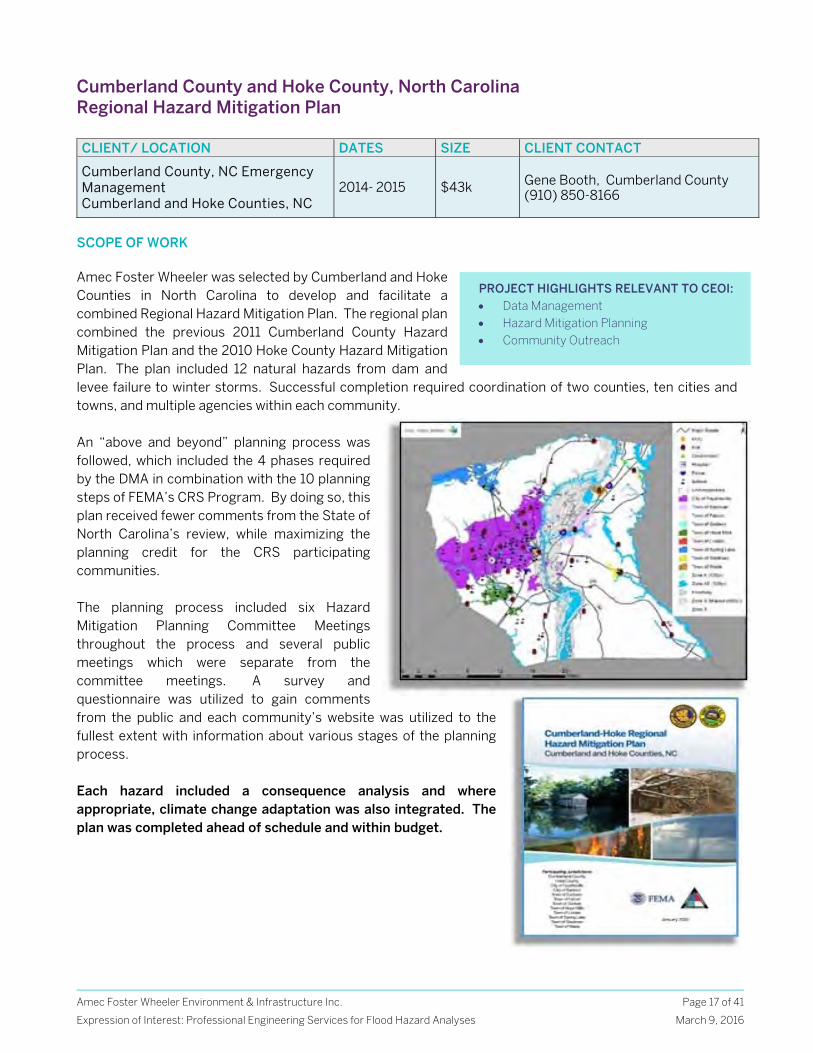
SCOPE OF WORK Amec Foster Wheeler was selected by Cumberland and Hoke Counties in North Carolina to develop and facilitate a combined Regional Hazard Mitigation Plan. The regional plan combined the previous 2011 Cumberland County Hazard Mitigation Plan and the 2010 Hoke County Hazard Mitigation Plan. The plan included 12 natural hazards from dam and levee failure to winter storms. Successful completion required coordination of two counties, ten cities and towns, and multiple agencies within each community. An “above and beyond” planning process was followed, which included the 4 phases required by the DMA in combination with the 10 planning steps of FEMA’s CRS Program. By doing so, this plan received fewer comments from the State of North Carolina’s review, while maximizing the planning credit for the CRS participating communities. The planning process included six Hazard Mitigation Planning Committee Meetings throughout the process and several public meetings which were separate from the committee meetings. A survey and questionnaire was utilized to gain comments from the public and each community’s website was utilized to the fullest extent with information about various stages of the planning process. Each hazard included a consequence analysis and where appropriate, climate change adaptation was also integrated. The plan was completed ahead of schedule and within budget.
PROJECT HIGHLIGHTS RELEVANT TO CEOI: Data Management Hazard Mitigation Planning Community Outreach
Amec Foster Wheeler Environment & Infrastructure Inc.
Expression of Interest: Professional Engineering Services for Flood Hazard Analyses
Page 18 of 41
March 9, 2016
ECS Map Modernization and Risk Map Services State CTP and National PTS Projects, Including Kanawha County WV CLIENT/ LOCATION DATES SIZE CLIENT CONTACT Various State CTP and National PTS Regions III, IV, VIII & IX Projects
2015 $750k Tucker Clevenger, PE, CFM 703-488-3783
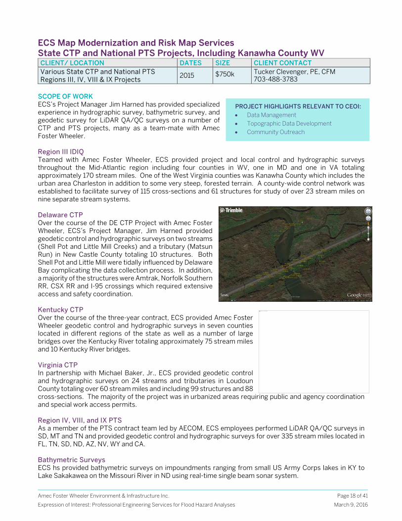
SCOPE OF WORK ECS’s Project Manager Jim Harned has provided specialized experience in hydrographic survey, bathymetric survey, and geodetic survey for LiDAR QA/QC surveys on a number of CTP and PTS projects, many as a team-mate with Amec Foster Wheeler. Region III IDIQ Teamed with Amec Foster Wheeler, ECS provided project and local control and hydrographic surveys throughout the Mid-Atlantic region including four counties in WV, one in MD and one in VA totaling approximately 170 stream miles. One of the West Virginia counties was Kanawha County which includes the urban area Charleston in addition to some very steep, forested terrain. A county-wide control network was established to facilitate survey of 115 cross-sections and 61 structures for study of over 23 stream miles on nine separate stream systems. Delaware CTP Over the course of the DE CTP Project with Amec Foster Wheeler, ECS’s Project Manager, Jim Harned provided geodetic control and hydrographic surveys on two streams (Shell Pot and Little Mill Creeks) and a tributary (Matsun Run) in New Castle County totaling 10 structures. Both Shell Pot and Little Mill were tidally influenced by Delaware Bay complicating the data collection process. In addition, a majority of the structures were Amtrak, Norfolk Southern RR, CSX RR and I-95 crossings which required extensive access and safety coordination. Kentucky CTP Over the course of the three-year contract, ECS provided Amec Foster Wheeler geodetic control and hydrographic surveys in seven counties located in different regions of the state as well as a number of large bridges over the Kentucky River totaling approximately 75 stream miles and 10 Kentucky River bridges. Virginia CTP In partnership with Michael Baker, Jr., ECS provided geodetic control and hydrographic surveys on 24 streams and tributaries in Loudoun County totaling over 60 stream miles and including 99 structures and 88 cross-sections. The majority of the project was in urbanized areas requiring public and agency coordination and special work access permits. Region IV, VIII, and IX PTS As a member of the PTS contract team led by AECOM, ECS employees performed LiDAR QA/QC surveys in SD, MT and TN and provided geodetic control and hydrographic surveys for over 335 stream miles located in FL, TN, SD, ND, AZ, NV, WY and CA. Bathymetric Surveys ECS hs provided bathymetric surveys on impoundments ranging from small US Army Corps lakes in KY to Lake Sakakawea on the Missouri River in ND using real-time single beam sonar system.
PROJECT HIGHLIGHTS RELEVANT TO CEOI: Data Management Topographic Data Development Community Outreach
This image cannot currently be displayed.
Amec Foster Wheeler Environment & Infrastructure Inc.
Expression of Interest: Professional Engineering Services for Flood Hazard Analyses
Page 19 of 41
March 9, 2016
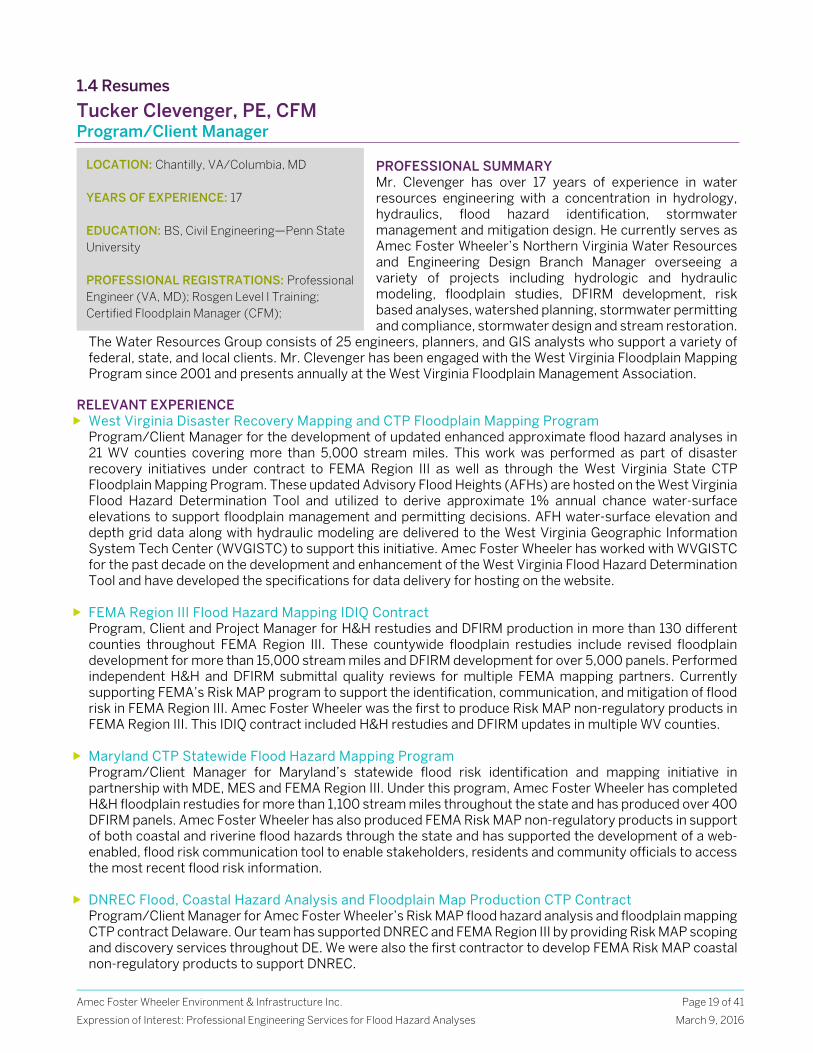
1.4 Resumes
Tucker Clevenger, PE, CFM Program/Client Manager
PROFESSIONAL SUMMARY Mr. Clevenger has over 17 years of experience in water resources engineering with a concentration in hydrology, hydraulics, flood hazard identification, stormwater management and mitigation design. He currently serves as Amec Foster Wheeler’s Northern Virginia Water Resources and Engineering Design Branch Manager overseeing a variety of projects including hydrologic and hydraulic modeling, floodplain studies, DFIRM development, risk based analyses, watershed planning, stormwater permitting and compliance, stormwater design and stream restoration.
The Water Resources Group consists of 25 engineers, planners, and GIS analysts who support a variety of federal, state, and local clients. Mr. Clevenger has been engaged with the West Virginia Floodplain Mapping Program since 2001 and presents annually at the West Virginia Floodplain Management Association.
RELEVANT EXPERIENCE West Virginia Disaster Recovery Mapping and CTP Floodplain Mapping Program
Program/Client Manager for the development of updated enhanced approximate flood hazard analyses in 21 WV counties covering more than 5,000 stream miles. This work was performed as part of disaster recovery initiatives under contract to FEMA Region III as well as through the West Virginia State CTP Floodplain Mapping Program. These updated Advisory Flood Heights (AFHs) are hosted on the West Virginia Flood Hazard Determination Tool and utilized to derive approximate 1% annual chance water-surface elevations to support floodplain management and permitting decisions. AFH water-surface elevation and depth grid data along with hydraulic modeling are delivered to the West Virginia Geographic Information System Tech Center (WVGISTC) to support this initiative. Amec Foster Wheeler has worked with WVGISTC for the past decade on the development and enhancement of the West Virginia Flood Hazard Determination Tool and have developed the specifications for data delivery for hosting on the website.
FEMA Region III Flood Hazard Mapping IDIQ Contract Program, Client and Project Manager for H&H restudies and DFIRM production in more than 130 different counties throughout FEMA Region III. These countywide floodplain restudies include revised floodplain development for more than 15,000 stream miles and DFIRM development for over 5,000 panels. Performed independent H&H and DFIRM submittal quality reviews for multiple FEMA mapping partners. Currently supporting FEMA’s Risk MAP program to support the identification, communication, and mitigation of flood risk in FEMA Region III. Amec Foster Wheeler was the first to produce Risk MAP non-regulatory products in FEMA Region III. This IDIQ contract included H&H restudies and DFIRM updates in multiple WV counties.
Maryland CTP Statewide Flood Hazard Mapping Program Program/Client Manager for Maryland’s statewide flood risk identification and mapping initiative in partnership with MDE, MES and FEMA Region III. Under this program, Amec Foster Wheeler has completed H&H floodplain restudies for more than 1,100 stream miles throughout the state and has produced over 400 DFIRM panels. Amec Foster Wheeler has also produced FEMA Risk MAP non-regulatory products in support of both coastal and riverine flood hazards through the state and has supported the development of a web-enabled, flood risk communication tool to enable stakeholders, residents and community officials to access the most recent flood risk information.
DNREC Flood, Coastal Hazard Analysis and Floodplain Map Production CTP Contract Program/Client Manager for Amec Foster Wheeler’s Risk MAP flood hazard analysis and floodplain mapping CTP contract Delaware. Our team has supported DNREC and FEMA Region III by providing Risk MAP scoping and discovery services throughout DE. We were also the first contractor to develop FEMA Risk MAP coastal non-regulatory products to support DNREC.
LOCATION: Chantilly, VA/Columbia, MD YEARS OF EXPERIENCE: 17 EDUCATION: BS, Civil Engineering—Penn State University PROFESSIONAL REGISTRATIONS: Professional Engineer (VA, MD); Rosgen Level I Training; Certified Floodplain Manager (CFM);
Amec Foster Wheeler Environment & Infrastructure Inc.
Expression of Interest: Professional Engineering Services for Flood Hazard Analyses
Page 20 of 41
March 9, 2016
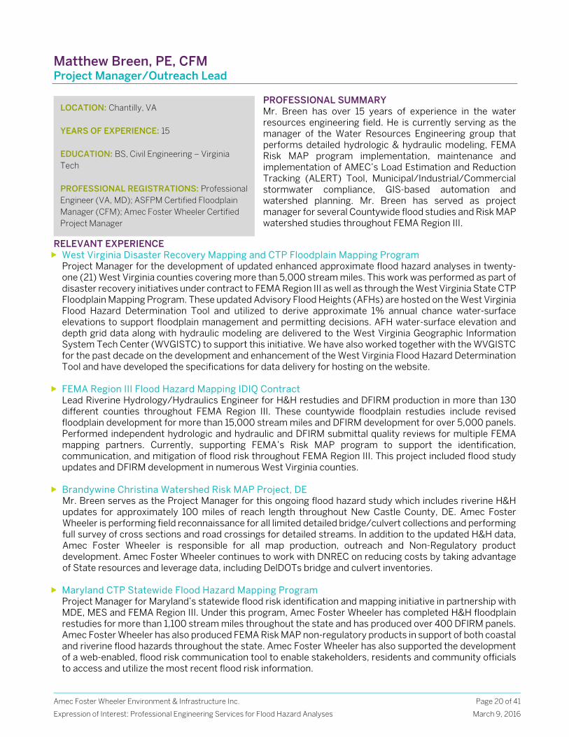
Matthew Breen, PE, CFM Project Manager/Outreach Lead
PROFESSIONAL SUMMARY Mr. Breen has over 15 years of experience in the water resources engineering field. He is currently serving as the manager of the Water Resources Engineering group that performs detailed hydrologic & hydraulic modeling, FEMA Risk MAP program implementation, maintenance and implementation of AMEC’s Load Estimation and Reduction Tracking (ALERT) Tool, Municipal/Industrial/Commercial stormwater compliance, GIS-based automation and watershed planning. Mr. Breen has served as project manager for several Countywide flood studies and Risk MAP watershed studies throughout FEMA Region III.
RELEVANT EXPERIENCE West Virginia Disaster Recovery Mapping and CTP Floodplain Mapping Program
Project Manager for the development of updated enhanced approximate flood hazard analyses in twenty-one (21) West Virginia counties covering more than 5,000 stream miles. This work was performed as part of disaster recovery initiatives under contract to FEMA Region III as well as through the West Virginia State CTP Floodplain Mapping Program. These updated Advisory Flood Heights (AFHs) are hosted on the West Virginia Flood Hazard Determination Tool and utilized to derive approximate 1% annual chance water-surface elevations to support floodplain management and permitting decisions. AFH water-surface elevation and depth grid data along with hydraulic modeling are delivered to the West Virginia Geographic Information System Tech Center (WVGISTC) to support this initiative. We have also worked together with the WVGISTC for the past decade on the development and enhancement of the West Virginia Flood Hazard Determination Tool and have developed the specifications for data delivery for hosting on the website.
FEMA Region III Flood Hazard Mapping IDIQ Contract Lead Riverine Hydrology/Hydraulics Engineer for H&H restudies and DFIRM production in more than 130 different counties throughout FEMA Region III. These countywide floodplain restudies include revised floodplain development for more than 15,000 stream miles and DFIRM development for over 5,000 panels. Performed independent hydrologic and hydraulic and DFIRM submittal quality reviews for multiple FEMA mapping partners. Currently, supporting FEMA’s Risk MAP program to support the identification, communication, and mitigation of flood risk throughout FEMA Region III. This project included flood study updates and DFIRM development in numerous West Virginia counties.
Brandywine Christina Watershed Risk MAP Project, DE Mr. Breen serves as the Project Manager for this ongoing flood hazard study which includes riverine H&H updates for approximately 100 miles of reach length throughout New Castle County, DE. Amec Foster Wheeler is performing field reconnaissance for all limited detailed bridge/culvert collections and performing full survey of cross sections and road crossings for detailed streams. In addition to the updated H&H data, Amec Foster Wheeler is responsible for all map production, outreach and Non-Regulatory product development. Amec Foster Wheeler continues to work with DNREC on reducing costs by taking advantage of State resources and leverage data, including DelDOTs bridge and culvert inventories.
Maryland CTP Statewide Flood Hazard Mapping Program Project Manager for Maryland’s statewide flood risk identification and mapping initiative in partnership with MDE, MES and FEMA Region III. Under this program, Amec Foster Wheeler has completed H&H floodplain restudies for more than 1,100 stream miles throughout the state and has produced over 400 DFIRM panels. Amec Foster Wheeler has also produced FEMA Risk MAP non-regulatory products in support of both coastal and riverine flood hazards throughout the state. Amec Foster Wheeler has also supported the development of a web-enabled, flood risk communication tool to enable stakeholders, residents and community officials to access and utilize the most recent flood risk information.
LOCATION: Chantilly, VA YEARS OF EXPERIENCE: 15 EDUCATION: BS, Civil Engineering – Virginia Tech PROFESSIONAL REGISTRATIONS: Professional Engineer (VA, MD); ASFPM Certified Floodplain Manager (CFM); Amec Foster Wheeler Certified Project Manager
Amec Foster Wheeler Environment & Infrastructure Inc.
Expression of Interest: Professional Engineering Services for Flood Hazard Analyses
Page 21 of 41
March 9, 2016
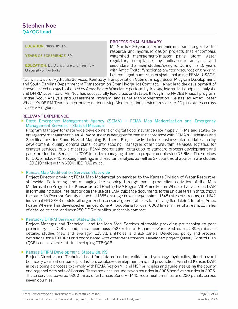
Stephen Noe QA/QC Lead
PROFESSIONAL SUMMARY Mr. Noe has 30 years of experience on a wide range of water resource and hydraulic design projects that encompass watershed management/master plans, storm water regulatory compliance, hydraulic/scour analysis, and secondary drainage studies/designs. During his 16 years with Amec Foster Wheeler as a water resources engineer he has managed numerous projects including; FEMA, USACE,
Nashville District Hydraulic Services; Kentucky Transportation Cabinet Bridge Scour Program Development; and South Carolina Department of Transportation Open Hydraulics Contract. He had lead the development of innovative technology tools used by Amec Foster Wheeler to perform hydrology, hydraulic, floodplain analysis, and DFIRM submittals. Mr. Noe has successfully lead cities and states through the NPDES Phase I program. Bridge Scour Analysis and Assessment Program, and FEMA Map Modernization. He has led Amec Foster Wheeler's DFIRM Team to a premiere national Map Modernization service provider to 20 plus states across five FEMA regions. RELEVANT EXPERIENCE State Emergency Management Agency (SEMA) – FEMA Map Modernization and Emergency
Management Services – State of Missouri Program Manager for state wide development of digital flood insurance rate maps DFIRMs and statewide emergency management plan. All work under is being performed in accordance with FEMA’s Guidelines and Specifications for Flood Hazard Mapping Partners. Project tasks include business plan updates, policy development, quality control plans, county scoping, managing other consultant services, logistics for disaster services, public meetings, FEMA coordination, data capture standard process development and panel production. Services in 2005 included managing others to prepare countywide DFIRMs. The services for 2006 include 40 scoping meetings and resultant analysis as well as 27 counties of approximate studies – 20,210 miles within 6300 HEC-RAS miles.
Kansas Map Modification Services Statewide Project Director providing FEMA Map Modernization services to the Kansas Division of Water Resources statewide. Performing and managing the scoping through panel production activities of the Map Modernization Program for Kansas as a CTP with FEMA Region VII. Amec Foster Wheeler has assisted DWR in formulating guidelines that bridge the use of FEMA guidance documents to the unique terrain throughout the state. McPherson County alone had 1565 drainage flow change points, 1345 miles of streams, and 642 individual HEC-RAS models, all organized in personal geo-databases for a “living floodplain”. In total, Amec Foster Wheeler has developed enhanced Zone A floodplains for over 6000 linear miles of stream, 10 miles of detailed stream, and over 280 DFIRM profiles under this contract.
Kentucky DFIRM Services, Statewide, KY Project Manager and Technical Lead for Map Mod Services statewide providing pre-scoping to post preliminary. The 2007 floodplains encompass 7527 miles of Enhanced Zone A streams, 239.6 miles of detailed studies (new and leverage), 125 AE sinkholes, and 815 panels. Developed policy and process definitions for KY DFIRM and coordinated with other departments. Developed project Quality Control Plan (QCP) and assisted state in developing CTP QCP.
Kansas DFIRM Development, Statewide, KS Project Director and Technical Lead for data collection, validation, hydrology, hydraulics, flood hazard boundary delineation, panel production, database development, and FIS production. Assisted Kansas DWR in developing a process to comply with FEMA Region VII and NSP principles and guidelines using the county and regional data sets of Kansas. These services include seven counties in 2005 and five counties in 2006. These services covered 9300 miles of enhanced Zone A, 1440 redelineation miles and 280 panels across seven counties.
LOCATION: Nashville, TN YEARS OF EXPERIENCE: 30 EDUCATION: BS, Agriculture Engineering – University of Kentucky

Amec Foster Wheeler Environment & Infrastructure Inc.
Expression of Interest: Professional Engineering Services for Flood Hazard Analyses
Page 22 of 41
March 9, 2016
M. Troy Biggs, PE, PH, D.WRE Senior Water Resources Technical Specialist
PROFESSIONAL SUMMARY Mr. Biggs is a Senior Civil/Water Resources Engineer specializing in H&H modeling and design, dam breach analysis, flood hazard analysis and mitigation design, stormwater management design, erosion and sediment control, adequate outfall analysis and watershed planning. He is the Senior Technical Expert for the Water Resources Design group. As a Professional Hydrologist and Diplomate of Water Resources, he has lent his expertise to support Amec Foster Wheeler’s FEMA program in many capacities over the past decade, as both a modeler and technical reviewer. Mr. Biggs’ expertise is relied upon to solve complex hydrologic and hydraulic scenarios including two dimensional analyses and flood control structure dynamics.
RELEVANT EXPERIENCE West Virginia NRCS Stream Restoration (seven sites in Grant and Hardy Counties)
Lead Design Engineer responsible for initial planning, site visit, trip report, and development of field notes for seven sites. Projects include the development of site survey and base map, Stream Visual Assessment Protocol (SVAP), sediment gradation determination from pebble counts and bar analysis, and preliminary design (geomorphic stream assessment, H&H analysis, preliminary site plan, and construction drawings). Deliverables include preliminary construction specifications, construction quantities, design report, QA plan, operations, inspection and maintenance plan, and internal quality control reviews.
Independent Technical Review Maryland Flood Hazard Mapping Program Water resources engineer responsible for reviewing 167 different hydraulic models for streams in Wicomico, Howard, Dorchester, and Somerset Counties, MD, for the USACE. Eighty-nine of the 167 models were detailed studies; the remaining 78 were approximate studies. The data provided by the USACE included digital copies of the HEC-RAS hydraulic models, a digital copy of the hydrology report, drainage point and floodplain shapefiles, digital topographic data and aerial photography. Discharge data was verified and the CHECK-RAS program was executed on each of the individual streams, and cross section location, discharge location, and floodplain limits were analyzed using the provided GIS data. Created summary report with comments for general modelling issues and stream specific issues.
Tidbury Creek Watershed Floodplain Study, Kent County, DE Water resources engineer in support of watershed-based flood study update located in the Tidbury Basin in Kent County, DE. Hydrologic updates were developed using regional regression analyses. HEC-RAS hydraulic modeling was performed for flooding sources within the watershed in order to determine 1% annual chance water-surface elevations and better define flood risk. Automated, GIS-based software was used to support H&H modeling.
Bradshaw and Mason Creek Flood Study Independent Technical Review, Roanoke County, VA Water resources engineer responsible for reviewing H&H analyses for Bradshaw and Mason Creeks in Roanoke, VA. Responsible for reviewing USGS regression equations used to generate flows as well as HEC-RAS models in order to determine if the product was acceptable for use in updating the Flood Insurance Study for Roanoke County.
Floodplain Mapping Support for USACE Norfolk District, Chesterfield County, VA Water resources engineer responsible for developing floodplain models covering 31 miles in Chesterfield County, VA. Utilized HEC-GeoRAS along with digital terrain data and cross section data to extract the necessary input data for a HEC-RAS model in order to train the USACE on automated modeling and mapping. Also responsible for map preparation and coordination with the US Army Corps of Engineers Norfolk District.
LOCATION: Chantilly, VA YEARS OF EXPERIENCE: 15 EDUCATION: MS, Civil and Environmental Engineering—Virginia Tech BS, Civil and Environmental Engineering—Virginia Tech PROFESSIONAL REGISTRATIONS: Professional Engineer (WV, VA, MD, OH, IN); Professional Hydrologist (PH); Diplomate, Water Resources Engineer (D.WRE)
Amec Foster Wheeler Environment & Infrastructure Inc.
Expression of Interest: Professional Engineering Services for Flood Hazard Analyses
Page 23 of 41
March 9, 2016
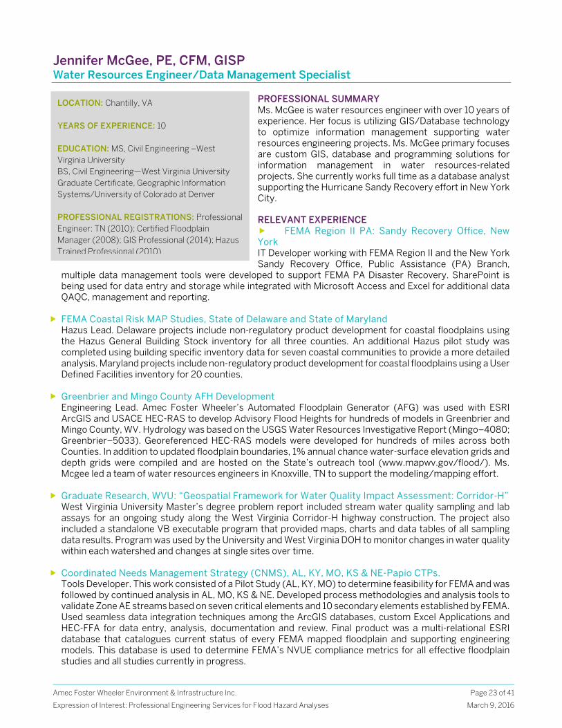
Jennifer McGee, PE, CFM, GISP Water Resources Engineer/Data Management Specialist
PROFESSIONAL SUMMARY Ms. McGee is water resources engineer with over 10 years of experience. Her focus is utilizing GIS/Database technology to optimize information management supporting water resources engineering projects. Ms. McGee primary focuses are custom GIS, database and programming solutions for information management in water resources-related projects. She currently works full time as a database analyst supporting the Hurricane Sandy Recovery effort in New York City. RELEVANT EXPERIENCE FEMA Region II PA: Sandy Recovery Office, New York IT Developer working with FEMA Region II and the New York Sandy Recovery Office, Public Assistance (PA) Branch,
multiple data management tools were developed to support FEMA PA Disaster Recovery. SharePoint is being used for data entry and storage while integrated with Microsoft Access and Excel for additional data QAQC, management and reporting.
FEMA Coastal Risk MAP Studies, State of Delaware and State of Maryland Hazus Lead. Delaware projects include non-regulatory product development for coastal floodplains using the Hazus General Building Stock inventory for all three counties. An additional Hazus pilot study was completed using building specific inventory data for seven coastal communities to provide a more detailed analysis. Maryland projects include non-regulatory product development for coastal floodplains using a User Defined Facilities inventory for 20 counties.
Greenbrier and Mingo County AFH Development Engineering Lead. Amec Foster Wheeler’s Automated Floodplain Generator (AFG) was used with ESRI ArcGIS and USACE HEC-RAS to develop Advisory Flood Heights for hundreds of models in Greenbrier and Mingo County, WV. Hydrology was based on the USGS Water Resources Investigative Report (Mingo–4080; Greenbrier–5033). Georeferenced HEC-RAS models were developed for hundreds of miles across both Counties. In addition to updated floodplain boundaries, 1% annual chance water-surface elevation grids and depth grids were compiled and are hosted on the State’s outreach tool (www.mapwv.gov/flood/). Ms. Mcgee led a team of water resources engineers in Knoxville, TN to support the modeling/mapping effort.
Graduate Research, WVU: “Geospatial Framework for Water Quality Impact Assessment: Corridor-H” West Virginia University Master’s degree problem report included stream water quality sampling and lab assays for an ongoing study along the West Virginia Corridor-H highway construction. The project also included a standalone VB executable program that provided maps, charts and data tables of all sampling data results. Program was used by the University and West Virginia DOH to monitor changes in water quality within each watershed and changes at single sites over time.
Coordinated Needs Management Strategy (CNMS), AL, KY, MO, KS & NE-Papio CTPs. Tools Developer. This work consisted of a Pilot Study (AL, KY, MO) to determine feasibility for FEMA and was followed by continued analysis in AL, MO, KS & NE. Developed process methodologies and analysis tools to validate Zone AE streams based on seven critical elements and 10 secondary elements established by FEMA. Used seamless data integration techniques among the ArcGIS databases, custom Excel Applications and HEC-FFA for data entry, analysis, documentation and review. Final product was a multi-relational ESRI database that catalogues current status of every FEMA mapped floodplain and supporting engineering models. This database is used to determine FEMA’s NVUE compliance metrics for all effective floodplain studies and all studies currently in progress.
LOCATION: Chantilly, VA YEARS OF EXPERIENCE: 10 EDUCATION: MS, Civil Engineering –West Virginia University BS, Civil Engineering—West Virginia University Graduate Certificate, Geographic Information Systems/University of Colorado at Denver PROFESSIONAL REGISTRATIONS: Professional Engineer: TN (2010); Certified Floodplain Manager (2008); GIS Professional (2014); Hazus Trained Professional (2010)
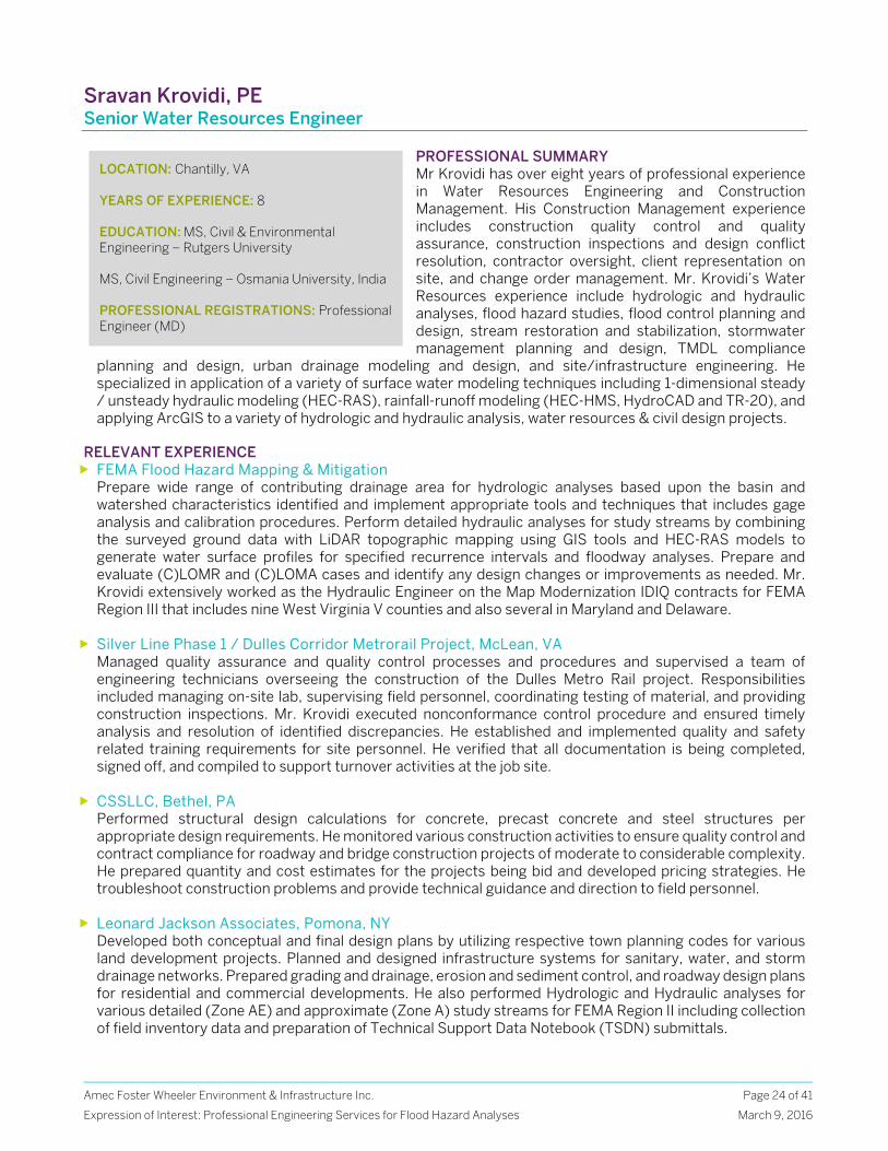
Amec Foster Wheeler Environment & Infrastructure Inc.
Expression of Interest: Professional Engineering Services for Flood Hazard Analyses
Page 24 of 41
March 9, 2016
Sravan Krovidi, PE Senior Water Resources Engineer
PROFESSIONAL SUMMARY Mr Krovidi has over eight years of professional experience in Water Resources Engineering and Construction Management. His Construction Management experience includes construction quality control and quality assurance, construction inspections and design conflict resolution, contractor oversight, client representation on site, and change order management. Mr. Krovidi’s Water Resources experience include hydrologic and hydraulic analyses, flood hazard studies, flood control planning and design, stream restoration and stabilization, stormwater management planning and design, TMDL compliance
planning and design, urban drainage modeling and design, and site/infrastructure engineering. He specialized in application of a variety of surface water modeling techniques including 1-dimensional steady / unsteady hydraulic modeling (HEC-RAS), rainfall-runoff modeling (HEC-HMS, HydroCAD and TR-20), and applying ArcGIS to a variety of hydrologic and hydraulic analysis, water resources & civil design projects.
RELEVANT EXPERIENCE FEMA Flood Hazard Mapping & Mitigation
Prepare wide range of contributing drainage area for hydrologic analyses based upon the basin and watershed characteristics identified and implement appropriate tools and techniques that includes gage analysis and calibration procedures. Perform detailed hydraulic analyses for study streams by combining the surveyed ground data with LiDAR topographic mapping using GIS tools and HEC-RAS models to generate water surface profiles for specified recurrence intervals and floodway analyses. Prepare and evaluate (C)LOMR and (C)LOMA cases and identify any design changes or improvements as needed. Mr. Krovidi extensively worked as the Hydraulic Engineer on the Map Modernization IDIQ contracts for FEMA Region III that includes nine West Virginia V counties and also several in Maryland and Delaware.
Silver Line Phase 1 / Dulles Corridor Metrorail Project, McLean, VA Managed quality assurance and quality control processes and procedures and supervised a team of engineering technicians overseeing the construction of the Dulles Metro Rail project. Responsibilities included managing on-site lab, supervising field personnel, coordinating testing of material, and providing construction inspections. Mr. Krovidi executed nonconformance control procedure and ensured timely analysis and resolution of identified discrepancies. He established and implemented quality and safety related training requirements for site personnel. He verified that all documentation is being completed, signed off, and compiled to support turnover activities at the job site.
CSSLLC, Bethel, PA Performed structural design calculations for concrete, precast concrete and steel structures per appropriate design requirements. He monitored various construction activities to ensure quality control and contract compliance for roadway and bridge construction projects of moderate to considerable complexity. He prepared quantity and cost estimates for the projects being bid and developed pricing strategies. He troubleshoot construction problems and provide technical guidance and direction to field personnel.
Leonard Jackson Associates, Pomona, NY Developed both conceptual and final design plans by utilizing respective town planning codes for various land development projects. Planned and designed infrastructure systems for sanitary, water, and storm drainage networks. Prepared grading and drainage, erosion and sediment control, and roadway design plans for residential and commercial developments. He also performed Hydrologic and Hydraulic analyses for various detailed (Zone AE) and approximate (Zone A) study streams for FEMA Region II including collection of field inventory data and preparation of Technical Support Data Notebook (TSDN) submittals.
LOCATION: Chantilly, VA YEARS OF EXPERIENCE: 8 EDUCATION: MS, Civil & Environmental Engineering – Rutgers University MS, Civil Engineering – Osmania University, India PROFESSIONAL REGISTRATIONS: Professional Engineer (MD)
Amec Foster Wheeler Environment & Infrastructure Inc.
Expression of Interest: Professional Engineering Services for Flood Hazard Analyses
Page 25 of 41
March 9, 2016
Kevin Waters, PhD, EIT Water Resources Engineer
PROFESSIONAL SUMMARY Dr. Waters is a water resources engineer with expertise in river mechanics and hydraulic modelling. With nearly three years of modelling experience in FEMA’s National Flood Insurance Program, he has worked on flood studies in NY, NJ, PA, DE, MD, and VA, including an extensive 125-mile study of the Delaware River. He conducts experimental research in quantitative fluvial geomorphology, including step-pool sequence stability, the use of higher order statistics to describe gravel bed surface structure, sediment transport in unsteady flows, and the impact of aquatic vegetation on bed evolution and stability. His work has resulted in four peer-reviewed journal articles with key contributions including a novel approach for improving
sediment transport predictions during a hydrograph and a real-time bed load monitoring system for sediment load measurement and channel slope estimation in hydraulic flumes. In addition, Dr. Waters has been a guest lecturer in undergraduate water resources engineering at the University of Virginia. RELEVANT EXPERIENCE Tyler County, WV—Hydraulic Analysis
Water Resources Engineer responsible for development of HEC-RAS models and floodplain mapping for 24 stream miles of approximate studies. Provided internal technical review of 110 stream miles of approximate studies to ensure proper hydraulic modeling methodology was applied.
Brandywine Christina Watershed Risk MAP Project, DE Water Resources Engineer/hydraulic modeler for detailed, limited detailed, and approximate studies which involved development of HEC-RAS models and floodplain mapping. Primary modeler for two detailed studies (4.4 total stream miles), five limited detailed studies (9.5 total stream miles), 28 approximate studies (32.8 total stream miles), and internal technical reviewer of 17 other approximate studies (32.1 total stream miles).
Frederick Towne Mall Redevelopment, Hydraulic Impact Analysis, Frederick, MD Primary hydraulic modeler of complex site located between two streams that experience split flow flooding from main channel that creates overland flooding of the existing mall site. Evaluated existing and proposed site conditions for mall redevelopment plan and assessed proposed impacts to flooding conditions. Made recommendations to client for acceptable building grades and layout to mitigate flooding concerns and assure proper insurance of structures.
SEMA MAS 29 – QA/QC of Hydraulic Data, Jefferson County, MO Provided review support for 17 different HEC-RAS models as part of Jefferson County, MO remapping effort. Reviewed hydraulic modeling methodology and data incorporation to ensure sound practices were being followed. Coordinated with project manager and modeling engineers to expedite review process.
CSXT Arkendale to Powell’s Creek Third Track, CSXT, Stafford and Prince William County, VA Developed corrected effective and proposed conditions HEC-RAS model of Little Creek for use in CLOMR application for proposed CSXT railroad track expansion along Potomac River. Prepared CLOMR application materials in accordance with FEMA standards. Coordinated with engineers at another firm on CLOMR review status. Provided expertise in regards to modeling methodology for pending scour analysis.
FEMA Region II—Delaware River Flood Study (New Jersey/Pennsylvania) Modeled northernmost 25-mile segment of Delaware River and conducted floodway encroachment analysis for full 125-mile detailed study length. Tasks included developing HEC-RAS model from survey data, orthoimagery, and LiDAR, calibrating model to historical flood results, and delineating floodplain boundaries.
LOCATION: Chantilly, VA YEARS OF EXPERIENCE: 3 EDUCATION: PhD, Civil Engineering—University of Virginia ME, Civil Engineering—Stevens Institute of Technology BS, Civil Engineering—Villanova University PROFESSIONAL REGISTRATIONS: Engineer-in-Training, 2014
Amec Foster Wheeler Environment & Infrastructure Inc.
Expression of Interest: Professional Engineering Services for Flood Hazard Analyses
Page 26 of 41
March 9, 2016
Andrew Simko, EIT Water Resources Engineer
PROFESSIONAL SUMMARY Mr. Simko has three years of experience in the Water Resources Engineering field. He is currently working as a Water Resources Engineer at Amec Foster Wheeler’s Chantilly, VA office. Mr. Simko has experience in hydraulic and hydrologic modeling, GIS analysis, and water quality modeling. His primary task is to utilize modeling and GIS tools to develop FEMA floodplain maps in several states. He has assisted in floodplain studies in West Virginia, Delaware, and Maryland. In addition, Mr. Simko has also developed hydrologic models for the design of best management practices and flood mitigating ponds.
Before joining Amec Foster Wheeler, Mr. Simko worked as a research assistant at Virginia Tech. He conducted a two-year long study of an experimental best management practice for Fairfax County as part of the Chesapeake Bay TMDL program. This study involved stormwater collection, water quality laboratory tests, extensive site visits, and statistical analysis of data.
RELEVANT EXPERIENCE Kanawha County, West Virginia Flood Study
Water resources engineer for approximate flood studies in Kanawha County, West Virginia. This ongoing project covers updated flood hazard analyses and Approximate Flood Height (AFH) development for over 280 miles of streams within the county. HEC-RAS and GIS is being utilized to incorporate real world terrain data into the updated hydraulic models. Upon the completion of this project, the updated models and approximate flood maps will be uploaded to the West Virginia Tool Flood Hazard Determination Tool for public use.
Tyler County, West Virginia Flood Study Water resources engineer for updated approximate flood studies and AFH development in Tyler County, West Virginia. Over 150 miles of streams were restudied and modeled for this project. The models were developed using HEC-RAS and GIS. The models and approximate flood maps developed for this project will be incorporated into the West Virginia Tool Flood Hazard Determination website.
Gunpowder Watershed Risk MAP Project, MD Water resources engineer for flood studies in Baltimore County and Baltimore City in support of the Gunpowder Watershed Risk Map project. This project included the development approximate, limited detailed, and detailed hydraulic models and floodplain maps. GIS and bridge survey information were utilized the develop HEC-RAS models that incorporated real world terrain data and obstructions.
Brandywine Christina Watershed Risk MAP Project, DE Water resources engineer for flood studies in Delaware in support of the Brandywine-Christina Watershed Risk MAP project in New Castle County, DE. Assisted in the development of approximate and detailed hydraulic models and floodmaps. This was done using HEC-RAS and ArcGIS. In addition, a team was deployed to Delaware to gather missing bridge information. This involved locating, measuring, photographing, and documenting bridges to further enhance the limited detailed and detailed models.
Kinley Creek Stormwater Management Study Water resources engineer for a flood study in Lexington County, South Carolina. Due to frequent home flooding along Kinley Creek, Amec Foster Wheeler was tasked to propose possible solutions. Mr. Simko contributed to the hydrologic modeling of proposed stormwater facilities and pond retrofits. In addition, GIS was utilized to identify at-risk properties. The project concluded with a detailed report to Lexington County on the cost and benefits of each proposed solution.
LOCATION: Chantilly, VA YEARS OF EXPERIENCE: 3 EDUCATION: BS, Civil Engineering—Virginia Tech MS, Environmental Engineering—Virginia Tech PROFESSIONAL REGISTRATIONS: Engineer-in-Training
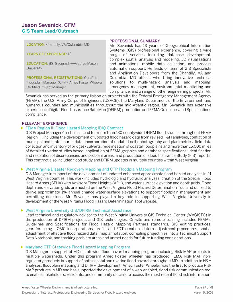
Amec Foster Wheeler Environment & Infrastructure Inc.
Expression of Interest: Professional Engineering Services for Flood Hazard Analyses
Page 27 of 41
March 9, 2016
Jason Sevanick, CFM GIS Team Lead/Outreach
PROFESSIONAL SUMMARY Mr. Sevanick has 13 years of Geographical Information Systems (GIS) professional experience, covering a wide range of services including database development, complex spatial analysis and modeling, 3D visualizations and animations, mobile data collection, and process automation support. He leads of team of GIS Specialists and Application Developers from the Chantilly, VA and Columbia, MD offices who bring innovative technical solutions to multi-hazard analysis and mapping, emergency management, environmental monitoring and compliance, and a range of other engineering projects. Mr.
Sevanick has served as the primary liaison on projects with the Federal Emergency Management Agency (FEMA), the U.S. Army Corps of Engineers (USACE), the Maryland Department of the Environment, and numerous counties and municipalities throughout the mid-Atlantic region. Mr. Sevanick has extensive experience in Digital Flood Insurance Rate Map (DFIRM) production and FEMA Guidelines and Specifications compliance.
RELEVANT EXPERIENCE FEMA Region III Flood Hazard Mapping IDIQ Contract
GIS Project Manager/Technical Lead for more than 130 countywide DFIRM flood studies throughout FEMA Region III, including the development of updated flood hazard data from revised H&H analyses, conflation of municipal and state source data, incorporation of updated orthophotography and planimetrics, field data collection and inventory of bridges/culverts, redelineation of coastal floodplains and more than 15,000 miles of detailed riverine studies based, application of FEMA graphics and database specifications, identification and resolution of discrepancies and problem areas, and production of Flood Insurance Study (FIS) reports. This contract also included flood study and DFIRM updates in multiple counties within West Virginia
West Virginia Disaster Recovery Mapping and CTP Floodplain Mapping Program GIS Manager in support of the development of updated enhanced approximate flood hazard analyses in 21 West Virginia counties. This work included hydrologic and hydraulic analyses, creation of the Special Flood Hazard Areas (SFHA) with Advisory Flood Heights (AFH), and water surface elevation and depth grids. Flood depth and elevation grids are hosted on the West Virginia Flood Hazard Determination Tool and utilized to derive approximate 1% annual chance water-surface elevations to support floodplain management and permitting decisions. Mr. Sevanick has played a key role in supporting West Virginia University in development of the West Virginia Flood Hazard Determination Tool website.
West Virginia University GIS/DFIRM Technical Assistance Lead technical and regulatory advisor to the West Virginia University GIS Technical Center (WVGISTC) in the production of DFIRM projects and GIS technologies. On-site and remote training included FEMA’s Guidelines and Specifications for Flood Hazard Mapping Partners standards, GIS editing practices, georeferencing, LOMC incorporations, profile and FDT creation, datum adjustment procedures, spatial adjustment of effective flood hazard data, map annotation, compiling project files into a Technical Support Data Notebook, and tracking problem areas and unmet needs for future funding considerations.
Maryland CTP Statewide Flood Hazard Mapping Program GIS Manager in support of MD’s statewide flood hazard mapping program including Risk MAP projects in multiple watersheds. Under this program Amec Foster Wheeler has produced FEMA Risk MAP non-regulatory products in support of both coastal and riverine flood hazards throughout MD. In addition to H&H analyses, floodplain mapping and DFIRM development, Amec Foster Wheeler was the first to produce Risk MAP products in MD and has supported the development of a web-enabled, flood risk communication tool to enable stakeholders, residents, and community officials to access the most recent flood risk information.
LOCATION: Chantilly, VA/Columbia, MD YEARS OF EXPERIENCE: 13 EDUCATION: BS, Geography—George Mason University PROFESSIONAL REGISTRATIONS: Certified Floodplain Manager (CFM); Amec Foster Wheeler Certified Project Manager
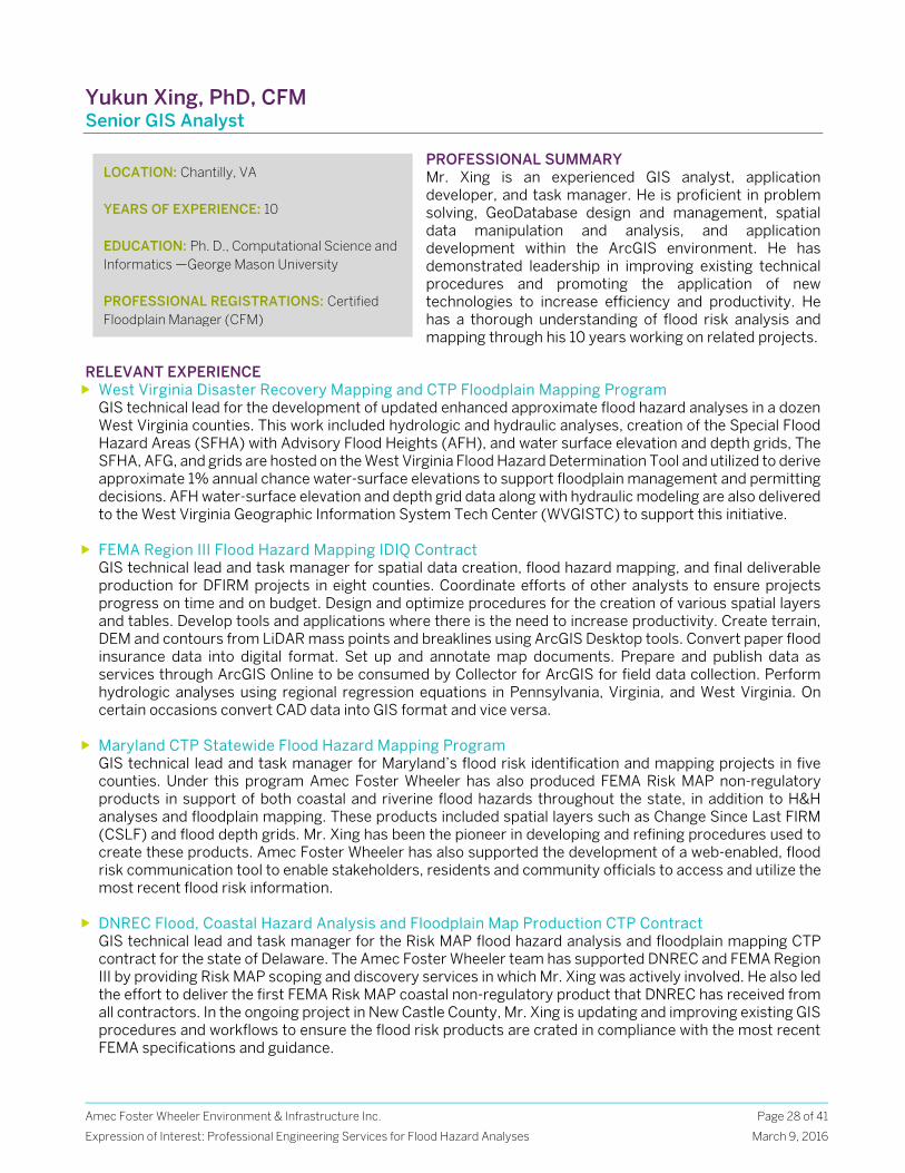
Amec Foster Wheeler Environment & Infrastructure Inc.
Expression of Interest: Professional Engineering Services for Flood Hazard Analyses
Page 28 of 41
March 9, 2016
Yukun Xing, PhD, CFM Senior GIS Analyst
PROFESSIONAL SUMMARY Mr. Xing is an experienced GIS analyst, application developer, and task manager. He is proficient in problem solving, GeoDatabase design and management, spatial data manipulation and analysis, and application development within the ArcGIS environment. He has demonstrated leadership in improving existing technical procedures and promoting the application of new technologies to increase efficiency and productivity. He has a thorough understanding of flood risk analysis and mapping through his 10 years working on related projects.
RELEVANT EXPERIENCE West Virginia Disaster Recovery Mapping and CTP Floodplain Mapping Program
GIS technical lead for the development of updated enhanced approximate flood hazard analyses in a dozen West Virginia counties. This work included hydrologic and hydraulic analyses, creation of the Special Flood Hazard Areas (SFHA) with Advisory Flood Heights (AFH), and water surface elevation and depth grids, The SFHA, AFG, and grids are hosted on the West Virginia Flood Hazard Determination Tool and utilized to derive approximate 1% annual chance water-surface elevations to support floodplain management and permitting decisions. AFH water-surface elevation and depth grid data along with hydraulic modeling are also delivered to the West Virginia Geographic Information System Tech Center (WVGISTC) to support this initiative.
FEMA Region III Flood Hazard Mapping IDIQ Contract GIS technical lead and task manager for spatial data creation, flood hazard mapping, and final deliverable production for DFIRM projects in eight counties. Coordinate efforts of other analysts to ensure projects progress on time and on budget. Design and optimize procedures for the creation of various spatial layers and tables. Develop tools and applications where there is the need to increase productivity. Create terrain, DEM and contours from LiDAR mass points and breaklines using ArcGIS Desktop tools. Convert paper flood insurance data into digital format. Set up and annotate map documents. Prepare and publish data as services through ArcGIS Online to be consumed by Collector for ArcGIS for field data collection. Perform hydrologic analyses using regional regression equations in Pennsylvania, Virginia, and West Virginia. On certain occasions convert CAD data into GIS format and vice versa.
Maryland CTP Statewide Flood Hazard Mapping Program GIS technical lead and task manager for Maryland’s flood risk identification and mapping projects in five counties. Under this program Amec Foster Wheeler has also produced FEMA Risk MAP non-regulatory products in support of both coastal and riverine flood hazards throughout the state, in addition to H&H analyses and floodplain mapping. These products included spatial layers such as Change Since Last FIRM (CSLF) and flood depth grids. Mr. Xing has been the pioneer in developing and refining procedures used to create these products. Amec Foster Wheeler has also supported the development of a web-enabled, flood risk communication tool to enable stakeholders, residents and community officials to access and utilize the most recent flood risk information.
DNREC Flood, Coastal Hazard Analysis and Floodplain Map Production CTP Contract GIS technical lead and task manager for the Risk MAP flood hazard analysis and floodplain mapping CTP contract for the state of Delaware. The Amec Foster Wheeler team has supported DNREC and FEMA Region III by providing Risk MAP scoping and discovery services in which Mr. Xing was actively involved. He also led the effort to deliver the first FEMA Risk MAP coastal non-regulatory product that DNREC has received from all contractors. In the ongoing project in New Castle County, Mr. Xing is updating and improving existing GIS procedures and workflows to ensure the flood risk products are crated in compliance with the most recent FEMA specifications and guidance.
LOCATION: Chantilly, VA YEARS OF EXPERIENCE: 10 EDUCATION: Ph. D., Computational Science and Informatics —George Mason University PROFESSIONAL REGISTRATIONS: Certified Floodplain Manager (CFM)
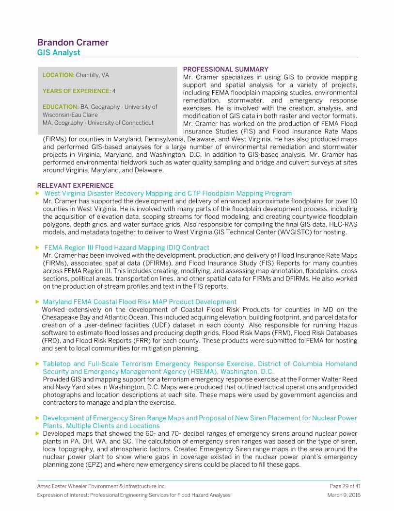
Amec Foster Wheeler Environment & Infrastructure Inc.
Expression of Interest: Professional Engineering Services for Flood Hazard Analyses
Page 29 of 41
March 9, 2016
Brandon Cramer GIS Analyst
PROFESSIONAL SUMMARY Mr. Cramer specializes in using GIS to provide mapping support and spatial analysis for a variety of projects, including FEMA floodplain mapping studies, environmental remediation, stormwater, and emergency response exercises. He is involved with the creation, analysis, and modification of GIS data in both raster and vector formats. Mr. Cramer has worked on the production of FEMA Flood Insurance Studies (FIS) and Flood Insurance Rate Maps
(FIRMs) for counties in Maryland, Pennsylvania, Delaware, and West Virginia. He has also produced maps and performed GIS-based analyses for a large number of environmental remediation and stormwater projects in Virginia, Maryland, and Washington, D.C. In addition to GIS-based analysis, Mr. Cramer has performed environmental fieldwork such as water quality sampling and bridge and culvert surveys at sites around Virginia, Maryland, and Delaware.
RELEVANT EXPERIENCE West Virginia Disaster Recovery Mapping and CTP Floodplain Mapping Program
Mr. Cramer has supported the development and delivery of enhanced approximate floodplains for over 10 counties in West Virginia. He is involved with many parts of the floodplain development process, including the acquisition of elevation data, scoping streams for flood modeling, and creating countywide floodplain polygons, depth grids, and water surface grids. Also responsible for compiling the final GIS data, HEC-RAS models, and metadata together to deliver to West Virginia GIS Technical Center (WVGISTC) for hosting.
FEMA Region III Flood Hazard Mapping IDIQ Contract Mr. Cramer has been involved with the development, production, and delivery of Flood Insurance Rate Maps (FIRMs), associated spatial data (DFIRMs), and Flood Insurance Study (FIS) Reports for many counties across FEMA Region III. This includes creating, modifying, and assessing map annotation, floodplains, cross sections, political areas, transportation lines, and other spatial data for FIRMs and DFIRMs. He also worked on the production of stream profiles and text in the FIS reports.
Maryland FEMA Coastal Flood Risk MAP Product Development Worked extensively on the development of Coastal Flood Risk Products for counties in MD on the Chesapeake Bay and Atlantic Ocean. This included acquiring elevation, building footprint, and parcel data for creation of a user-defined facilities (UDF) dataset in each county. Also responsible for running Hazus software to estimate flood losses and producing depth grids, Flood Risk Maps (FRM), Flood Risk Databases (FRD), and Flood Risk Reports (FRR) for each county. These products were submitted to FEMA for hosting and sent to local communities for mitigation planning.
Tabletop and Full-Scale Terrorism Emergency Response Exercise, District of Columbia Homeland Security and Emergency Management Agency (HSEMA), Washington, D.C. Provided GIS and mapping support for a terrorism emergency response exercise at the Former Walter Reed and Navy Yard sites in Washington, D.C. Maps were produced that outlined tactical operations and provided photographs and location descriptions at each site. These maps were used by government agencies and contractors to manage and plan the exercise.
Development of Emergency Siren Range Maps and Proposal of New Siren Placement for Nuclear Power Plants, Multiple Clients and Locations
Developed maps that showed the 60- and 70- decibel ranges of emergency sirens around nuclear power plants in PA, OH, WA, and SC. The calculation of emergency siren ranges was based on the type of siren, local topography, and atmospheric factors. Created Emergency Siren range maps in the area around the nuclear power plant to show where gaps in coverage existed in the nuclear power plant’s emergency planning zone (EPZ) and where new emergency sirens could be placed to fill these gaps.
LOCATION: Chantilly, VA YEARS OF EXPERIENCE: 4 EDUCATION: BA, Geography - University of Wisconsin-Eau Claire MA, Geography - University of Connecticut

Amec Foster Wheeler Environment & Infrastructure Inc.
Expression of Interest: Professional Engineering Services for Flood Hazard Analyses
Page 30 of 41
March 9, 2016
David A. Stroud, CFM Hazard Mitigation Planning Lead
PROFESSIONAL SUMMARY Mr. Stroud has over 24 years of experience as a floodplain/hazard mitigation planner. Mr. Stroud’s hazard mitigation planning experience includes both development of hazard mitigation plans and reviewing and scoring plans for FEMA. He has also worked for the Insurance Services Office (ISO) on behalf of FEMA’s National Flood Insurance Program’s (NFIP) Community Rating System (CRS) Program as the lead hazard mitigation planner and Flood Training Coordinator for 18 years. Mr. Stroud has significant experience with the minimum regulations of the National Flood Insurance Program (NFIP), FEMA Grant programs and FEMA’s Repetitive Loss Program. He also works with communities, states and FEMA Regional offices on all aspects of hazard mitigation planning and CRS Program.
RELEVANT EXPERIENCE Southside Hampton Roads Regional Hazard Mitigation Plan, City of Franklin All-Hazards Mitigation
Plan, Southampton All-Hazards Mitigation Plan, Hampton Roads Planning District Commission, Chesapeake, VA Mr. Stroud was a subcontractor to Salter’s Creek Consulting for the update and revision of three individual plans for the Hampton Roads Planning District Commission. Mr. Stroud is responsible for the quality control and quality assurance of these plans, the CRS lead and also involved in meeting facilitation.
Liberty County Hazard Mitigation Plan, Liberty County, GA Mr. Stroud served as Project Manager and Senior Hazard Mitigation Planner in the update of this multi-hazard mitigation plan which covered the County and seven incorporated municipalities. The plan complied with FEMA’s DMA planning requirements and the CRS 10-step planning process. This plan incorporated new critical facilities which had not been captured in the past and an update to the Georgia Information Management System was completed.
Community Rating System (CRS) Plan Review, FEMA/ISO, Washington, DC. Current contract with FEMA’s CRS Program to provide plan review support for local mitigation plans submitted under the CRS Program. The review process follows FEMA’s Local Multi-Hazard Mitigation Planning Requirements (44 CFR 201.6) and FEMA’s CRS 10 CRS Planning Steps and those creditable elements under each CRS planning Steps Under this contract,
Northern Colorado 10 County Regional Hazard Mitigation Plan Update
Ten-county regional Plan update. Mr. Stroud provided QA/QC on the planning effort primarily to make sure the plan complied with the FEMA’s requirements in the July 2008 Guidance “Blue Book.”
CRS Program Improvement, City of Charleston, SC Mr. Stroud served as Project Manager to improve the City of Charleston’s CRS Classification from CRS Class 7 to CRS 6 through a variety of Activities including Open Space Preservation and creating a new freeboard ordinance. Additionally, the City’s stormwater regulations were credited for the first time. This CRS class improvement resulted in annual savings of $4.9 million for policy holders in the City.
CRS Program Improvement, City of Alexandria, VA Mr. Stroud served as Project Manager to improve the City of Raleigh’s CRS Classification to a CRS Class 7 through a variety of Activities including Open Space Preservation, Ordinances, GIS, Stormwater Management, etc. Mr. Stroud worked with the City Engineer in a comprehensive approach to the CRS program which provided the City of Alexandria with sufficient credit points to improve their CRS Rating. Alexandria was successful in becoming the first CRS Class 7 Virginia community.
LOCATION: Durham, NC YEARS OF EXPERIENCE: 25 EDUCATION: PhD, Civil Engineering, University of Virginia 2014 ME, Civil Engineering, Stevens Institute of Technology/Civil Engineering BS, Civil Engineering, Villanova University PROFESSIONAL REGISTRATIONS: ASFPM Certified Floodplain Manager (CFM)
Amec Foster Wheeler Environment & Infrastructure Inc.
Expression of Interest: Professional Engineering Services for Flood Hazard Analyses
Page 31 of 41
March 9, 2016
James A. Harned, PE, PLS Field Survey Lead
PROFESSIONAL SUMMARY Mr. Harned has over 28 years of experience as a land surveyor and water resources/civil engineer. His work experience includes projects involving topographic/hydrographic/ cadastral/route/ as-built surveys, pipeline easement and alignment exhibits, pad/site/roadway/utility design, watershed management, hydrologic and hydraulic modeling of pipe and open channel systems, and design of drainage structures and stormwater quality/quantity management systems. RELEVANT EXPERIENCE Hydrographic Surveys - FEMA Region III Project Manager of both conventional and GPS surveys of stream cross-section and structures to support FEMA
restudies in the Mid-Atlantic region. Responsible for monument recovery, project control survey (horizontal and vertical), survey of stream cross-sections and structures, collection of digital photography of cross-sections and structures, structure sketches, data reduction, exporting point data in the appropriate state plane coordinate and vertical datum system, preparing Elevation Reference Mark recovery cards using CAD, and delivery in required DCS digital formats. Services provided for six counties spanning three states, four in West Virginia, including nince stream systems in Kanawha County.
Delaware CTP – New Castle County Risk Map Project Manager for geodetic control and hydrographic surveys on two streams (Shell Pot and Little Mill Creeks) and a tributary (Matsun Run) in New Castle County totaling 10 structures. Both Shell Pot and Little Mill were tidally influenced by Delaware Bay complicating the data collection process. In addition, a majority of the structures were Amtrak, Norfolk Southern RR, CSX RR and I-95 crossings which required extensive access and safety coordination.
Dam Inundation Mapping – KY Finance Cabinet Project Manager and field data collection team leader for collecting downstream hydrographic survey data and real time bathymetric data to support dam breach modeling and inundation mapping for Willisburg Lake in central Kentucky, Bert T. Combs Lake in eastern Kentucky and Bullock Pen Lake in north central Kentucky. Hydrographic surveys conducted using both GPS and conventional equipment.
Kentucky CTP Map Modernization Project – KDOW State-wide, KY QA/QC Manager and field data collection team member for collecting hydrographic survey data on structures and cross-sections to support hydraulic model development for DFIRM production. Task required review of hydrographic survey data, digital photography, and structure sketches using both Trimble Geomatics Office software and manual procedures to produce final project digital and hard copy deliverables for eight (8) counties and a number of large bridges over the Kentucky River totaling approximately 75 stream miles.
Virginia CTP – Loudoun County Risk Map
QA/QC Manager and field data collection team member for collecting hydrographic survey data on structures and cross-sections to support hydraulic model development for DFIRM production. Task required review of hydrographic survey data, digital photography, and structure sketches using Trimble Business Center software to produce final project digital deliverables 24 streams and tributaries totaling over 60 stream miles and including 99 structures and 88 cross-sections.
LOCATION: Louisville, KY YEARS OF EXPERIENCE: 28 EDUCATION: MS, Agricultural Engineering – University of Kentucky BS, Agricultural Engineering – University of Kentucky PROFESSIONAL REGISTRATIONS: Professional Engineer (FL, KY, IN, GA, WV, OH, ND, MT, WY); Professional Land Surveyor (KY, ND);
Amec Foster Wheeler Environment & Infrastructure Inc.
Expression of Interest: Professional Engineering Services for Flood Hazard Analyses
Page 32 of 41
March 9, 2016
1.5 References Please feel free to contact our client references identified below regarding our performance on the aforementioned Flood Hazard Mapping and Analyses projects. Robert Pierson Senior Engineer FEMA Region III Phone: 215-359-8463 Email: [email protected] David Guignet NFIP State Coordinator Maryland Dept of the Environment Phone: 410-537-3775 Email: [email protected] Michael Powell Natural Hazards Program Manager/NFIP State Coordinator Department of Natural Resources and Environmental Control Division of Watershed Stewardship Phone: 302-739-9921 Email: [email protected] Tim Keaton, CFM Putnam Co. Planning & Infrastructure Phone: 304-586-0237 Email: [email protected] Eric Hopkins GIS Specialist West Virginia GIS Technical Center Dept. of Geology & Geography West Virginia University Phone: 304-293-9463 Email: [email protected]
Technical Approach
Technical Approach
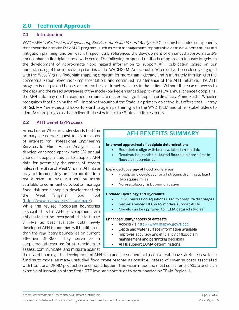
Amec Foster Wheeler Environment & Infrastructure Inc.
Expression of Interest: Professional Engineering Services for Flood Hazard Analyses
Page 33 of 41
March 9, 2016
2.0 Technical Approach
2.1 Introduction
WVDHSEM’s Professional Engineering Services for Flood Hazard Analyses EOI request includes components that cover the broader Risk MAP program, such as data management, topographic data development, hazard mitigation planning, and outreach. It specifically references the development of enhanced approximate 1% annual chance floodplains on a wide scale. The following proposed methods of approach focuses largely on the development of approximate flood hazard information to support AFH publication based on our understanding of the immediate priorities of the WVDHSEM. Amec Foster Wheeler has been closely engaged with the West Virginia floodplain mapping program for more than a decade and is intimately familiar with the conceptualization, execution/implementation, and continued maintenance of the AFH initiative. The AFH program is unique and boasts one of the best outreach websites in the nation. Without the ease of access to the data and the raised awareness of the model-backed enhanced approximate 1% annual chance floodplains, the AFH data may not be used to communicate risk or manage floodplain ordinances. Amec Foster Wheeler recognizes that finishing the AFH initiative throughout the State is a primary objective, but offers the full array of Risk MAP services and looks forward to again partnering with the WVDHSEM and other stakeholders to identify more programs that deliver the best value to the State and its residents.
2.2 AFH Benefits/Process
Amec Foster Wheeler understands that the primary focus the request for expressions of interest for Professional Engineering Services for Flood Hazard Analyses is to develop enhanced approximate 1% annual chance floodplain studies to support AFH data for potentially thousands of stream miles in the State of West Virginia. AFH data may not immediately be incorporated into the current DFIRMs, but will be made available to communities to better manage flood risk and floodplain development via the West Virginia Flood Tool (http://www.mapwv.gov/flood/map/). While the revised floodplain boundaries associated with AFH development are anticipated to be incorporated into future DFIRMs as best available data, newly developed AFH boundaries will be different than the regulatory boundaries on current effective DFIRMs. They serve as a supplemental resource for stakeholders to assess, communicate, and mitigate against the risk of flooding. The development of AFH data and subsequent outreach website have stretched available funding to model as many unstudied flood prone reaches as possible, instead of covering costs associated with traditional DFIRM production and map adoption. This vision made the most sense for the State and is an example of innovation at the State CTP level and continues to be supported by FEMA Region III.
AFH BENEFITS SUMMARY
Improved approximate floodplain determinations
Boundaries align with best available terrain data Resolves issues with outdated floodplain approximate
floodplain boundaries Expanded coverage of flood prone areas
Floodplains developed for all streams draining at least two square miles
Non-regulatory risk communication Updated Hydrology and Hydraulics
USGS regression equations used to compute discharges Geo-referenced HEC-RAS models support AFHs Models can be upgraded to FEMA detailed studies
Enhanced utility/access of datasets
Access via http://www.mapwv.gov/flood Depth and water surface information available Improves accuracy and efficiency of floodplain
management and permitting decisions AFHs support LOMA determinations
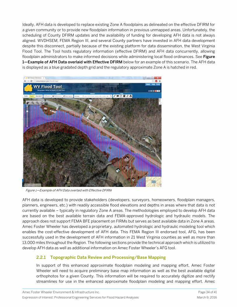
Amec Foster Wheeler Environment & Infrastructure Inc.
Expression of Interest: Professional Engineering Services for Flood Hazard Analyses
Page 34 of 41
March 9, 2016
Ideally, AFH data is developed to replace existing Zone A floodplains as delineated on the effective DFIRM for a given community or to provide new floodplain information in previous unmapped areas. Unfortunately, the scheduling of County DFIRM updates and the availability of funding for developing AFH data is not always aligned. WVDHSEM, FEMA Region III, and several County partners have invested in AFH data development despite this disconnect, partially because of the existing platform for data dissemination, the West Virginia Flood Tool. The Tool hosts regulatory information (effective DFIRM) and AFH data concurrently, allowing floodplain administrators to make informed decisions while administering local flood ordinances. See Figure 1—Example of AFH Data overlaid with Effective DFIRM below for an example of this scenario. The AFH data is displayed as a blue gradated depth grid and the regulatory approximate Zone A is hatched in red.
AFH data is developed to provide stakeholders (developers, surveyors, homeowners, floodplain managers, planners, engineers, etc.) with readily accessible flood elevations and depths in areas where that data is not currently available – typically in regulatory Zone A areas. The methodologies employed to develop AFH data are based on the best available terrain data and FEMA-approved hydrologic and hydraulic models. The approach does not support FEMA BFE placement on FIRMs but serves as best available data in Zone A areas. Amec Foster Wheeler has developed a proprietary, automated hydrologic and hydraulic modeling tool which enables the cost-effective development of AFH data. This FEMA Region III endorsed tool, AFG, has been successfully used in the development of AFH information in 21 West Virginia counties as well as more than 13,000 miles throughout the Region. The following sections provide the technical approach which is utilized to develop AFH data as well as additional information on Amec Foster Wheeler’s AFG tool.
2.2.1 Topographic Data Review and Processing/Base Mapping
In support of this enhanced approximate floodplain modeling and mapping effort, Amec Foster Wheeler will need to acquire preliminary base map information as well as the best available digital orthophotos for a given County. This information will be required to accurately digitize and rectify streamlines for use in the enhanced approximate floodplain modeling and mapping effort. Amec
Figure 1—Example of AFH Data overlaid with Effective DFIRM
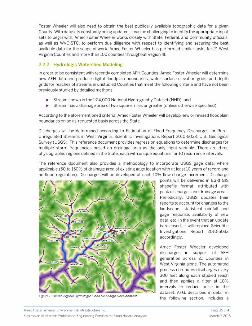
Amec Foster Wheeler Environment & Infrastructure Inc.
Expression of Interest: Professional Engineering Services for Flood Hazard Analyses
Page 35 of 41
March 9, 2016
Foster Wheeler will also need to obtain the best publically available topographic data for a given County. With datasets constantly being updated, it can be challenging to identify the appropriate input sets to begin with. Amec Foster Wheeler works closely with State, Federal, and Community officials, as well as WVGISTC, to perform due diligence with respect to identifying and securing the best available data for the scope of work. Amec Foster Wheeler has performed similar tasks for 21 West Virginia Counties and more than 100 counties throughout Region III.
2.2.2 Hydrologic Watershed Modeling
In order to be consistent with recently completed AFH Counties, Amec Foster Wheeler will determine new AFH data and produce digital floodplain boundaries, water-surface elevation grids, and depth grids for reaches of streams in unstudied Counties that meet the following criteria and have not been previously studied by detailed methods:
Stream shown in the 1:24,000 National Hydrography Dataset (NHD); and Stream has a drainage area of two square miles or greater (unless otherwise specified)
According to the aforementioned criteria, Amec Foster Wheeler will develop new or revised floodplain boundaries on an as-requested basis across the State.
Discharges will be determined according to Estimation of Flood-Frequency Discharges for Rural, Unregulated Streams in West Virginia, Scientific Investigations Report 2010-5033, U.S. Geological Survey (USGS). This reference document provides regression equations to determine discharges for multiple storm frequencies based on drainage area as the only input variable. There are three physiographic regions defined in the State, each with unique equations for 10 recurrence intervals.
The reference document also provides a methodology to incorporate USGS gage data, where applicable (50 to 150% of drainage area of existing gage location with at least 10 years of record and no flood regulation). Discharges will be developed at each 10% flow change increment. Discharge
points will be delivered in ESRI GIS shapefile format, attributed with peak discharges and drainage areas. Periodically, USGS updates their reports to account for changes to the landscape, statistical rainfall and gage response, availability of new data, etc. In the event that an update is released, it will replace Scientific Investigations Report 2010-5033 accordingly.
Amec Foster Wheeler developed discharges in support of AFH generation across 21 Counties in West Virginia alone. The automated process computes discharges every 300 feet along each studied reach and then applies a filter at 10% intervals to reduce noise in the dataset. AFG, described in detail in the following section, includes a Figure 2 - West Virginia Hydrologic Flood Discharge Development
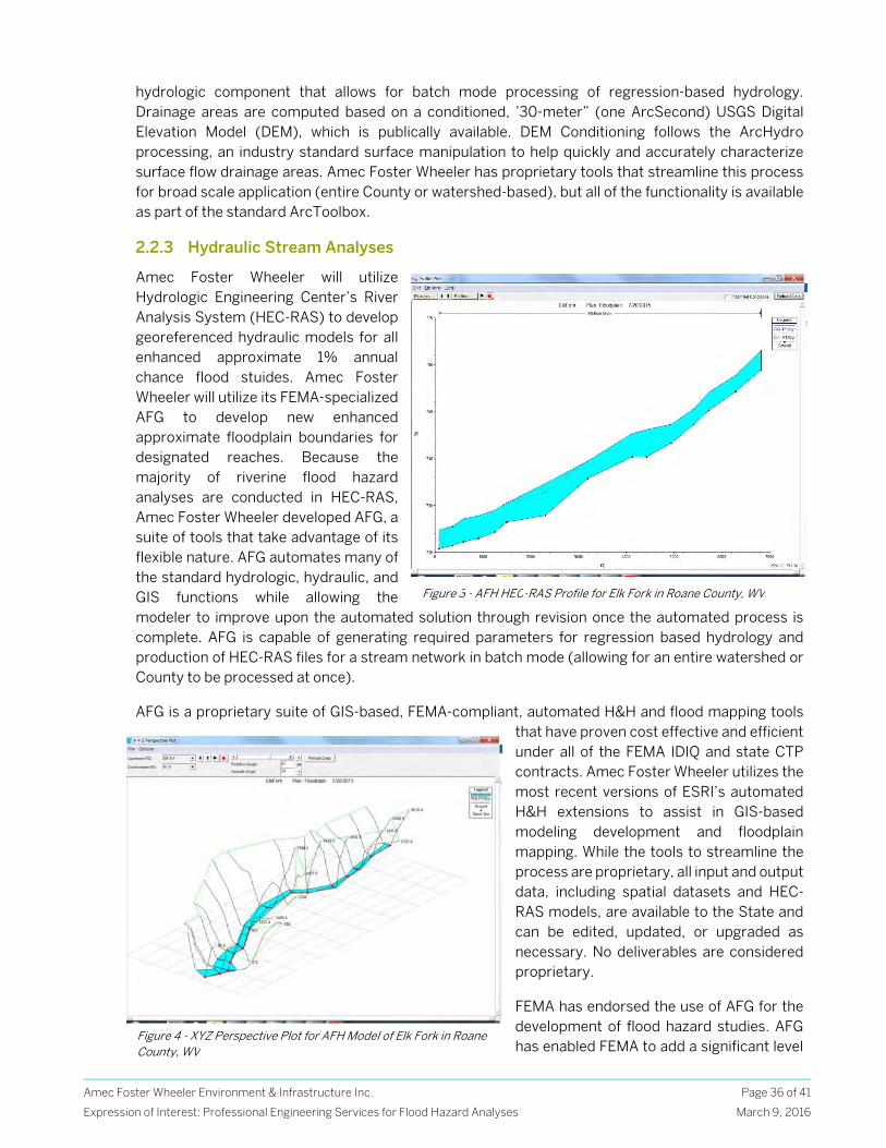
Amec Foster Wheeler Environment & Infrastructure Inc.
Expression of Interest: Professional Engineering Services for Flood Hazard Analyses
Page 36 of 41
March 9, 2016
hydrologic component that allows for batch mode processing of regression-based hydrology. Drainage areas are computed based on a conditioned, ’30-meter” (one ArcSecond) USGS Digital Elevation Model (DEM), which is publically available. DEM Conditioning follows the ArcHydro processing, an industry standard surface manipulation to help quickly and accurately characterize surface flow drainage areas. Amec Foster Wheeler has proprietary tools that streamline this process for broad scale application (entire County or watershed-based), but all of the functionality is available as part of the standard ArcToolbox.
2.2.3 Hydraulic Stream Analyses
Amec Foster Wheeler will utilize Hydrologic Engineering Center’s River Analysis System (HEC-RAS) to develop georeferenced hydraulic models for all enhanced approximate 1% annual chance flood stuides. Amec Foster Wheeler will utilize its FEMA-specialized AFG to develop new enhanced approximate floodplain boundaries for designated reaches. Because the majority of riverine flood hazard analyses are conducted in HEC-RAS, Amec Foster Wheeler developed AFG, a suite of tools that take advantage of its flexible nature. AFG automates many of the standard hydrologic, hydraulic, and GIS functions while allowing the modeler to improve upon the automated solution through revision once the automated process is complete. AFG is capable of generating required parameters for regression based hydrology and production of HEC-RAS files for a stream network in batch mode (allowing for an entire watershed or County to be processed at once).
AFG is a proprietary suite of GIS-based, FEMA-compliant, automated H&H and flood mapping tools that have proven cost effective and efficient under all of the FEMA IDIQ and state CTP contracts. Amec Foster Wheeler utilizes the most recent versions of ESRI’s automated H&H extensions to assist in GIS-based modeling development and floodplain mapping. While the tools to streamline the process are proprietary, all input and output data, including spatial datasets and HEC-RAS models, are available to the State and can be edited, updated, or upgraded as necessary. No deliverables are considered proprietary.
FEMA has endorsed the use of AFG for the development of flood hazard studies. AFG has enabled FEMA to add a significant level
Figure 3 - AFH HEC-RAS Profile for Elk Fork in Roane County, WV
Figure 4 - XYZ Perspective Plot for AFH Model of Elk Fork in Roane County, WV
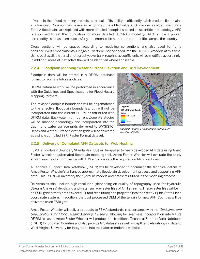
Amec Foster Wheeler Environment & Infrastructure Inc.
Expression of Interest: Professional Engineering Services for Flood Hazard Analyses
Page 37 of 41
March 9, 2016
of value to their flood mapping projects as a result of its ability to efficiently batch produce floodplains at a low cost. Communities have also recognized the added value AFG provides as older, inaccurate Zone A floodplains are replaced with more detailed floodplains based on scientific methodology. AFG is also used to set the foundation for more detailed HEC-RAS modeling. AFG is now a proven commodity as it has been successfully implemented in numerous communities across the country.
Cross sections will be spaced according to modeling conventions and also used to frame bridge/culvert embankments. Bridge/culverts will not be coded into the HEC-RAS models at this time. Using best available aerial photography, overbank roughness coefficients will be modified accordingly. In addition, areas of ineffective flow will be identified where applicable.
2.2.4 Floodplain Mapping/Water-Surface Elevation and Grid Development
Floodplain data will be stored in a DFIRM database format to facilitate future updates.
DFIRM Database work will be performed in accordance with the Guidelines and Specifications for Flood Hazard Mapping Partners.
The revised floodplain boundaries will be edgematched to the effective floodplain boundaries, but will not be incorporated into the current DFIRM or attributed with DFIRM data. Backwater from current Zone AE studies will be mapped accordingly and incorporated into the depth and water surface grids delivered to WVGISTC. Depth and Water Surface elevation grids will be delivered as a single compiled ESRI Raster Format dataset.
2.2.5 Delivery of Complaint AFH Datasets for Web Hosting
FEMA’s Floodplain Boundary Standards (FBS) will be applied to newly developed AFH data using Amec Foster Wheeler’s automated floodplain mapping tool. Amec Foster Wheeler will evaluate the study stream reaches for compliance with FBS and complete the required certification forms.
A Technical Support Data Notebook (TSDN) will be developed to document the technical details of Amec Foster Wheeler's enhanced approximate floodplain development process and supporting AFH data. This TSDN will inventory the hydraulic models and datasets utilized in the modeling process.
Deliverables shall include high-resolution (depending on quality of topography used for Hydraulic Stream Analyses) depth grid and water surface raster files of AFH streams. These raster files will be in an ESRI grid format (not to exceed 10-foot resolution) and projected into the West Virginia State Plane coordinate system. In addition, the post processed DEM of the terrain for new AFH Counties will be delivered as an ESRI grid.
Amec Foster Wheeler will deliver products to FEMA standards in accordance with the Guidelines and Specifications for Flood Hazard Mapping Partners, allowing for seamless incorporation into future DFIRM releases. Amec Foster Wheeler will produce the traditional Technical Support Data Notebook (TSDN) for updated Counties and also provide GIS datasets as well as depth and elevation grid data to West Virginia University for integration into their aforementioned website.
Figure 5 - Depth Grid Example overlaid on traditional FIRM
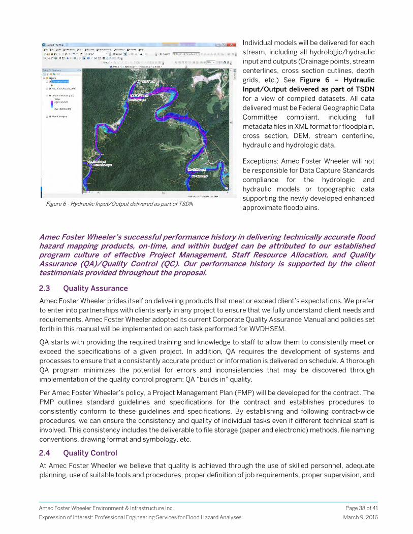
Amec Foster Wheeler Environment & Infrastructure Inc.
Expression of Interest: Professional Engineering Services for Flood Hazard Analyses
Page 38 of 41
March 9, 2016
Individual models will be delivered for each stream, including all hydrologic/hydraulic input and outputs (Drainage points, stream centerlines, cross section cutlines, depth grids, etc.) See Figure 6 – Hydraulic Input/Output delivered as part of TSDN for a view of compiled datasets. All data delivered must be Federal Geographic Data Committee compliant, including full metadata files in XML format for floodplain, cross section, DEM, stream centerline, hydraulic and hydrologic data.
Exceptions: Amec Foster Wheeler will not be responsible for Data Capture Standards compliance for the hydrologic and hydraulic models or topographic data supporting the newly developed enhanced approximate floodplains.
Amec Foster Wheeler’s successful performance history in delivering technically accurate flood hazard mapping products, on-time, and within budget can be attributed to our established program culture of effective Project Management, Staff Resource Allocation, and Quality Assurance (QA)/Quality Control (QC). Our performance history is supported by the client testimonials provided throughout the proposal.
2.3 Quality Assurance
Amec Foster Wheeler prides itself on delivering products that meet or exceed client’s expectations. We prefer to enter into partnerships with clients early in any project to ensure that we fully understand client needs and requirements. Amec Foster Wheeler adopted its current Corporate Quality Assurance Manual and policies set forth in this manual will be implemented on each task performed for WVDHSEM.
QA starts with providing the required training and knowledge to staff to allow them to consistently meet or exceed the specifications of a given project. In addition, QA requires the development of systems and processes to ensure that a consistently accurate product or information is delivered on schedule. A thorough QA program minimizes the potential for errors and inconsistencies that may be discovered through implementation of the quality control program; QA “builds in” quality.
Per Amec Foster Wheeler’s policy, a Project Management Plan (PMP) will be developed for the contract. The PMP outlines standard guidelines and specifications for the contract and establishes procedures to consistently conform to these guidelines and specifications. By establishing and following contract-wide procedures, we can ensure the consistency and quality of individual tasks even if different technical staff is involved. This consistency includes the deliverable to file storage (paper and electronic) methods, file naming conventions, drawing format and symbology, etc.
2.4 Quality Control
At Amec Foster Wheeler we believe that quality is achieved through the use of skilled personnel, adequate planning, use of suitable tools and procedures, proper definition of job requirements, proper supervision, and
Figure 6 - Hydraulic Input/Output delivered as part of TSDN
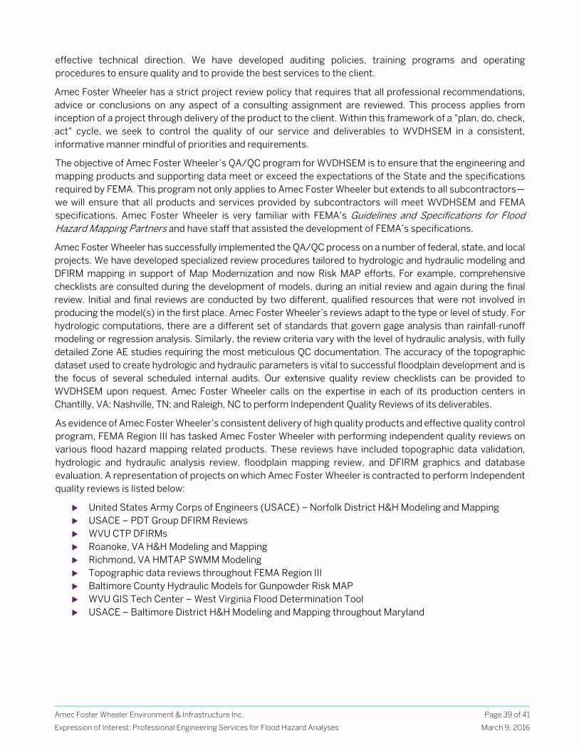
Amec Foster Wheeler Environment & Infrastructure Inc.
Expression of Interest: Professional Engineering Services for Flood Hazard Analyses
Page 39 of 41
March 9, 2016
effective technical direction. We have developed auditing policies, training programs and operating procedures to ensure quality and to provide the best services to the client.
Amec Foster Wheeler has a strict project review policy that requires that all professional recommendations, advice or conclusions on any aspect of a consulting assignment are reviewed. This process applies from inception of a project through delivery of the product to the client. Within this framework of a "plan, do, check, act" cycle, we seek to control the quality of our service and deliverables to WVDHSEM in a consistent, informative manner mindful of priorities and requirements.
The objective of Amec Foster Wheeler’s QA/QC program for WVDHSEM is to ensure that the engineering and mapping products and supporting data meet or exceed the expectations of the State and the specifications required by FEMA. This program not only applies to Amec Foster Wheeler but extends to all subcontractors—we will ensure that all products and services provided by subcontractors will meet WVDHSEM and FEMA specifications. Amec Foster Wheeler is very familiar with FEMA’s Guidelines and Specifications for Flood Hazard Mapping Partners and have staff that assisted the development of FEMA’s specifications.
Amec Foster Wheeler has successfully implemented the QA/QC process on a number of federal, state, and local projects. We have developed specialized review procedures tailored to hydrologic and hydraulic modeling and DFIRM mapping in support of Map Modernization and now Risk MAP efforts. For example, comprehensive checklists are consulted during the development of models, during an initial review and again during the final review. Initial and final reviews are conducted by two different, qualified resources that were not involved in producing the model(s) in the first place. Amec Foster Wheeler’s reviews adapt to the type or level of study. For hydrologic computations, there are a different set of standards that govern gage analysis than rainfall-runoff modeling or regression analysis. Similarly, the review criteria vary with the level of hydraulic analysis, with fully detailed Zone AE studies requiring the most meticulous QC documentation. The accuracy of the topographic dataset used to create hydrologic and hydraulic parameters is vital to successful floodplain development and is the focus of several scheduled internal audits. Our extensive quality review checklists can be provided to WVDHSEM upon request. Amec Foster Wheeler calls on the expertise in each of its production centers in Chantilly, VA; Nashville, TN; and Raleigh, NC to perform Independent Quality Reviews of its deliverables.
As evidence of Amec Foster Wheeler’s consistent delivery of high quality products and effective quality control program, FEMA Region III has tasked Amec Foster Wheeler with performing independent quality reviews on various flood hazard mapping related products. These reviews have included topographic data validation, hydrologic and hydraulic analysis review, floodplain mapping review, and DFIRM graphics and database evaluation. A representation of projects on which Amec Foster Wheeler is contracted to perform Independent quality reviews is listed below:
United States Army Corps of Engineers (USACE) – Norfolk District H&H Modeling and Mapping USACE – PDT Group DFIRM Reviews WVU CTP DFIRMs Roanoke, VA H&H Modeling and Mapping Richmond, VA HMTAP SWMM Modeling Topographic data reviews throughout FEMA Region III Baltimore County Hydraulic Models for Gunpowder Risk MAP WVU GIS Tech Center – West Virginia Flood Determination Tool USACE – Baltimore District H&H Modeling and Mapping throughout Maryland
Amec Foster Wheeler Environment & Infrastructure Inc.
Expression of Interest: Professional Engineering Services for Flood Hazard Analyses
Page 40 of 41
March 9, 2016
2.5 Cost and Schedule Compliance
Amec Foster Wheeler has implemented an Earned Value Management (EVM) system in compliance with FEMA requirements to ensure cost and schedule compliance. This system supplements the MIP EVM system and provides an additional tool to manage, monitor and report cost and schedule performance. Amec Foster Wheeler’s outstanding performance with regards to schedule and budget is reflected in the EVM reporting and performance has been rewarded by our clients with additional contract work.
EVM integrates technical performance requirements, resource planning, with schedules, while taking risk into consideration. The process uses effective internal technical, cost and schedule management control systems for daily better management insight. The data results provide excellent indicators for future performance and trends. Ultimately, EVM allows effective management decisions to minimize the adverse impacts to the project.
In addition, Amec Foster Wheeler uses MS Project and our corporate financial accounting software, BST®, as primary performance managers of schedule and costs. Costs, resources, and schedule are balanced across the Amec Foster Wheeler Team using these tools. These web based tools provide daily updates for the PM and Study Team Leaders. Resultant reports mimic the MIP work flow and facilitate clear communications to the MIP. The following descriptions detail supplemental programs utilized by Amec Foster Wheeler to ensure budget and schedule compliance as well as the delivery of high quality products.
2.6 Additional Services/Teaming Partners
Based on our understanding of current WVDHSEM goals and what is specifically requested in the Professional Engineering Services for Flood Hazard Analyses EOI, the approach described above is focused predominantly on AFH development; however, Amec Foster Wheeler is qualified to provide comprehensive FEMA Risk MAP program support. In the event that traditional detailed (Zone AE) flood studies are required of the selected vendor, Amec Foster Wheeler has included trusted teaming partner Jim Harned, of Erickson Contract Surveying, Inc to supplement Amec Foster Wheeler’s comprehensive Risk MAP services. Jim Harned is the former proprietor of Harned Surveying and Engineering (HSE). HSE was a trusted AMEC teaming partner in FEMA Region III since 2001. They successfully supported AMEC by providing cost-effective field survey in support of FEMA floodplain studies, including surveys in Kanawha, Jackson, Cabell, Wyoming, McDowell, Raleigh Counties, under Jim’s direction. Recently, Jim has joined Erickson Contract Surveying, Inc. (ECS). ECS
“We have previously worked closely with AMEC as they have provided QA/QC services for FEMA on Hydrologic and Hydraulic studies in Maryland counties—all handed in a professional and timely manner. We are currently working with AMEC on full hazard restudies, preliminary map issuance and post preliminary work in additional Maryland Counties. Throughout these efforts, AMEC has performed each of these services with the utmost care and professionalism and allowed us at the state to move this mapping process into a digital environment with foresight and vision.”
Dave Guignet, Maryland State NFIP Coordinator
The West Virginia GIS Technical Center (WVGISTC) has partnered with Amec Foster Wheeler since 2010 to help FEMA Region III and the State of West Virginia implement and maintain the West Virginia Flood Tool. Amec Foster Wheeler has provided model-backed Advisory Flood Height analyses for 21 counties and has consistently stood behind their product with invaluable outreach and technical support to stakeholders. While the WVGISTC is responsible for the development of the Flood Tool application, the overall success of this project is the result of an effective partnership of organizations striving toward a common goal. Amec Foster Wheeler’s knowledge and experience with the National Flood Insurance Program and their understanding of the State’s long term vision for floodplain management have been vital to this success.
Eric Hopkins, WVGISTC
Amec Foster Wheeler Environment & Infrastructure Inc.
Expression of Interest: Professional Engineering Services for Flood Hazard Analyses
Page 41 of 41
March 9, 2016
is a small, veteran-owned business. ECS is a surveying, engineering and environmental services consultant with specialized data acquisition and processing experience from aerial and hydrographic platforms. ECS utilizes the latest technology including Trimble R10 GPS bases and receivers, conventional total stations, and Sonar Mite sonar equipment to seamlessly collect stream, lake and overbank elevation data that can be exported directly from our TSC3 data collectors to a Trimble Business Center, CAD or GIS environment.
ECS has built a full-service surveying company with specialized experience for each service we provide our clients, including hydrographic and bathymetric surveys. Jim Harned will serve as the Survey Lead and is based in their Louisville, Kentucky office. Jim is both a water resources engineer as well as licensed surveyor and has conducted numerous hydrologic/hydraulic studies for industry, state and federal clients. Jim Harned has an established a track record with Amec Foster Wheeler for strong lines of communication and a performance with regard to both schedule and budget, on the Kentucky and Delaware CTP Projects, FEMA Region III IDIQ Contract, and while performing similar services for FEMA Study Contractors in Regions IV, VIII, and IX. Amec Foster Wheeler is pleased to include ECS on the project team to provide comprehensive surveying services to the Risk MAP program support available to the State.
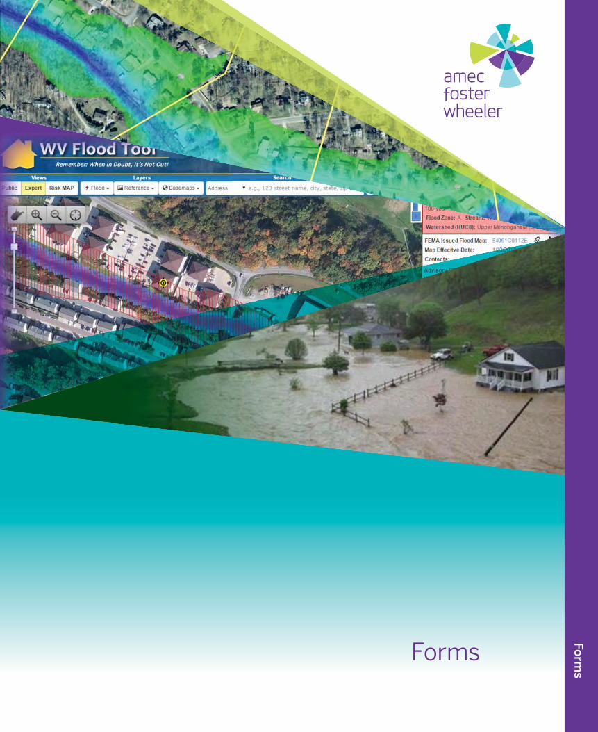
Forms
Forms
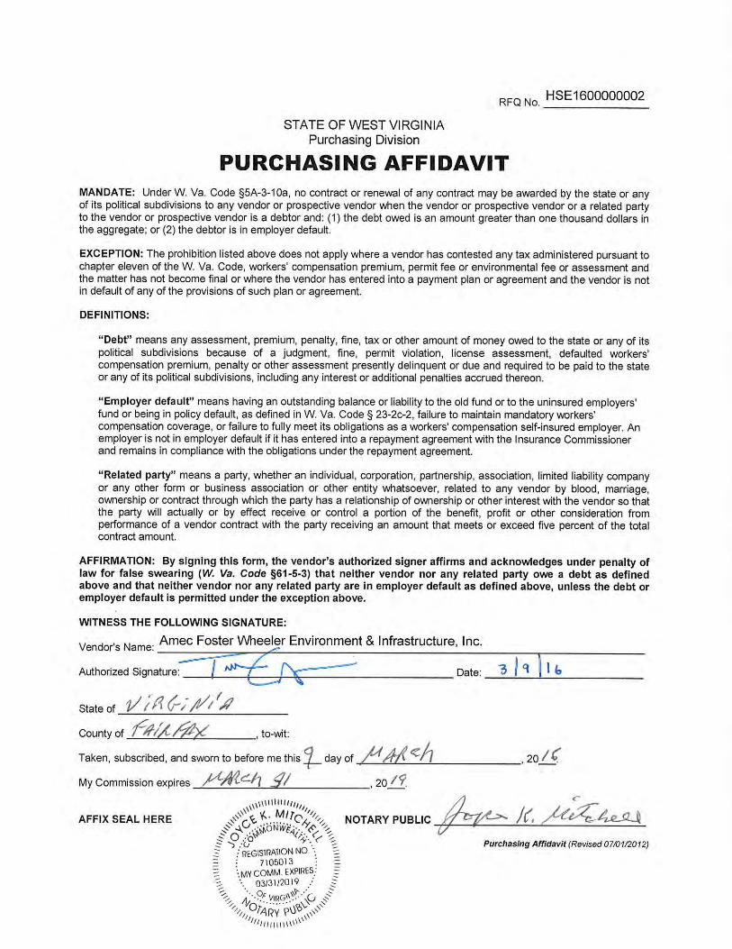
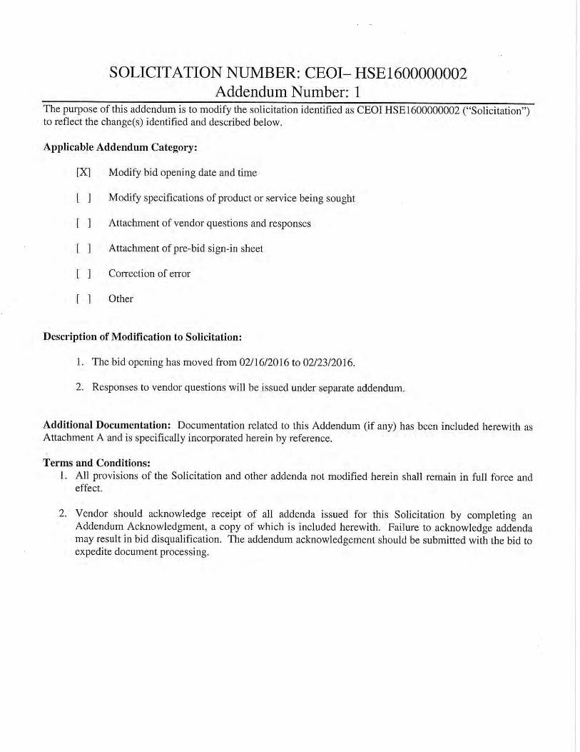
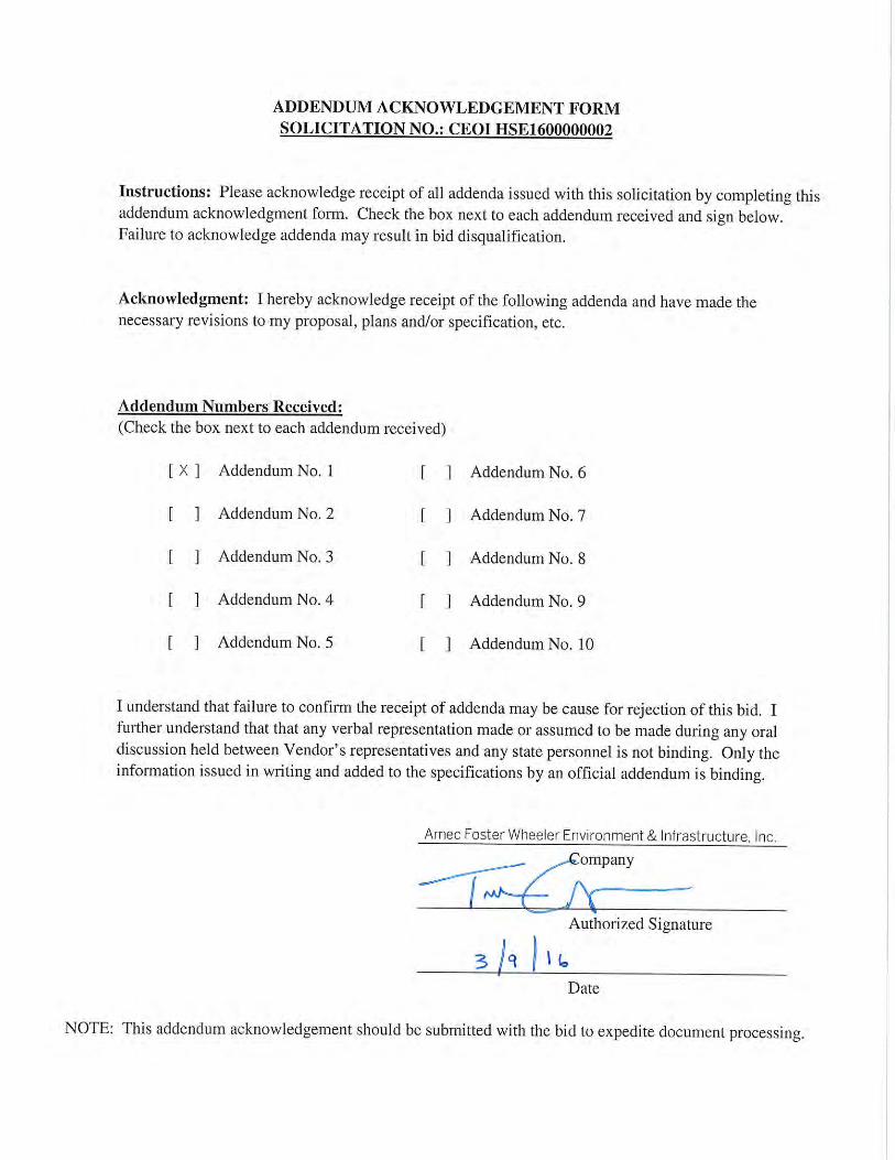
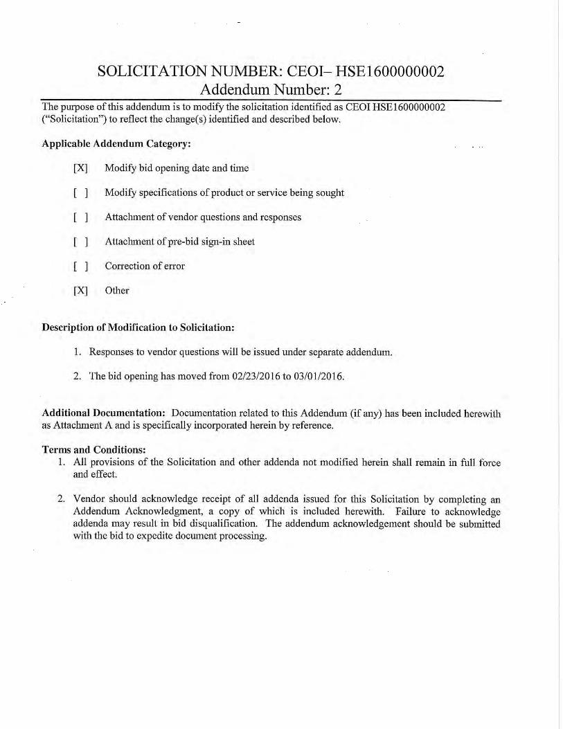
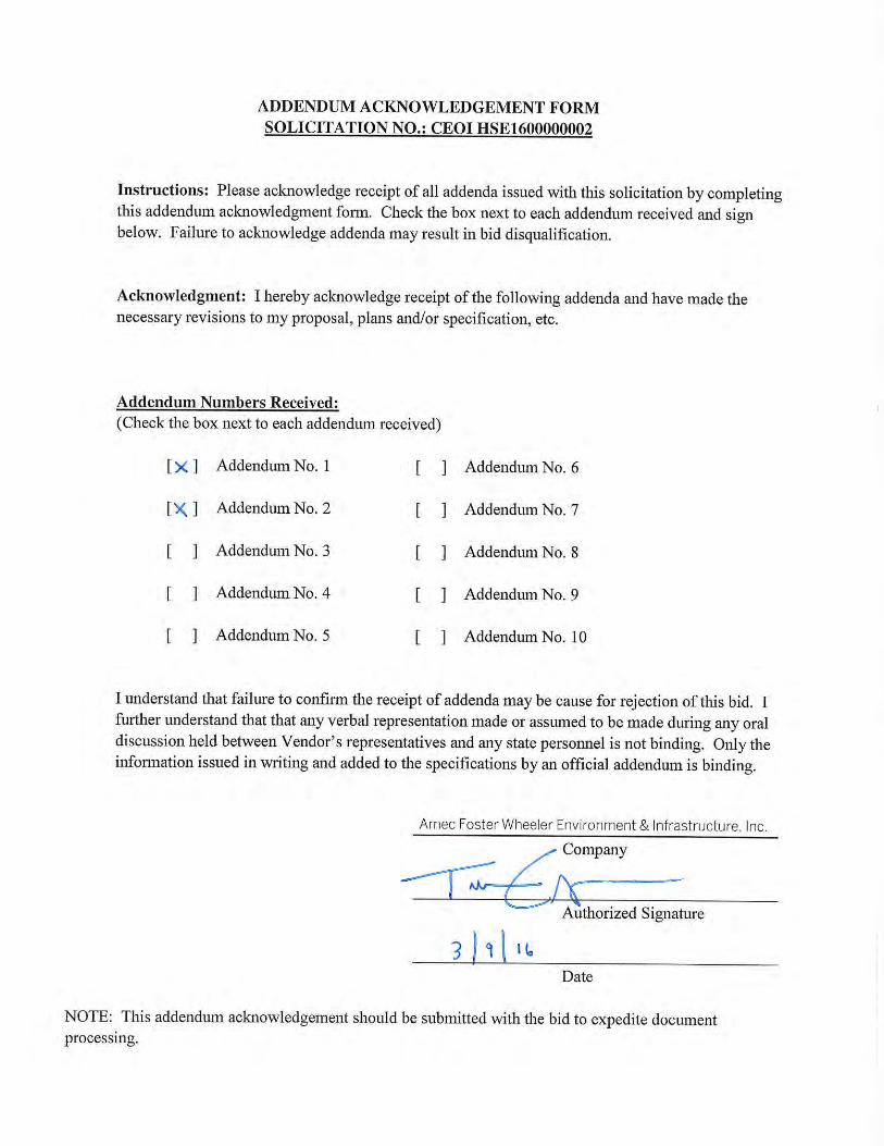
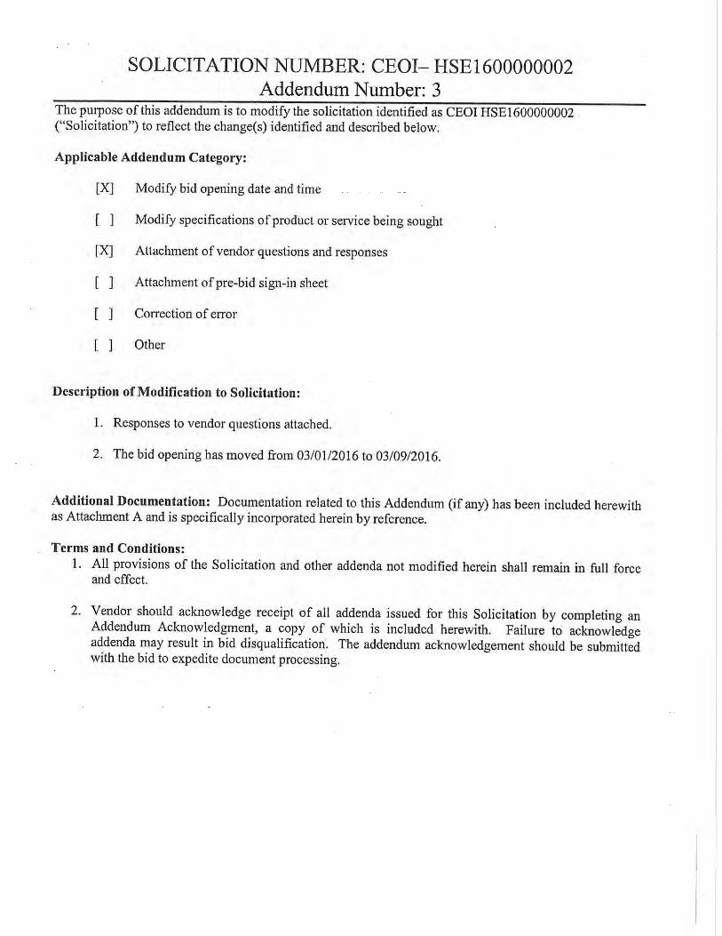
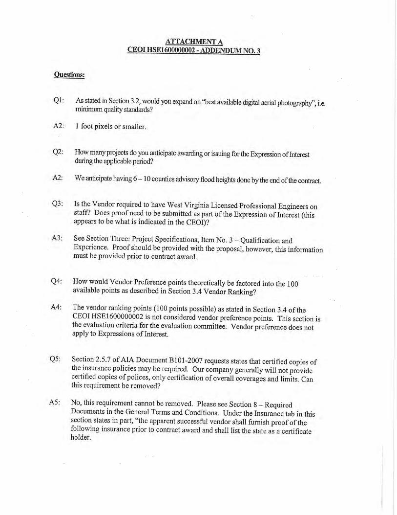
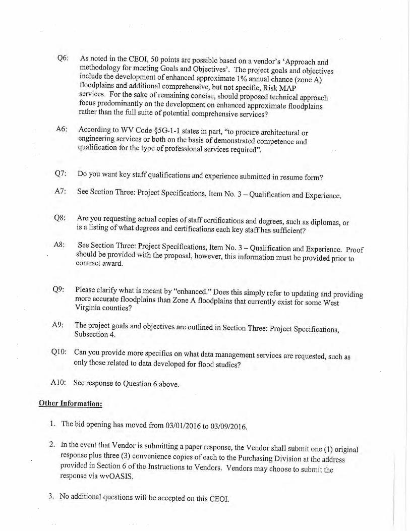
![Flood Map Modernization Flood Map Modernization Mapping the Risk Editorial Board Meeting [date] V123005 [COMMUNITY NAME] FLOOD MAP MODERNIZATION](https://img.pdfslide.net/doc/110x75/56649ebb5503460f94bc3787/flood-map-modernization-flood-map-modernization-mapping-the-risk-editorial.jpg)