Embed Size (px)
Citation preview

~1~
AddendumtotheSabine‐NechesWorkPlan
WorkPlanAddendumSabineandNechesRiversandSabineLakeBayBasinandBayAreaStakeholderCommittee
8 August 2011

~2~
AddendumtotheSabine‐NechesWorkPlan
TableofContentsTableofTables ............................................................................................................................... 3
TableofFigures ............................................................................................................................. 3
1. Introduction ............................................................................................................................. 4
2. Adoption of Environmental Flow Standards for Surface Water ............................................. 5
3. Central Geo-Referenced Database .......................................................................................... 5
4. Existing Data Summary .......................................................................................................... 6
5. Work Plan Approach............................................................................................................... 8
5.1. Monitoring Programs ....................................................................................................... 8
5.1.1. Hydrology ................................................................................................................. 8
5.1.2. Water Quality ............................................................................................................ 8
5.2. Surveys ............................................................................................................................. 9
5.2.1. Hydrology ................................................................................................................. 9
5.2.2. Water Quality ............................................................................................................ 9
5.2.3. Biology .................................................................................................................... 10
5.3. Research Studies ............................................................................................................ 10
5.3.1. Biology .................................................................................................................... 11
5.3.2. Geomorphology ...................................................................................................... 12
6. Proposed Budget ................................................................................................................... 15
7. Appendix ............................................................................................................................... 17
7.1. Environmental Flow Standards Measuring Points / Standards & Maps ........................ 17
7.1.1. Sabine Basin............................................................................................................ 17
7.1.2. Neches Basin ........................................................................................................... 24

~3~
AddendumtotheSabine‐NechesWorkPlan
TableofTablesTable 1. Existing Data Summary .................................................................................................... 7 Table 2. Hydrology Study Matrix ................................................................................................. 13 Table 3. Water Quality Study Matrix ........................................................................................... 13 Table 4. Biology Study Matrix ..................................................................................................... 14 Table 5. Geomorphology Study Matrix ........................................................................................ 15 Table 6. Surveys Schedule ............................................................................................................ 15 Table 7. Proposed Ten Year Budget Distribution ......................................................................... 16 Table 8. Sabine River and Tributaries - Final TCEQ Adopted E-Flow Standards ....................... 18 Table 9. Neches River and Tributaries - Final TCEQ Adopted E‐flow Standards ....................... 25 TableofFiguresFigure 1. Big Sandy near Big Sandy, Texas (08019500) ............................................................. 19 Figure 2. Sabine River near Gladewater, Texas (08020000) ........................................................ 20 Figure 3. Sabine River near Beckville, Texas (08022040) ........................................................... 21 Figure 4. Big Cow Creek near Newton, Texas (08029500) ......................................................... 22 Figure 5. Sabine River near Ruliff, Texas (08030500) ................................................................. 23 Figure 6. Neches River at Neches, Texas (08032000) .................................................................. 26 Figure 7. Neches River near Rockland, Texas (08033500) .......................................................... 27 Figure 8. Angelina River near Alto, Texas (08036500) ............................................................... 28 Figure 9. Neches River at Evadale, Texas (08041000) ................................................................ 29 Figure 10. Village Creek near Kountze, Texas (08041500) ......................................................... 30

~4~
AddendumtotheSabine‐NechesWorkPlan
1. Introduction
This Addendum to the Sabine and Neches Rivers and Sabine Lake Bay Basin and Bay Area
Stakeholder Committee (Sabine-Neches BBASC) Work Plan was prepared in response to the
Texas Environmental Flows Science Advisory Committee (SAC)’s 24 June 2011 Draft
Memorandum to the Texas Environmental Flows Advisory Group (EFAG), “Re: Review
comments on Sabine and Neches Rivers and Sabine Lake Basin and Bay Area Stakeholders
Committee Work Plan dated 7 December 2010” (SAC Memorandum). The Sabine-Neches
BBASC appreciates the constructive comments provided in this draft review, which are
intended to assist the EFAG in determining if the Sabine-Neches BBASC Work Plan is
consistent with Senate Bill 3 (SB 3) requirements, and is pleased to provide herein the
additional detail and specificity needed for the Work Plan to better serve as a useful
framework for detailed planning and development of future monitoring studies and projects.
The Addendum further defines “what monitoring, special studies, or other information is
required to fill data gaps and validate and refine the environmental flow analyses and
environmental flow regime, as well as the environmental flow standards and achievement
strategies” (SAC Memorandum/ Sabine-Neches Work Plan). Specifically, the Addendum
lays out what parameters will be addressed within the disciplines of hydrology, water quality,
biology, and geomorphology. Data gathered will supplement existing data and establish
baselines where data is lacking. The Addendum adds survey schedules (see Table 6, pg. 15),
allows for assessment of the effectiveness of the monitoring programs, surveys, and research
studies, and ensures that state flow standards continue to protect a sound ecological
environment. Estimates of cost and funding sources are included for parameters within each
discipline.
The Sabine-Neches BBASC should provide oversight for Work Plan implementation. The
competitive request for proposal (RFP) process described in the Work Plan (Section 5.2,
pg. 12) should be developed and issued by the Sabine-Neches BBASC, with assistance from
the Sabine-Neches BBEST and technical support from the Tri-Agencies. The Sabine-Neches
BBASC will also be responsible for assigning prioritized ranks to the RFPs, because it is
likely that funds will not be sufficient to study all proposed elements. The RFPs will be
motivated by the objectives and strategies laid out in the Work Plan and this Addendum, and
details of studies will be developed by the researchers in response to the RFPs based on

~5~
AddendumtotheSabine‐NechesWorkPlan
available funds, for example Texas Water Development Board (TWDB) Research and
Planning Funds for Environmental Studies.
2. Adoption of Environmental Flow Standards for Surface Water
On 20 April 2011, the Texas Commission on Environmental Quality (TCEQ) adopted
environmental flow standards for the Sabine and Neches Rivers, their associated tributaries,
and Sabine Lake Bay.1 By rule, these environmental flow standards are adequate to support
a sound ecological environment, to the maximum extent reasonable considering other public
interests and other relevant factors.2 In the Standards, TCEQ found that the Sabine and
Neches Rivers, their associated tributaries, Sabine Lake Bay, and the associated Sabine-
Neches estuary are substantially sound ecological environments.3 Sound ecological
environment is defined in the Standards as “an ecological environment that: supports a
healthy diversity of fish and other aquatic life; sustains a full complement of important
species; provides for all major habitat types including rivers and streams, reservoirs, and
estuaries; sustains key ecosystem processes; and maintains water quality adequate for aquatic
life.”4
3. Central Geo-Referenced Database
To make the data and literature pertaining to the Sabine and Neches Rivers and Sabine Lake
Bay centralized and more universally accessible, the TCEQ-contracted literature review
conducted by Stephen F. Austin State University (SFASU) for the Angelina and Neches
River Basins and the literature gathered for the Sabine River Basin by the Sabine-Neches
BBEST5 should be added to the TCEQ-funded Texas Environmental Flows Information
System (EFIS6) maintained by the University of Texas at Austin Center for Research in
Water Resources (CRWR). A central geo-referenced database is an essential tool in future
1 TEX. WATER CODE ANN. § 298 Subchapter C, http://info.sos.state.tx.us/pls/pub/readtac$ext.ViewTAC?tac_view=5&ti=30&pt=1&ch=298&sch=C&rl=Y, referenced 19 July 2011. 2 Senate Bill 3, Section 11.1471(a)(1). 3 TEX. WATER CODE ANN. § 298.260(a). 4 TEX. WATER CODE ANN. § 298.255(3); this is the definition of “sound ecological environment” recommended by the Sabine-Neches BBASC in its Recommendations Report (Section 10.1 Recommendation 10, pg. 49), http://www.tceq.state.tx.us/assets/public/permitting/watersupply/water_rights/eflows/2010snbbasc_finalrecommendations.pdf, referenced 19 July 2011. 5 Sabine-Neches BBEST Library, http://www.sratx.org/BBEST/library.html, referenced 21 July 2011. 6 http://efis.crwr.utexas.edu/, referenced 19 July 2011.

~6~
AddendumtotheSabine‐NechesWorkPlan
efforts to determine and address data gaps and to validate and refine the environmental flow
standards and achievement strategies.
4. Existing Data Summary
While the Sabine-Neches BBEST identified data gaps in its Recommendations Report,
extensive U.S. Geological Survey (USGS) hydrology7 and water quality data8 are available,
as well as biology sampling for programs such as the Texas Instream Flow Program (TIFP9)
and the Toledo Bend Project Federal Energy Regulatory Commission (FERC) relicensing10
and geomorphology studies conducted for the TIFP. Existing data is summarized below.
7 USGS Water Data for Texas, http://waterdata.usgs.gov/tx/nwis, referenced 21 July 2011. 8 Available via Texas Clean Rivers Program: Data, Forms, and Map Resources, http://www.tceq.texas.gov/waterquality/clean-rivers/data/crp-resources.html, referenced 21 July 2011. 9 http://www.twdb.state.tx.us/instreamflows/, referenced 21 July 2011. 10 http://www.tbpjo.org/PublicRelicensing/default.aspx, referenced 21 July 2011.

~7~
AddendumtotheSabine‐NechesWorkPlan
Table 1. Existing Data Summary
Location (USGS Gage ID)
TCEQ Segment (Station ID)
Hydrology Water Quality Biology Geomorphology
Big Cow Creek (08029500)
0513 (10466) USGS gage (1952‐present)
Routine monthly, >10yrs, diel 10, 11
Fish 02, 03, Benthics 93, 94, 96, 02, 03
Phillips 08
Big Sandy Creek (08019500)
0514 (10468) USGS gage (1939‐present)
Routine monthly, >10yrs
Benthics 93, 94
Sabine R. @ Gladewater (08020000)
0506 (10428) USGS gage (1932‐present)
Routine monthly, >10yrs
Sabine R. @ Beckville (08022040)
0505 (13628) USGS gage (1938‐present)
Routine monthly, >10yrs
Karatayev 07 (US59)
Sabine R. @ Ruliff (08030500)
0502 (10397) USGS gage (1924‐present)
Routine monthly, >10yrs
Karatayev 08, Randklev 09
Phillips 03, 07, 08, 09; Heitmuller 10
Village Creek (08041500)
0608 (10609) USGS gage (1939‐present)
Quarterly, >10yrs Cooper 04 Phillips 08, 09
Angelina River@Alto (08036500)
0611 (10630) USGS gage (1959‐present)
Quarterly, >10yrs
Neches R. @ Neches (08032000)
0604 (13627) USGS gage (1939‐present)
Quarterly, >10yrs Phillips 08
Neches R. @ Rockland (08033500)
0604 (10585) USGS gage (1912‐present)
Quarterly, >10yrs Phillips 08
Neches R. @ Evadale (08041000)
0602 (10580) USGS gage (1921‐present)
Quarterly, >10yrs Cooper 04 Phillips 08, 09

~8~
AddendumtotheSabine‐NechesWorkPlan
5. Work Plan Approach
The SAC Work Plan Guidance11 recommends an approach that utilizes measurements within
the following four environmental flow disciplines, hydrology, water quality, biology, and
geomorphology, to evaluate characteristics reflecting a sound ecological environment. Data
from all four disciplines will be collected concurrently as applicable to provide a
comprehensive interdisciplinary assessment within three categories: monitoring programs,
surveys, and research studies. Table 2 (pg. 13) to Table 5 (pg. 15) present study matrices for
each discipline subdivided by category.
5.1. Monitoring Programs
Long-term monitoring programs will provide an extensive dataset over an extended
period for analysis of whether the environmental flow standards are adequate to support
a sound ecological environment, to the maximum extent reasonable considering other
public interests and other relevant factors.
5.1.1. Hydrology
Hydrology measurements at the environmental flow standards measurement
points will utilize USGS gaging data. Although the USGS periodically verifies
and adjusts rating curves, adjustments to the rating tables will be recommended
on a periodic basis as needed. Please see Table 2. Hydrology Study Matrix
(pg. 13) for details.
5.1.2. WaterQuality
Routine water quality parameters will be collected at each site utilizing existing
Texas Clean Rivers Program (TCRP12) monitoring and established TCEQ Surface
Water Quality Monitoring (SWQM13) protocol to determine water quality.
Current monitoring under TCRP will be sufficient to meet the objectives for this
project. All monitoring will be conducted in accordance with an approved TCRP
11 Report # SAC-2010-02, Considerations in the Development of an SB3 Work Plan for Adaptive Management, 20 August 2010, http://www.tceq.state.tx.us/assets/public/permitting/watersupply/water_rights/eflows/20100820sac_guidance_workplan.pdf, referenced 21 July 2011. 12 http://www.tceq.texas.gov/waterquality/clean-rivers, referenced 21 July 2011. 13 http://www.tceq.texas.gov/waterquality/monitoring/index.html, referenced 21 July 2011.

~9~
AddendumtotheSabine‐NechesWorkPlan
Quality Assurance Project Plan (QAPP14). The monitoring results will be
submitted to TCEQ as routine monitoring for inclusion in the assessment to
produce the Texas Integrated Reported for Clean Water Act Sections 305(b) and
303(d) (Integrated Report15). The parameters included are listed in Table 3.
Water Quality Study Matrix (pg. 13).
5.2. Surveys
Focused surveys (short- or long-term) address data gaps identified by the Sabine-Neches
BBEST in its Recommendations Report.
5.2.1. Hydrology
During periods of low flow (near environmental flow standards subsistence flows
or lower), additional flow measurements may be collected as needed to verify
flow values recorded by the USGS gages. The gages are most accurate for the
middle of the rating curve and it is critical for this project to have accurate
measurements during low flow events. Since low flows may not occur every
year, this monitoring will not be regularly scheduled. Low flows will be
measured in accordance with the TCEQ SWQM protocols and compared to the
USGS gaged flows. Coordination with the USGS through the USGS Cooperative
Water Program16 provides for routine evaluation of gage rating curves and
making any necessary adjustments on a four to six week visitation schedule.
5.2.2. WaterQuality
Additional water quality monitoring will be conducted periodically during low
flow conditions. The data collected during these TCRP Special Studies will be
used to compare the water quality during low flows to other flow conditions.
These measurements will include 24-hour dissolved oxygen (DO) and other field
parameters for a one-week period. The procedures will follow TCEQ SWQM
protocols and will be biased for flow data (BF-Biased Flow); these data will not
be suitable for assessments for inclusion in the Integrated Report. The water
14 See Quality Assurance Information for the Texas Clean Rivers Program, http://www.tceq.texas.gov/waterquality/clean-rivers/qa/index.html, referenced 21 July 2011. 15 http://www.tceq.texas.gov/waterquality/assessment/10twqi/10twqi, referenced 21 July 2011. 16 http://water.usgs.gov/coop/, referenced 21 July 2011.
~10~
AddendumtotheSabine‐NechesWorkPlan
quality parameters included for Special Studies for low flow monitoring are listed
in Table 3. Water Quality Study Matrix (pg. 13).
5.2.3. Biology
Biological monitoring will be conducted to increase the baseline data set that
characterizes the sound ecological environment for each site. Biological
monitoring will include fishes, benthic macroinvertebrates, aquatic plants, and
habitat assessment. The monitoring will be performed in adherence to the
methodologies listed in the latest TCEQ SWQM protocols. Monitoring of
mainstem measuring points will utilize the procedures specified for large rivers.
One low flow survey will be conducted at each location on a five-year cycle and
the monitoring will be conducted during the established critical period from July 1
to September 30. It is possible the low flows may occur outside of the critical
period. The sampling periods will be adjusted for site- and collection-method-
specific protocols to meet the objectives of the study. Reach lengths to be
sampled in the large river sites will include at least one full meander of the stream
channel whenever possible and will include at least two types of geomorphic
channel units (e.g. riffles, pools, runs, glides). The minimum length for biological
sampling in large rivers will be 500 meters and the maximum will be one
kilometer. Modifications to meet the study objectives for this sampling will be
addressed on a case by case basis. Final sampling specifications will be addressed
in the TCRP QAPP prior to sampling.
Biological monitoring data collected during low flows will be submitted to TCEQ
as biased for flow data (BF-Biased Flow) and will not be suitable for assessments
for inclusion in the Integrated Report.
5.3. Research Studies
Short-term research studies also address data gaps identified by the Sabine-Neches
BBEST in its Recommendations Report. Please see also Table 4. Biology Study Matrix
(pg. 14).

~11~
AddendumtotheSabine‐NechesWorkPlan
5.3.1. Biology
The Sabine-Neches BBEST identified data gaps for biological data particularly
mussels, riparian, and some fish communities and recommended research to
establish baseline information.
Mussels The distribution and abundance of freshwater mussels of the family
Unionidae in the Sabine and Neches River Basins are poorly understood. Natural
factors and manmade disturbances affect the presence and survival of freshwater
mussels. Natural factors include: drought-to-flood cycles; lack of suitable habitat;
and competition and predation by other indigenous species. Manmade
disturbances include: water pollution; environmental alterations; commercial
harvesting; and competition from invasive species such as the Asian Clam
(Corbicula sp.) and Zebra Mussels. Special studies through specific RFPs need to
be undertaken in the Sabine and Neches River Basin watersheds to document and
establish baseline distribution and life history information including host fish for
glochidia (larval stage) life stages.
Riparian A Research Study similar to work done in the Lower Sabine River
under the TIFP17 should be conducted in the Lower Neches River in the first ten-
year study cycle. Since the Big Thicket lines the Lower Neches River, it would
be important to compare and/or contrast the two systems because large woody
debris is a very important geomorphological and fish habitat parameter. Similar
studies should be considered for the second ten-year study cycle for the Upper
Sabine and Upper Neches River Basins.
Fish Communities The SAC biological overlay guidance18 provided numerous
references that address the complexity of describing flow regimes for aquatic
organisms. First, habitat characteristics are strongly influenced by but not solely
dependent on flow. Second, different life stages (adults, eggs, fry, and juveniles),
17 McBroom, M. 2008. Developing a large woody debris budget for Southern rivers. Presented to The Texas Water Development Board, In Fulfillment of TWDB Contract No. 0604830632, August 31, 2010. http://www.twdb.state.tx.us/RWPG/rpgm_rpts/0604830632_WoodyDebris.pdf, referenced 1 August 2011. 18 Report # SAC-2009-05, Essential Steps for Biological Overlays in Developing Senate Bill 3 Instream Flow Recommendations, 31 August 2009, http://www.tceq.texas.gov/assets/public/permitting/watersupply/water_rights/eflows/biologyoverlay.pdf, referenced 22 July 2011.

~12~
AddendumtotheSabine‐NechesWorkPlan
and habitat use (foraging, cover, and spawning) have different habitat-flow
relationships. Work Plan surveys described in Section 5.2.3 will be directed
toward documenting existing populations, their distribution in the Sabine and
Neches River Basins, and establishing habitat features by direct measure of
populations. Specific research studies will be required to describe the flow needs
of target species that can’t be determined with existing data. An existing effort by
TPWD and Texas State University to assemble a database of habitat needs for fish
species19 may guide future studies. Additional research studies will be achieved
through specific RFPs to address data gaps and supplement other efforts.
5.3.2. Geomorphology
Sabine and Neches River Basin areas with insufficient geomorphological data will
be evaluated to delineate major geomorphic process zones and identify major
geomorphic controls and transition zones. This geomorphological work has been
developed for the Lower Sabine River20 and needs to be developed for the Upper
Sabine River and the Upper and Lower Neches River. The details of these studies
should be developed by the researchers in response to Sabine-Neches BBASC
RFPs.
19 Texas Fish Habitat Survey, http://rsi-db.its.txstate.edu/fishhabitatsurvey/, referenced 22 July 2011. 20 Phillips, J.D., Slattery M.C. 2007. Geomorphic Processes, Controls, and Transition Zones in the lower Sabine River. Austin: Texas Instream Flow Program, http://www.twdb.state.tx.us/RWPG/rpgm_rpts/0600010595_Sabine.pdf, referenced 21 July 2011; and Phillips, J.D. 2008. Geomorphic controls and transition zones in the lower Sabine River. Hydrological Processes 22, 2424-2437.

~13~
AddendumtotheSabine‐NechesWorkPlan
Table 2. Hydrology Study Matrix
Objectives ‐ Continue to support USGS gages at locations with TCEQ flow standards criteria. Flow may be measured by other methods (doppler flow meters are currently used) as needed.
Work Plan Approach
Monitoring Program Survey
Parameter USGS flow Other methods as needed
Frequency 15 min continuous As required by flow conditions
Existing Program
Yes No
Approximate Cost
$16,000/year/gage $1,200/measurement/site
Sponsor USGS/Local Cooperator/Sabine Compact/TWDB
USGS/TCRP Partner/Tri‐agencies
Table 3. Water Quality Study Matrix
Objectives ‐ Continue existing monitoring programs. Additionally, use targeted in‐situ monitoring to evaluate dissolved oxygen, pH, temperature, and specific conductivity at 15min intervals for up to seven days during low flow conditions.
Work Plan Approach Monitoring Program Survey
SWQM Monitoring Category Routine Monitoring Special Study
Frequency monthly or quarterly 2 events/year21
Existing Program Yes No
Approximate Cost $1,500/site/event $2,200/site/deployment
Sponsor TCEQ/TCRP Partner TCEQ/TCRP Partner
Routine Monitoring Parameters
Special Study Parameters
DO, pH, Temp., Specific Cond. Biased Flow (BF), 15 min interval, 1 week period
TP, NH4, TKN, SO4, Cl DO, pH, Temp., Specific Cond.
Bacteriological
Turbidity
21 September to August Fiscal Year (FY).

~14~
AddendumtotheSabine‐NechesWorkPlan
Table 4. Biology Study Matrix
Objectives ‐ Collect biological community data over time to support future validation and/or refinement of environmental flow standards.
Work Plan Approach
Surveys Research Studies
Research Studies
Research Studies
Parameter Fish/Ecoregion‐specific IBI Mussels Riparian Fish Lifecycle ‐ main channel / oxbows / tributaries
Benthic Macroinvertebrates/TCEQ Aquatic Life Use (ALU) metrics
Woody debris and riparian forest study
Physical Habitat/TCEQ habitat assessment as minimum
Frequency 1/5 yrs; see Table 6 As determined by specific SN‐BBASC RFPs
Upper Sabine Basin
2012 & 201322
Upper Neches Basin
2014 & 2015
Lower Neches Basin
2016 & 2017 2016 & 2017
Lower Sabine Basin
2018 & 2019
Existing Program No No No No
Approximate Cost
$10,000 $50,000 per 2 yr period
$50,000 per 2 yr period
TBD
Sponsor TCRP Partner/Tri‐agencies (TCEQ, TWDB, TPWD)
Tri‐agencies Tri‐agencies Tri‐agencies
22 All study years are based on a September to August FY.

~15~
AddendumtotheSabine‐NechesWorkPlan
Table 5. Geomorphology Study Matrix
Objectives ‐ Establish baseline information to delineate major geomorphic process zones and identify major geomorphic controls and transition zones.
Work Plan Approach Research Studies Projected Dates
Parameter geomorphic process zones, geomorphic controls, and transition zones
Existing Program No
Approximate Costs
Upper Sabine Basin $40,000 2012 & 2013
Upper Neches Basin $45,000 2014 & 2015
Lower Neches Basin $35,000 2016 & 2017
Total $110,000
Sponsor Tri‐agencies
Table 6. Surveys Schedule
Measurement Point Year
2012* 2013 2014 2015 2016 2017* 2018 2019 2020 2021
Big Cow Creek nr Newton X X
Village Creek nr Kountze X X
Big Sandy Creek nr Big Sandy X X
Angelina River nr Alto X X
Sabine R. nr Gladewater X X
Neches R. nr Neches X X
Sabine R. nr Beckville X X
Neches R. nr Rockland X X
Sabine R. nr Ruliff X X
Neches R. at Evadale X X
* Senate Bill 1 State Water Plan23 published. 6. Proposed Budget
The current programs as well as proposed additional studies to be developed through the Sabine-Neches
BBASC RFP process will be dependent upon available funding. Any reductions in funds for these data
collection efforts would require the Sabine-Neches BBASC to reassess and prioritize the Proposed Ten Year
Budget Distribution (Table 7, below) based upon available funds.
23 http://www.twdb.state.tx.us/wrpi/swp/swp.asp, referenced 21 July 2011.

~16~
AddendumtotheSabine‐NechesWorkPlan
Table 7. Proposed Ten Year Budget Distribution
Study 2012 2013 2014 2015 2016 2017 2018 2019 2020 2021 TOTAL
Continous Flow (USGS Gauges)*
160,000 160,000 160,000 160,000 160,000 160,000 160,000 160,000 160,000 160,000 1,600,000
Flow (Survey) 12,000 12,000 12,000 12,000 12,000 12,000 12,000 12,000 12,000 12,000 120,000
WQ Monitoring* 120,000 120,000 120,000 120,000 120,000 120,000 120,000 120,000 120,000 120,000 1,200,000
WQ Survey 8,800 8,800 8,800 8,800 8,800 8,800 8,800 8,800 8,800 8,800 88,000
Biological Surveys 20,000 20,000 20,000 20,000 20,000 20,000 20,000 20,000 20,000 20,000 200,000
Biological Research Studies
Mussels 25,000 25,000 25,000 25,000 25,000 25,000 25,000 25,000 25,000 25,000 250,000
Riparian 25,000 25,000 50,000
Fishes TBD** TBD TBD TBD TBD TBD TBD TBD TBD TBD TBD
Geomorphological Studies
Upper Sabine 20,000 20,000 40,000
Upper Neches Basin
22,500 22,500 45,000
Lower Neches 17,500 17,500 35,000
Total $365,800 $365,800 $368,300 $368,300 $363,300 $388,300 $388,800 $345,800 $345,800 $345,800 $3,628,000
* These programs are currently funded through TCRP (TCEQ and Planning Partners), USGS (and Local Cooperators including the Sabine Compact), TWDB (Research and Planning Funds for Environmental Studies), and TPWD. ** To Be Determined

~17~
AddendumtotheSabine‐NechesWorkPlan
7. Appendix 7.1. Environmental Flow Standards Measuring Points / Standards & Maps
7.1.1. SabineBasin
The TCEQ-adopted environmental flow standards for the Sabine River Basin are
presented in Table 8, below. The Sabine River Basin measurement points with
flow standards are shown in Figure 1 through Figure 5.

~18~
AddendumtotheSabine‐NechesWorkPlan
Table 8. Sabine River and Tributaries - Final TCEQ Adopted E-Flow Standards
BSBS SRGW SRBE n/a* SRRL
Season Flow Status Big Sandy Creek near Big
Sandy, TX Sabine River near Gladewater, TX
Sabine River near Beckville, TX
Big Cow Creek near Newton, TX Sabine River near Ruliff, TX
Winter
Jan‐ Feb‐Mar
Subsistence 20 cfs 45 cfs 66 cfs 28 cfs 949 cfs
Base 73 cfs 305 cfs 482 cfs 62 cfs 1,672 cfs
Pulse
1 per season Trigger: 358 cfs Duration: 10 days Volume: 5,932 ac‐ft
1 per season Trigger: 1,880 cfs Duration: 15 days
Volume: 48,599 ac‐ft
1 per season Trigger: 2,900 cfs Duration: 15 days
Volume: 84,998 ac‐ft
1 per season Trigger: 693 cfs Duration: 8 days
Volume: 4,911 ac‐ft
1 per season Trigger: 1,600 cfs Duration: 3 days
Volume: 10,202 ac‐ft
Spring
Apr‐May‐Jun
Subsistence 9 cfs 22 cfs 28 cfs 20 cfs 436 cfs
Base 33 cfs 131 cfs 255 cfs 42 cfs 1,329 cfs
Pulse 1 per season
2 per season Trigger: 313 cfs Duration: 13 days Volume: 5,062 ac‐ft
2 per season Trigger: 1,580 cfs Duration: 16 days
Volume: 51,150 ac‐ft
2 per season Trigger: 2,160 cfs Duration: 15 days
Volume: 72,092 ac‐ft
2 per season Trigger: 350 cfs Duration: 7 days
Volume: 2,545 ac‐ft
2 per season Trigger: 3,250 cfs Duration: 8 days
Volume: 42,883 ac‐ft
Summer
Jul‐ Aug‐ Sep
Subsistence 8 cfs 14 cfs 22 cfs 20 cfs 396 cfs
Base 15 cfs 37 cfs 56 cfs 31 cfs 737 cfs
Pulse
1 per season Trigger: 50 cfs Duration: 6 days Volume: 671 ac‐ft
1 per season Trigger: 168 cfs Duration: 7 days
Volume: 2,752 ac‐ft
1 per season Trigger: 285 cfs Duration: 6 days
Volume: 5,436 ac‐ft
1 per season Trigger: 109 cfs Duration: 5 days Volume: 873 ac‐ft
1 per season Trigger: 3,380 cfs Duration: 11 days
Volume: 54,321 ac‐ft
Fall
Oct‐Nov‐Dec
Subsistence 8 cfs 17 cfs 22 cfs 20 cfs 396 cfs
Base 22 cfs 54 cfs 83 cfs 40 cfs 809 cfs
Pulse 1 per season
2 per season Trigger: 130 cfs Duration: 9 days
Volume: 2,189 ac‐ft
2 per season Trigger: 380 cfs Duration: 11 days Volume: 1,098 ac‐ft
2 per season Trigger: 628 cfs Duration: 9 days
Volume: 7,245 ac‐ft
2 per season Trigger: 322 cfs Duration: 7 days
Volume: 2,232 ac‐ft
2 per season Trigger: 2,020 cfs Duration: 5 days
Volume: 17,662 ac‐ft
*No control point is established within the WAM for this gage. All designated flow rates shown in this table represent average daily values in units of cubic feet per second.

~19~
AddendumtotheSabine‐NechesWorkPlan
Figure 1. Big Sandy near Big Sandy, Texas (08019500)

~20~
AddendumtotheSabine‐NechesWorkPlan
Figure 2. Sabine River near Gladewater, Texas (08020000)

~21~
AddendumtotheSabine‐NechesWorkPlan
Figure 3. Sabine River near Beckville, Texas (08022040)
~22~
AddendumtotheSabine‐NechesWorkPlan
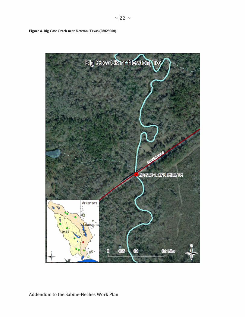
Figure 4. Big Cow Creek near Newton, Texas (08029500)

~23~
AddendumtotheSabine‐NechesWorkPlan
Figure 5. Sabine River near Ruliff, Texas (08030500)

~24~
AddendumtotheSabine‐NechesWorkPlan
7.1.2. NechesBasin
The TCEQ-adopted environmental flow standards for the Neches River Basin are
presented in Table 9, below. The Neches River Basin measurement points with
flow standards are shown in Figure 6 through Figure 10.

~25~
AddendumtotheSabine‐NechesWorkPlan
Table 9. Neches River and Tributaries - Final TCEQ Adopted E‐flow Standards
NENE NERO ANAL NEEV VIKO
Season Flow Status Neches River
near Neches, TX Neches River near Rockland
Angelina River near Alto, TX
Neches River near Evadale, TX
Village Creek near Kountze, TX
Winter
Jan‐ Feb‐Mar
Subsistence 51 cfs 67 cfs 55 cfs 228 cfs 83 cfs
Base 196 cfs 603 cfs 277 cfs 1,925 cfs 264 cfs
Pulse
1 per seasonTrigger: 833 cfs Duration: 10 days
Volume: 19,104 ac‐ft
1 per seasonTrigger: 3,080 cfs Duration: 14 days
Volume: 82,195 ac‐ft
1 per season Trigger: 1,620 cfs Duration: 13 days
Volume: 37,114 ac‐ft
1 per seasonTrigger: 2,020 cfs Duration: 6 days
Volume: 20,920 ac‐ft
1 per seasonTrigger: 2,010 cfs Duration: 13 days
Volume: 36,927 ac‐ft
Spring
Apr‐May‐Jun
Subsistence 21 cfs 29 cfs 18 cfs 266 cfs 49 cfs
Base 96 cfs 420 cfs 90 cfs 1,804 cfs 117 cfs
Pulse 1 per season
2 per seasonTrigger: 820 cfs Duration: 12 days
Volume: 20,405 ac‐ft
2 per seasonTrigger: 1,720 cfs Duration: 12 days
Volume: 39,935 ac‐ft
2 per season Trigger: 1,100 cfs Duration: 14 days
Volume: 24,117 ac‐ft
2 per seasonTrigger: 3,830 cfs Duration: 12 days
Volume: 68,784 ac‐ft
2 per seasonTrigger: 1,380 cfs Duration: 13 days
Volume: 23,093 ac‐ft
Summer
Jul‐ Aug‐ Sep
Subsistence 12 cfs 21 cfs 11 cfs 288 cfs 41 cfs
Base 46 cfs 67 cfs 40 cfs 580 cfs 77 cfs
Pulse
1 per seasonTrigger: 113 cfs Duration: 4 days
Volume: 1,339 ac‐ft
1 per seasonTrigger: 195 cfs Duration: 5 days
Volume: 1,548 ac‐ft
1 per season Trigger: 146 cfs Duration: 8 days
Volume: 2,632 ac‐ft
1 per seasonTrigger: 1,540 cfs Duration: 9 days
Volume: 21,605 ac‐ft
1 per seasonTrigger: 341 cfs Duration: 8 days
Volume: 6,159 ac‐ft
Fall
Oct‐Nov‐Dec
Subsistence 13 cfs 21 cfs 16 cfs 228 cfs 41 cfs
Base 80 cfs 90 cfs 52 cfs 512 cfs 98 cfs
Pulse 1 per season
2 per seasonTrigger: 345 cfs Duration: 8 days
Volume: 5,391 ac‐ft
2 per seasonTrigger: 515 cfs Duration: 8 days
Volume: 8,172 ac‐ft
2 per season Trigger: 588 cfs Duration: 12 days
Volume: 12,038 ac‐ft
2 per seasonTrigger: 1,570 cfs Duration: 7 days
Volume: 17,815 ac‐ft
2 per seasonTrigger: 712 cfs Duration: 9 days
Volume: 11,426 ac‐ft

~26~
AddendumtotheSabine‐NechesWorkPlan
Figure 6. Neches River at Neches, Texas (08032000)

~27~
AddendumtotheSabine‐NechesWorkPlan
Figure 7. Neches River near Rockland, Texas (08033500)

~28~
AddendumtotheSabine‐NechesWorkPlan
Figure 8. Angelina River near Alto, Texas (08036500)

~29~
AddendumtotheSabine‐NechesWorkPlan
Figure 9. Neches River at Evadale, Texas (08041000)

~30~
AddendumtotheSabine‐NechesWorkPlan
Figure 10. Village Creek near Kountze, Texas (08041500)