Embed Size (px)
Citation preview
WSR-88D and TDWR-SPG DataStatus And Plans
*TDWR – SPG Only in This File*Michael Istok
NWS Office of Science & Technologyand
Tim CrumWSR-88D Radar Operations Center
15 January 2009
National Weather Service
Family Of Services/Partners Meeting
Phoenix, AZ
1/15/09 FOS Meeting 2
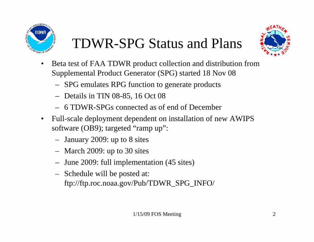
TDWR-SPG Status and Plans• Beta test of FAA TDWR product collection and distribution from
Supplemental Product Generator (SPG) started 18 Nov 08– SPG emulates RPG function to generate products– Details in TIN 08-85, 16 Oct 08– 6 TDWR-SPGs connected as of end of December
• Full-scale deployment dependent on installation of new AWIPS software (OB9); targeted “ramp up”:– January 2009: up to 8 sites – March 2009: up to 30 sites – June 2009: full implementation (45 sites)– Schedule will be posted at:
ftp://ftp.roc.noaa.gov/Pub/TDWR_SPG_INFO/
1/15/09 FOS Meeting 3
TDWR-SPG Status and Plans(Continued)
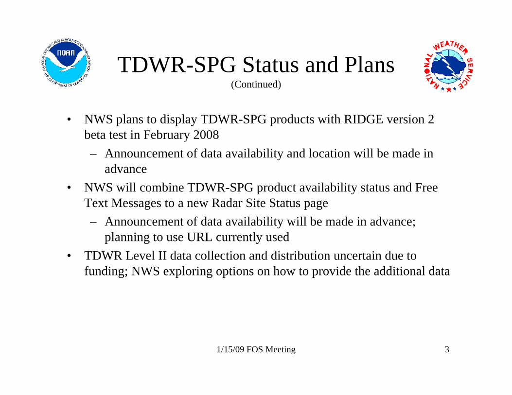
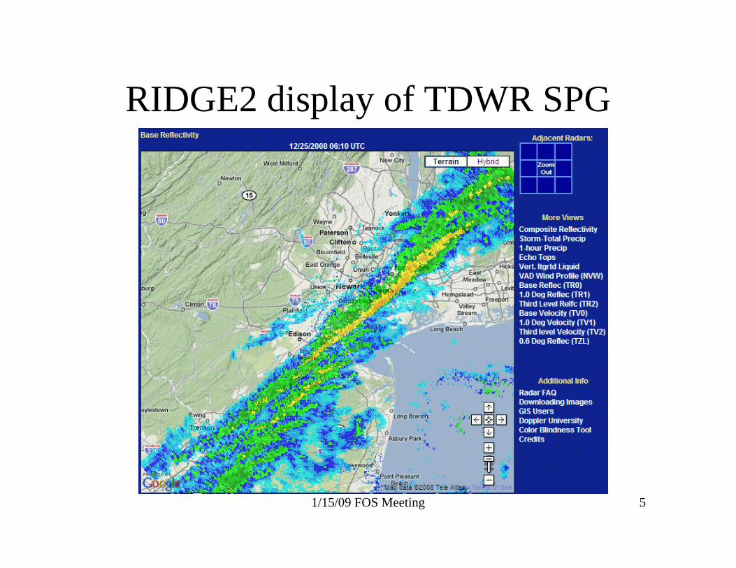
• NWS plans to display TDWR-SPG products with RIDGE version 2 beta test in February 2008– Announcement of data availability and location will be made in
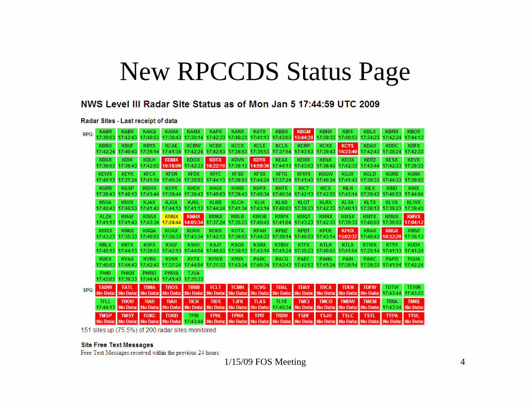
advance • NWS will combine TDWR-SPG product availability status and Free
Text Messages to a new Radar Site Status page– Announcement of data availability will be made in advance;
planning to use URL currently used• TDWR Level II data collection and distribution uncertain due to
funding; NWS exploring options on how to provide the additional data
1/15/09 FOS Meeting 4
New RPCCDS Status Page
1/15/09 FOS Meeting 5
RIDGE2 display of TDWR SPG
1/15/09 FOS Meeting 6
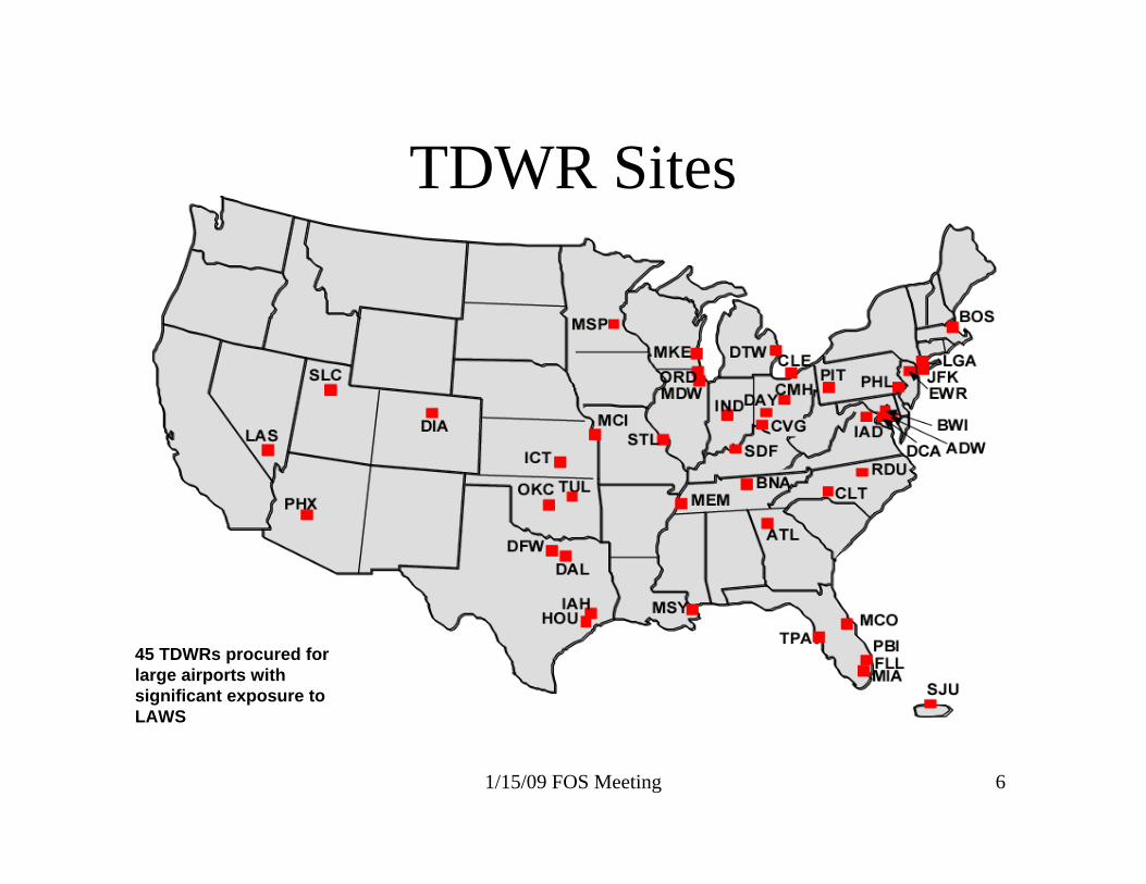
TDWR Sites
45 TDWRs procured for large airports with significant exposure to LAWS
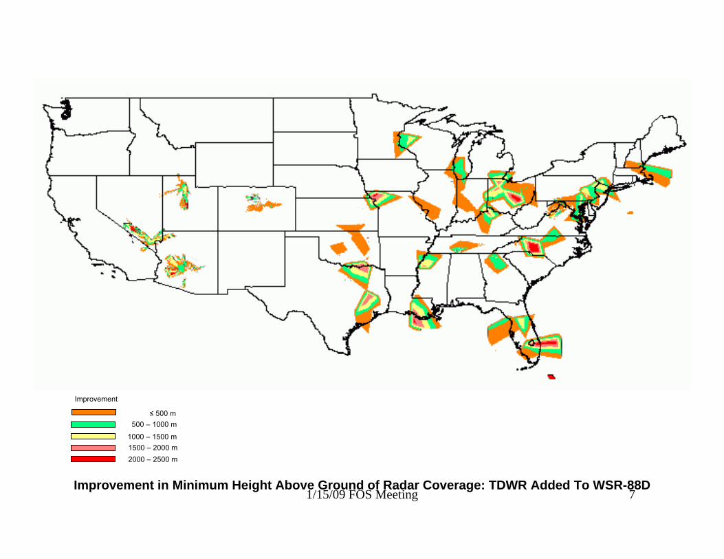
1/15/09 FOS Meeting 7Improvement in Minimum Height Above Ground of Radar Coverage: TDWR Added To WSR-88D
≤ 500 m500 – 1000 m
1000 – 1500 m
Improvement
1500 – 2000 m2000 – 2500 m
1/15/09 FOS Meeting 8
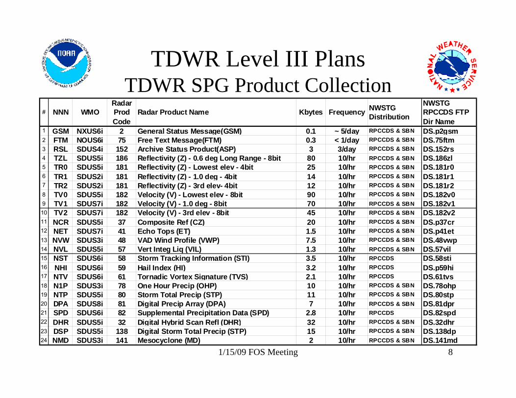
TDWR Level III PlansTDWR SPG Product Collection
# NNN WMORadar Prod Code
Radar Product Name Kbytes Frequency NWSTG Distribution
NWSTG RPCCDS FTP Dir Name
1 GSM NXUS6i 2 General Status Message(GSM) 0.1 ~ 5/day RPCCDS & SBN DS.p2gsm2 FTM NOUS6i 75 Free Text Message(FTM) 0.3 < 1/day RPCCDS & SBN DS.75ftm3 RSL SDUS4i 152 Archive Status Product(ASP) 3 3/day RPCCDS & SBN DS.152rs4 TZL SDUS5i 186 Reflectivity (Z) - 0.6 deg Long Range - 8bit 80 10/hr RPCCDS & SBN DS.186zl5 TR0 SDUS5i 181 Reflectivity (Z) - Lowest elev - 4bit 25 10/hr RPCCDS & SBN DS.181r06 TR1 SDUS2i 181 Reflectivity (Z) - 1.0 deg - 4bit 14 10/hr RPCCDS & SBN DS.181r17 TR2 SDUS2i 181 Reflectivity (Z) - 3rd elev- 4bit 12 10/hr RPCCDS & SBN DS.181r28 TV0 SDUS5i 182 Velocity (V) - Lowest elev - 8bit 90 10/hr RPCCDS & SBN DS.182v09 TV1 SDUS7i 182 Velocity (V) - 1.0 deg - 8bit 70 10/hr RPCCDS & SBN DS.182v110 TV2 SDUS7i 182 Velocity (V) - 3rd elev - 8bit 45 10/hr RPCCDS & SBN DS.182v211 NCR SDUS5i 37 Composite Ref (CZ) 20 10/hr RPCCDS & SBN DS.p37cr12 NET SDUS7i 41 Echo Tops (ET) 1.5 10/hr RPCCDS & SBN DS.p41et13 NVW SDUS3i 48 VAD Wind Profile (VWP) 7.5 10/hr RPCCDS & SBN DS.48vwp14 NVL SDUS5i 57 Vert Integ Liq (VIL) 1.3 10/hr RPCCDS & SBN DS.57vil15 NST SDUS6i 58 Storm Tracking Information (STI) 3.5 10/hr RPCCDS DS.58sti16 NHI SDUS6i 59 Hail Index (HI) 3.2 10/hr RPCCDS DS.p59hi17 NTV SDUS6i 61 Tornadic Vortex Signature (TVS) 2.1 10/hr RPCCDS DS.61tvs18 N1P SDUS3i 78 One Hour Precip (OHP) 10 10/hr RPCCDS & SBN DS.78ohp19 NTP SDUS5i 80 Storm Total Precip (STP) 11 10/hr RPCCDS & SBN DS.80stp20 DPA SDUS8i 81 Digital Precip Array (DPA) 7 10/hr RPCCDS & SBN DS.81dpr21 SPD SDUS6i 82 Supplemental Precipitation Data (SPD) 2.8 10/hr RPCCDS DS.82spd22 DHR SDUS5i 32 Digital Hybrid Scan Refl (DHR) 32 10/hr RPCCDS & SBN DS.32dhr23 DSP SDUS5i 138 Digital Storm Total Precip (STP) 15 10/hr RPCCDS & SBN DS.138dp24 NMD SDUS3i 141 Mesocyclone (MD) 2 10/hr RPCCDS & SBN DS.141md
1/15/09 FOS Meeting 9
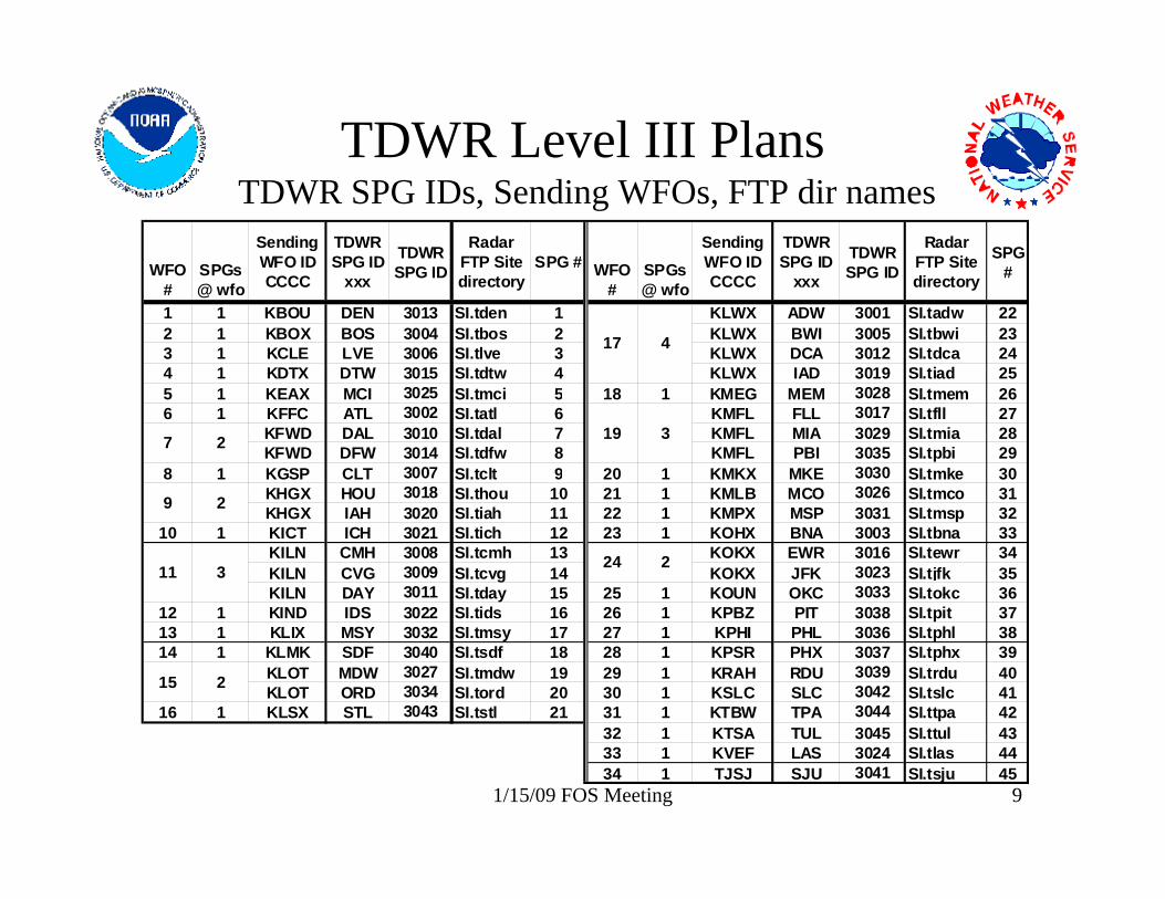
TDWR Level III PlansTDWR SPG IDs, Sending WFOs, FTP dir names
WFO #
SPGs @ wfo
Sending WFO ID CCCC
TDWR SPG ID
xxx
TDWR SPG ID
Radar FTP Site directory
SPG # WFO #
SPGs@ wfo
Sending WFO ID CCCC
TDWR SPG ID
xxx
TDWR SPG ID
Radar FTP Site directory
SPG #
1 1 KBOU DEN 3013 SI.tden 1 KLWX ADW 3001 SI.tadw 222 1 KBOX BOS 3004 SI.tbos 2 KLWX BWI 3005 SI.tbwi 233 1 KCLE LVE 3006 SI.tlve 3 KLWX DCA 3012 SI.tdca 244 1 KDTX DTW 3015 SI.tdtw 4 KLWX IAD 3019 SI.tiad 255 1 KEAX MCI 3025 SI.tmci 5 18 1 KMEG MEM 3028 SI.tmem 266 1 KFFC ATL 3002 SI.tatl 6 KMFL FLL 3017 SI.tfll 27
KFWD DAL 3010 SI.tdal 7 KMFL MIA 3029 SI.tmia 28KFWD DFW 3014 SI.tdfw 8 KMFL PBI 3035 SI.tpbi 29
8 1 KGSP CLT 3007 SI.tclt 9 20 1 KMKX MKE 3030 SI.tmke 30KHGX HOU 3018 SI.thou 10 21 1 KMLB MCO 3026 SI.tmco 31KHGX IAH 3020 SI.tiah 11 22 1 KMPX MSP 3031 SI.tmsp 32
10 1 KICT ICH 3021 SI.tich 12 23 1 KOHX BNA 3003 SI.tbna 33KILN CMH 3008 SI.tcmh 13 KOKX EWR 3016 SI.tewr 34KILN CVG 3009 SI.tcvg 14 KOKX JFK 3023 SI.tjfk 35KILN DAY 3011 SI.tday 15 25 1 KOUN OKC 3033 SI.tokc 36
12 1 KIND IDS 3022 SI.tids 16 26 1 KPBZ PIT 3038 SI.tpit 3713 1 KLIX MSY 3032 SI.tmsy 17 27 1 KPHI PHL 3036 SI.tphl 3814 1 KLMK SDF 3040 SI.tsdf 18 28 1 KPSR PHX 3037 SI.tphx 39
KLOT MDW 3027 SI.tmdw 19 29 1 KRAH RDU 3039 SI.trdu 40KLOT ORD 3034 SI.tord 20 30 1 KSLC SLC 3042 SI.tslc 41
16 1 KLSX STL 3043 SI.tstl 21 31 1 KTBW TPA 3044 SI.ttpa 4232 1 KTSA TUL 3045 SI.ttul 4333 1 KVEF LAS 3024 SI.tlas 4434 1 TJSJ SJU 3041 SI.tsju 45
24 2
17 4
19 3
11 3
15 2
7 2
9 2
1/15/09 FOS Meeting 10
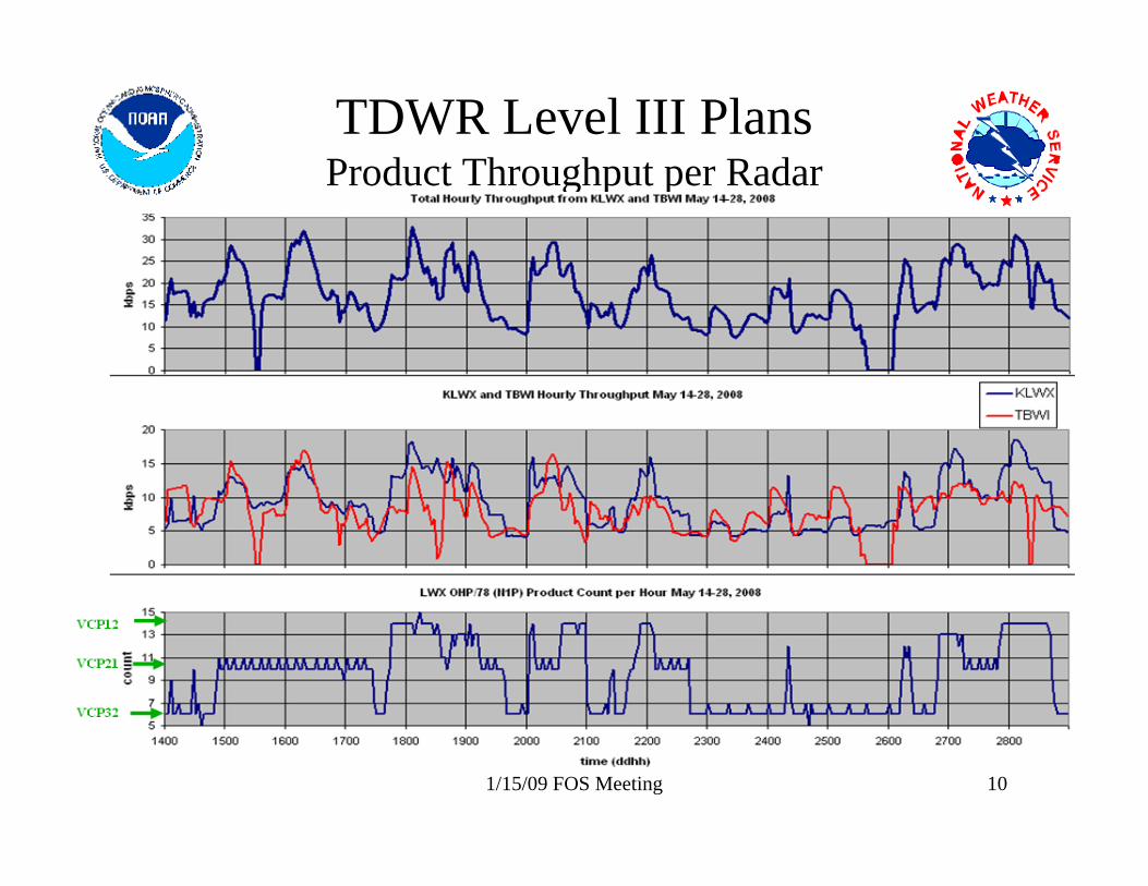
TDWR Level III PlansProduct Throughput per Radar
1/15/09 FOS Meeting 11
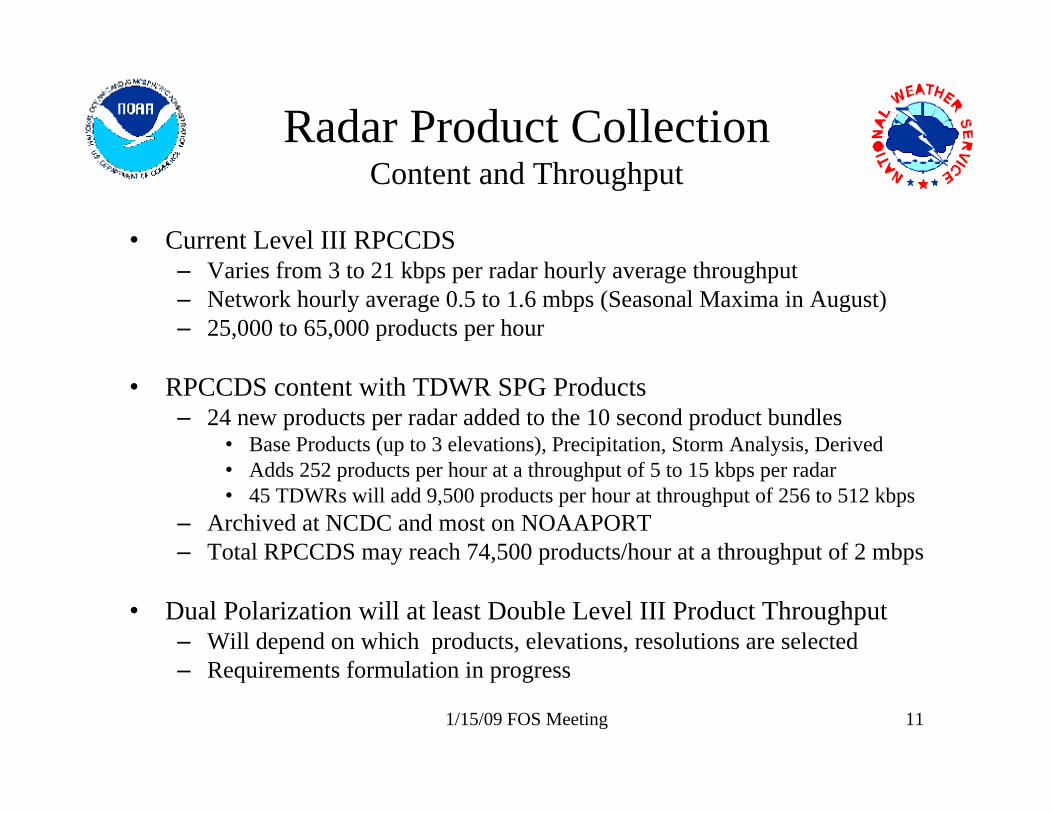
Radar Product CollectionContent and Throughput
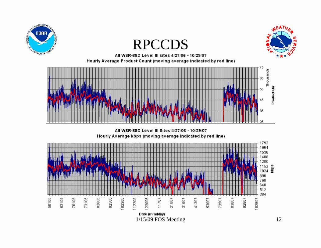
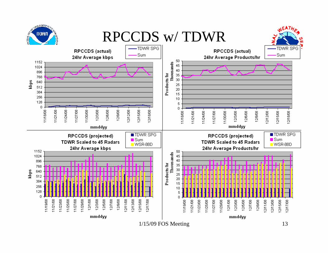
• Current Level III RPCCDS– Varies from 3 to 21 kbps per radar hourly average throughput– Network hourly average 0.5 to 1.6 mbps (Seasonal Maxima in August)– 25,000 to 65,000 products per hour
• RPCCDS content with TDWR SPG Products– 24 new products per radar added to the 10 second product bundles
• Base Products (up to 3 elevations), Precipitation, Storm Analysis, Derived • Adds 252 products per hour at a throughput of 5 to 15 kbps per radar• 45 TDWRs will add 9,500 products per hour at throughput of 256 to 512 kbps
– Archived at NCDC and most on NOAAPORT– Total RPCCDS may reach 74,500 products/hour at a throughput of 2 mbps
• Dual Polarization will at least Double Level III Product Throughput– Will depend on which products, elevations, resolutions are selected– Requirements formulation in progress
1/15/09 FOS Meeting 12
RPCCDS
1/15/09 FOS Meeting 13
RPCCDS w/ TDWR
1/15/09 FOS Meeting 14
Additional Information
• Project updates and other Level II information:– http://www.roc.noaa.gov/NWS_Level_2
• NWS Real-Time WSR-88D Transmit/Receive Status:– http://weather.noaa.gov/monitor/radar/– Soon to include TDWR data flow status and FTMs
• NWS Real-Time Level II Data Monitoring Site:– http://weather.noaa.gov/monitor/radar2/
• WSR-88D Software/Program updates for product users: – http://www.nws.noaa.gov/tg/rpccds.html
• Build specific training materials:– http://www.wdtb.noaa.gov/
1/15/09 FOS Meeting 15
Additional Information(Continued)
• NCDC Radar Resources: Order Level II and Level III (including TDWR) Archive Data Via FTP, Use NCDC Java Viewer to View Level II and Level III Archive Data, etc.– http://www.ncdc.noaa.gov/oa/radar/radarresources.html
• Run RPG Software, LINUX Platform: The Common Operations and Development Environment (CODE)– http://www.weather.gov/CODE88D
• Federal Meteorological Handbook No. 11 (FMH-11) Part A Updated for Build 11 will be available electronically in May– http://www.ofcm.gov/homepage/text/pubs.htm
• Follow-up questions to: [email protected] or [email protected]
1/15/09 FOS Meeting 16
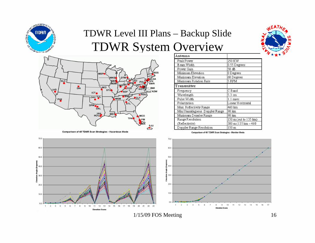
TDWR Level III Plans – Backup SlideTDWR System Overview
1/15/09 FOS Meeting 17
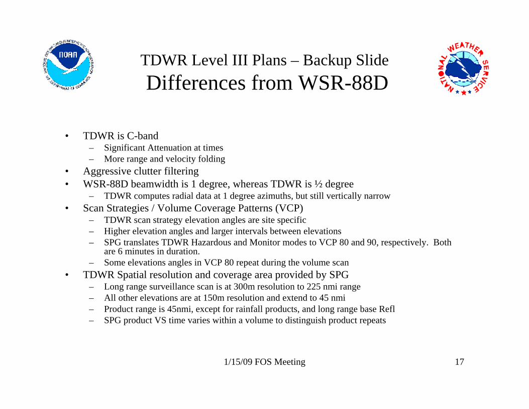
TDWR Level III Plans – Backup SlideDifferences from WSR-88D
• TDWR is C-band– Significant Attenuation at times – More range and velocity folding
• Aggressive clutter filtering• WSR-88D beamwidth is 1 degree, whereas TDWR is ½ degree
– TDWR computes radial data at 1 degree azimuths, but still vertically narrow• Scan Strategies / Volume Coverage Patterns (VCP)
– TDWR scan strategy elevation angles are site specific– Higher elevation angles and larger intervals between elevations– SPG translates TDWR Hazardous and Monitor modes to VCP 80 and 90, respectively. Both
are 6 minutes in duration.– Some elevations angles in VCP 80 repeat during the volume scan
• TDWR Spatial resolution and coverage area provided by SPG– Long range surveillance scan is at 300m resolution to 225 nmi range– All other elevations are at 150m resolution and extend to 45 nmi– Product range is 45nmi, except for rainfall products, and long range base Refl– SPG product VS time varies within a volume to distinguish product repeats
1/15/09 FOS Meeting 18
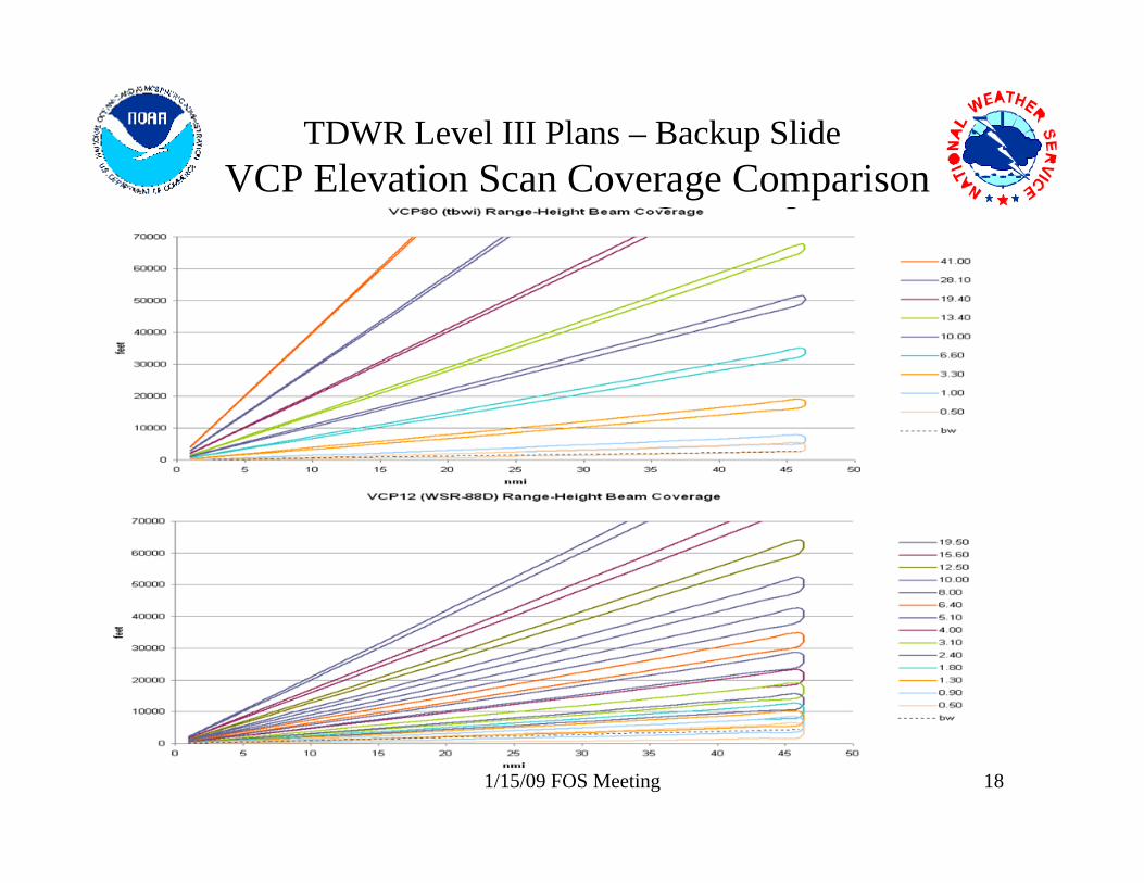
TDWR Level III Plans – Backup SlideVCP Elevation Scan Coverage Comparison
1/15/09 FOS Meeting 19
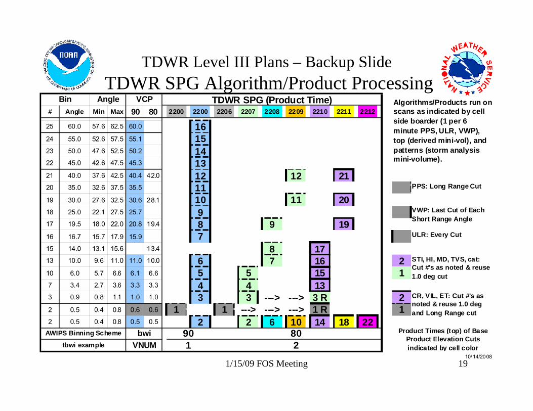
TDWR Level III Plans – Backup SlideTDWR SPG Algorithm/Product Processing
# Angle Min Max 90 80 2200 2200 2206 2207 2208 2209 2210 2211 2212
25 60.0 57.6 62.5 60.0 1624 55.0 52.6 57.5 55.1 1523 50.0 47.6 52.5 50.2 1422 45.0 42.6 47.5 45.3 1321 40.0 37.6 42.5 40.4 42.0 12 12 2120 35.0 32.6 37.5 35.5 1119 30.0 27.6 32.5 30.6 28.1 10 11 2018 25.0 22.1 27.5 25.7 917 19.5 18.0 22.0 20.8 19.4 8 9 1916 16.7 15.7 17.9 15.9 715 14.0 13.1 15.6 13.4 8 1713 10.0 9.6 11.0 11.0 10.0 6 7 16 210 6.0 5.7 6.6 6.1 6.6 5 5 15 17 3.4 2.7 3.6 3.3 3.3 4 4 133 0.9 0.8 1.1 1.0 1.0 3 3 ---> ---> 3 R 22 0.5 0.4 0.8 0.6 0.6 1 1 ---> ---> ---> 1 R 12 0.5 0.4 0.8 0.5 0.5 2 2 6 10 14 18 22
PPS: Long Range Cut
STI, HI, MD, TVS, cat: Cut #'s as noted & reuse 1.0 deg cut
CR, VIL, ET: Cut #'s as noted & reuse 1.0 deg and Long Range cut
VWP: Last Cut of Each Short Range Angle
Product Times (top) of Base Product Elevation Cuts indicated by cell color
Angle VCP
10/14/2008
TDWR SPG (Product Time) Algorithms/Products run on scans as indicated by cell side boarder (1 per 6 minute PPS, ULR, VWP), top (derived mini-vol), and patterns (storm analysis mini-volume).
Bin
ULR: Every Cut
AWIPS Binning Scheme
tbwi examplebwi
VNUM 218090