Model Urban Pipeline Initiative Panel
Discussion
Karen EdelsteinEastern Program CoordinatorFracTracker [email protected]
Mayor’s Council on Pipeline SafetyLest History Repeat Itself – Pipeline Safety
InitiativesMay 14-15, 2015Philadelphia, PA

• Shares maps, data, and analyses to communicate environmental and public health impacts of the oil and natural gas industry
• Staff in PA, NY, Ohio, California, West Virginia• Launched in June 2010, 501(c)(3) status since
2012
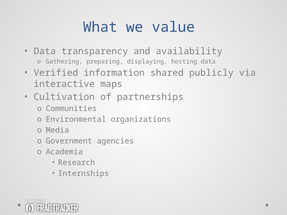
• Data transparency and availabilityo Gathering, preparing, displaying, hosting data
• Verified information shared publicly via interactive maps
• Cultivation of partnershipso Communitieso Environmental organizationso Mediao Government agencieso Academia
• Research• Internships
What we value
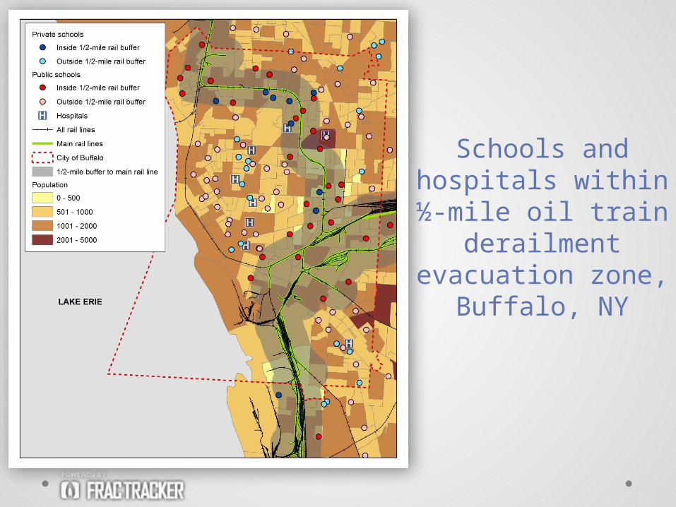
Schools and hospitals within ½-
mile oil train derailment
evacuation zone, Buffalo, NY
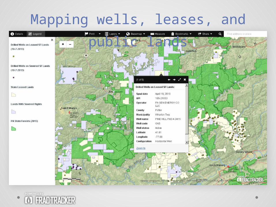
Mapping wells, leases, and public
lands
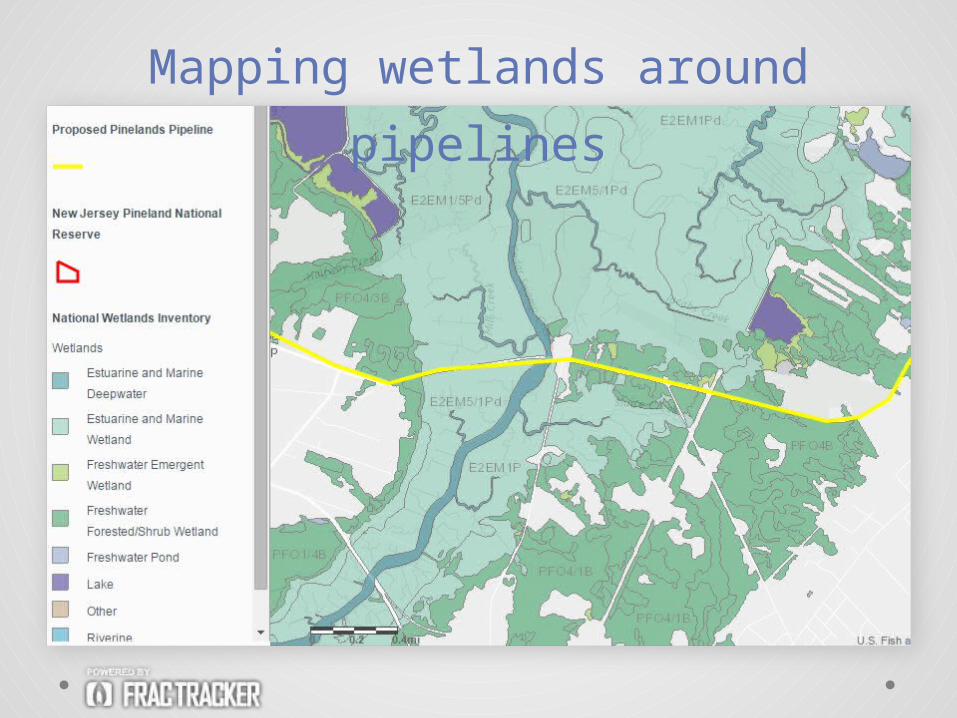
Mapping wetlands around pipelines
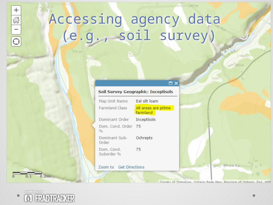
Accessing agency data (e.g., soil survey)
Pipeline mapping to increase
safetyIn the events of pipeline-related accidents, mapping can help to increase• Public safety
o Risk modelingo Identification of high-risk areas
• Personal safetyo In urban, suburban, and rural areas
• Environmental safetyo Air, earth, and water
• Efficiency of emergency responders
• More precise mapping can lead to damage prevention, and heightened safety for communities and responders
Models exist!
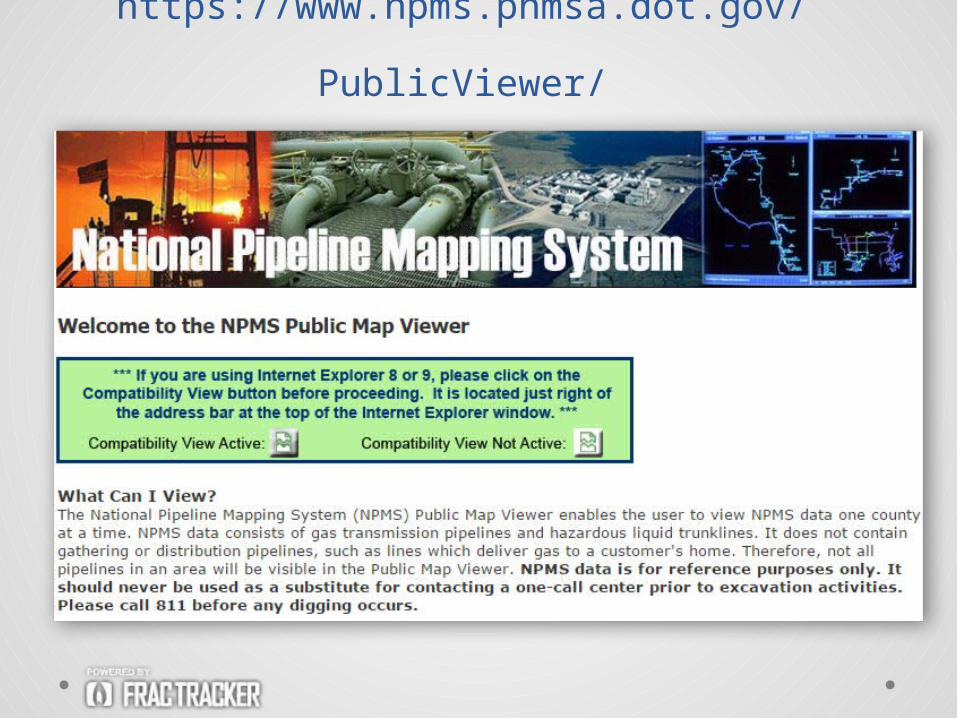
https://www.npms.phmsa.dot.gov/
PublicViewer/
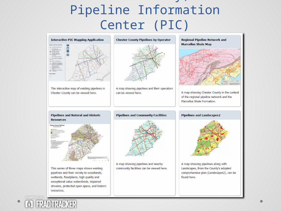
Chester County, PAPipeline Information Center
(PIC)
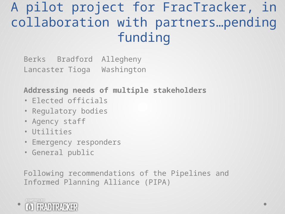
A pilot project for FracTracker, in collaboration with partners…pending
funding
Berks Bradford AlleghenyLancaster Tioga Washington
Addressing needs of multiple stakeholders• Elected officials• Regulatory bodies• Agency staff• Utilities• Emergency responders• General public
Following recommendations of the Pipelines and Informed Planning Alliance (PIPA)
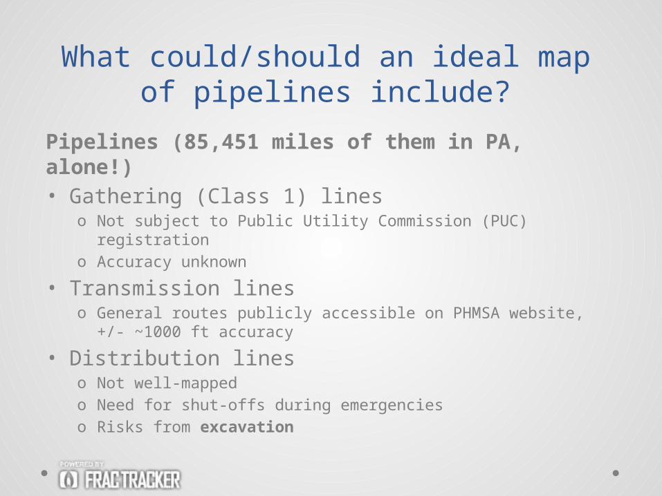
Pipelines (85,451 miles of them in PA, alone!)• Gathering (Class 1) lines
o Not subject to Public Utility Commission (PUC) registrationo Accuracy unknown
• Transmission lineso General routes publicly accessible on PHMSA website, +/-
~1000 ft accuracy
• Distribution lineso Not well-mappedo Need for shut-offs during emergencieso Risks from excavation
What could/should an ideal map of pipelines include?
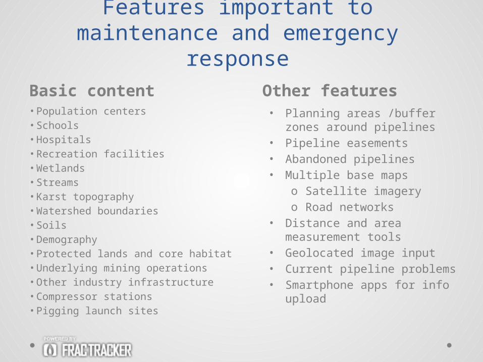
Basic content Other features• Population centers• Schools• Hospitals• Recreation facilities• Wetlands• Streams• Karst topography• Watershed boundaries• Soils• Demography• Protected lands and core habitat• Underlying mining operations• Other industry infrastructure• Compressor stations• Pigging launch sites
Features important to maintenance and emergency response
• Planning areas /buffer zones around pipelines
• Pipeline easements• Abandoned pipelines• Multiple base maps
o Satellite imageryo Road networks
• Distance and area measurement tools
• Geolocated image input• Current pipeline problems• Smartphone apps for info
upload
Location information on pipelines is closely held • By pipeline companies • By utilities
Concerns about information security issues
Technical solutions exist…Keep security high, but safety high, too• Password protection access to mapping
system• ArcGIS Server: built-in security• Defined privileges and role types
determine level of information access• $$ considerations
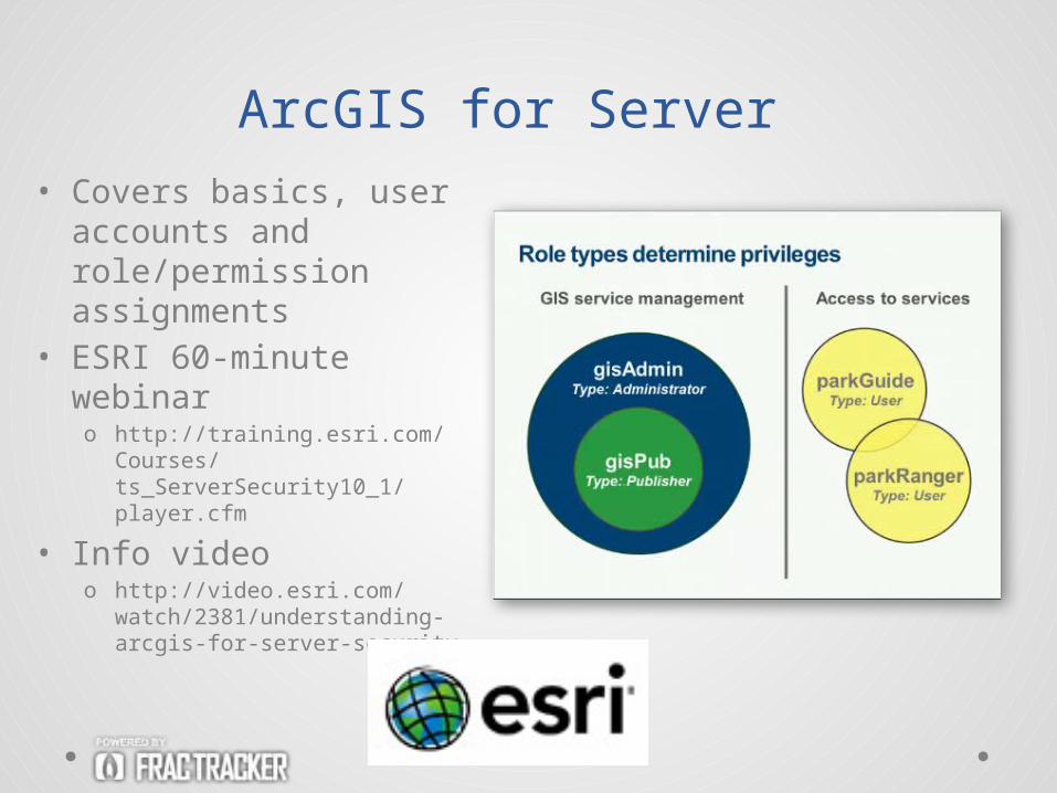
ArcGIS for Server• Covers basics, user
accounts and role/permission assignments
• ESRI 60-minute webinaro http://training.esri.com/
Courses/ts_ServerSecurity10_1/player.cfm
• Info videoo http://video.esri.com/watch/
2381/understanding-arcgis-for-server-security
Recommended


![[a.S Edelstein, R.C Cammaratra] Nanomaterials Syn](https://img.pdfslide.net/doc/110x75/577ca77c1a28abea748c6b7a/as-edelstein-rc-cammaratra-nanomaterials-syn.jpg)