Office of Coast Survey
Beyond ECDIS:Beyond ECDIS:navigation for the next 20 yearsnavigation for the next 20 years
Captain Shepard M. Smith, NOAAChief, Marine Chart Division
Office of Coast Survey

Office of Coast Survey
Agenda
• Technology Improvements• Privatization of printing charts• Shifting Markets and Products• Building a robust navigation enterprise• Making better charts• Measuring Organizational Performance

Office of Coast Survey
Source Data
RNC New Edition
NCS1 Workforce
Routine
ESRI NauticalCell-based ENC
Bentley Map 8(Raster)
ENC New Edition
Critical
RNC Update
ESRI NauticalCell-based ENC
Bentley Map 8(Raster)
ENC Update
Distribution System
Every 1-10 years(100 people)
Weekly (10 people)
Federal
Contract
Review
Compile
Review
Compile
Review
Compile
Review
Compile

Office of Coast Survey
System of the future-NCS2
Product finishing Consistency among
products
Vector Data
Raster Data
NoticeTo
Mariners
Source Data
NIS
Product Databases
Source applied one time as it comes in
Updates sent to products
Published Products
Weekly Updates
RNCRNC
Paper
ENC
POD

Office of Coast Survey
Experience to Date-NCS2 Implementation• System Accepted 2009• Cell-based ENC implementation 2012• Full implementation delayed
– Paper charting functionality not mature– Workflow in database is cumbersome– Difficult to manage conflicts in the database
• Implementation restarted June 2013– Pacific Islands done, California loading– Risk register guides implementation

Office of Coast SurveySlide 6
• Focus on Vector source to Vector Database source application
• Four main source types-hydrography, shoreline, navaids, channels
• Application of source to all products (ENCs, RNCs and Notices) will be done by one Compiler / Reviewer Team.
• Source zones will be created where short and long transaction source application will be done by only one compiler / reviewer team.
• Eliminates the need for two RNC production lines.
NCS2 Source Application Efficiency and Conflict Management
(Legeer lead)

Office of Coast Survey
Formatting and Distribution System(Griffin Lead)• Consolidating all formatting
and distribution functions in
one group and one system.• Goal is to have all raster and
ENC charts consistent in all formats at all times. • Eliminating our 254 dpi production line, and moving
all raster products to 400 dpi-April 1. • Thursday updates for all products. • Support for additional products to support mobile
apps, GIS support, etc.

Office of Coast Survey
Web Services for Coordination and Distribution-Enterprise GIS• Newly developed web
service allows us to host ENCs as a layer
• Adding a geographic component to all planning and coordination functions
• Ease of access to a wide variety of authoritative datasets

Office of Coast Survey
Print and Distribution System for Paper Charts• NOAA announced in October that we will
privatize all chart printing and distribution effective April 13, 2014
• We have two existing Print on Demand Partners, who have the capacity to absorb the commercial demand.
• Government and Military printing will be handled by the Defense Logistics Agency (DLA).
• Additional POD partners will be in business before April.

Office of Coast Survey
Freely Available PDF Charts
• Three Variants– Public version
• Edit locked, margin note, scale bars
– POD version• Unlocked, no note
– DLA version• Unlocked, margin
note, scale bars
Now Live!

Office of Coast Survey
400 DPI RNCs
April 2014

Office of Coast Survey
ENC Online• Web map on
OCS website• Also web
mapping services
• Updated weekly
• Ready reference tool for ENCs
12
Now Live!

Office of Coast Survey
ProposedNauticalCharts.gov• Common distribution point for NOAA, NGA, and
USACE navigational charts• Shared web mapping services• Clearly demonstrates interagency coordination• Supports ECS software, mobile apps,
redistributors, and customers directly• Currently seeking approval from DOC CIO, with
letters of support from NGA and USACE
Office of Coast Survey
Bathy overlays for precise navigation• Follow-on project from Norfolk project 2010• The form and limitations of traditional chart products
do not support precise maneuvering in ports.• Working with the USACE and our own hydrographic
team, we are developing a high resolution bathymetric overlay for dynamic areas
• Compatible with ECS, Pilot carry-aboard units, but not necessarily ECDIS
• Pilot project in lower Mississippi. Expected pilots in LA/LB, Norfolk.

Office of Coast Survey
Boundary, Traffic, and other overlays
• There is unmet demand for information to be “put on the chart”
• We are working on a model whereby additional layers can be “added” to a printed chart
• Also published as an ENC overlay

Office of Coast Survey
Future of Navigation-Changiang (Yangze) River Authority in China
• 2600 km river system with heavy traffic and large water level fluctuations
• The CRA has implemented an award-winning charting and navigation system.– All vessels are intermittently
network connected– Navaids position changes can be
updated to all ships within 1 day by innovative web services
– Water levels are integrated with the chart system so that charted depths and contours are changed with changing water levels.
16

Office of Coast Survey
Coast Survey Value Chain
SOLASSOLAS
`
SoftwareDevelopers
HardwareDevelopers
Maritime Educators
Websites
Maritime Infrastructure
Redistributors
Printers & Publishers
GovernmentMilitary
RecreationalCommercial
Non-Navigational
GovernmentMilitary
Pilots
Raven
Transas
ESRI
ECDIS
Navionics
RENCs
GeoGarage
MapTech
CMap
Web Architecture
ChartsFADS
RNCENC
PODPDF Web
Services
Coast Pilot

Office of Coast Survey
Expanding User Base-New Modes of Use
Small Recreational(Mobile Apps)
Small Recreational(Mobile Apps)
Large Recreational
(Chart Plotters)
Non SOLASCommercial
(ECS)
SOLAS(ECDIS)SOLAS(ECDIS)
Tens of Thousands
Hundreds of Thousands
A Million
Tens of Millions
Office of Coast Survey
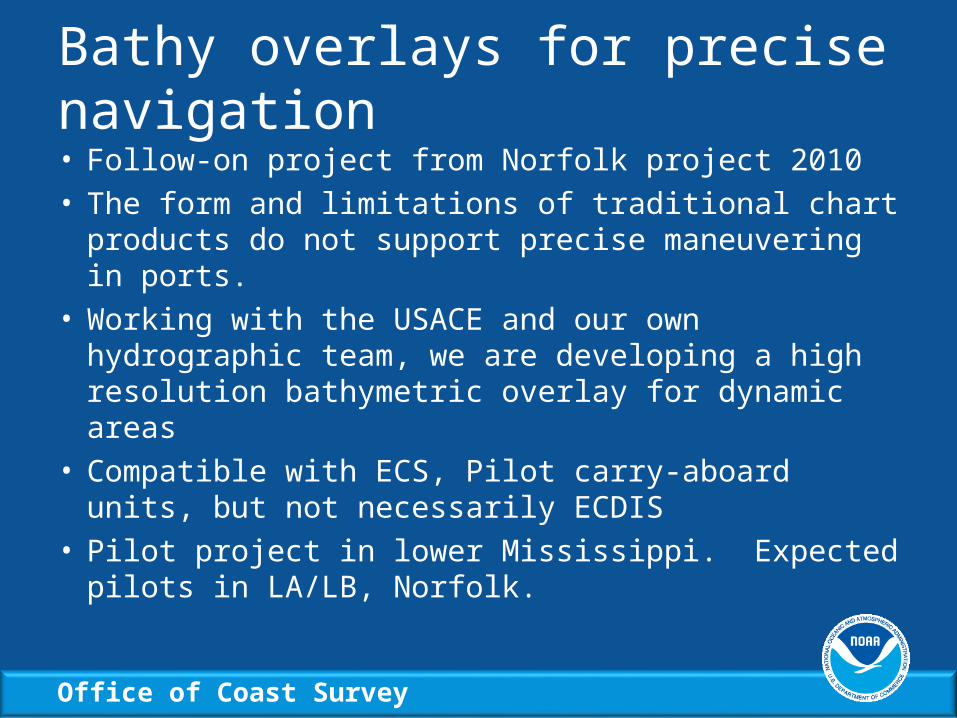
Embrace Unregulated Navigation Technology
• Tremendous source of innovation
• Medium for chart delivery to millions of customers
• Connectivity creates new opportunities

Office of Coast Survey
Mobile Strategy
• Mobile navigation system technology is merging with chart plotter systems, and both are using our products.
• Intermittently connected systems present new opportunities
• We have begun to modernize OCS’ distro systems to better support this technology
• Tiled charts, machine-accessible IDMS, modeled T&C, notice to mariners

Office of Coast Survey
Making Charts Better
Office of Coast Survey
Crowdsourcing
• Charts have used crowdsourcing since Columbus (2000+ shoal reported on charts)
• We have signed an agreement with ActiveCaptain to have access to their hazard database through our Enterprise GIS
• Glang and Ward (IHB) have plans to create a public trackline bathy repository at NGDC under GEBCO, compatible with data loggers, chart plotters, VDRs, and ECSs.
• Challenge-Do this ourselves!
22

Office of Coast Survey
Satellite Derived Bathymetrypart of “All of the Above” strategy
23

Office of Coast Survey
Future of NOAA ENCs
• ENC 1.0-All charts collected from raster charts and synchronized with street version (Sept 2016)
• ENC 1.5-All ENCs in a database with uniform attribution
• ENC 2.0-ENCs rebuilt to support full ECDIS functionality (and other use cases)
24

Office of Coast Survey
Marine Chart Division Dashboard
25

Office of Coast Survey
Primary (for now) performance measure
26

Office of Coast Survey
Hydro Application Backlog
27

Office of Coast Survey
Hydro Publication Backlog
28
Office of Coast Survey
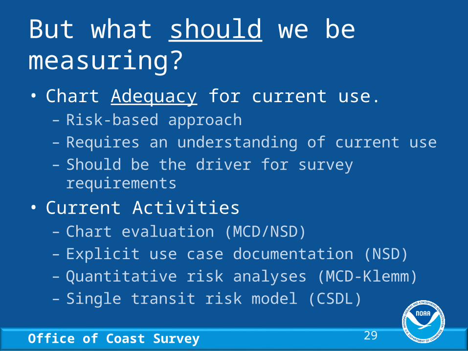
But what should we be measuring?
• Chart Adequacy for current use.– Risk-based approach– Requires an understanding of current use– Should be the driver for survey requirements
• Current Activities– Chart evaluation (MCD/NSD)– Explicit use case documentation (NSD)– Quantitative risk analyses (MCD-Klemm)– Single transit risk model (CSDL)
29

Office of Coast Survey
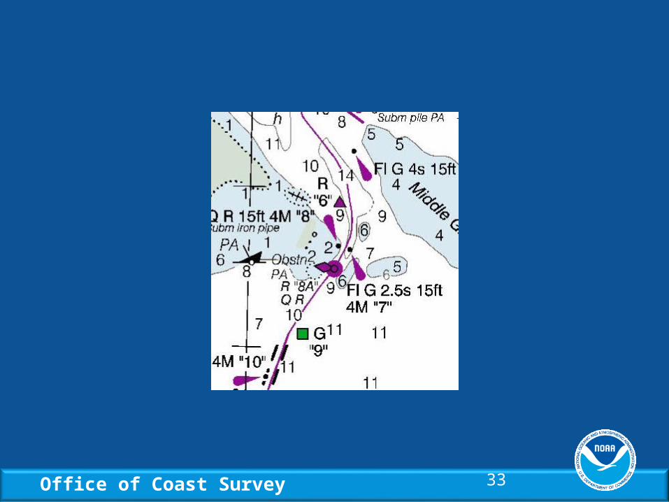
Chart Evaluation
• In preparation for new edition, compare the internally maintained chart to AIS tracks, orthophotos, crowdsourced discrepancies and bathy, satellite derived bathy, etc.
• Identify discrepancies and prioritize in the context of current use.
• Attempt to resolve with authoritative data, otherwise use best available and caveat as necessary.

Office of Coast Survey
Baltimore Harbor Risk AssessmentIALA IWRAP-MK2 Risk Model Evaluation

Office of Coast Survey
Intracoastal Waterway Chart
Office of Coast Survey 33
Recommended