Simple Data Types• Point (2d or 3d)
– Coordinates with attributes
• Polyline (2d or 3d)– Points collected by line segments– 2 lines max per point
• Polygon (2d)– Closed polylines
• Rasters (2d, 3d elevations)– Points in a grid (one attribute or lookup)
• Triangulated Irregular Networks (2d or 3d)– 3 lines max per point

Triangulated Irregular Networks
• TINs
• A “mesh” of triangles
VerticesNodes
Edges, Line Segments, LinksArcs
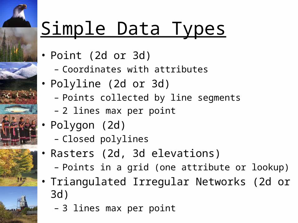
TINs – Complex but Flexible
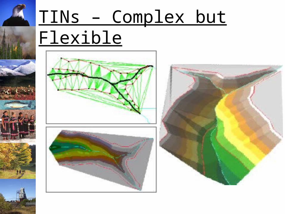
Water Resource Management
Improving Environmental Site Management Through the Use of Internet ResourcesAuthors: Gary Whitton, Clayton Cranor, Michael Lilly, David Nyman
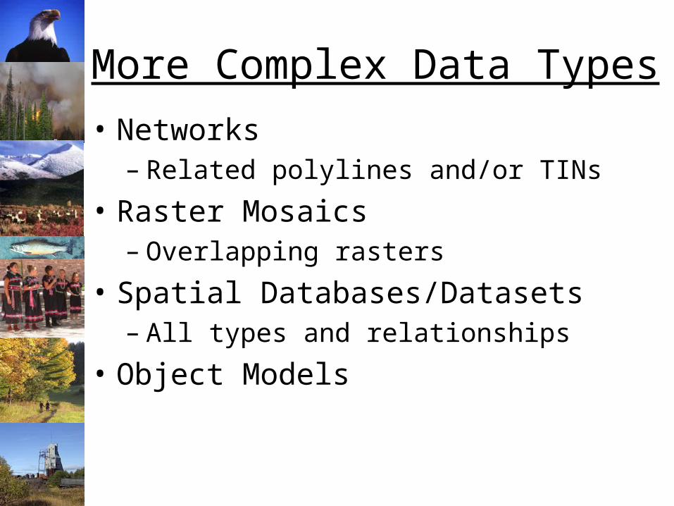
More Complex Data Types
• Networks– Related polylines and/or TINs
• Raster Mosaics– Overlapping rasters
• Spatial Databases/Datasets– All types and relationships
• Object Models
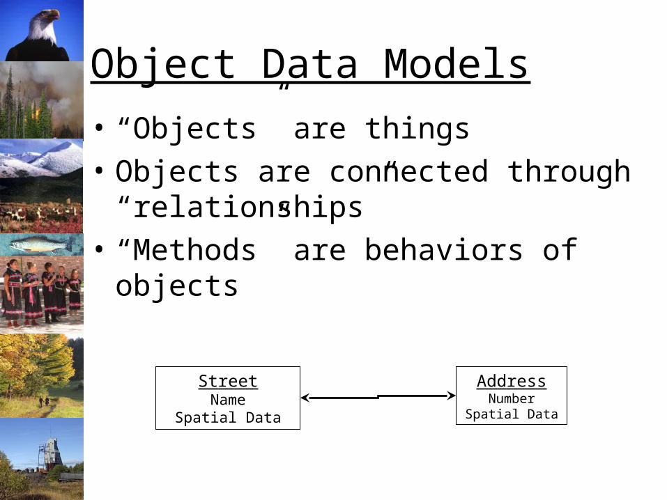
Object Data Models
• “Objects” are things
• Objects are connected through “relationships”
• “Methods” are behaviors of objects
AddressNumber
Spatial Data
StreetName
Spatial Data
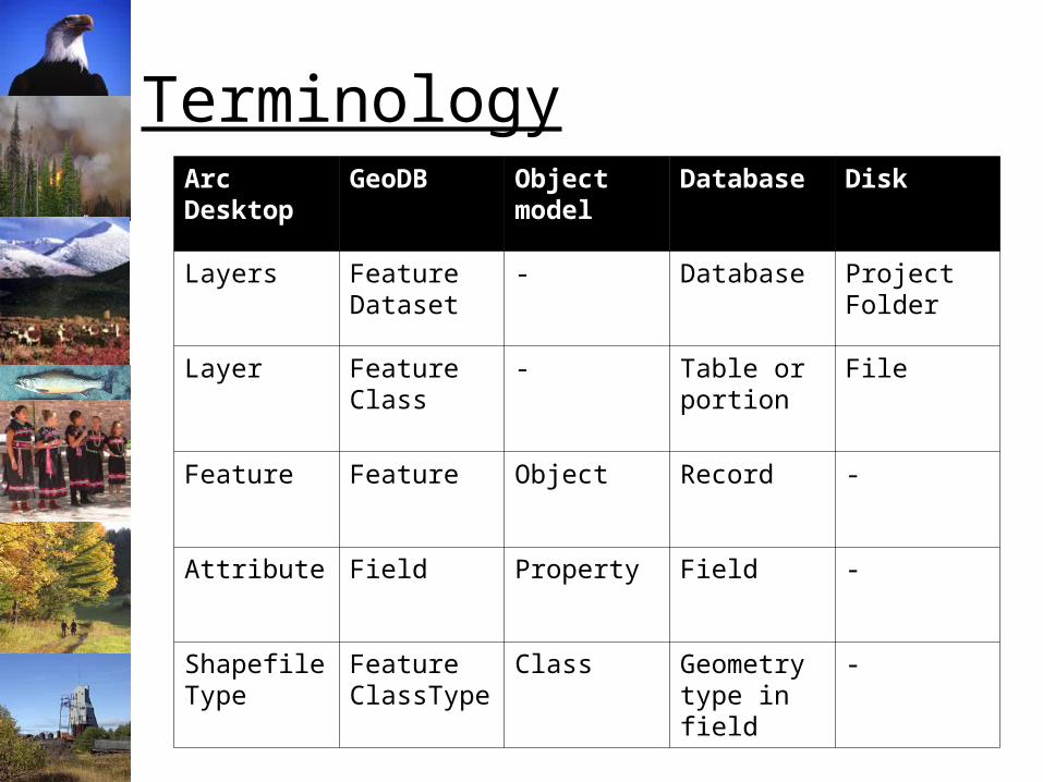
TerminologyArcDesktop
GeoDB Object model
Database Disk
Layers Feature Dataset
- Database Project Folder
Layer Feature Class
- Table or portion
File
Feature Feature Object Record -
Attribute Field Property Field -
Shapefile Type
Feature ClassType
Class Geometry type in field
-
Additional Slides
Networks
• Streams and rivers– Water supply– Flood prediction– National Hydrology Network
• Transportation (mature):– Freeways, highways, and roads– Ships– Planes
• Disease vectors (developing)
• Natural Resource Management (new)
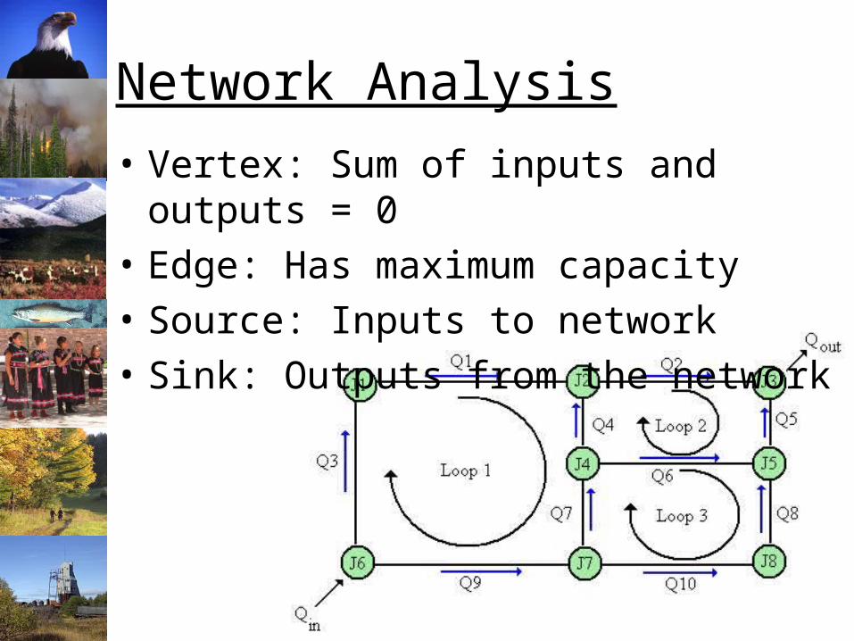
Network Analysis
• Vertex: Sum of inputs and outputs = 0
• Edge: Has maximum capacity
• Source: Inputs to network
• Sink: Outputs from the network
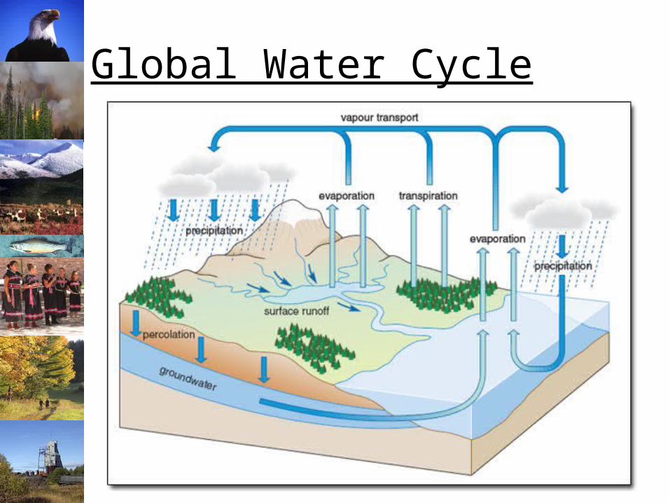
Global Water Cycle
Complex Features
• Polyline– Rivers & Streams: Connected networks of
“reaches”– Attributes include: quantity of flow
• Polygons– Groups of islands: Hawaii– “Holes”:
• Lakes on surfaces• Islands on lakes
Recommended