Embed Size (px)
Citation preview

Kiflemariam AbrahaSoil ResearcherNARI‐ERITREA
1
1. INTRODUCTION1. INTRODUCTION The State of Eritrea is located between latitudes 120 42' N to 180 2' N and longitudes 360 30' E to 430 20' E, in the north‐18 2 N and longitudes 36 30 E to 43 20 E, in the northeastern part of Africa.
Eritrea is bordered by the Red Sea to the east with about 1,200 km of coastline, by Sudan on the north‐west, by Ethiopia to the south and west, and by Djibouti on its south‐eastern extreme extreme .
The country has an area of about 124,000 km2 . It is situated in the Sahelian zone with high variation in It is situated in the Sahelian zone with high variation in topography and temperature and particularly the rainfall pattern is erratic with high variation from year to year.
2

Eritrea has three distinct physiographic zones:p y g p
The Red Sea Coastal Plain‐sandy and desert like, characterized by low hills, ridges, and rock out crops d i tl f T ti d t di t d dominantly of Tertiary and quaternary sediments and volcanic.
Central Highland‐ consists of heavily eroded plateau g y prunning north to south down the centre of the country with Precambrian basement complex schists and intrusive granite Towards the south the basement complex is granite. Towards the south, the basement complex is overlain Mesozoic sediments sandstone, and Tertiary basalts.
Western Lowland‐ the western edge of the plateau is inclined down to the western plains at about 600 m above sea level To the east the plateau is an abrupt steep sea level. To the east the plateau is an abrupt steep escarpment.
3
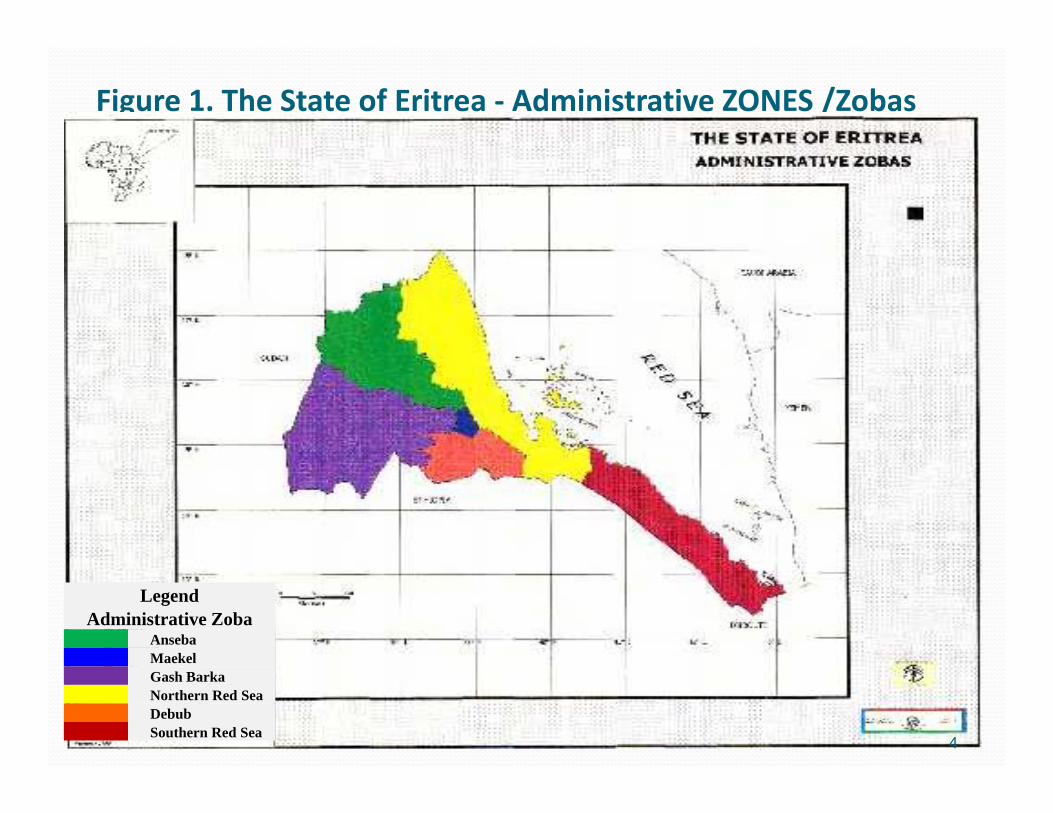
Figure 1. The State of Eritrea ‐ Administrative ZONES /Zobas
LegendAdministrative Zoba
AnsebaMaekel
Anseba
Maekel
Gash Barka
Northern Red Sea
Debub
Southern Red Sea
4
ae eGash BarkaNorthern Red SeaDebubSouthern Red Sea

Land use systems in Eritrea (1994 FAO)Hectares Percent
Cultivated Rainfed Land 562, 680 4,62
Land use systems in Eritrea (1994 FAO)
Cultivated Rainfed Land 562, 680 4,62
Irrigated Land 22,000 0.18
Disturbed Forest 53,000 0.43Disturbed Forest 53,000 0.43
Forest Plantations 10,000 0.08
Woodland and Shrub Land 673,000 5.52Woodland and Shrub Land 673,000 5.52
Browsing and Grazing Land 6,821,320 55.96
Barren Land 4,047,000 33.21Barren Land 4,047,000 33.21
Potential Irrigable Land (600,000) (4.92)
Potential Rainfed Land (904,320) (7.42)
5
Potential Rainfed Land (904,320) (7.42)
Total 12,189,000 100.00

Crop production varied considerably over the years mainly due to large y y gvariation in rainfall. For example in 1998 a bumper harvest has been recorded
ith t t l d ti f l dwith total production of cereal and grains estimated at 468,000 tons compared to 149 000 tons to thecompared to 149,000 tons to the previous season.
6

Climate The climate of Eritrea ranges from hot arid in the coastal The climate of Eritrea ranges from hot arid in the coastal plain areas to temperate sub‐humid in isolated micro‐catchments in the eastern highland escarpment.
Total annual rainfall tends to increase from north to south, from less than 200 mm at the northern border with Sudan,
8 i t i t d th th b d over 800 mm in a restricted area on the southern border with Ethiopia.
Mean temperatures range from 16° C in the highlands to Mean temperatures range from 16 C in the highlands to extreme highs of about 30° C along the Red Sea coast.
7

3. SOILS AND TOPOGRAPHY Eritrea consists of a central highland which divides the Eritrea consists of a central highland which divides the country between its eastern and western lowlands.
Altitudes vary from over 3,000 m above sea level in the highlands, to 130m below sea level in the south eastern gDanakil depressions.
The highlands have a very rugged topography.
The lowlands are generally flat plains, often interspersed ith hill with hills.
8

Soils are complex, varying from region to region in terms of texture, fertility, and other natural , y,characteristics .
The majority are residual soils, those developed j y pdirectly from weathered bedrock.
Soils that developed on the extensive basalt formations are the most fertile, those developed on the basement complex are of low to moderate fertility,
d th k f l f tilit and those on rocks are of low fertility Texturally most soils are stony, loams, sandy loams, or loamy sandsor loamy sands.
9
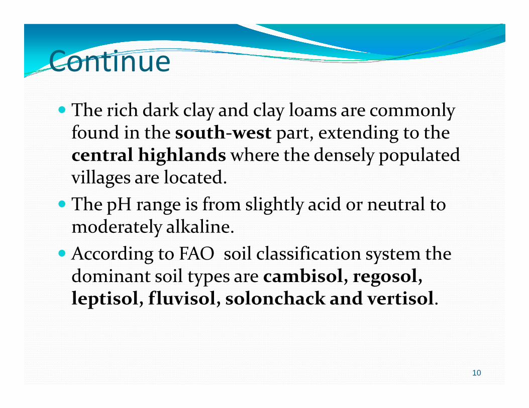
Continue The rich dark clay and clay loams are commonly f d i h h di h found in the south‐west part, extending to the central highlands where the densely populated villages are located villages are located.
The pH range is from slightly acid or neutral to moderately alkaline moderately alkaline.
According to FAO soil classification system the dominant soil types are cambisol, regosol, dominant soil types are cambisol, regosol, leptisol, fluvisol, solonchack and vertisol.
10

Figure 2. The State of Eritrea ‐ Soil Classification
11

Cont’ed Given the great relief of much of the landscape and Given the great relief of much of the landscape and generally arid or semi‐arid conditions, many soils are shallow with bedrock near the surface.
The shallowness of the soils reduces their ability to hold ymoisture for crops or natural vegetation production.
Soils in the western plains include vertisols and fluvisols which, with adequate rains or under irrigation, are highly suitable for agricultural development suitable for agricultural development.
12

JUSTIFICATION Soil resources inventory and the assessment of land Soil resources inventory and the assessment of land suitability classification is one of the main strategies of land use policy. p y
The Soil Survey and Land Classification concentrates work yin soil survey and land evaluation of the physical and chemical environment.
13

Cont’ed Substantially increases in soil productivity Substantially increases in soil productivitycan be obtained by improving the chemical, physical and biological fertility of soils, combined with and biological fertility of soils, combined with increased soil water and organic matter contents. Can be achieved by a holistic and integrated approach y g ppto soil management. Our view that the goal of soil fertility management
h ld b h d i f i i l should be the adaption of conservation agriculture which is characterized by the following good land management practices ; permanent soil cover, zero management practices ; permanent soil cover, zero or minimum tillage, crop rotation ‐ N‐fixing legumes , cover crops, fertilizers and sometimes f llfallows.
14

Cont’ed Constraints to good land management Constraints to good land managementcan also be overcome by a more holistic approach to solutions to all the constraint by adoption of to solutions to all the constraint by adoption of the good land management practices in the same locality by providing new fodder, fuel and y y p g ,timber sources, new livestock management systems, the fencing of the cropped areas, and no – till seed drills, the conditions for crop residues in the field are greatly enhanced.
15

ConstraintsLand Constraints to adaptionLand Management Practice
Constraints to adaption
1.Fertilizers Cost, lack of credit, lack of knowledge on types and quantities to apply, risks of drought annulling the b fi f f ilibenefits of fertilizer.
2.Water Conservation
Too demanding on labour for construction and maintenanceConservation
measuresmaintenance
3. Crop In specific area well practiced but in most of the areas Rotations are not practiced well, reduced straw for livestock, 4. Fallows Reduces cropping area, land area too small and
production to justify fallows, lack of fence, liable to grazing by livestock reducing the benefit of fallows
16
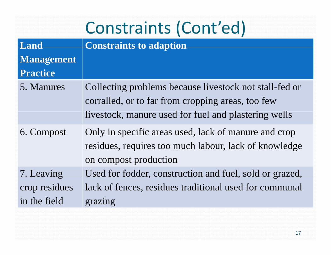
Constraints (Cont’ed)Land Constraints to adaptionLand Management Practice
Constraints to adaption
5. Manures Collecting problems because livestock not stall-fed or corralled, or to far from cropping areas, too few li k d f f l d l i lllivestock, manure used for fuel and plastering wells
6. Compost Only in specific areas used, lack of manure and crop id i t h l b l k f k l dresidues, requires too much labour, lack of knowledge
on compost production7. Leaving Used for fodder, construction and fuel, sold or grazed,7. Leaving crop residues in the field
Used for fodder, construction and fuel, sold or grazed, lack of fences, residues traditional used for communal grazing
17

Constraints (Cont’ed)Land Constraints to adaptionLand Management Practice
Constraints to adaption
8. Conservation tillage
Started in small scale, lack of knowledge of conservation agriculture tillage, lack of no-till seeders
d l l k f i bl h bi idand planters, lack of suitable herbicides9. Live Barriers Lack of suitable species, takes land out of production,
cause competition with the crop extra labourcause competition with the crop, extra labourrequired to maintain the barriers, not highly effective at reducing runoff
10. Develop Soil Classification
d il
Lack of training staffs, there is no awareness of soil classification and land suitability,
and soil map
18

Current status of soil fertility in Eritrea
The continuous removal of the highly fertile top soils from cultivated areas by water and wind erosion is the main
i t f t th t di tl t ib t d t th prominent factor that directly contributed to the degradation and the decline in soil fertility in different agro‐ecological zones of Eritrea, consequentially decrease in productivity.
Soil erosion, particularly in the highlands, is very serious and losses are estimated at about 15 tons/ha/year (Firebrace and losses are estimated at about 15 tons/ha/year (Firebrace and Holland, 1985)
In addition to ongoing soil erosion of the fertile top soil, an g g pinsidious decline in soil ferilty as a result of the kind of agricultural practices is being undertaken.
19

Currently there is a lack of reliable scientific data that could support the degree of soil fertility decline in Eritrea. However, th l t ib ti f i lt l t t GDP lthe low contribution of agricultural sector to GDP, low crop yield, soil laboratory analysis results can be considered as a good indicator to evaluate the fertility status of the soils.
Since its establishment in 1987, the soil laboratory was involved in collecting soil samples and carrying soil analysisinvolved in collecting soil samples and carrying soil analysis to determine the nutrient status of Eritrean soils.
In almost all soil samples it became clear that soils areIn almost all soil samples it became clear that soils are depleted in nitrogen and organic matter low to medium in phosphorous while potassium was found from low to high.
20

C t t t f il f il l ifi tiCurrent status of soil survey for soil classification
There is almost no information available on the morphological study of the Eritrean soils although there are some scattered studies of surface the Eritrean soils although there are some scattered studies of surface soils carried out at different times. Thus, without such information, it is difficult to classify the soils of Eritrea.
Soil survey is basically an inventory of the soil resources and consists of So su vey s bas ca y a ve to y o t e so esou ces a d co s sts oa soil map, descriptions of the soils and soil map units and prediction (interpretations) of soil behaviour for different uses and managements. This is the fundamental for productive natural resource management.
To date exploratory and reconnaissance soil surveys were carried out in selected areas to quantify and characterize areas considered to have potential for irrigation development, to assist in the development of appropriate parameters for the land resource survey and land evaluation for sustainable irrigation development.
In 1998 sector study on national soil and water resources and irrigation potential was carried out in different locations but not finalized.
21

The soil research unit within the national agricultural research institute have done soil survey works in some potential areas and at a small scale in researchsome potential areas and at a small scale in research site and small farm areas for irrigation development.
To date soil survey work has conducted. However, the soil survey works so far conducted was not being supported by satellite images or Arial Photos and GIS pp y gthat essentially work the survey in complete to classify our soils according to their common properties and use a proper land use systema proper land use system.
22
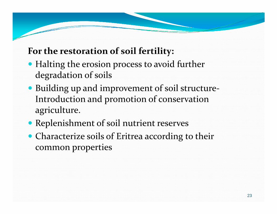
For the restoration of soil fertility: Halting the erosion process to avoid further Halting the erosion process to avoid further degradation of soils
Building up and improvement of soil structure‐Introduction and promotion of conservation agriculture.R l i h f il i Replenishment of soil nutrient reserves
Characterize soils of Eritrea according to their common properties common properties
23

Main ChallengesMain Challenges
As little information is available about the morphological characteristic of the Eritrean soils there is a need for urgent characteristic of the Eritrean soils there is a need for urgent soil survey and soil classification works at national level. Unless the soils of Eritrea are thoroughly studied and l ifi d di t th i ti it ill b classified according to their common properties it will be hard to talk about development programs. For this to be effective assistance from the international community will be needed in upgrading the skills of soil researchers.
In order to assess the fertility status of the Eritrean soils periodic soil analysis need to be carried out For this periodic soil analysis need to be carried out. For this purpose there is a need in strengthening the national soil laboratory and when possible establish satellite soil l b l l llaboratory services at zonal level.
24

Thank you
25


![Eritrea Trabajo Final[1]](https://img.pdfslide.net/doc/110x75/5571fd774979599169992a62/eritrea-trabajo-final1.jpg)