Embed Size (px)
Citation preview

TopicPrimary sedimentary structures
Prepared by
Azhar Mahmood
Primary sedimentary structures
Structures acquired during deposition of sedimentary rock unit are called as primary sedimentary structures.
Uses of primary sedimentary structures.
These are useful for maping purpose. These are useful to mark
paleocurrent direction. These are also use for marking of top
and bottom of strata. Environment of deposition can also
have been marked by primary sedimentary structures.
Relative age is also marked by them.
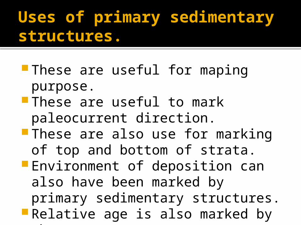
Primary Sedimentary Structures
Stratification - horizontal bedding is most common structure in sedimentary rocks
Primary Sedimentary Structures
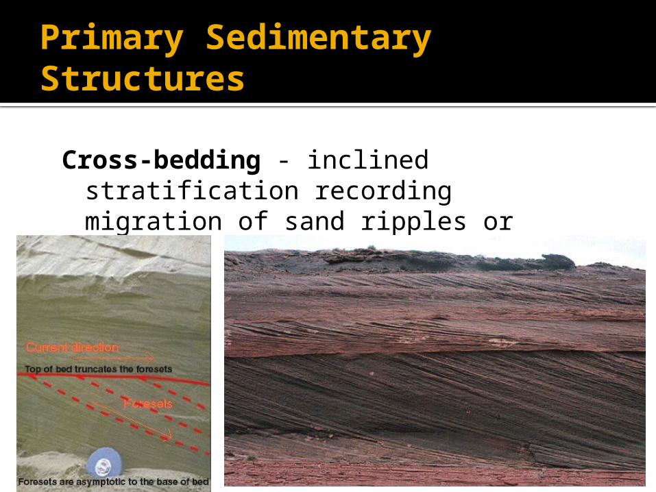
Cross-bedding - inclined stratification recording migration of sand ripples or dunes
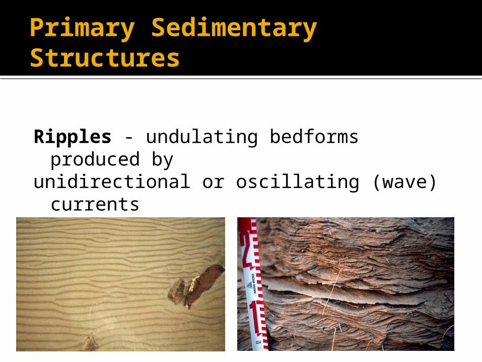
Primary Sedimentary Structures
Ripples - undulating bedforms produced byunidirectional or oscillating (wave) currents
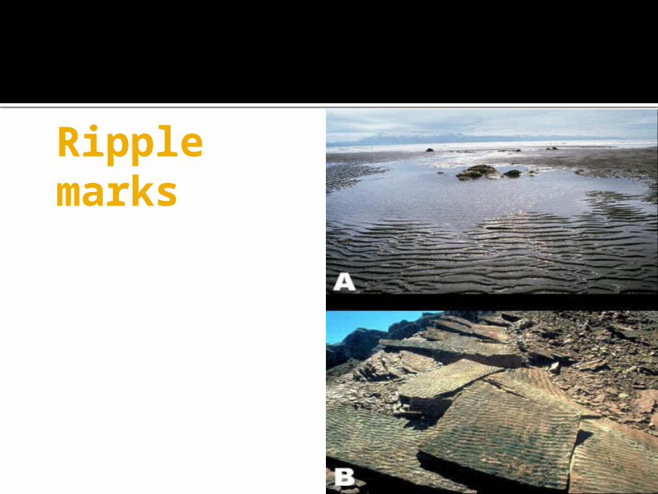
Ripple marks
Uses
Asymmetrical ripple marks describe the past flow direction
Symmetrical marks top and bottum

Primary Sedimentary Structures
Graded bedding - progressive decrease in grain size upward in bed• indicator of upwards direction in deposit• common feature of turbidites
uses
It,s useful for maping purpose. These are also use for marking of top
and bottom of strata.
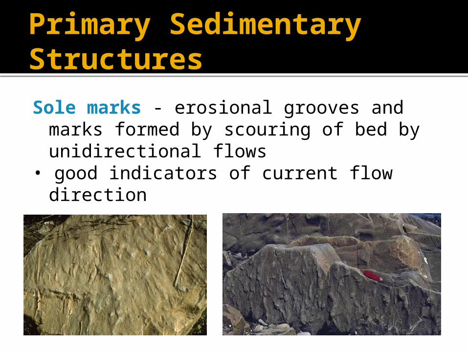
Primary Sedimentary Structures
Sole marks - erosional grooves and marks formed by scouring of bed by unidirectional flows
• good indicators of current flow direction
Primary Sedimentary Structures
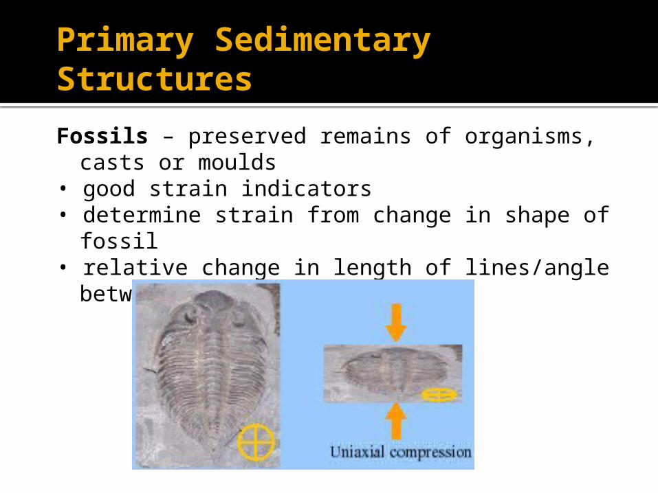
Fossils – preserved remains of organisms, casts or moulds
• good strain indicators• determine strain from change in shape of fossil• relative change in length of lines/angle between
lines
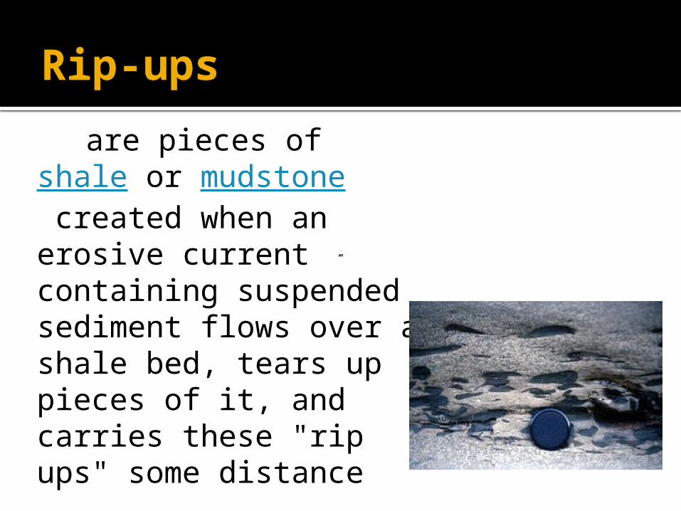
Rip-ups
are pieces of shale or mudstone created when an erosive current containing suspended sediment flows over a shale bed, tears up pieces of it, and carries these "rip ups" some distance
uses
Use for top and bottum Use for determine relative age
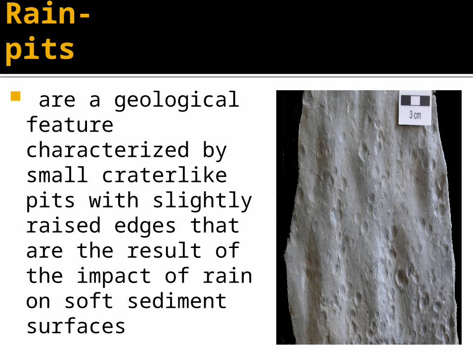
Rain-pits
are a geological feature characterized by small craterlike pits with slightly raised edges that are the result of the impact of rain on soft sediment surfaces
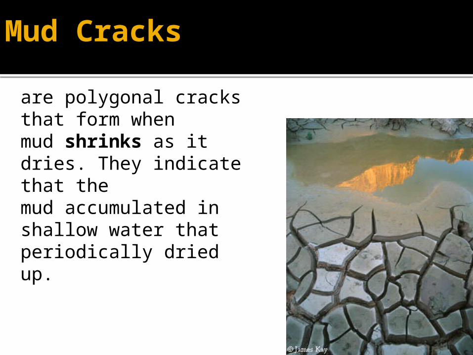
Mud Cracks
are polygonal cracks that form whenmud shrinks as it dries. They indicate that themud accumulated in shallow water that periodically driedup.
uses
It,s tell us Top and bottum Environment [Arid,Semi Arid] Condition
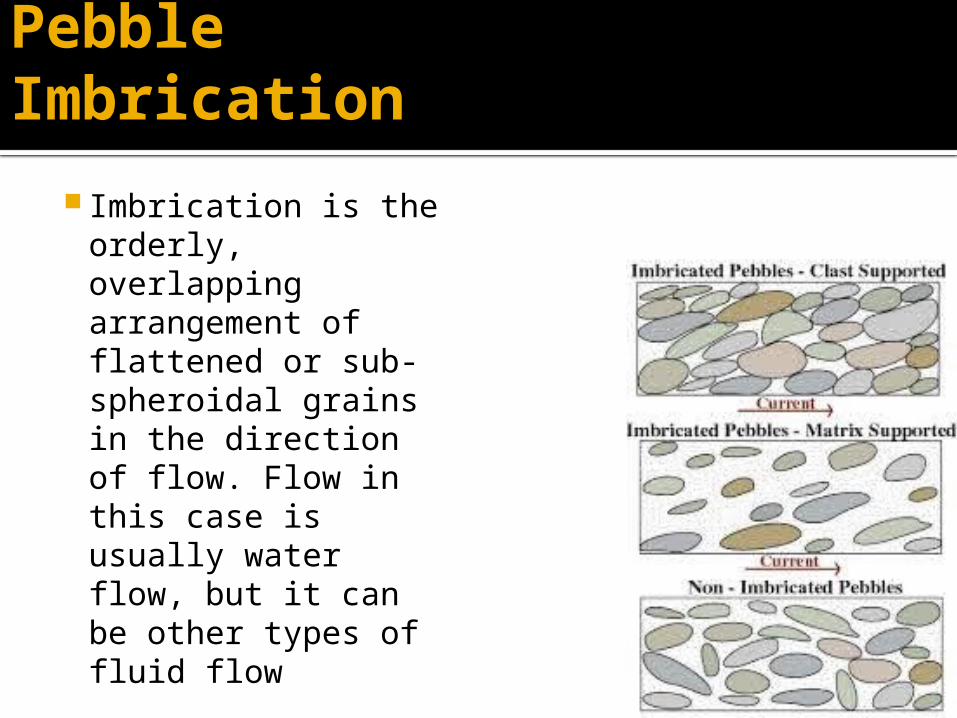
Pebble Imbrication
Imbrication is the orderly, overlapping arrangement of flattened or sub-spheroidal grains in the direction of flow. Flow in this case is usually water flow, but it can be other types of fluid flow
Uses
To determine paleo-path of rivers and channel
Current direction {which is always opposite to dip direction}
Flute Cast
When a river flow in the center of river V type structure formed by loose material are called flute cast

Soft Sediment Deformation
In it deformation as well as sedimentation carried out side by side
S.S.D = Deformation + Sedimentation
Types 1: Slump fold 2: Flame structures 3: Clastic Dikes
a. Slump Fold
A slump is a form of mass wasting that occurs when a coherent mass of loosely consolidated materials or rock layers moves a short distance down a slope Movement is characterized by sliding along a concave-upward or planar surface. Causes of slumping include earthquake shocks, thorough wetting, freezing and thawing, undercutting, and loading of a slope
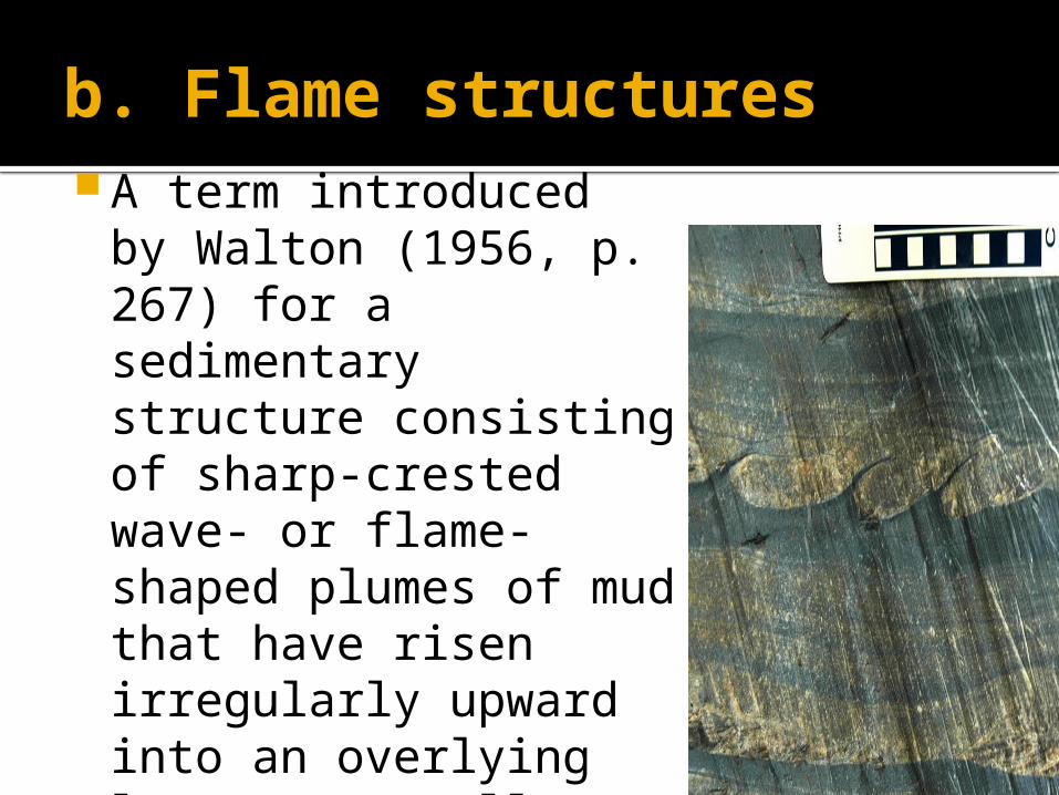
b. Flame structures A term introduced
by Walton (1956, p. 267) for a sedimentary structure consisting of sharp-crested wave- or flame-shaped plumes of mud that have risen irregularly upward into an overlying layer, generally a rapidly deposited sand
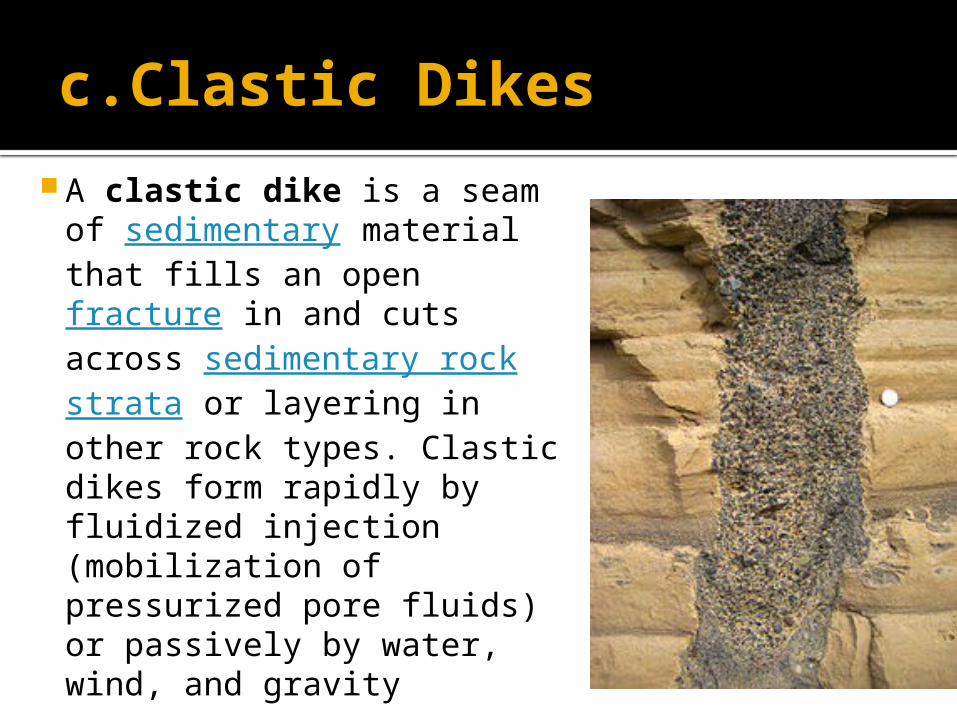
c.Clastic Dikes
A clastic dike is a seam of sedimentary material that fills an open fracture in and cuts across sedimentary rock strata or layering in other rock types. Clastic dikes form rapidly by fluidized injection (mobilization of pressurized pore fluids) or passively by water, wind, and gravity
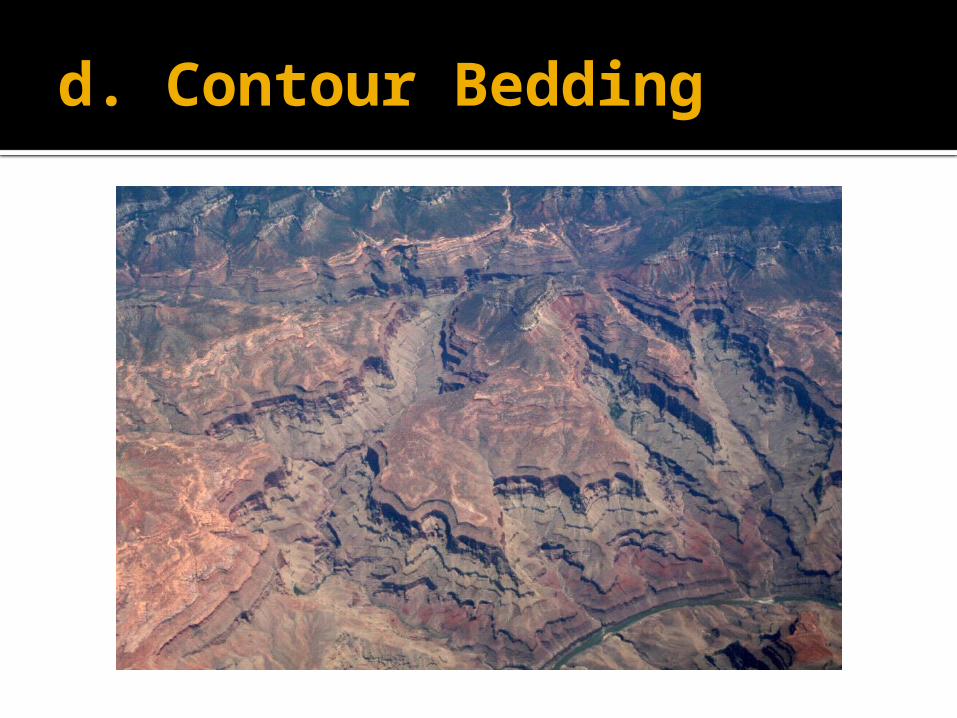
d. Contour Bedding
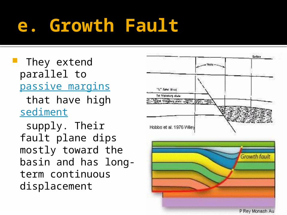
e. Growth Fault
They extend parallel to passive margins that have high sediment supply. Their fault plane dips mostly toward the basin and has long-term continuous displacement


![Automatismes et Informatique industrielle - fresnel.fr · et Informatique industrielle Intervenants: Mouloud Adel ... •A] Cours/TDs: 1) Struture d’un système automatisé Exemple](https://img.pdfslide.net/doc/110x75/5b81e2b17f8b9ae47b8d48b1/automatismes-et-informatique-industrielle-et-informatique-industrielle-intervenants.jpg)