TEL AVIV 2012
Salvage Excavation ReportsNo. 7
Sonia and Marco Nadler Institute of Archaeology Tel Aviv University
QIRYAT SHEMONA (S) fORT ANd VILLAgE IN THE HuLA VALLEY
Yuval gadot and Assaf Yasur-Landau
Contributions by
guy Bar-Oz, Karen Covello-Paran, gerald finkielsztejn, gilad Jaffe, Nili Liphschitz, Yossi Nagar,
Assaf Nativ, Noa Raban-gerstel, danny Rosenberg, Inbal Samet, Orit Shamir, Ron Shimelmitz,
Itamar Taxel and Irit Ziffer
Published by the Emery and Claire Yass Publications in Archaeology(Bequeathed by the Yass Estate, Sydney, Australia)of the Institute of Archaeology, Tel Aviv university
ISSN 1565-5407
©
Copyright 2012
All rights reserved
Printed in Israel
Editors Moshe fischer Ze’ev Herzog Oded Lipschits
contents
PREfACE 5
Yuval gadot and Assaf Yasur-Landau
Chapter 1 INTROduCTION 7
Yuval gadot and Assaf Yasur-Landau
Chapter 2 MIddLE BRONZE AgE STRATIgRAPHY ANd ARCHITECTuRE 15
Yuval gadot
Chapter 3 THE MIddLE BRONZE AgE POTTERY Of STRATA VII–V: TYPOLOgY ANd CHRONOLOgY 39
Assaf Yasur-Landau Chapter 4 PETROgRAPHIC ANALYSIS Of THE MIddLE BRONZE AgE
POTTERY: A PRELIMINARY REPORT 76
Assaf Nativ
Chapter 5 MIddLE BRONZE AgE OVENS: CONSTRuCTION, uSE ANd SPATIAL dISTRIBuTION 83
Assaf Nativ
Chapter 6 THE IRON AgE OCCuPATION AT QIRYAT SHEMONA (S), STRATuM IV 88
Karen Covello-Paran
Chapter 7 THE PERSIAN THROugH OTTOMAN REMAINS 120
Itamar Taxel
Chapter 8 A THASIAN AMPHORA STAMP 137
gerald finkielsztejn
Chapter 9 ZOOARCHAEOLOgICAL ANALYSIS Of THE fAuNAL REMAINS 139
Noa Raban-gerstel and guy Bar-Oz
Chapter 10 THE HuMAN SKELETAL REMAINS 160
Yossi Nagar
Chapter 11 THE BOTANIC fINdS 162
Nili Liphschitz
Chapter 12 THE gROuNdSTONE TOOLS ASSEMBLAgE 163
danny Rosenberg

Chapter 13 THE fLINT fINdS ANd THE CHARACTER Of THE MIddLE BRONZE AgE SICKLE BLAdES
171
Ron Shimelmitz
Chapter 14 THE SMALL fINdS 184
Assaf Nativ
Chapter 15 A STORAgE JAR wITH INCISEd fIguRAL MOTIf 189
Irit Ziffer
Chapter 16 A MACE/SCEPTRE HEAd fROM TOMB 1136 202
Assaf Yasur-Landau
Chapter 17 TExTILE REMAINS ON METAL 205
Orit Shamir
Chapter 18 AN INSCRIBEd SHERd 206
André Lemaire
Chapter 19 ENERgY ExPENdITuRE 208
Inbal Samet and gilad Jaffe
Chapter 20 THE STRATuM VII fORTRESS IN A TIME Of COMPETINg POLITIES
212
Assaf Yasur-Landau
INdEx Of LOCI 221
INdEx Of wALLS 227
5
PREfACE
The salvage excavation of the tell at Qiryat Shemona (South) (permits A-3733/2002 and B-272/2003) was a cooperative undertaking of the Institute of Archaeology of Tel Aviv university (with the collaboration of the Israeli Institute of Archaeology) and the Israel Antiquities Authority (IAA). The publication presented here combines the results of previously unpublished excavations by Clair Epstein (1974), Karen Covello-Paran (2002) and Assaf Yasur-Landau and Yuval gadot (2003).
The trial excavation at the site by Karen Covello-Paran was conducted with the help of Howard Smithline, Yossi Ya>aqobi (administration, IAA), Tsila Sagiv and Anastasia Shapiro (surveying). This trial was soon followed by a full excavation along the northeastern perimeter of the site. The first project season was carried out in June–July 2003. Assaf Yasur-Landau and Yuval gadot directed, with the help of Assaf Nativ, Lisa Yehuda, Mark Iserlis and Noga Blockman (area supervisors), gilad Jaffe and Adi Keinan (assistant area supervisors), Yossi Ya>aqobi (administrator, IAA), Yossi Nagar (physical anthropologist, IAA) and Marta guzowska (surveyor).
A second excavation season was carried out in August–September 2003. Assaf Yasur-Landau and Yuval gadot directed this season as well, with the help of Itamar Taxel, Assaf Nativ, Lisa Yehuda, Shai divon and gilad Jaffe (area supervisors), Sarit Paz (filling in for Yuval Gadot on September 1–2), Yossi Ya>aqobi (administrator, IAA), Yossi Nagar (physical anthropologist, IAA), Pavel (Pasha) Shrago (photography, TAu) and dov Porotsky (surveyor). we are very grateful for their professional work and diligence.
we thank Alon Shavit, the director of the Israeli Institute of Archaeology, for his unfailing support during the ten weeks of excavations and during the processing of the material in the period that followed.
Our successful collaboration with the IAA benefitted greatly from the logistic support and
archaeological advice of dror Barshad, Northern Region Archaeologist (IAA); Nimrod getzov, then the Northern Region Archaeological Consultant (IAA); Yardenna Alexandre, then district Archaeologist for the Eastern galilee and the golan Heights (IAA); and Reuven getzov, inspector (IAA).
Most of the finds from the excavations were processed at the Sonia and Marco Nadler Institute of Archaeology of Tel Aviv university, and we thank Israel finkelstein and Ze’ev Herzog, former heads of the Institute, as well as Sara Shachar Lev, administrative director of the Institute, and Na’ama Scheftelowitz, formerly assistant editor of Salvage Excavation Reports for their support. Nurith goshen and Assaf Nativ greatly assisted us in the preparation of the ceramic finds. Nirit Kedem helped in preparing the architectural plans for publication and contributed with her artistic skills.
The pottery was restored by Rachel Pelta and Yafit Wiener. All finds were photographed by Pavel Shrago. final plans were drafted by Nirit Kedem and Ami Brauner. The pottery was drawn by Alina Speshilov, Yulia gottlieb, Itamar Ben-Ezra and Hagit Tahan-Rosen (IAA). Small objects were drawn by Rodica Penchas. Pottery, flint and small find plates were digitized and prepared by Itamar Ben-Ezra. The text was carefully edited by Inbal Samet.
finally, we wish to thank the contributors to this volume for their efforts and patience. Special thanks are due to Karen Covello-Paran, who aside from contributing her chapter cooperated with us in the field and gave her utmost to make this a worthy publication.
Raphael greenberg and Lily Singer-Avitz lent their expertise and carefully reviewed the manuscript.
Assaf Yasur-Landau and Yuval Gadot 2012

6
7
LOCATION ANd NATuRAL ENVIRONMENT
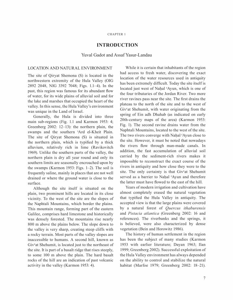
The site of Qiryat Shemona (S) is located in the northwestern extremity of the Hula Valley (OIg 2892 2048, NIg 3392 7048; figs. 1.1–4). In the past, this region was famous for its abundant flow of water, for its wide plains of alluvial soil and for the lake and marshes that occupied the heart of the valley. In this sense, the Hula Valley’s environment was unique in the Land of Israel.
generally, the Hula is divided into three main sub-regions (fig. 1.1 and Karmon 1953: 4; greenberg 2002: 12–13): the northern plain, the swamps and the southern <Ard el-Kheit Plain. The site of Qiryat Shemona (S) is situated in the northern plain, which is typified by a thick alluvium, relatively rich in lime (Ravikovitch 1969). unlike the southern parts of the valley, the northern plain is dry all year round and only its southern limits are seasonally encroached upon by the swamps (Karmon 1953: figs. 1–2). The soil is frequently saline, mainly in places that are not well drained or where the ground water is close to the surface.
Although the site itself is situated on the plain, two prominent hills are located in its close vicinity. To the west of the site are the slopes of the Naphtali Mountains, which border the plains. This mountain range, forming part of the eastern galilee, comprises hard limestone and historically was densely forested. The mountains rise nearly 800 m above the plains below. The slope down to the valley is very sharp, creating steep cliffs with a rocky terrain. Most parts of the valley slopes are inaccessible to humans. A second hill, known as giv>at Shehumit, is located just to the northeast of the site. It is part of a basalt ridge that rises steeply, to some 100 m above the plain. The hard basalt rocks of the hill are an indication of past volcanic activity in the valley (Karmon 1953: 4).
while it is certain that inhabitants of the region had access to fresh water, discovering the exact location of the water resources used in antiquity has been extremely difficult. Today the site itself is located just west of Naḥal >Ayun, which is one of the four tributaries of the Jordan River. Two more river ravines pass near the site. The first drains the plateau to the north of the site and to the west of giv>at Shehumit, with water originating from the spring of Ein adh dhahab (as indicated on early 20th-century maps of the area) (Karmon 1953: fig. 1). The second ravine drains water from the Naphtali Mountains, located to the west of the site. The two rivers converge with Naúal >Ayun close to the site. However, it must be noted that nowadays the rivers flow through man-made canals. In addition, the fast accumulation of alluvial soil carried by the sediment-rich rivers makes it impossible to reconstruct the exact course of the rivers in antiquity and how close they were to the site. The only certainty is that giv>at Shehumit served as a barrier to Naúal >Ayun and therefore the latter must have flowed to the east of the hill.
Years of modern irrigation and cultivation have almost completely erased the natural vegetation that typified the Hula Valley in antiquity. The accepted view is that the large plains were covered by a natural forest of Quercus ithaburensis and Pistacia atlantica (greenberg 2002: 16 and references). The riverbanks and the springs, it is believed, were also characterized by dense vegetation (Bein and Horowitz 1986).
The history of human settlement in the region has been the subject of many studies (Karmon 1953 with earlier literature; dayan 1963; Ilan 1999; greenberg 2002). Successful exploitation of the Hula Valley environment has always depended on the ability to control and stabilize the natural habitat (Marfoe 1979; greenberg 2002: 18–21).
CHAPTER 1
introduction
Yuval gadot and Assaf Yasur-Landau
Yuval Gadot and Assaf Yasur-Landau
8
fig. 1.1. Map of the Hula Valley.
Chapter 1: Introduction
9
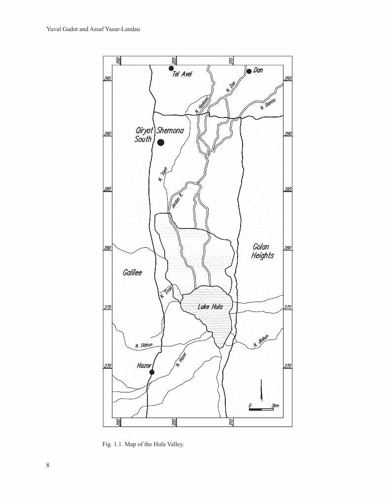
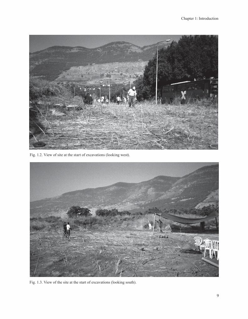
fig. 1.3. View of the site at the start of excavations (looking south).
fig. 1.2. View of site at the start of excavations (looking west).
Yuval Gadot and Assaf Yasur-Landau
10
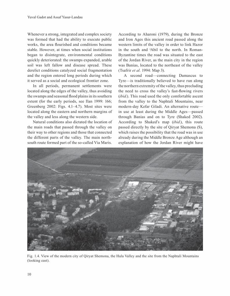
fig. 1.4. View of the modern city of Qiryat Shemona, the Hula Valley and the site from the Naphtali Mountains (looking east).
whenever a strong, integrated and complex society was formed that had the ability to execute public works, the area flourished and conditions became stable. However, at times when social institutions began to disintegrate, environmental conditions quickly deteriorated: the swamps expanded, arable soil was left fallow and disease spread. These derelict conditions catalyzed social fragmentation and the region entered long periods during which it served as a social and ecological frontier zone.
In all periods, permanent settlements were located along the edges of the valley, thus avoiding the swamps and seasonal flood plains in its southern extent (for the early periods, see Ilan 1999: 166; greenberg 2002: figs. 4.1–4.7). Most sites were located along the eastern and northern margins of the valley and less along the western side.
Natural conditions also dictated the location of the main roads that passed through the valley on their way to other regions and those that connected the different parts of the valley. The main north-south route formed part of the so-called Via Maris.
According to Aharoni (1979), during the Bronze and Iron Ages this ancient road passed along the western limits of the valley in order to link Hazor in the south and <Abil to the north. In Roman-Byzantine times the road was situated to the east of the Jordan River, as the main city in the region was Banias, located to the northeast of the valley (Tsafrir et al. 1994: Map 3).
A second road—connecting damascus to Tyre—is traditionally believed to have run along the northern extremity of the valley, thus precluding the need to cross the valley’s fast-flowing rivers (ibid.). This road used the only comfortable ascent from the valley to the Naphtali Mountains, near modern-day Kefar giladi. An alternative route—in use at least during the Middle Ages—passed through Banias and on to Tyre (Shaked 2002). According to Shaked’s map (ibid.), this route passed directly by the site of Qiryat Shemona (S), which raises the possibility that the road was in use already during the Middle Bronze Age although an explanation of how the Jordan River might have
Chapter 1: Introduction
11
been crossed by such a Middle Bronze Age route remains to be put forward.
The course of the rivers also dictated land division between the rural settlements and possibly even between the greater polities (greenberg 1990: 128; 2002: 76–77, 82). In the northwestern tracts of the valley the rivers are oriented north-south, while the eastern part of the valley is traversed by many east-west streams. It may well be that the borders between the main northern Hula polities were determined by these water courses. In light of this possibility, it is worth reiterating that Qiryat Shemona (S) is located just west of Naúal >Ayun, thus perhaps protecting the borders of a polity in which the site—or another located farther away—was the chief settlement.
In the 19th and early 20th centuries the area of Qiryat Shemona (S) was occupied by a market village named al-Khalisa (Khalidi 1992: 463; grossman 1994: 119–121). This village is known to have existed already in the Early Ottoman period (early 16th century). The centre of the village was located farther to the north of the site, at the spring, Ein adh dhahab. A mosque and other public buildings can still be seen today. The village’s history and its implications for understanding the site of Qiryat Shemona (S) are further discussed in Chapter 7.
ExCAVATIONS AT THE SITE: AIMS ANdMETHOdS
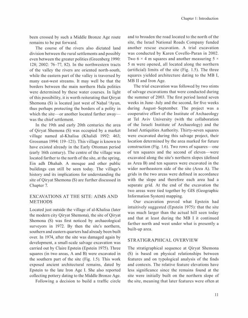
Located just outside the village of al-Khalisa (later the modern city Qiryat Shemona), the site of Qiryat Shemona (S) was first noticed by archaeological surveyors in 1972. By then the site’s northern, southern and eastern quarters had already been built over. In 1974, after the site was damaged again by development, a small-scale salvage excavation was carried out by Claire Epstein (Epstein 1975). Three squares (in two areas, A and B) were excavated in the southern part of the site (fig. 1.5). This work exposed ancient architectural remains, dated by Epstein to the late Iron Age I. She also reported collecting pottery dating to the Middle Bronze Age.
Following a decision to build a traffic circle
and to broaden the road located to the north of the site, the Israel National Roads Company funded another rescue excavation. A trial excavation was conducted by Karen Covello-Paran in 2002. Two 6 × 4 m squares and another measuring 5 × 5 m were opened, all located along the northern (artificial) limits of the site (Fig. 1.5). The three squares yielded architecture dating to the MB I, MB II and Iron Age.
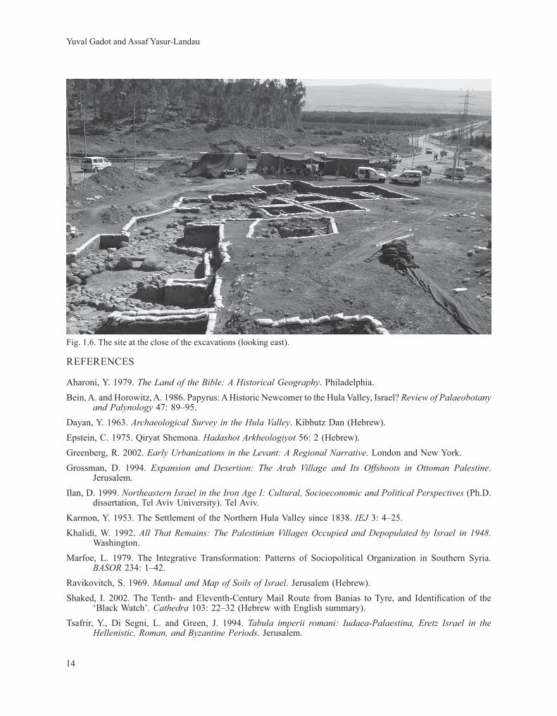
The trial excavation was followed by two stints of salvage excavations that were conducted during the summer of 2003. The first period lasted seven weeks in June–July and the second, for five weeks during August–September. The project was a cooperative effort of the Institute of Archaeology at Tel Aviv university (with the collaboration of the Israeli Institute of Archaeology) and the Israel Antiquities Authority. Thirty-seven squares were excavated during this salvage project, their location determined by the area marked for future construction (fig. 1.6). Two rows of squares—one of ten squares and the second of eleven—were excavated along the site’s northern slopes (defined as Area B) and ten squares were excavated in the wider northeastern side of the site (Area A). The grids in the two areas were defined in accordance with the slope and therefore each area had a separate grid. At the end of the excavation the two areas were tied together by gIS (geographic Information System) mapping.
Our excavation proved what Epstein had intuitively suggested (Epstein 1975): that the site was much larger than the actual hill seen today and that at least during the MB I it continued farther north and west under what is presently a built-up area.
STRATIgRAPHICAL OVERVIEw
The stratigraphical sequence at Qiryat Shemona (S) is based on physical relationships between features and on typological analysis of the finds and contexts. The relative feature elevations have less significance since the remains found at the site were initially built on the northern slope of the site, meaning that later features were often at
Yuval Gadot and Assaf Yasur-Landau
12
fig. 1.5. A plan of Qiryat Shemona (S), marking the location of all excavations conducted at the site.
Chapter 1: Introduction
13
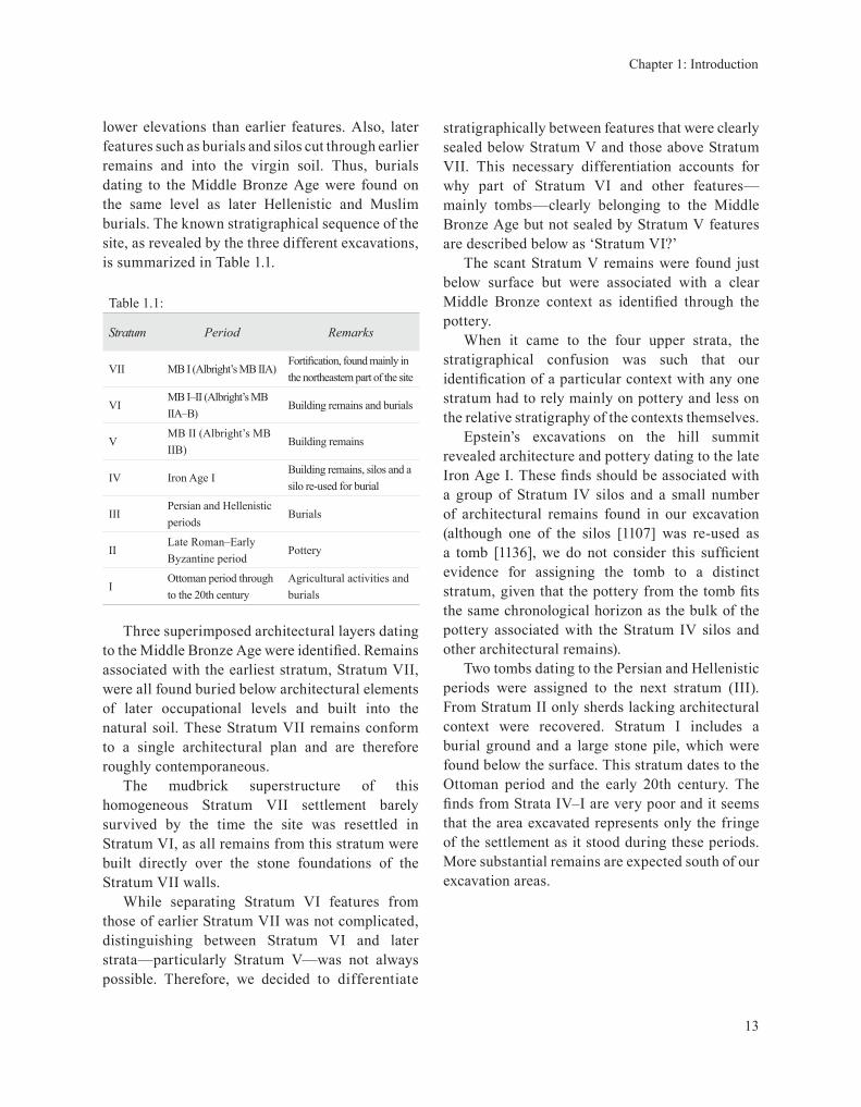
lower elevations than earlier features. Also, later features such as burials and silos cut through earlier remains and into the virgin soil. Thus, burials dating to the Middle Bronze Age were found on the same level as later Hellenistic and Muslim burials. The known stratigraphical sequence of the site, as revealed by the three different excavations, is summarized in Table 1.1.
Table 1.1:
Stratum Period Remarks
VII MB I (Albright’s MB IIA)Fortification, found mainly in the northeastern part of the site
VIMB I–II (Albright’s MB IIA–B)
Building remains and burials
VMB II (Albright’s MB IIB)
Building remains
IV Iron Age IBuilding remains, silos and a silo re-used for burial
IIIPersian and Hellenistic periods
Burials
IILate Roman–Early Byzantine period
Pottery
IOttoman period through to the 20th century
Agricultural activities and burials
Three superimposed architectural layers dating to the Middle Bronze Age were identified. Remains associated with the earliest stratum, Stratum VII, were all found buried below architectural elements of later occupational levels and built into the natural soil. These Stratum VII remains conform to a single architectural plan and are therefore roughly contemporaneous.
The mudbrick superstructure of this homogeneous Stratum VII settlement barely survived by the time the site was resettled in Stratum VI, as all remains from this stratum were built directly over the stone foundations of the Stratum VII walls.
while separating Stratum VI features from those of earlier Stratum VII was not complicated, distinguishing between Stratum VI and later strata—particularly Stratum V—was not always possible. Therefore, we decided to differentiate
stratigraphically between features that were clearly sealed below Stratum V and those above Stratum VII. This necessary differentiation accounts for why part of Stratum VI and other features—mainly tombs—clearly belonging to the Middle Bronze Age but not sealed by Stratum V features are described below as ‘Stratum VI?’
The scant Stratum V remains were found just below surface but were associated with a clear Middle Bronze context as identified through the pottery.
when it came to the four upper strata, the stratigraphical confusion was such that our identification of a particular context with any one stratum had to rely mainly on pottery and less on the relative stratigraphy of the contexts themselves.
Epstein’s excavations on the hill summit revealed architecture and pottery dating to the late Iron Age I. These finds should be associated with a group of Stratum IV silos and a small number of architectural remains found in our excavation (although one of the silos [1107] was re-used as a tomb [1136], we do not consider this sufficient evidence for assigning the tomb to a distinct stratum, given that the pottery from the tomb fits the same chronological horizon as the bulk of the pottery associated with the Stratum IV silos and other architectural remains).
Two tombs dating to the Persian and Hellenistic periods were assigned to the next stratum (III). from Stratum II only sherds lacking architectural context were recovered. Stratum I includes a burial ground and a large stone pile, which were found below the surface. This stratum dates to the Ottoman period and the early 20th century. The finds from Strata IV–I are very poor and it seems that the area excavated represents only the fringe of the settlement as it stood during these periods. More substantial remains are expected south of our excavation areas.
Yuval Gadot and Assaf Yasur-Landau
14
fig. 1.6. The site at the close of the excavations (looking east).
REfERENCES
Aharoni, Y. 1979. The Land of the Bible: A Historical Geography. Philadelphia.Bein, A. and Horowitz, A. 1986. Papyrus: A Historic Newcomer to the Hula Valley, Israel? Review of Palaeobotany
and Palynology 47: 89–95.dayan, Y. 1963. Archaeological Survey in the Hula Valley. Kibbutz dan (Hebrew).Epstein, C. 1975. Qiryat Shemona. Hadashot Arkheologiyot 56: 2 (Hebrew).greenberg, R. 2002. Early Urbanizations in the Levant: A Regional Narrative. London and New York.grossman, d. 1994. Expansion and Desertion: The Arab Village and Its Offshoots in Ottoman Palestine.
Jerusalem.Ilan, d. 1999. Northeastern Israel in the Iron Age I: Cultural, Socioeconomic and Political Perspectives (Ph.d.
dissertation, Tel Aviv university). Tel Aviv. Karmon, Y. 1953. The Settlement of the Northern Hula Valley since 1838. IEJ 3: 4–25.Khalidi, w. 1992. All That Remains: The Palestinian Villages Occupied and Depopulated by Israel in 1948.
washington.Marfoe, L. 1979. The Integrative Transformation: Patterns of Sociopolitical Organization in Southern Syria.
BASOR 234: 1–42.Ravikovitch, S. 1969. Manual and Map of Soils of Israel. Jerusalem (Hebrew).Shaked, I. 2002. The Tenth- and Eleventh-Century Mail Route from Banias to Tyre, and Identification of the
‘Black watch’. Cathedra 103: 22–32 (Hebrew with English summary). Tsafrir, Y., di Segni, L. and green, J. 1994. Tabula imperii romani: Iudaea-Palaestina, Eretz Israel in the
Hellenistic, Roman, and Byzantine Periods. Jerusalem.
Recommended